Mystery Valley Hike

Dawn in Monument Valley Arizona

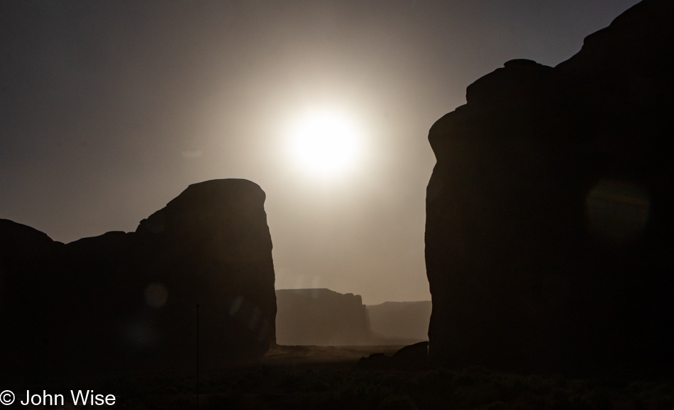
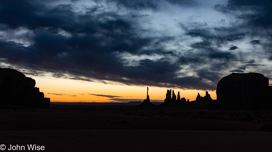
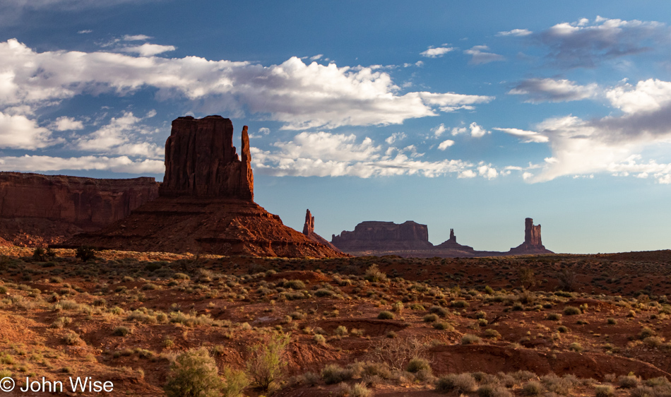
We were up before 5:30 and gone by 5:45. As luck would have it, we not only have the best hill in all of Monument Valley to experience the sunrise, but the sky has absolutely the right amount of clouds to deliver a level of spectacular that will help provide the most incredible photos of sunrise ever taken at this location. Then there’s that face in the clouds on the right looking down upon us that I can’t unsee. I’m studying it, trying to decipher what it wanted to share, but all I can do is look at those eyes and wonder if they are a portal through which the face with a bumpy nose in the rocks on the left is talking to the heavens, informing the universe to smile upon this day because we are here. I swear they are looking at each other, testing me if I know how to perceive my world.

Dawn in Monument Valley Arizona

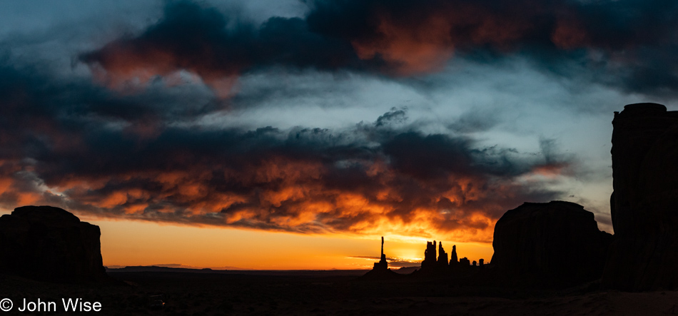
And then the faces give way, disappearing as the sky obliges their wishes to delight us down here. How about some night, day, blue, orange, red, and fire dropped into your eyeballs? Will that do, or do you need more?

Sunrise in Monument Valley Arizona

Look closely maybe everything is already here.

Sunrise in Monument Valley Arizona

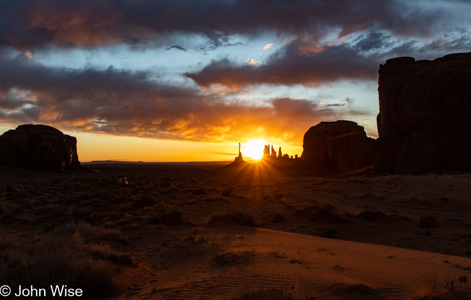
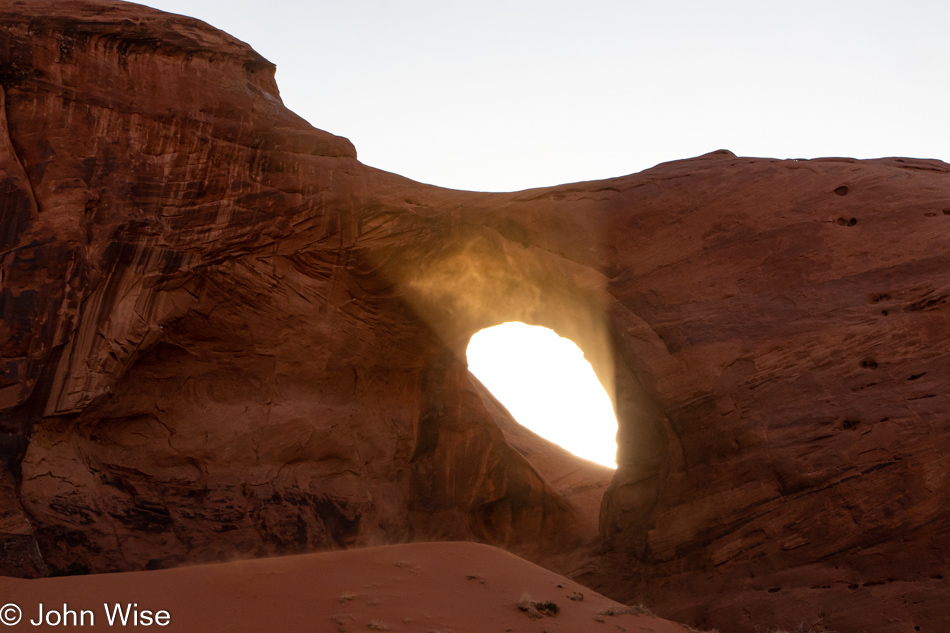
Oh, I’ve got it…here’s some white light with an intensity that will diffract off the clouds and rocks with rays that reach out to touch the sand. How’s that? Satisfied? Hmmm, something else huh? I know, turn around.

Sunrise in Monument Valley Arizona

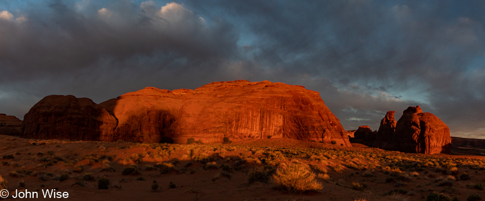
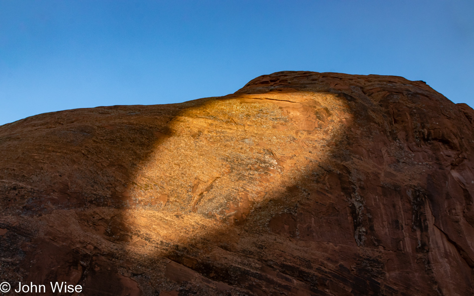
Come on now, tell me what’s being channeled; what’s your first impression? That’s right, for a split second, you thought you were looking at Uluru (formerly known as Ayers Rock on the other side of the earth for those who might know). The universe lets us know that quantum projection is one of its tricks if the mind is ready for phenomena that defy belief, but there it is. Maybe magic isn’t real, but then again, if the imagination is able to find a playground of knowledge that juxtaposes words and images at just the right moment when we are unchained from some small part of our critical mind, we can bask in the wizardry of allowing ourselves to be tricked. Now go forward and turn around.

Sunrise in Monument Valley Arizona

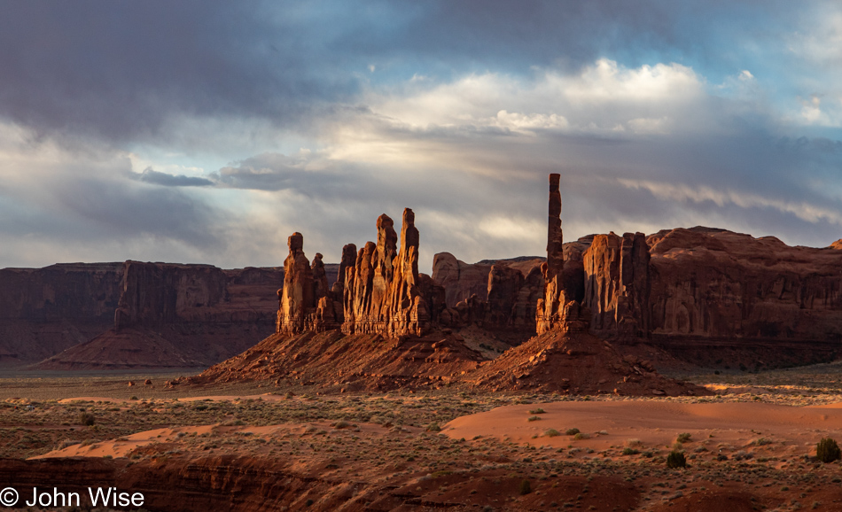
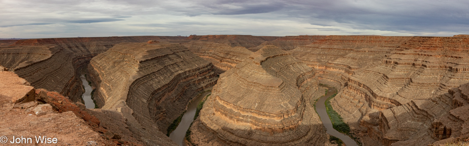
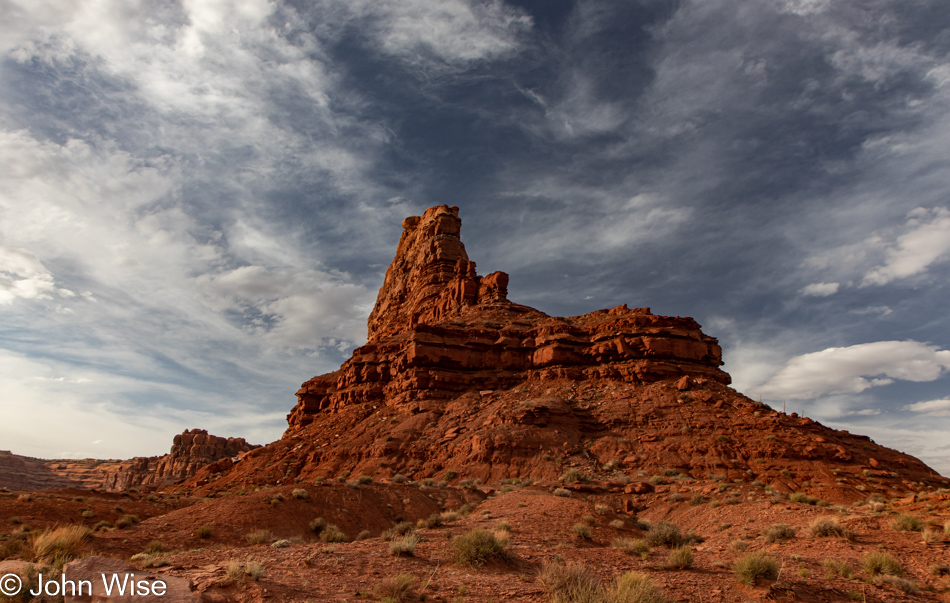
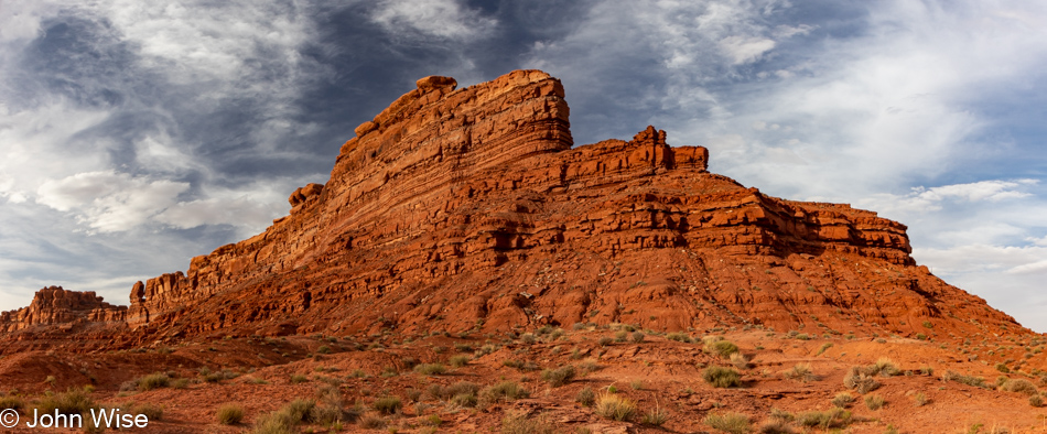
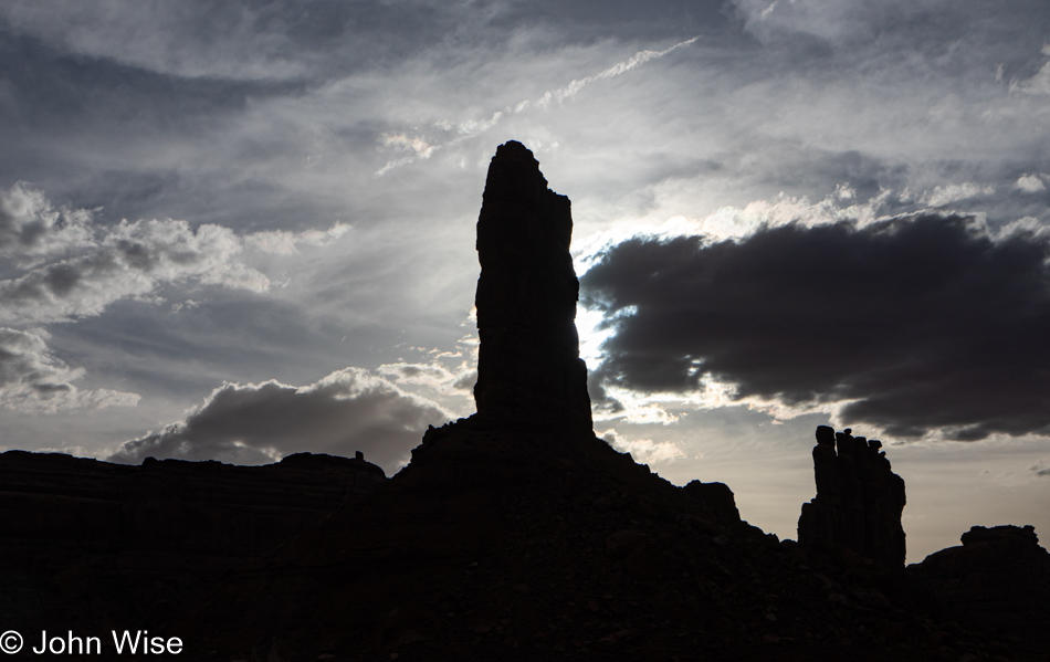
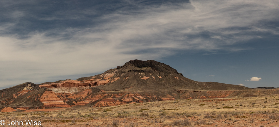
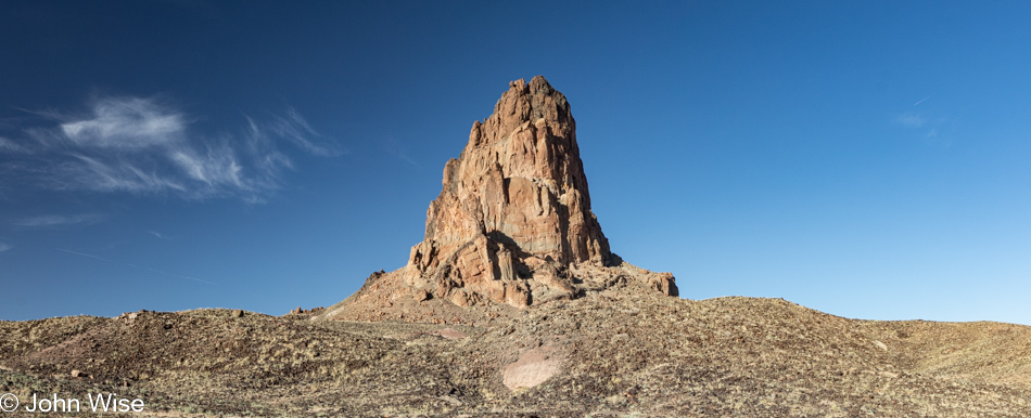
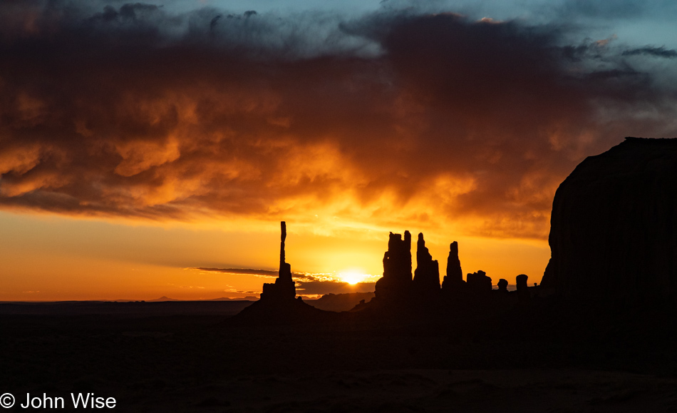
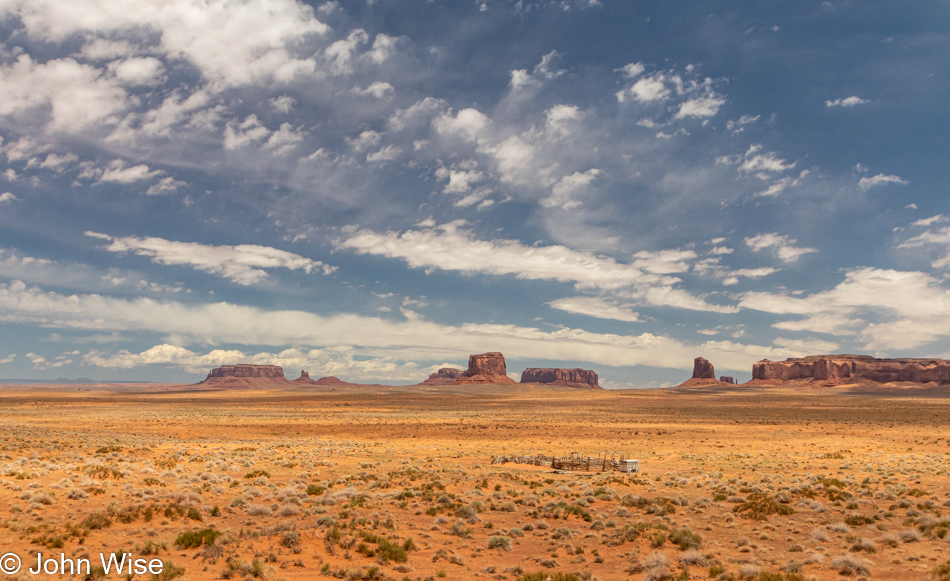
Two-hundred-sixty million years ago, the sand that would become the basis for the spires, buttes, and mesas of Monument Valley was deposited. De Chelly and Wingate sandstones are the names given to these petrified remnants, and that’s what we are looking at here at this incredible site. On the right, the spire standing alone is known as the Totem Pole; it is the remains of a butte around which everything else was eroded. How many other spires in the previous millions of years have come and gone, and how long will it be after this one collapses before something similar is ever seen again?

Sunrise in Monument Valley Arizona

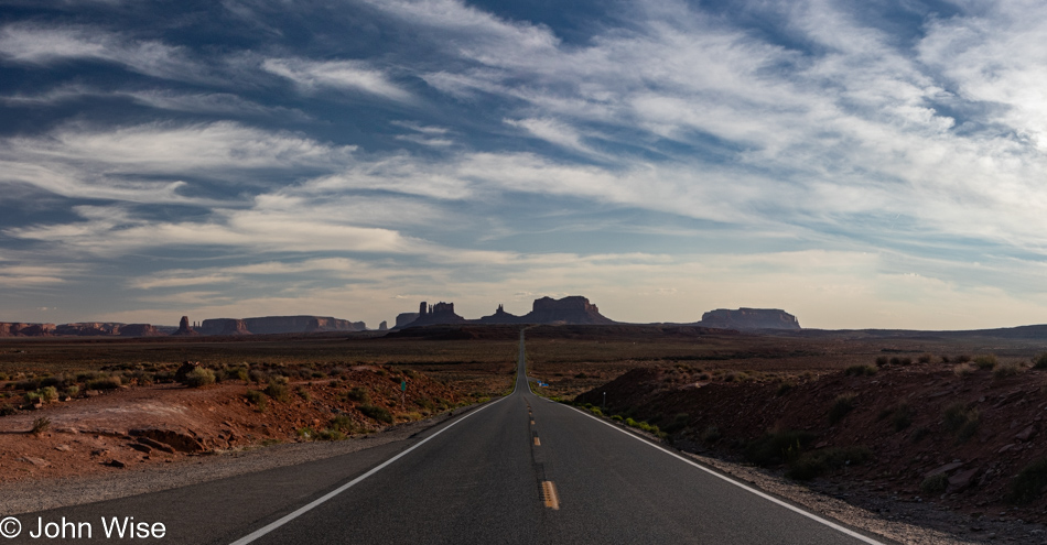
While others are heading in, we are heading out. Another adventure awaits.

Sunrise in Monument Valley Arizona

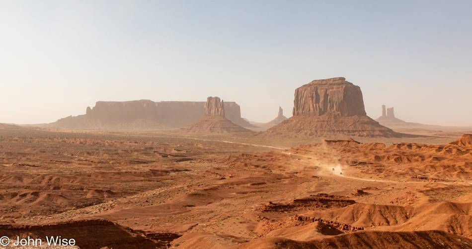
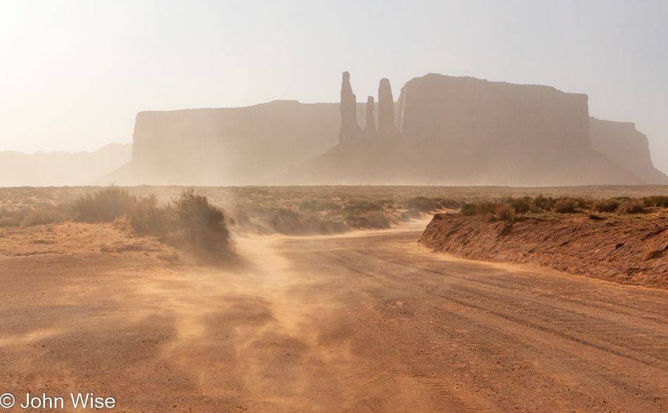
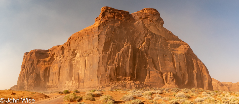
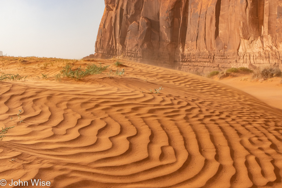
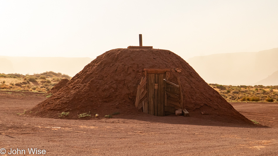
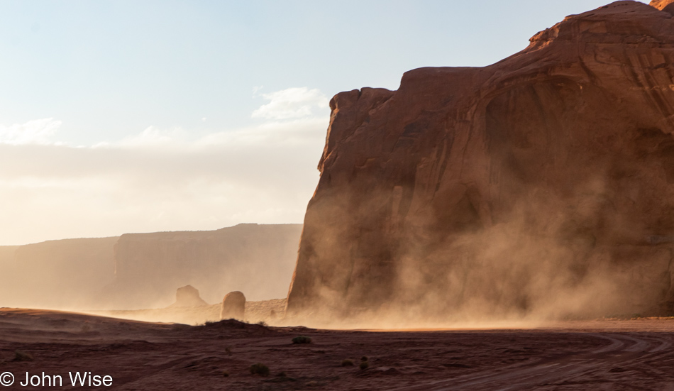
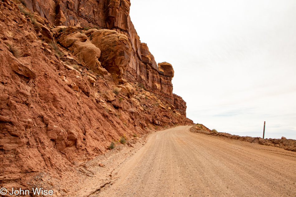
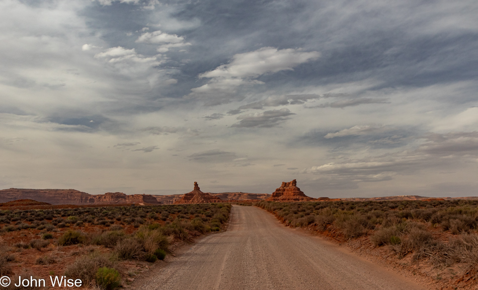
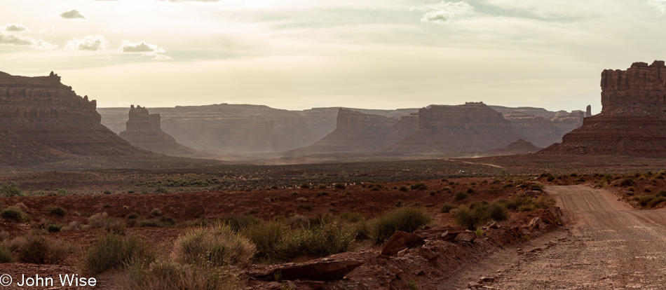
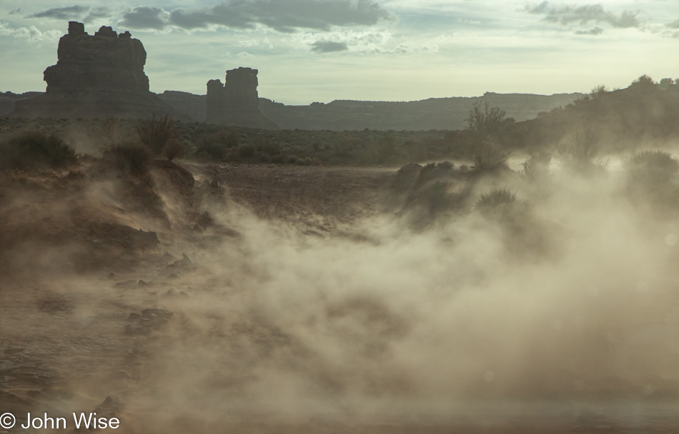
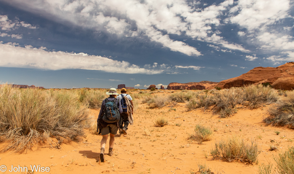
Not so fast but that doesn’t slow down Cody and his race to the exit for a hot meal. Our guide, as a condition of us staying overnight in the park, must stay nearby the entire time, as in the truck he brought us to the hogan with. For a short moment, he’ll disappear up the road for breakfast with his family in the warmth of his home. And besides, we passed all these places on our way in yesterday. Sure, but the air was choked on heavy dust that obscured the blue skies with haze, and while I’ve photographed it all before, I can never get enough of how beautiful it all looks to me every time I’m fortunate enough to be in Monument Valley yet again. So, from the crisp cold air in the back of the truck, I snap away, hoping a photo here and there won’t be too blurry from all the bouncing we’re doing down the well-worn dirt road.

Sunrise in Monument Valley Arizona

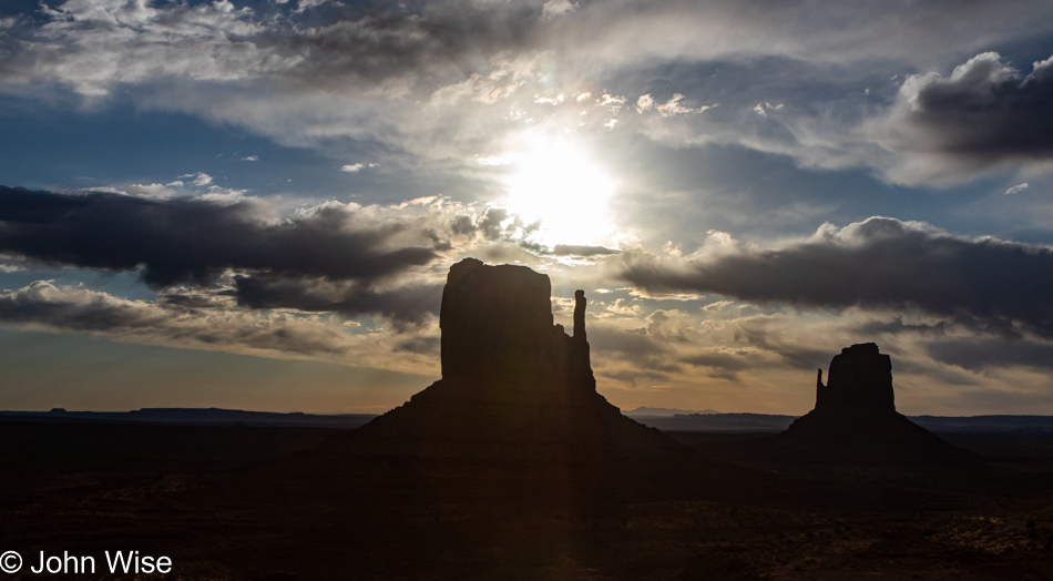
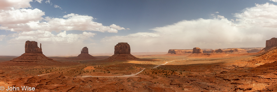
At the facilities of the View Hotel, yep, this is the view; we dipped into the restaurant and, mistaken for guests, were allowed to grab a couple of cups of coffee. This coffee was as necessary as capturing this image of the Mittens silhouetted in the rising sun on this promising day. I told you that Earth and Sky worked out a deal to offer the most impressive views of Monument Valley ever witnessed. Just wait until you see what comes next.

Mystery Valley on the Arizona Utah State Line

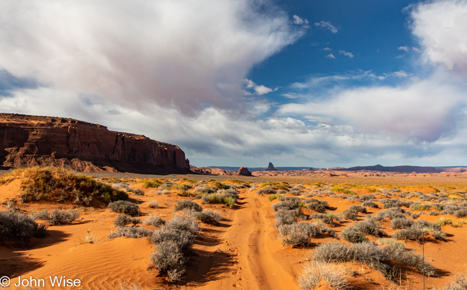
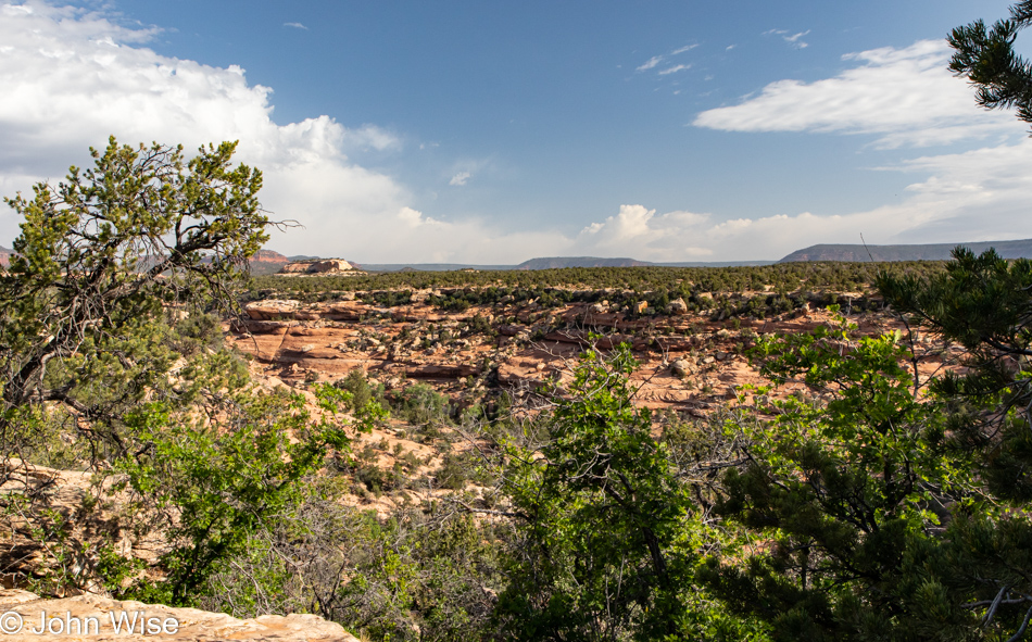
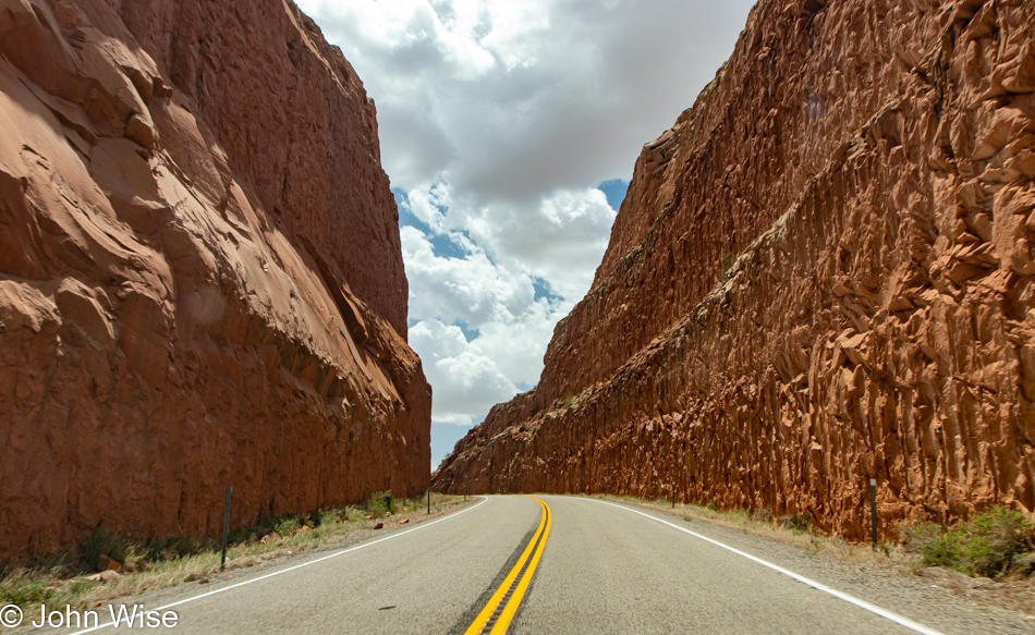
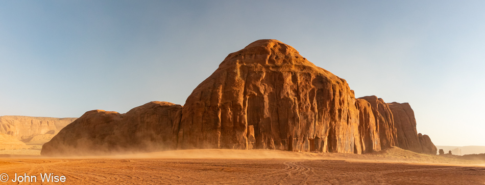
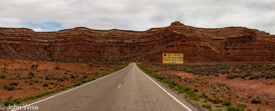
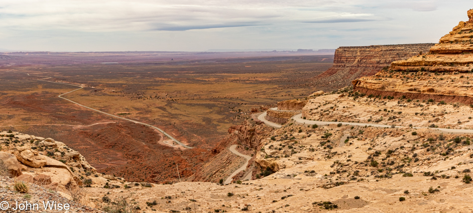
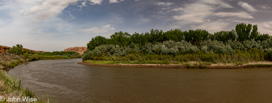
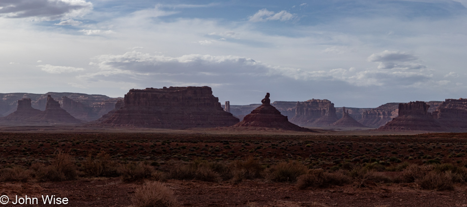
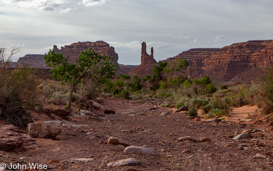
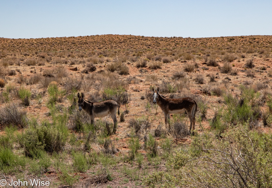
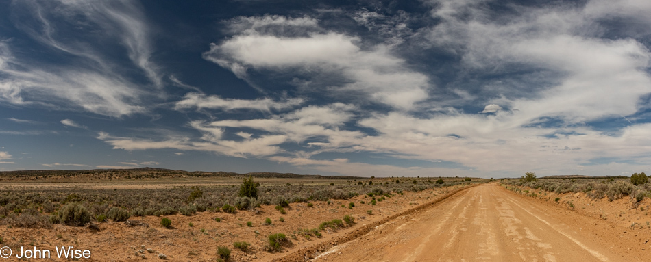
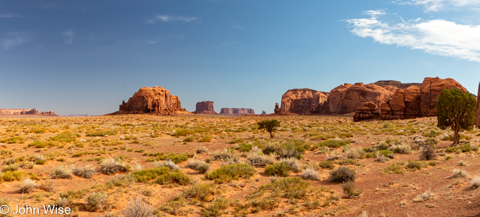
Buttes, mesas, and red sand, but it’s not exactly Monument Valley, though it is on the edge of it. It’s something else somewhere else, and that little strip without scrub brush or small bushes is our road to this place. We are visiting Mystery Valley.

Mystery Valley on the Arizona Utah State Line

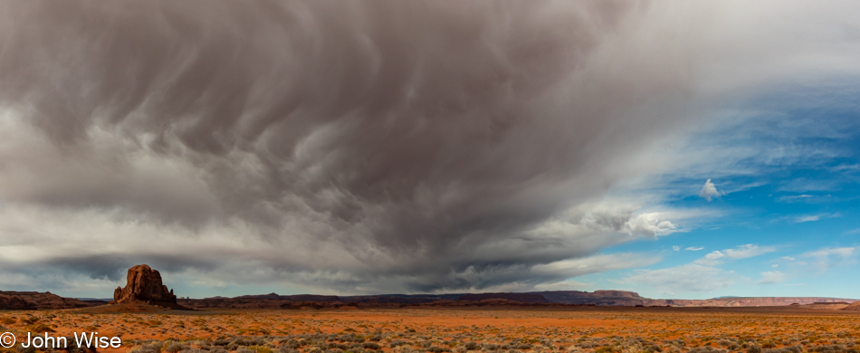
Or are we? Are those rain clouds starting to build up? Our guide wishes they were carrying rain as, according to him, it’s been too long since these parts have seen a good soaking. As a matter of fact, he says he’s not alone in his opinion that people up here are tired of all the wind and blowing sand. Come deep sand or a flood; we are not turning around as we are on an adventure to see things we’ve never seen before.

Mystery Valley on the Arizona Utah State Line

Thirty minutes earlier, as we rounded that bright orange butte left of center, Cody told us to take a good look at it because by the time we are done today, “You’ll have to look hard to find it.”

Mystery Valley on the Arizona Utah State Line

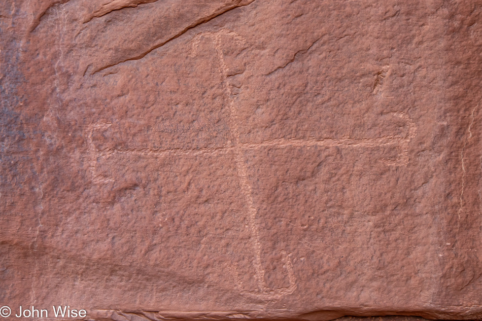
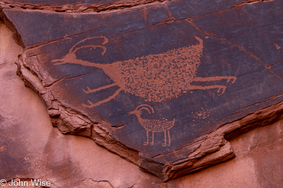
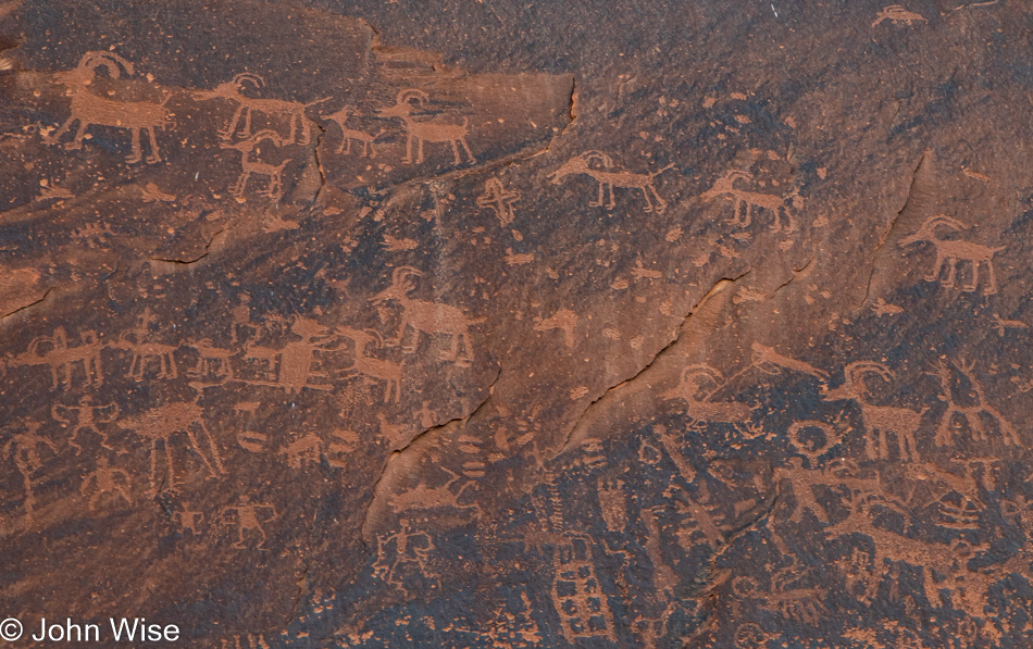
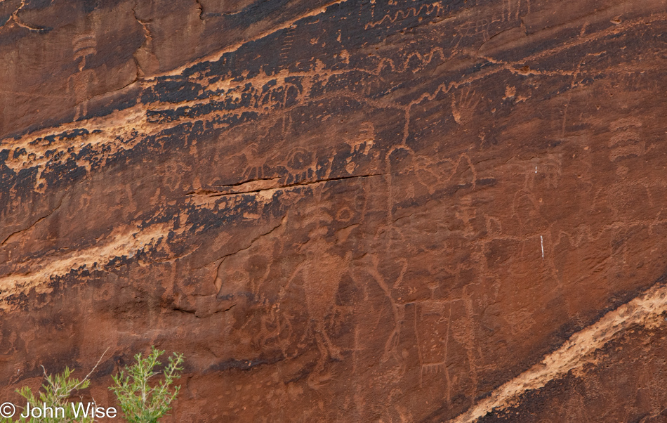
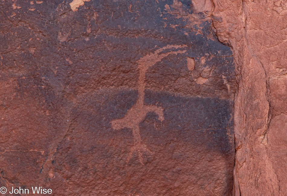
And so begins an interesting strategy in tour guidance; Cody stops for us to exit the truck and then informs us that we’ll be walking from this point. He’ll meet us around the corner, “Don’t worry, you’ll easily see where I park the truck.” We get walking, but I see it as a challenge as maybe we are supposed to find something, and he’s wondering how observant we are. The first thing I find is a small panel of a few petroglyphs with this one the most intriguing to my eyes. I have no idea what this could have meant other than the obvious regarding the four directions. A search for similar images offered no clues, so I looked into my theory about nursery rhymes I discussed in my previous post but came up flat there, too. When we reached Cody, I asked about the petroglyphs, and he informed me that there were none in this area; either he didn’t know these, or they were not supposed to be seen by outsiders due to their cultural significance. I’m going with the more intriguing explanation that these are secret symbols that offer clues about the mechanics of the world among the Diné (Navajo).

Mystery Valley on the Arizona Utah State Line

I not only closely examine the detail along this walk but I also have to step back as I just know we’ll be tested on what we found when we reach Cody. From this rock, I easily see a hidden Morse code message recorded in the dots and lines that spell out Ayoó án ín shí in Navajo.

Mystery Valley on the Arizona Utah State Line

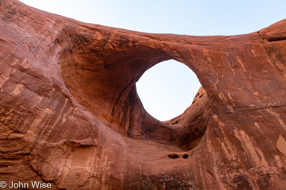
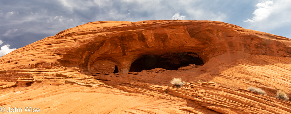
While I was able to identify the names of the various holes over in Monument Valley, this will remain a mystery which seems appropriate considering that we are in Mystery Valley. I’m already starting to understand the naming of this place we have only begun to explore.

Mystery Valley on the Arizona Utah State Line

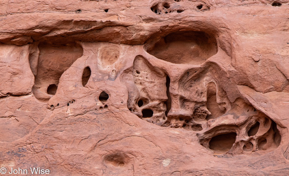
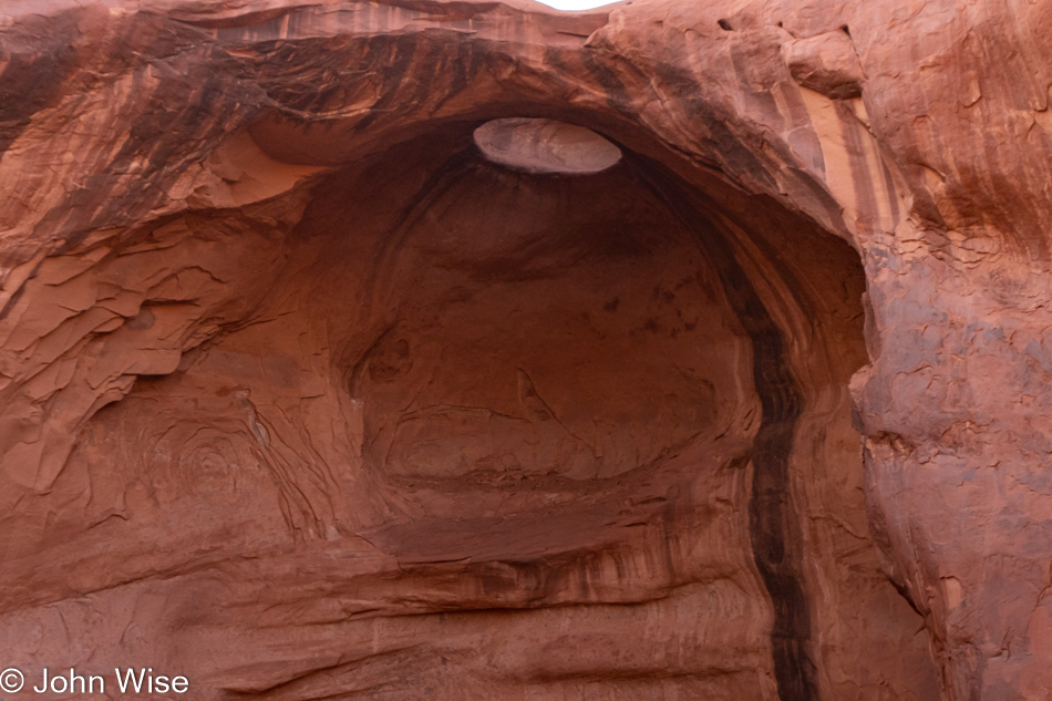
I fully understand that this next description will likely be met with a healthy amount of incredulity, but the truth, as it is, which has been pulled from the depths of the fantastic, goes something like this. This cavity is effectively a kind of MRI cross-section of the progenitor of an alien species that has since left this world. The petroglyph, along with the hidden Morse code in the rock, are the clues needed to decipher the mystery, while the hole in the rock points to the place in the sky where this race of beings took up residence. Please try to follow what I came to understand about what precisely we are looking at. This was a dual-brained creature with the limbic system housed in the rear part of the skull on the left while the cerebrum was found in the top cavity right-of-center. Below the cerebrum are the mouth and nasal passage. I should point out that this profile view has the creature looking to the right. This being was sightless, instead relying on the inheritance from sharks in the form of the Ampullae of Lorenzini in the lower jaw, bottom right structure.

I, too, am incredulous that this kind of information has been shared with me, but as I was informed, it doesn’t matter, as nobody of any real importance reads the crap I share here anyway.

Edit: I’ve since been informed that above the front brain, partially cut off in my photo, was the other part of the Ampullae of Lorenzini that allowed the electro-sensitive cells a vector-like operational capacity so the conducting positively charged hydrogen atoms (protons) were able to produce multi-dimensional images seeing not only the physical space before them but able to slice into time and quantum-realms to read in all directions. 

Mystery Valley on the Arizona Utah State Line

So, how in the world do I continue to make this post compelling after dropping such a bombshell? I’ll just come up with even more far-out nonsense, that’s how. Or maybe I don’t.

Mystery Valley on the Arizona Utah State Line

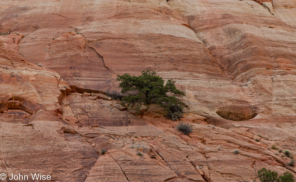
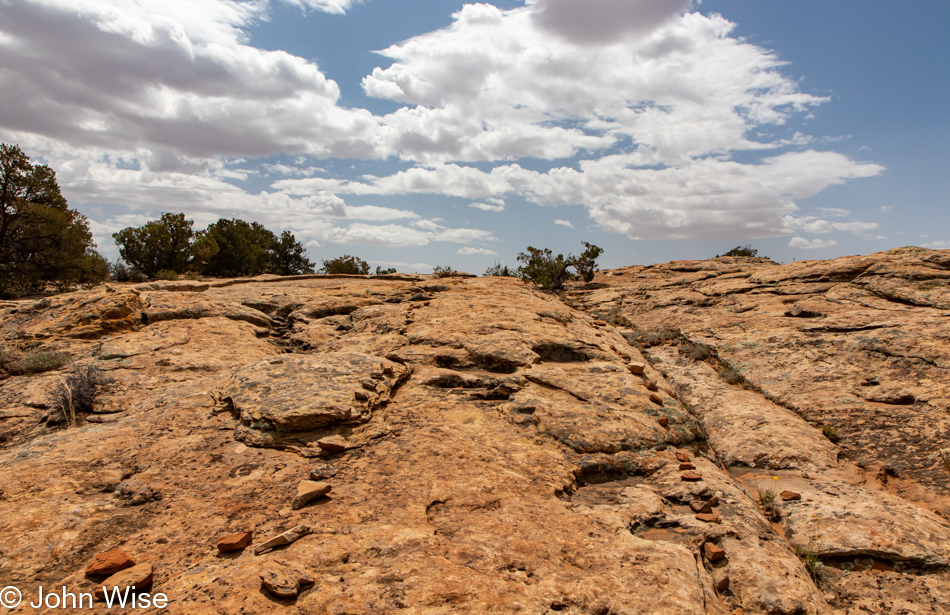
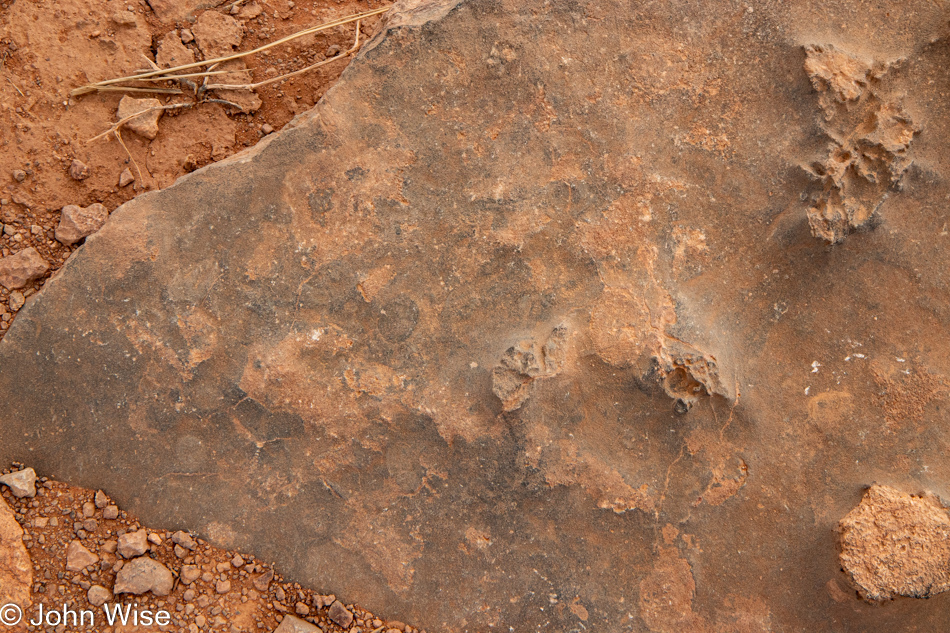
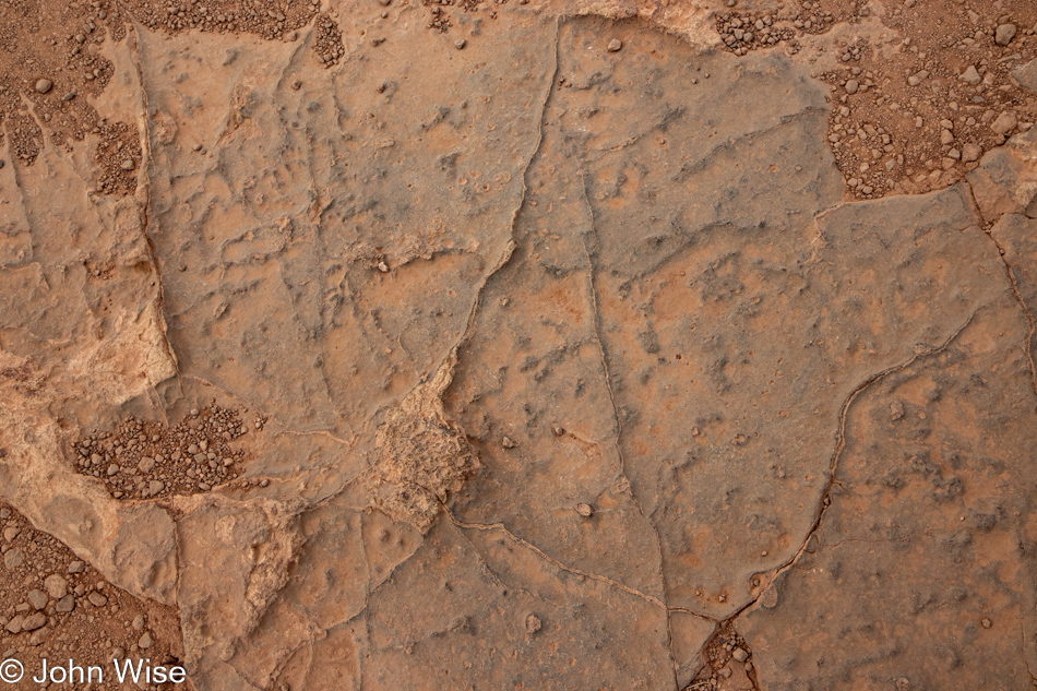
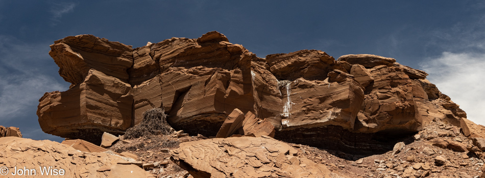
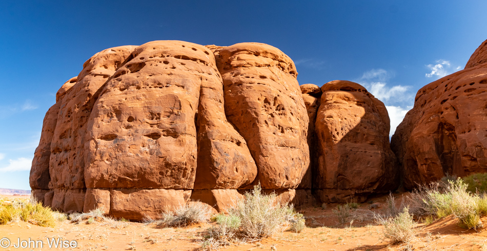
So, I have a basic understanding of this aspect of geology that softer rocks erode faster than harder ones, but I admit I have a difficult time getting my head around these formations. With this bit of knowledge, I can only figure that when this sandstone was settling, there were other things filling the area where these pockets are, but what could that have been?

Oops, I could have removed the previous paragraph and appeared smarter than I am but I’m leaving it here. After typing the question mark, I did what any half-aware human should do: go to your favorite search engine and enter, “How do pockets form in sandstone.” I ended up at a kid’s website called MiniMeGeology that explains it like this, “A liquid form of a mineral such as calcite or quartz “glues” the sand grains together. The holes that are left are great places for storing water or oil.”

[After inquiring with my favorite search engine, I found out that these sandstone shapes have a name. They are called tafoni and are caused by a combination of complex processes that involve water, salt, and mechanical erosion. Caroline]

I should have stuck to making up crazy stories that might camouflage my ignorance and lend authority that I’m actually exploring style instead of having to admit to a lack of real answers.

Mystery Valley on the Arizona Utah State Line

Hey, old dog, see those pockets? They were laser-etched by a race of two-brained aliens as a kind of punchcard that, once deciphered, will offer you magic powers to write beyond the mediocrity you currently are hobbled with. Now, get cracking.

Mystery Valley on the Arizona Utah State Line

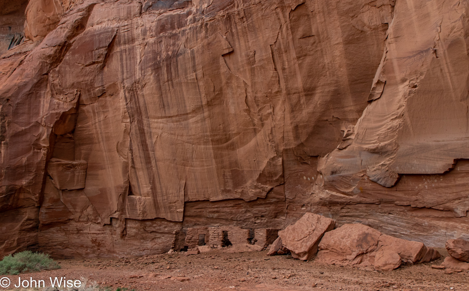
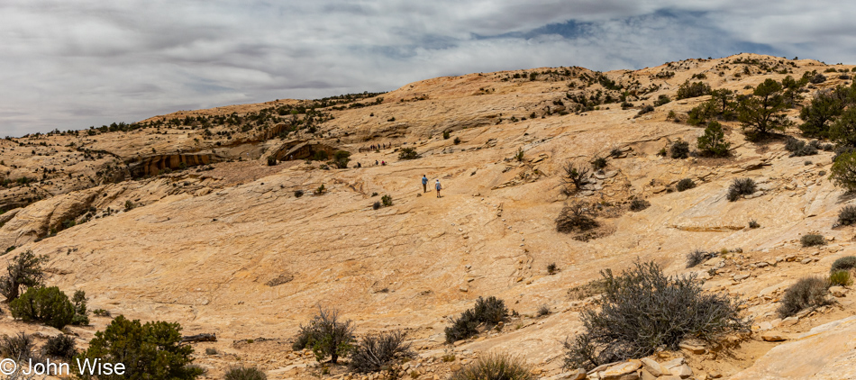
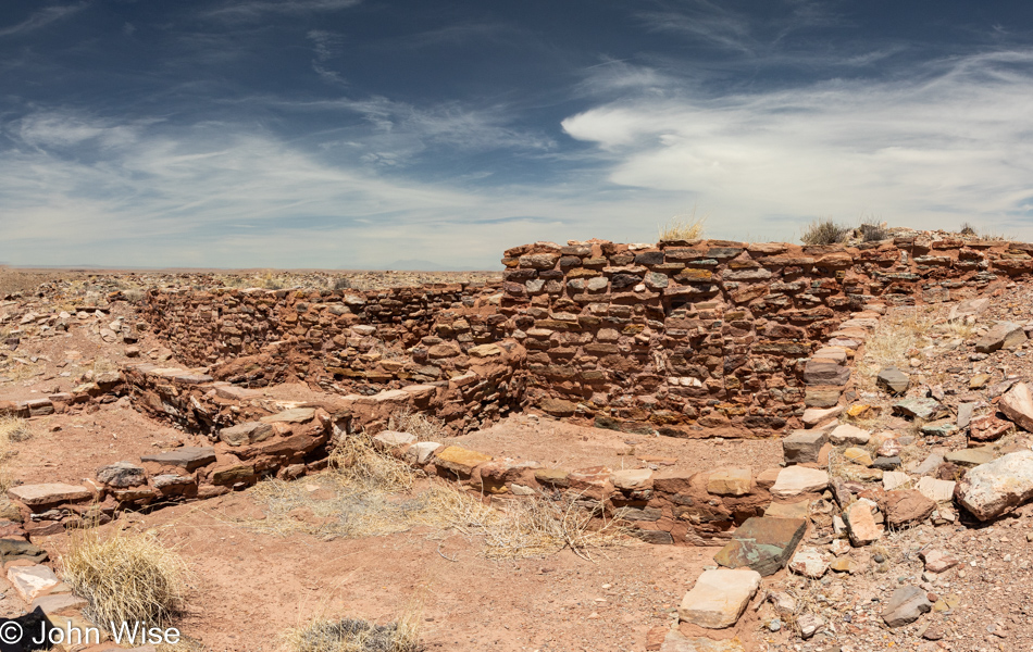
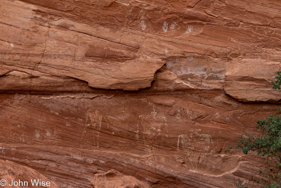
Our trek in Mystery Valley continues with a visit to the House of Many Hands.

Mystery Valley on the Arizona Utah State Line

The area is fenced off, and it seems that visitors have been respecting the barrier, as only ancient cow patties are on the other side of the fence. Those plops of poo are looking fairly ancient and ready to turn to dust and are the first clue that the fence line was moved further away from pictographs and ruins in the hopes these artifacts will survive their encounter with modern man (and beast).

Mystery Valley on the Arizona Utah State Line

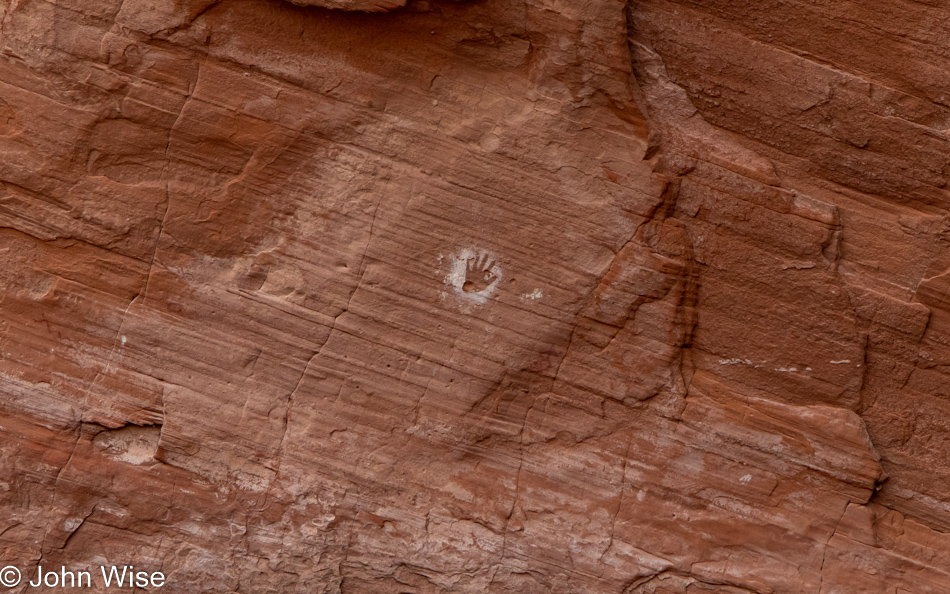
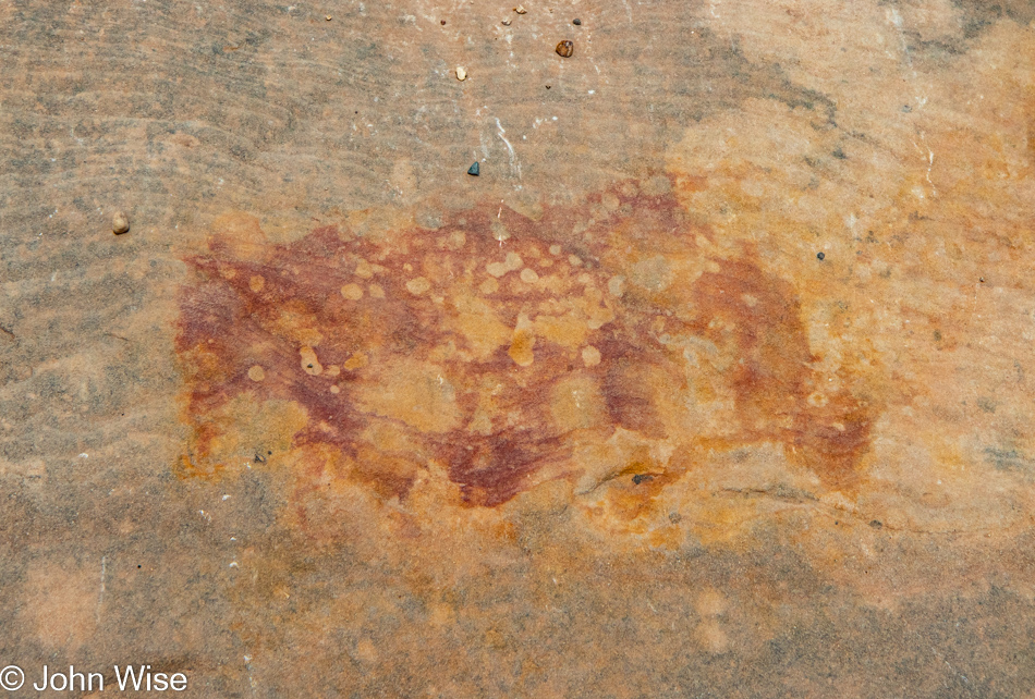
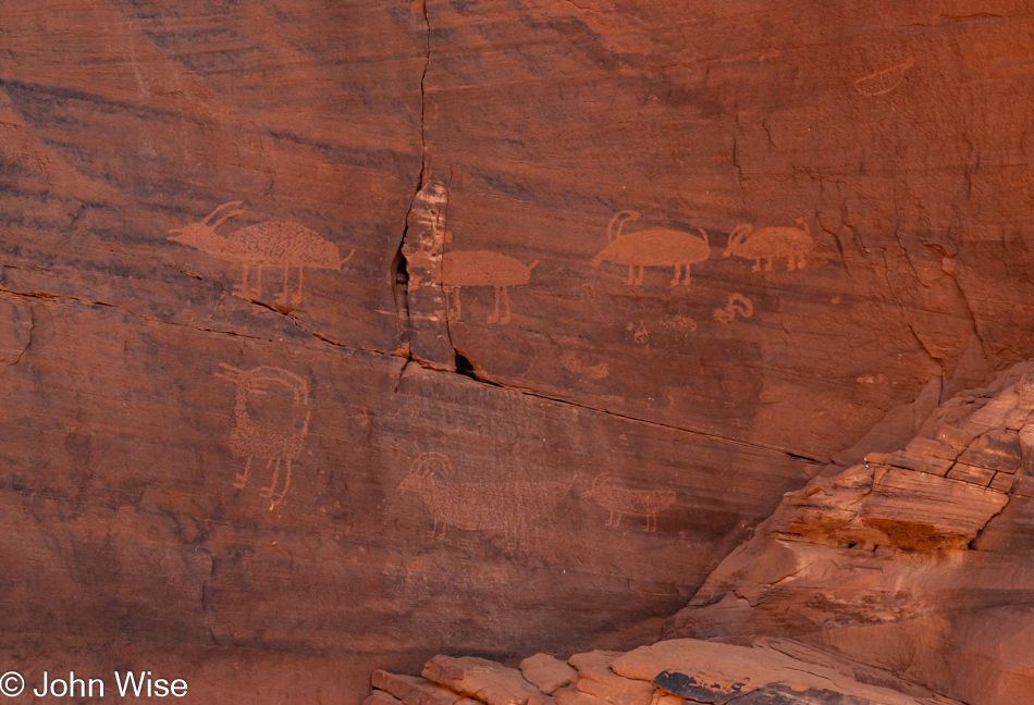
Thirty-one thousand years ago, people venturing into Chauvet Cave in what is today France blew a mouth of ochre over their hand, leaving a negative image of it. A thousand years ago, on this wall, people gathered here at their homes and did the exact same thing, except they used white clay to achieve the same effect.

Ferrison Cody in Mystery Valley on the Arizona Utah State Line

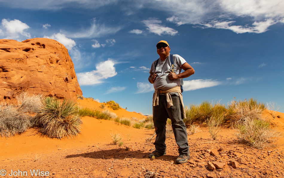
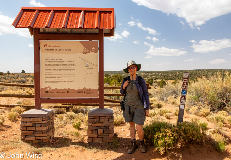
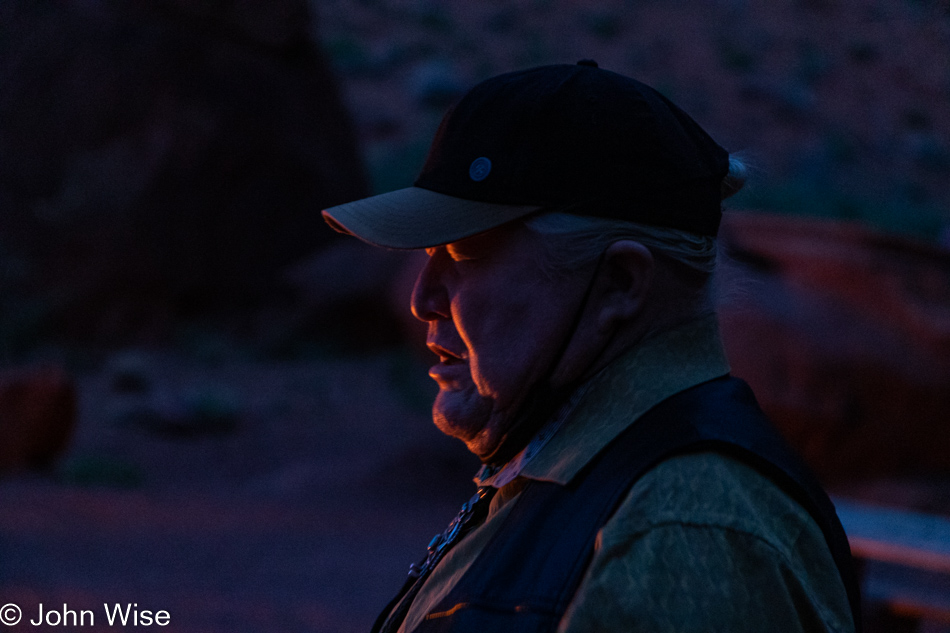
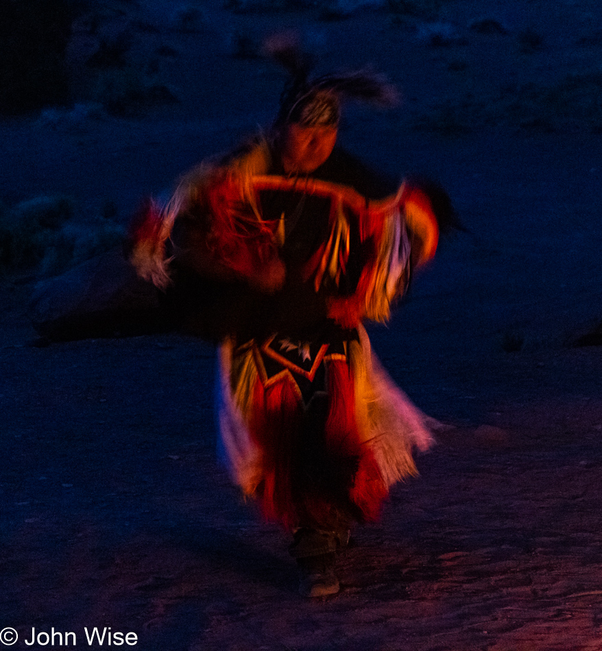
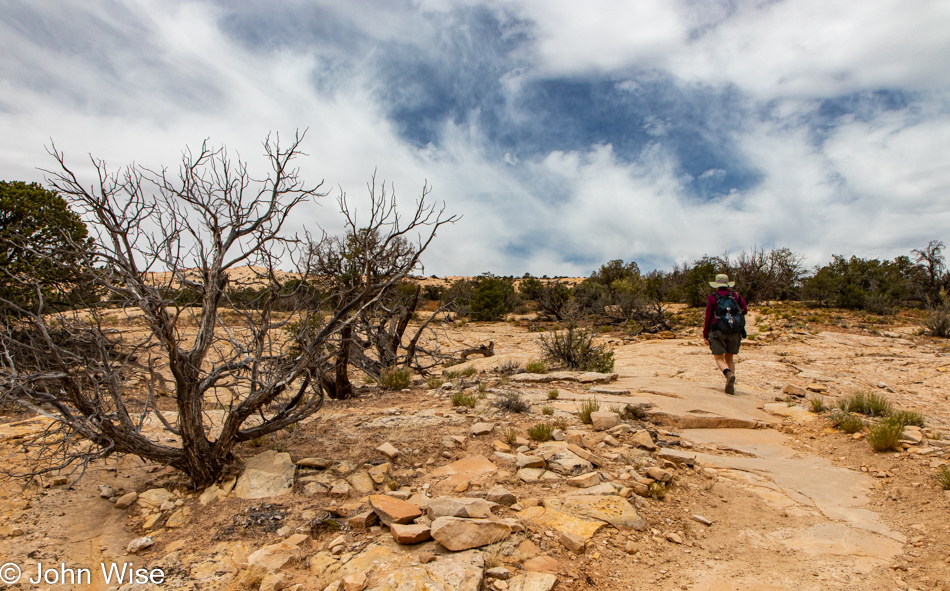
Meet Ferrison Cody (who prefers to be called Cody), our tour guide courtesy of Simpson’s Trailhandler Tours, who have been the provider of our sunset tour in Monument Valley, Navajo taco dinner, evening in a hogan, sunrise tour, and now this visit to Mystery Valley. Cody is a funny guy with a wry sense of humor that might keep you guessing, but by the time we depart company, we’ll be looking forward to the day we can employ his services once again. While he suggested a short 3.5-hour hike when we return, that would never be enough, so we’ll also consider a 5-hour slog up Hunt’s Mesa so we can capture an entire weekend of his time. While this hike isn’t over with as far as the blog post is concerned, I’m sharing right now that this guy ranks up with being an all-time favorite of ours, and we certainly let him know just that.

Mystery Valley on the Arizona Utah State Line

With the photo of Cody, we were now on the hiking leg of this 5-hour adventure. Our attention was directed to a narrow crack that was reminiscent of granaries we’ve seen elsewhere; if there’s any truth that this one hidden well out of sight actually stored mead, well, I’m taking that with a grain of salt.

Mystery Valley on the Arizona Utah State Line

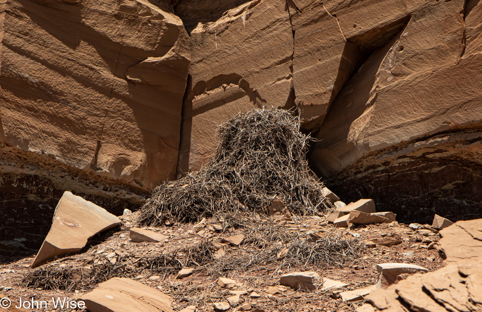
I don’t know if this was meant to be a curlew, a pelican, or maybe an ibis, but I’m not aware of any long-bill birds that don’t live near water. That doesn’t mean a lot when you consider all that I don’t know.

Mystery Valley on the Arizona Utah State Line

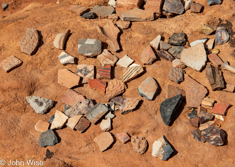
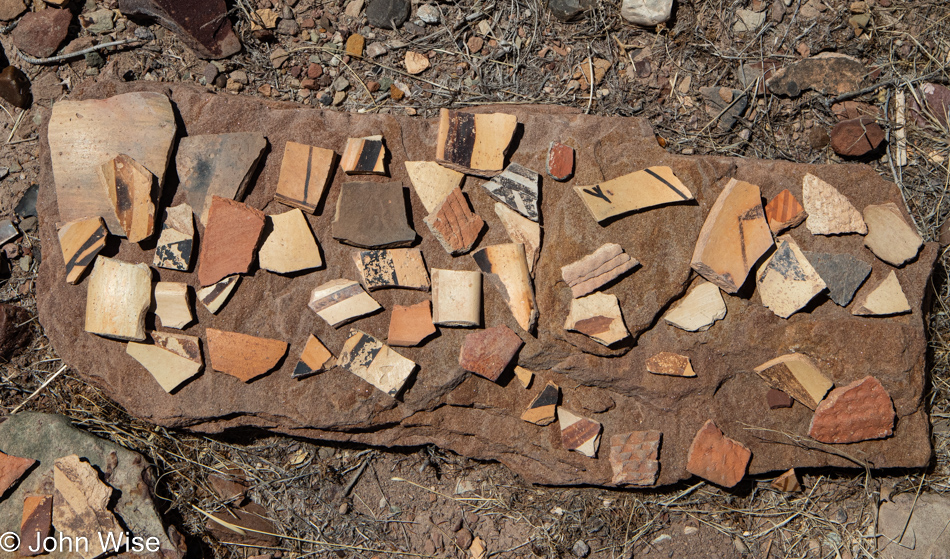
Pottery shards, cutting objects, and gold nuggets are just scattered about willy-nilly…oh, did I say gold? I meant rocks.

Mystery Valley on the Arizona Utah State Line

John Ford slept here.

Mystery Valley on the Arizona Utah State Line

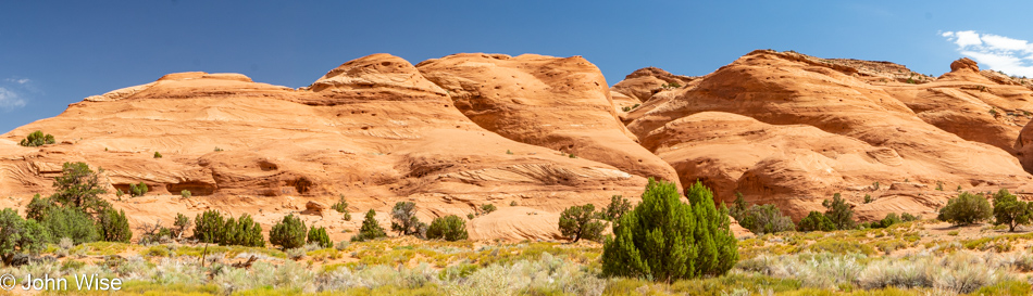
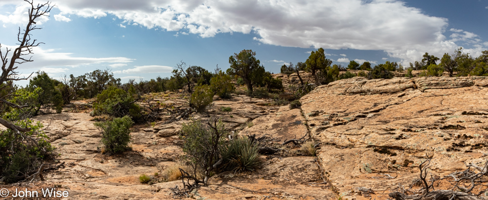
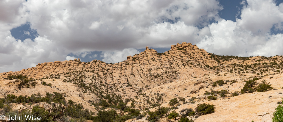
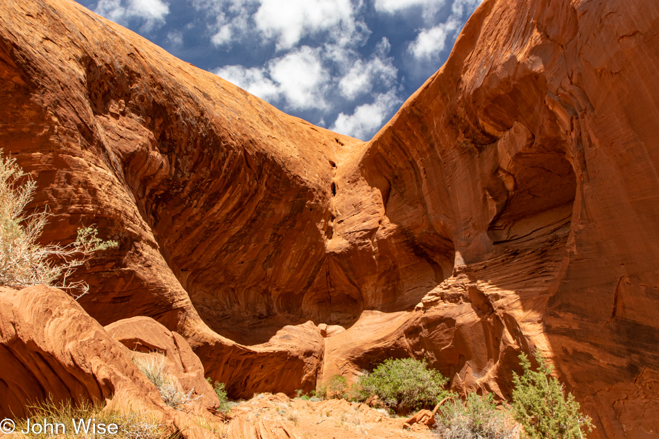
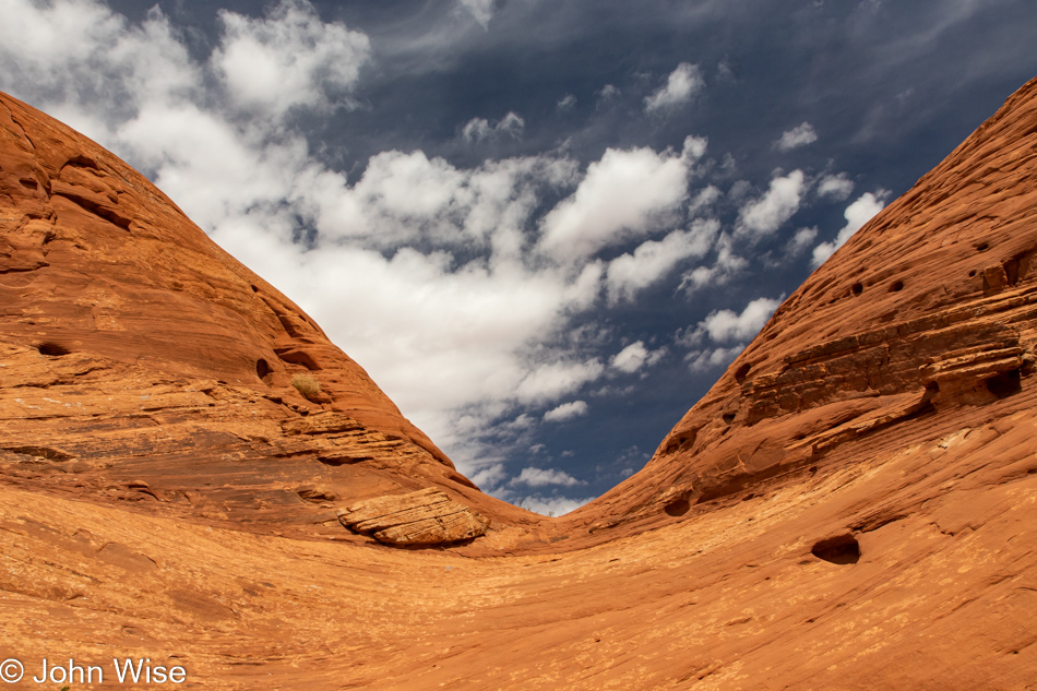
This landscape, from a distance, appears as if it’s just another part of Monument Valley, but out here on foot, the diversity of views seems to be shifting constantly, just as these sands frozen in time must have been doing millions of years ago.

Caroline Wise in Mystery Valley on the Arizona Utah State Line

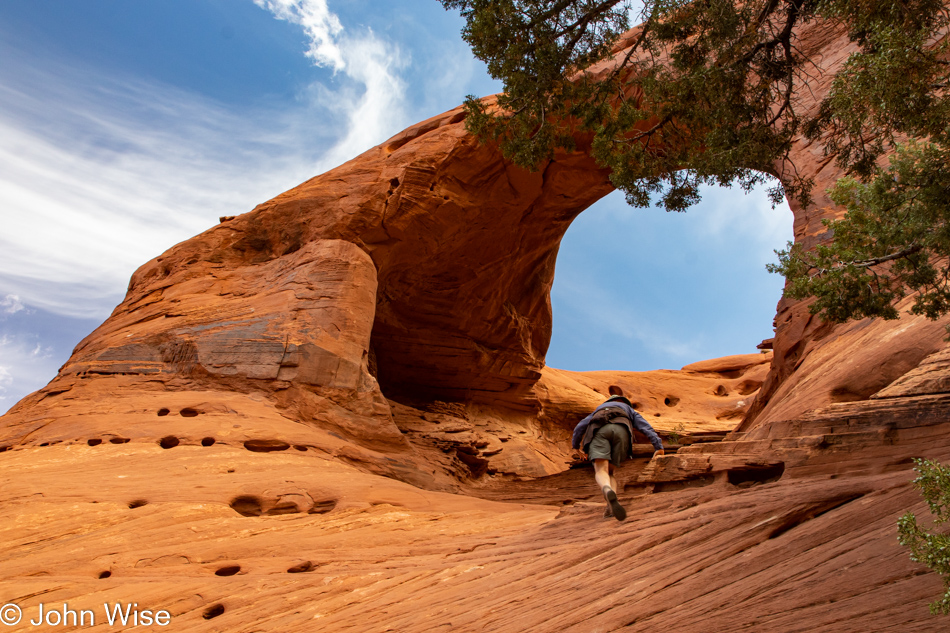
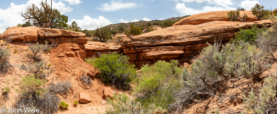
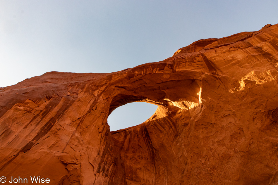
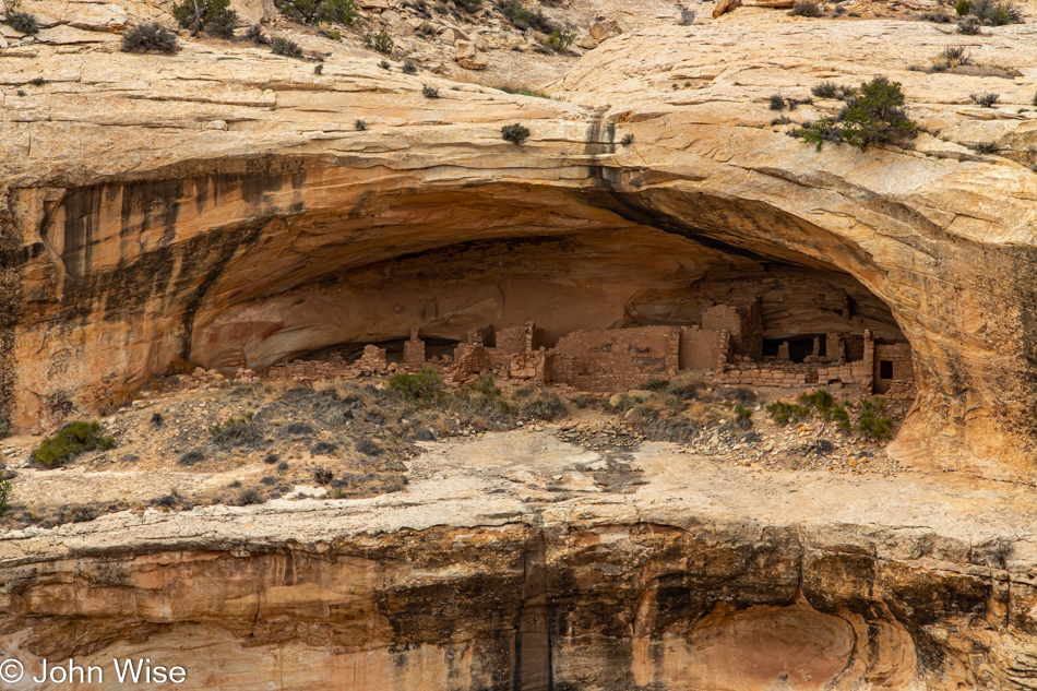
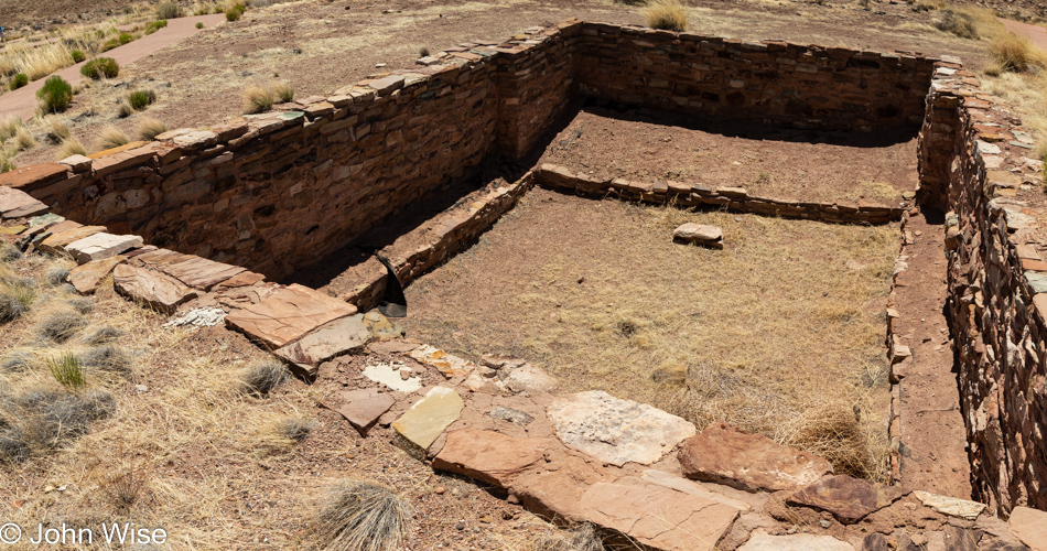
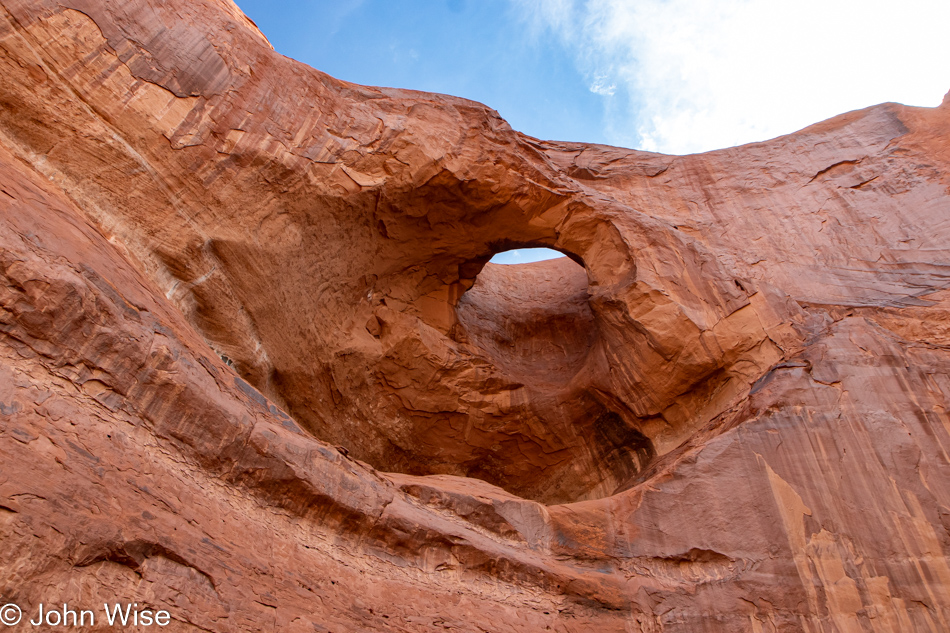
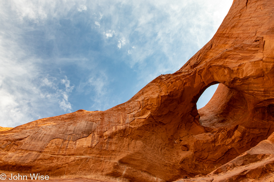
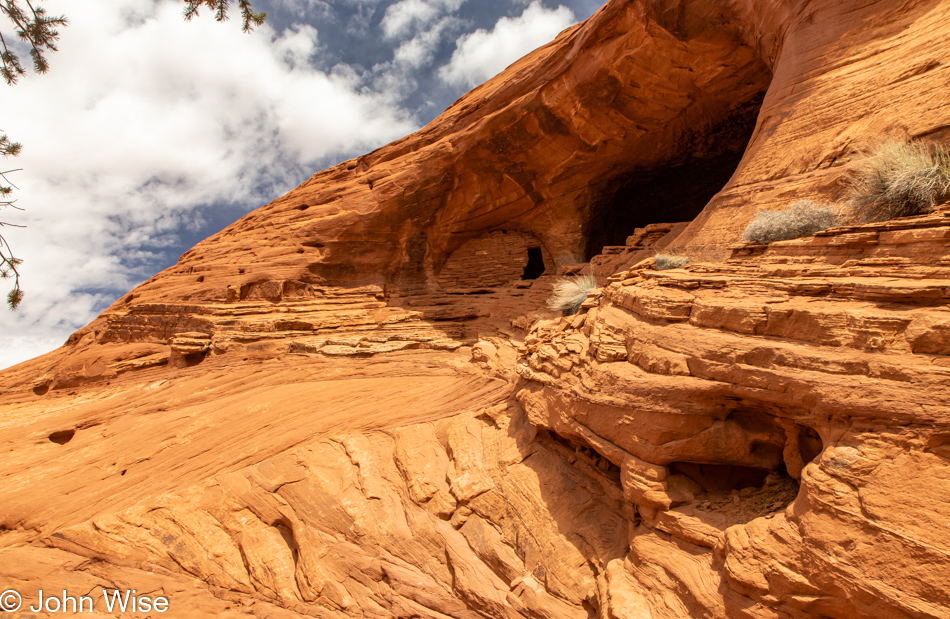
Maybe I could offer you more information about this arch but if I share too much, you might have your curiosity sated and then not have the need for the services of Cody. Speaking of curiosity, up under the arch are some ruins that will not be seen in close detail by my eyes, but obviously, my wife will see them with a better view than I will. The ascent seemed straightforward enough, but I turned myself around in my imagination to see that if I were up there, getting back down would likely turn into some terrifying moment of gut-wrenching acrophobia.

Mystery Valley on the Arizona Utah State Line

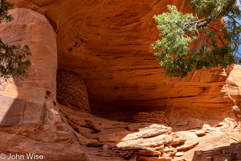
This was my best vantage point to see what my wife would have a more intimate experience with. On the roundhouse, there was an entry on the right side, and while she could have easily gotten much closer than she ultimately did, she kept a respectful distance. and when she was finished with her inspection, she finally considered that she had to come back down. Funny enough, she didn’t use her boots but instead relied on her butt and the intense friction its mass would provide her, ensuring there’d be no slipping on the steep sandstone.

Mystery Valley on the Arizona Utah State Line

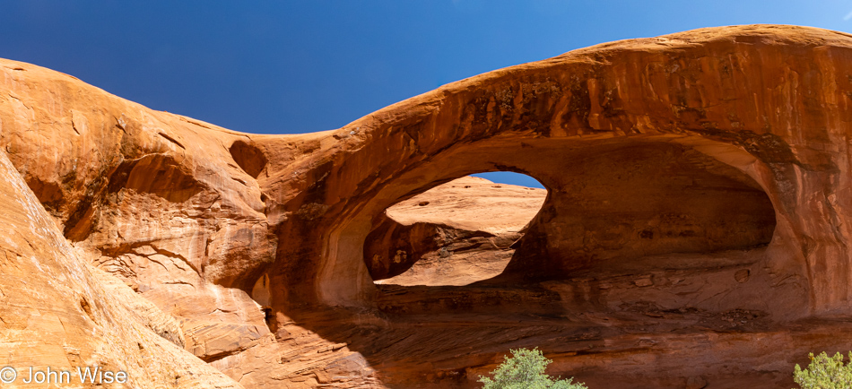
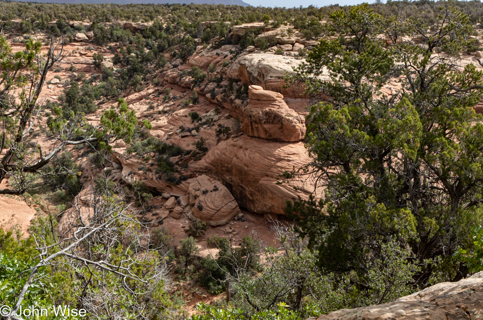
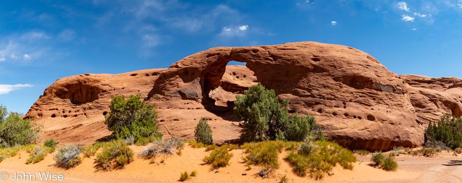
I spoke of shifting perspectives, and these three images demonstrate just that, I hope.

Mystery Valley on the Arizona Utah State Line

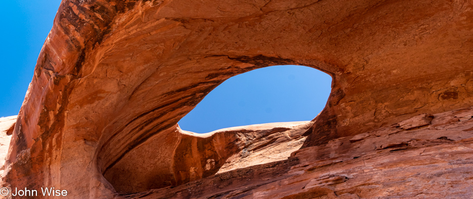
Same arch different place standing underneath it.

Mystery Valley on the Arizona Utah State Line

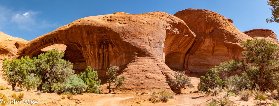
And finally, the majority of its surrounding structure.

Mystery Valley on the Arizona Utah State Line

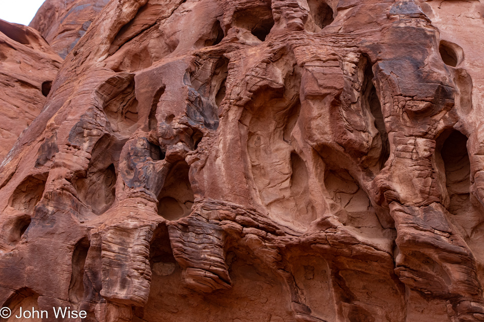
Obviously, not the same arch and maybe not even the same sandstone, although weathering and a slightly different amount of iron are the reasons behind the darker color. At second glance, I’m also noticing the Swiss cheese holes spread throughout that appear to correlate to different epochs.

Little fun fact: looking for information regarding different layers and how and when they were laid down, I discovered a word that’s new to me: chronostratigraphy. Wikipedia describes chronostratigraphy as the branch of stratigraphy that studies the ages of rock strata in relation to time. The ultimate aim of chronostratigraphy is to arrange the sequence of deposition and the time of deposition of all rocks within a geological region and, eventually, the entire geologic record of the Earth.

Mystery Valley on the Arizona Utah State Line

Three blind mice meet seven wandering antelope.

Mystery Valley on the Arizona Utah State Line

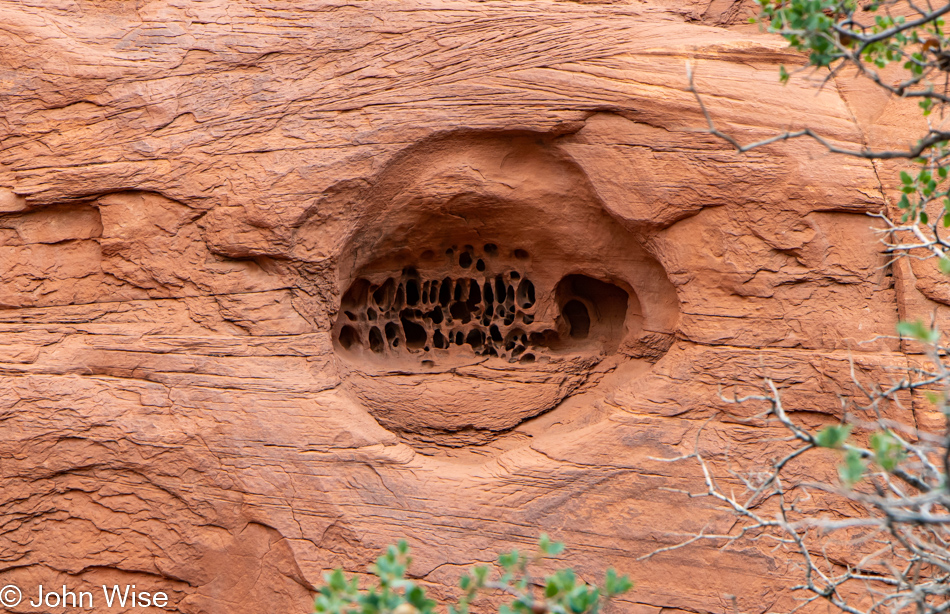
Those petroglyphs were seen in this crevice on the right. Damn it, I was trying to avoid my inner-teenage mind that filters far too much through an immaturity I can’t seem to shake, even approaching the cusp of 60 years old. It is my genuine hope that knowing that no one could possibly get through the preceding 2600 words of this post and still be reading at this point of the story, so throwing caution to the wind, I’m just going to put this out there. I don’t know about you, but to me, there’s something a bit vulvic/backsideish about this image; seriously, that’s why I even took this photo. If I lost some credibility with this, you don’t really know me. Then again, if someone is reading this in the year 2322, I’ll have to assume that you couldn’t have ever known me. And if someone says this is disrespectful of Diné culture, I’d say meh and argue that minds in the gutter are a normal part of life.

Mystery Valley on the Arizona Utah State Line

Now that I’ve said all there is to say, assuming I can recover from comparing rocks to genitalia, I should probably just stop right here. I’m groaning myself by now but what would you do after writing more than 13,000 words to 164 photos with only 44 hours left until you leave on your next trip? You, too, might be loopy by now. Compound that with this being the last 12 hours of a 5-day fast, and I’m a recipe to be relieved of a keyboard and any attempt at making sense. I should just hit the backspace key at this point because if I know anything, it’s that I don’t think anyone would want to read this far to listen to my lament, my whining, my poor excuse at trying to explain why I’m not really adding anything of value to the narrative.

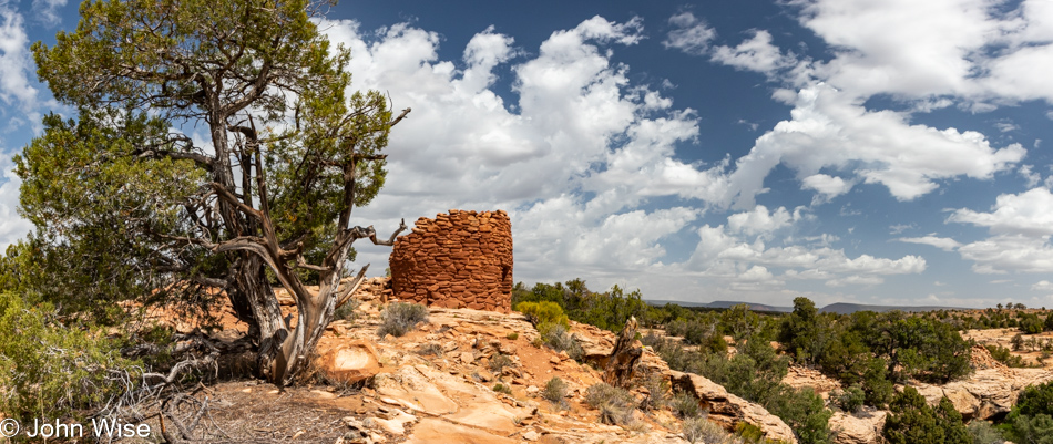
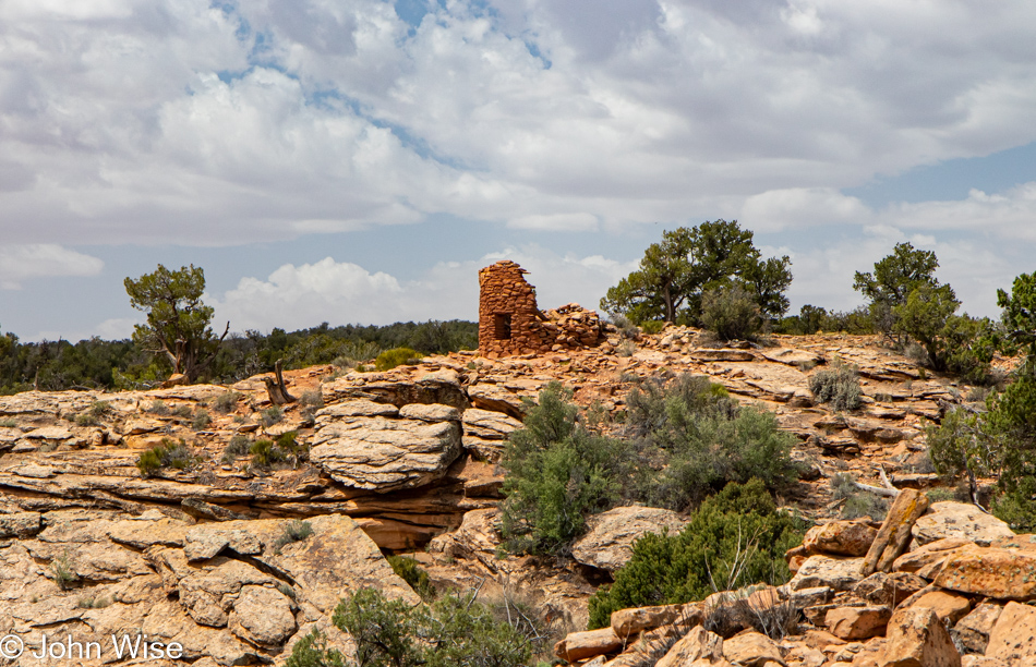
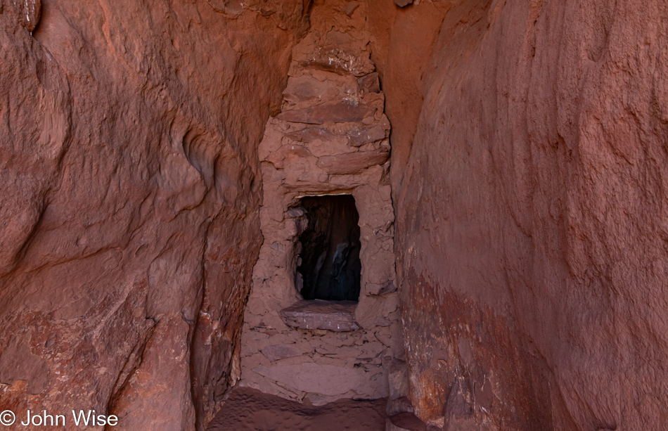
Okay, breaking out of that miasma of thought, I introduce you to a cave-dwelling tucked on high over some spectacularly angular petrified dunes that are not very well represented by this photo at all. Go see it for yourself is my advice.

Mystery Valley on the Arizona Utah State Line

Cleavage.

Mystery Valley on the Arizona Utah State Line

Oh yeah, I forgot that this wall of photos features another view of the mishmash of angles that were petrified in such an impossible way. If I were smart and still full of energy to continue this story, I’d return to MiniMeGeography and find out how it’s explained to children.

Caroline Wise in Mystery Valley on the Arizona Utah State Line

Are we outta here yet? Soon, we are heading back to the Jeep that is somewhere out there. I think I have as many grains of sand in my boots as I’ve gathered impressions today. This has me thinking about how when we’ve been hiking in fine sand, and our feet are sweaty, we rub our toes together to feel the stony little granules as though we could measure the amount of sand that is down in there by the intensity of feelings. When we finally get somewhere to whip off our boots and strip off the socks to inspect our feet,  we look at our toes and the mud ring that outlines them, and I, for my part, am kind of impressed. Then, without abandon, we shove our fingers between our toes and try dislodging the red/tan/ or brown paste that’s probably collected a bit of sock fuzz in it before shaking out our socks with satisfaction, knowing comfort is about to return. Well, that’s where I go; your results may vary.

Monument Valley in the distance as seen from Mystery Valley on the Arizona Utah State Line

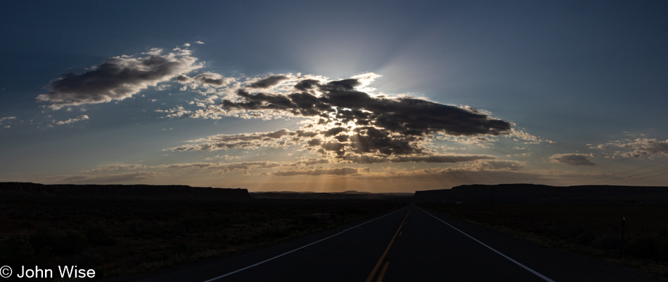
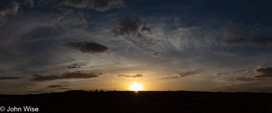
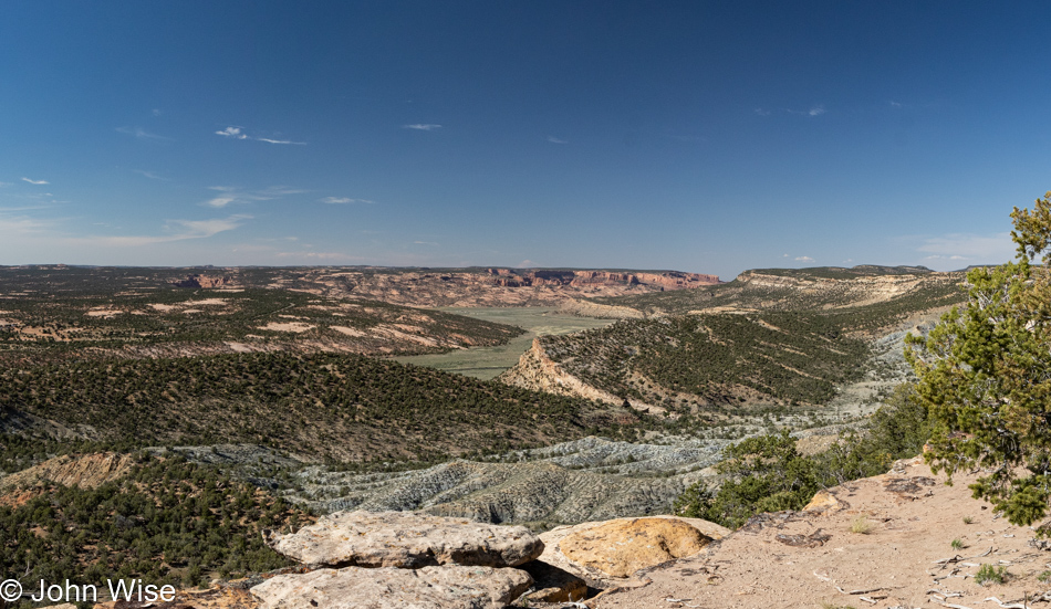
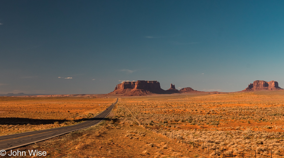
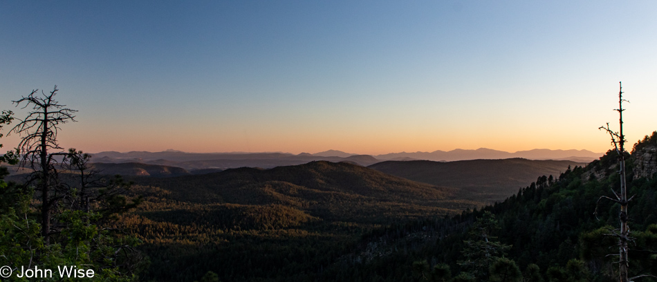
And with this last photo looking back towards Monument Valley, our Memorial Day trip is coming to an end.

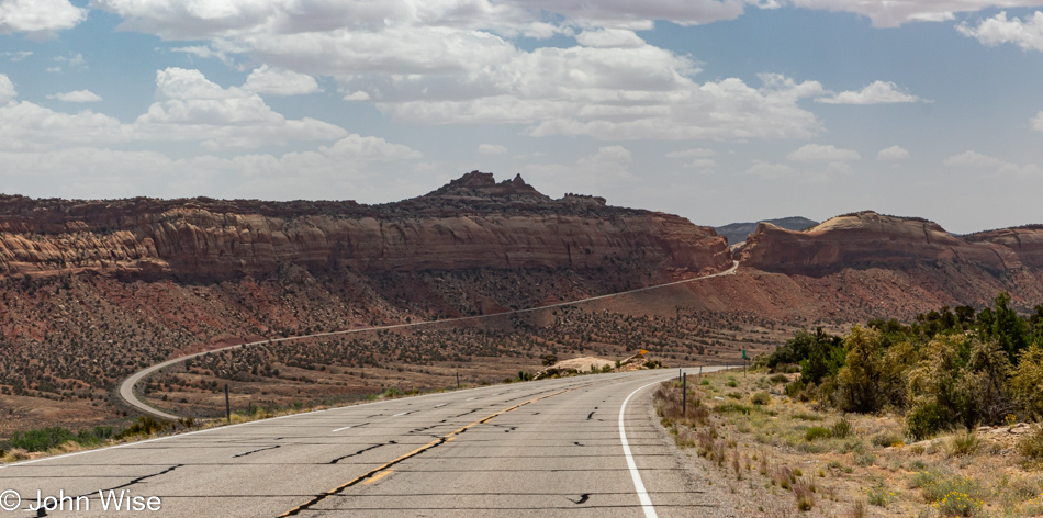
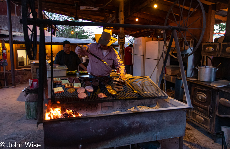
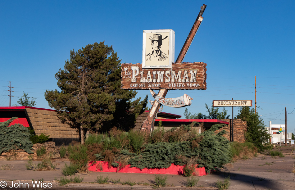
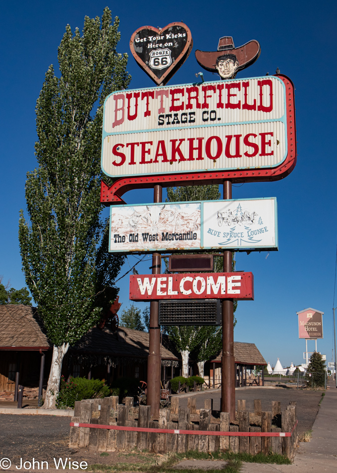
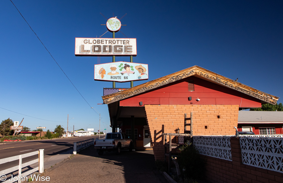
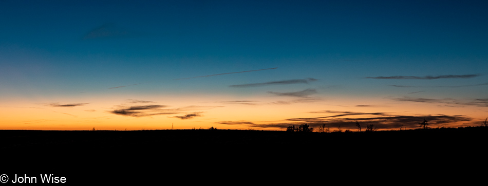
We’ve been driving south for some time now. My hope of finding some roast mutton on this adventure never came to fruition, so we had stopped in Kayenta at the seemingly most popular fast food joint on Navajo Lands, good old reliable Church’s Fried Chicken. Sitting in the parking lot gobbling down our hot lunch, a nearby rez dog we mistook for being dead meandered over, looking starved. That sad old animal was the beneficiary of a lot of crust, skin, and a sizable amount of meat as it stared at us with tears of loneliness in its eyes. Guilt is a powerful weapon when used against the sympathetic.

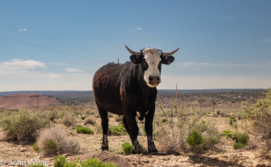
Well, here it is, the end of the trail. It wasn’t supposed to be this way, as we had designs on another night out, this one in Flagstaff. The idea was we’d avoid the grueling drive home to Phoenix on Memorial Day weekend because that’s always nothing shy of awful. Not this time, as we’ve already been witnessing, fear of recession, the effects of inflation, and high gas prices are keeping people at home. Covid already stole their time of enjoying the world, and now they’re giving more of it away to sequester themselves in their caves. So it goes, the cows don’t miss any of them anyway.

Bears Ears to Monument Valley

Fifteen-hour days don’t offer much time for blogging when those hours are being actively used for exploring. Yesterday was a good example of that with all motion and no pausing. At the moment, I’m finally sitting down to write. It’s 4:00 pm on the same day, and we have an hour to spare as we await Cody, who’ll be our tour guide this evening, but more about that later.

We were out early but not so early that the sun wasn’t up already. We must be getting comfortable in these years as in the past; we’ve taken a lot of pride in always being up at dawn; then again, we didn’t get to our room before 10:00 pm last night, so there was that. As I said, I wrote the previous bit when we were waiting for our tour guide, but as I’m here editing and adding to this post a week later, I find it lame that I tried to pull off getting to our room at 10:00 was a decent excuse for missing the sunrise. Heck, we used to get in at midnight and somehow still managed to drag ourselves out at 5:00 in the morning to see the first rays of sunlight. This can only be an indicator that we are growing old. Live it up, young people; this might happen to you, too.

These Twin Rocks in Bluff and the Cow Canyon Trading Post across the highway are the two things that will always let me connect with my fondest memories of our previous visits. The posh trading post below these rocks caters to a wealthy clientele, but it wasn’t always that way when real people moved through the area: back then, it was a mere gift shop for mortals. Now, for example, this trading post that will not be named has seven items on their website that they offer at under $200; most everything else costs between $500 and $21,000, and don’t even think for a moment you’ll find a postcard as that’s just too declasse and something the savage proletarians might still do but not the upper crust.

I need to put that axe away, stop the grinding, and wonder why this is becoming such a frequent theme as these trips accumulate. Maybe it’s my response to the nonsense consuming America here in the middle of 2022 as the price of gas has “skyrocketed,” mass shootings are happening at the rate of two a day (seriously, there were more than 60 during May), talk of recession is scaring people, inflation is a big topic, while some even worry about the potential of nuclear conflict due to Russia invading Ukraine. It’s my opinion that most of these topics are fear-based mechanisms to move the average American deeper into their self-imprisonment while barricaded in their euphemistically titled “Man Caves.” I need to also be mindful of the fact that the changes I’m seeing didn’t happen yesterday, the last month, or the previous year; these things have been accumulating.

In any case, considering the here and now, a 1,000-mile drive in a car that gets 30mpg will cost $166 in gas for the family compared to, say, flying 500 miles to Quebec City from New York City, which would cost a family of four over $2,000. Others might lament that inflation is putting lodging out of reach; oh really an apartment in Quebec City for five nights at $650 is too exorbitant? Yet, spending nearly $100 for dinner at a restaurant for a family of four is reasonable?

What I’m getting at is that I can’t help but think that travel is being discouraged for the hoi polloi (the common people) and that someday, my wife and I will be priced out of this luxury of luxuries. And we are the lucky ones as our decision to live frugally in Phoenix has allowed us to budget about $2,000 a month for travel, but I see the writing on the wall that by the time we reach retirement in approximately ten years, we will have to come up with $4,000 to maintain our pace. A decade ago, we could get away with spending about $150 a day or $900 a month. The big joke on the American people who think they’ll be traveling in retirement is that they’ll never be able to afford it on their meager social security. Heck, even if they saved $500,000 and drew that down by $2,000 a month for a period of 20 years while combining it with their $3,000 from social security, after food, property taxes, house payment, or rent, utilities, fuel, and dependable transportation, the remaining $1,000 might allow them to get away for a weekend a month. Damn, we are idiots oblivious to the future.

Gack, I’m such a horrible capitalist! Heck, I’m not even that, as truth be guessed, socialist blood courses through these veins. I want everyone to know some perfect corner of nature for themselves as I feel that Caroline and I planted some part of us out in the wilderness, and what’s bloomed has brought us oodles of happiness as though the sun filled us with a perpetual sense of wonder. We don’t just gaze at these places of expansive charm we unfold some intrinsically deep organ of perception that connects a kind of primordial umbilical cord into the heart of it all. We are not on the surface of a planet; we are profoundly connected to the flow of life. We don’t even breathe for ourselves; the atmosphere pumps air into our lungs so those of us in love and respect for this place of grandeur might share with others our heartfelt awareness of majesty.

I’m not all that impressed with you, my fellow humans; you’d never hold fast to the side of a stone wall, find nourishment and life to exist on your own without the support of all of the rest of us. Yet, egos, lies, and deceptions have tricked the masses into believing in individual greatness that might only be emulated by the most foolish among us. We need each other. Oh, why didn’t I see this before? I am now old and no longer part of the breeding gene pool. I can afford to ride high on my lofty ideas as I cannot attract another mate with my rigid hostility to banality, so I sit alone like this tree, unable to move from my stone perch. Hah, you’d be wrong if you believe that because just as this tree is able to throw off its seed, I throw off these words that might at some point take root in some other unlikely place and share an idea that could change the landscape.

Bears Ears National Monument (which we drove into and out of yesterday) is the focus of at least the first half of today with the intention of reaching the House on Fire. In that effort, we walked along the rim trail we assumed was the right one, this being the Mule Canyon Ruins Site and all. Staying on the trail and finding a path to House on Fire was a serious challenge. It turned out that the reason was we weren’t in the right place. This has something to do with the lack of adequate signage here in Bears Ears, as this was the park designated as a monument by Barack Obama and subsequently mostly canceled by our last president before Joe Biden restored its designation and territory. Some ambiguity is still part of what’s what and where those what’s are.

Sadly, we likely inflicted some damage on the fragile cryptobiotic soils as the “trail” was so random. Okay, it wasn’t random at all because it wasn’t even a trail but a series of mistakes by those who searched for the same thing before us, but with an interpretive panel nearby and a pit toilet, this had to be the right location, the previous right turn only said Mule Canyon while this said Mule Canyon Ruins where there are none, as far as we could find.

Later, we learned that the House on Fire is down that canyon trail titled Mule Canyon, not this rim trail featuring a ruin. House on Fire is not actually on fire but offers the appearance of being so if you arrive at exactly the right time when sunlight is reflecting off the opposite wall and onto the curved cliff above the ruin. Needless to say, we will not be seeing that during this visit as the window of opportunity has closed, and the house is no longer on fire.

After this great hike, we did actually catch sight of the House on Fire across the canyon and down below. This is a horrible photo of that site, but hey, it’s all I got. If you zoom in on the broken boulder near the center of the photo, you might recognize a few people standing near it, but sadly, not us.

Over at the interpretive sign (which we had ignored on arrival), we now understood that Mule Canyon Ruin is this structure right here. We couldn’t see it nor the kiva to its right from the parking lot, hence not finding it. Defeated (just kidding, we are never defeated), we took off looking for the unmarked turnoff that promised to deliver us to the Cave Towers.

Just off the road and through a gate was a sandy, bumpy road we were too chicken to drive as it appeared that it wouldn’t have played well with the bottom of our car and merely two wheels of traction. Good thing the walk wasn’t very long to the beginning of the trailhead Caroline is standing at.

It was out here in this vast land that we got lost forever. We are out there right now wandering aimlessly and carefree because what’s better than communion with the infinite when your god is the universe of nature? Natural sensuality, hot, cold, wet or dry, sunny, dark, dangerous, sometimes benign, holding all the potential for surprise, enlightenment, fun, and love, these things feed our sense of the real. Look at it all spelled out in the clouds, bushes, hills, and sand. Stop a moment and try to remember the last time your feet trudged through the sand and you tripped over a pebble because your focus was on a cloud that reminded you of something or other.

After exhausting the possibility of returning to our car, we took up residence where an Anasazi structure once stood. Starting with just a pile of rocks, we created ourselves a home from the ruin. If you’ve been looking for us, you’ll find us here, wherever here is. We’ve given up the search for meaning outside of perfection, as it seems that our larger society is intent on exploring the madness of not being able to cope with nothingness. Out here, the space between is full of everythingness, and where gaps exist, our love and appreciation fill those voids.

We continued work on our growing tower home, making great progress with the understanding that monsoons will arrive with the summer. Protection from those tempests was required as our naked skin couldn’t fully shield us out here in the big nowhere, though we seem to have been effective in throwing off the banality that was just under our skin from living amongst all of you.

I can finally admit that we didn’t get lost by accident; we made an intentional move to escape the inanity of all that our culture stuffed us full of, as though we were some kind of sacrificial turkeys destined to be eaten by those who feast on the poison of stupidity. Our modern-day Dracula myth works this way: fatten the masses on intellectual tripe and then milk those fantastic breasts that money is excreted from. Titties and cash are the elixirs of happiness for the ruling class.

Now that we live carefree, naked, without money or hope of returning to your world, I beg of you, do not try to rescue us as we have rescued ourselves from drudgery and will find happiness on our own. As I grow to forget you all, I will remove a stone at a time from our new home until the day we die when we’ll have left the earth without leaving a trace that these new ancient ones with dreams had once been among you. Your existence does not deserve dreams as you wallow in the sorrow of failure. Hey Caroline, do you think we can get Grubhub to deliver us some coffee from Starbucks out here?

Today, we’ll drive over 153 miles of paved roads that, on average, cost our governments about $635,000 per mile to build. Caroline and I are truly experiential millionaires as we trek effortlessly over these $97,155,000 worth of roads in a car that has over 100 years of engineering behind it. We travel with music, phone service, and even an ice chest, allowing us to have fresh fruit, meat, hard-boiled eggs, and whatever else we might want to drag along in our air-conditioned car. The gasoline for this adventure today, even if it were $10 a gallon, will set us back $33, but in reality, at $5.39 a gallon, we only have to pay $17.92 for this entire day of crazy exploration. But wait, there’s more; what if I told you that the state of Utah would also supply you with picnic tables so you could just pull over and feast? Still not enough for your pittance of tax contributions? Just ahead, you’ll find places to stay and people preparing hot food and medicine should you need it, and you can get there from the comfort of your car, traveling at 60 miles an hour over the surface of a planet in space. How about we stop complaining about taxes and the price of gas?

Just wow, who the heck had the great idea to slice down through a mountain of stone so we could easily drive through this space instead of driving off the cliff? Look at the photo above this one; the road that climbs the incline is exactly where we are right now. As for the signs that tell drivers, “No Stopping or Parking” and warnings of falling rocks, they are heeded as the danger is apparent and so I take my photo through the windshield while trying to drive especially slowly.

We are heading east before turning south to avoid being late for a scheduled 5:00 p.m. meeting.

But first, we’ll have to stop for just one more thing. A short hike to a one-hundred-sixty-million-year-old dinosaur track left by a meat-eating, bipedal, theropod beast that is long extinct. Photographing this mid-day was no easy task as shadows were nowhere to be found. I did take a photo with Caroline’s hand next to the impression, but it didn’t turn out as well as this one. The track is larger than her hand.

For your information, we are in Butler Wash, which runs for 23 miles north and south. There are many things to explore, including the Wolfman petroglyph panel we would have liked hiking out to, but the threat of rain (hard to believe, but we actually caught some sprinkles at the trailhead) and our need to be punctual for what comes next dictated that we’d have to keep it for another time. After heavy clouds appeared on the horizon and started moving away, they were replaced by increasingly strong winds.

Monument Valley Navajo Tribal Park is what was on the itinerary.

This is where we were to meet up with Cody, who I mentioned at the top of this post; he’ll be doing the rest of the driving on this day. By now, with a ton of sand tossed aloft, we’ll have to deal with limited visibility, a camera that is being impregnated with fine red dust, and expectations of red boogers. Continuing COVID rules up here on Navajo lands demand that we wear masks while in buildings; due to the dust storm, we happily wear our masks for the majority of the afternoon outside to avoid that potential booger problem I referred to.

Look to our photos of the next morning for a comparison of just how much dust is in the air at this moment.

It should be obvious that this butte is named after an Indian chief; just look for it.

A benefit of our guided tour is that it leaves the main trail through the park and brings us to locations not otherwise seen by mortals attempting to damage their own cars. Being out here, there’s so much to see that it’s easy to be distracted by the monuments, forgetting to see the little things.

Our tour is about something more than taking the path less traveled; we’ll be sleeping overnight here, right in this exact hogan, as a matter of fact. But we have a lot more to see and do before we unload our gear and lay down for the night.

Maybe you think this is the inside of the hogan we’ll be sleeping in? You’d be wrong as this one is adjacent to ours. The woman sitting next to Caroline is Effie Yazzie, daughter of Susie Yazzie, whom we met on our first overnight in a hogan. She sadly passed away nine years ago. Little did we know all those years ago that we were effectively in the presence of royalty, a matriarch, an occasional actress, and partly responsible for 73 descendants? I have a photograph of Susie Yazzie on that post from March 2008, which you can see by clicking over to this post.

While it’s a bit dark, you might be able to see the profile of George Washington here (looking left). We’ll see more than a few holes in the sandstone towering above us, such as here at Big Hogan. Look again; maybe you see an Iroquois Warrior, or is it a rabbit?

Cody offered us a song in the Big Hogan and requested that we not share it on social media, so in respect of that, I offer you the drum he played.

I have christened this unnamed feature, the Cobbler’s Anvil.

The Eye of the Needle was the next hole/arch/natural bridge we visited. Hmmm, this is becoming a “This, then that” list of things, and there’s no fun in that.

Here’s the deal: it’s June 6th when I’m writing this part of the post. I’m midway through a five-day fast, and in four days, we will head up to Winslow, Arizona, for the next step in our journey. I’ve written 2,800 words so far for this post with 42 images, and I’m still facing the need to write tomorrow’s post about Mystery Valley featuring 43 incredible photos that should also include some inspired words. This process is a formidable one as I’m intent on blogging each of our many trips this year while not falling behind, but there are other things in life that also require tending to.

We alone have been afforded this opportunity to peer through black gates into the warm taupe sky to see Earth’s past carried on the wind illuminated by the sun. The ancient dust rains down after being jettisoned from its resting place, some of it will travel with us to places beyond Monument Valley, while the majority of it will find a new home right here on the desert floor. Fine sand is in our teeth, occasionally in our eyes; it’s accumulating in our ears and hair. We breathe it, and we’ll be eating some small amount when dinner comes around. We are fortunate to be on hand for this slow-motion reorganization of our planet, where we can see for ourselves in real-time the shift of matter that ultimately breaks down and changes everything.

Stand below the giant Eye of the Sun and look into its depths; what do you find? Do you see the streaks of tears staining its cheek? It’s incomprehensible that we should be offered these opportunities to gaze into grandeur and not be forever transformed, but that’s the reality the sun and universe must contend with, and so they cry. If there were gods, they too would shed tears at the simplicity of a creature capable of such exquisite passions squandering these rare moments.

From one, the many arise. Somewhere in the distant, unknowable past, someone realized they could peck an image into the desert varnish found on rocks. This one person left a mark, followed by many others imitating what had been done by this pioneer. We can never know the first stone artist here in the Desert Southwest, but we can relish that hundreds if not thousands, followed the lead and offered the future a mystery. From an anonymous author, possibly during the 16th century, someone penned a nursery rhyme titled “Hey Diddle Diddle” that spoke of a cow jumping over the moon. This panel has me thinking of an antelope in the form of a constellation that jumps over the terrestrial relative. Now I’ll have to reconsider the petroglyphs I’ve seen and wonder if I’m not looking at nursery rhymes.

Without change, something sleeps inside us and seldom awakens. The sleeper must awaken.” ― Frank Herbert, Dune.

Gates also act as blinders, stopping us from seeing the full picture, while a veneer of dust can obscure what we think we are seeing. Where we humans are in our perception of the world and our place within the universe is still hidden behind many a door, gate, much haze, and darkness. In dream worlds, we manifest glimpses of potential we might be afraid to experience for ourselves; we find shelter in the safety of our heads, knowing dreams are not real. When we open our eyes and stare into the light of knowledge, we risk blinding ourselves with truths that make us largely incompatible with many of our species. There is an inherent cost that arrives with even a glimmer of enlightenment, and that is you will be simultaneously alone and forever locked solidly in the multitude of the whole of everything.

As above, so behind. Oh, I know this is a modified version of the better-known quote, but this is an intentional re-imagining due to the circumstances I find myself in. I don’t know the proper name for this version of crepuscular rays, a.k.a. god rays that have taken shape due to the dust blowing through the Eye of the Wind, but the idea of light beaming out of the eye instead of only inward could also be referred to as another moment in awe. As for the play on the quote, I began this paragraph with, look behind me.

The sun passes through the Eye of the Wind while the space between is being observed by countless brain cells in our individual heads, all firing to interpret the moment. On one hand, eyes and minds are not precise recording devices, but they do act extremely well as pattern recognition machines. While we cannot pull these images from our memories with the same fidelity as a photograph, when we do see something similar, we are able to compare it to the impression left behind and find familiarity to better understand the impression. We do not only see with our eyes but also with our memories. Which then begs the question, what memories have you tried to collect?

In Henry Wadsworth Longfellow’s poem titled, A Psalm of Life, the following stanza resonates with me.

Lives of great men all remind us
We can make our lives sublime,
And, departing, leave behind us
Footprints on the sands of time

The sand of time is an old idiom referring to grains passing through the constriction of the hourglass that should have us thinking about how our moments are passing through the constriction of our limited existence. If you do not try to capture those grains and simply let them float away, you will not have been available to witness what time could have offered you.

The sun has set; its rays cast light elsewhere. The blowing sand is beginning to settle in the late day as a number of us gather around a table to share a meal. The others arrive under their own circumstances with ideas that direct their narrative, but no matter the background, we are here with those who feed us, sing to us, and tell us their story. Around a fire, we are reminded that the light shining on our faces is temporary, but for a moment when we were on hand trying to understand the impossible and magnificent.

How many of us never learned to look into the flickering light of memories that might allow us to see not only our ancestors but some part of life as big as love? Can you beat a drum, sing a song, or tell of the extraordinary if the images within are a frenzied blur of chasing aspirations and goals that have nothing to do with one’s soul, whatever that might be?

Dance with beauty into the heart of the night. Paint your dreams so they intertwine you with amazement and wonder on your path to see the light of love and life. When you wake, be sure to throw open the door welcoming the sun into your new day, turn around, and shine your own light into the universe. You are now dancing.

Mexican Hat and Surroundings

Mexican Hat, Utah

Today started out on the wrong foot, with us deciding at 5:00 am that the commitment to haul ourselves nearly 4 hours north wasn’t going to be happening. The original idea had us revisiting Horseshoe Canyon, but after a night of sleep that was more akin to playing the rotisserie chicken game until 5:00, when I finally dragged my exhausted body over to turn on the loudest air conditioner in all of southern Utah (that at least helped get some sleep), we decided to change plans.

It was already after 7:00 when we finally hit the road, a bit disappointed that we bailed on our plans at the last minute, leaving us relatively aimless other than knowing we were going north. We drove into the gloomy, overcast morning. The only thing we could muster those first minutes was stopping at the Mexican Hat rock on the other side of town.

Mexican Hat, Utah

Not more than a few more miles beyond that was the turnoff to head out of Goosenecks State Park. This, too, would be a revisit, but sometimes it feels that almost everything in America qualifies as that for us.

Goosenecks State Park in Mexican Hat, Utah

Back a hundred or so years ago, on our last trip out here, we believed we were the only people at this overlook; that’s not true this time. Maybe it’s a Memorial Day Weekend thing, but a half dozen campers are parked along the rim, and there are a few other visitors out here just for the peek into the depths below.

Goosenecks State Park in Mexican Hat, Utah

It’s a beautiful 2-mile roundtrip walk out to the trail’s end. Along the way, I’m enchanted by the rock formations we’re walking over as there are hints of a marine past where it appears to Caroline and me that a shallow sea influenced the look of this fossilized sandstone. Caroline picks up on the thought that these look as though they have a milky translucency where she can glean hints of the underlying structure that formed these rocks.

Goosenecks State Park in Mexican Hat, Utah

I’ve stared hard, contemplated, and searched my memories, trying to find what this reminds me of, and maybe the best I can come up with is a dry lake bed that’s been compressed by subsequent layers accumulating on top of it. How often do we stop to consider just what it is we are walking on? The reality is that we are walking atop history, usually oblivious of how familiar we’d be with it. If I knew I was walking on a lake bed, a shallow sea, or a broad river bed, it would change how my imagination would contextualize the environment I’m experiencing as I strain to see what might have been prior to my arrival.

Heading up the Mokee Dugway in Mexican Hat, Utah

With the overcast sky, we agree that there’s nothing to be gained driving up the scary Mokee Dugway and that we will take the right turn just before the ascent and drive through Valley of the Gods before returning to the road that will take us up Bluff way.

We made the right turn, and not 5 seconds later were making a U-turn to face our fears and drive up the dugway; not my idea, mind you. We know we’ve driven down it a couple of times, but we had no recollection of going the opposite direction, not to say we haven’t, as in having taken so many road trips across the Southwest, maybe a thing or two gets lost to time.

Heading up the Mokee Dugway in Mexican Hat, Utah

It’s a white knuckle climb up the 3-mile (4.8km) series of switchbacks that will take us up the 1,100 feet (335 meters) needed to find our way onto the top of the mesa. We had the opportunity to learn one bad aspect of going up instead of down: if you encounter someone going down on the really narrow parts, they have the right of way, and you have to back up. This was the point where Caroline was questioning her enthusiasm for this diversion instead of an easy drive through the Valley of the Gods.

Heading up the Mokee Dugway in Mexican Hat, Utah

By the way, when we got home after this trip, we looked at our old photos that lay witness to our travels over the Mokee Dugway and now have to question if we’ve ever driven down the narrow dirt road. How could we have lost those memories that we’ve apparently always driven up the Dugway?

Butler Wash Anasazi Ruins Trail in Bears Ears National Monument, Utah

Not prepared to turn around and return the way we came, we continued up the road into Bears Ears National Monument. We passed one spot that talked to our curiosity, but it was supposed to be part of tomorrow’s adventure and so we just kept on driving. When we saw the Butler Wash Anasazi Ruins Interpretive Trail sign, we turned in there as it sounded compelling.

Butler Wash Anasazi Ruins Trail in Bears Ears National Monument, Utah

Before our next mini-adventure in the continuing bigger adventure, it was time for lunch. We turned to a new favorite, bologna, and boiled egg sandwiches, but it turned out to only be a snack as in a couple of hours, we’d pull over for another round. Done with that, it was time to hit the trail.

Butler Wash Anasazi Ruins Trail in Bears Ears National Monument, Utah

Back when accretion was at work accumulating successive layers of sediments, something was happening here that will remain inexplicable to me. While I have some sense that the oxidation of iron is playing a role in creating rust, I’m desperate to know precisely why this bit of sandstone is red and orange. If it’s being excreted over time as it’s exposed to the elements, then why just here? What are the processes going on in the sandstone that are drawing particular minerals to this location? I should have been a geologist.

Butler Wash Anasazi Ruins Trail in Bears Ears National Monument, Utah

There’s something missing from this photo. Namely, the layers of earth that used to be here but are now scraped from view by good ol’ Mother Nature, who eroded that history and delivered it somewhere else. What remains allows us to see the sand dunes that were petrified somewhere in the distant past. Like a kind of two-legged ant, we walk in the gap of time where once a hidden sandwich from another era hid the story of the earth unfolding.

Butler Wash Anasazi Ruins Trail in Bears Ears National Monument, Utah

The easy hike was a beautiful one that brought us to an overlook of the ruins; sadly, it was marred by “that” family who are in the universe all by themselves. Loud, obnoxious, and oblivious to anyone else who might not want to be witness to their antics on the other side of a barrier or running over a path as they tried to find a way to visit the ruins in the caves that seem off-limits to us.

Bologna and egg sandwich

Back at the main north-south highway, we took a short drive north to Blanding because, though it was mid-day, we’d not yet had coffee, and we were in dire need. With headaches fading (yes, we are addicted to caffeine) and pep returning to our senses, it was a snack or eat; we pulled over for round two of our culinary delight. Looks appetizing, huh?

White Mesa, Utah

I don’t believe White Mesa, Utah, ever had a golden age, but then again, which Indian lands ever had that after colonization?

Bluff Fort in Bluff, Utah

How have we failed to visit the Bluff Fort on previous visits to this corner of Utah? Cynicism is the likely answer, as there’s a certain amount of cheese factor going on, but today, this was a GREAT stop. Thanks to the docents and staff for sharing some great details that told the harrowing story of the pioneers who first came into the area via covered wagons that should have never made the trek.

Bluff Fort in Bluff, Utah

Well then, things come into focus after returning to Phoenix and searching like mad for almost 5 minutes for clues as to why we never stopped at Bluff Fort. The visitor center/co-op building, which is the main focal point of a stop here, wasn’t opened until 2013, and somehow, a decade passed by without our passing through Bluff.

Bluff Fort in Bluff, Utah

Learning of the hearty natures of the pioneers who toiled to reach this remote outpost is nearly gut-wrenching. They sliced their way through a small gap in a wall of rock so they could go forward, but not before having to use men, horses, and ropes to guide their wagons down the steep, rough trail they’d forged. Then, there were floods from the nearby San Juan River and the simple hardships brought on by being so far away from any other community.

Today, Bluff is heading for the toilet. My apologies to the citizens of Bluff, but the Bluff Dwelling Resort & Spa is the ugliest nod to the artificial opulence desired by a certain elitist segment of our population who have no compunction with gentrifying authenticity with their fake realities. Don’t get me wrong, I really do dislike the pretentious banality that often arrives with wealth, but what is an otherwise poor community supposed to do when the majority of Americans can no longer afford to get off the beaten path? Again, let’s try to find some honesty: that majority could afford to come out to these out-of-the-way destinations, but why would they want to walk away from their self-imprisoned existence sitting in front of another iteration of their favorite videogame, the 17th season of some lame series, or from witnessing the 48th time their favorite sports franchise meets some other team.

Just like Jackson, Wyoming, Steamboat Springs, Colorado, and Sun Valley, Idaho, those places won’t fade off the map like so many American cities as the wealthy have realized the incredible value of living somewhere profoundly beautiful. I guess Bluff, Utah, has the added benefit of having the San Juan River running through it, which in the southwest United States is a treasure when such a valuable resource such as water is disappearing in the larger communities being left by the rich who can gentrify the places they want for themselves. No, seriously, I’m not bitter or anything.

San Juan River at Sand Island in Bluff, Utah

Inspired at the moment by a sign reading Sand Island that pointed the way down to the San Juan River, a quick left turn not only brought us riverside but there’s an incredible panel of petroglyphs.

Petroglyphs near the San Juan River at Sand Island in Bluff, Utah

I’ve interpreted this panel for the first time ever; it reads: don’t allow the wealthy interlopers to steal the lands and resources available to all. Too late ancient ones, our souls were cheap fodder easily traded with the hopes we’d be able to take a selfie of ourselves with some rich and famous douchebag who was second in importance only to our children. We are a collective of toolbags. About now, you must be wondering, “Jeez, John, what crawled into your crack?” The sad reality of dreamless people who want nothing more than cheap gas, bullets, and drive-thru convenience.

Petroglyphs near the San Juan River at Sand Island in Bluff, Utah

There are three figures here with three bars over their heads; they are tapping into other dimensions to discover how to cope with the future that is going to arrive, where much of their world would disappear in the clutch of the conquering force. Today, I’m one of those persons with three bars over my head looking into the higher dimension, trying to discover how to cope with the conquering force of wealth that has no space for the peasantry of common people just as our ancestors had no space for the indigenous people that populated these lands before them. All around me, I witness the mass of America moving onto a virtual reservation where the resources of the intellect have been stripped bare.

Highway 191 south of Bluff, Utah

If only I could find the time to write these narratives in situ when I’m resonating with the beauty and happiness of the moment instead of trying to capture recollections of these days a week later. In the interim, there have been 17 mass shootings, with the most recent one happening in the past 12 hours right in Phoenix, Arizona, where I’m trying to write this. To say I’m distracted by our abhorrent and vulgar attitudes when these incredible sights should soothe our abysmal and wretched selves would be an understatement. Aside from Caroline’s and my opportunity to indulge in such wonderful distractions, where am I supposed to find hope that America isn’t headed into the abyss of self-destruction?

Valley of the Gods in Mexican Hat, Utah

But this post is not supposed to be about the woes afflicting those I cannot see; I’m here to capture not only the visual impressions of a couple in love traveling into deeper love but also to write about the gravel, clouds, scrub brush, dust, bumps, colors, and the oohs and aahs found between the sighs of wow from the woman traveling with me.

Valley of the Gods in Mexican Hat, Utah

Welcome to Valley of the Gods.

Valley of the Gods in Mexican Hat, Utah

Here, in the presence of such a large nature, we bow in the silence of awe. It was either something like that or a non-stop series of under-the-breath utterances of wow in between, repeating how incredibly lucky we are to afford ourselves these experiences.

Valley of the Gods in Mexican Hat, Utah

Had we opted to venture onto this 17-mile drive this morning, we would have traveled under the gray, overcast sky, so this is working out perfectly. Another thing, compare the price of this drive (FREE) with that “other” 17-mile drive ($11.25) taking looky-loos past pricey homes (median price about $5 million depending on the source) and derpy golfers who effectively dropped a testicle on the green as an offering to play Pebble Beach ($575 for a round) and you’ll either guess that we are relatively poor or class snobs resentful about our own bourgeoisie status, maybe both?

Valley of the Gods in Mexican Hat, Utah

I admit that the 17-mile drive in Carmel, California, has the Pacific Ocean, but with a little imagination, one can still witness the inland sea, oceans, and lakes that once welcomed marine life right here, and don’t forget the dinosaurs.

Valley of the Gods in Mexican Hat, Utah

I just went on an internet hunt to find out if this butte had a name, and while I came up empty-handed, I did find more than a few unsatisfied visitors to Valley of the Gods. I could take 100s of images of a pile of poop on a sidewalk, but I doubt I would ever find even one that represented an aesthetic that might inspire others to look for the best in random poop left in our environment. On the other hand, there are those who share with others reviews such as, “Meh” and “The first few miles were OK. After that it got pretty boring” about a majestic place such as this. I understand that we all have a different sense of what constitutes beauty, but to be so devoid of empathy, soul, intrinsic values, or a basic understanding of how time and earth sciences create such unique complexity just casts those imbeciles into the pool of troglodytes.

Valley of the Gods in Mexican Hat, Utah

Oh my god…just look at all that dust blowing up in the hostile winds, trying to antagonize my allergies and ruin how clean my car is. What’s wrong with nature obscuring my view and wrecking photos? I hate Valley of the Gods; it’s just a bunch of boring meh-ness with no redeeming qualities aside from the fact it doesn’t carry an AR-15 to mow us down as we drive through. Why are we even out here in this monotonous land of endless tedium where everything is ugly and stupid? You know what’s tedious? This snark that detracts from settling into extolling virtues of yet another place we passed through in, yep, you can guess it, AWE!

Valley of the Gods in Mexican Hat, Utah

Greenery in the desert is a sign that water runs through here. The astute will know that this is a wash on those rare occasions when rain has been falling in the surrounding area. I’m simultaneously happy we are not here while it’s raining (we’d certainly be stuck in the mud) and disappointed that we can’t be on hand for one of those moments when water feeds the dry earth we’re traveling over right now.

Valley of the Gods in Mexican Hat, Utah

Every turn, every moment, every view is changing the way things look. By the time we reach a place, it often appears quite different than it did from a great distance, from just 200 feet away, and the spot we stopped at to take a photo. Perspective shifts sure are easy in the great outdoors if you are looking for them, so why are they so hard to come by as people look within?

Valley of the Gods in Mexican Hat, Utah

The sun will set on the landscape but only temporarily, as opposed to the imminent day when it sets on us for eternity. Until that day, how many sunrises and sunsets will you have seen, not metaphorically in the sense that you were aware they were happening and could picture them in your mind’s eye but that you’d seen with your own eyes? Why isn’t the real mark of luxury the cumulative number of times we can lay claim to having watched waves lap at the shore, witnessed the leaves of fall change color, seen the bud of a cactus blooming, or the coming into focus of a rainbow spreading across the sky? The obvious answer is that we cannot easily parade impressions around but we can arrive in the right car, have the big home, or the pricey clothes that offer nothing about how rich someone is experientially.

Mexican Hat, Utah

Maybe you’ve read all this before right here on my blog, but I’d argue that just as I never tire of seeing this rock balanced atop a small butte that inspired the name of this community of Mexican Hat, it, like my words, enter reality and hang out until time and nature erodes them until they crumble and are lost in time. So if you continue returning to these pages, the canyon that is John is what you are visiting, and while the angle of the sun, the position of the clouds, and the time of day might alter how things are seen, you might witness much the same thing until an arm from my river of thought carves a new pathway that breaks out of the routine flow.

Mexican Hat, Utah

Enough of this; it’s time to eat, not only for the day the events pictured above took place but at this moment I’m writing these words. Seeya later, sun. With my senses satiated, I need to heed the beckoning of my stomach, though compared to the exquisite nature of the meal that followed on this travel day, the lunch I’m about to jump into pales in comparison. On second thought, there is no comparison.

Hank Whipple at Mexican Hat Lodge - Home of the Swingin' Steak in Mexican Hat, Utah

This is grill master Hank Whipple, whose family operates this outpost called Mexican Hat Lodge, affectionately known as the “Home of the Swingin’ Steak.” Last night, this man grilled me up a 20-ounce (almost 600 grams) ribeye steak (entrecôte), but eating that whole thing after 7:00 pm was a mistake in judgment because that hunk of meat lying in my gut commanded serious attention, thus disrupting any hope of blissful sleep. So, tonight, not only are we eating earlier, but I’ve opted for the more manageable 8 ounces (228 grams) of flank steak. As for Caroline, come on, she’s always reasonable.

Meandering Hopi and Navajo Lands

Wigwam Motel in Holbrook, Arizona

Only a few hundred feet from the railroad tracks and well within earshot of the rail crossing just up the road, our sleep was punctuated by the sound of trains passing throughout the night. Small price to pay considering we’re sleeping in a 72-year-old concrete wigwam. And not just any wigwam, mind you; John Lassiter of Pixar passed through this area on vacation some years ago and, inspired by many of the sights he had encountered (including the Wigwam Motel), he would make some of those locations famous as they found their way into the animated feature film Cars.

Wigwam Motel in Holbrook, Arizona

During many of our previous visits to Holbrook, we used the old town here on Route 66 as a waypoint before moving on to other places that drew out more of our curiosity. Well, today, we’re taking the time to walk around in order to get a better feel for the place.

Holbrook, Arizona

Last night, I forgot to point out the difference in gasoline prices between the Phoenix area and these northern climes: we paid $4.39 a gallon up this way and $5.19 down in Phoenix. Why this large delta in prices? This doesn’t make sense as hauling fuel further away should also impact prices, but I think what’s at work is that the oil companies know that the populations of big cities have more income, and so, in effect, they can squeeze us for greater profit while only making a reasonable amount of money in rural areas that would otherwise harm the lower-income population. That, or we are subsidizing rural America so they can better survive what is often a meager poverty-level existence?

Holbrook, Arizona

Walking down Hopi Drive, once the old Route 66, offers a tragic view into the nostalgia that hangs over this part of Holbrook as while a few businesses are hanging on most are gone, and what remains grows long in the tooth. Surprisingly, an old movie theater is still here, and had we known, we likely would have stopped in last night for the only showing of the day at 7:00 pm of Top Gun Maverick. Joe and Aggies Cafe, we’ve eaten at before, is shuttered, and its dusty windows offer a glimpse into a time capsule.

Holbrook, Arizona

While we’ve always had a soft spot for old signage, it’s only now occurring to me that signs such as this one at Butterfields Steak House would never be affordable today. Handcrafted, heavy steal, blinking lights, and neon towering 30 feet over the road, these are now relics of the past for old towns like this. I’ve likely shared this before, but it was back in 1969 or so when I first passed through this area and had the sound of the passing trains during the night seared into my memories. While I can never know which motels or restaurants we stopped at during our epic cross-country trip from Buffalo, New York, to Long Beach, California, where my father was living, I do have distant images stored in my memories of waiting for tables at noisy cafes, looking at wildly colored desert landscapes, and endless roads.

Holbrook, Arizona

Some of the old motels have been converted into long-term rentals, albeit without any of the services that once serviced rooms every morning, invited guests into pools, and brought people into experiences that would last lifetimes.

Holbrook, Arizona

Decaying places become sad tragedies of forgotten pasts when a new generation has little to no connection to what has been. At least with the ancestral Native Americans, there’s mystery remaining in the scattered ruins, eliciting a deeper wonderment where we try to imagine something so distant that it defies our ideas of just how things worked.

Holbrook, Arizona

When it comes to America’s relatively recent past, I think most romantic notions are gone, and the antiquated, weathered relics are skipped over as our modern car culture seeks out drive-thru convenience and luxury that allows people to separate themselves by class compared to 60 years ago when we were all just Americans out for adventure into the unknown.

Holbrook, Arizona

Achtung Europäer, this is part of why you want to travel to the United States. It doesn’t matter if Romo’s on Route 66 is good or bad, but you will have eaten Mexican food at a diner with a mural of a taco, burrito, and a chili pepper racing down the road through Monument Valley and past petrified wood as you yourself move between those areas.

Holbrook, Arizona

How does one shit on the past? Read the bottom of the sign, Vape Smoke Shop featuring vapes, E-juice, and CBD. Sure, life evolves and goes on, and who buys rocks these days anyway or wants to stop in at a trading post to buy tchotchkes from an old man selling junk made in China? All the same, we don’t turn old churches into sex shops (not that anyone goes to those anymore either), but to desecrate through neglect and abandonment the adornments that were part of a prosperous past is the ignorance of a culture that has failed to understand exactly what it is that makes other places that cherish their history so attractive.

Homolovi State Park in Winslow, Arizona

Homolovi is Hopi for “Place of the Little Hills,” and that’s exactly where we headed after leaving Holbrook.

Donkeys at Homolovi State Park in Winslow, Arizona

Within eye-shot of Interstate 40 is this state park that not only features donkeys staring at people menacingly but there are also seven ancient Pueblo sites dating from 1260 to 1400.

Homolovi State Park in Winslow, Arizona

The people who lived here are called the Hisat’sinom, which is Hopi for “long-ago people.”

Homolovi State Park in Winslow, Arizona

While outsiders might consider this a site of Native American ruins, the Hopi consider it to still be spiritually alive. As such, the broken pottery shards scattered across the Pueblos were the belongings of ancestors; they are not here as souvenirs, and out of respect, visitors should do their best not to collect the personal belongings of others. Just try to imagine that your grandparents died and your family was preserving their home as a shrine to their lives, but random visitors wandered into their bedroom and helped themselves to your family’s heirlooms.

Homolovi State Park in Winslow, Arizona

I wonder how many times I’ve written the explanation that this underground room is a kiva used for ceremony and political purposes?

Homolovi State Park in Winslow, Arizona

Maybe it looks desolate to us here 600 years after the villages were abandoned, but we can’t know life here back when the nearby Little Colorado River sustained life. As white Americans moved in back in the 1870s, they made off with many of the stones from the pueblos to build their own homes in a place such as Sunset, Arizona, that was eventually washed away during one particular bad flood of the river. There were other towns out here that didn’t make it either, such as Brigham City and Obed, while Joseph City, with a small population of 1,307 inhabitants, has managed to hold on.

Homolovi State Park in Winslow, Arizona

As of today, 2022 will be known as the Year of the Lichen in John and Caroline’s fake Chinese calendar of themed years.

Donkeys at Homolovi State Park in Winslow, Arizona

A gang of thug donkeys challenges us to just try passing them without making offerings. Tired of dried grass and some noxious plants that are unpalatable to all life, they held their ground with a menacing look of “Give us carrots or suffer the consequences.” Sorry, donkeys, but we have popcorn, bologna, boiled eggs, granola, and soy milk in the car, not exactly gourmet donkey fare.

Homolovi State Park in Winslow, Arizona

Loud squawking coming from a crevice allowed us to spot a raven’s nest with two juveniles awaiting feeding from mom and dad. But it was the thing that was nearly overlooked that should have first grabbed our attention…

Homolovi State Park in Winslow, Arizona

…the ancient nest remains of what I can only guess is from eagles that once lived in the area. When I asked at the visitor center what this was, I was told that it was the accumulation of debris from the ledge above. Right, a small bit of lifeless rock above somehow collected twigs of a near-uniform size and then deposited them right here at the base of this cliff-face. I’d guess that eagles have been nesting here for centuries and that even before this easily identifiable pile was built, there’s an even older layer that sits below the small number of rocks that fell at some point in the past. Those pieces of sandstone should be able to be aged depending on the amount of patina if any, that exists on them. Golden eagles still live in the area and are of religious significance to the Hopi people. Come to think about it, maybe the person at the visitors center didn’t want to identify exactly what this was in order to stop the curios from dissecting/desecrating this beautiful old nest.

Homolovi State Park in Winslow, Arizona

Eagle food remains.

Homolovi State Park in Winslow, Arizona

Most of the stones that comprised this village closest to the river are long gone as I guess they were the easiest to pilfer for the town down the road that is no longer down said road that is also no longer in existence.

Arizona Highway 87 in Northern Arizona

Well, we know where we’re goin’
But we don’t know where we’ve been
And we know what we’re knowin’
But we can’t say what we’ve seen

And we’re not little children
And we know what we want
And the future is certain
Give us time to work it out

We’re on a road to nowhere
Come on inside
Takin’ that ride to nowhere
We’ll take that ride

Arizona Highway 87 in Northern Arizona

Junior Geologist John is going out on a rim here by taking a WAG (wild-ass guess) about what we are looking at. Could this be a cinder cone that sprouted out of some sandstone hills that eroded all around us? Could these be here because the lava covering protected them from being scraped off the landscape?

Arizona Highway 87 in Northern Arizona

There we were; one minute, we were admiring some horses walking a fence line, and the next…

Somewhere between Indian Route 4 and Route 41 on Hopi Lands in Arizona

…we are driving down a dirt road that disappears on the horizon.

Somewhere between Indian Route 4 and Route 41 on Hopi Lands in Arizona

After following the dirt road for an infinity, we found ourselves beginning to wonder, just how long is infinity?

Somewhere between Indian Route 4 and Route 41 on Hopi Lands in Arizona

Hello, startled young bull; we apologize for interrupting your meal, but do you know where we are? He answers, “Down the road is a freckled horse, but he’s a bit aloof and unlikely to help you, though he certainly knows these lands.” Well, thanks, but I now have to wonder how is it we were able to communicate with a bovine?

Somewhere between Indian Route 4 and Route 41 on Hopi Lands in Arizona

Hey, Mr. Horse with the freckled neck, the startled bull behind you told us you know the way, “I do; just follow me.”

Somewhere between Indian Route 4 and Route 41 on Hopi Lands in Arizona

Well, this just looks like more of the same, only different.

View from Black Mesa, Arizona

After countless miles in the dirt, sand, rock, uphill, and over dale, we immediately recognized the land far away from this overlook. Our road would take us right through the gap in the distance to Tsegi, Arizona.

Burned remains of the Anasazi Inn at Tsegi Canyon near Kayenta, Arizona

The Anasazi Inn that once stood here on Highway 160 is now mostly gone. Fire, looting, and possibly other forces have decimated this plot of land until what remains standing is a shell seen here and a couple of other remnants. The image in this photo is from a collaboration between poet Esther Belin and the photographer of Jetsonorama. On the left of the mural was the following note:

BELIEVE – Afterward we will get up. All together, with the sound of canyon wind howling, red clay masks preserving our faces. Our government clothes tattered, no longer creased with false doctrine. The pressurized steamed language escapes from the pores of our skin. The monogrammed label “Property of U.S. Government” erased from memory. Our teeth, sweat, saliva, fingernails, strands of hair recompose as the daughter of First Man and First Woman. The four support pillars reconfigure the directional mountains. The zenith and nadir bolt lightning into our backbone. The stone knife in our hand slays monsters. The sun rays fasten us snuggly to Nahasdzáán. The rainbow tethers a shield over us. All together, the intertwined winds breathe again. — Esther Belin

My apologies for not being able to maintain the format of the poem. Should you want to learn more about the project it might be found between www.jetsonorama.net, www.justseeds.org, and www.artjounalopen.org.

Burned remains of the Anasazi Inn at Tsegi Canyon near Kayenta, Arizona

Someone out there used to stay at the Anasazi Inn in Tsegi, Arizona. They don’t know yet that it’s been wiped off the map, and maybe that person has some random memories of having stayed there. Might they remember the linoleum floor that was part of the experience? This is nearly all that is left that is still recognizable; in time, it too will be gone, and only the impressions still surviving in brains will be left.

Agathla Peak in Navajo or Spanish: El Capitan south of Monument Valley in Kayenta, Arizona

There should be many things between here and there or here and where we’ve been but often the dearth of things capturable is bigger than the space they fail to fill. Opportunities to cater to desires and experiences unknown to those moving through an environment are lost when the means or knowledge remain in a void as inaccessible as my wishes to discover what I’m missing. Not being Diné nor having the means of meaningful investment, I cannot act as the proxy that would bring forth what lies in the margins of my imagination that would take us beyond the space between.

Agathla Peak in Navajo or Spanish: El Capitan south of Monument Valley in Kayenta, Arizona

At least there’s El Capitan waiting to serve our senses.

U.S. Highway 163 looking towards Monument Valley

And after that, our first glimpse of Monument Valley.

Monument Valley from Forrest Gump Point in Mexican Hat, Utah

Little did I know what I wasn’t seeing here at Forrest Gump Point; I wasn’t seeing the crowds that apparently wait for the weekend before making their pilgrimage.

San Juan River in Mexican Hat, Utah

Passing over the San Juan River is the turning point, and I know we are not far from finding our pangs of hunger satiated by a slab of cow that has been foisted upon a swinging grill where it will cook to perfection over an open fire. Then, in the shadow of Valley of the Gods, we’ll sit roadside as we have many a time prior and enjoy another aspect of perfection as the sun sets and we bask in full stomachs and the knowledge we’ve already arrived and have no further to go than upstairs to survive the Mal de Puerco.

Trip 10 is Here!

Caroline Wise and John Wise leaving Phoenix, Arizona

It all seemed so easy six months ago when I opened that spreadsheet and entered a column of dates on its left side. Those dates were calculated at approximately two weeks apart, other than where I knew we’d be away for longer stretches such as the Mexico vacation and around holidays where we might be able to be gone for 4 to 6 days. Today, we are venturing into one of those 6-day affairs because it is Memorial Day Weekend and the beginning of summer. We know better than to travel on Friday or Monday, so we leave on Thursday afternoon and return Tuesday night.

While I’m excited as always to be going out on the road, I’d be remiss to not admit some laziness nipping at the heels saying, “Take a break and just chill out at home.” We are now in the 100s (38c+) here in Phoenix, Arizona, and the heat suggests that lethargy isn’t a bad thing; my brain says something different.

So, where’s this big adventure taking us here at the end of May? The core of this journey will have us between Monument Valley, Mexican Hat, Valley of the Gods, Bears Ears National Monument, Canyonlands with a return to Horseshoe Canyon, and finally, Flagstaff for some long-neglected sights.

But for now, my time in the coffee shop is coming to an end, and all those prep things I need to finish before hitting the road are yet to be done, as I simply let everything go until the last second. Those things are the tedious chores that, once done over a hundred other times, become a quick jam so Caroline and I can get down the road with most everything we need without worrying too much about anything left neglected at home.

Finished all the things requiring finishing. There was so much running around that I was able to go from a measly 3,500 steps as I dropped Caroline at her office this morning to my requisite minimum of 10,000 steps when I returned to get her. It was 4:00 pm when I arrived and surprise of surprises, she was ready.

Four Peaks off the Beeline Highway in Arizona

Up the Beeline Highway for the 2nd time this month but instead of going east to New Mexico as we did two weeks ago, we’ll head north up to Holbrook before continuing on to Utah tomorrow. Considering the size of tonight’s small town and that it’s Thursday, we checked out our dinner options and fixed on stopping in Payson as it looks like Holbrook rolls up the sidewalks at 8:00 pm. Well, before arriving in Payson, we stopped along the highway at the Mogollon Rim Visitor Center to grab this photo of the desert with Four Peaks in the background.

Near Woods Canyon Lake in Payson, Arizona

Dinner was effectively American diner fare, nothing great, nothing horrible. On these trips into big nature and small towns, it’s a rare day we stumble into a culinary delight as my daughter and I did last year at Piccola Cucina Ox Pasture in Red Lodge, Montana, or as Caroline and I did just two weeks ago at Ancient Ways in Ramah, New Mexico. There have been other little treasures found along the road, but they are few and far between. This doesn’t imply any kind of disappointment, as fine dining and gourmet meals are not what we are searching for when visiting places with grand vistas that act as the greatest food for the eyes. Zoom in to this photo, and to the right, you’ll see some jagged peaks in the far distance; you are looking at the Four Peaks from about 80 miles away (128km).

Near Heber, Arizona on Highway 377

It’s about 8:00 pm when we turn left off of Highway 277 and join Highway 377 which will bring us right into Holbrook in about half an hour. Like so many drives out of Phoenix intended to position us somewhere further up the road, it not only shortens our drive the following day, we hope to miss the majority of traffic that is escaping our sprawling city. With only 3.5 hours left in drive time, if we were to head directly to our destination of Mexican Hat, Utah, we’d have plenty of time to wander over the Hopi and Navajo Lands.

Extra tidbits: Caroline was knitting the second sock of a new pair she’s making me, and just before sunset, I asked her to read some Proust to us in our ongoing efforts to tackle In Search of Lost Time. We are currently about 480,000 into the 1.2 million words that comprise this French novel.

Wigwam Motel in Holbrook, Arizona

It’s dark, and most of the lights are off here at the Wigwam Motel after we checked in, so this was the best photo I was able to capture, though I shot about 20 others. We’re now set up in our tiny room, with a tiny toilet, tiny desk, and too fat of pillows but that’s all great as we are once again sleeping in a wigwam on old Route 66.

Inside our room at the Wigwam Motel in Holbrook, Arizona

They are not fancy, but they are a cultural luxury, and as one of only three of the original Wigwam Villages still in existence, it’s an experience that is absolutely worth repeating. Come to think of it, maybe it’s time for us to stay in Village #7 over in Rialto/San Bernardino, California, during our upcoming July visit. This location in Arizona was known as Village #6, and the other remaining property is in Cave City, Kentucky.

Death Mystery

Death or Dismemberment Sign

Woken by the terror of being exposed for a transgression I might have committed 40 years ago, that’s how this dream ended, or did it? The interesting thing about this brain in my head is that although my waking mind might want to escape a nightmare, the brain has other ideas and insists on continuing the journey of working out what it was processing prior to me stepping out of bed and finding enough wakefulness that returning to the stress of what was being dreamt is over.

I was racing through the panic that something that should remain hidden was going to be uncovered, and somehow, I knew that I’d be implicated in what was unfolding. A mysterious round spot of concrete floor had drawn the attention of new residents of my childhood home, “What is underneath that?” Why should I even know, let alone feel some sense of guilt, about this discovery? Maybe it’s because my brain had already foreshadowed that I’d be the likely suspect due to circumstances that would become evident once things were revealed.

So, with ugly anticipation, I stood by in fear as the thick slab of concrete was broken up. Once a small corner has been opened and I’m recognizing what is about to be revealed, a skeleton is coming into view. Immediately, I recognize the clothes and am drawn into dread that the signs are pointing right at me: I killed this woman and buried her in my childhood backyard. I need to escape and run away from the universe that is about to close in on me! At this moment, I wake up, hoping that a trip to the bathroom will put sufficient distance between me and this horror so that I won’t have to continue the experience. I was wrong.

Who was the woman buried under this slab that has entombed her for the past four decades? Why and how would I have murdered someone and then buried her at the very home in which I had grown up instead of somewhere far away? Dreams move in peculiar ways, and before law enforcement is involved, I watch a news broadcast that shows an old photograph from 40 years ago featuring the woman and the unidentified man with whom she was last seen; it was me. I knew that there’d be no escape.

There must be some hint of memory of how this happened and why, but I can’t find anything. Surely, I’m doomed, and I’m trapped in this restless dream I desperately want to end. First, though, I must figure out why and how I’m implicated in something I don’t seem to know anything about. My conclusion is that based on me in the photo, I must have been between 18 and 20. The first clue explaining things comes to mind: these were the years I was in the throes of drug and alcohol abuse when, more than a few times, I had walked through days in total blackouts. Okay, I can’t find a memory of this, as I was likely so high or drunk that the situation was wiped from my mind.

The next clue that knocked at these non-obvious memories was, “Why did I bury her at my childhood home?” Hey, wait, I wasn’t even living there during the worst of my self-abuse. Be that as it may, maybe I did it because I couldn’t deal with the body at the house I was sharing or the apartment I would take later. So, I’m still likely going to be seen as guilty of the crime.

Cracking a hole into the back patio and then refilling it with fresh concrete would have never flown with my control freak father. He would have investigated that in a heartbeat. Just then, I remember that my father had gone to court due to charges regarding the allegation he’d molested a family member, and then years after, another sibling told me that our father had molested her as well. The cascade opened up; my stepmother once started to complain to me about my father. They’d been divorced some time and she was about to tell me about something that she instantly had regrets about even alluding to, and stopped herself short from sharing that memory. What could it have been?

It’s dawning on me that all fingers point to him, that maybe I’d been inebriated, and he offered to give a ride home to the woman with whom I had been hanging out. This would make sense as only he could have allowed the concrete replacement. Maybe he really did have a predilection for sexually aggressing women and girls, and my desire to see my father as a hero, albeit an angry one, had clouded my vision of the monster he really was.

As I worked this out in my sleepy half-awake state of tossing and turning, the gripping anxiety started to relent to my relief that nothing of the events of those days were in my head as the situation was not of my making.