Stamina in the Face of Death Valley

Death Valley National Park, California

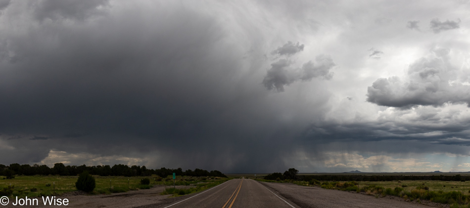
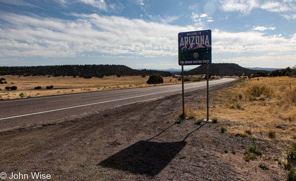
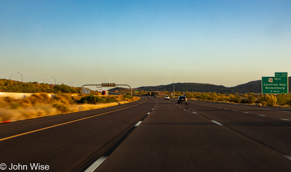
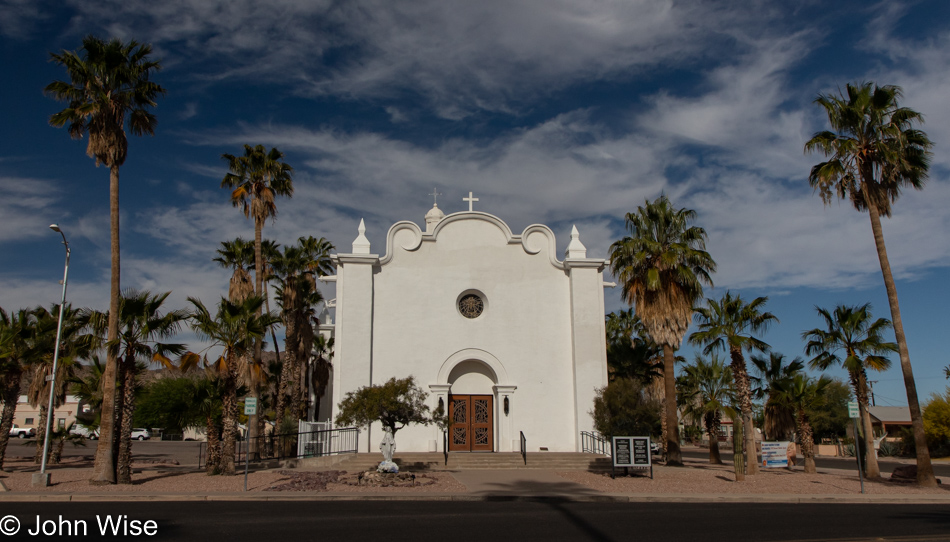
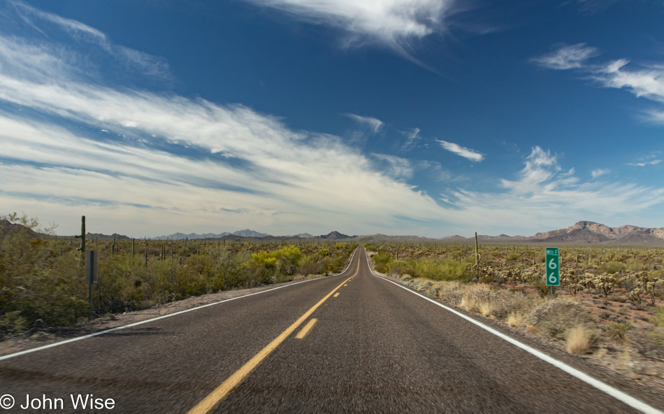
Recently, I turned 60, not with dread but also not without the nattering echoes of those who came before me and groaned of declining energy and poor stamina when they entered this age. When we left home yesterday, it had not been my intention for this trip to be a test of any sort, but maybe it will end up being some of that. With the arrival of my 60s, what impact might I find? Leaving Phoenix, we had a 450-mile drive ahead of us that should have taken about 7.5 hours, but with countless stops for photos of this and that, we optimized our indulgence by stretching out our time crossing the Sonoran and Mojave Deserts before arriving at the doorstep of Death Valley at 7:00 p.m. Checked-in to our room in Shoshone, we walked across the street to the old familiar Crowbar Saloon we first ate at back in 2007 and then took the dark road up to the hot spring pool, this also brought us to having walked 5.5 miles for the day. By 10:30, we were snoring, but if you read yesterday’s post, you’d already know some of those things.

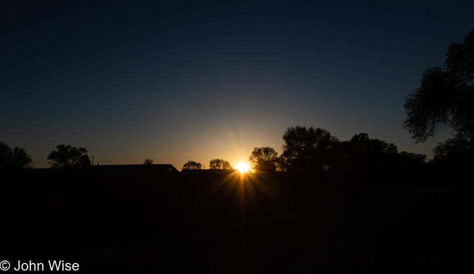
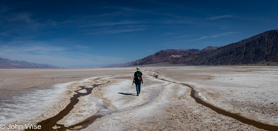
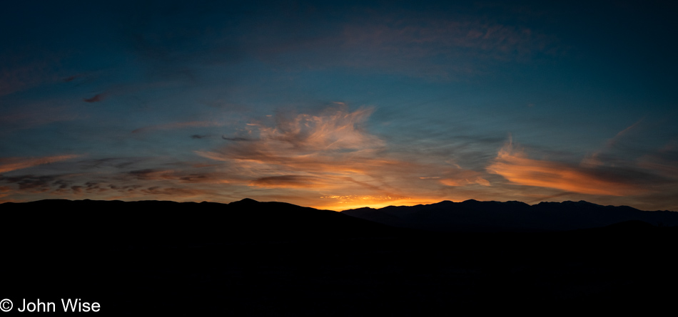
It’s 5:30 in the early morning as we peel ourselves out of bed after sleeping better than is typical for our first night out on the road. We are embarking on our day in the wee hours even after our lengthy 17-hour day of traveling yesterday. The point here is, and this is only now dawning on me, we are still plowing into experiences and doing our best to take advantage of our time in the world. As we turned on the road that would bring us to Death Valley, the sun hadn’t yet peeked over the horizon, but by the time we were about to descend to the saltpan, the world of this harsh landscape was becoming well illuminated. Who knows what the rest of my next decade will bring, but here on the other side of 60, I’m thrilled to know that my stamina hasn’t fallen by the wayside.

Death Valley National Park, California

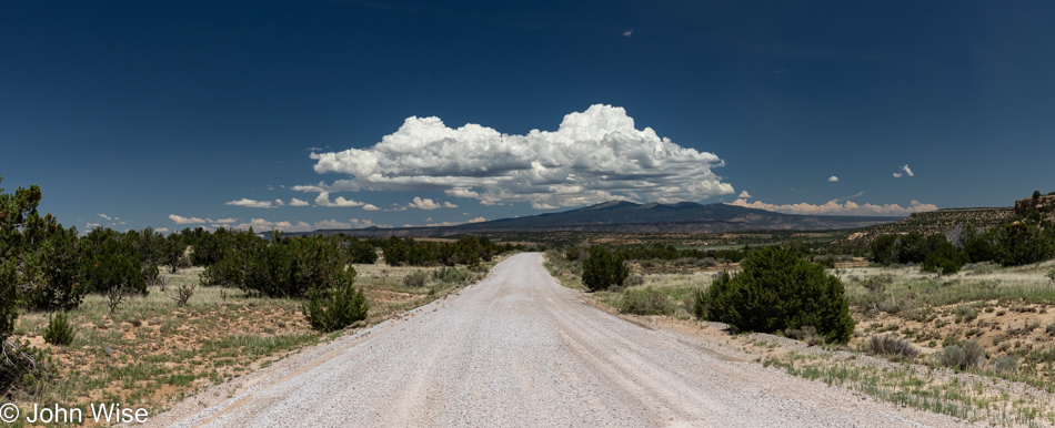
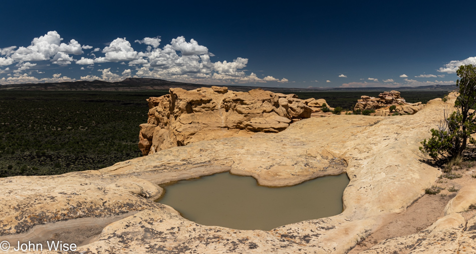
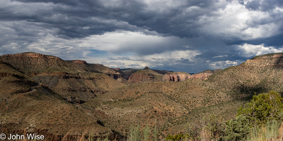
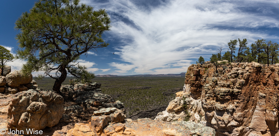
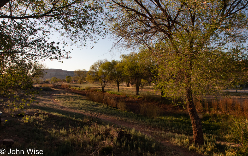
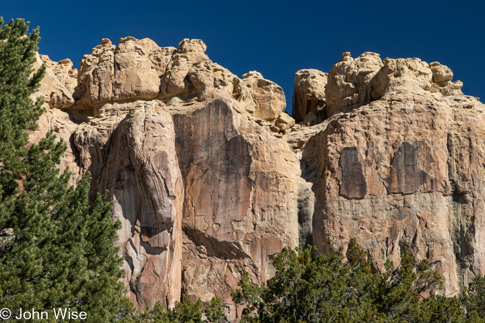
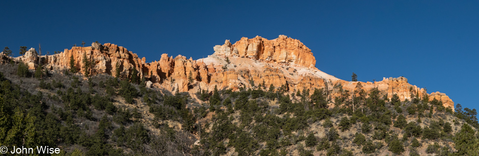
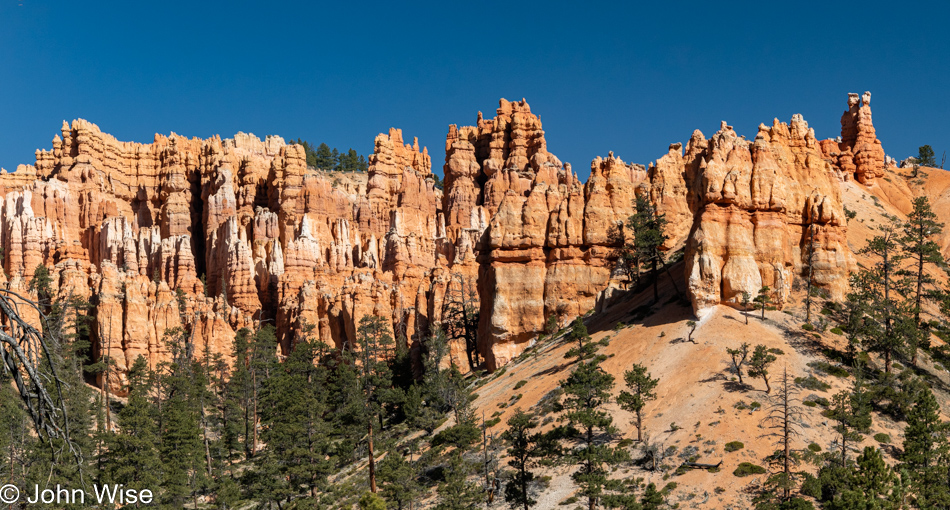
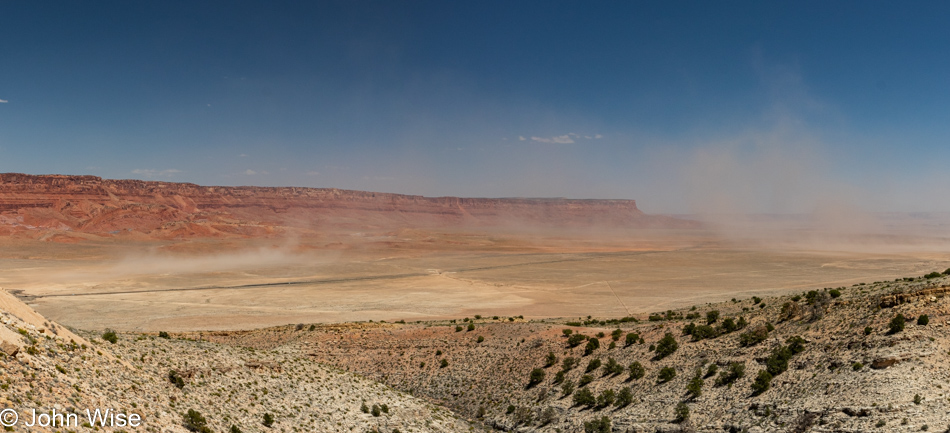
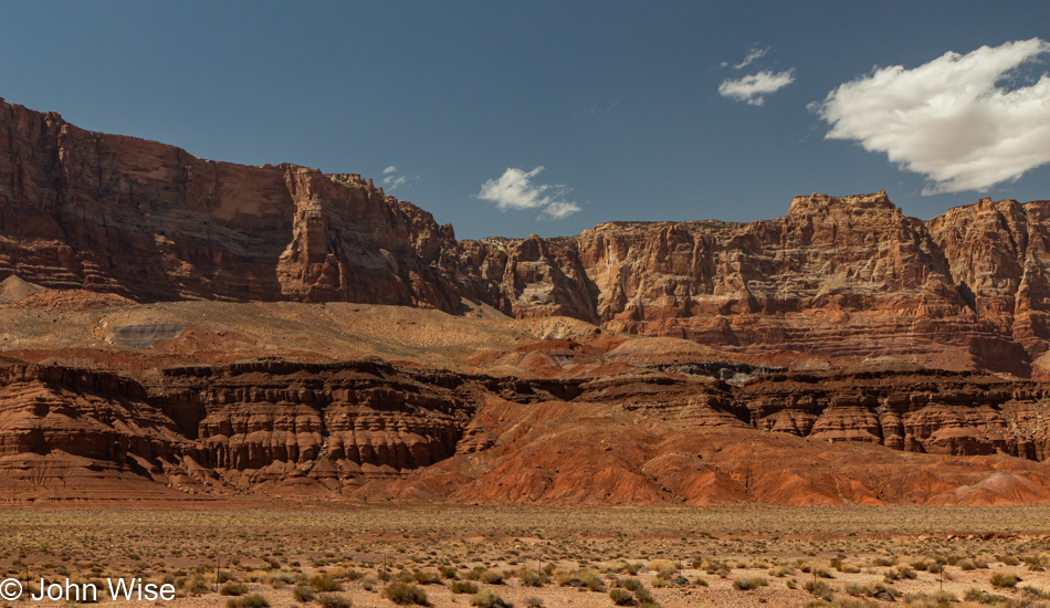
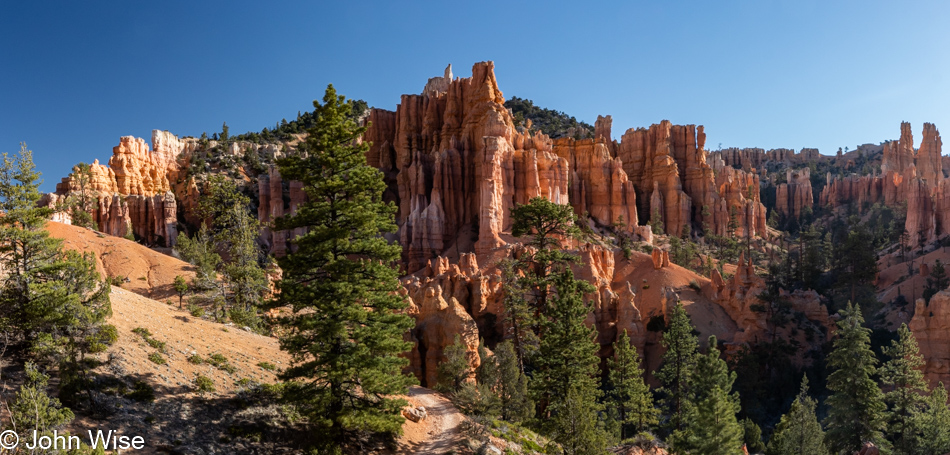
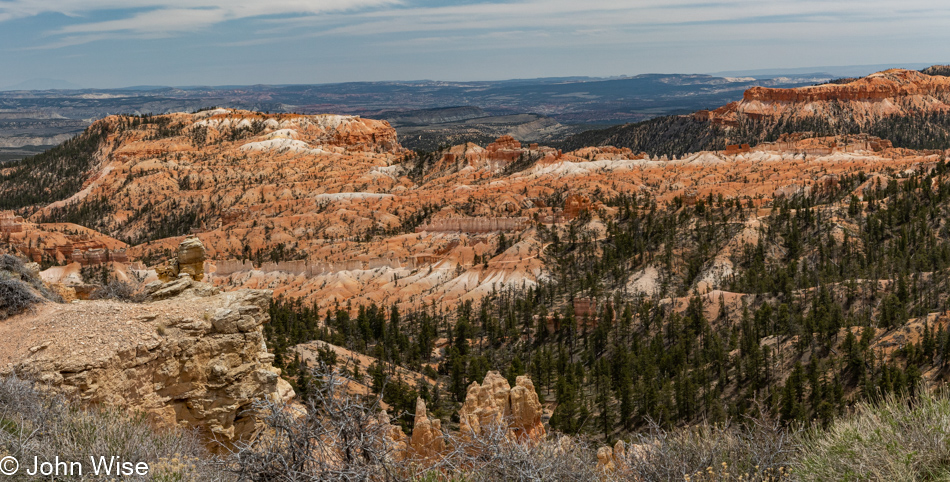
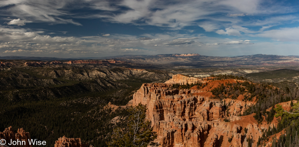
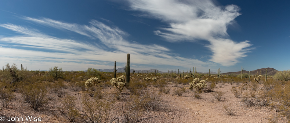
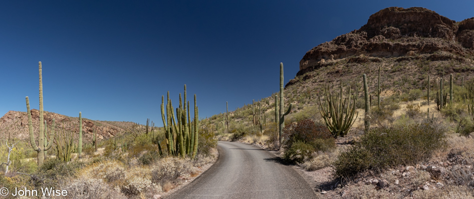
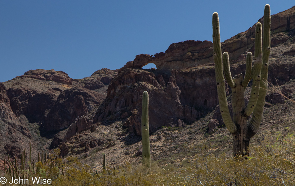
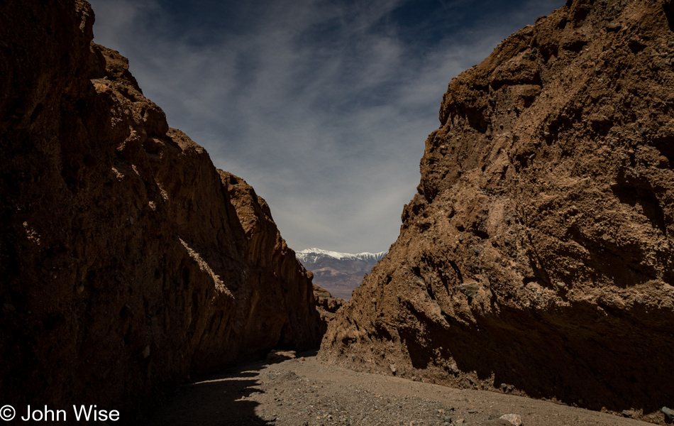
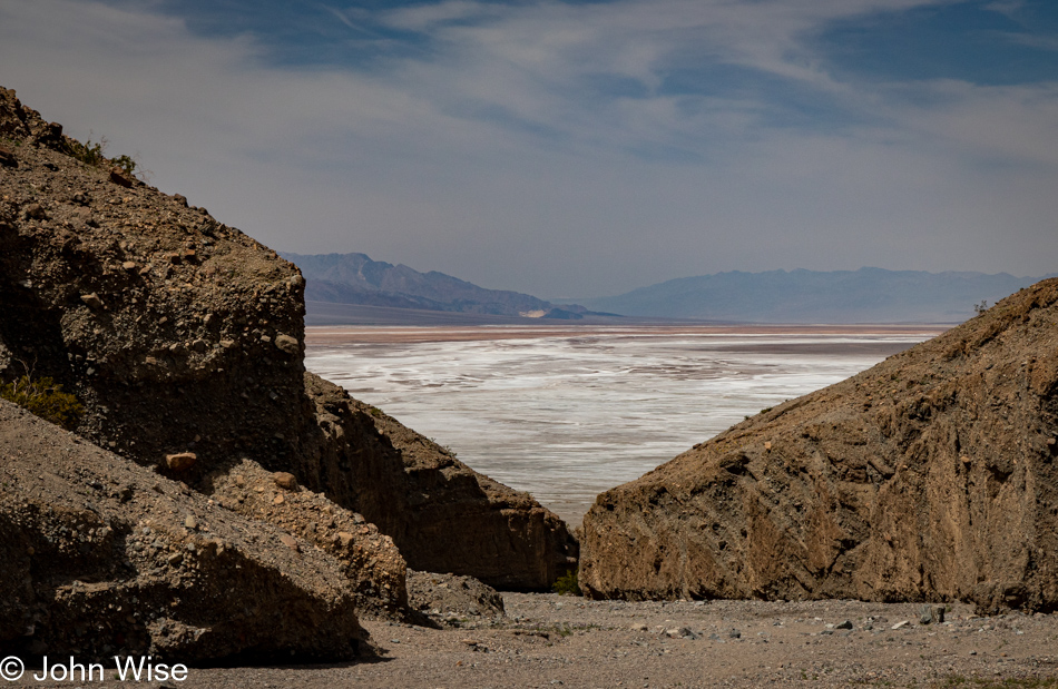
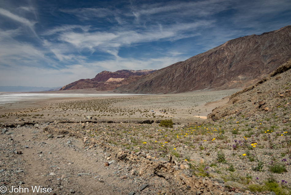
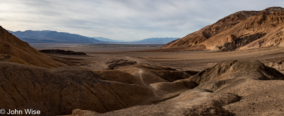
Having passed in and out of Death Valley from the west, the north, the northeast, and the south, the southerly approach is by far my favorite. The gradual approach from this side of the park also benefits from the quiet due to so few people out this way. Most visitors will congregate in the relative proximity of the visitor center. While many will go as far south as the iconic Badwater location (282 feet below sea level), that leaves the bottom 50 or so miles of the park relatively unvisited, and it is down here where our day begins in earnest.

Room Canyon at Death Valley National Park, California

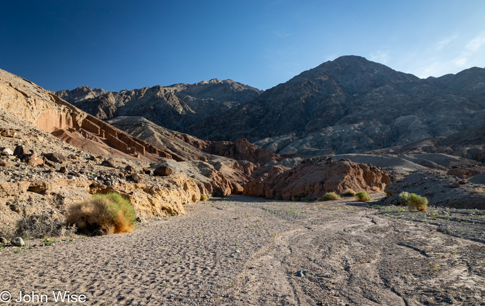
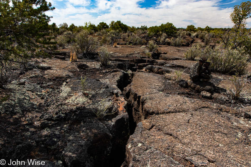
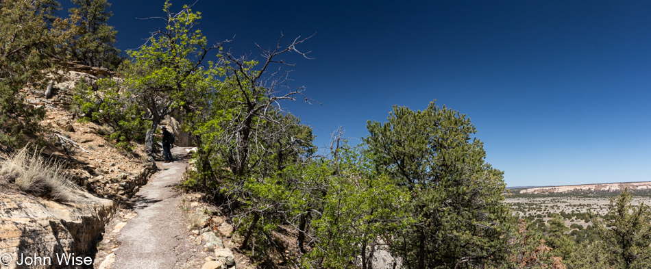
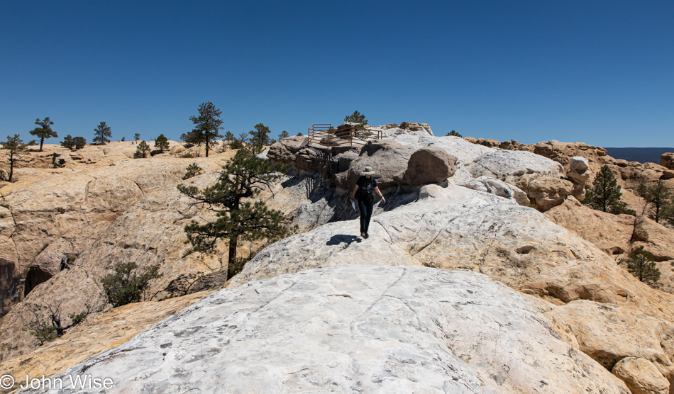
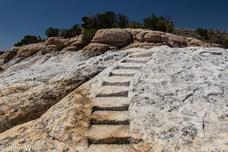
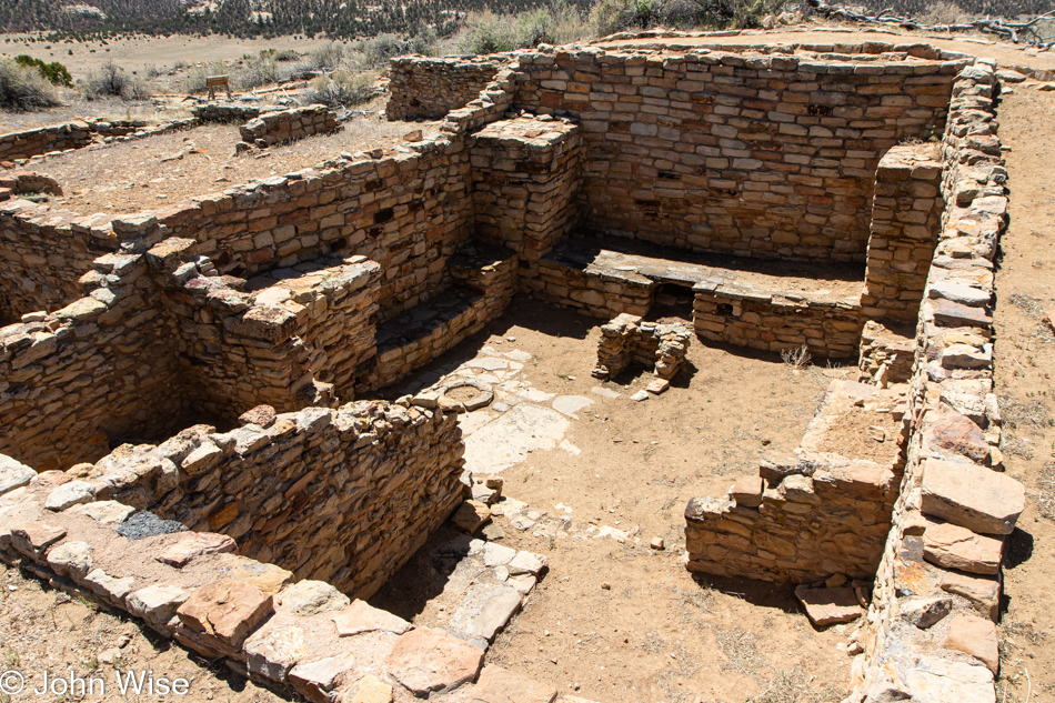
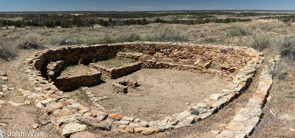
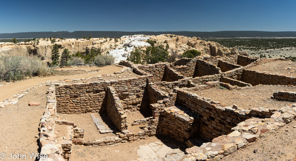
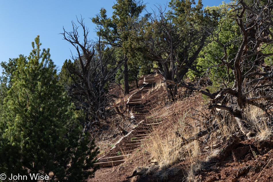
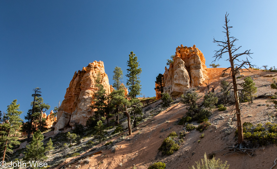
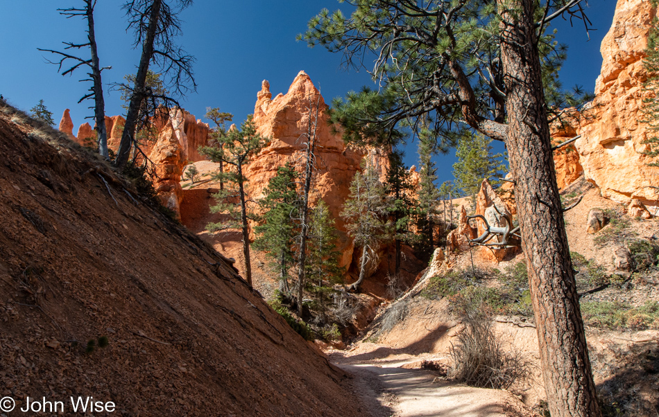
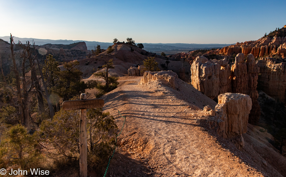
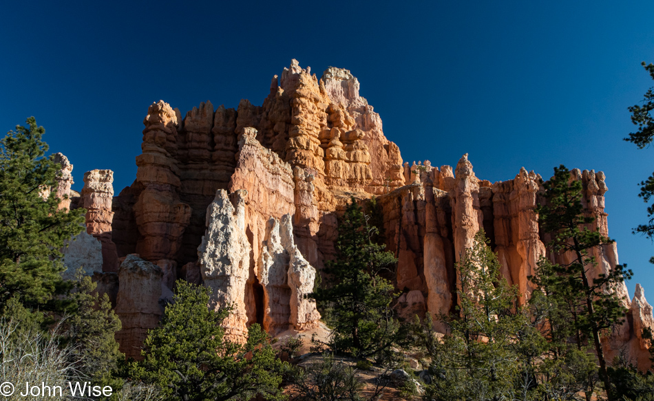
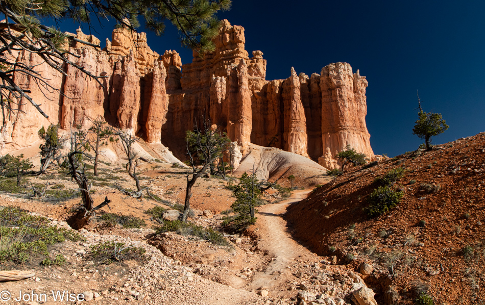
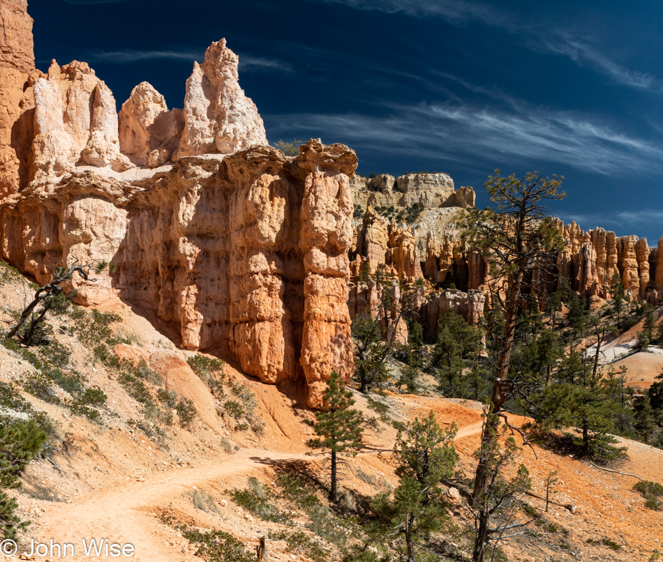
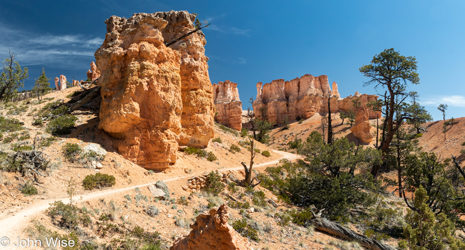
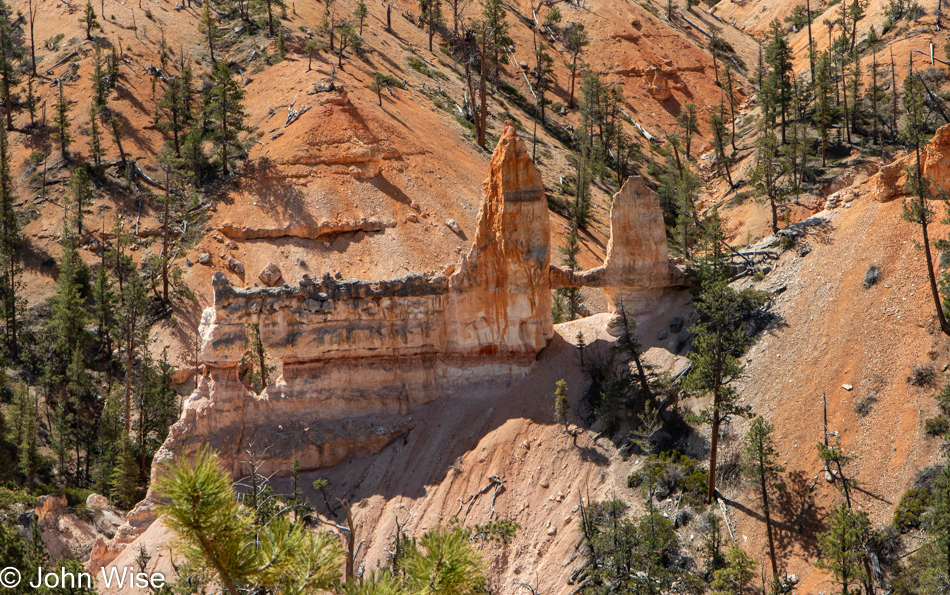
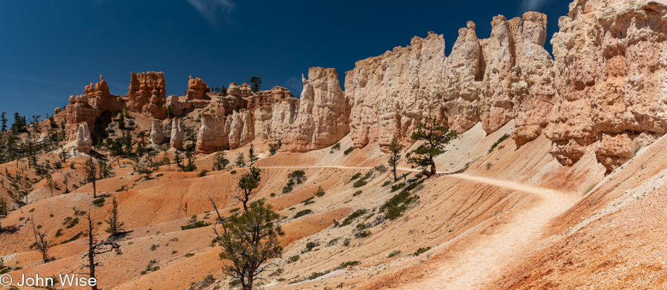
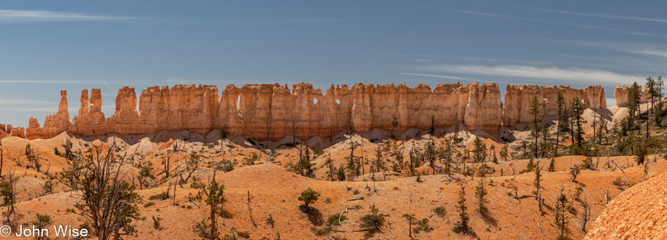
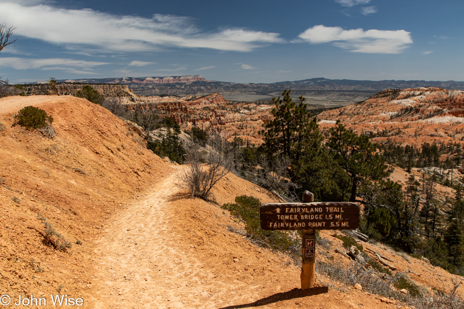
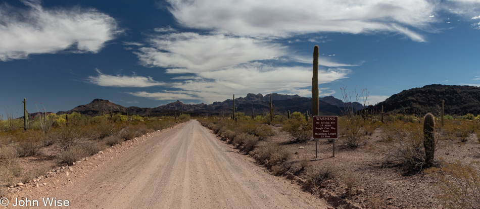
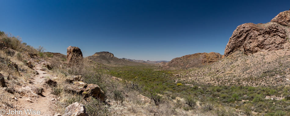
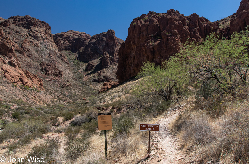
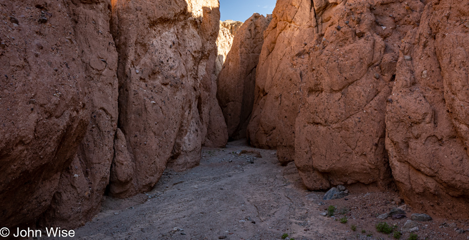
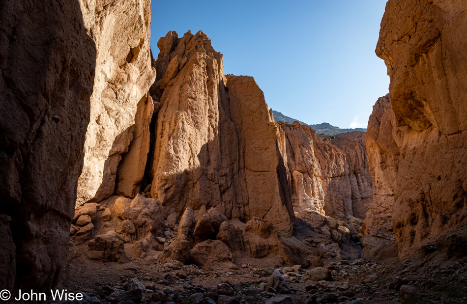
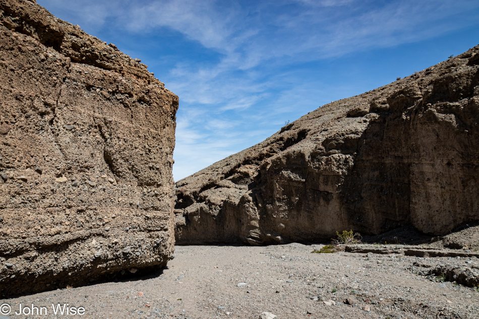
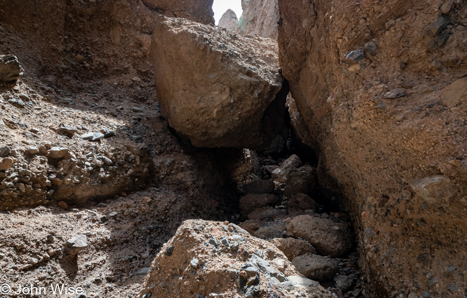
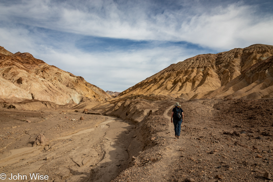
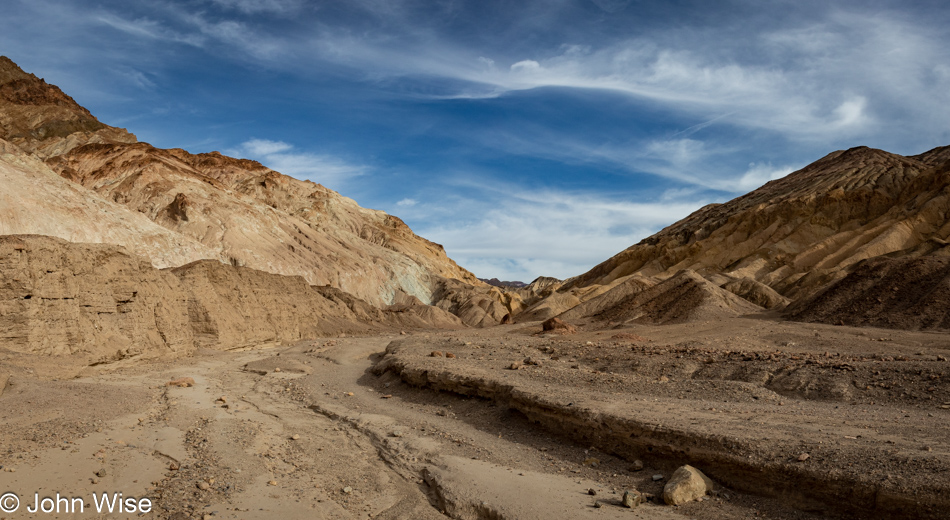
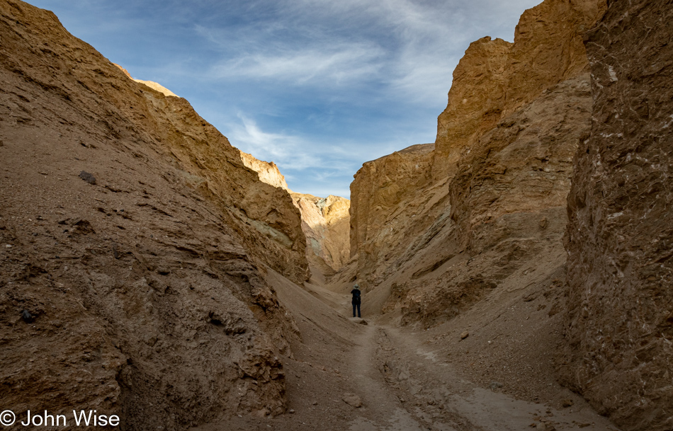
There is no trailhead and no parking lot. We just pull up in front of mile marker 39 and start walking east. Our first hike of the day is Room Canyon, rated as a moderate 3-mile trail. The path to the canyon is not identified with cairns, but if you look at the ground ahead of you, you’ll see the footprints of others, and you can hope they went in the right direction. This is as good a place as any for me to include my endorsement of the AllTrails app and how important it has become to us. Before arriving somewhere, like here in Death Valley, which doesn’t have phone service, one should identify the trails they are interested in and then download the trail maps while they have plenty of signal. Our go-to trails are typically rated as moderate because easy is just too easy, though, for an interpretive experience, those are often not bad. The strenuous trails often feature rock climbing, exposure, or some serious elevation gain. Everyone who ventures into America’s national parks and hikes should have AllTrails with them and do some research before embarking on their adventure.

Room Canyon at Death Valley National Park, California

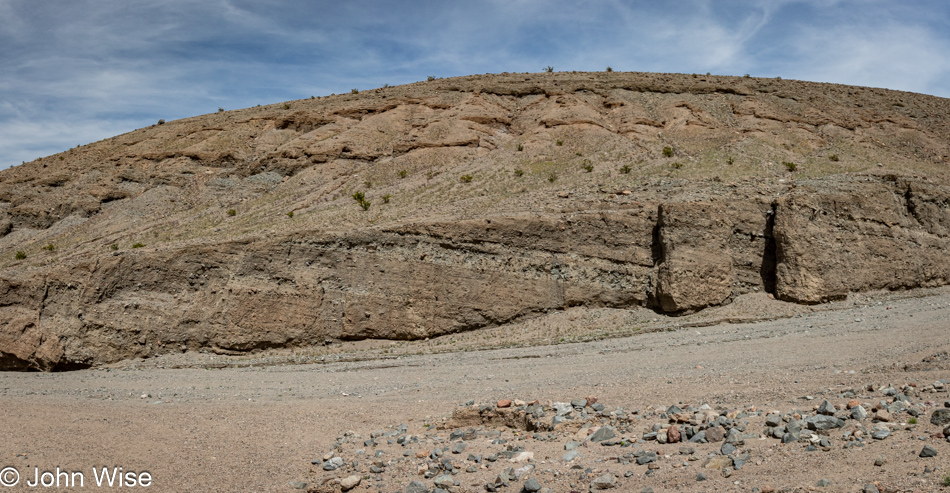
After our short hike into an alluvial fan, we are now in the mouth of a canyon carved out of the alluvium that’s been deposited from the eroding mountains behind us.

Room Canyon at Death Valley National Park, California

The post title mentions stamina and is in reference to what we’ll have to muster if we are to capture the three hikes we have penciled in as the activities for our day, but by now, it also speaks to what I’ll require to complete writing this post that still has nearly 50 photos below this one. Should you be able to slog your way through this marathon post, which will likely veer into a fair amount of prolix (defined as speech or writing using or containing too many words/tediously lengthy), you too will have had to find your stamina for such a long post to find what gems might exist here, if any.

Room Canyon at Death Valley National Park, California

For Caroline and myself, the gems are many, at least in viewing the photos that we find to be magnificent. The writing that accompanies these images is often a mixed bag where at least I wonder if I’ve not said this all before. Even if I add a new twist or some bit of delightful poesy where a verse finds a potentially enchanting resonance, one must toil over hundreds if not thousands of words until they, too, find a diamond in the rough.

Caroline Wise at Room Canyon at Death Valley National Park, California

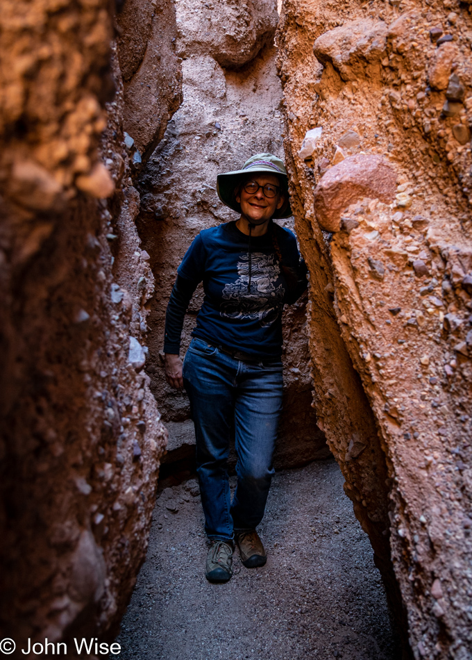
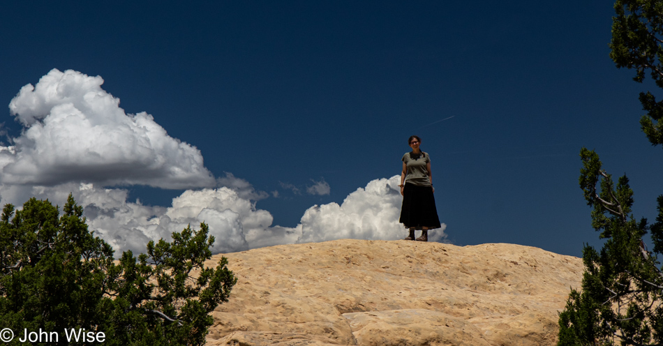
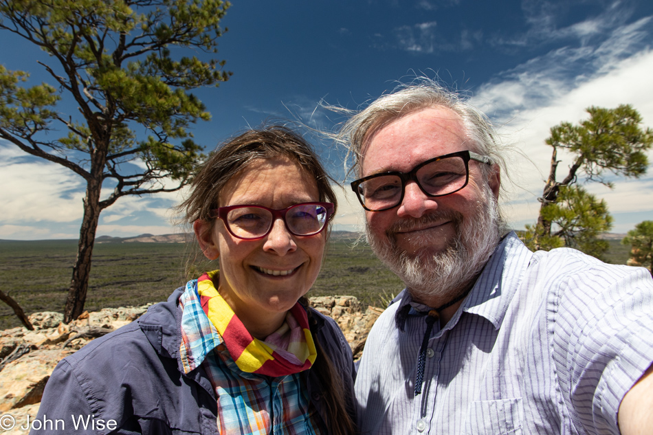
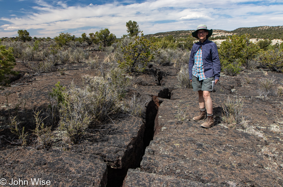
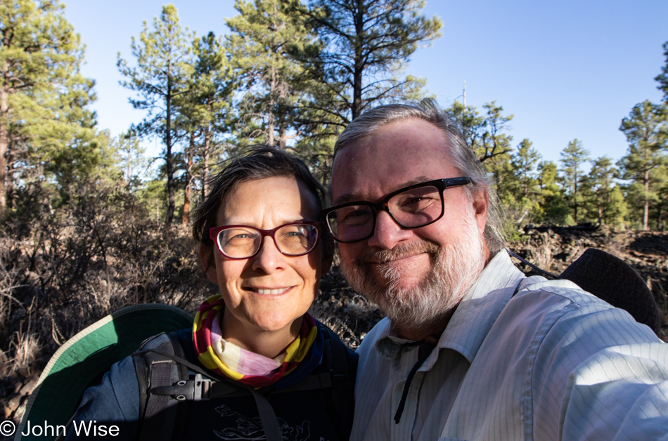
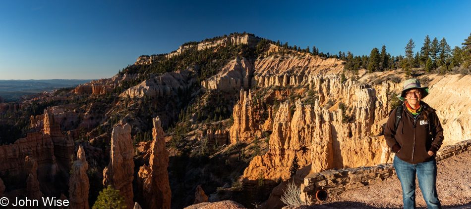
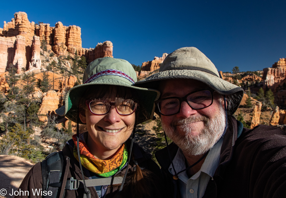
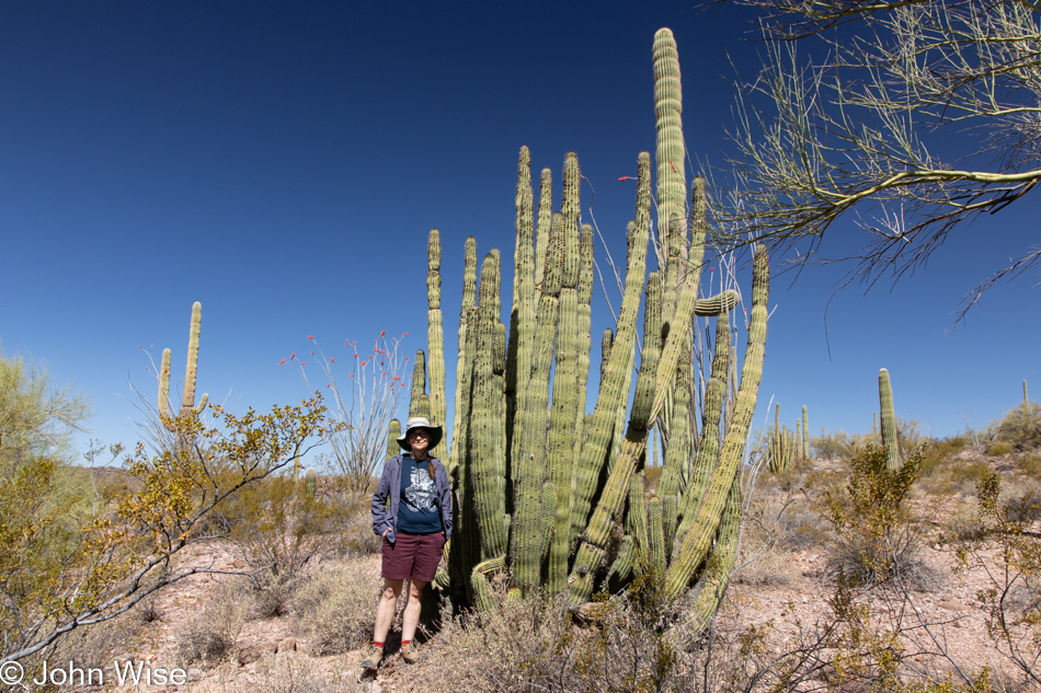
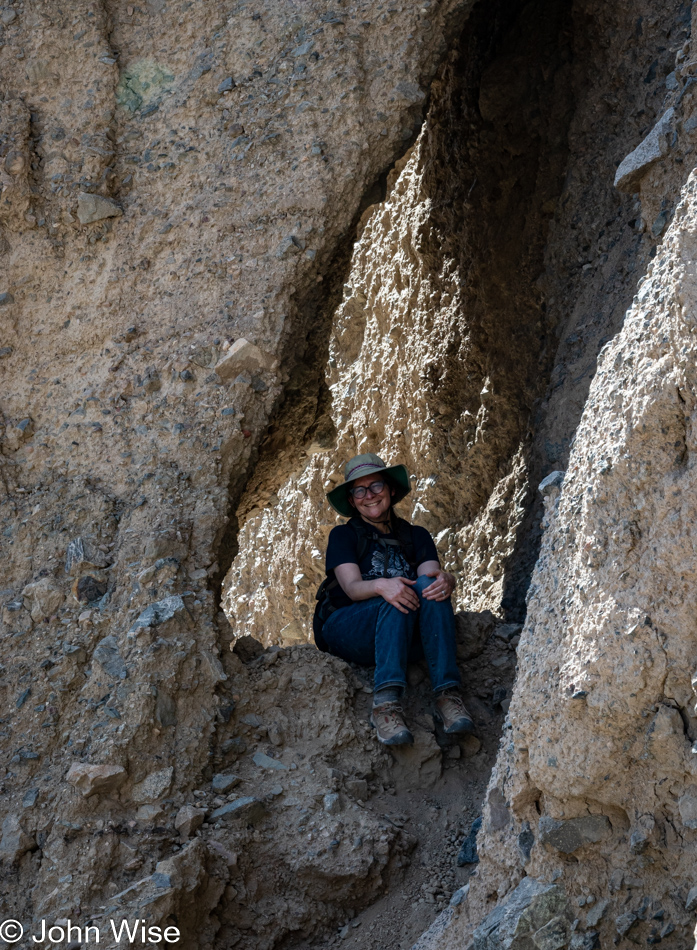
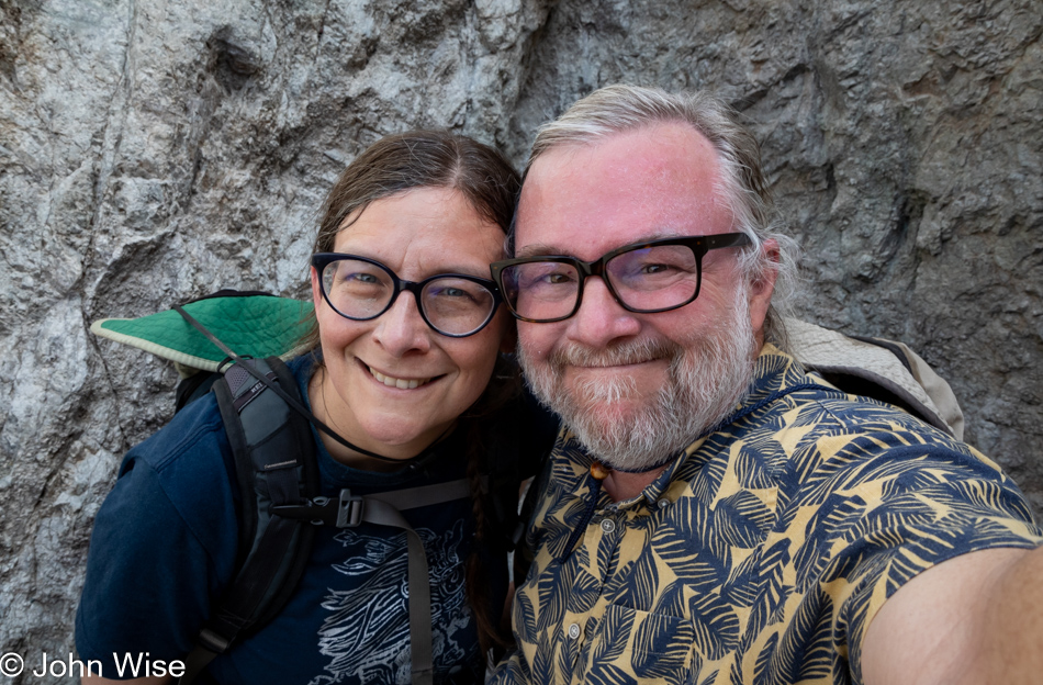
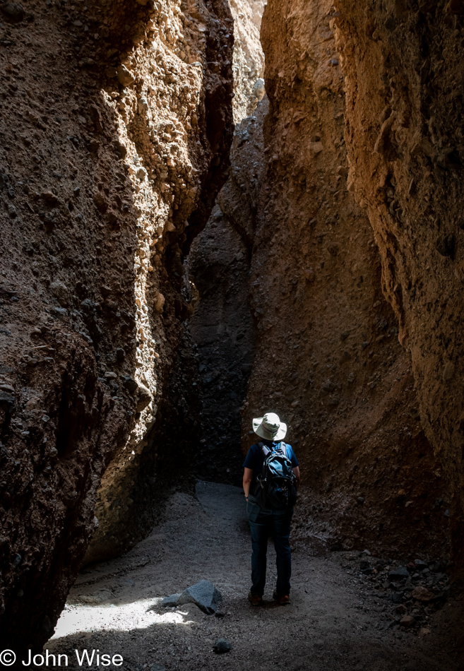
Speaking of finding a diamond in the rough, it’s now been 10,000 years and 12 trillion experiences shared with this woman, who (according to her) has enjoyed being between the proverbial rock and a hard place that is our relationship. There’s something about her smile here that may not be apparent to others: it is the look of “Wow, I can’t believe we are here.” Today, along with our planned hikes that are not considered to be some kind of “I’ve worked for this, and I’m owed it,” is a day of astonishment that we have the ambition and compatibility to venture into places with someone who equally enjoys the time. How far we go is irrelevant; how far we’ve come carries a satisfaction that accumulates, as does our love.

Room Canyon at Death Valley National Park, California

Had this been the extent of our adventure, we’d leave and realize our good fortune to have been able to find so much indulgence between yesterday’s drive up, time in the hot spring last night, sunrise this morning, and this first bit of exploration in Room Canyon here at Death Valley. But this is only the beginning, and nobody should ever, for even a second, consider that there are greater rewards ahead. Every moment is the most valuable token of a splendid life any two people have been granted.

Caroline Wise at Room Canyon at Death Valley National Park, California

I don’t believe that those who named this place Death Valley were being ironic, but then again, we do not call Earth the Death Planet, though death happens every day. I vote for renaming this national park Massively Wow Life Valley because being here amplifies the sense of how incredible it’s been that life took hold on this outpost in the Milky Way.

Room Canyon at Death Valley National Park, California

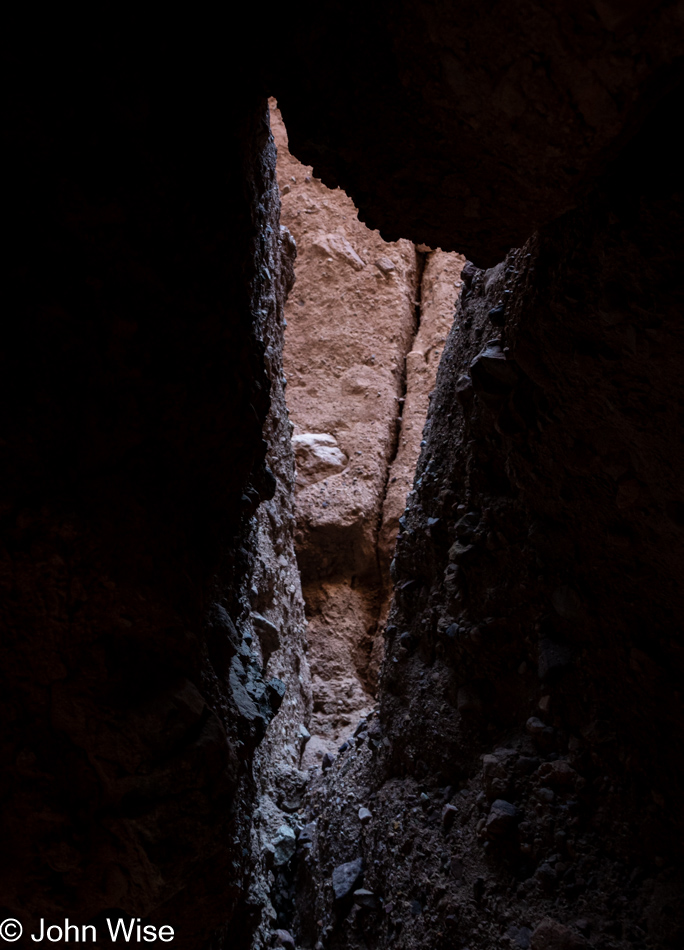
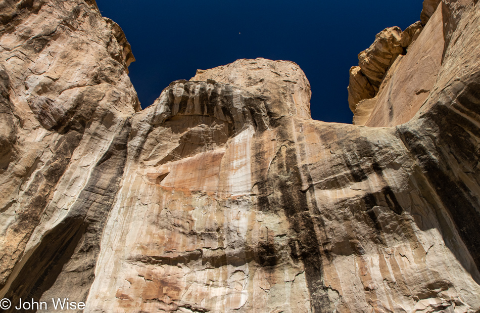
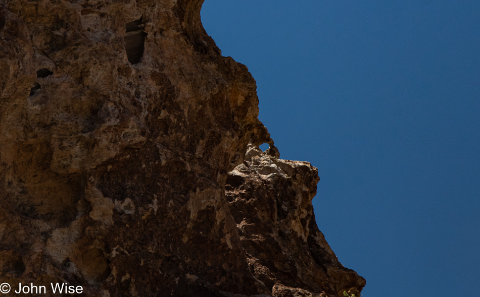
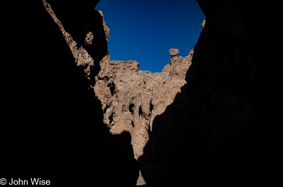
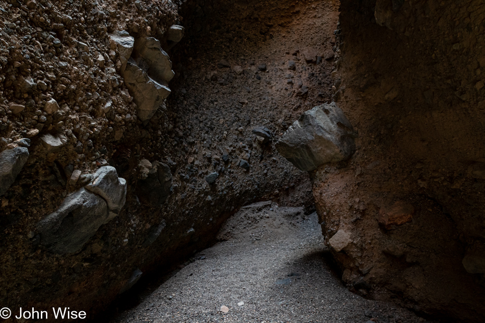
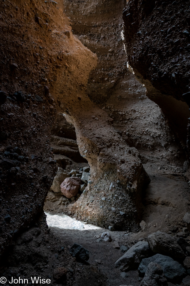
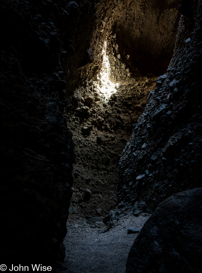
As a telescope acts as a portal through space into unknowns, so too does nature act as a portal into its history and maybe its future. As I peer into this crevice with light falling in from above, I can surmise what is out there, but I do not have first-hand knowledge. This mystery is the intrigue that helps propel our dreams.

Room Canyon at Death Valley National Park, California

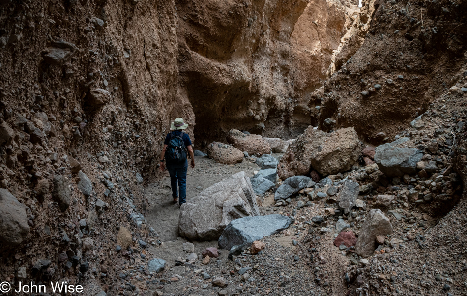
From one space, we enter another by the simple act of going forward. Obviously, we had to have the means to be here, but I’d argue that everyone has that opportunity if they were to desire such things. The argument that most people can afford this if they own a relatively decent car could easily be taken issue with, but I’d say that while those more than 500 miles away would have to focus on something closer to where they live, such a weekend could cost as little as about $200. Without going into too many details, that’s about $120 for gas, $40 for two nights of camping, and park admission. As for food, that was going to be consumed at home regardless. Instead, people will convince themselves that a real immersive vacation must take place at Disneyland, Hawaii, Las Vegas, or on a cruise to the Bahamas. This all-or-nothing mentality is great for Caroline and me because we find ourselves all alone today at Room Canyon.

Room Canyon at Death Valley National Park, California

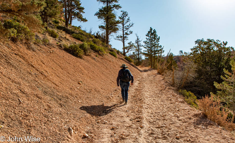
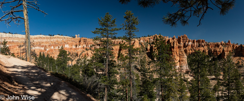
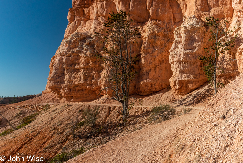
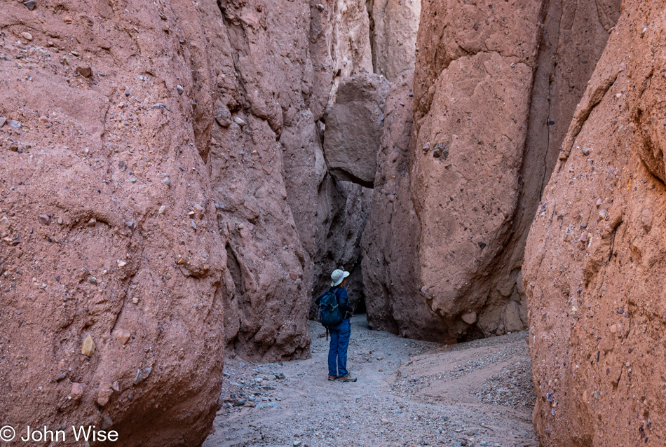
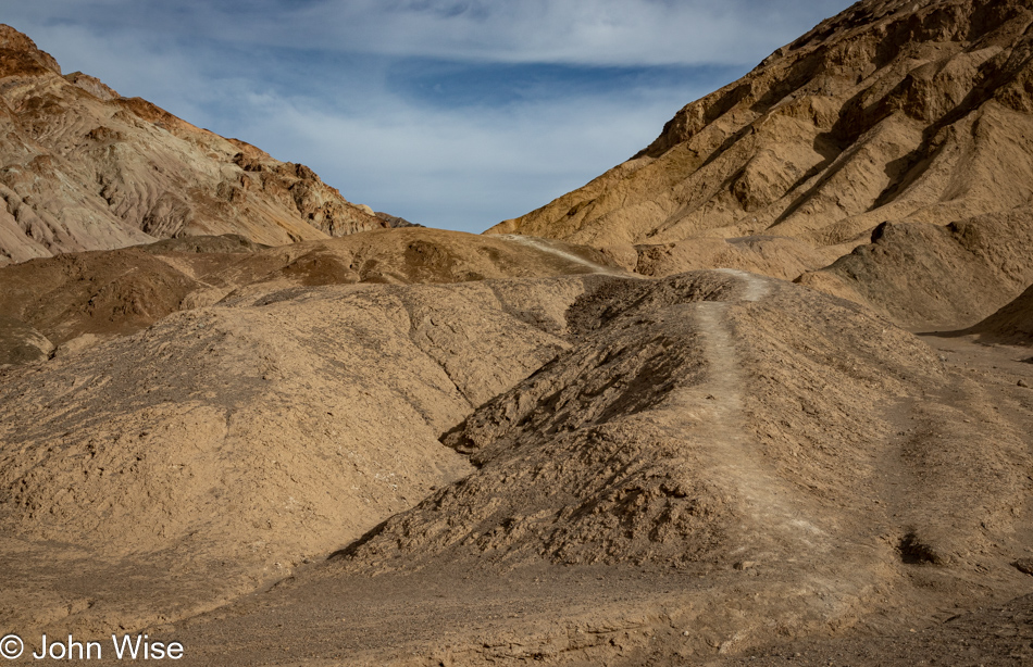
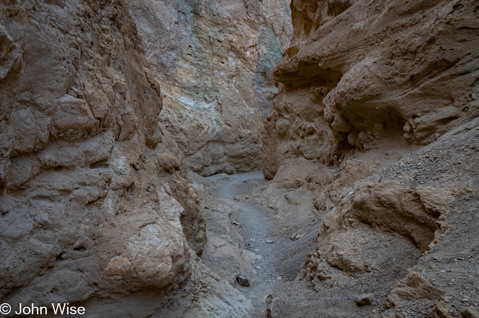
If you look closely at this image and the one above it, you’ll see that we’ve progressed about 100 feet up the trail. Sometimes, it’s not the broad vista, i.e., the big picture, that’s all important but the readjustment of your focus to see what you might miss if you are only honing your hyperopic vision.

Room Canyon at Death Valley National Park, California

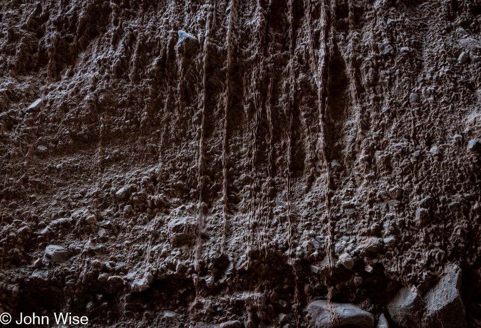
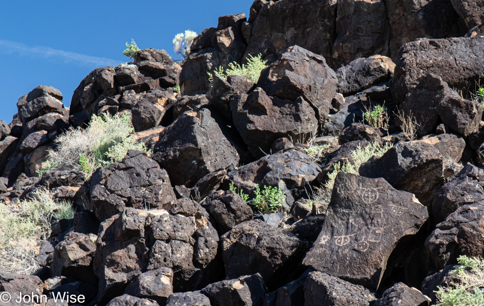
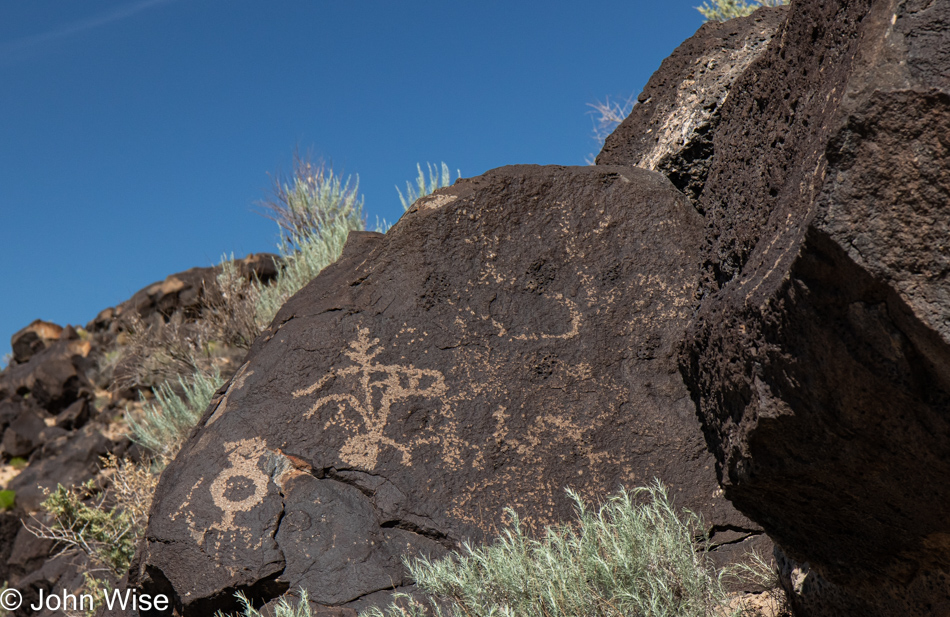
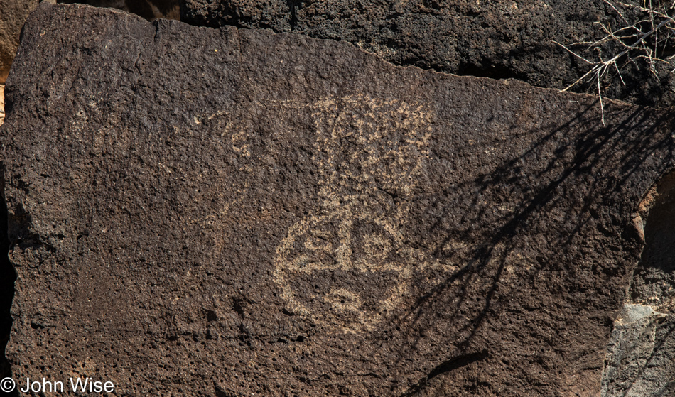
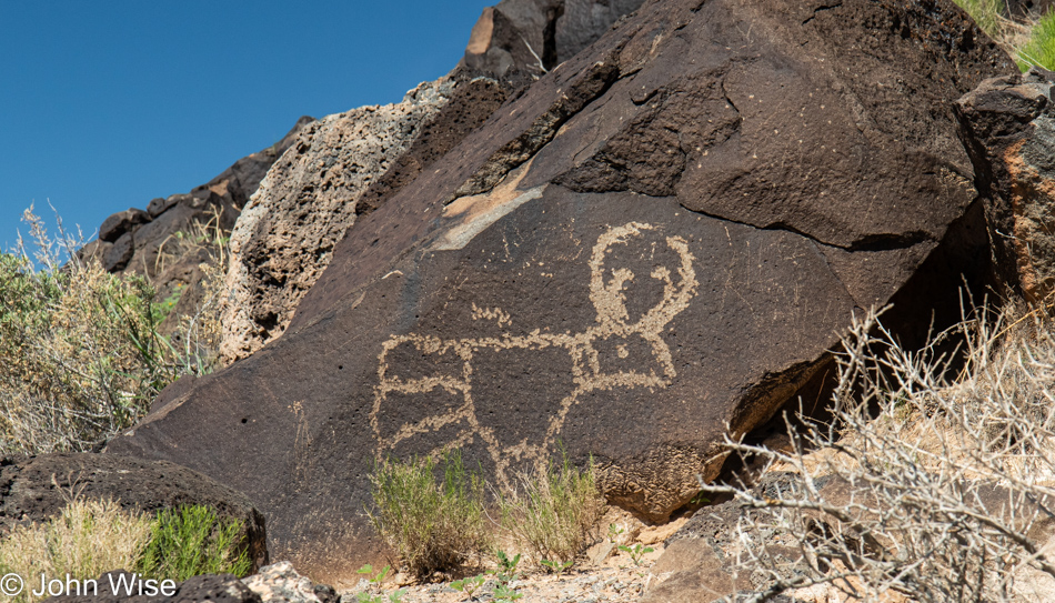
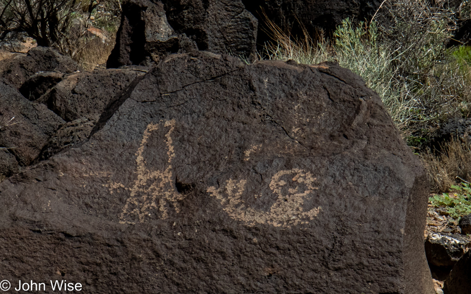
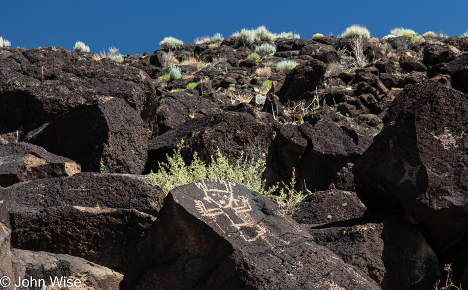
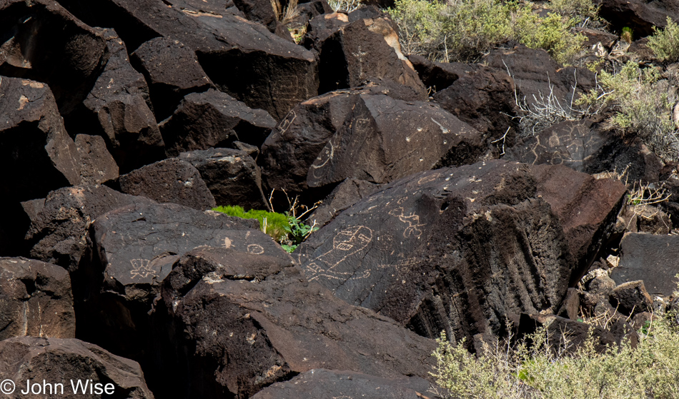
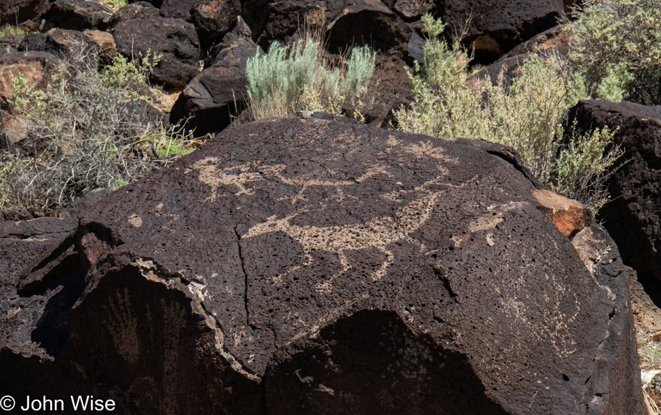
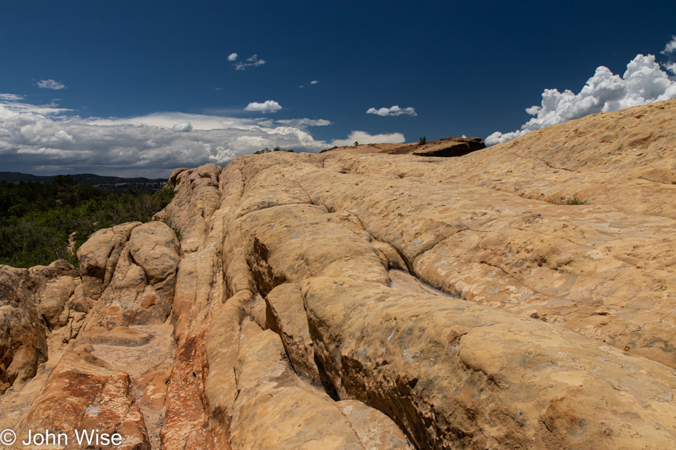
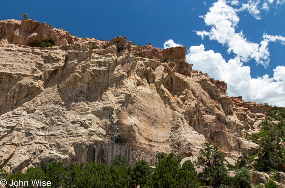
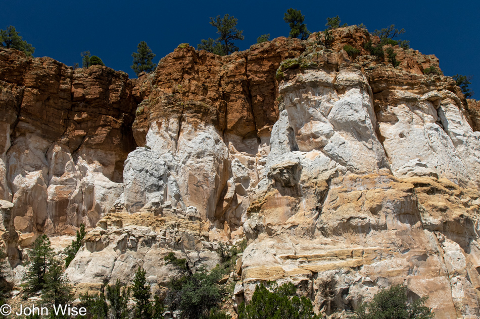
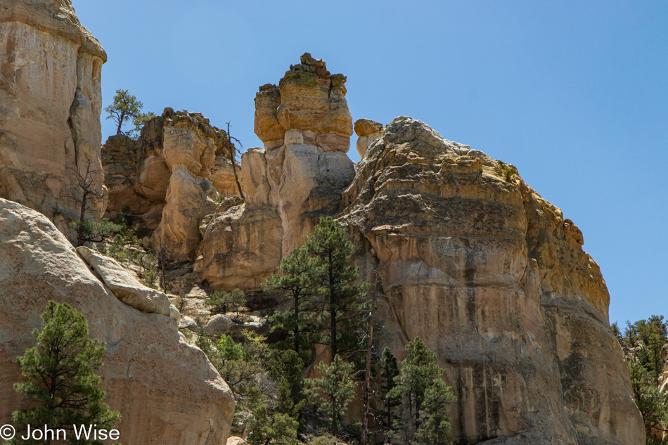
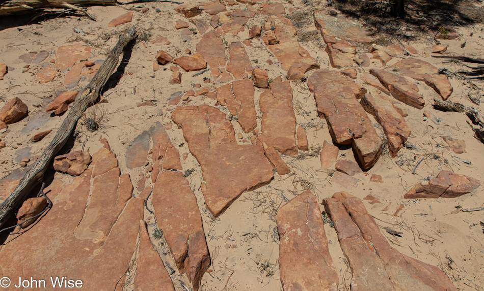
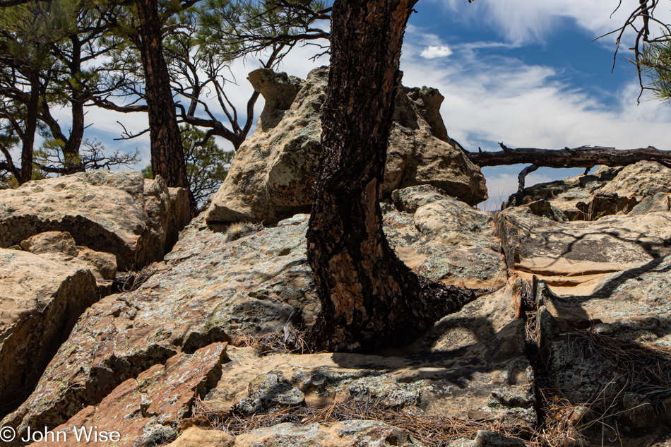
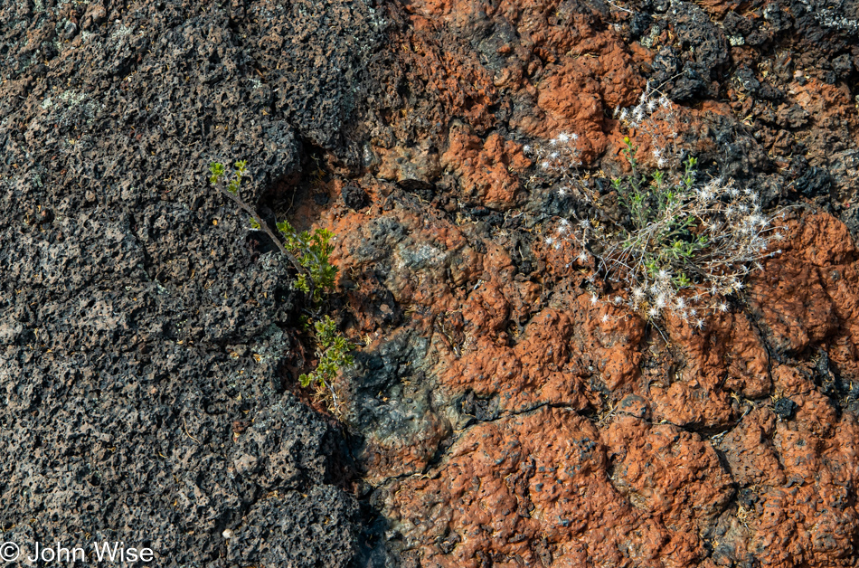
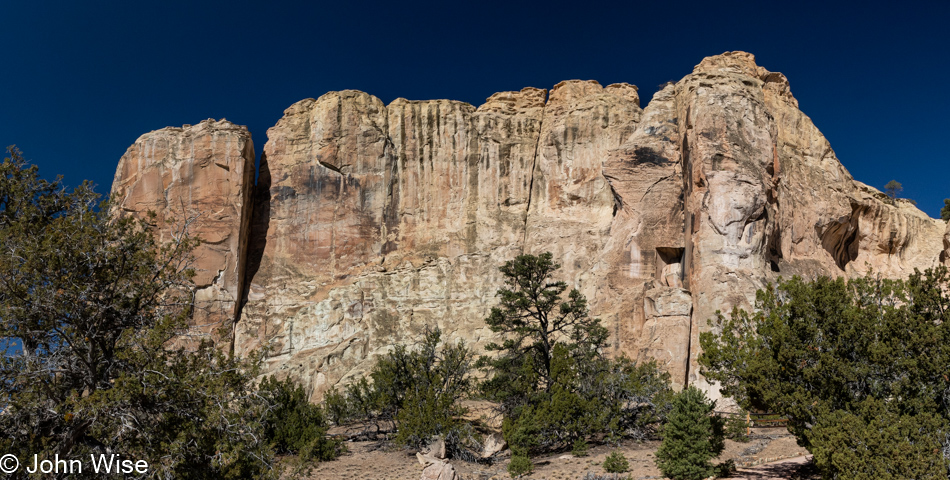
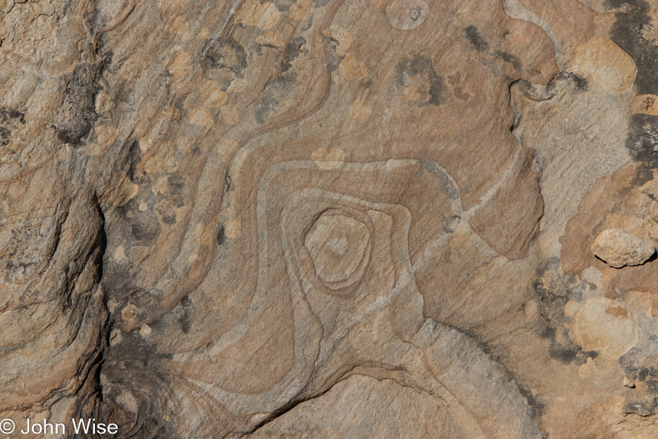
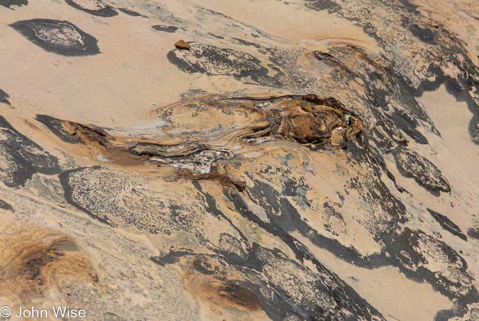
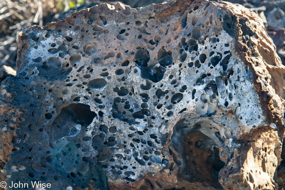
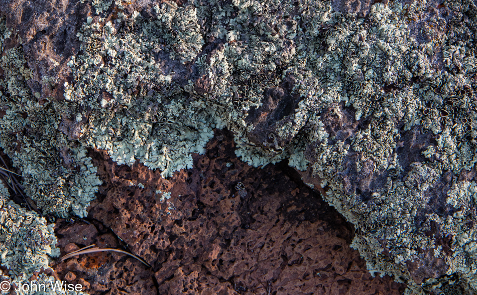
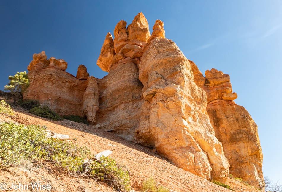
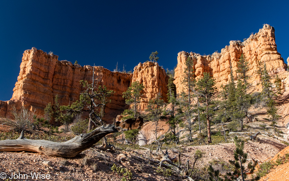
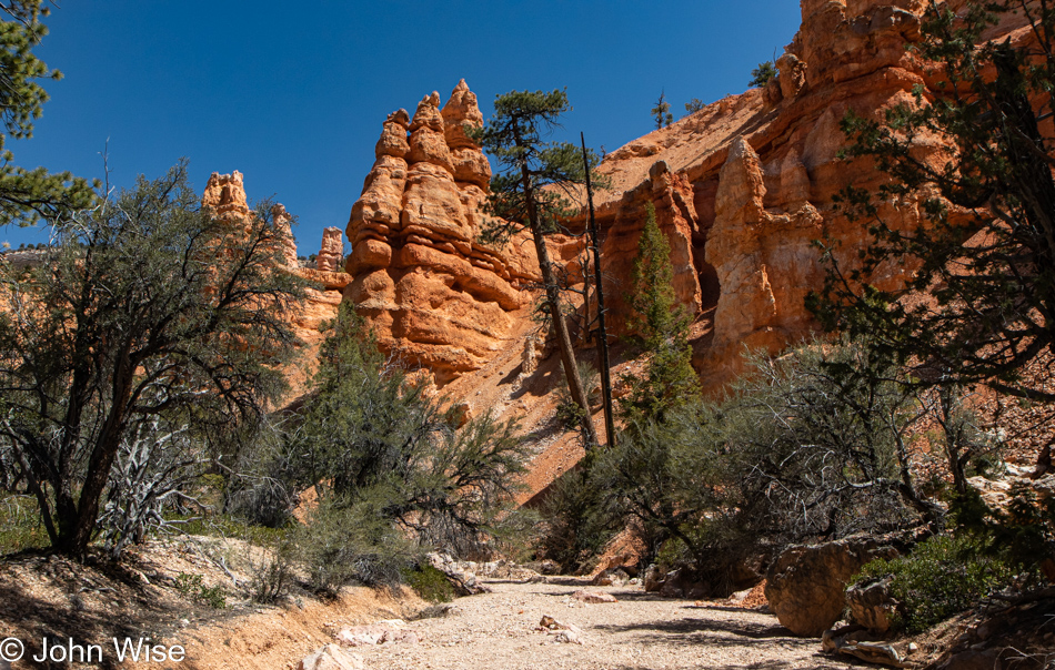
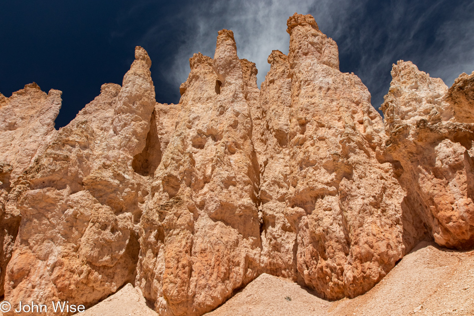
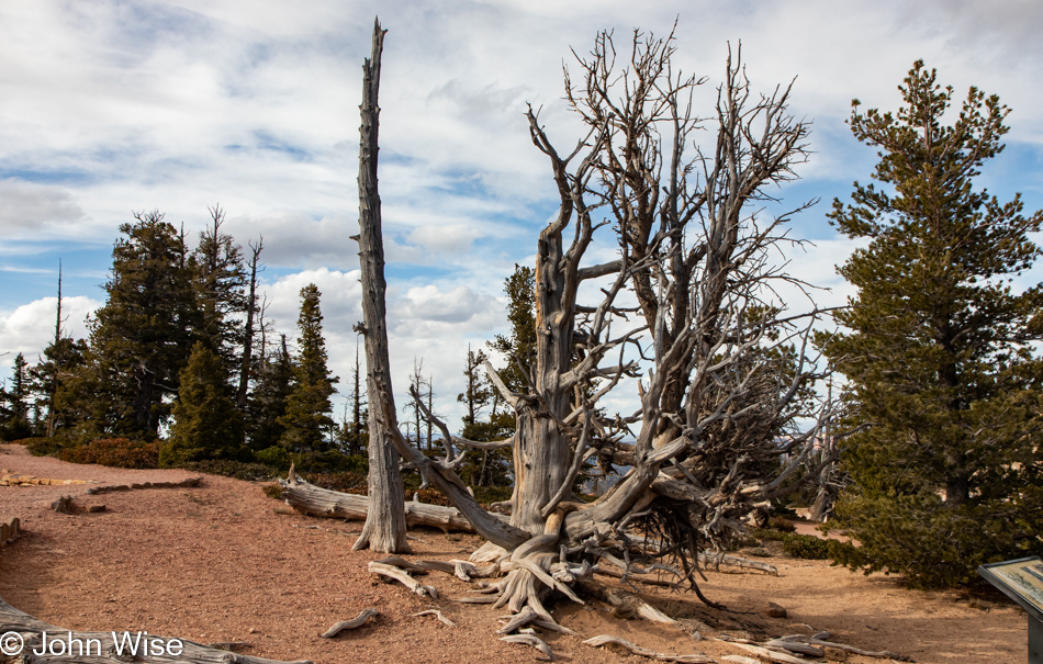
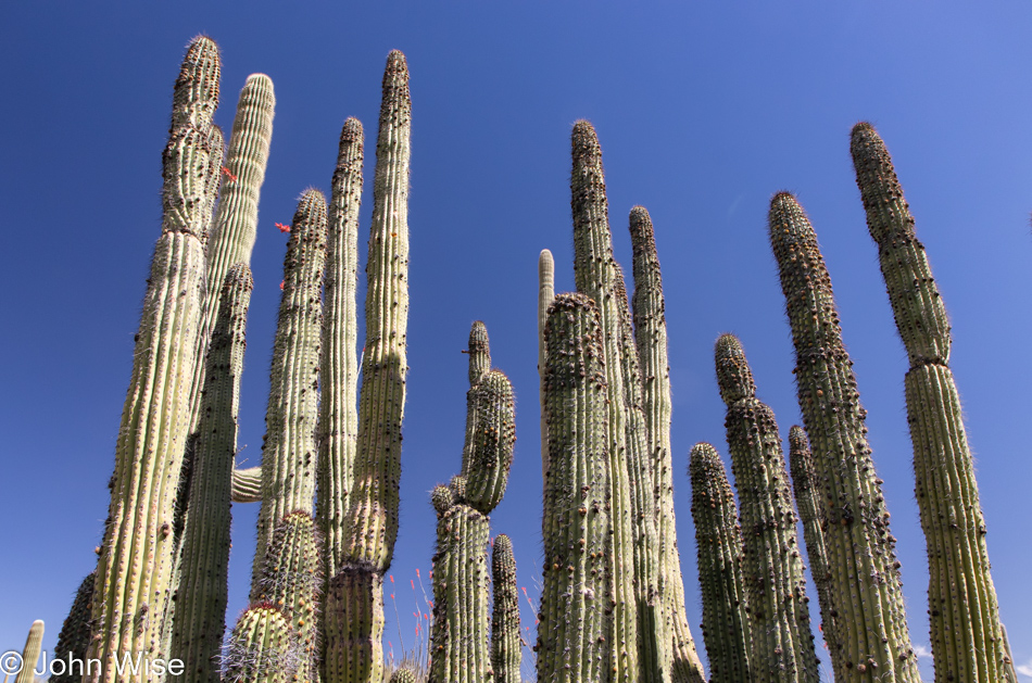
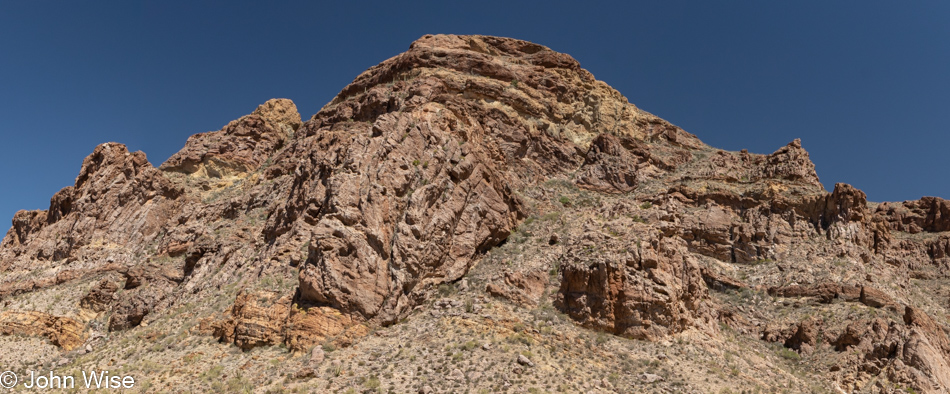
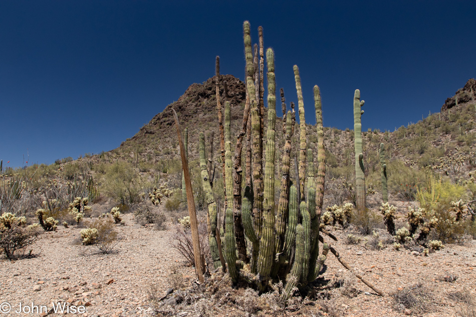
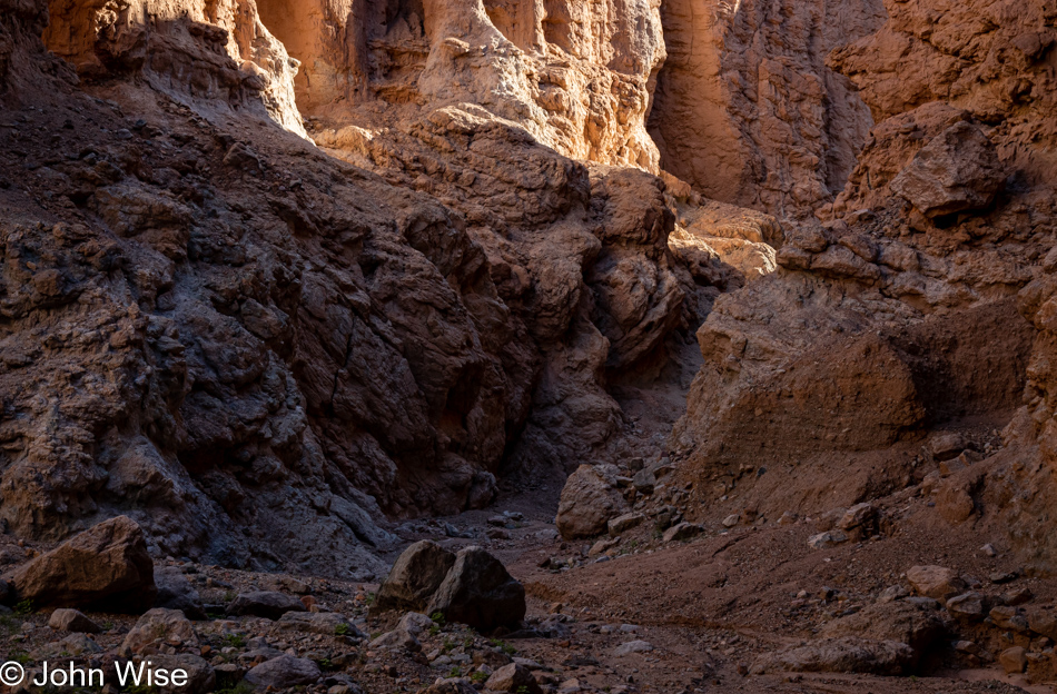
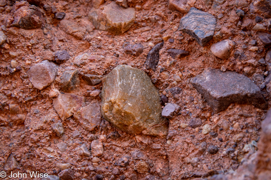
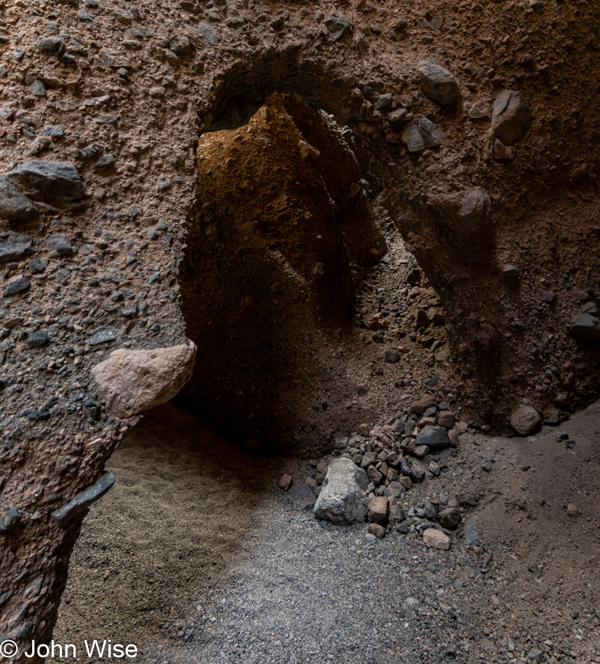
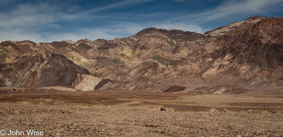
Earlier this year, we spent a couple of hours in Kartchner Caverns, and in my subsequent writing about them, I deeply considered their formation and the molecular processes harnessed across time. Peering into those details in ways I hadn’t previously, I was enchanted watching in my mind’s eye the accretions forming to produce the cavern features we were there to experience. Today, we are here in an open-air canyon, and under an overhang are signs of accretions dripping down a wall. Where’s a geologist when you need one? How old might these be, what is their mineral composition, and how many other places in Death Valley can we find others?

Room Canyon at Death Valley National Park, California

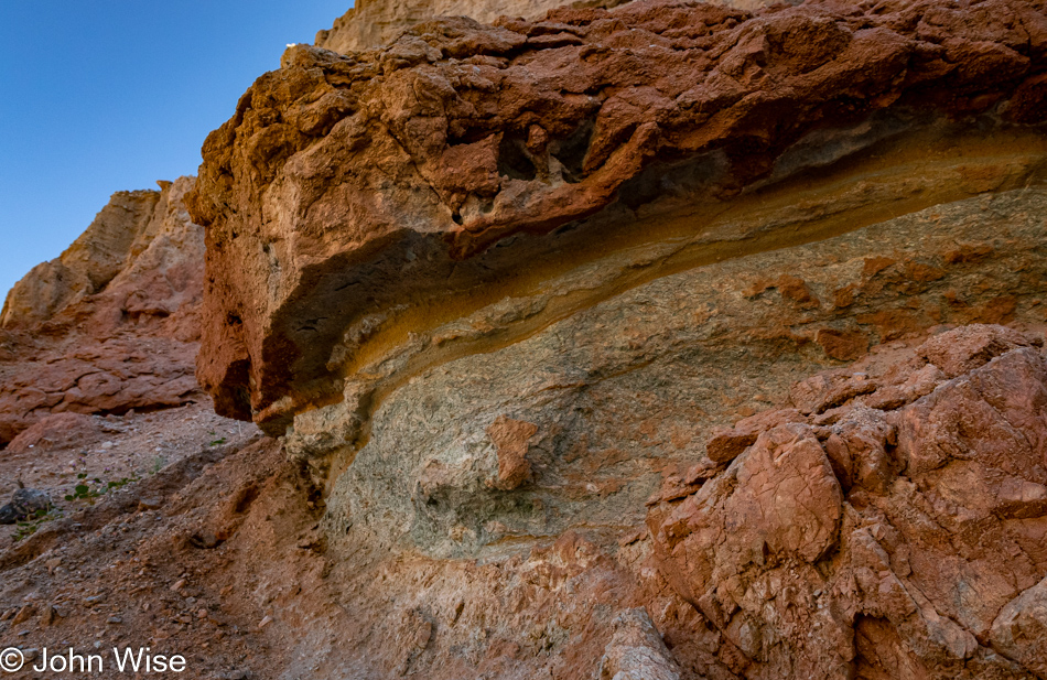
Again, my kingdom for a geologist! While I understand that softer rock erodes faster than the overlying harder rock, I dream of knowing what was at work during those years these layers were forming. The greenish layers are making a sandwich of what appears to be sandstone, and within the green lower area, there is red rock, but it’s not evenly distributed, so what’s the story?

Room Canyon at Death Valley National Park, California

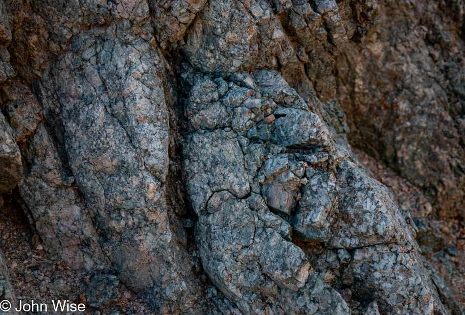
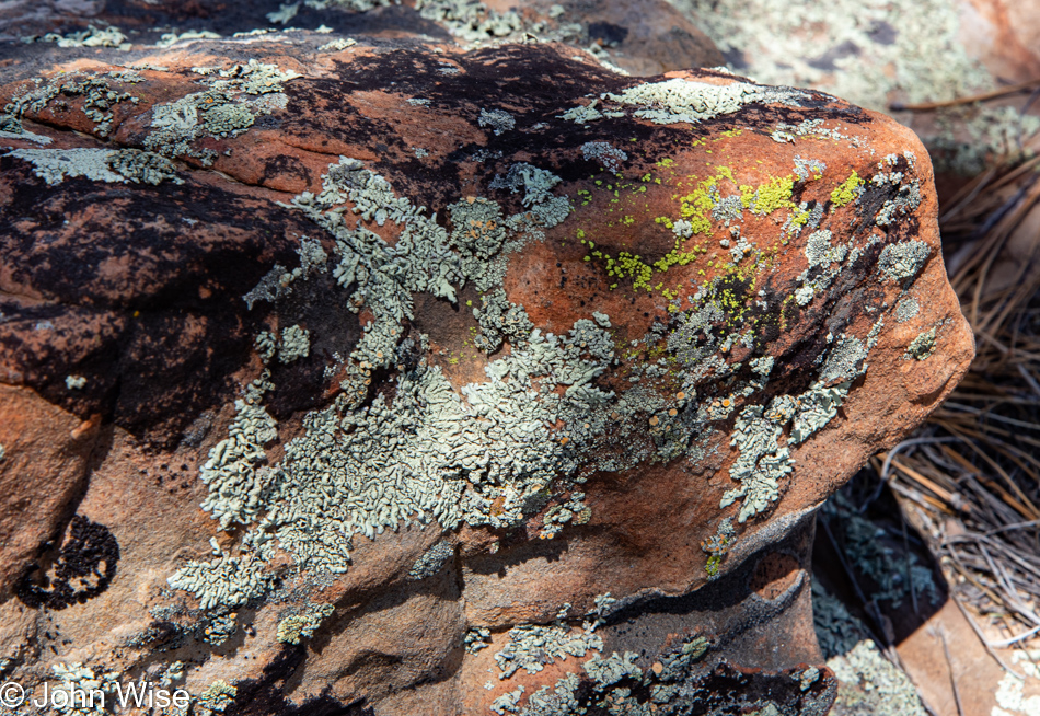
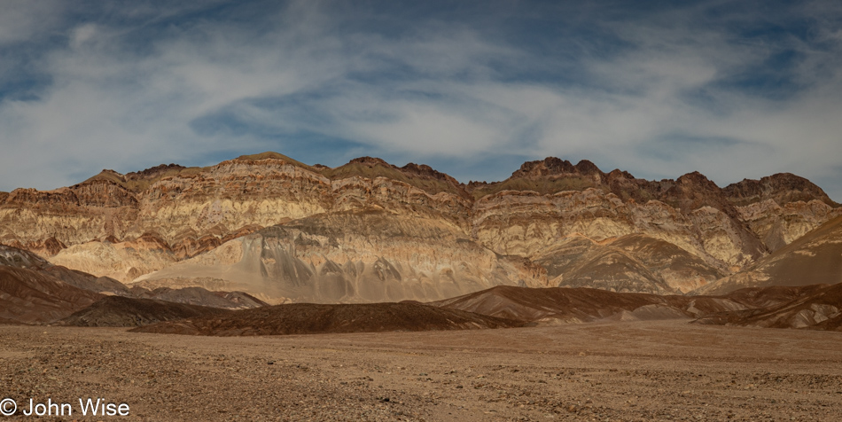
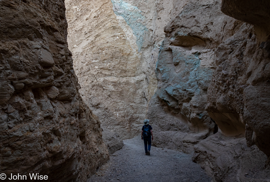
And then this small area of turquoise-hued rocks catches my eye and while I can appreciate the aesthetic qualities, I’m being denied any knowledge of precisely what’s at work here to have created this pocket of blue-green treasure. Learning that Death Valley has not really been a place to find much copper, I’ll eliminate the chance that the minerals at work here are malachite or azurite, which both oxidize towards green and instead, I’ll lean towards this display being caused by the presence of chlorite.

Flowering plant at Room Canyon at Death Valley National Park, California

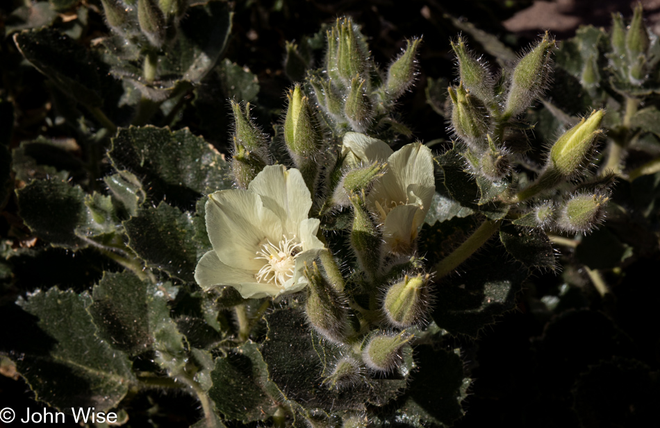
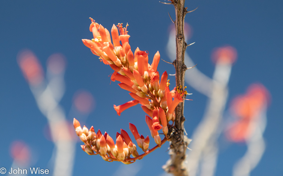
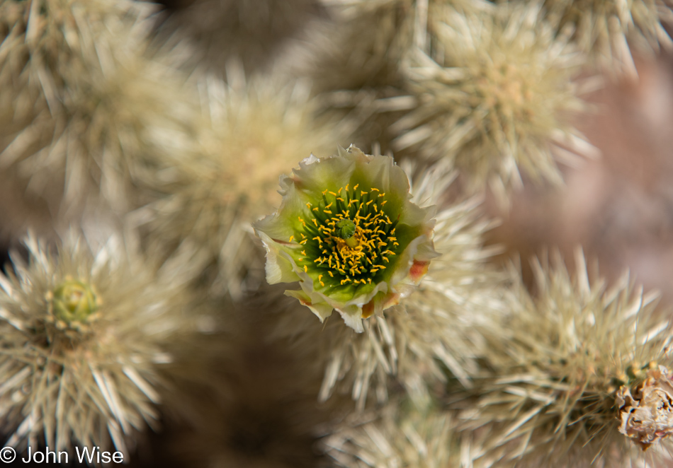
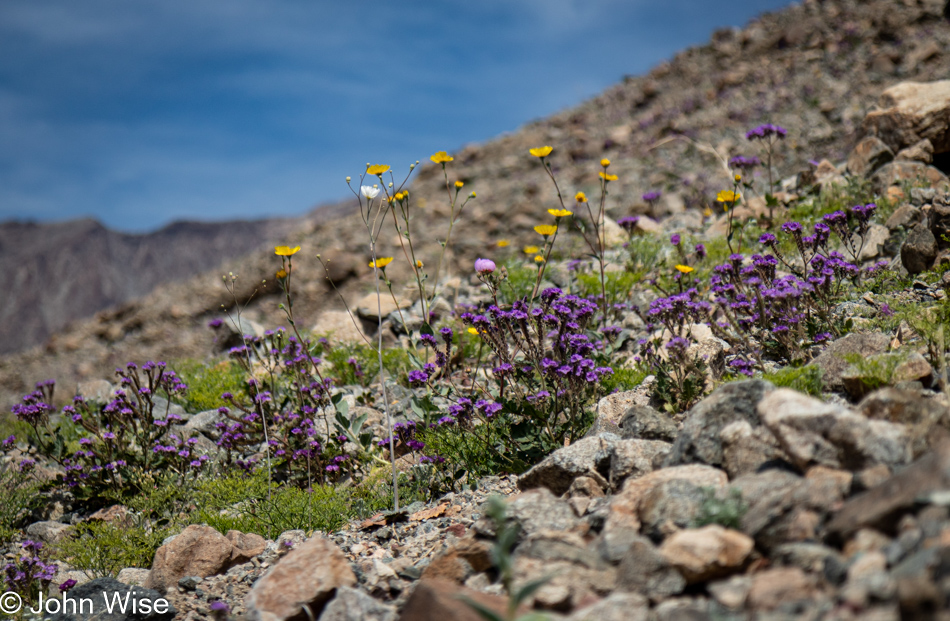
Hey Caroline, have we ever seen flowering desert rock nettle before? Looking for them, I learned that the International Carnivorous Plant Society considers the Eucnide urens a “murderous plant” because flies that come in for aphids are killed by the plant, but while this nettle strengthens its stinging spines with calcium phosphate, the same stuff our bones and teeth are made of, it can’t “eat” the flies so it does not qualify as carnivorous and is simply a murderer.

Wildflowers at Room Canyon at Death Valley National Park, California

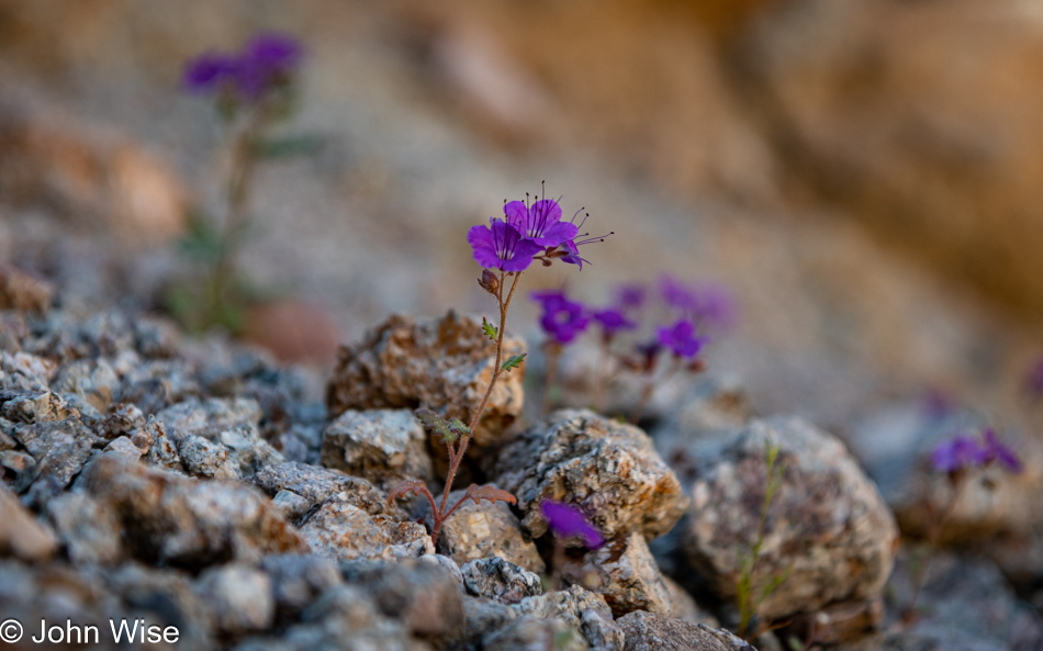
On the other hand, there’s this notch leaf scorpionweed that, while intensely and beautifully saturated in a wonderful shade of purple, can cause a rash similar to the effect of poison ivy. Please consider that I may be wrong about identifying this wildflower, just as I can be wrong about almost everything I write here.

Wildflowers at Room Canyon at Death Valley National Park, California

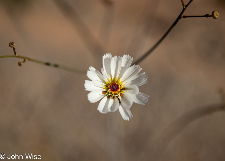
After an exhaustive search, I’ve come to the conclusion that this is the gravel ghost flower.

Conglomerate at Death Valley National Park, California

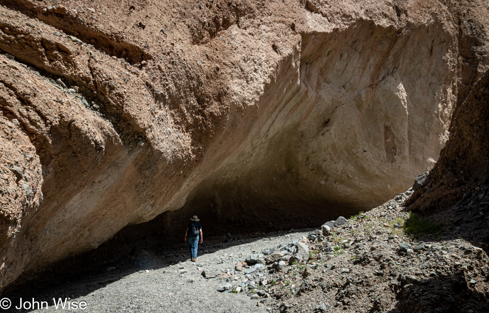
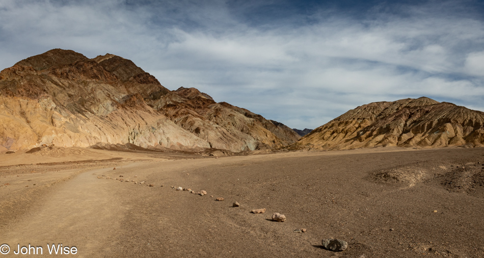
The scale of my lack of knowledge is often frightening because it took until the day in Phoenix writing this post that I was able to answer the question of why I wasn’t able to find a single hint of fossils in all of the alluvia I was scouring for hints of life. While I wanted to believe that this was made of eroded materials that settled on the shore of the long-gone Lake Manley, I should have noticed that the rocks that have been cemented together do not show signs of water erosion. This debris arrived from high above where it broke off the surrounding mountains and collected at the foot of them. It should have been obvious that there would be no fossils in this type of alluvium. This feels like a gaping chasm in the basics of understanding how our planet was made, how it evolves, and how what we perceive shouldn’t be taken for granted.

Caroline Wise on the salt pan in Death Valley National Park, California

The world of John would certainly be rendered simpler if I were to drop the curiosity and join the modern clan/cult of “Veni, vidi, vici,” best exemplified in the digital age by posting an iconic photo to Instagram while sitting back to enjoy the influencer cred. Maybe you ask, what is this Latin phrase harkening back to Julius Caeser? “Veni, vidi, vici” is translated to, “I came, I saw, I conquered,” which has been reduced to, “I came because someone really cool also went; I saw what I had to see in order to take the same photo, I’m a winner because everyone else tells me I am.” Am I alone in thinking that my totem should read, “Odi profanum vulgus et arceo?”

Carolne Wise at Sidewinder Canyon in Death Valley National Park, California

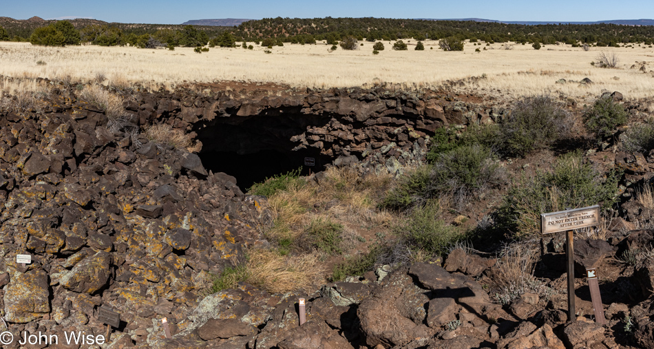
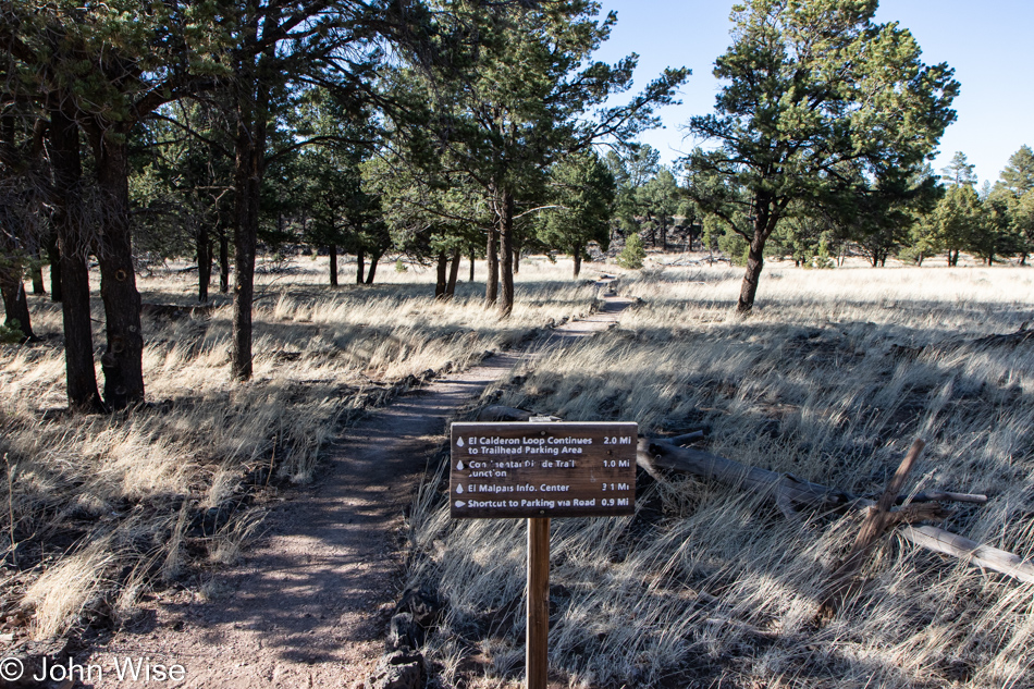
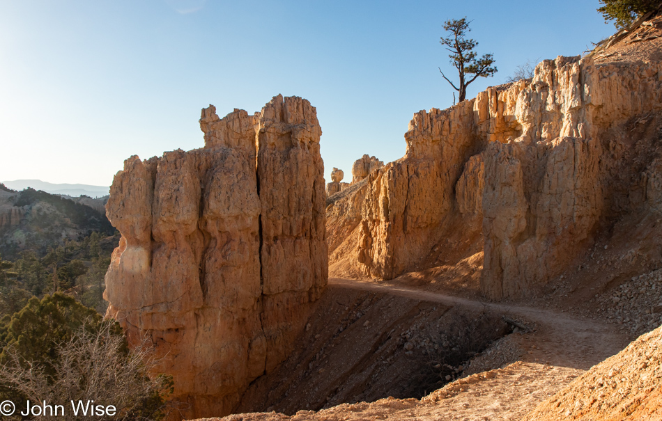
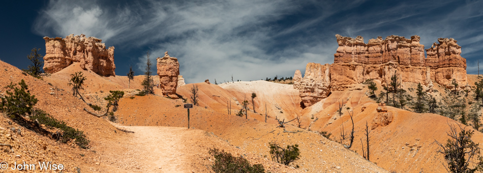
This is the moment we realize just how important AllTrails is to our peace of mind, as there are five potential trails that lead into Sidewinder Canyon, and only one can be right. A family of four coming off of one of these warns us from heading that way, so we consult our AllTrails map that we downloaded in Shoshone the night before to adjust our bearings. With nearly a dozen cars at the trailhead, we can only wonder how others made their decision.

Sidewinder Canyon in Death Valley National Park, California

From our initial impression, it would appear that the others are heading into places that are not Sidewinder Canyon. Should this prove true, we are promised a quiet 5-mile hike this afternoon.

Carolne Wise at Sidewinder Canyon in Death Valley National Park, California

It was a slog under direct sunlight in loose gravel before Caroline took up this perch in the shade of what appeared to be a fallen slab of the cliffside. After what felt like about 45 minutes, maybe even an hour, where we had 1,145 feet of elevation gain to contend with, there was serious consideration of turning around while we wondered what could possibly be so interesting further up the wide mouth of this gravelly canyon.

Sidewinder Canyon in Death Valley National Park, California

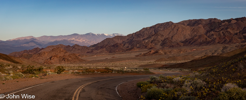
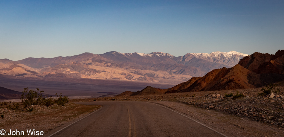
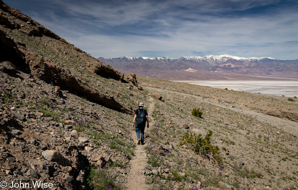
There were these occasional spectacular views of looking back at the snowcapped Telescope Peak in the Panamint Range, and as you can see, we are now able to enjoy a bit of shade as the canyon narrows.

Carolne Wise at Sidewinder Canyon in Death Valley National Park, California

When do the exciting views that make this such a highly recommended trail begin? Just kidding, if a massive rock overhang that could fall at any time to snuff us out of existence isn’t thrilling, what is?

Carolne Wise and John Wise at Sidewinder Canyon in Death Valley National Park, California

We’ve reached the end of the trail as it relates to our skills of clambering up the rock faces behind us. While we could see the way up, the way back down might present other challenges for the overweight guy afraid of heights, so we’d just have to turn around, check out the side canyons, and call it quits here at Sidewinder Canyon.

Sidewinder Canyon in Death Valley National Park, California

On the way in, we skipped all four side canyons that branched off the main trail with the idea that we might do them on the way back down. This was the last one and is now the first one on our return. The only one marked with a cairn, there must be something special here, so, at a minimum, we’ll explore this short quarter-mile hike.

Sidewinder Canyon in Death Valley National Park, California

Right away, Sidewinder Canyon transformed into a gem, but at this time, we’d not yet seen a thing.

Sidewinder Canyon in Death Valley National Park, California

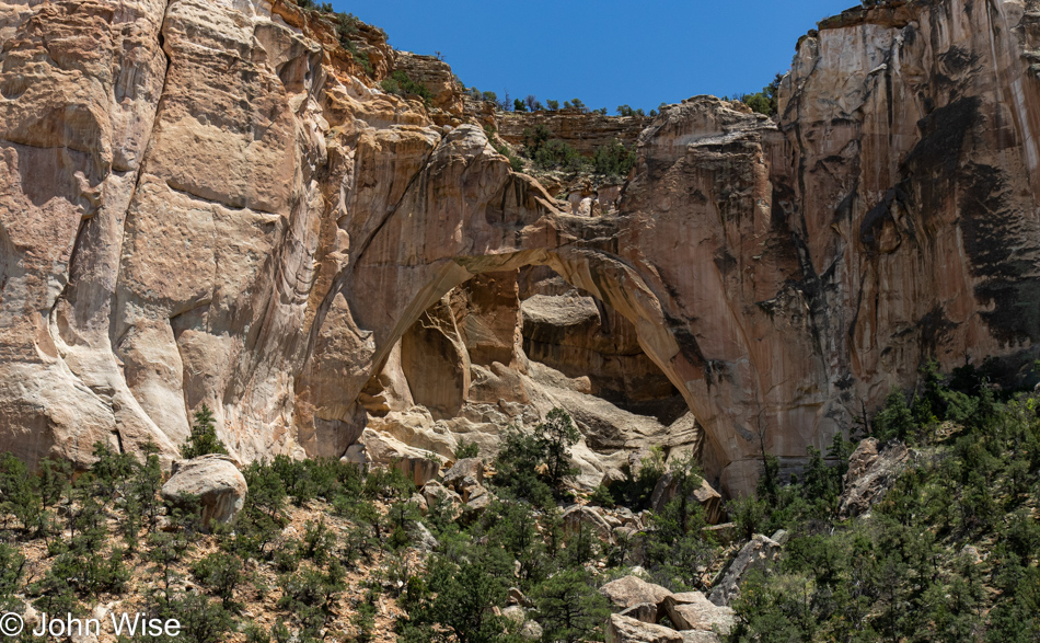
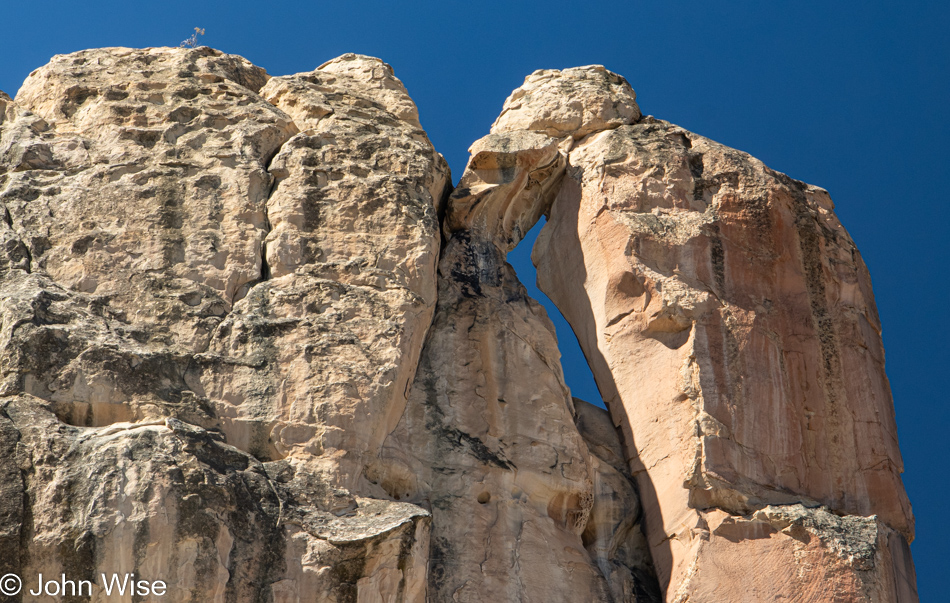
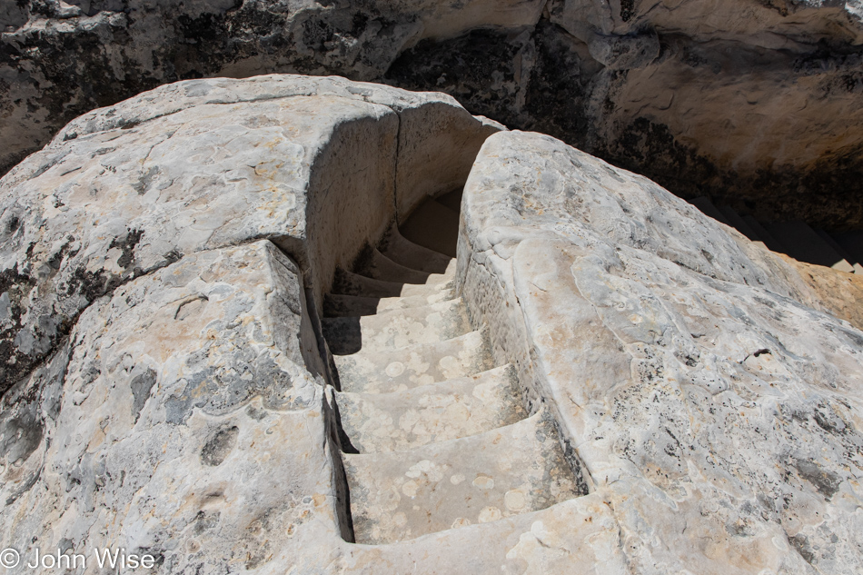
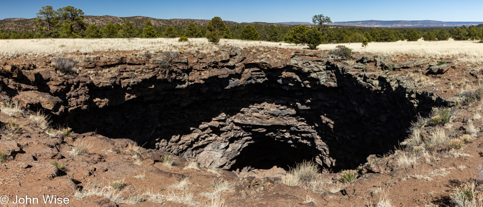
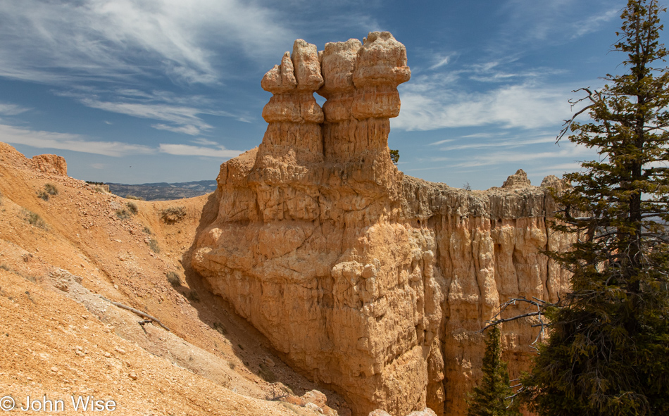
It is impossible to convey just how astonishing the sight of what you are looking at is. Not only did things cool off substantially in this narrow slot, but the light was at a premium, though there was just enough to understand that the hole we were about to walk through was a bizarre feature tucked away back here. We stood here a good 5 minutes examining things from all angles trying to figure out if it was manmade or carved by nature. There’s a steep path up and around it that Caroline braved, trying to gain a vantage point that might explain how this doorway got here. The surrounding rock and towering slice of earth overhead balanced over the opening suggest that it would have been stupidly foolish for any human to dare stand under so many tons of rock precariously resting in this space and dig it out, so it must be a natural path to the other side.

Sidewinder Canyon in Death Valley National Park, California

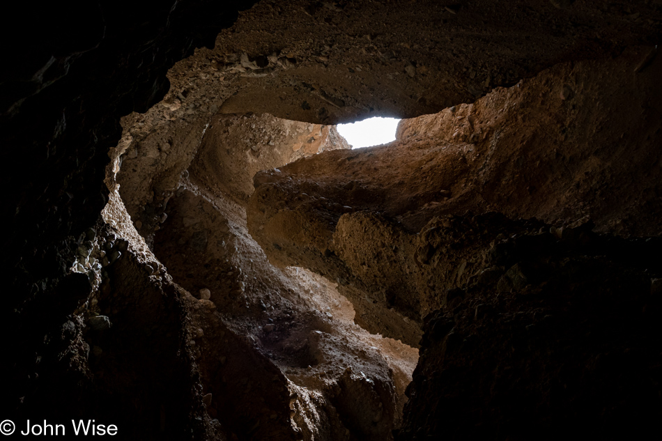
Step through the open door and look up; this is that view, which helps explain why it’s so dark down here.

Sidewinder Canyon in Death Valley National Park, California

The word that comes to mind regarding the state entered in this passage is stupefied. How does the hand of nature massage its contours to offer us a perfect world that not only supplies the essential ingredients to care for ourselves but then throws in a load of sensual aesthetic qualities that present our senses with an exquisite orchestration of visual, audible, and other sensory delights that dumbfound us as we stand there in awe? Incredulous that we’ve been gifted this ability to perceive such intense beauty, we are often brought to the edge of emotion that wants to find a way out in some way that far exceeds the exclamation of “wow!” Much of what I write here is a feeble attempt to capture the tiniest fragment of that enthusiasm that feels all too impossible to convey, and so I just keep on searching for the proper sequence of words that might talk back to us in the future and remind us that we’ve traversed the furthest reaches of the incredible that few will discover within or outside of themselves.

Sidewinder Canyon in Death Valley National Park, California

Charles Darwin once said, “The love of all living creatures is the most noble attribute of man.” I’d change that to include the love of all things, even those things we cannot overcome.

Carolne Wise at Sidewinder Canyon in Death Valley National Park, California

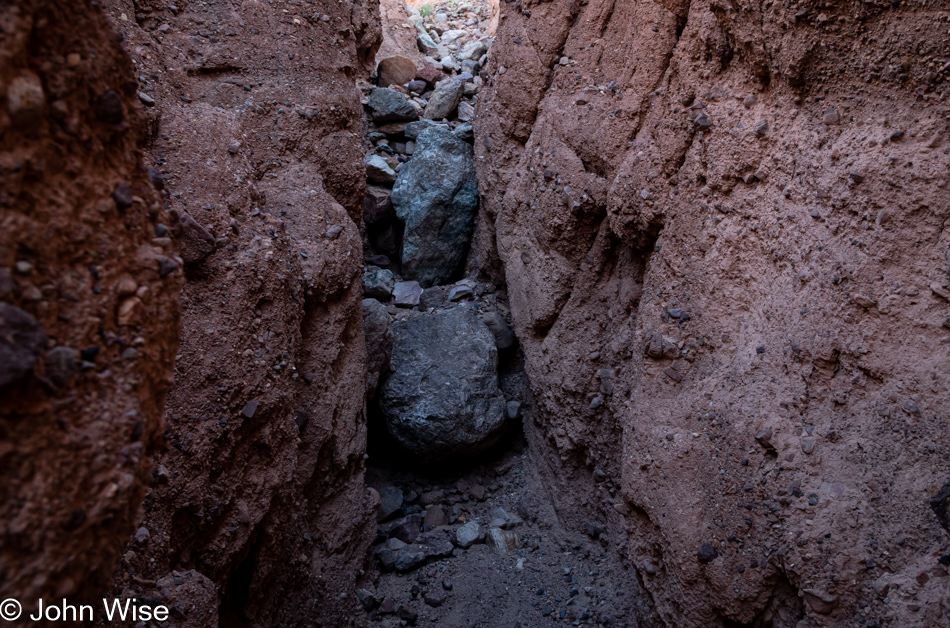
That large boulder was the end of this side canyon for us; we turned around and were able to enjoy it all over again.

Carolne Wise at Sidewinder Canyon in Death Valley National Park, California

Slot number two. See human for scale.

Sidewinder Canyon in Death Valley National Park, California

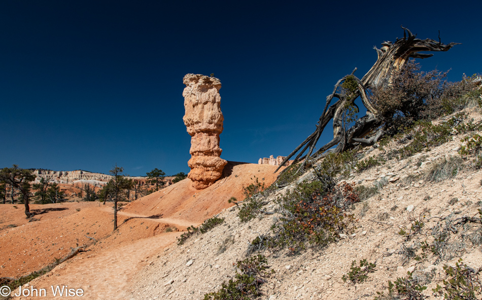
If you take nothing else from this post, leave knowing that these photos are poor representations of the breathtaking sights found here in Death Valley.

Sidewinder Canyon in Death Valley National Park, California

We have emerged from slot canyon number three in our sequence, and I’m left with the impression that hikers should consider visiting these in reverse order compared to what we chose, meaning visit each side hike as you are entering Sidewinder Canyon in order to save the best for last but then again, who am I to judge what is pleasing to others?

View from Sidewinder Canyon in Death Valley National Park, California

Let’s return to the subject of stamina as I now have 36 photos I’ve written to and have 16 ahead of me, including this one. Caroline often wonders why I don’t just slice the image count in half or even a third when the chore of writing to each and every photo means I’ll be spending an inordinate amount of time teasing thoughts out of my head, often longer than the actual time spent in an environment. You see, this is a clever ploy used by me to spend studied time in front of the photo waiting for some intrinsic value or grand inspiration to seep out of the pixels to talk to me about what I might share. Once I find that muse, er um, delusion, I run with it, and in so doing, I create the situation where my wife will have to then look into each bit of writing to ensure I’m coherent and grammatically correct, but there’s a side effect to writing so much, and that is she is then compelled to dwell within the scene allowing her memories to find a deeper place within our shared experience.

Wildflowers at Sidewinder Canyon in Death Valley National Park, California

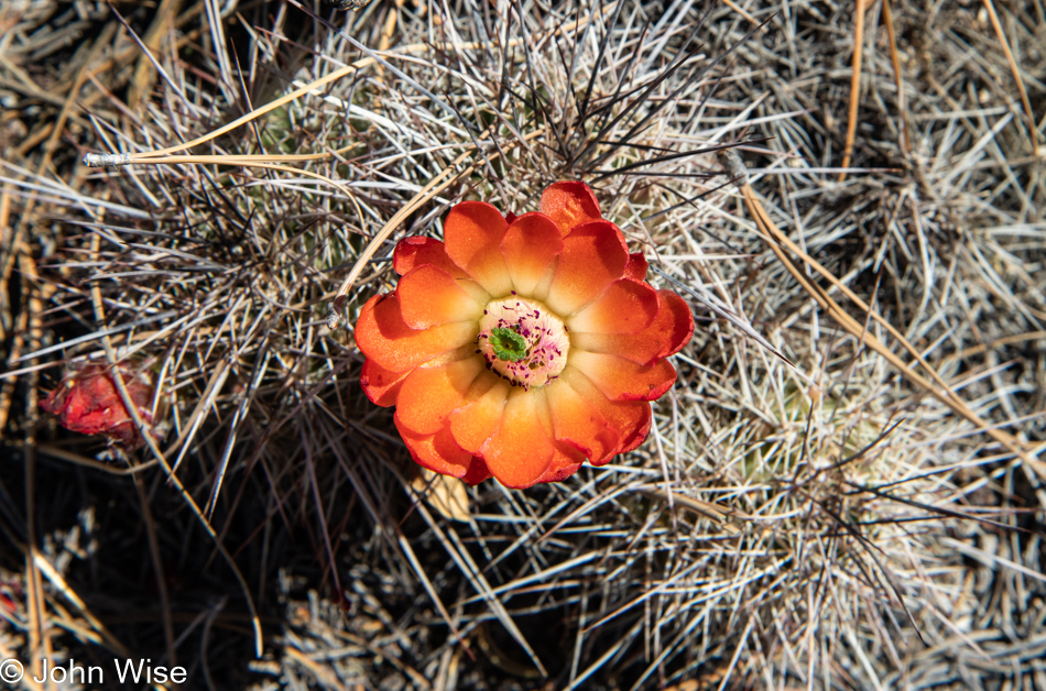
This entire process, no matter the motivation, requires the stamina to persist and, if need be, go slow to find my footing before establishing a flow that hopefully brings me to the end of the page without cutting out the remaining images before continuing with the next day. This is the third or fourth day of returning to this evolving post, and other than my wife reading this; I really have no expectation that anyone else will, other than some artificial life algorithm training another Large Language Model (LLM) so it can sample yet another human in order to learn how people express themselves. Like these wildflowers that must bloom in a hostile environment where nobody may ever happen by to appreciate their tenacity to persist, they pop into life for a brief time, grace us with their beauty, and could care less if they’re well received. Right there, that’s my writing philosophy.

View from Sidewinder Canyon in Death Valley National Park, California

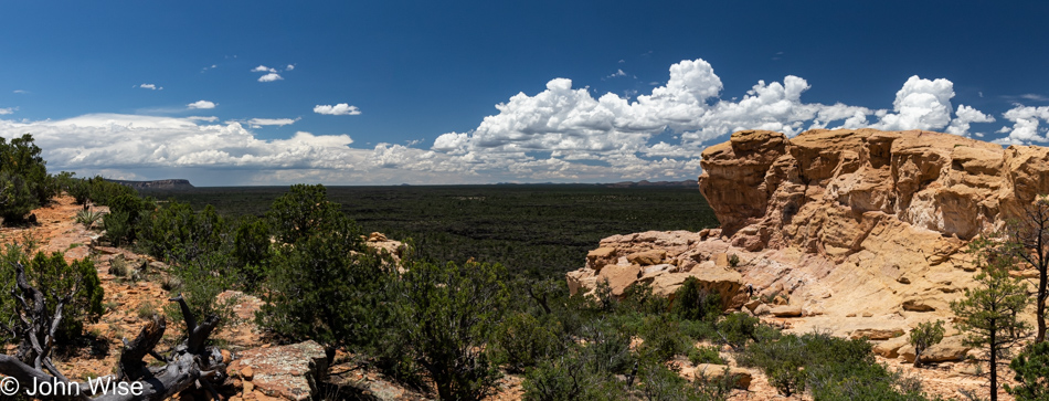
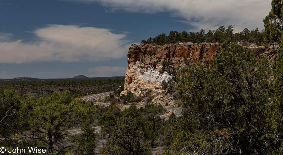
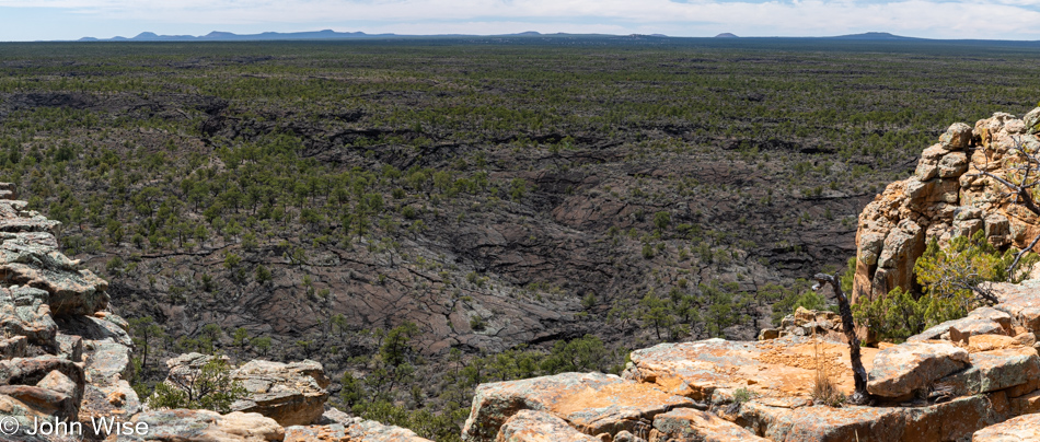
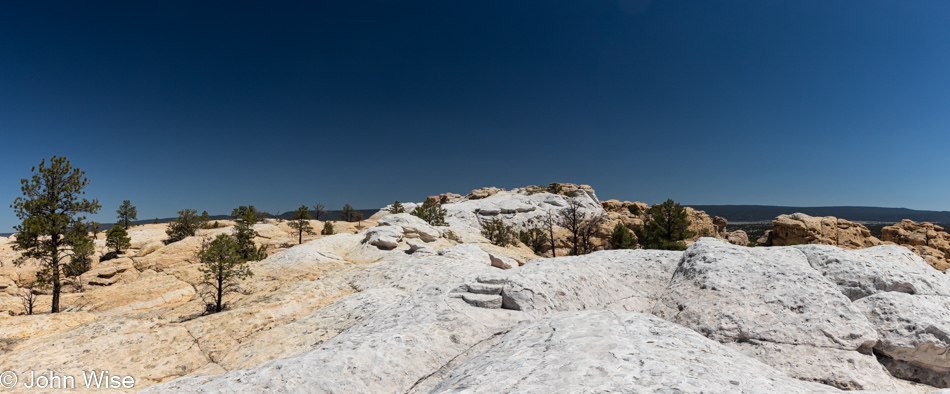
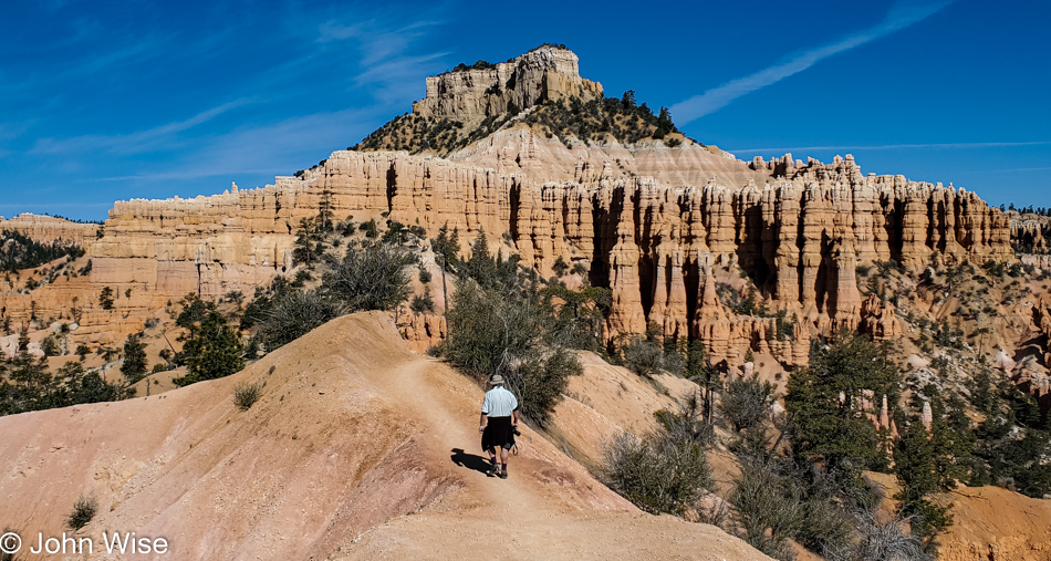
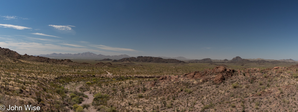
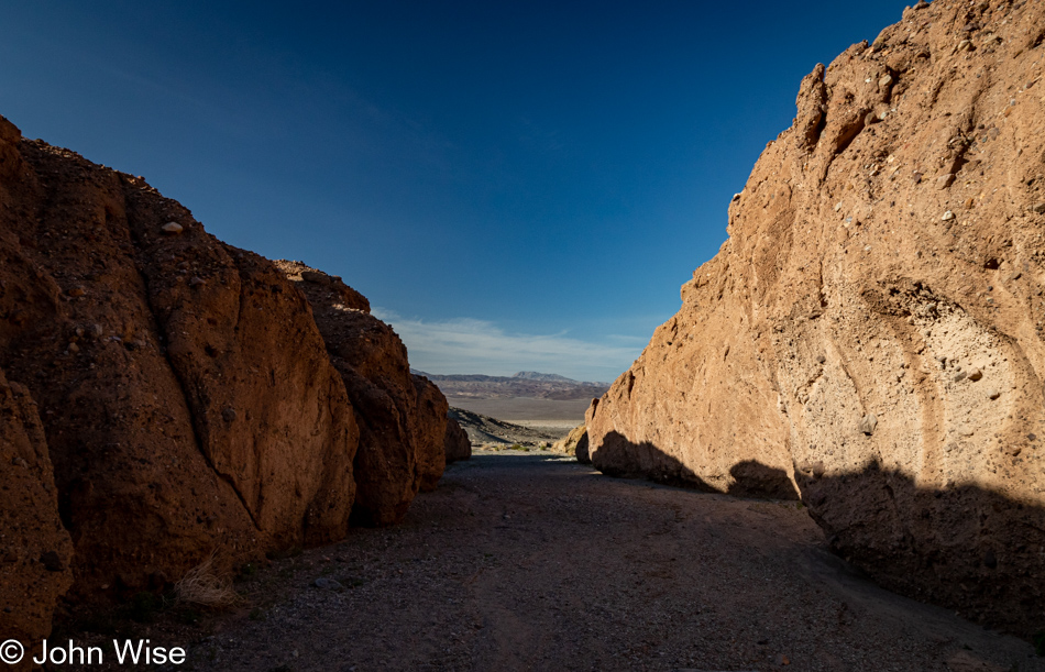
Just to the right of the center of the image is our car, which will whisk us away to lunch if we don’t become distracted on the way up the road.

Death Valley National Park, California

This is not Badwater, we didn’t bother to stop at Badwater on this visit to Death Valley because EVERYONE else was there. Never have we seen so many people and such a number of cars at that iconic location ever. It was an absurd level of visitors, as though Badwater had become an extension of a Disney ride. All we could do was crawl by with mouths agape wondering which influencer delivered the horde to this formerly serene place.

Death Valley National Park, California

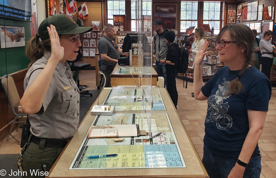
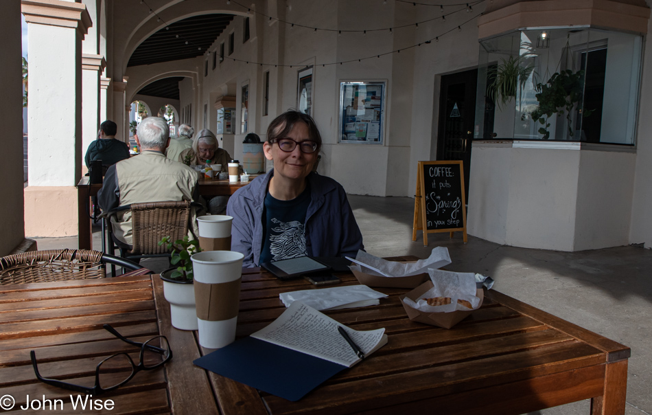
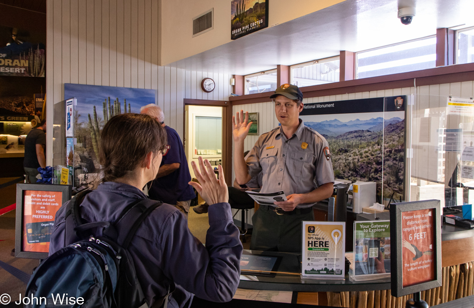
By the time we reached The Oasis and the Last Kind Words Saloon, our lunch options were pretty limited and, to be honest, as I was having no kind thoughts about the type of visitor the park attracts these days, I just wanted a quick bite so we could get back on a trail away from the grotesque superficiality on display here. Having a captive audience in Death Valley, the concessionaire puts us visitors in the bind of not having many options, and they are able to charge what the market will bear. We shared ten wings ($26), Caroline had a beer ($10), and I had an iced tea ($4). With tip, our bill for a shared appetizer and two drinks was $51. Not only that, our time at the saloon stole an hour from our day. Growing discouraged with our brief time here at the hub of Death Valley, we had one more thing to take care of, which was buying a new annual pass for our National Parks at the visitors center. Asking the ranger about the mayhem, we were advised to reconsider visiting on holiday weekends. This is Easter weekend, and there are still remnants of spring break filtering through. Now we know.

Desolation Canyon in Death Valley National Park, California

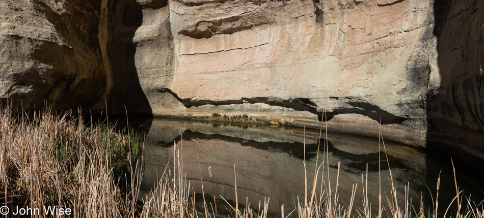
Time for a return to peace and quiet, which is exactly what one might expect at Desolation Canyon.

Caroline Wise at Desolation Canyon in Death Valley National Park, California

Who needs to check with AllTrails? The path very obviously goes that way.

Desolation Canyon in Death Valley National Park, California

There were some sketchy areas along the way for me, but as much as possible, I at least went as far as I could before my vertigo was either overcome or defeated, and we had to turn around. Things were going along more or less fine until I reached the point of ultimate pucker, where my butthole gland jolted me with a surge of anxiety that screamed a clear and resounding “nope!” It was at this point that we looked at the AllTrails map and saw that we were off the main route. How could this be, as the trail was so clearly defined?

Desolation Canyon in Death Valley National Park, California

We’d already been hiking back when it occurred to me that I should have taken a photo from our furthest point up the pucker trail. Oh well, it’s early enough; we can try this again once we get back down there.

Desolation Canyon in Death Valley National Park, California

I see; we weren’t supposed to walk on the visible trail next to the wash; we were supposed to be in the middle of the wash.

Desolation Canyon in Death Valley National Park, California

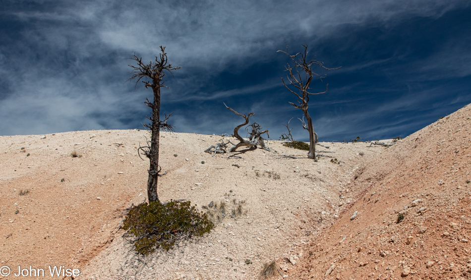
We quickly learned why this canyon earned its name: this is absolute desolation. Not a single plant, lizard, or bit of moisture though we did hear the occasional bird tweeting from above. Then there was also that guy who was on his descent from a nearby peak because he has the kind of hooves that allow his species to ascend escarpments and was now racing to reach Dante’s View at Coffin Peak before sunset after he whipped out his wings.

Desolation Canyon in Death Valley National Park, California

It’s intensely beautiful down here, but the sun is not in our favor, and like just about anywhere on the trails in Death Valley, we wouldn’t want to be out here after the sun sets, so we keep on moving, not taking the time we should in order to take it all in.

Caroline Wise at Desolation Canyon in Death Valley National Park, California

There was another dead end ahead for us before finishing the Desolation Canyon Trail, a rock face with obvious hand and foot holds but purely vertical and something that I wouldn’t have been happy needing to come down. Mind you; this is certainly a disappointment for me as I, like any normal person who’s already invested the effort in getting out here, want to reach the end of the trail for that sense of winning a prize for reaching the end of the trail. Alas, this isn’t meant to be my way of winning; I’ll have to accept that by being forced out of this canyon earlier than expected, we were able to do other amazing things that were meaningful, too. Those details follow.

Sunset over Death Valley National Park, California

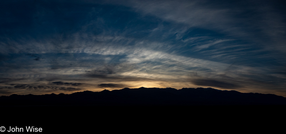
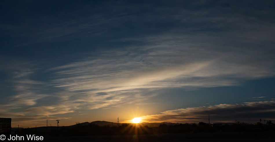
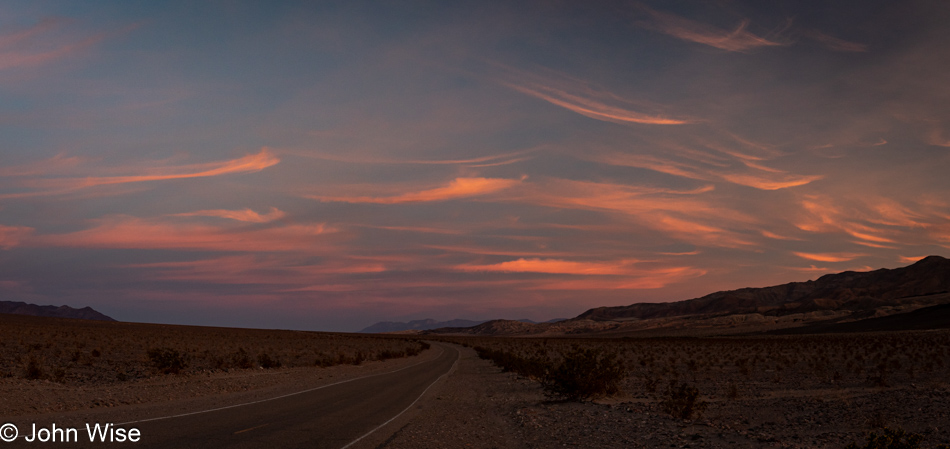
It feels like a rare moment when we are afforded the opportunity to experience a glorious sunset here in Death Valley. I don’t know why we can’t find any memories of sunsets in the park; maybe it’s due to being overwhelmed by the sites of the day or that they simply can’t compare to the spectacular sunsets we witness in Arizona, regardless of the reason, today, we were gifted with this late burst of color in the early evening sky that bore remembering.

Sunset over Death Valley National Park, California

From where we left the trail, the nearly 70-mile drive down to Shoshone was going to take us nearly 90 minutes, getting us to dinner shortly before 8:00, but here we were stopping yet again. There’s no question in our minds that whatever might be sacrificed later is just the way it is because capturing yet another reminder of a perfect day takes precedence.

Sunset over Death Valley National Park, California

Nearly 15 miles covered by 32,000 steps on three different hikes is what we got in today. Starting with Room Canyon, moving on to Sidewinder Canyon with a quick jaunt out onto the salt flat in-between before finishing the day on the Desolation Canyon trail. When we pulled into our motel, we figured it was too late to hit the hot spring, so we went for dinner at the Crow Bar across the street and talked of taking a dip in the morning before the day got underway, but as luck would have it, we got our order in before a large (loud) party of Germans and before we knew it, it looked as though we could clear our bill and get to our room to change by 8:40 allowing us almost 15 minutes at the pool. We wasted no time and were in the water by 8:45. The gate is supposed to be locked at 9:00, but as luck was once more favoring us, the guy didn’t show up until some minutes after 9:00 allowing us a full 20 minutes of hot spring winddown for our tired bodies and heavy feet. This was just the elixir nature ordered for this couple of outdoor enthusiasts who were celebrating their stamina to be on the go and enjoying every moment of a day that stretched into a 15-hour adventure of non-stop sublime impressions.

Petroglyphs to Phoenix

Left Santa Fe early but late enough to allow us another opportunity to have breakfast over at the Pantry Restaurant. With that out of the way, we pointed the car toward Albuquerque. We had a mission that had us dropping in on the Petroglyph National Monument for the experience that precedes qualifying for yet another junior ranger badge.

With ample signage warning visitors not to leave ANYTHING visible in their cars at the Rinconada trailhead parking lot, we used this admonishment to go someplace else. We opted for a trail that had us backtracking a bit north to Piedras Marcadas Canyon. I didn’t have a good feeling about our hike starting off under these circumstances as I couldn’t help but think that maybe Albuquerque had started modeling itself after the TV series Breaking Bad. Not that I know a lot about that show, but I do know that gangsterism, meth, mayhem, and more meth were the central themes, using Albuquerque as its location.

Obviously, we’re walking the Piedras Marcadas Canyon trail by now, collecting petroglyphs in the camera.

Within the Petroglyph National Monument, there are an estimated 25,000 etchings that have been carved into the patina of the rocks stretching over the 12 square miles the National Park Service protects.

The oldest petroglyphs are estimated to be over 4,000 years old, but I’m guessing this one of a boy riding a snail is not one of those, though the early rendition of the Flying Spaghetti Monster to the left could predate Jesus.

This beautiful petroglyph I’m interpreting as, “Oh my god, it’s summer and there isn’t a tree anywhere to find shade under.”

From our perspective on a fenced trail, there are multiple dozens of petroglyphs etched into the rocks right in front of us. This has me wondering how many are out of view because what are the chances that consideration was made by early inhabitants to ensure their messaging would be visible to those that passed below?

The trail through here, while it’s been here a long time, wasn’t always so well defined, as evidenced by the worn side paths that are still growing over. I’m guessing that some decades ago, people were basically allowed to scramble over the boulders to see what they could see.

Seventy years ago, visitors didn’t understand the value of these sites and didn’t think anything about walking on fragile areas of Yellowstone, breaking off a chunk of stalagmite at Carlsbad Caverns, or crawling on the walls of an old pueblo. Today, it feels as though there is a wanton desire to destroy for the sake of destruction and leaving your own personal mark on something that cannot be repaired. Just as we learned that areas of Bandelier that were once visitable and likely listed in our old park brochure are no longer on maps in order to dissuade others from finding and harming these historic sites, it makes me wonder how long we’ll have access to seeing these petroglyphs with our own eyes.

Our short 2-mile hike took us about 90 minutes of walking through sand that only grew progressively warmer as we went along. Good thing Caroline had a gallon of water on her back. Time to return to the visitor center for you know what.

Yep, swearing in as a fully-fledged Junior Ranger at Petroglyph National Monument in Albuquerque, New Mexico. It’s still too early in the morning to go find Sadie’s for some of their regional eats, so we’ll get on the road as there are still 420 miles ahead of us on our way home.

This long, straight road ahead takes us to Arizona (unless we detour).

Of course, we had to detour; we are John and Caroline, and lingering is part of who we are. Taking Interstate 40 to Interstate 17 for the fastest straightest shot home sounded so incredibly boring that anyone should know that we’d never take that route. So, in Grants, we left the freeway to travel back down through El Malpais National Monument just as we did back on May 15, two months earlier.

Sixty days ago, in order to save time for the other things we wanted to do out here, we skipped the Sandstone Bluffs Overlook, but not today.

Caroline went one direction, the way of the daredevil unafraid of heights, while I took the more terrestrial path.

While she was up there somewhere on the right, I made this my viewpoint.

Until we converged again to take off for another view from the bluffs.

Maybe this looks somewhat familiar from our trip last month.

It should have, as we are right back out here at La Ventana Arch, but the lighting feels better.

Right up atop this cliffside is the Narrows Trail we’d love to revisit already, but time won’t allow it today.

Well, let’s be serious, time would allow it if I’d not set my mind on eating at Guayo’s El Rey in Miami, Arizona, meaning we would have to reach that small town before it grows too late. As it turned out, we had to go to Guayo’s on the Trail in Globe as the unreliable Google, while knowing the existence of these businesses, didn’t know that the Miami location was closed for vacation until the 22nd. Good thing I called ahead due to my growing mistrust of anything shared by Google.

For the rest of our drive home, we’d hit rain here and there, often quite heavy. While the cloud cover makes for somewhat dull landscapes regarding color and brightness, it sure does have the potential to lend drama to a sky.

What’s worse than driving mountain and canyon roads during heavy rain here in Arizona? Driving on any roads in the rain anywhere in this state.

Dinner at Guayo’s on the Trail was not at all what I was looking for and now has me wondering if the two Guayos are even related. One thing is certain: I’ll never visit the Globe location again. As you can tell from the sky over Picketpost Mountain in Superior, the rains have stayed behind while we return to the hot, dry desert of Phoenix.

Squeezing Everything Out of Sunday

Wake, shower, pack, eat breakfast (including blue corn pancakes), and get moving down the road. If we timed things correctly, we’d arrive at the El Malpais National Monument visitor center just as they were opening at 9:00. This sounds a bit rushed, and maybe it was a little, but we were moving further away from Arizona on the day we’d be heading home.

Caroline had finished the junior ranger booklet last night so we could pass through Grants, New Mexico, on the north side of the park, eliminating the need to double back later in the day to return it. Sworn in once more, this probably brings her close to 1,000 such badges she earned over the years.

These are the sandstone cliffs we were seeing in the distance yesterday while hiking on the cinder cone over at the El Calderon trail, it turns out that these are technically not a part of the park here at El Malpais. I suppose when one considers that El Malpais translates from Spanish to the bad country or badlands, it makes sense as the fossilized lava fields that make up the majority of the national monument are jagged, sharp, treacherous, and simply not very hospitable.

Just how angry that environment of nearly raw lava is will be experienced firsthand as we venture out on the Acoma-Zuni Trail. Prior to our arrival, we’ve read multiple times about the importance while hiking this 8-mile trail to always keep sight of the next cairn that will direct us through the maze that awaits us. Water, sunscreen, and a couple of snacks are in the bag, and we are ready to tackle what we can, which, by the way, is not the entirety as we are not fooling ourselves that we can hike 8 miles across and then turn around and hike back.

It’s called the common collared lizard, but, come on, with a blue-green body, yellow head, and yellow speckles down its back, I’d say this is anything but common. Also uncommon, it sat there making eye contact as I slowly approached to take its photo. I did not use a telephoto lens; I just walked up, pushed my camera closer, and snapped off a few shots.

Somewhere nearby, another hiker, a solo woman hiker, went by in a bit of a blur, she was on a mission. That mission has to do with the Continental Divide Trail that slices through here, using the Acoma-Zuni Trail. Her direction suggests she was on a southerly trek, which would also imply that this is not a thru-hike but working on another segment of a multi-year hike, likely the last bit of the 3,100-mile trail. A badass in the badlands.

At 59 years old, you might think I’ve learned a lesson or two about expectation, but every time we venture out on a new trail, I’m of the opinion that this one will be somehow easier than those we’ve traveled before. What happens is that reality intrudes on my fantasy, and I learn that new challenges are being presented. Steep-sloping rocks were not part of what was in my imagination, nor were chasms opened up by the ancient lava. The advice I’d read that hikers on this trail would benefit from hiking poles and gloves should have been heeded, but know-it-all John isn’t comfortable with being weighed down with unnecessary things like poles, an extra lens, water, food, or any of that other junk, it’s just me and my camera. So how is it that I’ve not died of exposure, dehydration, or starvation out in these environments? I have a wife who doesn’t see the world quite the same way I do and drags all that stuff and more along with us on her back, well, everything but the hiking poles that we are reconsidering the need for.

Thorns and beautiful flowers were the least of our worries out here. Come to think about it, I don’t think Caroline really had any worries at all.

It was me who had worries, fears, and anxiety as things grew steeper, chasms became deeper, and the angles sharper. All this, and we weren’t even 2,000 feet across the 7 miles of fossilized lave that was still ahead of us. Sadly, it was paralyzing enough that I had to turn back, and obviously, Caroline would be doing the same. Just as I run into debilitating emotions that stop me from getting further at times, one of my greater disappointments is that it also stymies Caroline’s opportunity to see more. Sure, she does her best to assure me that at least we were able to see and experience the things we’d never have already seen had we stayed at home, but this is still small consolation for the parts of the journey denied her.

So, with the Acoma-Zuni Trail now behind us, we are on to the next part of the day’s activities as we continue south.

We pulled into the parking lot at La Ventana Natural Arch and met another person hiking the CDT (Continental Divide Trail). A Lithuanian, though he calls Poland home, he’s on a 6-month visa in order to have enough time to complete the entirety of the hike from Mexico to Canada. Tom is his name, and he’d just descended that area in front of us, probably to the left. On a previous visit to the United States, he completed the Pacific Crest Trail. We left Tom with an ice-cold refill of one of his water bottles before taking off for our short walk to view the arch

There’s a massive arch in the center of this image, though it’s not exactly easy to see. I even went beyond the barrier to scramble up the well-used unofficial path of those who break the rules trying to get a better photo, only to learn that there isn’t a better photo to be had from here. Maybe at different times of the day, the light hits things just right so that the scale of things can be appreciated better, but today at mid-day, it just wasn’t happening.

We are heading up there somewhere next.

Just below this point, we parked the car near some picnic tables and walked through a lot of sand up here on the Narrow Rim Trail, that’s a 7.3-mile out-and-back hike.

In no time, we’re atop the cliff and walking in wow.

Cairns identify the way when the trail becomes difficult to see.

How it is that we are the only ones up here is astonishing as although the trail is considered moderate in difficulty, these old people think it’s pretty easy and seriously pretty on the eyes. As a matter of fact, we are bowled over and maybe a little bit disappointed that we didn’t head directly to this part of the park because we are well aware that we’ll not be able to make it to the overlook of the arch due to the time constraints that now exist if we want to get home before 10:00 pm. We won’t turn into pumpkins or stones should we not get home prior to that, but driving at night comes with growing uncertainty the older I get, or maybe I’m no longer able to deal with fatigue the same way as I could 20 years ago.

A little more than a mile into the hike we start discussing if we’ve gone far enough. We agree we have, but it’s so incredibly, perfectly beautiful out here that we’ll just keep on a short bit more, just to the next corner to check out the view, and then we’ll reconsider.

This keeps on like that until we’ve hiked at least 2 miles up the Narrows Rim for this look facing northwest behind us. It cannot be overstated how we are walking in the profound, crushed by the gravity of what is being offered us up here all alone. How can it be possible that we are experiencing this without a thousand others walking with us, confirming to one another that we are the fortunate people of the earth, unable to comprehend why it should be us? With eyes saturated, we agree that this is really as good a spot as any to turn around. Sure, we know we are only about 1.5 miles from the overlook that would offer an overhead view of La Ventana Arch, but if we went that far, what would we have to come back to?

Yesterday, I didn’t think I had anything else to say about lichen, and then I somehow found something, but today, I’m not even going to try other than to ask, isn’t it magnificent?

People may extinct themselves, but as the saying goes, life finds a way, as evidenced by a tree growing out of rock. If you know me, you might be asking, “Hey John, did you just quote Jurrasic Park?” Just remember that I was once young and watched the same pop pap that all of us take in, and as I’ve explained before, I had to stop as those things not only become ingrained in my memories, they become poisons that take a greater place in my head where that damned theme song to Gilligans Island or Arnold telling us, “I’ll be back,” continue to live.

While the Acoma-Zuni trail is further north of here, this is essentially what we were supposed to be hiking upon. It all looks so innocuous from a few hundred feet above, but I swear that down there, I had the feeling that those rocks were the jaws of some t-rex bent on consuming me. I should give this writing exercise a break about right now as once I start drifting into movie references I have a hard time pulling myself back from that ledge.

About to reencounter the flat earth, we’ve already decided to stick around one of the picnic tables to enjoy our lunch right here instead of searching for something hot that would just make us later getting home, seeing that it would have us sitting down for the meal because I prefer not to eat from styrofoam while moving down the road.

This was the smart thing to do as otherwise we’d have brought all this food just to take it home. I now know that I’m a fan of bologna and hardboiled egg sandwiches on multi-grain bread; the only thing missing was potato chips sitting atop the egg slices. Add an apple, some popcorn, and a couple of cashews, and this made for the best lunch we’d ever had on this particular Sunday in May during 2022. If we could do it all over again, we’d rewind the tape and not change a thing.

I thought we were heading home, but the short Lava Falls Trail held enough attraction for Caroline that we turned down the short dirt road for the drive to the trailhead.

The trail is a short 1-mile affair rated as easy, but that doesn’t take into consideration that hikers have to step over what amounts to chasms. I believe something goes haywire in my brain when out in nature, as I’d swear this crack in the earth appeared much larger in person than what I see in my photograph. Maybe I should blame Herr Nietzsche for planting those thoughts regarding the staring into ravines (or something to that effect) for my looking for my inner lusus naturae somewhere down there in the darkened bowels. Would Freud suggest that my fear is of the below and going down while ascending and going higher is my preferred space? Ah yes, thanks to my mother who abandoned me as a child, I’m afraid of what represents her vagina, but on the other hand, I’m afraid of heights; do they represent the large phallus of the father? Good thing I’m no Freudian scholar or any other scholar for that matter, as I’m fairly certain, I’d be in the first order of scatological demon-freaks plumbing the genital metaphors due to my potty mind that on occasion reveals my aged childish imagination.

Yesterday on the El Calderon trail, we learned about why there were black and red cinders in different areas; they stem from different volcanic eruptions. There are also obvious reasons why lava can have color variations, such as we saw there on the trail and here at Lava Falls; the black lava has more magnesium, while the red contains more iron. I thought this was a great example of two flows that sit right next to each other and yet are chemically quite different.

Following the path of the cairns is the advice proffered, but I’ve run out of faith and chosen our return to the safety of anywhere else instead of finishing our loop trail. Maybe by writing about hiking poles once again, I’ll draw closer to finding the religion of using these crutches. With that in mind, I did a quick search for the pros and cons of hiking with poles; steadying yourself in precarious balancing situations is the number one pro, while having your hands free for quick photos is the first con I’m noting.

If you were to glance over our photos of traveling in Europe, you might arrive at the conclusion that we are church snobs. Far from it, we love all churches but especially Catholic ones, as they are mostly open. Here in Quemado, New Mexico, at the intersection of Nothing and Vast Openness, we encountered the Sacred Heart Church. It’s a small affair, and it being Sunday, it just had to be open.

Built during the 1930s, around the time that Quemado was referred to as the Rodeo Center of New Mexico, this church is a pretty good reflection of the building materials available in the area. Historical information about this area is sparse, though a book titled A History of Highway 60 and the Railroad Towns on the Belen, New Mexico Cutoff by Dixie Boyle seems to have the most data about the area in general that I could find.

Thirty-five miles later, we are back in Arizona with only 236 miles (380km) until we reach home.

We jumped back in time at the Arizona State Line, gaining time and allowing us to live the 16th hour of the day all over again. It’s as though we see the future from the past that was already lived once but is now happening in a new space. Looks good from here.

We’d simply turned around to look into the distance of where we’d come from and were curious if we were, in fact, gleaning two event horizons separated by the quanta of perception as we traveled through the wormhole called Daylight Savings Time. What is found behind is not so ahead, which implies we are moving between dimensions, right?

As if the intra-time portal opened between the geographic regions of Arizona and New Mexico wasn’t enough, we stumbled into a full eclipse of the moon. Not just any eclipse either, as you can easily see, this is a Blood Moon that prophecy suggests will guide Caroline and me into a blissful future paved with great happiness.

A Perfect Saturday in New Mexico

Sunrise in Zuni, New Mexico

Out with the rising sun, barking dogs, hornos (beehive-shaped adobe ovens pictured below), and a man named Elroy singing us a song dedicated to John and Caroline while accompanying himself on the air guitar; this was a first. That’s how our perfect Saturday began in the Native American village of Zuni, New Mexico.

Bread ovens in Zuni, New Mexico

We are staying at the one and only place for lodging in this small town of approximately 6,000 people, the Inn at Halona. Further north up on Interstate 40, traveling from Gallup, Grants, and Albuquerque to points further east, the towns along the freeway are noisy, generic, and sad. Some might argue that Zuni, a bit south of all that, is sad, too, but they’d be wrong. It’s simply reflecting with brutal honesty how colonizers disadvantaged a people for which there was little room in the expanse of white America. In this sense, Zuni is much like Window Rock, Arizona, or Oglala, South Dakota, but the locals have never been less than stellar with us. It’s strange how those on the margin are often some of the most generous people we meet during our travels.

Zuni, New Mexico

Last night, during a late check-in, we learned (maybe we were reminded, I’m not sure) that breakfast was included. Since the Halona Inn is a bed and breakfast, it should have been apparent that it would include the first meal of our day. We dined on a sumptuous affair crowned by blue corn pancakes and served promptly at 7:00. Trey is our server and cook, and I’d likely be correct in saying that she’s A’shiwi (the Spanish named the people of this region Zuni). Her enthusiasm and friendliness really contributed to breakfast being better than it might have otherwise been.

El Morro National Monument, New Mexico

There was some hesitation in eating breakfast at the Inn as we’d brought our own to allow us to get out on the trail at daybreak, but thinking twice about it, a hot breakfast here on the Zuni reservation sounded enticing. Good thing it worked out this way and that we were willing to linger a bit longer on our way to El Morro National Monument as it turned out that the park doesn’t open until 9:00 anyway. We waited less than 5 minutes before the automatic gate swung open, allowing us to make our way to the visitor center and the trailhead.

El Morro National Monument, New Mexico

There are three possible paths from here for us to take; the first goes to the right to Inscription Rock and Mesa Top Trail Loop further on. We can go left directly to the Mesa Top Trail and the Pueblo ruin we’ll also reach if we take a right. Our third choice is to turn around and leave; well, that’s hardly a viable choice after putting ourselves out here just for this anticipated hiking adventure.

El Morro National Monument, New Mexico

We opted to go to the right to match our political affiliation (NOT), and the first unexpected sight is found here in this alcove. Signs of waterfalls abound. Obviously, with the cloudless blue skies that are accompanying our day, there’s not a drop of moisture that will flow from those chutes carved into the sandstone. But just below…

El Morro National Monument, New Mexico

…is this pool with a depth of about 12 feet. This reliable source of water brought people into the area for centuries.

Petroglyphs at El Morro National Monument, New Mexico

Obviously, Native Americans were the first in the area centuries before anyone of European descent arrived on the scene.

Petroglyphs at El Morro National Monument, New Mexico

The Ancestral Pueblo Indians who lived on the cliffs above were present from around 1275 to 1350 AD, while the Zuni/A’shiwi have been living in the area for about 1300 years.

Inscriptions at El Morro National Monument, New Mexico

Then, back in about 1540, Francisco Vázquez de Coronado first encountered the Zuni. Whether he made it to this watering hole remains unknown, but there you have it, a European in the Southwest of the North American continent. Sixty-five years later, Juan de Oñate passed through here, leaving his autograph on Inscription Rock. This photo is not of that precise panel but is a fair enough representation of the style of messages left when Spaniards were passing through. Juan de Oñate came to New Mexico in 1598 and became a villain in the eyes of the Puebloan Indians in the area when he ordered the slaughter of 500 people in retribution for the killing of a dozen conquistadors in 1599.

The inscription pictured above says, “We passed by here, the Sergeant Major and Captain Juan de Archuleta and Adjutant Diego Martin Barba and Ensign Agustin de Ynojos. The year of 1636”

Inscriptions at El Morro National Monument, New Mexico

Skip this part of my story if you want to avoid controversial politics about which I’m opinionated but ofwhich I am no expert. A segment of America is raging at the moment of this writing about Critical Race Theory (CRT) and the Great Replacement bizarro idea. Critical Race Theory opponents are afraid that white children might be made responsible for answering to the misdeeds of their forefathers, while the Great Replacement asserts that minorities are out to replace white people. I’m of the belief that the white Christian hegemonistic bias that has been at work for far too long upon these shores is afraid to let go. Where once we railed against primitive, archaic people who originally populated this country, we ourselves are now the primitive, archaic people afraid of change.

Although white Europeans from Spain arrived in the lands that would become the western United States 80 years before the pilgrims landed and Ponce de Leon visited what would become Florida in 1513, I was taught that American history really begins at Jamestown in 1607 and at Plymouth Rock in late 1620 and then again in 1776 while the interloping Spaniards were of no particular consequence as they were not from North European stock anyway which is where the good god-fearing Christians come from. Was the Catholicism of the Spaniards part of the problem and the reason why there was so much controversy around John F. Kennedy becoming president as a Catholic? Our fundamentalist roots that took hold in the northeast feel like a boat anchor holding America back as we’ve sacrificed education (maybe a poor example, but look at the first carving made by an American citizen at this monument that includes a typo, insciptions) in order to enforce a kind of intellectual violence aimed at maintaining conformity and fear of the future. Our common knowledge is no longer commensurate with the rigor required at this time in history.

Someday, this massive tottering chunk of sandstone will collapse, and the monument at El Morro will be changed. With the passage of time, the inscriptions carved on these walls, noting who passed through here starting before 1605 and continuing until the early 20th century when this area was designated a national monument, will all fade and disappear. But none of this will change the fact that this was a part of our cultural history and remains part of the permanence of the earth. In my brief moment of being human, I have the opportunity to experience these things the way they are, understand how they were, and hope to leave it all in at least the same condition with which I was fortunate enough to have been presented. Maybe that’s the best we can do with nature and history, but regarding our intellectual and cultural capacity, we should always be striving to build personal monuments that can best weather the elements of reflection and accountability.

El Morro National Monument, New Mexico

We slog up the switchbacks as we need to gain elevation if we are to capture what lies above in the unknown heavens that remain out of sight.

El Morro National Monument, New Mexico

But don’t forget to get lost in the enchanting details that might otherwise remain unseen should your desire to reach the destination have you racing over the trail. This applies not only to the day or hour but to the entirety of your life.

El Morro National Monument, New Mexico

So, there you are, traveling with confidence and curiosity until you encounter the BLOCK. Fear drills into you, and uncertainty grips your strength as the ability to carry on is no longer certain. The good intentions begin to crumble. That’s just what happens to me every time I reach that place in my path where my personal weakness rears its ugly head, screaming at me to start trembling. I oblige as I consider the abyss I’ll certainly stumble into because the sides of the path ahead that would otherwise support me fall abruptly into apparent nothingness. This is my fear of heights, where an irrational mind is making decisions that would stop me in my tracks. It does happen that I am forced to give in to that crippling effect, but today won’t be that time.

El Morro National Monument, New Mexico

Before we ever got out here, I examined the trail from across the ridge using our binoculars. I watched a family of five traverse the terrifying heights of near-certain death with their 5, 7, and 8-year-old (my estimation) children seemingly oblivious of their own mortality; oh yeah, they are at that age they are unaware of such things. I had to dig deep to muster the strength of determination if we were to see that pueblo ruin on the other side with our own eyes. I just had to share this experience with Caroline instead of denying the two of us the reward of accomplishing what we set out to do. This idea of never giving up sure comes at a cost; in this instance, it’s called panic.

El Morro National Monument, New Mexico

If you look at the photos I’m sharing here on the razor’s edge and wonder what the big deal is, consider that I’m only able to stop and snap an image where I’m absolutely certain about my footing. Ambiguity about my wavering center of gravity requires I focus on the most serious of tasks, where are my safe places, and don’t fixate on the potential of my feet not performing as they have for more than 55 years. This photo of the stairs was one such moment where I still had a split second to grab the photo and capture this brilliant carving showing us the way down. The place I was standing was not ideal, but I was able to bring up the camera just long enough to snap this image, not two shots, just this one, of which I was uncertain if I’d framed it decently.

El Morro National Monument, New Mexico

Breathe, find the center, look around, and calm down. There’s immense beauty out here and profound accomplishment when each step demands a level of commitment that, from moment to moment, feels impossible. I cannot photograph the places that offer the greatest accomplishment, that of me overcoming me, but when I get to my safe place, I can stop to revel in what I just did and the wonderful new sights and vistas that have opened up for me having gone through the impossible. Writing when I’m less than inspired is part of this design to go further. I don’t always have inspired words; some could argue that I never have but I do have the wherewithal to not give up or take an alternative easy path. As much as I loathe the difficulties, I’m aware that I’m able, with enough effort, to make the kinds of strides that, in retrospect, gave me more life than I would have otherwise found in front of a TV, playing a video game, or tossing back a drink at the sports bar. That’s right; I’m here on the Headlands Trail at El Morro, finding out more about myself, love, aesthetics, beauty, strength, and the universe just by looking at the patterns found in a random spot of sandstone.

El Morro National Monument, New Mexico

This is how we ascend to heights above our meager beginnings. From deep below, where we dwell in the murky world of our naivete and ignorance, we watch the shadows of others creating our false reality while, on rare occasions, the individual arrives on the scene who appears to have been born with an impatience to see, know, and do more. Then the question arises once you’ve climbed those stairs: do you own a vocabulary and evolving knowledge of the world to find sense and meaning in that obscure realm of the unknown you’ve not experienced prior to your arrival?

El Morro National Monument, New Mexico

Look for luxury hotels in New York City, and you’ll easily find a dozen that will want more than $1000 a night; if you are seriously wealthy, you can part with as much as $75,000 per evening. Should you want to spend a weekend between a pueblo and a kiva, well, that’s priceless, priceless because it’s not available. There’s no such accommodation or situation that allows a visitor to spend any amount of money or time that brings them into the history, ritual, ceremony, or sharing of the sacred with the Puebloan people of the Southwest. For me, and if I can speak for my significant other, the sacred, be it sea, mountain, creature, desert, sunrise or sunset, cathedral, laughter, or the imagined world of what might occur within the kiva, these are the most profound luxuries that can only be experienced with the desire to travel further within ourselves.

El Morro National Monument, New Mexico

Though I’ve written more than a few times about kivas, I should consider that not everyone knows what they are as they encounter one of my posts. A kiva is a subterranean room, as pictured here and above, that at one time had a roof over it. These rooms were used for the rites of the Kachina and for political meetings. Among the Puebloans of today, kivas are still in use, but there is no invitation for outsiders to witness the proceedings due to our white-dominant culture having never been able to demonstrate respect for the practices of a people long considered not only primitive but subhuman, too. As a white man, I have no possible ability to conceive of what it’s like to be a person of color who’s been marginalized as a type of animal any more than I can understand what it is to be a woman, a fish, or a grain of sand.

El Morro National Monument, New Mexico

We’ve been making movies for more than 100 years, and while we’ve explored themes of aliens, monsters, outer space, the bottom of the sea, all types of realms out of fantasy, heroes, love, tragedy, war, cooking, dancing, and most anything else imaginable out of the more than 250,000 films ever made but there are very few that portray Native Americans in a realistic light. What was life like for the Ancestral Pueblo Indians? What did the area around Phoenix, Arizona, look like 1500 years ago when the Hohokam Indians built irrigation canals, farmed, and possibly visited Chaco Canyon over in New Mexico to trade with other indigenous people coming up from Central America? Sadly, my head is full of images of Indians on horses yelping while shooting arrows at cowboys, which always won when it comes to movies.

El Morro National Monument, New Mexico

Now, just because the surface of things might be blemished by events that occurred deep in history, that doesn’t make us accountable for the flow of nature and how the world was evolving. Maybe what affected the variations that occurred in this sandstone were anomalies, and for some viewers of these artifacts, the uniformity of what their expectations informed them to appreciate is not being met here, but for others, this is a mark of perfection. What I mean to say is that ugly things certainly happened in our recent histories, but that doesn’t imply we’ll be perpetuating those poor behaviors; if we are, that’s a different matter. If we fail to address those who would bring intentional harm to people, places, and things that we should know better through reasoning, then our complicity in inflicting damage is an issue we must face and suffer the consequences of our own gross stupidity.

Junior Ranger Caroline Wise at El Morro National Monument, New Mexico

On the other hand, we can all quite easily celebrate the potential good within us when we slow down, take the time to get out of our routine, and maybe even do something that’s not altogether easy. From creating a grueling travel itinerary that promises to bring us to difficult junctures to those delightful moments when, after completing a junior ranger booklet, Caroline is awarded a badge that affirms she’s learned something more about the place we just invested so much in being at.

Ancient Way Cafe in Ramah, New Mexico

Time for a pause in the philosophy of participation and awareness; our stomachs needed to take the stage. Our expectations were low out here in Ramah, New Mexico, population 505; how good might a meal be in a town this small? Off the chart is the answer. The Ancient Way Cafe served us Reuben and BBQ brisket sandwiches that were nothing less than terrific; we skipped the potato chips, opting for a salad, and then, against our better judgment, we considered dessert. Really, nothing, in particular spoke to us, but a sweet sounded nice after our morning hike; plus, we are on vacation. With serious reluctance, we agreed on their apple pie ala mode but not just any apple pie but New Mexico style, meaning it came with pine nuts and green chili. No way, fresh apples, spicy chilies, not a lot of sugar, and an awesome crust. This required a couple of cups of coffee so we could kick back and enjoy this unexpected luxury. There is no doubt in our minds that this will be the best pie we have this year as it’s easily the best pie we’ve had in years.

A perfect start to the morning, a perfect hike, perfect weather, and a perfect lunch all lend appreciation to our basking in the incredible where the horizon only holds more promise of great things. Sure, we could choose to see the cost of gasoline, lodging, and food as being impediments to enjoying these moments, but those are small consequences of using our time to find something more meaningful within ourselves that also works to further cement the intense relationship we share.

Caroline Wise at El Malpais National Monument Visitor Center in Grants, New Mexico

We jump-started Sunday by making the nearly hour-long drive to Grants, New Mexico up on Interstate 40 to dip into the El Malpais National Monument Visitor Center. By collecting the junior ranger booklet today, we’d be able to drop it off in the morning tomorrow to avoid backtracking up north instead of starting our trek home to the southwest. It’s not that we’d be in a hurry to rush home come Sunday, but by being able to retain the 90 minutes we might lose by needing to return to Grants, we’d have more opportunity to linger in the areas we might find attractive. Regarding this park and how to pronounce its name, we just learned this today: the park service says it is spoken this way: ehl MAHL-pye-EES.

Grants, New Mexico

Interstate 40 was a culture killer. The small businesses that once lined the legendary Route 66 have been devastated. Driving through Grants is a great example of what is lost when progress demands that speed and efficiency rule the day, which, to be fair, should be expected when projections of traffic would overwhelm the previous roadway. Without economic assistance after the interstate came in, many small businesses shut down, and their properties were left to rot as sad reminders of a romantic age following World War II, when Americans ventured into parts of their country they may have only seen in the movies. Our elderly relatives who stayed in quaint motels with air conditioning, phones in the room, and swimming pools after a day of driving nearly 50 mph before stopping at the trading posts and diners along the way were building mythologies of the Great American Road Trip. Today, many of those roads are within what we refer to as fly-over states as commercial aircraft made it cheaper to fly between Des Moines and Las Vegas. Off-ramps where cars and trucks rapidly decelerate from 80mph are now the surviving stops along America’s highways where people dip in for refueling, a cup of coffee, and some fast food from one of the available drive-thrus. And all this from the guy who’d like to brag about a lack of nostalgia.

El Calderon Trail at El Malpais National Monument in New Mexico

In trying to bring more detail to these posts, I often spend no small amount of time researching something or other about a particular location, in this instance, our next trail called El Calderon. I’m expecting somebody’s name, or maybe the word is related to the caldera, but what was nearly at the top of the list was the urban dictionary definition that brought a nice chuckle to my inner-14-year-old immature self; it reads: noun 1. A large, cavernous asshole similar to the caldera in a volcano; a hot, steamy, wide vagina. Example: Diarrhea erupted out of Erick’s Calderon like hot magma out of a volcano. Yep, I can see that in my photo.

El Calderon Trail at El Malpais National Monument in New Mexico

Well, this is an uncomfortable transition as I’m not able to muster an idea of how I go from the previous subject reference to talking about the beauty of lichen. I just searched the 2,870 published blog posts I’ve written over the years and see that I’ve written about lichen some 30 other times. I’m not going to take the time right now to read those posts as though I might discover some essence of lichen I’ve not yet shared. As a matter of fact, I hope that someone reading this might call me out for grasping at nothing to cover that I have nothing to say about this lichen growing on volcanic scoria rock.

El Calderon Trail at El Malpais National Monument in New Mexico

The lava tubes are off-limits here during our visit; seems that they might be forever off-limits. In the case of the bat cave, which is the hole straight ahead, due to a host of human impacts on the colony, we are no longer welcome lest we extinct them. To the left of this image in the same depression is the Xenolith cave, which requires a permit to visit, though I think those are currently not available.

El Calderon Trail at El Malpais National Monument in New Mexico

We’ve entered the El Calderon cinder cone, and while there’s a certain cool factor, there’s also an accompanying pucker factor. Sure, these loose cinders have been relatively stable for 115,000 years by now, but how does one ever really know when the steep slopes of a volcanic cone might crumble in a landslide, dragging trees, cinders, and John to the bottom of the cone?

El Calderon Trail at El Malpais National Monument in New Mexico

Frightened as I was, walking on millions of tiny hard rocks that seemed to shift with every step, I made it up to the rim trail.

El Calderon Trail at El Malpais National Monument in New Mexico

Looking out over the cone rim, I quickly ascertained that nature would be intent on taking my life today if I dared venture out upon the edge. I was freaking out as it was, walking on cinders contained by these meager pieces of wood that offered me little in the sense of personal security. I could see across the way an invitation to join the abyss as I was certain to slip on my fear.

El Calderon Trail at El Malpais National Monument in New Mexico

Oh yeah, flat land. Not only was this path going to bring us back to the parking lot, but it would also allow us bragging rights about that day we were out on the Continental Divide Trail; who cares that it would only be one mile of the 3,100 mile total?

El Calderon Trail at El Malpais National Monument in New Mexico

As ejecta leave the comfort of the netherworld and come to fly through the air or flow upon the surface of Earth, the escaping gases leave these holes, and it is this kind of volcanic rock I was referencing when I wrote of lichen growing upon scoria, a few photos above.

El Calderon Trail at El Malpais National Monument in New Mexico

We’ve been out here among the trees and volcanic debris, falling in love with how beautiful it all is, how isolated we feel as there’s nobody else on the 5.6-mile trail with us, and how lucky we are to even want to be in these types of places. And though we are approaching 1o miles and our feet are tiring, we really don’t want the trail to end.

El Calderon Trail at El Malpais National Monument in New Mexico

Going into this, we had no idea that New Mexico had an official state grass, but it turns out that this Blue Grama is, in fact, the grass that holds that distinction.

El Calderon Trail at El Malpais National Monument in New Mexico

Should we jump on it or crawl under it? Caroline wanted nothing to do with either idea, well, neither did I…until I saw that on the left side, there was a hole that would make for an interesting framing of her face if she got up in there. Still a big nope. Was it the chance of snakes being under there or that I might walk over the volcano bridge trying to scare her that she stayed away?

El Calderon Trail at El Malpais National Monument in New Mexico

Oooh, am I looking at filaments of fungi colonized by cyanobacteria? You betchya. While the species looking at this lichen (me, the human) has been walking the earth for about 2 million years, and this particular example of its creatures will likely only be here for about 80 years, there are lichens on our planet that have been dated to 8,600 years old. The descendants of this composite organism have existed for between 250 – 480 million years with some controversial research suggesting that forms of lichen might have existed over 2 billion years ago. Not that this stuff really matters, but in some sense, this is like time travel, where, right before our faces, we are able to look into the proverbial faces of a living thing that predates everything else around us.

And then totally unrelated (unless you are interested in the appearance of life on this planet), but one of those facts (unless you are a fundamentalist) that piques my sense of aha-ness is how, while looking at the lichen, I consider what my wife shared with me last week. She said, “Isn’t it strange to think that sharks have been swimming in the ocean since before there were trees?” There’s a species that survived planetary cataclysm, extinctions including that of the dinosaurs, and ice ages, but it might not survive us because humans hate sharks and would rather eat or kill them instead of allowing them to coexist. Oh, you want to remind me that we are doing the same with wolves and bears? For the sake of life here on earth, lichen can consider itself lucky that we’ve not figured out how to make bullets small enough to wipe it out.

Maybe my point is that while we are allowed to fall into the magnificence of nature, it seems we are just as happy to have our eyes glued to television screens, our minds stuck on the shenanigans and crimes of celebrity and politics, and our souls bound to the lies we tell each other for the cause of making money and busy work so we don’t explore deeper questions of existence. So what is smarter, lichen or the two-legged idiots that would burn the planet to a crisp if it made madmen richer and eternally famous?

Caroline Wise and John Wise on the El Calderon Trail at El Malpais National Monument in New Mexico

Jeez, what am I thinking when all I really want to do is finish this post so I can move further down the metaphorical trail here days after we left the literal trail called El Calderon? As I typed the last period after three paragraphs and 385 words above, which are just a small part of the over 4,500 words of this post that will never be read, I have to wonder why I didn’t just break it up to fill the spaces below. There’s an easy answer here that goes like this: writing allows me to linger in the experience of walking in the infinity of potential enjoyed beyond the confines of time and space we typically live in while in the routine of life. Out here, everything is blooming, happening, sparkling, and emerging before our senses. So the longer I dwell here with the images cementing memories of what might have otherwise passed, I’m still hiking in the woods with the smiling-faced human seen here in this photo among the lichen, trees, bugs, scoria, blue grama, and a trillion other things we missed.

El Calderon Trail at El Malpais National Monument in New Mexico

I’m starting to see a trend with these travel blog posts, specifically, Saturdays, where I pen this monumental screed that is likely quite duplicative of what preceded it. Don’t worry, though; I won’t give up writing about each and every trip we take this year, regardless of how repetitive I might be. I’m not too worried that I’ll write verbatim what’s been written before, but what choice do I have other than plagiarizing myself? Hmmm, I’m not cutting and pasting elements from those previous missives, so technically, I’m not really plagiarizing myself, but is there a word for being so thematically similar that it might sound like I’ve said it all before? Not to be indignant but even if I were redundant, who f’ing cares? I will forever know things about my life shared with Caroline that will remain vibrantly alive in our shadow years, where the glow of memories will be inching ever closer to darkness and my ultimate demise. The sun may be setting, but our enthusiasm to set out on yet another trail is not diminishing, and my desire to capture some tiny intrinsic part of what made a day special is still running full steam ahead.

And so I write, trying to catch those elusive rays that illuminate not just the day but our continuing appreciation of the world and each other. This is all nothing more than the next installment in the saga of love, love of nature, love of sound, scent, hands, smiles, and the most tender moments found when love appears as golden as what lies ahead on the horizon of where we are yet to travel.

Short Hike in Bryce and Go Home

Yesterday’s pain party was worse than I whined about in yesterday’s blog post, so on our way back to our hotel after dinner, we’d decided we’d had enough and that Sunday would be a chill day with some sightseeing, but we’d lay off the hiking. After waking and packing the car, we turned left out of the driveway in the direction of home. We didn’t make it a mile before I suggested that we should at least take a look at the Tropic Trailhead that was just around the corner. Caroline agreed, and we whipped a U-turn. Both of us felt pretty good, and we agreed that at the first sign of knee or hip pain returning, we’d turn around from this trail that was rated as easy.

The elevation change is so subtle that it’s almost like walking on level ground out here; we sigh a relief and confirm that we are both okay and ready to continue. That solo deer walked along on our right for nearly a minute before jumping forward and then cutting right to cross the trail; once more, I’m foiled from getting a better photo as I failed to anticipate needing a zoom lens. Maybe if I write this enough times to myself here, I’ll remember to bring it next time. I’ll also point out that nearly every trailhead has a sign warning people parking there to NOT leave valuables in their car, and there are times we simply don’t want to lug that 3-pound lens in Caroline’s backpack. Oops, I think I wrote “we” in that last sentence when I meant Caroline. I might even feel guilty if I saddled that weight on her shoulders with the water, sweaters, food, sunblock, and the multitude of other things she takes responsibility for carrying as I’m too sensitive to be bothered with anything that detracts from taking perfect photos. Just try to think of it as I’m the deer moving lithely, independently, and free of burden in case I have to respond to capturing something important while my devoted wife remains at a safe distance, ready to support me and react to my beck and call. We call it happiness through structure. She’ll call this last bit BS after reading it, I’ll bet ya. [Eye rolling intensifies – Caroline]

Shenanigans and nonsense are not what we are here for, nor what my writing about the day’s events should be about, but after this weekend’s slog of writing a mega-ton of love stuff, I’m nearly exhausted at even the idea of trying to share meaningful prose here. So, on that note, these are beautiful orange and white rocks that also fall in the category of hoodoos, which have everything to do with our hike into Bryce Canyon from the only way in that doesn’t descend from the rim.

It’s only a 1.8-mile hike to the fork in the trail, and as long as we don’t hit any steep parts along the way, we feel confident we’ll have a good majority of the requisites steps we need for the day or about 8,000 of the 10k we aim for. Considering that we were comfortable with just heading south out of Utah for the trek home, we are thrilled that we didn’t cut bait and go.

Met a Swiss couple crossing our trail as we reached the spot where the Peek-a-boo, Queens, Navajo, and horse trails converge. They went left, and so we went right to not be right on their heels.

Hey, wait, I thought we’d agreed that there would be no up or downhill of any significance. With neither of us finding insurmountable pain in our joints, we decided that it was okay, but just this one to see what’s around the bend. There wasn’t a spectacular view, so after about five more minutes up this horse trail, we were about ready to turn around.

This was as far as I wanted to go while Caroline continued up to the saddle between these hoodoos as her gut said unto her, “A great view is just ahead.” Wrong. Turn your ass around and return from whence you came.

Somewhere down on the forest floor below is where we are heading.

Did I not see this on the way up the trail, or does it just look that different from a change in perspective?

We are on the other side of the branch in the trail heading up Peek-a-boo.

The idea is to go as far as we’re still comfortable after starting on the trail in a counter-clockwise direction.

The Peek-a-boo is only 3 miles long, and we half-considered trying it, seeing our entry into the basin had already afforded us the chance to avoid the seriously difficult part of the trail that descended from Bryce Point and required us to leave that way too had we not hiked in on the Tropic Trail. But here in the curve the trail narrowed while the hillside dropped precipitously, so that’s it, I’m done, no more exposure for me.

Having considered no hiking at all today and now being on the verge of 5 miles, we are happy that we’ve seen as much as we have.

Seeya some other day, Bryce, or at least we can hope to return someday.

We are back in Arizona, where the winds have gathered steam and a considerable amount of dust. Our time out here on the Colorado Plateau is growing short, but our desire to return home before dark is curtailing the throwing that concern out the window so I can photograph every sight that knocks at my sense of sharing what I find intriguing or attractive.

As much as we are moving forward, albeit relatively slowly, others are simply in a hurry. They race up behind us, except I’m now old enough that when I see them a mile behind me, I start looking for pullouts so I can take a short pause, allowing the insane to speed into impatience. This view from a pullout is just one of those moments.

The scale here is lost in the midday sun, where shadows are rare. The amount of dust held aloft by the strong winds also fails to look as foreboding as it did to our naked eyes, but no matter as we’ll hopefully retain a sense of things long after we forget that we were traveling through the Vermillion Cliffs at this point after leaving the North Rim of the Grand Canyon behind us.

Come October, we’ll be right back here in the Marble Canyon area as we take a night before climbing up the road to spend the night at the Grand Canyon, north rim, of course, on the last day of their season. Come to think about it, we will drive through here again at the end of June with a night in Fredonia, Arizona, on our way into the Wasatch Mountains east of Salt Lake City, Utah.

Our worst fears about driving home in the afternoon on a Sunday once Phoenix started hitting the upper 90s are the traffic jams created by everyone else leaving the high country and their weekend in the Flagstaff area. Well, here we are, and there’s nobody out here! Talk of recession, $5 a gallon gas, and the conversation about overpriced hotels must be taking their toll, as this is just not normal. I can only hope that gas hits $8 a gallon over the summer.

Fairyland Trail – Bryce National Park

In the quiet cold of a crisp, clear morning alone near the trailhead of the Fairyland trail in Bryce National Park, we hear echoes of The Continental as he greets us with a hearty “Wowie-wow-wow-wow!” Oh, is that cowbell in the distance? Well, this beautiful sight doesn’t require more cowbell, though I suppose a little wouldn’t hurt either. Time to get Walken and make our way into our day on the trail.

Note – Caroline, upon reading the above just moments after I wrote it, wondered if we’ll remember the references when we are older. Hey Caroline, we are already old, and if we don’t know what this is pointing at, we probably have dementia or some other brain ailment. With that in mind, I’m including this link to the Saturday Night Live skit with Christopher Walken playing The Continental.

I closed Friday’s post, chronicling our drive north to be right here on this early Saturday morning, by writing about the role of love in these adventures. That was how I had planned to start today’s post, too, but being goofy was part of the beginning of this day as well, so that is that. Finding profundity even in the shadow of these photographic reminders is not always easy, though, in the back of my mind, I always hope to find some exalted eloquence to bring Caroline and me back to the sense of grandeur we were experiencing on these days out in the American wilderness.

Awe is a well-worn word that likely shows up on half of all of our travel posts. I should probably mix it up and occasionally write of our veneration or admiration, but awe comes closest to gob-smacked without sounding so heavy-handed and cliched, so I’ll stick with awe. Now join me in looking in awe upon the hoodoos of our wildest imagination because this is no CG rendering of a fantasy landscape; it is the reality of the Fairyland Trail.

In the run-up to this visit to Bryce, I was looking for trails we’d not traversed previously, and that are of a particular length so we could spend the majority of our day out in the middle of things. Having been here before, I considered that there is the rim, it goes down to the basin, and along the way, we marvel at the hoodoos. As I’ve mentioned these “hoodoo” things a couple of times already, I should share just what they are. According to Wikipedia, “A hoodoo is a tall, thin spire of rock, usually formed by erosional processes. Hoodoos typically consist of relatively soft rock topped by harder, less easily eroded stone that protects each column from the elements. They generally form within sedimentary rock and volcanic rock formations.”

What we are learning on this trail that I missed doing my research is that there is exposure here. I have acrophobia, or extreme fear of heights, and that’s what I had to deal with very early on the trail. I can only hope we don’t encounter more of that nonsense. At this point in our hike, we didn’t yet know that the trail was also rated as strenuous, but we’ll fully recognize that during the last few agonizing miles. Being up here at around 8,000 feet of elevation might also contribute to the extra exertion our hike requires.

Like the imperceptible speed of erosion, Caroline and I move along like glaciers scraping over the earth in such a way that only time is allowed to witness our movement. In our mastery of ninja-snail skills, we require millennia to make progress down the path. This is a quality we are constantly refining so we might graduate to spending many millennia or maybe someday a myriad to move from here to there. And what do we see while lingering on the trail into our world? The understanding that reality is different than desire. We wish to observe a molecule of growth emerge from a filament of lichen, to watch a photon be absorbed by the leaf as it uses the sun’s energy to convert carbon dioxide and water into sugar, to be present in the mind of the bird as its instinct to fly is first relayed from its brain to its wing. Those are desires, wishes, dreams, and flights of fantasy that, under the circumstances of being on a hike, are all equally impossible to realize. Instead, reality dictates that we are only allowed to absorb but a fraction of the infinity flowing into our eyes, and so we go slow, hoping that more of more remains in memories that seem to be tossed off all too easily following these encounters with the amazing.

Now, look back to where you’ve been. Was this there before, or has it been altered by a shift in perception? Why wasn’t our brain tuned to see it in all lights and angles? Is there a method of grading this in our minds that would allow a higher prioritization in the hierarchy of memories? How sad the tragedy that we have evolved to better recognize faces, even of those we might wish to forget; seriously, why do any of us carry the image of Hitler, Freddy Kruger, or even the mask of Darth Vader better than we can recall the image of things out of nature aside from the most iconic monuments? Just then, the answer jumps into my head: mountains, beaches, trees, and flowers rarely kill people; other people kill people, so knowing which faces are dangerous is a survival strategy.

Scroll back and then return here. Am I sharing a different aspect of something already seen, or is this a wholly new view? Had I written this in situ, I might be able to answer that question but it’s now a week later. It takes a good amount of time to parse 815 photos to find the 70ish or so that I’m posting, and so my brain, while not wiped clean, is looking at these images and wondering, is this something I’ve already shared? If I were to extend that thinking, I’d give up writing the words dropping in on this page, as where else have I shared these exact thoughts?

Trees struggle to hold on to the loose, ever-shifting earth; bushes cling low to the surface to establish a foothold lest strong winds send them off to other places, while rocks and sand continue to fall from above. Rain and snow work between the unseen spaces, ensuring there will always be less to see here than the time before, and there is nothing we can do to freeze this treasure in time, guaranteeing that anyone, even just tomorrow, will ever see Bryce Canyon in just the same way we have. An hour from now, our footsteps may disappear under the stride of someone else who passes through, a leaf might sprout, or a larger rock let’s go, and the path forward will be unpassable until those who care for these trails take it upon themselves to remedy the blockage so we can continue experiencing such sights.

If Arvo Pärt were up for it, he’d be my first choice to compose the soundtrack for Bryce, next up Max Richter, and I suppose even Hans Zimmer might craft something appropriately elegant; instead, I’ll have to make do with the sound of the wind, birds, our steps in the sand, and the silence that emerges from between the hoodoos as although they may take on the visual characteristics of organ pipes, they do not bellow in lush tones though they appear as if they could serenade us with the most beautiful music.

Sure, we are looking at the camera, but we’re so well practiced with this act of taking selfies that we understand that we are looking at each other, searching for the mirror of each other’s happiness, and as days pass until we look once again at these faces captured during this moment, we’ll know full well that we are gazing at love. Those two faces were engineered by the hidden hand of the universe to know the matching snuggly places where things just fit and find reassurance that the feelings and scents belong together just as the nature and shape of the surface of the earth are perfectly matched to the atmosphere that embraces everything underneath it. In this sense, I am Caroline’s tree and earth, and she is my oxygen and universe.

Every word I share here should be part of a love letter, and the fact is, even in lament, I’m in love, if in no other sense than the potential that things don’t have to be the way they are when they fail. Our human systems might fail our fellow men and women, but on occasion, we execute things perfectly, such as when the initiative has been undertaken to carve a trail through a mess of chaos that allows us to scale places we’d otherwise not be able to tread. I have no idea who mapped this trail, who paid for it, or who toiled to reshape the earth, so however many years later, we’d be here on a perfect day taking a stroll through a national park among alien rock formations as though it were the most normal thing ever.

Consider this precariously balanced top-heavy spire just waiting until the day we arrived; for us, this could be the most normal thing ever because these forms are what shape this park, right? Wrong, this is not normal; this is treasure and experience beyond all monetary value as my mind nor my imagination is able to assign memories to the idea of money but intriguing beauty fits like a glove to deliver something akin to ecstasy.

John Wise on the Fairyland Trail in Bryce National Park, Utah

At the opposite end of ecstasy is terror, and that’s where I was standing before crossing this narrow razor’s edge of near-certain death. I gave two seconds of serious consideration to turning around, but back there at the trailhead was the first time I was launched into a bout of anxiety regarding my horror of hovering next to an abyss. Turning around would be defeat, though knee-buckling fear wrenched my stomach into a convulsion that initiated a conversation with my lower intestine, specifically my rectum, that pinched off in ways that drilled at my confidence. Before I can turn into a quivering wreck of adventure-canceling jello, I ask Caroline not to say a word of encouragement to me, don’t start after me before I reach the other side, just wait in silence.

I forgot to share with you that on the way to the park, the temperatures dipped as low as 25 degrees (-4c), though, at the trailhead, it had already warmed to a toasty 28 degrees (-2c). Add to this, I was wearing shorts because why would I need pants when we’d already seen temperatures in the upper 90s (35c’ish) down in Phoenix? Well, at least I had my long-sleeve wool shirt and a fleece, but by this time in our hike, we’d moved beyond needing a sweater, so I’d tied that around my waste. The gusty winds we were promised for Sunday were practicing for tomorrow’s performance, and while admittedly relatively light, they felt as though they would pick up at any second to whip over the ridge over which I’m about to struggle while wearing a sail around my waist. Oh, holy expletives, just go, John, and so I did, talking to myself out loud to remind my feet to find the trail with a tunnel vision that should blind me to the monsters from below trying to draw me into the void.

My atheist inner voice started talking to me after I turned around to watch Caroline cross, pleading with my non-existent god not to allow another inch of exposure to encroach on my well-being. Begging didn’t help as there was more to come, but nothing as precarious as this fine line dividing life and death.

Writing about my fear sure was a lot easier than living through the moment, but these unfolding views demanded I continue, that and my pride that I should accomplish our 8-mile hike we would turn into a 10-mile journey. How the extra 4400 steps were clocked is lost in mystery.

Yeah, it looks just like that thing we won’t mention here.

Here, in my parallel universe, exactly one week after we were hiking these trails, I’m immersed all over again in Bryce Canyon, except now I have the luxury of channeling all of my attention towards interpreting the experience. I’ve been writing since 7:30 in the morning; it is now 5:00 in the afternoon, and I’m not yet halfway through my task. When I call this opportunity a luxury, I’m not exaggerating, as how many people have the wherewithal to sit down with their thoughts, recollections, and inspiration before trying to bring back those impressions to feed my wife’s and my memories while possibly inspiring someone else to dream of visiting some of the places we’ve gone? What a gift that rises to equal the very act of traveling, including this travel within myself a week later.

Like the trail, like the day, like our love, I just keep going forward, searching for whatever surprises might be around the corner.

The Fairyland Trail could easily be renamed the Fairytale Trail and live up to that new name. If one arrives equipped with an adequate supply of imagination in their mental backpack, they will quickly consider that this basin is not only host to the potential of fairies but is a place where a narrative of enchantment can unfold into a fantastical story that will travel with them the rest of their lives.

Should you doubt my claim above or fail to find the magic of astonishment in environments that plant the mythical seeds of the profound within us, maybe you will be fortunate enough to be visited by a creature sent to whisper the secrets of how to peer into unseen universes and embrace the impossible. Maybe part of the key to these moments is to exude such an extraordinary amount of love that creatures, trees, the sky, and mountains become aware of your presence and open the window to that hidden dimension.

But what if that dimension is not hidden at all but simply unknowable to those without the vocabulary and love to embrace potential and opportunities? Could the inability to give sense to the unfathomably profound be part of the reason there are so few people out here? Maybe the peeking in from the rim of the canyon both here at Bryce and down south at the Grand Canyon is all that fragile, inexperienced minds are able to tolerate as they make baby steps into exploring the depths of places too overwhelming during their first encounters?

We gain a footing in the mysteries of our world as we bridge the way forward, crossing over the fears that travel with us. I’d like to suggest that those fears are actually tools that propel our uncertainty and challenge us to work harder at overcoming them if we are to continue growing. On the other hand, there will always be those afraid to step over the shadows of the unknown while sadly spending lifetimes insulating themselves from exploring the breadth of potential happiness. I believe that confidence and, subsequently, happiness arrive with conquering the irrational, the fear, and the thoughts that we might only learn a mere fraction of things from the vastness of potential knowledge and experience. For example, overcoming the terror I experienced walking next to the ledge gives me the reward of being on the other side of that anxiety. On this other side, I find a new world I was reluctant to step into, but I am now able to discover the ecstatic joy of new things so beautiful that they defy easy description.

If I were a poet, I could focus my writing on trying to send aloft these images with a descriptive narrative allowing the blind to understand what was captured and what it is that is elevating my aesthetic sense of inspiration. Even with my creativity crippled, I’m driven to continue trying to unravel a flow of experience on these pages. But I’m sadly aware that I’m lost in a linguistic poverty that continuously fails in the conveyance of the magnitude of emotion I float through when my best friend and I are under the spell of such moments.

And so I just continue to write, searching for what’s out there. In the same vein, I hope that as I discover sights new to me, I might find a new sequence of words in my writing that will transform my brain allowing me the expression I’m looking for. Without constant practice, I’ll certainly end all possibility of obtaining that revelation. Oh, is that it over on the right? Probably not; I better keep foraging both in nature and in the expanse of a mind not afraid to fail.

I have to laugh out loud as I scrolled down to this photo and thought, “This is my brain, an expanse of clouded blue and a barren landscape with just three words barely clinging to life I must choose from what will reveal intrinsic values that transcend my mortality.”

The trail has started its ascent towards the rim with the end of the heavy lifting in sight. After having been out here for hours there’s a bittersweet sense that our time among the hoodoos is coming to an end.

Are you thinking what I am? These formations surely do look a lot like candy nut clusters made of some sort of milk chocolate nougat.

By this point on the trail, I’m tired. This is the Chinese Wall as it’s known out there, and that’s about all I have to say about it. Regarding this sense of being tired, this is the second day of writing this post, and it’s already late in the afternoon as I try to finish. Rightfully so, too, as I’m approaching nearly 3,000 words that I’ve shared here.

Hallelujah, we are reaching level ground soon when we meet the Rim Trail for the walk back to the Fairyland Trailhead. Not long after this, we reached the elevation of nirvana and were savoring the ease we’d be traveling the next hour or so; we could see cars in the Sunrise Point parking lot and proper toilet facilities. Phew, easy going from here forward.

WTF, we are climbing? Those thoughts that the last miles would be a stroll in the park were misguided. I should have done better research regarding our hike today. Not only did we discover a couple of extra miles out here, but we were also contending with 4,619 feet of elevation change (1,408 meters), and of course, those pesky drop-offs and facts such as the trail being rated as strenuous, so why should the end of it treat us nicely?

Well, at least there’s this brilliant overlook where we can gain a different perspective of the Chinese Wall near the dead center of this photo.

We’re finally at the high point of our hike, and the view around us is spectacular. If I share the other directions surrounding us, I’d only pile on more writing obligations and all I want to do is both finish the hike and this hunt for something else, anything else I can share here that will pull you into our experience.

This must be it, the end, as that’s the beginning. Right out there, where the five lunatics are standing calmly at the edge. Just to the left is the trailhead where I first clenched at the thought of crossing that narrow strip of trail sliced into this 60 to 70-degree slope, as judged by my puckering backside. Lucky for me and for Caroline, as I don’t think she would have hiked this alone, there was nobody out there at 7:00 this morning that I had to pass because I wouldn’t have been able to. But now we are just minutes from our car, air-conditioning, a giant bag of popcorn from Costco, and rest for our weary, aching joints.

Caroline Wise becoming a Junior Ranger at Bryce National Park in Utah

Seeing how it was still early, we jumped over to the visitor center for Caroline to collect a Junior Ranger workbook in order to earn her ranger badge, the real reason we visit any national park or monument. As for me, I found a chair and did nothing, enjoying the fact that my wife had to answer every question and do every exercise because she’s not a kid; adults must suffer to earn these kinds of rewards.

Hmmm, it was still early, and although we were exhausted, we weren’t ready to find dinner or go crash at the hotel. We’ll go for a drive down to Rainbow Point. We didn’t get far before we pulled over at the Aqua Canyon Overlook to get a good look at the snow that’s still lingering in the park.

Where is MY FOOD, you meaningless, empty-handed land animals? My freshly minted Junior Ranger wife swore to uphold the rules and regulations of the national park, and that means not feeding this bird…like she “accidentally” might have done with that beautiful blue and black Steller’s jay pictured in so many photos above.

We are in no hurry to leave the view of Agua Canyon as that would mean working our legs back to the car and stepping off that crazy steep curb we parked in front of. So it was a normal curb, but our joints were screaming at us with an angrier voice than any raven might as they complained about any step that went downhill.

Caroline had the brilliant idea that we could relieve the growing discomfort by limbering up with a 1-mile trail rated as easy with a minor 200 feet of elevation change. Plus, it’s called the Bristlecone Loop Trail, so we’ll see some of those amazing trees we last saw years ago at the Great Basin National Park over in Nevada. What a damned stupid idea this was; why did I agree to this act approaching a kind of suicide for my poor knees? Since when can 2 degrees of descent make me want to cry? Please, invisible non-existent god, lift me off this trail and drop me at the nearest restaurant where I promise I won’t make a spectacle of my pitiful being by rubbing cheesecake on my knees as though somehow that might help.

The end credits start to roll right here. There are no funny outtakes. We made it back to the car and drove 15 miles down the park road to the Bryce Lodge dining room to have one of the worst buffet-style meals we’ve ever had to suffer through. Did we care that it was poor? Heck no, while we had almost zero energy left, we were still able to muster some tiny bit of something inside so we could smile at each other and bask in the awe that we earned bragging rights to having had such a great day. Life rocks.

Down Around Ajo Way

Sunrise in Ajo, Arizona

A slow day in the Desert Southwest started with the sun pouring into our east-facing window. Like an alarm clock hammering at our ears, the light of day insists that sleep is over. Into the morning we go.

After using those supplies of the hygienic type we secured last night, we started our journey south. Ajo, though it means garlic in Spanish, is no place for culinary delights by a long shot. Just getting breakfast is a chore. Likely due to the carnage of two years of pandemic, Google and the business listings of Ajo are out of sync. Luckily, we found Oasis Coffee at the main square, where we were able to get some decent coffee, a bagel for Caroline, and a bacon egg panini for me. Behind the wife was a gaggle of Brits that we learned were also heading down to the national monument; we were determined to beat the crowd, so it was time to drop the pen, go find some water, and point the car towards the trail. That was until Caroline thinks “bathroom” but finds half a dozen of those gray-haired people of English descent already in line ahead of her; she’ll just have to pull up a tree or cactus somewhere south of here.

Catholic Church in Ajo, Arizona

Starting our drive south of Ajo, I was wondering why a place would be named after a herbaceous bulb related to the onion that doesn’t seem to be related to this town in any way. Wikipedia came to the rescue by informing us that Ajo might have gotten its name from the similar-sounding Tohono O’odham word for paint (oʼoho). As for Tohono O’odham, they are the original dwellers on these lands, and their name means Desert People.

Organ Pipe Cactus National Monument in Ajo, Arizona

Search out the extraordinary and be prepared to be surprised. Here we are at Organ Pipe Cactus National Monument down in a tiny corner of Southern Arizona, but that is deceiving as it turns out that this desert outpost with very few roads is more than 12 times bigger than Paris and almost 4.5 times bigger than Munich. Yep, it’s that big! There are about 101 miles (162km) of dirt roads through the monument; of those, we’ll only be able to visit 21 (34km) today.

Organ Pipe Cactus National Monument in Ajo, Arizona

The one paved road through the park is an artery traveling between Mexico to the south and Why, Arizona, and points beyond to the north. Our first stop will be the visitor center to pick up the Junior Ranger booklet so Caroline can nab a badge from this park. As it turned out, my wife was going to have to step up to adulting as this national monument offers a “Desert Ranger” program for non-kids.

Cristate Cactus at Organ Pipe Cactus National Monument in Ajo, Arizona

The first question has Caroline wishing for the Junior Ranger booklet where she can draw cute pictures and write poetry because asking her to describe and diagram the genetic mutation that leads to cristate cactus formations has her stumped. That is until I offered her the explanation that this is a defect in the apical meristem and as far as the diagram was concerned, she was on her own.

Organ Pipe Cactus National Monument in Ajo, Arizona

Our wish during this visit to Organ Pipe Cactus National Monument was to make our way over the 41-mile-long Puerto Blanco Drive that would have brought us past Quitobaquito Springs (closed for restoration work), but the ranger informed us that there are sandy parts of the road and that at a certain point, we will be limited to one-way traffic so turning around becomes impossible should we hit a part of the road we’re not comfortable negotiating.

Organ Pipe Cactus National Monument in Ajo, Arizona

Instead, we are heading up the popular Ajo Mountain Drive.

Caroline Wise at Organ Pipe Cactus National Monument in Ajo, Arizona

What was the lesson learned from visiting this particular organ pipe cactus that was a short walk away from the gravel road? For me, it was I should have worn my hiking boots as random unidentifiable cactus needles are able to penetrate the rubber soles of my walking shoes, and while I didn’t need pliers to remove them, it’s a rude moment when a needle meets flesh.

Organ Pipe Cactus National Monument in Ajo, Arizona

I would like to imagine that nearly anyone looking at this image would be able to figure out the reference to organ pipes.

Organ Pipe Cactus National Monument in Ajo, Arizona

After a good stretch of washboard dusty dirt road, we run into some paved sections that are always delightful as, for a couple of minutes, our car is turned into the greatest luxury ride ever.

Organ Pipe Cactus National Monument in Ajo, Arizona

Guess how many cars have passed us at this point? Mind you that we’ve already been crawling around out here at a snail’s pace for a good hour. Well? The answer is NONE!

Organ Pipe Cactus National Monument in Ajo, Arizona

E-bike rentals here at the park would be ideal as the 21 miles of this road are too much to walk, but the car is allowing us to drive too fast. Being realistic, the argument against e-bikes could easily be made that most visitors are only interested in getting a glimpse of things the quickest way possible.

Organ Pipe Cactus National Monument in Ajo, Arizona

The Desert Ranger booklet points out that standing right here should be the largest organ pipe cactus easily accessible to those driving by, but all we found were these whale-like looking skeletal remains of what once was the said cactus.

Organ Pipe Cactus National Monument in Ajo, Arizona

The ocotillos are in bloom, and why it took me so many years to learn the details of this semi-succulent plant is beyond me. First of all, the name is Spanish for Little Torch, which should be obvious enough from the color and shape of the flowers. This plant that is able to live for nearly 60 years is related to the boojum tree. Finally, the fresh flowers are edible and can be used in salads; when dried, they can be used as herbal tea.

Organ Pipe Cactus National Monument in Ajo, Arizona

We’ve reached Arch Canyon, and the one and only hike we’ll do out here today. Look closely at the big blue spot in the rocks, and just above that is a minuscule, fragile-looking second arch. I’ll just go ahead and tell you now: the trail that would have taken us up close and personal with the arches eventually would get too hairy for me, so this will be the best photo of it that I was able to take, but we wouldn’t know that until we got deeper into the canyon.

Organ Pipe Cactus National Monument in Ajo, Arizona

So, we started our pleasant hike over a well-groomed trail thriving on the exquisite beauty and solitude out here.

Organ Pipe Cactus National Monument in Ajo, Arizona

Looking back on the way we came.

Organ Pipe Cactus National Monument in Ajo, Arizona

It was just around this corner where a steepish ascent up some slick rock marked by cairns would have taken us up the mountain for a more intimate encounter with the arches, but like I said…

Organ Pipe Cactus National Monument in Ajo, Arizona

As we turned around just beyond those signs, one of them warning us about immigrants and traffickers, I spotted the smallest arch I’d ever seen. About 25 feet overhead was this tiny opening I don’t believe a hand could have fit through.

Cristate Cactus at Organ Pipe Cactus National Monument in Ajo, Arizona

Another organ pipe cristate, also referred to as a crested cactus, was found, but the saguaro cristate described in the booklet couldn’t be found; maybe it is now gone.

Cristate Cactus at Organ Pipe Cactus National Monument in Ajo, Arizona

I can’t remember ever seeing this cristate mutation in the Phoenix area; I wonder if this is an environmental factor due to elevation, weather, or soil chemistry.

Organ Pipe Cactus National Monument in Ajo, Arizona

Come to think about it, why don’t these organ pipe cacti call the desert up in Phoenix home? From Phoenix down to the Mexican border and beyond, these lands are all part of the Sonoran desert. As a matter of fact, the Sonoran desert extends 260 miles south to Guaymas, Mexico, and yet, saguaro cacti are only native to Arizona. Of course, the internet has all the right answers. It turns out that organ pipe cacti require predictable, warm-season rains and rocky soil, and the Phoenix area doesn’t meet those requirements.

Organ Pipe Cactus National Monument in Ajo, Arizona

Flowering jumping cholla, also known as teddy bear cholla, is what’s leaving the needles on the ground I’m stepping on; this is my best guess.

Caroline Wise at Organ Pipe Cactus National Monument in Ajo, Arizona

After nearly 5 hours in the monument and some serious noodling to figure out the physics, chemistry, biological function, and symbiotic relationships between various plants and creatures, it was time to turn in the 40-page questionnaire that tested Caroline’s knowledge that might allow her to become a Desert Ranger and as you can see for yourself at her swearing-in ceremony, she is now a fully qualified Desert Ranger with distinction. She earned this extra title for explaining how cycles of the moon influence the hydrological function of organ pipe cactus and the volume of water exchanged with the environment during these transitional times. Yep, she’s that smart…O estoy tan lleno de mierda.

Ajo, Arizona

So, from the visitors center, we were supposed to head down to Puerto Peñasco, Mexico, but things didn’t work out that way. The proverbial confluence of events conspired against our inner Schweinehunds, and we headed north instead of our dreamed-of Pollos Sinaloa El Angel for lunch near the ocean. Giving up that grilled chicken had us feeling defeated as that really was the only reason for driving hundreds of miles into the desert at the cusp of summer, that and the Carne Asada we enjoyed yesterday.

Mining Museum in Ajo, Arizona

Seriously though, we were warned that passing through Sonoyta on the border carried risks of police trying to fleece tourists passing through for any perceived infraction; one anecdotal story from the ranger at the park of having his phone stolen down in Rocky Point by armed men, and then the admonition to be very aware of the U.S. side of the border closing at 8:00 p.m. and the heavy traffic on holiday weekends. Sonoyta hotels often sell out due to travelers after waiting hours in line being turned away when the border closes. Too much hassle in our book, so we returned to Ajo, sat down for lunch followed by a coffee back at Oasis, and then drove across the way to visit the closed Ajo Historical Society Museum.

Mining Museum in Ajo, Arizona

The rusting hulk of a Kilbourne & Jacobs Automatic Air Dumping Car is a relic of the mining industry made by a company that was founded in 1881 and went bankrupt by 1923. I think this logo plate weighs more than the bumper on our Kia.

Mining Museum in Ajo, Arizona

This is the train car from just above.

Mining Museum in Ajo, Arizona

I was considering the effort to restore that decaying train car, heck we see people on YouTube restoring anvils, lanterns, knives, planes, cars, etc., well restoring that car would be interesting to me. This got me thinking of restoring the 100-year-old wood cart this broken wheel is attached to, so I researched the world of wooden wheels used for these types of projects, and it turns out there’s a market out there. I’d imagine it is a small one, but for between $300 and $1000 apiece, people are able to acquire wood wheels for their covered wagons, carriages, cannon wagons, and vending carts that require an old-world appeal.

Mining Museum in Ajo, Arizona

Ajo was the site of the first open-pit copper mine in Arizona, for what that’s worth.

Ghost Figure by Val Uschuk of Ajo, Arizona

The Ghost Figures of Ajo are sculptures distributed around town by Val Uschuk, who seems to spend her time between Durango, Colorado, and out here in the remote desert. The pieces are worth seeking out, and when we are in Durango in August, we’ll be sure to keep our eyes open for the ones that are installed there.