Map of America – 2024

Map of America 2024

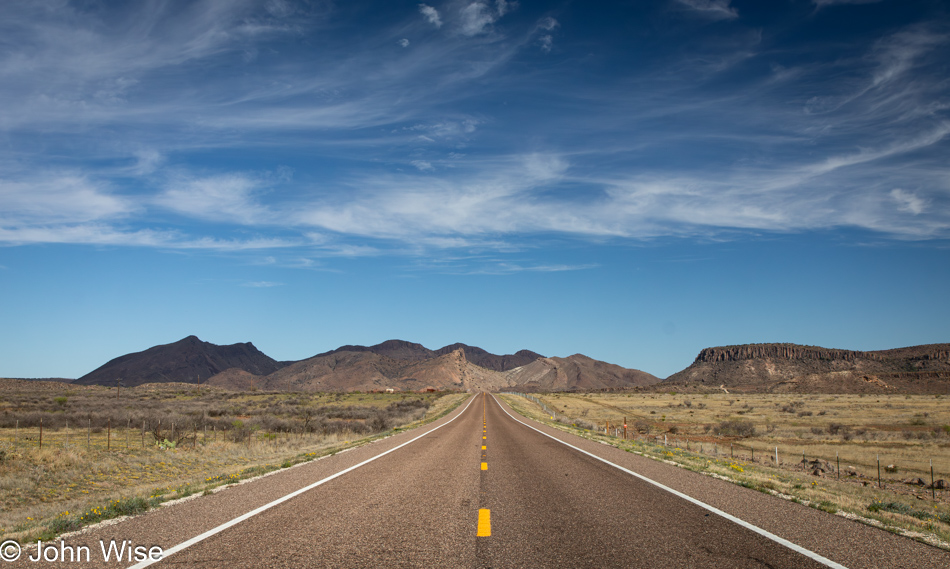
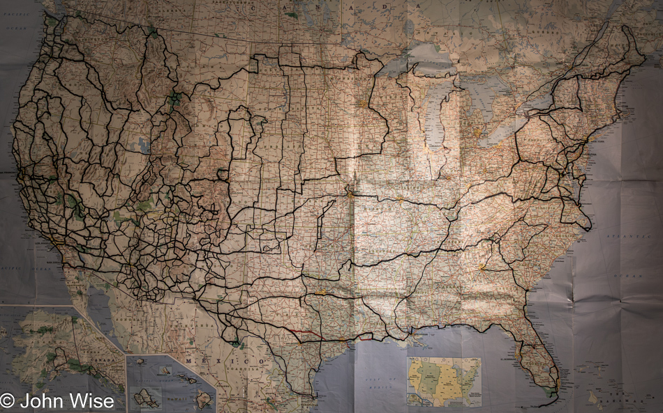
It’s been six years since I last updated our map here, and comparing that older image with this one, you’d be hard-pressed to find what new roads we’ve added. East of the 100th meridian, which is right about the exact middle of the U.S., has been poorly traveled by Caroline and I, and while we’d like to rectify those omissions, getting out into those places is a seriously laborious task. To reach the middle, we need to drive 1,000 miles into America requiring about 15 hours before things get underway. Of course, we could fly to somewhere, such as Dallas, Texas, for nearly $1,000, rent a car for about $1,000 for two weeks, or drive our own car and spend about $75 on gas for each direction, though we’d lose a lot of time. The idea of exploring areas on the map we’ve not seen in the South feels like a bit of a roll of the dice should we decide to commit more than $5,000 to wander places not known as having brilliant natural or historical destinations, aside from Civil War sites. If we opt for the northeast, we’d be inclined to hit some old favorites that would distract us from visiting the unknown, which has always been a large part of the joy we find in traveling.

While prices for airfare, car rentals, and hotels have tripled in the past 15 years, incomes have not. At this point, the question becomes whether it is better to throw that $5,000 and $5,000 more to spend three weeks in Europe instead of two weeks on American roads, where we may or may not find significance along the way. For $5,000, we can fly into Mexico City, Mexico, and have a luxurious adventure exploring ancient history and amazing food throughout the region while still coming home with $1,000 in our pocket. We also feel that we are excluding ourselves from many of the National Parks in America as more of them become overcrowded and require reservations. Just consider the Dry Tortugas in the Gulf of Mexico west of the Florida Keys: its campsites are sold out through March 2025. Travel no longer feels as easy as it once did.

Adieu Eclipse Adventure

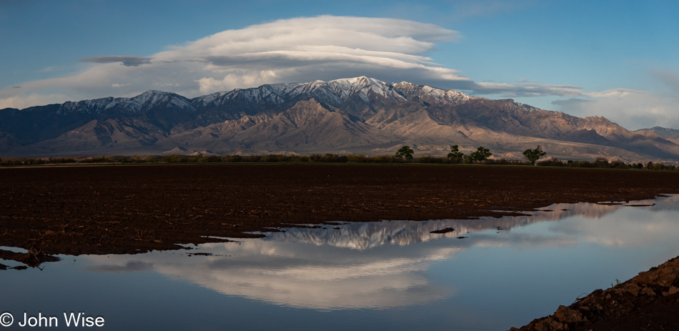
Mt. Graham in Safford, Arizona

After our lengthy ten-hour drive yesterday, we arrived back in Duncan, Arizona, quite late last night. With a heap of gratitude for Deborah and Clayton, we checked right back into the room we had left Saturday morning. With them out for vacation until the 14th, starting just a couple of hours after our departure, they had told us that our room at the Simpson Hotel would be left just the way we had left it and that if we wanted to stay in it again on our way home, we were welcome to it. For free! This would work out perfectly because, from here, we were only about 3.5 hours from home, allowing Caroline to get to work at a respectable hour and turn a PTO day (Personal Time Off) back in for a vacation later this year.

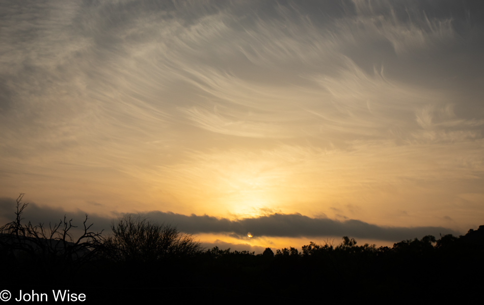
In all the years driving past Mt. Graham, neither of us could remember seeing lenticular clouds over the summit, and as I spotted the standing water in a field of freshly planted cotton, the setting was fixed to be captured. Fifteen minutes later, there were no signs of clouds over the mountains. Those with keen eyes can spot the observatory up there; it’s a small white dot to the right of the highest peak.

As I was about to close out this post, I was thinking about our next journey out of Phoenix, which, according to our itinerary, doesn’t happen until July when we are visiting Santa Fe, New Mexico, and that just doesn’t feel right. So, I brought up a map and gave some thoughts about May and June, and I’m coming up empty-handed. Such is the dilemma of those who prefer to travel away from the summer horde.

Incomprehensible Beauty

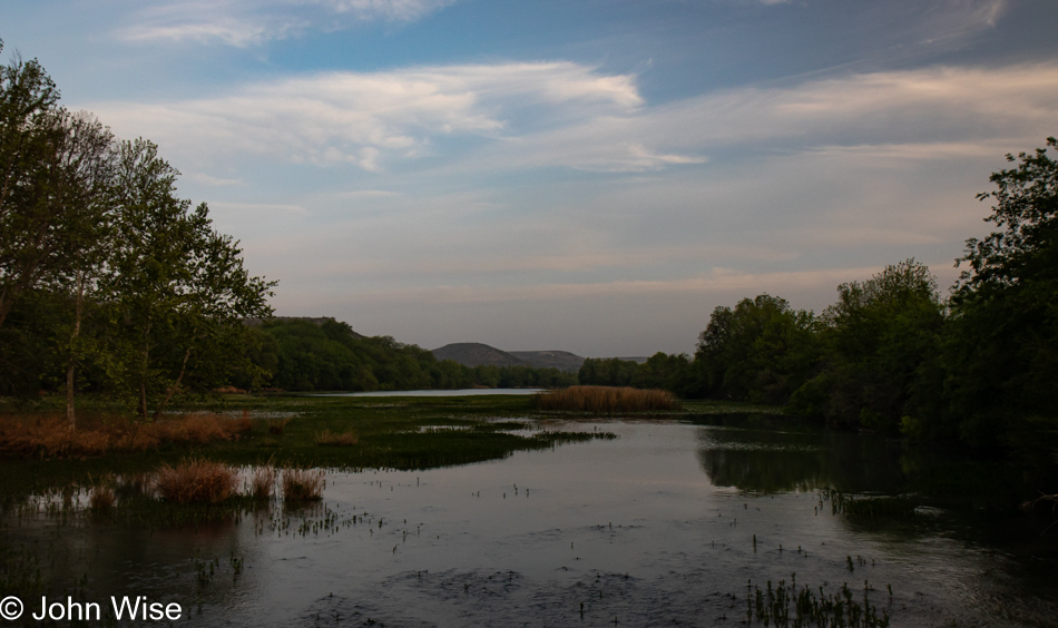
Devils River off Highway 163 in West Texas

Well before dawn, we left our motel and stopped at a gas station for a coffee, as that’s what there was for coffee in Ozona, Texas. This, though, was a fortuitous moment as we found a lucky penny we would come to be certain changed our day. The idea behind our early departure was to beat the horde we were sure would trek south into the Del Rio, Brackettville, and Uvalde areas. Well, here we are on our way south, and the horde has not materialized. Maybe the poor weather forecast kiboshed the plans of some of those 42 million people who were expected to venture out for this full eclipse that is the last one visible over the U.S. for the next 26 years.
Highway 163 in West Texas

A couple of hours later, we arrived at a coffee shop in Del Rio, Texas, less than five miles from Ciudad Acuña, Mexico, and about two hours from the start of the solar eclipse. We’ve driven 887 miles (1,427km) across the deserts of Arizona, New Mexico, and Texas to be here only to arrive under a seriously overcast sky with weather reports warning of severe storms in the area later today. Obviously, the sky in the photo here is not overcast, it was taken while still driving south to Del Rio.

With nothing else to do, we took up a perch at a table, with me busy playing the roles of both cantankerous Muppets Waldorf and Statler. Per my normal mode of operation, I’m grading my fellow human beings. Exactly how well they fit into that narrow definition regarding human characteristics is up for debate. First point of observation: the women here have not mastered the art of skin-tight booty shorts/leggings: you should either rock them commando-style or wear a thong because lechers such as myself do not want to see your panty lines digging deep into the girths you are shoving into your second skin. Next point, desert-sand-tan leather boots of one sort or other appear to be de rigueur for Texans unless you are a visitor from Florida, in which case you wear sandals. Californians appear to prefer running shoes.

There is certainly a nice diversity out here in West Texas and not a single person practicing their right to open-carry a weapon. Speaking of weapons, I’d briefly considered a side trip to Uvalde for some morbid tourism, but with nearly 900 miles ahead of us as soon as the totality passes, we’ll need to hit speeds approaching 150 miles per hour (240 km/h) if we are to make it back to Phoenix this evening before 9:00. Pardon me, not being in Germany, Google is estimating that we’ll need almost 14 hours to get home, leaving no time to take in a mass shooting site.
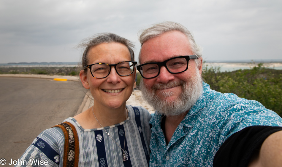
Caroline Wise and John Wise at Amistad Reservoir in Del Rio, Texas

Note the overcast sky behind us here at the Amistad National Recreation Area that was chosen as our viewing spot for the totality because it’s just a little west of Del Rio and significantly further west of Bracketville, our original destination. The weather forecast showed that there was going to be some breaking up of the storm clouds starting in the west, and as long we were still in the path of the totality, we figured it was better to be happy with a little more than two minutes of the full eclipse rather than risk seeing none of it. As for the selfie, I was supposed to share one of us during the eclipse, in the dark, but it turned out that having been rendered into blubbering crying babies by the sun in eclipse, or was it the shadow of the moon, that teary-eyed image I shot is not fit for posting here if I want to maintain my illusion of manhood.
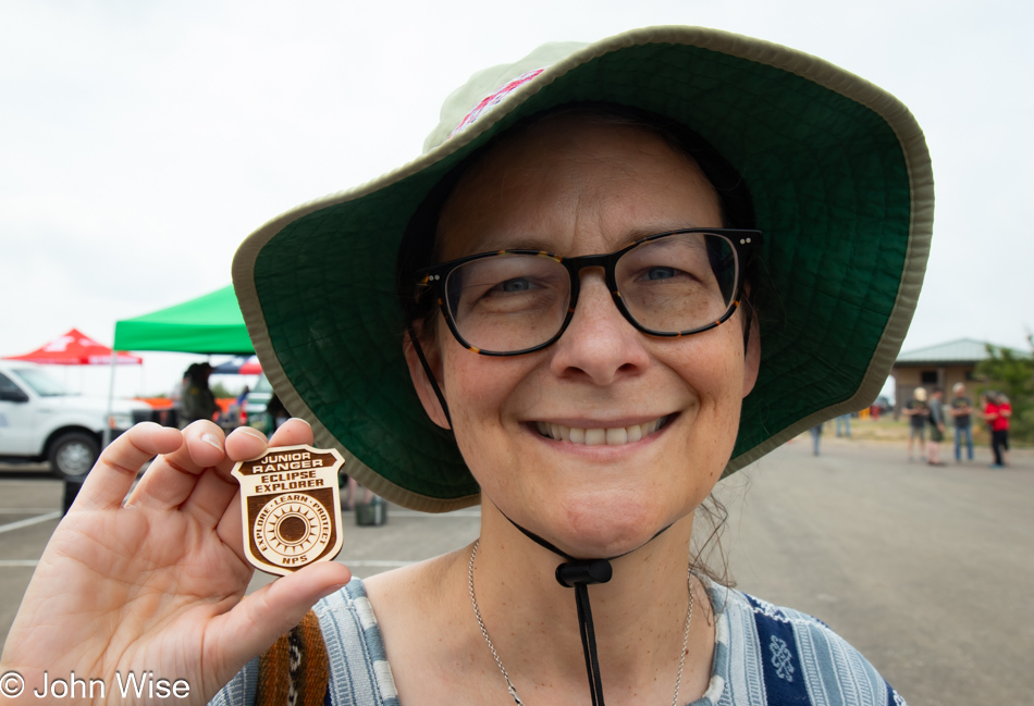
Caroline Wise at Amistad Reservoir in Del Rio, Texas

How lucky was our misfortune of having our destination shift at the last minute? By coming to the Diablo East section of the Amistad Reservoir, the park service was on hand to inform the public and help them see the eclipse, but it was this special Eclipse Explorer Junior Ranger badge that made everything worth it. Even had we never seen the sun itself, just adding such a rare badge to the collection would have meant the world to Caroline.
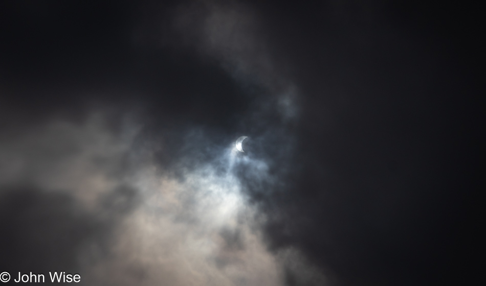
Eclipse as seen from Del Rio, Texas

It was about 12:15, when we noticed the moon starting to creep over the sun for the first time. The clouds were streaming overhead, and while this might look bleak, the photos I took with my DSLR without any filtering were turning out better with some cloud cover than those with clearer skies. Because I left Arizona with the idea that taking photos of the eclipse was the thing I was least interested in, I had not brought my 70-200mm lens, ND filter, and tripod so I could better focus on the matter at hand rather than witnessing it through my camera.
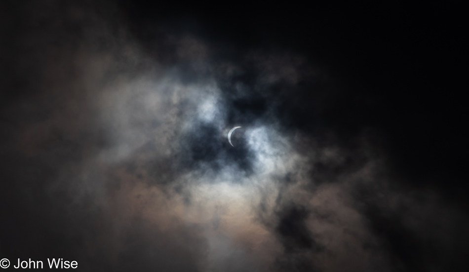
Eclipse as seen from Del Rio, Texas

With more than an hour between the start of the eclipse and totality, I had plenty of time to get a shot here and there, many shots actually, though most have ended up in the digital dustbin of history, never to be seen again. By this time, the excitement from the adjoining parking area, where the majority of star chasers were positioned, was palpable, with cheers going up every few minutes as the moon crept closer to blotting out the light of the giant hot disk in the sky.
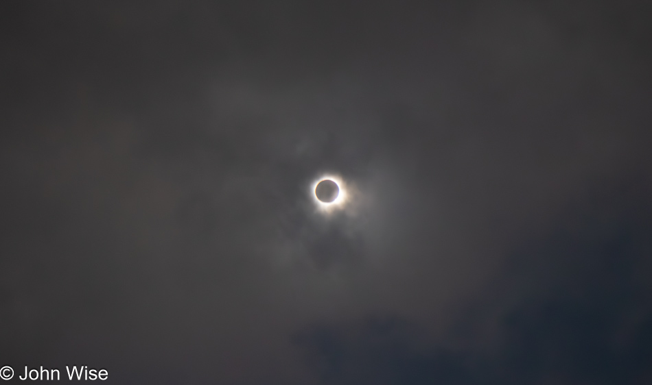
Eclipse as seen from Del Rio, Texas

Something unexpected happened on the way to falling under the full shadow of the moon, known as the totality; as the moon moved into position, the gravitational disturbance of some deep-seated primordial senses lingering in our bones punched the two of us, doubling us over in a stream of tears. Nothing bad, mind you; it wasn’t that we were seeing God and the second coming of his son ignoring our presence as if to notify us that we’d be dwelling in hell, nope, nothing like that. We were seriously overwhelmed by the incomprehensible beauty of watching the living prominence of the sun pulse and breathe in a manner never previously witnessed by either of us.
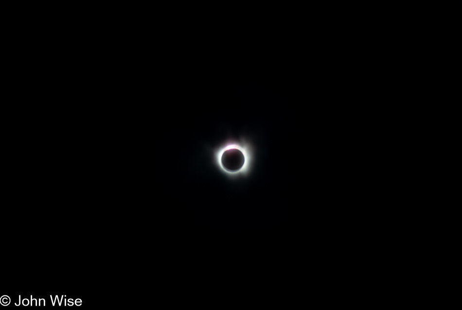
Eclipse as seen from Del Rio, Texas

Not having been prepared for the gargantuan emotional outpouring that seized us, all of a sudden, I was gripped by the wish to have the most exquisite record of this event so I might better reference the images and always remember where the universe took me today. As desperately as I desired a perfect artifact of this solar phenomenon, my senses never stopped telling me to focus on looking at the totality as I will likely never have the opportunity again to stare at the sun without filtered glasses and not damage my eyesight or go blind.

While staring at this incredible sight, one has to remember to also look around as it truly became dark all around us, so dark in fact that the lights of the parking lot had turned on. The orange glow on the horizon was also a sight to see, and while I tried taking photos of that beautiful view, the settings on my camera were set for taking pictures of the sun, and I couldn’t figure out how to change anything while enraptured in the state of weeping ecstasy I was gripped by. Take note, I wasn’t alone in this emotional outpouring; maybe we were even triggering each other to cry harder as we felt the others’ empathy and understanding of such a momentous event.

There were two moments of feeling that it couldn’t get any better: the first was at the beginning, when a seriously heavy amount of clouds moved in to block all sight of the eclipse and we thought we’d seen all of the totality we’d be afforded. Satisfied, we started looking around again at the general area until a roar went up from the large group that drew our attention back to the sun. The impenetrable cloud cover must have exploded because the sky was as clear as anyone could have dreamed of, we saw stars in the distance in the middle of the day.
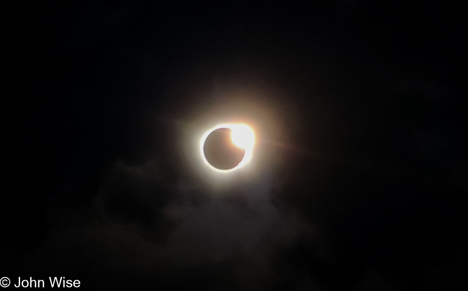
Eclipse as seen from Del Rio, Texas

The next moment of ultimate wow was the fabled diamond ring which I only barely captured here with my phone. This image does zero justice to what was seen with the naked eye. At this point, there was a kind of threat of madness that should we stare any longer into the absolutely ecstatic image of what was playing out in the sky, we’d simply have to dissolve from the intensity of it all. To say we were shaken would be an understatement. Never before in all of our travels, both geographically and psychedelically influenced, have either of us been taken to such an emotionally giddy place of euphoria. A week later, while writing these words, I can still feel the sting of my eyes as I recollect the fervor of sensations coursing through my heart and mind, struggling to make sense of such a rarity of experience.

Looking north from Interstate 10 east of El Paso, Texas

For 3 minutes and 28 seconds, Caroline and I were lost under the eclipse, hardly able to think, reduced to nothing but feeling. We left the area about 10 minutes after the totality with tears still threatening to spill from eyes full of the immensity of that incomprehensible beauty, and for the next 45 minutes driving up the road, the knot in our throat remained ever-present. In hindsight, it could have only worked out this fortunately because of that lucky penny found at the start of our day. As for the rest of the day, nothing else mattered.
The Incredibly Monotonous Permian Basin

North of Alpine, Texas

Leaving the hills and canyons of the Alpine, Texas, area for a drive north, we were soon entering the Permian Basin. Maybe we were always in the basin as it stretches in all directions for a total of 86,000 square miles or 250 miles (400 km) wide and 300 miles (480 km) long. Our path is being dictated by roads not previously travelled by us that we had tried to identify by looking at a very low-res image of our Map of America shared here on the blog in 2018. After we get home from this trip, I’ll be posting an updated map of the roads we’ve driven over that includes last year’s trip up the middle of the U.S. and the roads we’ll travel today.

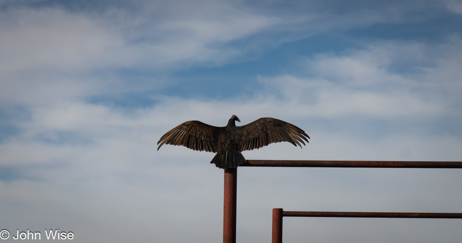
Buzzard seen north of Alpine, Texas

After passing by this “ornamental sculpture,” we needed to turn around to determine if we’d seen what we thought we had. Pulling up after a quick U-turn, the buzzard had pulled its wings in but once again threw them back out. Obviously, it was not a sculpture. A buzzard buddy was also perched nearby, warming his wings in the sun, but I couldn’t fit the two in a single shot, nor could I capture a more detailed image as lazily I had taken only a single lens with us on this trip. As a matter of fact, I didn’t bring my tripod either, which will hurt my ability to take pictures of the main reason we are on this trip; more about that tomorrow.

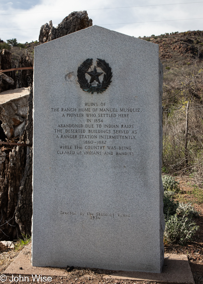
Proud of oppresion in rural Texas

Is that three bullet holes that have chipped into the historical marker that’s making me hysterical? This sign from 1936 celebrates the clearing of Indians and bandits back when the “country” was being cleared of those scourges. The land didn’t need clearing if it wasn’t for the invading hordes that wanted an abundance of free lands that those pesky Indians didn’t hold a title to. Maybe I’m just too woke, but I find it an affront and demeaning to Indigenous Americans to equate them with bandits and the suggestion that they needed to be pushed away in any case.

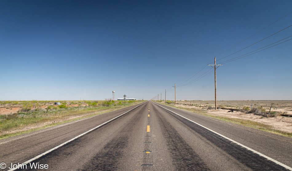
Highway 17 south of Pecos, Texas

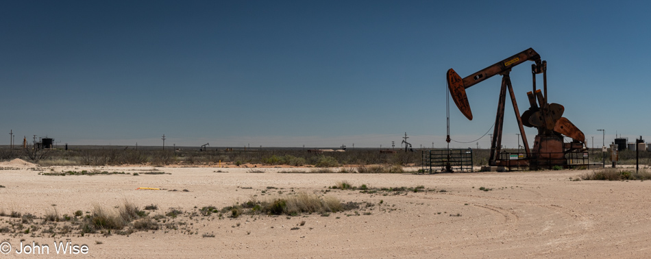
The area we were out traversing from about Saragosa, Texas, to Hobbs, New Mexico, is home to the incredibly monotonous landscape that is nothing but dirt, oil and gas wells, and sellers of brine. Brine is a salt solution used by the mining industry; we had to look that up. This is pretty much what everything looks like in the Permian Basin.

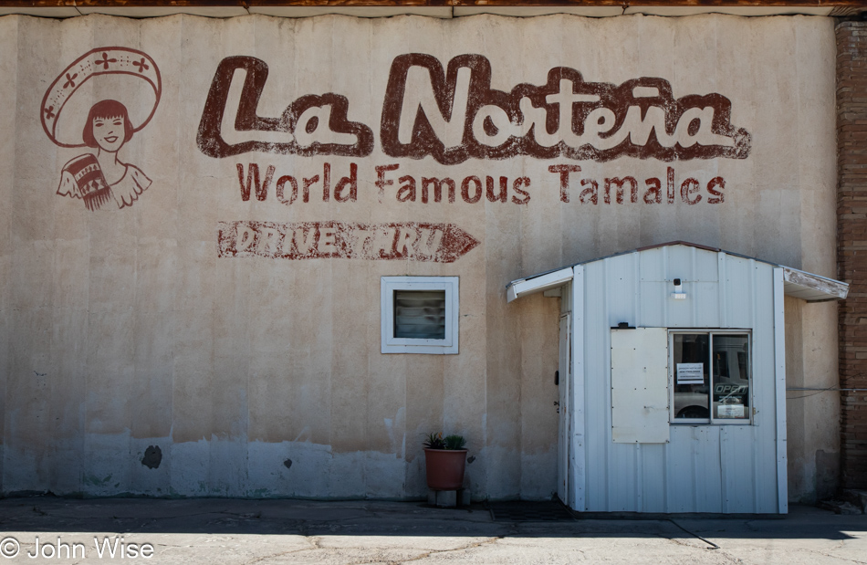
La Norteña Tamales in Pecos, Texas

This was a coup that only happened due to the demands of the bladder. After stopping at a gas station here in Pecos, Texas, Caroline was admiring a sign next door and said she wanted to take a photo of it. Often, when I hear that, I’ll also move to take the same image using my DSLR, should her sense of the aesthetic have been correct, and later, I regret not having taken the same photo with a better-quality camera. Good thing I did because after taking this, I wandered to the front of the building believing that La Norteña Tamale Factory was closed due to the open sign being off in the drive-thru, but sure enough, they were open. I ordered a couple of tamales for each of us, one green chili chicken tamale and the other a spicy red beef. Back on the road heading north, we shared one of the green chili tamales and immediately turned around to return to the shop.

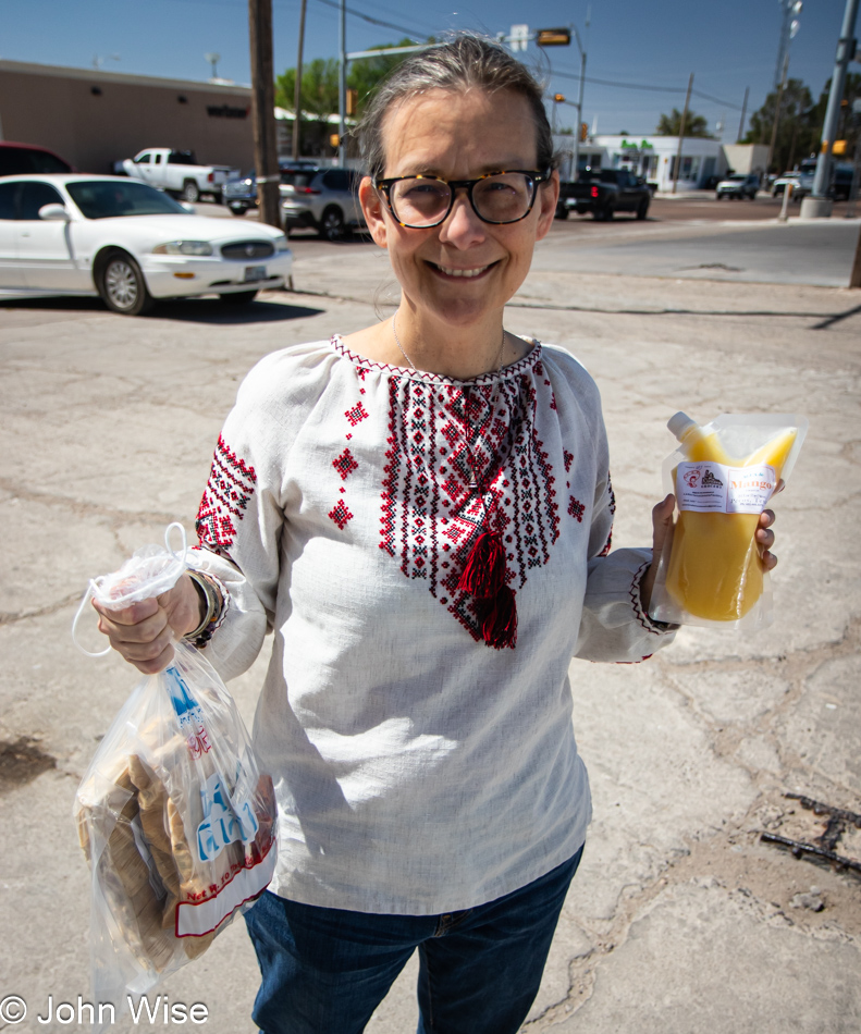
Caroline Wise at La Norteña Tamales in Pecos, Texas

We did not go back to register a complaint; we were not unhappy. On the contrary, we were ecstatic that a $2 tamale should be so amazingly perfect. That’s right, perfect. Our return was to collect a dozen of the green chili chicken and a dozen of the Hatch chile “Rajas” tamales, along with a packet of spicy peach ring candies by Nooshka’s Candies. Beaming with enthusiasm and exclaiming our delight, the owner came out of the kitchen to thank us and explained that the quality of everything they offer is due to the efforts of the amazing staff. Before we left, he generously gifted us with a melon/mango aqua fresca. Good thing we brought the ice chest with us on this trip.

Oilfield near Jal, New MexicoFarther along the road, the smell of gas permeated the area on occasion while we also drove through wafting invisible clouds of more fragrant petroleum. At least petroleum is somewhat interesting smelling, whereas gas is anything but. The eye sees sand, low bushes, discarded and unused equipment, and 10,000 pickup trucks interspersed between countless tankers and various other semi-vehicles, pulling and pushing every manner of equipment across the otherwise barren land.
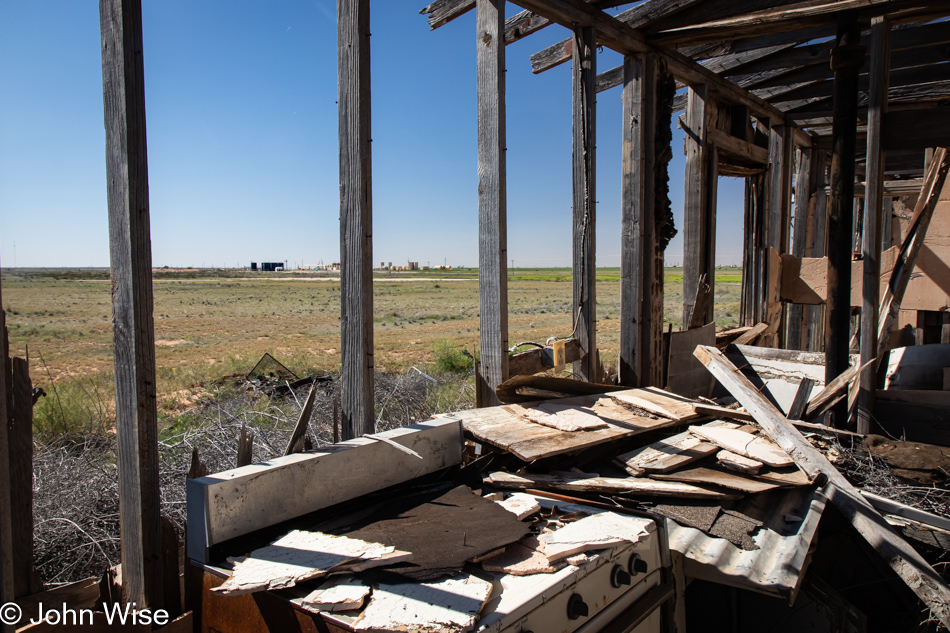
Ruin on Highway 62 Eastern Texas

With nearly 150 miles (240km) driving north before turning east for more of the same, the majority of our day was spent in this seeming wasteland with no redeemable qualities other than being an epicenter for economic activity that contributes to an incredible resource wealth for Texas and New Mexico. Well, that stuff and the town of Pecos with those tamales.

Near Seminole, Texas

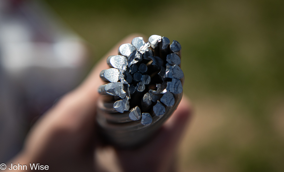
Big-time nerd action was had on the side of one of the roads we traveling when we stopped to watch a crew working on electrical towers putting up high-voltage transmission lines. We kept our distance until I noticed one of the guys starting to cut a cable, and I asked if we could see the cable up close; he said we had to keep our distance, but he then cut off a length of the aluminum and steel cable and brought it to me. Sadly, it was too long to fit in our car, and he’d already moved on, so there was no asking him for a shorter piece. No matter; we were as happy as if we’d spotted wolves in Yellowstone.

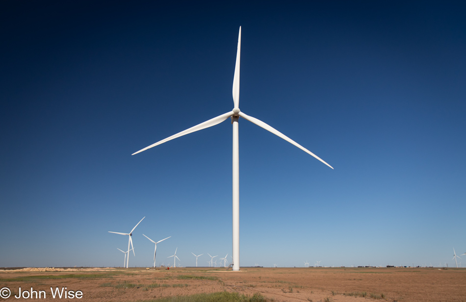
Wind Turbine South of Stanton, Texas

While much of the Permian Basin is this flat, dry environment with sporadic areas that are farmed, the area is big on energy extraction of not only oil and natural gas but of wind too. With about 2 billion barrels of oil produced worth around $150 billion annually and 10.5 trillion cubic feet of natural gas extracted worth about $38 billion, the wind might be a small part of the economy, but still, they are producing about $6 billion of electricity by harnessing this resource.

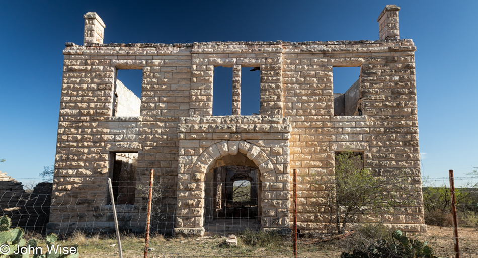
Stiles Courthouse in Big Lake, Texas

On the side of State Highway 137 near Big Lake, Texas, stands the old Stiles Courthouse which is looking like it won’t be of this world much longer. If this was part of a larger town at some point in the past, evidence of that is hard to see out here. The building was still in use in 1966 by the highway department before being abandoned. In 1999, an arsonist burned it after two previous failed attempts.

Ozona, Texas

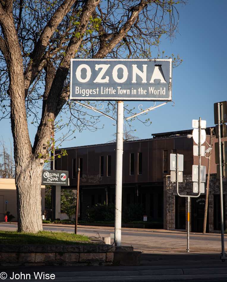
Twenty-four years ago, while returning from our first cross-country road trip, we passed through Ozona, Texas, and took a photo of this sign; you can see it by visiting this ancient page from that trip. Tonight, we are staying here in Ozona. By the way, our original attraction was due to the sound of the name of the town, which reminds us of our home state, Arizona.

Desert to Desert

Dimitri at Simpson Hotel in Duncan, Arizona

Good morning, Dimitri! Nice to see you here on your perch, and thanks for guarding the parlor of the Simpson Hotel from intruders overnight. When we got in last night, the table I sat at for writing on my previous visits was set for dinner as we were joining Deborah, Clayton, Gavin, and Richard for dinner to celebrate Richard’s birthday. While Dimitri wasn’t uninvited, he was nowhere to be seen, which was just as well, as there wouldn’t have been enough cake to go around.

Stuffed owl at Simpson Hotel in Duncan, Arizona

This is not a writing trip but a respite from the task, which meant that we slept in, as much as remaining in bed until 6:00 a.m. can be considered sleeping in. By the time we emerged from our ablutions, Furry the Owl, a friend of Little Burrowing Owl who lives in a hole in a field on the outside of town next to their friends, the ground squirrels who live in a nearby mound, was surprised we hadn’t shown up earlier. We informed Furry that we’d been distracted by dreams that saw us looking to the clouds for the red-tailed hawk so we could warn everyone of its presence with chirping sounds. Or was all of that part of a dream? The more likely truth is that Clayton was the one surprised that he was downstairs in the kitchen well before my arrival in the parlor and then shared the song Little Burrowing Owl, from Mr. Elephant with us, which influenced this narrative and subsequently lodged itself in our ears like a worm for the duration of our adventure to stand under the shadow of the moon that promised to blot out the sun in two days.

South of Deming, New Mexico

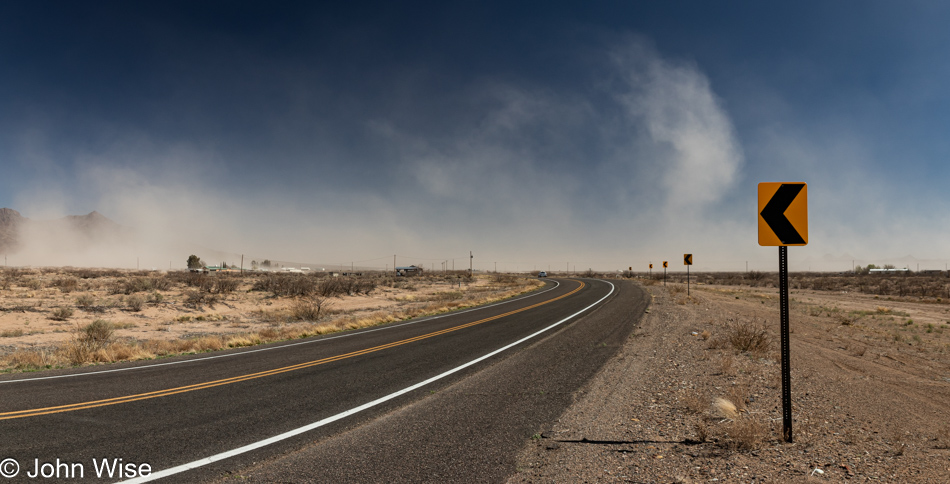
A surprise road we’d not traveled previously became the route we’d journey on today as we were informed about a major freeway construction project on the west of El Paso, Texas, that we could bypass if we took this southerly trail. Prior to reaching this dusty stretch of highway, Caroline and I had traveled out of Duncan over to Silver City, New Mexico, to visit with old friends Tom and Sandy. The time spent out their way was brief, but we had to consider the two hours we’d lose today going east. This photo was taken about halfway between Deming and Columbus, New Mexico, on Highway 11, and as you might be able to guess from all the dust in the air, it was seriously windy out here in southern New Mexico.

Columbus, New Mexico

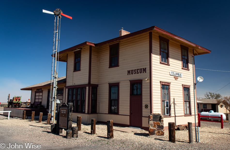
This is the oldest building in Columbus, New Mexico, dating from 1902. Operating as a train depot until 1960, when the line was closed with the track and ties sold off, it is now the local museum next to Highway 9, which used to be the route of the train.

Mexican border wall in southern New Mexico

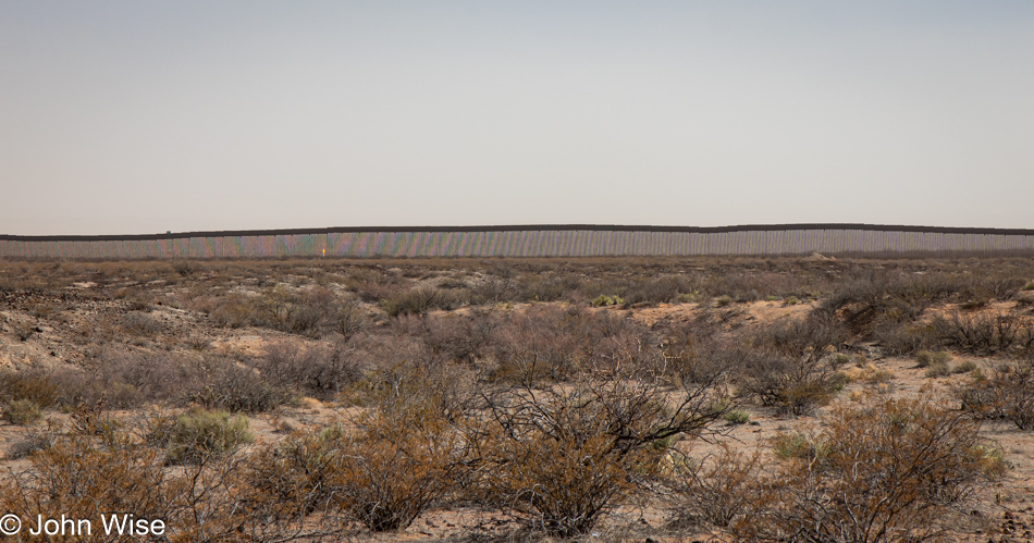
That’s the infamous fence protecting us Americans from the invaders from Mexico who arrive to steal our jobs. While I’m mostly in agreement that people should take the proper steps to emigrate to the U.S., there are pathways for that to happen for those who are well-qualified and educated to bring skills to our country, but we have millions of dirty jobs that average American’s do not want, and this is where those less-fortunate souls to our south come in to take “all of our jobs.”

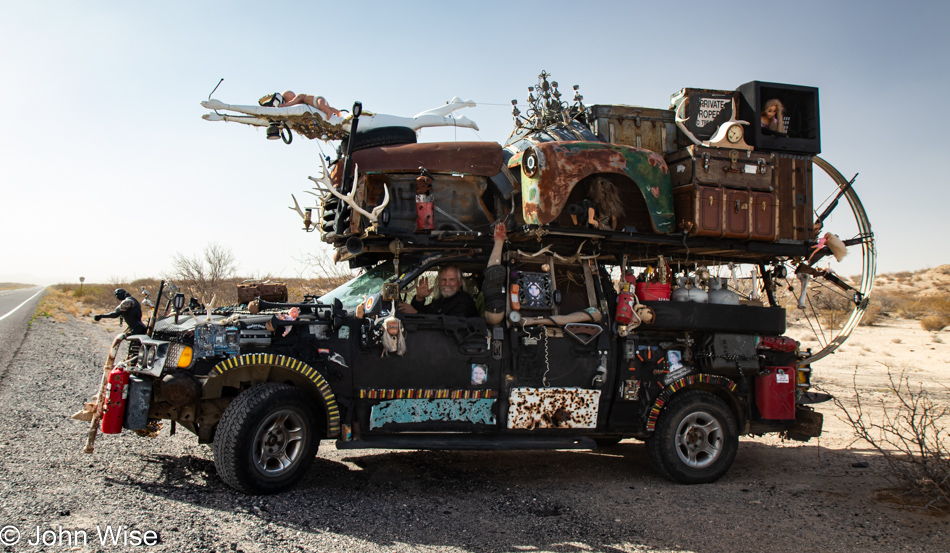
Art Car in southern New Mexico

We passed this art car at 80mph and whipped a quick U-turn to catch the guy before he pulled away. Weapons, ammunition, odds and ends, a couple of images of Greta Thunberg, mannequin parts, antlers, and assorted car parts made up this oddly balanced vehicle out here next to the Mexican border.

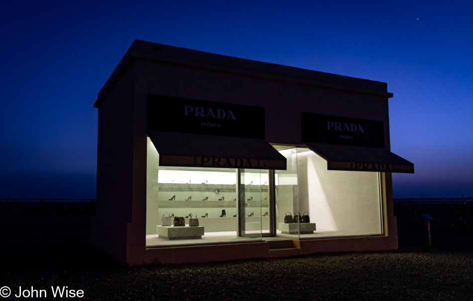
Prada Store in Marfa, Texas

It turns out that it’s been 22 years since Caroline and I last passed through this corner of Texas on a trip that took us through Valentine, Marfa, and Terlingua down to Big Bend National Park. This famous Prada Store art installation outside of Marfa didn’t show up until 2005, a few years after our visit.

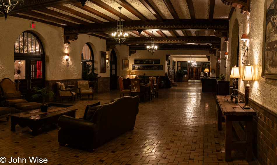
The Holland Hotel in Alpine, Texas

The historic Holland Hotel, built back in 1928, was where we were checking in to spend the night. Of peculiar coincidence, Deborah and Clayton of the Simpson Hotel are also staying here this evening before continuing eastward to San Antonio, Texas, in the morning. They were a few hours behind us, which had us staying up writing and knitting before they arrived around midnight, as we didn’t want to lose the opportunity for this chance encounter with the proprietors of the Simpson so far away from home.

Looking for Star Light

Mt Graham in the distance on the way to Duncan, Arizona

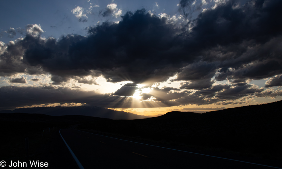
We are traveling in the general direction of where millions of others are going: to the eclipse. Months ago, when we snagged a motel room outside of the eclipse totality. We knew we’d be positioning ourselves a couple of hours north of where we wanted to be with the hope that the drive to our destination wouldn’t be a road of mayhem. The booking in Ozona, Texas, was hundreds of dollars cheaper than in the path of the totality, where we were seeing places that would have normally cost about $100 a night going for close to $1,000 for the evening of April 7th, 2024. Flights into the areas of the totality were also too pricey, so we are driving, which is what we were doing when I snapped this image of the setting sun. Once again, we are staying out at the Simpson Hotel in Duncan, Arizona, right near the New Mexico state line.

Happy New Year From Out Here

Simpson Hotel in Duncan, Arizona

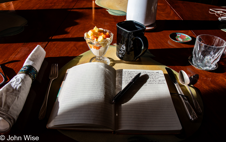
Happy New Year, and welcome to 2024. I took up my place in the first sunlight of the day while Clayton was busy in the kitchen making coffee and presenting us with a parfait breakfast starter.  Caroline is on the phone with her mom in Germany, and I try basking in the warm sunshine while writing, but enjoying the ambiance of the Simpson Hotel is a powerful distraction.

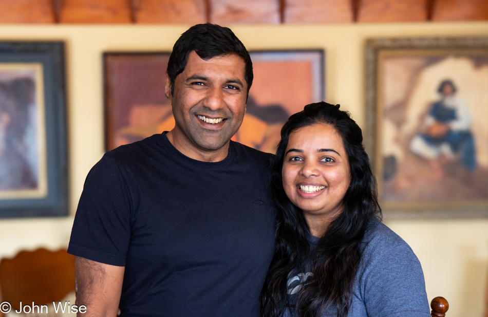
Karthik and Lakshmi at the Simpson Hotel in Duncan, Arizona

A newly married young couple who arrived last night joined us for our morning meal: Lakshmi and Karthik, who also live in the Phoenix area. They’ve been out wandering around the area for the past week, trying to get more of the Southwest into their senses before Karthik takes off for India to deal with some of the beaurocracy involving working on an H1B visa. While he’s gone, Lakshmi will be dealing with their move up to the Portland area. When they told us about their travels from the Petrified Forest to Gallup, over to Santa Fe and Albuquerque in New Mexico, and various points between before finally landing in Duncan, Arizona, it was nice to see a mirror image of Caroline’s and my enthusiasm for sharing time together exploring our world. In the popular vernacular of the day, they are vibing. Over breakfast, sumptuous as always, we discussed the drive home, in which all four of us were traveling in the same direction but talked of a detour through Virden, New Mexico, to try catching sight of some sandhill cranes.

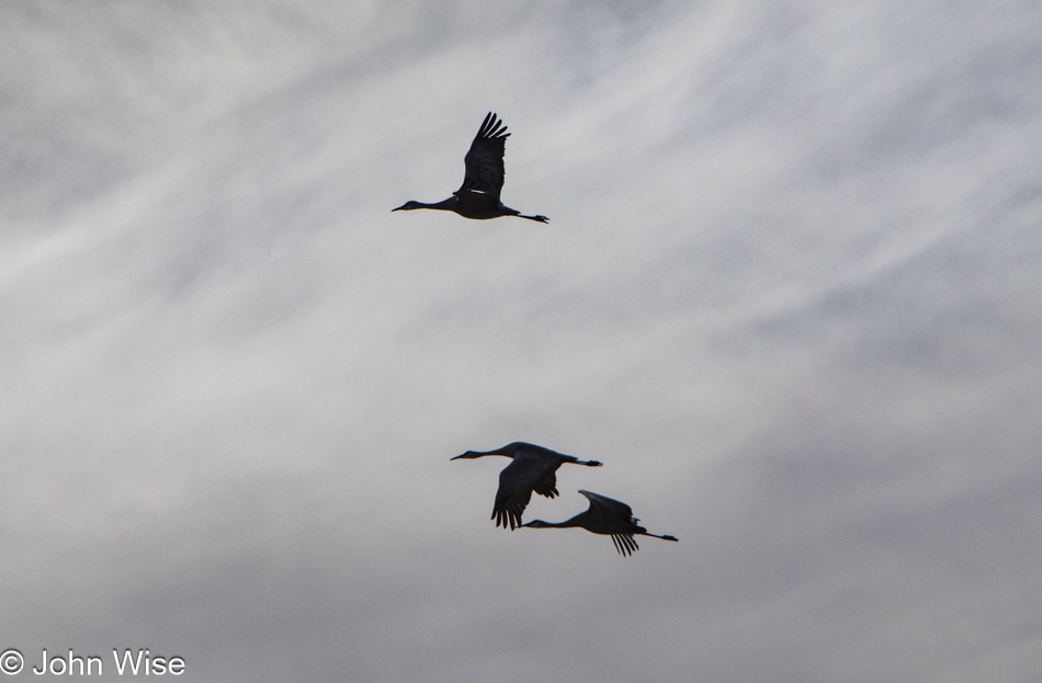
Sandhill Cranes in Virden, New Mexico

These large birds were in short supply, and the ones we did spot were quite distant from where we could observe them. We’d brought binoculars, but even so, nobody got a great view of the cranes. No matter, we’d seen wildlife and were able to share some enthusiasm with Lakshmi and Karthik about how incredible these opportunities are.

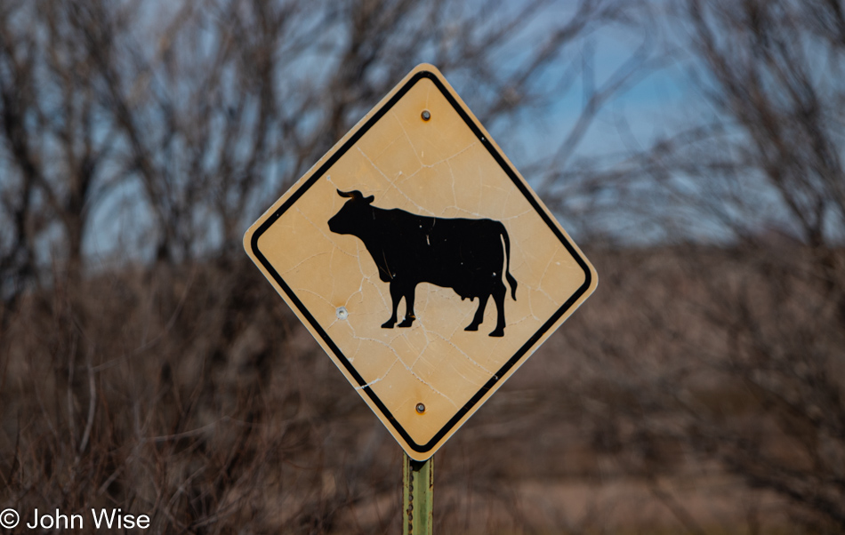
Cow sign in Virden, New Mexico

With nothing left to do, and instead of trying to wedge something else into the last minutes of our getaway, we accepted that our long weekend was coming to a close and that by focusing on the drive west, we’d be able to go further into In Search of Lost Time.

On a final note, Clayton left us with a quote from historian Charles A. Beard to ponder: “The bee fertilizes the flower it robs.”