New Mexico – Into the 4th of July

Somewhere near Albuquerque, New Mexico

This is another one of those blog posts to emerge out of the distant past as it’s summer 2022 when I rediscovered the directory of photos that languished for the intervening years. With no notes and no itinerary, we had to rely on Caroline’s sleuthing skills to identify landmarks in our photos.

Somewhere near Los Ojos, New Mexico

We knew from the photos that follow that we were in the Chama, New Mexico, area, and you’ll see the reason in the posts for the 4th and 5th of July, but we were initially preoccupied with how this day evolved. Where did we start, and where did we finish?

Heron Lake State Park in Los Ojos, New Mexico

A body of water helped in that we could scan north-central New Mexico and isolate the area to about 100 miles around Chama.

Caroline Wise at Heron Lake State Park in Los Ojos, New Mexico

Not only does she have beautiful eyes, but she has an eye for finding stuff as it relates to maps. Just forget the idea that she’s good about finding her own stuff in close proximity to where she sets things down.

Heron Lake State Park in Los Ojos, New Mexico

It was this escarpment that turned out to be key and allowed her to verify that we were at the Lake Heron State Park near Los Ojos, New Mexico.

The moon as seen from Heron Lake State Park in Los Ojos, New Mexico

So, maybe our day started in Gallup, Grants, or maybe even Albuquerque, and we’d left the night before to get the bulk of the driving out of the way? Nope, with Gallup only 4.5 hours away from Chama, we’d never have taken so few photos along the route. This can only mean that we were intent on making a lot of miles and simply never stopped so we determined that we had to have begun the day in Phoenix and driven the 495 miles over the course of the entire day.

Update: well, that’s what I thought when I wrote this last paragraph, but then upon consolidating a bunch of Caroline’s and my photos, I discovered a couple of videos Caroline shot from the passenger window of the landscape that shows us traveling north. With the time of the videos being shot at about 7:00 p.m., I’m gonna guess we stayed somewhere between Flagstaff and Winslow, meaning we would have had about a 6-hour drive to Chama, which kind of then makes sense why there were so few photos.

Heron Lake State Park in Los Ojos, New Mexico

With this out of the way, I can start taking a look at our 4th of July festivities that remained out of sight for the past 13 years.

Seeya Later

Jessica Aldridge (Wise) with her great great aunt Eleanor Burke

Today my family shrunk by one great big wonderful soul, Auntie, also known as Eleanor Burke passed away. This grand lady strode into life in 1912 and from 1963 onward (the year I was born) offered me a smile every time I would be so lucky to have shared a moment with her. Before Auntie’s passing, my daughter Jessica had one more chance to visit with her great-great-aunt, and shortly after that my mother-in-law on a visit from Germany also had the opportunity to spend some time listening to stories recounting a wonderful life in Buffalo, New York. Caroline and I last saw her in the hours before she departed. Not only was she a sweet 97-year-old lady, but she was also a terrific lady her entire life. Click here to view one of my favorite photos of Eleanor.

Jutta at San Pedro Fish Market

Jutta Engelhardt at San Pedro FIsh Market in California

This is one of those blog posts that had to be revived from the dead, as it never existed until mid-2022 when I recognized a lone directory of only eight images.

It was late morning / early lunchtime on a Friday when we showed up at the San Pedro Fish Market in southern California.

Caroline Wise and Jutta Engelhardt at San Pedro FIsh Market in California

Apparently, we were trying to beat the crowds, and from the time of day that I took these photos, we obviously spent the night before in California, but I have no supporting documentation nor any photos following that showed what we might have been doing over here on the weekend. I can surmise that we were visiting family in Santa Barbara, but I’m not certain. With my great aunt Eleanor having passed and the family gathering around her in the previous days, combined with a faint memory that my mother-in-law was starting to suffer from the Arizona heat of summer, we may have just cut things short and sent Jutta home early. Whatever the sequence of events was, they are lost in time, other than we feasted next to the sea this particular Friday morning.

Update: I found Jutta’s original flight info that showed her returning to Germany on July 10th, but Caroline and I ended up traveling over the 4th of July, and Jutta was definitely not with us on that trip, which means she’d already gone home.

Wandering the Old West with Jutta – Day 2

Hackberry General Store in Hackberry, Arizona on Old Route 66

As I explained in yesterday’s post regarding this wander into the Old West, these images and memories did not find their way to being published until August 8th, 2022. Forgive me if they are sparse on details, but we had no notes or itinerary in the archive to spur our thoughts.

While I’ve shared a dozen of the best photos from this day, there were enough details in some of the other images to extract locations. Maintaining our exploration of Route 66, our first stop was here at the Hackberry General Store in Hackberry, Arizona.

Jutta Engelhardt at the Hackberry General Store in Hackberry, Arizona on Old Route 66

The place was still closed as we were simply too early for normal human beings to venture down the road, which is okay with us as then the whole world is ours alone. As we walked around the place, Jutta spotted this sticker from Magdeburg, Germany, which is the city in which she was born back on July 25, 1935. This means my mother-in-law was nearly 74 years old during this visit; gotta admire her stamina.

Old Route 66 between Hackberry and Truxton, Arizona

Now that we got the fact that my mother-in-law, who was older than stones, had that connection to home, we got back to wandering the dusty trail.

Frontier Motel at 16118 E Hwy 66 in Truxton, Arizona near Peach Springs

Following the theme that the old motels we once entertained staying at close before we get to them, the Frontier Motel in Truxton, Arizona, near Peach Springs, is now long out of business.

Indian Road 18 between Peach Springs and Havasu Falls, Arizona

Blink, and you might miss Indian Route 18 in the direction of Supai.

Indian Road 18 between Peach Springs and Havasu Falls, Arizona

No, I did not photograph these whispy clouds just so I could rainbow colorize them in Photoshop at some point in the future; this is just what we saw.

Trail to Havasu Falls on the Havasupai Nation in Arizona

We are approaching the parking lot for the trailhead to Havasu Falls on the Havasupai Reservation.

Trail to Havasu Falls on the Havasupai Nation in Arizona

Our objective is not to take a mid-day 10-mile hike to the falls; nope, we are just out here for the views.

Caroline Wise on the Trail to Havasu Falls on the Havasupai Nation in Arizona

Okay, just a little bit of trail, as in maybe a couple of hundred feet, but that’s it.

Old Route 66 halfway between Peach Springs and Seligman, Arizona

And then back the way we came, except now we travel with an appetite.

Delgadillo's Snow Cap in Seligman, Arizona on Old Route 66

There’s so much more to visiting Delgadillo’s Snow Cap in Seligman, Arizona than random smiley face potato things in your french fries, but capturing the antics of the staff is a difficult one. Back in 2002, on a camping trip next to the Colorado River, Caroline and I had our first encounter with the owner, Juan Delgadillo, and consider ourselves lucky to have met this charismatic man who passed away two years after that visit.

Jutta Engelhardt and Caroline Wise at Delgadillo's Snow Cap in Seligman, Arizona on Old Route 66

And that concludes our brief wandering around the Old West.

Wandering the Old West with Jutta – Day 1

Burro Jim Motel in Aguila, Arizona

This is another one of those blog posts that might have never been if it weren’t for my desire to build a comprehensive index of all of our travels. For more than a few years, I’ve been returning to old directories of photos and teasing out the exact days we were away from Phoenix. On more than a few occasions I find trips of which not a word or photo was ever shared. While on a lot of old posts, there were a minimum of images due to bandwidth issues at the time; I’m flummoxed how some trips never found their way up here. So here August 8th, 2022, I’ve brought together the best photos from this quick two-day getaway, and now I have to craft something or other to say because there’s nothing.

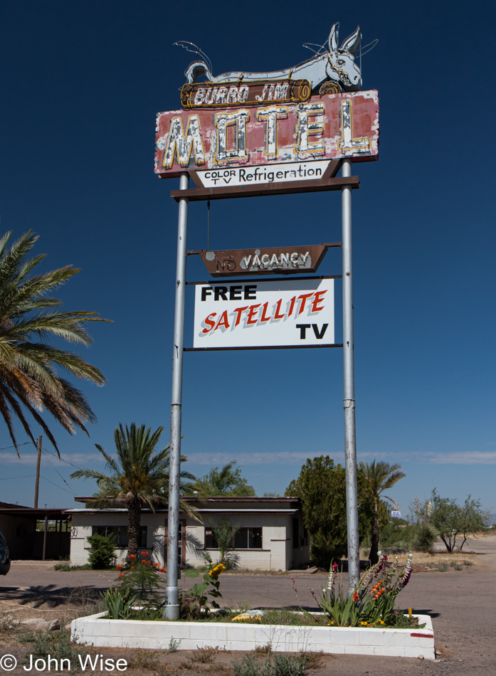
First up is an easy one; you see, back in 2001, Caroline and I passed right through here. On that day, this sign appeared to still be perfect, but here on the day I’m writing this in 2022, the Burro Jim Motel in Aguila, Arizona, is dead and gone. Click here to visit that trip from 2001.

Sunset Motel in Wenden, Arizona

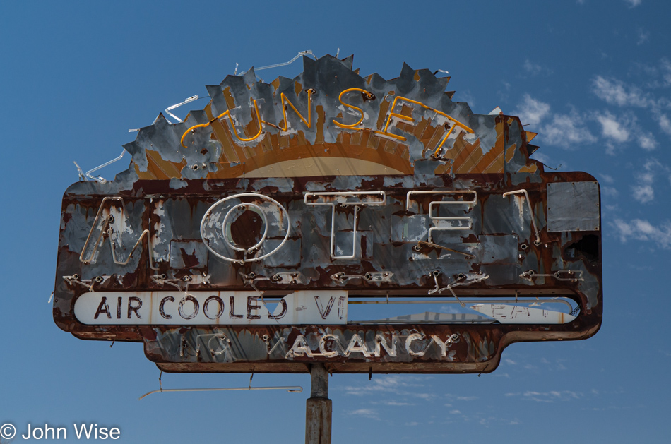
The Sunset Motel in Wenden is defunct, too, though it probably was so even back in 2009. Knowing that we were traveling from Phoenix to Aguila and then Wenden allowed me to start determining the direction of our trip, and that made it a bit easier to put things back together.

Old horse tie-up and ruin in Salome, Arizona

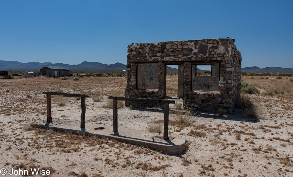
I’ve looked for information about this old stone building with horse tie-ups still out front here in Salome but have never found anything.

Hope, Arizona

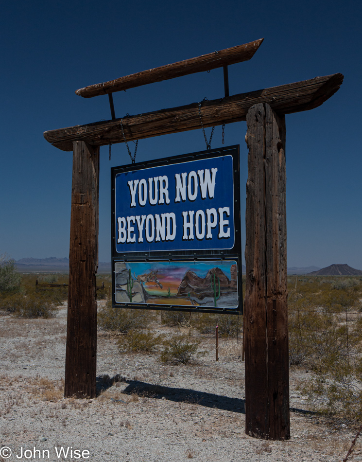
You enter Hope and just as quickly are leaving Hope behind.

Old Brayton Ghost Town & Museum near Bouse, Arizona

Old Brayton Ghost Town & Museum near Bouse, Arizona, was already fading fast here in 2009, but somewhere between then and 2022, it was removed from the map.

Old Brayton Ghost Town & Museum near Bouse, Arizona

This old stuff makes me curious about driving out this route once again and seeing how things have changed in the intervening years. Heck, for all I know, I’ll stumble upon another directory of photos featuring this exact trek.

Near Parker, Arizona

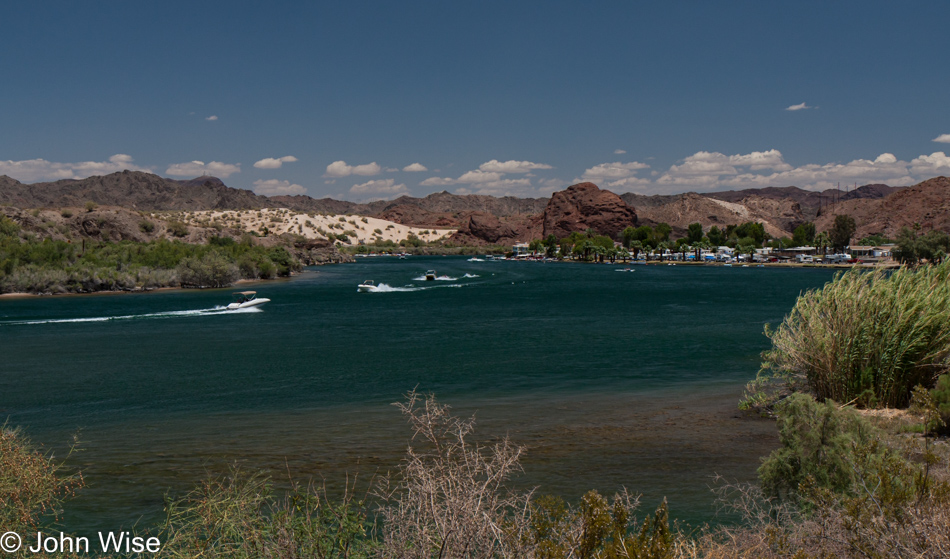
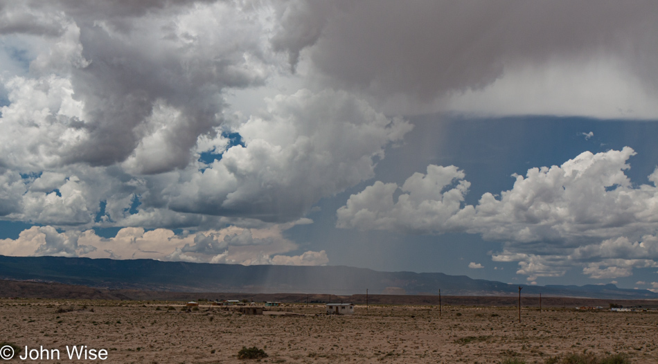
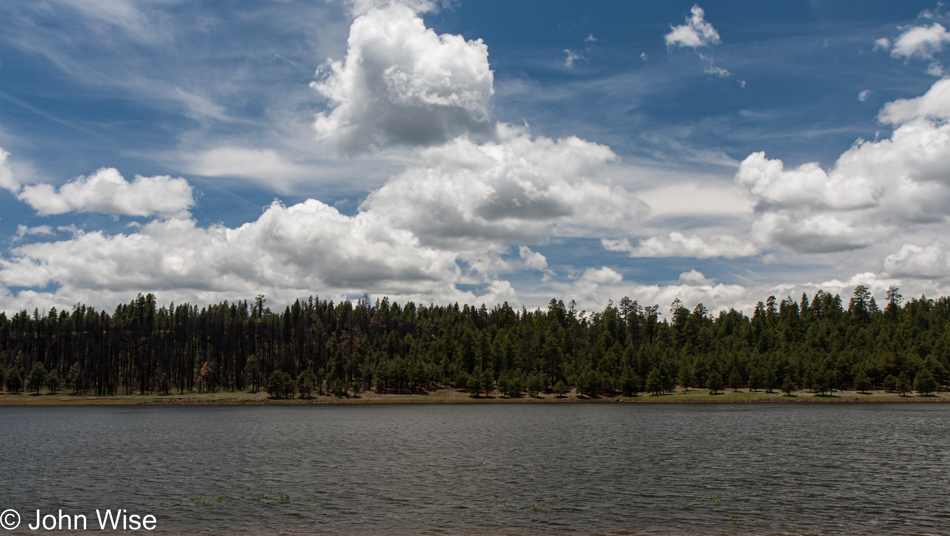
That’s the Colorado River with California on the left and Arizona on the right. We are traveling north on State Route 95.

Bill Williams National Wildlife Refuge near Parker, Arizona

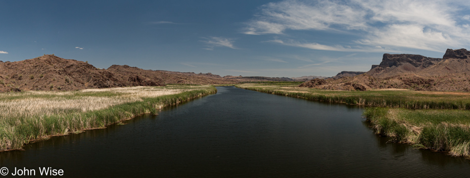
This is the Bill Williams National Wildlife Refuge, and in the over 25 years we’ve lived in Arizona, we have yet to hike its short trails; this must be fixed.

Jutta Engelhardt and Caroline near Parker, Arizona on Knitting in Public Day

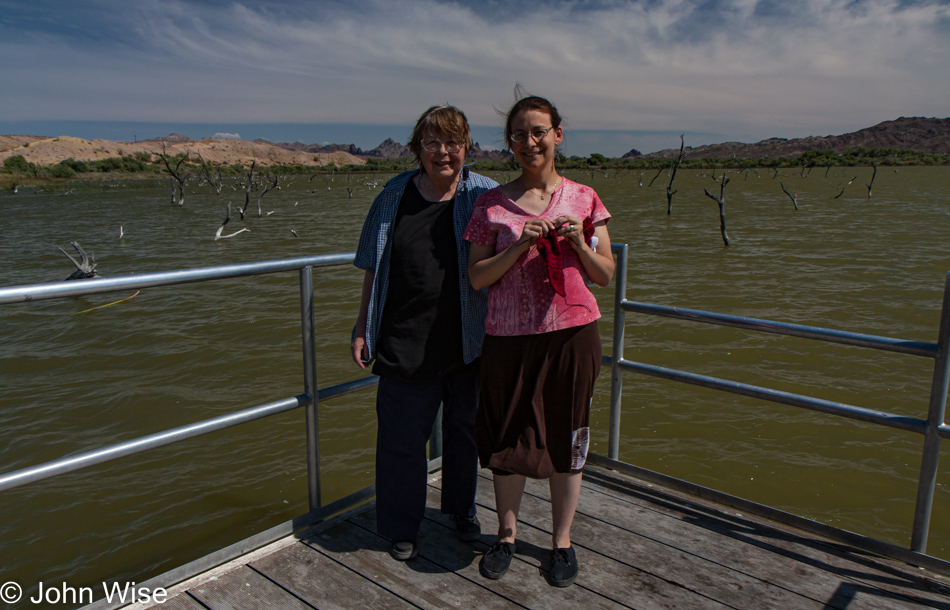
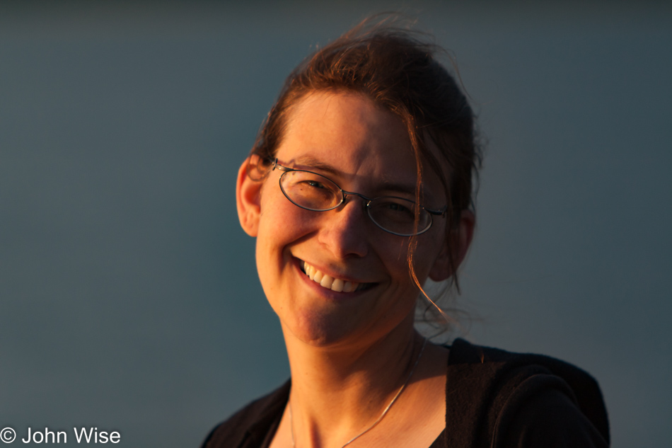
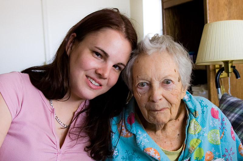
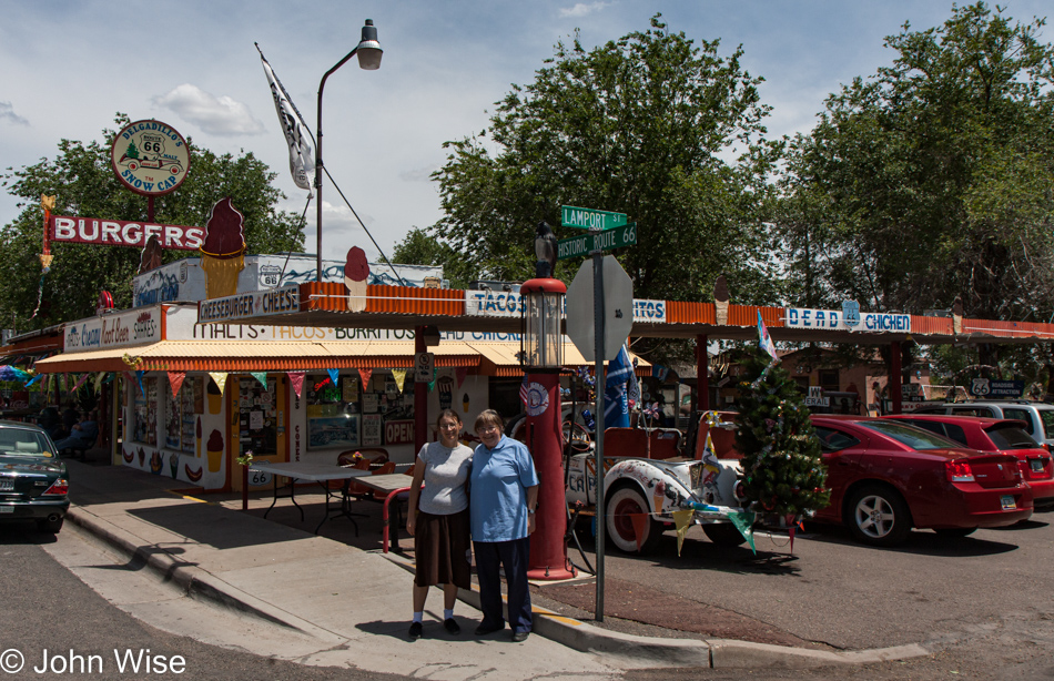
Caroline posing while holding her knitting with Jutta can only mean one thing: it’s World Wide Knit in Public Day.

Jutta Engelhardt and Caroline Wise on old Route 66 a.k.a. Oatman Highway in Arizona

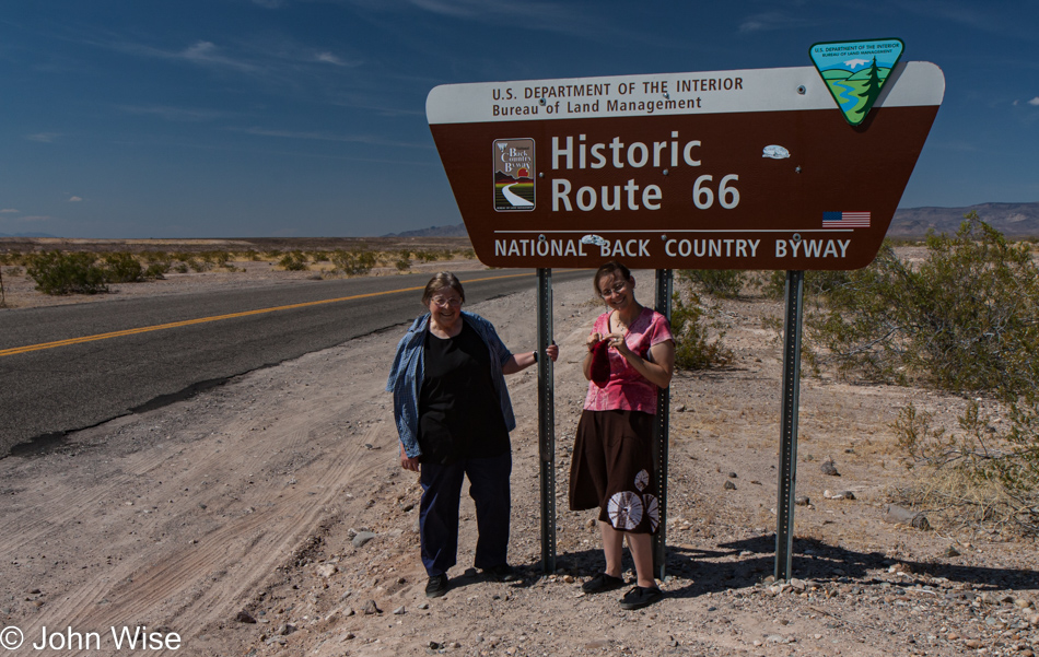
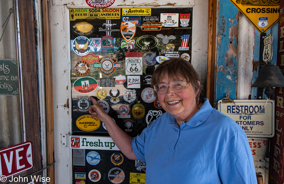
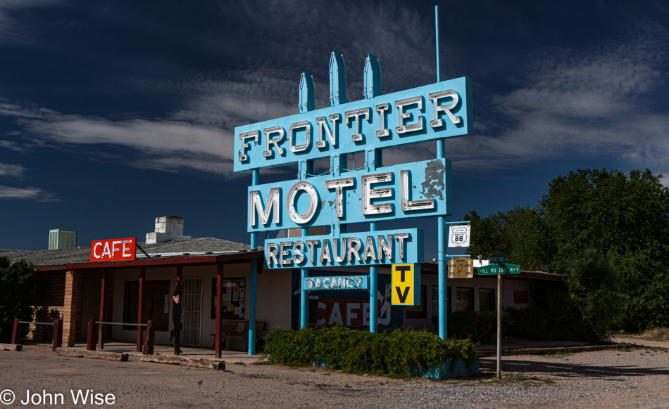
Okay, Caroline, we get it; you are knitting in public. Yeah, but when has anyone else ever knitted in public on Historic Route 66?

Old Route 66 a.k.a. Oatman Highway in Arizona

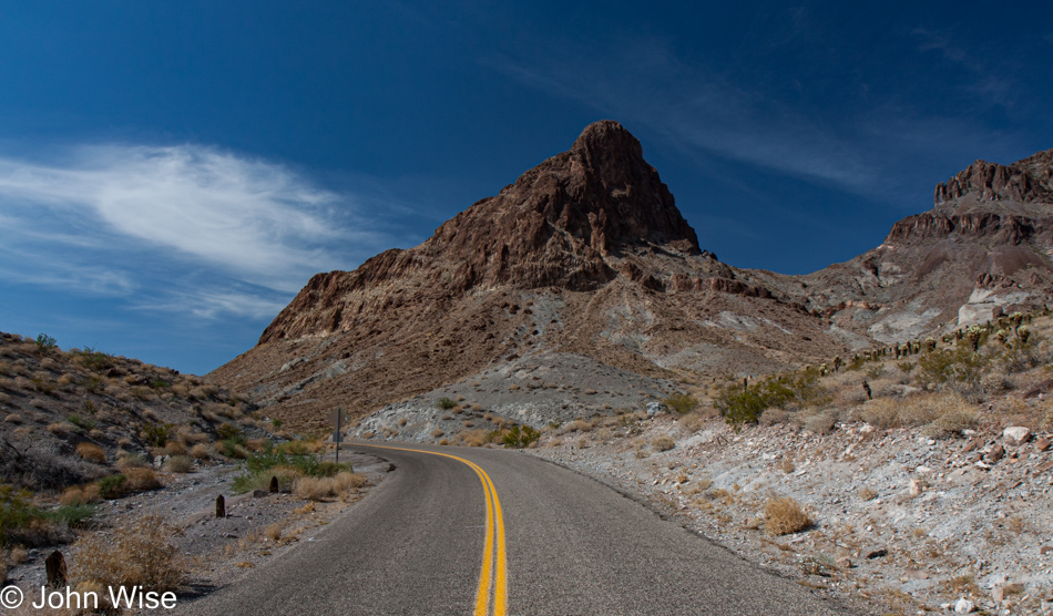
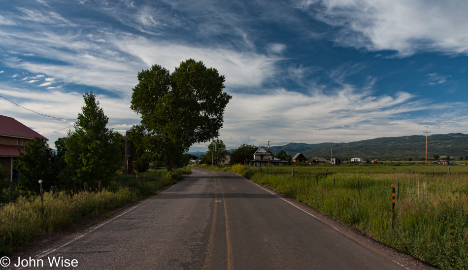
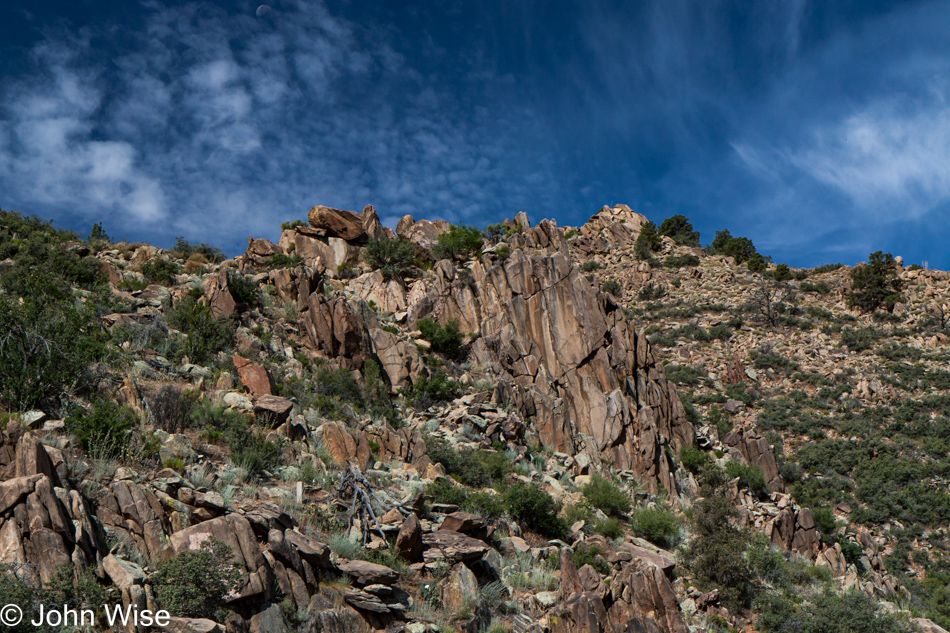
When you travel the broad expanse of Interstate 40, you can only wonder why the original highway planners of Route 66 brought the road through areas such as this. Talk about being off the beaten path.

Old Route 66 a.k.a. Oatman Highway in Arizona

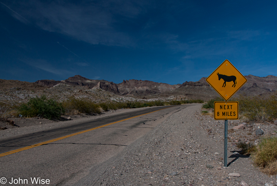
I would have bet $100 there was NO chance we’d be seeing burros on this road.

Caroline Wise in Oatman, Arizona

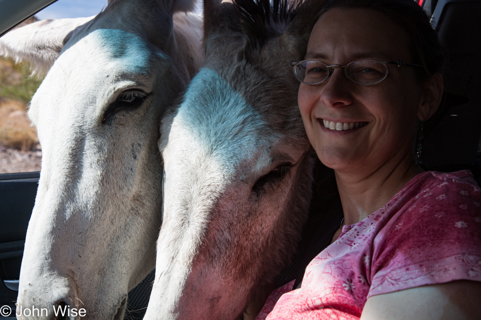
And then all of a sudden, you have two of them jamming their heads into your car, pleading that we take them with us or feed them. It’s probably the latter, as who has ever seen a burro in the backseat of a car?

Donkey's in Oatman, Arizona

Good thing I didn’t bet $100 per burro.

Donkey's in Oatman, Arizona

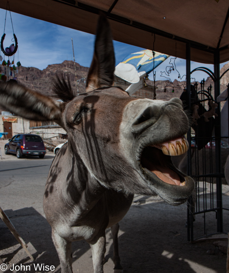
Nothing like a braying burro to get others to laugh with them.

Oatman, Arizona

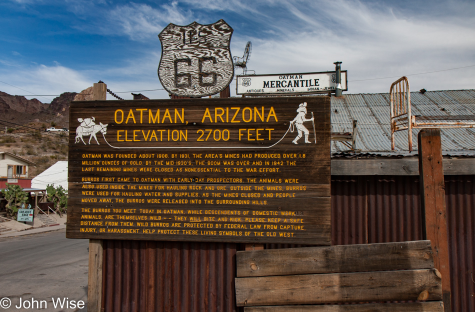
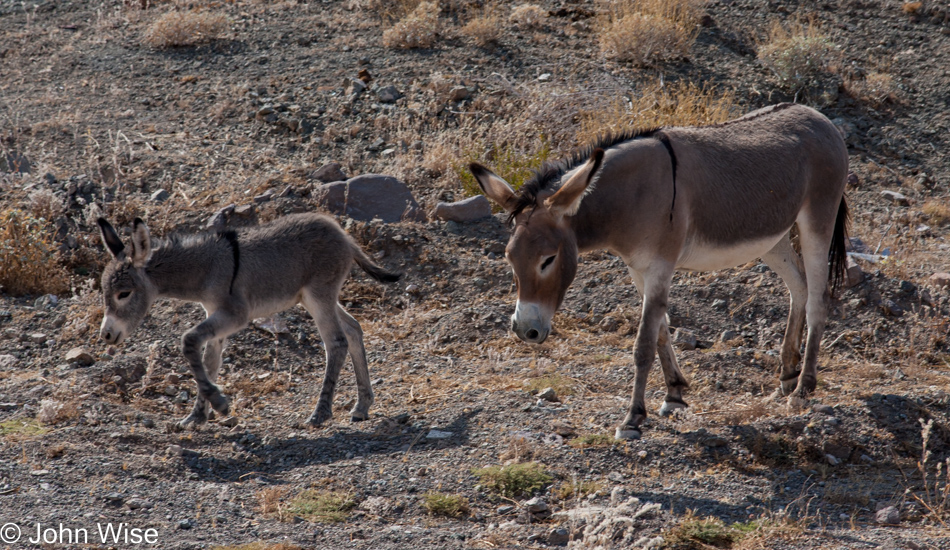
The sign, aside from telling us about gold mining in the area, warns visitors to avoid the burros as they are wild and will bite and kick. Later, we also found out that local shops sell carrots to tourists as burro food, which makes some of them rather fat. Interestingly, fat donkeys carry a lot of their extra weight on their necks.

Caroline Wise in Oatman, Arizona on Knitting in Public Day

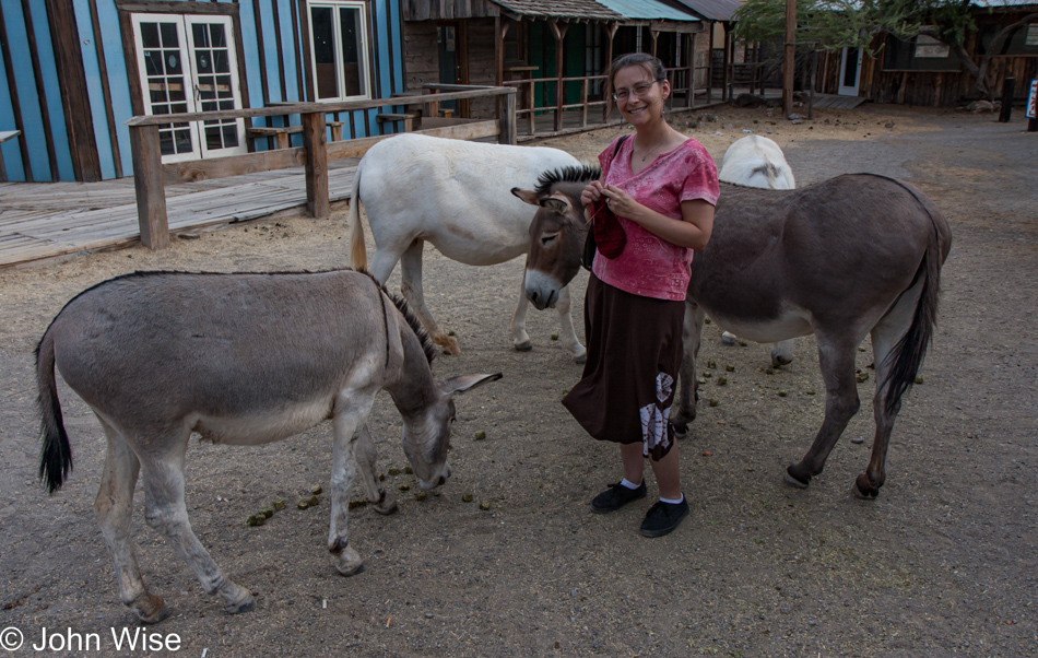
Apparently, the burros are either domesticated by now due to all the visitors feeding them, or they’ve come out to politely watch the knitting-in-public-day festivities.

On Pierce Ferry Road to Meadview, Arizona

At this point in identifying our road trip, I got lost on the map for quite a while.

Caroline Wise and Jutta Engelhardt nn Pierce Ferry Road to Meadview, Arizona

From where the next day started photographically, it only made sense that we stayed in Kingman, Arizona, for the night.

On Pierce Ferry Road to Meadview, Arizona

But these photos looked like nothing around Kingman.

On Pierce Ferry Road to Meadview, Arizona

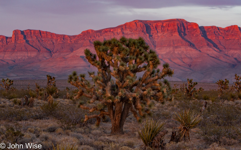
Joshua trees and vermillion cliffs weren’t triggering our memories, so both Caroline and I continued scouring StreetView on Google Maps, trying to find something from our photos that would hint at our location.

On Pierce Ferry Road to Meadview, Arizona approaching South Cove Marina

It turned out that we went in a very unintuitive direction, far away from either of our best guesses.

On Pierce Ferry Road to Meadview, Arizona approaching South Cove Marina

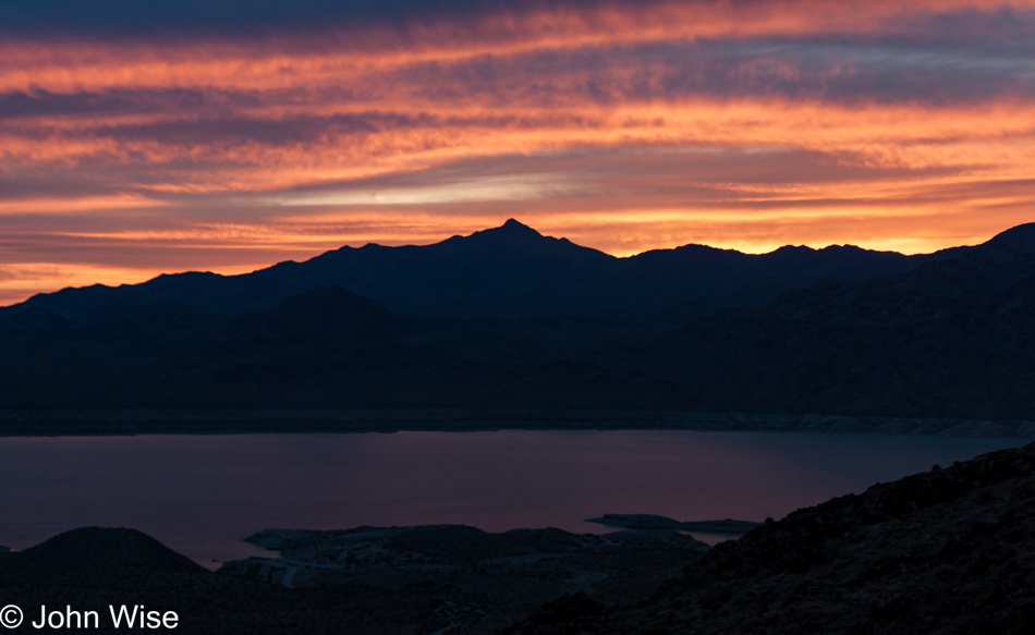
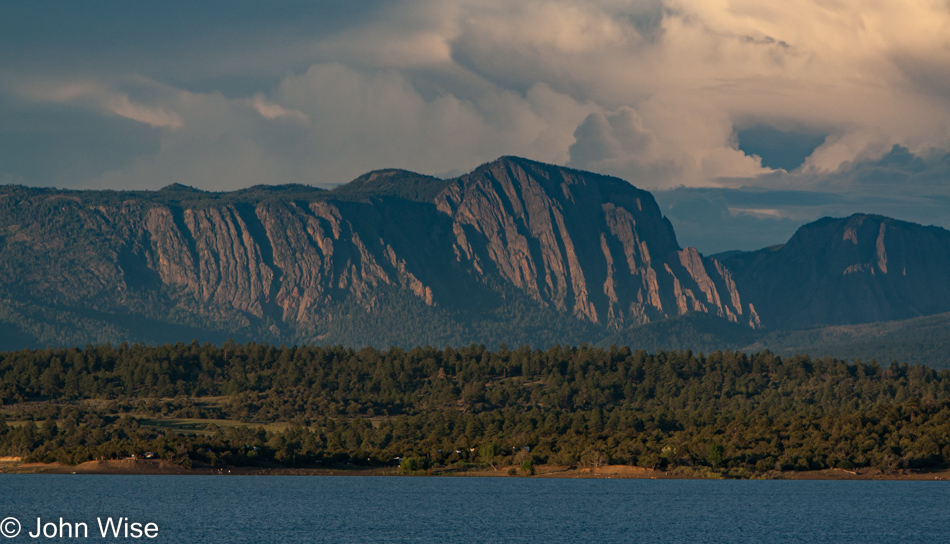
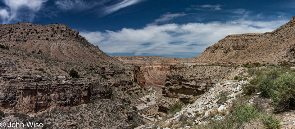
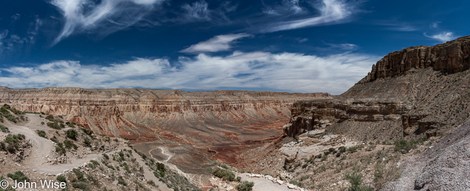
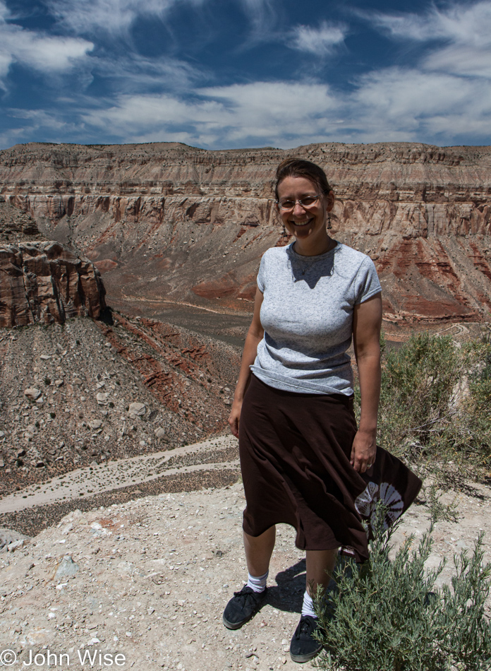
This overlook is on Pierce Ferry Road, which travels out to Meadview, Arizona, as we were approaching South Cove Marina. We turned around at this point as there were over 70 miles ahead of us that would need nearly 90 minutes to cover before we’d reach somewhere for dinner. This is how we wander into the Old West.

A Short Drive North With Jutta

Somewhere north of Fountain Hills on AZ-87 heading towards Payson, Arizona

Recovered from the intense trip to America’s northeast and Rinku and Yagnesh’s extravagant wedding, it was time to reset things with a short drive north.

Jutta Engelhardt on Lake Mary Road heading towards Flagstaff, Arizona

Jutta and I took this Wednesday after dropping Caroline at work to get in our little Kia Spectra 5, taking advantage of the cool weather and beautiful day.

Upper Lake Mary approaching Flagstaff, Arizona

Here we are at Upper Mary Lake shortly before arriving in Flagstaff, where my mother-in-law and I had lunch before heading down the 17 freeway to return to Phoenix and the heat of the desert.