Monterey, California – Day 2

Foggy Highway 1 going north near San Simeon, California

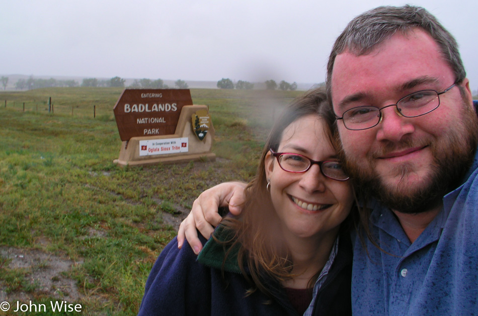
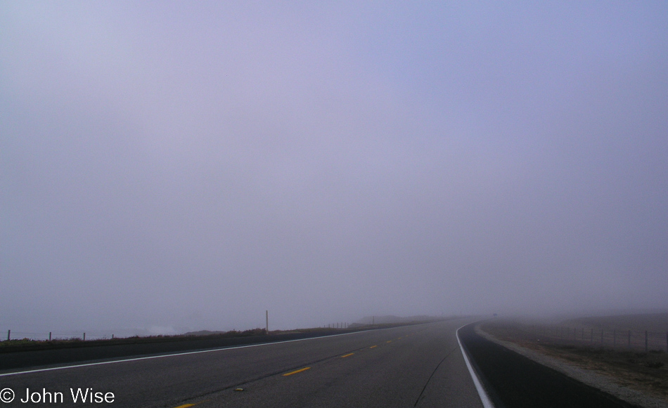
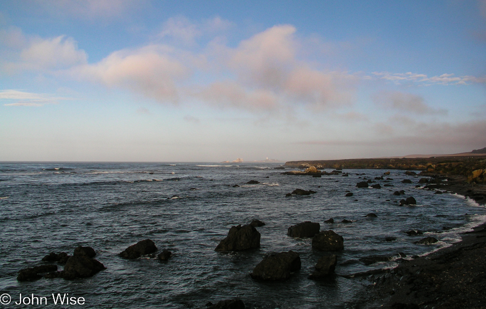
Our 9th trip to Monterey Bay Aquarium (our 2nd one this year!) is well underway. As we leave the cheapest motel I could find in San Simeon the place is covered in morning fog. Not living on the coast, we don’t really have a good read on this, and for all we know, the fog is hiding rain clouds just above it. No matter, it’s always an amazing time out here on Highway 1.

Highway 1 going north near San Simeon, California

Smile and the whole world smiles with you, and maybe those smiles might have the world smiling at you with beautiful blue skies.

Caroline Wise and John Wise at the Elephant Seal Viewpoint near San Simeon, California

Yeah, smiles.

Elephant Seal Viewpoint near San Simeon, California

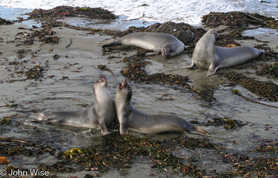
Bellowing and getting in each other’s faces, Elephant Seals are not known to smile. No matter the time of year we stop here, we have seen at least a few dozen of these giants. Just a couple of years ago, we spent New Year’s Eve here, and as the Elephant Seals’ only human visitors brought in the New Year with them. That night, in total darkness, not being able to see 10 feet in front of us, we heard an unfamiliar sound. The next morning, we saw that the females had become mothers during the previous week. Pups were scattered across the beach and were squawking like a gaggle of geese. The herd on this visit is small, mostly juveniles, a few females, and only a handful of males. We spend a few minutes watching two young males squaring off in practice for the battles that will someday give them their own harem.

Highway 1 on the Pacific Coast of California

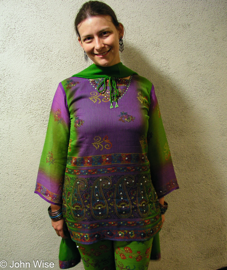
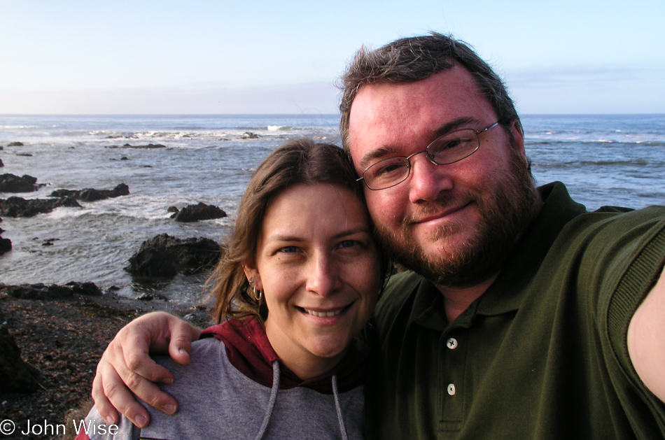
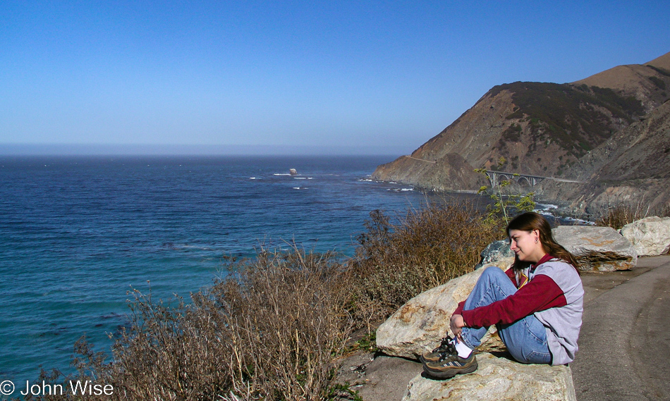
A rare photo of me looking landward instead of seaward out here along the Pacific Ocean.

Highway 1 on the Pacific Coast of California

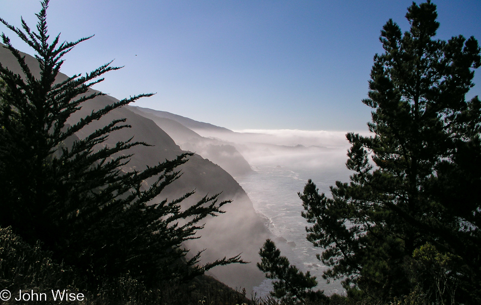
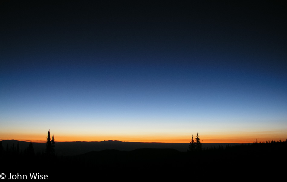
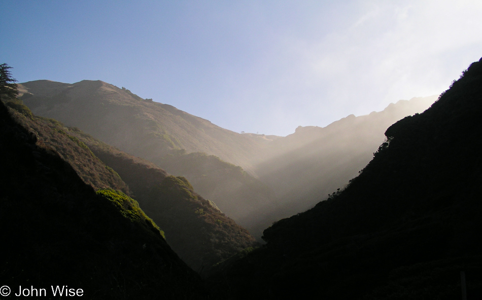
The fog, slow to lift in places along the California coast, is welcomed by us desert dwellers. It adds to romanticism. Highway 1 is a twisting, windy road not built for the faint at heart. At moments, we are not much above sea level, and then seconds later ride high above the beach, tracing along the steep mountainsides. From fog, the road emerges into the sunlight, and the waters in the cove below become a clear turquoise invitation to pull over off the narrow road to gaze at the beauty stretching before you. It’s a dramatic place to be every time.

Pampas grass on Highway 1 on the Pacific Coast of California

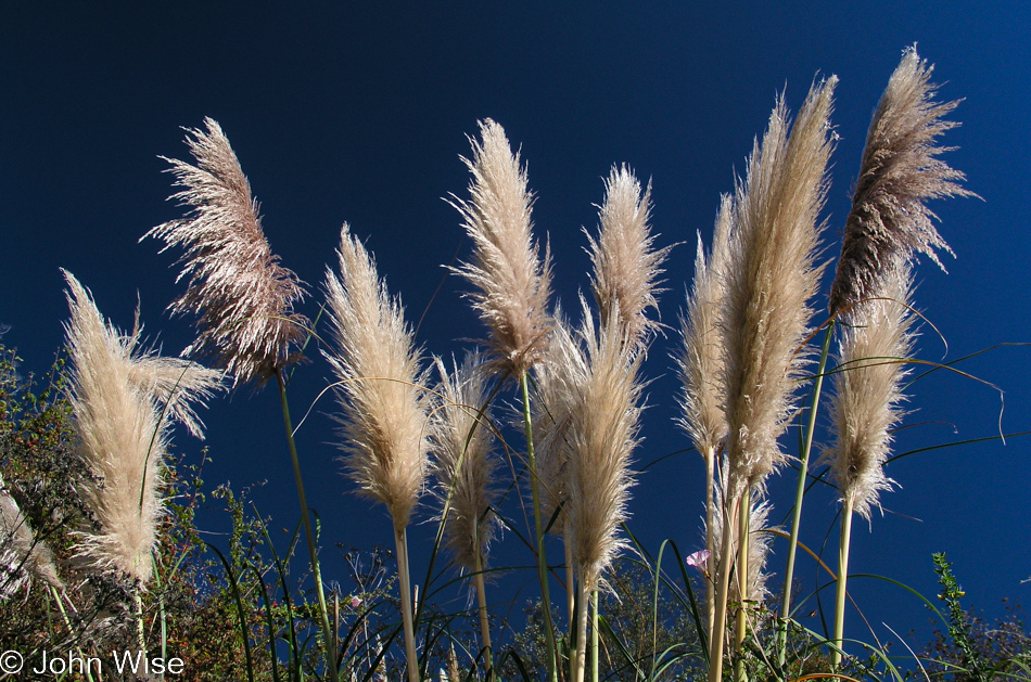
Something about pampas grass brings yet more happiness into this car crawling up the coast.

Highway 1 on the Pacific Coast of California

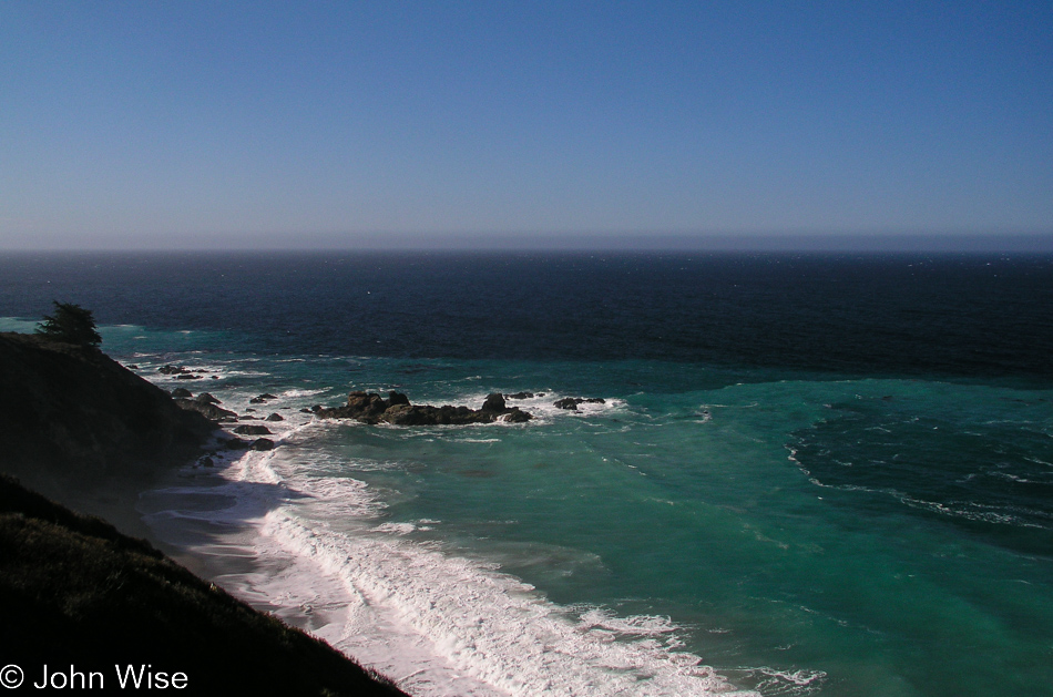
Some things never change, such as our need to stop far too often to admire the view.

Caroline Wise sitting next to Highway 1 on the way io Big Sur, California

Famous bridges greet us in images seen a hundred times before. Even on rainy days, these vistas are spectacular. From Winter and Spring to Summer and Fall, we have traveled this highway through all types of weather, but never have we been less than awestruck at the sights this genius of a well-placed road delivers to those of us willing to traverse its serpentine route. On this particular drive up to Monterey, we are not without purpose and try earnestly to curtail our stops in order to arrive in Monterey on time for a scheduled reservation.

Big Sur Bakery in Big Sur, California

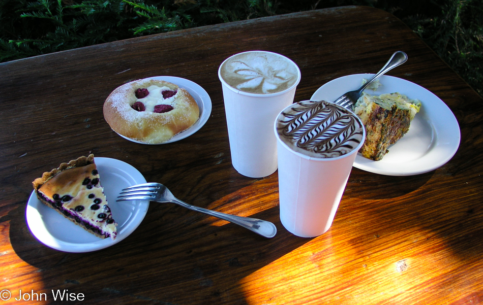
We could be stuffed to the proverbial gills and still, we’d have to stop at the Big Sur Bakery on our quest to try every pastry they make.

Caroline Wise at Garrapata Beach in Big Sur, California

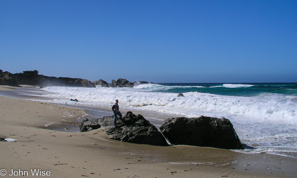
At the time, we weren’t quite familiar with Garrapata Beach and how vicious it could be. Knowing what we know now at the time of this writing (see below), we’d never think this was a good idea to have one of us dash over to some rocks that had just been surrounded by churning waters for a quick photo, but here it is today.

Monterey Bay, California

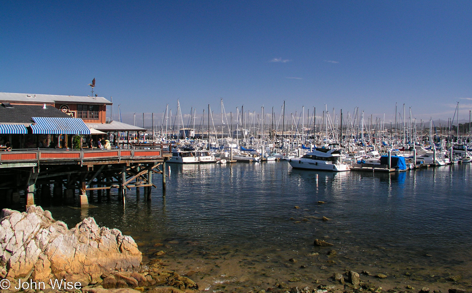
We’ve arrived at the Fisherman’s Wharf in Monterey instead of the aquarium because we have a date with Derek M Baylis.

Caroline Wise sailing on Monterey Bay in California

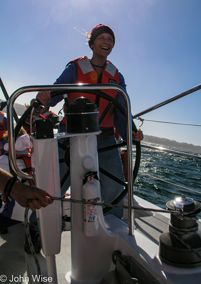
Derek is a thing, actually, as in a 65-foot sailboat. Caroline and I have booked a couple of places for the Science Under Sail program hosted by the Monterey Bay Aquarium. Members could sign up for a journey on a research sailing vessel to learn about the Monterey Bay ecosystem while out in the bay. Luck would have it that the captain asked for a volunteer to pilot this craft, and I pushed Caroline to volunteer faster than that smile would show up on her face, but it turns out that once she took the helm, that smile arrived at lightspeed. I don’t know if I’ll ever see a deeper look of wow on her face for the rest of our lives. Okay, so there was that whale that showed up between us and the shore at some point that the staff told us was a baby humpback.

While out on the sailboat, we looked at water samples under a microscope. The ROV that was to offer us a look below didn’t work out as the conditions of the bay were too murky to be viable, and so instead, we took a wonderful trip out on the bay (a National Marine Sanctuary) and learned about what was out here under the surface. The entire expedition lasts about 4 hours and is well worth the price of admission. It is only about 4:00 when we return to shore, and with 2 hours until the Aquarium closes, we drive to Cannery Row, find parking, and pop in.

Caroline wise at the Monterey Bay Aquarium in Monterey, California

Last year, we were members of the Aquarium, which allowed entry for one year, along with the benefits of receiving discounts on whale-watching tours and the Science Under Sail program, as well as early entry and evening visits on select days for members only. We took advantage of as many of these offerings as we could, considering we had to drive across two states to visit. The Monterey Bay Aquarium was one of our first stops on Caroline’s first visit to the United States back in 1992. We try to visit at least twice a year, sometimes we get lucky and might find ourselves here three times in one year. We dine on Fisherman’s Wharf and check into our hotel for an early morning wake-up call.

Monterey Bay Aquarium in Monterey, California

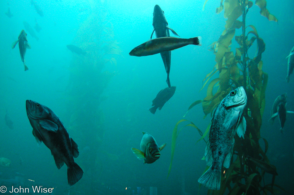
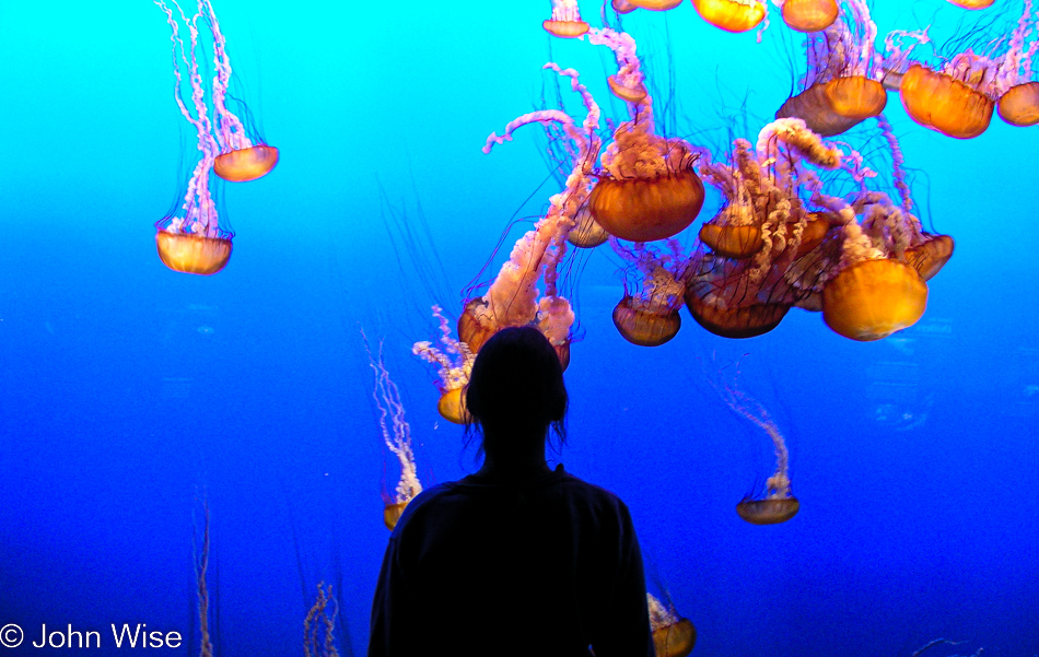
There will never be a time we don’t spend an inordinate amount of a visit entranced by the Kelp Forest. It was getting late by now, and it turned out that some of the fish had already gone to sleep. Yep, that’s the way they sleep.

Disclaimer: This post was not written on or near the date it shows up on my blog. This particular sequence of days wasn’t written about until September 2022 as I was trying to better catalog our travel images on this site.

Additional info: In November 2022, I found a composite post of the three days I wrote four months after our trip on February 26, 2005. I grabbed what was there, merged it into this post, and deleted the other.

Monterey, California – Day 1

Roadside Perfume Dispenser in Womens Bathroom

Be warned, not just about using a perfume dispenser at a gas station restroom but the fact that this post wasn’t written for many years after the events depicted herein. Whatever is presented as a potential storyline is simply the musings of a now-old man filling gaps in a record of experiences that were being had prior to me adequately documenting the important stuff.

In any case, what I do know is that on this day, we left Phoenix, Arizona, and headed for Monterey, California, an ambitious drive for a quick weekend. Considering that this day of October 8, 2004, fell on a Friday, I am certain that we left in the afternoon. Otherwise, we would have made it all the way to our ultimate destination. Instead, we made it 620 miles to San Simeon, California, which I deduced from the first photo of the next day, which shows our motel.

Labor Day 2004 – Day 4

We had 802 miles to travel before getting home around 9:00 p.m., so we were on the road by 5:30, well before the sun made an appearance.

An hour later, we were yet to see the sunrise, but this was even better, a large flock of sheep ambling down the road. This is the kind of traffic jam we can enjoy.

Out of Baggs, Wyoming, and into Colorado on State Road 13. Yay, the sun has returned.

I will never accept the name of this chain of gas stations outside my reading of it as a 15-year-old, juvenile, dirty-minded idiot.

From Craig, Colorado, where we came and went, we continued south a while to Meeker, picking up State Road 64 west towards Rangely, Colorado.

Oh, do we really have time for these kinds of detours? Yeah, but what if we never pass through this area again? Will we regret not having stopped at the Waving Hands site? Okay, but just this one time.

From Rangely, we were driving straight south on the 138 until reaching Loma, where caught the dreaded Interstate 70 over to Cisco, Utah. Making tracks now.

The Desert Southwest comes back into view, approaching Dewey, Utah, on the 128 with a great drive along the Colorado River.

Near the junction where Moab, Utah, connects the Colorado River to Arches and Canyonlands National Parks. No time to fool around as it’s getting close to 2:00 p.m., except we are hungry and need to stretch our legs, so why not head over to Eddie McStiff’s for some hot lunch? Great, they are closed for Labor Day, so we went to the Mondo Cafe even though they don’t feature Eddie’s signature miso dressing.

Hole N” The Rock south of Moab is a place we’ve wanted to visit, but we never had time, so why not stop on this day when we only have 800 miles to cover?

Albert Christensen, who built this hole-in-the-rock abode, had a beloved donkey named Harry. While Albert and his wife are gone, Harry, the Donkey is still present in their living room as a stuffed sight to behold. It seems that Mr. Christensen was an amateur taxidermist who should have considered taking his skills to Hollywood to work in special effects for horror films.

We are near Mexican Hat, Utah, on our way toward Monument Valley. Those layers out there are one of Caroline’s all-time favorite roadside views.

There are things more important than showing you one more photo of Monument Valley that we’ve all seen before, but this menu at the Mitchell Butte Dinner on the road leading into Monument Valley will prove to be a real rarity. For Caroline and I, one of the treats of driving up this stretch of road was the vendors hawking Navajo arts and food items, but some years after this visit, in trying to modernize people’s experience here, the vendors were pushed out and their shacks removed.

In our book of southwest delicacies, the roast mutton and grilled chilies on fry bread is a treat we cannot pass up. Maybe we should have eaten a lighter lunch up in Moab so we could have shared three or four of these nearly burned, tough old muttons that require a commitment to eat. Rarely do we leave without a heavy-duty workout of the jaw muscles.

Almost exactly 72 hours after we left on Friday, we are reentering Arizona, having paid visits to New Mexico, Oklahoma, Colorado, Nebraska, South Dakota, Wyoming, and Utah. Almost home.

We are approaching the edge of the Navajo Reservation as we leave Tuba City and turn south towards Flagstaff.

What a glorious sunset to send us off with. Oh, wait, what’s going on up ahead? An hour after we left Flagstaff and just a bit south of Camp Verde, with only 90 miles left out of 2700 driven so far we hit a traffic jam. This is no ordinary jam either, as we are barely moving. Thirty minutes after we first stopped we reset the odometer to better monitor our progress. Time check 8:20 p.m. By 9:10 p.m., we traveled a total of 1.7 miles. 9:50 p.m., and we are 5.1 miles down Highway 17. It’s not until 10:25 p.m., two hours and 7 miles after things came to a crawl that this clears up, and we are finally on our way home in earnest with an hour to go before we arrive.

Labor Day 2004 – Day 3

Carhenge at daybreak in Alliance, Nebraska

When it’s not even 6:00 a.m. yet, you visit Carhenge in the dark because it’s not really light out yet. I try to tell myself that being early is allowing me to capture these silhouettes instead of the cars in full daylight, like normal people.

North of Carhenge on Highway 87 in Nebraska

These Nebraskans must be related to the people of Alabama, as who else erects rest areas like this? Well, when you gotta go, you just grab your German news magazine, climb the hay bail, and perch like nobody’s watching.

Caroline Wise entering South Dakota on SD-407 near White Clay, Nebraska

We just passed through Whiteclay, Nebraska, to get into a cold South Dakota and hope we never have to pass this way again. Next up was Pine Ridge, South Dakota, which I suppose is a kind of capital city of the Pine Ridge Reservation and home to the Oglala Lakota Indians. In Lakota, the reservation is known as Wazí Aháŋhaŋ Oyáŋke.

On the Pine Ridge Reservation in South Dakota - Site of the Massacre of Wounded Knee

This is not the place to be on a gray, cold, and wet day as the place is already embued with tragedy as it was here that American soldiers killed nearly 300 Lakota, about half of whom were women and children. They were buried in a mass grave by American troops looming over them as conquering heroes, with more than a few being awarded medals for their efforts. It doesn’t matter that this was 114 years ago as I try to imagine how the survivors feel knowing my ancestors tried to extinct the bison and them after stealing their lands. If it were me, I’d probably have a chip on my shoulder.

For those who want to relegate this to ancient history, consider that Black Elk, born Heȟáka Sápa in 1863, didn’t die until 1950 or 4 years after Bill Clinton was born. Black Elk was a witness to the massacre when he was 27 years old, so we can be certain it was an image that stayed with him his entire life. He was also the second cousin to Crazy Horse, which is the monument that is the focus of our ultimate destination on this trip into the Great Plains.

Caroline Wise and John Wise at Badlands National Park in South Dakota

The gloom is a kind of poetic wrapper for the gravity of what these lands represent, but we didn’t come up here to be depressed or feel bad. No, we came to Badlands to witness nature and to arrive wearing smiles to add some brightness to the day.

Badlands National Park in South Dakota

Doesn’t look good for taking a trail into the badlands of Badlands. Maybe the rain will stop and quickly run off so we can see more of this national park by walking over it instead of from our car windows.

Longhorn Saloon in Scenic, South Dakota

Scenic, South Dakota, is home to the Longhorn Saloon that, while closed now, apparently allowed Lakota Indians in its establishment when it was still in business. From the zombie population of alcoholics in Whiteclay and a massacre at Wounded Knee Creek to reminders of our segregationist past, I’m not all that certain. I’m enjoying our visit to South Dakota this time.

Badlands National Park in South Dakota

There’s much to learn out here at Badlands but we don’t have access to any information about the land. While this looks like the banded layers of ash from volcanic discharge that fell on the area of Petrified Forest in Arizona, we don’t really know if this is the same process. It is pretty, though, even in the foul weather.

Badlands National Park in South Dakota

Yes, we want to explore below. No, we don’t want to do so in the mud.

Badlands National Park in South Dakota

Leaving the White River Valley Overlook in the previous photo, we are on our way out of the park and stop one last time before giving up all hope of the clouds parting and the sun popping out.

Wall Drug in Wall, South Dakota

Hmm, I’d heard of this famous stop on the road; we’ll have to check it out.

Caroline Wise at Wall Drug in Wall, South Dakota

Stepping back in time is a major theme of exploring America. What happened to those days of moving into the future? Wall Drug was mostly worth the visit, but it’s showing its age, making me wonder how many more years will it be able to hold on as an attraction that is likely more appealing to older Americans needing that nostalgic sense of another time and age.

Mount Rushmore in Keystone, South Dakota

Mount Rushmore offers up some side-boob (no offense meant) as we do a drive-by. To gather a glimpse was enough as we weren’t in the mood for crowds, and it wasn’t all that long ago that we were here for a more extensive visit.

Crazy Horse Monument in South Dakota

The Crazy Horse Monument is what we really wanted to see until we got here and realized it was not something we needed to see. At least the sky is clearing. My feelings about the tragedy of everything out here are muddying my ability to enjoy myself. Maybe I’m just tired?

No, I’m just disappointed in all of this. Even Mount Rushmore was carved out of mountains known as the Black Hills, which were sacred to the Lakota Sioux. The man who created the monument was Gutzon Borglum, who was a white supremacist noted for referring to non-whites as the “mongrel horde.”  Then this monument to Crazy Horse feels like a cheap commercial grab where money and selling trinkets are the only thing being celebrated instead of offering something that should have the same respect of a church, but then again, the Lakota will never get government sponsorship to build a monument to someone it hated at one time.

Caroline Wise and John Wise entering Wyoming west of Custer, South Dakota

That flap of hair from Caroline that I’m wearing makes my head look stranger than normal; as a matter of fact, maybe it makes me look fatter. Nah, I’m just fat, and Caroline is not tall, but the sky is blue, and we are in Wyoming, moving south again.

On WY-450 west of Newcastle, Wyoming

We passed through Newcastle, Wyoming, shortly after entering the state and took a note to learn who Anna Miller was. Turns out she was the wife of a sheriff who was the last person killed in the area during the Indian Wars, so instead of celebrating the brave countrymen defending their ancestral lands, we honor the marauding intruder and his wife by naming a museum after them. I need to hit the gas and escape our twisted history.

Near the Black Thunder Coal Mine off WY-450 east of Wright, Wyoming

We are on the edge of the Black Thunder Coal Mine, one of the largest, if not the largest, coal producers on earth. How appropriate it seems that the black heart of the region is an open festering sore contributing to the fouling of our environment. My cynicism is not the best quality I know, but it seems to be all I have today.

WY-387 direction Caspar, Wyoming

Trying to chill in the beauty of things and be appreciative that we are able to see and feel.

Sunset approaching Caspar, Wyoming

We are passing through Casper, Wyoming, here at sunset, driving in the direction of Medicine Bow. Along the way, we are listening to someone reading from the book The Hiding Place about Corrie ten Boom and her ordeal as a prisoner in the women’s concentration camp known as Ravensbrück after helping Jews hide from Nazis.

It’s 10:00 p.m. when we pull into Riverside, Wyoming, to spend the night at the Bear Trap Bar & Cabins.