Canyonlands to Natural Bridges

Newspaper Rock on the way to The Needles District of Canyonlands National Park in Utah

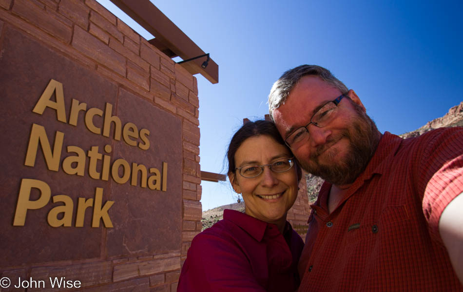
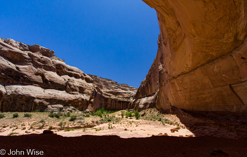
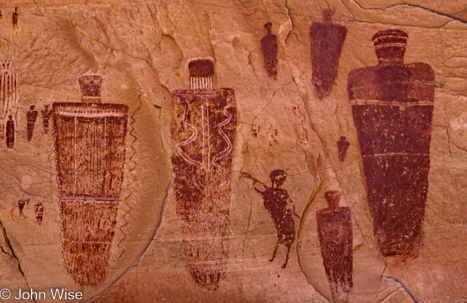
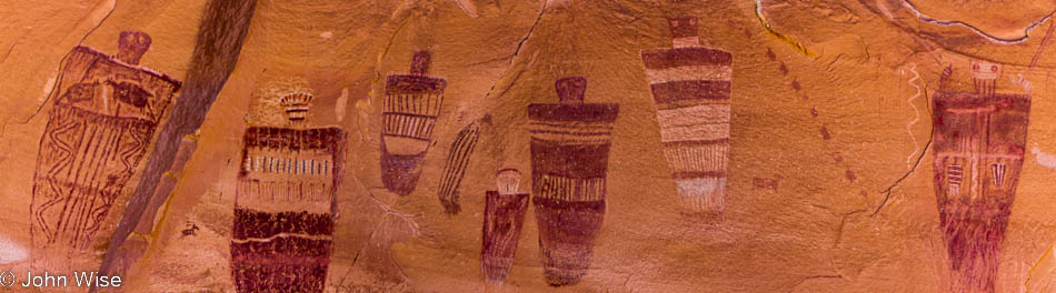
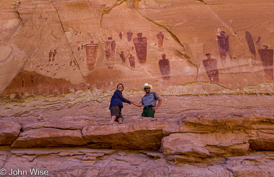
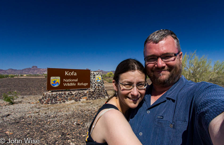
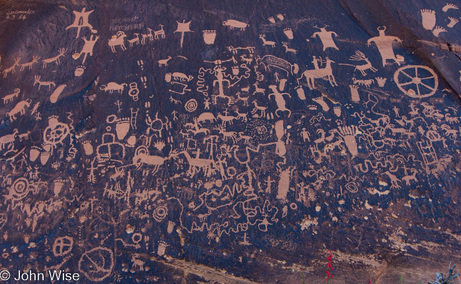
Updated in 2022: On the previous day’s post I added an addendum while I’m opting to insert some photos I felt were missing from this post. As we headed into Canyonlands, we stopped at Newspaper Rock.

An old abandoned granary at Canyonlands National Park in Utah

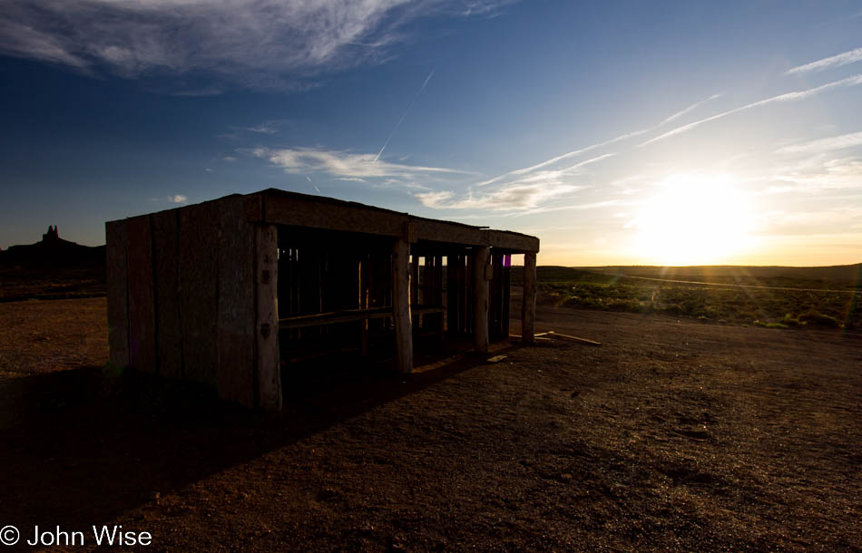
Today is Memorial Day, the day we commemorate U.S. soldiers who died in military service. Standing at this abandoned granary in the Needles district of Canyonlands National Park, I can’t help but think that there is not a day set aside to recognize the Native Americans who died during their own military service to defend the lands they called home. If we can have a Martin Luther King Jr day, then I think we can just as easily have a National Day of Recognition for Native Americans.

Cryptobiotic soil in Canyonlands National Park in Utah

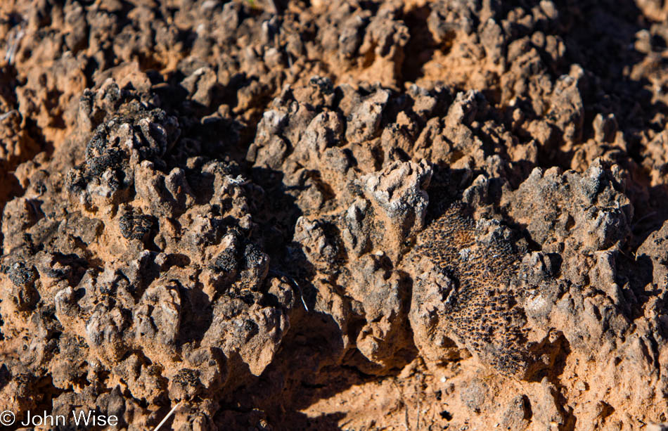
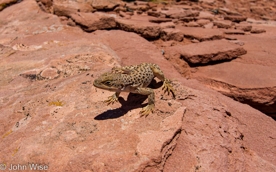
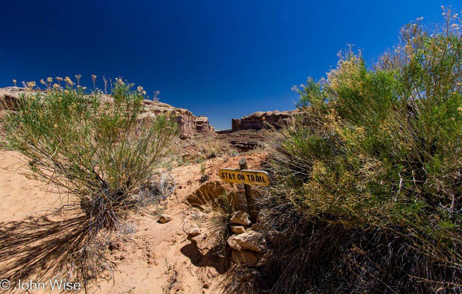
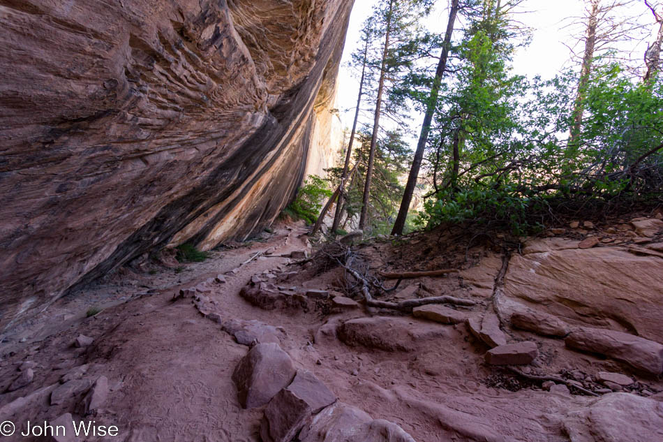
The earth I stand upon is actually a trail, and the park service would prefer that I remain on this trail. All around me is cryptobiotic soil. This fragile habitat is what holds the surface together and makes life for many species possible in this arid environment. If you click the picture above to open the larger image, you can see the detail of the cyanobacteria, mosses, and lichen – well, I can only guess that is what you can see because I’m not a biologist, but there is definitely some type of species making the soil its place of dwelling.

The trailhead of the Confluence Overlook Trail in Canyonlands National Park in Utah

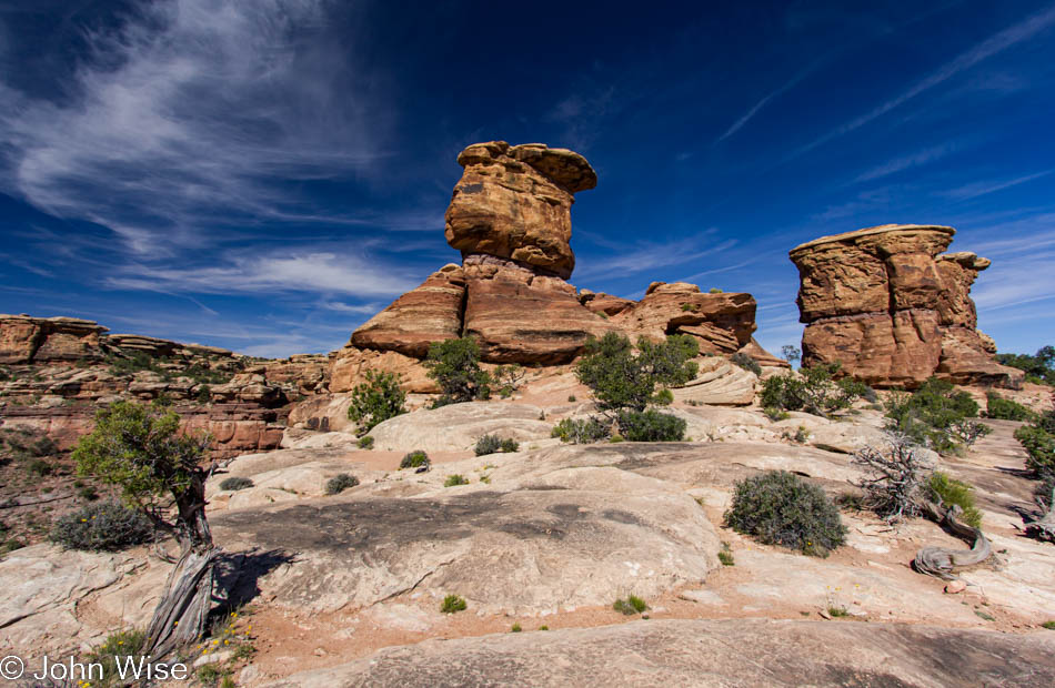
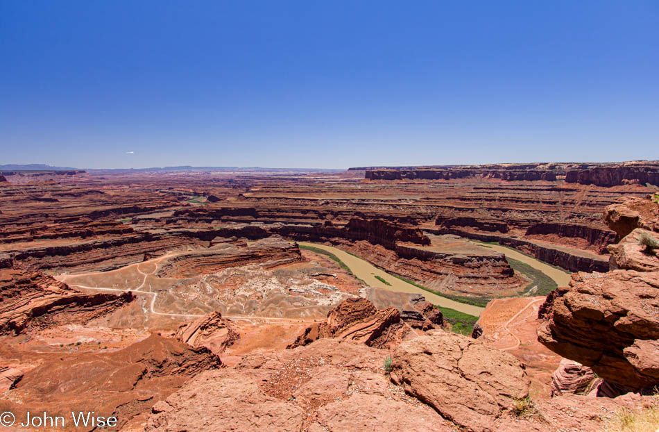
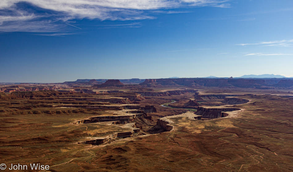
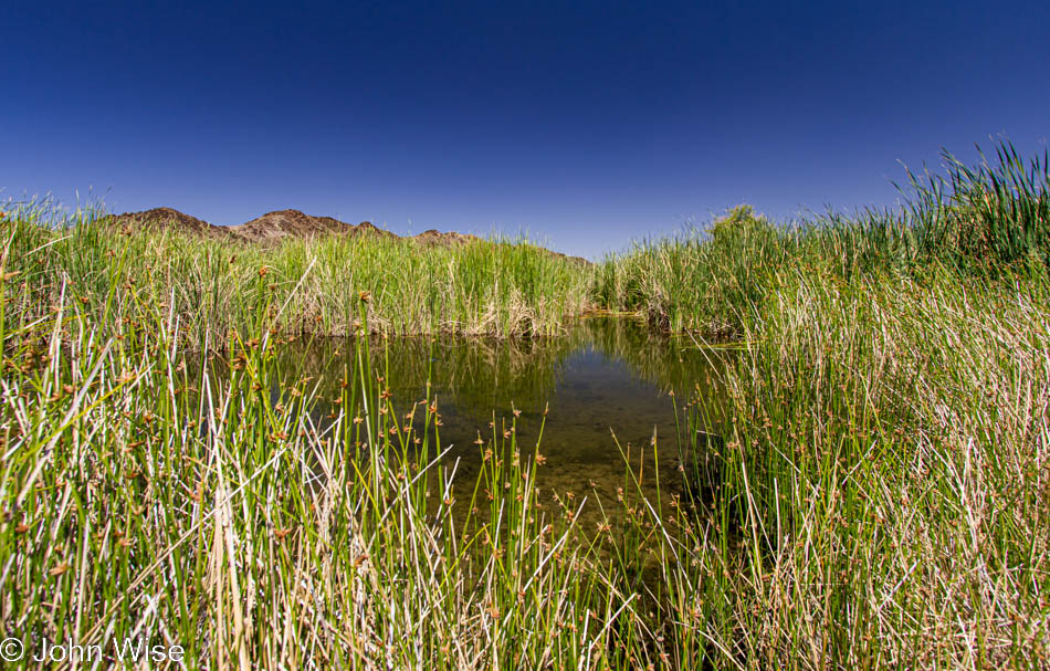
We are on our way home today and only visiting the Needles district of Canyonlands National Park for a short time, figuring we shouldn’t be getting home too late. These rocks are at the end of a road where a trail begins that takes visitors out to the confluence overlook of the Colorado and Green rivers. As we were about to leave, we nodded and said hello to two ladies who were donning hiking boots and about to embark on the trail when we recognized them from our hike out to Horseshoe Canyon on Saturday. These ladies from Poland are easily in their mid-60s, if not just about 70, and are a grand inspiration in tackling this nearly 11-mile trail today.

Unidentified plant near Canyonlands National Park in Utah

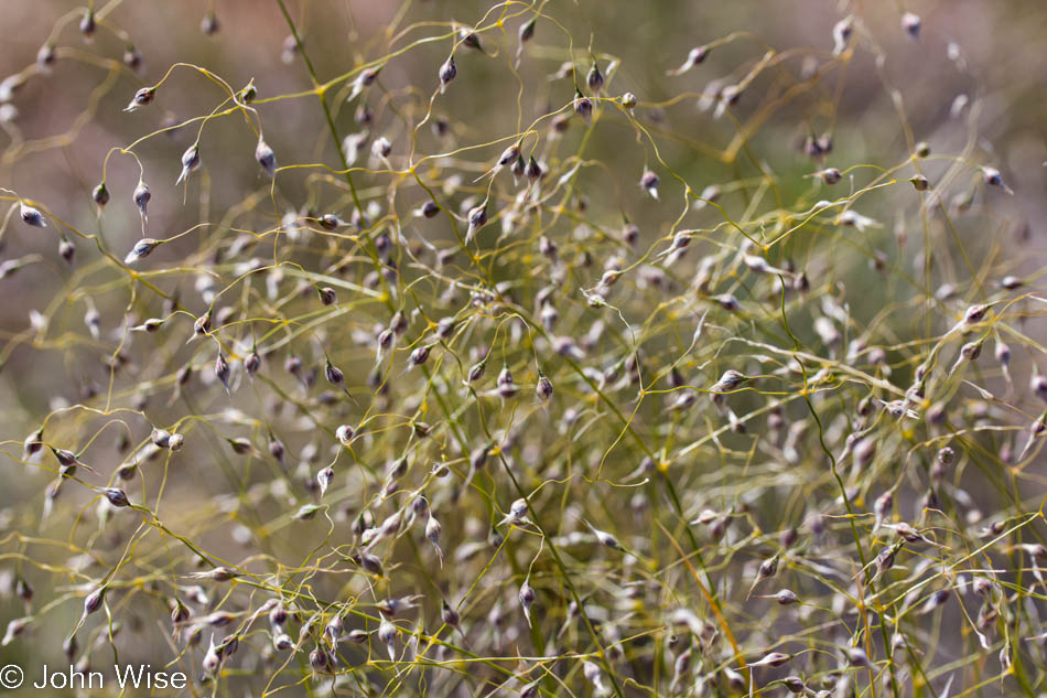
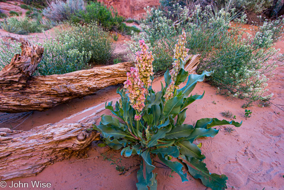
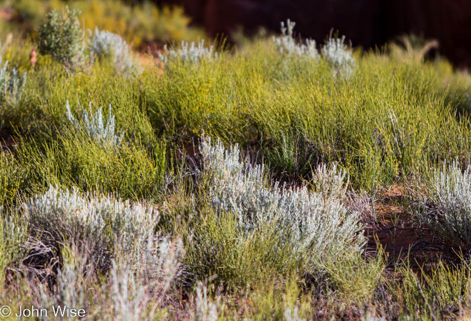
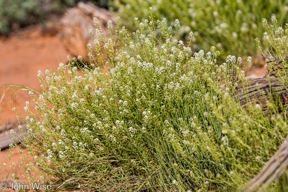
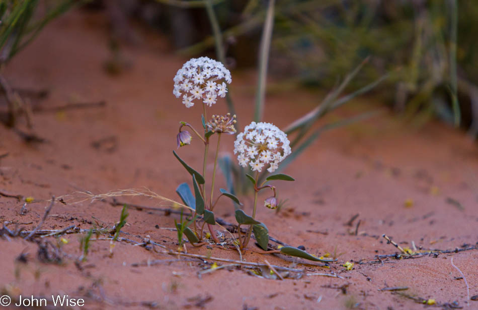
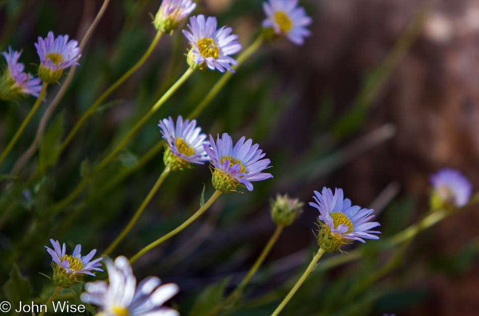
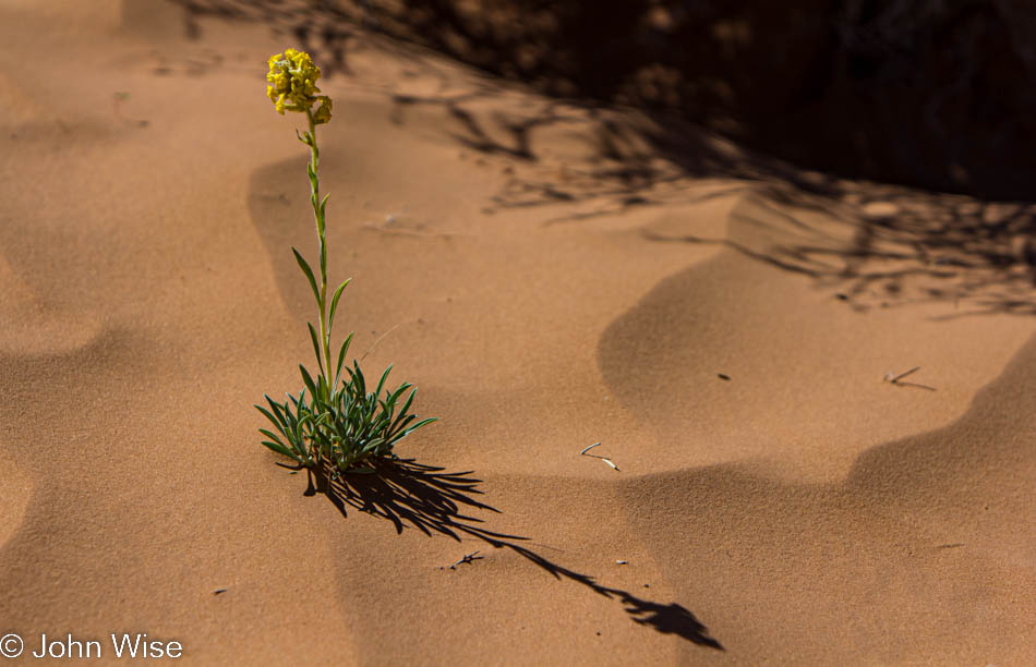
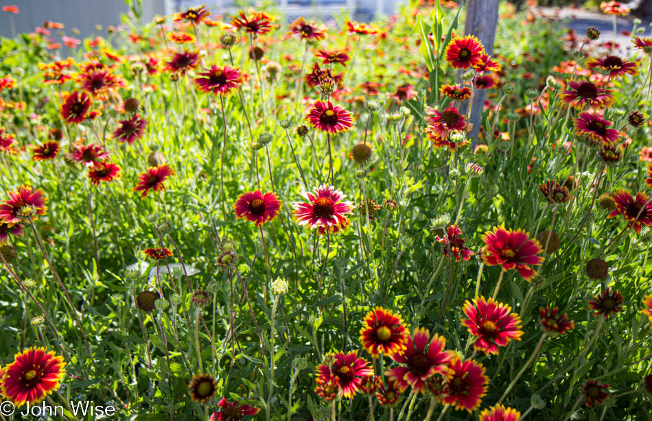
The end of the road was our destination and turnaround point. On the way back out of Canyonlands, the sun’s position in the sky allowed us to better appreciate the carpet of wildflowers stretching in all directions. So much for making good time up the road as we whipped out the macro lens and tried stopping for each species of flower we could spot – at 5 miles per hour. When what might be a once-in-a-lifetime opportunity arises that gives you the chance to witness something so spectacular, you must take the time and disregard the potential discomfort or tiredness at a later time, lest you’d look back and feel foolish for hurrying along and missing out on greatness seldom seen.

Unidentified flower near Canyonlands National Park in Utah

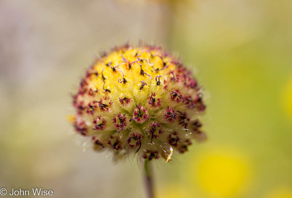
Oh, more flowers, more than one could shake two sticks at. I could easily post 15 or more photos of the various types of blossoms that presented themselves roadside on this beautiful day. It took close to an hour to travel the 10 miles between the park exit and Newspaper Rock. Down on our knees or sitting on our butts, we lingered amongst the flowers, taking in their scents and colors. In a week, would they still be here to dazzle those visitors?

Panorama of landscape near Canyonlands National Park in Utah

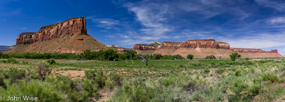
The scenery out here on a spring day wants to stop the car on its own accord and forces us from our seats to spend a quiet, intimate moment with nature. At this rate, we’ll be home at midnight. When we were here four hours earlier, it was beautiful then, too, but now the light is absolutely perfect. This is one more of those occasions of finding yet another perfect place on earth, one that makes you think, “Hey, I could live here, and then I’d know how the view changes with the day, the season, and the weather.”

Stand of aspen trees near Monticello, Utah in the Manti-La Sal National Forest

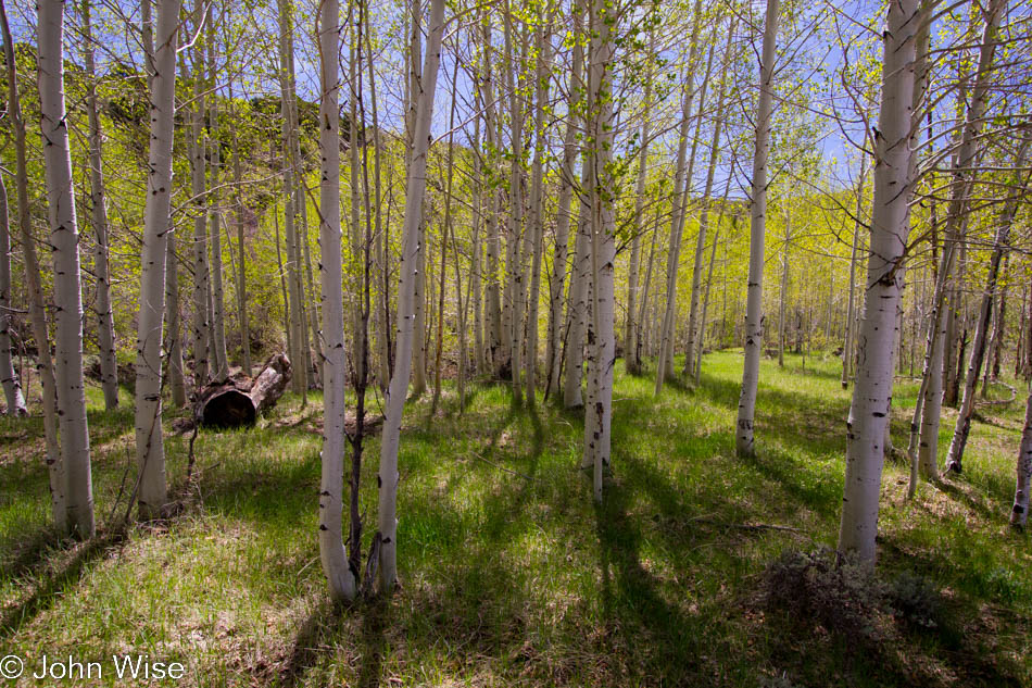
We are not far from the main road when a paved road on the right appears to be a detour we haven’t taken before. County Road 136 says it leads to Monticello and so we take it. We begin to climb into the Manti-La Sal National Forest and mountain range. What a find, out of the desert and into the forest. The views from up here stretch for a hundred miles north. While the view was terrific to our eyes, the haze did nothing for the camera and the quality of the images I shot. So instead, I offer these aspen trees, and more specifically, I offer them to my daughter Jessica, who long ago told me that she loves aspen, and now when I see a stand of them, I think of her.

Deer roadside on County Road 101 west of Monticello, Utah

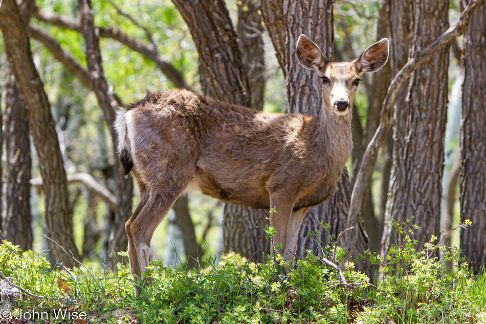
The road was hardly long enough; we could have easily stayed all day on this twisting section of pavement. A couple of patches of snow dotted the hillsides, soon to be gone with summer just around the next corner. More pullouts and some benches to sit for hours and gaze out over Canyonlands to the west, the La Sal mountains to the north, and Ute Mountain to the east over in Colorado would have been welcomed. What was the next best thing? A deer gazing at us. Next to the road at the edge of the forest, a staring contest was begun. Wait a minute, is that a lawn ornament? A silly place for one if it is, ok, it blinked and went back to foraging.

The Peace Tree Juice Cafe in Monticello, Utah

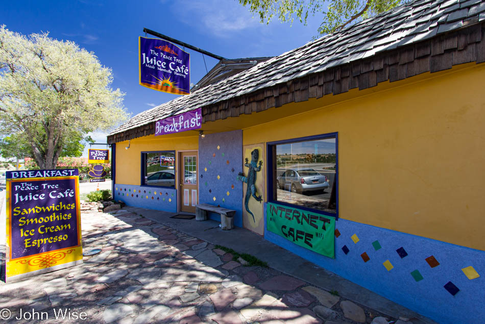
Out of the woods and into town. How is it that the little blip on the road of Monticello, Utah, has this awesome place called The Peace Tree Juice Cafe serving up some great all-natural, organic, fresh, diverse foods, and in Phoenix, we get Applebee’s? There are Peace Tree locations in Moab and Blanding as well; how did we miss stopping in at the Moab location? Drats.

Air Freshener from Torsten Kühne of Frankfurt, Germany

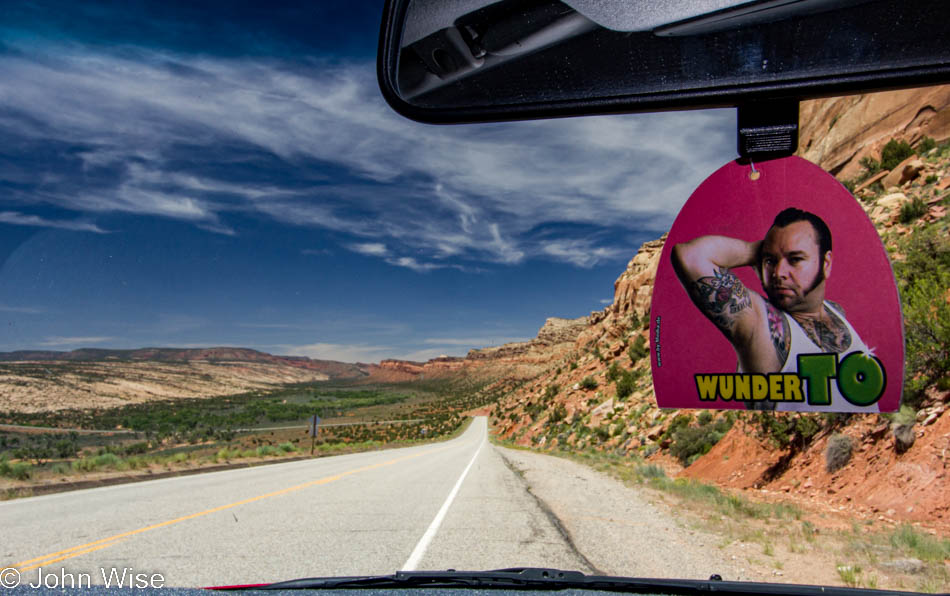
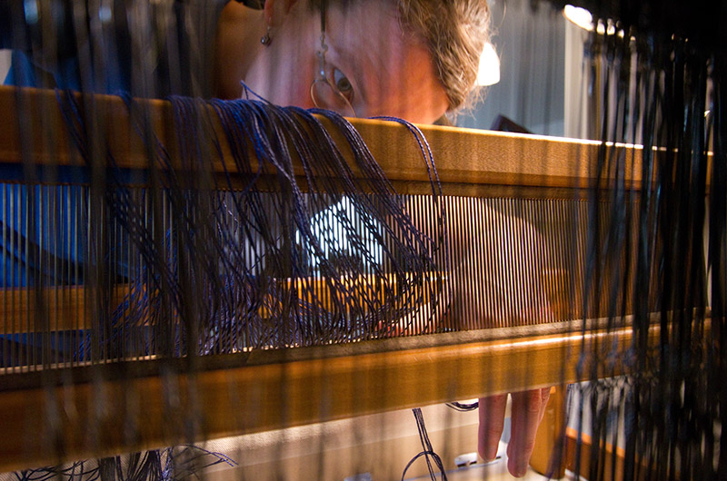
A friend of ours from Frankfurt, Germany, Torsten Kühne, had made a bunch of air fresheners as part of an art project to have people send him photos of the air freshener from around the world.

The trail to Sipapu natural bridge in Natural Bridges National Monument in Utah

A little further south, we arrive at our last stop of this trip, Natural Bridges National Monument. Caroline grabs the Junior Ranger booklet and we scoot to the trail as quickly as we can. This is our second visit to the park, but this particular trail was new for the two of us. We only went as far as the big overhang to view Sipapu Bridge as time was closing in us. The next one, Kachina Bridge we gazed at from the main paved trail. But the third bridge had to be seen from below.

Underneath the Owachomo bridge in Natural Bridges National Monument in Utah

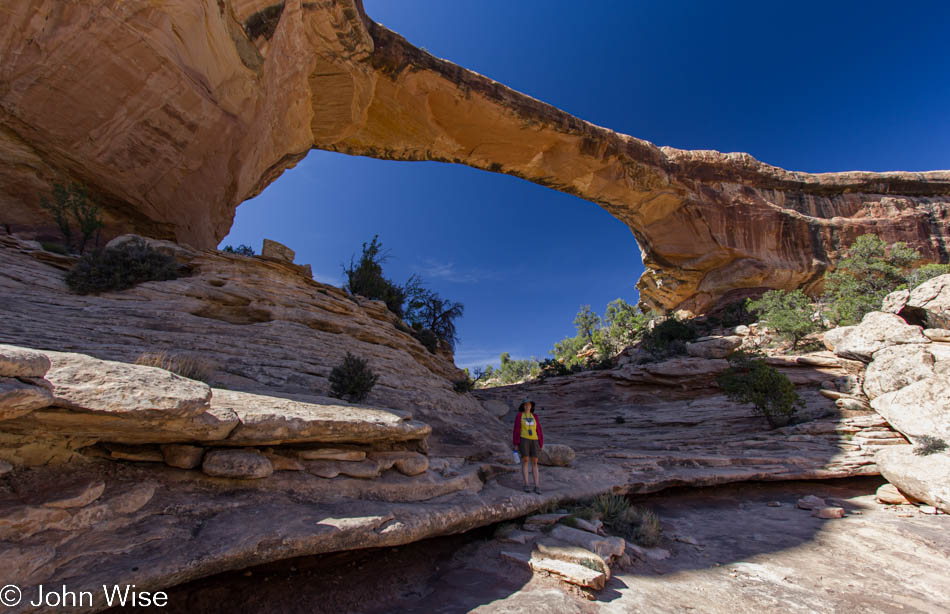
Years ago, we took our picture under this very bridge, the Owachomo Bridge. Somehow, we hadn’t recognized back then that the trail continued under the bridge to where this photo was taken. Look under Owachomo; Caroline is standing there in a yellow shirt. I also learned today that there is a trail that loops for 8.6 miles from Sipapu to Kachina to Owachomo and back to the parking area at Sipapu – it seems like there is always something to come back to in the National Park system.

Caroline Wise getting her Junior Ranger Badge at Natural Bridges National Monument, Utah

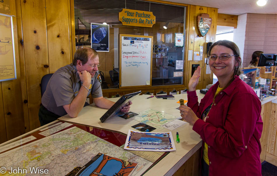
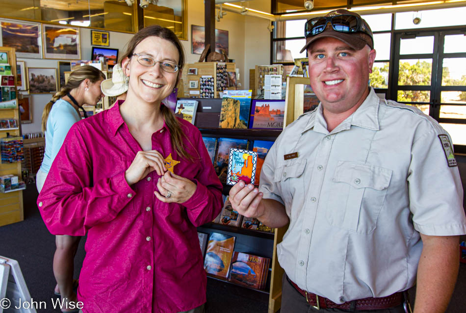
Back when Caroline started doing these Junior Ranger programs, little did we know how many she’d collect; adding this is part of our effort to identify the various places and the dates she got them.

Moki Dugway near Mexican Hat, Utah

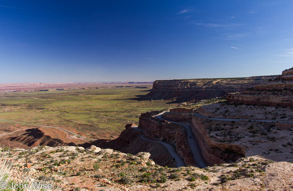
We often wonder how many times we’ve been to places, and it was just this year when we were trying to figure out if we’d ever driven down the Moki Dugway or if we’d always driven up it. This photo answers that question, as from the series of images, we were obviously on our way down that way.

An empty sales stall at Monument Valley in Utah at sunset

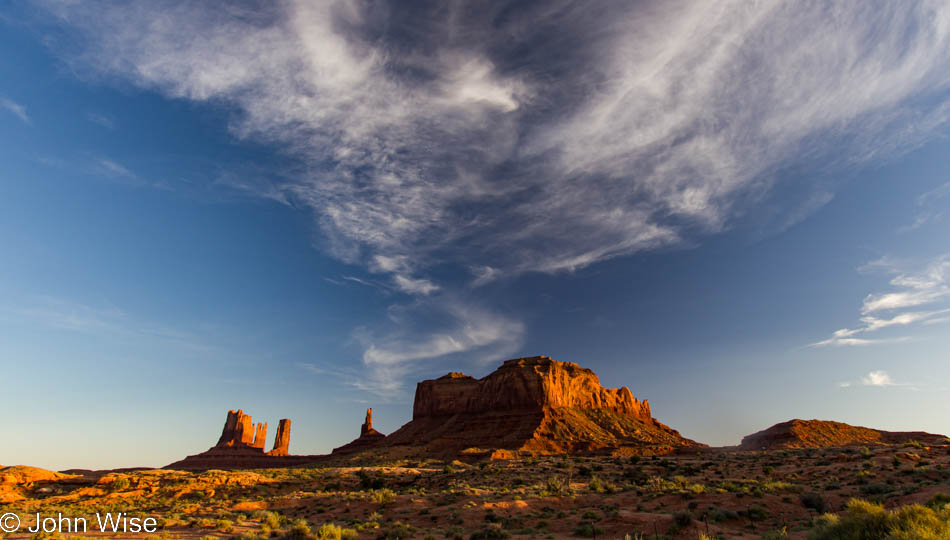
It’s late now, and it no longer really matters how much more time is taken because we will be home somewhere in the middle of the night. So why not stop once more at the Mexican Hat Lodge and grab dinner? We did; I could not resist another swinging steak. We wolfed down dinner, trying to bask in the atmosphere for the brief visit, and were once again going south. As on our trip up north a few days prior, we are passing through Monument Valley again at sunset. The shops have closed up, the natives have gone home, no more jewelry for sale today.

Monument Valley, Arizona

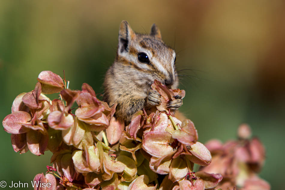
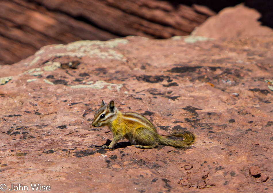
Update in 2022: Why so many images were left out is a mystery to me; maybe I was thinking that we’d already shared too many images of those places.

Desert Details

Various plants, flowers, and dead old logs on the desert floor in Arches National Park in Utah

While traveling, I shoot a lot of photos, too many to post. Often, it is a chore trying to pick a few favorites that I will post with a short narrative about our journey. It can be too easy a choice to select those images with sweeping horizons, vast landscapes, and dramatic sunsets. But that can also give the impression that I miss the fine points. So today, I am showing the fine details and skipping the grandiose.

Desert plant life in Arches National Park in Utah

At sunrise on a holiday weekend, there is no waiting at the ranger booth to pay fees; two hours later, there will be over a hundred cars backed up with impatient families racing to collect an experience or two as they zoom over the road to a “hot” destination to snap a few photos and be on their way. Arches National Park this Memorial Day weekend will be plenty busy, but right now, it is all ours. The trail to Landscape Arch is quiet. All around us, spring has delivered an abundance of flowers and greenery. During the late summer and early fall, it is easy to look past the dead brush, crunchy weeds, and all of the other stuff that looks as though it was alive at the time the rocks that make up the park were still sand.

Flowering plant life in Arches National Park in Utah

To be distracted in thinking that Landscape Arch is ‘the’ thing to see is easy, and if you want to view just what the big attraction is, you can Google that, but I want to share with you what the average visitor appears to be missing. Look down at the ground, feel the fine, still cool, red sand, put your nose close to the flowers, and try to find their fragrance. There is a world of ever-changing desert life that fills in the spaces under the soaring skyline. First, you have to come to your senses that what is between your car and your idea of a destination is just as integral a part of the journey as the collection of trophies.

Flowers blooming in Arches National Park in Utah

A tiny flower is observed. How long will it live? What is its purpose? Should I have brought a book about the local flora so I might be wiser tomorrow for learning today the breadth of variety that exists in a landscape, so many people might see as barren? All around me, giant red sandstone rock begs for attention; I gladly give mine to those things below the radar screen.

A chipmunk eating breakfast in Arches National Park in Utah

Before leaving Arches we visit the now-open visitor center so Caroline can pick up a Junior Ranger guide. She whittles away like a chipmunk, trying to finish the exercises to earn her badge, and in no time, she is being sworn in. With so many people swarming into the park, we decide to leave early. This is not the first or second time we have visited Arches, and we drive over to the more subdued Dead Horse Point State Park.

A yellow Colorado Chipmunk posing at Dead Horse Point State Park in Utah

The rim trail is our hike of choice. The overlook of the Colorado River is truly stunning, but so is this yellow Colorado chipmunk. I don’t know about you, but I had never seen a chipmunk with yellow markings before – now that’s epic. For a couple of hours, we amble along the cliffside, taking our time to commune with lizards, study various cactus flowers, take in the intoxicating scent of cliff rose blossoms, and generally stay in amazement at the colorful state of the otherwise monochromatic desert.

Twisted bark of a tree at Canyonlands National Park Islands in the Sky sector in Utah

And now, over to Canyonlands and the Islands in the Sky district. The focus of this hike could loosely be considered to be the Upheaval Dome, and we sure are thrilled to see this natural anomaly about which scientists still aren’t sure how it was formed, but we are also just as happy to see how some terrific trail builders cut us a path over this difficult terrain so we can find our way over a primitive land with relative ease.

Little purple flowers in bloom at Canyonlands National Park in Utah

The day will end with dinner in Moab at Eddie McStiff’s and another visit to the local grocery for some fresh fruit and snacks for the next day. The town of Moab is stuffed to the gills with visitors on Memorial Day – the busiest day of the year for this mountain biking mecca. A torch-red strip of flaming clouds cut a diagonal across the light clouds before the sunset. Tired from a busy day of looking at small details, we head to our room to digest the rich diet of a million things our eyes ate over the course of a beautiful day.

Caroline Wise and John Wise at Arches National Park in Utah

Addendum: This post was missing all of these photos from what I’m calling an addendum. Why I only focused on the fauna and flora in close-up when I originally posted this is now beyond me. So here in the closing days of 2022, I’m rectifying these omissions to include images of where the photos above were taken. Obviously, our day started in Arches National Park.

Arches National Park in Utah

These thin fins, being all that remains of what was once solid rock surrounding them, just feel crazy that they’d still be standing while everything else simply eroded away.

Arches National Park in Utah

Delicate arch.

Dead Horse Point State Park near Moab, Utah

After leaving Arches National Park, we headed over to Dead Horse Point State Park still near Moab, Utah.

Dead Horse Point State Park near Moab, Utah

While Caroline works on her Junior Ranger booklet, I’m here with my new lizard friend, taking photos and hanging out.

Dead Horse Point State Park near Moab, Utah

The view from Dead Horse Point of a gooseneck in the Colorado River.

Caroline Wise at Dead Horse Point State Park near Moab, Utah

Earning her Dead Horse Point badge and a Red Rock Ranger patch is another pivotal moment in Caroline’s life.

Canyonlands National Park in Utah

The Green River Overlook in the Canyonlands National Park, Utah.

Canyonlands National Park in Utah

The Grand View Point in Canyonlands.

Horseshoe Canyon – The Great Gallery

The Colorado river at the head of Lake Powell in southern Utah

The sun rises after we do, and we are on the road close to first light. My notes should have told us that our turn-off was just four miles north of Mexican Hat on Road 261. Instead, we drove through Bluff and over Road 95, adding a few too many miles to our morning drive. By the time we reach the top end of Lake Powell and the bridge that crosses the Colorado River, the sun is just high enough in the sky to light the canyon below. The sun reflects hot white off the muddy brown water, the same river water that will carry us through the Grand Canyon in October.

Near the trailhead leading into Horseshoe Canyon at Canyonlands National Park in Utah

The real impact of our detour is that we don’t arrive at the trailhead at 9:00 am for a ranger-led tour through Horseshoe Canyon.  Resigned to our lack of punctuality we turn down the bumpy dirt road towards the trailhead and finally make tracks down the trail shortly before 11:00 – so it goes. Our first adventure into this corner of Canyonlands National Park near the infamous Maze District is about to begin. We have lots of water, lunch, and fresh feet ready to tackle the six-and-a-half-mile hike.

A Woodhouse Toad in Horseshoe Canyon at Canyonlands National Park in Utah

The canyon is beautifully bedecked in wildflowers and greenery set against the pink, red, and orangish landscape so common on the Colorado Plateau. We plod along slowly, well, no slower than usual for the two of us, as Caroline and I must inspect every detail and linger to observe the shadows, light, sway of the trees, and beat of the sun as they make their play on the pictures before us. Walking through the riverbed in the sand, Caroline notices the movement of the last creature we expected to find in this arid environment, a Woodhouse toad.

Under a cliff overhang in Horseshoe Canyon at Canyonlands National Park in Utah

Canyon walls stretch high above, the sand makes for slow going, and the temperature is starting to inch higher. Our destination at the end of the trail isn’t the only thing we are here to see, as on the way down, we pass rock art known as petroglyphs and pictographs. Petroglyphs are etched into the rocks, while pictographs are painted onto the rock. They are found at several locations in Horseshoe Canyon and, at times, quite high upon those canyon walls. We stop and wonder what the symbols, peoples, and animals meant to the Native Americans who created them. Maybe these ancient billboards were meant to speak to other native peoples who traveled these lands in the past, or maybe they were meant to convey a message to future generations of Indians still able to interpret this wordless visual language. In this photo, look to the right of the image under the overhang – just left of the shadow next to the green vegetation are two hikers – so you might appreciate the scale of the canyon we are traveling.

Pictograph rock art at the Great Gallery in Horseshoe Canyon at Canyonlands National Park in Utah

The Great Gallery. Pictographs standing over six feet tall tower over us – and the other more than a dozen people who hiked out here with the park rangers earlier this morning. Overwhelming is the first impression these giants convey.

Pictograph rock art at the Great Gallery in Horseshoe Canyon at Canyonlands National Park in Utah

Caroline and I have seen our fair share of Native American rock art, but it has never been of such magnitude. We stand below the ledge admiring the figures, trying to take in as many details as we can while at the same time trying to create some context for who they were and what they meant to the people who took the time to baffle and bedazzle us with their neolithic graffiti skills.

Caroline Wise and Ranger Nate on the ledge of the Great Gallery in Horseshoe Canyon at Canyonlands National Park in Utah

After stepping back to have some lunch and sit amongst the other visitors, we inquired with one of the rangers if Caroline’s Junior Ranger kit that I had arranged to have brought along had made it down the trail into the canyon; sure enough, it had. Ranger Lilly had it, although she had tried to pawn it off on anyone else but found no takers – lucky Caroline. With pen in hand, Caroline got to work; furiously, she ran through the exercises until there was just one more task: a ranger program. Ranger Nate jumped to the rescue; he guided a group of us up to the ledge to speak in detail about the pictographs and allow us a closer inspection. After signing off in her Junior Ranger booklet, Ranger Nate swore Caroline in as a new Canyonlands Junior Ranger right up under those giant beings standing as witnesses.

A lone wildflower in the red sands of Horseshoe Canyon in Canyonlands National Park in Utah

The hike back was a slog through the sand. Our feet began to tire before we were to start the ascent up the canyon wall. We still stopped to admire the random wildflower or lizard baking in the mid-afternoon sun. The steep canyon walls vied for attention, as did the song of the random birds nesting in the crags and trees above. We hiked on and on and up the trail until, off in the distance, we could spot our car at the trailhead. Almost finished we paused for a drink of water, sharing a beaming smile that we finally made it deep into one small but significant corner of Canyonlands National Park and could now brag between ourselves that we had personally seen the Great Gallery with our own eyes.

Blackberries and a Ghost Town

Blackberries on the bush at Silva's Farm in Yuma, Arizona

Early O’thirty was about when we were off and driving southwest towards Yuma, Arizona, for a morning of blackberry picking at Silva’s Farms. Two years ago, we picked buckets full to bring back home and freeze. Now, out of fresh, sweet blackberries, it was time to make the trip once more. The season lasts about a month, and the 235-mile drive each way may not seem worth it to some, but then they probably haven’t spent a few hours in an orchard picking blackberries that fall off at a touch, staining fingers purple before being gobbled up. And gobbled up. A few for the bucket, five for me, two for the bucket, and six for me. Two thoughts come to mind: I hope I don’t get a stomach ache and do too many sun-warmed sweet blackberries give you the runs? I can attest that after eating more than a pound – for free – I felt great and was able to maintain my dignity without a mad dash to the outhouse.

Flowers at Silva's Farms in Yuma, Arizona

Twenty pounds worth, that’s how many blackberries we ended up packing into the ice chest. For everyone who thought we were crazy for driving so far just for berries, they sure didn’t mind taking a couple of pounds off our hands once they tasted them. From the farm, we drove further south to San Luis on the Mexican border, looking for a roadside taco shack. We found Tacos Sahuaro with the cook armed with a cleaver chopping up the lengua (tongue), which I tried and enjoyed. With my stomach full of tongue, it was time to drive north.

The wetlands near Imperial Dam north of Yuma, Arizona

Our first detour was a visit to Imperial Dam, and along the road, we were surprised by an oasis of shallow wetlands. A checkmark is placed next to this location for a winter return when we assume this area must play host to migratory birds. This dam on the Colorado River is the collection point for the water that will be pumped northwest into California and down to the Yuma area to irrigate the desert lands that feed so much of America’s desire for lettuce and other produce. North of the dam, we visited the Senator Wash Reservoir and surrounding lakes to see what was what on the California side of the Colorado River.

Caroline Wise and John Wise in front of the Kofa National Wildlife Refuge sign in western Arizona

Highway 95 north passes the Kofa National Wildlife Refuge – we failed to see wildlife, but our turnoff from the main highway onto Castle Dome Mine Road was not with the intent of going bird watching; we were driving up this bumpy dirt road to visit the Castle Dome Ghost Town. In our little red Kia Spectra, we bounced along over the washboard road for about 10 miles before approaching the sign directing us to a small car corral.

Inside the home of the Stone Cabin Ladies at Castle Dome Ghost Town in western Arizona

Proprietor Allen Armstrong welcomed us and collected our small $6 entry fee – that was worth every penny, although we didn’t know it at that moment. Castle Dome Ghost Town is one of the most amazing ghost towns we have visited – although we haven’t seen Bodie in California yet. After walking through the gift shop, you enter the town and take two steps back into history. Allen and his wife Stephanie purchased the property, saving it from the wrecking ball, and began restoring the 37 buildings that make up this great attraction. The photo above features some of the belongings of the Stone Cabin Ladies – Stephanie is currently writing a book about the sisters who lived in the area. One of them survived into her 90s and welcomed visitors to their diner until 1988.

Inside the Castle Dome Hotel in western Arizona

Interior of the hotel with artifacts galore on display. The openness of the displays and the opportunity to walk through this historic site are simply wonderful. Allen explained how many of the treasures were recovered from the mines where “old junk” was discarded. If you plan a visit, don’t do like us, and arrive at 2:30, you’ll be disappointed that you have so little time before they close up and kick out the ghosts at 5:00 pm.

Inside an old grocery store at Castle Dome Ghost Town in western Arizona

We ran out of time to visit the other side of the road, where an old bunkhouse and some abandoned mines are located. The mines are closed up so no one goes hurting themselves, tumbling down a shaft, or getting lost in some maze with the rattlesnakes. During the summer, the old ghost town sees few visitors – it’s hot, really hot out here, and there ain’t no air conditioning. If you should find yourself wanting to visit and aren’t sure about the hours or directions you can call the ghost town at 928-920-3062. Their map coordinates are: N 33° 02.766 W 114° 10.668

Caroline Wise at the bar in a kitchen at Castle Dome Ghost Town in western Arizona

Before leaving, we offered Allen some of our stash of chilled blackberries. He told us of how he and his wife would pick berries when they used to live in Washington, canning them for later use on pancakes. Tomorrow morning, he and his wife would make pancakes to enjoy the blackberries with – kind of a re-acquaintance with a moment from their own history. Take a minute yourself someday and visit Castle Dome Ghost Town and acquaint yourself with a moment from our country’s history – you’ll have a great time out here in the middle of nowhere.

Out On The Farm

Caroline Wise digging in our plot at Tonopah Rob's Vegetable Farm prepping the ground to plant beans

Started the day out at Tonopah Rob’s Vegetable Farm helping Rob and Jerry with the Saturday morning Farm Stand where they sell veggies picked during the previous few days. In between chatting and restocking, helping Rob’s mom in the kitchen, and checking out the progress of the farm, Caroline picked up a shovel and helped turn over half of our plot. For my volunteering out on the farm, Rob gave me a 12 foot by 14-foot plot to grow what I wanted to. Besides the garlic which should be done next month and a small row of chard I’m leaving to see if we might get one more cutting from it, the plot has been cleaned. I began sowing seed on September 21st and made my first harvest on October 27 – some radishes and greens are quick to grow. Since that first harvest Caroline and I have enjoyed the following:

  • 25.5 lbs of Lettuce
  • 10.3 lbs of Radishes
  • 18.5 lbs of Carrots
  • 10.3 lbs of Spinach
  • 17.7 lbs of Cabbage
  • 10 lbs of Chard
  • 10.5 lbs of Turnips
  • 14.5 lbs of Arugula, Bekana, Mizuna (salad greens)
  • 2.75 lbs of Beets (crop failure)
  • 1.7 lbs of Broccoli
  • .75 lbs of Broccoli Greens
  • 1.0 lbs of Turnip Greens
  • 2.6 lbs of Bekana
  • 4.25 lbs of Collard Greens
  • 1.6 lbs of Cilantro
  • 1.0 lbs of Fenugreek
  • .9 lbs of Chervil
  • .5 lbs of Chual (a desert southwest green)

Nearly 135 pounds of all-natural veggies came out of our tiny plot! This coming week I’ll be out planting beans. After the garlic is picked and I finish with the beans, that will be it for the season as it is simply too hot over summer to be out working the soil. Over the course of summer I’ll be posting a series of stories on Tonopah Rob’s website detailing what went into my plot, when and how much I harvested, and the shelf life I was getting while storing the haul. Obviously, there were times we couldn’t eat the amount of food picked in a few days. I do hope to take the lessons learned these past six and a half months and apply them at the end of this year to see what kind of yield improvement I can get if I do things better the second time around.

Surrender, Dorothy!

Caroline Wise learning to setup and weave on a Dorothy loom

Knitting, spinning fiber into yarn, dyeing wool and cotton, drop spindle yarn, charkha, inkle loom, Navajo loom, tapestry loom, hand-knit socks, carding fiber, I suppose it was only a matter of time before Caroline took an interest in yet another fiber art, this time it would be the more traditional weaving loom. A private lesson with Bernie Goodrich out in Apache Junction, Arizona was scheduled and early today we drove out for Caroline to learn how to dress a Dorothy 8-shaft loom followed by a weaving lesson. Bernie has quite a few years of experience and was more than happy to share her knowledge with my wife. I learned long ago not to turn away from the opportunity to see how something I may know little about works. How many of us take for granted that our machine-woven Chinese underwear is using the same basic weaving technique that has been used for thousands of years? The guild Bernie belongs to rented the loom to Caroline for the next two months, I’m looking forward to my hand-woven wool boxers that should be done in time for summer.