Cumbres & Toltec Steam Train

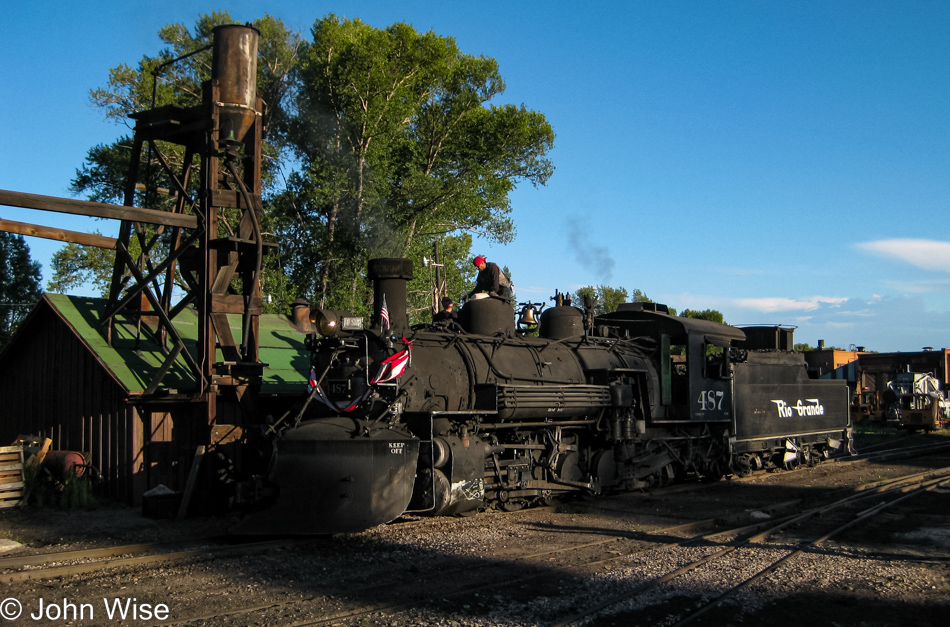
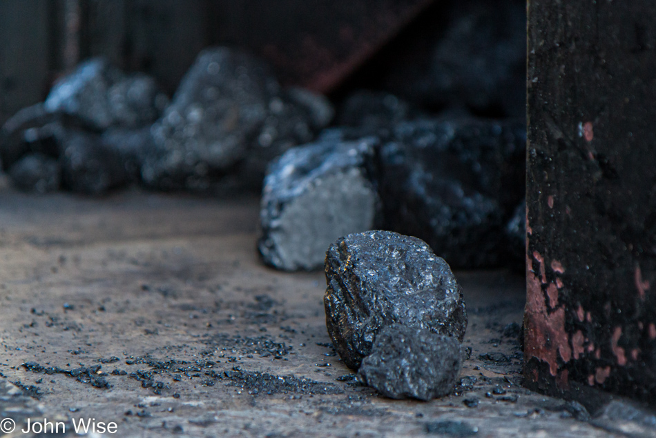
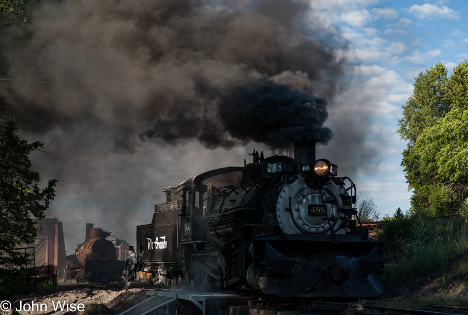
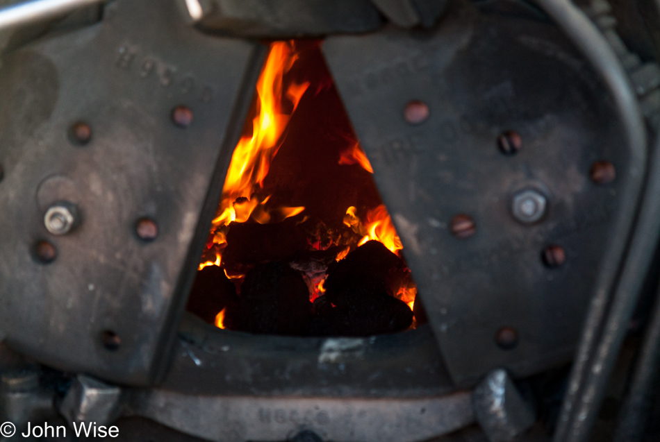
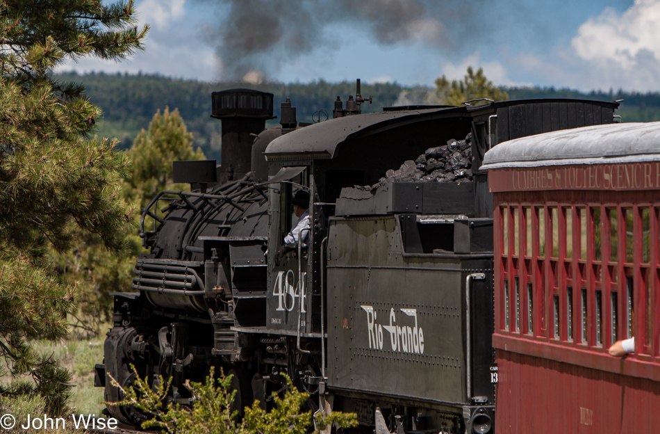
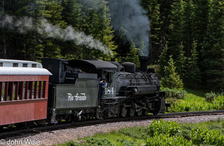
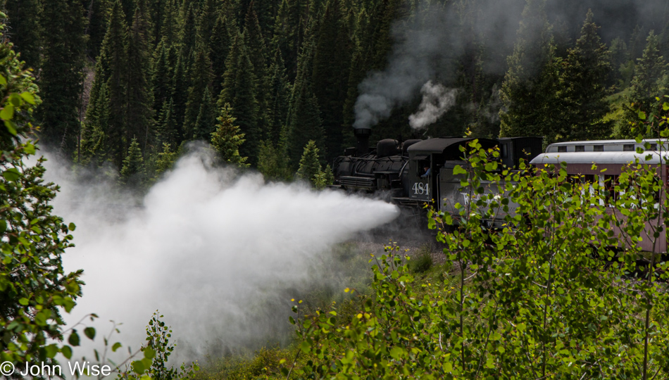
Guilt and delight as the old steam engine belches thick black coal smoke, getting ready to take us into a countryside we’ve never seen. On one hand, to satisfy our sense of the aesthetic, we are shooting this raw, unfiltered black soot into the atmosphere, but then again, this is the easily visualized pollution that pales in comparison to the billions of tons created by human activity. Not that I want to excuse it, but yeah, I guess I want to do just that.

We are hanging out at Chama station as the train yard returns to life, and we wait until we are ready to depart. The initial part of this journey doesn’t begin with a train ride, though. For some, it will, but not for us. We will be boarding a bus this morning for the drive to Antonito, Colorado, where we’ll be catching the train going south.

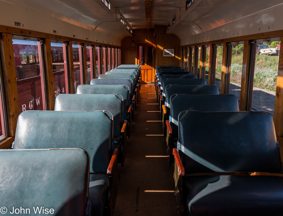
Moving across rugged terrain by steam locomotive is not a quick means to an end. Nor should it be when you consider we are here for the scenic element as much as the historic sense of nostalgia that comes with riding an old-fashioned train that was built back in 1925.

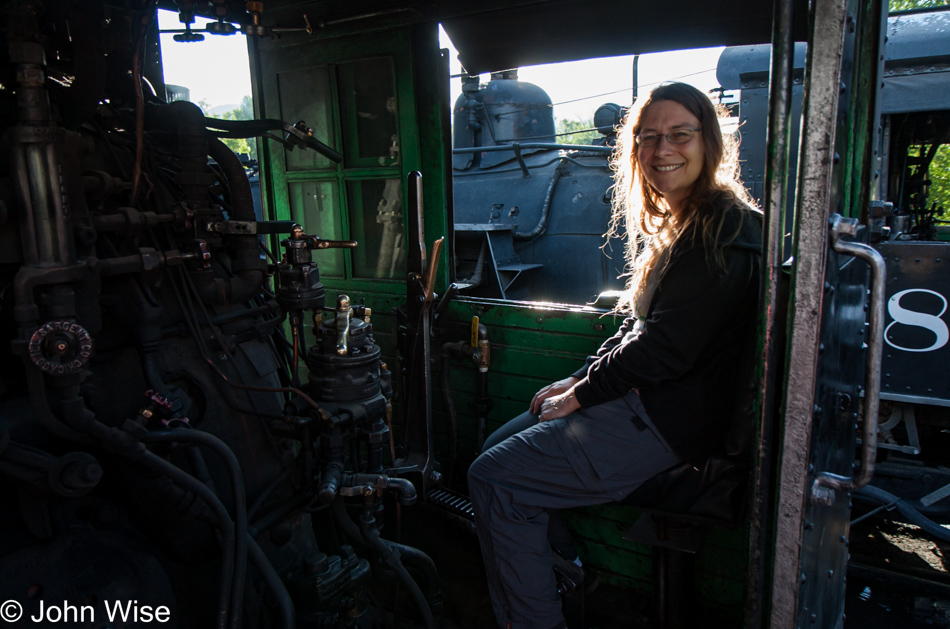
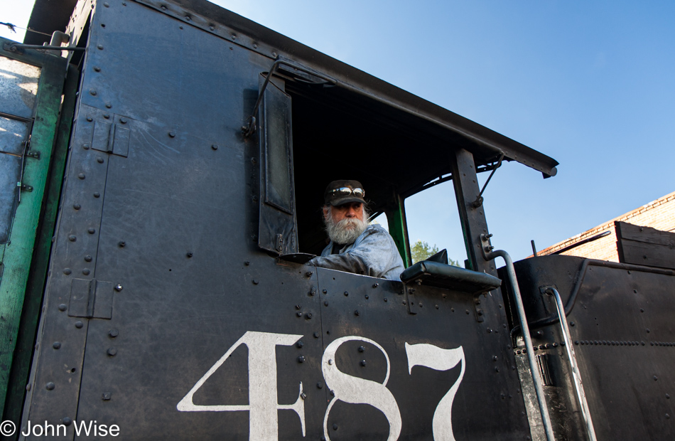
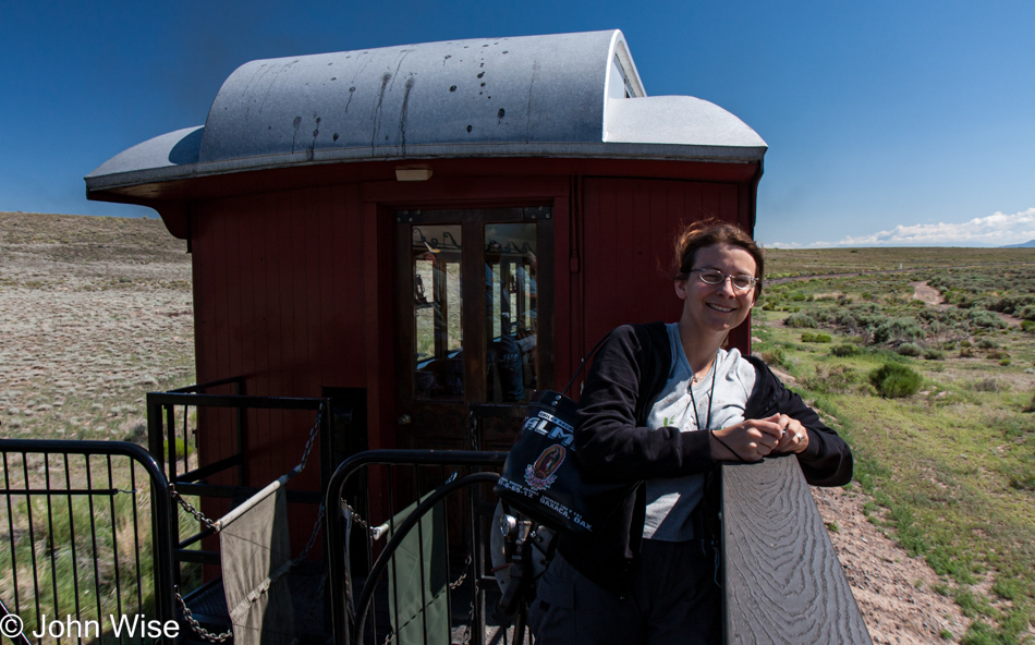
While waiting for our coach to take us north, we were invited to become acquainted with the engines and were not going to be shy about that. Who knew that this might be foreshadowing an event yet to happen in the future?

I’ll explain that last statement, as I’m not sure how the reader got to this post. I have to explain that I’m writing this post on August 10th, 2022, because back in 2009, when we were out here, I never got around to blogging a thing about this long 4th of July weekend. So, the foreshadowing is my allusion to what is penciled into our itinerary for 2023 travels. Late summer of 2023 we should both be aboard an antique K-36 Baldwin locomotive shoveling coal and pulling the throttle as we join the Cumbres & Toltec Fireman & Engineer school program. My fingers are crossed.

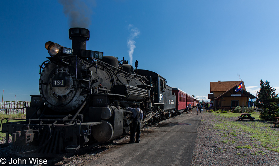
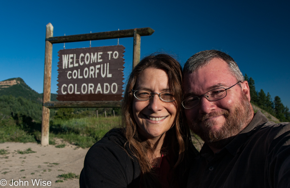
Here we are in Antonito, Colorado, about to board the train that will bring us back to Chama.

And off we go into the Wild West.

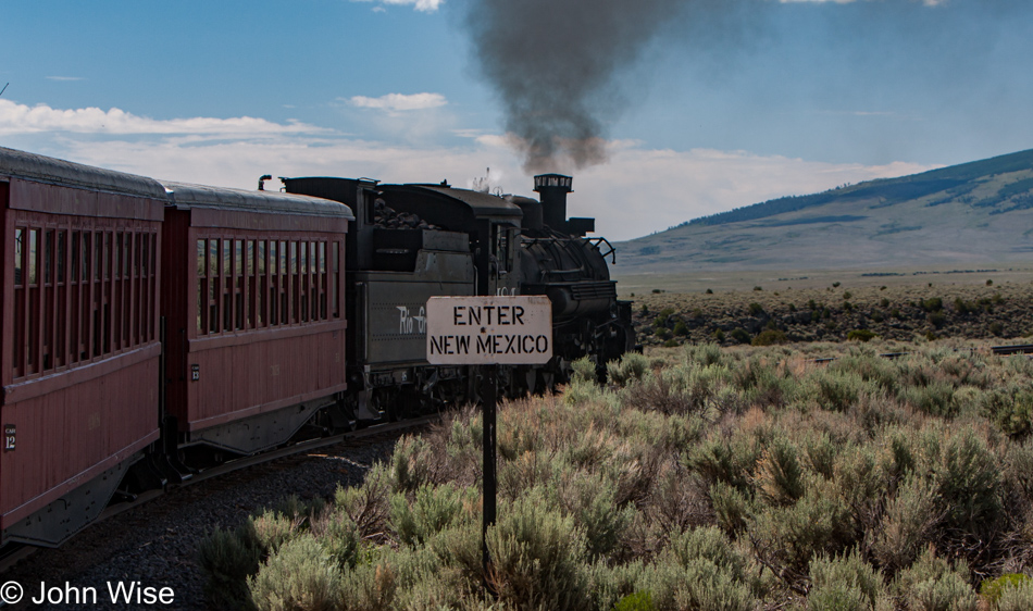
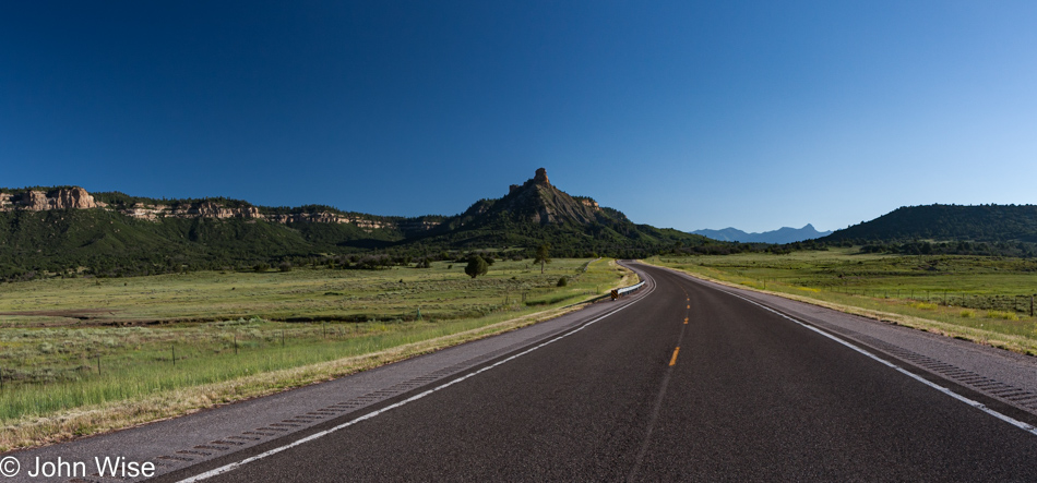
It’s barely more than six miles to the New Mexican state border, with 58 miles still ahead of us, though we’ll pass between the states a couple more times.

We’ll be out here away from it all for over six hours, not a bad way to spend a day.

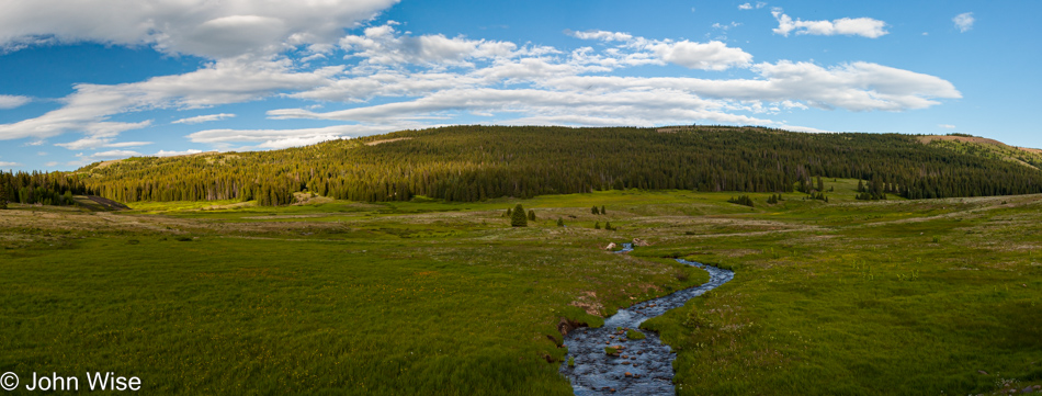
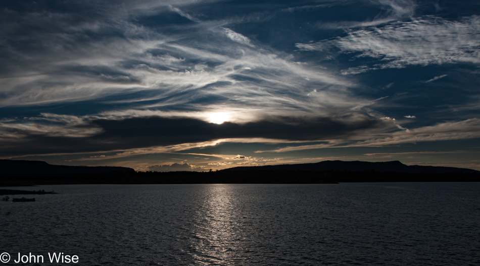
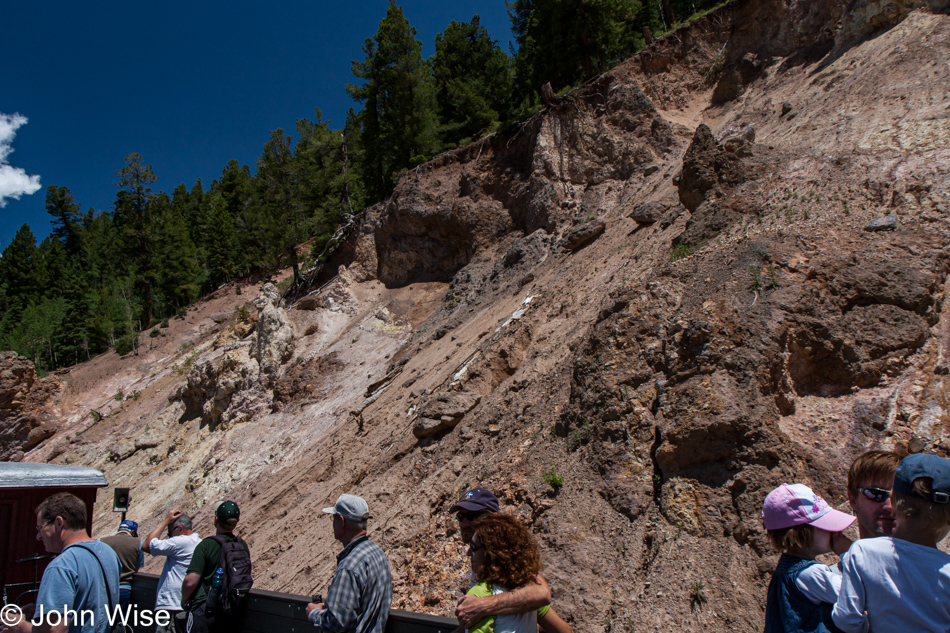
Maybe the most difficult part of this ride into history is trying to find a sense of mind allowing us to glimpse the world as it might have been seen by people traveling these rails after 1880 when they were first laid down.

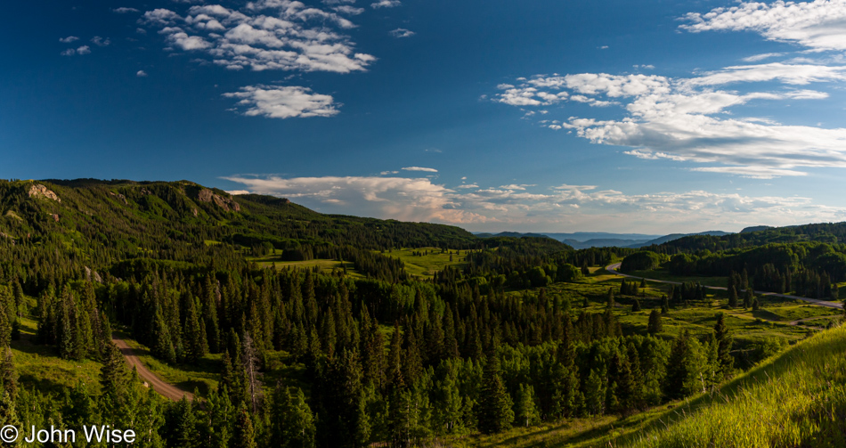
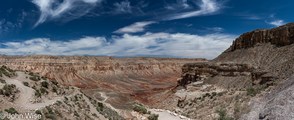
There’s a reason behind the naming of this route and the first part comes from Cumbres Pass, which we’ll cross at 10,015 feet of elevation (3,053 meters), and the Toltec Gorge, which is 600 feet deep.

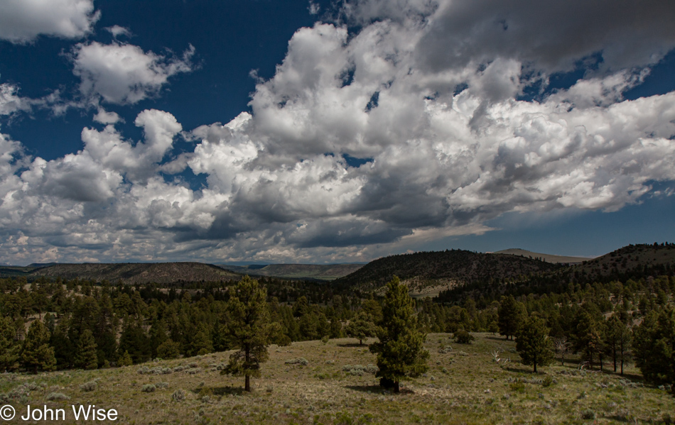
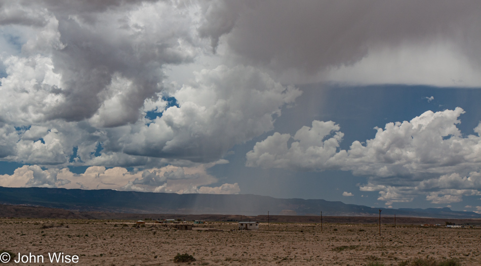
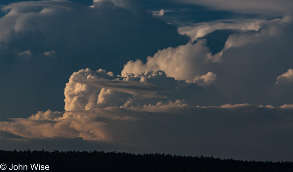
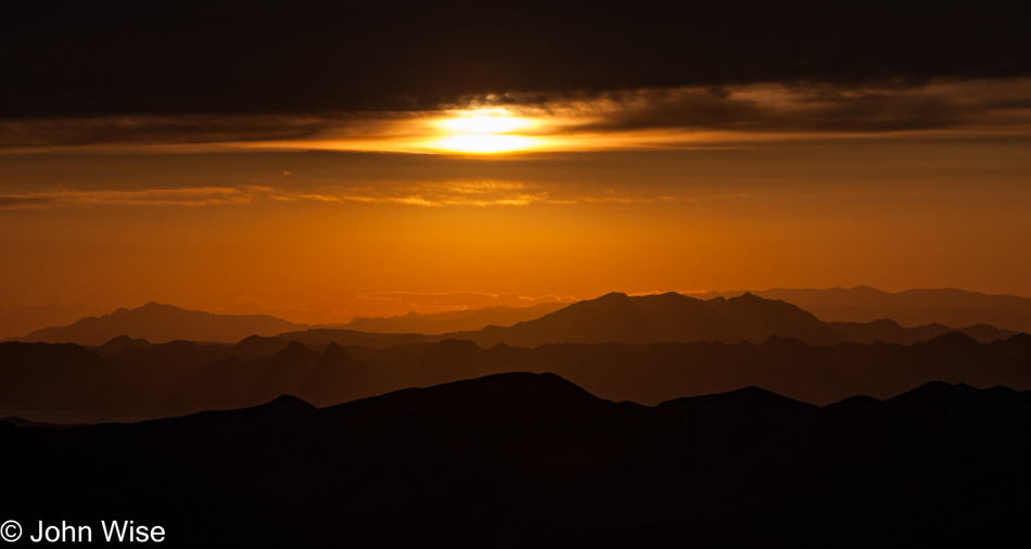
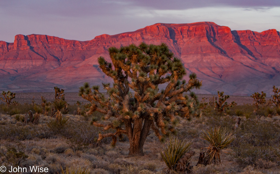
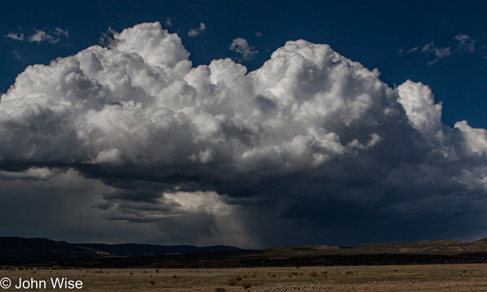
How do we so frequently find the good fortune to have the perfect weather when out exploring our world?

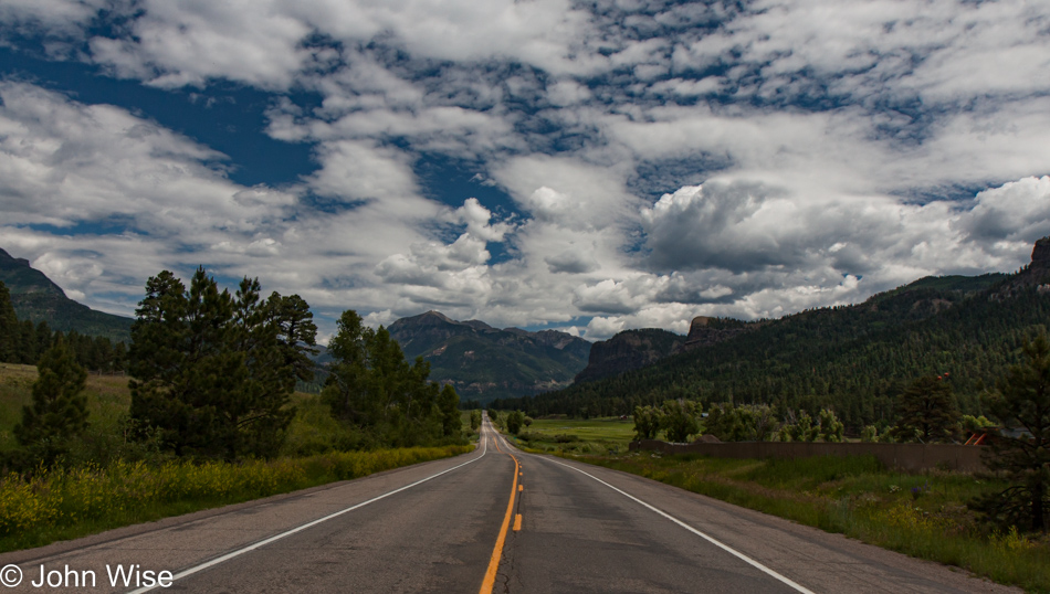
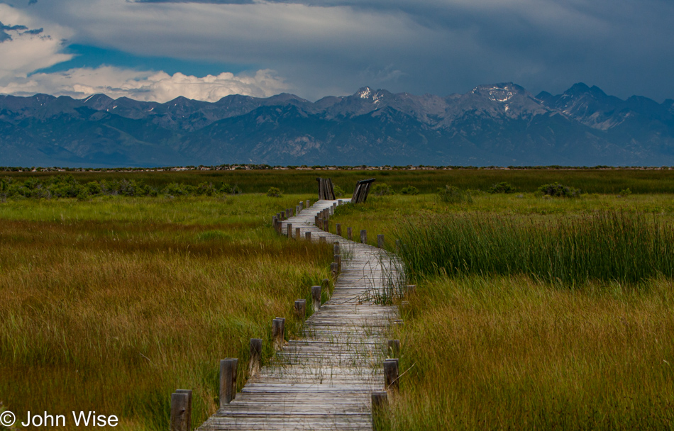
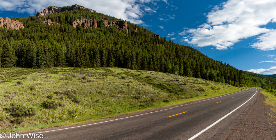
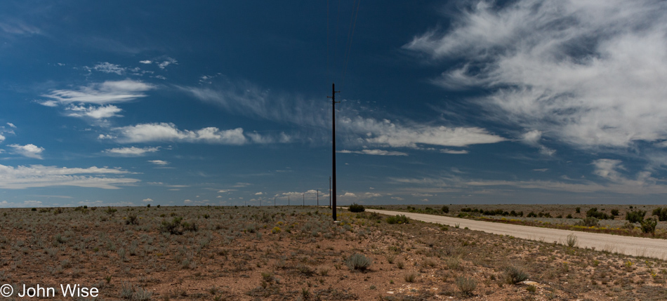
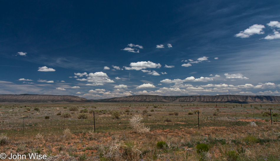
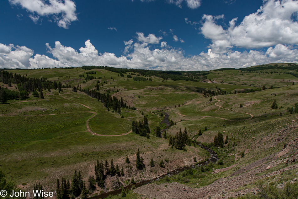
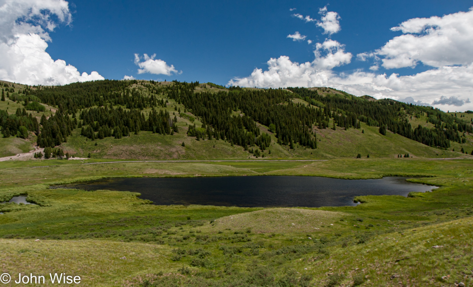
Along parts of our route, there are forest roads that parallel the track.

If your goal is to get 60 miles down the road as quickly as possible, this method of travel is certainly not the most expedient, but if time allows, I believe it is the greatest way to travel. No billboards, no franchises hawking their uniformity, no chance of another train veering into your lane, just the slow journey into a rarely seen corner of America.

Sadly, there’s no way to make this into a multi-day holiday in the United States because we have so few scenic rail lines in our country. Sure, there are short lines here and there, but if a traveler were to want to embark on a 10-day cross-country trek not shared with busy freight lines and unreliable service through efficient corridors of travel instead of the most beautiful, that’s not going to happen.

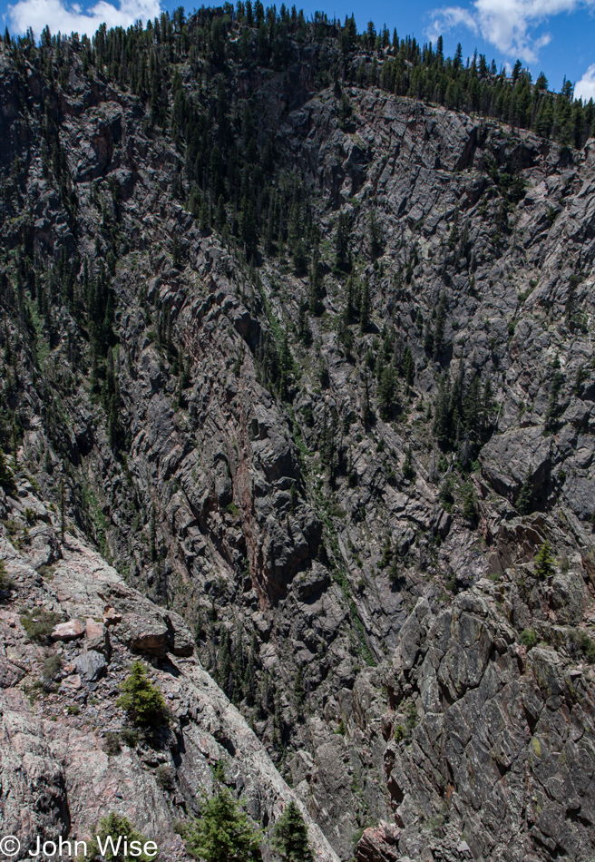
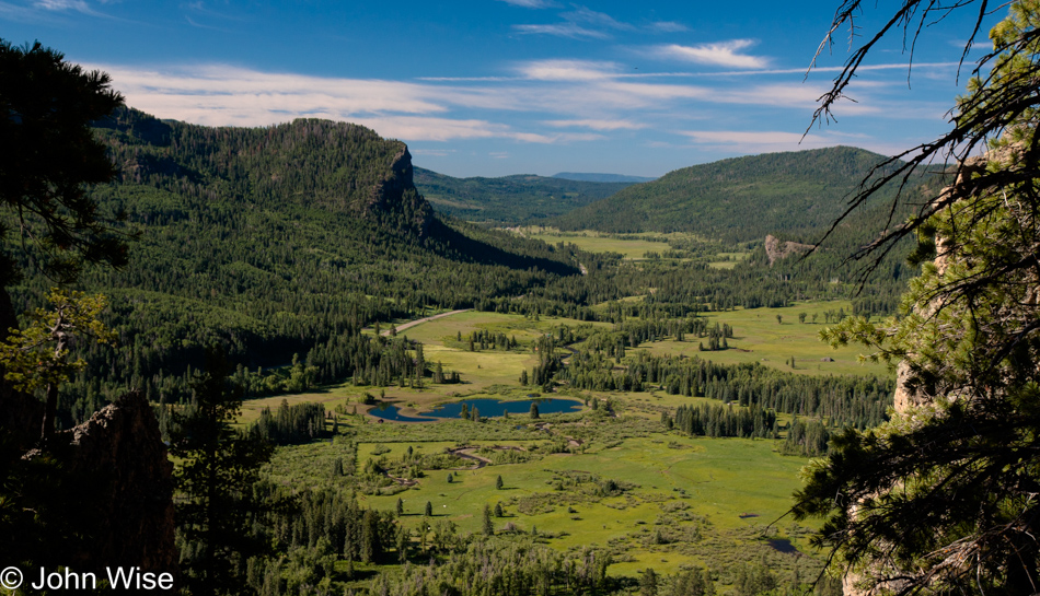
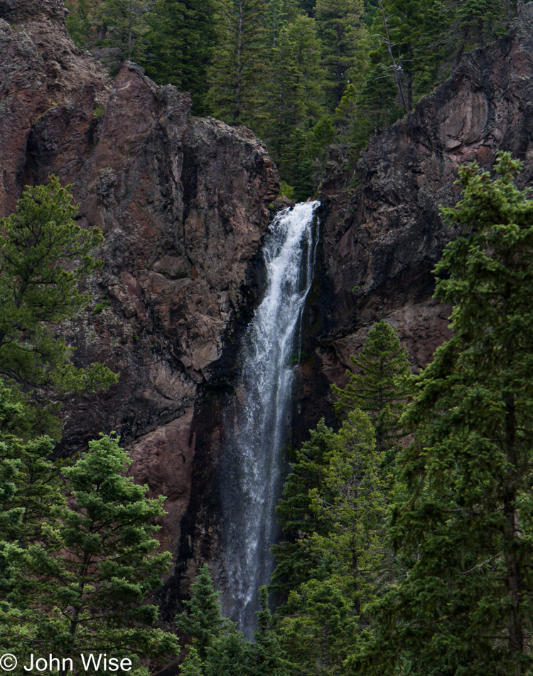
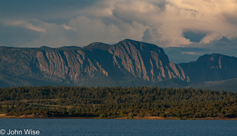
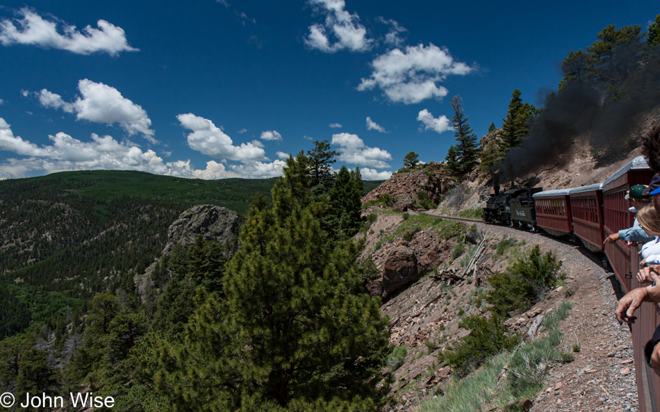
We’re passing through the Toltec Gorge back in New Mexico, which is drawing passengers from their comfy seats out to the open-air cars. Six hundred feet below is the Rio De Los Pinos.

Having made this trip and documenting it is allowing me years later to linger in the memory of it all, and if I want to romanticize the magnitude of what it was, I have this luxury. Whatever the cost was, the effort required to drive the over 500 miles to northern New Mexico and then back home, the quality of the meals found here and there, none of that matters anymore as the images I’ve carried with me all show me a perfect day where everything must have been perfect.

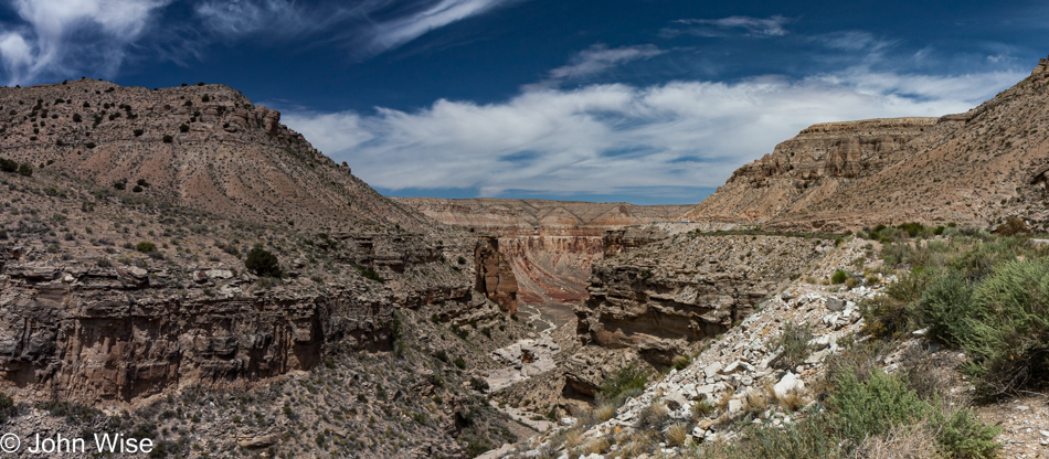
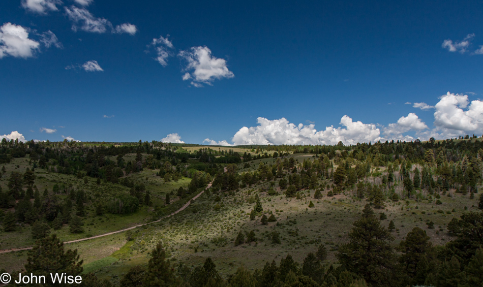
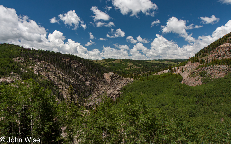
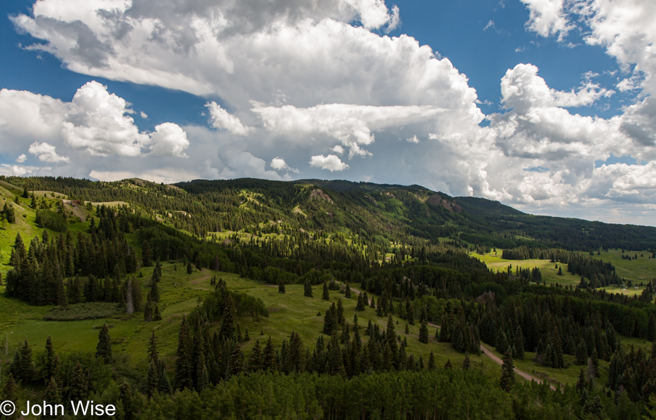
I believe we just passed back into Colorado and that we are looking at Forest Road 74, which originates in New Mexico on the left, with Colorado FDR 103 on the right.

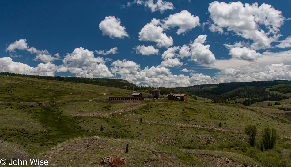
Osier Station in Colorado is up at 9,626 feet of elevation (2,934 meters) and was our lunch stop.

Starting our push to climb over the Cumbres Pass.

Heading for the home stretch.

Yeah, I could do this for weeks.

And so, as with all good things, this too has to draw to an end.

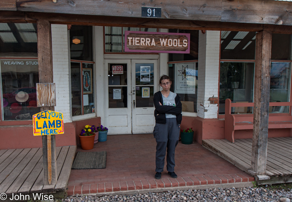
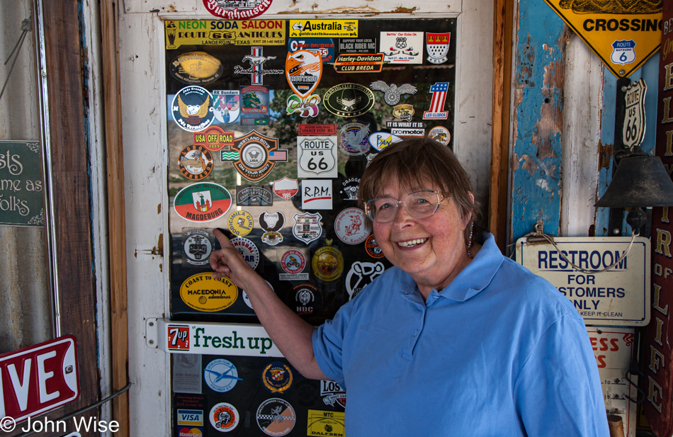
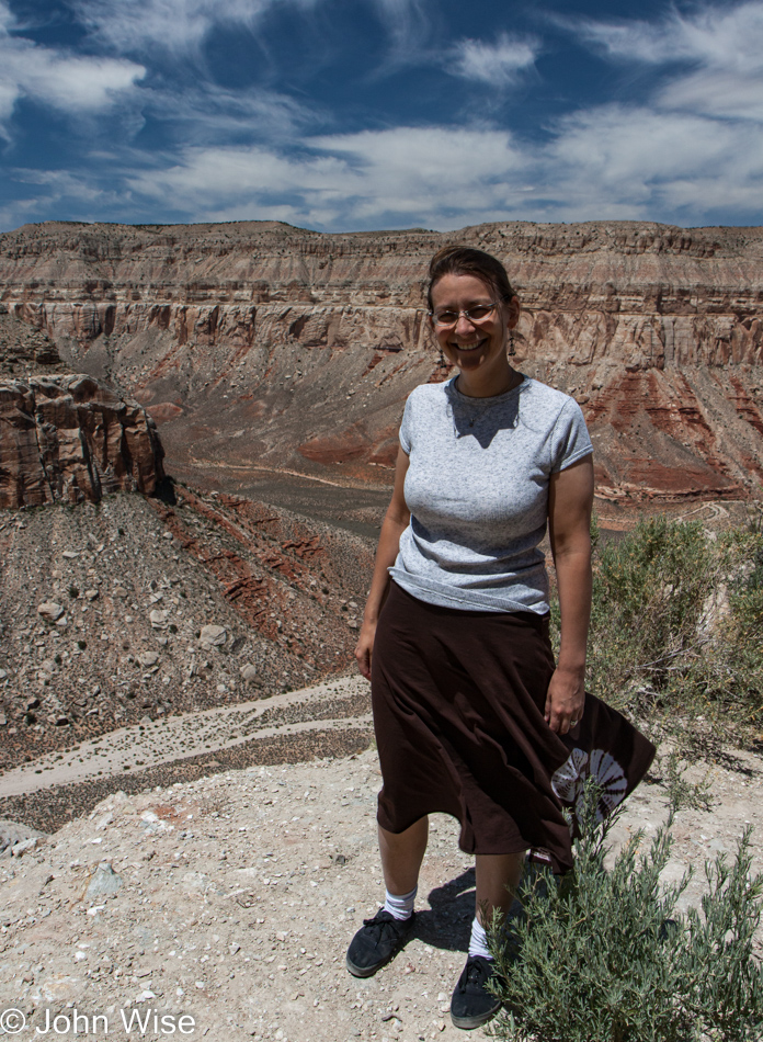
Oh no, not a bitter end!? Caroline is experiencing a small letdown with this failed attempt to visit Tierra Wools in Chama, New Mexico.

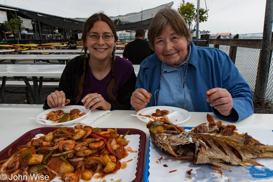
We won’t make it home today, won’t even try as with 9 hours of driving ahead of us, that would be foolish. We did stop in Albuquerque, though, as we knew we’d be able to collect an incredible meal at Sadie’s Mexican Restaurant for dinner; they were open and did not disappoint.

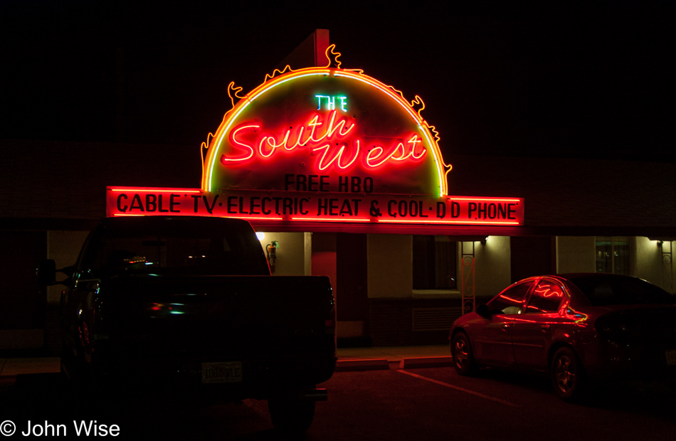
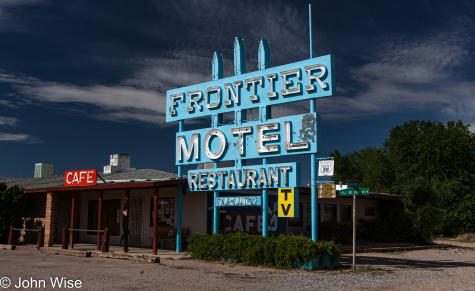
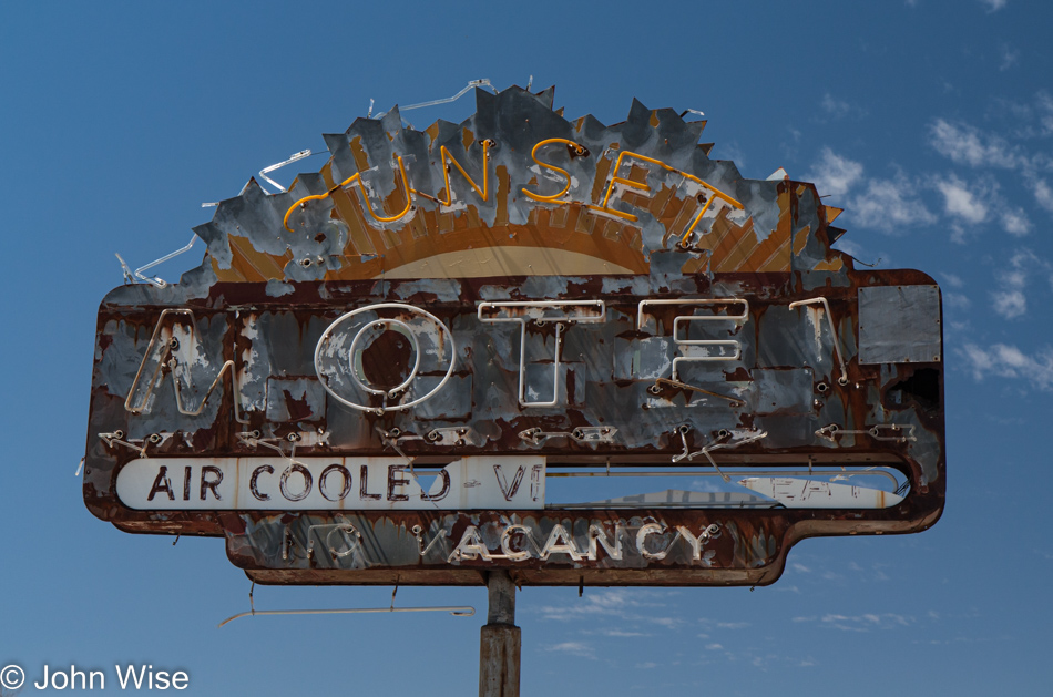
Stayed at the Southwest Motel in Grants, New Mexico, which would put us only about 340 miles from Phoenix. This is important because on the next day, July 6th, there’s not a single photo, and that can only mean one thing: we drove directly to Caroline’s office, and she went to work. You see, we are all about maximizing the use of vacation days, and with Arizona ahead of New Mexico regarding the clock, if we’d left early enough, we could have had Caroline sitting down at her desk shortly after 9:00 a.m. thus saving a day for the next trip that was only 80 days away.

4th of July – New Mexico to Colorado

North of Chama, New Mexico heading into Colorado

We first visited this area not far from Brazos, New Mexico, back in the analog age of the 1990s with two old friends, Ruby and Axel. Camera technology had failed people as the cost of getting a somewhat good photo or two from expensive film was skyrocketing, so people just stopped taking so many photos. Had the world looked so incredibly well-defined, colorful, and grain-free back then, I believe there would have been no need for digital cameras, but Kodak failed us. Today, though, this is what northern New Mexico looks like, and I think everyone should come and see it for themselves.

Caroline Wise and John Wise at the Colorado State Line

Look hard, those are the faces that are in the mode of celebrating America’s Declaration of Independence because if you’ve not noticed the date, it’s the 4th of July.

U.S. Route 84 to Pagosa Springs, Colorado

If this were all you ever knew about Colorado and you allowed this to be the image of the state, minus the snow-capped Rockies, of course, then you’d have a pretty good sense of the place. Oh, I should add, just forget about the eastern half of Colorado as it’s just flat and Great Plains-y.

U.S. Route 84 to Pagosa Springs, Colorado

With over 23,000,000 waterfalls, Colorado has more of these features where water tumbles over edges than anywhere else on Earth, including the United States.

Pagosa Springs, Colorado on the 4th of July

Oh my god, are those Stukas over Colorado, or am I in Disneyland?

Pagosa Springs, Colorado on the 4th of July

Maybe those planes were effectively the announcement that festivities were getting underway here at the 4th of July parade in Pagosa Springs, Colorado? Yeah, that’s what that was.

Pagosa Springs, Colorado on the 4th of July

If we’ve learned nothing else, it would be that the 4th of July should be spent not just once but multiple times in small towns as there’s something wholesome (sorry for the corny word) about being in places where simple things are appreciated and celebrated. You should check out our trip from a few years ago to Canadian, Texas to see that we really do love these small-town American adventures.

Pagosa Springs, Colorado on the 4th of July

Sorry about the irreverence of this post and its potential to veer out of control instead of just respecting the holiday, but that reference above regarding the Stukas Over Disneyland was a nod to the punk band The Dickies. Well, that memory took me over to YouTube to check out this band I last listened to back in the late 1970s, and it turns out that I needed to listen to them in real punk rock style. Huh, you’re not sure what I mean? Ya know how the songs were short? Listening to those hits all these years later, I managed about 20 seconds of Where Did His Eyes Go? before skipping to Attack of the Mole Men. I made it about 15 seconds into that before clicking on I’m a Chollo, which was pretty good for almost 45 seconds before I’d had enough of this punk rock session.

Pagosa Springs, Colorado on the 4th of July

If only this horse-drawn buggy had a gun turret mounted somewhere, anywhere, even on the horse, this photo could have been the epitome of what it means to be America: flags, guns, streets, sitting around, beer at the saloon, food, and well, that’s enough.

Traveling north on Wolf Creek Pass - US Highway 160 north of Pagosa Springs, Colorado

Traveling north on Wolf Creek Pass – US Highway 160 north of Pagosa Springs, Colorado. There’s a song from C.W. McCall penned in 1975 titled Wolf Creek Pass; it’s not punk, nope, it’s worse, don’t listen to this turd.

Traveling north on Wolf Creek Pass - US Highway 160 north of Pagosa Springs, Colorado

Over the course of this blog post, we are working to document no less than 10% of all waterfalls in this great wet state. This is but number two, with only 2,299,998 left to go.

Traveling north on Wolf Creek Pass - US Highway 160 north of Pagosa Springs, Colorado

Lunch was at the Peace of Art Cafe in Del Norte, Colorado. This is not their location.

Somewhere between Del Norte and Antonito, Colorado

Russell Lakes State Wildlife Area in Saguache, Colorado, as I said, is wet. Just last month, with my mother-in-law Jutta in tow, we all went out on a Wandering Out West road trip, a weekend really, but during that time, we detoured, and then more than a dozen years later, when I was actually writing that post, we had to figure out where the heck we had gone. Well, same thing here as this is yet another post that didn’t see the light of day until August 2022. Where are we?

A couple of days ago we had no idea where these pictures were taken, not a clue. So, while I was out writing whatever stuff I made up for that other post, Caroline and her super-sleuthy skills pegged it. The motivation back then to take this 40-mile detour north is lost by now, but that’s what we did, and instead of looping around towards the Great Sand Dunes National Park, we apparently turned around and went south the way we came.

Somewhere between Del Norte and Antonito, Colorado

Maybe you are wondering about the scattershot writing style and want to ask, “What’s up with this post, John?” Just as we are out celebrating the 4th, we are free to see what we want, photograph what we want, and say any old crap we want because this is America.

Somewhere between Del Norte and Antonito, Colorado

Birds fly, while some quack and others do both.

Las Mesitas Church ruin in Antonito, Colorado

San Isadore Church ruin in Las Mesitas, Colorado west of Antonito, Colorado.

Traveling the Cumbres Pass via Highway 17 from Antonito, Colorado to Chama, New Mexico

Traveling the Cumbres Pass via Highway 17 from Antonito, Colorado, to Chama, New Mexico, and stopping at the Conejos River. If you are wondering if I’ll return to snark, punk references, or lay down some, “I’m American, which means I have the freedom to be as crazy as I want,” you might be looking for a while because by now I just want to be done with these old posts.

Traveling the Cumbres Pass via Highway 17 from Antonito, Colorado to Chama, New Mexico

Jeez, this road is long. I mean the one where I account for every travel day Caroline and I have taken since we started taking digital photos. Today, meaning this particular July 4th, 2009, represents our 663rd day away from Phoenix, Arizona. It was back on August 8th, 1999, that I found our oldest digital image of us traveling to Los Angeles, California, with friends; that is Day 1 in my grand index. This means that I’m in the first ten years of our travels in the digital photography age and still have 13 more years to ensure I’ve covered here on this blog. Remember, although I reference 2009 here, I’m writing this sitting in a Starbucks at 32nd Street and Union Hills Drive on August 9th, 2022.

Traveling the Cumbres Pass via Highway 17 from Antonito, Colorado to Chama, New Mexico

The paragraph above is called filler for the empty mind because I didn’t know what else to say, so I go for relatively superfluous stuff that, while conveying something, really has nothing to do at all with our drive to Colorado and return to New Mexico on this day.

Traveling the Cumbres Pass via Highway 17 from Antonito, Colorado to Chama, New Mexico

Ah, this is the Cumbres Pass area that will play a significant role in tomorrow’s big adventure.

Traveling the Cumbres Pass via Highway 17 from Antonito, Colorado to Chama, New Mexico

At this moment, Caroline and I stood at the most beautiful scene we’d ever seen and would ever see on this particular day at the time we stopped to take it all in. Sure, there will be others in the future, but never again will we capture this moment like we did at this moment.

Cumbres and Toltec Steam Train in Chama, New Mexico

Cumbres and Toltec Steam Train in Chama, New Mexico, not that we’re going to be on a train tomorrow or anything, but if we were to be on a train, that would be a mighty fine way to spend a day.

Cumbres and Toltec Steam Train in Chama, New Mexico

I once found something just like that in my Christmas sock but I didn’t own a steam train, so I still wonder just what that signified.

Fireworks show on the 4th of July in Chama, New Mexico

After a ton of joking, one might be inclined to believe that the next thing I share is hyperbole or nonsense, but this part is real and true. This was one of the two best fireworks shows we ever experienced. Right here in Chama, New Mexico, the proximity and acoustics of the show left us in awe.

Fireworks show on the 4th of July in Chama, New Mexico

The other fireworks display that hit hard was at Disneyworld in Orlando back in late 1999; that one brought us to tears.

Fireworks show on the 4th of July in Chama, New Mexico

This is about it. I’m outta stuff to say, and I can’t think of any more witty things to add or draw in, so I’d kind of just like to end this post right here, but there’s the matter of the two photos below this.

Fireworks show on the 4th of July in Chama, New Mexico

Yeah, this is one of them, and the other, as you might have guessed, is just below.

Fireworks show on the 4th of July in Chama, New Mexico

At this moment, I’m feeling like a poor writer as I’ve tried pulling readers all the way to the very last photo without any written payoff other than this mea culpa that I’ve failed to add some compelling narrative of why you’ve traveled all the down to the bottom of this post. On the other hand, there is this spectacular firework image to dazzle your eyes with. Till tomorrow.

New Mexico – Into the 4th of July

Somewhere near Albuquerque, New Mexico

This is another one of those blog posts to emerge out of the distant past as it’s summer 2022 when I rediscovered the directory of photos that languished for the intervening years. With no notes and no itinerary, we had to rely on Caroline’s sleuthing skills to identify landmarks in our photos.

Somewhere near Los Ojos, New Mexico

We knew from the photos that follow that we were in the Chama, New Mexico, area, and you’ll see the reason in the posts for the 4th and 5th of July, but we were initially preoccupied with how this day evolved. Where did we start, and where did we finish?

Heron Lake State Park in Los Ojos, New Mexico

A body of water helped in that we could scan north-central New Mexico and isolate the area to about 100 miles around Chama.

Caroline Wise at Heron Lake State Park in Los Ojos, New Mexico

Not only does she have beautiful eyes, but she has an eye for finding stuff as it relates to maps. Just forget the idea that she’s good about finding her own stuff in close proximity to where she sets things down.

Heron Lake State Park in Los Ojos, New Mexico

It was this escarpment that turned out to be key and allowed her to verify that we were at the Lake Heron State Park near Los Ojos, New Mexico.

The moon as seen from Heron Lake State Park in Los Ojos, New Mexico

So, maybe our day started in Gallup, Grants, or maybe even Albuquerque, and we’d left the night before to get the bulk of the driving out of the way? Nope, with Gallup only 4.5 hours away from Chama, we’d never have taken so few photos along the route. This can only mean that we were intent on making a lot of miles and simply never stopped so we determined that we had to have begun the day in Phoenix and driven the 495 miles over the course of the entire day.

Update: well, that’s what I thought when I wrote this last paragraph, but then upon consolidating a bunch of Caroline’s and my photos, I discovered a couple of videos Caroline shot from the passenger window of the landscape that shows us traveling north. With the time of the videos being shot at about 7:00 p.m., I’m gonna guess we stayed somewhere between Flagstaff and Winslow, meaning we would have had about a 6-hour drive to Chama, which kind of then makes sense why there were so few photos.

Heron Lake State Park in Los Ojos, New Mexico

With this out of the way, I can start taking a look at our 4th of July festivities that remained out of sight for the past 13 years.

Jutta at San Pedro Fish Market

Jutta Engelhardt at San Pedro FIsh Market in California

This is one of those blog posts that had to be revived from the dead, as it never existed until mid-2022 when I recognized a lone directory of only eight images.

It was late morning / early lunchtime on a Friday when we showed up at the San Pedro Fish Market in southern California.

Caroline Wise and Jutta Engelhardt at San Pedro FIsh Market in California

Apparently, we were trying to beat the crowds, and from the time of day that I took these photos, we obviously spent the night before in California, but I have no supporting documentation nor any photos following that showed what we might have been doing over here on the weekend. I can surmise that we were visiting family in Santa Barbara, but I’m not certain. With my great aunt Eleanor having passed and the family gathering around her in the previous days, combined with a faint memory that my mother-in-law was starting to suffer from the Arizona heat of summer, we may have just cut things short and sent Jutta home early. Whatever the sequence of events was, they are lost in time, other than we feasted next to the sea this particular Friday morning.

Update: I found Jutta’s original flight info that showed her returning to Germany on July 10th, but Caroline and I ended up traveling over the 4th of July, and Jutta was definitely not with us on that trip, which means she’d already gone home.

Wandering the Old West with Jutta – Day 2

Hackberry General Store in Hackberry, Arizona on Old Route 66

As I explained in yesterday’s post regarding this wander into the Old West, these images and memories did not find their way to being published until August 8th, 2022. Forgive me if they are sparse on details, but we had no notes or itinerary in the archive to spur our thoughts.

While I’ve shared a dozen of the best photos from this day, there were enough details in some of the other images to extract locations. Maintaining our exploration of Route 66, our first stop was here at the Hackberry General Store in Hackberry, Arizona.

Jutta Engelhardt at the Hackberry General Store in Hackberry, Arizona on Old Route 66

The place was still closed as we were simply too early for normal human beings to venture down the road, which is okay with us as then the whole world is ours alone. As we walked around the place, Jutta spotted this sticker from Magdeburg, Germany, which is the city in which she was born back on July 25, 1935. This means my mother-in-law was nearly 74 years old during this visit; gotta admire her stamina.

Old Route 66 between Hackberry and Truxton, Arizona

Now that we got the fact that my mother-in-law, who was older than stones, had that connection to home, we got back to wandering the dusty trail.

Frontier Motel at 16118 E Hwy 66 in Truxton, Arizona near Peach Springs

Following the theme that the old motels we once entertained staying at close before we get to them, the Frontier Motel in Truxton, Arizona, near Peach Springs, is now long out of business.

Indian Road 18 between Peach Springs and Havasu Falls, Arizona

Blink, and you might miss Indian Route 18 in the direction of Supai.

Indian Road 18 between Peach Springs and Havasu Falls, Arizona

No, I did not photograph these whispy clouds just so I could rainbow colorize them in Photoshop at some point in the future; this is just what we saw.

Trail to Havasu Falls on the Havasupai Nation in Arizona

We are approaching the parking lot for the trailhead to Havasu Falls on the Havasupai Reservation.

Trail to Havasu Falls on the Havasupai Nation in Arizona

Our objective is not to take a mid-day 10-mile hike to the falls; nope, we are just out here for the views.

Caroline Wise on the Trail to Havasu Falls on the Havasupai Nation in Arizona

Okay, just a little bit of trail, as in maybe a couple of hundred feet, but that’s it.

Old Route 66 halfway between Peach Springs and Seligman, Arizona

And then back the way we came, except now we travel with an appetite.

Delgadillo's Snow Cap in Seligman, Arizona on Old Route 66

There’s so much more to visiting Delgadillo’s Snow Cap in Seligman, Arizona than random smiley face potato things in your french fries, but capturing the antics of the staff is a difficult one. Back in 2002, on a camping trip next to the Colorado River, Caroline and I had our first encounter with the owner, Juan Delgadillo, and consider ourselves lucky to have met this charismatic man who passed away two years after that visit.

Jutta Engelhardt and Caroline Wise at Delgadillo's Snow Cap in Seligman, Arizona on Old Route 66

And that concludes our brief wandering around the Old West.

Wandering the Old West with Jutta – Day 1

Burro Jim Motel in Aguila, Arizona

This is another one of those blog posts that might have never been if it weren’t for my desire to build a comprehensive index of all of our travels. For more than a few years, I’ve been returning to old directories of photos and teasing out the exact days we were away from Phoenix. On more than a few occasions I find trips of which not a word or photo was ever shared. While on a lot of old posts, there were a minimum of images due to bandwidth issues at the time; I’m flummoxed how some trips never found their way up here. So here August 8th, 2022, I’ve brought together the best photos from this quick two-day getaway, and now I have to craft something or other to say because there’s nothing.

First up is an easy one; you see, back in 2001, Caroline and I passed right through here. On that day, this sign appeared to still be perfect, but here on the day I’m writing this in 2022, the Burro Jim Motel in Aguila, Arizona, is dead and gone. Click here to visit that trip from 2001.

Sunset Motel in Wenden, Arizona

The Sunset Motel in Wenden is defunct, too, though it probably was so even back in 2009. Knowing that we were traveling from Phoenix to Aguila and then Wenden allowed me to start determining the direction of our trip, and that made it a bit easier to put things back together.

Old horse tie-up and ruin in Salome, Arizona

I’ve looked for information about this old stone building with horse tie-ups still out front here in Salome but have never found anything.

Hope, Arizona

You enter Hope and just as quickly are leaving Hope behind.

Old Brayton Ghost Town & Museum near Bouse, Arizona

Old Brayton Ghost Town & Museum near Bouse, Arizona, was already fading fast here in 2009, but somewhere between then and 2022, it was removed from the map.

Old Brayton Ghost Town & Museum near Bouse, Arizona

This old stuff makes me curious about driving out this route once again and seeing how things have changed in the intervening years. Heck, for all I know, I’ll stumble upon another directory of photos featuring this exact trek.

Near Parker, Arizona

That’s the Colorado River with California on the left and Arizona on the right. We are traveling north on State Route 95.

Bill Williams National Wildlife Refuge near Parker, Arizona

This is the Bill Williams National Wildlife Refuge, and in the over 25 years we’ve lived in Arizona, we have yet to hike its short trails; this must be fixed.

Jutta Engelhardt and Caroline near Parker, Arizona on Knitting in Public Day

Caroline posing while holding her knitting with Jutta can only mean one thing: it’s World Wide Knit in Public Day.

Jutta Engelhardt and Caroline Wise on old Route 66 a.k.a. Oatman Highway in Arizona

Okay, Caroline, we get it; you are knitting in public. Yeah, but when has anyone else ever knitted in public on Historic Route 66?

Old Route 66 a.k.a. Oatman Highway in Arizona

When you travel the broad expanse of Interstate 40, you can only wonder why the original highway planners of Route 66 brought the road through areas such as this. Talk about being off the beaten path.

Old Route 66 a.k.a. Oatman Highway in Arizona

I would have bet $100 there was NO chance we’d be seeing burros on this road.

Caroline Wise in Oatman, Arizona

And then all of a sudden, you have two of them jamming their heads into your car, pleading that we take them with us or feed them. It’s probably the latter, as who has ever seen a burro in the backseat of a car?

Donkey's in Oatman, Arizona

Good thing I didn’t bet $100 per burro.

Donkey's in Oatman, Arizona

Nothing like a braying burro to get others to laugh with them.

Oatman, Arizona

The sign, aside from telling us about gold mining in the area, warns visitors to avoid the burros as they are wild and will bite and kick. Later, we also found out that local shops sell carrots to tourists as burro food, which makes some of them rather fat. Interestingly, fat donkeys carry a lot of their extra weight on their necks.

Caroline Wise in Oatman, Arizona on Knitting in Public Day

Apparently, the burros are either domesticated by now due to all the visitors feeding them, or they’ve come out to politely watch the knitting-in-public-day festivities.

On Pierce Ferry Road to Meadview, Arizona

At this point in identifying our road trip, I got lost on the map for quite a while.

Caroline Wise and Jutta Engelhardt nn Pierce Ferry Road to Meadview, Arizona

From where the next day started photographically, it only made sense that we stayed in Kingman, Arizona, for the night.

On Pierce Ferry Road to Meadview, Arizona

But these photos looked like nothing around Kingman.

On Pierce Ferry Road to Meadview, Arizona

Joshua trees and vermillion cliffs weren’t triggering our memories, so both Caroline and I continued scouring StreetView on Google Maps, trying to find something from our photos that would hint at our location.

On Pierce Ferry Road to Meadview, Arizona approaching South Cove Marina

It turned out that we went in a very unintuitive direction, far away from either of our best guesses.

On Pierce Ferry Road to Meadview, Arizona approaching South Cove Marina

This overlook is on Pierce Ferry Road, which travels out to Meadview, Arizona, as we were approaching South Cove Marina. We turned around at this point as there were over 70 miles ahead of us that would need nearly 90 minutes to cover before we’d reach somewhere for dinner. This is how we wander into the Old West.