Rabbi Wise

John Wise of Phoenix, Arizona

The tragedy of it all as the day has come when the beard must go. Not all of it, but what is left could be construed as dirt from a distance. For months I was certain that I would careen through the Grand Canyon with a beard befitting a mountain man. Sadly, the reality of not being able to properly bathe for 18 days and a couple of experiments here at home with letting the thing get nappy convinced me that I would probably be better off reducing my responsibility of facial hair maintenance. But, this is certain – I am not going to trim my beard again before my next big backcountry journey, which happens to be next September when we are scheduled to do some horseback riding in the northwest of Yellowstone for ten days. Shalom Aleichem.

Bagdad to Prescott

Caroline Wise and John Wise standing in front of the sign welcoming visitors to Bagdad, Arizona

Some years ago, Caroline and I were on a quest to see as much of Arizona as possible. In our attempt, we kept a map, and after each trip, we took a Sharpie and drew over the roads we had traveled. That map was ultimately nearly full from corner to corner and top to bottom of markings designating the path. And so it was that this year, we retired that map and started a new one where we are attempting to retravel all of those roads that stretch across our state. We have been to Bagdad twice before, but our current map wouldn’t be complete if didn’t visit small towns like this one all over again.

A rare rock duck indigenous to the Arizona desert

On the narrow winding road out of Bagdad towards Kirkland, the rolling desert landscape changes little from corner to corner. But as the elevation increases, we are noticing a gradual change from brown to green. Then, off in the distance, we spot a rare native to the Arizona desert: the elusive desert white Rock Duck. When they sit very still, they blend in with such great stealth that one could easily pass the Rock Duck and never notice it – well, we did.

Between Bagdad and Kirkland, Arizona somewhere in the low mountain desert

Leaving the town of Kirkland, which is actually little more than an intersection with one remaining business still functioning, called the Kirkland Bar & Steakhouse Hotel – on the National Historic Register! If Caroline hadn’t planned on meeting another fiber fanatic while in Prescott before 2:30, we would have stopped for a bite to eat in this historic building next time. Up the road, we went higher and higher.

The Skull Valley Garage in Skull Valley, Arizona

Not far from Prescott is Skull Valley. You go to Skull Valley just because the name is cool. Who cares what you do while in Skull Valley, that doesn’t matter as you are now in Skull Valley! Maybe it would be cooler to be in Nothing, but as Nothing is no longer anything, we must now satisfy ourselves with visits to Bloody Basin and Skull Valley!

A street side mural in Prescott, Arizona

There was actually a bigger purpose to this trip besides a map line; we needed to visit Prescott for a stop in Puttin’ On The Hats. For our trip down the Colorado River through the Grand Canyon, which is quickly approaching, we needed river hats. Something to shade us from the sun that wouldn’t be ruined after getting drenched. The hats would also require chin straps to prevent them from being dragged off our heads. With the best selection of hats in Arizona and us needing just about any excuse to take a road trip, it was easy to justify a circuitous 250-mile trip just to buy hats. Caroline took some time to meet with Rowena, who makes glass bead jewelry. Rowena recommended lunch at Pangea Bakery and for Caroline to dip her toe into A Good Yarn, where she could easily lose an arm and a leg, spending a small fortune on fiber. Wow, the discipline my wife had in only buying about 3 miles of weaving yarn. We drove back home at the end of the trip but not at the end of the day. Later that evening we attended an incredible performance of Rahim AlHaj, a world-renowned oud virtuoso, at the MIM.

Kings Canyon – Day 2

Hazy layers of mountains in the early morning at Kings Canyon National Park, California

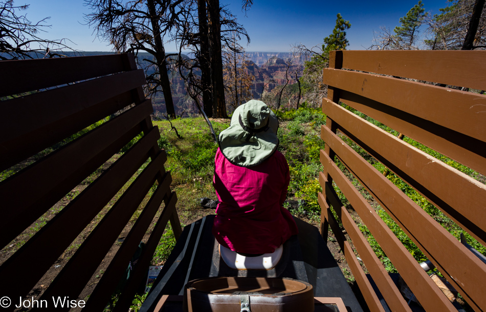
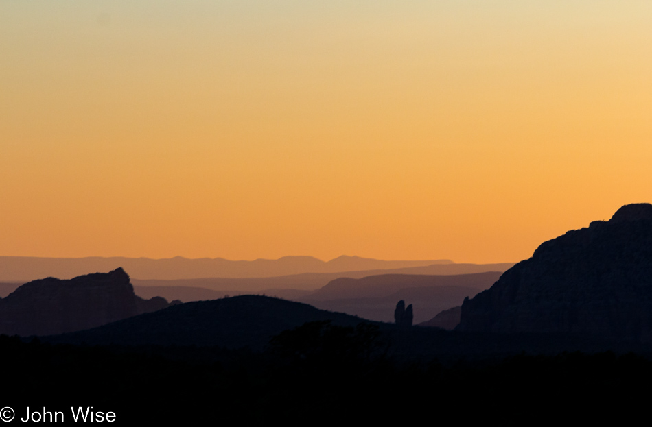
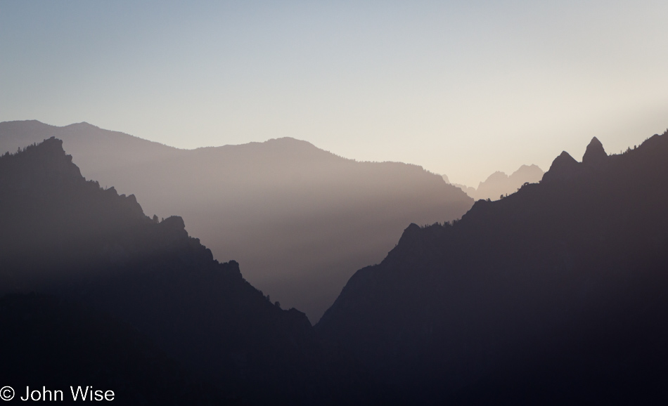
It’s morning in the mountains with the sun straggling over the heights, slipping over one peak to be trapped behind another. Shadows still rule the early day up here. The traffic that will befoul the roads in a few hours is still at bay, as is the heat. A cool, moist air tries to convince us that we could be a bit chilled. But we come from the desert below and will enjoy our moment of freedom from oppressive weather. At home, even the early morning sun peaks over the horizon with a sizzle this time of year, up here, we are temporarily saved from its blistering attack.

Kings Canyon National Park, California

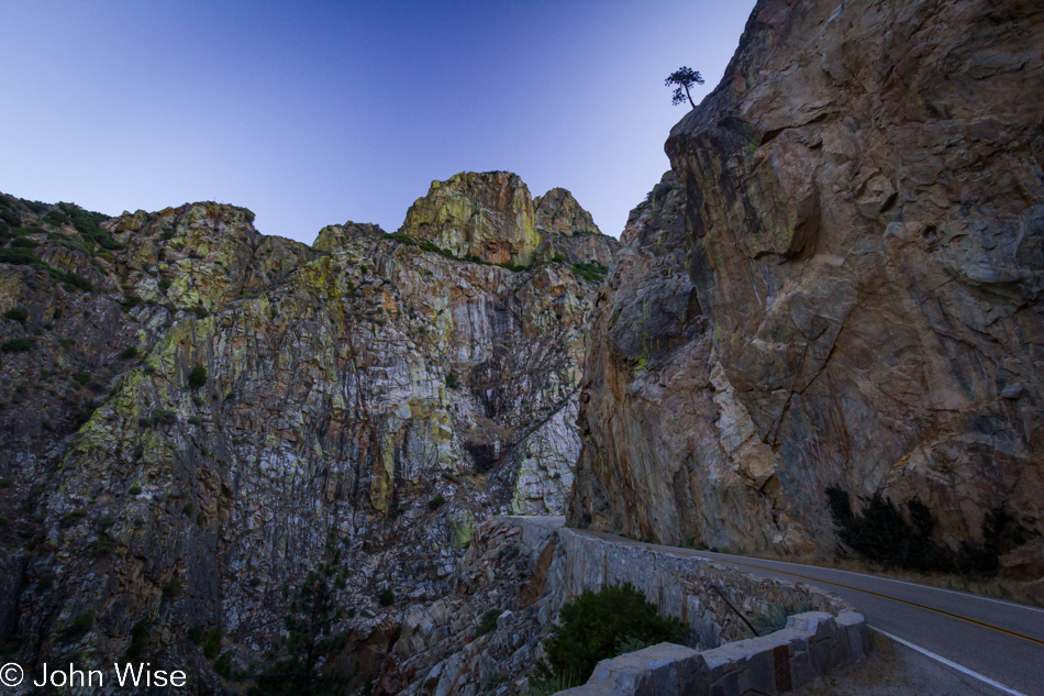
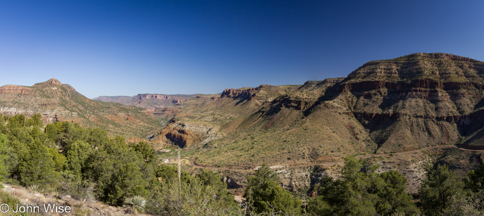
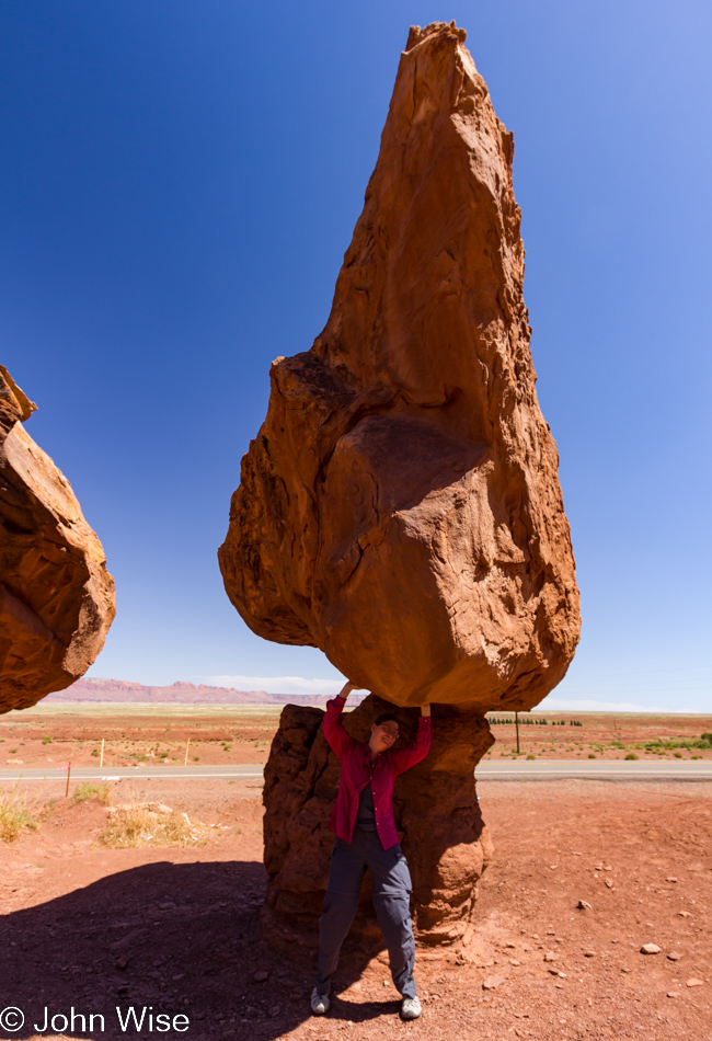
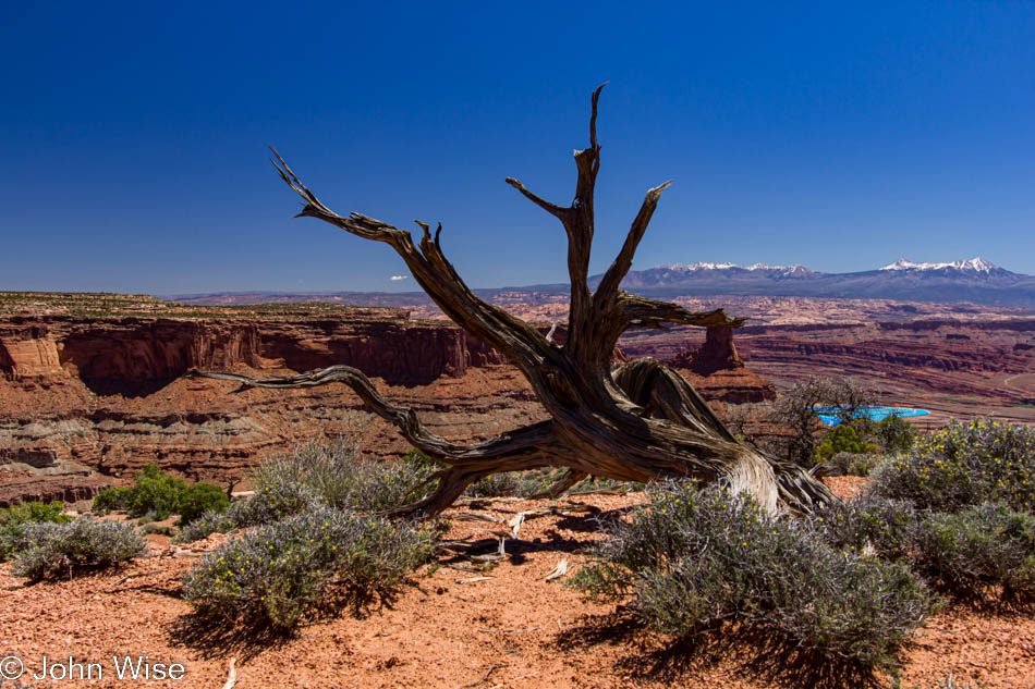
Addition: It’s January 2023, and in the process of creating an index of our travels, I recognized that over the years, some blog posts weren’t connecting to the uploaded photos and instead were using some kind of cached image. This has required me to reupload dozens of day’s worth of photos spread out over some years. In some cases, I’m seeing images I should have uploaded or at least, some I want to upload now. The images that are reuploaded are also being adjusted as in my view, I think I’m able to do a better job using Lightroom. There’s one other image I’m adding below that I’ll also mark as an addition. As for the subject matter, we were driving through a canyon on a narrow road hanging to the side of a cliff.

Grizzly falls in Kings Canyon National Park, California

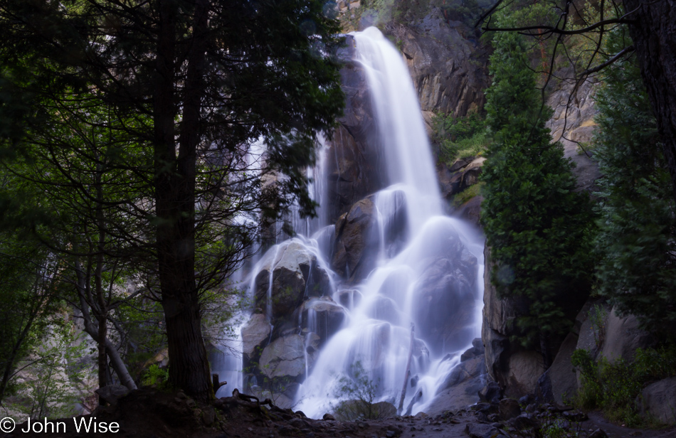
A subtle yet magnificent waterfall – Grizzly Falls. The mist is being shot out of the foot of the falls; all around us, the ground, the trees, the leaves, and soon we, as well, are covered in moisture. Until then, we delight in standing near the cascade of wispy veils of water that spray over the boulders, wet our faces, and cover our glasses in droplets, obscuring our sight. Eventually, the cold of the early morning finds its way through our thin layer of toughness, shortening our stay. Anyway, we have a date with a ten-mile-long trail.

Mist Falls trail in Kings Canyon National Park, California

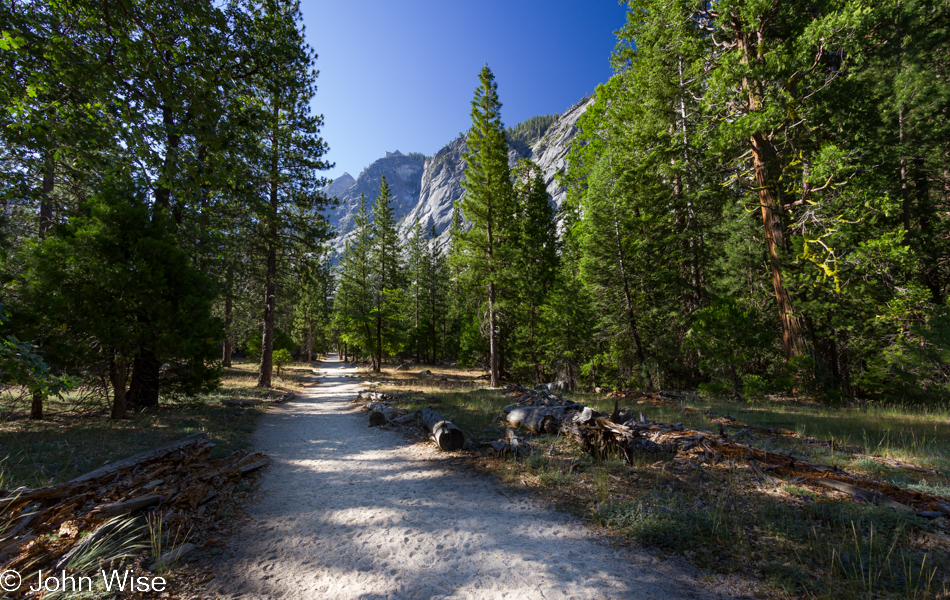
So, we cut the thirty-mile drive from three hours yesterday down to an hour and a half this morning, but it still was too long to be off on our hike near sunrise. We reach the trailhead at 7:45; we might have to do better than a mile an hour this time – maybe. Luck would have it that the parking lot is still relatively empty, so not too many people should be on the trail yet; plus, some of these cars probably belong to the backpackers who have taken the longer hike up to Paradise Valley and points beyond. We are on the Mist Falls Trail, which becomes the Woods Creek Trail just beyond our destination.

Amongst the ferns in the forest on the Mist Falls Trails in Kings Canyon National Park, California

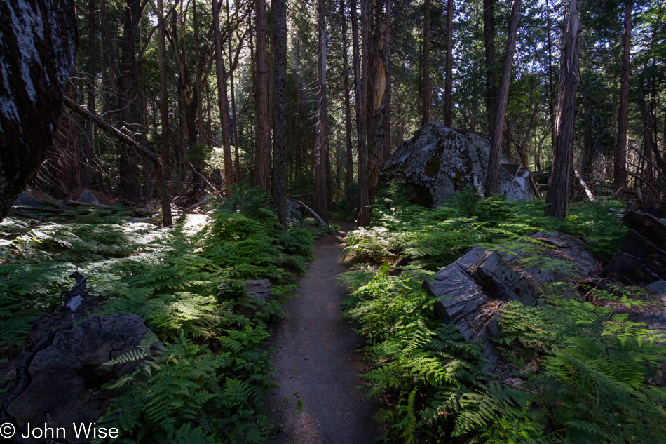
The first part of the trail is nearly level and casually cuts a path through the meadow and intermittent forest. In a moment, boulders dot the landscape, and the hike turns up a canyon. Grasses give way to ferns, and the trail becomes even lusher. Down at the foot of the canyon, we are once again in shadow, this time from the sun eating Mount Gardiner standing overhead at 12,907 feet. After more than an hour, no one else has passed us, but this is about to change.

Vibrant green summer growth on the forest floor in Kings Canyon National Park, California

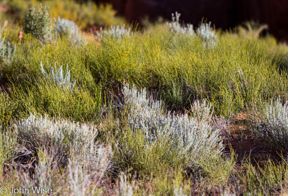
The forest is old and constant yet, at the same time, new and dynamic. The trees may have towered above for hundreds of years, but this fresh green growth has come up with the disappearance of the last snow and the march forward of spring. We would easily be forced to our knees and crawl to catalog all that is to be seen here, but that would give short change to what is above our heads. And what of all that is before our noses? The day is too short for everything our eyes, ears, noses, and fingers can behold; life is too short to see all that it has put before us.

White water rushing by the Mist Falls Trail in Kings Canyon National Park, California

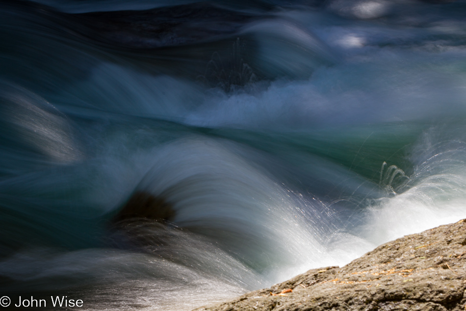
For an hour now, we have been walking along the river. It’s not always visible, but we can hear it. When it does come into view, it doesn’t fail to amaze. Maybe we dam our rivers to allow us to forget what a wild river looks and sounds like. This way, we do not wish to see more racing, tumbling water; we accept that water is controlled, portioned, priced, and commodified. There is an inherent, maybe even primordial, draw to rushing water. When you look into the crashing waves, the deep emerald flow, and the white foamy tumult, there is an elevation of senses that tells you that the world and all that is around you is vibrant and alive. It demands your attention, your respect, and your sense of awe.

Cascading water next to the Mist Falls Trail in Kings Canyon National Park, California

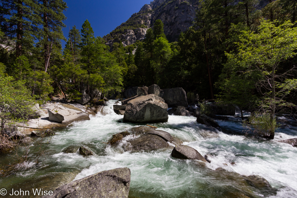
The trail steepens, and the river grows louder. Mosquitos politely remind us that we should put on gobs of insect repellent, which we do in great haste. We are gaining in elevation, and while the trail map claims that we will only gain 800 vertical feet, it feels like a lot more. If it weren’t for the flying mini-monsters emitting those high-frequency buzzing noises, we could pull up a chair and feel like we’ve seen it all, being content to call this the end of the trail. Moving forward keeps the blood-sucking tyrants away from the places the repellent missed, and who knows, maybe Mist Falls will be even more beautiful than what we are looking at on our way.

Kings Canyon National Park, California

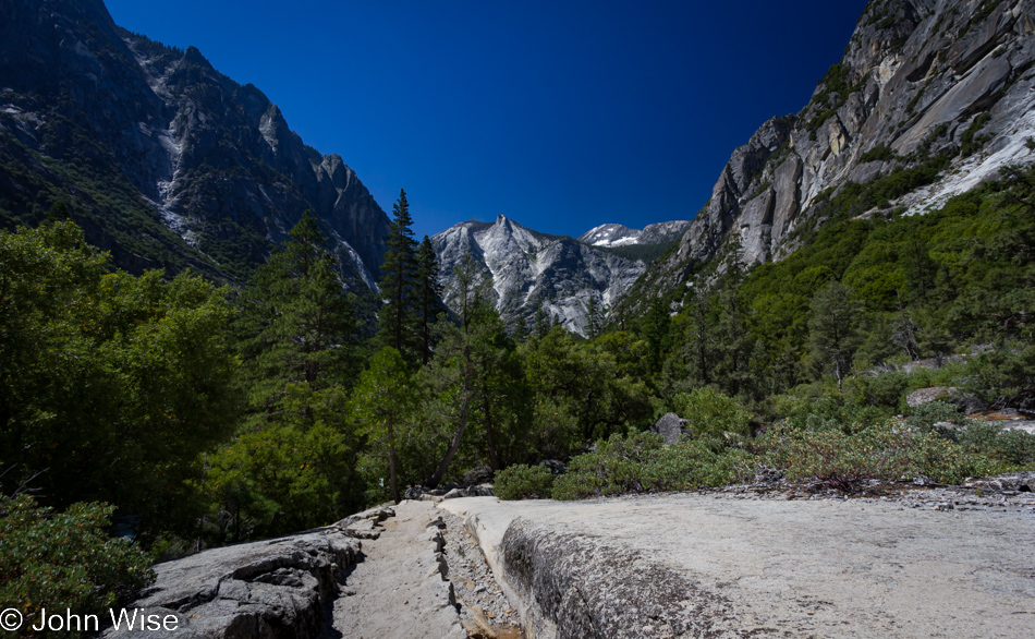
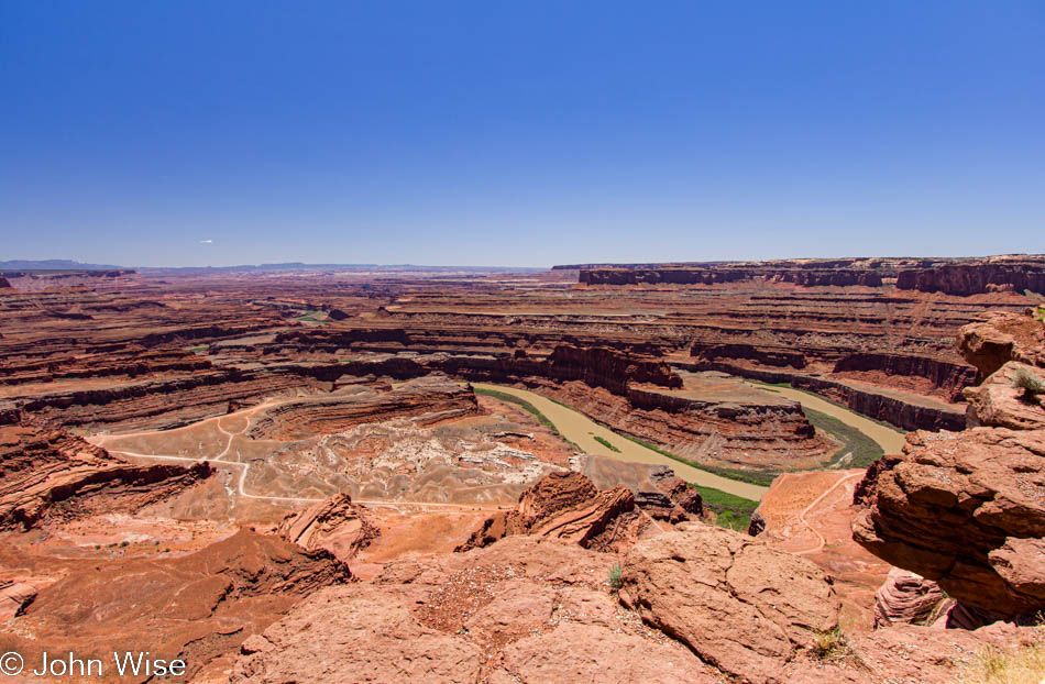
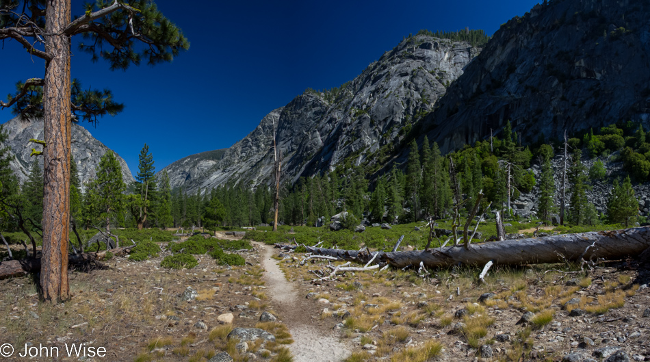
Addition: With so many intimate shots showing the details of the place we were visiting, I thought it was needed here in January 2023 when I updated this post to add a better overview of where were at in Kings Canyon National Park.

A rattle snake on the Mist Falls Trail in Kings Canyon National Park, California

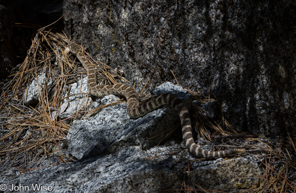
Is that the sound of a rattlesnake? Well, look at that: right next to the trail, the first rattlesnake in the wild Caroline and I have seen. Over the rest of the day, we’ll see two more. For twenty minutes or so, we stood still, watching the snake map his territory. Or maybe it was just trying to figure a way out. From where we first saw this five-year-old specimen, it was at the end of the road unless it was going to try to pass us. It curled up behind the rock next to the trail in a defensive position until it recognized that we were not trying to corner it and finally, it started to relax and slithered back up the trail in front of us. The snake found a crevice and, within minutes, was above us in the rocks and soon gone.

A lush fairy garden on the Mist Falls Trail in Kings Canyon National Park, California

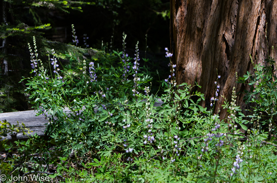
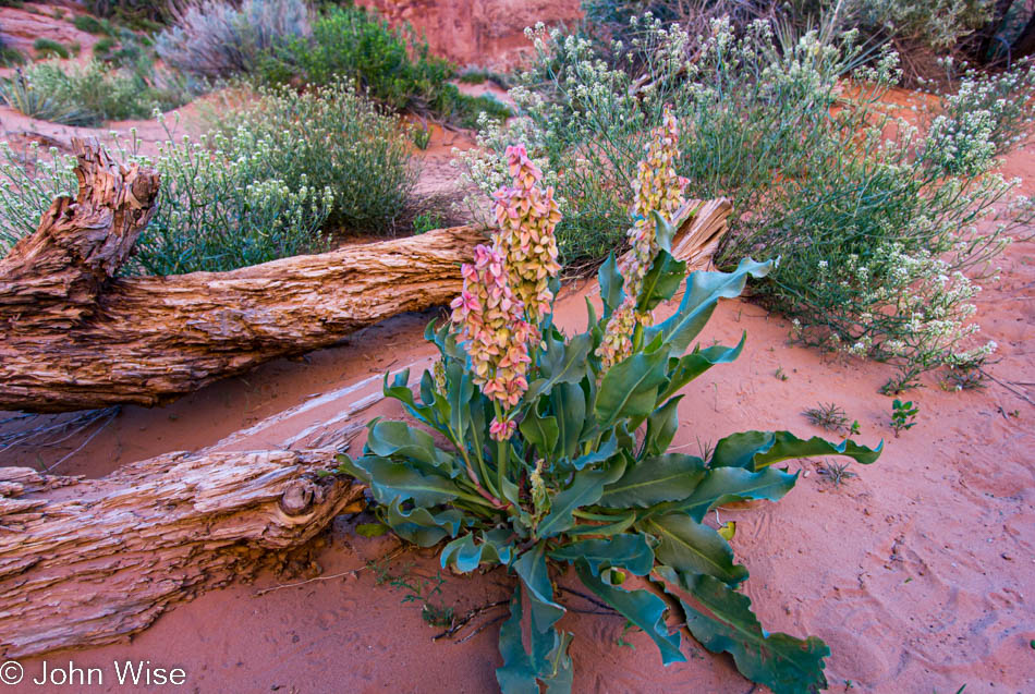
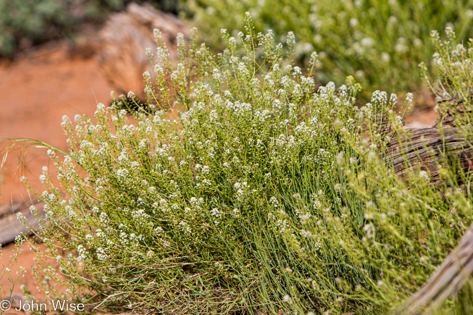
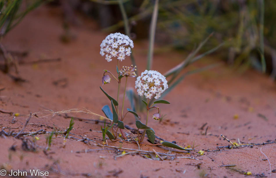
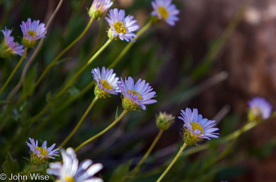
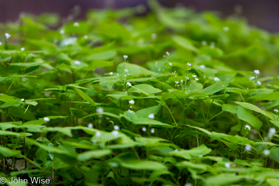
To think that a few months ago, this trail was covered in snow. Maybe ice had formed along the river, or had it stopped flowing over the winter? Is it silent here under the trees in January? While wildflowers can’t literally scream and dance, they do come close with their beauty beckoning us to admire their perfect setting as we walk by. All of the pieces are laid out in such a way that the contrasts, gradations of color, and depths say you are about to see just what your imagination of what a perfect reality should look like, looks like. And there it is, next to the red bark of a tall tree, against the dense forest, in sun, speckled with blotches of shade, fern fronds in the background catching glimmers of light, fluttery insects bouncing from purple flower to flower and floaty ephemeral unknown things drifting in the air above this perfect scene, it is all so dreamy and all ours for as long as we choose to bask in its glow.

Caroline Wise standing in a pool next to a cascade above Mist Falls in Kings Canyon National Park, California

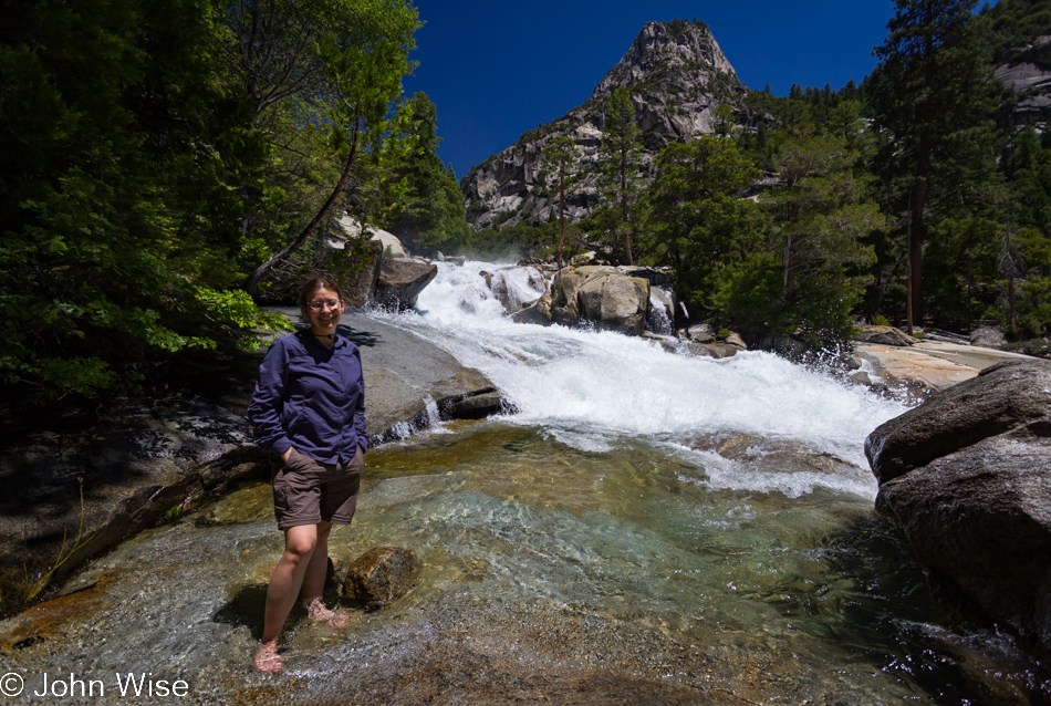
Mist Falls. We have arrived. While Mist Falls themselves were quite nice, it was the cascade just above them that really drew our attention. Riverside Caroline took off her boots and stepped into the “very” cold waters of what is part of the South Fork of the Kings River. This was also a great spot for her to dry her socks and for us to break out our lunch. Today’s gourmet mid-day meal was of whole wheat bread bedecked with peanut butter, raspberry peach jam, and sliced banana – a PBB&J. Drink was courtesy of our Camelbak and was of the lukewarm water variety. But then, who cares about food while the eyes are feasting?

Caroline Wise and John Wise on the Mist Falls Trail in Kings Canyon National Park, California

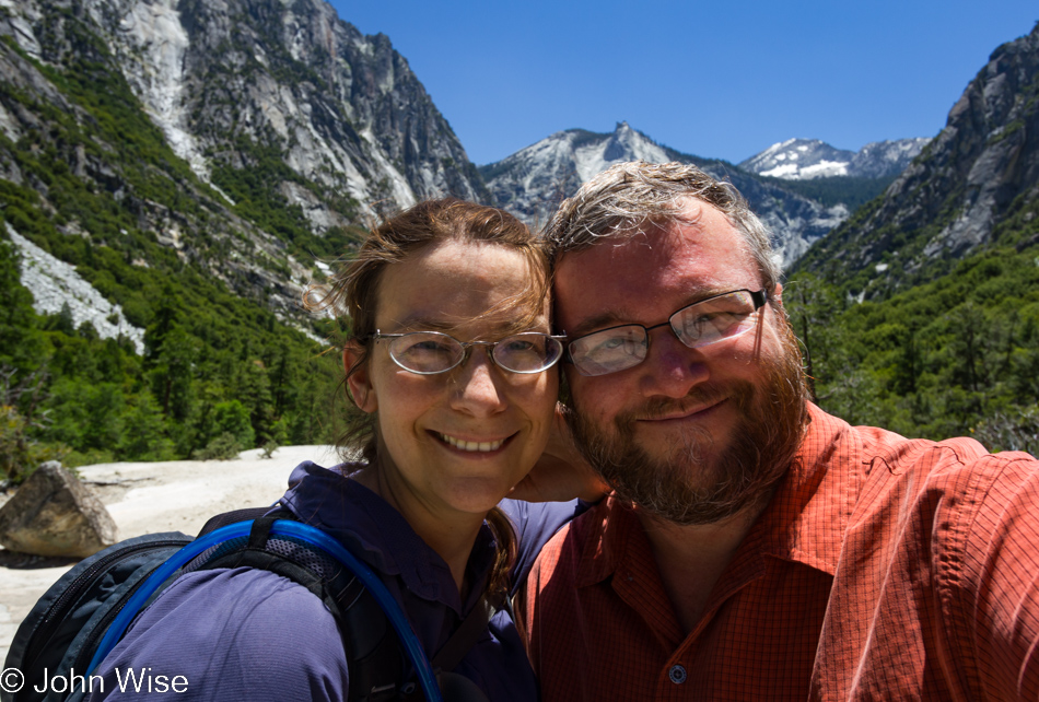
Ok, time to run down the mountain. Like that’s going to happen with Pokey and Sleepy Wise. Everything looks so different hiking in the opposite direction; we have all the reason in the world to inspect these details with all of the attention spent on the trip up. There was a photo I didn’t include of our trek up the trail; it was taken just before the photo of the rattlesnake, and a glimpse of it can be seen behind us in this photo. The view from up here is the kind of vista you hope to see after hiking through the forest and up mountains. It is obscured here by our big heads, and to see it in its full grandeur, one should have to make the journey to Kings Canyon National Park and get off the beaten path to witness it in person.

On the meadow of a loop return trail after leaving the Mist Falls Trail in Kings Canyon National Park, California

The trail back to the car took a detour over a bridge and through the forest on the opposite side of the river. We were almost turned back by our apprehension of crossing a small but fast-moving knee-deep stream. Lucky for us, a group of half a dozen hikers came by and marched right over those strategically placed tree limbs like they were a bridge built just for them. We mustered our courage and followed their path. Yay, we will be able to take this alternative route to finish our hike! This was only as good an idea in theory as the reality of the soreness in our feet counterbalanced that enthusiasm and had us thrilled when we finally saw the next bridge that would deliver us back over the river towards the trailhead.

Mosses growing on a dead burned out trunk of a Sequoia tree in Kings Canyon National Park, California

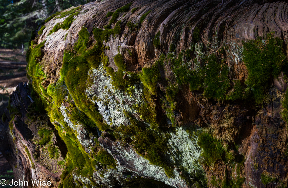
With that hike behind us and it still early in the day, we weren’t about to waste the light of day by putting our tired feet up; we drove right over to Converse Basin. The night before, Ranger Frank (aka John Muir) Helling told in his narrative of a burned-out sequoia tree that the real John Muir cut into with his ax more than a hundred years ago to count the growth rings. Those ax marks can still be seen and rings counted like they were exposed just yesterday. Funny thing to stand there thinking that John Muir would have seen pretty much the identical things I’m looking at. No, this picture is obviously not those ax marks; it is the moss that grows on the opposite side of this burned-out hunk of tree. As mentioned above, some things have to be seen by your own eyes.

The General Grant Sequoia tree, the second largest tree on earth at Kings Canyon National Park, California

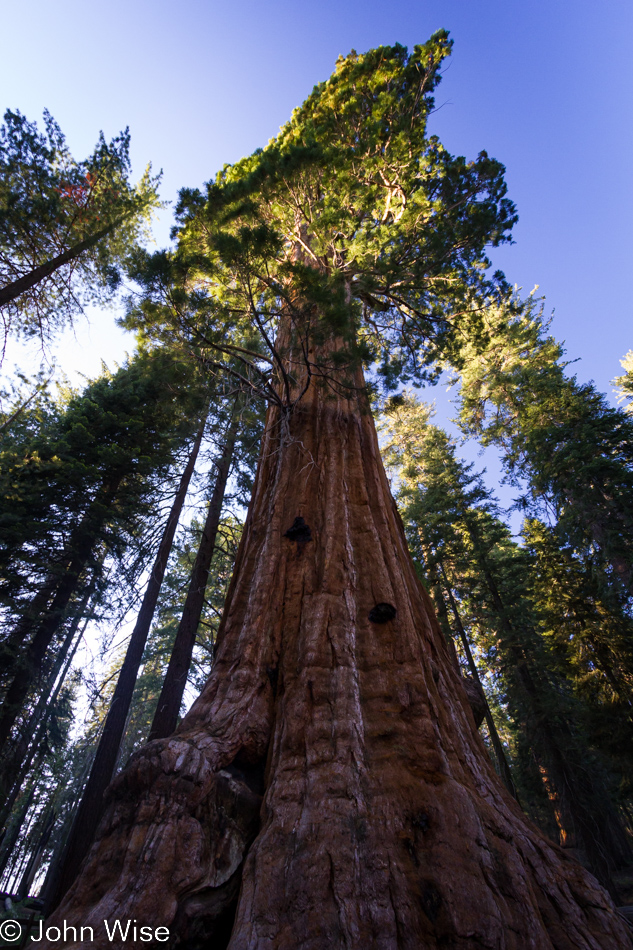
The sun is low but not gone after dinner. We take the short drive to Grant Grove to see the namesake of this corner of Kings Canyon National Park. The General Grant Tree is the second largest tree on earth, and the nearby General Sherman is the largest. While reading about the trees, I was reminded that Caroline and I have visited the largest trees on earth here in Kings Canyon and Sequoia National Park, the tallest trees at the Redwoods National Park, and the oldest trees on earth, the bristlecone pine in the Great Basin National Park. Not ready to go to our cabin, we took in another ranger-led campfire talk, this one about the history of the sequoia groves, logging, and Sequoia and Kings Canyon National Parks.

Lavender, Petrified Wood, and Nostalgia

Salt River Canyon on Highway 60 in eastern Arizona

Early in our road trip days, it wasn’t uncommon to take a single day to explore. In the past few years, it has become the norm to venture far and wide, taking five, seven, or ten days to immerse ourselves in a destination far away. Today, we return to form. Out over Globe, Arizona, and up through the Salt Canyon, the road climbs toward the White Mountain Apache Reservation. We pass through Show Low on our way northeast.

Shiloh Village near Concho, Arizona

Remember Y2K? Here in Concho, Arizona, it appears that the nearly deserted Shiloh Village may have been part of that lore. With rusting street lights, underground electricity, and the random fire hydrant, there isn’t much out here – besides Red Rock Ranch & Farms. And this ranch is precisely the reason for taking the 200+ mile drive today. We are attending the 7th Annual Arizona Lavender Festival.

Lavender from Red Rock Ranch and Farm near Concho, Arizona

Lavender is everywhere. Different colors of lavender, shades of purple to snowy white. The festival isn’t a grand affair out here in the middle of nowhere, but it’s intimate enough to be personal and worth the visit. The first folks we spoke with are from Terroir Seeds Company, a small family-owned operation specializing in heirloom and open-pollinated seeds. After signing up for their catalog, it was time for the first cooking demonstration using lavender in the kitchen. With about sixty of us crowding around the speaker, we were invited to sample a half dozen lavender-inspired concoctions, including a lavender lemonade mix that led me to think about making a green tea, lavender, and limeade drink after returning to Phoenix.

Lavender from Red Rock Ranch and Farm near Concho, Arizona

Back outside, the wind kicked up and gave the appearance that a monsoon was on the way. Outback, we snagged two box lunches we had reserved – both meals were prepared using lavender. I had the chicken and lavender wrap with lavender couscous, a non-lavender coleslaw, and a lavender ginger cupcake, while Caroline had the lavender veggie wrap and the same sides as I. Before leaving, we bought a small lavender plant, a cookbook for using lavender in your meals, and a lavender and chili blend called Herbes de Concho. This particular spice blend uses a chili that nearly went extinct from the local area known as the Concho Red Chili; seeds for this chili are available from Terroir Seeds.

Caroline Wise and John Wise in front of the Petrified Forest National Park sign - Arizona

If we are this far north, there is no other choice but to visit the Petrified Forest National Park just a few miles up the road. Not that we haven’t been here a half dozen times already, but this visit is for Caroline to, you guessed it, get her Junior Ranger Badge. After the obligatory self-portrait in front of the park sign, we head directly to the visitors center to make the case for why my big kid needs to be a Junior-Senior Ranger. They oblige her, and she is quick to get busy working on what lessons will be learned for this honor.

Petrified wood against a fluffy white cloud sky in Petrified Forest National Park, Arizona

Our first trail is just outside the visitors center, and you may or may not know of all of the signs that tell visitors to stay on the trail, well, they apparently rarely mean what they demand. What is wrong with these incompetent nincompoops? Were they born yesterday, did they forget their brain in the car, or did their children siphon off the remaining intelligence through their incessant pestering, complaining, and various neuroses? Hey wife, get to work as Ms. Junior Ranger and get those people off the log and back on the trail. Right, fine, I’ll be the Ranger Man here and give you an example of how it’s done. “Hey you, yeah you, do you see a trail over there? Can you read? Do I need to pull out my tazer, zap you, and drag your convulsing body back onto the trail?” Yep, that’s how I did it, sort of. Alright, in truth, that was the dialog in my imagination before the more polite words, “Excuse me, you need to return to the trail; the sign behind us says, STAY ON THE TRAIL,” fell from my mouth.

Petrified log at Petrified Forest National Park in Arizona

Now free of our National Park good deed work, we get to the more important task of enjoying our time learning new things about the Petrified Forest we hadn’t known before. Caroline sits in the middle of the trail inspecting rocks. Rocks that used to be trees. Rocks that, in some cases, still look like trees. Such as this one where a knot is still visible; I’m guessing there may have been a branch of the tree connected here some gazillion years ago. All of the petrified trees here have fallen over; in one particular tree at the base of the root structure, you can see the gravel the root system was holding on to as the tree toppled. Today, if you visit the Redwoods, the Sequoias, or Olympic National Park, you can see the exact same situation in the roots of more recently felled trees. Nature’s time frozen in stone.

Petrified wood at Petrified Forest National Park in Arizona

Oh, the desire to have a souvenir, to have a massive piece of petrified wood that is way too big for our small abode. It wouldn’t matter that it is too big; it would compete with my attention for the internet as I sit for hours in my purpose-bought chair that would be used solely for staring at the intricacies of how the minerals in the trunk of this tree overtook the organic material replacing it with colorful stone. Maybe we could buy one of those polished slices the size of a dining table, they can’t be much more than thirty, forty thousand dollars.

Caroline Wise at Petrified Forest National Park in Arizona

The winner of not just a Junior Ranger Badge but a patch, too, all that hard work paying off.

Detail of glass ceiling panels at the Painted Desert Inn National Historic Landmark in Petrified Forest National Park, Arizona

The Painted Desert Inn, once a trading post, then an inn and restaurant, is now a museum. The last time we came through, it was being refurbished. Today, it is a gleaming nostalgic example of what we lose as we rush to modernization. Route 66 use to deliver visitors right to the door of this beautiful National Historic Landmark. The Civilian Conservation Corps built the Inn between 1937 and 1940 but by 1963 the Fred Harvey company closed it and by the mid-70’s its demolition was proposed. Only by a raucous public outcry was the building saved. The painted glass panels above are in the ceiling and are all original – this building is a treasure.

The now dirt roadbed where the historic Route 66 once was at the Petrified National Park in Arizona

Speaking of old Route 66, while most of it is gone supplanted in large part by Interstate 40 here in Arizona, there are small still paved segments still navigable. Here in Petrified Forest, there is this stretch where the mother road once flowed. Just to the left of those old telephone poles, the roadbed is now long gone, but the poles and a sign bring attention to passersby that this world-famous road was once here.

The sign for the 66 Motel in Holbrook, Arizona

The nostalgia has us hankering for a chocolate malted in an old-style diner on good old Route 66, so we aim the car for Holbrook, and wouldn’t you know it, the first old-fashioned diner is owned by a Hindu who doesn’t have malteds or apple pie and ice cream on the menu. Caroline remembers a Dairy Queen further in town, and so we go that way. On the way over, we recognize the first-ever motel we stayed in some ten or so years ago, the 66 Motel. There’s a back story to this adventure back then. I was horrified at staying at a cheap motel, all the stories of bugs, filth, noise, etc., but for Caroline, it was all about the neon, Route 66, the nostalgia, and the Americana of it all. So after relentless requests to stay at one of these dives, I finally gave in, choosing the cheapest place, which is also the furthest from the freeway, the 66 Motel, with rooms from $16.95 – I take the room without a look at it. Turns out, this wasn’t so bad after all, and so it went that from that day on Caroline and I have taken to the cheapest motels America has to offer. And after more than 400 nights in these places, we have only had to leave three that were disgusting beyond description.

Rim-to-Rim to Home

Sign directing us to the Ken Patrick and the Uncle Jim trails on the north rim of the Grand Canyon National Park

The last day of our trip up north, and we indulge ourselves by sleeping until 5:30. Since today is Sunday, we are assuming that others will be even slower than us and that by the time we arrive at today’s trailhead after driving south from Jacob Lake, we’ll still be early enough to beat the crowds. Our destination parking lot combines the launch point for those hiking the North Kaibab trail into the canyon with our trail that starts on the Ken Patrick Trail and continues on the Uncle Jim Trail. We are expecting a five-mile round trip. What we hadn’t bargained for nor came prepared for were the clouds of mosquitos that nearly turned me back more than once.

North Rim of the Grand Canyon National Park, Arizona

Those mosquitos were so thick I was close to panicking from time to time and started losing interest in taking photos.

Caroline Wise sitting ring side watching the canyon form while adding to the river that cuts through it.

This picture should tell you why we chose the Uncle Jim Trail; we had heard about the best view from a toilet in the southwest, with this pit toilet facing the rim just feet from the precipice. Not while sitting there, Caroline got busy finishing the work required for her Grand Canyon Discovery patch, at least out here on the rim with the wind blowing; the mosquitos were kept at bay. After nearly an hour of inspecting plants and bugs and reveling in the view, we began the hike back. The backside of the loop trail was halfway decent in regards to the mosquitos, but when we reached the point where the trail had forked, they were waiting for us. We ran the gauntlet and almost escaped unscathed.

Caroline Wise with Brighty the Brass Donkey on the North Rim of the Grand Canyon, Arizona

Caroline with Brighty the Donkey, who has quite a shiny nose.

Sitting on the patio at the edge of the Grand Canyon on the north rim

With some essay work waiting to be completed, we sat at the rim’s edge of the lodge while Caroline finished the details, and we awaited the opening of the dining room for lunch. Over lunch, we met Joe Evans of New York City, who divides his time between traveling America and volunteering on the Thai/Burmese border, helping refugees learn self-sustainability. It often happens that we meet some of the more interesting people when we ourselves are traveling. After lunch, we went back over to the visitor center for Caroline to collect her Discovery patch, and with that, the car was pointed toward home.

Vermillion Cliffs in Arizona

Leaving the north rim traveling east, this overview might be one of the best in the entire state.

Caroline Wise at Cliff Dwellers in northern Arizona

She was certain that she’d be able to lift this boulder off its puny pedestal and set it right back down; lucky for us, it didn’t just fall and crush her.

The Schultz fire in Flagstaff, Arizona as seen from Cameron, Arizona on the road to the south rim of the Grand Canyon National Park

Back through Jacob Lake, the windy roads, past Vermillion Cliffs, and over the Colorado River via the Navajo Bridge. Going south on the 89, we can see the smoke off in the distance and are desperately trying to figure out where it’s coming from. We scan the radio stations looking for a clue, no signs are posted about detours, so we continue going south. Then, just minutes before reaching Cameron, a station starts to tune in from Flagstaff; the 89 is closed near Sunset Crater north of Flagstaff. We ask ourselves once, what is the likelihood that we will be detoured right back up here? We decided on a Rim-to-Rim visit.

Caroline Wise and John Wise standing in front of the Grand Canyon National Park sign

We turn west on the 64 and are soon entering the south rim of the Grand Canyon – this is the first time we have visited both the north and the south rim of the canyon in a single day. While some people take the easy route and simply hike across, we took the long way and drove the 210 miles from rim to rim. At the entry station, the rangers hadn’t heard about the closure yet, but by the time we arrived at the Tusayan entry station, it was obvious from the mass of cars in line on a late Sunday afternoon with many pulling boats that probably were on their way to Lake Powell that they had been turned away from the road closure on the 89 and detoured through the canyon. Relieved, we felt like we had made the right decision.

The view in to the Grand Canyon from Desert View near the Watch Tower

While we are excited to be at the south rim, we also want to get home, and this two-hour detour isn’t helping us get there any quicker. But we can’t just drive through so we decide to stop at the Desert View Watch Tower. The view of the Colorado River below is a favorite, and the tower, designed by Mary Colter 78 years ago, is as amazing today as it must have been back then.

The Watchtower at the Grand Canyon National Park in Arizona

Of the building Mary Colter designed, we have been to Hermit’s Rest, the Hopi House, and the Watch Tower; we have stayed at the Bright Angel Lodge, and in October, we will visit Phantom Ranch at the bottom of the Grand Canyon. Strange enough, we have never stayed at La Posada, the luxury hotel she designed in Winslow, Arizona.

Sunset near Sedona, Arizona

We continued south through Tusayan and connected with Interstate 40 in Williams. On the other side of Flagstaff, we got a great view of the thunderously large billowy clouds rising from the fire. But just wanted to find the 17 freeway so we could go home, no time for forest fire tourism. The sky was bright orange as we drove past the red rock country of Sedona to our west; it would be full of stars by the time we got home. Starbucks in Cottonwood is a great midpoint pit-stop to find a pick-me-up cup of coffee. The rest of the drive was one of those long, boring hauls through Black Canyon in the dark we have made once too often.

Desert Details

Various plants, flowers, and dead old logs on the desert floor in Arches National Park in Utah

While traveling, I shoot a lot of photos, too many to post. Often, it is a chore trying to pick a few favorites that I will post with a short narrative about our journey. It can be too easy a choice to select those images with sweeping horizons, vast landscapes, and dramatic sunsets. But that can also give the impression that I miss the fine points. So today, I am showing the fine details and skipping the grandiose.

Desert plant life in Arches National Park in Utah

At sunrise on a holiday weekend, there is no waiting at the ranger booth to pay fees; two hours later, there will be over a hundred cars backed up with impatient families racing to collect an experience or two as they zoom over the road to a “hot” destination to snap a few photos and be on their way. Arches National Park this Memorial Day weekend will be plenty busy, but right now, it is all ours. The trail to Landscape Arch is quiet. All around us, spring has delivered an abundance of flowers and greenery. During the late summer and early fall, it is easy to look past the dead brush, crunchy weeds, and all of the other stuff that looks as though it was alive at the time the rocks that make up the park were still sand.

Flowering plant life in Arches National Park in Utah

To be distracted in thinking that Landscape Arch is ‘the’ thing to see is easy, and if you want to view just what the big attraction is, you can Google that, but I want to share with you what the average visitor appears to be missing. Look down at the ground, feel the fine, still cool, red sand, put your nose close to the flowers, and try to find their fragrance. There is a world of ever-changing desert life that fills in the spaces under the soaring skyline. First, you have to come to your senses that what is between your car and your idea of a destination is just as integral a part of the journey as the collection of trophies.

Flowers blooming in Arches National Park in Utah

A tiny flower is observed. How long will it live? What is its purpose? Should I have brought a book about the local flora so I might be wiser tomorrow for learning today the breadth of variety that exists in a landscape, so many people might see as barren? All around me, giant red sandstone rock begs for attention; I gladly give mine to those things below the radar screen.

A chipmunk eating breakfast in Arches National Park in Utah

Before leaving Arches we visit the now-open visitor center so Caroline can pick up a Junior Ranger guide. She whittles away like a chipmunk, trying to finish the exercises to earn her badge, and in no time, she is being sworn in. With so many people swarming into the park, we decide to leave early. This is not the first or second time we have visited Arches, and we drive over to the more subdued Dead Horse Point State Park.

A yellow Colorado Chipmunk posing at Dead Horse Point State Park in Utah

The rim trail is our hike of choice. The overlook of the Colorado River is truly stunning, but so is this yellow Colorado chipmunk. I don’t know about you, but I had never seen a chipmunk with yellow markings before – now that’s epic. For a couple of hours, we amble along the cliffside, taking our time to commune with lizards, study various cactus flowers, take in the intoxicating scent of cliff rose blossoms, and generally stay in amazement at the colorful state of the otherwise monochromatic desert.

Twisted bark of a tree at Canyonlands National Park Islands in the Sky sector in Utah

And now, over to Canyonlands and the Islands in the Sky district. The focus of this hike could loosely be considered to be the Upheaval Dome, and we sure are thrilled to see this natural anomaly about which scientists still aren’t sure how it was formed, but we are also just as happy to see how some terrific trail builders cut us a path over this difficult terrain so we can find our way over a primitive land with relative ease.

Little purple flowers in bloom at Canyonlands National Park in Utah

The day will end with dinner in Moab at Eddie McStiff’s and another visit to the local grocery for some fresh fruit and snacks for the next day. The town of Moab is stuffed to the gills with visitors on Memorial Day – the busiest day of the year for this mountain biking mecca. A torch-red strip of flaming clouds cut a diagonal across the light clouds before the sunset. Tired from a busy day of looking at small details, we head to our room to digest the rich diet of a million things our eyes ate over the course of a beautiful day.

Caroline Wise and John Wise at Arches National Park in Utah

Addendum: This post was missing all of these photos from what I’m calling an addendum. Why I only focused on the fauna and flora in close-up when I originally posted this is now beyond me. So here in the closing days of 2022, I’m rectifying these omissions to include images of where the photos above were taken. Obviously, our day started in Arches National Park.

Arches National Park in Utah

These thin fins, being all that remains of what was once solid rock surrounding them, just feel crazy that they’d still be standing while everything else simply eroded away.

Arches National Park in Utah

Delicate arch.

Dead Horse Point State Park near Moab, Utah

After leaving Arches National Park, we headed over to Dead Horse Point State Park still near Moab, Utah.

Dead Horse Point State Park near Moab, Utah

While Caroline works on her Junior Ranger booklet, I’m here with my new lizard friend, taking photos and hanging out.

Dead Horse Point State Park near Moab, Utah

The view from Dead Horse Point of a gooseneck in the Colorado River.

Caroline Wise at Dead Horse Point State Park near Moab, Utah

Earning her Dead Horse Point badge and a Red Rock Ranger patch is another pivotal moment in Caroline’s life.

Canyonlands National Park in Utah

The Green River Overlook in the Canyonlands National Park, Utah.

Canyonlands National Park in Utah

The Grand View Point in Canyonlands.