Across the Southern U.S. – Day 6

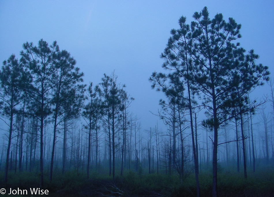
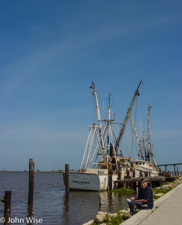
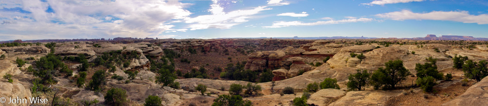
We wake in Homestead, Florida, the city that had borne the brunt of Hurricane Andrew back in 1992. It’s our sixth day out with a plan to meander down the Keys. Instead of taking Highway 1, which we have to return on, we are entering the Keys on Card Sound Road.

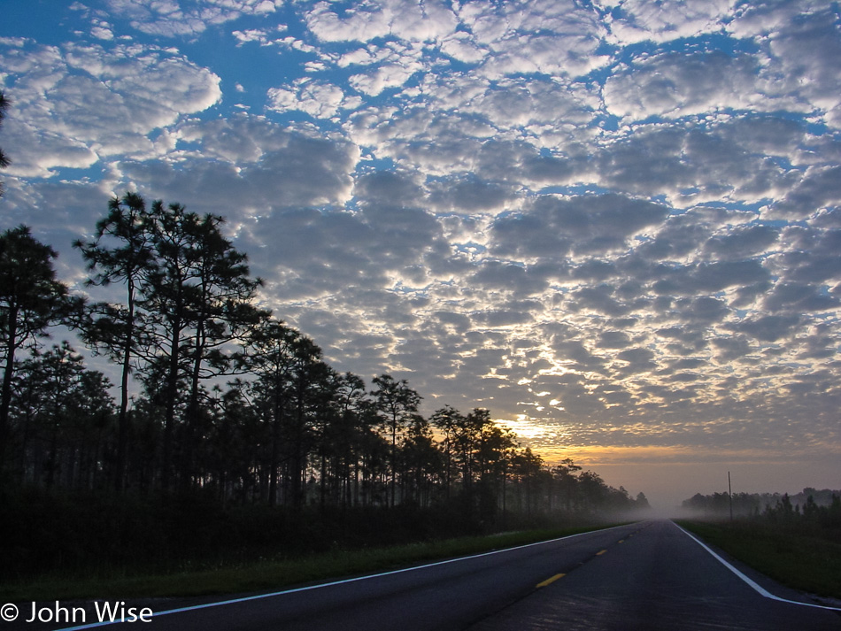
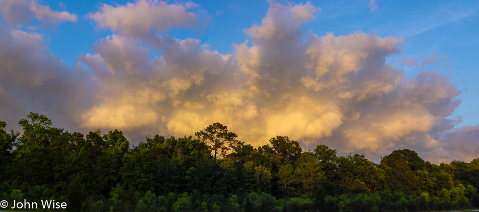
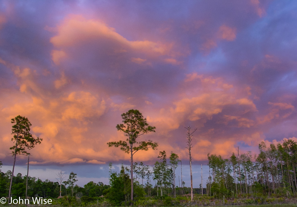
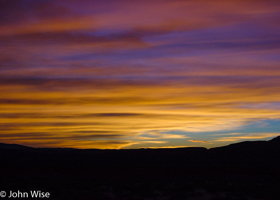
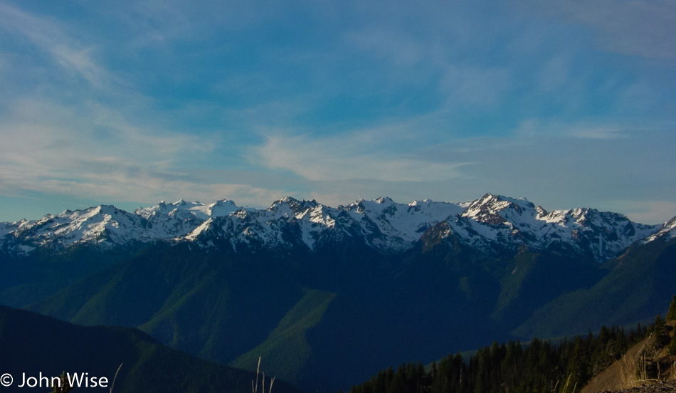
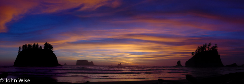
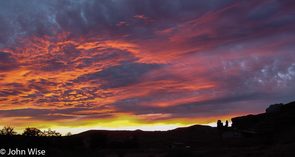
A perfectly clear sky has made room for a well-rested sun to rise unobstructed, bathing the morning in orange and gold before alighting the heavens with a radiant blue ceiling.

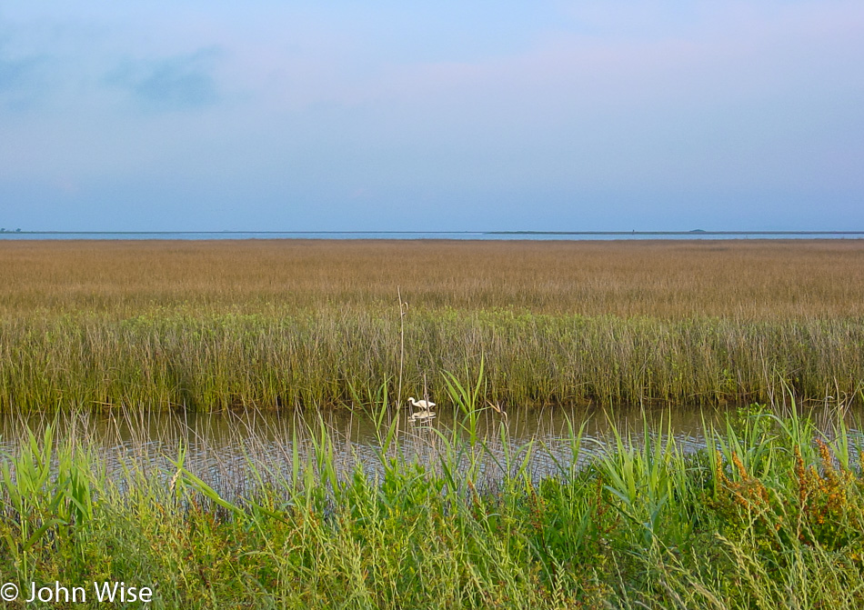
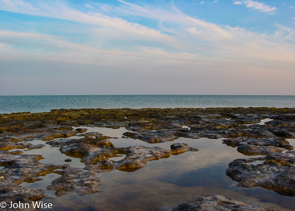
We check in with the John Pennekamp Coral Reef State Park for a glass-bottom boat tour of the nearshore waters. The tour departs at 9:00 a.m., giving us an hour, so we check out the local waters looking for fish or other signs of life. The visitor center has a small aquarium that we spy on for a moment before we recognize it’s almost time to board our boat. Our three-hour cruise won’t deposit us on any exotic islands today, but we are expecting a spectacular tour. Slowly, we are pulling out of the dock area, passing mangroves to our right and left when in front of the bow, half a dozen large rays swim along with us before diving below the green waters.

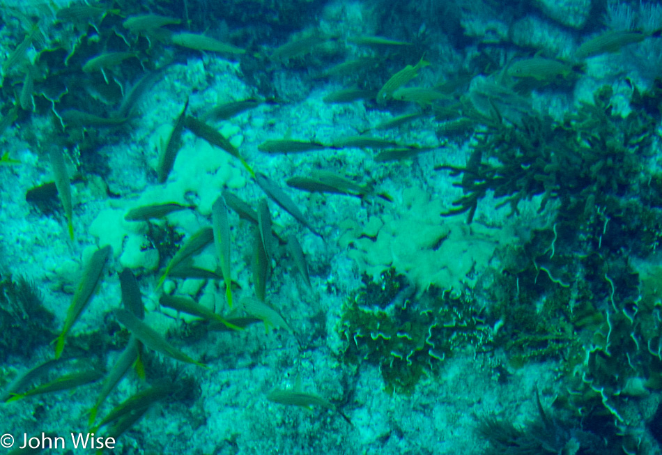
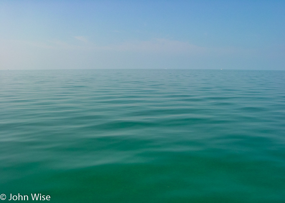
Under the best of conditions on a glassy ocean and not a cloud on the horizon, we travel southeast. After an hour we slow to a float with the clearest of waters, giving us a wonderful view of the sea life teeming on the reef. Our captain deftly positions his craft, offering up parrotfish and multi-colored schools of other fish that there are so many of it’s hard to keep up with which species are which. Corals, plants, and a plethora of shrubbery appear so close to our eyes that the impulse to reach out and touch them is tough to resist.

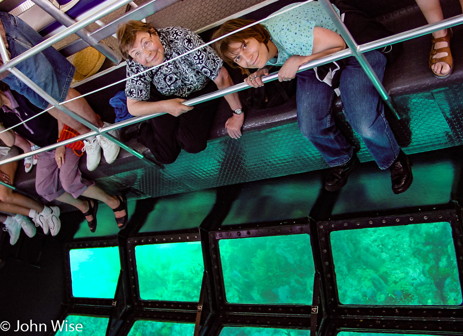
It’s almost like scuba from the view of things, then again, not. Still, this is pretty cool, and Jutta is loving her time out on the sea.

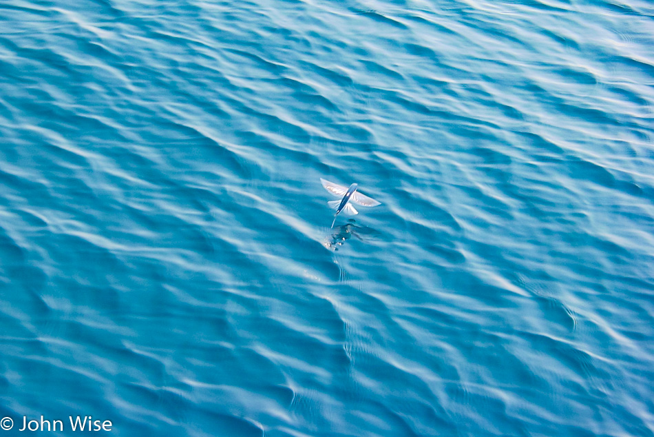
The captain, recognizing the incredible clarity of the water on this particular day, offers us a rare chance to view an artificial reef in superb detail. On our way to this sunken treasure, dozens and dozens of flying fish that thrust out of the water, skimming well above the surface for distances of up to 300 feet, join us!

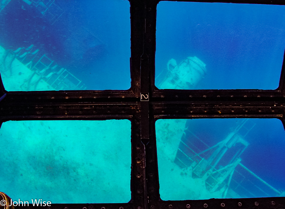
Twenty minutes later, the ‘reef’ comes into view: it’s the USS Spiegel Grove. The ship lies on its side on the ocean floor 130 feet below us. Being 84 feet wide and 510 feet long, the ship at its widest point is only 46 feet below us. Truly amazing today is that we can see the bridge of the ship which is so far below the surface. We were told this is exceptional water clarity and a rare day indeed. Sadly, we departed after 15 minutes; our tour was almost over.

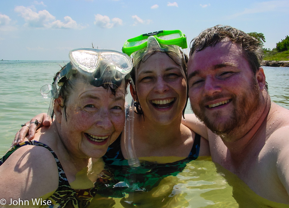
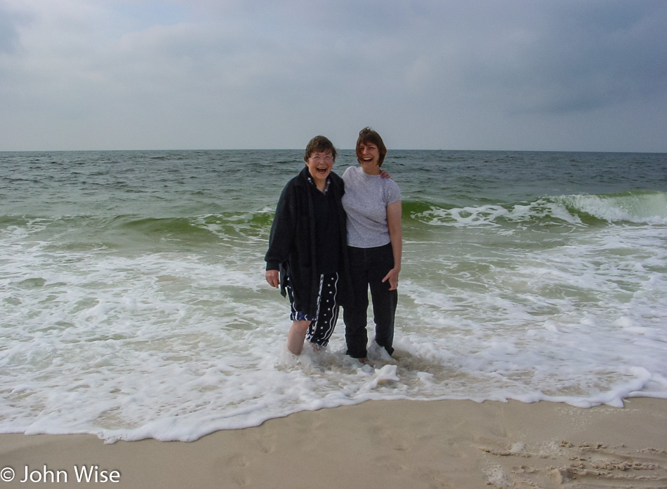
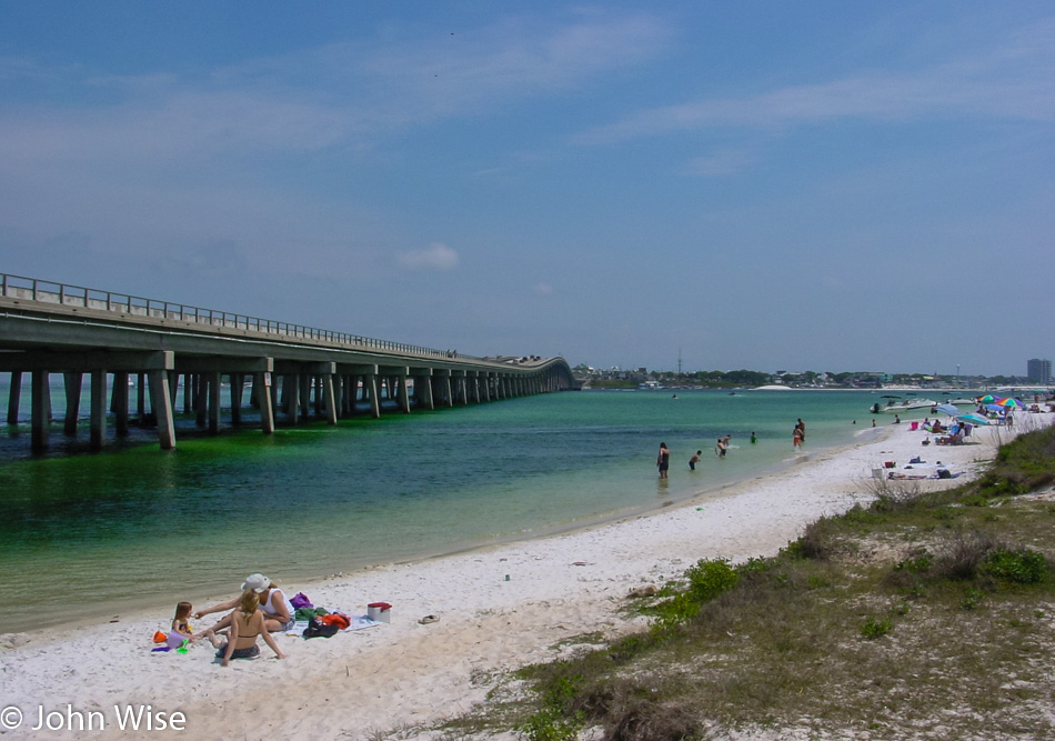
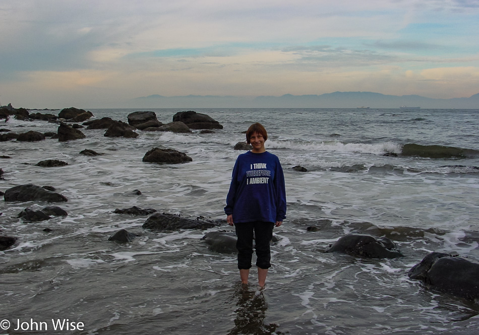
Driving south on Highway 1 around noon; we bask in our ocean adventure. Before we know it, mile marker 37 is ahead of us, signaling our next destination, Bahia Honda State Park. A surprise awaits Jutta, which it turns out seems more of a fright than anything pleasant. Caroline takes her mom to a changing area while I visit the gift shop. Upon Jutta’s approach, she eyeballs the snorkeling equipment in my hands and quickly exclaims that she “doesn’t do that.” Fair enough, as my mother-in-law is 68, so I ask if she’ll oblige me and put on the mask and just look in. Standing in chest-high water, Jutta dons the mask, dips her face past the surface, pops back up, and blurts out an enthusiastic, “I do that!”

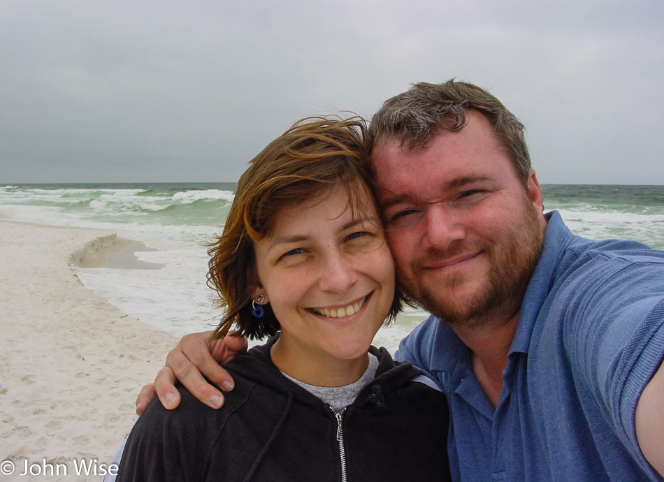
We float about, taking our time exploring the coast, occasionally sharing something we find exciting or beautiful. We float about a bit too long. I likely have third-degree burns and will pay dearly in the coming days for not wearing sunscreen on my back. While the burns aren’t literally third-degree, they are still painful enough for me to make one of those rare concessions to Caroline that she was correct and I should have let her layer on the sunblock.

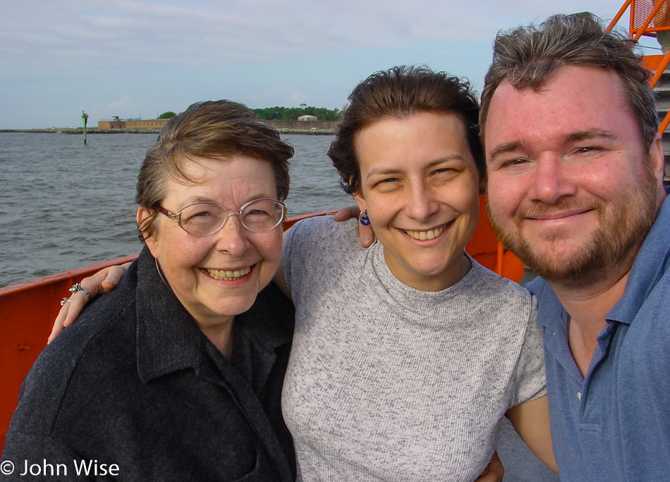
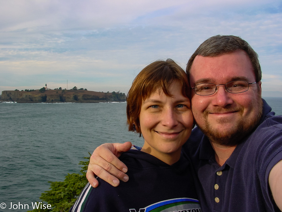
Intensely happy, I think we all feel that we have left the most grueling part of the road trip and are beyond doubt on vacation. Before leaving the beach, I snap a photo of us still in the water and feel as close to Jutta as I ever have, as I see her enjoying herself like a child at play.

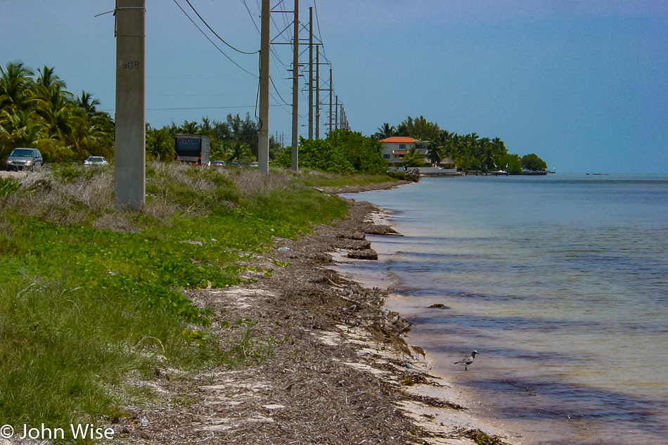
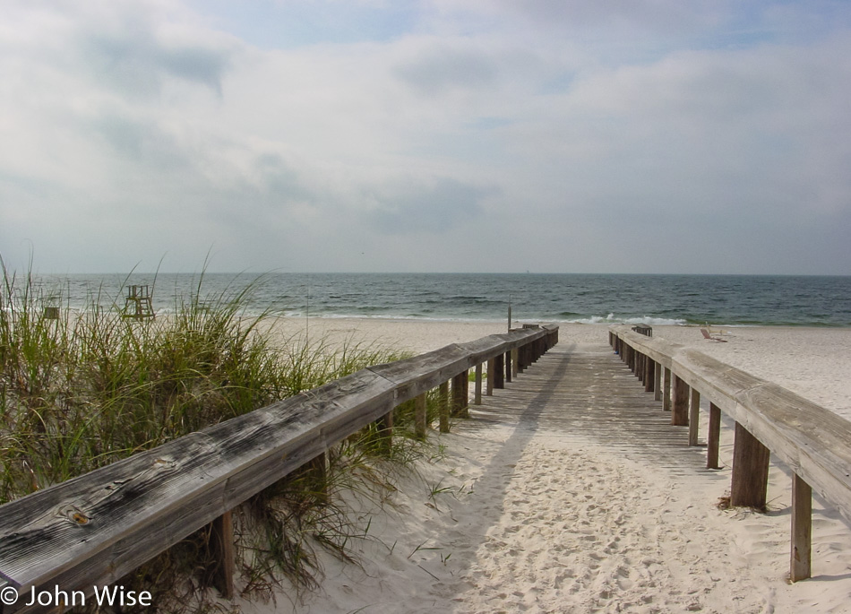
The road through the Keys sometimes finds itself seriously close to the water’s edge. This mix of bridges and tiny islands certainly lends itself to the sense of going somewhere profoundly different than anywhere else any of us have traveled before.

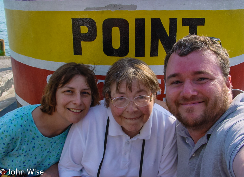
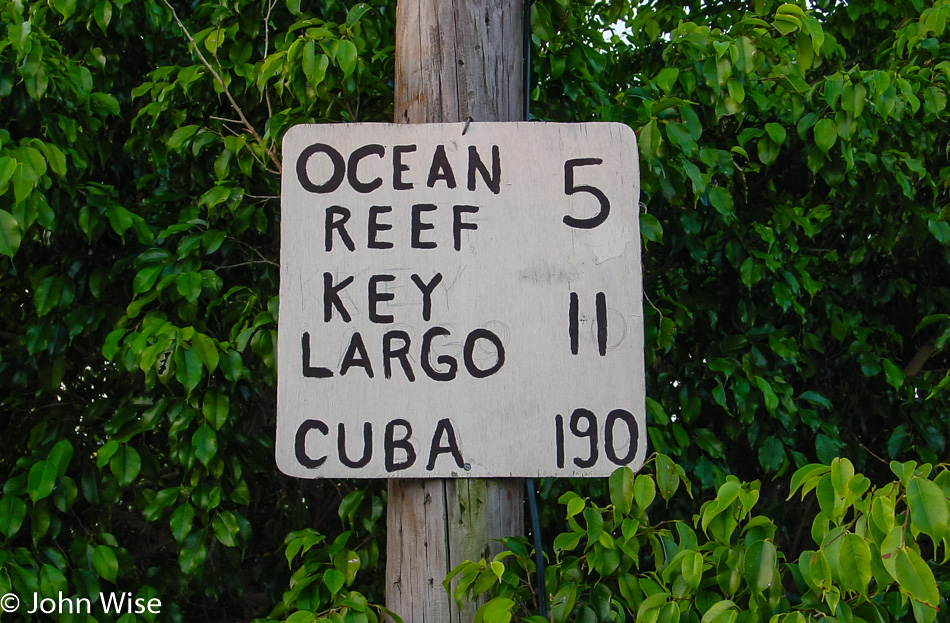
The southernmost point in the continental United States and only 90 miles to Cuba: we have arrived in Key West. The crowds are not conducive to our mood or a pace we can relate to after such a lazy day, so after a quick view of mile marker zero, we turn into a local neighborhood.

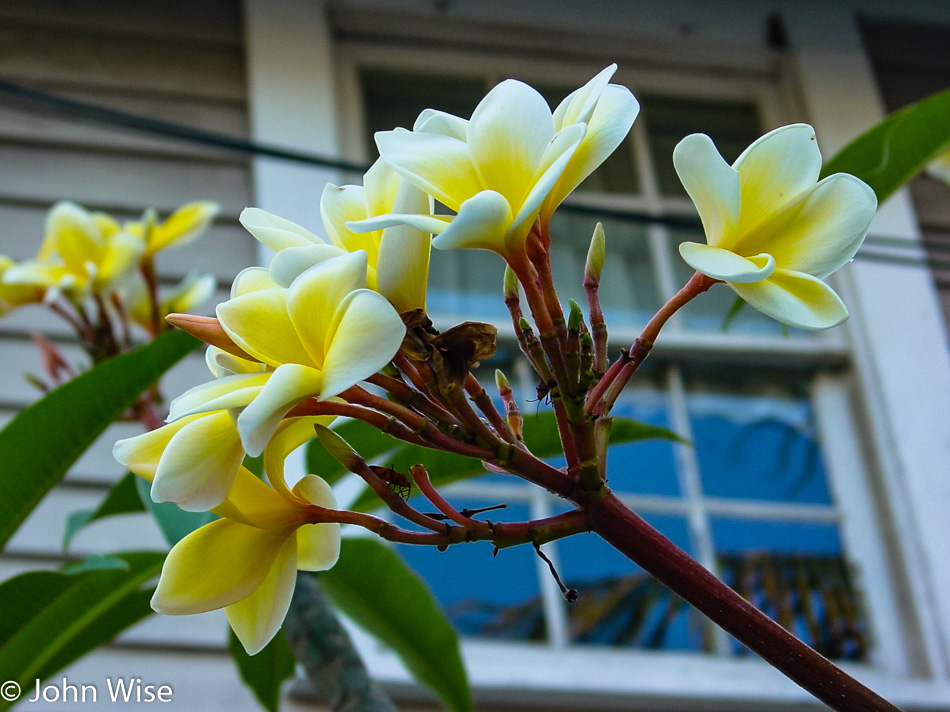
Flowers abound, and while many may find the bars a natural draw or the architecture a beauty to look at, we are too busy gawking at hibiscus, bougainvillea, and plumeria. This, more than Santa Barbara, California, is a flower lover’s paradise!

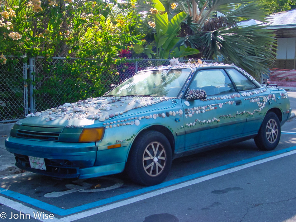
Or maybe a seashell lovers hookup place, too?

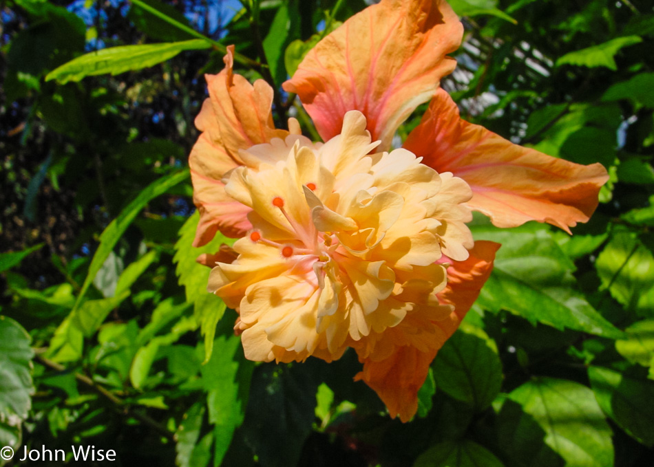
I could have shared many photos of flowers, but then this blog might take on too heavy a botanical slant when there are other things yet to share.

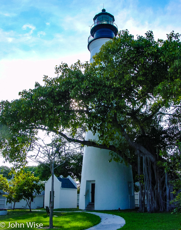
Turning a corner, we find ourselves approaching Ernest Hemingway’s former home, now a museum and tourist attraction. The Hemingway Home and Museum is closed, unfortunately, as it’s after 5:00, and the gate is locked. We will have to satisfy ourselves with a visit to the lighthouse across the street. The Key West Lighthouse & Keeper’s Quarters Museum is closed too, as it’s after 4:30, and its gate was locked even earlier than Hemingway’s.

Not having a serious drinker among us that might compel a crawl of the many open bars, we are about to depart when, in my peripheral vision, a business marquee catches my eye. While researching our route across the southern United States and looking for various recommendations for must-see, must-experience, and must-eat at destinations, I was reminded of a name that rang a bell as I sped by. We just passed and need to make a quick U-turn back to the Blond Giraffe.

Although it may not be very accurate to make such a bold claim based on such a limited sampling of key lime pie, I would be willing to tell the world that this is the best key lime pie you will ever find. We drive away, splitting a single frozen, chocolate-dipped key lime pie on a stick, saving three slices of key lime pie for later. Oh my God, this key lime pie on a stick is absolute heaven on earth; whose idea was it to split one three ways? Us car occupants are in ecstasy while simultaneously howling regrets for not purchasing individual pies on a stick. We vow to return someday, but in case that isn’t possible, we keep their website close to someday order that overnight delivered package of 30 slices of chocolate-dipped frozen key lime elation. Yummy.

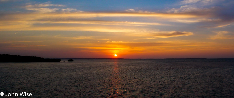
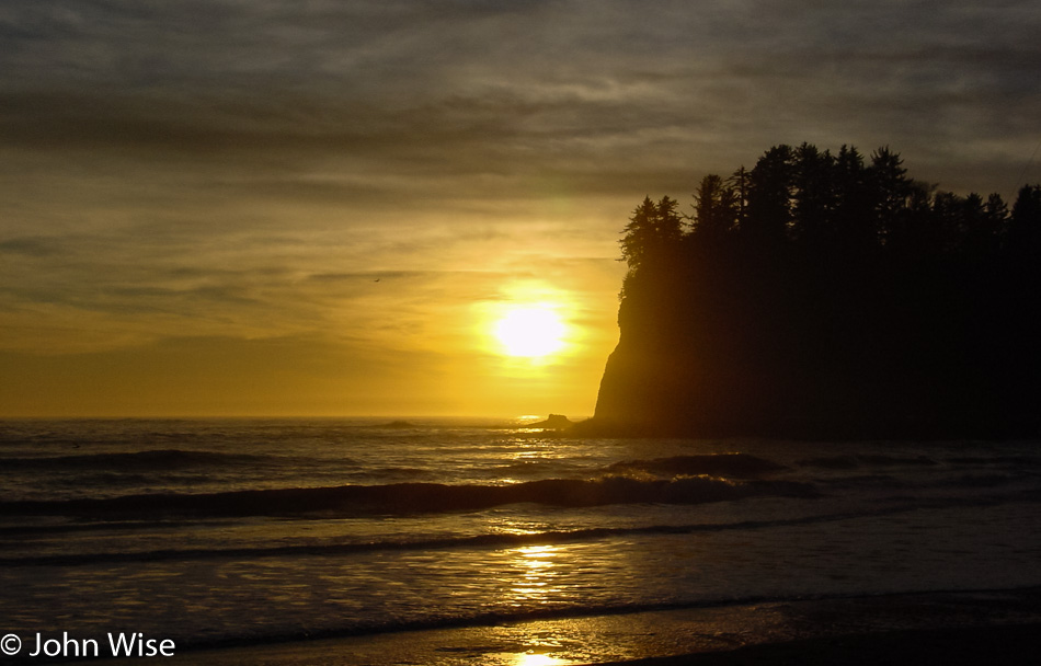
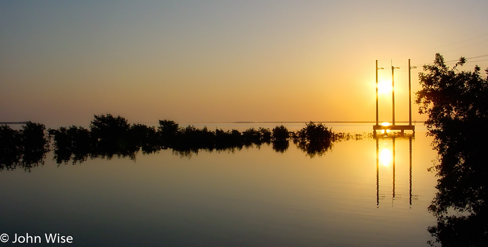
Our time in the Keys is coming to an end. Fort Lauderdale, our destination for the evening, is still more than 180 miles north of us. While the setting sun gently takes its golden light below the horizon, we can afford the luxury of a few more stops along the road north out of the Keys. It has always been difficult for Caroline and me to leave any coast, and the Keys are no exception after this perfect day. With the ocean surrounding us, we share a waking dream of staying right here overlooking the Gulf of Mexico while the final glimmerings of light pave the way to evening until the next morning when we can turn around and watch the first rays rise over the Atlantic.

Across the Southern U.S. – Day 4

Last night, we checked in early at 9:30 p.m. this morning; we are leaving shortly after 6:00 and will soon be in Alabama. A misty gray sky lends mystery to the woods on the sides of the road where, in the distance, we can nearly make out the dueling banjos. “Was that a squealing pig I just heard?”

The sun breaks up the clouds and creeps over the Alabama horizon on Bayou La Batre.

It’s a stunning morning, yikes; it’s about to be stunning in another way to a giant turtle we just passed in the middle of the other lane. I turned the car around with my two passengers, oblivious as to what precisely I was doing. It seemed both were looking the other way, or maybe they were falling asleep.

This is one heavy-duty turtle, but even with its armor, it’s hardly a match for a speeding two-ton car, so we will move him off the road. Before that, though, I’ve got to get a photo of this guy. Down here, this is one mean-looking, razor-clawed, thick-leathered turtle, except for that optimistic sort of smile he has inadvertently going on. Laying in the street too now, I put the camera within inches of this face, and he seems to pose while I snap away; good thing he’s a slow-moving turtle.

Now before a car comes barreling down the road, it’s good deed time, and who should be selected to perform this? Caroline. She reaches down and gently starts to put her hands around his midsection when SNAP! Like lightning, a blur of dinosaur monster-turtle attempts to chomp off Caroline’s left arm with a single severing bite. Thanks to her ninja skills, she is able to save her limb in the nick of time by yanking her arm from the turtle’s jaws of death.

But now, HERE COMES A CAR! No fear, Jutta is here. Having quickly learned from the turtle’s stealth-like high-speed reflexes to attack her daughter, Jutta goes into high gear with Caroline and I standing in stunned awe by the following rapid chain of events. With a quick step right and a football-like snatch that would have had my mother-in-law drafted by the National Football League had they seen such skill, she swooped in for the grab, swing, and toss. The turtle disappeared off the road and was saved from certain death. I’d swear it was losing its breakfast over there in the grass from the motion sickness Jutta had inflicted. We made sure it was right-side up and doing well. With her newfound energy, Jutta sprinted back to the car, and we continued down the road.

The land is flat and wet with grasslands on our sides; we are driving through Heron Bay.

Too bad about all those hurricanes this coast is prone to, as it’s beautiful down here in the early morning quiet.

With the approach of the sea coming closer to the road, we soon cross the bridge to Dauphin Island. Dauphin Island is off the coast of Alabama and is in line with the Gulf Islands National Seashore.

We ferry across the waterway separating Mobile Bay from the Gulf of Mexico to join Route 180. Caroline and I could ride ferries all day while traveling over rivers and through wetlands and coastal areas. Approaching the other side, we spot some pelicans sitting on pilings. We are starting to feel a frenzied excitement, as these pelicans are an indicator that we are getting closer to our ultimate destination.

Welcome to Florida.

The gulf shore is an inviting spot to take a moment to dip your toes into the warm water. We walk along, looking for shells while strolling in and out of the calm surf. Although the sky is cloudy, the clouds part from time to time to give us a glimpse of blue sky that is like a smile from above.

This coast is flat as far as the eye can see. Compared to the 1400 miles of coast we’ve traveled along the western United States, where even while at the beaches, you can see mountains on the horizon, this land is flat in all directions.

Florida and the landscape appear to have changed again. Dunes, white sands, and clearing skies are as inviting as they look relaxing. As we drive along in the warmth of the clearing day, we are all getting a little drowsy. We stop for a rest with Jutta taking a short nap in the car while Caroline and I take a walk down by the bridge along the waterfront just before entering Fort Walton Beach.

On our way again, the roadside is a tropical paradise. Soon, we veer back out toward the ocean with Mexico Beach, bringing our attention to its pristine white sands. We zig instead of zagging back inland through a tropical forest off Point St. Joseph and are again ready for another stop, this one in Apalachicola.

In the old town section of Apalachicola, we take up our place sitting on the dock of Apalachicola Bay next to the fishing boats. It’s a beautiful sunny day with light clouds, a balmy 70 degrees, and a cool coastal breeze that feels perfect. Jutta takes a moment to write to her friend Renate; the two have known each other since University. The waters lapping the shore, the sounds of the breeze rustling the trees with birds in all directions singing and squawking, and not a car to be heard let us get lost here picturing fishermen in the early dawn light preparing these boats to head into the gulf. For nearly an hour, we drift here before we begin the drive south.

For Caroline and me, this area of northern Florida is the epitome of green, something a resident of the desert can truly appreciate, while for Jutta, this is the very essence of wild nature, something a resident of Europe’s accounted for and planned flora can easily appreciate. We scan every tree, shrub, and corner. We are looking for eagles, hawks, and squirrels; we look for gators, manatees, and turtles.

The sunlight and blue sky are reflected in still waters, with its edges cast in shadows, hiding communities of aquatic life just out of our view. Horizons disappear behind densities of plants that look impenetrable. In this watery world along the road, we cross the famous Suwannee River, immortalized by Robert Foster in the song ‘De Swanee’ more than 150 years ago. Someday, we’ll find our way up to its waters to their origins in the Okefenokee Swamp in Georgia.

The sun begins its routine of disappearance while the clouds moving back in overhead lend dramatic flair to our closing day.

With about 200 miles to go before reaching Ft. Myers for the night, this would be the last photo that punctuates the day. Tomorrow, we enter South Florida and the Everglades.

Big Bend, Carlsbad, Bosque, Petrified Forest – Day 2

It never fails that getting away from a major freeway allows us to see the world change in dramatic and beautiful ways. We are well outside of El Paso now; as a matter of fact, we entered Texas at 6:00 this morning. By the time we stopped for this photo of the pony in the rising sun, we were on the US-90.

Good thing we have our ice chest with us because eating here at the old HiWay Cafe is now out of the question.

Well, no wonder the cafe had problems staying in business; the town of Valentine, where it’s at has a population of only 217.

Update: As of 2016, the population has dwindled to only 125 residents. By 2023, it was 73.

Welcome to Marfa! I’d already known the name of this town from a stint in drug/alcohol rehab I did back in 1983 (I think that was the year). By some freak chance, I ended up in a hospital in Century City, California, across the street from the Twin Towers as they were known (used for the exterior shots of the TV series L.A. Law), and after I’d been there about a week some homeless guy was brought in by a taxi driver who told the people that greeted this transient that he’d been on the floor of the taxi tripping out about the threat of being shot on his way in.

More than a few of us wondered why they allowed the heavily bearded old guy in this place on the edge of Beverly Hills. Over the next days, I’d walk by his room, and on one occasion I heard him listening to Kraftwerk, which at the time seemed kind of out of the ordinary. Another time, I caught the Screamers and thought, “NO WAY!” I was 20 years old and had been deep into the Los Angeles punk scene, and this dude was just too old for punk; he was probably about 50. Yeah, one more time strolling by, except this time, I thought I was hearing Devo’s rumored but unreleased Muzak recordings. I had to stop in and ask.

The guy had told me that the Screamers had recently played at his birthday party. I was incredulous. Regarding Devo, I was correct, and he told me that Mark Mothersbaugh was his friend. “So, who are you?” He answers me with another question, “Have you ever seen the film Giant with James Dean?” My answer was no, as I loved horror and sci-fi growing up. “Well, what about the film Easy Rider?” I excused myself, explaining I was a punk/industrial kind of person and that the hippy stuff of the late ’60s was more my dad’s generation than mine. “What about Apocalypse Now?” With that, he struck a nerve: he was the crazy photographer! I had just met Dennis Hopper. The old guy taught me a lot over the next couple of weeks, including planting the seed of taking an interest in his film career that early on took him to Marfa, Texas, where he was featured in the film Giant with James Dean and Elizabeth Taylor.

Out of Marfa and onto US-67 heading for the Mexican border. Along the way, we passed through the Shafter Ghost Town; not many ghosts, but many ruins remain, although they are fading from the sun and wind that constantly gnaw at their existence.

This old javelina didn’t make it out of town and was lying here drying out like the rest of everything that passes through. Looking back, I should have grabbed one of those fangs for a pendant, though I guess that practice was reserved for those who took the animal’s life.

Entering a familiar-looking country reminiscent of Arizona. Strange to think that we’re in America, but just a stone’s throw across the river is Mexico. We tried visiting Fort Leaton State Historic Site in Presidio, but it was locked up tight, the first place to put on the list of places to come back to.

How this “stream” got named the Grand or Big River is beyond me, but this slice between Mexico and the United States is the famous Rio Grande, sometimes known as Rio Bravo. It’s really true what Will Rogers once said about it, “The only river I know of that is in need of irrigating.”

Hoodoos in Texas, who knew?

Back in the day, maybe John Wayne and Clint Eastwood visited these places, but today, there are very few people wandering around and even fewer living out here. The truth is more mundane, with this place called Contrabando having been built in 1985 for a Roy Clark film titled Uphill All The Way.

Update: A flood six years after we visited caused serious damage, and by 2015, most of the buildings were removed.

This National Park right here is the primary reason for our visit to our southern border in deep Texas. Big Bend seemed like a remote enough corner that might not be too busy on Christmas day, and so here we are.

Just us and the tarantulas. Well, there are probably some snakes, scorpions, bats, coyotes, and a few javelinas roaming around too.

With a loose framework identified for this road trip, you can bet we don’t have much time to explore the longer trails that might show us some of the more off-the-beaten-path locations. We’ll just add Big Bend to the list of places we’d like to return to.

On our way to the park, we had stopped in Terlingua to check into the Longhorn Ranch Motel and RV Park to ensure we had a room for the night else we would have had to leave the area early and head up to Alpine, Texas, on the US-90 for our overnight. With plenty of time now available, we were able to take a hike out along the Rio Grande and enjoy the sunset. We can report that in our entire time along the river from Presidio to Lajita for nearly 50 miles and then again here in the park, we never once encountered the hordes of immigrants racing across the border that so many people up north fear. Matter of fact, in talking with some locals, they said the border issue is grossly overblown and that for hundreds of years, people have been going back and forth across this border for work and family without issue. Sadly that lack of hysteria doesn’t sell well to idiots who feel that the potentially shitty jobs that immigrants often take are under threat.

Caroline is dipping her feet in the Rio Grande near Santa Elena Canyon. She would have walked in, but how would it have looked if, at that moment, an official or border agent had seen her walking out of the Rio Grande coming from the direction of Mexico, which is just 30 feet away? What we did see in Mexico were a few wild donkeys yay, wildlife!

I have to wonder which side is Mexican sunset and which side is American sunset and if they have to have papers to cross borders. Merry Christmas, everyone.

Pacific Northwest – Day 4

Shortly after the moon goes to sleep and while the sun is just returning to wakefulness, there is a calm and quiet in the transition zone between night and day. The city hasn’t stirred yet, but the birds know that this is one of the best times, and we tend to agree with them. To their song of return, we depart Sequim and will have to watch the sunrise in our rearview mirror because we are heading west.

If it’s quiet in the early dawn, it is absolutely still under the blanket of fog. Living in Arizona, we might have an occasion once every four or five years where the valley has a fog layer, but those are rare and short-lived. In these places where the mist is hugging the very surface of the land, it is easy to entertain the idea that the day will be kept at bay, and the intimacy brought by the low ceiling will make the entire day cozy.

We are on the move and heading into the mountains. We are near the entrance gate of Olympic National Park, and much to our surprise, they have started their limited seasonal hours. Lucky us, it’s not too long until the road opens, and not far from where we are waiting is a peek at the kind of forest environment we hope to visit tomorrow when we visit the western side of the park.

This is Hurricane Ridge, and while the peaks are snow-capped, in a few more weeks, there’s a good chance that the entire environment up here will be covered in snow. Should you arrive on one of those snowy days, you’ll have to travel with tire chains, or you will not be allowed passage, or so says the park ranger who reminds us how lucky we are.

The policeman on the side of the road is not here for a sobriety check; he’s recommending that if we can detour or delay our travels, it would be best. Ahead, there is a car that has gone off the road due to the black ice; that is a driving hazard, but for us forward is the only way to go. We go very slow and do our best to be careful.

This bit of fog hadn’t gotten the message that it was time to burn off and instead showed off its perfect reflection in the calm waters of Lake Crescent on Highway 101.

And then we’re deep in the fog again; this seems like it could be a theme today.

This roadside psychic horse was beaming its brain waves at our car as it must have sensed I was traveling with a Caroline who loves horses. It said, “Hey, fellow hairy chin person, bring that sweet-smelling, friendly woman over here and let us connect a moment.” I’m a sucker for telepathy and making my wife and random creatures happy.

On the road to Cape Flattery.

On the footpath to a point out on Cape Flattery that will take us to the end of the trail.

As we reach the ocean, the rocky cliffs and turquoise waters align to show us perfection in which trees, birds, air, and space exist for just this moment, dazzling the observer who is out participating in their life.

We are the farthest out we can go. This is the northwestern edge of the contiguous United States. Behind us are Tatoosh Island and the Cape Flattery Lighthouse. To our left is the Strait of Juan de Fuca in Canada. And we can be here because the people of the Makah Reservation are sharing their lands with us.

Heading back through Neah Bay, there is no other way to make our way down the coast.

Our backtracking worked in our favor as it allowed Caroline to step into the waters of the Strait of Juan de Fuca with Vancouver Island behind her.

Check into our motel early? Not a chance with a tiny bit of available sunlight still available. We drove out to La Push on the Pacific Ocean on the chance we might see a nice sunset.

We never anticipated witnessing one of the most spectacular sunsets we may ever see. Just so you know, this image is made up of half a dozen photos, as it would have been impossible to photograph otherwise. You just can’t take these digital cameras for granted in how they allow us to stitch panoramas together, making up for not owning incredibly expensive cameras and lenses or being limited by the amount of film we have, though memory cards can get expensive.

Dinner was at The In-Place, right next door to our motel, the Pacific Inn.

Vegas, Great Basin, Tahoe, Pt Reyes, Monterey – Day 2

Caroline Wise in Nevada

Leaving Las Vegas a little later than we typically would because we were up late last night. One thing about Vegas is that for us, it doesn’t really get going until about 9:00 p.m. and is downright electrifying in the wee hours of the night, creating a good reason to sleep in. We are driving north.

Joshua Tree in Nevada

It’s only 243 miles (400 km) to our destination today, but it will take about twice as many hours as usual with all of our stops to see stuff along the way.

Billboard in Nevada

Reminder photo to return to soak in a barrel of mineral water away from the trains on a future visit.

Nevada

Exposed geology that allows us to look below the surface is always attractive and worth a stop.

Nevada

A sober reminder that as we travel north here in November, places away from the desert tend to get cold and even have snow. There are so many times we’ll leave Phoenix and have forgotten this little fact that necessitates things like warm clothes and driving in conditions we are not accustomed to.

Nevada

God rays illuminating a small patch of ground is not something you see every day.

Nevada

Even rarer is the glow of sunset hidden from our view by overcast skies that manage to puncture the cloud cover to cast pink against snow-spattered mountains.

Ely, Nevada

We’ve reached our destination of Ely, Nevada, and the idea of Thanksgiving dinner at an old casino hotel in a dusty old town sounds like the perfect recipe for a lifelong memory. Being served by a middle-aged smoking lady steeped in the tradition of being a waitress in the classic 1960s sense only added to the mystique.

Arches to Canyonlands – Day 3

Caroline Wise in Arches National Park, Utah

We spent the night in Moab, Utah, which put us within minutes of reaching Arches National Park. We won’t go on any spectacular hikes or do a backcountry overnight camping, but we will have had the opportunity to at least once in our life see this landscape with our own eyes.

Arches National Park Utah

Hence the name: Arches. Click the image or click here to see a larger version of Windows Arch.

Arches National Park, Utah

I believe this was called Landscape Arch.

Arches National Park, Utah

We chose a weather-appropriate day to be here. What we didn’t choose wisely was how much time to allocate to being here, only 3 hours.

Newspaper Rock State Historical Monument Utah

Route 211 off the 191 is where we have to aim the car to enter the southern end of Canyonlands National Park. Along the way is the Newspaper Rock State Historical Monument which is a treasure while simultaneously being a place that draws in absolute idiots who see no harm in defacing these incredible monuments. This won’t be the first time I ask myself what is wrong with young men. Seriously, the elderly and most women do not have the destructive potential of a man between the ages of 15 and 27.

Route 211 into Canyonlands National Park Utah

Route 211 heading into Canyonlands.

Canyonlands National Park Utah

Welcome to Canyonlands National Park in Utah.

Canyonlands National Park Utah

This is not a park you just drive through or walk up to an edge and feel you’ve seen anything. The depth and breadth of this park are to be seen by foot but be wary of The Maze as it is not unheard of that people get lost in there and die. We should also note that someday, we’ll return for a hike out to the confluence of the Green and Colorado rivers. Click the image or click here for a larger view of this panorama.

Sunset in Bluff, Utah

On the way to Bluff, Utah, for an overnight at Calf Canyon Bed & Breakfast, we passed through Monticello, where the road sign still reads Highway 666. Religious zealotry and superstition will one day change this Highway to Hell to Highway 491 in pandering to the wacky.