The Long Way Up – Trip 14

Frog Rock near Congress, Arizona

Forty-eight hours ago, we had nothing fixed in stone about where we might go. Penciled in was the idea we might head into Los Angeles, but with our heat wave here in the Southwest, that didn’t sound like an appealing plan. With Caroline asking about doing something, I quickly looked at our options, but the prices for lodging in Greer and Pinetop/Lakeside were reflective of the attraction of desert dwellers getting away to those cooler parts of the state and thus were struck from the list of possibilities. Mount Lemon down in Tucson at 9,171 feet (2,795 meters) of coolness above the heat saw all lodging sold out throughout the next weeks, if not months.

Flagstaff wasn’t capturing my imagination, but just then, west of that mountain town, Williams caught my eye. It’s been ten years since Jutta, Caroline, and I one winter morning, hopped aboard the train that runs to the doorstep of the Grand Canyon South Rim north of here. Other than that overnight and one back in the year 2000, when Caroline had blue hair, and we made our very first train journey to the Canyon, we’ve not really given any time to explore the area, so we decided we’d rectify that.

With our cheap room at the Rodeway Inn booked (I can’t believe I have to say that it’s only $80 a night when that was luxury lodging of last resort for us 20 years ago), I went to work on finding us some hiking trails. Then, just this morning, on our walk, I was wondering if Caroline had a junior ranger badge from nearby Walnut Canyon National Monument, and she thought she didn’t. Looking up Walnut Canyon in the long list of 2,907 published blog posts, it would appear that it’s been about 20 years since last we visited, but maybe I missed publishing something about a subsequent visit; who knows? As it’s only about 40 miles east of Williams, I guessed that we’d pay it a visit.

Overlook of Congress, Arizona

Williams is only about 2.5 hours north of us, and that’s if we take the less-than-scenic route of driving up Interstate 17, which we’ve been doing a lot this year, so I had to mix things up. Why not add an hour to the drive time and take us out over Congress (the Frog Stone up top and this overlook are nearby), Yarnell, Skull Valley, Iron Springs, Paulden, and Ash Fork? Hey, that’s a great idea, and it’s a lot easier to stop for photos of the blistering desert before heading into the higher elevations.

It being Friday, Caroline finished her day with a quick happy hour in the form of a tasty Manhattan handcrafted by the boss. Out by 3:30, we were underway, and since I had already stopped for coffee, we had nothing to do but drive. But we didn’t get very far as in Wickenburg; I pulled into the old Tastee Freeze we’ve been stopping at for years so Caroline could get a small cone dipped in chocolate. Trying to be good about my diet, I had a single bite, and that was that.

Caroline Wise at the Granite Mountain Hotshots Memorial State Park near Yarnell, Arizona

After passing through the small town of Congress but before Yarnell, we detoured to check out the Granite Mountain Hotshots Memorial State Park. It turns out that the park is actually a trail with memorial plaques along the first 2.5 miles that share a small story about each of the 19 firefighters who perished out here a few years ago. An additional mile of the trail takes visitors to the fatality site. It’s late, and it’s hot, so we pencil into our brains that we’d like to return around October for the 7-mile roundtrip hike.

Skull Valley, Arizona

Skull Valley is the tiniest little crossroads, and normally, I think I would have photographed the small market, but it’s looking shabby these days. The area out here between Yarnell and Prescott is beautiful, and most of it is used as ranchland, with a guy named Rex Maughan seeming to own nearly everything. Well, Maughan ranches include 512,000 acres of land or 800 square miles of Arizona (2,071 square kilometers). For scale, these ranches add up to being about eight times larger than Paris, France, or only slightly smaller than the entire country of Luxembourg.

Sunset south of Ash Fork, Arizona

Not a lot of sights, really but this sure was better than the interstate we’ve driven so often. Sunset was just south of Ash Fork, about 45 minutes from Williams where we’ll be spending the weekend.

Trip 13 Going to New Mexico

Superstition Mountains as seen from north of Fountain Hills, Arizona

It’s not even been 72 hours since we returned from our 4th of July jaunt to Utah, and we are already bouncing right back out, this time to Santa Fe, New Mexico. Right now, it’s only 8:00 in the morning, and I pulled into the coffee shop to race through prepping a few more photos from last weekend and jot down the beginning of another departure. At the moment, I don’t have a firm idea of what time we’ll be leaving Phoenix as Caroline has to finish her work day, but I’d guess that we’ll hit the road somewhere between 3:00 and 5:00. Our plan has us driving to Gallup, New Mexico, this afternoon, but if we can go further, that’d be terrific. So, with this first note of the day in the bag, it’s time to turn my attention to completing a few more photos before making my way home to pack.

Al & Diane's Red Onion Lounge in Heber-Overgaard, Arizona

Caroline was ready at 3:00 p.m., but this time, I was running behind because I had the bright idea at 2:15 to take advantage of a sale that Verizon had just sent to me. I had less than 72 hours to respond to an $800 discount on a new Samsung S22 Ultra phone upgrade. Normally, I’d be getting $35 in trade for my old S9+ (I know this because I checked a month ago), so I went through the motions, and the new phone should be in Monday’s mail.

With that business out of the way, I picked up the wife, and at 3:30, we made our way to Starbucks in Fountain Hills and then turned on the BeeLine highway towards Payson. Deja vu was in effect as we were on the exact same route, only in reverse, that we just drove on Monday. It was already 6:00 p.m. when I flipped the blinker to turn north on Highway 277, in the direction of Holbrook, when I blurted out that we should pull a quick U-turn and have dinner at this place we’ve often passed but never had stopped. With low expectations, we did just that.

Caroline Wise at Al & Diane's Red Onion Lounge in Heber-Overgaard, Arizona

Al & Diane’s Red Onion Lounge in Heber-Overgaard was our dinner stop. This iconic and “Famous” roadside joint has been here forever and was exactly what we expected: a slightly different version of our favorite old haunt in Phoenix that was once known as Wagon Yard. With the evening’s vittles out of the way, we could continue on into the late day.

Highway 277 between Holbrook and Heber, Arizona

I thought we might make it to Grants, New Mexico, tonight, but with 60 miles left, we opted for our original destination of Gallup, New Mexico. We found a cheap room at EconoLodge for the low-low price of only $59; this was likely the best deal we were going to get. We have a 3-hour drive ahead of us in the morning, meaning we’ll be getting up with the rising sun so we can be on the road by 6:00 a.m.

Another Day in the Wasatch Mountains

The air up here in the Wasatch Mountain Range is crisp and clear, making it a perfect place for hot-air ballooners looking for an exciting way to see the surrounding landscape. Sure, a part of us would like to gain that perspective of floating over the countryside, but the uncertainty of how our fear of heights will handle this situation allows our curiosity to back away from feeling the need to do all things just because we could. Our terrestrial viewpoint isn’t a bad one either, after all, we are offered countless opportunities to witness an infinity of sights and experiences such as this one upon walking out the door of our motel.

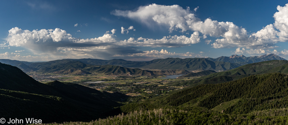
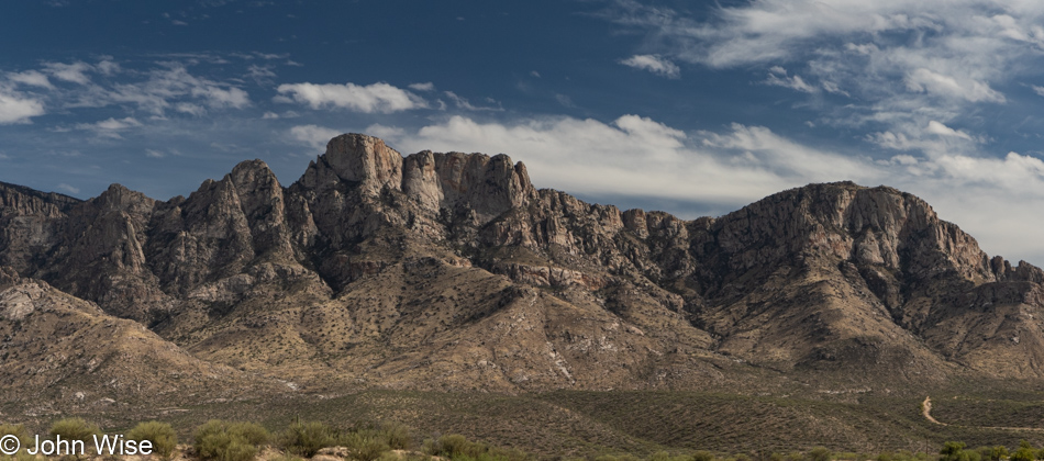
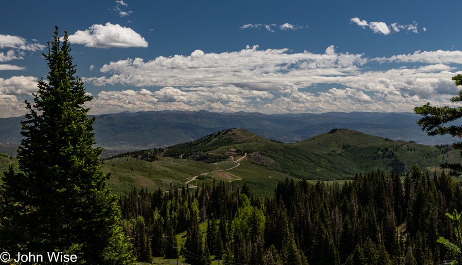
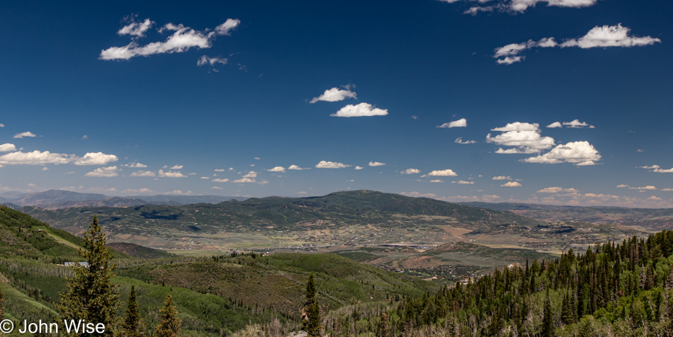
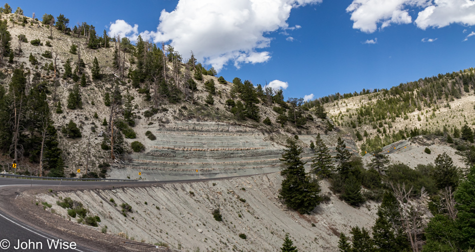
This morning, we are heading up through the town of Midway on Pine Canyon Drive, a bit of a nail-biter with very few opportunities to pull over on the narrow road full of hairpin turns. During winter, this road is closed, and it’s obvious why. That’s Midway in the distance on the valley floor, and to the far left, you can spy a corner of Heber City. At some point, just before our trailhead, we merged onto Guardsman Pass Road, and shortly after, we reached our parking area.

Good thing we showed up early as there were already 20 cars parked in the large dirt lot, but by the time we’d come off our hike, the area was full, and people were parking a quarter mile away in an overflow area on a sketchy steep side driveway, while others who hadn’t heeded the signs that there was NO parking along the road were getting ticketed or maybe on their way to being towed. By the time we were finished with our walk, we only wanted some food and to rest our tired feet. Enough of that; time to get on down the Bloods Lake Trail before continuing on to Lackawaxen Lake.

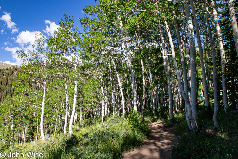
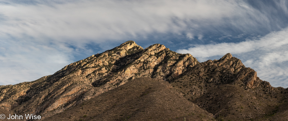
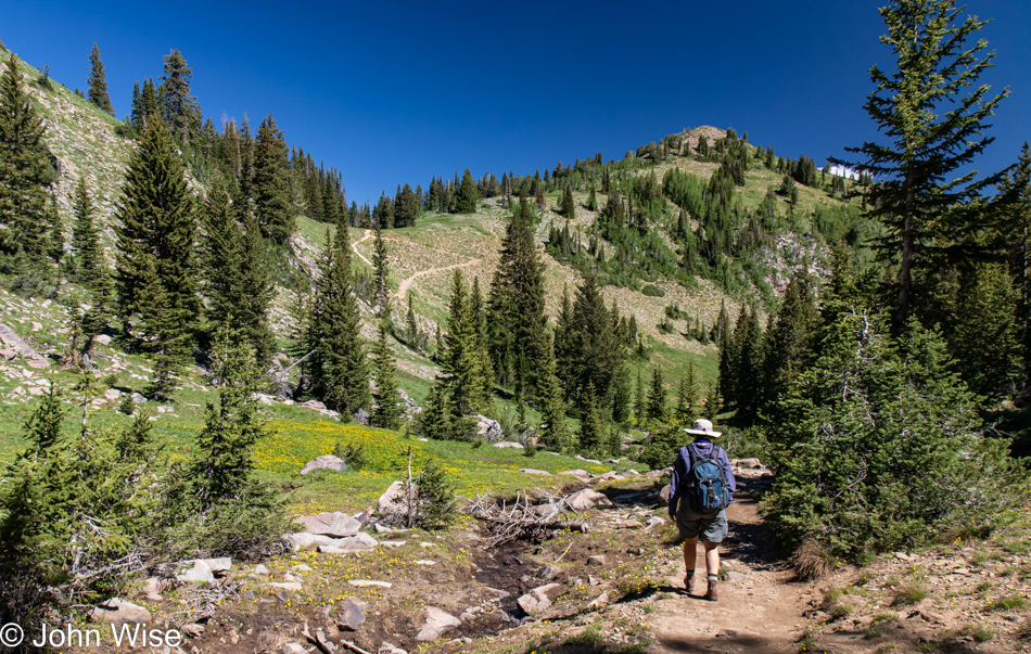
A small detail to note: we parked in the shadow of Jupiter Peak, which stands just below 10,000 feet, and our hike will take us over towards Clayton Peak, towering at 10,689 feet (3,258 meters). The trail itself is supposed to be just over 5 miles with an elevation gain of 1,118 feet (310 meters), but considering that we took an alternative trail back to the car, we had more gain than that and, of course, the descent. And while this was our major activity of the day, somehow, we amassed over 8 miles of walking (13km).

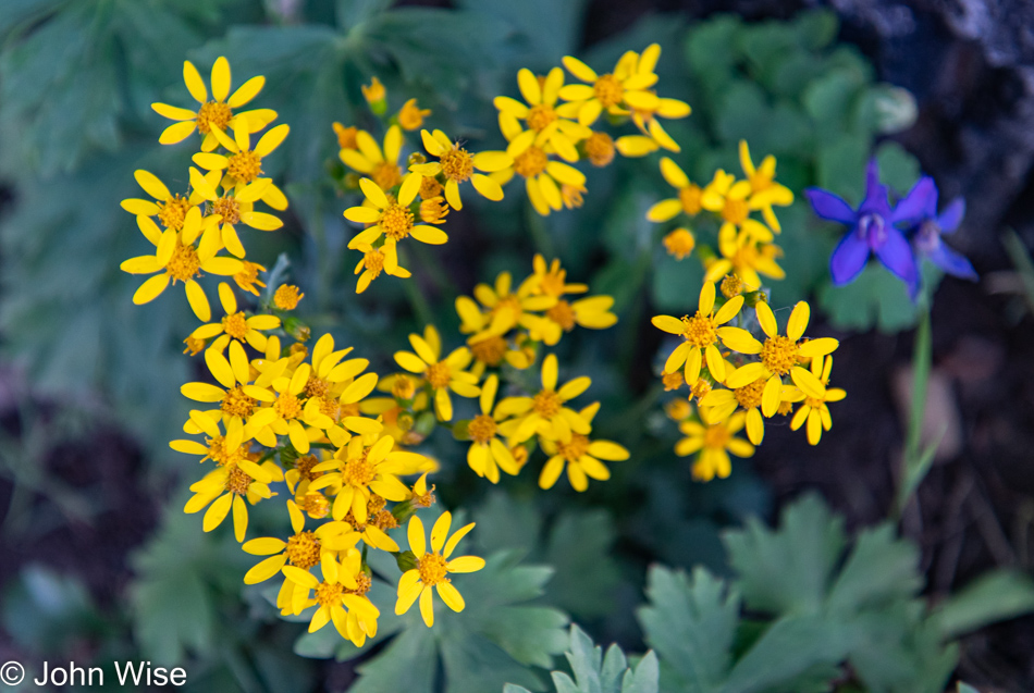
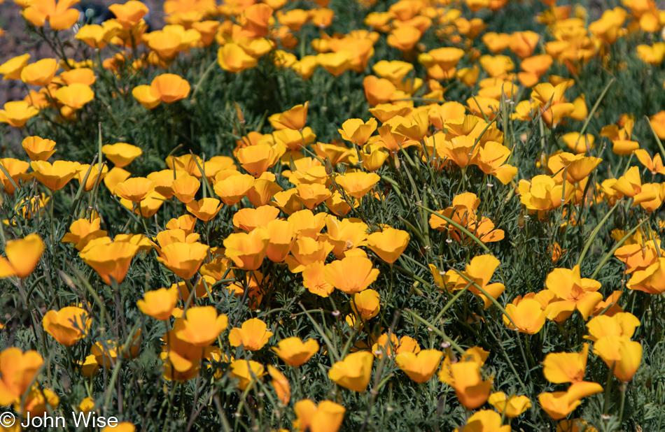
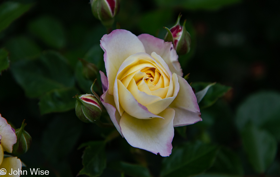
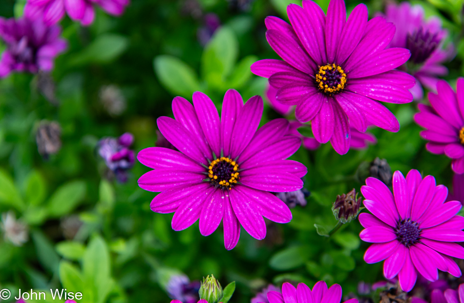
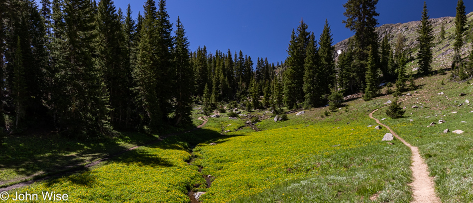
As you’ve seen by now, the forested trail is beautiful and in keeping with the theme established a couple of days ago at Cedar Breaks National Monument: we are here during the season of wildflowers. These particular yellow flowers appear to be part of the packera genus of plants and are commonly known as golden ragwort.

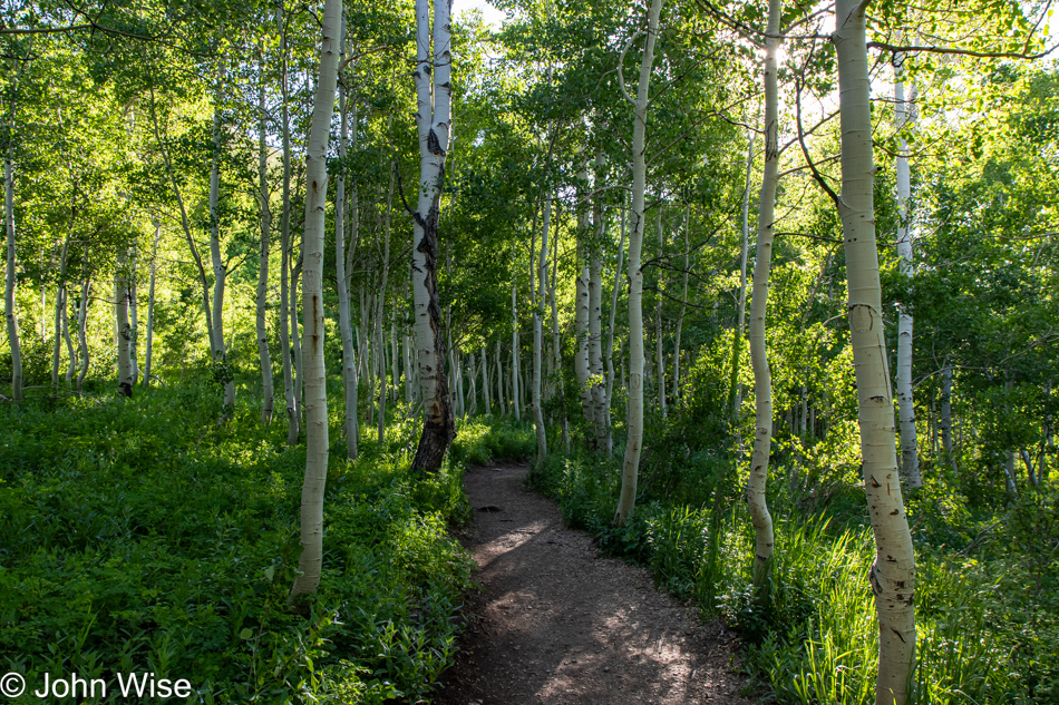
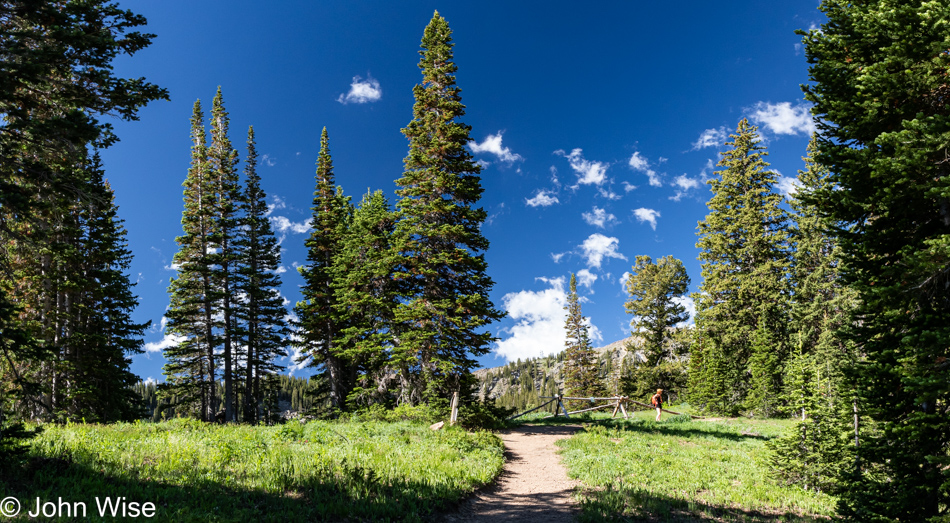
Switchbacks at this elevation are never really fun for those of us who live in lower climes, but the excitement of being in such an intriguingly beautiful location and our insatiable desire to experience more move us forward, even if we have to take frequent breaks to catch our breath.

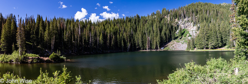
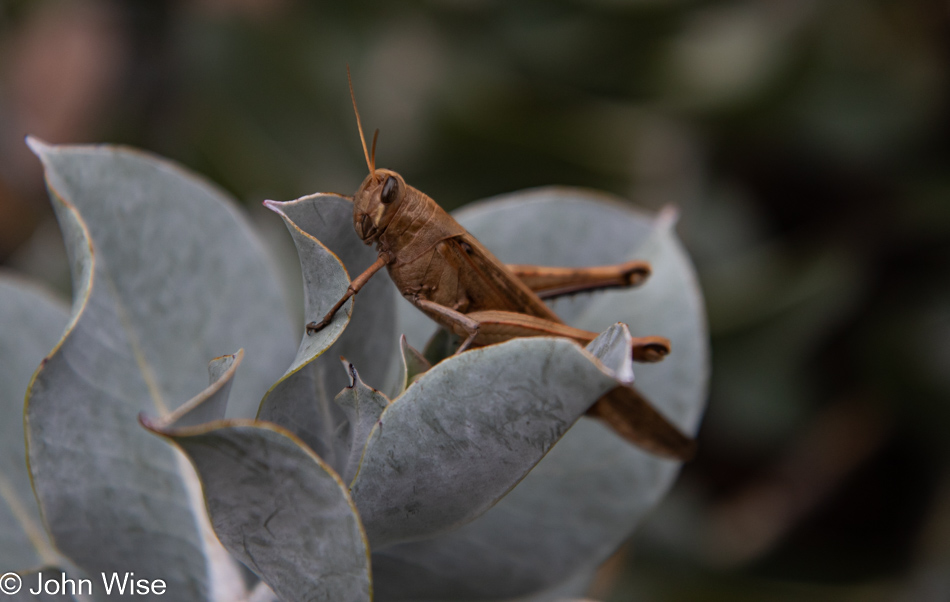
For our efforts and treasure offered to the gods of capitalism, we are afforded payoffs like this. At this point, we are little more than a mile up the trail, and this is also the place most hikers park themselves if they are able to endure the mosquitoes. We’ll only be here momentarily as Lackawaxen Lake is still another mile and a half away, and we have about 32 miles (563km) of driving ahead of us today before reaching the town of Blanding, Utah, where we’ll have an overnight.

If we didn’t live an 11-hour drive away from here, we’d certainly make the effort to visit more often. As for flying up to Salt Lake City and grabbing a rental car, that would add no less than $600 to the cost of the weekend. When using our own car, we spent about $140 in gas to be here, and that’s for the roundtrip.

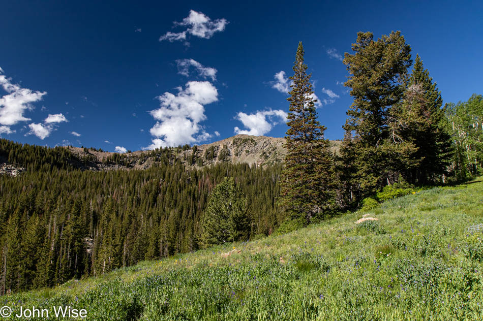
That’s Clayton Peak up there, and it’s just below it down in the treeline where we’ll find our next lake and even more mosquitoes.

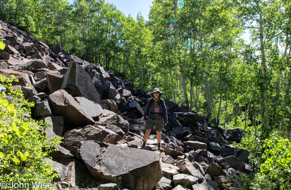
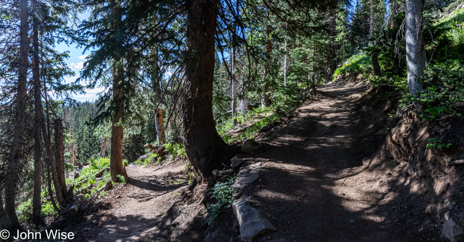
Some small rocks to walk over before we reached some serious boulders that required negotiating, along with a bit of snow further along the trail just before arriving at the lake. Regarding the jagged boulder field, a couple of times, I found my way through on my butt, as standing high above the gaps was triggering my anxiety.

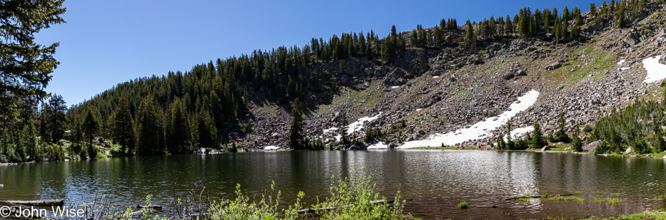
But we made it to Lackawaxen Lake, where we lingered for two, maybe three minutes before running away with a cloud of angry, hungry mosquitoes on our tail.

My stoic, resilient, hard-ass wife is not one to let some pesky mosquitoes interfere with her joy, so she just keeps on going while ignoring the bloodsuckers drinking from her bare legs so they can make baby mosquitoes. I, on the other hand, shoo them away, swat them, nearly panic when they approach my ears, ask Caroline if she sees any of them on my shirt, and then whine that we don’t have a gallon of Deet/bug spray with us, hell that we don’t even have the tiniest bottle with us. We are at the mercy of mosquitoes, but we have the option to leave while they must live and die here.

While my eyes luxuriated in the spectacular beauty of the meadow, and I considered what I might write next, I was still thinking of mosquitoes and my snarky comment that we have the option to leave while they must remain. This is where they’ll live and likely die and while some mosquitoes can fly up to 10 miles, I’m guessing that most live near a good water source and a place they can easily find food. Food, that’s what we are to the females, this much I knew; what I didn’t know is that the males feed on nectar but only for a brief ten days as they flash into existence and die rapidly, after only ten days! In comparison, female mosquitoes enjoy a much longer life that, on average, is estimated at up to 45 days, while other sources say it is closer to only two weeks. I also learned about diapause, which is the condition when insects effectively enter a kind of hibernation state due to conditions unfavorable for their species, such as mosquitos here in these mountains when winter sets in.

As I was looking inward to find something sweet to write about these two sacrificial blood banks that the mosquitoes zeroed in on every time we took the slightest pause, I had to chuckle to myself as I somewhat maliciously considered that many people in society are frozen in diapause waiting for optimal conditions for them to emerge from stasis and start living lives in the great happiness of optimism instead of their futile non-existence under the rock of despair. Long live the smile of knowing you are alive and have options.

Today was our day to gaze upon this scene for the first time in our lives, and while we may never have the good fortune to ever look at it again, we’ve been here, even if only for a moment. A thousand years from now, this view might not have changed much at all, but the memory of us or specifics of our existence will be long gone as we’ll have been dead for more than 950 years by then. It’s all temporary and virtually impossible to see but a tiny fraction of the space rock we live on for such a very brief time. In some way, we are all like male mosquitos existing for but ten days where everything we will ever know and see must be had in those meager 240 hours. Every second counts, my fellow humans, or are you really content with your mosquito-like existence? On second thought, I should consider that those I’d like to reach might never read something about someone else’s adventures and thoughts as they go about a life of profound isolation. All the same, I’ll just leave this right here.

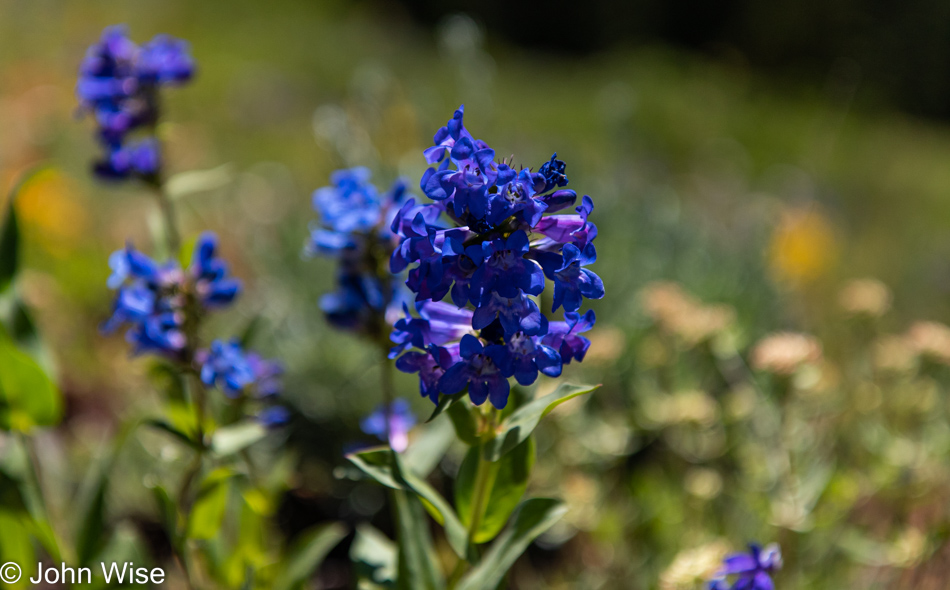
Wasatch penstemon flowers.

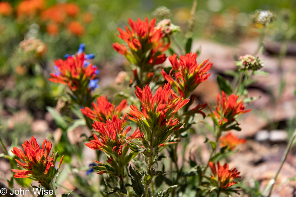
More Indian paintbrush.

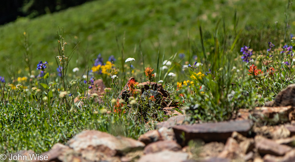
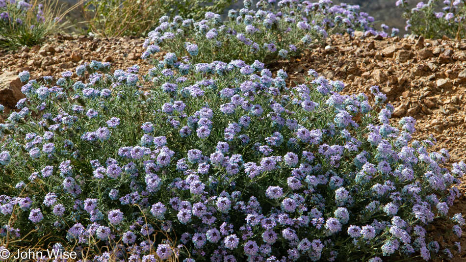
Bring them all together, and voila! a beautiful little patch of wildflowers.

The horror of horrors was our drive into Park City, which is a bastion of self-important asshole drivers high on their wealth and oblivious to civility. I will never again make the mistake of passing through this corner of America, but the view from above this wealthy enclave (towards the right and out of view) is a spectacular one.

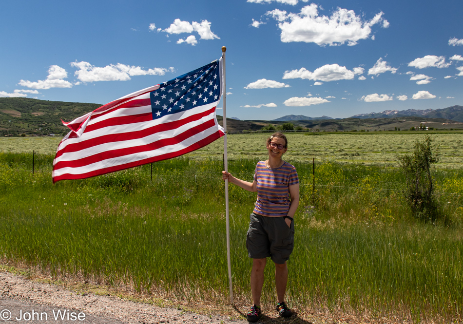
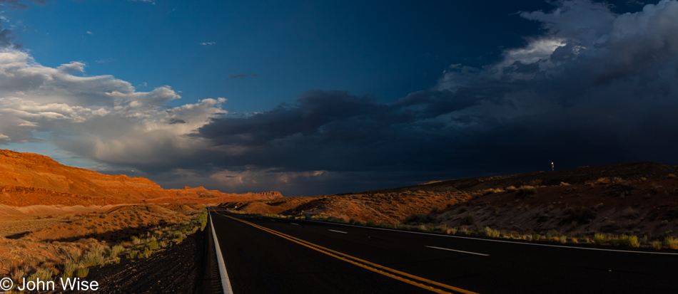
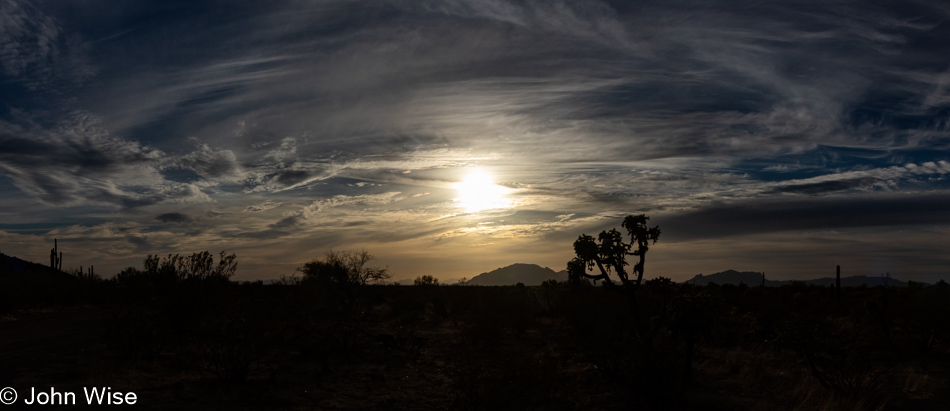
We are on Utah State Road 35, driving southeast, preferring to take the scenic route instead of the faster highway. Tomorrow being the 4th of July, this flag-lined stretch of road feels like one of the most honest celebrations of the big day.

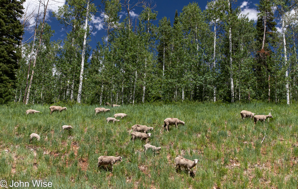
Freshly shorn sheep free-ranging next to the road is not something one sees every day, so we had to turn around, pull over, and hang out with all the sheepies and their lambs.

I believe this to be the last photo I shot on this stretch of road before transitioning to the 191 in Duchesne.

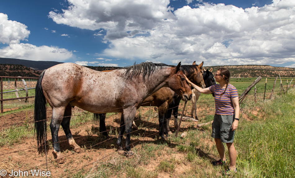
How long should it take to drive to where we are going today? Just as long as it takes, considering that we have to stop for a dozen sights along the way, such as these elegant horses.

It’s the details between the other details that paint the bigger picture of what was what when we were out somewhere, seeing the things that became memories that must fade with the passage of days.

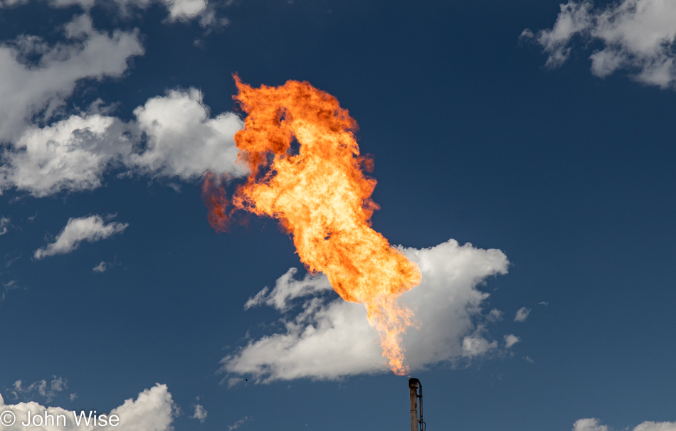
I must have taken dozens of photos waiting to capture the right one of this gas flare and this fire unicorn certainly qualifies as perfect in my book of stumbling into the coincidental.

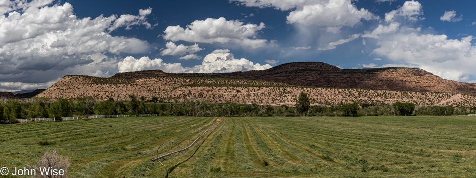
We are somewhere between Duchesne and Helper, Utah, at this time, and signs of people living out this way are few. What is here is a lot of oil and gas pumping. We were also offered a lesson in stopping in the middle of the street for a photo when thinking there was nobody behind us; I was about to step out of our car for a photo when I heard the roar of a giant diesel engine and then caught sight of a large oil tanker speeding straight at us. I threw the car back into gear and hit the gas as hard as I could so the guy fast approaching didn’t have to slam on his brakes to avoid rolling over us and snuffing our lives out of existence.

Beauty is found in the fluid and infinite state of things; we sense it in the clouds, layers of stone, patterns of where trees grow, the song of birds, music, or the sound of flowing water. We are always passing through sensuality and the passions of nature but are not always tuned to understanding the equation to which we are intrinsically linked. Every time we venture into these unknown ramparts and bucolic scenes, we are enmeshing ourselves in the greater tapestry of life as humans have come to know it. Expressing this relationship in words, images, music, or poetry is our primal language that transcends the work/enslavement structures distilled from others who desire to use human capital for their own means. To be out, exploring, observant, and in delight is to be free. The amazement of opportunity is where freedom is most easily found.

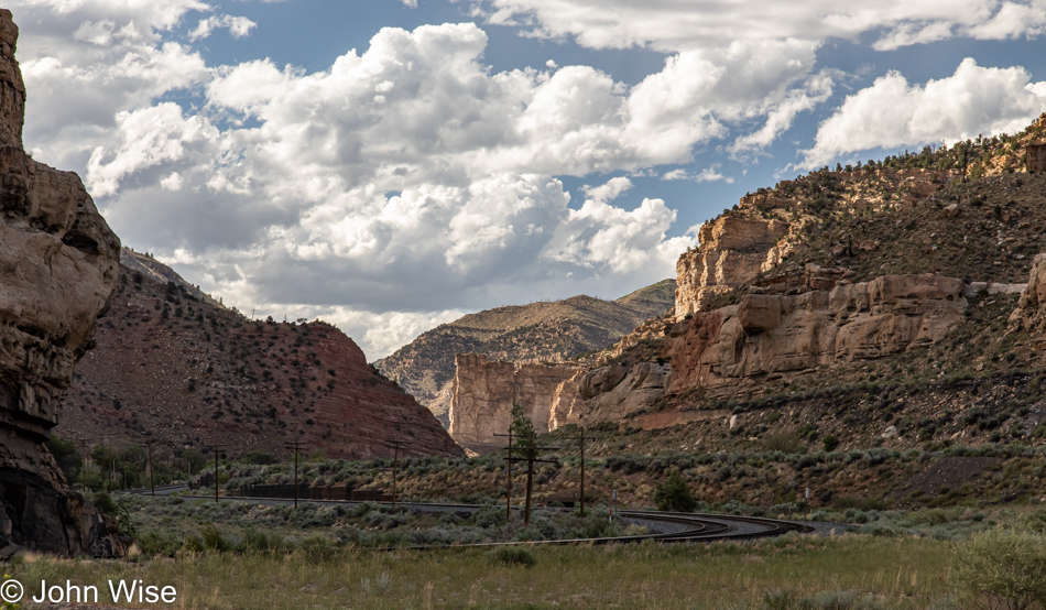
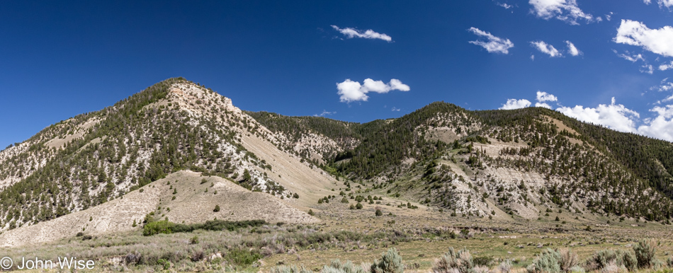
Somewhere near Castle Gate seems appropriately named to me.

While we can’t always avoid major highways, we try not to miss the few views worth capturing, even if it means rolling down the window, having Caroline take the wheel, and me shooting the photo while driving at 80 mph. Yes, that is exactly how this photo was captured.

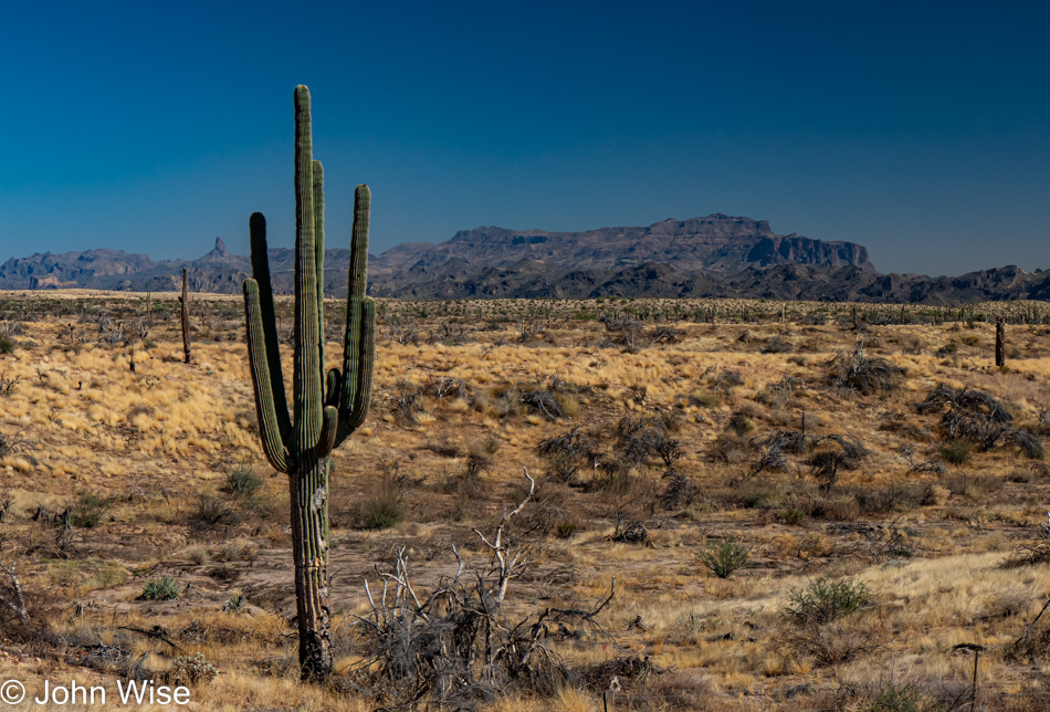
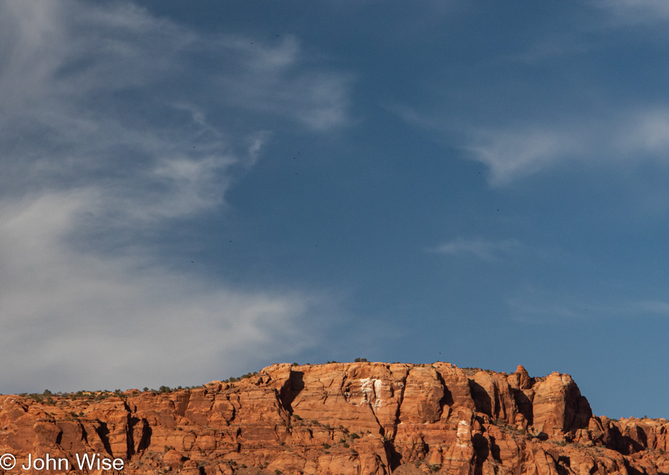
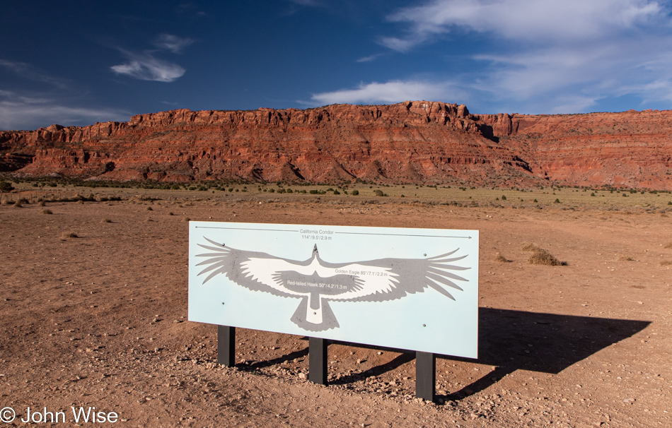
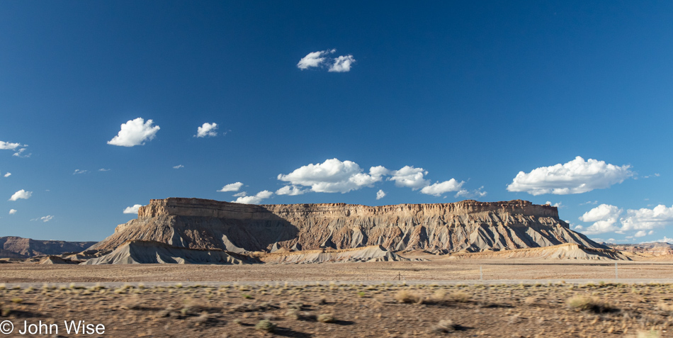
Arches National Park and Moab, Utah, are out there over the horizon.

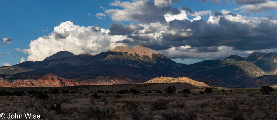
No time for crowded tourist destinations this late in the day as we still have 75 miles ahead of us.

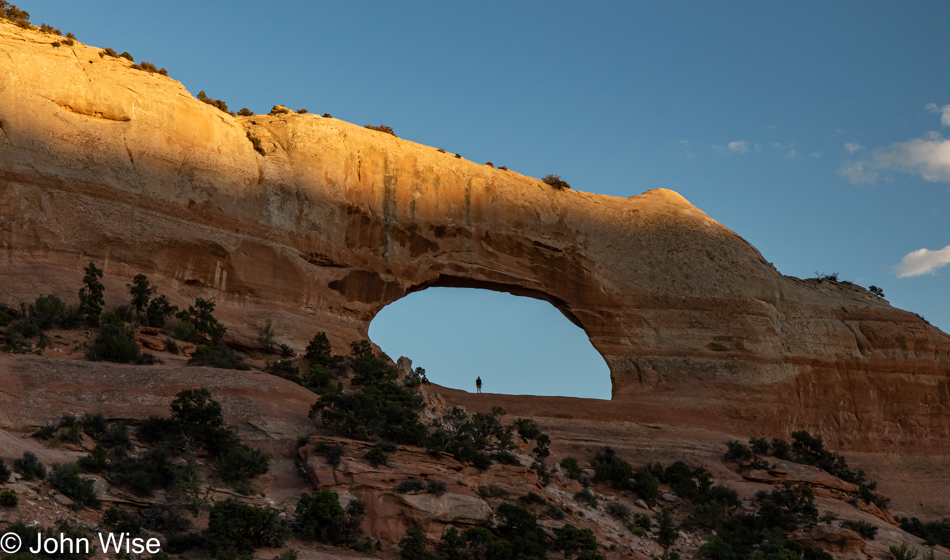
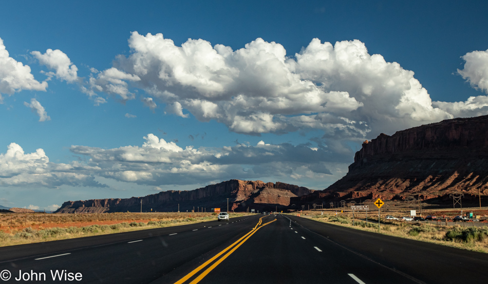
Okay, just a quick stop at Wilson Arch.

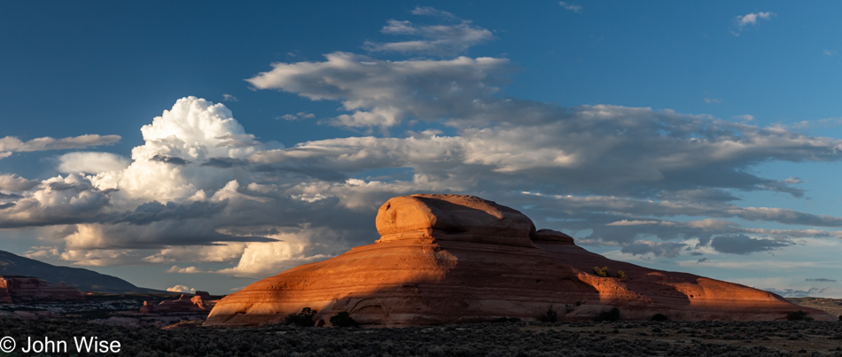
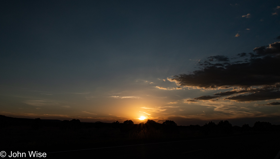
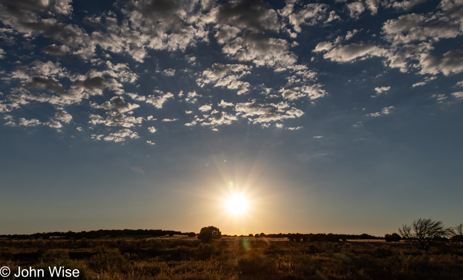
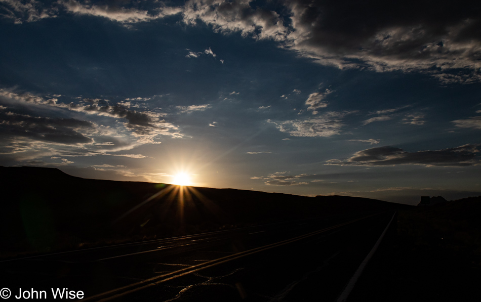
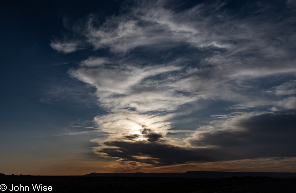
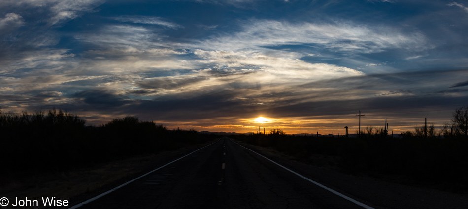
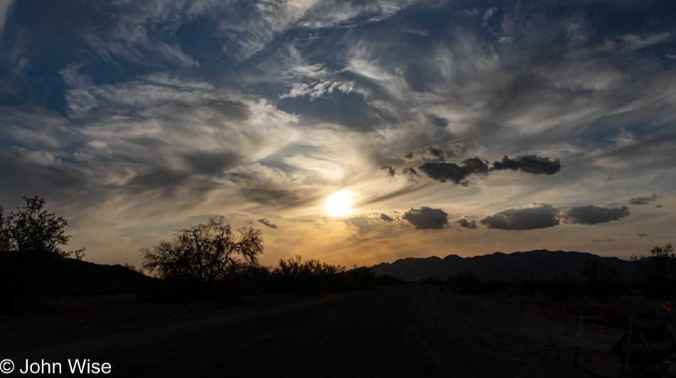
We’d better stop for this, too, as maybe this will be the best photo we are afforded for sunset.

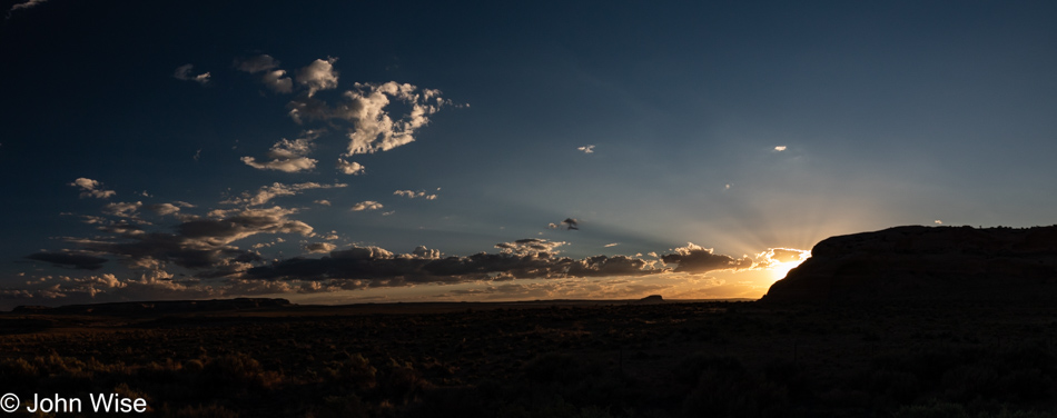
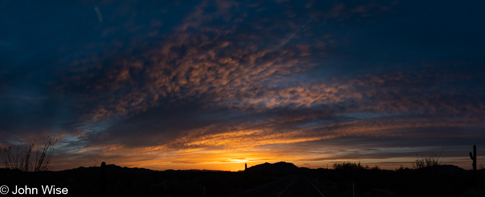
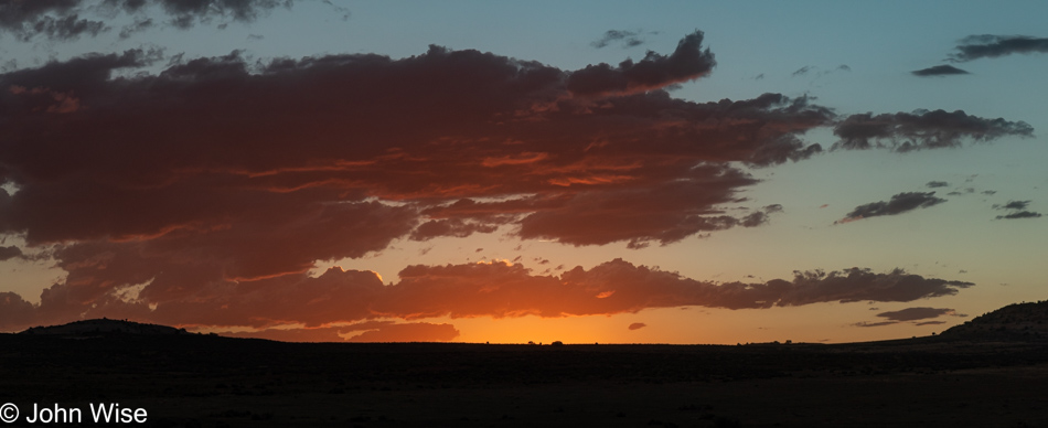
But then we saw the sun hiding just behind a sandstone bluff, sending out god rays and some golden glow, letting me frame the foreground as a silhouette. This, though, has to be it as it’s getting late, and we still have to check in to our motel further down the road.

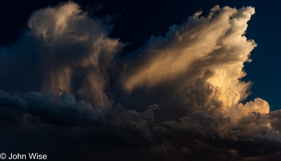
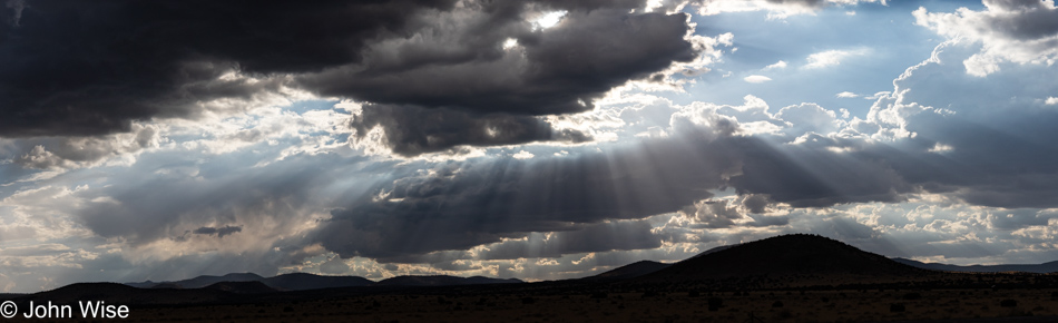
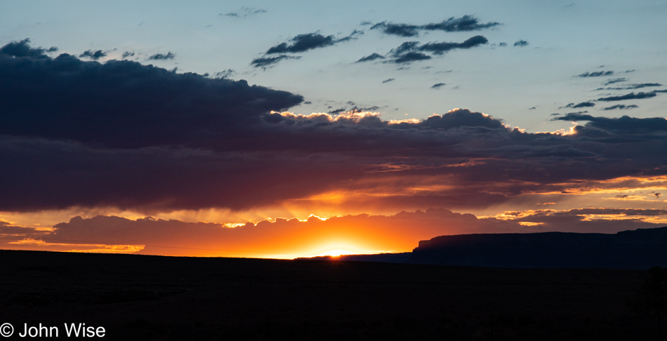
I can’t just drive by clouds that are this spectacular, but I swear, this is it.

Okay, so I lied.

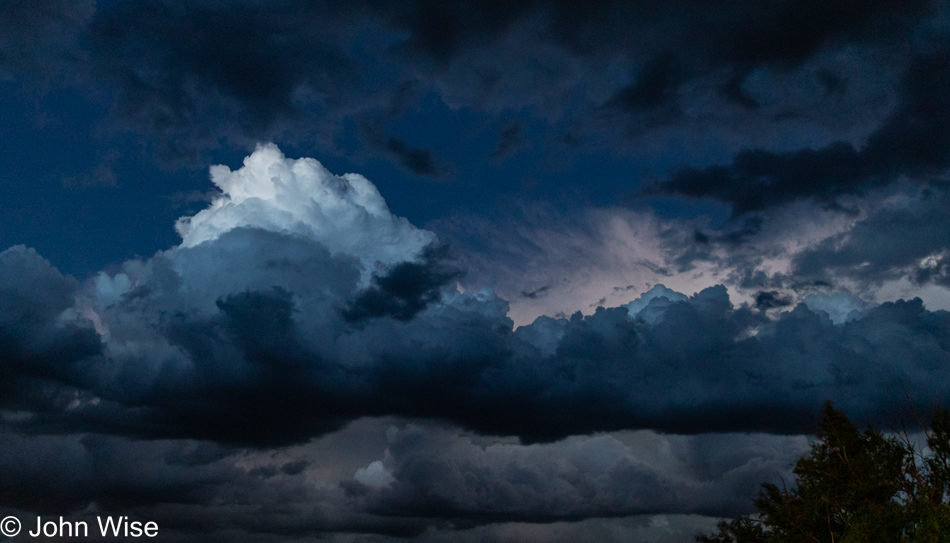
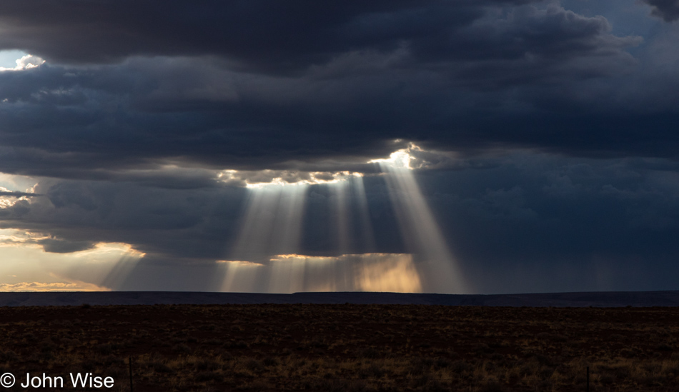
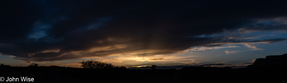
Tricked you here; you might have thought this was one more lie regarding stopping on our way to Blanding; well, we were pulling into our motel parking lot at 9:30 and just enchanted that down on the ground, it appeared to be already nighttime, but this one section of the sky was still capturing daylight from the long-set sun that we thought would be impossible to capture. But it turned out pretty good, or so I thought. So this is the last of the 37 images that accompany our day that started high in the mountains and followed us down to canyon lands in the southeast of Utah.

Celebrating America – Trip 12

Caroline Wise with her new U.S. passport in Phoenix, Arizona

We are entering the long 4th-of-July weekend here in the United States, with Caroline having just received her first U.S. Passport as an American citizen. She actually opened it last night, but I decided that it should go here at the beginning of the 12th trip of 2022, during America’s celebration of Independence Day. When her workday is finished, and I’m done with preparations, we’ll be driving up to Fredonia, Arizona, tonight. Just two months ago, we were passing through this small Arizona border town on our way to Bryce Canyon National Park. Tomorrow’s path will take us further north to Heber City, Utah, which will be our base for hiking in the mountains. While seemingly everyone else is lamenting the economy, inflation, the price of gas, the state of the union, and the myriad of other nagging issues, we are filling our tank, ice chest, and bags full of gratitude that even in the “worst” of times, this is still one of the greatest places to be. Happy birthday, United States, and thanks for welcoming my German woman to the fold.

Summer monsoons in Arizona

The same procedure as every trip? Yep, the same procedure as every trip. Wait until the last four hours before we are supposed to leave, and I get busy with loose ends. I was certain I had plenty of time; most everything was already done, or so I thought. Pack clothes and toiletries, the ice chest, the crate with dry foods, silverware, and a couple of bowls. Take out the trash, wash any dishes that were used this morning or at lunch, remember that I needed to get ice that I forgot while I was over picking up prescriptions, vacuum, turn up the A/C, power down computers, unplug all plugs that don’t have to be plugged in, sweep the patio, and get everything into the car. I’m at Caroline’s office at 3:05, five minutes late, but that’s okay because she won’t get away until 3:30.

Summer monsoons in Arizona

This is our normal and that’s that. We are on the road and driving north. I called our lodging for the night in Fredonia, the Grand Canyon Motel as it’s known, though it’s a good distance from that landmark, and told the proprietor Chuck that we’d likely not show up until between 9:00 and 9:30. Google is showing us that we’ll arrive right in the middle of that.

Sunset in Northern Arizona

It’s that old blistering-hot temperature of summer as we left the valley, but up in the mountains of Flagstaff, it slips into the mid-60s, likely due to all the rain clouds in the vicinity. We only see a few drops, see a few flashes of lightning, and in a few minutes, we are on the other side of the city. Somewhere near Wupatki National Monument, we pulled over for dinner. Actually, we needed to pull over for photos of the god rays, and well, that was a great place to break into the ice chest and fish out the bologna, boiled egg, and lettuce in which we’ll be wrapping our sandwiches. A simple, fast, on-the-go dinner so we waste no time and simultaneously save money while dining in the greatest outdoor dining room of all time.

Sunset in Northern Arizona

We had to stop a few more times for dramatic skies as a travel-themed blog post without travel photos would be like a bologna/egg sandwich without mustard. As a hint of things to come, this photo was shot near Marble Canyon between the North and South Rims of the Grand Canyon, where we’ll be staying in mid-October when I’ll be sure to bring my 70-200mm lens for photographing those condors that live nearby.

Sunset in Northern Arizona

It was 9:15 when we pulled into a Family Dollar that was open, the only store open after 9:00 in this small outpost of Fredonia; we needed fresh ice for our provisions. Our goal on this trip is not to go out for meals; you see, I came off a 5-day fast on Monday and decided to dip right into a keto diet as I’m aiming to drop 20 pounds. By 9:25, we are checked in and heading to cabin 6, which includes a small kitchenette, for a miserly price of only $70. It’s now 10:00, and I’m skipping photo prep as I feel more pressed to jot down these few notes before we turn in. Come tomorrow, we have a 70-mile drive before jumping on our first trail, but more of that then.

North Out of Arizona – Trip 8

Caroline Wise and John Wise driving north in Arizona

It’s already been a fortnight since our last travels that took us south, down to Ajo, Arizona, on the Mexican border; today, we head north. For the trip before that weekend in Ajo, we headed to Los Angeles, and so, as a preview of our next outing two weeks after this, I hope you might already guess that we’ll be going east. Today’s adventure, however, will bring us to Bryce National Park in Utah, about 80 miles north of the Arizona border.

Late last year, I took our friend Brinn up to Bryce to get his head out of some difficulties he was dealing with and realized it was likely well over ten years since Caroline last visited. After checking all blog posts, I surmise it might actually be closer to 20 years. It’s unfathomable that it’s been that long as the images of the park are never very far from our memories. Another aspect of this being a shame is that we are a mere 420 miles from the park. On the other hand, we have to avoid the place in summer: too crowded, yet we likely won’t be hiking in the winter because of too much snow. And so we have late April through the end of May and late September to early November to spend quality time there.

While I would love to bring Caroline back to the trail we’ve hiked together before (the same one that Brinn and I were on last year), it’s time for the two of us to capture the park from different perspectives, and to that end, I have a 7.8-mile hike scheduled on Saturday and an 8.7-mile hike for Sunday. While we are prepared for chilly mornings, both days should be mostly sunny with highs in the mid-60s; sunrise won’t be until 6:30, while sunset doesn’t arrive until 8:15.

Well, enough of this small talk; I have a few things to finish before we depart in a short 2 hours, as in lunch…

…That was 10:00, and now it’s noon. We are packed, fed, and about to get on the road. Next stop, Flagstaff for coffee and gasoline.

We are now well north of the big cities and moving deeper into the quiet of a landscape we are in love with. Along the way, we pass dozens of Native American roadside vendor stands that often look as though they’ve been abandoned for years. I’ve likely shared this more than a few times, but we miss the old Chief Yellowhorse stop along the road up here as they really worked the cheesy signs welcoming drivers traveling along this dusty path. Occasionally, there’s a bit of art that adorns these plywood stands that somehow endures the harsh winds and blistering sun that wears down the surrounding mountains. Maybe I’m drawn to them due to a romantic notion of what these stands harken back to from a different age when innocence and naivety allowed people to enjoy simpler things that still felt exotic.

But, like with all things, there is no such thing as permanence. Everything under the sun fades away. With enough time, mountains are turned to dust, and maybe too quickly, people’s dreams turn to dust, too. We’ve passed this fin countless times and while its erosion is imperceptible to us, the erasing of human activity here appears accelerated. There are homes and families that exist right along this road that straddles an invisible Grand Canyon on our left that is just out of view, but opportunities to succeed are rare, and with fewer and fewer travelers interested in souvenirs from the exotic old west and the Indians that scrape by, what’s here that represents humanity, aside from the asphalt, will ultimately also turn to dust. So, you better gather your experiences and live your life out in the real while it still remains.

Just ahead and moving off to the northeast is the rapidly disappearing Colorado River. While the river remains flowing from its catchment basin further upstream, our demands on harnessing and wasting it tax the entire ecosystem so we can feed golf courses, fill swimming pools, water the grass at our homes in the surrounding deserts, and create entertaining fountains over in Las Vegas. In other words, we are idiots failing to understand any sense of balance. Is our disconnect from these environments poisoning our responsibility that we’ve offloaded to weak politicians, celebrities, and those who put financial gain above survival? It would appear that we are driving into an oblivion of nothingness.

A shadow mirror deep below the edge is the lifeblood of all living things; we call it water. A dozen years ago, Caroline and I grew wealthier than many people on earth as we were afforded the luxury of traveling this muddy liquid highway called the Colorado River. From above, we are on an old highway bridge turned pedestrian bridge from which we can look right into the Grand Canyon. It’s not the view everyone is familiar with, but 5 miles north is Lees Ferry and the official beginning of the Grand Canyon, where mile marker zero denotes the launch point for rafting adventure into the canyon containing this mighty river. A singular moment was required to make the decision to travel through the “Big Ditch” which turned into one of the best opportunities we’ve offered ourselves. Any and all sacrifices should be met to afford one’s self these once-in-a-lifetime experiences that change the fabric of who we are and how we see our place on this planet. We can no longer see the Colorado or the lakes that try to contain it and not consider the impacts we inflict upon all of life in the Southwest as society takes water for granted.

I’m well aware that many of my themes by now are well-worn and maybe even tired, but if there is any real connection to the beauty taken from these spectacular landscapes that resonate within me, then there must also be a deeper appreciation and desire to protect and respect these environments in such esteem where important words bear repeating. Speaking of repeating, this road has been driven countless times, not that I couldn’t figure out roughly just how many times, but I don’t want to as I enjoy the idea that I can no longer really know as it’s that familiar.

I know these sights, no I don’t. Well, not having a photographic memory, I can’t say I truly know them, but they must be somewhere in the recesses of my mind as I know for certain we’ve passed through here before. We are fortunate to have these imperfect recollections where if we are inclined to return to a place that brought us wonder, it can be new once again and inspire fresh awe.

Did we miss this monument on previous excursions through the area, or is this dedication to the Dominquez-Escalante Expedition of 1776-1777 been placed here recently? Who cares, we needed to stop to even figure out who he was. So, it wasn’t a he but them. They were Franciscan friars Atanasio Dominguez and Silvestre Velez de Escalante, who ventured into the wilderness to document what they found on their 2,000-mile 6-month exploration to California. They never made it to that territory due to the approach of winter, but their journal served to help Lewis & Clark with their expedition in 1803, and so, as you might guess, I’ll head over to Amazon to grab a copy of their document of what they found nearly 250 years ago before the indigenous cultures were forced to cede their identities to the wave of invaders that were at their doorstep.

While back on the Navajo Bridge, a man who’d taken his chair out on the bridge to watch condors told us of a rookery out near House Rock and that there were now over 100 condors in the area. To be honest, I was skeptical, but a sign for the Vermillion Cliffs National Monument with a map showed a condor viewing area up the road in House Rock Valley. Still, we were incredulous and didn’t believe there was any real chance we’d see condors if we made the detour. The turn-off is not well marked and requires a turnaround, but we thought, what does it matter if we get into Tropic, Utah, later than planned?

We might have been 4 miles up the gravel road before we spotted a pickup truck near a covered picnic table and two women, one with an antenna in her hands when we realized we were at the right spot. Caroline looked through a scope that is mounted here and immediately saw one of these giant California condors flying right above what turned out to be streaks of bird poop. While it may be difficult to spot in this lower-resolution photo, there are ten condors in the image above. Once again this year, we wonder out loud about these travels into nature, why we are failing to bring our binoculars and my 70-200mm lens?

We saw more than 4% of the entire population of surviving wild California condors that exist on Earth today. This giant scavenger nearly went extinct with only 22 birds still alive back in 1982, and they are still under threat due to states like Arizona that won’t ban hunters from using lead in the bullets they use for hunting. This then begs the question: I thought hunters were not doing this for sport as much as they were shooting animals for food. If condors are scavenging carcasses that are full of lead, then it can only be due to hunters shooting whatever the fuck they want and leaving the rotting corpse to be claimed by whatever comes along to dispose of the spoils of our war against wild animals.

Then, on the other hand, there are those of us who see our tax dollars at work maintaining these trails into our wildlands where average people can drive up to see things never seeable in our cities. Driving up to a view equipped with shade, seats, a toilet, and even a scope so the curious are offered this kind of experience that is nothing but luxury. Along the way, we’ll find food, gas, lodging, and random surprises that are only accessible due to the constant support of an infrastructure that allows these types of forays, even for the hunters, off-roaders, and those happy to inflict damage to an environment I’d prefer remained pristine. But we live in a world where compromise is supposed to be the rule, and I’m good with that, though we can still try to exist within parameters that best preserve things that are beneficial to people, land, and the various species with whom we share this world.

Do you see that? Can you feel what I’m trying to share? Have you seen the moments I captured over the course of our afternoon? All of this is love, love between the two of us experiencing our world, love of the opportunity to be present, love of the sights, and those who lend massive effort to our ability to have such times of life. Without the entirety of all things working in concert to allow these two people to be here in this precise instant, life might otherwise be a total chaos of randomness where order never finds an equilibrium. We must stop and harness our powers of observation and consideration to see that in the sunset, the condor, the river flowing through the canyon, and the two people tracing a path over our earth are all bringing the potential to recognize unraveling beauty, discover new love, reaffirm an engaging relationship to this brief moment in time where life happens on the most profound terms.

Our source of inner light shines for such a short time once you fall in love with all of this, but if you fail to see the horizon closing in on you, you will waste this precious resource called happiness. The phenomenon where our hearts are allowed to fill with awe, joy, surprise, and magnanimity towards ourselves and the world around us is a fleeting flash of potential that is only illuminated for the briefest of times with a prominence that will be witnessed by very few. Share this opportunity for love with yourself and get out of your way, out of your fear, out of your routine. Escape your cynicism and look for the profound in the tiniest of things, in your heart, mind, and soul.

The Long Way Round – Trip 7

John Wise and Caroline Wise at King Coffee Roastery in Phoenix, Arizona

Happy Good Friday, and it is. I’d forgotten that Caroline would be off today, so last night, I was surprised for the second time to find out that we’d be able to leave for our weekend getaway whenever we chose. But this opened up a dilemma for which I wasn’t exactly ready. You see, all week, I’d been working on details regarding other trips by moving some days around, adding activities, deciding that we’d head out over the 4th of July into the Wasatch mountain range east of Salt Lake City, adding the Zuni reservation to the mix by nixing something else, and booking a night in a hogan in Monument Valley for the second time in 14 years. After juggling these hundreds of threads, I had to turn my attention to working out in greater detail just what we’d be doing this weekend.

We already knew that we were heading to Ajo, Arizona (garlic in Spanish) and then down to Organ Pipe National Monument for some hiking, but that was it. With a brain already fixated on travel plans, I brought up the map and knew almost immediately that we should simply go the wrong way. Instead of driving west, we’d go east. Ninety minutes east of Phoenix is Miami, and in Miami is Guayo’s El Rey, and at Guayo’s El Rey we’ll be stopping for lunch. A lunch of carne asada at my favorite place for just that.

After eating, will we backtrack? Heck no. We’ll drive another 10 miles east before turning south to make the long detour around Tucson before finally taking a quiet road to Ajo, where we are booked for the next two nights. But don’t go thinking that this was all I could come up with tomorrow; we’ll be having lunch at a grilled chicken stand in Puerto Peñasco, Mexico, on the Gulf of California, though those details and the rest of today will have to wait for us to get underway. At the moment, we are sitting at King Coffee Roastery down the street from home while I’m starting today’s post, and Caroline is knitting away to finish the new pair of socks that she’s promising I’ll be wearing before the weekend is out.

No, seriously, I typically hate any food photos I shoot; well, the donuts a couple of weeks ago turned out okay, but I have no eye for shooting meat. But then I thought, maybe this is like nature images where nothing I capture ever even remotely is as appealing as what we experienced with all of our senses tuned to wonder, and that years from now, when for one reason or other, I can no longer enjoy the worlds best carne asada, I’ll be able to look back at this one and remember the sense of yummy it offered me, though the image of it was less than appealing.

The signs around town mention the poppies, but had we ever been in Miami to see them in bloom? Had we simply overlooked them, or were we so uninspired that day that we couldn’t be bothered? I do have to admit no small amount of annoyance after driving the road between Superior and Miami as speeding lunkheads plow aggressively over the winding roads as they impatiently need to arrive somewhere that always seems to be dictated by some kind of emergency if their driving is any indicator. It’s hard to stop and smell the flowers when survival and stress are wearing you down.

Today, with the decision to let time be damned, we took the long way around by going well out of our way to turn a 2.5-hour drive into a nearly 8-hour tour east, south, west, and a little bit north just so we could get out and smell the nearly scentless wildflowers of the Arizona Desert on a spring day.

I’ve never seen a thistle I didn’t like, though the same cannot be said after touching one of these spiny plants.

We’re on Arizona road number 77, traveling south; the astute might notice I’m looking north for this photo.

Oh, more wildflowers, we must pull over, or how else will we use all that time between lunch and the setting sun to occupy ourselves when today’s destination doesn’t hold a ton of things to do?

The reminder that the drive wasn’t all about grand vistas and flowers but included a good deal of brown, tan, lifeless, dull dirt, leafless plants, and desert stuff that isn’t always amazing in its repetition. Hmmm, that sounds cynical and like the words of someone failing to appreciate the complexity of what a desert embodies. I should never give in and take the world around me for granted; I, better than most, have a pretty good idea of the formation of our planet, the upheaval, and the chemistry that has been working over millennia to form every bit of organic everythingness that must be here for me to begin to make even the smallest of observations. So let me reframe this: wow, just look at this spectacular dirt being eroded right next to the road for everyone who passes to witness just one more bit of nature at work on our behalf.

Then the Santa Catalina range of mountains screams at me, “You even care a lick about that little bit of dirt roadside when this kind of majesty is here to astound you?”

After negotiating our way through the chaos of Tucson (Little Phoenix in its boringness), we were on the quiet and scenic Arizona Route 86 for the rest of our drive southwest through Sells before turning northwest on our way to Ajo.

And this is why you turn a 127-mile (205km) trip into a 341-mile (558km) meander, a great lunch, colorful wildflowers, terrific mountains, and a fantastic sunset.

But the sunset wasn’t over yet, with the shifting high clouds and the evolving glow of the horizon offering us a thousand beautiful views that changed with the curve of the road, the cactus in the foreground, and which part of the sky was capturing particular spectra of color.

Our motel is on the sketchy side, with the amenities not what they might have been at one time. With no soap or shampoo in the room, we had to track that down. Stepping back out of our room, we heard a commotion around the corner from the housekeeper and the girl from the front desk: they were dealing with a snake. It turned out to be a non-venomous western ground snake, a pretty reptile with its orange and black bands. It slithered away after we caught a glimpse of its snakeness, heading for a hiding place behind our room.

After we were done hunting snakes, we informed the ladies that we needed some supplies of the hygiene type and were offered the basics. What they couldn’t help with was the musty old smell of our room, but we don’t pay $77 a night on a weekend with high expectations anymore; after all, it’s no longer 2005.

With the A/C on and a window open, we took a walk out along the road under the full moon, the peaceful quiet of the desert broken by the sound of giant truck tires barreling down the road as the partiers were approaching the hour that the border into Mexico closes for the night. Trying to keep an eye open for snakes that might look for warmth out on the highway while being aware of speeding vehicles that might not see us, we strode along, enjoying the pleasant evening.

Back in our room, still too warm and funky, I turned to blog chores as Caroline tucked into the Kindle and her reread of Tracks by Robyn Davidson. None of this lasted very long, as we were tired following our marathon drive.

And so this was how trip number 7 of the year started out as we ventured into the desert for a mini-vacation close to home.

L.A. to Phoenix

Last night, somewhere about an hour after we went to sleep, the sound of a racing car engine woke me first. The squealing tires demanded I jump out of bed, quickly followed by Caroline. Our room on the third floor of the Garden Suite Hotel facing Western Avenue offered us the perfect view of the intersection at 7th Street and Western. What was going on down there took some time to decipher. The smell of burning rubber, a ton of smoke, roaring engines, and the sound of the crowd spilling into our room, but tired brains took a moment to compute that we were witnessing our first-ever sideshow, also known as a takeover.

Then it all starts to come together: someone disabled the street lights, there was a coordinated effort to shut down the streets in such a way that law enforcement wouldn’t easily reach the intersection, enough people showed up to make a sizable audience, and then the mayhem ensues. Get your tires smoking, turn into the circle, and hammer the gas. Passengers were hanging out of windows, and kids were darting into the middle of the street where cars encircled them, pouring smoke over everything. On the edges, other kids were trying to touch the cars when they weren’t jumping out of the way. This lasted nearly 15 minutes before a police helicopter showed up, and maybe 5 minutes after that, we could hear sirens from the approaching police. With the explosion of a large firework right in the intersection, things broke up, the crowd scattered, and cars pulled away in all directions, leaving us astonished at what we’d just seen.

Seven hours later, as we crossed the intersection, the smell of burned rubber was still present, and the idea that we heard, saw, and experienced what we did in the wee hours of last night felt like a dream.

Here we are across the street at Sun Nong Dan Korean restaurant that we visited last night. This is what $30 bought for breakfast compared to yesterday. First up was hot barley tea, followed by the banchan: kimchi (spicy), pickled radish (yummy), pickled onion with jalapeno (okay), garlic chive in sesame oil (oh my god, my mind is blown in amazement), and a side of brown rice (dyed purple with black rice!). Caroline ordered the Tta Roh Guk Bap (beef brisket with dried cabbage Soup), and I went for the Yuk Gae Jang (spicy beef & leek soup). Both had a good amount of spiciness to them; this wasn’t just some mild gochugaru added for coloring.

We were promised a partly sunny day, but all we see is gray, occasionally dark gray hinting at a chance for rain, but that won’t ruin our day as our dispositions are sunny enough. Hmm, I read those last six words and think I need to mash the backspace key and delete that cheese, but there’s a hint of truth there. You see, we always know we might be hit with unfavorable weather when we travel, but what exactly is unfavorable? Is cold, wet, windy, or too hot a negative for successful travel? Maybe this is why so many people think they need to go to Cancun, Hawaii, Ibiza, Tenerife, Miami, or other places at only particular times of the year. Well, that would be a setup for disappointment. All of today’s photos were shot under gray skies, that is, until we reached the Palm Springs area of the Californian desert on our way home when the sun finally emerged.

So now that you know the weather and our attitude towards it, I can share that we are at the Huntington Library and Garden in San Marino, California. In yesterday’s post, I wrote how we got our dates backward for when we were supposed to be here and at LACMA; well, the staff here at the Huntington had no problem exchanging the tickets and letting us enter right away, which was a big relief. Our first stop is at the library and this statue of Commodus (son of Marcus Aurelius and movie villain in the film “Gladiator”) as Hercules holding his son Telephus; I guess it’s kind of like the image of Trump as Rambo but also holding a baby Arnold Schwarzenegger.

Close-up detail of one of the original Gutenberg bibles that still exists. This volume printed on vellum is incomplete just as the majority of the 48 remaining bibles are, but lucky Caroline and I have also seen a complete copy at the Library of Congress in Washington D.C. and the one at the Austrian National Library in Vienna. Next time we are in Germany, I want to make a point of seeing the Frankfurt University Library copy that is also complete, and since I’ve also seen the one in Mainz, Germany, it’ll take me to have been in the presence of 10% of these old bibles from 1455.

An example of cross-writing where back in the days of expensive writing paper, the author would write their letter in the traditional top to bottom fashion and then turn the page 90 degrees to continue writing. This page at the Huntington Library wouldn’t be here if it didn’t hold significant historical importance; it is from Mary Shelley, author of Frankenstein and wife of Percy Bysshe Shelley, written to her friend Marianne Hunt in 1819.

The stacking of coincidence to make for synchronicities isn’t lost on us. First, we go to Mexico City, and Caroline learns that it used to be a city surrounded by a lake. Then, yesterday at LACMA, we visited the Mixpantli exhibit that has a floor map interpreting the phase between Tenochtitlán becoming Mexico City. Now, here at the Huntington, Caroline spotted this map printed in 1524 of Tenochtitlán created as conquistador Hernán Cortés was causing the fall of the Aztec empire.

The various gardens here are part of the attraction for visitors who get to explore 130 of the 207 acres that comprise the grounds.

Couldn’t help but think of Kehinde Wiley’s presidential portrait of Barack Obama with this shot.

Inside the 55,000 square-foot Beaux-Arts mansion that Henry Huntington and his wife Arabella called their winter home. At other times of the year, you might have found them somewhere between mansions in New York or their home in Paris, France. Huntington made his fortune as a railroad magnate.

This is such a big, beautiful room, and normally down there at the end is the famous Blue Boy, a full-length portrait by Thomas Gainsborough painted in 1770, but it’s over in England on display until May 15 at the National Gallery in London. This is the first time the Blue Boy has been back in England in 100 years, and is likely the last time. In its stead is a modern interpretation commissioned by the Huntington of the Blue Boy by artist Kehinde Wiley. Interested in seeing what it looks like? Visit the Huntington; it’s worth your effort.

While there are more than a few paintings from Edward Bird here, it doesn’t seem like the artist ever gained the kind of reputation that would make his work extremely valuable.

This is a small overview of the very crowded Japanese garden. I know it doesn’t look that crowded, but I waited to get this photo with so few people in it, and like I said, it’s a small corner of it.

Next we headed to the new Chinese garden that was still under construction when we visited last. This place is perfect.

I might now be wishing for blue skies and sun, but I’d like to think that we’ll return here again and maybe on that day I can get a shot of this view in full glorious sunlight or maybe we’ll really get lucky and come back for a summer twilight visit

Part of the transition zone between the Chinese and Japanese gardens, I believe.

For Caroline.

Back at the Japanese garden, though, we are just skirting it on the way to the Australian corner of the Huntington.

Last time we were here, the bonsais were chained down as something pricey had been stolen; looking around now there are enough surveillance cameras to dissuade potential thieves, I hope. This bonsai is an elm tree.

Almost missed this plant and flower as it’s kind of away from the trail. Caroline first noticed the peculiar gray metallic leaves, and then, on our approach, there were maybe half a dozen blooms distributed between two of these giant Australian plants.

The squirrels seen across the grounds are fluffy, fat, and cute, but they are not the only wildlife.

Initially, I wanted to avoid the desert plants as I feel we see enough of them where we live, but obviously, we don’t live in all desert areas and my memory didn’t remind me of the opulent beauty on display here.

Are these edible?

There are thousands of impressions, if not millions more, here at the Huntington, but I can’t share them all. It was a toss-up if we’d even visit this garden as there’s also the nearby Descanso Gardens just 10 miles away in La Cañada Flintridge that we would like to return to. We are scheduled to return to Los Angeles in July, but it’s awfully hot here, so maybe we’ll swap an October trip to Chinle, Arizona, with that one?

Okay, time to go; we are both getting hungry here shortly before 2:00 p.m.

Yes, we bought fresh strawberry donuts from the world-famous Donut Man in Glendora, but we didn’t tuck into those right way; we are way more reasonable than that. After collecting dessert, we headed over to El Gallo Giro in Fontana, where we thought of stopping on Friday night before visiting the Northwoods Inn. In this case, our memories were far greater than the food we found today at this popular Mexican fast-food restaurant. On the other hand, the donuts were everything we’d hoped for and more.

We pulled off the freeway at Desert Center to find a brass plaque that noted the role of the town in the founding of Kaiser Permanente, but couldn’t find it. Now, at home writing this, I found an article from 2014 that already spoke of the theft of that sign. While we couldn’t find what we were looking for, we had this opportunity to look back west at a terrific sunset before continuing our way east to Phoenix as we continued to nibble on donuts and finish our coffees.