Lost Texas – Day 4

Corpus Christi, Texas

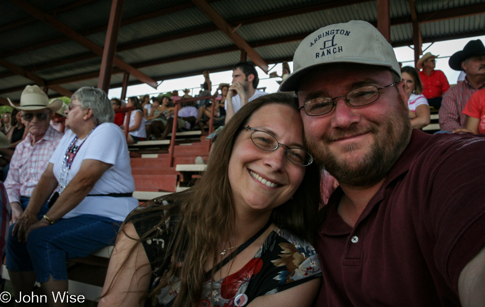
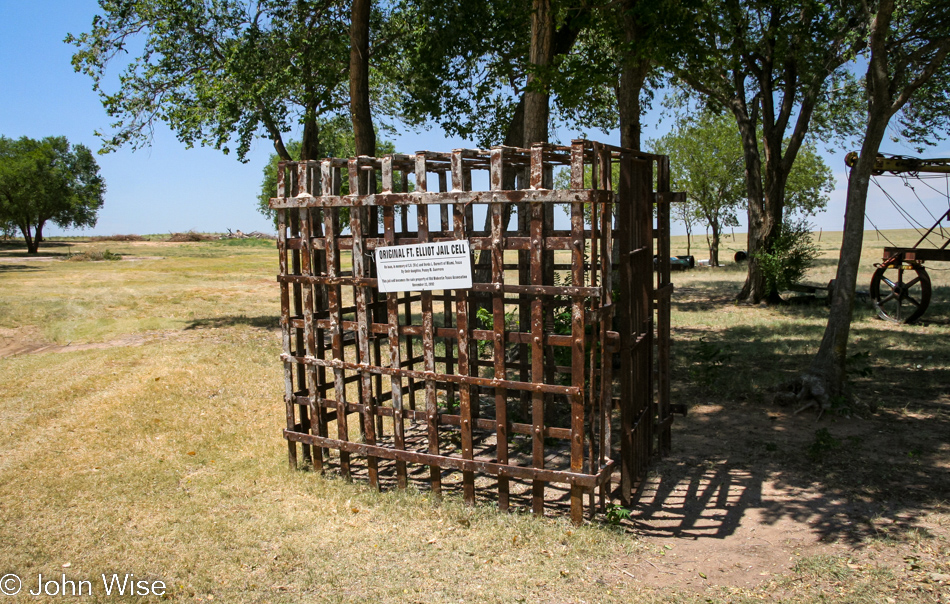
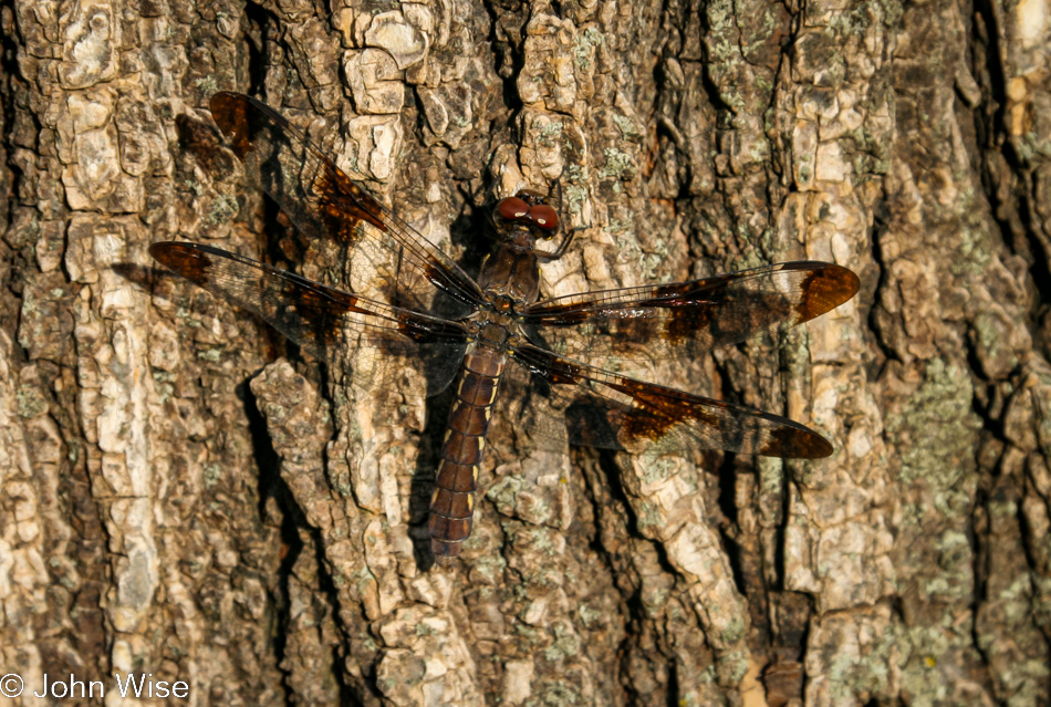
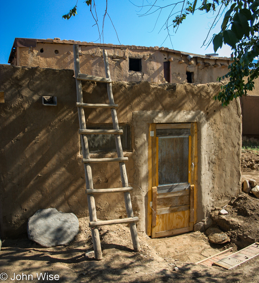
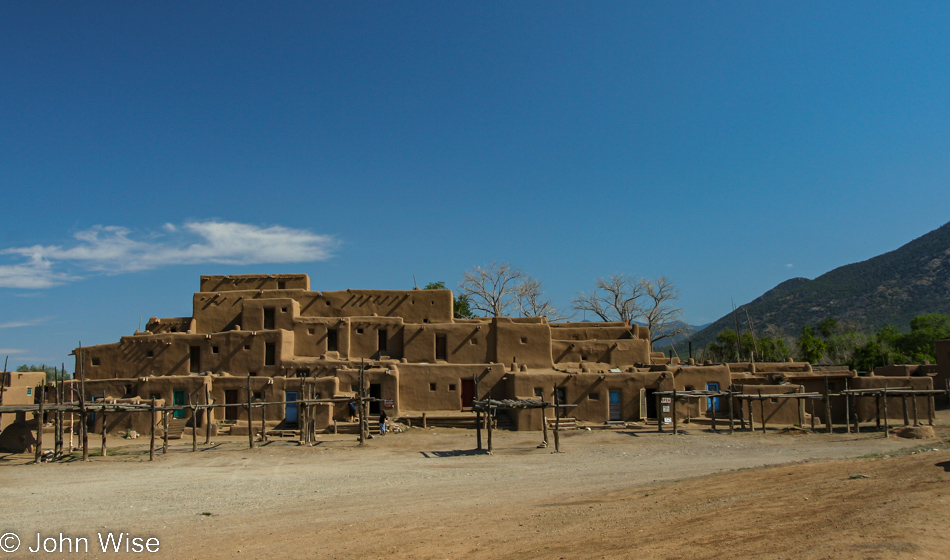
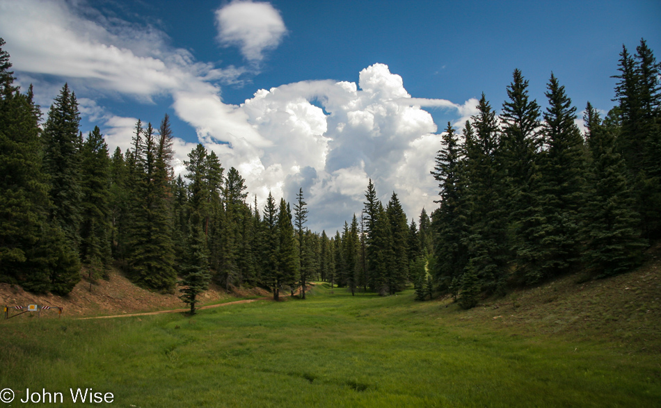
Let’s get this disclaimer thing out of the way right here: this post and the entire series of Texas posts of this trip did not get published until February 2023 because they were nearly lost in time. No notes exist; well, at least they’ve not been found if they do exist. The photos are of middling quality because they were shot on my phone. So, that’s that.

Corpus Christi, Texas

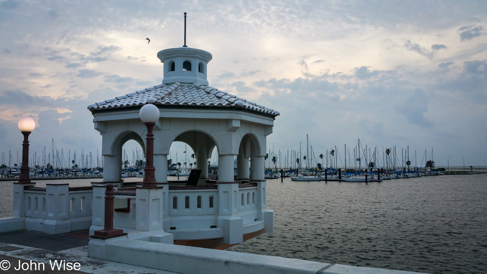
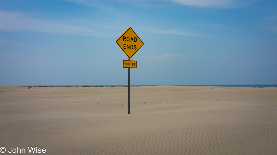
We are on North Shoreline Boulevard in Corpus Christi for sunrise. Nothing else is known about the start of this day.

Corpus Christi, Texas

I can only wish that somehow I’d already learned that the impressions made on these days would mean a great deal to me as I’ve grown older. There’s a tragedy about the lack of foresight under which we humans operate, and we fail to apprise one another of the better lessons from which we could benefit. Photography and writing are far too important to our older selves to lay fallow and neglected until it’s too late to drag them forward.

Caroline Wise in Corpus Christi, Texas

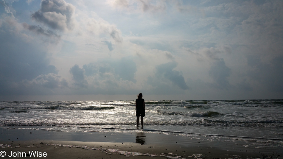
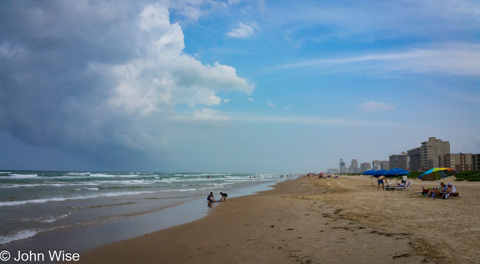
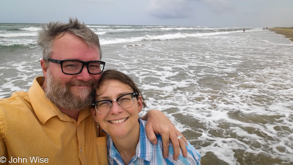
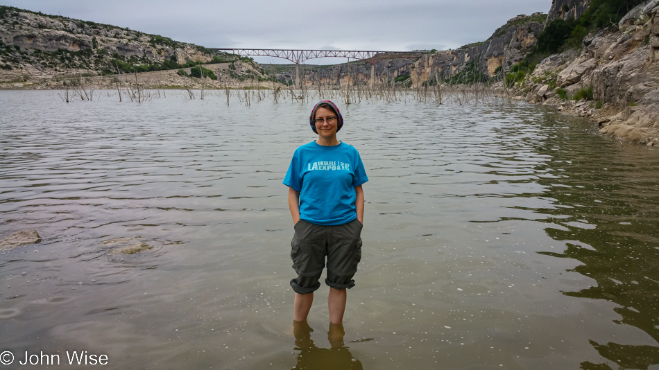
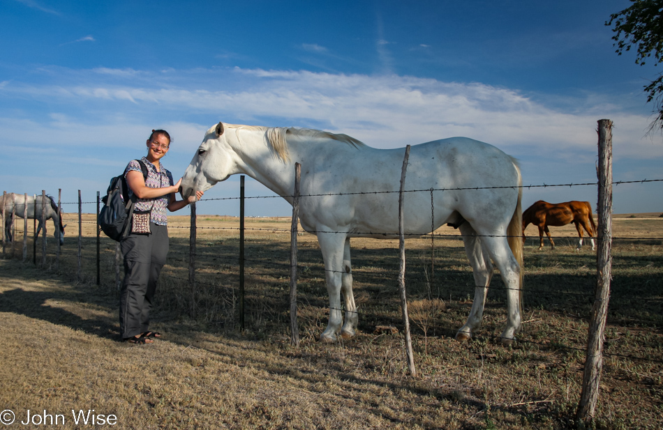
It’s been countless times I’ve watched my wife standing at the edge of the ocean, just looking out into it all. I don’t know where she is during those moments of being lost in the sea; maybe I hope she’s nowhere and simply drifting in the contemplative space of something like a meditation. What I do know is that I love bringing her to these locations for us to find whatever we end up taking with us.

Oakridge Smokehouse in Schulenburg, Texas

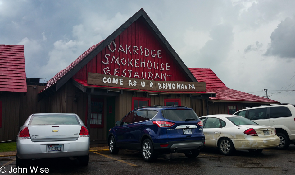
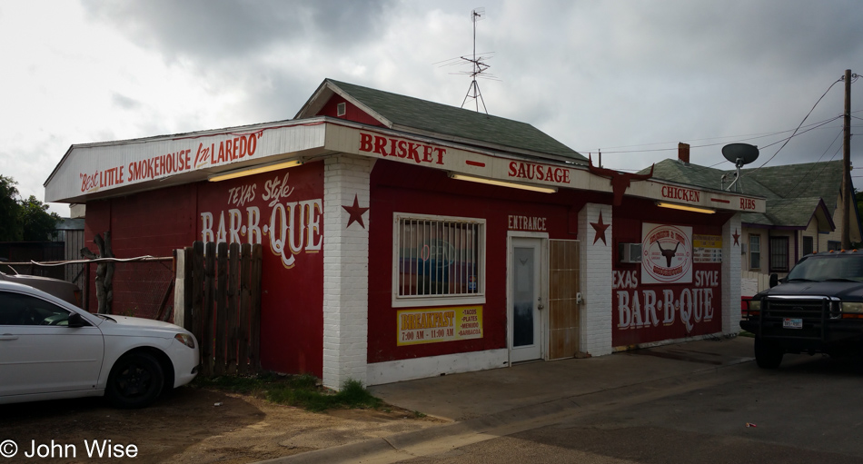
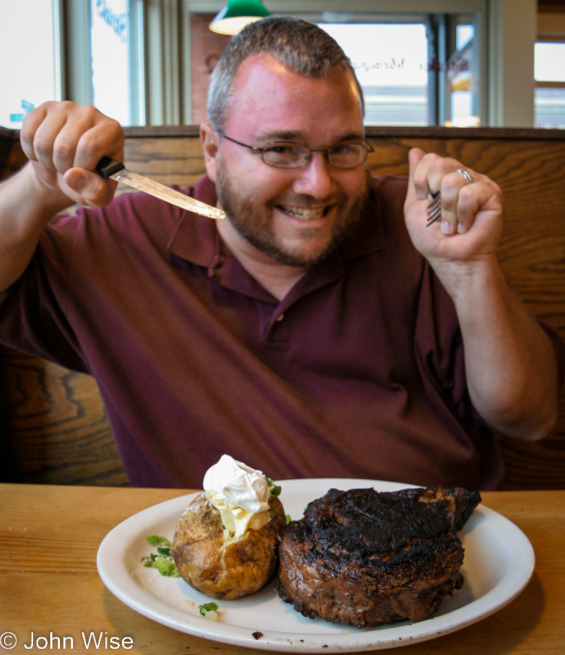
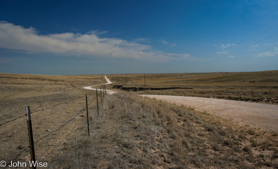
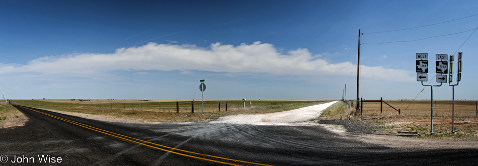
We’re out in the middle of nothing, a place that looks a lot like we’re not anywhere. The closest big city is Houston, about 100 miles away, while in the opposite direction to the west is San Antonio, about the same distance; 150 miles behind us in the South is Corpus Christi, and it’s about the same distance as Waco. Highway 77 is a two-lane affair. Schulenberg, where we are stopping for lunch at the Oakridge Smokehouse Restaurant, is a tiny dot on the map with a population of only about 2,600, and yet the parking lot to this joint is packed. How is it possible that this out-of-the-way roadside BBQ is better than anything I’ve ever had in Phoenix with a population of over 3 million?

Highway 77 between Schulenburg and Rosebud, Texas

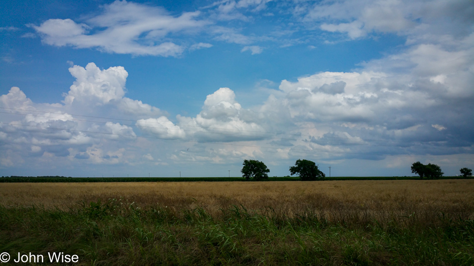
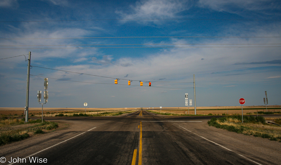
It’s flat out this way. With Dallas, Texas, more than 200 miles away, I wonder how tall a building would have to be there for me to see it from here. Catch some air here; this next part is not here due to time travel; it’s not that flat in Texas. I told you that I’m writing this in 2023, and this will be my first reference to ChatGPT and Microsoft’s implementation of it with Bing, chat specifically. I asked it how tall a building would have to be for me to see it from 200 miles away; ChatGPT (a.k.a. Sydney) supplied me with this formula: x = √ (a² – 2ad + d² + r²) – r, and then it did the math for me telling the building would have to be at least 1.26 miles tall or more than 6,650 feet. Now I know.

Rosebud, Texas

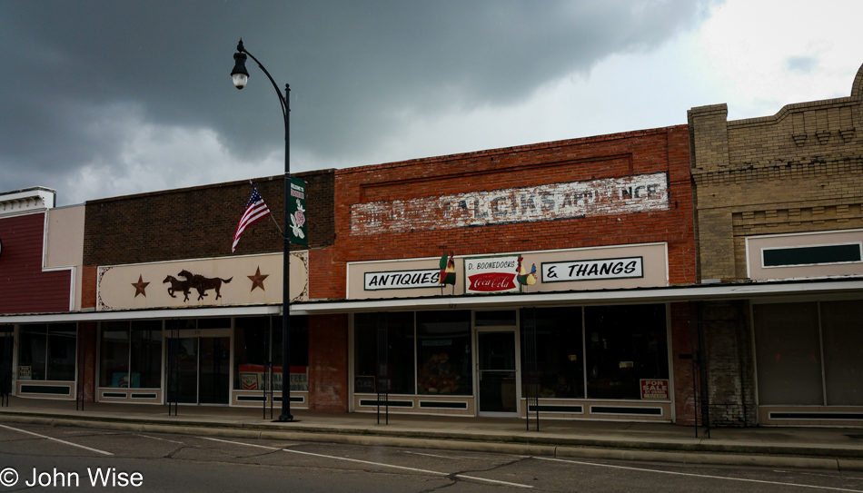
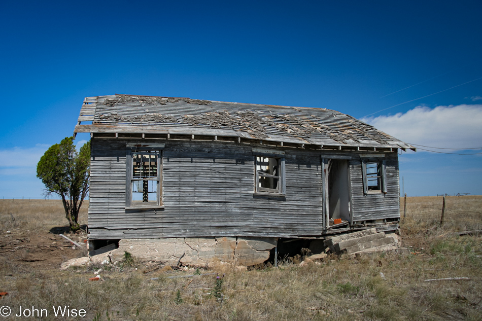
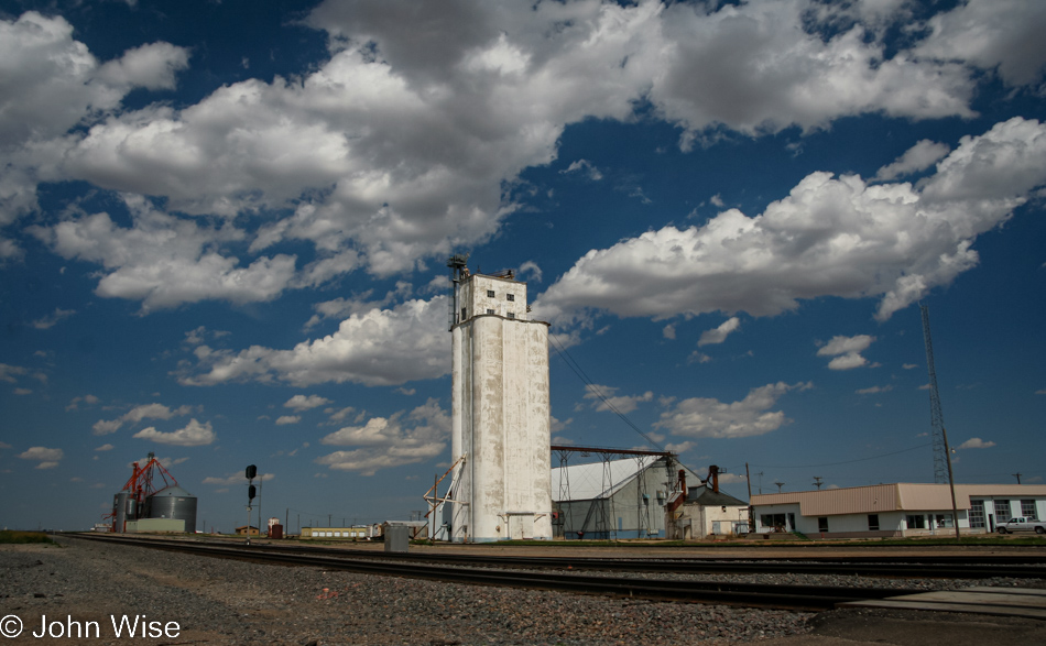
This is Rosebud, and I’m pretty certain that it will never be the metaphor for someone’s distant, lost youth as it was portrayed with a red sleigh in the famous movie that shares its title with the name of this Texas town.

World's Largest Cedar Rocking Chair near Lipan, Texas

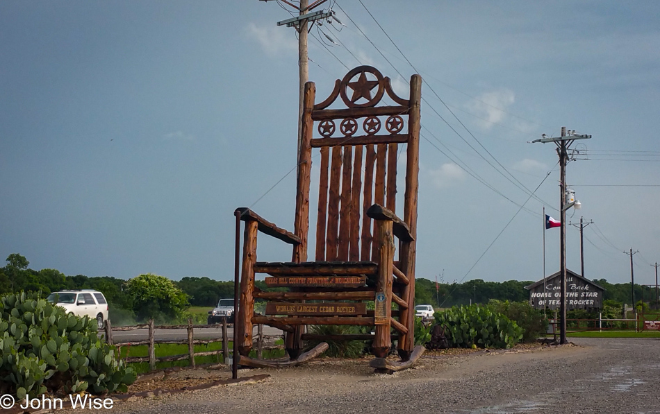
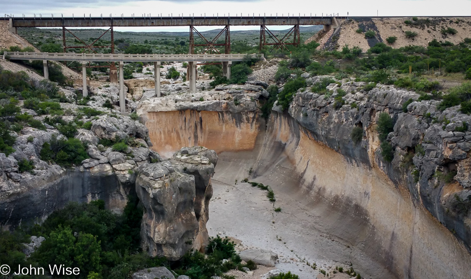
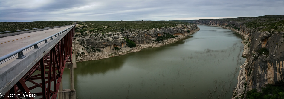
Believe it or not, we’ve been out on the road for nearly 8 hours by this time. No, we are not pulling over to relax in the World’s Largest Cedar Rocker in Lipan, Texas; nope, we are here for what’s just below.

Natty Flats Smokehouse in Lipan, Texas

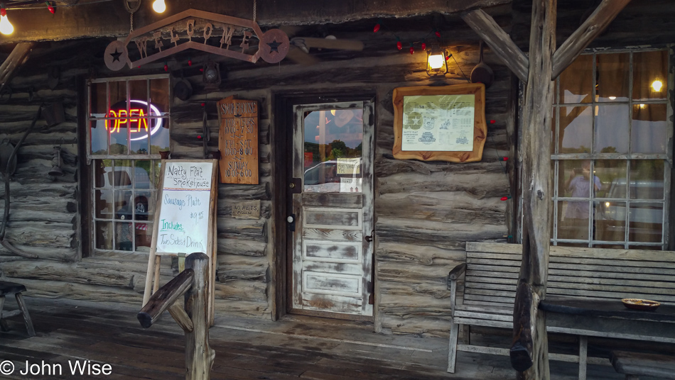
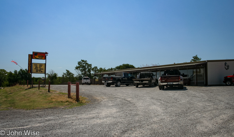
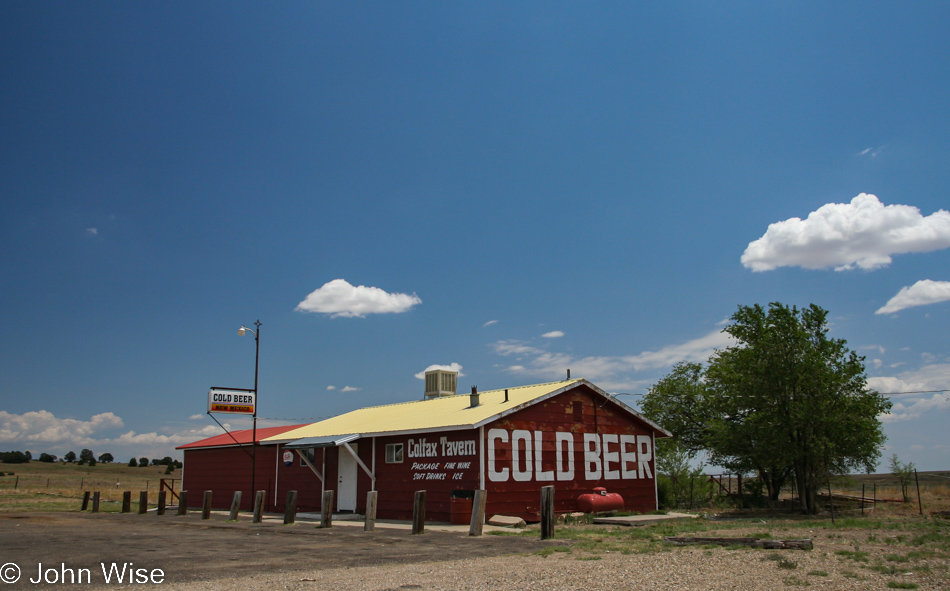
If you want to think there’s anything else to eat in Texas, you’d be wrong, and once again, we are at some out-in-the-middle-of-nowhere joint, this time called Natty Flat Smokehouse.

Somewhere on Highway 281 between Lipan and Mineral Wells, Texas

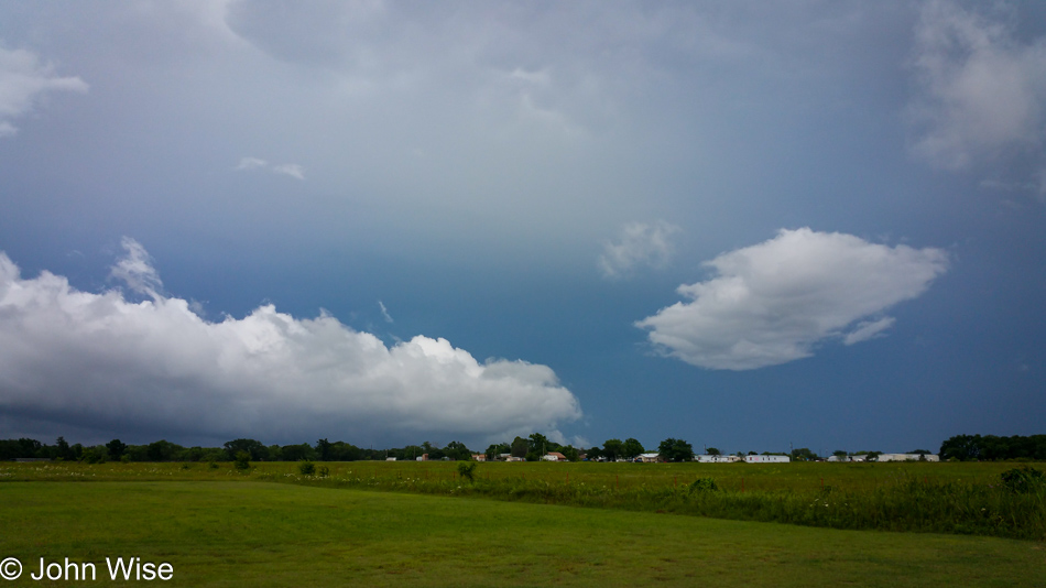
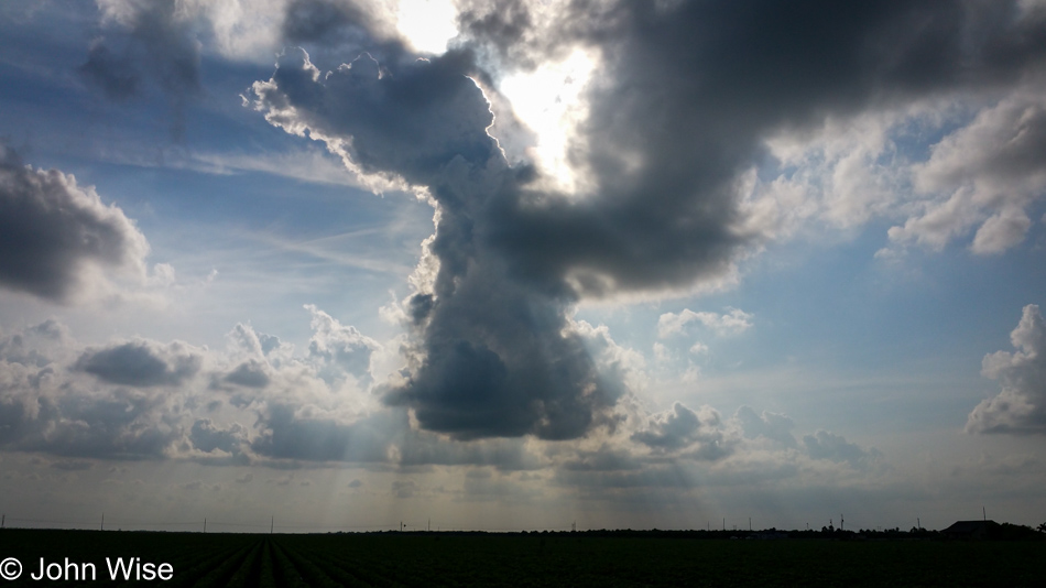
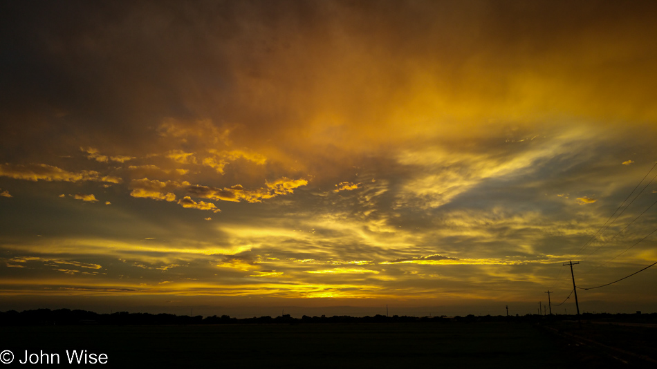
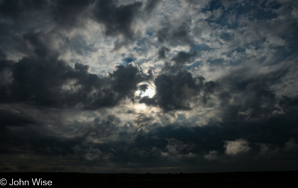
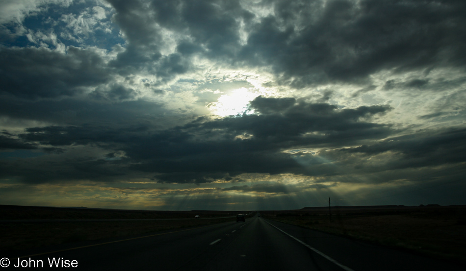
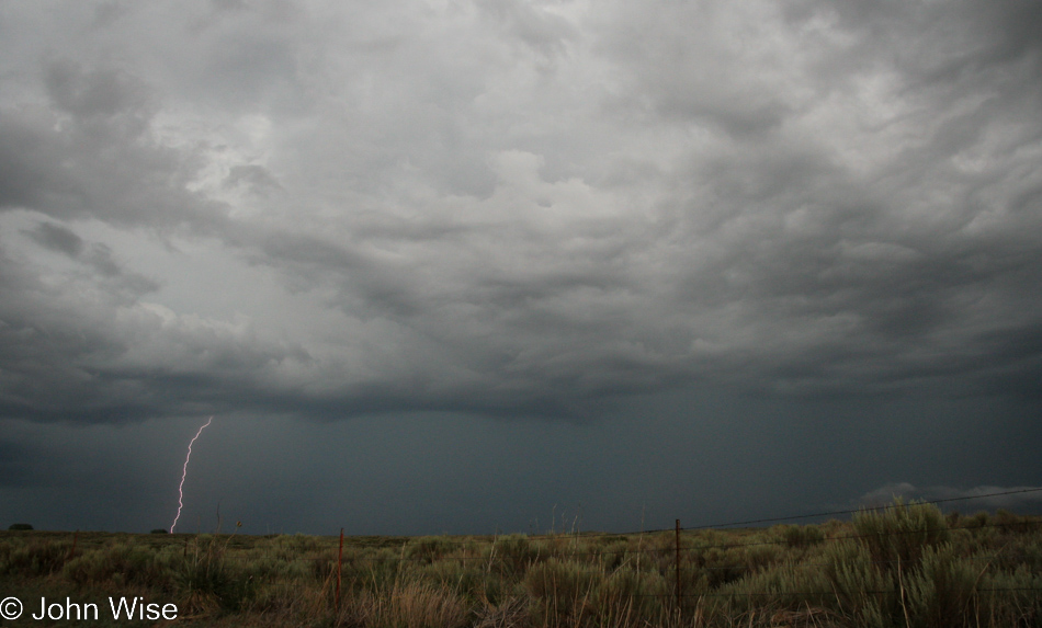
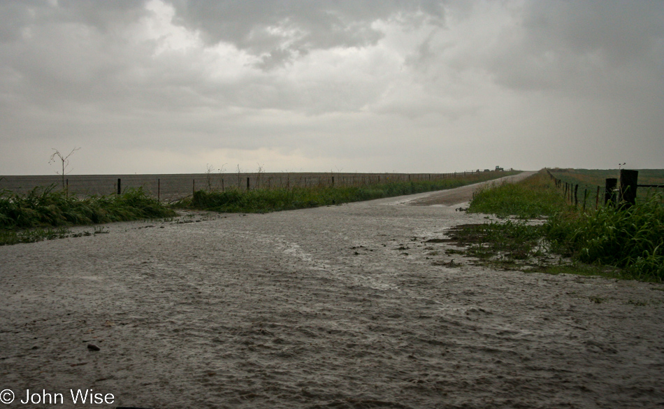
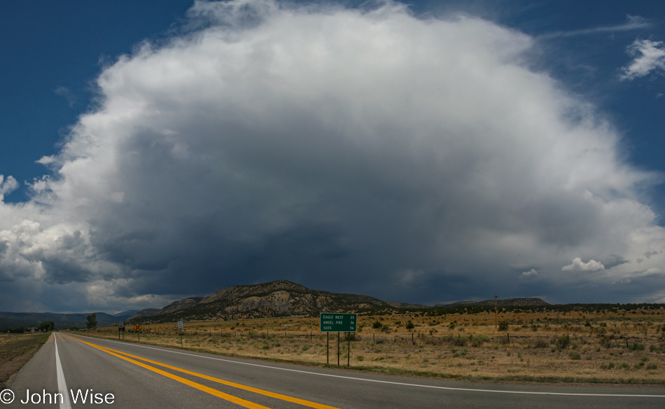
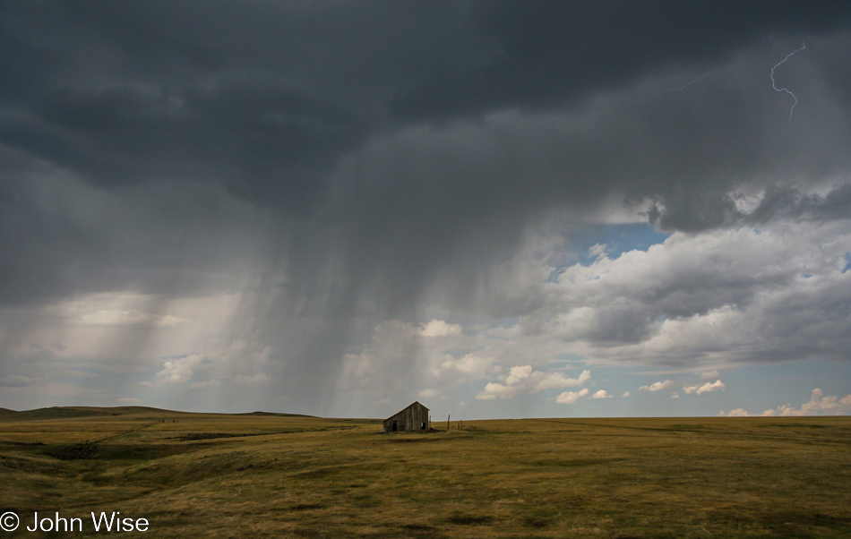
Maybe these dark skies should have been offering us clues, but we just kept driving north.

Baker Hotel in Mineral Wells, Texas

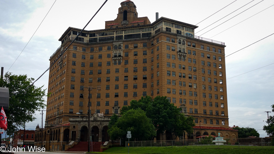
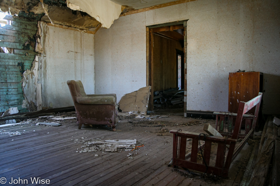
Our stop here at the Baker Hotel in Mineral Wells, Texas, will be the last image of the day. Shortly after this, we ran into the rain, and not just any rain. This was the kind of heavy downpour that made us pull over more than once when driving was becoming too sketchy. As soon as the rain would relent even a little, we’d pull back onto the road and drive on; we were hoping to make it to Oklahoma City. We never did and instead ended up in Lawton, Oklahoma. Exhausted from the stress of driving in the torrential rains, we grabbed a room at Motel 6 and learned how lucky we were as it sounded like we had been the last ones to cross the Texas and Oklahoma state line, which crosses the Red River, which was now flooding over the road we had just come up. As far as going to Oklahoma City, that wasn’t going to happen, with the roads to the north unpassable due to the accumulation of high water. This was a change in plans we’d never anticipated.

Lost Texas – Day 3

Somewhere south of Del Rio, Texas

As I’ve stated in the previous two days of this blog post covering our trip to Texas, this isn’t being written and posted until February 2023. What’s worse, there are no notes to work from and the itinerary from that time ended up being more of a suggestion of locations instead of fixed destinations. In addition to the lack of notes, these images arrive from the land of laziness: I shot these with my Samsung S6 instead of taking the DSLR I would have normally used. Like I said, I was being lazy.

So, from out of the fog, memories are dragged from wherever they can be found and splashed upon the page. As I posted yesterday, I believe we stayed in Del Rio, and the timing between images seems to support that, but if anyone in the future looking at this image of a foggy road can offer me a more precise placing of where we were, I’m open to adjusting these details.

Briskets and Beer Smokehouse in Laredo, Texas

Fortunately, there are moments that are captured, such as this one when we were stopping for breakfast in Laredo, Texas. How do I know we are in Laredo? It says so on the side of the building, over there where it’s stenciled saying, “Best Little Smokehouse in Laredo.” Should you be wondering about barbecue for breakfast, we are in Texas, where that’s all they eat.

Caroline Wise hitchhiking on Highway 83 out of Laredo, Texas

Picked up the convict, who was apparently on the lam and in need of a ride to the Guitar Center in McAllen further south. She seemed reasonable, so I said sure until I heard she was looking for a ukulele. Who plays the ukulele these days? She could only have been a serial killer.

South Padre Island, Texas

Here we are at South Padre Island on the Gulf of Mexico in southern Texas, with not a barbecue joint in sight.

South Padre Island, Texas

Looks to me like the road has already ended.

John Wise and Caroline Wise on South Padre Island, Texas

Do I look stressed out to you? It’s been a little more than a year since I started a virtual reality company.  While I knew it would eat my time, I never really considered what we would have to give up as I wanted to build something in that space for the previous 20 years, and with the opportunity finally available, I jumped on it. The consequence of that decision was that Caroline and I rarely traveled, and when we did, I don’t think my heart was 100% in it. Of course, we were together, and I couldn’t be anywhere else but with her when we were out on the road, but it’s like these photos taken with a phone; I couldn’t be bothered with investing myself deeply in these trips as I did prior and since shutting the company down.

South Padre Island, Texas

Someone lost their dinosaur, and now its plastic corpse lays discarded, awaiting a poor turtle to come eat it and commit suicide on this unhealthy snack.

On the way to Corpus Christi, Texas

We avoided the highway as long as we could while trying to find our way east toward Corpus Christi, where we’d be staying the night.

On the way to Corpus Christi, Texas

While we know we ate at some random crab-shack-kind-of-place in Corpus Christi, the photo was a bunch of meh, like most of our food photos. We have no idea where it was precisely, and I suppose it doesn’t really matter. Being out on the road with Caroline is often the best part of traveling, and so it was with this excursion into southern Texas. I can’t remember thinking that anything we were seeing was so compelling to inspire a return visit. Tomorrow, we leave for parts north as we are going to cut right through the middle of this massive state.

Lost Texas – Day 2

It may not be like yesterday, so maybe it feels like somewhere in the past year, but though I find some familiarity with this scene, I cannot place where I took this photo. Days later, after I prepped these photos, it dawned on me that once we get past El Paso, Texas, this size of population wouldn’t be on our route, and so, knowing we left Deming, New Mexico, this morning and tracing the map, it would appear to me that we opted to take the Woodrow Bean Transmountain Drive out of Vinton, Texas, in order to bypass the toilet-mint city of El Paso. Based on Google Streetview, it appears that my guess is correct, but I could be wrong, too.

The reason I could be wrong and the memory foggy is that this post is not being assembled until February 2023, eight years after our trip to Texas. Since the details are lost to time, the images and what I’m able to tease out of this journey will have to suffice as the parts that might trigger what memories we have buried deep in our heads. Why even perform this type of backfill? Because this is where we go to revisit the places we’ve been and re-encounter things we’ve done.

Hello, from somewhere in Texas on a cloudy day. While the landscape is reminiscent of areas of Arizona, I’m including this as we don’t have many photos from this day where we did an extraordinary amount of driving, as in about 550 miles or 9 hours, according to Google.

We’ve arrived in the town that Judge Roy Bean allegedly founded in 1882, called Langtry, Texas. This old building was the Jersey Lilly Saloon that Bean built for a famous English actress he never met. He only ever saw a drawing of her in a magazine; her name was Lillie Langtry. I found one story that attributes the name of the town to her, while a more reputable source says the town was named after George Langtry, who helped build the nearby railroad lines. By the way, Roy Bean wasn’t a real judge and was, in fact, a murderer who became a justice of the peace in the area, though he knew nothing of the law. Court was held right here in his saloon. Bean died in March 1903, ten months before Lillie Langtry passed through town.

In the background is an old Southern Pacific Railroad bridge passing over a canyon that runs to the Eagles Nest Creek and the Rio Grande River just outside of Langtry.

This view is from Highway 90 crossing the Pecos River south of Langtry, Texas

The same bridge, as seen from the Pecos River boat ramp, with Caroline Wise standing shin-deep in the water on her quest to step into all of America’s riverways.

Based on a number of factors (including conjecture), we believe we stayed in Del Rio, Texas, for the night.

On The Way Home

Leaving Texas

Our big adventure to the panhandle of Texas to celebrate the holiday is coming to an end. The only thing left to do is point the car west and go home. We were up early in order to leave Arrington Ranch as soon as we could after sunrise, but not too early as we wanted to head into town for a stop at the Bucket for some coffee and breakfast, togo. We recommend the cinnamon rolls and breakfast burgers; the sourdough sure lends a great touch.

Cross of our Lord Jesus Christ in Groom, Texas

Our road south on Highway 83 took us to Shamrock, Texas, where we caught Interstate 40. Typically, we avoid freeways, but with 897 miles (1,450 km) ahead of us, we wanted to get home today, preferably before midnight. Fifty miles west of Shamrock we reached Groom, Texas, and the home of this giant Cross of our Lord Jesus Christ. While passing through two time zones and gaining two hours, I have to pull over twice, allowing Caroline to drive while I try to get some rest. She swears later that I slept well based on my loud snoring.

Entering New Mexico

In Albuquerque, we stop at Sadie’s for great New Mexican food, some of the hottest cooking around. Sadie’s was another discovery from the road trip I took with my mom, except that Caroline sent us there when we phoned her to ask for a restaurant recommendation in the area. We move in and out of the rain, at times so heavy it is difficult to see more than half a dozen car lengths ahead of us, and Route 66 beckons us to leave the Interstate for a few miles to revisit the Mother Road.

On Interstate 40 travelling west in New Mexico within 100 miles of Arizona

The photo above is on Interstate 40, somewhere west of Acoma Pueblo and east of the Continental Divide.

Flagstaff, Arizona ahead

Fifteen and a half hours after leaving Canadian we reached home in Phoenix, Arizona. These long drives are getting harder the older I get.

Independence Day in Canadian, Texas

Of course, we were up with the rising sun on America’s annual day of celebrating our independence. We didn’t travel to northern Texas to sleep in as an expression of freedom; we are here for all of the merriment we can partake in.

Note: while we were up early, this blog post is extremely late with its arrival, most of it anyway. It was the end of January 2023 when I finally got around to adding the 19 images that didn’t accompany the single photo of the man on a small tractor pulling a bunch of kids as part of the parade in Canadian, Texas. As I’ve explained in other posts, bandwidth was at a premium back on the days these posts were first penned, and so they were as big as I dared make them, unfortunately. From the original post, there were about 250 words to describe the entire day; they needed to be reworked and integrated into this new text, which will hopefully maintain the original message and sentiment.

This is the Hemphill County Courthouse and the hub of where today’s events are getting underway. Wafting in from around the area are sausages on a stick and kettle corn, trying to drag us in for snacking, but I have my senses tuned for something special in a few hours.

Along the way, we learned that there’d be a turtle race after the parade and that we still had time to size up the participants; our money was on number 30.

Vendors selling t-shirts, jewelry, and various arts and crafts set up in the shade, letting parents mill about, talk, and browse while their kids lined up to be dunked in a barrel of water by other kids throwing softballs at a target. There are hundreds of people lining Main Street with their lawn chairs and blankets spread out for a comfortable view of the upcoming parade.

And then the street comes to life, and the most unlikely of sights Caroline or I could have imagined come sauntering by, who ever heard of longhorn cattle being ridden during a parade? Apparently, it’s a thing in Texas.

We’d be amiss to deny that there’s something endearing about being in a small American city for such a wholesome way of celebrating such a day. There’s zero commercialism here, no police cordon keeping the kids from crossing into the street, just families, friends, and members of the community coming together for a day of partying.

Red, white, and blue were everywhere.

Right after the parade, we sprinted over to the courthouse parking lot only to witness our turtle lose but an exciting race it was. Around the corner, a local grocer was selling 25-cent hot dogs, and later in the day, there was water polo, a watermelon feast, and the rodeo got going.

The faces of a random couple in the stands smiling at the Great American Experience. This was Caroline’s first-ever rodeo.

The opening ceremony began with the national anthem and a ride around the arena with the colors of the United States and Texas in tow.

Men attempted to ride the bulls and broncos, but mostly, they were busy picking themselves up out of the dirt after colliding with it.

While the tots tried their hand at riding sheep, the slightly older kids tried staying atop bucking miniature donkeys.

This is why I had to stay away from the snacks on offer at the courthouse; I knew I had another date at the Cattle Exchange for the last perfect ribeye I’d be having on this trip.

Canadian, Texas

With uncertainty about the fireworks show this evening due to the threat of rain, all we could do was hang out till evening or head back to the ranch; so instead, we took a short tour of the town and then headed up the road.

Approaching Higgins, Texas

The horizon is looking rather foreboding.

Caroline Wise on the Oklahoma / Texas border

Drove up to Higgins, Texas, where we crossed into Oklahoma.

Rainy Oklahoma

We didn’t get far before a flooding road turned us around.

Caroline Wise and John Wise at the Texas State Line

No matter, now we get to visit Texas twice on this 4th of July.

Approaching Canadian, Texas

Things started drying up, and with the glimmer of sunshine out there, we started thinking we just might see some fireworks tonight.

Fireworks in Canadian, Texas

Sure enough, following some late-day duck races, fireworks lit up the early evening sky, and after 12 hours of fun and observance of Independence Day, we were on our way back to the ranch for our last night in Canadian, Texas.

Arrington Ranch in Canadian, Texas

The Arrington Ranch Bed and Breakfast in Canadian, Texas as seen in the Tom Hanks film Castaway

Last night I shared a photo of the now-famous sign in front of this ranch, made so by Tom Hanks in the film Cast Away. We are at Arrington Ranch in Canadian, Texas. This house was built by Civil War soldier G.W. Arrington in 1919; his descendants, Mike and Debbie Arrington, rent out the five beautifully furnished bedrooms for only $70 each.

Update: While the previous bit of writing is from the original post, most of what you’ll find here will be from a 2023 update, including every one of the photos below. In the old text, the day was compressed into 333 words, and I’ll be using those as the basis for what else I share about the images I’ve added, but just know that some of the impressions will be coming out of a head that experienced these things 17 years ago. Since the time of our visit out to the Panhandle of Texas to celebrate America’s birthday, the Arrington’s have ceased renting the property. My daughter and I drove by back in 2021 and saw that the place was starting to show its age. I can only guess that the upkeep has exceeded its potential. This state of decay, like that which affects so much across our country, is a sad and tragic comment about what we hold dear.

Last night, we let ourselves in the house, and it turned out that we’d be the only guests for the long weekend; how could this be? This morning, we met Debbie Arrington, who invited us over to their main home. After saying hello to the horses, we headed over to meet Mike Arrington.

Now introduced to both of the Arringtons, we took a walk over a small corner of their thousands of acres of ranch; along the way, we learned about how drought and the misuse of Texas aquifers were destroying ranch life for many in Texas. Mike shared the high costs of having hay shipped in from as far as Canada, yep to Canadian, Texas, and how it made cattle ranching increasingly more difficult. While he may be fortunate to have the Washita River right here on his land, that’s not enough to care for the 5,400 acres of land that require rain to support cattle. We were invited for a swim but being the idiots we have been known to be, opted not to: a mistake.

The Arringtons are part of a group working to preserve their little corner of Texas called the Texas Prairie Rivers Region. After seeing their population dwindle in the 1980s, some ranch owners got together to save Canadian from decrepitude and have since made great inroads in revitalizing this once-thriving corner of Texas.

We’re going south based on the recommendation of Mike and Debbie that the breakfast near and far would be found out there.

Along the way, we’ll have to take inventory of the old houses in ruin peaking through their windows, where we could find them, and seeing what was what.

Some of the places were well aerated with no glass left at all.

At this time in our lives, we were still movie nerds, so being here at the intersection of FM-48 and FM-1268, where the last scene of Cast Away was shot pressed all of our buttons. But this was not where breakfast was to be found.

From there, we had five more miles further south before reaching the small town of Mobeetie, which is also the oldest town in the panhandle. We are at the Cowboy Oasis, a place that created a long-lasting memory, not due to the food but because of the patrons. We walked into no fanfare from the many cowboys in this place but after others walked in, the assembled diners would greet the next person or people as they passed through the front door. Feeling a bit neglected until we left, as we stood up to depart, I introduced everyone to Caroline and me, and with that, the dozen or so people at the Cowboy Oasis wished us a good day, letting us leave with big smiles on our faces for becoming part of the in-crowd.

If there was a map of homes not trashed by people but in a state of natural decay, I’d take that road trip.

We are at the Mobeetie Jail Museum, which is also home to some of the artifacts that remain from Fort Elliot, including the old flag pole that stands near this old cell.

On our quest to see a bit more of the panhandle, we are on a loop drive that is taking us to Pampa and points beyond. This is the Laketon Wheat Growers grain elevator that is obviously no longer in use.

Somewhere out in this vast openness, we drove over to Fritch, Texas, with the hopes of visiting the Alibates Flint Quarries but were foiled by the need for a reservation. Maybe another time.

And so we drove and drove because that’s what you do in Texas.

View from Elsie Road in Panhandle, Texas, on our way back to Canadian.

Ferg’s Cafe in Miami, Texas, is as open as this sign is well cared for (it’s not).

If you only know Texas from a drive across Interstate 10, you too might find Texas to be one of the ugliest states in America, but there really is a lot more to it.

I’m fairly sure we are on FM-2266 heading into a local park.

We are here to see trees and dragonflies. We were not let down.

This is part of the Gene Howe Wildlife Management Area, helping to make our first full day in the Canadian, Texas area a win.

Prairie Land

Timewarp out of the summer of 2006 into January 2023 because that’s when I’m sitting down to transform this ancient blog post that, up until this time, was but one photo, the one at the very bottom, paired with a minimal amount of text. As I’ve stated the same in many other posts, back in the day, posts saturated with a lot of photos were taxing people’s devices and our internet bandwidth, so I kept things brief. But here I am a thousand years later (as measured in internet time), and I started dragging old photos out of their digital tomb and presenting some of my favorite zombies.

As was our routine in our impetuous youth, we sped across the landscape and stayed on the move. This day would have been no different as we obviously left Taos early in the day. Well, we left the town proper…

…as we were on our way to Taos Pueblo, a few miles up the road.

For over 1,000 years, this village has been occupied by the indigenous people who call it home. I have mixed feelings right now as I consider that I’m looking in on their lives as a curiosity, but then again, I do the exact same thing on the streets of California or if I visit a forest. I have an inherent curiosity that wants to know what’s what. If I could find an angle to be invited through this door to join in for a meal and an hour or two of listening to a story about those who lived here prior to the current inhabitants, I would jump at that opportunity.

This is what we all come to see: the Hlauuma (North House) of Taos Pueblo. We were too early for vendors to be present, the shops to be open, nor were we able to sign up for one of the tours that hadn’t begun yet.

I believe we are near Angel Fire, New Mexico, and I have the vague memory that as we passed through, we’d made a mental note, apparently quickly forgotten, that we should return to the area as it was extraordinarily beautiful.

Reaching Cimarron, New Mexico, we had a choice: go straight ahead and reach an interstate or turn left and go north on a secondary route, we opted for the main highway as we had a ways to go today. As for the photo, this is looking back to whence we came.

Get real, we did NOT take the interstate! We are plying U.S. Route 64, a two-laner taking us by wonderful places such as the Colfax Tavern, where they call their lone outpost next to the road “Cold Beer,” though, in reality, it’s at the farthest western point of Maxwell, New Mexico.

A band of rain and a whisp of lightening hover over the flattening landscape of the Great Plains in northeast New Mexico

During our road trips across America, Caroline and I try to respect and appreciate the culture and beautiful land as best we can. Out on these nearly barren plains, one can almost imagine that just 150 years ago, there were 60 million bison eating their way across a sea of grass. It is a tragic shame that the imagination of so many overstimulated TV addicts cannot see the wonder that exists even in places like the plains where seemingly nothing much at all is happening, but an entire complex ecosystem once thrived.

We take a small, lonely road called NM-72 from Raton, New Mexico, to Folsom, the site of the famous archeological dig of the early 20th century, where it was determined that humans had lived in North America for nearly 10,000 years. Six years after this find, and 170 miles southeast near Clovis, New Mexico, a Clovis point was unearthed, dating Native American occupation of North America back 13,500 years. A long history of Native Americans exists in the United States but is largely ignored. Current thinking places humans in North America for about 20,000 years now, but our (white) ancestors discovered America.

Maybe if the indigenous peoples of North America had left empty ketchup bottles in their wake, we could have taken them seriously, or as Eddy Izzard once said (I’m paraphrasing), without a flag, the land was up for grabs.

The weather on Capulin Volcano forced us to stay in our car; we drove up, we drove down, and we were gone.

If this is the biggest grain silo we’ve ever seen, we must be in Texas, and from the name atop those silos, you can deduce we are passing through Sunray.

After Sunray, we arrive at sunflowers. Funny how sunflowers are so big and happy looking, and yet, as they fill the view with their incredible splash of color, they offer nothing in the way of scent.

South of Morse, Texas, at the intersection of Farm to Market Road 281 and Texas Route 136. Now, we are really in the middle of nowhere.

About an hour later, I’m pulling up and introducing Caroline to the Cattle Exchange Restaurant in Canadian, Texas, where my mother and I first ate the best ribeye steak I’d ever had. Wouldn’t you know it though, Caroline is a vegetarian, and while she agreed that the bread pudding, bread from a nearby bakery, the salsa, and baked potato were all superb, she does not have an opinion about their amazing steaks, though she does see that it brings her husband incredible joy.

And here we are at our lodging, also in Canadian, Texas. This is the 5,400-acre home of the Arrington Ranch but also this gate and barn figured in the Tom Hanks film Castaway, as did the wings the young woman in the film was making. I’ll share more about this place tomorrow, but first, I must recover from a food coma.