Happy McKiteface Over Oregon- Day 9

A Stellar Jay at Umpqua Lighthouse in Reedsport, Oregon

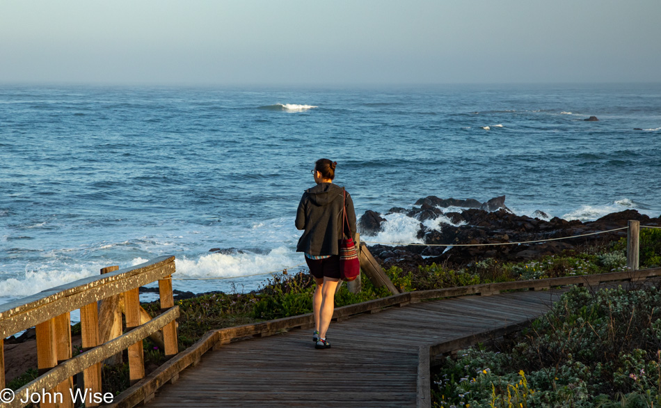
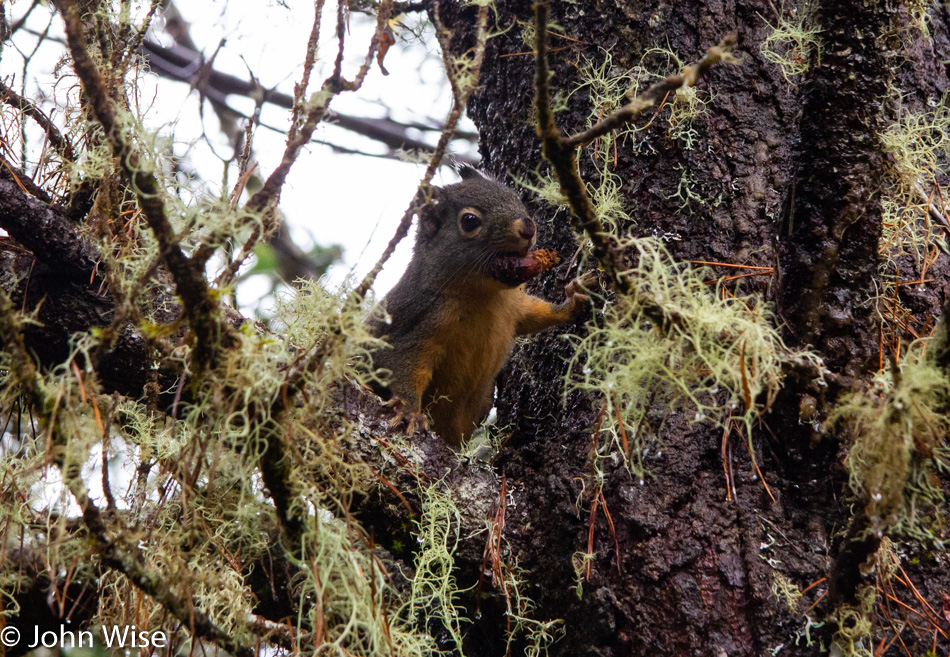
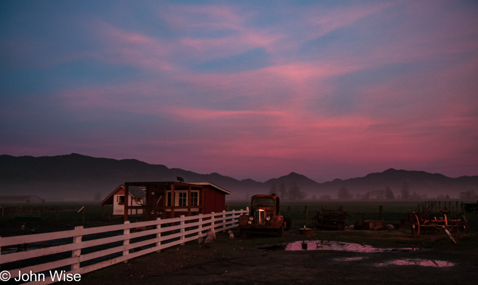
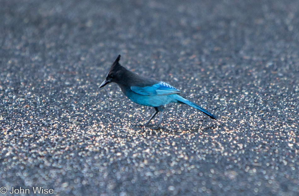
Good morning, Steller’s jay! I hope you enjoy your morning meal courtesy of the vanlife guttersnipes that squatted here overnight. Caroline and I have been visiting the Oregon coast for about 20 years now, and I can say with certainty we’ve never seen so many roadside freeloaders who don’t have the respect to pay attention to the “No Overnight Camping Allowed” signs. I can only surmise that their sense of being free to roam America’s roads allows them to feel a sense of entitlement that arrives with their chosen form of homelessness for the sake of social media status. Regarding the homeless situation, it has spilled out of the bigger cities and now shows up on the coast in ways we’d not seen before. From more people living in cars (not in the aforementioned vanlife configuration) to people struggling with loads of stuff being moved through town and those who will join the ranks in the coming year due to the problem of rising rents, the situation is one of ugly proportions. Back to the vanlifers, Caroline and I used to pull into overlook parking lots where we might be the only people, but when we pull in, and there are people just waking, finishing their ablutions, or putting away the cooking gear, I try to imagine what our experiences would have been like if people in motorhomes had exercised the same liberties, especially considering two large vehicles could fill up a pullout and stop anyone else from stopping for a moment. Just because we didn’t park at an ocean overlook doesn’t mean our waking experiences are any less valid or someone else’s even greater because they flaunt convention. Enough of that, I look forward to the day that vanlife is no longer a thing or I’m dead and gone, no longer able to witness the arrogance.

Umpqua Lighthouse in Reedsport, Oregon

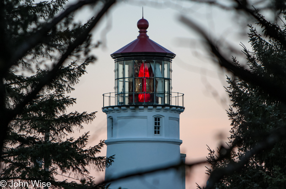
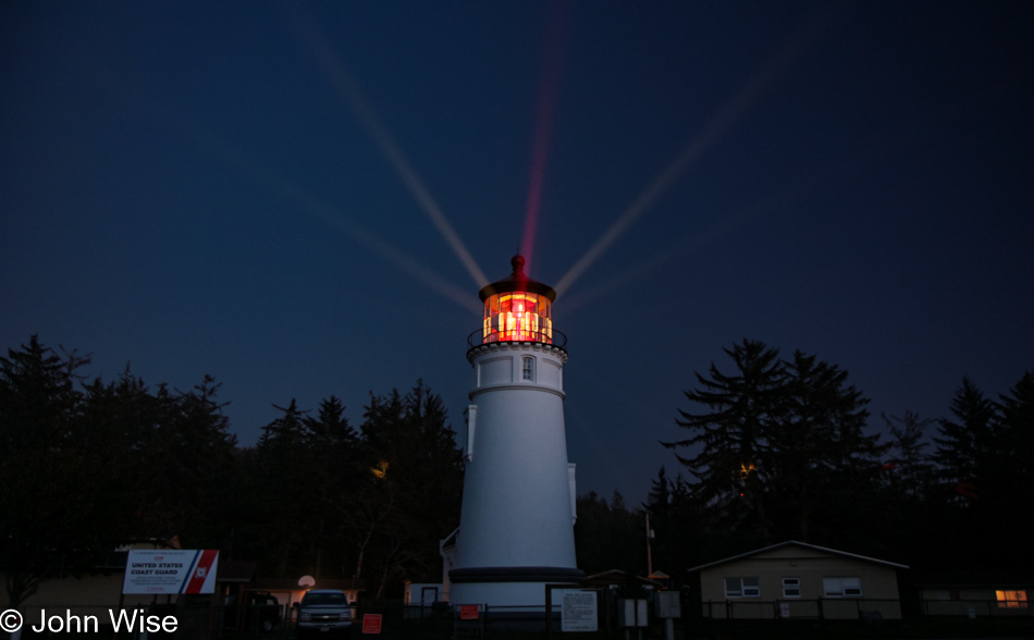
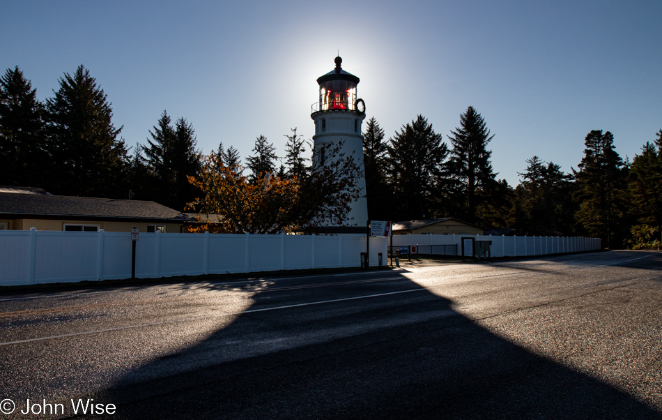
Normally, waking near the shadow of a lighthouse is a terrific thing, but driving into someone’s temporary bedroom sure puts a damper on that. Fortunately, they were soon gone after we spoiled their perfect isolation with our intrusion. Oops, I said I was done with all that, but the truth is that I’m never done once something gets jammed in my craw.

When we travel on weekends, it’s often been difficult for Caroline to connect with her mom in Frankfurt for her weekly call, but it just so happens that our brother-in-law Klaus is visiting Jutta as we were packing up the yurt and is going to bring us into a video chat. While my mother-in-law has certainly been here at the lighthouse, we have some skepticism about how much she remembers or whether she simply learned to just go along with things and agree to fond memories rather than admit these things are largely gone from her book of memories. It’s really not a problem, though, as she smiles a lot, and we know she’s still very aware that she’s been to the United States many times, even if many of the details are lost to the passage of time.

Umpqua River in Winchester Bay, Oregon

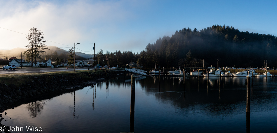
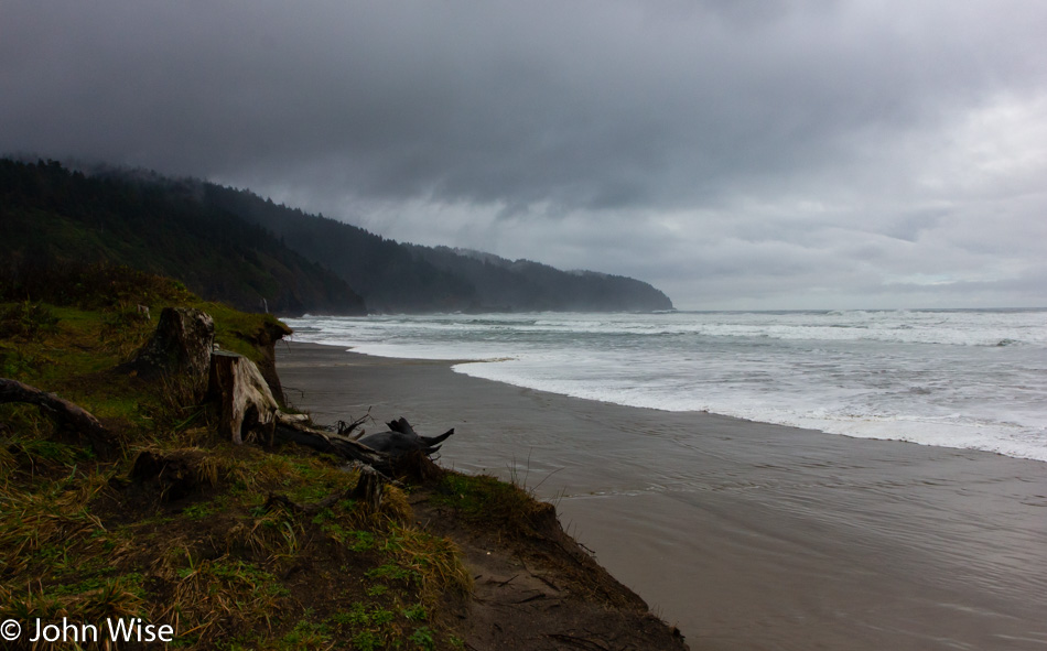
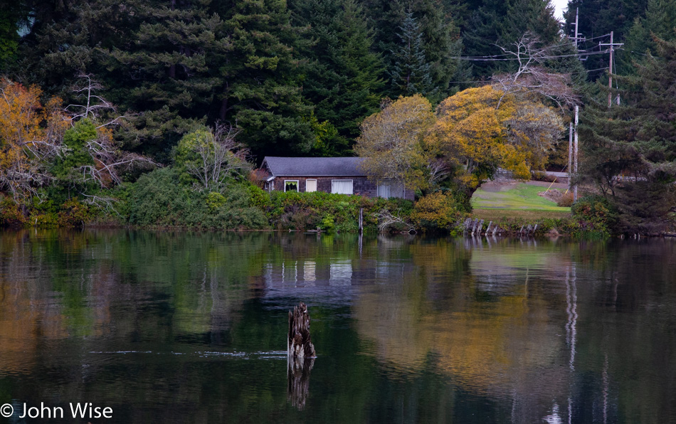
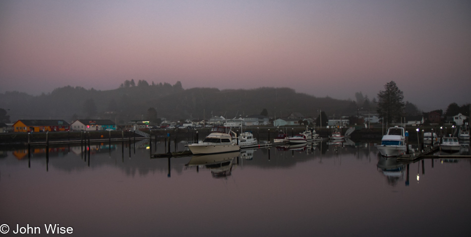
Do you remember how years ago there was a floating restaurant off in the distant corner here in Winchester Bay? We fondly do and have often wished to visit again, but it’s been closed for years. We first dined there back in 2006; such is the good luck of having blog posts to remind one of something that might have been forgotten otherwise. Today, we sit next to the Umpqua River for breakfast after choosing the place with more cars parked outside, figuring the locals know something.

Umpqua River in Winchester Bay, Oregon

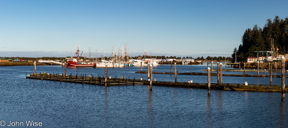
Never believe in 10-day forecasts, or better yet, simply don’t look at them because would they really change your travel plans? This is probably bad advice because at least they offer some idea of how to dress for potential weather conditions. As for the location, we are on the other side of the restaurant for a post-breakfast walk under perfect skies.

Umpqua Lighthouse State Park in Reedsport, Oregon

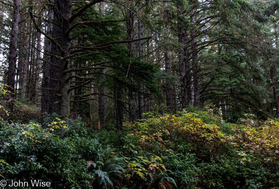
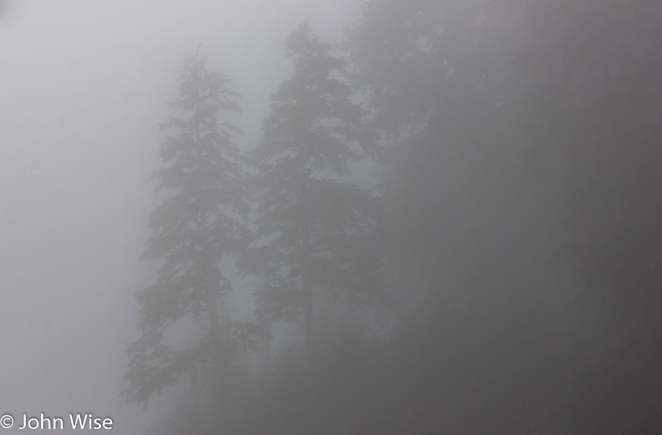
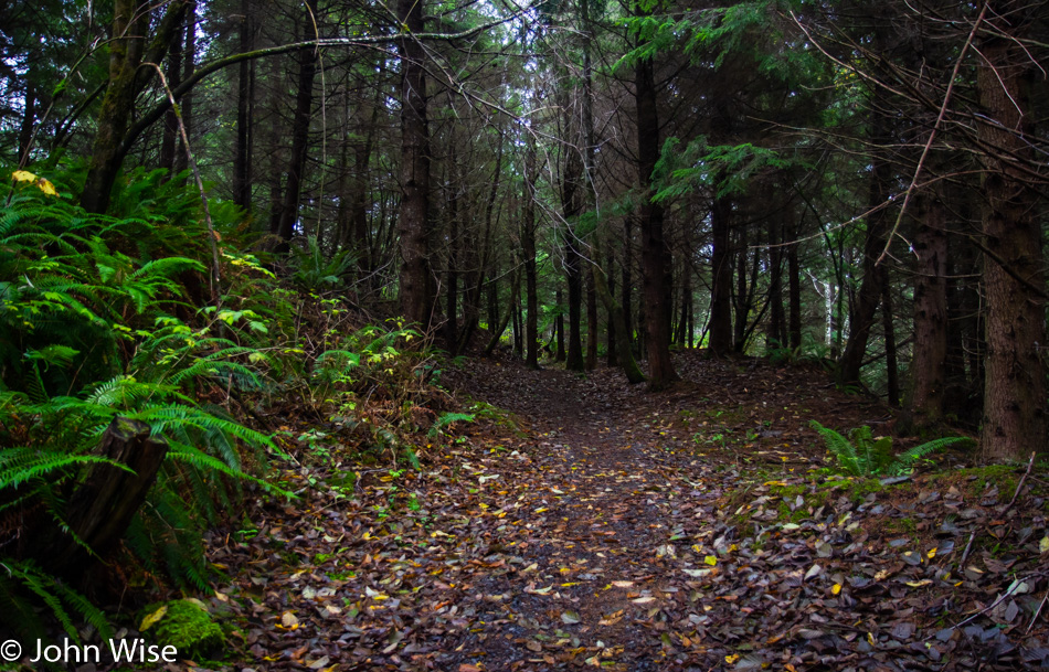
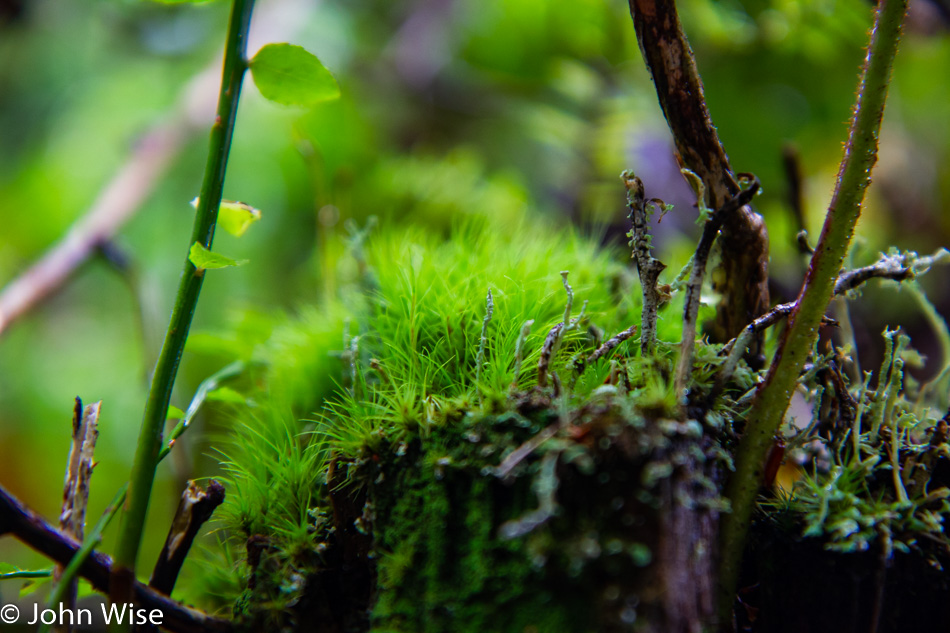
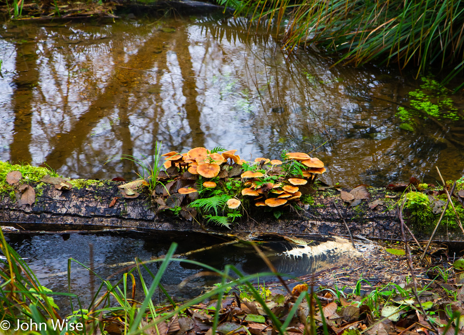
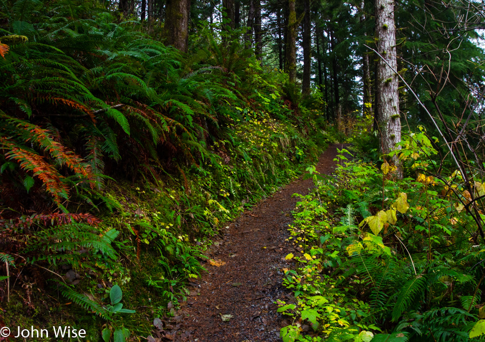
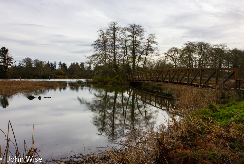
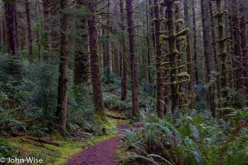
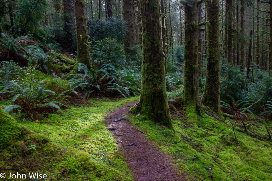
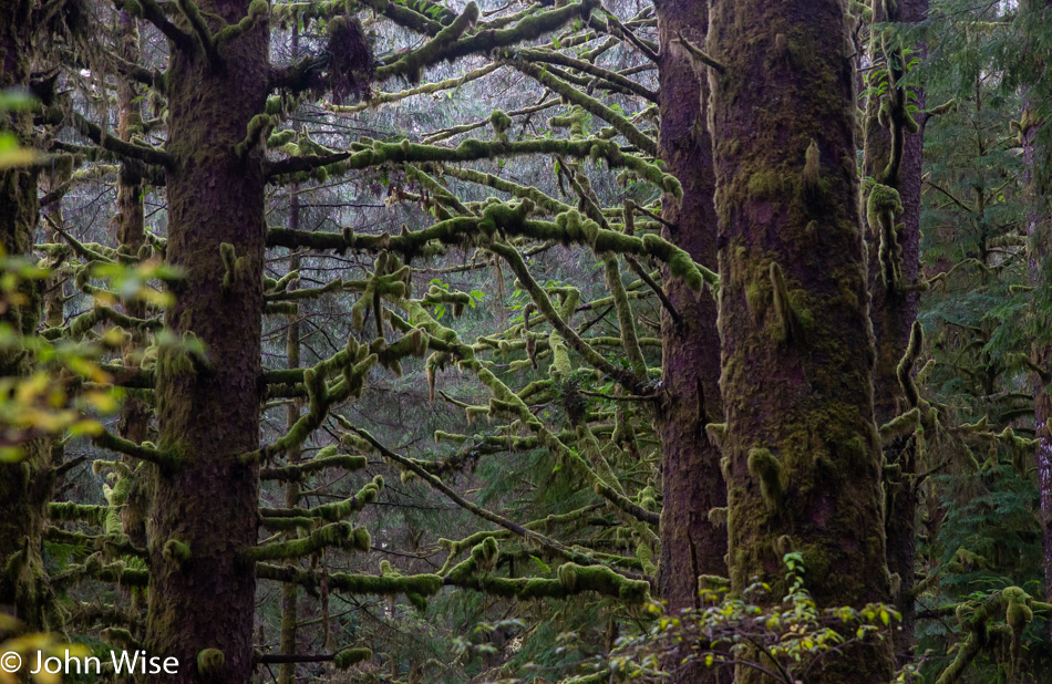
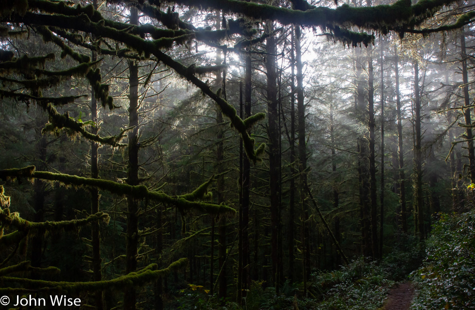
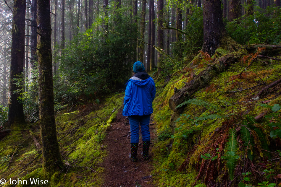
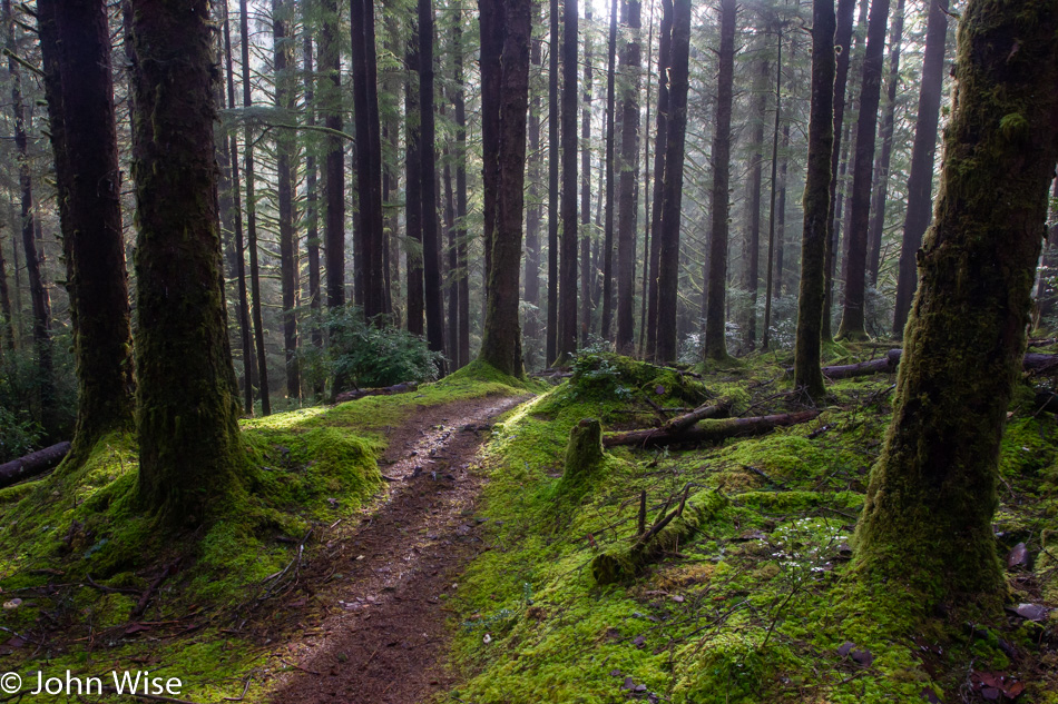
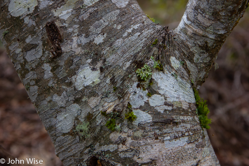
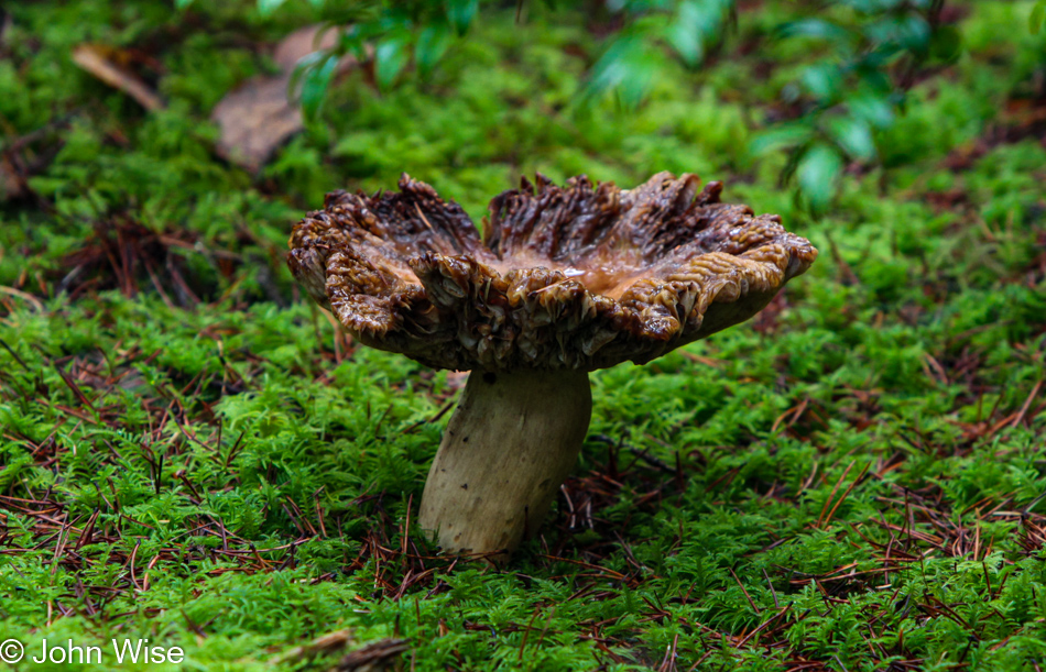
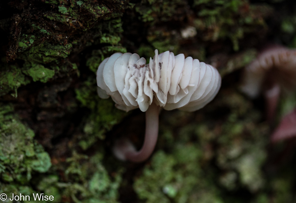
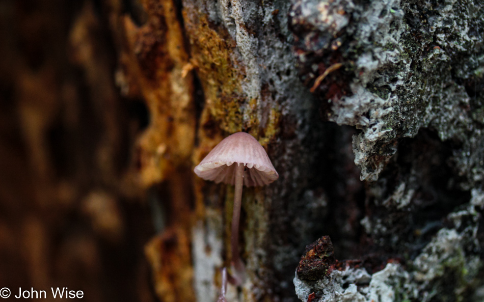
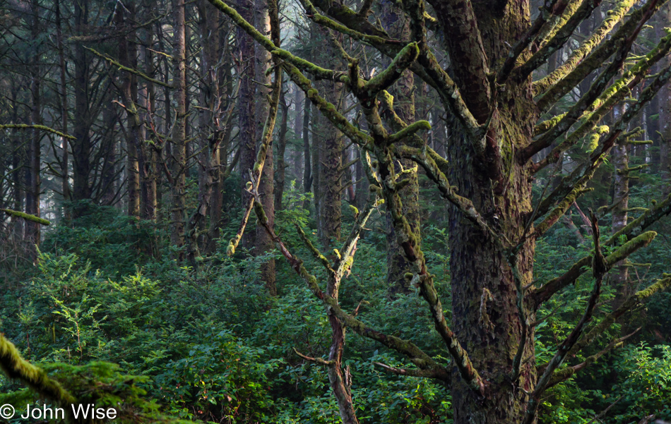
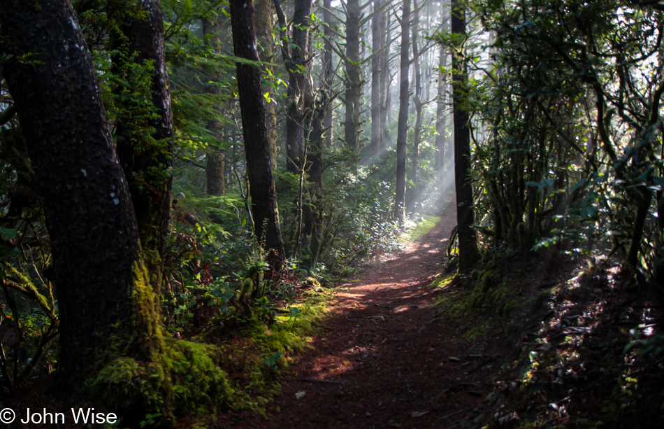
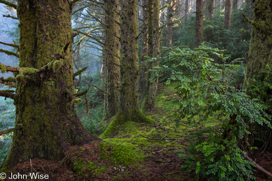
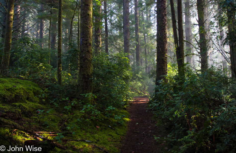
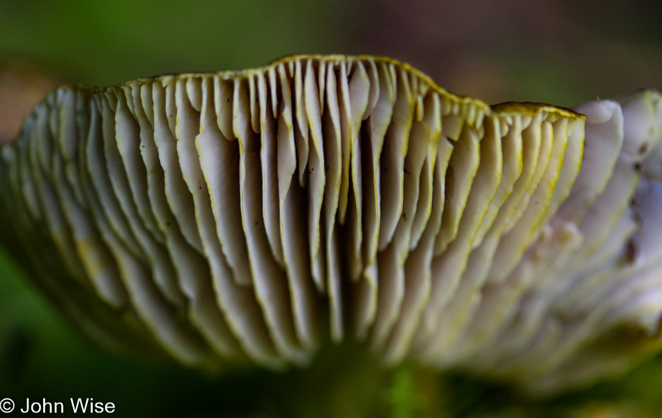
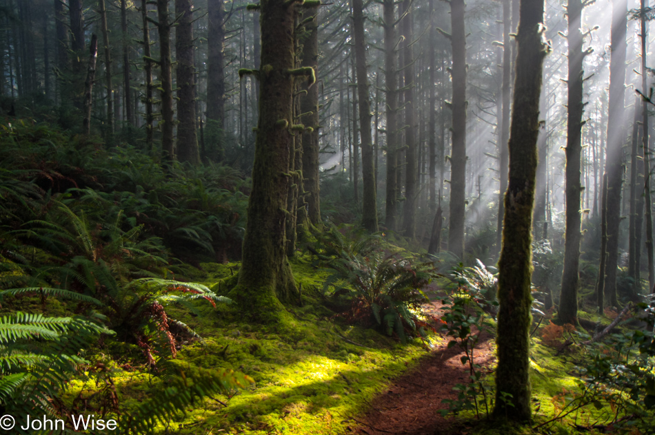
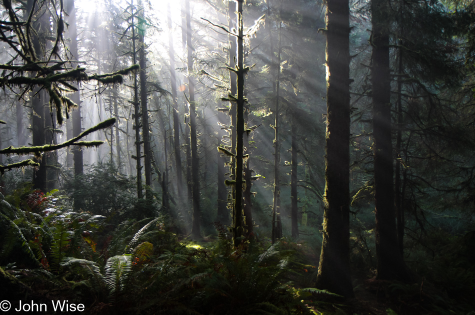
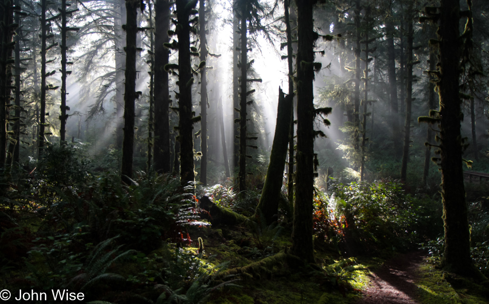
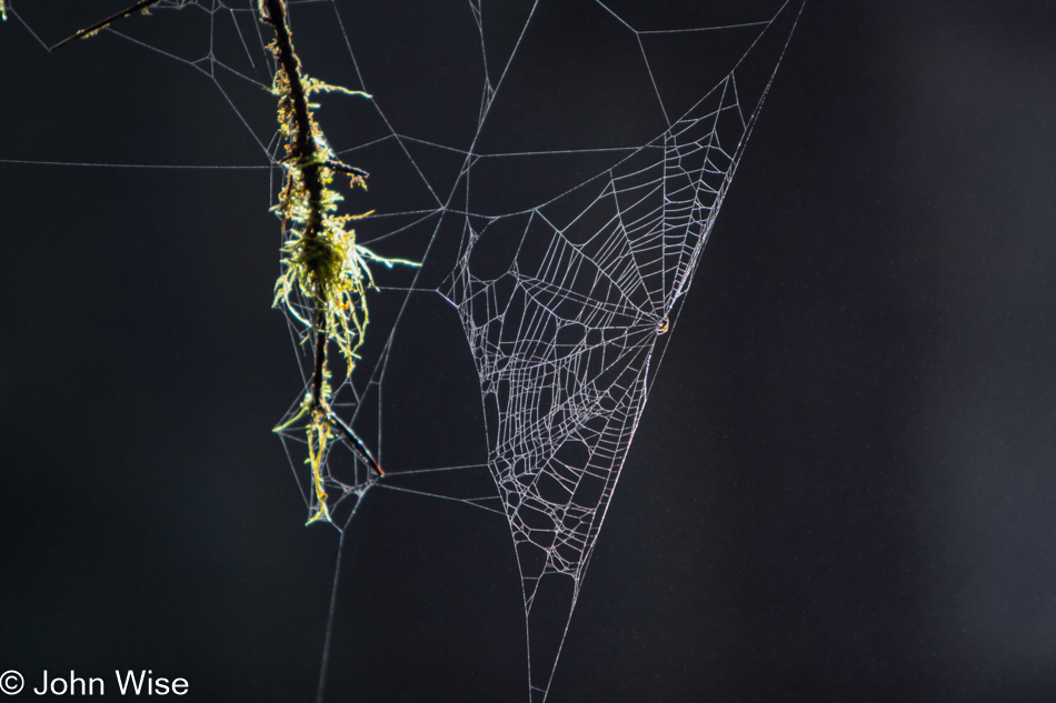
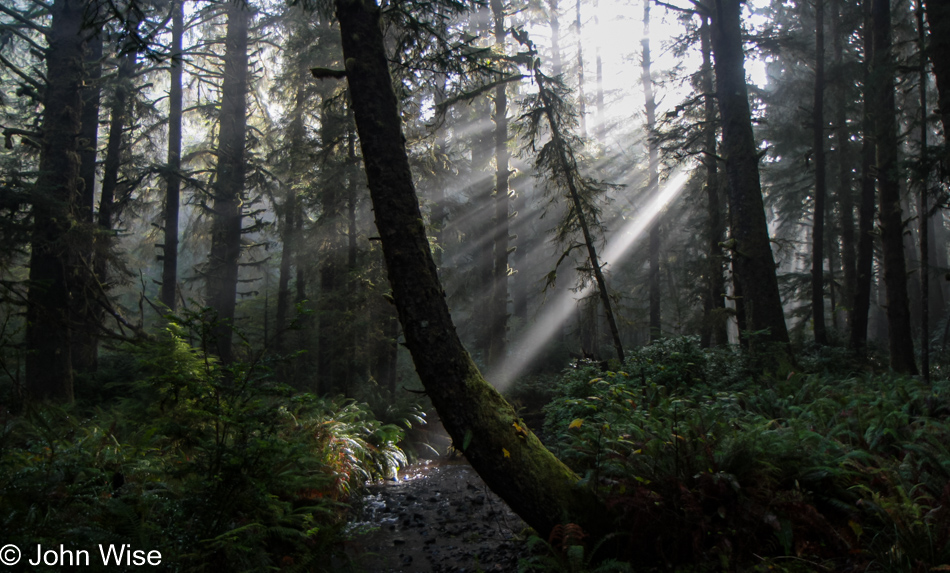
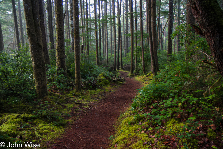
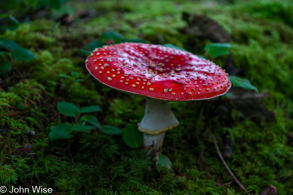
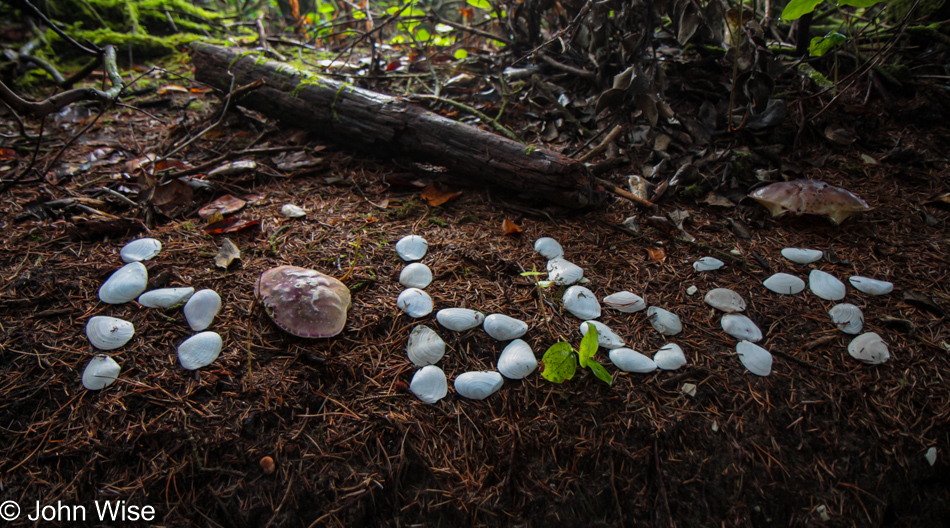
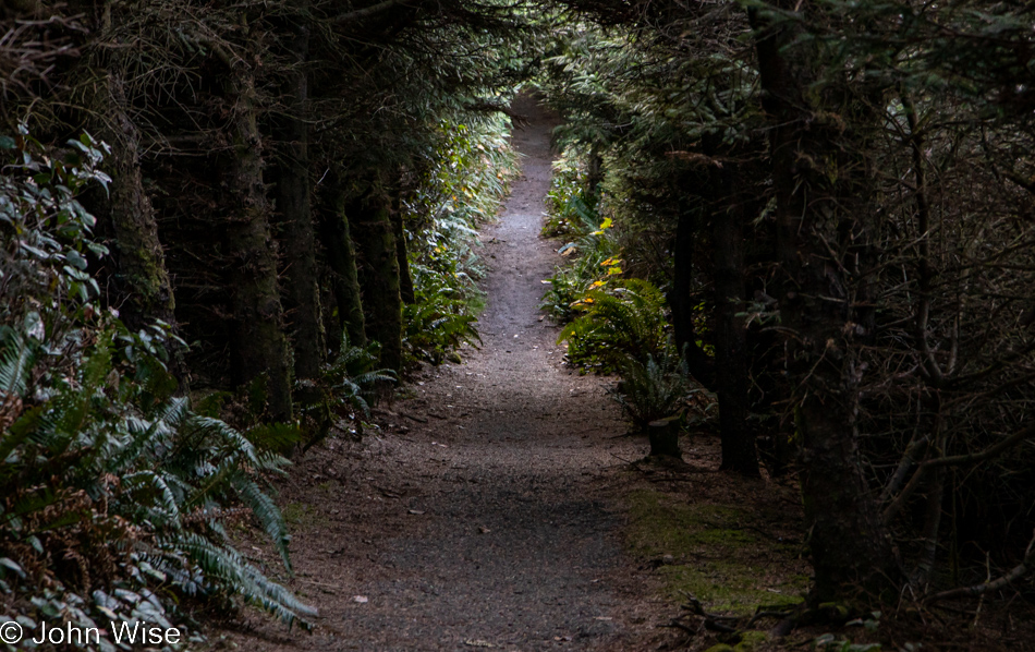
This isn’t just any old forest; it is the forest that goes back…

Umpqua Lighthouse in Reedsport, Oregon

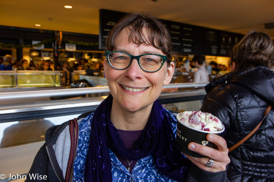
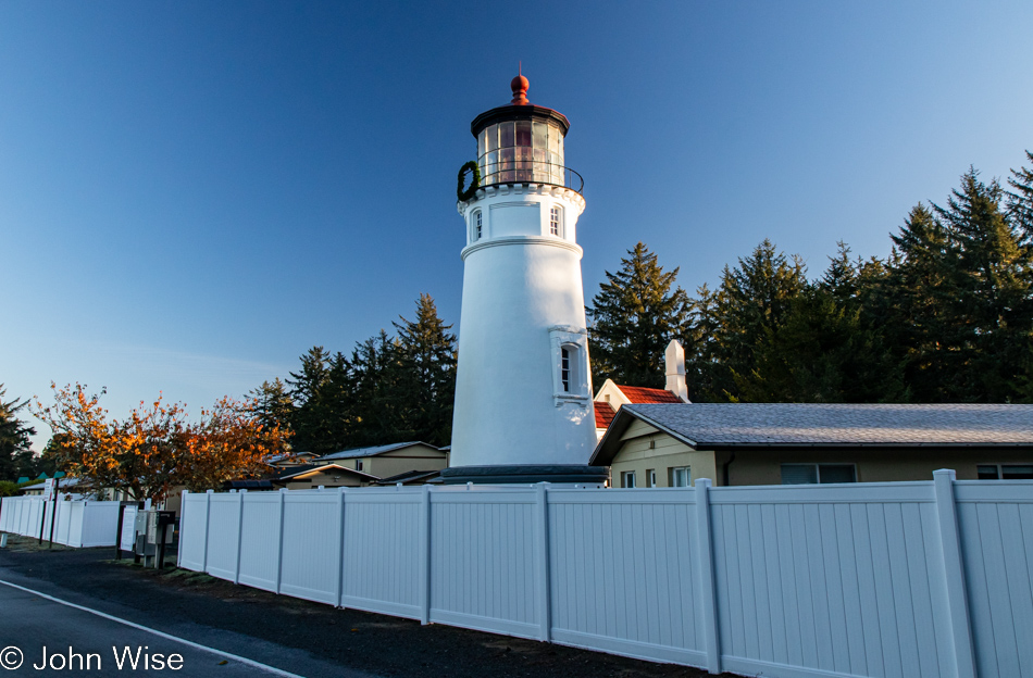
…back to the Umpqua Lighthouse because without Tillamook Creamery around for breakfast dessert, this will have to do.

Oregon Dunes seen from the David Dewett Veterans Memorial in North Bend, Oregon

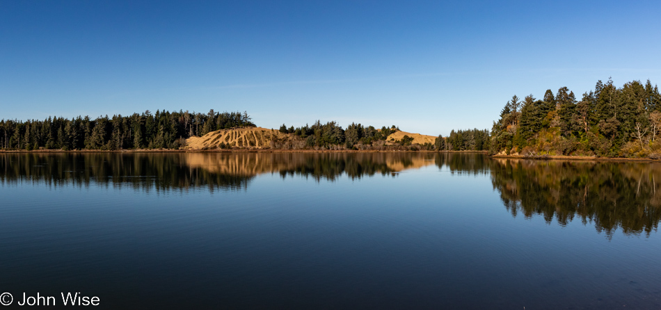
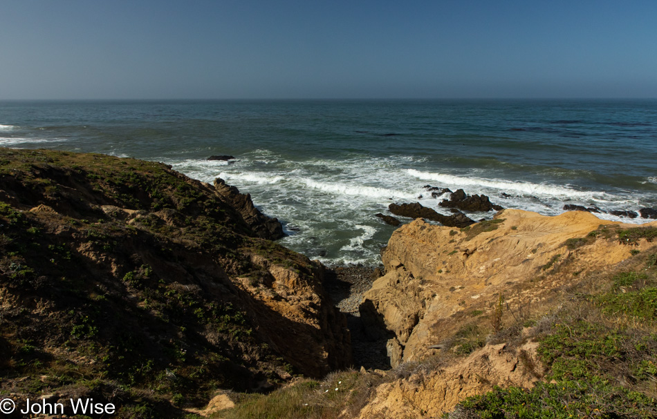
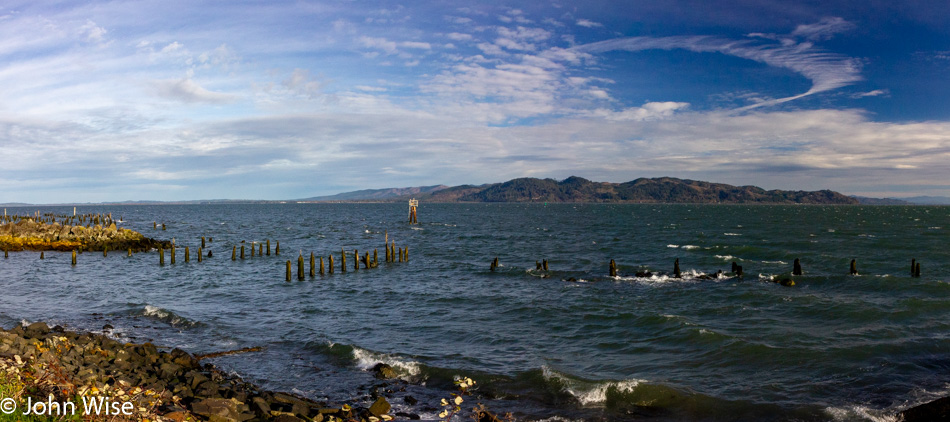
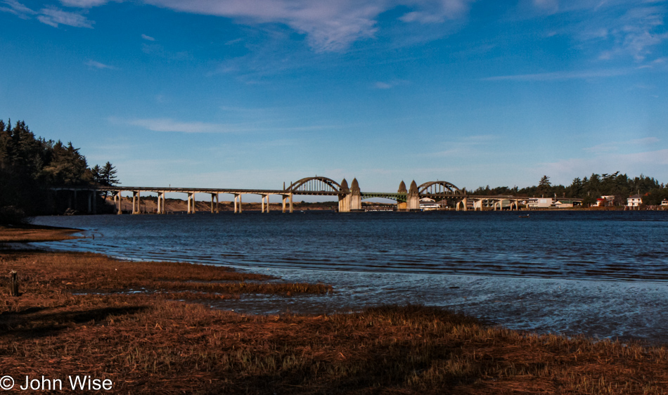
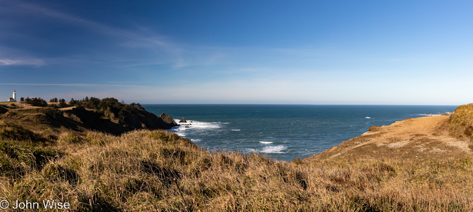
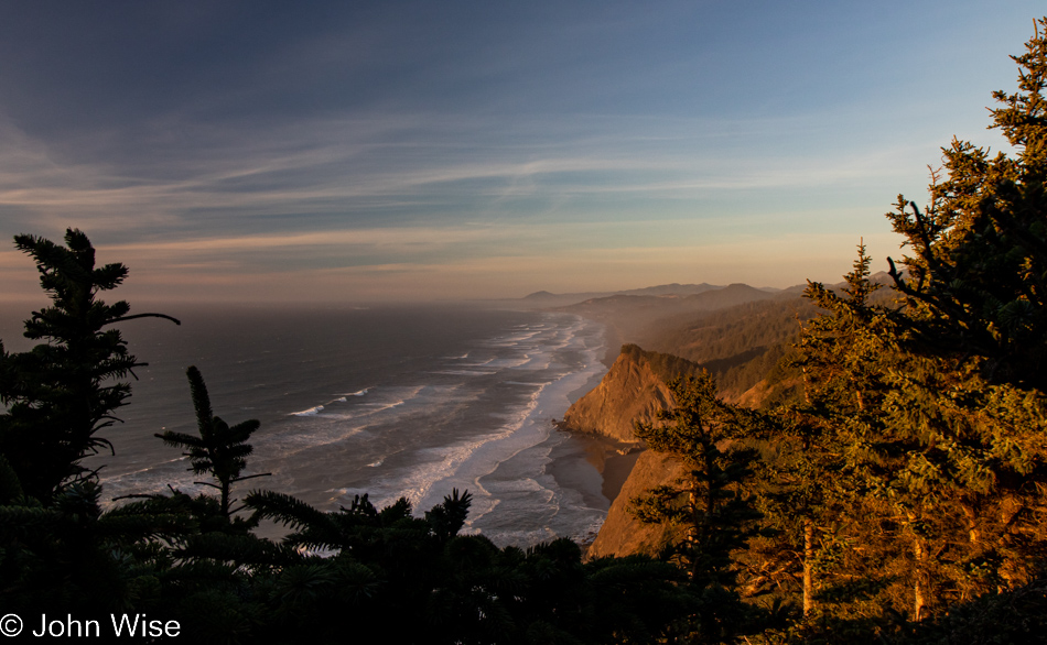
We are looking across one small part of Coos Bay from the vantage point of the David Dewett Veterans Memorial in North Bend. It almost never fails that the reflections of the Oregon Dunes catch our eye, and poetically, it makes sense that a place of such great reflection should be the site of a veterans memorial.

McCullough Memorial Bridge in North Bend, Oregon

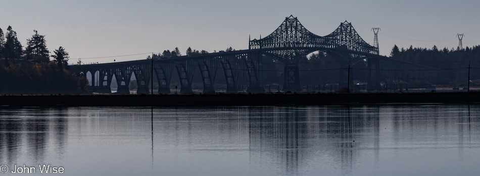
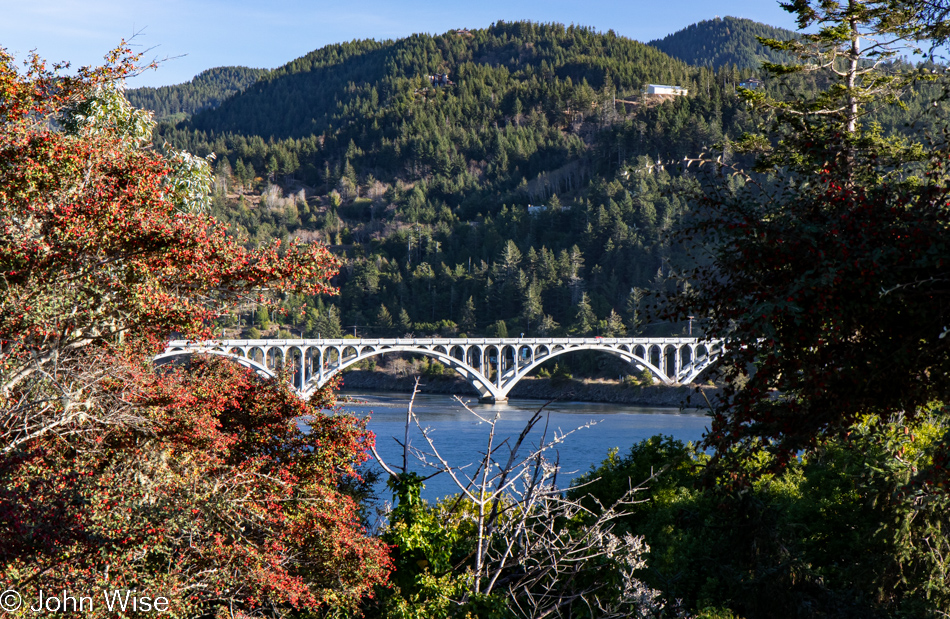
In the opposite direction, you’ll find the McCullough Memorial Bridge.

Rail bridge over Coos Bay in North Bend, Oregon

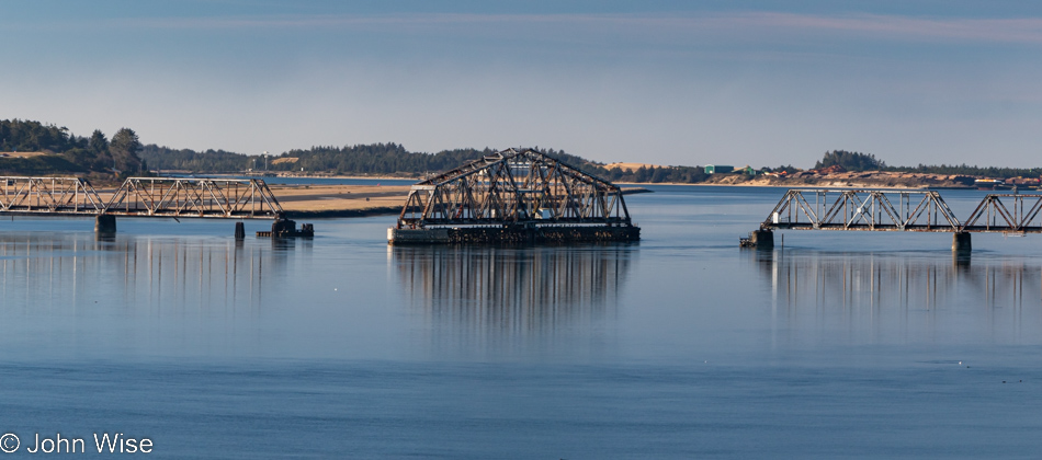
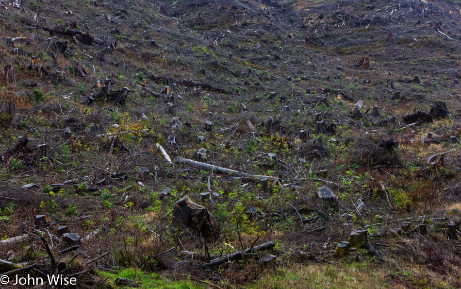
In all the years we’ve been passing through here, we’ve yet to see this rail bridge in any other position or to see trains crossing the bay. We can only guess that this is a relic of the age of forestry as it existed in the past.

McCullough Memorial Bridge in North Bend, Oregon

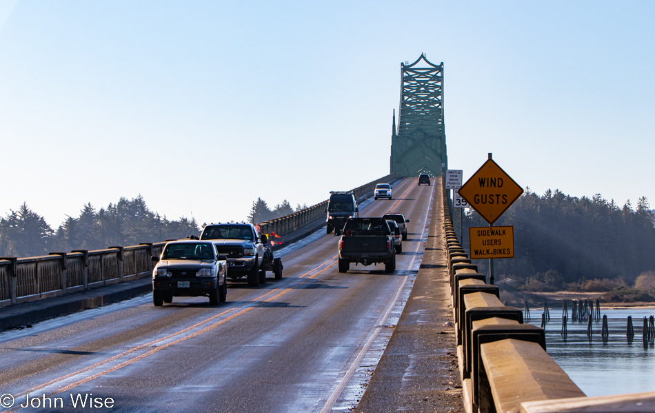
From this fascination with bridges, one might think Arizona doesn’t have any, but it turns out that Arizona and Oregon are nearly equal in that department, which suggests that the bridges in Arizona are not remarkable in any way. Before you object: yes, we have the Navajo Bridges over the Colorado River and the London Bridge that was moved from the U.K. to Lake Havasu, along with the Black Bridge down in the Grand Canyon, but other than those, I cannot think of any other memorable crossings in Arizona. [May I suggest Roosevelt Lake Bridge?  Caroline]

McCullough Memorial Bridge in North Bend, Oregon

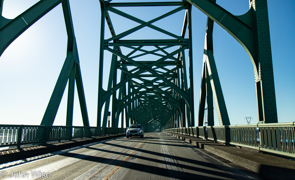
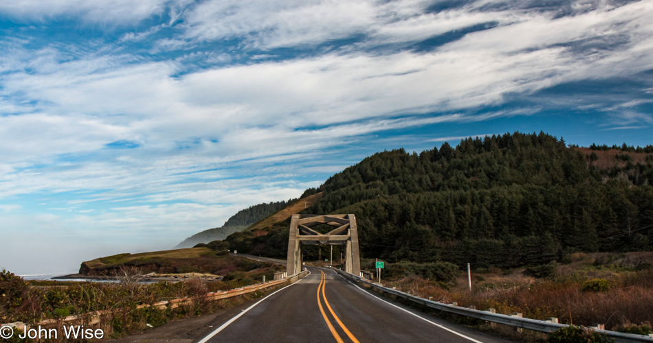
For 86 years, people have been using this bridge, but has anyone else taken so many photos of it?

Traveling Highway 101 south of Coos Bay, Oregon

I’m always trying to remind myself to not only stop and take photos of the most iconic things but also the mundane ones along the way, as they are just as important a part of the attraction that draws us back year after year.

Old rain shelter on Riverside Drive in Bandon, Oregon

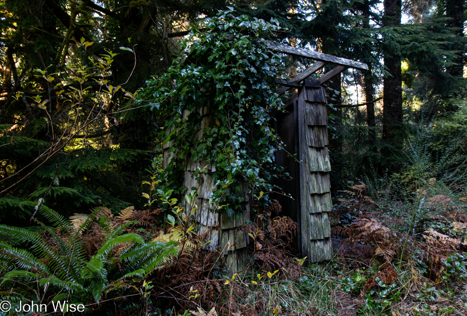
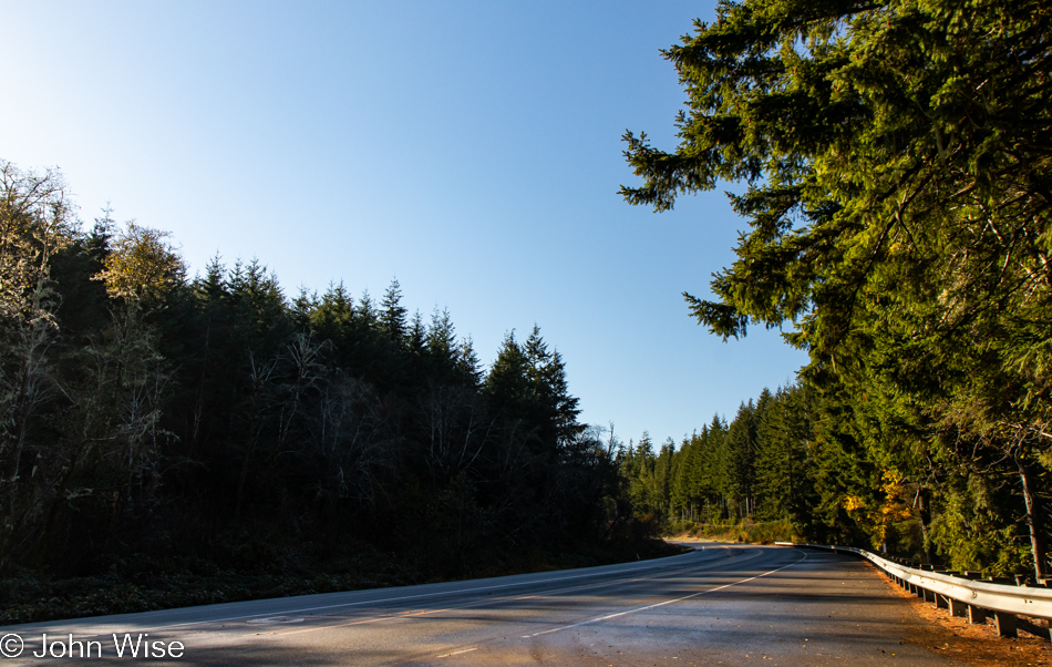
In addition, we try to turn down side roads we might have missed on previous travels, and today, that worked in our favor when we turned onto Riverside Drive. At first glance, this might look like an outhouse to those of us not accustomed to living in rainy places but upon looking closer, it was obvious that this was a long-neglected bus stop for kids who needed shelter while waiting for their school bus.

Big Foot and child on Riverside Drive in Bandon, Oregon

That, or it was a hiding place from a marauding Big Foot and its daughter.

Bandon Marsh National Wildlife Refuge in Bandon, Oregon

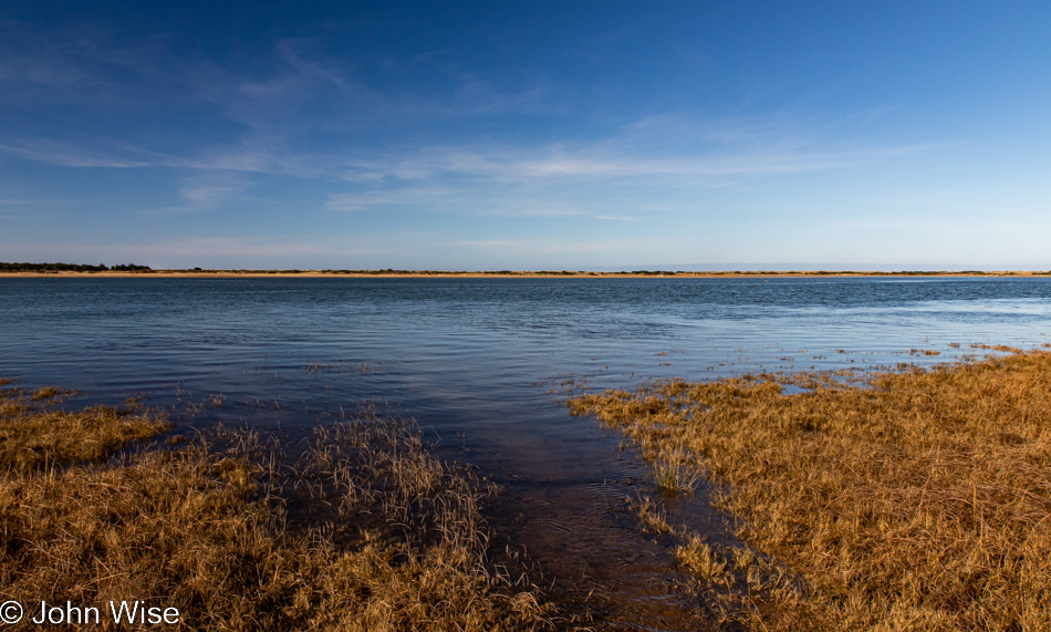
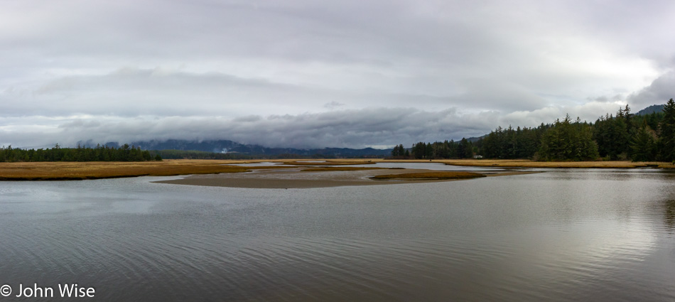
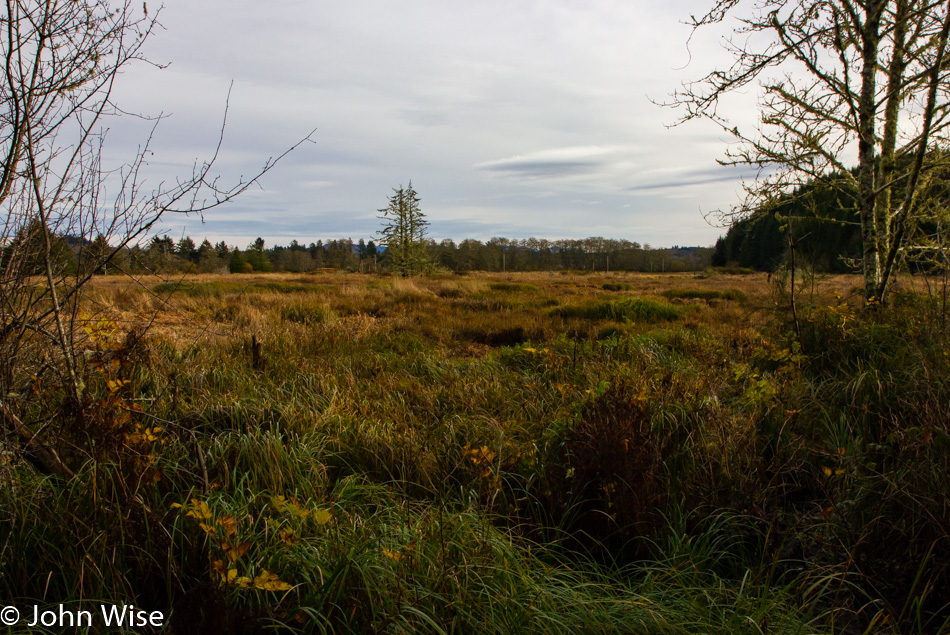
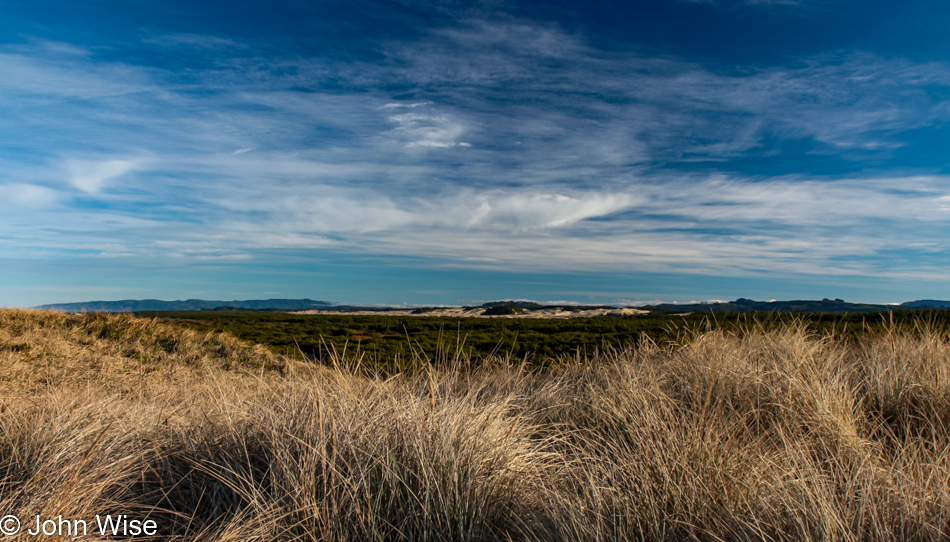
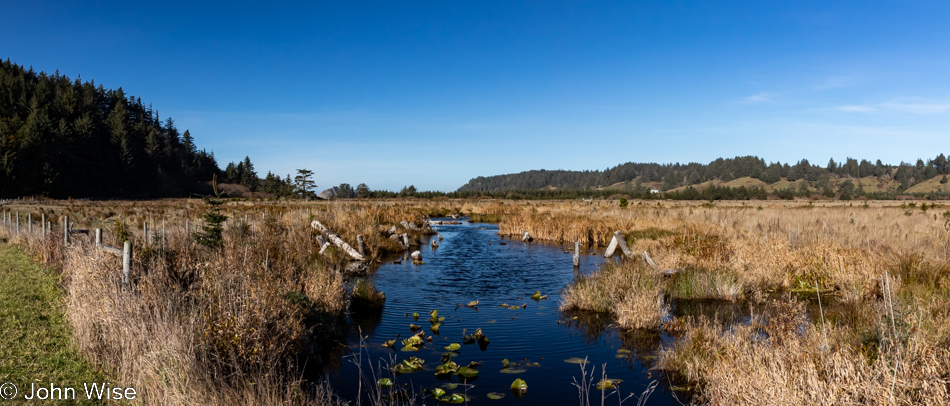
Also from Riverside Drive, a view of the Bandon Marsh National Wildlife Refuge we’ve never seen before.

Caroline Wise at the Wool Company yarn store in Bandon, Oregon

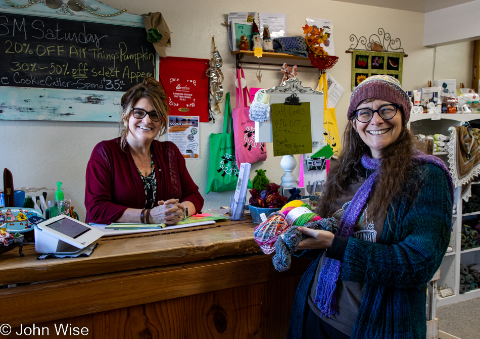
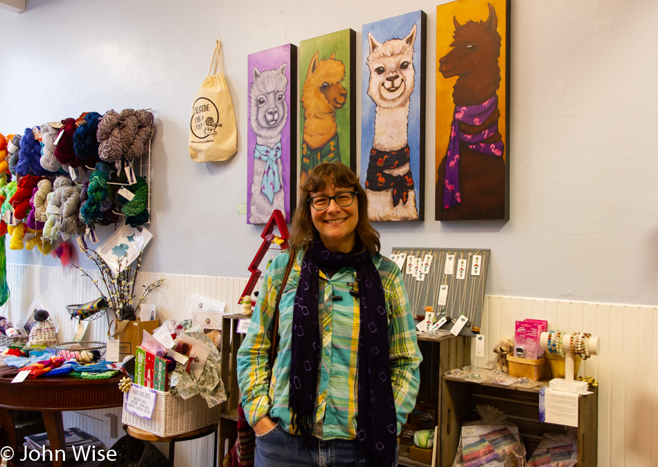
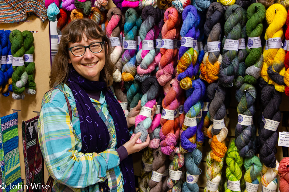
The same cannot be said of the Wool Company yarn store in Bandon that we’ve visited countless times and must have bought 50 skeins of yarn from by now. Yes, there is new sock yarn there, destined for my feet.

The famous Langlois Market in Langlois, Oregon

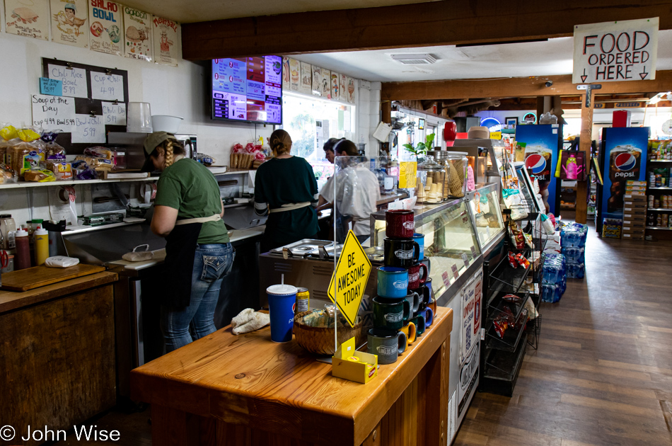
Another place becoming a regular stop on our journeys is found here at the famous Langlois Market, best known for the more than 1,000,000 hotdogs they’ve sold from their little roadside market in a town of only 370 people.

Cape Blanco State Park in Port Orford, Oregon

Not being able to remember offhand the last time we visited the Cape Blanco Lighthouse, we decided to drive down the road through the state park to have a gander.

Cape Blanco State Park in Port Orford, Oregon

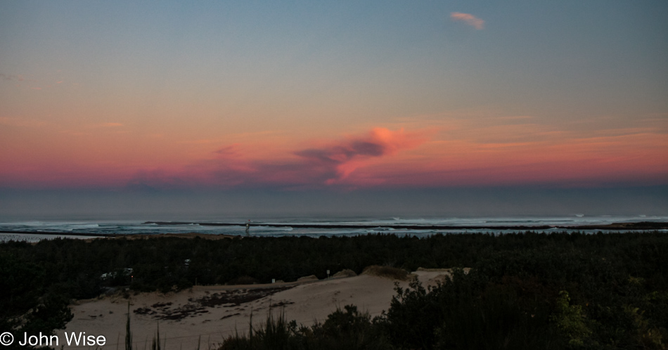
Oooh, it’s windy and cold out here, but the sky demands that we take the short walk in the elements to nab a photo of the lighthouse should it happen that I’ve never taken one in such nice weather.

Cape Blanco State Park in Port Orford, Oregon

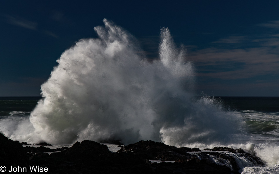
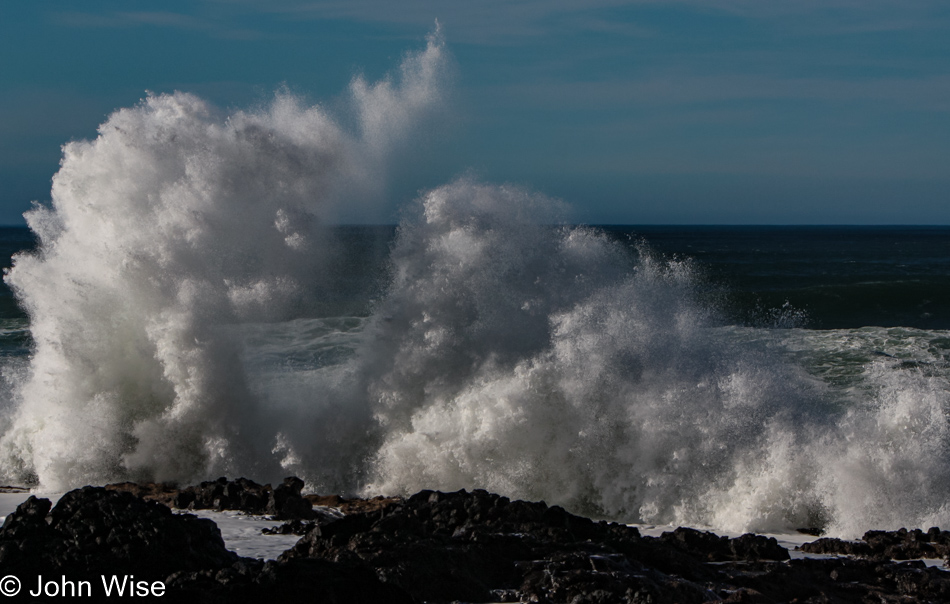
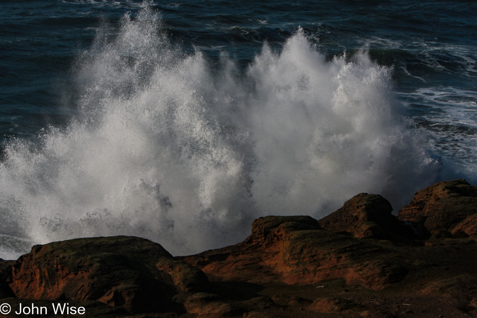
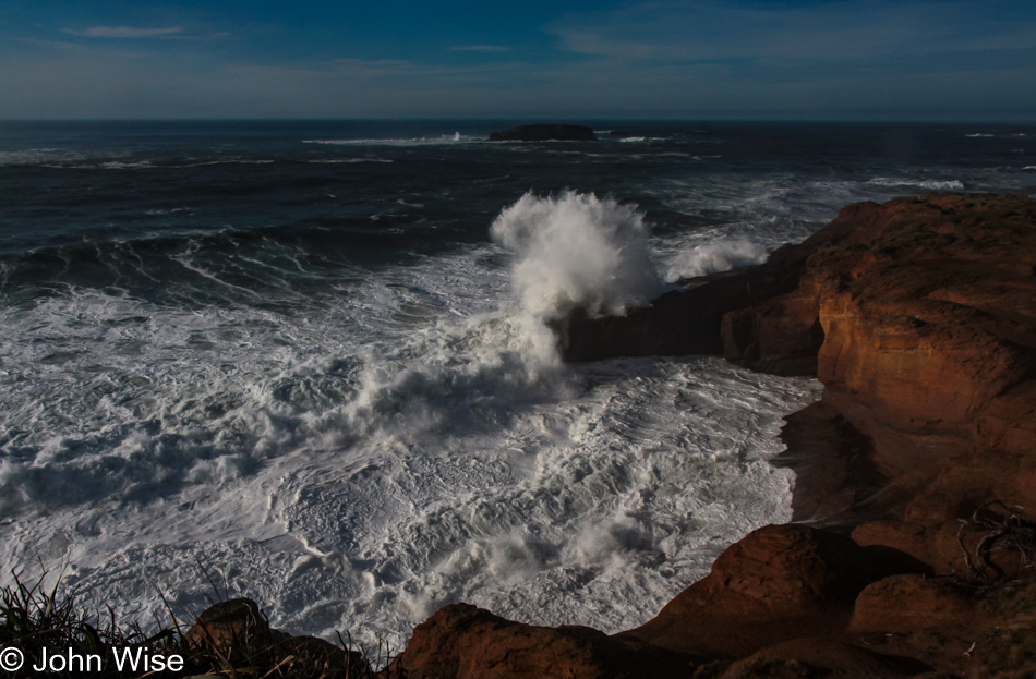
Apparently, Neptune has raised his Sword of Damocles against those who live above the surface of his vast ocean, threatening all of us should we not heed our own knowledge that we are ravaging his seas.

Cape Blanco State Park in Port Orford, Oregon

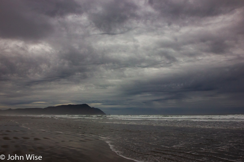
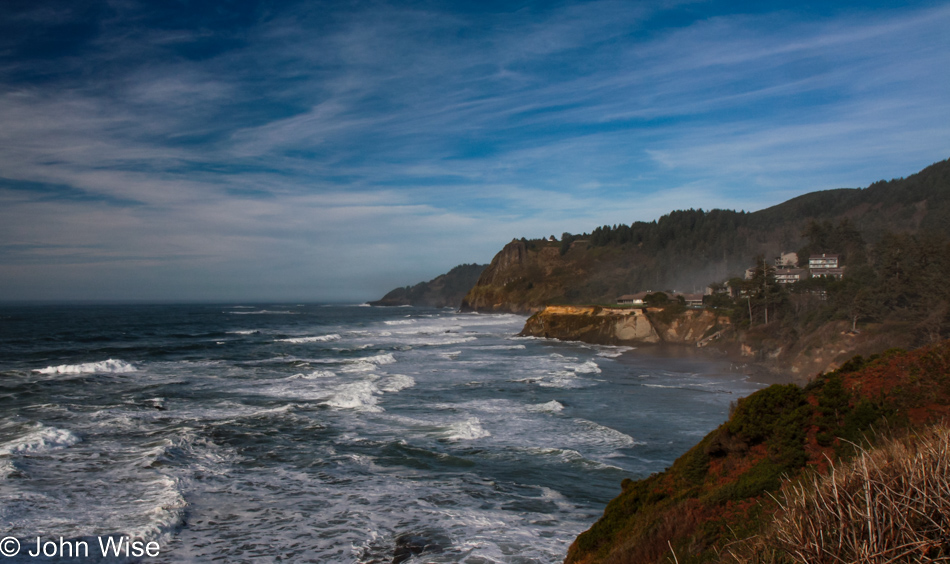
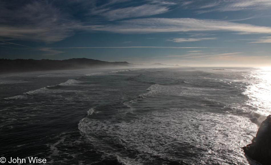
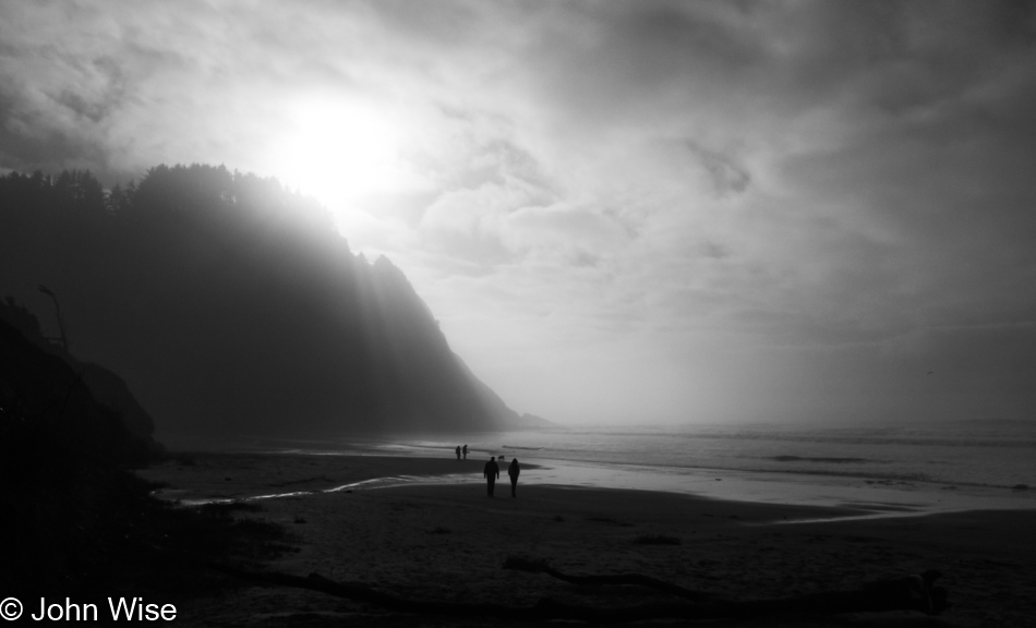
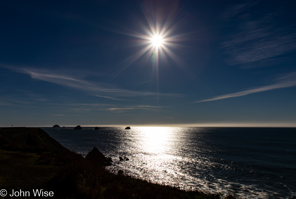
And to our right, as we walk out on the spit of land that is home to the lighthouse, is this view of the deep blue sea that just yesterday was dark green.

Lighthouse at Cape Blanco State Park in Port Orford, Oregon

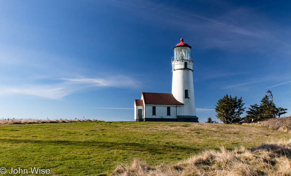
At this time of year, nothing is open; the season is over. No matter, as the tower itself is not currently visitable even during the summer.

Caroline Wise at Cape Blanco State Park in Port Orford, Oregon

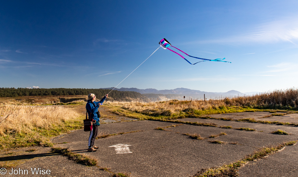
As I said, it’s windy out here, which Caroline thought was as good a time as any to break out the new kite and test how it compares to the one it’s replacing. We’ll just call it love.

Cape Blanco State Park in Port Orford, Oregon

Our car is out there in front of the tree line, and looking at the photo above this one, you might have noticed that Caroline was standing in the old parking lot. Even if the road to the lighthouse was still open, you should be reluctant to drive it as the adjacent cliffside is eroding.

Cape Blanco State Park in Port Orford, Oregon

This is still part of the Cape Blanco State Park, and to the left is the Historic Hughes House built in 1898 that is visitable.

Port Orford, Oregon

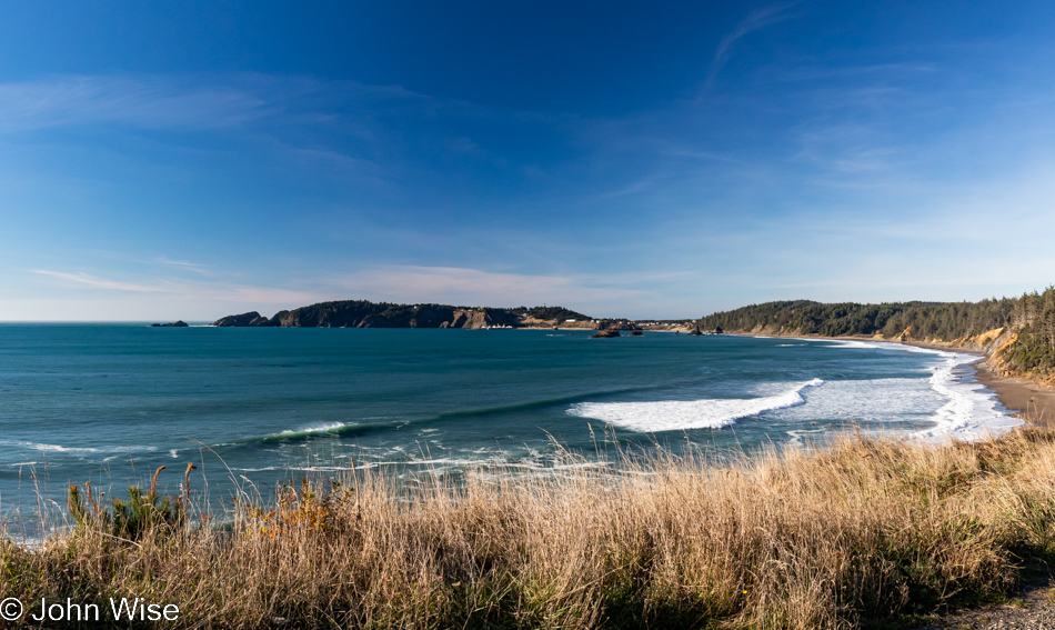
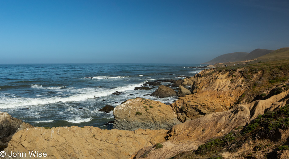
There are a lot of places I can say with certainty we’ve visited before, even multiple times, but this pullout looking north towards Port Orford seems to me to be one of the surprisingly many new sites we’ve stopped at during these days.

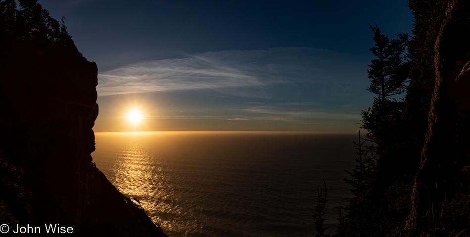
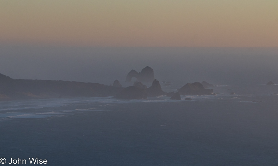
Looking southwest from the same vantage point offers up a crisp sky and a horizon nearly devoid of any fog. Of all the times we’ve been asked if we’ve been here or there, this country or that, nobody has ever asked if we’d ever had the opportunity to be out in the middle of the Pacific Ocean.

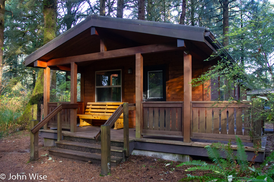
While our yurt at Bullards Beach State Park in Bandon is now 30 miles behind us, we have a date with a rock 35 miles ahead.

View from Highway 101 north of Gold Beach, Oregon

Persistence paid off in my attempts to figure out where the heck we were on the road, but it is mislabeled on Google Maps and is not identified at all on Bing; the address is roughly 35690 Oregon Coast Highway, identified with Port Orford, and it is NOT Foramen Arch.

View from Highway 101 north of Gold Beach, Oregon

Turn and look south, and this is your view from the photo above. To the left of the image, you can see Euchre Creek spilling into the ocean.

Wedderburn Bridge in Gold Beach, Oregon

Moving down a hill and between the bushes, we were offered this view of Wedderburn Bridge in Gold Beach. I wanted to snap a photo from the road, which gave a much better view; stopping for a photo would have been too dangerous though, so this one will have to do. It’s yet another bridge designed by the famous civil Oregonian engineer with a Hitler mustache named Conde McCullough.

Caroline Wise at Meyers Creek Beach in Gold Beach, Oregon

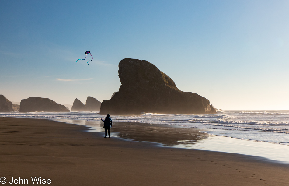
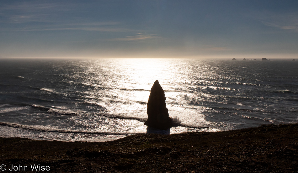
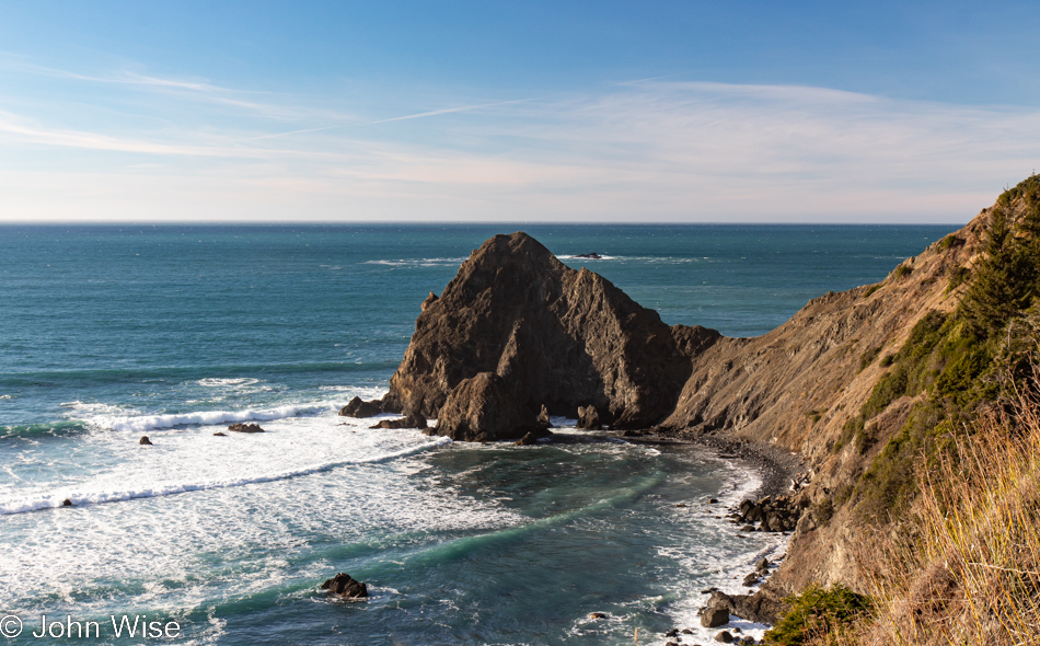
Meet our southern date here at Meyers Creek Beach, the Shark Fin. This visit, though, now comes with 100% more kite.

Meyers Creek Beach in Gold Beach, Oregon

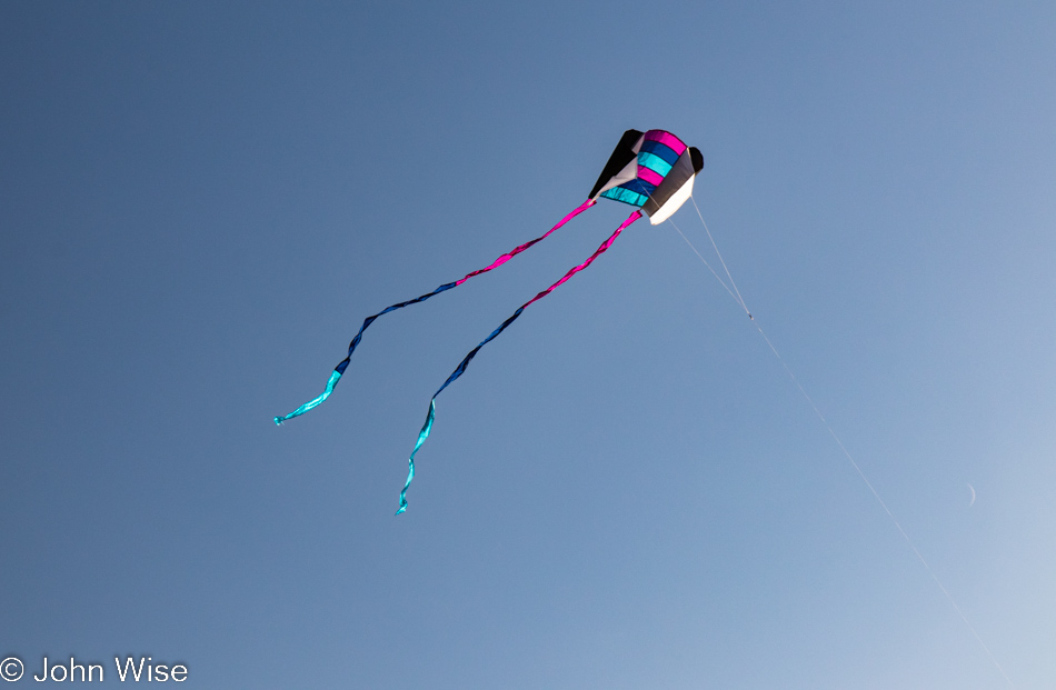
No more disappointment trying to fly the previous pathetic little kite that was reluctant to take to the sky, as this one is a natural.

Caroline Wise at Meyers Creek Beach in Gold Beach, Oregon

Caroline is so happy with this new kite that she’s named it Happy McKiteface. Cute name and all, but I think it actually describes her.

Meyers Creek Beach in Gold Beach, Oregon

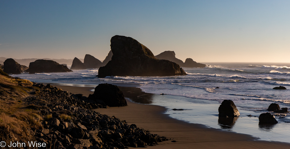
Until next time, Shark Fin, it’s been great.

Cape Sebastian Trail in Gold Beach, Oregon

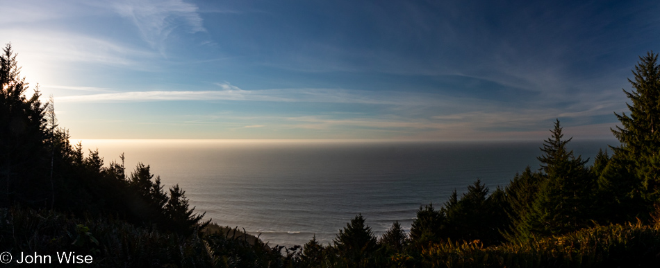
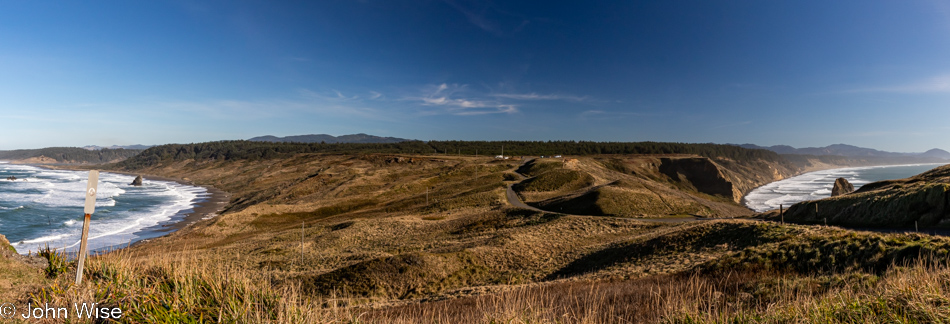
There we were, driving north as though we were doing so with purpose when, not even two miles away from our last stop, a steep road up a hillside on my left seemingly demanded that I pull a quick U-turn to investigate. Why hadn’t the Cape Sebastian sign caught our attention before?

Cape Sebastian Trail in Gold Beach, Oregon

Seeing how we are now up here, we should check out what is down the hill, not this way but the one in front of us.

Cape Sebastian Trail in Gold Beach, Oregon

Nope, this is the view to the north, but in a second, you’ll know what I’m speaking of.

Cape Sebastian Trail in Gold Beach, Oregon

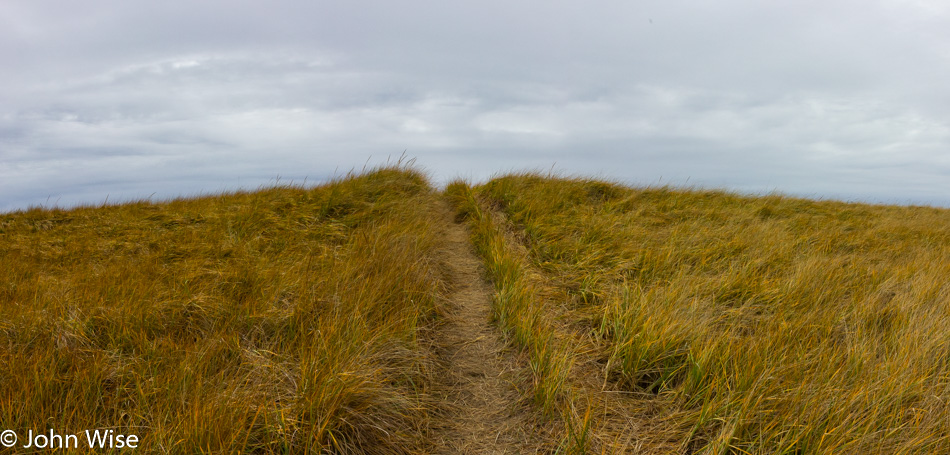
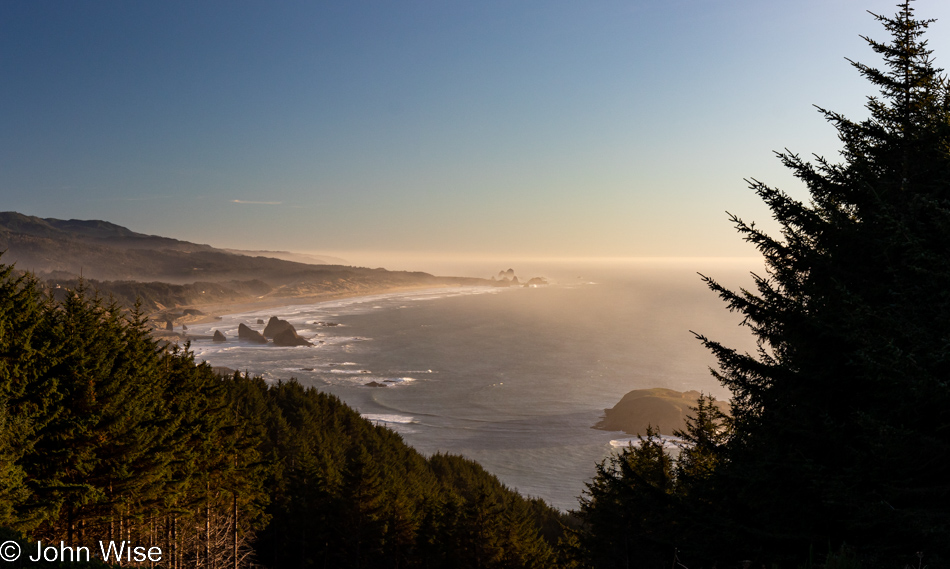
This is the trail I wanted to bring your attention to.

Cape Sebastian Trail in Gold Beach, Oregon

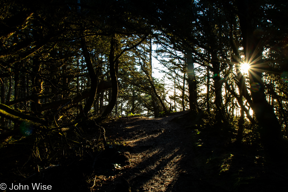
It apparently brings us out to the edge of Cape Sebastian.

Cape Sebastian Trail in Gold Beach, Oregon

Where exactly it’s going is uncertain as there was no trail map at the parking lot, and at this moment, we’ve not passed anyone else who can tell us anything more about where we are. Checking our phones is not an option as we have no signal.

Cape Sebastian Trail in Gold Beach, Oregon

If this were as far as we’d been able to go, it would have been worth every moment and more. Around this time, we’d met a couple coming at us on the trail, and we asked how far they went; they’d gone all the way to the beach but warned us it was too late to try that as it would certainly be dark by the time we got back to where we were talking with them. Something to come back to.

Cape Sebastian Trail in Gold Beach, Oregon

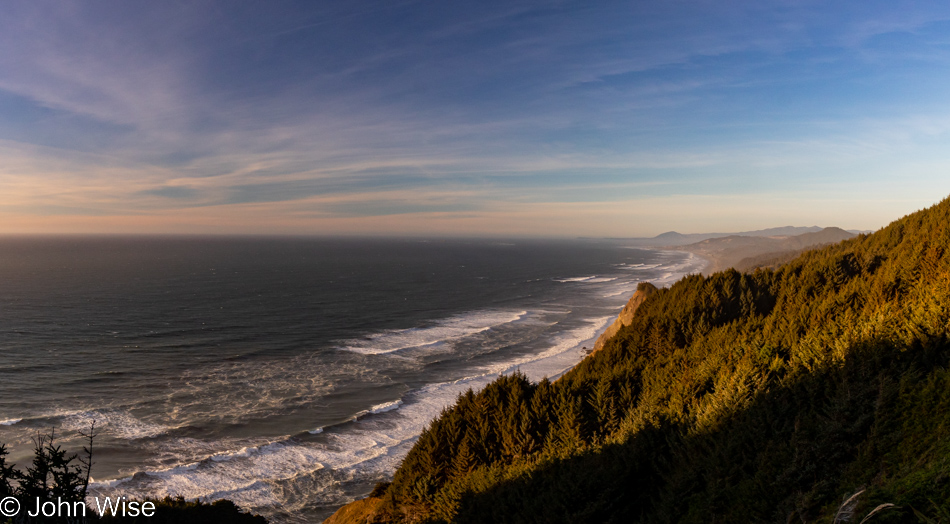
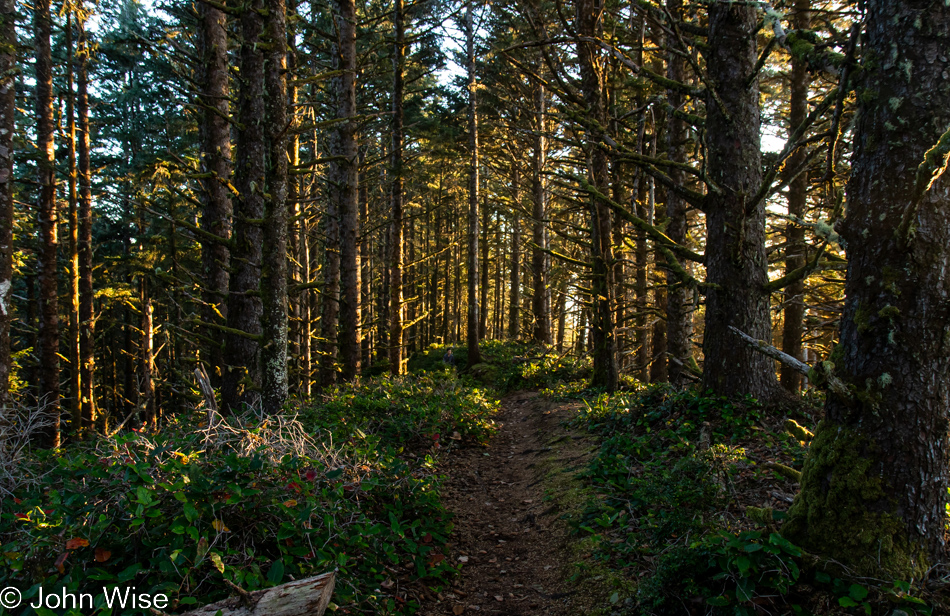
With that, we turned around for our walk back through the forest until we found a slightly different view north.

Cape Sebastian Trail in Gold Beach, Oregon

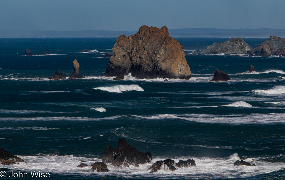
In the distance to the south, way out there, that’s Arch Rock.

Cape Sebastian Trail in Gold Beach, Oregon

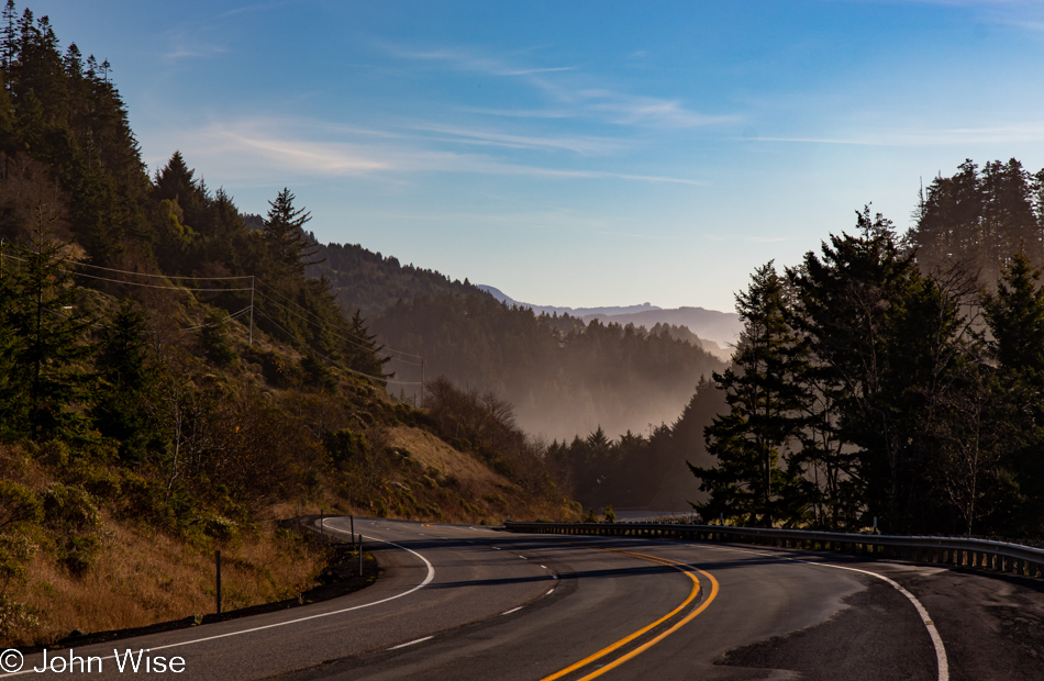
Back at the Cape Sebastian parking lot and ready to tackle the last 65 miles to the evening’s yurt accommodations.

Visitor Center Beach at Gold Beach, Oregon

We’ll still have 60 miles left after this “last” stop, but who could blame us? We’ve stopped at the Gold Beach Visitors Center, which appears to be the name of the beach, but that can’t be.

Visitor Center Beach at Gold Beach, Oregon

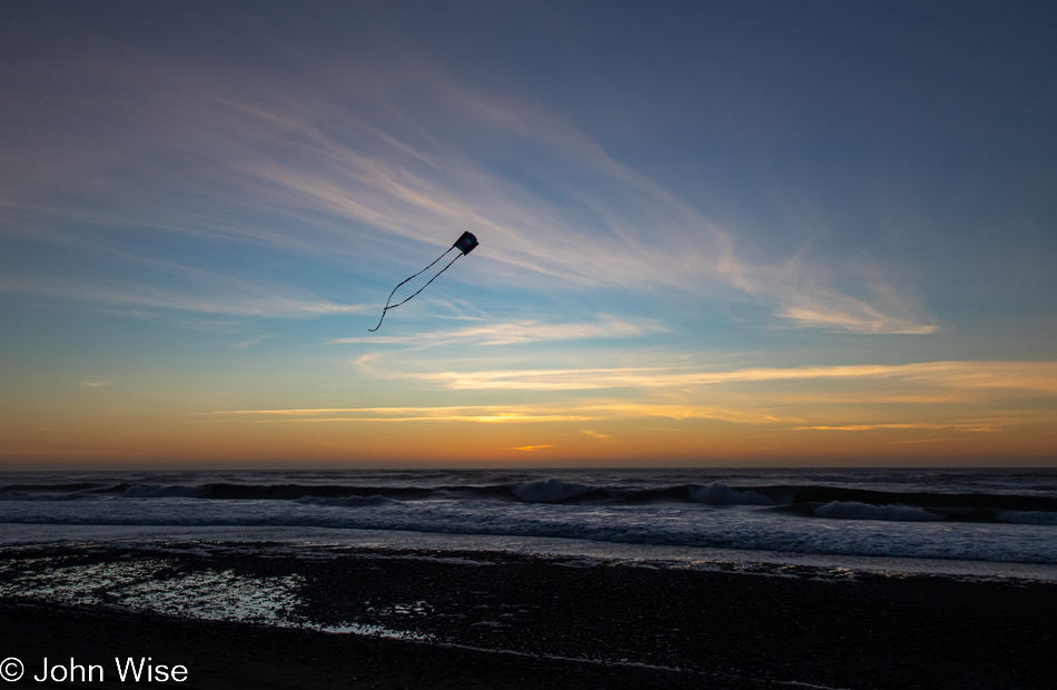
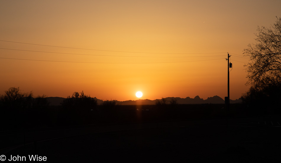
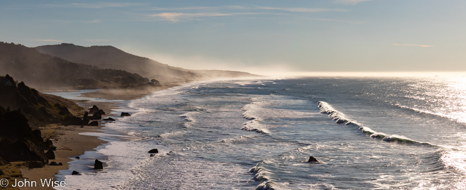
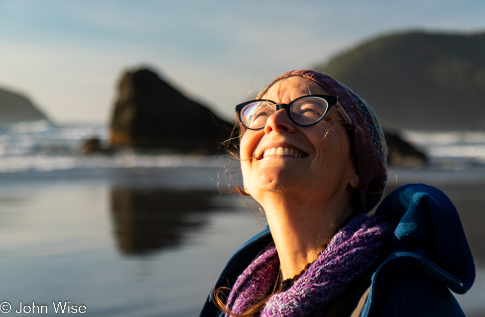
While I busied myself photographing the last moments of the setting sun, Caroline quietly pulled out Happy McKiteface and threw it aloft before I could protest. With that smiling face beaming at her new kite high above the beach in the fading light of day, there was no way I was going to rain on her moment of finding yet more joy.

Sunday Closing The Loop

Moonstone Beach Boardwalk in Cambria, California

We got up a minute before the alarm at 5:59. An exchange of telling each other that we love each other, a hug, and a moment of recognition about how wonderful a vacation we’ve been having. Things were mostly packed last night; I just needed to get on my shoes, stop this quick bit of writing, leave Seferina, the housekeeper, a little something of gratitude, and head out the door. Hopefully, it will still be before 6:30 as we take our last walk of this journey along the sea, and then we’ll turn our car east for the long drive home.

Moonstone Beach Boardwalk in Cambria, California

Out before the sun peaked over the mountains to the east, we were able to watch its first rays illuminate the world around us in golden sunlight. The flowers return to their vibrant colors, birds become more active, and humans emerge from their lodgings to join us on the boardwalk.

Moonstone Beach Boardwalk in Cambria, California

And here comes the sun, oh glorious sun that illuminates our way and breathes life into all.

Moonstone Beach Boardwalk in Cambria, California

Just met a fellow Canon camera enthusiast who was down on the Central Coast from the Oakland area. Her name was Tabitha, should she stumble on this entry and read a bit. She seemed most interested in the wildlife but also the catharsis that comes with being on the seashore. Tragically, I also learned that where she lives has become a trap because high rents and low-paying jobs have limited her options to escape the crushing despair of a bleak existence. But here at the ocean, she finds her better self and is able to celebrate the win of being away from home, if even for a short while. I wished her the best and rejoined Caroline on an overlook where she was patiently waiting for me.

Snail on Moonstone Beach Boardwalk in Cambria, California

Minutes become hours, become days, and still, we reach for another moment where the secrets of what draws our fascination to the coast might be made known.

Moonstone Beach Boardwalk in Cambria, California

Maybe the great mysteries should remain just that so we can continue to return again and again as we search for the elusive in places that strike magic into the depths of who we are.

Snail on Moonstone Beach Boardwalk in Cambria, California

Only an hour was carved out for our time along the Pacific before we dropped the key off and moved onto Main Street for breakfast at the Creekside Gardens Cafe. After we leave there, the challenge will be moving without distraction to arrive home before midnight.

While Google suggests that the way we came via Santa Barbara and Los Angeles to the south is the fastest route, it is also the one that takes us by a dozen or more beaches that will tug at our inner Schweineschnecke that would defeat us from getting home while we are still able to keep our eyes open. We both know that we’ve seen a fair share of the abundance of beauty that lies out here along the western edge of the United States, and still, we want just one more photo, one more walk along the crashing surf, another chance to listen to the birds, or clean sand out of our shoes. We will try to do our best to just drive, I swear.

On Highway 1 near Harmony, California

That intention lasted maybe 10 minutes before we pulled over to snap a photo of the green rolling hills that we missed on the way up. This is certainly the end of giving in to temptation…

Harmony Headlands State Park in San Luis Obispo County, California

…That lasted for almost 5 minutes before we were making a U-turn to check out what Harmony Beach State Park might have to offer. It appeared that we might be able to walk to an overlook about a mile down the trail, but unfortunately, the information didn’t offer any real indication of exactly how long the trail would be. But we easily convinced ourselves that 20 minutes out and 20 minutes back was manageable.

Harmony Headlands State Park in San Luis Obispo County, California

Wouldn’t you just know that the ocean view wasn’t to materialize until we were right upon it at about the 2-mile mark?

Harmony Headlands State Park in San Luis Obispo County, California

The trail extends up the coast, but now we have a 40-minute walk back to the car, so we’ll have to be content that we visited yet another destination on this trip that we would have driven by on previous visits.

When we pulled into the very small parking area here at Harmony Beach, there was one other car parked. On our way back, we passed a family of about a dozen members and maybe ten other small groups that were hiking in. So lucky we were that our time out here was in quiet isolation.

Arizona Rest Stop on Interstate 10 at Sunset

Prior to leaving ten days ago, we already knew where today’s lunch was going to be: Shakey’s Pizza and that’s exactly where we went. Traffic out of L.A. was at times heavy but the traffic returning to the Southern California area here on Mother’s Day was crazy. All the same, here we were already in Arizona before sunset and managed to arrive home at 8:30 p.m. instead of the midnight return I was worried about.

Oregon Coast – Day 7

Last night’s lodging was in the quiet village of Oceanside, and after breakfast at Blue Agate Cafe, we were ready for our trek south along  Netarts Bay. Our first stop is the home of Jacobsen Salt Company, where they are cooking up local seawater to make some amazing finishing salt. We first learned of the factory and shop on the sea from Allie, who is the owner of Seaside Yarn and Fiber. Later that same night, we were introduced to it at Stephanie Inn in Cannon Beach, which includes it on the table. To top it off, Caroline’s cocktail last night at the Schooner Restaurant & Lounge (where we enjoyed an amazing dinner complete with “Oysters Rockoyaki”) featured a salted rim of Jacobsen Salt. With all that in mind, we would have to visit the shop if they were open this Wednesday morning in the off-season. Sure enough, the place is open, but sadly, there are no “factory” tours due to insurance reasons, as though falling into a boiling vat of salt brine might portend bad things. All the same, almost everything is on display. The bay behind the shop is where they collect the water that is filtered and then cooked down in the large vats in the shed. From there, the salt is collected and put on offer in the shop. This is certainly the most expensive salt we are ever likely to buy, but supporting this kind of artisanal business for enjoying a taste of the Oregon Coast after we return to our desert-dwelling in Arizona is well worth the cost.

Cape Lookout State Park is quiet this morning with nary a soul to be seen or heard out here, just us and all this ocean, gray skies, and forest behind us. Our destination is a mere 60 miles from here. Although the daylight only shines briefly on these late fall days, we would arrive in Newport too early if we didn’t stop along the way to smell the woods and banana slugs.

Speaking of forest or lack of it in this case, this is what clear-cutting looks like. No responsible harvesting happening here; just come in and strip the land bare. Driving past this scarred battlefield feels like open warfare and an assault on visitors who are traveling through trying to appreciate the beauty of the state. Of course, this is privately owned land, but it is still regulated by laws or, in this case, a lack of them. If the Oregon legislature were so inclined, they could put an end to this type of carnage, but in a state with a limited economy, they appear to be beholden to powerful lobbies that must work hard (pay) to ensure the rules remain in their favor.

These lands that face obliteration will be replanted only to be harvested again when it’s economically viable to do so. The old growth obviously will never return, but I also wonder if the biodiversity that had existed prior to the clear-cut will ever return. Then there’s the question of how we disrupt the wildlife that nested or foraged here. What about erosion and pollution? If this were a properly managed tree farm, the harvester might expect to earn about $5,000 per acre, but it’s a wild forest of mixed age and types of trees, so the amount often ends up being less. Once replanted, it takes about 35 years before the acreage can be harvested again.

Fortunately, Oregon hasn’t allowed the majority of the state to be obliterated by stupidity and so we tree-hugging visitors still get to enjoy the greenery even when obscured in a gray shroud of fog. I, for one, prefer the mystery induced by misty roads into dark forests where I might encounter Bigfoot instead of running into anger at witnessing a landscape pillaged of its beauty.

Ah, here we are at Clay Myers State Natural Area and Whalen Island. We’ve experienced tremendous views, mirror-smooth waters, gorgeous mountains in the background, and walks on the island. Today, we are only checking out the view off the brand-new bridge to the island. Turns out there’s been even more work done here in the Sand Lake area.

Welcome to Sitka Sedge State Natural Area. This new explorable corner near Cloverdale has just opened to the public this past June and represents the last intact estuary in the state. Over time, the state park system is going to open a total of six wildlife viewing areas. To the best of our ability to identify such things, there are currently three of those areas that are complete. The first one features squirrels, cute, furry, little squirrels, that stopped to check us out because maybe they thought we were cute, furry, little people.

After making our way through the woods, we were greeted by a favorite sight: European beach grass. Just like the yellow gorse found along the coast, this is an invasive species that was intentionally planted by early white settlers who believed they were taming the land. Instead, they created a kind of nightmare for some while producing a lovely golden sand dune waving in the wind for others.

While we’d like to walk up that way to where the Western Snowy Plover nesting area is, the rain is going to keep us away. In any case, we’ve been enjoying them darting away from the surf on their hunt for morsels right here near where we exited the forest.

If we had to guess, we’d probably put our money on the thought that a seagull enjoyed a tasty breakfast of crab before our arrival. Strange that we never find legs or claws nearby when stumbling across these shells.

There’s much of this 244-acre park that we won’t be seeing today, but it’s great knowing there’s so much to come back to on a future visit.

Another sunset at Siletz Bay would be grand, but not being ones to often sit still, we’ll continue to use the available daylight to find impressions of places that sing to our memories.

Or that appears to be seen for the first time, allowing altogether new memories to be formed.

Funny how just 100 meters in an open landscape can allow everything to look so different.

The closing 30 minutes of the day can see us frantically searching for the perfect spot to experience the sunset. I believe I’m probably more conflicted with the inner dialog that asks if this is the most perfect spot or if it is simply just adequate. Caroline, on the other hand, has the patience to be still and believe that anywhere I pull over is likely going to be host to the greatest sunset we’ve ever witnessed. I decide to press on.

Ah, Boiler Bay on a stormy ocean, this must be the perfect place. The sea explodes against the rocks here, jetting upwards in what appears to be at least 100 feet. Only on very calm days does this pullout fail to exhilarate us.

As is usual, I probably spend too much time looking through my camera’s viewfinder, hoping for this shot right here. Did I take 50 or more photos to get this one? It is likely the latter. Caroline meanwhile simply stood at the fence line, taking it all in without a care in the world while I remained busy trying to capture the image that would best represent these closing moments of daylight along the Oregon coast. Oh, how I love this stretch of America, warts and all.

Oregon Coast – Day 4

I could have posted a photo of our yurt from the night before, but I’ve probably posted that exact yurt half a dozen other times. Last night, though, we had a new experience here on the coast as we stayed in a cabin, and so here’s a photo of that deluxe cabin complete with shower, toilet, and rudimentary kitchen. Was it worth $100, considering we had to supply bedding and head to the store to buy two towels? Nope. Had we been better prepared with wood for the fire pit, coals for the barbecue, and had a couple of friends with us it would have been a great deal. While I’ve said it before, it bears repeating that coastal Oregon State Parks are amazing for their proximity to the ocean and their fully equipped campgrounds.

You are looking at the mouth of the Columbia River and the endpoint of Lewis & Clark’s journey across the western United States. It’s blustery out here and significantly colder than other places along the coast we’ve been so far, must be cold air blowing in from Washington across the river.

From there, we drove into Warrenton to find some breakfast at Arnie’s Cafe. They do a great job, so great that you have to wait for a table. Breakfast foods don’t often photograph well, so instead; I present you with a small lake we drove by after our morning feast.

We checked in with Fort Clatsop National Historical Park to make sure Caroline wasn’t missing any levels from her Junior Ranger badges, as she thought there was an award she didn’t have. Turns out there was a consolidation of awards so she already had everything she would ever earn here. While in the visitors center, I noticed a road through part of the park we’d not previously traveled and so that’s where this part of the story picks up. We are at Netul Landing, taking a walk over to the South Slough Trail.

The first part of the path is flat and takes us along the Lewis & Clark River. We could stay on this trail, which would bring us back to the visitors center, where we could turn left and hit the “Fort To Sea Trail,” which is a 6.1-mile hike, but we are more interested in the slough today.

At a fork with a sign pointing to “Steep Trail,” we crossed the road and nearly immediately climbed the equivalent of about 15 flights of stairs (not pictured). This was a thigh-burning climb that had us thinking that we wouldn’t want to go down the same path on a wet trail. Fortunately, it’s a loop, so there won’t be any backtracking today.

The area shows heavy evidence of a clear-cut done in the past with large old tree trunks still rotting on the steep hillside. The entire area, including the slough, is going through a restoration in order to restore the habitat that had been left in ruin.

How long has this tree been dead? How long until what remains today no longer does so? Time and nature provided the fertile ground where the tree lived, performing its job of helping keep the surrounding soil stabilized thus allowing the other plant and animal life to also thrive for a moment. When men came along, they harvested the trees and, in their wake, left the hillside torn to shreds. A fire could have just as easily done the bidding of mankind by disrupting the balance, so in some ways, all things are equal. The flames that catch hold of dry terrain don’t consume out of greed or malice, while we hardly have the patience to work sustainably and will move against nature and our own best interests.

The lessons are all around us: live symbiotically within your environment, and your place on earth will sustain you. We are a reckless species armed with the knowledge that should allow us to know better, and yet we continue with our destructive ways while the information abounds but is ignored. We too often deride those as kooks and crackpots who advocate for a healthy attitude towards planetary well-being and recently have lumped scientists into the same bag. Yet nature continues while the biped that claims superiority lives with poor intentions and worse practices.

Whenever we find ourselves away from home in any of Earth’s biomes, we have to stop and look deep into its ecosystems and reflect on how unnatural we live in comparison. True, we have 7 billion fellow humans with complex needs and a kind of mobility that no other species can claim. Collectively, we have the skills, knowledge, and, more importantly, the need to make our nest the most healthy and beautiful place it can be, just like this little garden of moss and lichen perched on the edge of a fallen log that is thriving and apparently doing well to my untrained eye.

Islands of hope are where restoration begins. The engineers and scientists who worked to rebuild these wetlands had to dig channels that would allow an exchange of waters in an area that had long been fouled. Over time opportunistic pockets of life take hold and lay a foundation for further expansion of more complex ecosystem elements until things can fall back into balance, thus negating our previous abuse of the lands along the river.

So, being out here on the South Slough at this stage of its regrowth can be seen as a treasured peek into our futures. The trail forward may be steep, and the damage under repair disheartening. We took things to the brink of total destruction, but there are glimmers that cooler heads will prevail. I remain ambivalent that as I write this and have a desire for more people to take an interest in these lands, there is a consequence of too many of us being personal witnesses as we often bring more damage.

In front of us is the network of water veins and grasses that filter the environment and thus do the bulk of the work in restoring this system back to equilibrium. Knowledge within people works much the same way, but where we can use a bulldozer to move earth around, we haven’t found an equivalent tool to move stupidity out of the way of the masses. At this point, my hope for our species takes a nosedive, as I’m afraid we’ll have to nearly extinct ourselves before restoration is able to take place.

A bridge as a metaphor is needed here, along with a spark that ignites hope that our way ahead is achievable. Will we flow with the river of life or fight the current of survival with outmoded, archaic thinking that places the will of humanity in the hands of an unseen deity that has failed to show its face to any of the 7 billion souls on earth that require a healthy thriving planet? Why are we diseased with this lack of will to knowledge at this critical juncture in our evolution? How have we been so corrupted by our embrace of blind stupidity masquerading as some kind of perverted intelligence? Is that the sound of Nero fiddling while the fire roars?

Time to leave the frying pan and flames behind and head somewhere else, like up this grassy knoll over to the beach here at Gearhart. My aching desire to find beauty and drag others to help celebrate what we have before we lay waste in such a totality that we’ll never again be able to crest the hillside is a burden I can’t tell you that I love. I do wish I could leave my concern behind and go about every waking moment blind to everything other than my own existence and happiness, but I don’t seem to have the DNA to muster that disregard.

Even though the day may be gray and blustery with the threat of the tempest beyond the horizon, I still have something worth celebrating in the most joyous way.

That celebration is found in the incredible love Caroline and I share, where our smiles are genuine and heartfelt. I believe that we equally enjoy the sensation and elation of each other’s touch and presence. We comfort one another in hugs, and the spark in our eyes allows us to look forward to another day indulging in the beauty of the world we are exploring. Maybe it’s my dream for others in love to one day share in the wonder of seeing the magnificence that can be had walking through their world and being witness to things large and small, beautiful and stupendous that motivates these musings.

When all else fails in saving the planet, there’s always more yarn. Welcome to Seaside Yarn & Fiber, which just opened this past October here in Seaside, Oregon. This nice little shop is next door to a bakery, and next to it is Beach Books. After collecting more yarn, we headed to the bookstore, where Alexa, a very enthusiastic bookworm herself, recommended we grab a copy of Rising Out of Hatred by Eli Saslow. Her solid endorsement convinced us, and with it as one of three books we bought, she asked that we reach back to her and let her know our thoughts when we finish it. We will.

Into Cannon Beach, we had enough time for yet another yarn store and even more yarn. If you are thinking that we are running out of room in the car for anything else, you’d likely be right. This isn’t our first time to many of these yarn stores, and here at Coastal Yarns we once again leave with sock yarn that will one day likely grace my feet.

Before dinner, I finally dragged this small fragment of my synth out of the trunk and played with a patch for a short while. By the time we were stuffed to the gills following dinner, I was hardly able to focus on a return to playing with knobs and patch cables and instead allowed thoughts of the cozy bed to lure me to another great night of coastal sleep and dreaming.

Oregon Coast – Day 3

Long fall nights and short days in the cool climes of Oregon make for some serious, cozy sleep as we consistently fail to wake up with the sunrise. Being in a yurt requires you to bring your own bedding and so having our feather blanket and pillows from home only adds to the comfort, making it easy to sleep in. Another contributing factor is that we are in a darkened forest and use the justification that there’s not enough available light to take photos, so we may as well stay cozy and warm. By the time we finally emerge from the yurt, we are already packed up and have had a bite to eat in preparation for exploring the familiar trail awaiting our visit. We know this routine as everything that is going on this morning has been done before; we are well-practiced. Our next steps take us out on a loop trail that heads into this most southerly of temperate rain forests here at Carl G. Washburne Memorial State Park.

Trying to find something new to say about this trail will probably take my words down the path of those already written here more than a few times. Talking of the quality of light, the shades of green or dew-covered mosses are now well-worn tropes I will have to revisit unless I can find some other angle to deliver how they talk to me on yet another trek through their home.

Maybe our visit is more like small talk made with an old friend where you needn’t say anything in particular but simply walk through old memories, reminiscing about the warm thoughts you keep around. Caroline and I rarely actually talk with one another here in this forest, as we are both intent on hearing every detail that makes itself available. From the trickling streams to water dripping off the lichen upon the ferns below, we listen. Occasionally, a bird offers a quiet call, and we strain our ears to hear if another bird in the distance answers. Sometimes, I stand especially still, hoping to catch the sound of a mushroom breaking out of the earth or maybe a newt stepping gingerly over the damp forest floor.

The sun enters silently, though its light screams vibrantly through the mist, delivering god rays upon areas of the forest that seem to receive direct sunlight only rarely. We look into that light flirting with blindness as subtle rainbows on the edges of the rays can be seen from just the right angles. When a mushroom or particular patch of undergrowth is the beneficiary of the fleeting light show, we scramble over to see the magic of momentary full illumination and once again exclaim our incredible good fortune at being here.

This is a common pose on the trail; we call it “imitating trees.”

We are lucky to be out here early in the chilled morning before others start down this trail. I cannot tell you that they are as observant of this pristine forest as I believe we are. We’ve heard people in the distance who are apparently trying to be the apes of the forest, letting their call be heard in order to establish primacy through loud vocalizations. Others bring their dogs and must be oblivious to their barks or believe the noise is keeping bears at a distance. These acts of serenity pollution only work to spoil their visit by ensuring they miss fully half the experience of being in such a beautiful place. Too bad this isn’t called a church or hospital as I believe then they would at least make some small attempt at being respectful.

No matter the number of times we’ve visited Carl G. Washburne, we’ve seen something new; even the old feels new. This mushroom that looks crocheted to Caroline is one of those new things. As for the old things, we are content to not only be such ourselves but have thoroughly enjoyed our time among the others.

From this favorite spot, nearly in the middle of the Oregon coast, we continued our drive north, stopping in Newport for some lunch. The Newport Cafe was once again chosen, though this time, we opted not to up the ante and go for the 8-pound burger. Though I worked hard on trying to convince Caroline that the photo opportunity alone would make it worthwhile. Instead, it was time for an oyster sandwich for her and a seafood scramble for me. Even though we had coffee with our lunch, we still had to stop at Dutch Bros. for yet more coffee because Oregon demands that you always drink more coffee.

Our destination tonight is the most northwestern point in Oregon at Fort Stevens State Park, and so that we don’t have to drive a lot under dark skies on narrow, twisting cliffside roads, we try to get serious about moving ourselves along. We didn’t get far before we spotted the pull-off for Siletz Bay National Wildlife Refuge we’ve passed many times, but today, we stopped.

Every time prior to heading up the coast, there’s a feeling that we’ve seen the majority of what’s to be seen. Then, once we arrive and start looking deeper at the landscape, we discover places that we’ve been aware of and are even somewhat familiar with, but we realize that we’ve never properly gotten out and spent time there. The trail map shows us the best way to witness Siletz Bay, traveling by small boat. Unfortunately, we don’t own kayaks, nor do we know where to rent them nearby, so we’ll have to be happy to walk the short trail around Alder Island.

Alder Island is undergoing a restoration in what looks like an attempt to save the shore from disappearing into the wetlands. When we pulled up to the small parking lot there was one other car here, but there’s been no sign of others. Maybe they had a canoe with them and were somewhere out on the looping waterway?

If only Caroline and I could figure out a way to eke out a living here on the coast we could call this home. Time to hit the road again.

That stop at Siletz wasn’t our last one. We had a date with the Tillamook Creamery and their newly finished supersized visitor center. While others stop for a factory tour or maybe to load up on some cheese, Caroline had her sights set on a scoop of Marionberry Pie ice cream. Note to management: she’d prefer you leave the pie crust chunks out of the ice cream and focus on the marionberry.

After checking into our deluxe cabin at Fort Stevens State Park, we drove into Astoria for some dinner. Our first choice proved too laden with darkness combined with a limited menu, so we headed over to a little Bosnian place called Drina Daisy, where we split a rotisserie roasted lamb plate for two. A quick stop at Fred Meyers because we didn’t bring towels, and we were once again in the super dark forest ready to write and knit. Well, that lasted maybe an hour before we were lulled to sleep by the serenity of the woods and nearby ocean.

Umpqua to Siletz Bay

Umpqua Lighthouse State Park in Reedsport, Oregon

Disclaimer: This post is one of those that ended up being (mostly) written years after the experience was had. While there was a paragraph or two posted way back then with a single photo, there were no other notes taken, so most of what is shared here must be extracted from the images and what memories they may have lent us.

Our last day on the Oregon Coast started in our rental yurt at Umpqua Lighthouse State Park. This view is from the overlook in front of the lighthouse, and between us and the ocean, you’ll find many an offroad enthusiast with some kind of vehicle racing over the sand.

Umpqua Lighthouse State Park in Reedsport, Oregon

These romantic artifacts from our past survive both as beacons beckoning us to remember the past and drawing those of us attracted to the light still visible from another age.

Siltcoos Beach in Florence, Oregon

With 375 miles ahead of us today, we will not be able to stop everywhere, but that doesn’t mean we won’t push things. We walked over the sand dunes here at Siltcoos Beach, hanging out for about a half-hour.

Siltcoos Beach in Florence, Oregon

Maybe because we don’t live here, we have to hold fast to these images and memories, immortalizing them on these pages so we can always refer to them. I wonder if those who live in these places put as much emphasis on seeing intently what might be too easy to take for granted.

Jessie M. Honeyman Memorial State Park in Florence, Oregon

Another short drive and we pulled over to Honeyman State Park, a park that we had somehow missed stopping at on any of our previous visits to Oregon. The air was still, and with the sky speckled with light, thin clouds, we were treated to a perfect reflection of trees, sky, sand dune, and clouds on the small lake.

Prichard Wayside in Florence, Oregon

That’s the Siuslaw River Bridge over there, and we’re at the Prichard Wayside on the south side of Florence as we take this opportunity to see this bridge from a different angle. If time allowed, we’d make it a project to capture all of the coastal bridges of Oregon from various perspectives and different lighting situations; heck, I should include that we’d like to do the same for the nine lighthouses out here, too.

Big Creek Bridge in Lane County, Oregon

Big Creek Bridge is just north of Carl G. Washburne Memorial State Park, which we are indeed passing by without a brief return visit.

Devils Churn Cape Perpetua Scenic Area on the coast of Oregon

The same could not be said about our next stop as we pulled into the parking lot at Devils Churn for a brief stop.

Devils Churn Cape Perpetua Scenic Area on the coast of Oregon

I swear, we’ll only be here a few minutes.

Devils Churn Cape Perpetua Scenic Area on the coast of Oregon

Yes, Caroline, I’m almost done. I think.

Devils Churn Cape Perpetua Scenic Area on the coast of Oregon

But how can we leave when things are this spectacular?

Devils Churn Cape Perpetua Scenic Area on the coast of Oregon

Well, it required nearly an hour for us to pull ourselves away and get back on the road. Let me correct this before Caroline does: it took nearly an hour of prodding. In Yachats, we drove next to the bay and marveled at the rough surf under the deep blue skies and then had a lunch of clam chowder at Mo’s Annex in Newport. Obviously, there are no photos of this segment of the drive as maybe, just maybe, I was a bit too indulgent at the Churn.

View from Devils Punch Bowl area in Otter Rock, Oregon

In Otter Rock, we threw a last look into the Devil’s Punchbowl.

View from Devils Punch Bowl area in Otter Rock, Oregon

No, I won’t get lost in the crashing surf here, too; I know we still have about 300 miles ahead of us, and it’s after lunch.

View from Devils Punch Bowl area in Otter Rock, Oregon

Yeah, but I would have missed this one had I jumped back in the car.

View from Devils Punch Bowl area in Otter Rock, Oregon

We’ve only been here for about 15 minutes.

View from Devils Punch Bowl area in Otter Rock, Oregon

That is a gutsy surfer on a good 8-foot wave on a late fall day in these cold northern waters. Now we can get back to the car, and we’ll just keep going all the way to Seattle for our flight home.

Depoe Bay, Oregon

Wouldn’t you know it, we ran into another distraction in Depoe Bay, where we watched water shooting no less than sixty feet into the air. This shot is not of that 60-footer; just keep scrolling.

Depoe Bay, Oregon

Getting closer…

Depoe Bay, Oregon

A spouting cone was working hard as the tide was at just the right height for this horn to spout a jet of misty water high in the air, accompanied by the onlookers’ oohs and aahs. With the perfect shot in the camera, we can take our drive north seriously now.

Rocks rising above the water in Siletz Bay, Oregon

By the time we reached Siletz Bay, the sun was low in the sky, and we were trying to convince ourselves that we really should stop making all these roadside visits, but the day was so beautiful, and we suckers for beauty were mere moths drawn to the light. Click here to compare to the photo I took of the same place three days before.

Tillamook, Oregon

Under a pink, lavender, and dark blue sky, we reached Tillamook with the hopes of nabbing one more sandwich from the Blue Heron Cheese Company, but unfortunately, we were more than a few minutes too late. We arrived in Seattle, Washington, sometime late in the evening with heads full of terrific Oregon memories from our 10th visit to the state.

Carl G. Washburne – Rainforest

Yachats, Oregon

Disclaimer: This post is one of those that ended up being (mostly) written years after the experience was had. While there was a paragraph or two posted way back then with a single photo, there were no other notes taken, so most of what is shared here must be extracted from the images and what memories they may have lent us.

Beautiful Yachats, Oregon, which we should call home in retirement. (Well, that was our thinking in 2008 when things were still affordable up along the Oregon Coast. Nowadays, in 2022, as I’m expanding this post, that dream is no longer possible due to private equity and AirBnB destroying the ability to find affordability in places where big profit can be exploited.)

Devils Churn in Yachats, Oregon

The ferocity of the Devil’s Churn persuaded us that we didn’t need to spend another minute here and that we should just get down the road, or else be trapped for hours while I aim to take the most perfect photo of the chaos.

Carl G. Washburne Memorial State Park in Florence, Oregon

Having visited so many of these locations on prior outings, we now have a repertoire of places requiring revisits. Carl G. Washburne Memorial State Park is one of those destinations in our ever-growing list of must-return-to sites.

Carl G. Washburne Memorial State Park in Florence, Oregon

From sand dunes to rocky coastal mountains, the Oregon Coast is a treasure trove for exploration, but here at the Carl Washburne State Park, a lush rainforest is roadside and yet rarely visited. While the opposite side of the road, with its Hobbit trail to the mile-long sandy beach, is popular, the China Creek trail sees few visitors. This works out fine for Caroline and me, for we appreciate the quiet, the solitude, and the solemnity of this overgrown, mushroom and moss-infested forest.

Carl G. Washburne Memorial State Park in Florence, Oregon

Elk are said to inhabit the area along the trail, but they have remained elusive to us so far; mushrooms, though, are here in abundance.

Carl G. Washburne Memorial State Park in Florence, Oregon

Mushrooms come in all shapes and sizes. Imagine that these were elephants or unicorns, and there’d be millions lining up to witness the spectacle. Well, lucky us that people don’t find the same enjoyment in the rain forest so it’s all ours.

Carl G. Washburne Memorial State Park in Florence, Oregon

Or maybe Oregon should import gorillas into these environments, and then the crowds would come, though that would just ruin our pilgrimages to this beautiful little corner of the coast.

Carl G. Washburne Memorial State Park in Florence, Oregon

Ha, I should point out that this part of the trail isn’t even in the deepest part of the forest yet; that’s still coming up.

Carl G. Washburne Memorial State Park in Florence, Oregon

Just past these mushrooms.

Carl G. Washburne Memorial State Park in Florence, Oregon

And then, blam, you are in the moss-covered three-handled family gradunza. That’s right, if you ever wondered what Dr. Seuss took influence from, this was it.

Carl G. Washburne Memorial State Park in Florence, Oregon

Our happy place.

Carl G. Washburne Memorial State Park in Florence, Oregon

If we were small enough, our happy place might be under this mushroom, but we are giants.

Carl G. Washburne Memorial State Park in Florence, Oregon

Though not so giant as to compete with the trees.

Carl G. Washburne Memorial State Park in Florence, Oregon

Nor as big as the sun that shines down these rays into the trees, casting shadows within the fog.

Carl G. Washburne Memorial State Park in Florence, Oregon

So, the best we can be are puny people in awe of how incredible not only the place is, but how fortunate we are to realize we can be here to be energized in the magic of light and shadow.

Carl G. Washburne Memorial State Park in Florence, Oregon

In Arizona, the spider webs are invisible in our zero-humidity, dry climate, but up here, they are gathers of both insects and dew.

Carl G. Washburne Memorial State Park in Florence, Oregon

Maybe I’m getting too carried away with the god-ray photos?

Carl G. Washburne Memorial State Park in Florence, Oregon

Well then, here’s a salamander taking a break with the green world around it reflected in its eyes.

Carl G. Washburne Memorial State Park in Florence, Oregon

Wait a minute, have I shared a photo previously of this exact location? Probably, but I’ve also taken a thousand photos of my wife and shared them too.

Carl G. Washburne Memorial State Park in Florence, Oregon

Not a mushroom but an alien intelligence sent here to observe us.

Carl G. Washburne Memorial State Park in Florence, Oregon

I sure have created myself a task I often feel ill-prepared for by adding all of these photos. I’ve endeavored to include a corresponding amount of something to say about each, but that’s difficult, especially considering that I’ve likely written about the general area and impressions a dozen or more times.

Caroline Wise and John Wise at the Carl G. Washburne Memorial State Park in Florence, Oregon

Looking back at these memories, I see the forest as it was and still is; Caroline looks almost the same, while I’ve grown thinner and grayer. We still have that green camera bag, Caroline only recently retired that flannel shirt we bought at Euro-Disney in 1992, and she wore at our Las Vegas wedding, and we are still not quite satisfied that we’ve experienced enough of Oregon, and so this November 2022, like so many other Novembers, we’ll be back, likely on this exact trail.

Carl G. Washburne Memorial State Park in Florence, Oregon

We’ve often wondered how many of our photos are from essentially the exact same spot. For that matter, how many of these words have been written verbatim time and again?

The Hobbit Trail at the Carl G. Washburne Memorial State Park in Florence, Oregon

After starting the China Creek Trail at the trailhead near the park office and covering the Valley trail, you may cross over Highway 101, where you can choose to hike to Heceta Head Lighthouse or turn right over the Hobbit Trail, returning to the park entrance on the beach (hopefully at low tide).

Hobbit Beach next to Carl G. Washburne Memorial State Park in Florence, Oregon

This is one of the majestic photos that defy my belief that I captured it. Caroline should chime in here about now and inform me that, in fact, she took it.

[Come on, John, everybody knows that only you take nice photos ^_^  Caroline]

Caroline Wise and John Wise at Hobbit Beach next to Carl G. Washburne Memorial State Park in Florence, Oregon

Two selfies of us in one post can only mean I’m giving into the nostalgia of things, or maybe I enjoy getting lost in the romantic notion that those two smiling faces have been sharing space in front of the camera for so many years.

Hobbit Beach next to Carl G. Washburne Memorial State Park in Florence, Oregon

This guy or gal is an uncommon sight for us to see on a beach in Oregon, especially at this time of year.

Winchester Bay in Reedsport, Oregon

I believe we are at Winchester Bay, which would make sense with our lodging being just around the corner.

Umpqua Lighthouse State Park in Reedsport, Oregon

If this is the Umpqua River Lighthouse, and it is, then we must be staying in yet another yurt because just behind that lighthouse is the Umpqua Lighthouse State Park. Apparently, this was our first time staying at this park, as far as the old reservation confirmations I still have in email. We were in yurt C53, and some years later, we stayed in B18, followed in 2019 and 2021 when we stayed in C35, which is the same yurt we’ll be occupying in November 2022.