Disclaimer: This post is one of those that ended up being (mostly) written years after the experience was had. While there was a paragraph or two posted way back then with a single photo, there were no other notes taken, so most of what is shared here must be extracted from the images and what memories they may have lent us.
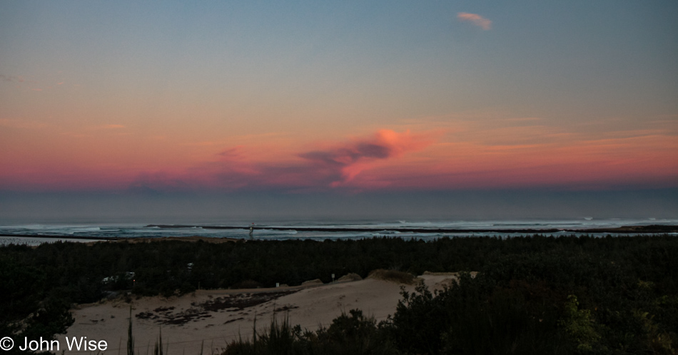
Our last day on the Oregon Coast started in our rental yurt at Umpqua Lighthouse State Park. This view is from the overlook in front of the lighthouse, and between us and the ocean, you’ll find many an offroad enthusiast with some kind of vehicle racing over the sand.
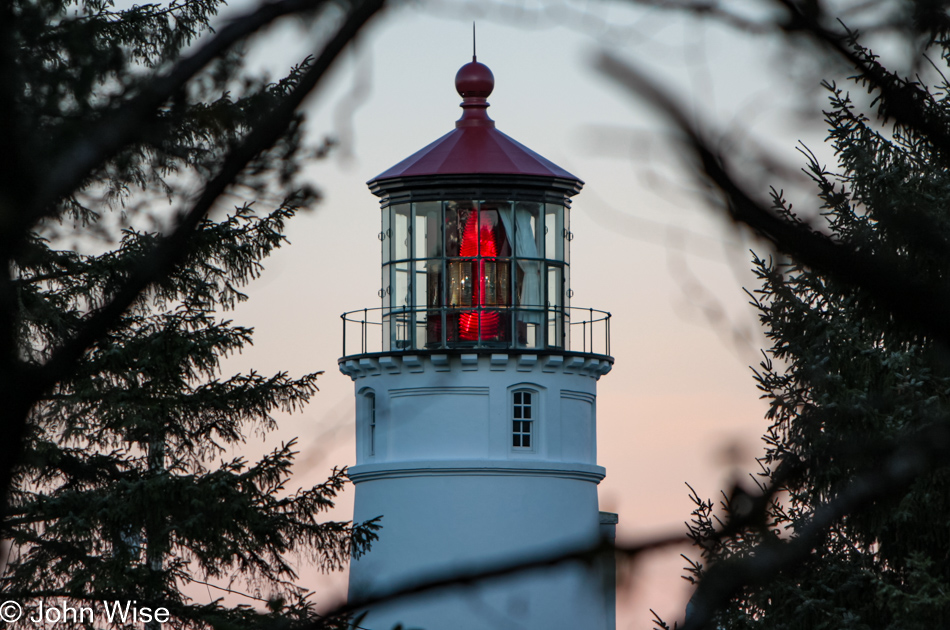
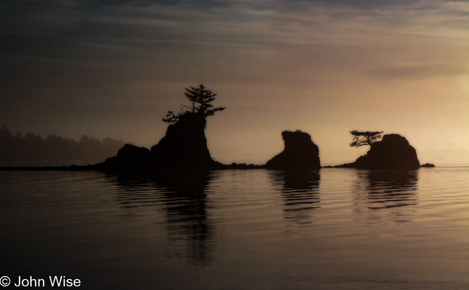
These romantic artifacts from our past survive both as beacons beckoning us to remember the past and drawing those of us attracted to the light still visible from another age.
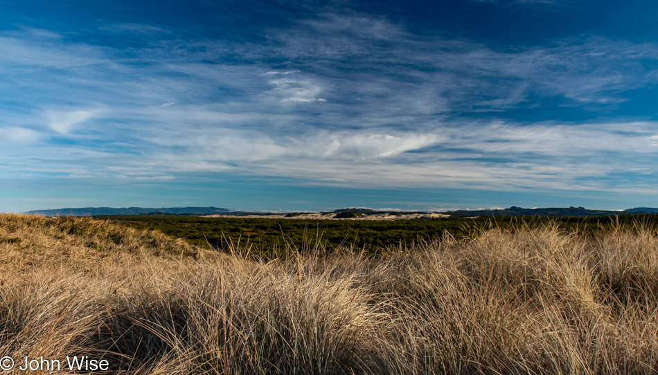
With 375 miles ahead of us today, we will not be able to stop everywhere, but that doesn’t mean we won’t push things. We walked over the sand dunes here at Siltcoos Beach, hanging out for about a half-hour.
Maybe because we don’t live here, we have to hold fast to these images and memories, immortalizing them on these pages so we can always refer to them. I wonder if those who live in these places put as much emphasis on seeing intently what might be too easy to take for granted.
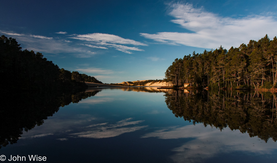
Another short drive and we pulled over to Honeyman State Park, a park that we had somehow missed stopping at on any of our previous visits to Oregon. The air was still, and with the sky speckled with light, thin clouds, we were treated to a perfect reflection of trees, sky, sand dune, and clouds on the small lake.
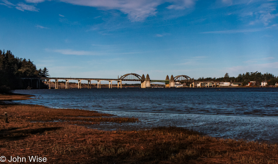
That’s the Siuslaw River Bridge over there, and we’re at the Prichard Wayside on the south side of Florence as we take this opportunity to see this bridge from a different angle. If time allowed, we’d make it a project to capture all of the coastal bridges of Oregon from various perspectives and different lighting situations; heck, I should include that we’d like to do the same for the nine lighthouses out here, too.
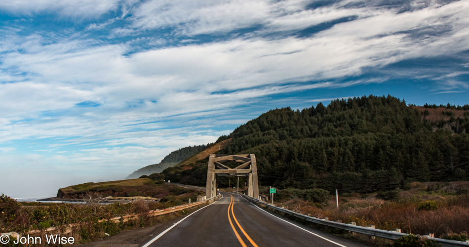
Big Creek Bridge is just north of Carl G. Washburne Memorial State Park, which we are indeed passing by without a brief return visit.
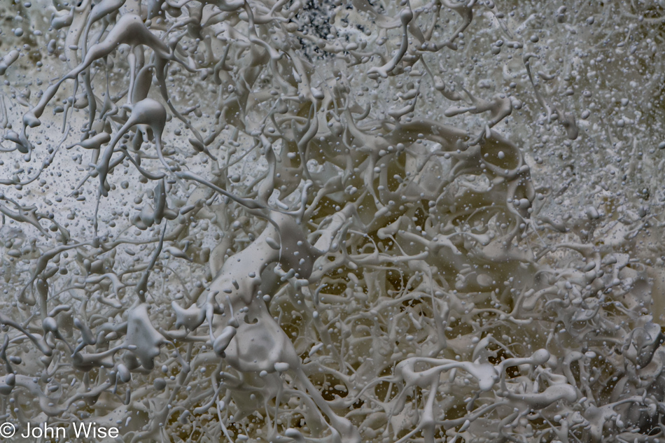
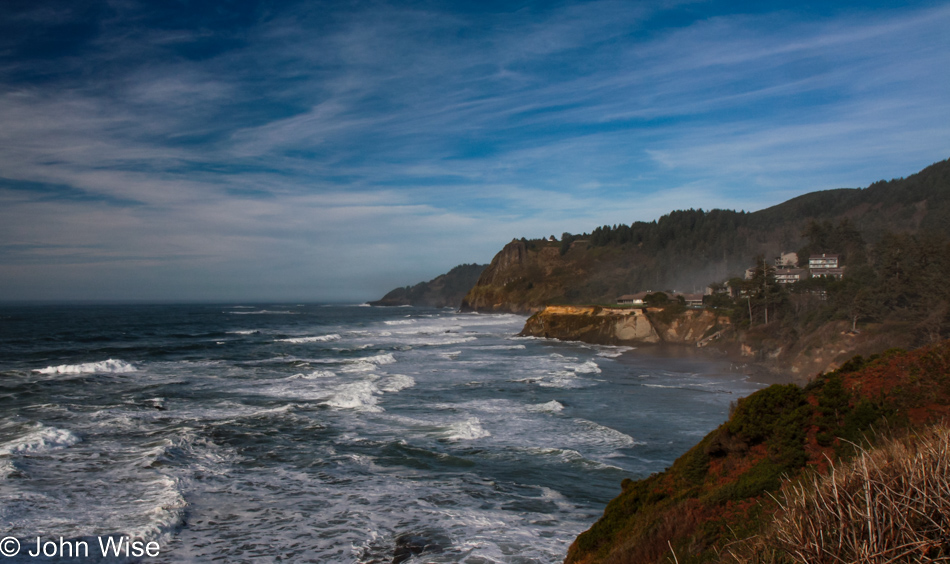
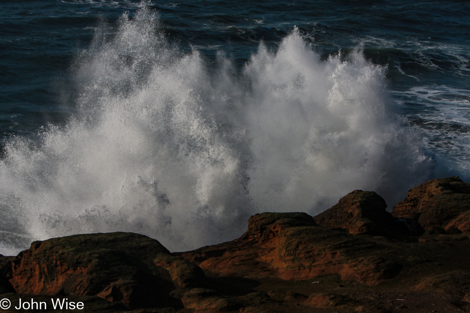
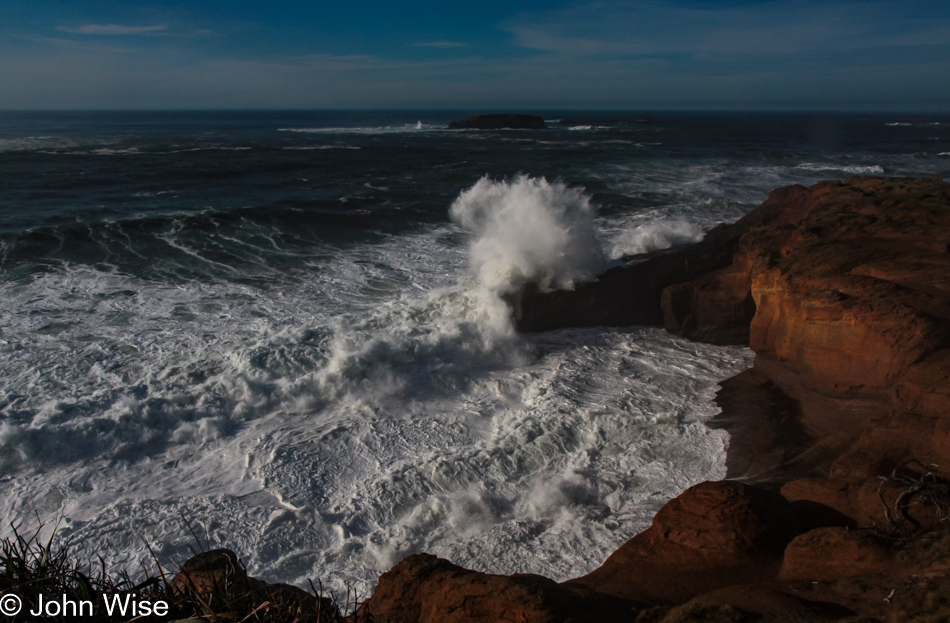
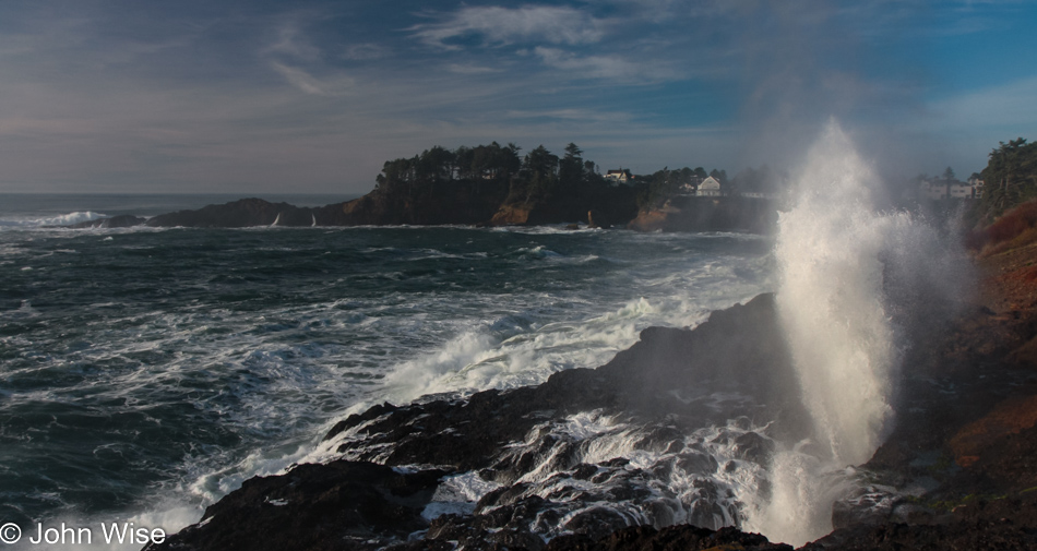
The same could not be said about our next stop as we pulled into the parking lot at Devils Churn for a brief stop.
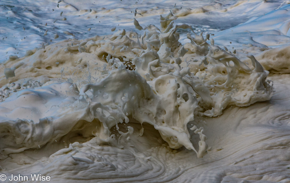
I swear, we’ll only be here a few minutes.
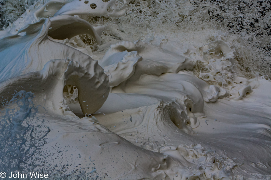
Yes, Caroline, I’m almost done. I think.
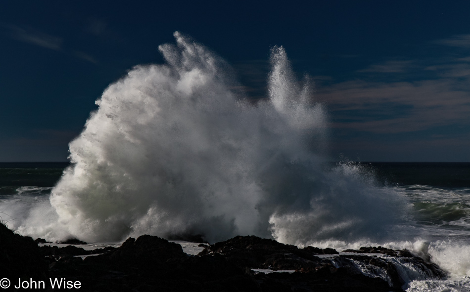
But how can we leave when things are this spectacular?
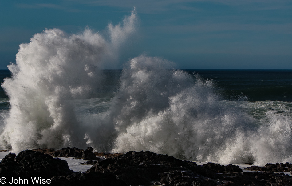
Well, it required nearly an hour for us to pull ourselves away and get back on the road. Let me correct this before Caroline does: it took nearly an hour of prodding. In Yachats, we drove next to the bay and marveled at the rough surf under the deep blue skies and then had a lunch of clam chowder at Mo’s Annex in Newport. Obviously, there are no photos of this segment of the drive as maybe, just maybe, I was a bit too indulgent at the Churn.
In Otter Rock, we threw a last look into the Devil’s Punchbowl.
No, I won’t get lost in the crashing surf here, too; I know we still have about 300 miles ahead of us, and it’s after lunch.
Yeah, but I would have missed this one had I jumped back in the car.
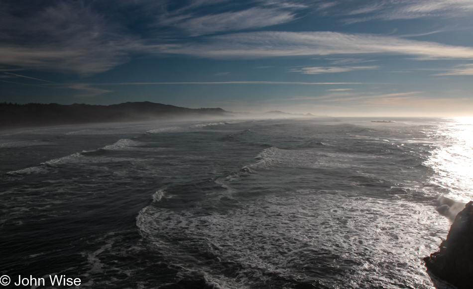
We’ve only been here for about 15 minutes.
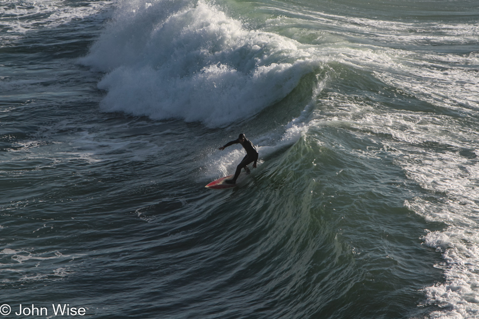
That is a gutsy surfer on a good 8-foot wave on a late fall day in these cold northern waters. Now we can get back to the car, and we’ll just keep going all the way to Seattle for our flight home.
Wouldn’t you know it, we ran into another distraction in Depoe Bay, where we watched water shooting no less than sixty feet into the air. This shot is not of that 60-footer; just keep scrolling.
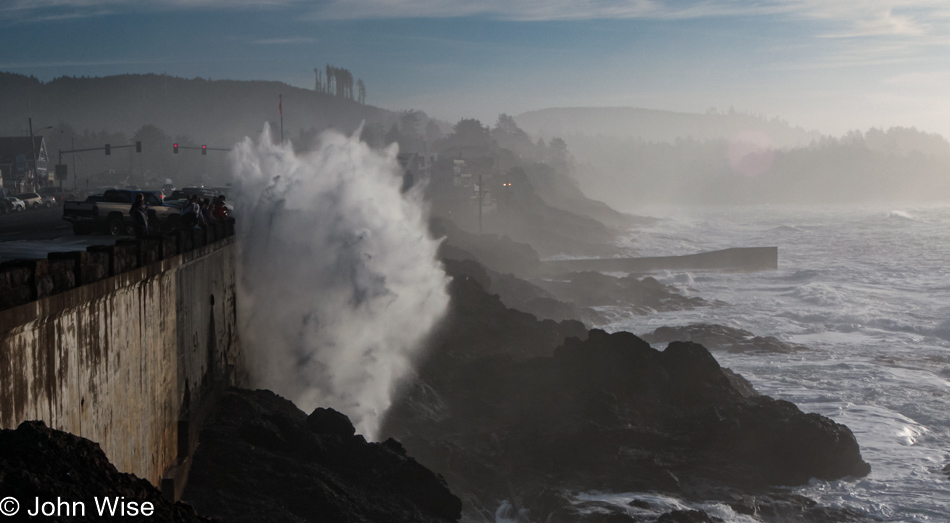
Getting closer…
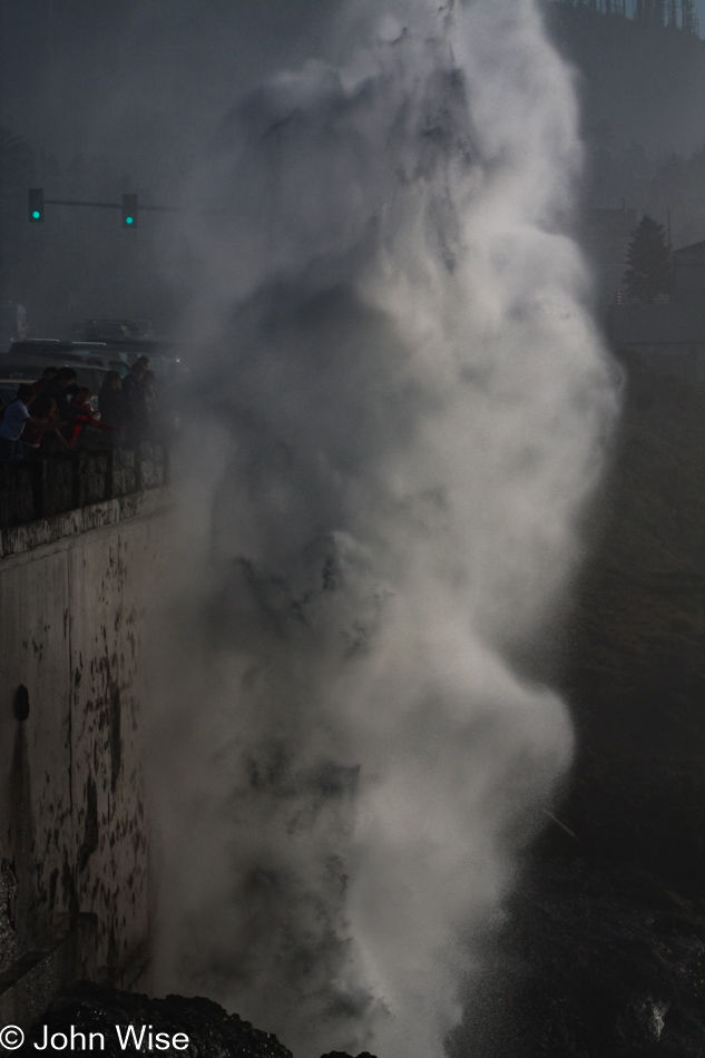
A spouting cone was working hard as the tide was at just the right height for this horn to spout a jet of misty water high in the air, accompanied by the onlookers’ oohs and aahs. With the perfect shot in the camera, we can take our drive north seriously now.
By the time we reached Siletz Bay, the sun was low in the sky, and we were trying to convince ourselves that we really should stop making all these roadside visits, but the day was so beautiful, and we suckers for beauty were mere moths drawn to the light. Click here to compare to the photo I took of the same place three days before.
Under a pink, lavender, and dark blue sky, we reached Tillamook with the hopes of nabbing one more sandwich from the Blue Heron Cheese Company, but unfortunately, we were more than a few minutes too late. We arrived in Seattle, Washington, sometime late in the evening with heads full of terrific Oregon memories from our 10th visit to the state.