There are so many places in between that we never document, and thus, we forget those stops along the road. While I try to record our travels, the photos I capture are not always worth sharing. Even though an image was taken because of the enchanting nature of its subject matter, sometimes the quality just isn’t there, and some photos are simply ugly shots. As I prep pictures for these posts, there can be a high level of disappointment that I didn’t capture what I thought I had, and so with posts getting long enough when I end up with 15, 20, 35, or more photos, I neglect telling you about the unpictured places. Take this morning. We started in the old town of Gallup, New Mexico, but we were surrounded by homeless wanderers, and while we helped the first young couple that asked with cash, this was going to be overwhelming so we left. Since it was so early on a Sunday morning, we weren’t able to stop in at Mary Walker’s shop, Weaving in Beauty. I took a photo of the front door, but upon looking at it now, I find the image boring; yet we were there, and without this note, it would be forgotten.
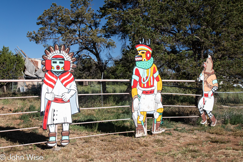
Pulled over at Joe Milo’s Trading Company in Vanderwagen for no other reason than our attempt at taking photos of the Katsinas along the fence line. There are so many beautiful, larger-than-life Katsinas here, but the background isn’t ever all that great. I think they work best as objects that catch your eye as you are driving down the road and draw you into the trading post.
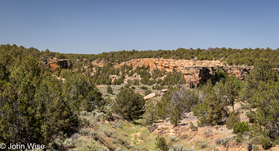
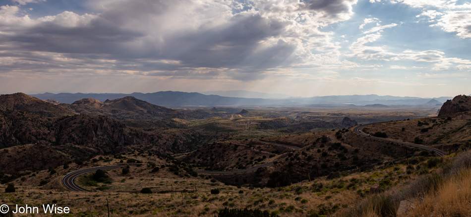
Heading south out of Gallup, we’d already established that we would be taking the scenic route with a slow drive over the landscape instead of getting on Interstate 40, which would have zipped us home in less than 4.5 hours. So, after I passed a paved road heading north on our right, I hurriedly slowed down to make a quick U-turn and see where this side road would take us. Here we were, driving up Cousins Road, trying to avoid looking at the map and just waiting for the pavement to give way to dirt, but after passing through Chi Chil Tah and reaching Jones Ranch Road, we decided to turn around and head back to our highway on a slightly different path.
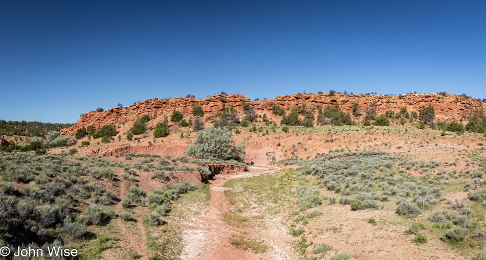
We turned right on Oak Mesa Road, as it was paved, and looked to connect to Smooth Mountain Road, which was further east and had caught our attention on the way out. By the way, I dare you to try and find some of these names on Google or Bing Maps as they are listed officially with names like County Road 6 or Indian Service Road 7010, but when you drive through here, you’ll see actual street names and not the road numbers, go figure. Once we reached Smooth Mountain Road, it was almost smooth, as smooth as a gravel road can be, I suppose.
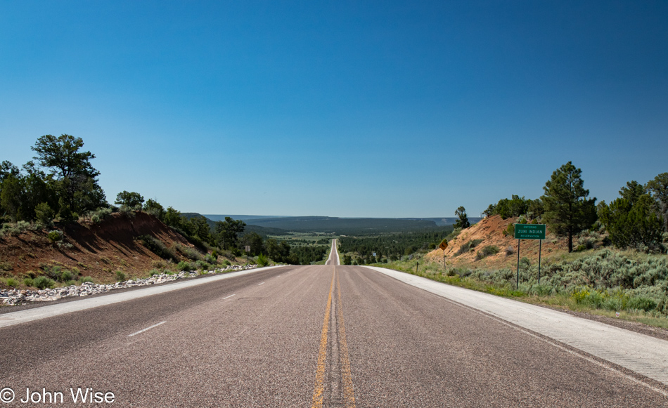
After about an hour, we were back on the road taking us south, a road number that coincides with our area code: 602. It was just over a year ago that we spent the weekend right out there, straight ahead in Zuni, at The Inn At Halona.
The entire time we were driving down Route 602, we were nearly certain that we’d never driven this specific road between Zuni and Gallup; well, at least, we couldn’t recall when that occasion would have been. It would take getting home and checking our trusty map that documents every roadway we’ve traveled on over the past 25 years to find out that this one had already been covered. How nice it is that something that might have otherwise been familiar is new again.
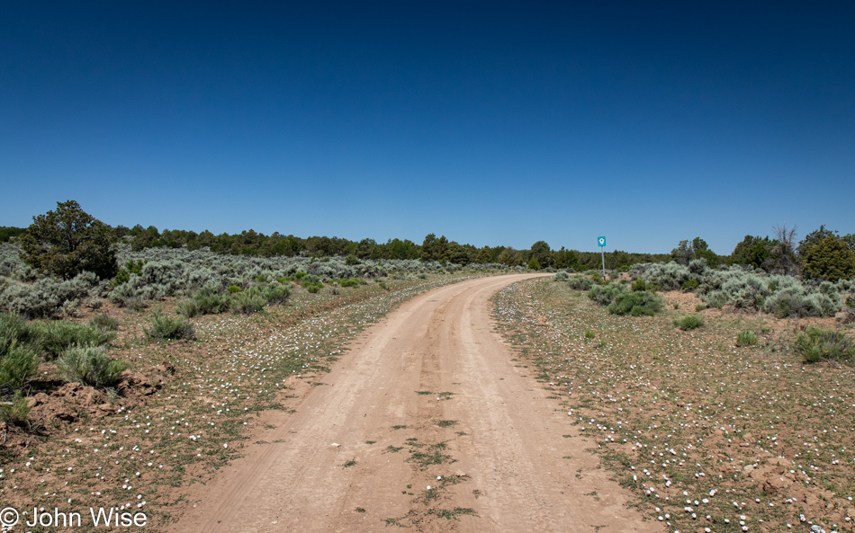
I can’t tell you where Indian Service Route 9 goes as we didn’t follow its path, but I can assure you that the flowers that lined its way were a lot prettier than you can likely tell by looking at this photo. But isn’t that the truth about everything we see with our own eyes compared to what is captured in an image?
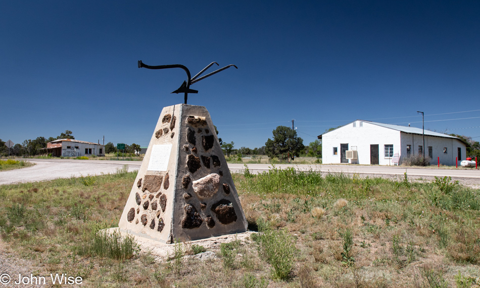
Route 602 gave way to Route 36, which took us through Fence Lake, population between 42 and 121 depending on the source, and as we stood here at the intersection of downtown Fence Lake, we were even more certain that we’d never passed this way, wrong. How this monument faded from memory will be a mystery unless we passed through here in the dark.
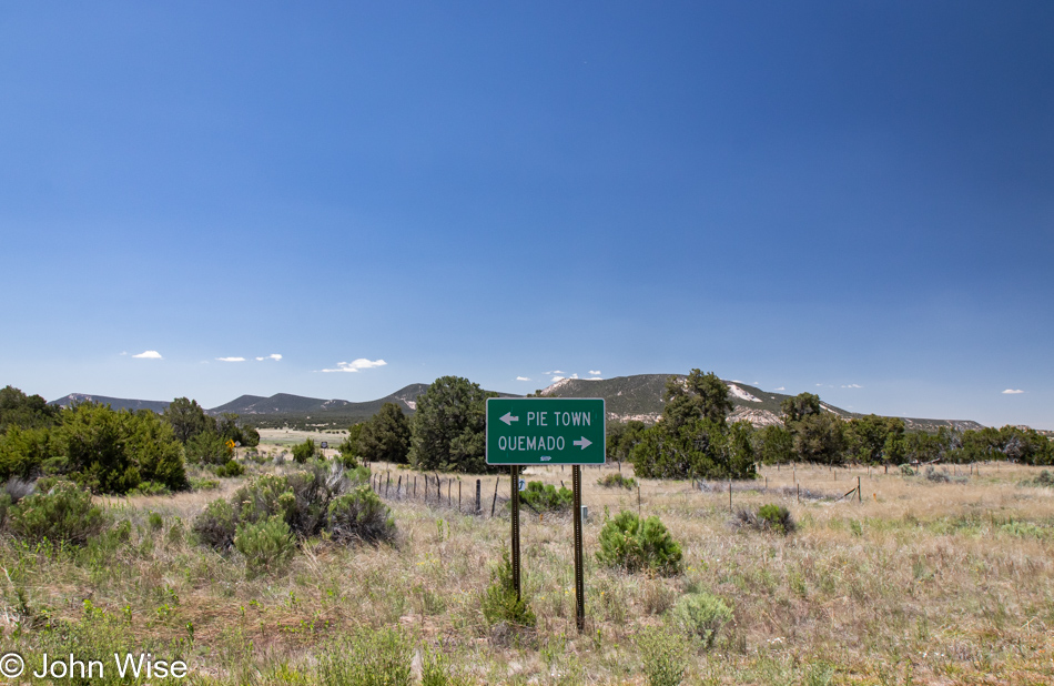
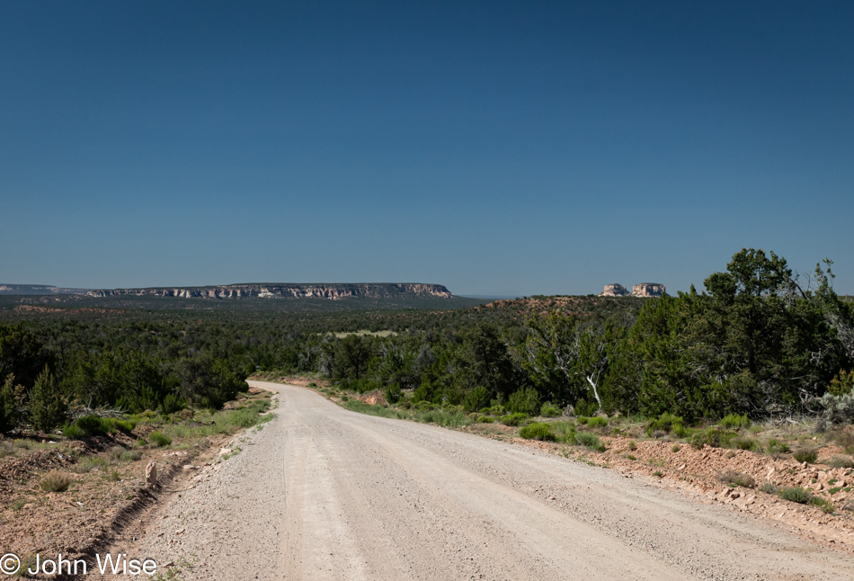
Finally, a legitimate new road to add to our trophy map of conquered roads. We are heading to Pie Town on dirt road number 603 with fingers crossed that here on Father’s Day, which is also a Sunday, one of the pie shops in Pie Town is open and not sold out or so busy that we’ll have to continue our road trip home.
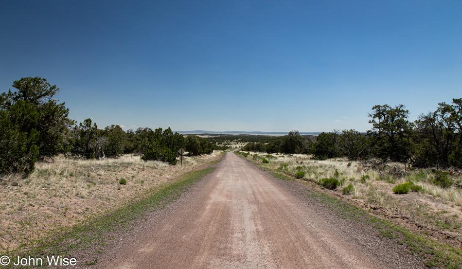
Only 23.5 miles of dirt, gravel, and washboard lay ahead, and once we’re done bumping down this dusty trail, we’ll be delivered to the world-renowned Pie Town, USA. In case you are curious about cellphone signal quality out this far from everything, you’d be correct if you guessed we had no service, and should you wonder if that makes us nervous, it does, but I’d never voice that while we are out here lest I jinx us and it turns out that we really could use a phone to help us with a disabled car or some other issue.
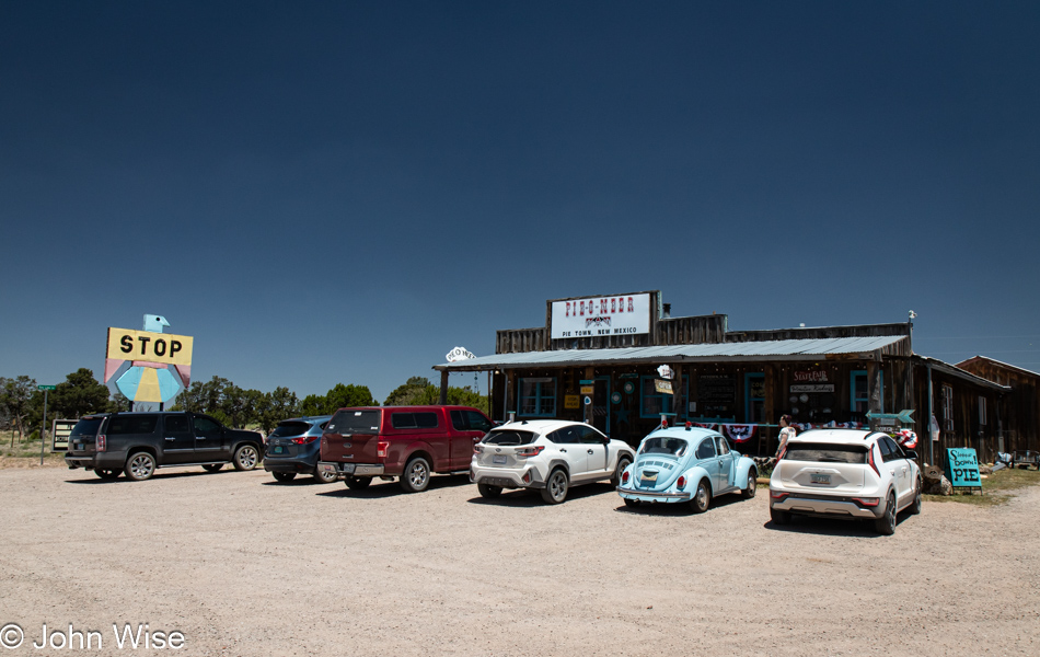
Pie-O-Neer in Pie Town is not only open, but it’s not nearly as crowded as feared. What’s more, they still had New Mexico apple and green chile pie available. The Pie-O-Neer Pie Cafe offers meals too, but you won’t be choosing what you want to eat as they feature a fixed menu, you can take it or leave it. Today’s plate was Mexican-themed, and we said, Yeah!
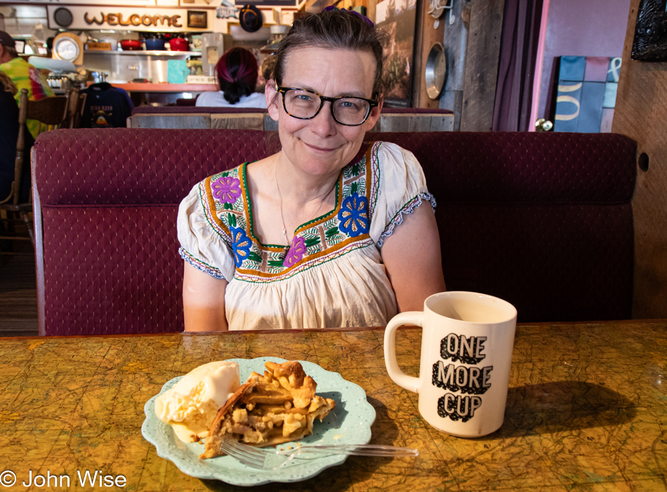
Is there anything more American than pie and coffee in a tiny old diner in the middle of nowhere? Sure, there is; that pie should be served with a scoop of ice cream.
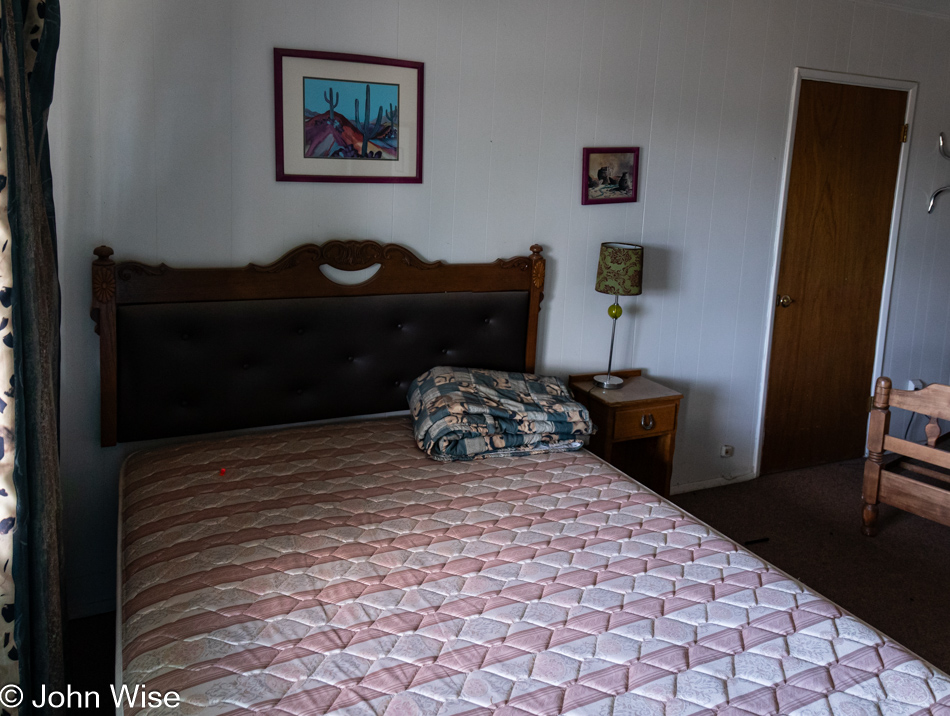
Appetites satisfied all that was left to do was cover the 20 miles to Quemado, New Mexico, to dip into a free abandoned room at the Alegre Motel and catch a nap. The only problem was that Caroline wasn’t interested in inspecting the rooms to find out which looked the coziest.

Well, if I wasn’t going to get a nap, I’ll just collect that creepy clown figurine on the right and add it to my collection of things I’m gathering from the defunct Alegre, but wait, that’s not just any figurine, it’s an “Emmit Kelly Jr Clown with Accordion” that could be worth a pretty penny. You see, maybe it’s worthwhile to explore these abandoned liminal spaces that may or may not be occupied by someone who could turn out to be your worst nightmare. I should probably keep in mind that I’m too old to sprint away from serial killers who might be in better shape and younger than me.
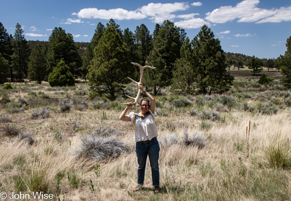
Pulled over to take a photo down the road, and Caroline, spotting some sticks next to the fence line, left the car to investigate. Closer inspection revealed that the “sticks” turned out to be a 5-point elk antler. After this quick photo, we stowed it in the trunk and had just gone to take a look for the second one when a park ranger/law enforcement truck pulled up behind our car, flashing a warning because our car was still on the road. We quickly jumped back in and continued our journey. With the antler in the back of the car, we were giant grins driving down the road, simply incredulous that we were the proud new owners of a massive antler. We talked about turning around to try and find the other one but decided this was good enough.
I’ve on more than one occasion expressed my gratitude to those who’ve hand-carved the 10s of thousands of trails across the U.S. and likely have neglected to say how much I appreciate the work that has gone into creating our vast highway system with all the small roads, paved and dirt, that crisscross our country allowing those interested to explore a landscape that will never be fully be seen by a single American ever.
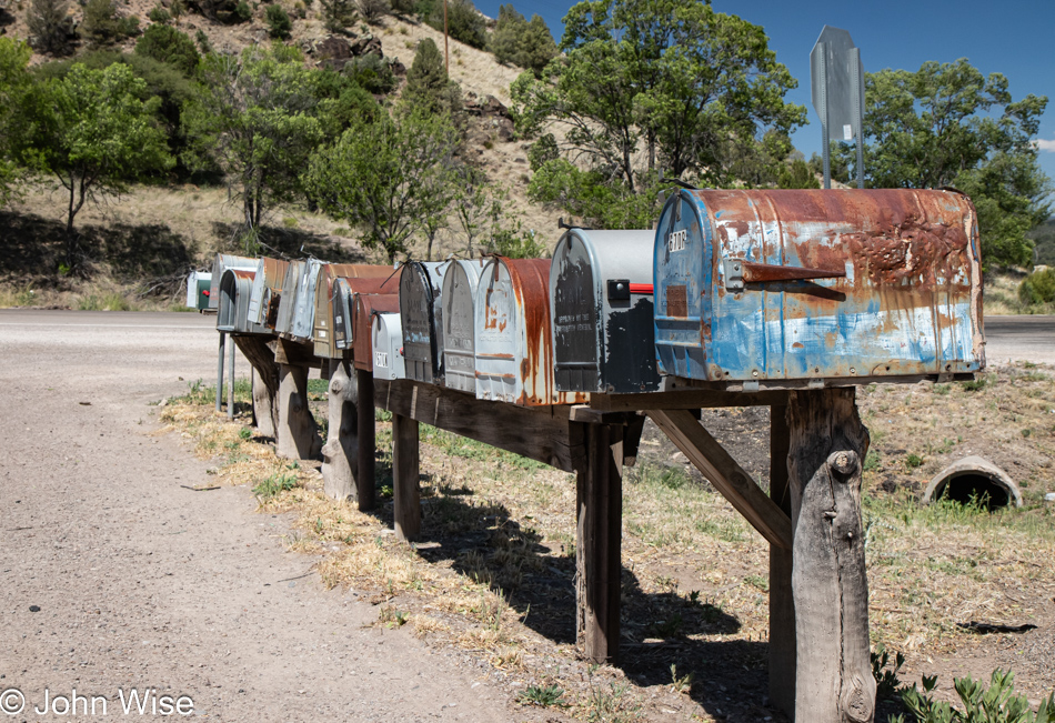
This quintessential symbol of rural life found roadside across the country may only be a mailbox, but there is an undeniable aesthetic that screams Americana, and we love the sight of them.
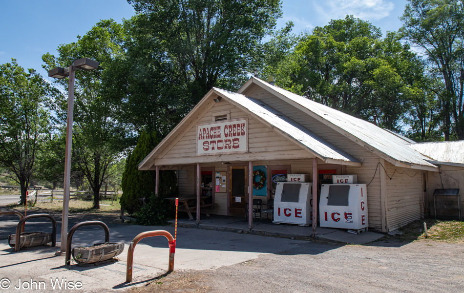
This can’t be the first time I’ll attempt to write something about a small country store, and while I was considering what to say about the Apache Creek Store at the intersection of State Highways 12 and 32 in Reserve, New Mexico, it occurred to me that should I decide to cut and paste something from a previous blog post, nobody other than an AI could know that I’ve done so and then I thought, heck I should write an entire post exclusively using recycled text. Now I have to wonder how much my brain is already doing this.
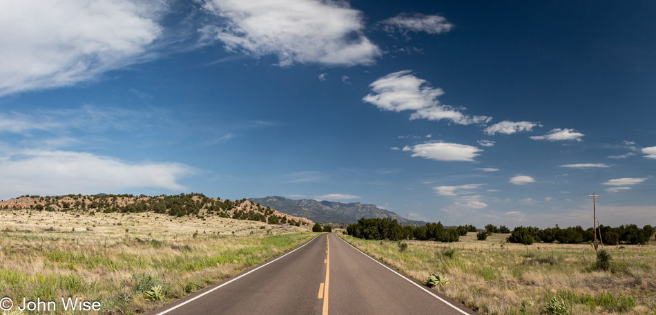
I’ll have to guess that we are already on State Route 180, about 180 miles from where we began this morning in Gallup. What you can’t see in the shot is what time it is; the deal is that we’ve already been out here for about 8 hours at this place on the road. How we turned 3 hours of driving into 8 is a mystery to us. With about 280 miles yet ahead of us, good thing we gain that hour as we cross back into Arizona.
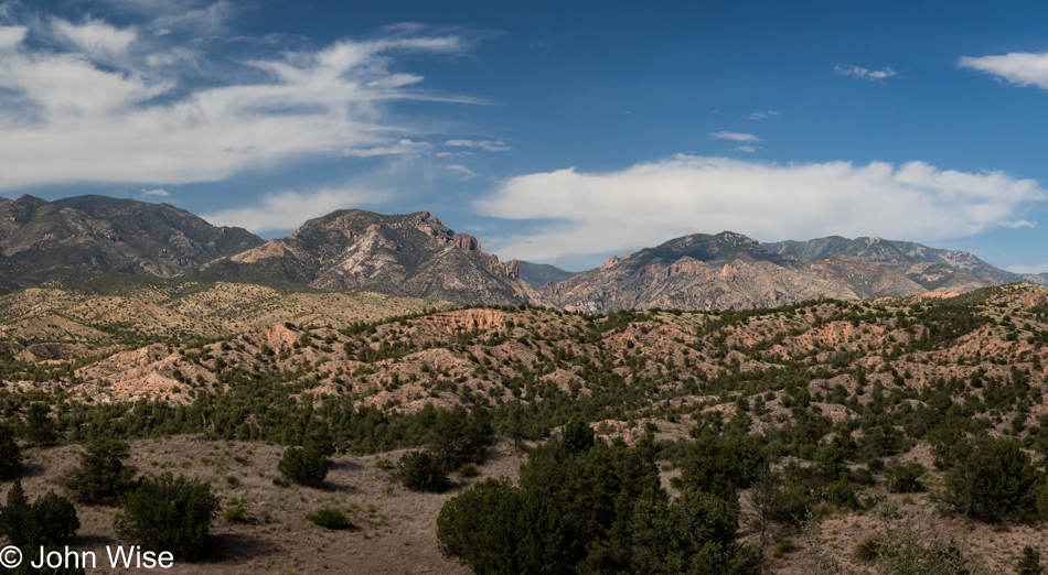
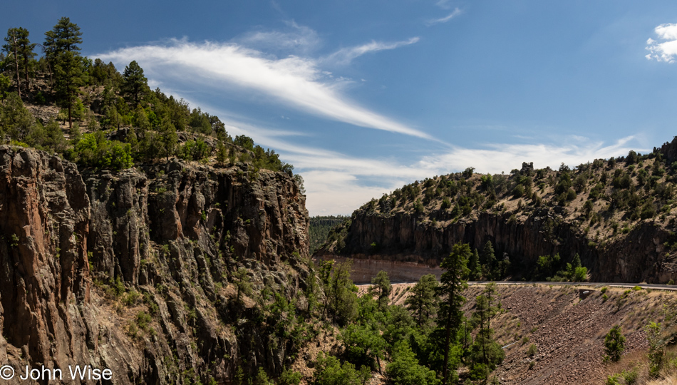
Shortly before our turn west, we stop at the Leopold Vista in Buckhorn, New Mexico to admire the landscape of the Gila Wilderness Area from this viewpoint. This spot on the map was dedicated to Aldo Leopold, author of A Sand County Almanac. The reason behind the dedication is best explained by this paragraph from Wikipedia about him:
In 1909, Leopold was assigned to the Forest Service’s District 3 in the Arizona and New Mexico territories. At first, he was a forest assistant at the Apache National Forest in the Arizona Territory. In 1911, he was transferred to the Carson National Forest in northern New Mexico. Leopold’s career, which kept him in New Mexico until 1924, included developing the first comprehensive management plan for the Grand Canyon, writing the Forest Service’s first game and fish handbook, and proposing Gila Wilderness Area, the first national wilderness area in the Forest Service system.
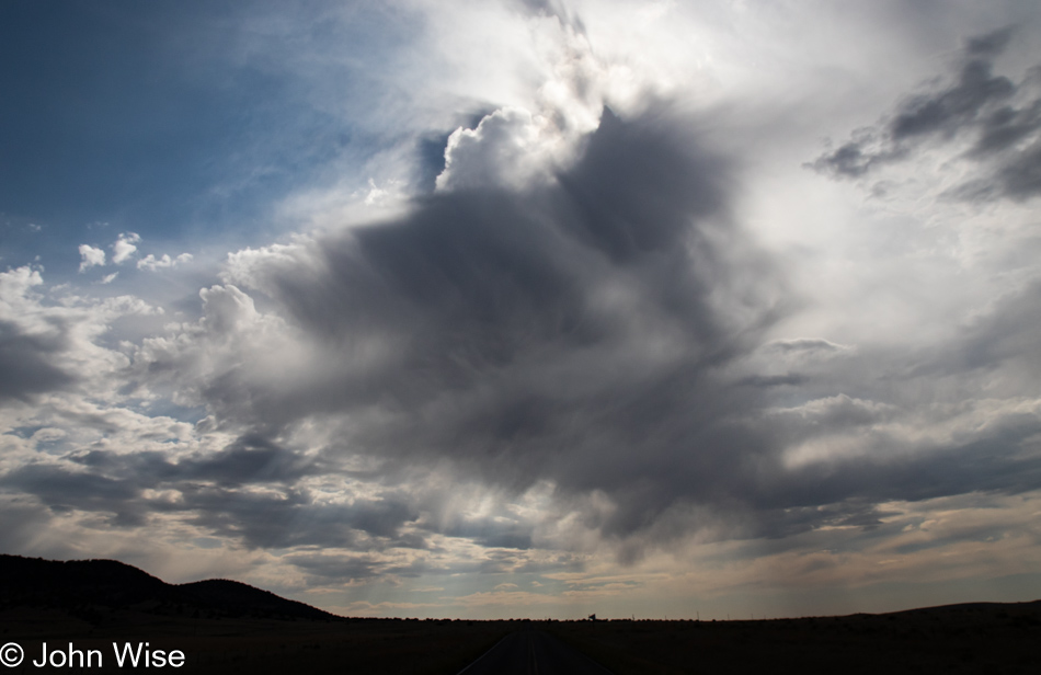
This is the wrong time of day to be driving west, right into the sun. Maybe the clouds will help protect us from being blinded.
We are well into Arizona at this point, and considering it would be smart to put an end to the incessant stops along the way if we want to be home before 9:00, how could we just pass by the Needles Eye outside of Clifton?
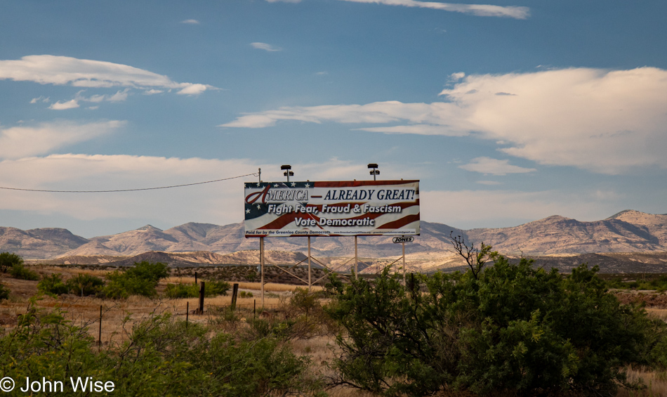
Seriously, we were finished with these stops along the way until this sign in Conservative Country stood out like a sore thumb and had us laughing as we drove by. With so many signs across the west shot to bits using various gauge guns and the old familiar pattern of the shotgun blast, how has this sign not been burned to the ground or hit with a bazooka? It reads, “America – Already Great!” followed by, “Fight Fear, Fraud & Fascism, Vote Democratic.”
Hi John, my name’s Tomo Shindo with Japanese TV production company in Los Angeles. We’re interested in using one of your photos in a Japanese TV program. What’s the best email address to get in touch with you? The photo we’re interested in is the one from SIGGRAPH 1999.
https://www.johnwise.com/1999/08/
If you could email me at xxxxxx@xxxxx, that would be great. Thank you!
-Tomo
Tomo Shindo
Production Manager