Aside from the arrow of time, does anything else truly move in a straight line? I was recently digging through a single day from 18 years ago, May 31, 2005, to be exact. It was a random Tuesday, the 150th day since I’d started blogging; I was looking at a map of the Phoenix area and saw that 51st Avenue ran south of the valley, spilling out of Laveen before entering the Gila River Indian Community. Back then, I was, for the most part, only posting one image per blog entry because, with the modems of the day, photos were bandwidth-intensive.
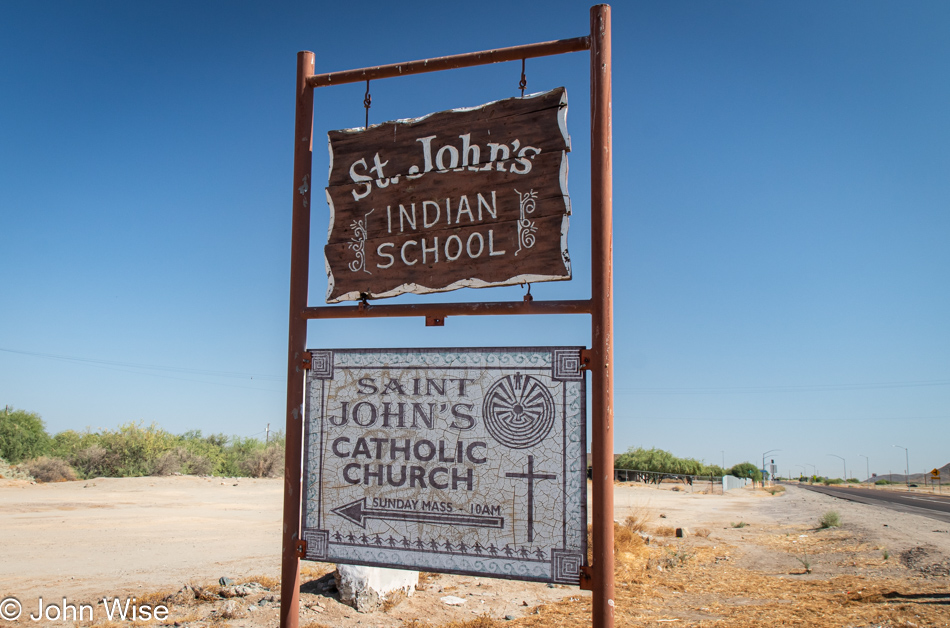
Over the past years, I’ve been trying to flesh out these brief missives by returning to the old photos and trying to identify other images that might have been worth sharing but were left behind due to the limitations of the time. And so it was when I encountered this solo trip that saw me heading down past the St. John’s Indian School in Komatke, cruising through the tiny town of Maricopa with a population under 1,500, driving over to Gila Bend, and then for some strange reason, turning around to drive to Sacaton, Arizona. With those images fresh in my mind and the fact that Caroline and I would not be taking a long 4th of July trip somewhere, I suggested that we retrace some of the steps of that old drive, and that’s just what we’re doing today.
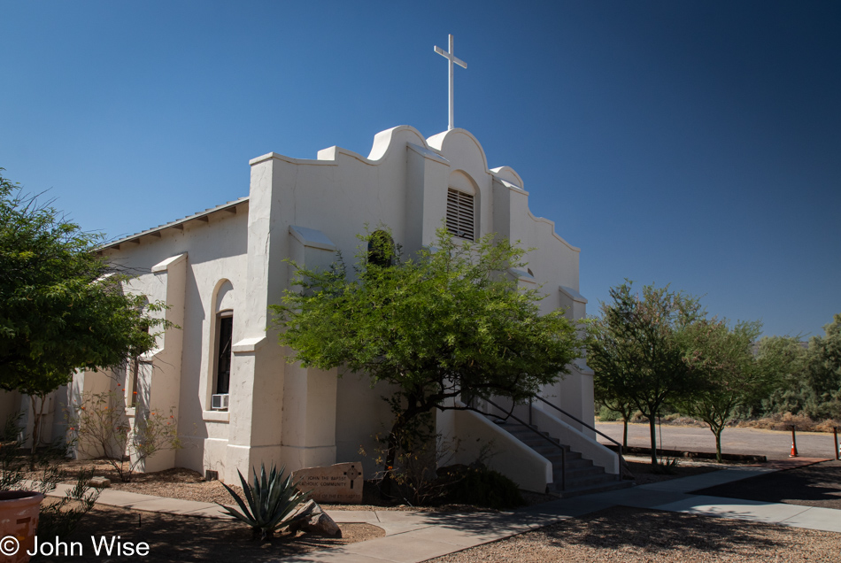
While the old sign and Catholic church still exist on the lands where the St. John’s Indian School once stood, everything else has been wiped off the map. We ran into a young friar, Brother Damian, who is yet to enter the seminary, and asked if he might know what happened to Deacon Cline Anselmo I’d met on that visit in 2005. Brother Damian knew nothing of the man as he was relatively new to the order of the Franciscan Friars of the Holy Spirit, which had only taken over the property some years ago when things were in quite a state of disrepair. As I looked around standing near the church, nothing much looked familiar.
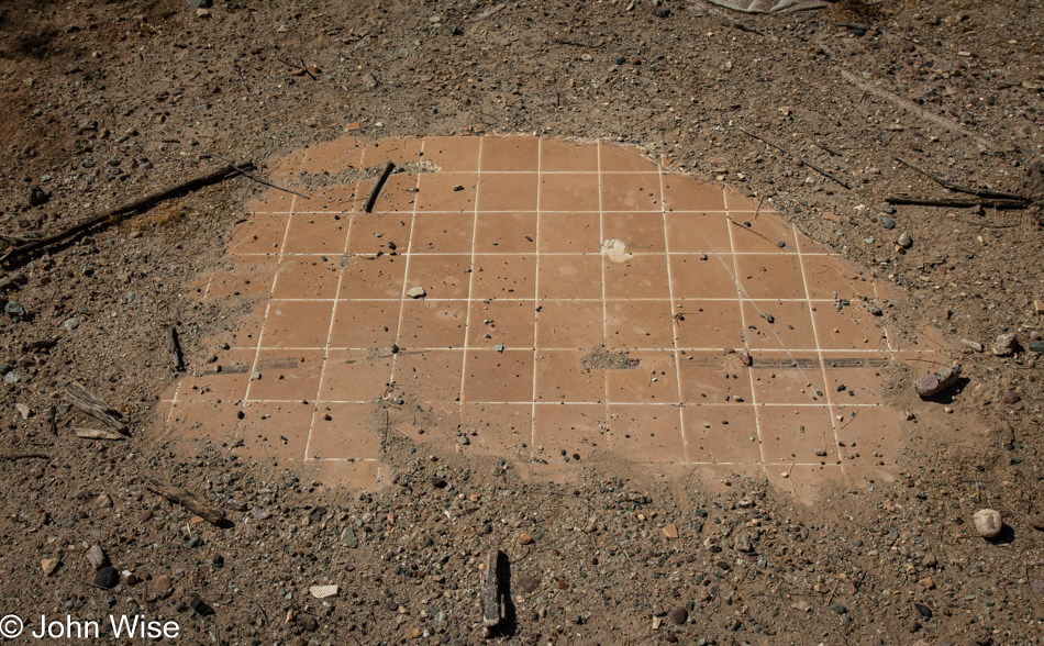
The grounds have been cleared of the old ruins and foundations of the boarding school that once stood here. Walking the periphery, we were able to find some foundation relics and this small section of floor that was once part of a bathroom. I know it was a bathroom because later on I checked my photos, some I’ve not shared, and sure enough, there is this tile pattern and two toilet drain pipes in one of the images. Somebody wasn’t very effective in hiding this. Back in the main courtyard, we walked around looking for any hints of what had once been here, and sure enough, there was a half-inch of rock covering the floor of one of the old buildings. I get the sense that somebody is hiding the shame of past transgressions. Click the link in the top paragraph if you are interested in seeing more from my visit 18 years ago.
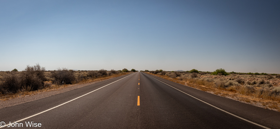
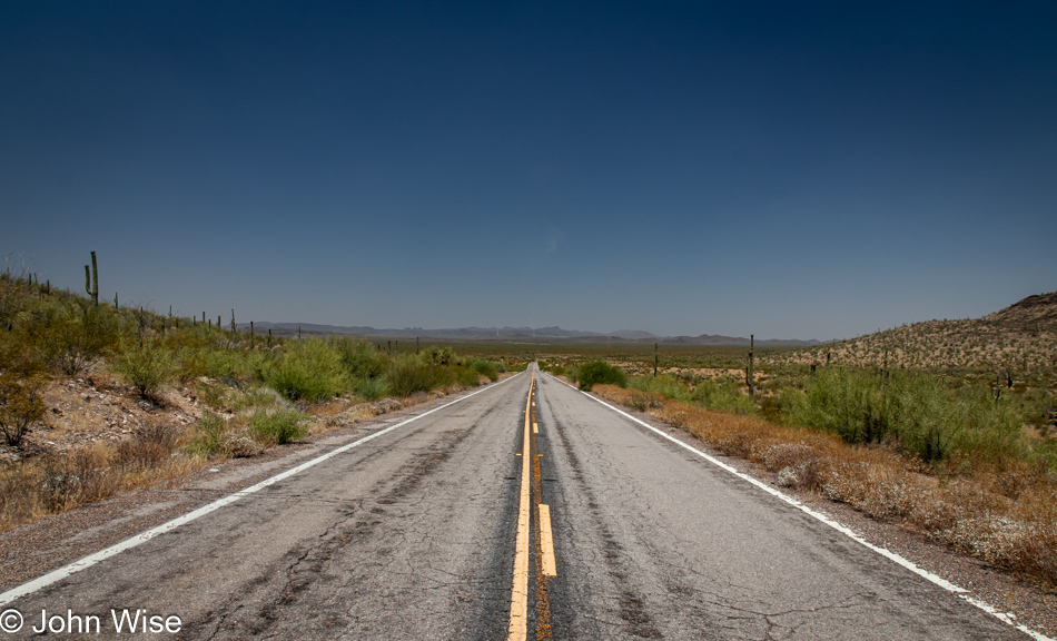
I will be sharing a lot of beautiful (at least to Caroline and me) locations today that are often connected by long flat stretches of road leading us through the middle of nowhere. This is Beltline Road on the Gila River Indian Community, driving southeast until we turn south on the John Wayne Parkway, a.k.a. State Route 347 that took us through Maricopa. At the beginning of this post, I intentionally mentioned that the population of this town was under 1,500 when I first passed through in 2005 because today, as Caroline and I drove through this ugly, joyless outpost of everything that is wrong with modern American life, franchises, uniformity, and doltishly named communities such as Cobblestone Farms and Rancho El Dorado, the population has ballooned to over 70,000 with absolutely nothing out of the ordinary or stylish anywhere to be seen. Maricopa is a community of banality for the conformist blandness that found a home they could afford while only requiring an hour and a half to drive to work up in Phoenix.
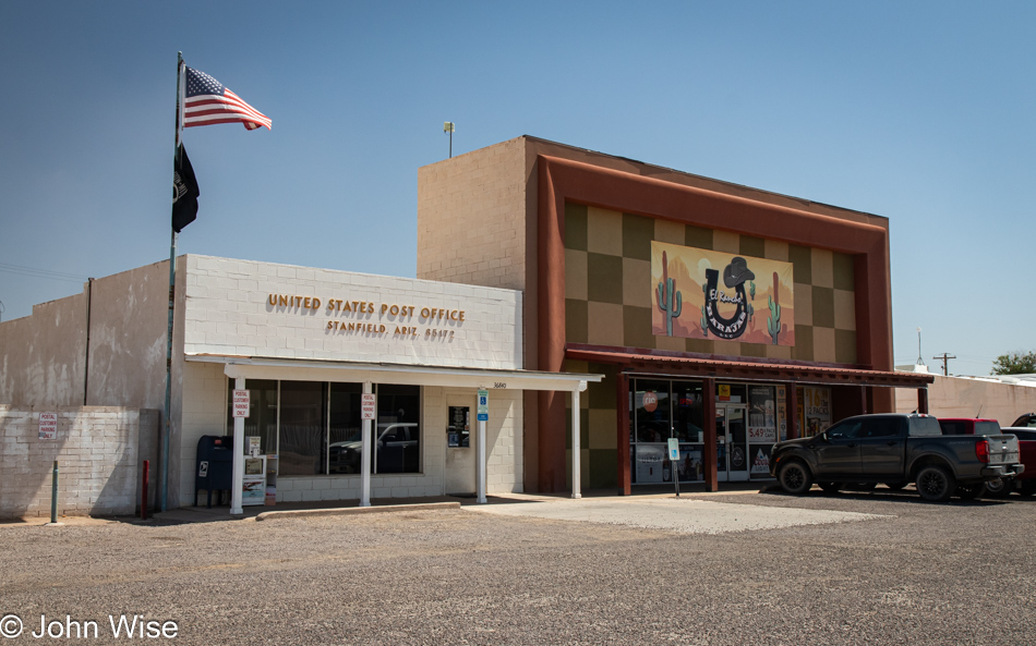
Just prior to entering the downtown area of Stanfield, Arizona (pictured), we passed by a rather large feedlot and dairy. While it looked like there were millions of cows, I’m informed by multiple internet sources that there are about 12,500 dairy cows and about 52,000 steers milling about under the blistering sun at this particular lot in Stanfield. According to the Arizona Beef Council, there are only 980,000 head of cattle in the entire state, so I guess I’ll have to accept that there are not millions of cows out here.
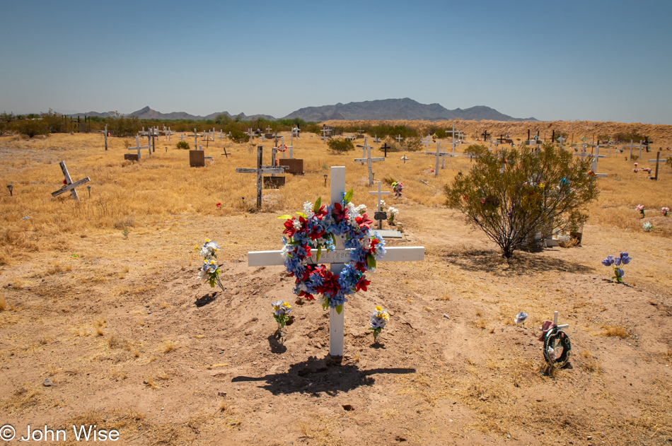
On the southern end of the town of Kohatk, Arizona, in the Tohono O’odham Nation, was this cemetery that caught Caroline’s eye. I was struck by how many graves were not much longer than about 2 feet long, meaning they were the final resting place of babies that hadn’t even made it to toddler age. While this has me wondering about infant mortality on Native American lands, I can’t imagine that information is easy to come by.
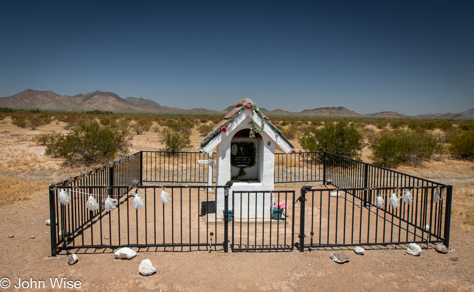
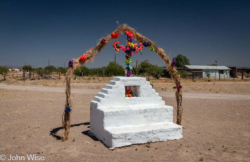
Not much further south of Kohatk was this rather extravagant roadside memorial in honor of Jenelle Jolynn Juan, who passed away in 2006 at the young age of only 16 years old. These memorials and shrines to lost loved ones are found far too frequently distributed across the lands of the Tohono O’odham, and due to their locations next to roads, we assume that it was here where they died.
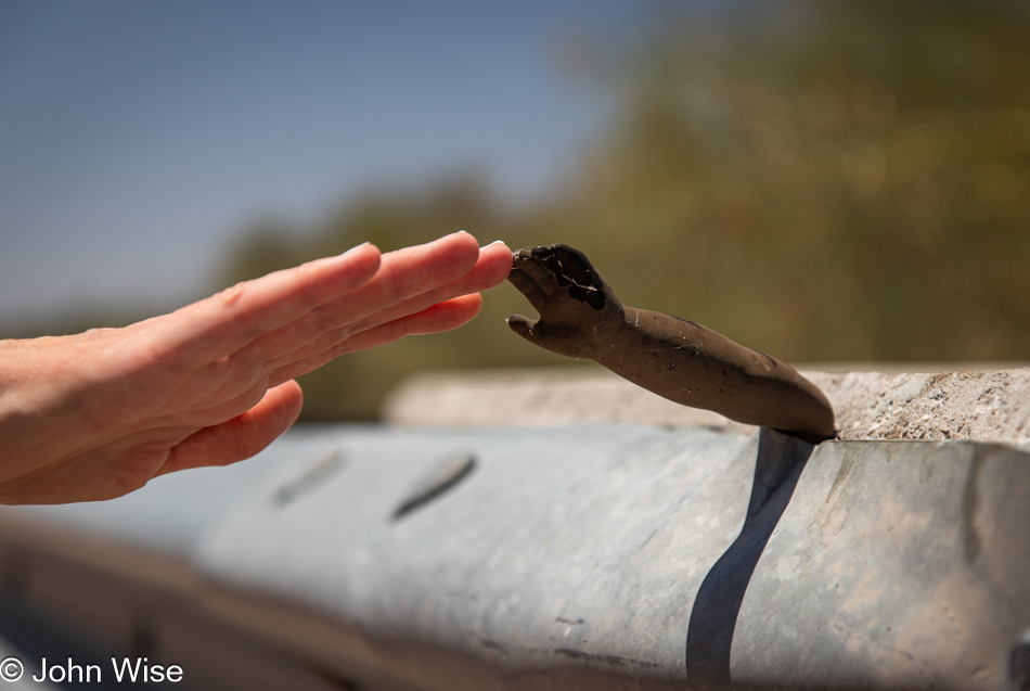
Reaching out to touch the other and a bit of the past. Two years prior to this re-encounter with the disembodied baby arm jammed into a guardrail of a bridge over an unnamed wash near Santa Rosa; we stopped after I somehow caught sight of the arm that was still there; click here to visit my post titled Desolation Road to see the original image. When I was walking up just before taking the photo, I inadvertently startled a beefy steer of massive proportions down in the bed of the wash because it bolted, making quite the commotion and was snorting kind of ferociously; I whipped the camera around but capturing his backside wasn’t very photogenic. He was a beautiful beast with serious musculature and although I continued over the bridge to position myself for a better photo, he was having nothing to do with it and moved off into the brush.
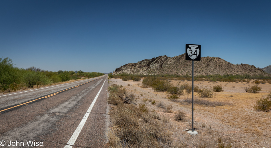
Good thing that hand from the past reached into my conscience because, at that point, we were already about 500 feet beyond Indian Route 34 that we were supposed to turn west on. We’ve never been on this road before, but if all goes well, meaning we don’t encounter some rutted or sandy dirt road that turns us around, we are heading to a place we’ve never been before and where few ever travel.
So much beauty exists in the desert that it likely has me using the word too often in referring to this state of glorious charm; as a matter of fact, I wouldn’t blame anyone reading my posts over time to believe the word beauty occupies a permanent spot at the tip of my tongue. There’s so much I see that provokes this exclamation of extolling the grandeur I spot in life it’s as though I’m drooling language, and my vocabulary is limited to beautiful, wow, and amazing.
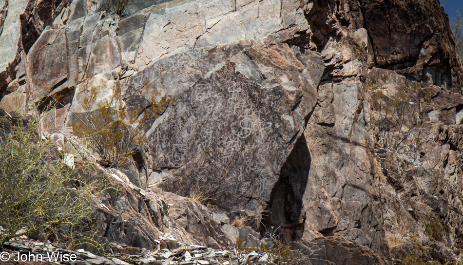
When looking at petroglyph panels, do you, too, get the idea that Einstürzende Neubauten might have been influenced by Native Americans of the Southwest for the creation of their logo? This got me wondering if I was asking something that was obvious to everyone else, and sure enough, there are various thoughts about the origins of the logo, with someone suggesting it was an Olmec Native American influence though Blixa Bargeld has stated it was of Toltec inspiration. Wow, a lightbulb has turned on for me now. Considering that Chaco Culture in New Mexico was coming into existence around the height of the Toltec Culture and how some theories have seen Chaco as a trade crossroads, did the stick figure we see in petroglyphs move from the south of Mexico near Veracruz up to our region? What other petroglyph symbols might have taken influence from ancient cultures found south of the U.S. border?
On the final approach to one of our primary destinations, we see this arch in the distance, which must be why the next village on Indian Route 23 is named Ventana. Should you not know, Ventana means window in Spanish.
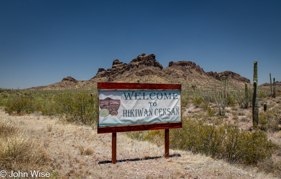
The sign welcomes us to Hikiwan Ceksan, which I believe translates to Hikiwan District, which is one of eleven districts in the Tohono O’odham Nation.
How have we missed traveling through such a vast area of Arizona? Where are the Tohono O’odham PR people? I suppose with only 13,055 people of the Tohono O’odham Nation living on the reservation of 2.8 million acres (11,330 km2), there are not a lot of people to work the sights and the concessionaires that would be required to host tourists. Something else I learned today, among Indian lands in the United States, the Tohono O’odham Nation is only second in size to the Navajo Nation, which has a population of approximately 170,000.
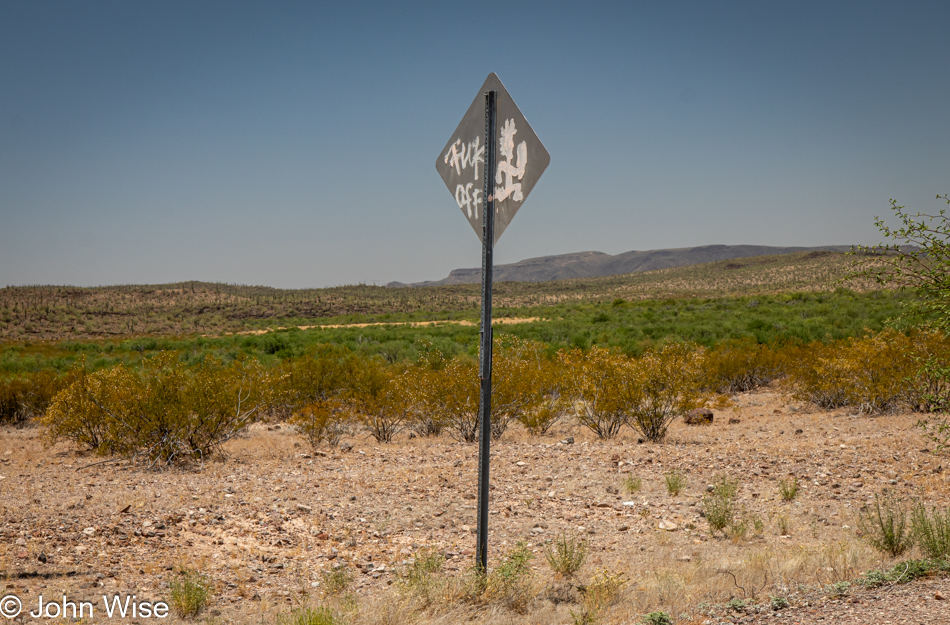
Caroline might prefer I heed this sign and that we “Fuck Off” and run the other way, as she’s suffering a mild amount of embarrassment due to her husband’s puerile fascination with paying a visit to where we are stopping next.
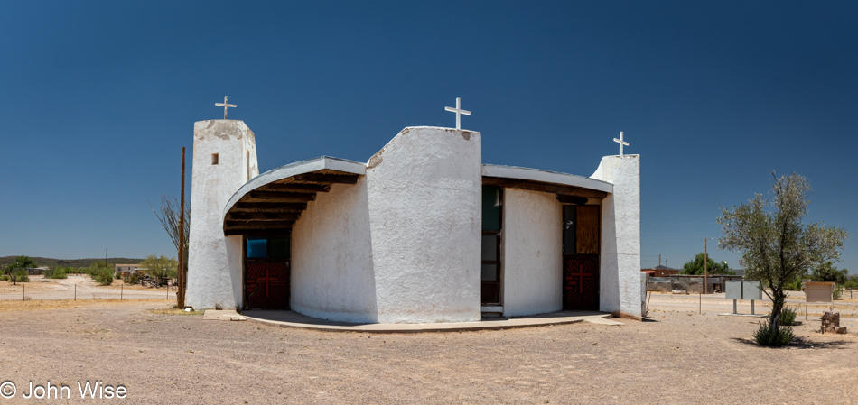
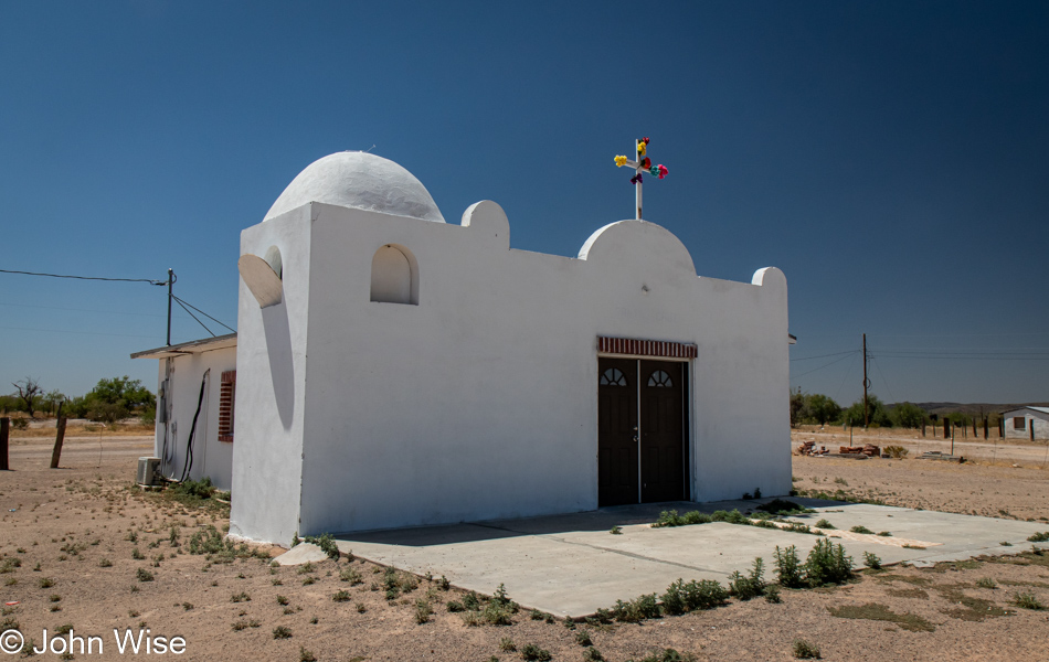
We have landed in Kaka, Arizona. Search for it on Google and check the Wikipedia article on Kaka, Arizona, and you’ll see that I’m not shitting you, we are in Kaka. Not a popular destination for sure. I could only find one other photo of this Catholic church on the entirety of the internet, but it’s a beautiful building, though neglected. As I’ve already shared, we are in the Tohono O’odham Nation, and in the O’odham language, Kaka is spelled either Ge’hakah or Gagka, depending on the source, and means “a clearing.”
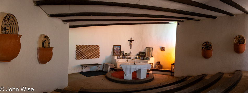
This church is a bit of a contradiction since it appears there have never been many people living out here. As of our visit today, there are allegedly about 83 people, down from 141 back in 2010. The church’s architecture is beautiful with its mostly round footprint. The interior is set up amphitheater-style and descends lower than the surrounding earth the church was built on, probably to help with cooling. With stucco pots and baskets on the walls, as you can see in this photo, there’s no mistaking that this place was built with a Native American influence. The altar is a simple affair of photos, images, candles, and a cross, with the lighting spilling in from windows on the side and near the doors. It appears mostly disused, judging from the amount of cobwebs, insects, and rodent feces (kaka) that are all over the interior space. No matter those minor blemishes, this church made our visit to this faraway place perfect.
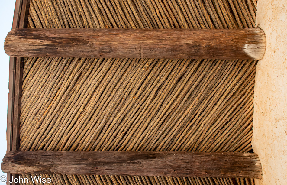
I can’t be certain, but from the information Caroline found online about integrating the environment and Western architecture with the traditions of the O’odham people, I’d guess that using these ocotillo branches seen utilized in shade structures known as Wattos here within the roof of the church was another design element that allowed the building to blend into the culture.
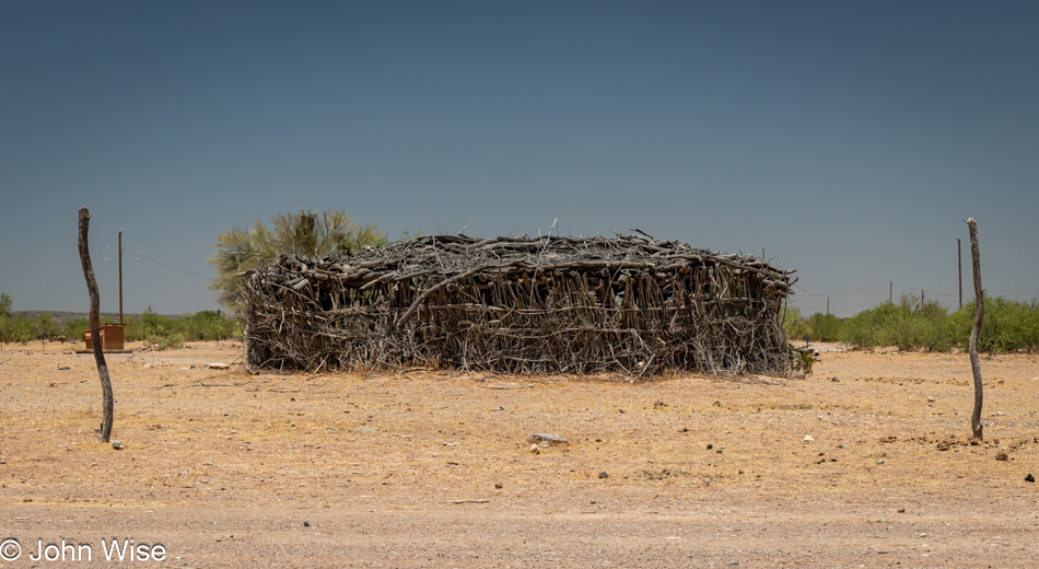
This is a great example of a Watto made of ocotillo branches and various sticks that offer shade from the midday sun. By spilling water on the dirt floor, the O’odham people effectively created a form of air-conditioning that helped them endure the scorching summers of life in the desert. While we were in “town,” not a single resident could be seen or heard; does anyone really live out here anymore? To my amazement, when I turned a spigot near the church, water came rushing out, leaving me to wonder how running water got this far out in the middle of nowhere, a.k.a. Ge’hakah.
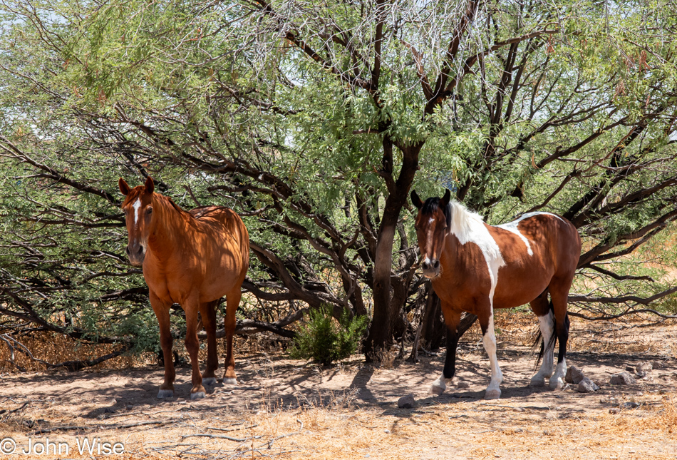
Wandering horses are always a welcome sight, though they never allow us to approach them. This was as close as I was able to get before they took off into the brush.
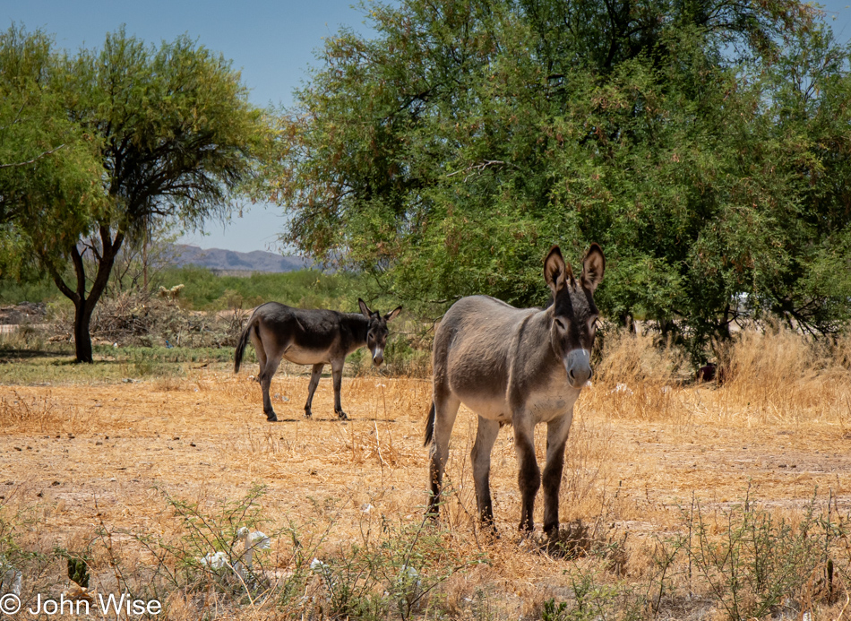
Hello donkeys, are you any friendlier than the horses about me approaching you? Nope, and off they went back to their baby donkey that hanging out in the shade out of frame. The foal was able to hit Mom up for some nursing while she and man-donkey kept a watchful eye on the guy with a camera.
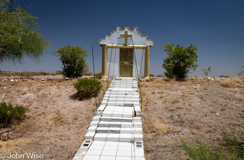
A memorial that almost made it to monument status. The door was unlocked should one feel like taking a moment to say a prayer while out back, Caroline discovered a cache of discarded glass jar religious candles and collected one to refill after we got home.
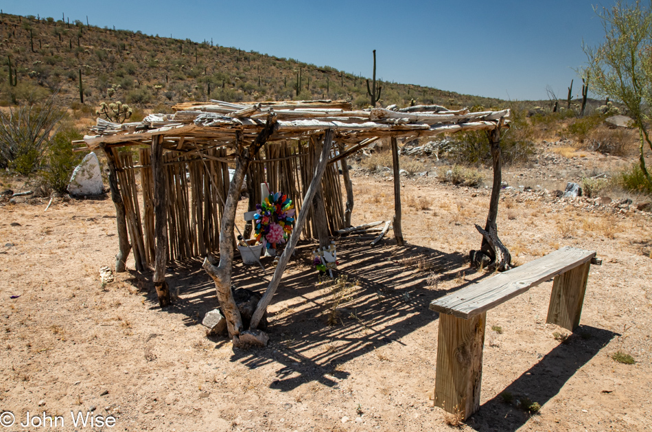
So, is this a Watto or a ramada? What is certain is that it’s yet another memorial of a life lost out on the rez.
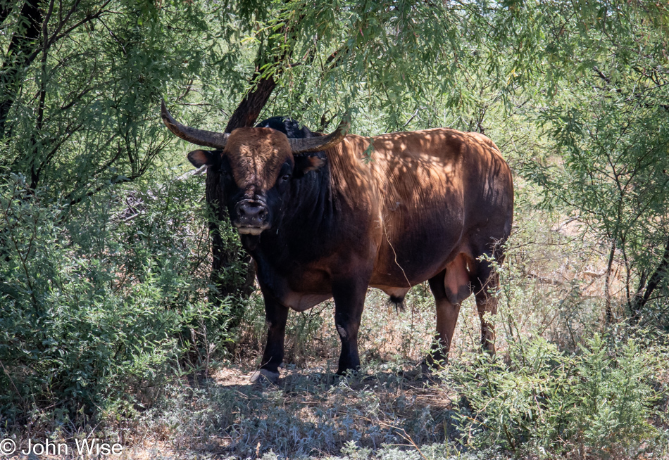
You have to ask yourself, is it the steer I’m admiring or those rather large balls?
Should we continue down Indian Route 34 for the last few miles before it meets Highway 86 or see what’s down Indian Route 7, which leads more or less in the same direction? Seeing that the slight detour is paved, we took the road to the village of Hadaison Wo’o, still on the Tohono O’odham Nation. We were about to drive by when Caroline told me to turn around because she spotted another church in the distance. This is a significant milestone worth remembering because, in our relationship, Caroline is generally not the first person to notice things in the distance. Heck, she doesn’t see the things she’s looking for that are right in front of her face! I turned the car around, and we slowly approached the building on unpaved streets. The church doors were locked, and while I was tall enough to peer through the windows on the doors, Caroline wasn’t, so I pointed the camera into the church to give her an idea of the interior, but the windows were too dirty to have something worth sharing. Right behind us, though, we spotted another interesting sight.
The way the arch is wrapped at this memorial was interesting and not something we’ve seen before here in the Southwest. As I’m looking at it today, I have to wonder if the metal bars on each side of the tiled walkway to the roadside memorial/monument four photos above this were at one time fitted with a similar setup. Not much else going on here in Hadaison Wo’o and like the other villages we passed through, not a soul to seen or heard.
Certain that we’d find a village with food or a roadside vendor this afternoon, we didn’t bring even a single morsel of sustenance with us though we were smart enough to know that we should have plenty of water, which was why we’d stopped at the grocery prior to leaving Phoenix to grab two gallons of water. By now, we were starving, and with one restaurant remaining in Ajo that we hadn’t tried yet, we opted for a late lunch at Arriba Mexican Restaurant. First, though, we made sure to dip into Oasis Coffee, which closes at 4:00. While we should have finished eating before that, we did not want to risk not having a coffee at this point in our long day.
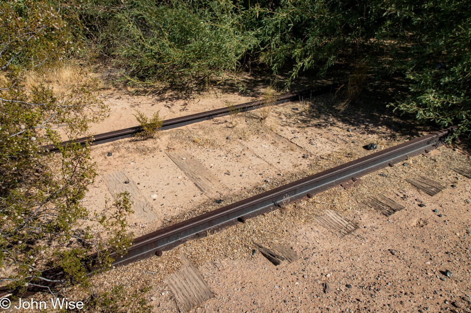
The drive from Ajo north to Gila Bend is bordered by the Barry M. Goldwater Air Force Range, which has plenty of signs warning people not to trespass. On the right side of the car, behind the fence, is a railroad track that has my interest as I’ve never seen a train over there, and how would it be that it even passed through the Air Force property? The further we drove, I could see that plants were growing in the middle of the tracks, so now I know for sure they are no longer used. Then, just before reaching Gila Bend, I spotted a small guard shack offset from the road for the Gila Bend Air Force Station that would allow us to drive over the railroad track, so I made a U-turn in order to satisfy my curiosity about the tracks. As we pulled over and jumped out of the car, I was waiting for someone to speed up to interrogate us as to why we were taking photos this close to a bombing range, but we were left alone to walk around for a few minutes. It’s obvious that these rails haven’t seen a train traveling down them for a seriously long time.
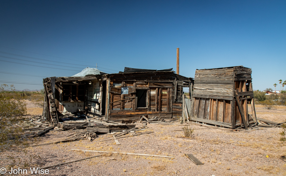
This collapsing old building (Einstürzende Altbauten) was made of old railroad ties and would never be confused with any building practice in use today. The most normal parts of it were the ancient ceramic electricity outlets and a tipped-over toilet.
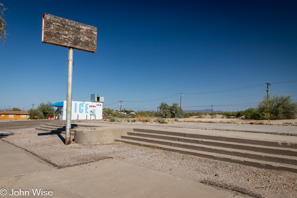
We had decided to circle around to Gila Bend because, in keeping with my trip from 2005, this was a major part of that drive, and I had photographed a bunch of defunct sites, including this one featuring steps to nowhere. As for the gas stations, they are all gone. Again, if you want to see the photos from that day, click the link at the beginning of this post.
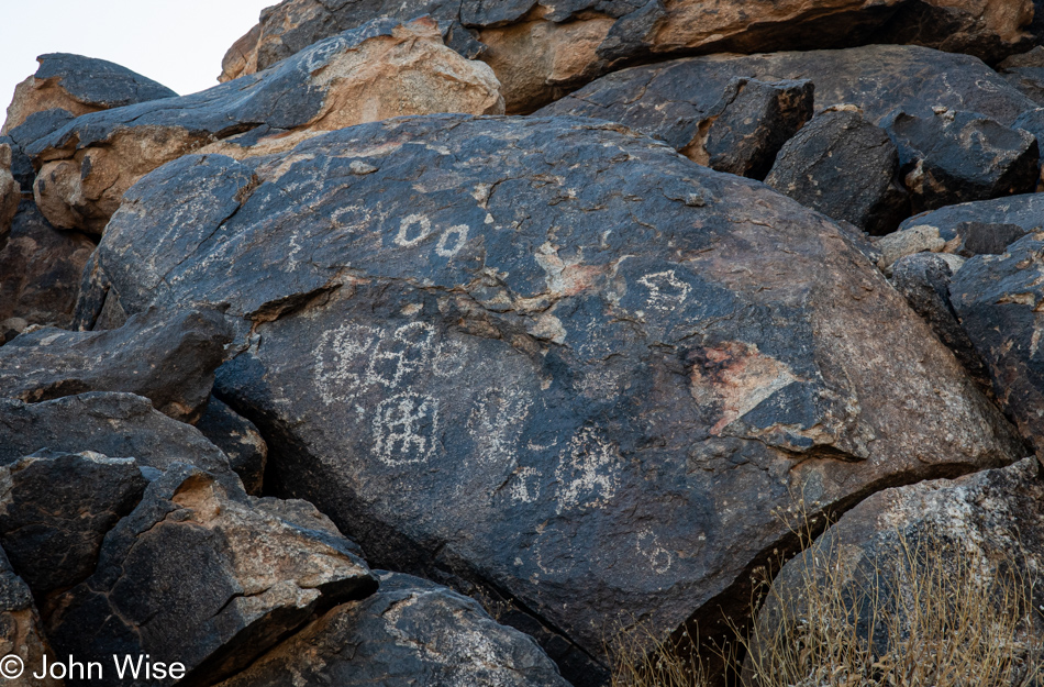
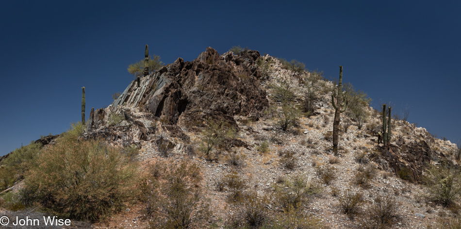
To avoid heading to Buckeye and returning home on the I-10 from the west we cruised along down Maricopa Road to close today’s loop before heading north to go home. Just before reaching Maricopa, Caroline pointed out that we were close to a site she’d read about earlier in the day. Not too far south of our current road lies Petroglyph Mountain in Ak-Chin Village. Ak-Chin is an O’odham word that means “a place where the wash loses itself in the sand or ground.”
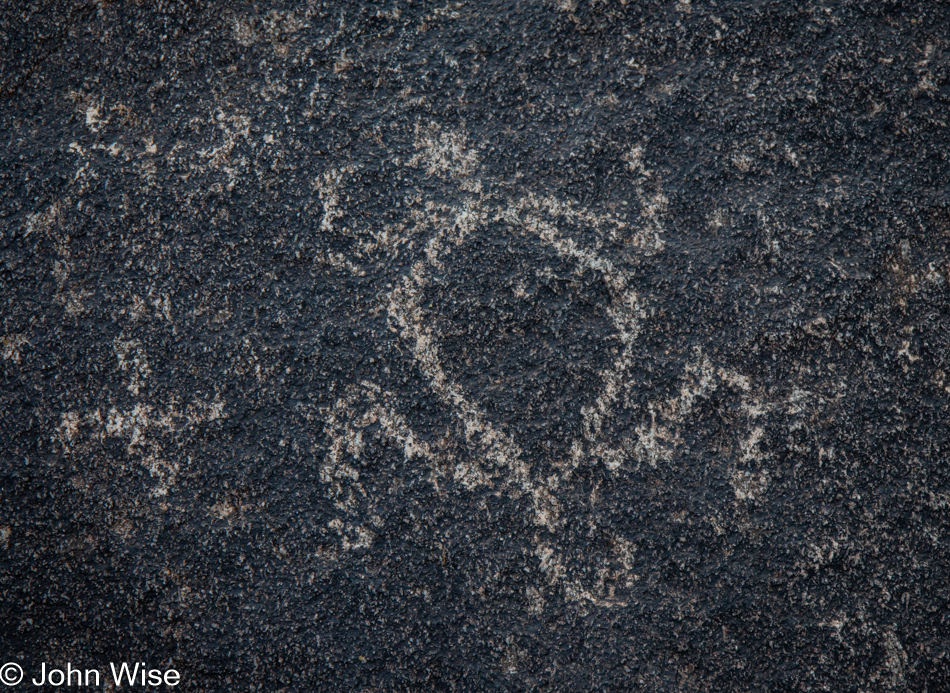
There are a number of petroglyphs right next to a driveway not 30 feet from the road, and as a reviewer stated, while not worth a drive all the way out here just for a few dozen petroglyphs, if you are in the area anyway, you should stop by. This concludes our reach into the past.