Independence Day in Oregon – Day 4

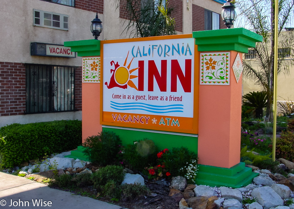
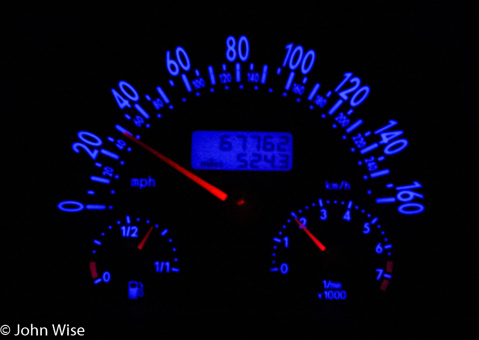
When we get home, we’ll pay for these long days as we collapse in exhaustion, but for now, we just keep going. This morning, we were out of the motel and on the road by 6:15. We are on the approach to Lassen National Park.

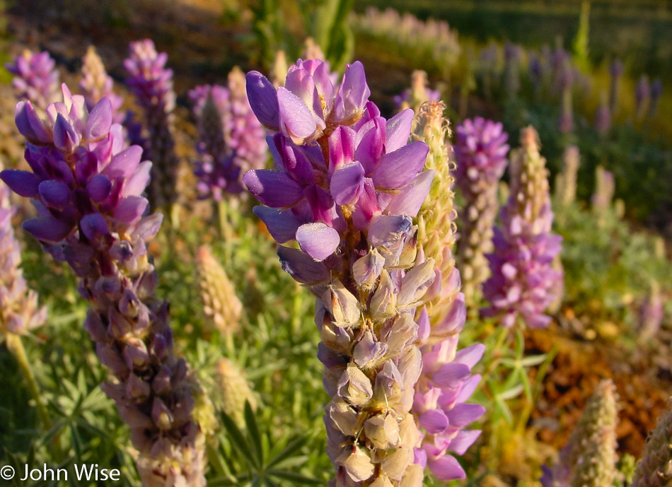
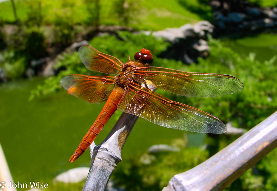
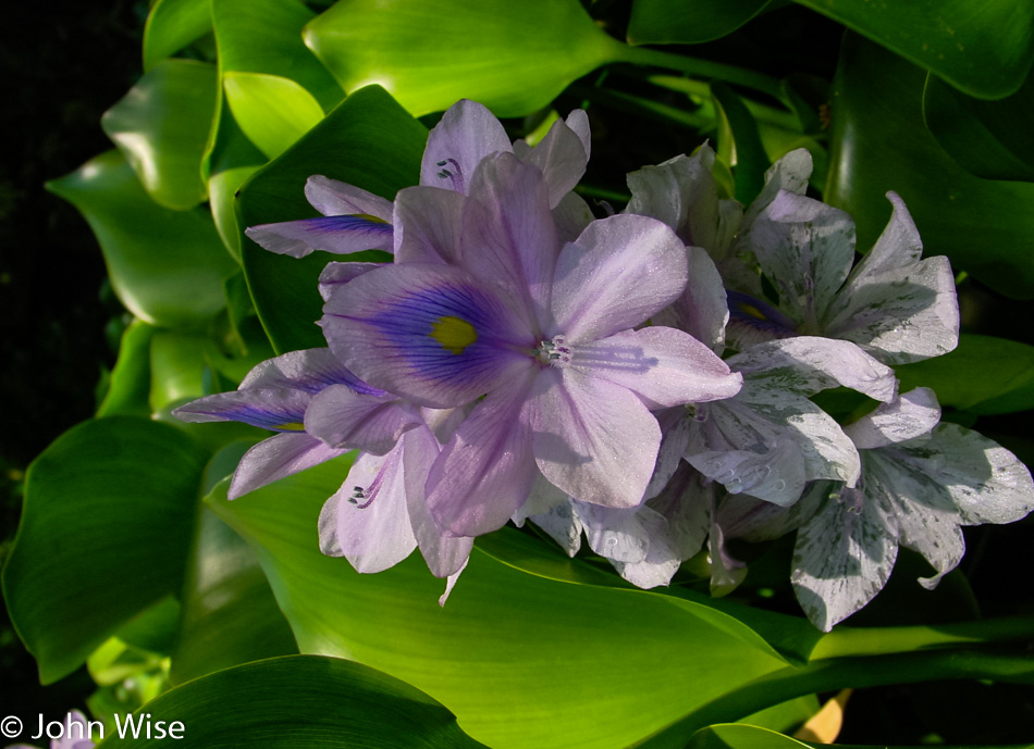
It is this stuff here that delays us getting places in a timely manner, as flowers are a powerful attraction and scream at us to stop and take photos. While we’re in the throes of quickly stopping the car, jumping out, grabbing the photo, and getting going again, it seems rational and perfectly reasonable to think, “What the heck, it’ll only take a minute,” except these minutes add up and it’s probably never as fast as I hope. Part of the allure of these races to get out and around is to capture enough elements that when we look back at the visual arch of the trip, we will be inspired to visit some of these spots again or if there was an abundance of mediocrity we can relegate that corner to the pile of “not interested.”

This is Hat Lake and one of the first big indicators that there’s more to this park than the southernmost active volcano known as Mount Lassen, which is the main draw for our visit today.

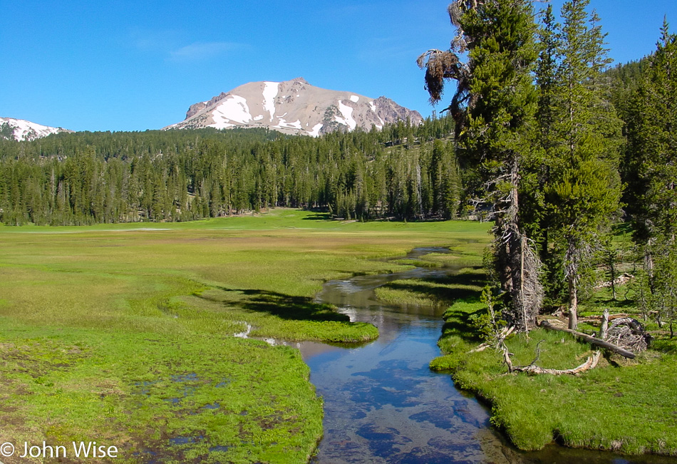
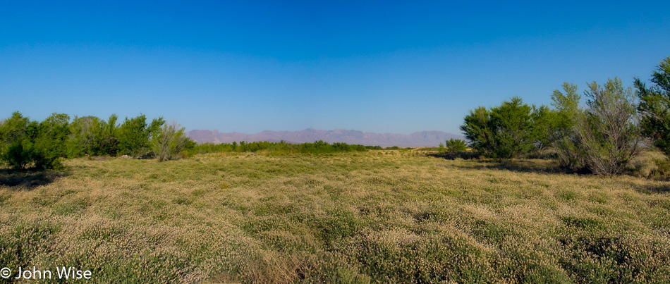
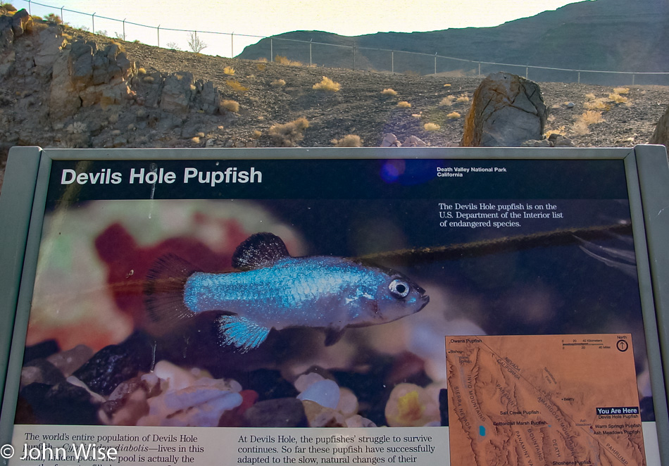
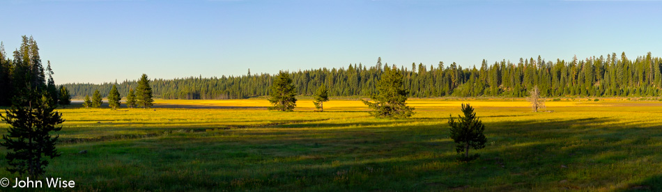
Kings Creek runs through this meadow; unfortunately, we weren’t prepared to do the same. Next time in Lassen, remember to bring waders. And this is how it happens for us to be drawn back to a place; these beautiful impressions continue adding up until we reach astonishment levels. This will be accompanied by a bit of sadness that we weren’t able to fully explore this meadow, but then again how in the world does anyone on a five-day trip that takes in Bonnie & Clyde’s Death Car, Devils Hole Pupfish in a remote corner of Death Valley, Ash Meadows Refuge, the Rhyolite ghost town, fireworks in Lakeview, Oregon, Crater Lake National Park, Lava Beds National Monument, Lassen National Park, Yosemite National Park, Lake Tahoe (coming up later today), Mono Lake and Manzanar National Historic Site (giving away where we’re going tomorrow) and not need to be quick about it?

This is Mount Lassen, and while there’s a path to its peak, this will not be the trip where we make that hike.

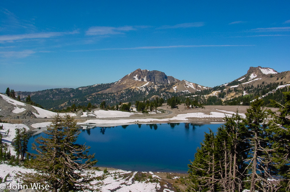
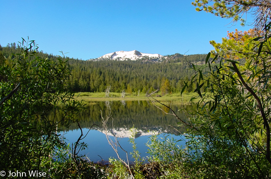
Lake Helen alone could be a great reason to visit Lassen. Fortunately, there are 1000 other compelling reasons to be here, too.

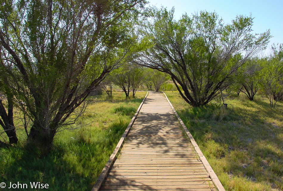
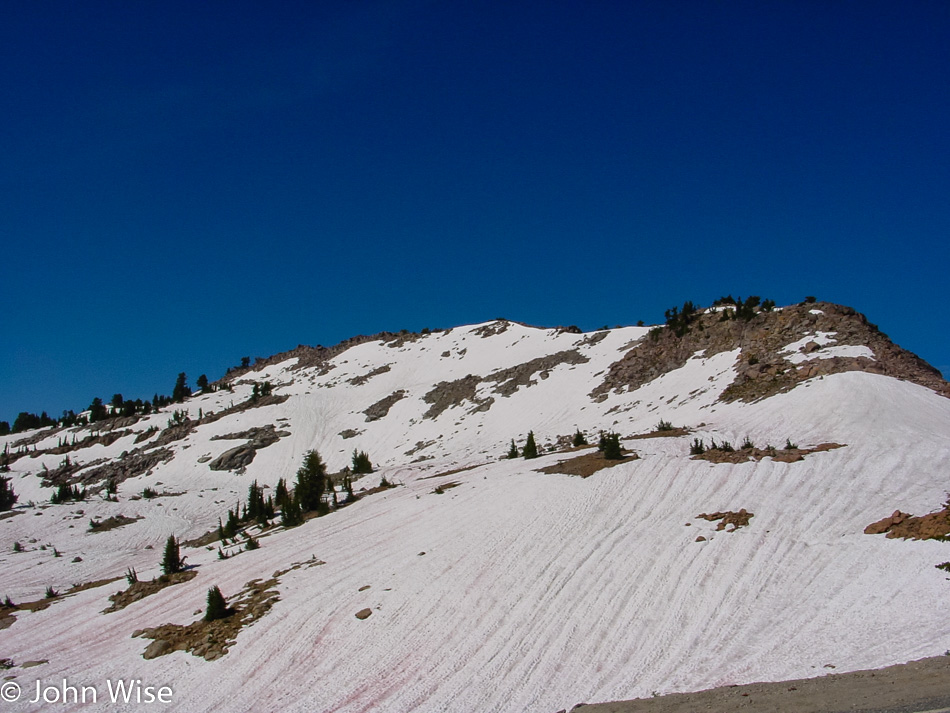
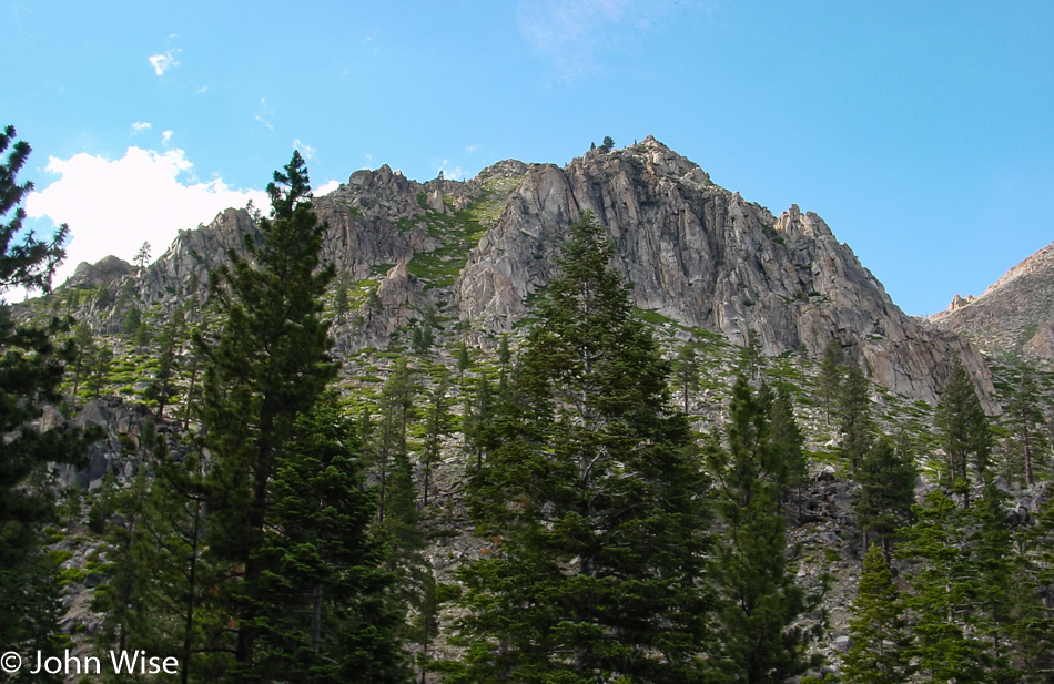
The terrain is varied and beautifully seductive. Our three-hour bullet tour can never do this park justice, but at least now we know that if we planned a couple of longer hikes here, the time spent would be well worth the effort.

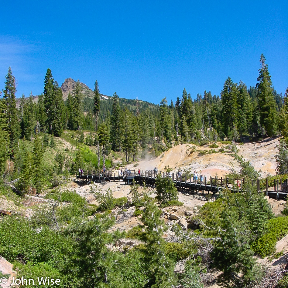
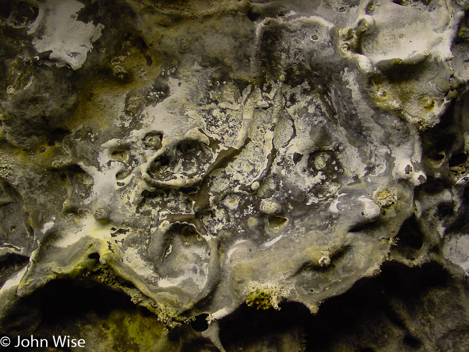
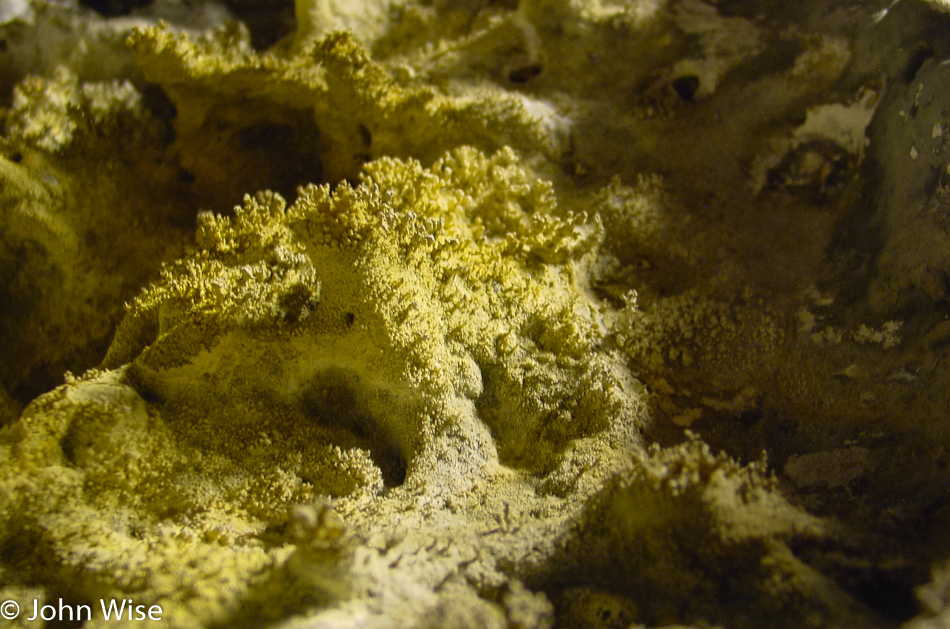
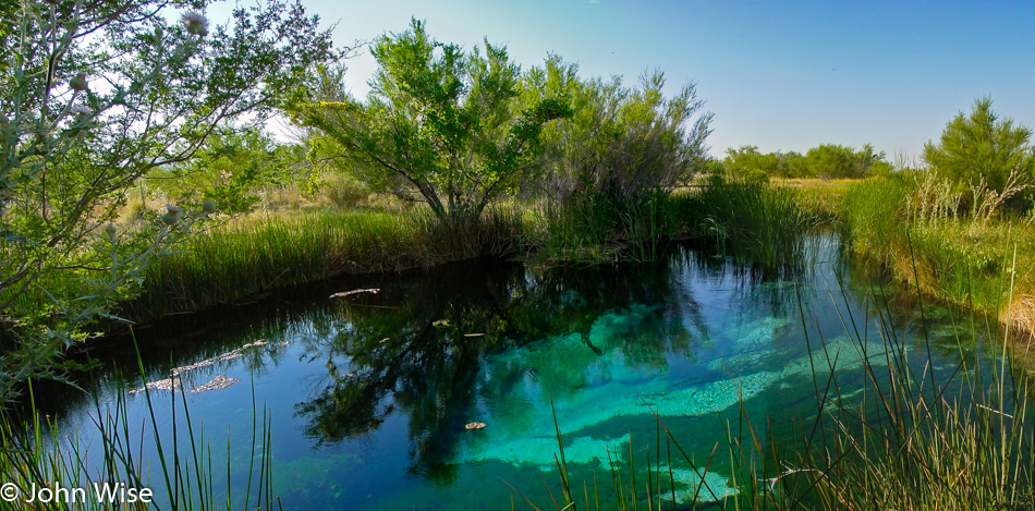
Visiting the Sulphur Works hydrothermal area is an immediate reminder to your nose that this is a geologically alive area. Volcanic activity has been a large part of Lassen’s past and could still be a part of its future.

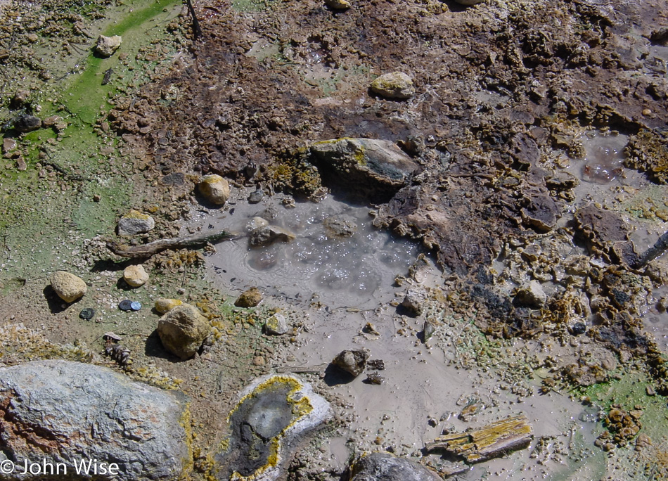
Gases and boiling water suggest something is cooking below. Mount Lassen’s lava dome is the largest on earth and is definitely still active, with its last eruption occurring back in March 1915.

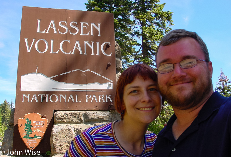
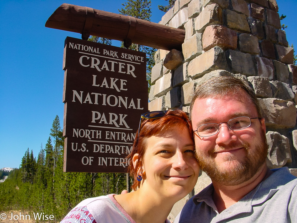
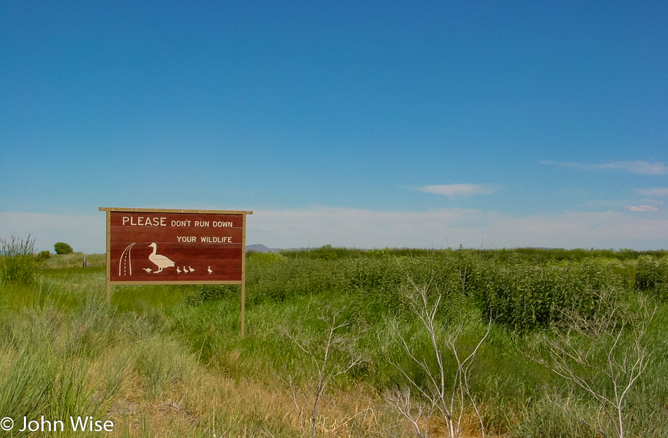
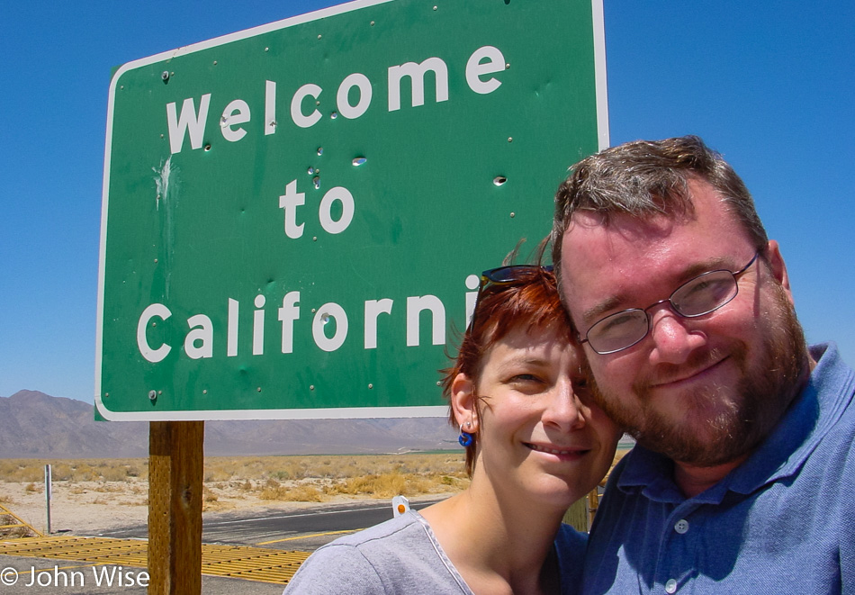
Here at the southern entrance is the sign we’d been looking for on our way into the park this morning, hence why it’s being shown as we exit the park.

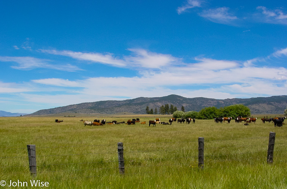
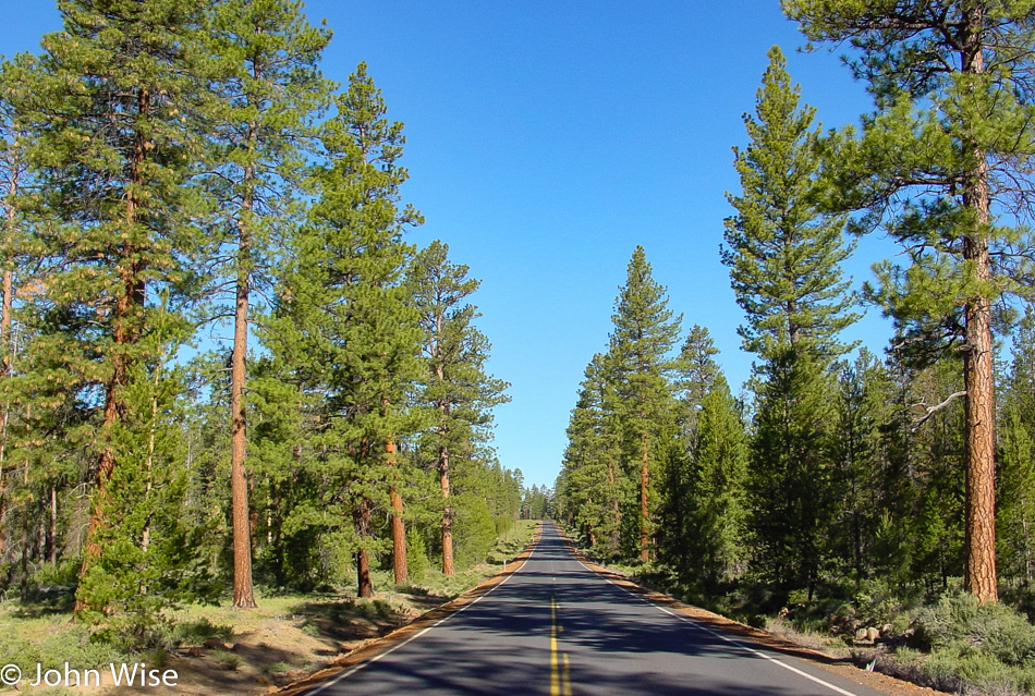
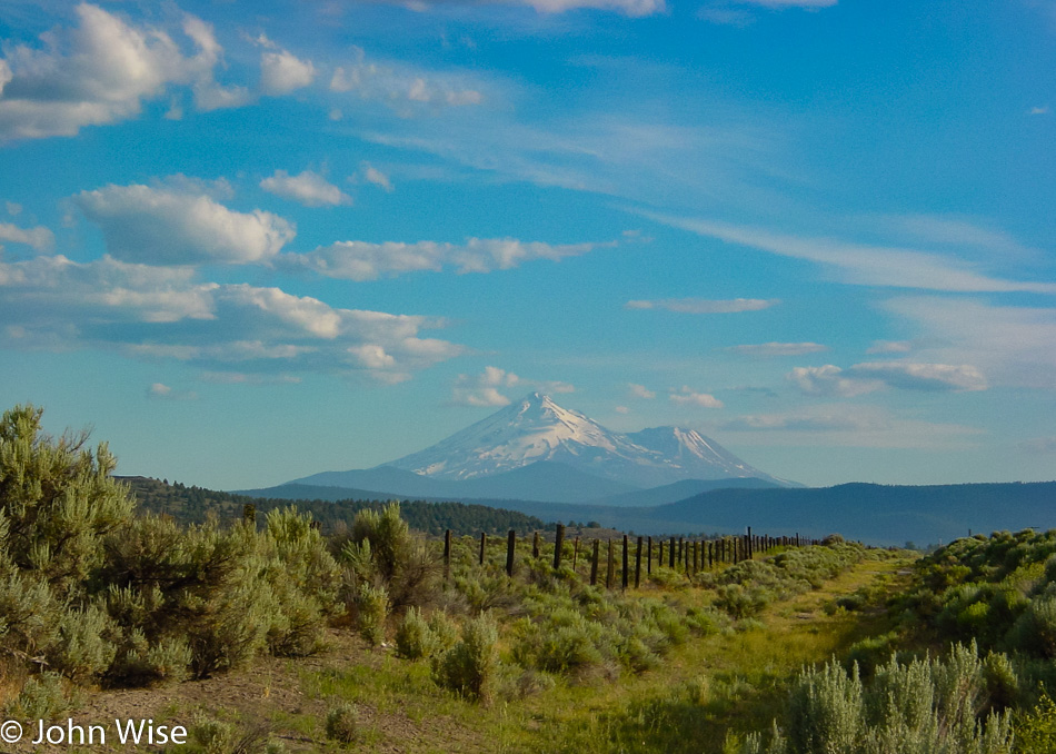
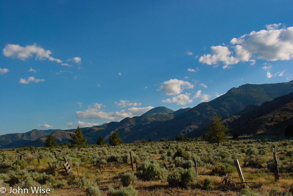
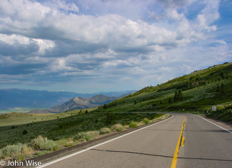
What a great day to be out driving in northeastern California.

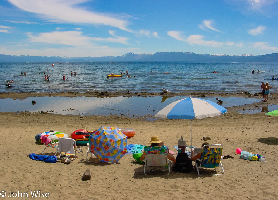
Lake Tahoe is a beautiful place, but with the bumper-to-bumper traffic in town, this is coming off the list for a return visit around any holiday weekend. I know, famous last words.

The mountains of the western United States are a treasure comparable to the extraordinary beauty found in the Alps of Europe. It’s kind of funny how when we are not among these marvels, they are “out of sight, out of mind,” but when we are here, I want to remain in their towering stature and bask in their glory, I’m guessing that’s how many visitors feel after visiting this vast land that reaches into the sky and our hearts. Again and again, I should return to these mountains and the memory of John Muir, who not only founded the Sierra Club but worked tirelessly to protect hundreds if not thousands of square miles that include Yosemite, the Sequoias, Redwoods, and uncountable locations in between.

To those who drag heavy machines and asphalt out to the sides of mountains, taming the land so we might cruise along the edge of a place without needing to ride a horse and spend valuable time that is in short supply: I thank you all.

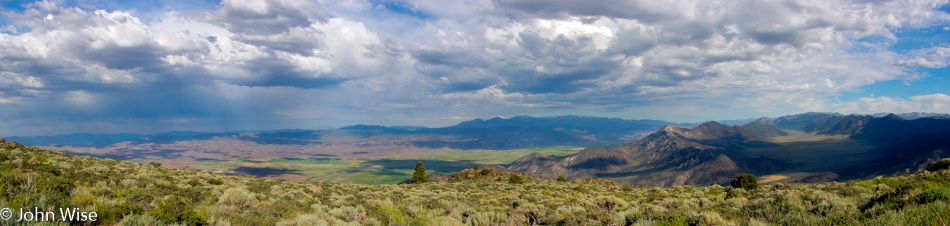
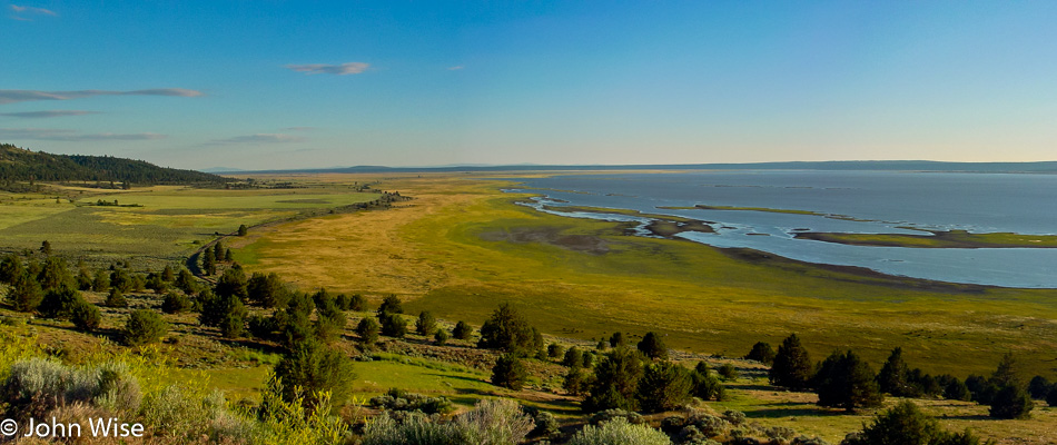
I should probably link higher resolution images to these panoramas as they are much better storytellers; when you can see the details that we saw that day and that are still present in the photos, maybe I’ll get to that task one day.

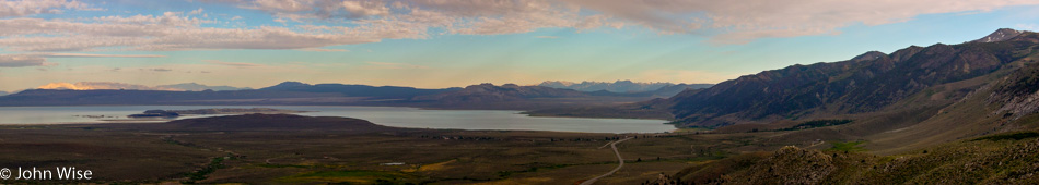
That’s Mono Lake in the distance, and we need to decide if we should drive down there or not.

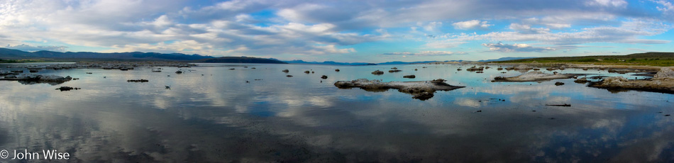
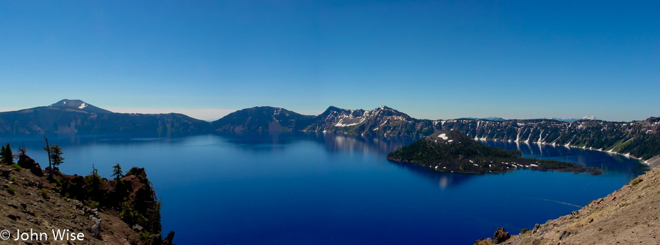
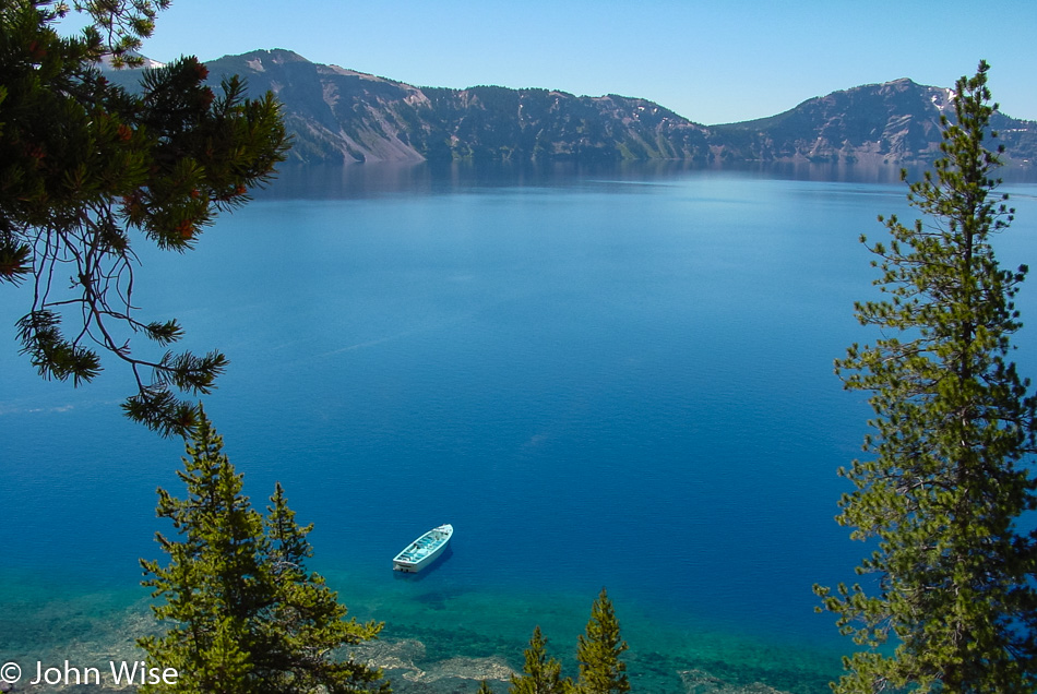
Nobody needed to twist our rubber arms as the car seemed to have a mind of its own and pulled us in closer until we were right next to the shore. Who would have ever dreamed that we would visit two endorheic places in one long weekend? Endorheic basins or lakes (such as Crater Lake) have no outlet, and while Crater Lake is always being replenished by a lot of rainfall and up to 44 feet of snow per year, Mono Lake is a saline body of water similar to the Great Salt Lake in Utah and the Salton Sea in Southern California.

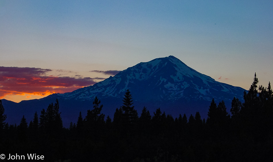
Once again, we are on the move, hunting for a perfect sunset.

Well, this seems like a great place for a sunset, but what about further up the road? And what road might this be? We are in Yosemite National Park, having come in via the east entrance.

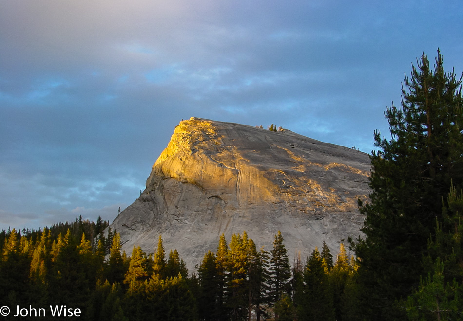
Lembert Dome in Tuolumne Meadows is almost the perfect place for sunset.

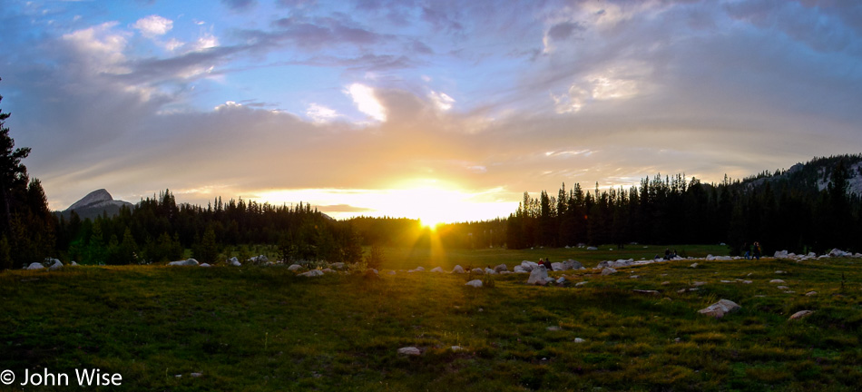
And then we find THE perfect place with the perfect light on a perfect day right smack dab here where we are in the meadow.

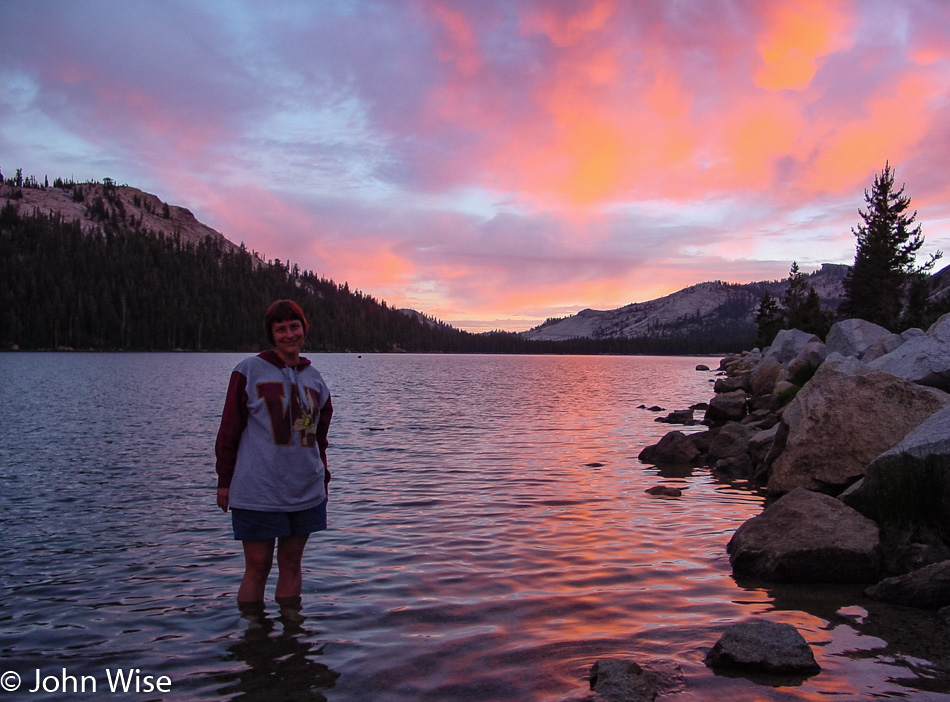
Tenaya Lake is where we’ll snap the last photos of the day before heading back down the eastern side of Yosemite. This is an alpine lake with a surface elevation of 8,150 feet (2,484 meters), which is probably the highest body of water Caroline has ever stood in. If you are wondering about the temperature of the water, she let me know it was cold, really cold.

Independence Day in Oregon – Day 3

Though we were up late last night for the fireworks, we still woke up shortly after the break of dawn this morning and were getting gas by 6:30 (we’re still unaccustomed to having someone else fill our tank here in Oregon). Between stretches of the forest, we also drove through some beautiful meadows and spotted four pronghorn antelope basking in the sun while we basked in their glory from our perspective driving by.

Our path wasn’t the most direct, but it was certainly scenic. County Road 676, also known as Silver Lake Road, passes through the wetlands next to Wocus Bay and the Klamath Marsh National Wildlife Refuge. While passing through the refuge, we spotted a beaver, cormorants, and geese.

By 10:00, we are pulling into Crater Lake National Park, and the furthest northwest we’ll travel on this extended long weekend, Silver Lake on the way here this morning was a bit further north. After checking out the park map, it’s decided to take the loop drive around the lake going clockwise.

Our view of the lake is a spectacular one. The color of the water is the bluest we’ve ever seen; maybe it has something to do with how deep it is, as it is the deepest lake in the United States at 1,949 feet or 594 meters. Or maybe it’s the elevation here where the caldera rim reaches heights of 8,000 feet or 2,400 meters above sea level. Maybe it’s the fact that no stream or river runs into the lake, as this lake has been filled with rainwater and snow. But the reality is that it’s probably the combination of all these factors. On the right of the lake is Wizard Island, which is a cinder cone formed about 7,000 years ago. The island’s peak is 767 feet above the surface of the lake, but incredibly, it sits on the caldera floor over 2,000 feet down below. The trees on the island have never been harvested, with some of them clocking in at over 800 years old now.

We are heading down the Cleetwood Trail which is the only trail in the park that takes you lakeside.

Kind of a strange thought that we are atop a 2,000-foot-deep caldera here at water level and that where Caroline is sitting used to be a mountain peak that towered over a mile above her. That mountain peak was called Mount Mazama before it exploded in a fit of volcanic fury just 7,700 years ago. While in human terms, that might seem like a lot, in geological terms, that was a split second ago.

The scenic drive doesn’t exactly follow the crater rim; east of the lake, we drove through a beautiful canyon complete with several waterfalls, including a larger one called Vidal Falls. A little bit further down the road, we returned to the lakeside and were able to catch this great view of Phantom Ship, that black rock in the lake that stands 170 feet high.

Just three hours after our arrival we were already heading for the exit but stopped at the visitors center for some tchotchkes because life without a fridge magnet is meaningless and empty.

Driving south towards California, we pulled over to a scale and learned the useless information that our car weighs 1350 pounds. After arriving in California, we stopped to pay a visit to the Klamath Basin National Wildlife Refuge in Tulelake. Here in the refuge, we spotted some black-necked stilts, glossy ibis, and western coots, so like the sign points out, “Don’t run down your wildlife.”

Just a few minutes south of the refuge, we enter Lava Beds National Monument and are nervous that the visitor center might already be closed as it’s a bit after 5:00. With that in mind, we stopped here at the Devil’s Homestead Lava Flow overlook and were just as quickly off and running again hoping the visitor center might be open longer than others.

Lava Beds National Monument in Tulelake, California

Wow, the visitors center is open until 5:30 leaving us 10 minutes after we arrived to buy a magnet and find out what else we can do with our shrinking day. Drats, there are no magnets, might as well go home! Just kidding. We walked over to the closest and most easily accessible lava cave equipped with lights, explanatory signs, and a stairway right in the visitor center parking lot. One of the major attractions at Lava Beds is that people can explore over a dozen of these caves; helmets and lamps are available at the visitor center for the unprepared, as long as one arrives in a timely manner. Lava caves are formed when the flowing lava cools off on the surface, building a roof, while the hot lava below continues to run until it empties, thus leaving a tunnel. During the cooling process, interesting underground shapes can be formed, and sometimes these tunnels cross or are re-melted and re-cooled during and after a volcanic event.

Lava Beds National Monument in Tulelake, California

Melted stone, dripping calcified minerals, lichen, a bunch of spider webs, and people have replaced the 2,200-degree lava that once flowed through here, and we’re probably luckier for it.

Lava Beds National Monument in Tulelake, California

We are out of the cave less than 30 minutes after we entered it; this is the downside of trying to do a little bit of everything in the shortest amount of time.

Lava Beds National Monument in Tulelake, California

A cinder cone that one day might grow into a full-fledged volcano. Tomorrow, we’ll continue the volcanic theme with a visit to Lassen National Park, but for today, we need to get along as we are hoping to get down to Susanville that on a direct route wouldn’t be too far away, so we’ll take the long way so we can get a glimpse of what you see in the next photo.

Mount Shasta, California

This is Mount Shasta, standing at 14,179 feet above sea level, a dormant volcano. Maybe this road trip should have been themed as the “Volcanic Run.”

VW Beetle covered in insects

It was quite a detour around Mount Shasta and Weed, California, but I’d seen those iconic images of the Weed sign with Mt Shasta framed behind it and just had to see it for myself. We stopped for gas in McCloud, and while we were enjoying the views, we were almost shocked at the carnage on the bumper. I’ll spare you the closeups.

Mount Lassen, California

The sun setting in the distance, and yet another view of Mt Shasta.

Caroline Wise at Frontier Inn in Susanville, California

We finally arrived in Susanville, California, at 11:00 p.m. and had a seriously funky room here at the Budget Host Frontier Inn.

Independence Day in Oregon – Day 2

Saddle West Casino in Pahrump, Nevada

We left the Saddle West Hotel Casino RV Resort, one of two motels in town, at about 6:00 in the morning. Pahrump has a big advantage in comparison to other Nevada towns – especially those in neighboring Clark County (such as Vegas, Henderson, and Laughlin) – prostitution is legal here in Nye County; several billboards enlighten the unsuspecting (?) traveler of this fact, and there is even a brothel museum. We are probably going to come through here again on a future trip and hope to take a closer look at that. Another curiosity finds a home here in Pahrump; the radio show Coast to Coast AM hosted by Art Bell lives and operates from out this way. If you ever wondered why he opens his show with “from the kingdom of Nye” – now you know.

Just north of town, we turned west on Highway 190 in the direction of the California state line and Death Valley National Park, but on this side of the border lies a small exclave called Devils Hole bordering Ash Meadows National Wildlife Refuge. Naturally, we were curious and had decided to pay a visit to both. Another “Devils Something” notch on our National Park bedpost, who could resist? While a lady at a gas station effectively placed some doubt in our minds whether our Beetle could handle the unpaved road into the refuge, we also started to wonder what kind of “meadow” we could hope to find since, for several miles, we saw nothing but the usual stuff such as dry shrubs, sagebrush, and short trees. Nevada certainly managed to make it all look pretty enough and even arranged some wildlife for us: we saw several bighorn sheep standing on a hill in the distance. We eventually hit our turnoff into the refuge, although there was no sign other than “Bill Copeland Memorial Highway.” Judging from the map and the fact that we were heading for a faint cluster of greenery, we started believing that we were on the right track.

Caroline and I were beginning to have doubts about whether we would be able to access Devils Hole from our current location. We drove right by it because it was just a chain-link fenced-off area that looked like a lot of nothing. The Hole lies near the refuge’s northeastern exit, which is stocked with xeroxed info maps; that’s how we realized that a) we had just missed Devils Hole, the world’s only habitat of the Devils Hole Pupfish (clap, everybody), and b) that we hadn’t even seen the best of the Ash Meadows Refuge yet. But first, we turned around and pulled off the road next to the (closed) access road to the Devils Hole parking lot. They even discourage you from parking near the Hole. Devils Hole is not very scenic but is a rather heavily guarded scientific research area. We hung out for a short while, trying to spot one of the elusive and precious fishies in the water below us, but that proved impossible even with binoculars at the ready.

Highway 373 led us to the other side of the refuge to visit the crown jewel itself, the interpretive boardwalk to Crystal Creek Spring. The reason why there are these patches of green meadows and wetlands out here lies in the hidden groundwater.

The area has a large reservoir of “fossil” water, meaning it stems from an ancient melted glacier. It surfaces in various spots in this valley, offering habitats for various kinds of – you guessed it – desert pupfish, including the Ash Meadow pupfish. These wily little fellows have the capability of surviving even in the meekest of hostile puddles. Farmers used to pump the water away from the springs, and the pupfish all but disappeared, but in recent years, the larger springs are being restored, and the pupfish are recovering. Unlike the nearly barren Devils Hole, Crystal Creek Spring is an incredible oasis, overwhelmingly beautiful, clear, and deep. You can see the pupfish swimming near the algae at the bottom with the naked eye.

By now, it was time to jump into the Beetle again and continue on our journey. We rejoined the paved road on Highway 373 North until reaching the junction of Highway 95 West. About 40 miles further on, we passed the little town of Beatty, Nevada, and turned onto Highway 374 towards the Californian border. Four miles out of Beatty, we found Rhyolite – our next destination. In 1908, this was Nevada’s third-largest town, sprawling with over 8,000 inhabitants. Today, only a few of the brick structures remain, most of them in ruins. Rhyolite’s most interesting building is the “bottle house,” made with the help of over 10,000 bottles (mostly beer bottles of the pre-Budweiser variety). The place is in pretty good shape compared with the schoolhouse, for example.

An example of one of the buildings in this ghost town that hasn’t fared well over the intervening years of neglect and lack of a population.

The same can be said about vehicles that were left to the elements; they likely won’t be driven again any time soon.

Just next to the Rhyolite townsite (in the suburbs, so to speak) lies an outdoor art exhibit of a curious kind – the Goldwell Open Air Museum, a project of the late Belgian artist Albert Szukalski (1945-2000). He founded the museum in 1984 with his sculpture “The Last Supper,” and later on, several other sculptures by various and distinguished artists were added, such as the true blond above. A truly unique art experience that has been seen by millions of visitors on their way to Rhyolite.

Finally, we headed back towards Beatty, where we stopped for gas, postcards, and the loo. On the way out of our pit stop, we saw a sign offering “free police car rides.” Unfortunately, only for shoplifters; what a drag. Near the Esmeralda County line but still in Nye, we passed another example of the kind of business that Nevada is famous for, and I’m not talking about casinos. For some reason, these establishments are usually called “So-and-so Ranch,” although, in reality, the buildings resemble double-wide trailers. Anyway, in case you ever asked yourself what a brothel in the middle of nowhere looks like, wonder no more.

The road had started to climb higher and the surroundings became a tad greener and then dipped again for another encounter with the lovely sagebrush, especially true when it is fresh and fragrant. We are looking at a small corner of Palmetto, Nevada. Founded in the early 1860s after silver was found in the area, the town went through not one but two revivals, only to disappear for good during its last downturn. It was named after the local Joshua trees which the settlers thought were related to palm trees. A few miles past Palmetto, we spotted a few bighorn sheep; unfortunately, there was no chance to pull over for a picture.

Back in California for only about 10 miles before swinging back into Nevada. While we have now passed through Oasis, California, we can’t tell you much about it.

Where the heck are we where people have to be warned about not bringing their explosives-laden vehicles through the main gate? This is obviously not Disneyland.

Mountains and sagebrush are not a bad combo.

We needed to dig into some driving as the day was quickly getting away from us since we had spent a fair share of our time checking stuff out, but this scene was too pretty to let pass. We are on the road passing through Nixon in rural western Nevada, looking out over Pyramid Lake. A bit further up the road, we’ll encounter Gerlach, Nevada, and remain on state route 447 until we return to California on our way toward Cedarville and points beyond.

This is Just Stuff and is a place for a bit of all things, including souvenirs, because once you enter Pine Creek on the Oregon border, the first thing you are likely needing to do is shop in a little funky joint to jump right into the Oregon vibe.

This is our second time this year and the second time in our lives that we are visiting Oregon. The first time this past March, we crossed over an eastern border of the state; this time, it’s a southern border. If you believe you are starting to see a trend, you’d not be mistaken. I can nearly assure you that it’s only a short matter of time before we enter the state over on the southwest side to take in Coastal Oregon from that perspective.

Is it a real geyser? Who cares? It’s pretty and reliable.

This single rocket on the Fourth of July is why we’ve driven nearly 1,000 miles to Lakeview, Oregon. Sitting on top of trucks and in lawn chairs like we’re at the drive-in in rural America is what the celebration of freedom is all about. Happy birthday, America!

Los Angeles – Day 2

California Inn in Ontario, California

The motel we love to hate and hate to love: California Inn in Ontario. First and foremost, it is cheap. Second, it is close to where my father lives. Third, it seems the TV is nearly always tuned to their free porno channel when we turn it on. Other than the sketchy people who stay here (except us, of course) and the yelling, random beating on the door looking for someone we are not, the questionable cleanliness, and the dated rooms, we actually kind of really like this motel.

Caroline Wise at the San Gabriel Nursery in San Gabriel, California

This is the kind of vehicle Caroline is highly qualified to drive; it is exactly her speed. We came back to the San Gabriel Nursery this morning to pick up some plants we were looking at yesterday, seeing we’ll be driving back to Arizona this afternoon and don’t need to worry about them getting too hot in the car. Caroline packed up Salvia Divinorum, aromatic Cleveland sage (Salvia sp.), red tea hibiscus, chocolate mint, a tiny lavender, a plumeria cutting, and sweet woodruff.

The Huntington Library, Art Collection, and Botanical Gardens in San Marino, California

The next stop is the Huntington Library, Art Collection, and Botanical Gardens in San Marino, California. This used to be a private residence in the early 1900s but is now home to 150 acres of various themed gardens and several art galleries.

The Huntington Library, Art Collection, and Botanical Gardens in San Marino, California

Italian 17th-century statuary chilling in the California Sun.

The Huntington Library, Art Collection, and Botanical Gardens in San Marino, California

The Japanese Gardens also feature a Tea Room that was originally the gardener’s quarters in a small part of a garden house built for Mrs. Huntington. More than a few of the bonsai trees are priceless in their perfection and age, and due to that value, they are chained down to discourage theft.

The Huntington Library, Art Collection, and Botanical Gardens in San Marino, California

Like the statuary above, this giant red specimen of Dragonfly remained motionless as I was afforded the opportunity for a close approach to snap my photo.

The Huntington Library, Art Collection, and Botanical Gardens in San Marino, California

While we spent a few hours in the garden we weren’t able to visit the museum and library on this day, so we have to make a note to return. The other thing we should pay attention to is the progress of their Chinese Garden, which is intended to be the largest outside of China.

Caroline Wise and John Wise at the The Huntington Library, Art Collection, and Botanical Gardens in San Marino, California

Maybe we got a little too much sun?

After leaving the garden, we headed east, stopping for lunch at Mix Bowl Cafe. Today, we discovered the pleasures of Thai pearl iced tea, also known as boba tea, and fried morning glory in oyster sauce. The pearls in the tea are made of tapioca and have practically no flavor but are fun to slurp out of the cup with the help of the extra-wide straw. Add to our lunch some steamed Koo chai dumplings and an order of pad kee mow (spicy rice noodles with mint leaves and deep-fried tofu), and we were ready to go visit my father around the corner.

Unfortunately, we missed Diana, but chatted with my dad for a couple of hours before hitting the long road home shortly before 5:00 p.m. We managed to stop only once in California – at the Starbucks in Banning – reaching the Arizona state line before Sunset.

Los Angeles – Day 1

San Gabriel Nursery in San Gabriel, California

We left Ontario early for a visit to the San Gabriel Nursery and Florist to “waste” some time before our first real destination opened. The theme this weekend is “Gardens in the City.” While at the Nursery, we browsed and enjoyed the fruit tree and bonsai sections, as well as the roses and herbs. There’s a small greenhouse area with house plants (such as the money tree) and a beautiful flower shop for floral arrangements. Of course, they have tons of greenhouses on the premises, but they are not open for customers to saunter into.

Caroline Wise and John Wise at Descanso Gardens in La Cañada Flintridge, California

Descanso Gardens in La Cañada Flintridge is one of two main to-do’s we have planned for today. The neighborhood alone is worth a visit, with huge mansions and beautiful gardens. We spent about 3 hours here and can easily recommend the Camellia Forest as it’s awesome.

Descanso Gardens in La Cañada Flintridge, California

With the L.A. basin being a zoo of pavement and cars it’s easy to not recognize the lush landscape that thrives in some of this city’s neighborhoods. While Hollywood Boulevard and Sunset Drive, along with Disneyland and the southern California beaches, draw the majority of visitors’ attention, one should, if time allows, either drive through some of the older neighborhoods or carve out time to visit a place like Descanso or the Huntington (we are heading over there tomorrow).

Descanso Gardens in La Cañada Flintridge, California

The Hairy Alien Tongue plant is poisonous if it licks you; fortunately, they are behind a glass enclosure, so we were never in danger. By the way, I’m kidding. We walked the paths through shady groves of blossoming trees, being careful not to disturb the many spiders who spun their beautiful webs from plant to plant, sometimes even across the path. In the sunny spots, lizards tried to keep cool by doing push-ups, or maybe they were warming up; who knows? There is also a small Japanese area with a tea house, pond, and a Zen garden.

Descanso Gardens in La Cañada Flintridge, California

The Boddy House Gallery, which is a former residence turned art gallery, was open, and we took a look inside at exhibits of two painters and a pottery artist. Caroline particularly liked the pottery, but the paintings of Fealing Lin were the most beautiful in her eyes. Another favorite was two large watercolor paintings of colorful flowers. We met the artist and took the opportunity to compliment her on her work.

Next, we took a nature trail through Chaparral, which just means all kinds of native riparian plants – in other words, an area that has not been “domesticated” but rather left alone, except for the trail and plant name signs. We found several aromatic sage plants there, but since there was no tree cover, we started overheating and were glad to get back to the more shady areas. Then we meandered a bit through more native plants like poppies that grow taller than 7 feet and some very impressive cacti. As we were passing a pond, we noticed a tiny train track crossing the path, and soon afterward, a miniature train chugged past. A glance at the map confirmed that our round trip through the Gardens was almost finished. We lingered for a short time in the International Rosarium, which features rose hybrids sorted by their countries of creation. We had no idea that Germany and Denmark have contributed such impressive varieties to the world of roses. The aromas are truly intoxicating.

These things, too, are becoming a rarity. The once ubiquitous payphone and phone books are quickly disappearing; it’s only a matter of time before cell phones replace them all.

Making a visual note to remind us to visit the Warhol exhibit. It always feels like there’s something to do in L.A. and yet another thing we’ll regret not having done before we go back home. We are on Melrose Avenue for some lunch at an Indian joint before going to the movies.

John Wayne statue in Beverly Hills, California

Kind of a strange juxtaposition as this icon of wholesomeness, John Wayne, stands vigil in front of the Larry Flynt offices. We are here for the complimentary parking courtesy of Hustler.

Cecchi Gori Fine Arts Theatre in Beverly Hills, California

This is another big reason we are here in L.A. this weekend, the film “Atanarjuat: The Fast Runner” just opened. This movie made by the Canadian Inuit about the Inuit is being screened at the historic Cecchi Gori Fine Arts Theatre in Beverly Hills. The film is nothing short of brilliant, visually and story-wise. It does what a movie should do; it takes us somewhere else and leaves us having experienced something outside our daily lives. It was a big wow! At about 3 hours long you should have no worries because at no moment was this film ever boring.

After dinner at Zakuro for Shabu Shabu and Sukiyaki with our friend Mark Shimer, we took a stroll around Little Tokyo. This little shop called Daikokuya Ramen looks interesting, something for a future visit.

The dessert was Imagawayaki from Mitsuru Cafe, also in Little Tokyo. What is Imagawayaki, you might ask? They are a kind of pancake filled with sweet azuki bean paste that was first made at the Kanda Imagawabashi bridge back in 1772 and was named after the river Imagawa. This place in downtown L.A. was the first in America to make this traditional Japanese treat.

A trip into Little Tokyo would not be complete without a stop at Kinokuniya. Just try to find a better Japanese bookstore in all of southern California.

Speedometer

It’s 12:30 a.m. when we get on the 101 freeway and find ourselves stuck in a traffic jam moving at a mere 30 mph – that’s Los Angeles. Well before this, though, we had browsed the old and new music, including a healthy selection of vinyl at Amoeba Music, which just opened late last year; this place is enormous. Across the street, we dipped into the Arclight Cinerama Dome on Sunset Boulevard to see The Salton Sea with Val Kilmer. Because we were recently at the Salton Sea and we’ve liked Val Kilmer in some of his previous movies, we thought this might be kind of interesting, but we were wrong. I suppose almost anything we would have seen after The Fast Runner would have paled in comparison.

Los Angeles – Day 0

Caroline Wise and John Wise driving to California

Yet another trip to Los Angeles, driving across the sunny desert of the southwest on Interstate 10. Regarding the toothy grin, I don’t know where that came from either, as they just slip out from time to time.

We left after Caroline was done with work and made great time getting out of Arizona. Based on our notes, we brought a laptop, and Caroline used the drive time to get some website work done. We arrived in Ontario at the California Inn around 10:30 p.m. but could not resist driving over to Mix Bowl for a late dinner. It was really busy, too, as usual, and the food was delicious.