Rainbows of Contemplation

Grand Canyon National Park North Rim, Arizona

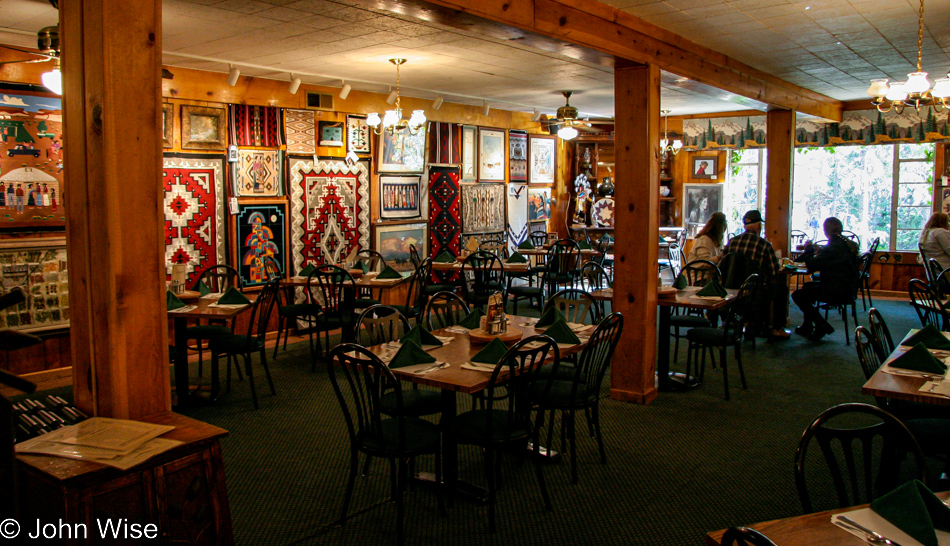
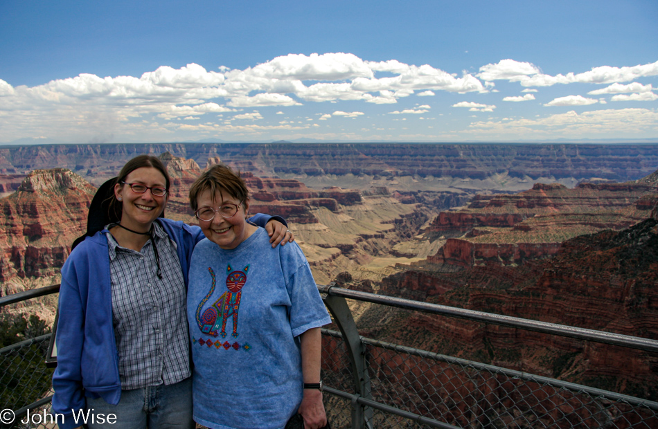
You can be certain that we were nearly the first at breakfast as we were uncertain at which point they’d run out of food. Should you wonder why we didn’t head somewhere else for dinner or breakfast, well, “somewhere else” is Jacob Lake, about 45 miles away, which requires an easy hour to drive in each direction.

Grand Canyon National Park North Rim, Arizona

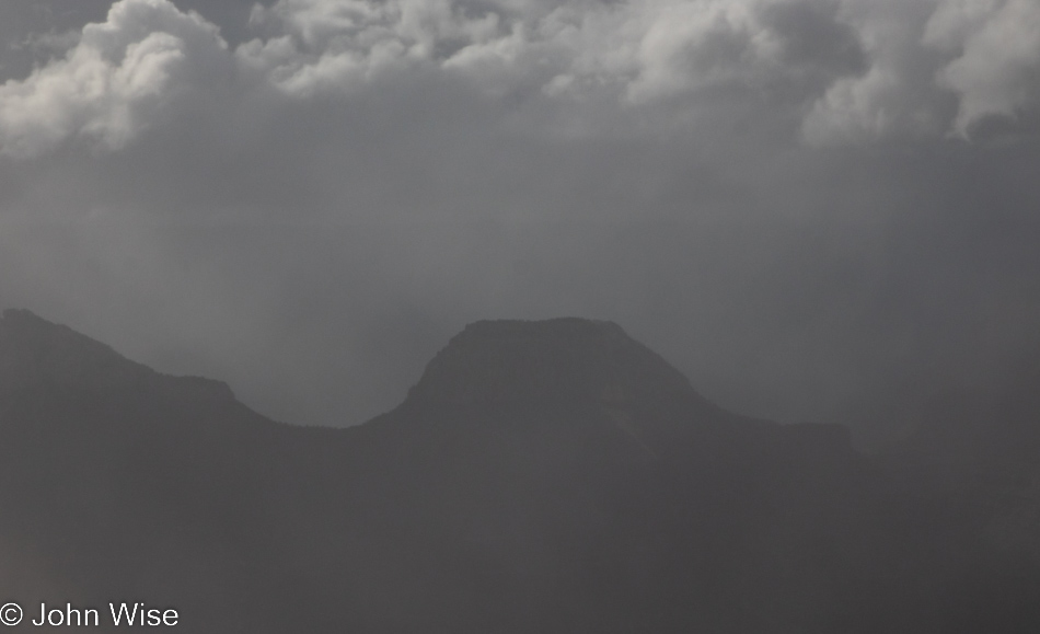
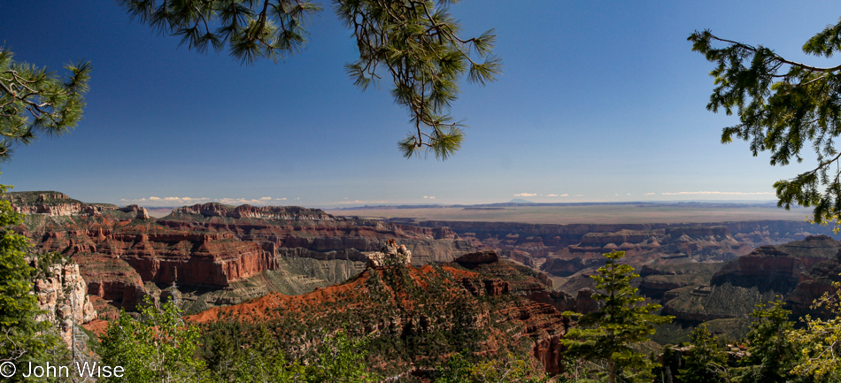
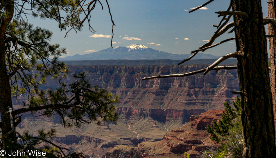
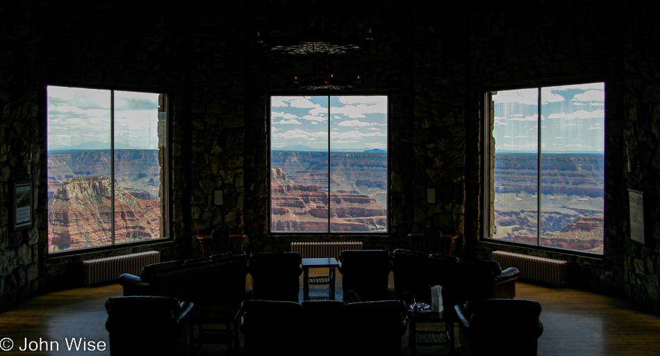
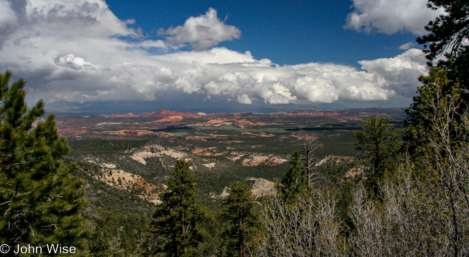
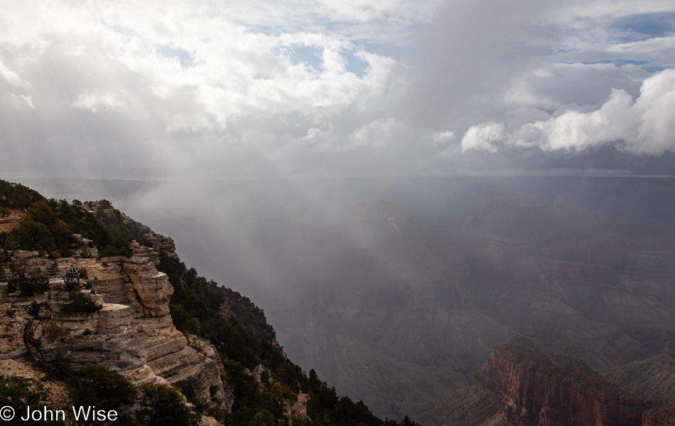
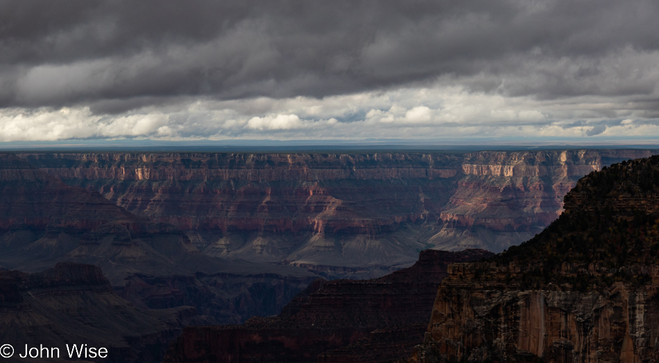
It’s a rare day in a national park that we pull up to the best seats in a lodge to just sit back and watch the weather pass, but that’s what we are embarking on right now. From a still-dark canyon when we first peeked into this fog-filled void prior to our visit to the dining room, the rain comes and goes. Also on the move have been some whisps of clouds forming off the edges of cliffs and nearby outcroppings.

Grand Canyon National Park North Rim, Arizona

In between, the sun pops out and brings golden light to small corners of the vast landscape sprawled before us, while at other fleeting moments, rainbows spring into their ephemeral existence and just as quickly fade away. The canopy floats by or is it hovering over the canyon? Whatever it’s doing or how it might be characterized, it’s beautiful.

Grand Canyon National Park North Rim, Arizona

Sitting here, I think about how, previously, we’ve seen others passing their time at this picture window and thought they were wasting an opportunity when they could have been on the go and capturing so much more outside on the trails. Maybe that was a testament to how much more contemplative those people were as compared to us at the time because here we are today, just like those people, monopolizing the comfy leather couch facing the panorama window.

Rainbow at the Grand Canyon National Park North Rim, Arizona

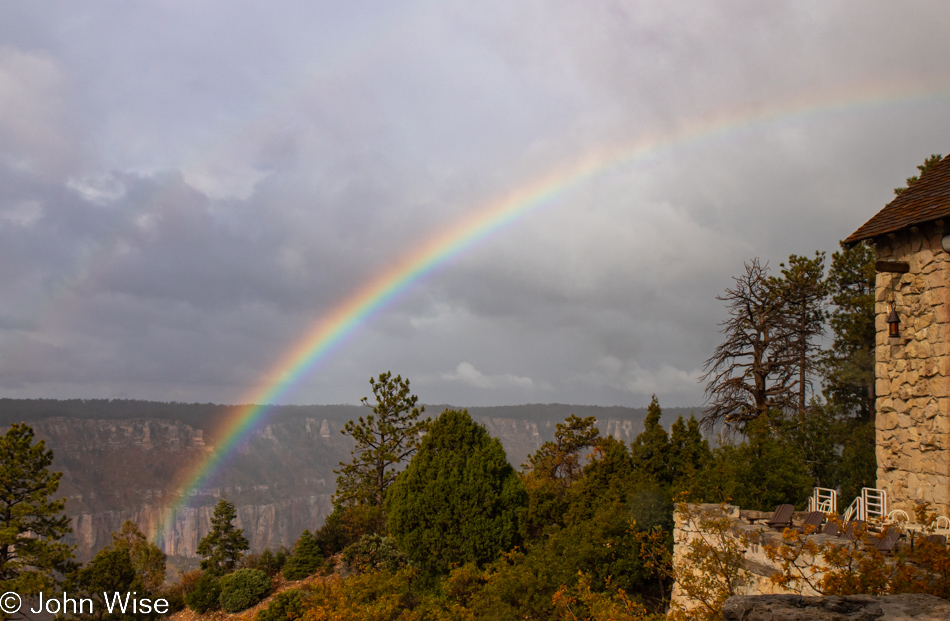
Just one of the many rainbows we watched come and go.

Grand Canyon National Park North Rim, Arizona

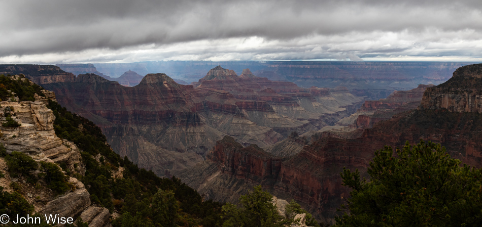
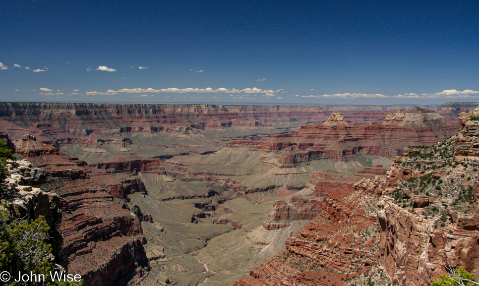
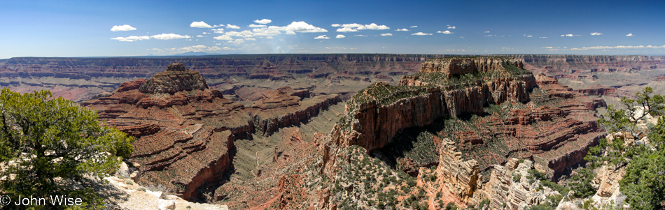
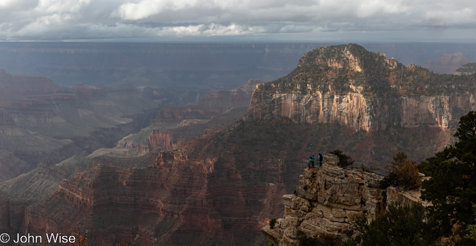
There won’t be a lot of variation in these photos aside from shifting weather and light as our plan to hit the North Kaibab Trail for a few miles of hiking today has been scratched due to the rain and our general satisfaction that not only had we hiked a considerable amount yesterday (about 12 miles), but we have these great seats that seem to be encouraging us to keep them warm (and get some sock knitting done).

Grand Canyon National Park North Rim, Arizona

A funny aside, when people want to step in front of the window we are camping at, they often excuse themselves as though the view was all ours.

Peggy Walker and Caroline Wise at the Grand Canyon National Park North Rim, Arizona

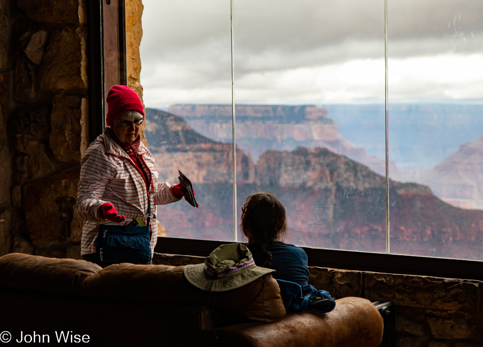
Funnier yet was meeting Larry and Peggy Walker, World Travelers. Larry first tried passing his wife off on me; well, he threatened that she might sit in my lap if I objected to sharing the view. This was followed up by him moving slyly into my spot next to Caroline when I had stood up to snap a photo or two. His smiling face of “Gotcha” was certainly worth a good laugh. It turned out that these two were celebrating their 50th anniversary this week while also accompanying some friends who were renewing their vows in Vegas. Larry and Peggy are just an awesome happy couple and an inspiration to both of us. Hopefully, we, too see our 50th anniversary someday.

Grand Canyon National Park North Rim, Arizona

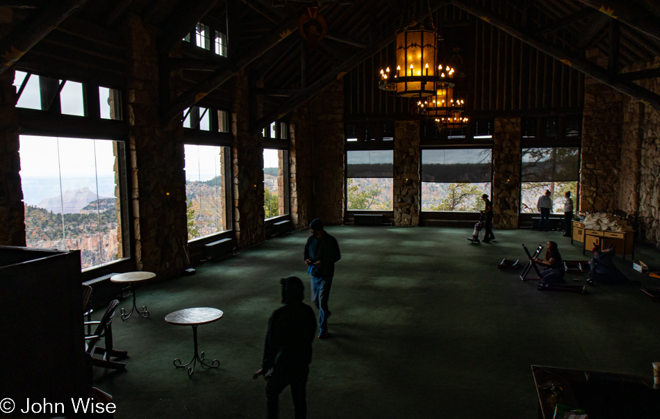
We sat a bit longer and started to learn that many people want to stop and talk, so contemplative moments are not all that easy to have. With this realization, we consider that it’s time to get moving again, but just then, another weather front is coming in from the east, and I’m curious to watch the canyon disappear again. As we got up after sitting there for close to three hours, we saw that all around us, the trappings that make the lodge a comfy place had been disappearing as the crew, anxious to be finished for the season, had been busy clearing the place out.

Vermilion Cliffs seen from Marble Canyon, Arizona

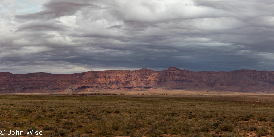
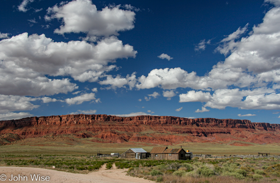
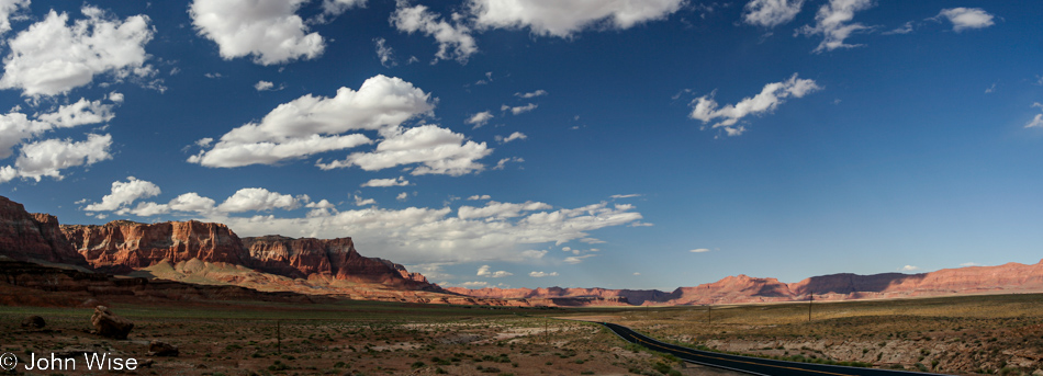
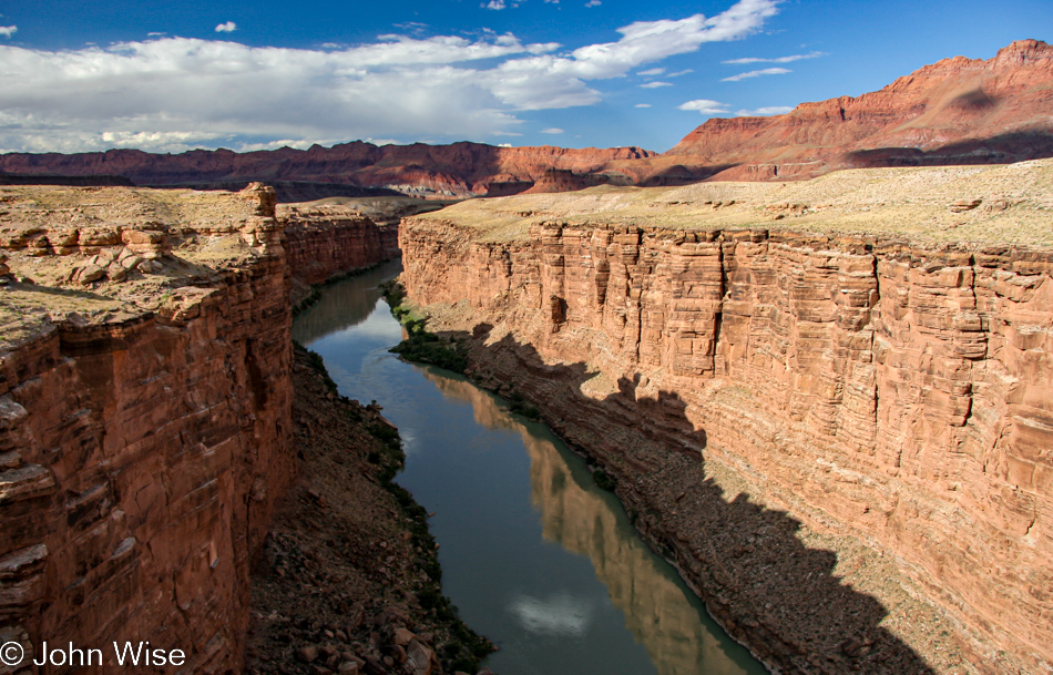
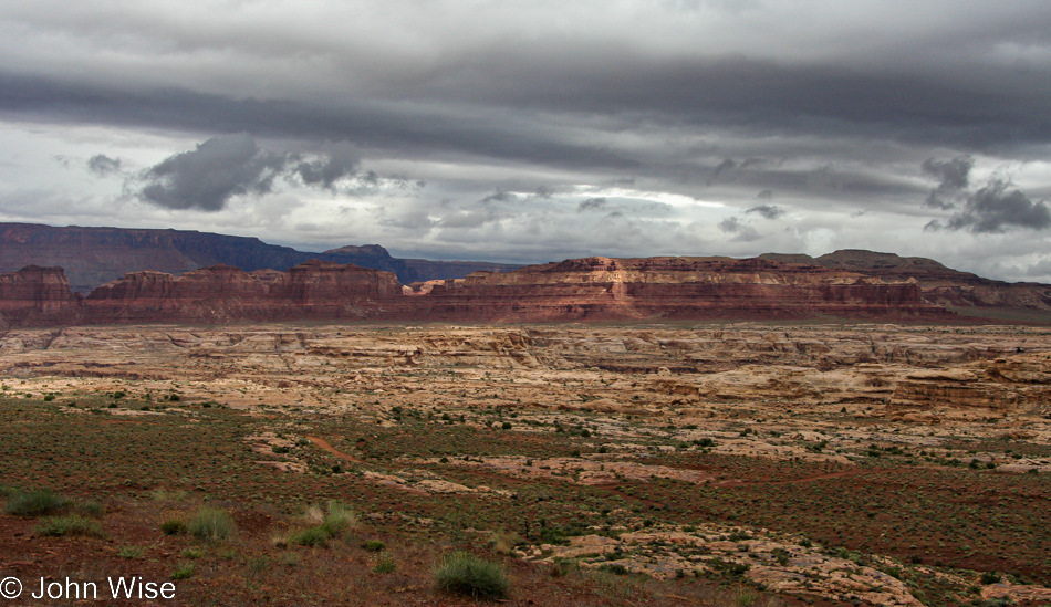
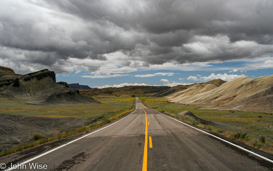
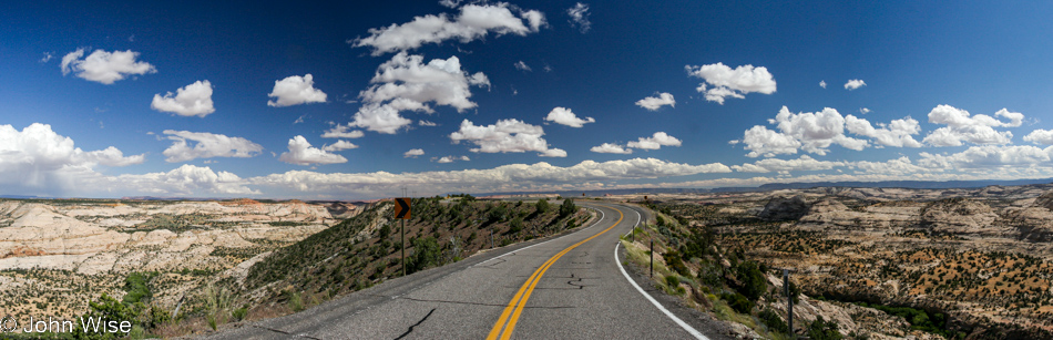
This must be a record year regarding how many times we’ve passed through the Vermilion Cliffs area, and each encounter is as worthy as any of the other travels through here.

Over the Colorado River on the Navajo Bridge in Marble Canyon, Arizona

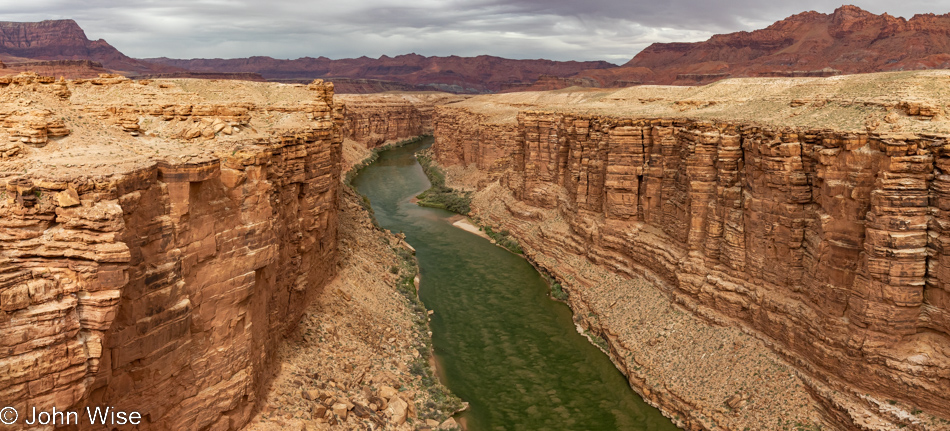
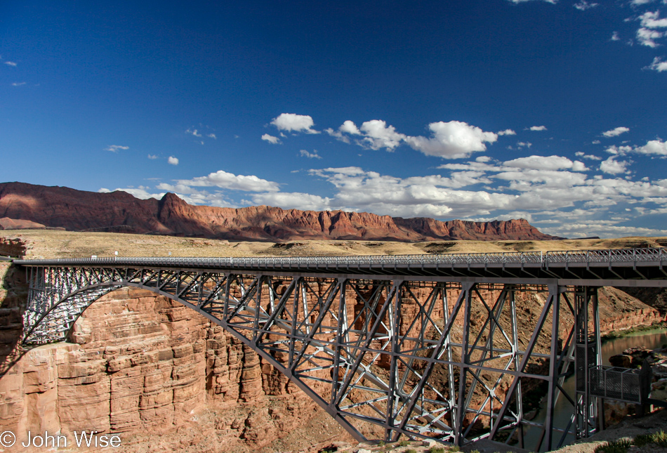
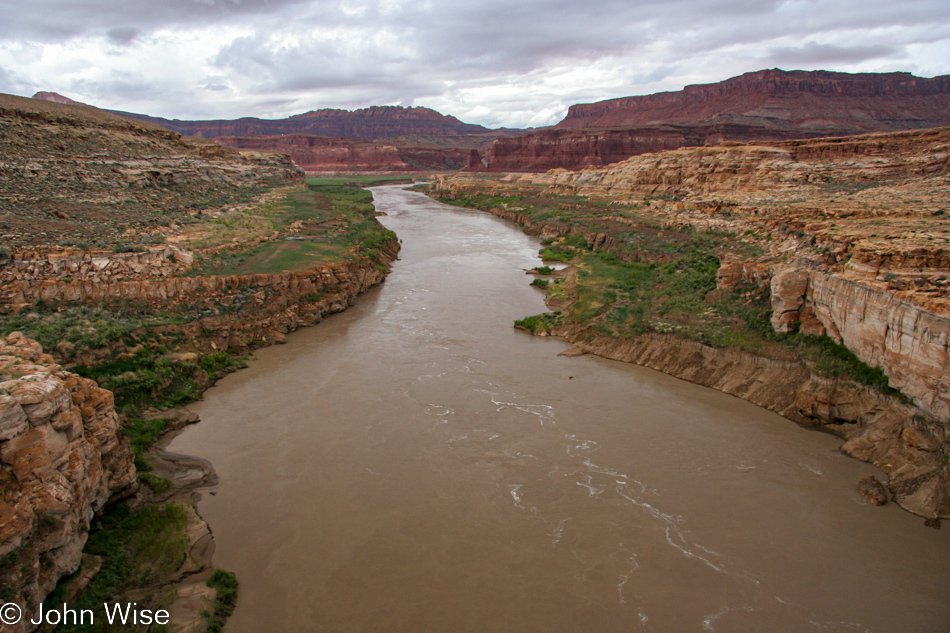
I’ve taken countless photos over the years of the Colorado River from the Navajo Bridge but I’m not sure I’ve ever taken one in this kind of light. I took this thought not as yet another iteration of this scene but as an establishing shot of what comes next. First, though, there’s a tiny detail at the top of the cliffside on the right, and while you can’t see it right now, it’ll all become clear in the next photo. Oh, and consider that the bridge we are on is 467 feet (142 meters) over the river below, which should give you some idea about the scale.

Condors at Navajo Bridge in Marble Canyon, Arizona

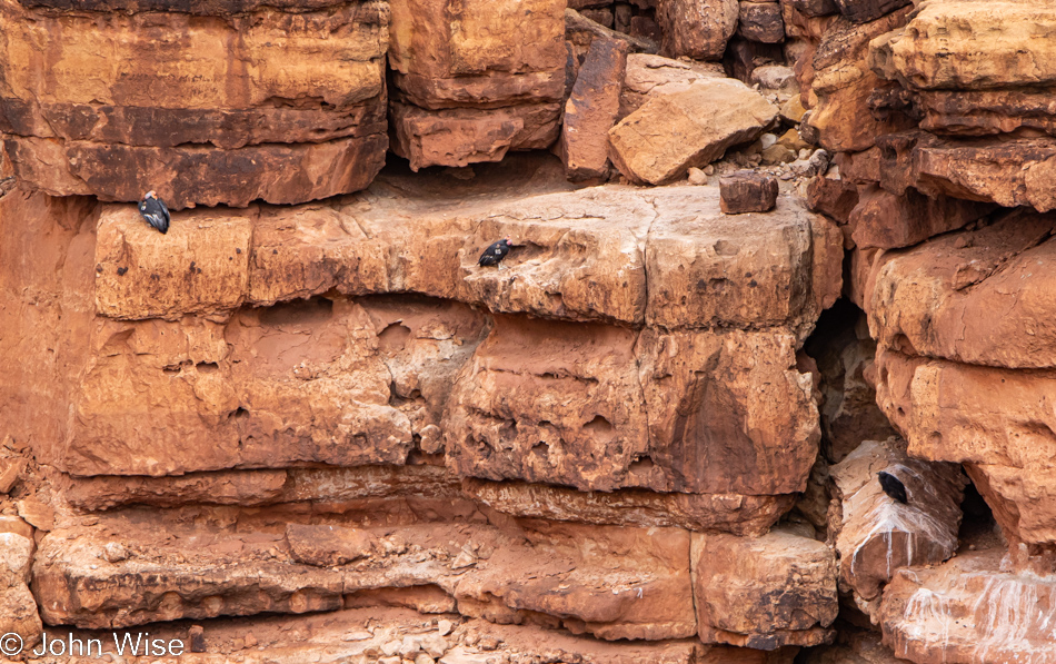
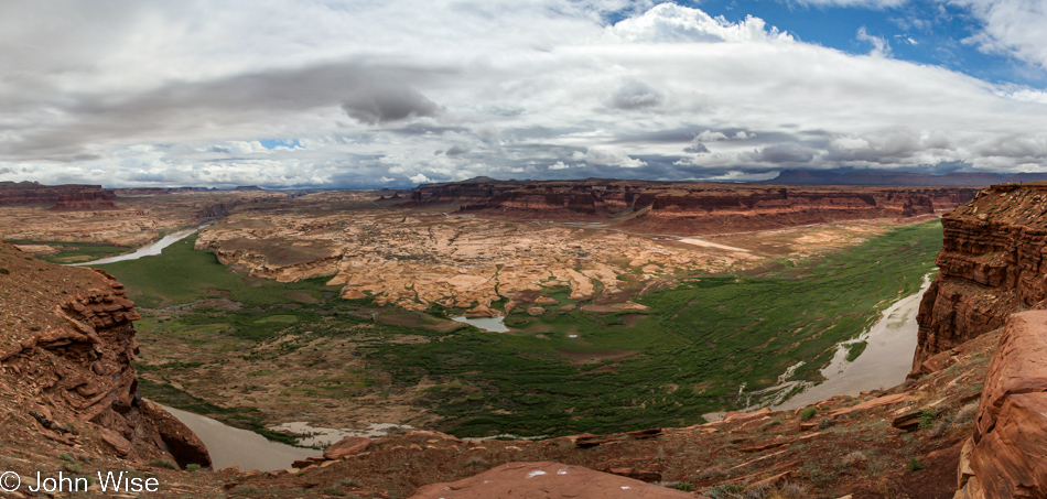
On the lower right sits an incredibly rare bird, rarer than its parents, above it to the left. That black spot is a fledgling condor born in the wild, one of a small handful. These are just three of the approximately 115 condors that are hopefully still alive in Arizona, and if I had to guess, I’d say that Caroline and I have seen no less than 15 of these giants of the scavenger world or more than 10% of all condors in our state; that’s simultaneously cool and tragic. Think about it: we are barely holding on to the 500 or so California Condors that still exist, although that’s from a low point of just 27 birds left in existence back in 1987. If we are having this difficulty keeping a species of bird with a 10-foot wide wingspan alive, what would make us believe we can keep ourselves going into the future? And if you believe it’s natural selection, the demise of condors was due to humans using lead ammunition for hunting and leaving animals and entrails in the wild where the birds would naturally finish them off. The resulting lead poisoning nearly brought them to extinction.

Rainbow seen over Highway 89 north of Flagstaff, Arizona

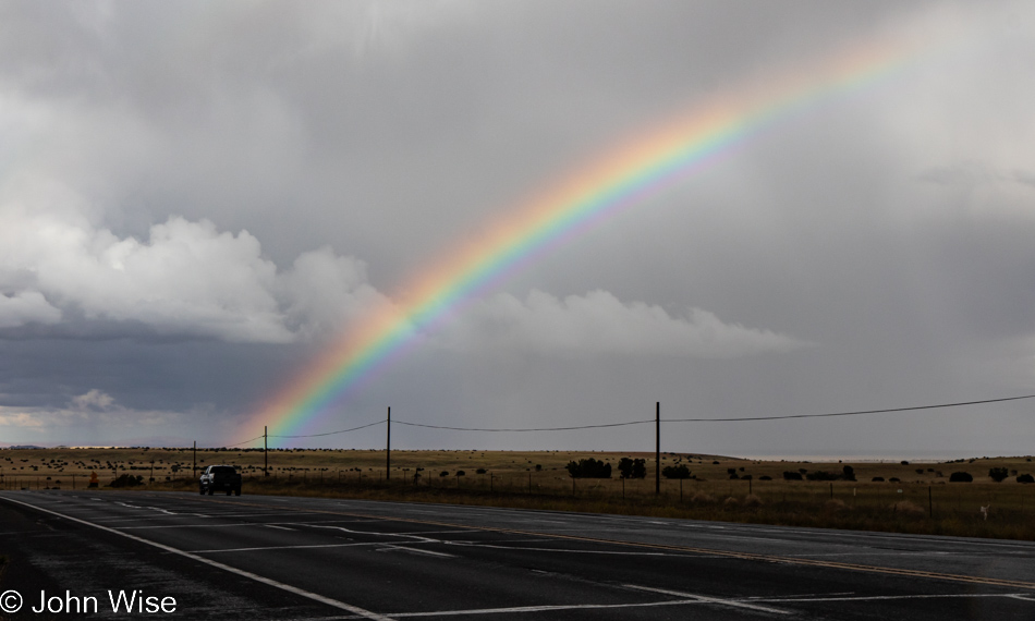
Since leaving the remarkable sight of the fledgling, we’ve been hitting intermittent rain, sometimes heavy. Just south of Flagstaff, the intensity of this rainbow demanded we stop. Sadly, the photo does it no justice.

Flagstaff, Arizona

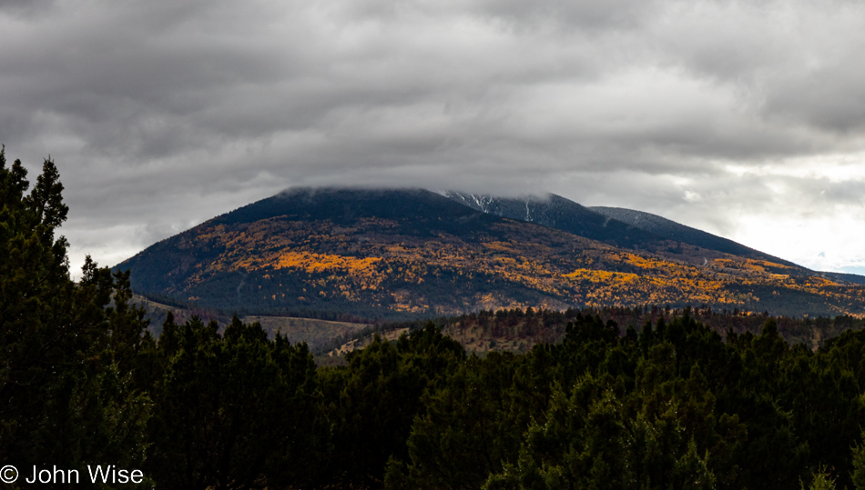
From a distance, we thought we were looking at sun rays shining through the clouds onto the forest that sits on the flank of San Francisco Mountain below Humphry’s Peak, that’s well out of sight. Nope, it wasn’t until we pulled over that we saw the thousands of Aspen trees changing color with the change of season.

Rainbow seen over Highway 17 south of Flagstaff, Arizona

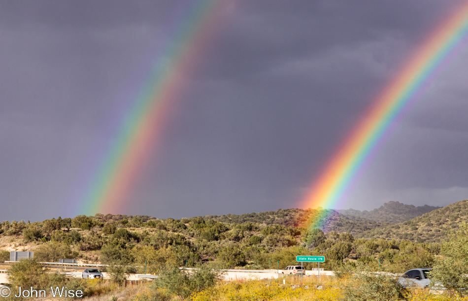
Hmmm, maybe Sedona is the magic place so many believe it is, as here we are at Highway 179, which is the exit for Sedona, and it was double-rainbows all the way.

Jutta On The Road – Day 16

Jacob Lake restaurant at the North Rim of the Grand Canyon National Park in Arizona

Disclaimer: This blog entry wasn’t written until 17 years after the trip. It should be noted that it was a huge mistake to have not written it way back when. Sometimes, after writing so much about other days, it happens that at the time directly after the trip (or even during), I convince myself that the details are not that important. Years later, these details are that important, and pulling them out of foggy memories is difficult. The photos help and often leave clues, and then Caroline’s memories are usually far clearer than mine. With that said, here goes.

Here, we are approaching the conclusion of an incredibly ambitious, maybe overly ambitious, trip that took in 9 states over 16 days. Our overnight was at Jacob Lake Inn, where we snagged a cabin; we were about to have breakfast at their restaurant.

Jutta Engelhardt and Caroline Wise at the North Rim of the Grand Canyon National Park in Arizona

Under incredibly clear skies, we are driving down to the north rim here in the Grand Canyon National Park, our 14th National Park or Monument of this trip.

North Rim of the Grand Canyon National Park in Arizona

Talk about choosing the right day to be here.

North Rim of the Grand Canyon National Park in Arizona

The south rim looks like it’s a stone’s throw away, while the San Francisco Peaks over in Flagstaff are about 60 miles away as the crow flies but about 200 by car.

North Rim of the Grand Canyon National Park in Arizona

You might notice that we were not out here for sunrise, nor will we be on hand for sunset, which is all okay as there’s no small amount of exhaustion going on. Then again, this kind of visibility is outrageous.

North Rim of the Grand Canyon National Park in Arizona

While this side of the Grand Canyon is not as busy as the south rim, how we calculated our arrival when absolutely nobody else was here will have to remain a mystery.

North Rim of the Grand Canyon National Park in Arizona

As I said, no one else is here with us.

North Rim of the Grand Canyon National Park in Arizona

Just us and this tree.

Jutta Engelhardt and Caroline Wise at the North Rim of the Grand Canyon National Park in Arizona

As I stop to really look at this photo of mother and daughter, I’m realizing that there are more photos of these two together in the United States than were ever taken of them in Germany where they were born and Jutta still lives.

Vermillion Cliffs area northern Arizona

We are now on our way home; if only that were our home over there.

Vermillion Cliffs area northern Arizona

The Vermillion Cliffs area of our state of Arizona is one of our great treasures, but rarely, if ever, have I heard anyone else mention them.

Navajo Bridge over the Colorado River and the Grand Canyon National Park in Arizona

From here, we’ll turn south and, in about 4 hours, be pulling into the driveway of the place we live. Here is the Navajo Bridge.

The Colorado River and the Grand Canyon National Park in Arizona

Both the new and the old Navajo Bridges cross the Colorado River. The old one is now only used for foot traffic while foot traffic is forbidden on the newer road bridge.

So, as I wrote in my disclaimer in the previous days’ posts, these entries have been written between 15 and 17 years after the events of the days covered. There was indeed a two-year gap in finishing the writing and photo prep due to losing track of working on this sequence, with other things grabbing my attention, but now they are done. While lacking the granular details, I’d like to have reminisced with, at least we now have a comprehensive visual record with minor tidbits brought to the blog, which will allow a greater chance of us stumbling into the images than when they sit in storage on a hard drive. Writing today, I think back to when my mother-in-law still had the ability to join us for such grueling adventures and wish we could share these old memories with her, but she’s in assisted living these days, and cognitive issues limit her ability to follow what she’s looking it on a computer or phone screen. Another reminder to do the things with those you love when they can be fully enjoyed and then celebrated for years into the future.

Jutta On The Road – Day 15

Mokee Dugway in southern Utah

Disclaimer: This blog entry wasn’t written until 17 years after the trip. It should be noted that it was a huge mistake to have not written it way back when. Sometimes, after writing so much about other days, it happens that at the time directly after the trip (or even during), I convince myself that the details are not that important. Years later, these details are that important, and pulling them out of foggy memories is difficult. The photos help and often leave clues, and then Caroline’s memories are usually far clearer than mine. With that said, here goes.

There is no swinging steak and eggs for breakfast at the Mexican Hat Lodge, and Monument Valley is not on the itinerary for this trip, so we are heading into new territory on Jutta’s behalf. Regarding the weather, no worries. I’ve looked ahead in my photos and see that we’ll be enjoying blue skies later in the day, but for now, we have drama above.

Jutta Engelhardt and Caroline Wise on the Mokee Dugway in southern Utah

There’s also the matter of drama in our backsides as we drive up this narrow gravel road known as the Mokee Dugway, which, while beautiful, is fraught with nail-biting fear as the edge of oblivion is always too close for comfort. Yep, it’s cold and windy up here at this overlook, and Jutta’s thin little cardigan ain’t cutting it.

Fry Canyon Lodge in southern Utah

We used to take photos of places as reminders with the idea that one day, we’d return and stay at that place. Well, it turns out that Fry Canyon Lodge was closed for renovations, except those renovations would never end or maybe never begin because it never opened again.

On the way to Lake Powell, Utah

There’s a river out there, a mighty and great river.

Colorado River flowing to Lake Powell in Utah

It’s called Colorado.

Upper end of Lake Powell in Utah

Little did we know that the era of Lake Powell reaching all the way up here to the Hite Marina was well over. Across the way, on the right, you might be able to make out the boat ramp, obviously, it no longer reaches the water. The bleached rock was underwater just a few years before, but in 2002, the lake level dropped too far.

Plant flowering in southern Utah

Reminder to self: not all views must be vistas and dramatic horizons; there are spectacles closer to us if we slow down and check out what’s around us.

Approaching Capitol Reef National Park in Utah

We’ll continue on Utah State Route 95 a ways further as our destination is mostly to the west.

Jutta Engelhardt and Caroline Wise at Capitol Reef National Park in Utah

No, Jutta didn’t just go and get tough; it was warming up by the time we reached the Capitol Reef National Park.

Capitol Reef National Park in Utah

With water flowing through the park, we’d be extra cautious as it’s been drilled into Caroline and me regarding the threat of flash floods. We are far too timid to risk something like being caught by one.

Capitol Reef National Park in Utah

So, instead, we’ll take the high road.

Capitol Reef National Park in Utah

The really high road overlooking the entirety of Earth!

Capitol Reef National Park in Utah

Oh my god, I don’t know if I can drive over that. Both sides fall off at such an angle that only death can result from leaving the road. Why are there no guardrails on this ridge? My plan was to look way out there and ensure I wouldn’t see one other car ahead of us and then drive right down the yellow stripe, and that worked I can only hope I never have to drive this again in my life.

Capitol Reef National Park in Utah

Well, if this is the reward for maneuvering the precarious tiny slice of road, maybe it was worth it.

Somewhere between Capitol Reef and Bryce National Park's in Utah

I’ll bet a dollar that before engine-driven water pumping all the beauty in the world didn’t make up for how hard it was to farm out here. Now that we can extract every drop of fresh water from below our feet, you can bet that’s just what we’ll do.

Jutta Engelhardt at Bryce National Park in Utah

National Park number two is right here at Bryce. Years ago, when we first brought Jutta through the area, we only got as far as Zion, so now we’re closing the loop.

Bryce National Park in Utah

It’s late in the day when we got here, which you can easily tell by the shadows, huh? So there will be no hikes into the hoodoos, but then again, nobody would ever expect that of us as we race across the United States, the entire western United States.

Caroline Wise and John Wise at Bryce National Park in Utah

Sometimes, a selfie with just the two of us reminds us that we are here together, which can easily be lost when Jutta and Caroline try to spend as much quality time together as possible while taking in a million new sights and experiences.