On the Move in Santa Fe

Big Tesuque Trail in the Santa Fe National Forest, Santa Fe, New Mexico

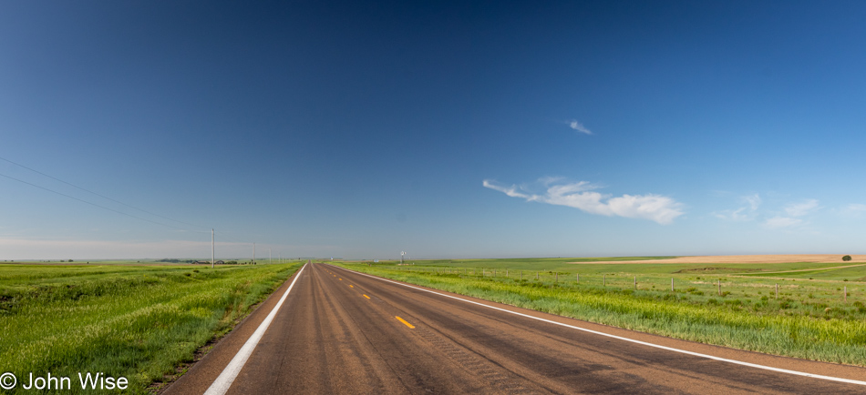
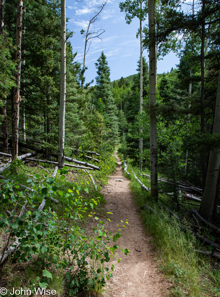
The road northeast out of Santa Fe brings visitors into the Santa Fe National Forest, and while it’s ultimately a dead end farther up the road, we are only going as far as the Big Tesuque Campground, where a trail of the same name begins and ends. If only we could find the trail. It was Alltrails that had brought this particular route to my attention, and somehow, I’m failing to see where the trailhead is, in spite of the nearby map that is useless. We ask someone who appears to be camping here, but he doesn’t know where the Big Tesuque Trail is either. Just then, across the street, a post caught my attention as the likely marker for the beginning of the trail. Bingo.

Big Tesuque Trail in the Santa Fe National Forest, Santa Fe, New Mexico

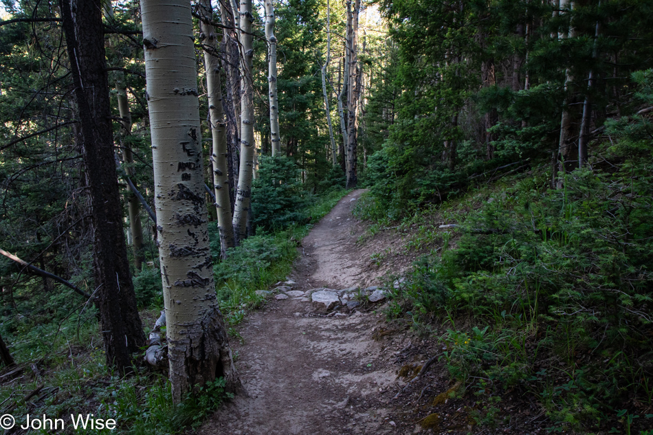
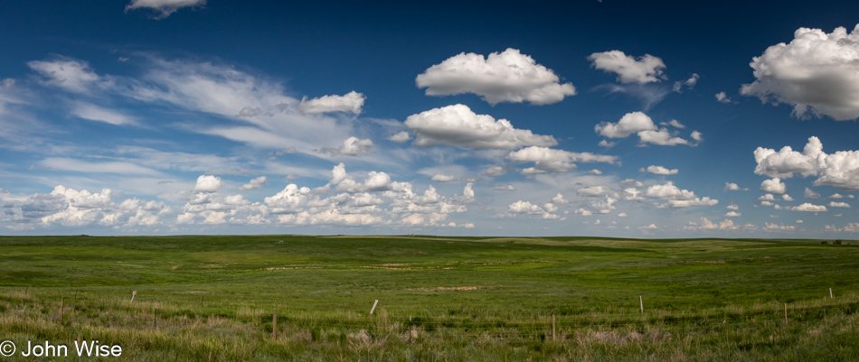
With the capital city of New Mexico just below us at about 7,200 feet, it should be no surprise that our forest route could start at 9,700 feet (2,950 meters) of elevation. What I really want to point out here is that, as we stepped from the car, the temperature was a relatively brisk 56 degrees (13 Celsius) or cold enough to our summer acclimated desert skin that a sweater was briefly considered, but no, we’d tough it out. It wasn’t only the cool air that greeted us: the nearby stream and the birds all sang songs that were music to our senses.

Big Tesuque Trail in the Santa Fe National Forest, Santa Fe, New Mexico

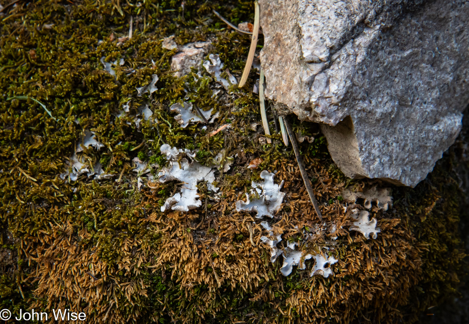
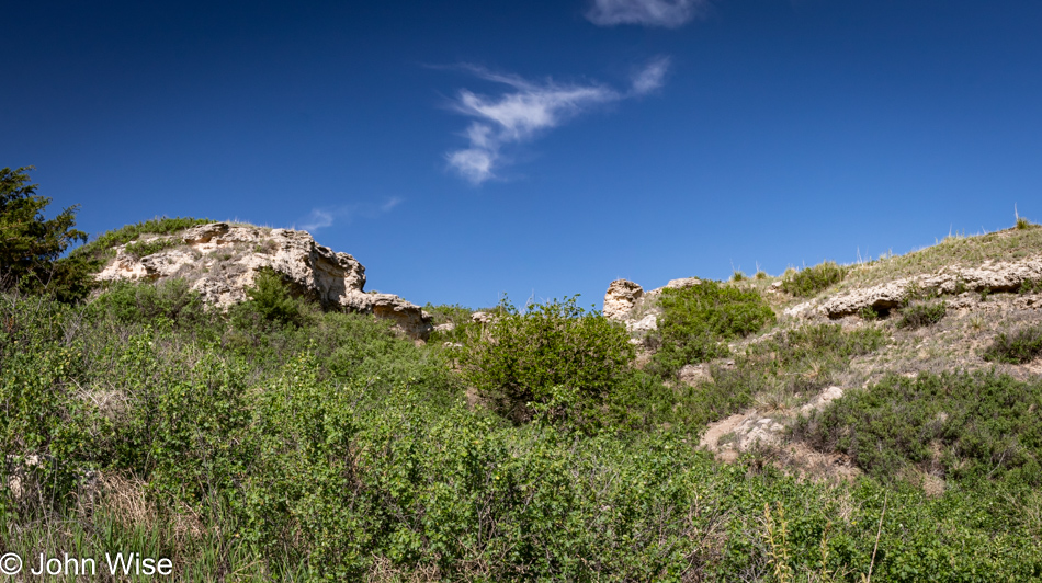
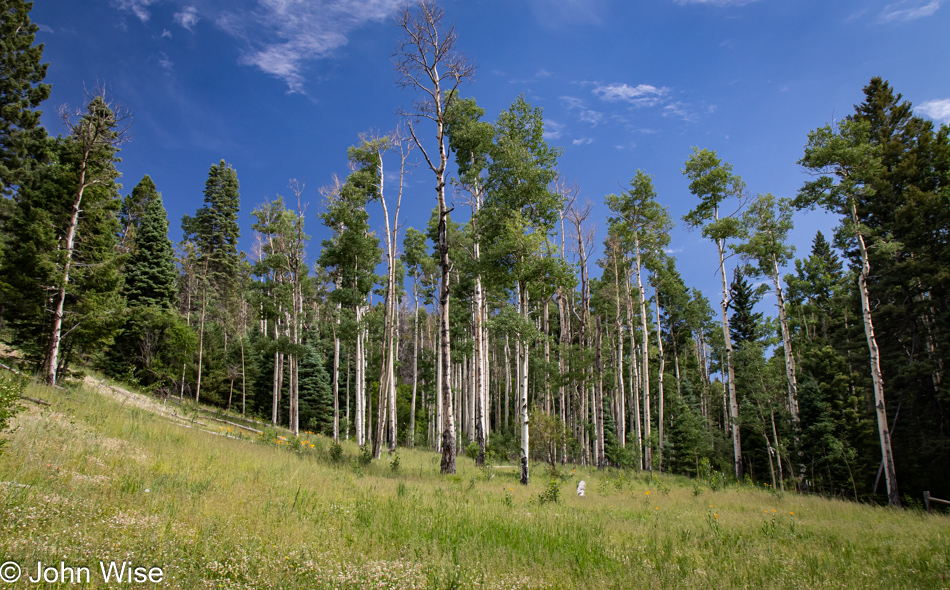
Oh my god! Rock, needles, shield lichen, and moss in a configuration we’ve never seen before. Isn’t the forest simply enchanted in its beauty?

Big Tesuque Trail in the Santa Fe National Forest, Santa Fe, New Mexico

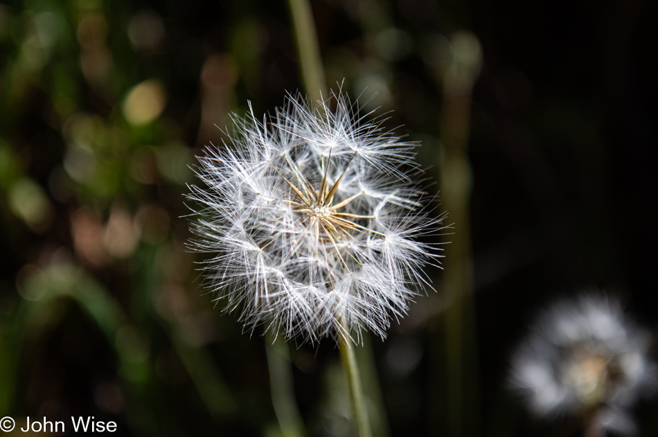
This is the point on the trail where one stops to make a wish that all successive days will be just as perfect as this one.

Caroline Wise on the Big Tesuque Trail in the Santa Fe National Forest, Santa Fe, New Mexico

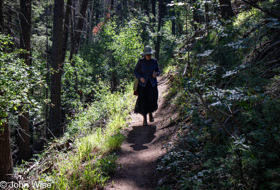
I don’t believe Caroline has ever worn a skirt while hiking in a forest, nor has she carried her purse. This combo gives her the silhouette of a Mennonite from time to time, depending on the light upon or behind her here on the trail.

Big Tesuque Trail in the Santa Fe National Forest, Santa Fe, New Mexico

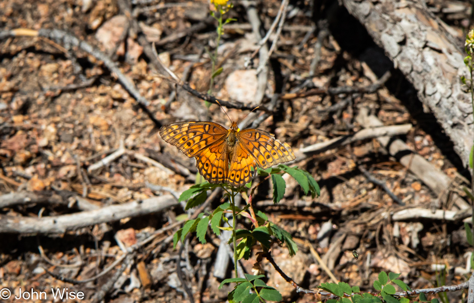
Wait a sec, I see a butterfly and am prepared to take 30 or more photos while I try my best to snap one with its wings perfectly open for me to capture the hidden message buried in the patterns I cannot decipher since I’m not a butterfly.

Caroline Wise and John Wise on the Big Tesuque Trail in the Santa Fe National Forest, Santa Fe, New Mexico

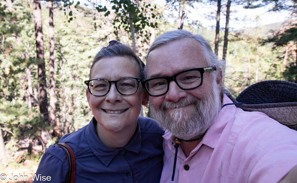
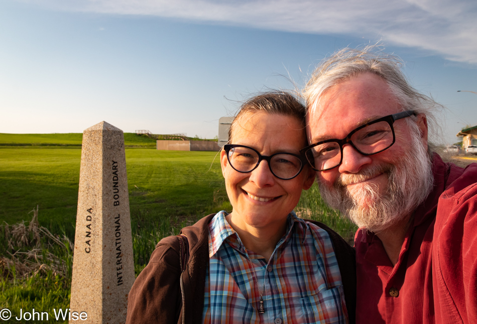
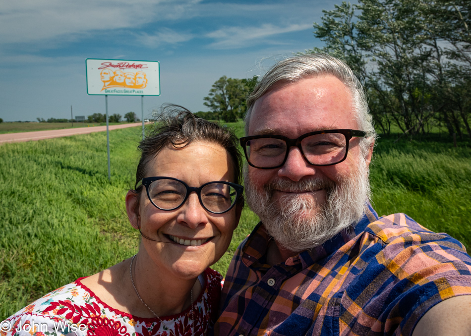
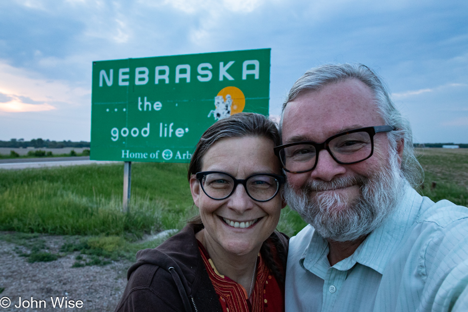
Nearly the same process takes place as I try to capture a selfie of Caroline and me with her eyes open, my hair not out of place, our glasses too low on our noses, no food on Caroline’s teeth, no dangling boogers, poor focus, one of us in a shadow or too bright of sun, or any of the other multitude of things that go wrong while trying to take a photo of the two of us. By the way, has anyone ever wondered if Caroline and I are roughly the same height? We are not, but when taking our photo, I bend my knees so we can appear cheek to cheek in our selfies. I also grab hold of one of her butt cheeks (which nearly always makes her laugh) before I start snapping photos and wildly moving the camera into different positions hoping that we are somewhere in the center. Some of you may think that taking a selfie is not that hard, but I would surmise that you are using your phone while I use my DSLR that; on more than one occasion, has allowed me to repair an image where lighting proved difficult, kind of like this one with the bright background. One thing I can’t take into account or fix is that we seem to be aging in our photos as the years pass.

Caroline Wise on the Big Tesuque Trail in the Santa Fe National Forest, Santa Fe, New Mexico

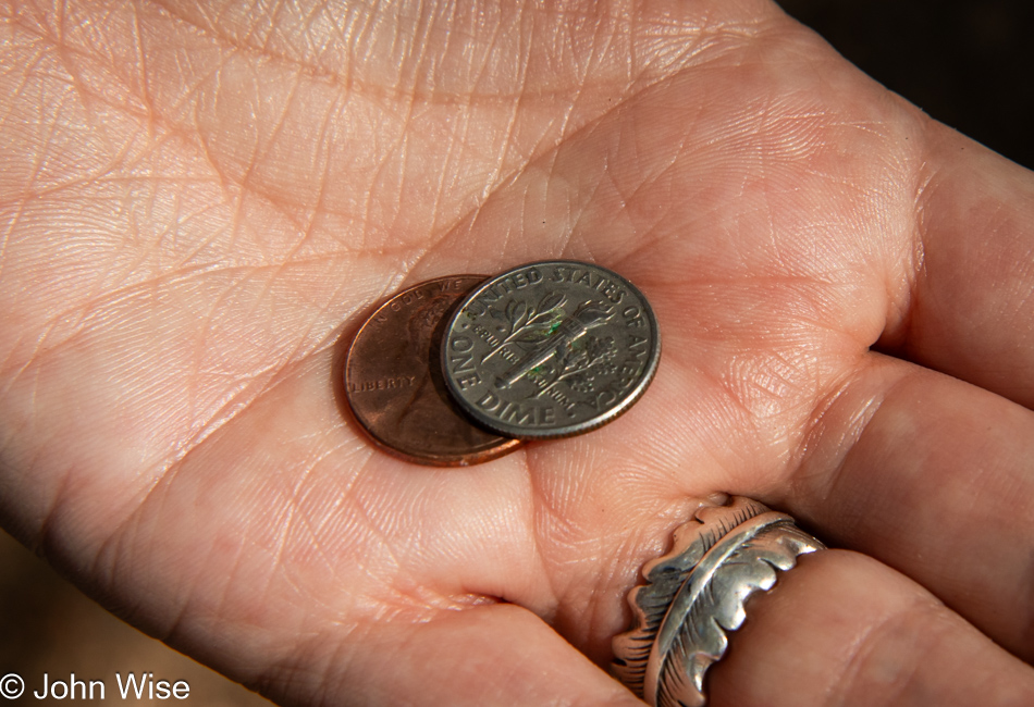
I had a choice: share the image of the damned dental flosser Caroline spotted on the trail (yeah, seriously, a dental flosser on a forest trail because everywhere is the right place for proper dental hygiene) or the eleven cents we found. Just how we managed to see any of this perplexes us, too, but there’s proof of the change. Barely a week passes that we don’t see discarded dental flossers or pick-up change on a walk.

Big Tesuque Trail in the Santa Fe National Forest, Santa Fe, New Mexico

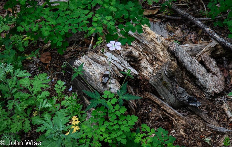
We could have taken this flower too and packed it between pages of a book as a keepsake, but then the next person would have been denied this beautiful scene,  and seeing Caroline already pocketed not only the dental flosser and the loose change, she also picked up a stinky cigarette butt.

Big Tesuque Trail in the Santa Fe National Forest, Santa Fe, New Mexico

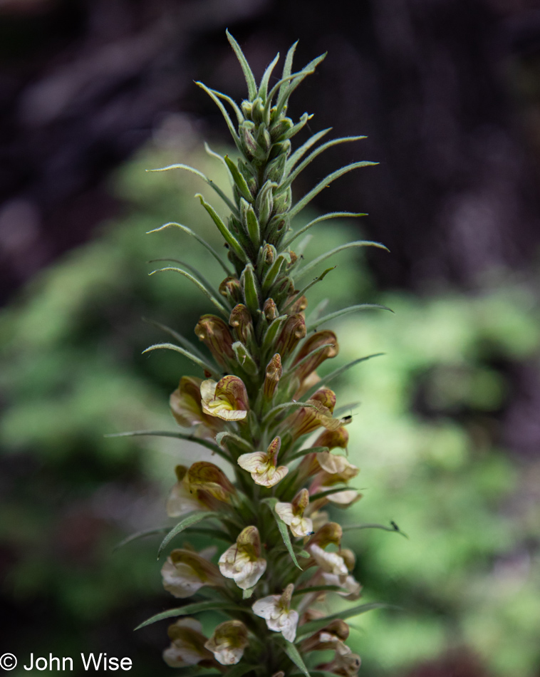
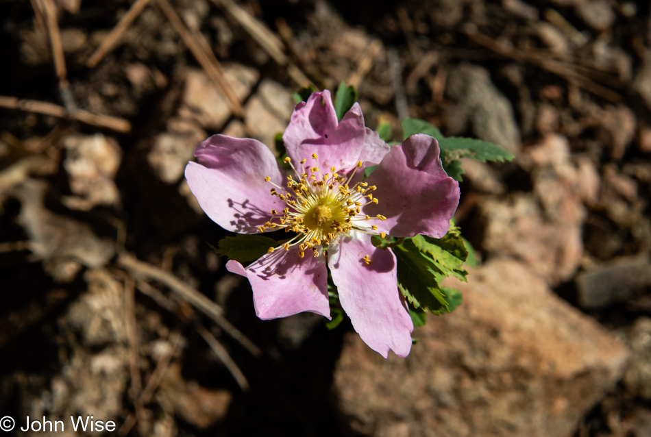
I’m going to put it out there that this is Pedicularis procera (giant lousewort), but we’ll let Caroline verify this as her “Search-fu” is far more attuned to perfection than any weak effort I throw at finding facts, meaning you really shouldn’t use my writing as something that arrives with any veracity. [Yes, you did get it right – this time… Caroline]

Big Tesuque Trail in the Santa Fe National Forest, Santa Fe, New Mexico

The trail guide said the walk was easy. It also said there would be only 597 feet (182 meters) of elevation gain. NO WAY, and I also don’t believe that the trail was 3.6 miles (5.8 km) long, WHATEVER.

Big Tesuque Trail in the Santa Fe National Forest, Santa Fe, New Mexico

After HOURS (1.75 hours without exaggerating), we have reconnected with the first leg of our hike, thus closing the loop, and are mere minutes away from reaching our car to head back down the hill to the International Folk Art Market.

Big Tesuque Trail in the Santa Fe National Forest, Santa Fe, New Mexico

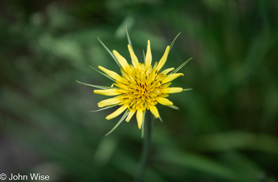
Yellow salsify is this flower’s name, but I certainly like the other name for it better: yellow goatsbeard.

Big Tesuque Trail in the Santa Fe National Forest, Santa Fe, New Mexico

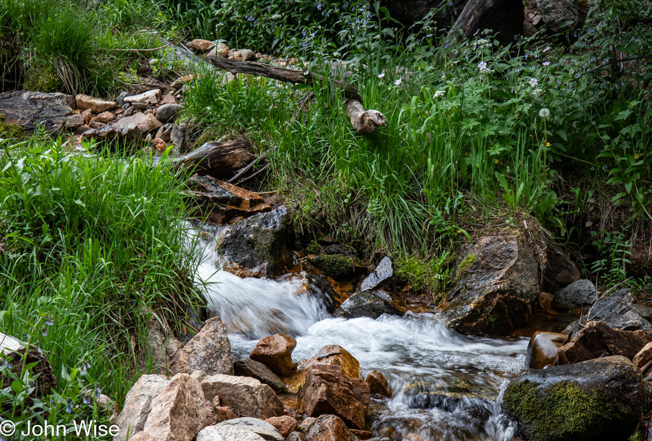
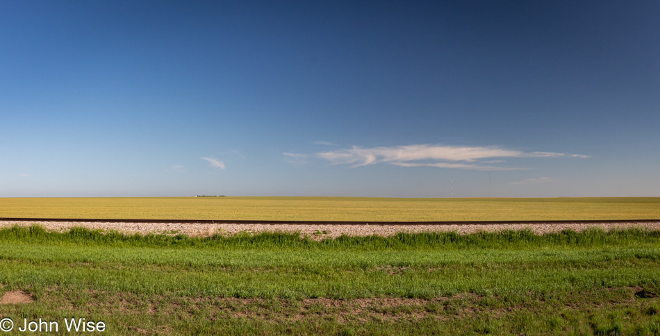
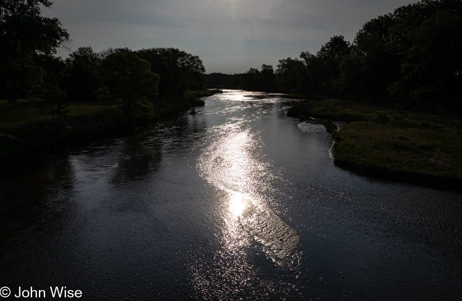
I’d mentioned the nearby stream we heard after getting out of our car; that stream flows just past the trailhead marker, and this is it right here. Its proper name is North Fork Tesuque Creek, meaning it is not actually a stream. Somehow, we lengthened the trail to 4.1 miles (6.6 km) and added a few dozen extra feet to the elevation gain, but now we’re done and need to head back to the city.

International Folk Art Market in Santa Fe, New Mexico

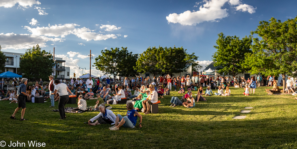
With no time to waste and following the maxim of “no rest for the wicked,” we were off the mountain and back at the market. We happened to catch this performance group having photos taken at the entrance, which reminds me that I should point out that the stage remained busy nearly all day, and in a nearby hall, talks/workshops are part of the program (for an extra charge). We attended one of the talks yesterday, but to be frank, the organizer of IFAM would be well advised to better screen and direct their speakers prior to the event. As for the performers on stage, Caroline and I did watch a few dancers from a local group perform dances, but there was not enough shaded seating available to invite us to hang out longer so we soon returned to meandering the grounds and were always on the move scouring the booths for something we might have missed.

Karma Choden of Bhutan and Caroline Wise at the International Folk Art Market in Santa Fe, New Mexico

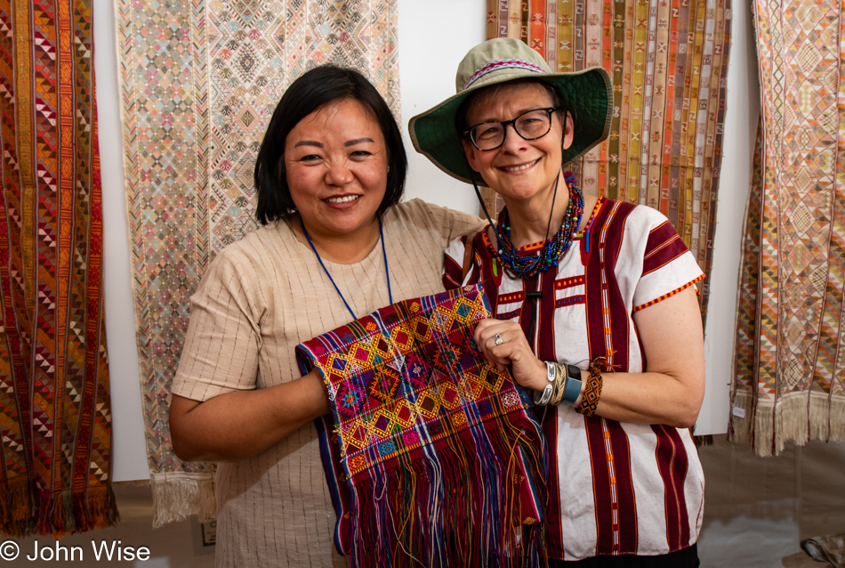
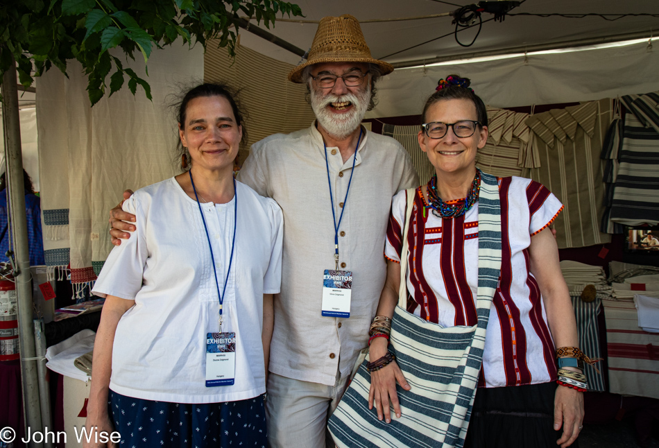
This blog post is being put together much like a length of woven fabric: Caroline and I are the weft, and these experiences are the warp. Because we are weaving so much of ourselves into such an incredible number of experiences today, it takes forever for the thing to take shape. Had we slept in, skipped the hike, visited the market, and did little else, I wouldn’t have nearly as much to share. I could have just thrown a few threads of what the day entailed into this post, and would have been done lickety-split. Instead, there are 41 photos representing our day, with 25 of them still to be scrolled past. As for the textile being shown, it is a rachu (ceremonial scarf or sash worn by Bhutanese women on special occasions) woven by the mother of Karma Choden of Bhutan who’s standing next to Caroline.

Bracelet from Crucelina Chocho of Columbia at the International Folk Art Market in Santa Fe, New Mexico

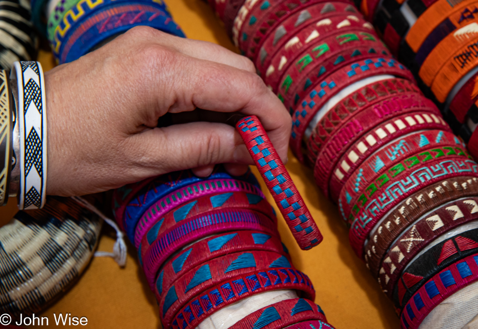
If you ask me, I think Caroline might be basing her purchases on ideas of geography in order to figuratively travel to all these places via the fiber arts. These bracelets are made by basketry artist Crucelina Chocho of Columbia, a member of the Wounaan indigenous group, using Werregue palm fibers.

International Folk Art Market in Santa Fe, New Mexico

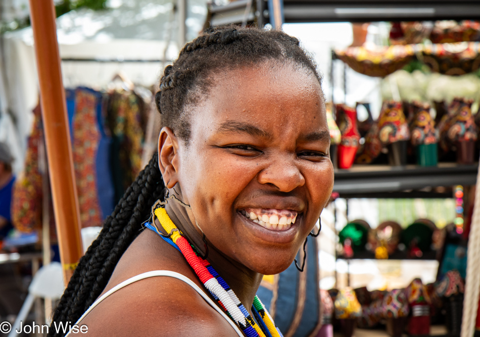
Trying to be discrete in capturing a photo of her earrings in the shape of Africa, this woman turned towards me with the smile that won “Best Smile of IFAM 2023.”

Olinda Silvano of Peru and Caroline Wise at the International Folk Art Market in Santa Fe, New Mexico

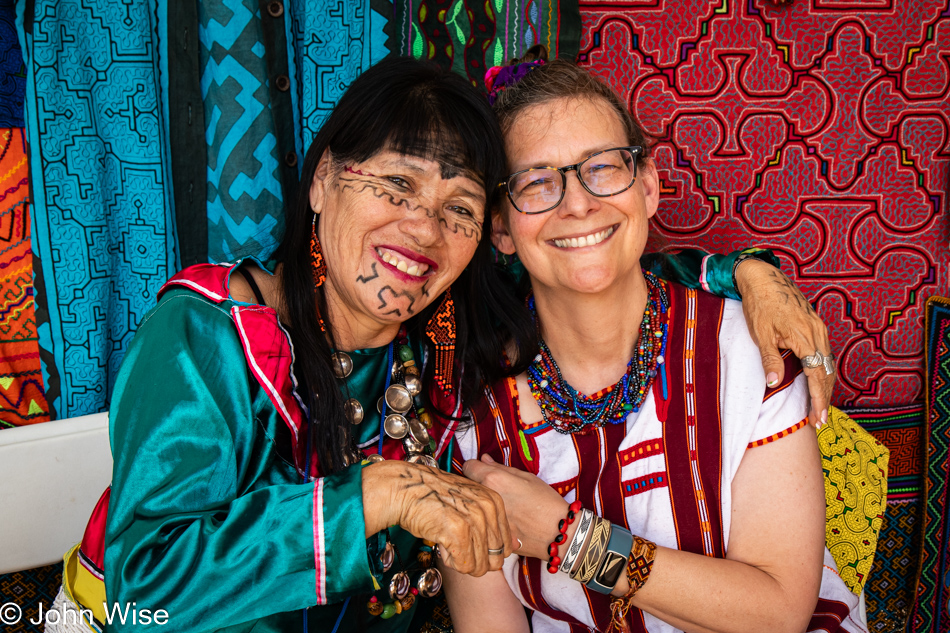
While the cloth in this stand didn’t capture Caroline’s eye, the bracelet made of black and red seeds did. Caroline’s been using a Dremel to grind holes into Texas mountain laurel seeds she wants to make into a necklace, and seeing such unique seeds from the Amazon was just the kind of thing that helped inspire her. This bracelet was made by the lady on Caroline’s right; she is Olinda Silvano of Peru.

Scissors from Zavkiddin Kamalov of Uzbekistan at the International Folk Art Market in Santa Fe, New Mexico

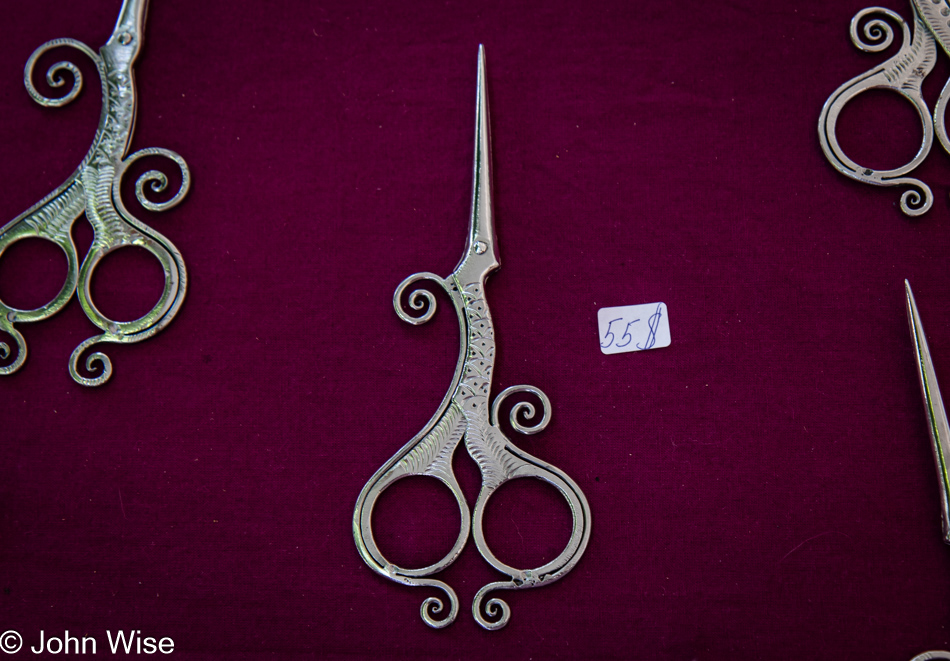
Why one can never have enough scissors is beyond my ability to write something that could explain the mind of my wife and her collection of things with fetish value. I may never truly understand this, but these little things definitely bring her joy.

Museum of International Folk Art in Santa Fe, New Mexico

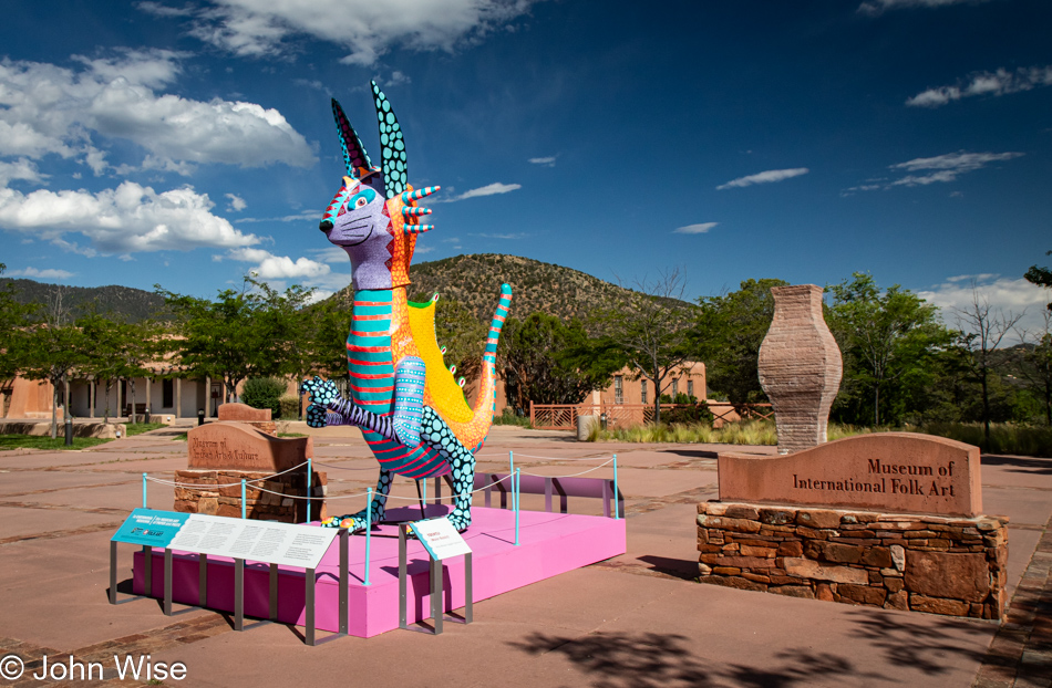
Last year at this time, the International Folk Art Market was held up here on Museum Hill. This year, it is hosted at the Railyard Park near the old town, and the museum area is awfully quiet. We are here because museum tickets are half-price for IFAM visitors this weekend, and more important than that, we were drawn in by an exhibit titled Ghhúunayúkata / To Keep Them Warm: The Alaska Native Parka at the Museum of International Folk Art.

Museum of International Folk Art in Santa Fe, New Mexico

The first collection we browsed was an ongoing exhibit called Multiple Visions: A Common Bond. There are over 10,000 artifacts from all over the world on display, and one can get lost in trying to look at everything. What is neat is that objects are not presented based on their subjects, usage, or style and are not separated by provenance, which makes connections and relationships between seemingly remote cultures apparent. Check out some of the items virtually here.

Museum of International Folk Art in Santa Fe, New Mexico

The reason behind the museum is that handcraft matters.

Museum of International Folk Art in Santa Fe, New Mexico

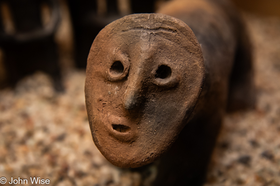
Last year at Meow Wolf, Caroline and I spotted a sculpture that we both thought enchanting. Of the many thousands of objects in this wing of the Museum of Folk Art, I happened to find this one that seemed familiar. Upon getting home, it turns out that there is a similarity. Click here and scroll down about 2/3rds of the page to compare this figurine to the piece in Meow Wolf and tell me if this is where the inspiration came from.

Museum of International Folk Art in Santa Fe, New Mexico

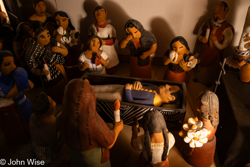
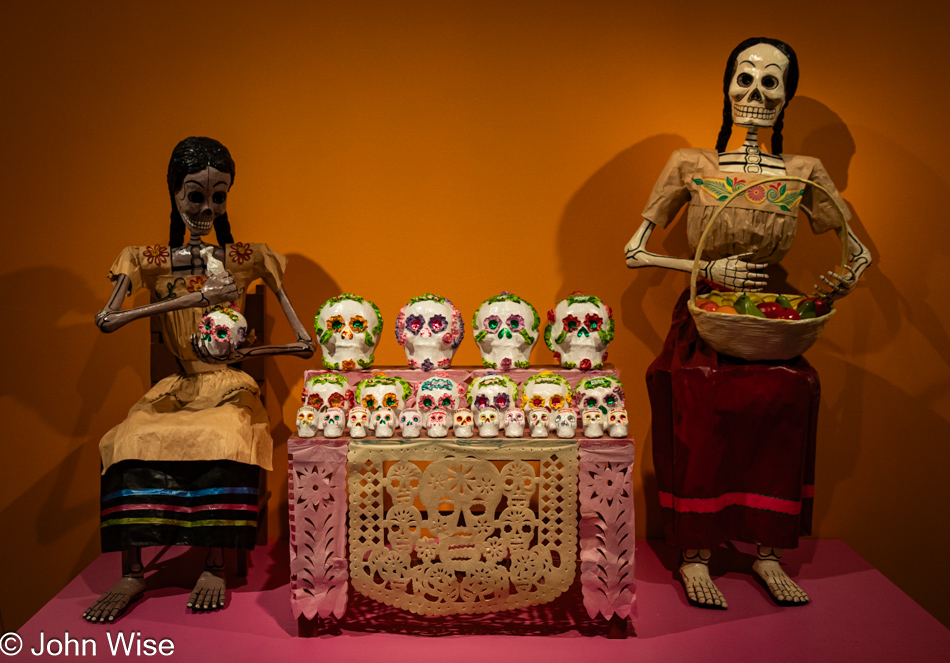
Gathering for the dead.

Museum of International Folk Art in Santa Fe, New Mexico

Gathering for the living.

Ghhúunayúkata / To Keep Them Warm at the Museum of International Folk Art in Santa Fe, New Mexico

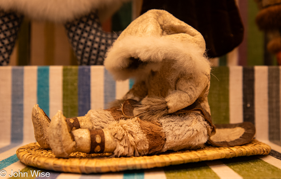
We’ve arrived in the hall featuring the exhibit Ghhúunayúkata / To Keep Them Warm: The Alaska Native Parka. There are 20 parkas on display representing 6 Alaska Native communities: Dena’ina, Iñupiaq, Koyukon, St. Lawrence Island Yupik, Unangan, and Yup’ik. Along with the garments (vintage as well as contemporary), we can see drawings, dolls, tools, and more.

Ghhúunayúkata / To Keep Them Warm at the Museum of International Folk Art in Santa Fe, New Mexico

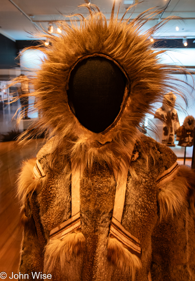
Who doesn’t dream of spending at least some short period of time in the Arctic and having the opportunity to wear something like this parka? As I write this on a mid-July day in Phoenix, Arizona, with temperatures hovering just below 120 degrees (49c), it is difficult to envision so much fur adorning my body (especially as a more hairless version of our species), but a naked ape can dream, can’t he?

Ghhúunayúkata / To Keep Them Warm at the Museum of International Folk Art in Santa Fe, New Mexico

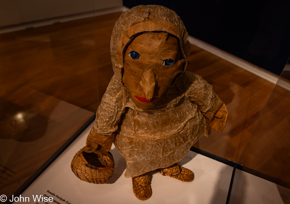
A seal skin doll is exactly what many of us have desired; go ahead and admit it.

Ghhúunayúkata / To Keep Them Warm at the Museum of International Folk Art in Santa Fe, New Mexico

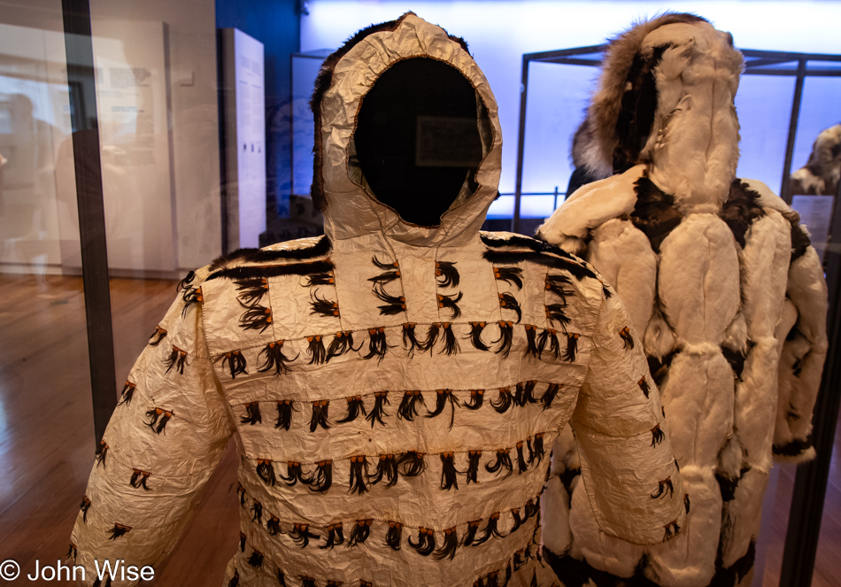
This St Lawrence Island Yupik ceremonial parka is made of seal gut, auklet crests, seal fur, cormorant feathers, cotton thread, and red ocher.

Ghhúunayúkata / To Keep Them Warm at the Museum of International Folk Art in Santa Fe, New Mexico

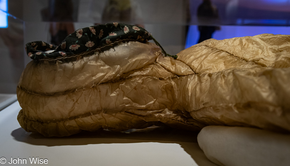
While this seal skin parka might make a great windbreaker, I can’t help that after an hour of sweating inside your waterproof hide; you’d smell like fish. One other thing about this garb: who else thinks it looks a bit Frankensteinish?

Ghhúunayúkata / To Keep Them Warm at the Museum of International Folk Art in Santa Fe, New Mexico

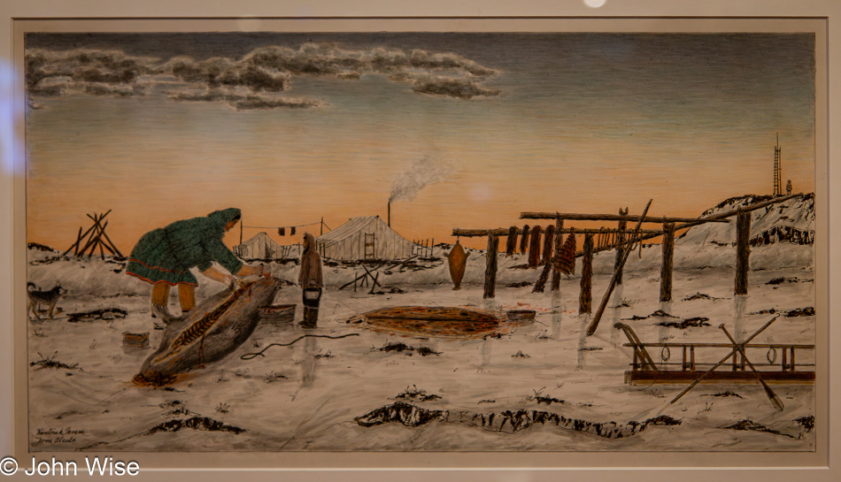
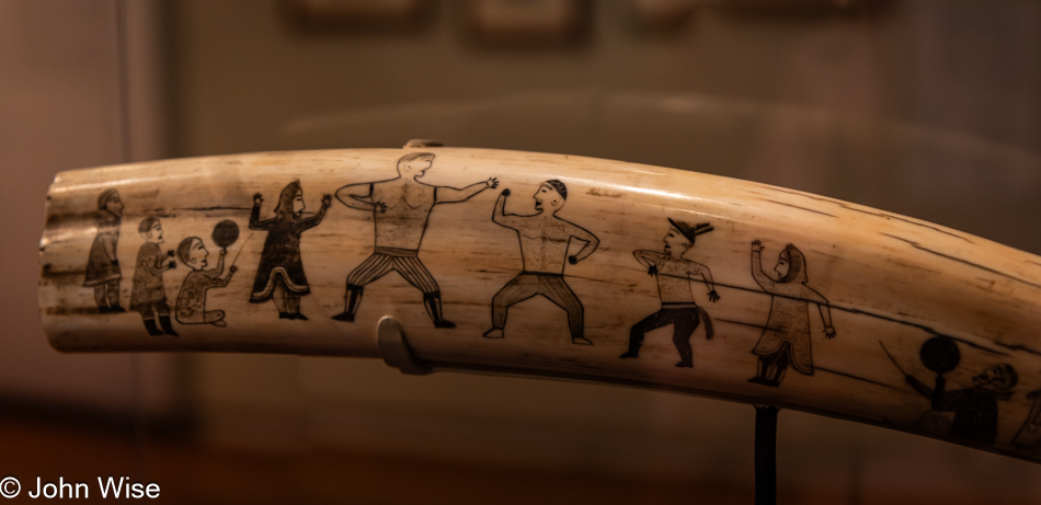
We can consider ourselves lucky that images such as these were painted about 100 years ago so we can glimpse a view of what life was like way up north. While life would have already changed for the indigenous people of the Arctic, this was still closer to their roots than what we’d see after film began capturing their lives.

Mexican Art of Paper and Paste at the Museum of International Folk Art in Santa Fe, New Mexico

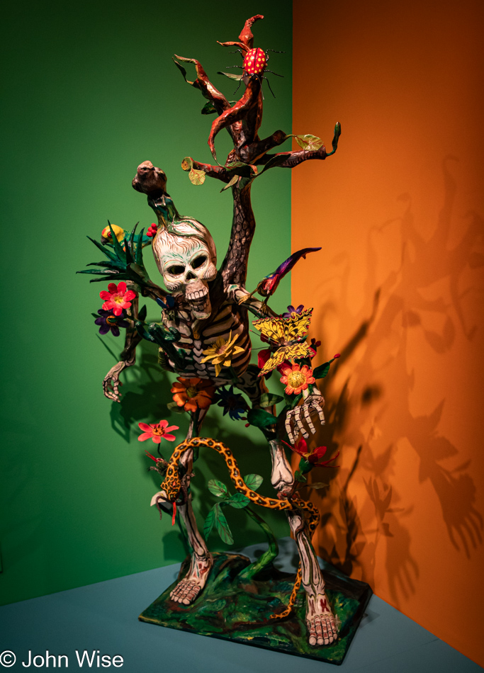
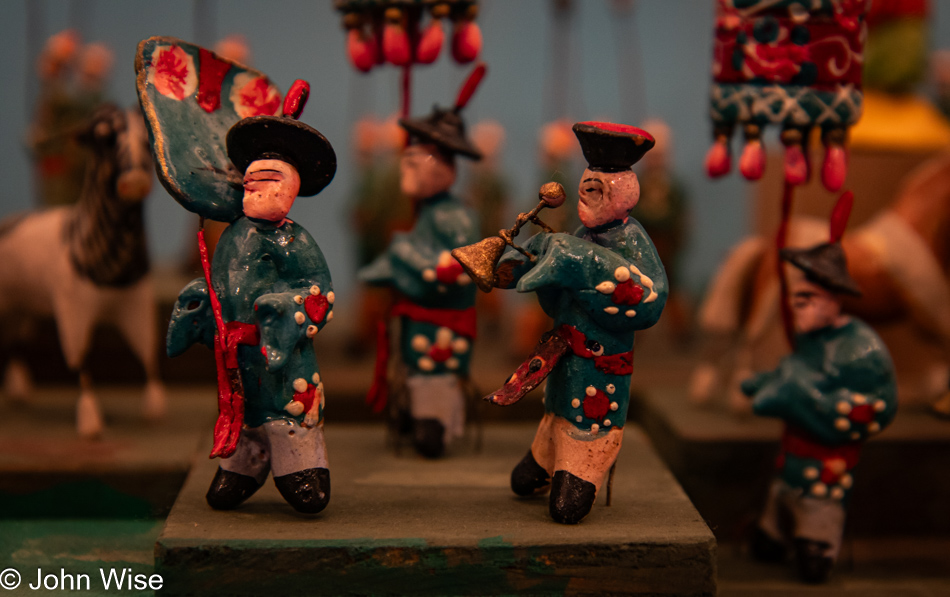
The third exhibit we visited is titled La Cartoneria: Mexican Art of Paper and Paste and has a heavy Day of the Dead feel.

Mexican Art of Paper and Paste at the Museum of International Folk Art in Santa Fe, New Mexico

We don’t have a lot of time to dwell here in the museum due to a commitment starting at 6:00 and my impression was that we were here to see the parka exhibit. Little did I understand that all parts of the Folk Art Museum were going to be of such interest.

Yōkai: Ghosts & Demons of Japan at the Museum of International Folk Art in Santa Fe, New Mexico

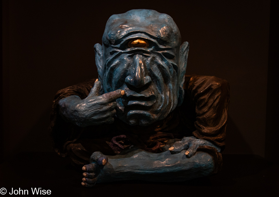
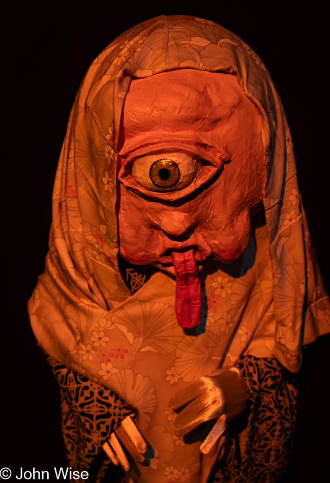
The last exhibit for us here at the museum is titled Yōkai: Ghosts & Demons of Japan.

Yōkai: Ghosts & Demons of Japan at the Museum of International Folk Art in Santa Fe, New Mexico

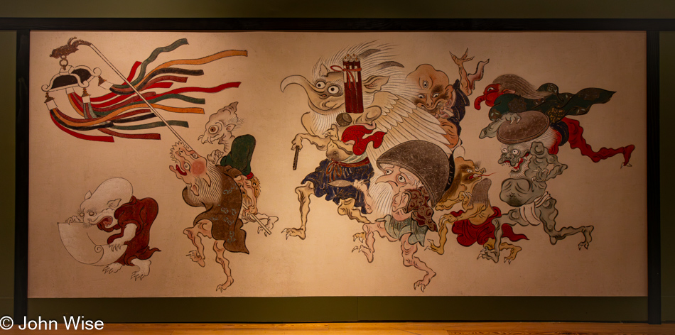
I have to admit to only a passing interest in this exhibit, as ghosts and demons are not really my thing. In lighthearted films lampooning the subject, and in some anime, I can find appreciation, but it’s a rare day.

Yōkai: Ghosts & Demons of Japan at the Museum of International Folk Art in Santa Fe, New Mexico

The utility of the subject matter for children or in entertainment is okay, but older American adults who take it all to heart and believe in it tend to make it all a bit repugnant. Obviously, that’s just me.

International Folk Art Market in Santa Fe, New Mexico

Our 6:00 commitment is back at the International Folk Art Market for the night segment. This was a separate entry, and while we thought we’d spent everything we were going to spend, it turns out that Caroline wasn’t finished ogling exotic clothes, and this bag from Zsuzsa Zsigmond of Hungary apparently pushed some buttons.

International Folk Art Market in Santa Fe, New Mexico

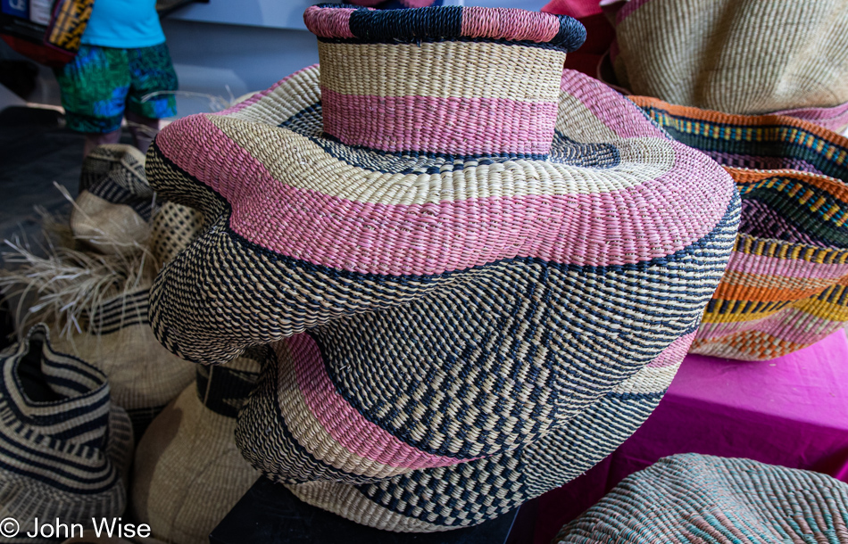
While we love these giant woven baskets from Nanasei Agyemang of Ghana, we simply do not have the space to keep one in our tiny apartment. Every time we see them in someone’s arms, they put a smile on our faces that they are so fortunate to be the new owner of such a unique basket.

Peruvian weaver at the International Folk Art Market in Santa Fe, New Mexico

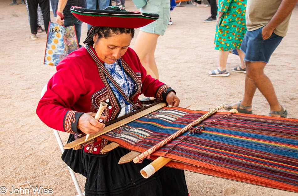
You’d have to be a real nudnik not to love everything about Peruvian weavers.

International Folk Art Market in Santa Fe, New Mexico

Live music and a bar were part of the Night Market here at IFAM, and while we were here, this side of things had little interest for us as we were inching towards exhaustion. So, after a final walk of the vendor booths, we said goodbye to another year that saw our attendance and hopefully not our last. As a matter of fact, before finishing writing that, I went over to the IFAM website to see that they posted the dates of next year’s 20th Annual Market running from July 11th to the 14th, and so I took the opportunity and booked our rooms at Motel 6 just around the corner of the Railyard Park.

The Sheep are Calling

Caroline Wise and John Wise in Fountain Hills, Arizona

We finished reading our book White Trash: The 400-Year Untold History of Class in America by Nancy Isenberg on our way out of Arizona today. Next week, we will be returning to Marcel Proust’s In Search of Lost Time. Like our return to this French author, which we have been reading intermittently since September 2021, so it takes time to return to other things, such as the annual Sheep is Life celebration on the Navajo Reservation. We last visited this event 15 years ago, in the summer of 2008, when it was being held in Tuba City. Today, we are driving to Gallup, New Mexico, which is the closest we could book a room to Window Rock, Arizona, where Sheep is Life is happening this year.

Arizona Route 87 south of Payson, Arizona

Another chapter from our evolving book of life is being written about this weekend. What follows is a chronicle of the events that occurred over the previous 55 hours. Come to think of it, this is likely just about the same time remaining in Proust’s book and hopefully not the amount of time required to write about these wonderful days.

Where were we going and exactly what time of year was it that we were last driving up Arizona Route 87 admiring how green things were out in front of us? Now, here we are in the early dry days of summer, and things are baking in their old familiar tan hues. Grabbing a decent photo on this stretch of road is nearly impossible because it follows a long curve after cresting a pass, and by now, everyone is hauling ass, and the shoulder is too narrow to pull over to snap a photo. So, while driving as slow as I can in the right lane on a straight section of the road, I ask Caroline to take the wheel while I quickly focus on getting a shot out of the windshield from the driver’s seat.

Arizona Route 377 north of Aripine, Arizona

We’d love to stay on the smaller roads that are less traveled, but this isn’t always easy or expedient. We weren’t able to leave the Phoenix area until nearly 2:30, and we’ll lose an hour when we enter New Mexico due to the time zone change, which will have us checking in to our hotel at approximately 8:00 p.m., the same time that the majority of restaurants close in Gallup. But John, with these skies, why concern yourself with anything other than witnessing and capturing the immense beauty you and your sweet wife seem to nearly always be falling into? Yeah, I know, it is quite charming, isn’t it?

Interstate 40 east of Holbrook, Arizona

And then the reality of expediency rears its ugly head, and we are thrust into the vapid expanse of the interstate that induces yawns but does promise faster delivery if one survives the madness of aggression that rages on America’s highways.

Sunset in western New Mexico

Not long after entering New Mexico on a slightly wider stretch of the highway, we had to pull over as far as we could so that, with the window open, I captured the setting sun that was busy enchanting us here in the Land of Enchantment.

El Rancho Hotel in Gallup, New Mexico

Ten years ago, Caroline stayed at this historic hotel on Route 66 when she and our friend Sharie Monsam were traveling through New Mexico on their way to Durango, Colorado, for a fiber workshop at the Intermountain Weavers. Today, it is the two of us checking in at El Rancho Hotel in Gallup, New Mexico, just as John Wayne, Howard Hughes, Ronald Reagan, Katherine Hepburn, Spencer Tracy, Errol Flynn, Kirk Douglas, Gregory Peck, and Humphrey Bogart did before us. The hotel was originally built in 1936 for the brother of director D.W. Griffith and was used as luxury accommodations for countless Hollywood celebrities.

El Rancho Hotel in Gallup, New Mexico

Sadly, room 316, known as the Howard Hughes Suite, was booked, so we were offered room number 326, the Dana Andrews Room. Dana who? That’s what we thought. It turns out that the majority of the films someone might know him from were shot in the 1940s and 50s, such as Fallen Angel and Kit Carson. Later in his career, he was relegated to TV and B movies such as Take A Hard Ride, directed by Antonio Margheriti and featuring Dana Andrews, James Brown (Cleveland Browns NFL player and actor), and Lee Van Cleef, which looks about as low budget as one might expect of Italian directors in 1975. This one might require watching if we can get past how dated it appears.

The Absolute Middle – Day 6

Sunrise in Santa Rosa, New Mexico

There was no alarm set for 4:30, but that didn’t stop us from waking up and getting out on the road by 5:00 in the early morning. When we left we could see still stars to the west ahead of us and barely an inkling of light behind us. We were probably nearly an hour down the road when we pulled over to snap this photo of the rising sun back on the western edge of the plains.

Lulu's Kitchen on Route 66 in Moriarty, New Mexico

We had left Santa Rosa so early that our breakfast choices were non-existent, but by the time we reached Moriarty, New Mexico, a place called Lulu’s Kitchen on Route 66 was just opening. This little joint is not a sit-down operation, and for one second, I considered going elsewhere, but time is precious today, so we opted to try their breakfast burritos. This being New Mexico, we had the choice of red or green chili, which was a plus. That our burritos took nearly 15 minutes to prepare. We at first perceived this as a negative, but that was only until we took our first bites. “Wow!” doesn’t do Lulu’s breakfast burros justice as they were perfect, nothing short of that. They are only open from Monday through Thursday from 6:00 to 2:00, so if you just happened to be passing through Moriarty on one of those four days during those limited hours, be sure to stop by.

Interstate 40 in New Mexico

From burritos to red rocks, we are back in the familiar.

Native American Curio Shop on Interstate 40 at the New Mexico and Arizona State Line

Harkening to a golden age of travel with people driving across the United States for an Old West experience, this is a typical Route 66 tourist stop for travelers to buy souvenirs made by real Indians, find clean toilets, and live their dreams from a childhood playing cowboys and Indians. Rest stops like these across Arizona and New Mexico invited people to marvel at the wonders never seen before in person.

Native American Curio Shop on Interstate 40 at the New Mexico and Arizona State Line

These relics are now mostly dilapidated, while some hold on better than others. Typically, we’ve avoided stopping as there’s a sadness to seeing the failing enterprises that, in days gone by, were likely hopping places bringing in a lot of outside currency.

Native American Curio Shop on Interstate 40 at the New Mexico and Arizona State Line

It was still early when we arrived here at the NM-AZ state line, hoping to find a roadside vendor selling roast mutton. We’d seen a sign west of Gallup, New Mexico, that a shop here sold roast sheep ribs, but they weren’t open yet, so no mutton for us. As for buying stuff from Teepee Trading that was open, we couldn’t bring ourselves to go in as there really wasn’t anything we wanted to add to our hoard of stuff.

Arizona State Line on Interstate 40

How many times have we passed by and failed to stop and capture this Arizona State Line sign?  Countless times, that’s how many.

Native American Billboards along Interstate 40 in Arizona

The town of Houck was named after a local trading post operator, James D. Houck. Trying to take photos from the car moving at highway speed didn’t allow me to fully investigate the surroundings; just the bright yellow sign was the first thing that caught my eye. And so I can’t tell you what else might be open, though it’s obvious that the old Armco gas station is no more and that whatever is left of Fort Courage is for sale. Not that I would expect most any reader of my blog to remember this, but the old show called F Troop that ran in the mid-60s and which I watched as reruns was set at Fort Courage. Not this trading post called Fort Courage, but at a fictional place. Anyway, that’s it for my nostalgia, I think.

Native American Billboards along Interstate 40 in Arizona

Get your CLEAN RESTROOMS, Indian Ruins, and Route 66 junk you didn’t know you needed at the NEXT EXIT!

Grand Canyon ahead on Interstate 40 in Arizona

What else were you supposed to do on those long cross-country drives when the family was cruising down the highway with nary a radio station to tune into, and your car could barely do 60 mph on your way to the Grand Canyon that was still 190 miles away?

Native American Billboards along Interstate 40 in Arizona

“Dad, you’ve got to stop at the next place; they have dinosaur fossils and petrified wood. I bet they’ll have ice cream, too.”

Native American Billboards along Interstate 40 in Arizona

“Oh my god, are those real dinosaurs? Come on, Mom, make Dad stop; we’ve got to pee.” Getting wise, Mom asks, “Didn’t you just pee at Fort Courage?”

Native American Billboards along Interstate 40 in Arizona

“But they have real teepees at that place, pleeeeze, Dad; you’ve gotta stop.”

As the years passed, so did the cars as people were no longer out seeing the sights, the drivers have somewhere to be, and tchotchkes they believed were probably made in Japan (1980s) or China (2000s) were not interesting. The days of Native Americans being curiosities are over, while nostalgia probably lives on for those trying to capture something out of the past.

Off Arizona Route 377 south of Holbrook, Arizona

In Holbrook, we were able to leave the interstate and return to the small roads that would take us home or maybe not. We’ve gotten the message that today will be a good day to pick up our new glasses from the Oculist, which is going out of business, so we’ll be going into Phoenix to deal with that and let the owners, Brian and Angela get on with changing their life’s direction. They’ll be missed, but everyone has to take a new direction from time to time.

Wild Woods in Heber-Overgaard on Arizona Route 260

From the passenger seat, “Come on, John, you’ve got to turn around; I’ve always wanted to check out those chainsaw carvings…and I’ve got to pee.”

Arizona Route 260 between Heber and Payson, Arizona

I’m making an extra effort today to photograph our return to Arizona since it feels that I too often neglect large parts of the landscape here because they feel so familiar. I’ve probably posted them dozens of times after all, but the reality is, I’ve likely not shared these stretches I might be taking for granted.

Arizona Route 260 between Heber and Payson, Arizona

Even though I know that Arizona is not all sand and cactus, I somehow want to forget that beyond the Grand Canyon, many people probably don’t know about our vast forested areas and herds of unicorns. Okay, we don’t have unicorns; I just wanted to see if anyone was reading this stuff, aside from our AI Overlords.

Arizona Route 87 south of Payson, Arizona

We have just left the Payson, Arizona, area on the Mogollon Rim, and for years, I’ve wanted photos of this transition zone from forest to desert, but the intensity of aggressive drivers racing to get back to Phoenix makes for a white-knuckled drive down to the lower elevations. Combine that wreckless speed assault with the fact that there’s no safe place to pull over, and the options to stop for photos are reduced to nil. So, through the windshield, I attempt a quick burst of images as Caroline handles the wheel from my right; I think we make a great team, albeit an occasionally dangerous one.

Arizona Route 87 south of Payson, Arizona

So, in yesterday’s post at the end of it, I mentioned a strange phone call. We were about to go to sleep when an old friend named Krupesh called me. We’d not heard from him in years. The first thing that came to mind was that he was chosen to share some dire news about someone we used to be close to in the Indian community who had passed away, but before he could convey that, he was already asking me to hold on. He handed the phone to someone else, and an even more distant voice said, “Hi John.” It was Jay Patel. The last time we saw Jay was August 15, 2004, as he was leaving the United States to return to India. He asked if we could meet the next day as he would be in Arizona for only two days and had to leave on Wednesday. Certainly, we could make that happen. Getting out of New Mexico early and not taking any detours on this last day of vacation was to ensure we would be back home in time to give us the greatest flexibility for fitting into his tight schedule.

Caroline Wise, Jay Patel and his daughter, John Wise in Phoenix, Arizona

I can’t believe we were just talking about Jay while we were up in North Dakota as the last time we were in that state, it was with him, and now here today, after nearly 20 years, we are seeing him and his daughter face to face. Jay was in the United States to take his mom and his little girl Siya to Disneyworld with a very brief stop here to say hi to friends. It would have been easy to monopolize Jay’s time, but when we arrived at Krupesh’s home, there were close to 20 people already there, so we did our best to race through shared memories and update each other about things happening in our respective lives.

Sonal Patel's mother, known as Ba in Phoenix, Arizona

This is Sonal’s mom, who’s earned the title, Ba – meaning grandmother. Sonal, you might remember, was the owner of Indo Euro Foods and was the person who convinced us to move closer to them back in 2003, which was great as we shared many meals over at their house for nearly ten years before circumstances saw us all drifting in various directions. It was Ba who made the exquisite food we’d enjoyed with them on so many occasions. It was simply wonderful seeing her smile again.

Rinku Shah, Jay Patel, Caroline Wise and Sonal Patel in Phoenix, Arizona

Of course, there was food and lots of it, but as I said, we didn’t want to keep Jay from everyone else who wanted to fall into conversation and laughter with the guy, so we took our leave after little more than a couple of hours here. On the left is Rinku; I photographed her wedding back in 2009; on the right is Sonal Patel, who will forever be an important part of our lives even if we rarely see her these days. Our time in the Gujarati community was a milestone in the experiences that have left indelible impressions upon us; we miss everyone who, for a decade, were some of our best friends.

The Absolute Middle – Day 5

Foggy U.S. Route 83 in Southern Nebraska

I think it was 5:15 when we woke, and I’m pretty sure we were in the car just after 5:30ish, but we were not about to go south yet. We had to double back on U.S. Route 83 North over the freeway because Penny’s Diner is just on the other side from where we spent the night. As we were sitting there having breakfast, Caroline was puzzling over the idea that the place felt familiar, and then it came to her: we ate at Penny’s Diner in Milford, Utah, last year on our way to Great Basin National Park.

Were we in that diner for even 30 minutes? It was still a bit dark when we left, but hints of daylight were coming through the early morning murk. It would take a short while to realize it wasn’t clouds but fog surrounding us.

Foggy U.S. Route 83 in Southern Nebraska

Driving at 112 mph (180 km/h) through the fog, we are counting on the road being as quiet as it was yesterday, and since we didn’t see a single policeman the day before, what would be the chances of seeing one now? Just kidding, I was too nervous that one of those giant farm tractors that lumber down the road could be crawling ahead of us, and then there are those seriously large loads where crews are moving the pieces of wind turbines into place. Nope, no speeding here, just calm cruising into the gray unknown.

Foggy U.S. Route 83 in Southern Nebraska

It could have remained foggy all morning, and that might have been delightful, though the photos would have suffered. Then again, that could have been a good thing, considering that we are still 1,200 miles (1,930 km) from home, but we didn’t come all the way out here to see it slip by too quickly.

Foggy U.S. Route 83 in Southern Nebraska

Living in the Phoenix area of Arizona, it’s easy to forget that other places have weather. I understand that readers might think I’m being tongue-in-cheek with such a statement, but as I’ve said before, it’s a rare day in the desert that we don’t see at least some small patch of blue sky, and I know that isn’t very common elsewhere. Likely due to the rarity of inclement weather, we dwellers from the Valley of the Sun have a romanticized view of what others seem to use as a basis for lamentation. Should you sense some contradiction, you’d be correct; I only like poor weather when it’s not conflicting with taking memorable photos.

Caroline Wise and John Wise at the Kansas State Line on U.S. Route 83

Take this photo here. Would it be so happy if it weren’t for the wind and sunshine? Of course, the smiles of the couple featured add to the sense that something is found here that is full of love.

U.S. Route 83 in Kansas

There is a kind of sadness out on the Great Plains when you realize it was turned into “The Flyover States.” A vast sea of monotonous boredom is all that might be found in this open expanse was what I learned and what others have shared over the years. This poor image was likely cultivated by Madison Avenue and Hollywood in order to help drive tourism to the two coasts of America to better serve New York City, Florida, and California as the destination with the greatest value. This disparagement of advertising was to the detriment of creating a viable tourism industry in the middle of America.

U.S. Route 83 in Kansas

The services out here only serve a perfunctory role for those requiring absolute utility. The quaint diner, bike trails across the prairie, a slow luxury train crawling over the landscape, a weekend barn stay, and an emphasis on wildlife refuges are the things sorely missing. Dreamy experiences are only manufactured in our metropolitan areas, beaches, and lakes.

U.S. Route 83 in Kansas

Out here on the Great Plains, you must engage your senses and plumb your imagination as trophies are not presented as self-evident iconic architecture and characters.

U.S. Route 83 in Kansas

Whoa, exposed rocks in Kansas, I had no idea! Out here on these small roads, there’s an opportunity in the randomness of things that might catch your eye where we can allow ourselves the indulgence of pulling over and enjoying the moment. That spontaneity to find serendipity is lost on the interstate, where you are forced to conform in order to survive.

Wheat next to U.S. Route 83 in Kansas

Wheat, this is exactly what you’d expect to see out here. You should also expect to listen to an incredible soundscape with the prairie abuzz as nature reawakens to the activity of bugs and birds. From hilly areas, sounds bounce around to these relatively flat expanses of the plains where bird calls, insects, and the wind change the entire orchestration of nature’s symphony. This part of our experience in the middle of America is nothing less than inspirational.

U.S. Route 83 in Kansas

Just as we were about to pass through Garden City, Kansas, we encountered these behemoths convening on the ramp to U.S. Route 400. I believe I’ve seen these types of tanks on feedlots, or maybe they are used for water, but my sleuthing skills are coming up short. All the same, they are amazing in their gargantuan size, as is being here to see a small part of the logistics of moving such pieces of equipment.

Finding out more about this giant roadside golf ball north of Sublette, Kansas, required turning to artificial intelligence as traditional search engine results or searching by image just weren’t doing it. Finally, reluctantly using Google’s Bard, I was able to learn that this FAA (Federal Aviation Administration)-operated radar station is used primarily for air traffic monitoring and secondarily for weather tracking.

Oklahoma State Line on U.S. Route 83

Only 36 miles of Oklahoma ahead of us on this narrow strip of the state.

U.S. Route 83 in Oklahoma

There, did you see it? That was Oklahoma.

A tick on U.S. Route 83 in Oklahoma

Hello, little Dermacentor variabilis, also known as the American dog tick or wood tick. Only strings of expletives are worthy to describe these damned demons that shove something called a hypostome through the skin, which is described as a harpoon-like doubled-edged barbed sword and is the mechanism that makes it so difficult to dislodge them. Needless to say, we are not fans, and after having one embedded in my leg last year for the better part of a morning and afternoon, I never want another one, as the hole it created took weeks to heal. I think this was the third tick we found during our trek into the Great Ticky Plains.

Texas State Line on U.S. Route 83

Welcome to Texas, where you are told to drive friendly, and maybe it’s just implied that you are supposed to shoot with deadly accuracy. To be fair, Texas has only had 18 mass shootings in the past ten years, hardly any at all, and only 154 people died. Don’t get stupid asking about how many were injured; they don’t count in Texas. By the way, there were supposedly 40 other mass shootings in Texas over this period of time, but they don’t have Wikipedia articles, so they don’t rise to be noteworthy and should be ignored. Finally, don’t go thinking that Texas is some kind of leader in mass shootings, as Illinois holds that distinction, with Texas being second. To you busybodies whose curiosity is getting the best of you, let me just go ahead and satisfy your curiosity now so you need not leave my site to learn the stats. Those 58 mass shootings saw 368 people killed and 1,217 injured, like I told you, hardly any at all.

On U.S. Route 83 in Perryton, Texas

Coming into Perryton, the first town you reach on U.S. Route 83 as you enter Texas, you are presented with this great mural, but before you leave town, you get to see these billboards.

On U.S. Route 83 in Perryton, Texas

Need a suppressor for your weapon while passing through Texas? Apocalyptic Fabrication has you covered. How about a Gun Candy colorful coating for your favorite firearm? They do that, too. It turns out that gun enthusiasts might also be fish lovers because the nearby Apocalyptic Aquariums are run by the same company. Guns and Fish, the Texas Way!

U.S. Route 83 in Texas

I was reconsidering my focus on mass shootings and aquariums after I hit save while working on this, and my first photo of this day triggered me to ask Google’s Bard about road deaths due to killer fog, and sure enough, on average, fog kills about 100 people per year with 2,000 injured, no small peanuts, huh? Okay, smarty pants, Bard, now show me how this eclipses the total number of mass shooting victims per year here in the Good’ol U.S. of A. Oh, really, that many? I should just leave this out but holy wow. This likely super faulty artificial intelligence operated by Google tries telling me that about 3,600 people a year die in mass shootings and that about 10,000 are injured. It ended its information/disinformation by trying to tell me that for comparison, in the same year, 2021, it was sampling, there was one mass shooting in the United Kingdom that resulted in ZERO deaths.

U.S. Route 83 in Texas

Yo, Mr. Bummer John, how about moving on down the road and returning to the grandeur and bird songs that accompanied your beautiful trip into the middle of America instead of dragging our dirty laundry out onto the highway?

Green Dinosaur outside Canadian, Texas on U.S. Route 83

Oh, look, a green dinosaur.

U.S. Route 83 in Texas

Lucky for us, it is Monday, which means that Cattle Exchange Steak House just behind us in Canadian is closed, or I might have been inclined to devour yet another pound of steak. Instead, we just keep driving down that old Texas highway.

Caroline Wise in Wheeler, Texas off U.S. Route 83

Jeez, Caroline, it looks like you want to go home with this statue of astronaut Alan Bean. Mr. Bean was born right here in Wheeler, Texas, on U.S. Route 83, thus putting this otherwise small town on the map. Speaking of maps, our need to study ours is quickly coming to an end, along with the ability to choose our own pace.

U.S. Route 83 in Shamrock, Texas

As Porky Pig used to say, “That’s all folks!” We are as far south on U.S. Route 83 as we’ll travel on this trip. The next part of our journey will take us onto Interstate 40 going west, where at 80 mph (130 km/h), we’ll be simply hauling ass with no opportunity to stop and admire anything.

Entering New Mexico on Interstate 40 from Texas

Our bug-splattered windshield becomes the filter through which I photograph our re-entry into New Mexico.

La Cita Mexican Restaurant in Tucumcari, New Mexico

Having emptied our ice chest yesterday, since our breakfast this morning in North Platte, we’ve been surviving on fruit, nuts, and a couple of tortillas until we reached Tucumcari, New Mexico, where La Cita, which we’d seen the other day, beckoned because it looked cool. Was the food cool? Well, the guacamole certainly hit the spot, and the rest was more or less standard Gringo/Mexican fare.

We thought we might make it to Albuquerque this evening, but by the time we reached Santa Rosa, we were finished and needed a break. No, we didn’t return to the stinky motel with the nostalgic Route 66 neon sign and opted for a Super 8 at $95 for the night. While in our room and minutes before we were about to go to sleep, I got the strangest phone call, but details will have to wait for tomorrow’s blog post. Stay tuned.

The Absolute Middle – Day 4

Caroline Wise and John Wise in Rugby, North Dakota at the Geographical Center of North America

This is it, the storied absolute middle of it all. Behind us on our right is the obelisk denoting the Geographical Center of North America here in the small crossroads town of Rugby, North Dakota. There’s not a lot of fanfare one can make of having been here, no awesome light show, fireworks, fountain, or clowns, just the two of us before 6:00 a.m.

After scrubbing our windshield free of bugs for the umpteenth time, we tossed our first tick out of the car (it had crawled up to the roof above the passenger door).  Slightly distressed, we picked up a couple of coffees at the Coffee Cottage Cafe (conveniently located between our motel and the center of the North American Universe), which smartly opens at 6:00 a.m. and turned north on North Dakota Route 3 with the early sunrise over our right shoulder. Our destination is the Great White North, but first, we must pass through what appears to be the most sparsely populated corner of the United States we’ve traveled through so far. There are plenty of signs that people are out here farming, but we are hard-pressed to see where they live. Birds, on the other hand, are ubiquitous.

After driving 1,909 miles in two and a half days, we arrived at the Canadian border. Time to go home.

Seems like we just got to Canada and here we are already back in the United States of America. Okay, the truth is we never actually left because we didn’t bring our passports. Seventy-two hours ago, we’d never have believed we’d actually make it this far, but here we are at the international border, and while Border Control Officer Beaver (yep, that’s really his name) has assured us that if we dip over into those northern foreign lands he has the ability to verify ownership of passports via his trusty computer, we demur and, with tails between legs, stay on the warm snuggly side of our home country.

In retrospect, we blew it. There we were at the entrance of the International Peace Garden, maybe the only time in our life, and we didn’t go in. Then again, there’s this vast open space on our map that tracks along the Canadian border for nearly the entire width of Montana, so that could be a future goal. Such is life; we are on Route 43, driving west just a few miles south of Canada on our way through the Turtle Mountains. Who knew there were mountains in North Dakota?

Before horses and settlers took up roots here, this area was the home of the Plains Ojibwe tribe. I’m hoping they went south for the winter, as I’d imagine the cold season here is a difficult one.

At times, to my distraction, Caroline studies the map during our road trips instead of the surrounding scenery. Today, that attention to the details has paid off as her curiosity had her asking, what the heck is Mystical Horizons? It is a modern version of Stonehenge, first conceived by Jack Olson, who was an aerospace engineer, inventor, and author who lived nearby. Sadly, Jack passed away before his vision of an astronomical site was realized, but the community around him made sure his dream came to be. There’s a ton of information about the site, how to use the fixtures for observation of the winter and summer solstices, along with the vernal and autumnal equinoxes, the polar star, and the life of Jack. There was mention of his book titled Once In The Middle Of Nowhere: The Center of the Universe: A Collection of Turtle Mountain Tales, which should arrive at our door the first week of June.

The other major payoff of visiting Mystical Horizons on the Turtle Mountains is the incredible view. We could even see the high rises of Dallas, Texas, far off in the distance. For those of you like my wife, who insists the world is NOT flat, she informed me that we didn’t see any high rises of anything anywhere and that the grain silos I’m confused about were maybe 10 miles away in Bottineau. Yeah, whatever.

This is likely Unit 357 Reservoir on the Souris River, also known as the Mouse River in some parts. The river flows out of Canada about 45 miles west of here and continues south about 70 miles through Minot, North Dakota, before looping to return to Canada and merge with the Assiniboine River. The Assiniboine joins the Red River that got its start down between North Dakota and Minnesota before finally flowing into Lake Winnipeg in the province of Manitoba, Canada. I don’t expect anyone else reading this to really care about the flow of the rivers, but by following their paths on the map, I was able to better understand their drainage basins and where water is going that falls in this part of the United States.

We are about 50 miles (78 km) west of our first encounter with the Canadian border near Kelvin because it is our goal to start the trek south from this particular point. Before I get to that detail, did you know that the name Canada is based on an Iroquoian word, “Kanata,” meaning “settlement,” “land,” or “village?”

We are looking south standing at the northern terminus of U.S. Route 83 that runs to Brownsville, Texas, 1,885 miles (3,034 km) away. We will not be traveling the entirety of that today nor tomorrow because we’ll be turning west in Shamrock, Texas, 1,093 miles (1,759 km) from right here tomorrow in the late afternoon. Should you be curious about lengthy roads here in the States, Highway 1 on the east coast runs from Fort Kent, Maine, to Key West, Florida, and while Caroline and I have been on the terminus of both ends, we are yet to drive the length of that road. Out of curiosity, I looked up the longest east/west highway, which turns out to be U.S. Route 20, starting in Boston, Massachusets, and ending in Newport, Oregon, for a distance of 3,365 miles (5,415 km). You can guess what I’m dreaming of while I write this.

We’re almost 200 miles south by the time we stop at the gas station across the street from this cattle weighing station in Sterling, North Dakota. While not wanting to skip all the opportunities to grab photos of our adventure, we must also contend with the fact that we’d like to be home in Arizona before Wednesday, and judging how weather and too many stops will impact our schedule is not an exacting science for the easily distractable. During our drive, we made breakfast from our deli stash in the ice chest, picked up more coffee in Minot, and passed through Bismarck, North Dakota, by noon before arriving at this junction 30 minutes later.

What is it about certain horses that seem to draw us in? Seriously, they sent friendly vibes to us as we were about to drive by. While we’ve been stopping for decades for roadside animals, these days, upon seeing horses, we can’t help but give a thought to our niece Katharina over in Germany.

Over a year and a half ago, my daughter Jessica and I were passing right through here near the birthplace of Lawrence Welk in Strasburg, North Dakota. You can read about that day she and I traveled U.S. 83 right here, CLICK. Just like that trip, Caroline and I brought up the classic Bubbles in the Wine written by Lawrence Welk.

Looking at that old post, I realize that by being here so early in the summer, Caroline and I are missing the maturing fields of corn and sunflowers.

Then again, we are missing nothing as we are enjoying this experience just the way it is.

We just drove around that imposing dark storm cell and, for about two minutes, even encountered a bit of rain. While I wished for more to help clean off the plastered bugs taking up permanent residence on our grill, it was brief, and before we entered the maelstrom, we turned and skirted the whole affair.

This is like a drive into a fairytale where the road brings us to an enchanted, unimaginable place distilled right out of our most wonderful dreams. On countless excursions over highways and byways, Caroline and I have always known that we’ll stumble into sight and sound combinations that will hold extraordinary novelty for our senses to such an extent that we’ll grip one another’s hand and glance over to affirm our astonishment that it was us at this moment who were the fortunate ones. This sky, these clouds, the soft rolling hills, and the very idea that somehow, with no one else out here, we should be the only people on earth to see these kinds of sights with our own eyes.

So where did the road deliver us? To this crossroads south of Murdo, South Dakota, where one can choose to go left and return the way they came or go straight ahead and in an hour find themselves in Nebraska, and that’s the choice we are making.

We are driving through the Rosebud Off-Reservation Trust Land, which appears to be a patchwork of plots north of the Rosebud Indian Reservation that we’ll cross further south of here. It’s such a peculiar thought to consider that pre-colonialism, there were more than 30 to 60 million bison roaming these plains. Only 150 years ago, our ancestors radically altered the environment by destroying the grasslands of the Great Plains and bringing the population of bison to a mere 541 animals remaining in the wild. Today, there are only 15.5 million people living on these lands, and those bands of Native Americans who once understood how to live in these environments are relegated to reservations where they struggle with a past and an uncertain future that remain neglected and out of sight.

It’s as though the storm of the white man swept over the land and scraped the world clean, leaving behind a sterilized world that was their own to exploit. Sure, I know that way of life is now long gone, but I have no sense that we’ve ever truly honored the lives and lifestyles of people who were so ruthlessly marginalized and nearly made extinct, like the animals with whom they shared these lands.

A “facilities” break was required by my passenger and travel companion, who’s been known to answer to Dweeb, Wife, Dream0line, Hey Du, and some unpublishable monickers. While she was next door tending to things, I walked over to this old gas station in White River that’s been closed for more than a decade, wondering who was the very last person to tank up here. A thought comes to mind: my paternal grandfather, John Alexander Wise, used to do quite a bit of traveling across the United States back in the 1960s through the 1980s, which has me wondering, have we ever filled up in some remote place he once visited? My earliest memories include him showing slides from a projector on his dining room wall of the places he had visited, but all those old images were lost to a flood in Buffalo, New York, after his death, along with a bunch of my father’s stuff that was stored in a basement of aunt’s house. Where might the spirit of Grandpa Wise be traveling?

We’ve entered the Rosebud Indian Reservation and tuned into “The Sicangu’s Voice KOYA 88.1 FM,” but not for long. Listening to new-wave stuff from the 80s is not really our kind of nostalgia when looking to listen in on the sounds of the Plains Indians.

Have you ever traveled forever into the infinite? We have. Upon these roads that go places you can never dream of, we have found our imaginations rewarded for having the wherewithal to be present in our lives. There you are, this thing between this and that, and none of it cares if you exist or not other than you and those who love you. There is no real way to record how you saw the world around you beyond some fragments of thoughts, an image or two, or maybe some poetry. Would you walk the floor of the ocean, the surface of the moon, or ride a bicycle in another dimension? So, why do so many fail to witness the spectacle that is all around them?

We do not waste time changing television stations or subscribing to streaming media; we transition between states and countries, landscapes and environments, and love and affection. Like Nebraska, we are searching for the good life.

I’ve tried avoiding using the many photos I took through our windshield, but this tiny chunk of forest in Nebraska had just sprung up, and I wanted to capture it without making a frantic stop, so here it is. Knowing that I’d be taking so many photos from the driver’s seat, we’ve stopped frequently to clean the windshield, and though I do feel compelled to share some of them, I’m not exactly happy with the motion blur, reflection, and tone differences that I find difficult to repair.

We visited our first Valentine back on Christmas Day, 2002, in Texas on our way to Big Bend National Park, and now here we are in Valentine, Nebraska, on Memorial Day weekend, 2023, and while not a déjà vu, it must be some kind of thing. What that thing is is not definable as I write, but I’ll take some time to ponder, and should I ever find out what brought this about, I’ll share it in a future update.

Like rainbows, I love these moments when a small cloud blots out the sun in a kind of eclipse, allowing me to gaze at the sky differently than I was just seconds before.

Not quite like this snake, but figuratively speaking, we’ve slithered over the landscape here in the middle of the United States, covering 630 miles so far, 110 miles still lay ahead.

That was our second snake encounter on this trip; yesterday, we saw one, and I photographed it, but it was on the road, and while it was alive, something didn’t seem right, and with so many other photos to write to, I skipped it. This brings up the many stops we’ve stopped to enjoy birds and the occasional frog. This is Ballards Marsh, where Caroline identified swarms of tree swallows over in those trees on the right; we also spotted two of what appeared to be some seriously tuned-in/tuned-out guys who’d pulled up their campers, popped out chairs and, with a goodly distance between them, sat there in the quiet of the prairie and seemingly did nothing. We were envious that we could not do the same.

Regarding the birds, we’ve seen and listened to quite a number of them in the last few days, including white pelicans, yellow-headed blackbirds, red-shouldered blackbirds, crested flycatchers, eastern kingbirds, pheasants, Canadian geese, merganser ducks, coots, cormorants, swans, seagulls, white-tailed hawks, a turkey, and I was pretty certain at least one eagle. Sadly, while we were up near Canada, we didn’t spot a single moose.

It will be 9:30 p.m. by the time we reach North Platte, Nebraska, but there will be no rushing to some cheap hotel as we are racing to make it to Runza, a small mid-west sandwich chain only found in Nebraska and a few surrounding states. Way back on Day 2 of this Great-Plains-Absolute-Middle-of-it-all adventure, we were stopping in Schoenchen, Kansas, when the lady we had asked how to pronounce the town name, upon hearing Caroline was from Germany, was certain we’d love us a Runza. These sandwiches are pretty far away from anything we know as German, but they are certainly unique, and we are happy we were able to have the experience and grab a taste of Nebraska. The traditional Runza is made of ground beef, onion, and cabbage, and I think this is what the lady thought was the German ingredient. The concoction is stuffed into what looks like a hotdog bun. With the lobby closed, we devoured our hot sandwiches in the car, starved by the time we got them as we allowed our hunger to build should these things seriously grab our taste buds. Would we return? Yes.

Our lodging was at a Quality Inn near Interstate 80, where we spent the somewhat outrageous sum of $108 for the night; I didn’t want any weird surprises this evening. Upstairs, we were asleep in minutes.

The Absolute Middle – Day 3

Kearney, Nebraska

Sit in the car too long and neglect walking and you too might consider rising before dawn and exercising your legs to get the old peristalsis working again. That was our idea anyway when it came to fetching breakfast. Down the road, barely a half mile or so from our motel was the Good Evans Breakfast & Lunch joint. It opens after the sun rises, so we paced back and forth in the parking lot, logging more steps and hoping that the walking plus breakfast coffee would be adding momentum to the peristaltic effect we were hoping to make part of this morning’s experience. For those too lazy to look up the word, I’ll give you a clue: we kept our room key just in case we were successful.

Only about 20 miles north on Nebraska Highway 10 near Pleasanton, we had to stop for the shimmering reflective surface of the South Loup River. I’ve likely said it dozens of times in previous blog posts, but flowing wild water holds special significance to us desert dwellers where that essential fluid is not often seen coursing over the landscape. Add to this beautiful aesthetic the cliff swallows that dart out from under the bridge, and if time allows, we could just hang out for an hour or more, taking things in.

At first blush, you might think you are only looking at a crop of some sort or other, but there’s more than meets the eye, and that more is the center pivot irrigation system off in the distance. We’ve seen these watering systems many times but never gave them much thought, and I’m sure most people who’ve flown over the United States have seen the circular crop patterns from high overhead. Upon our return home, I looked up the details and learned that these rigs are often custom-made to work with the contours of the land and the crop requirements of the farmer. Also, they are not cheap, costing between $35,000 and $90,000 each. The pivot point is located near a water and electricity source that will supply the elements required to put the irrigation system to work, and it turns out that newer versions are controllable by smart apps. The world leader in this tech (and it really has matured into a smart agriculture technology platform) is a company called Valley, found 190 miles east of us near Omaha, Nebraska. Finally, the inventor of the center point irrigation system was Frank Zybach of Columbus, Nebraska, which is only about 100 miles from where we were at this moment on the road. When considering that he revolutionized farming and that this form of irrigation is used in more than 100 countries, I’m surprised there aren’t signs directing us to his birthplace or the home where he built his first prototype. Not having social media in 1947 impacted his ability to find fame, I suppose.

I might consider lamenting that here we are, driving through the middle of America and half oblivious to the importance the Great Plains have played in shaping modern America, but I wouldn’t be the only one with blinders on as who really cares about the conveniences that already exist and are taken for granted while butts, brawn, and banality are all the rage here in the second decade of the 21st century.

Big thanks to the Nilsen Hay Company of Hazard, Nebraska, for supplying the two-story rest area, including a vintage payphone, should one need help. Fortunately for me, my peristaltic equilibrium was reawakened by coffee and walking while still in Kearney, but poor Caroline needed to perch beneath the haybale on the conveniently located commode next to the road. Trust me, I tried calling her on that phone so I could ask her to look over and smile, but she was too immersed in reading White Trash: The 400-Year Untold History of Class in America by Nancy Isenberg to care about the phone ringing off the hook. Regarding the book, it’s our current car reader (when we are not traveling) and a great companion to the last depressing tome we read this year titled Fantasyland: How America Went Haywire: A 500-Year History by Kurt Anderson.

Every mile we drive through farmland, we encounter another dirt road, which translates into 640-acre (259-hectare) plots of land, and from our vantage point, we typically cannot see where these roads terminate. We could take a gander at the map and figure it out, but I’m good with the mystery of what is out beyond my line of sight. Not knowing what lies beyond is like an invitation to return and discover where we’ve not been yet, which in turn makes the world infinitely large because we can never learn what is outside of our view in one lifetime.

A bunch of cliff swallows are here at the Middle Loup River off Nebraska Route 10, south of Loup City. When we approach these bridges where cliff swallows make their nests, they don’t seem perturbed by the passing cars, but when Caroline and I get out of the car and start talking, it seems as though they all leave their nests to investigate if we are threats to their clutches of eggs just below us. Strange thought I’m having as I write this: tomorrow afternoon, we’ll be crossing the Middle Loup again on U.S. Route 83, about 90 miles west of us right now, and we are yet to pass through South and North Dakota.

If we were birds, we’d fly about 30 miles west and drop in on the geographical center of Nebraska, which would put us literally in the middle of nowhere. This will be the closest we’ll get to that today here at 805th Road and Nebraska Route 70 south of the town of Ord. I’d have loved to explore the interior of this long abandoned house, but the dilapidated state of things I was looking at as I peered in suggested that wasn’t a great idea. Then there’s the matter of ticks; after having one buried in my leg last year during our trip to Oregon, I assure you that I have no lust for a second encounter.

The temptation is strong to hang around Ord, Nebraska, this morning. Who doesn’t want to take in an 8-hour accordion festival? With 90 minutes until things get underway over at the Golden Husk Theater (pictured left), we made the difficult decision that if we were going to make the Canadian border, we’d have to forego the accordion jams and get our polka on at another time.

Based on the time of day between the towns of Ord and O’Neill, Nebraska, along with the fact that we are traveling north on U.S. 281, I’m guessing that this shot of Caroline taking in the broad landscape is near Wheeler, Nebraska.

It appears that we are looking at an overflow channel of the Elkhorn River south of O’Neill, as satellite views show that this body of water can simply up and disappear. As much as we stopped for the river, it should be obvious that we are also here for the swallows.

It’s Memorial Day Weekend, and each of these flags honors a different local veteran. We noted the name of Callan Arnold Peter from O’Neill, who enlisted in the U.S. Army the year I was born, 1963, and subsequently shipped off to fight in the Vietnam War with the 1st Cavalry Division. He was awarded the Bronze Star, married a woman named Jane, had a couple of children, and passed away on Christmas day in 2017 at the age of 74.

There is so much aesthetic value to love about these beautiful old towns distributed across America, while there’s also a lot to hold in disdain. The religiosity of these communities can be off-putting as, at times, it feels that their dogma is so deeply enmeshed in the fabric of the inhabitants that they have an irrational fear of change. This is often evidenced by the faltering economy that isn’t able to invest in a few things that might help retain its young population and welcome tourism, but change is anathema to the mindset that hides frightened in the hinterlands of America. And so, decrepitude creeps in and removes any hope for revival as business after business must go away just as the local children do as they come of age.

Take Huffy’s Airport Windsocks in the brick building on the left, which is up for sale. What is the likelihood that the operation will continue here in town? Since 1985, the Hoffman family has been part of the economic prosperity of the town of Spencer, Nebraska, but for how much longer can they hold out without selling their family business before they simply walk away? If an outsider does come in to take over the operation, they’d likely move manufacturing to a location where labor is more readily available and cheap. My hope for small-town America is on shaky ground.

I look at myself about to visit South Dakota and can’t help but see that I’ve aged in the past 30 years, possibly more in the previous 10 years. Those of you who’ve also reached this age will likely have a better idea of what I mean, as for a long time, it seemed like I just looked like John, and from year to year, nothing much changed. When the gray started coming on harder, I knew it was an inevitability and that change was ahead. I’m certainly not lamenting the process as it is, after all just life, but I am thinking, will I be taking another selfie here at the South Dakota state line 20 years from now? Likely not, is my thought about that return date, maybe in 5 or 10, but who cares? Better live it up now, and with that, we unpacked our lunch stuff and picnicked on a windy, quiet side of the road between Nebraska and South Dakota.

We’d left Phoenix with an ice chest packed for this occasion, though we had assumed we’d get to those vittles prior to now. On that first day of traveling, we get those first inklings of hunger, but the idea of digging into a tightly packed ice chest is daunting, and it feels as though it will take too long to get to the essentials that lie deep below the ice and so we typically opt for some kind of fast food so we can maintain our pace of getting down the road. And so it was back on Thursday. Yesterday, we made it to Canadian, Texas, to find the Cattle Exchange was open for lunch. We left so stuffed that dinner was never a question, and we made do with a handful of nuts and a piece of fruit. Today, though, we lunched on cross sections of a fat dachshund named Mortadella wrapped in lettuce, slathered with mustard, and topped with a hard-boiled egg. We listened to the rush of the wind through the trees, the birds playing their favorite songs to serenade us, and smiled at one another that we both are in love with these simple things, even as we age. To celebrate our good fortune, we popped open the single can of Spindrift grapefruit soda we had brought with us, our version of sparkling wine.

Oh, a scenic overlook ahead? Don’t mind if we do. It’s the Missouri River and Fort Randall Dam in Pickstown, South Dakota, out there, and like so much of this trip out here, we’re the only ones bothering to take the sights in. Surprisingly, there are very few boats out on the water, while it does look like there are a dozen or more potential campers over next to the shore.

This sign makes note of a town called Grand View that was once found here on the right side of the road. That town didn’t make it. I wonder how many more of these signs will be placed roadside over the coming years when all that remains are the few photos when people took time to share their experiences in these faraway places scattered across the middle of the United States.

At this point in our marathon road trip, the southern part of South Dakota has been the most monotonous. This is not a complaint, just an observation because, in reality, we are looking for that legendary place out here that is as flat as a pancake so we can marvel that such a place exists, but so far, there’s enough undulation around that we doubt such a uniformly level landscape exists outside of lore.

Mackenzie at Buzz'n Coffee in Wolsey, South Dakota

Buzz’n Coffee Company in Wolsey, South Dakota, was open and was ready to serve us a couple of cold brews at a time when caffeine was going to come in handy. These kinds of endurance trips require that if we find a local coffee shop that’s open, to take advantage of the opportunity as it may be another one or two hundred miles before the next one is encountered. This little caffeine oasis on the Great Plains was opened by a local retired teacher, Carol Rowen, just before the pandemic hit, and here it is a few years later, and they’ve been able to hang on. Today, we were served by Mackenzie, and after hearing about the shop, we bought a pound of their coffee and a couple of muffins to support their efforts. Should we ever pass through again, I hope they will still be here.

The family that was once living the dream in this house has obviously resigned from the toil of trying to survive the demands of farming and its economic uncertainties.

By the time we reach Redfield, South Dakota, we’d already seen a couple of pheasants but none this large or willing to stay still while I get the camera ready.

At what point will humans no longer have the opportunity to see things with their own eyes before they’ve seen them on an electronic screen? How many times do we see a scene such as this one above where cows are walking across a ranch with members of the herd emerging from a shallow stream slicing across the landscape? Except in the celluloid portrayal, the sky is perfect, the camera frames things just right, and an appropriate amount of dust is kicked up to convey the correct sense of place. Doesn’t this, though, set us up for disappointment with reality? While this hasn’t happened to us, I do wonder how many people allow movies and streaming media to influence their thoughts about what they do and don’t like.

North Dakota State Line on US 281

In our version of a kind of reverse Tetris, where we are the shape going forward, turning, and positioning to be in the place we need to be next, we have entered North Dakota.

We’re a straight piece falling in a line that way. Before you wonder about that slight pink hue of this image, let me explain that I took it through the windshield, which added its own “flavor.”

What an entanglement this is; we have entered the lands of the Spirit Lake Nation, though, for the Caucasian population, the namesake lake of these tribes is Devils Lake. I refer to tribes because there’s an agglutination of native people that have been clumped together on this reservation, including the Pabaksa (Iháŋkthuŋwaŋna), Sisseton (Sisíthuŋwaŋ) and Wahpeton (Waȟpéthuŋwaŋ) Indians. It seems to me that keeping the name Devils Lake for a body of water that the Native Americans hold sacred is a bit rude, maybe even downright disrespectful.

We are crossing the Sheyenne River, and after learning that every bit of lodging around Devils Lake is booked, we are aiming for Rugby, North Dakota, where we snagged one of the two last rooms available this Saturday night.

By the time we reach our destination, the sun has dipped below the horizon here in the small town of Rugby, the Geographical Center of North America. The funny thing is that Caroline and I have been through here before, well, at least according to our map but something didn’t feel right, like, how’d we miss this geographical center the last time? So, I returned to that old series of blog posts from 2004 when we passed through North Dakota with Jay Patel on a cross-country trip. Damn, we left Williston, North Dakota, and aimed for Garrison and finally Mayfield, but apparently never hit U.S. Route 2, which means our map is inaccurate, drats. I guess we’ll be fixing that after we take possession of a new map, seeing our 19-year-old disintegrating relic of a map held together with more tape than paper is going to be retired following this trip.

Our room at the Northern Lights Inn likely hasn’t been used since last year, considering that the toilet is bone dry, but more than that, there’s a skin of brownish rusty scum lining the bowl; it’s as gross as it sounds. Trust me, I thought about complaining, but there were no other rooms anywhere nearby, and from the attitude of the desk clerk, he wasn’t about to clean it himself and would have jumped to give us a refund, telling us the room wasn’t usable and that he had nothing else. Flushing helped a bit while trying to pressure pee it away did little. We chose to ignore it which wasn’t that difficult as we’ve ignored worse, I think. For $92.84, one might expect better, but with more than 70 miles between us and the next hotel, beggars couldn’t be choosers.

The Absolute Middle – Day 2

East of Santa Rosa, New Mexico

Last night, we were up for about 45 minutes, starting around 2.30, when we were woken up by the sound of heavy rains and hail pounding our motel. After about 20 intense minutes of storming, things seemed to settle down, and with that calm, we decided we could go back to sleep, but we had just put our heads back on the pillows when the door was being pelted again. In bed, I had considered moving the car under the awning at the closed motel office, but I was certain the storm had passed; oops, so much for my desire to remain dry inside our room, as vengeance was the name of part deux. During the next respite from the onslaught, I donned a shirt and shorts and drove the car under that small covered area. Too late as now the storm really was over, and as I’d later find out, we had about a dozen small dents adorning the roof and hood of our car. At least our glass is intact. By 6:30, we are back on the road, waiting for the sun to emerge from below a band of heavy clouds to the east.

East of Santa Rosa, New Mexico

At the eastern side of New Mexico, it’s becoming obvious that we are transitioning to the Great Plains, hopefully not into Great Storms. Caroline broke out Wunderground.com in order to track where the weather was and where it was going as we chickens have no need for witnessing tornados near or far. We didn’t learn until later that crossing the Pecos River in Santa Rosa, New Mexico, is considered the rough edge of the plains; now we know.

Kix on 66 Diner in Tucumcari, New Mexico

An hour down the road, we are pulling into Tucumcari, New Mexico, looking for breakfast, and we have a couple of options. The best choice was the classic Kix on 66 Diner that had all the nostalgic vibe one might want when road-tripping. I ordered the Night Owl special featuring a stuffed poblano with eggs and hashbrowns, and Caroline went for the Tucumcari Mountain Taters, hashbrowns smothered in green chili because, in New Mexico, you can’t go wrong when ordering anything bathed in green chili. Our server even filled our thermos with coffee for our continuing adventure. As for the town of Tucumcari, it’s in bad shape, though there are some efforts underway to revitalize things with a couple of trending motels making waves in the national media.

We left mid-day Thursday in order to beat the crush of holidaymakers as they begin the stampede into America’s recreation areas, and while we heard that there would be a record post-pandemic crush of travelers in the airports, those who travel by road are largely not out here. We are accustomed to seeing SUVs with stuffed back windows, motorhomes, and big trucks pulling 5th-wheel trailers as middle America heads into the countryside, but not this Memorial Day, at least not yet. Mind you, we would have dropped into Oklahoma City, Fargo, Omaha, or elsewhere had the flights not been so damned expensive. Add to the cost of flying the exorbitant rates at the chain hotels and Airbnb, and I’ll leave this lengthy road trip with the impression that a part of America is being priced out of travel. This matters because without people renting the old motels or eating at diners, those places will disappear and the prices for what remains will go up, and choices will go away until we are left with a homogenous landscape where big character is no longer found.

Oh, cool, a Google Streetview driver, no, you can’t see him in the photo. He was sitting next to the road here in Texas, considering his options after getting stuck in the mud as he attempted to record this road. We know this because he warned us not to head that way. No problem, we were only stopping to take in the view and avoid taking another photo from our moving car, which wasn’t exactly necessary as east of Amarillo, we’d left the interstate at Farm to Market Road 1912 and headed north to Route 60. There is no image of us at the Texas state sign because we were driving at over 70mph under a gray sky with no chance to pull over for selfies; that was at 8:30 New Mexico time or 9:30 Texas time (we have entered the Central Time Zone).

Have you ever been to White Deer, Texas? Who has, and yet many people dream of going to another planet or at least think of heading into San Diego, Miami, or some resort in Mexico because nothing is in White Deer, and nobody of any importance has ever spoken of hanging out in this town of less than 880 people. People of importance, a.k.a. The Influencer, will not put U.S. Route 60, built back in 1926, on anyone’s list of “Must See” attractions across America because Route 66 already holds the baton of importance for those looking for nostalgia. Well, here we are, using it as an escape from the ugly and anonymous Interstate 40 that we were able to escape from back in Amarillo. Would I recommend visiting White Deer? I would with caveats, we were simply passing through, so we couldn’t afford the time to check out anything other than this grain silo, our first on this particular venture into the heartland, so while there may be other things to take in, we can’t know due to time constraints imposed by our hoped-for destination. On the other hand, we have been informed by a roadside sign here in White Deer that “God is real.”

We turned around to photograph the Carniceria La Unica here in Pampa, Texas, as Caroline took a particular liking to the cow and pig painted on the old building. A block away, we stopped at the sign welcoming visitors to Pampa because Caroline wanted to send friends and family in Germany a photo because of the German idiom “In der Pampa,” which translates to “Being in the middle of nowhere.” The word originates in South America and refers to a lowland grassy plains area that was just carved out of earth only 10,000 years ago by retreating glaciers and is now the home of Buenos Aires, Argentina.

The other side of the Middle of Nowhere.

Seventeen years ago, we were traveling through here, here being Miami, Texas, not to be confused with Miami, Arizona, or Miami, Florida, and we’d swear this metal longhorn wasn’t here because had it been, this photo would be redundant. While we’d like to include Miami, Oklahoma, on this trip, it’s too far to the east to be practical, but someday…

The majority of roads on this trip so far we have traveled on before creating a minor situation that feels like the adventure hasn’t really begun yet. There are many roads we’ve plied plenty of times, and this feeling doesn’t exist, but on those journeys, we are often on our way to places with which we are already familiar. For me, I’m in giant anticipation of where we start going once we hit Woodward, Oklahoma.

We’ve made it back to Canadian, Texas, home of Arrington Ranch, where part of the Tom Hanks film Castaway was filmed and where we stayed back on the 4th-of-July  weekend in 2006. While the old house is no longer rentable, the Cattle Exchange restaurant is still operating, and as luck would have it, they are open. I didn’t think I wanted a pound of ribeye for lunch, but who am I to argue with my gluttony? This old photo was taken by Julius Born from Canadian, who lived from 1879 to 1962, and is featured on one of the walls in the building where this steak house is found. Maybe we take it for granted that meat these days is refrigerated. Some things have changed here in Canadian and the Cattle Exchange, such as the Dough Girls bakery that used to make their rolls is long gone, so the bread pudding is different, and we were informed that after 134 years, the 4th of July rodeo may be skipped this year. Upon getting home and verifying things, it appears that the 135th 4th of July rodeo is, in fact, happening.

Those are the smiles of two travelers who are now under 60 miles from our turn north into the unknown absolute middle.

Would you believe it if we told you that here in Gage, Oklahoma, this brontosaurus was the most normal thing? This place is an alternative universe, and if you don’t believe that, stop in at the Sinclair gas station. More importantly, you must go into their convenience store and sit a spell; there’s something gravely wrong and part of that wrong could be that we are snobs and are unaccustomed to “real people.” As for this dinosaur made of old wheels, it is the creation of Jim Powers, whoever that is.

There it is, out there on the far horizon, the promised land of unknowns. We have turned left and are now traveling north on State Route 34 with an eye fixed on a point 991 miles (1595 km) ahead. In the middle of the road, in the middle of America, in the middle of a relationship where everything looks as perfect as can be. Let me be as clear as the sky is not; this perfection I reference is in regard to where we are on this adventure, where we are in life, and what is available to us. My observations about the larger world of the United States being mired in stupidity remain; the abhorrence I feel about dollar stores and poverty is being reinforced, witnessing the signs and hearing the words of American hate swirl around me every day. Remember, reader, I do not occupy my day with 8 hours of work. I do not watch television or distract myself with video games; I watch and listen to my fellow citizens nearly every day of the year. I observe where you shop, what you buy, and how you deride your children. To those of you who never see what I refer to, your enclaves of existence shield you from the middle of your country as you live in secure and wealthy corners, and the bottom of the class order you do have to witness is of the homeless and absolutely depraved while the middle is obscured in neighborhoods and on land you have no reason to ever see for yourself.

According to the interweb, this facility belongs to Cargill Salt and is found in Freedom, Oklahoma. We had to stop for the photo as it was one of the worst renditions of The Peanuts cartoon characters either of us had yet seen. It’s ironic that we live on such a beautiful land and extoll our freedoms while we remain collectively enslaved to outdated modalities of thinking where we voluntarily enslave ourselves and each other in nostalgia that deceives us into perceiving glorious pasts that are figments of our imaginations. We believe in nonsense that falls only slightly short of thinking that characters painted on the facades of things will somehow cover up the blemishes of our faults and weaknesses and do not miss the point that this was supposed to be a metaphor for what we adorn our bodies and faces with.

At what point in this blog does Dr. Alban’s 1990 hit Hello Afrika come to mind except you modify the lyrics with, “Hello America, tell me how yer doing.” Don’t worry if you stumble on the lyric about needing to “Unite and come together for our future,” as I, too can’t see how that will happen in our polarized country. The silver lining to this pubic outrage and obsession with shallow appearances is that Caroline and I have the entirety of so much of this land to ourselves, where we can embrace, sing, and dance our way into a celebratory life.

My desire to romanticize our potential is likely a naive weakness of mine as, for all I know, this home was a place of nightmares, just as this land is a place of nightmares for many. Why should I have these wishes for others to succeed and find happiness if I already found mine? How can it possibly matter to a 60-year-old man with options ahead of him to get what he wants if others are finding their own path or if they are crashing into a wall of disappointment and failure? Maybe empathy is a cruel joke on the animal that has softened due to lack of hardship after many a year, or is it an atrophying deep instinct to protect and project one’s tribe forward to better survive before the abandonment of life is encountered? Do we pass our home and treasures on to the next generation as things of value or do we lay waste to what has sustained us for so long?

Somewhere during the past year, and it’s being reinforced out here on the Great Plains this holiday weekend, it seems to us that communities with a strong attachment to tradition and god care more about their communities and the people that live in them. This evidence is weak and simple conjecture based on some random blips of thought that arrive out of thin air, and just as quickly as something plays to this idea, we pass through another town where god has forsaken the inhabitants and laid destitution upon their shoulders. Here in Coldwater, Kansas, the town center appears to still have some life left in it; keep praying, Coldwaterians.

Big dramatic clouds, a grain silo, and lush grasses at a crossroads, and I had everything required to stop for a photo to capture that sense of the Great Plains that draws me out here. With that, we were right back in motion, continuing to the north, except Caroline was stuck on her phone examining the map and Greensburg in particular. At the point we were about 7 miles away from the intersection, it was decided that we wouldn’t be deserving of the title of being nerds if we didn’t turn around, and so that’s just what we did based on what Caroline found. Sixteen years ago, Greensburg was taken off the face of the planet by the exhale of god who may not have been feeling the love of the people of this remote outpost. Some called it an EF5 tornado; I call it the smiting breath of our deity.

But it wasn’t the vengeful wrath of god that interested us; it was that the town’s butthole survived. Okay, enough of the blasphemous clowning around. The Big Well was the object of our curiosity. This is the world’s largest handgun well and an absolute specimen of tenacity combined with the insanity of people to risk their lives to establish a town in a place that wouldn’t ordinarily support life back in the late 19th century without water.

Clouds have been following us all day, but contrary to the weather forecast, they never rose to deliver storms upon our heads. Instead, they are acting as filters, offering us god rays that are as welcome as rainbows.

Of course, we were going to stop in a place called “Little Beauty,” which is what Schoenchen translates from German to. In the village proper was a steeple poking out of the surrounding town and trees offering the appearance that we were actually in Germany for a minute. Well, good thing we took the detour as we met this nice lady checking her mail who told us of a restaurant up in Kearney, Nebraska; we should try called Runza, sadly they’ll be closed by the time we arrive. She also told us how to pronounce Kearney, more about that in a moment.

Seems that we’ve been stopping a bit much for the photo opportunities, and that’s okay as it’s always been part of the loose itinerary that wherever it is we make it to, that will be good enough. We are currently in Stockton, Kansas, about 40 miles (64 km) from the Nebraska State Line.

The end of our day is fast approaching, which is a good thing as after more than 14 hours and 600 miles of driving, I could use a break.

If we weren’t so far north by now, it would be dark as it’s 9:00 p.m. as we pass into Nebraska.

We are staying at the Midtown Western Inn in Kearney, Nebraska, for only $70, including tax. Contrary to our perception of how to pronounce Kearney, it is actually spoken as “Karnee,” named after Colonel Stephen Watts Kearny; the extra “e” was a postal error in registering the name of the new town. Someone once claimed that Kearney was 1,733 miles to Boston and 1,733 miles to San Francisco, placing it in a kind of middle, but it looks like someone was playing fast and loose with the map, though maybe back when the routing of the roads was different, Kearney was out in the middle of nowhere.