Ash Meadows

Ash Meadows National Wildlife Refuge in Amargosa Valley, Nevada showing off its golden winter colors waiting the return of the green of spring and summer

On our return home, we traveled east out of Death Valley, driving towards Amargosa Valley in Nevada so we could make a second visit in five years to the Ash Meadows National Wildlife Refuge. I, for one, was surprised by the golden, lifeless landscape; suppose I had forgotten that winter has this capability. While I was initially disappointed by the contrast to our first visit, the longer we walked along the spring-fed stream that feeds these wetlands in the middle of the desert, the more enamored I became with the meadow’s winter beauty. The nearby Devils Hole, a small part of Death Valley National Park lying outside of the main park boundary, was also on the itinerary, but a long drive home and a late start had to leave our return visit to the Devils Hole pupfish for a future trip.

Salt Sausages

On the salt flat in Death Valley National Park at sunrise

Up before sunrise so we could take a long walk out on the salt flat near Badwater (elevation: 282 feet / 85.5 meters below sea level) and wouldn’t you know it, it takes forever for the sun to reach us.

On the salt flat in Death Valley National Park at sunrise

We almost gave up after having walked out approximately a mile and a half (2.4km) and waiting for more than a half-hour for the sun to peek over the mountains.

On the salt flat in Death Valley National Park at sunrise

Luckily, we held our ground because watching the shadow brighten and give way to sunlight was spectacular. The bluish salt quickly turns golden for a moment before blazing white.

Death Valley National Park in California

Out on the salty Death Valley floor, we found areas where the ground buckles and small stalagmites grow in the cracks; insects that didn’t leave before the last water evaporated are dried into fragile shells, and miniature forests comprised of salt crystals, hair-thin filaments, and ceramic-like chunks that sound of glass as they clink together.

Caroline Wise and Jutta Engelhardt on the salt flat in Death Valley National Park at sunrise

Daybreak here is as amazing as any sunrise at the Grand Canyon.

Death Valley National Park in California

Heading up Mustard Canyon Drive to visit a place in the park we’ve not visited previously, I think.

Death Valley National Park in California

The Harmony Borax Works lay in ruins but are well worth the drive up the narrow road.

Amargosa Valley, Nevada

Trying to maximize daylight hours during the shortened days of winter, we pushed Jutta along so we could make one more stop along the way before heading home. And don’t be mistaken; I’m not implying this giant cow is my mother-in-law.

Jutta Engelhardt and Caroline Wise at Ash Meadows National Wildlife Refuge in Amargosa Valley, Nevada

Looking into the clear waters that are emerging from this spring at the Ash Meadows National Wildlife Refuge in Amargosa Valley, Nevada.

Ash Meadows National Wildlife Refuge in Amargosa Valley, Nevada

Our visit will be short as we have quite a few miles left before pulling into Phoenix this evening.

Nothing Before Hoover Dam

Nothing, Arizona

Because Nothing, Arizona is better than Absolute Nothing.

Hoover Dam in Arizona

This view from the Arizona side of the Hoover Dam might not exist in the future.

Hoover Dam in Arizona

Almost two years ago, I took this exact same photo, except back then, the water level was higher, and if you look into the background of this new shot, you will see the construction work going on for the new bypass bridge. When that bridge is finished, the view from the Arizona side of the dam could disappear. This evening, we are driving to Shoshone, California, for a night of soaking in the natural hot spring the Shoshone Inn has on tap before driving into Death Valley National Park tomorrow morning. No, we did not stop in Las Vegas for a raucous night of gambling; I suppose the only thing we are really interested in with Vegas is a visit to the Liberace Museum.

Thanksgiving 2004 – Day 1

Rhyolite Ghost Town in California

Yesterday at 3:00 p.m., we left Phoenix via Wickenburg, Kingman, and drove to Las Vegas in Nevada before continuing northeast to Beatty, where we spent the night at the El Portal Motel for only $38. Sometime after Las Vegas, we were pulled over out in the middle of nowhere. Turns out that the road I chose to relieve myself had some kind of military secrecy thing, and the last place I should be dealing with my bladder is on this road off the freeway. There was no ticket, just a stern warning to move along quickly.

We were staying in Beatty so we could visit the Rhyolite ghost town and head through Death Valley National Park for a second time this year.

Death Valley National Park in California

Our plan is to cut through the park and head north at Olancha and then take the road over Yosemite from Lee Vining and maybe stay the night in Modesto, California.

Death Valley National Park in California

Can one ever experience enough Death? I mean Death Valley. This is our third visit and we are far from bored and feel we’ve barely scratched the surface of being able to claim we’ve really seen this national park.

Death Valley National Park in California

Spending a bit more time exploring the sand dunes as that’s the easiest and quickest thing we can do, seeing we are only supposed to be passing through.

Death Valley National Park in California

Remnants of trees are an intriguing sign of life when everywhere else we look, we see sand, salt, and scrub brush.

Death Valley National Park in California

How many other visitors feel kind of guilty about walking over dunes where there are no other footprints? Their pristine appearance should be left in perfection so the next visitor can experience how cool they look, but then we might as well just look at this stuff from the car. So we accept our destructive actions and trod on the virgin sand.

Death Valley National Park in California

Dried mudflats are almost like cement or maybe more like cobblestones.

Death Valley National Park in California

Got stuck at Stovepipe Wells talking with a guy who was working in the gift store about his years spent working in Yellowstone before moving out to Death Valley. Maybe someday we’ll be able to spend more than a week or so at Yellowstone.

Death Valley National Park in California

How much water was pooled here that left the earth so compacted? And who was so lucky to have been here to see the mountains and deep blue skies reflected in the pool?

Death Valley National Park in California

Not a blade of dead grass nor the remains of a bush offer evidence that anything here ever grows.

California central valley

Well, this is a wicked turn of events that testifies to some serious poor trip planning on my account. In Olancha we learn that the road we intended to travel over Yosemite is closed for the season due to heavy snow that collects up that way. We’re told that the mountain passes north of that may be closed or require chains, so we might want to consider an alternate route.

California central valley

Our adjusted plans take us south towards Kernville, where we can head west for a 200-mile drive across the Central Valley. This “lake” is irrigated land somewhere out here in the middle of California where so very much of our food is grown.

This being Thursday and Thanksgiving day, we decided to call it an early day and call it quits in King City. Spent the night at the Sage Motel for only $35 after having a wonderful Thanksgiving dinner at a place lost in time that we forgot to note.

Las Vegas

Caroline, Rinku, Raenu, John Wise and Jay Patel on the road in Arizona

A plot to take Jay to Las Vegas without his prior knowledge was hatched just days before. Anju helped us out by filling in at the store while Jay joined me to pick up some packages delivered by UPS. On the way, we see three women hitchhiking. I stopped to pick them up; they identified themselves as Sandy, Mandy, and Candy, and so began our foolery to bring Jay on a surprise visit to Vegas.

Caroline, Rinku, Raenu, and Jay in Las Vegas, Nevada

We left Phoenix at 3:15 and arrived in Vegas at 7:45.

 Jay Patel in Las Vegas, Nevada

Jay hadn’t been to Vegas before, and as he was leaving America in a few weeks, he just had to go.

Rinku, Raenu, and Jay in Las Vegas, Nevada

We went up the Stratosphere to ride the Bigshot and X-Scream at midnight,

 Jay Patel and Caroline Wise in Las Vegas, Nevada

Walked all over the place, goofing off until 4:30 a.m.

 Jay Patel in Las Vegas, Nevada

Goofing off until Jay passed out. Just kidding, we headed to our hotel to get all of 3 hours of sleep, figuring it was better than nothing.

Caroline, Rinku, Raenu, and Jay at Hoover Dam in Arizona

We awake early and are back on the road at 7:45 a.m. to Phoenix so Jay can get to work by noon. Here we are at Hoover Dam on the Arizona side. That’s Caroline Wise, Jay Patel, Rinku Shah, and Raenu.

4th of July – Day 2

Highway 50 Nevada

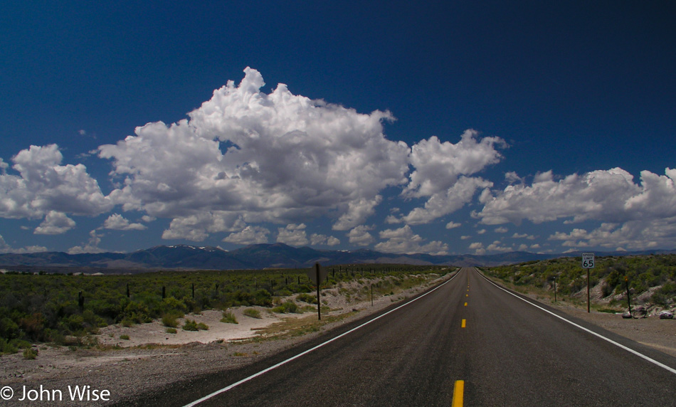
It was 5:30 a.m. when we hit the road, taking Interstate 50 West, which is also known as “The Loneliest Road” in America.

In Eureka, Nevada on Highway 50

Arriving in Eureka, Nevada, we stopped at the Pony Express Deli, and while it’s under new ownership the breakfast was as great as it was on our previous visit. We weren’t in town long, though, because of the nearly 800 miles we’ll be driving today. From here, we leave Interstate 50 for NV-278 going north.

Cicada on Highway 50 in Nevada

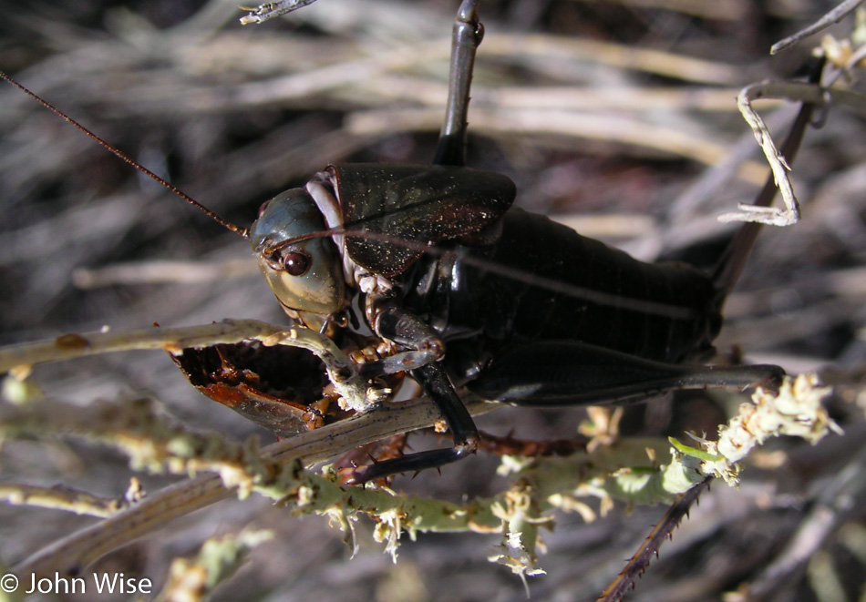
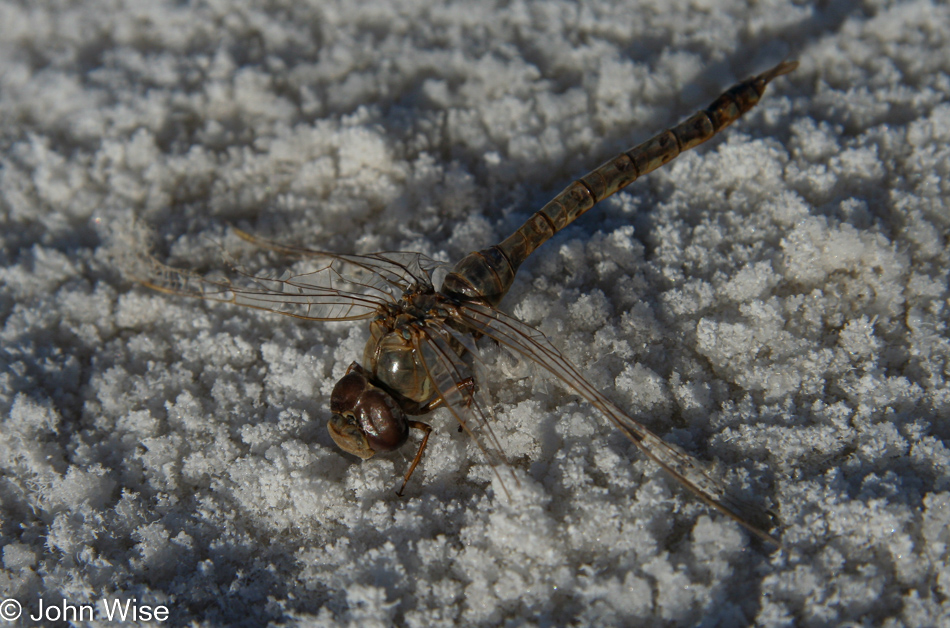
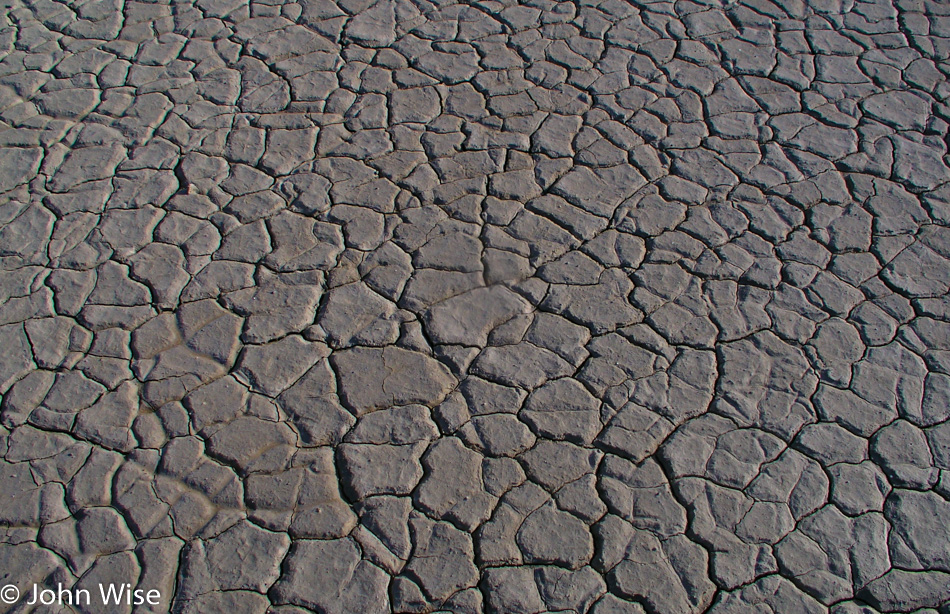
Our breakfast was burritos with eggs, while this cicada enjoyed a cannibal burrito of cicada head cheese scraped right from the half-shell. This was not something we sought out by stopping the car and checking the bushes for acts of such barbarity, but the sound of millions of these seasonal insects was here en masse. Rotting cicada corpses baked in the morning sun while their brethren clambered across the highway, trying to get to the other side before another car passed. When we stopped to listen to the symphony, we were startled by a nearby bush that appeared to shift as the cicadas that were occupying it all moved simultaneously away from the sound of our car door shutting. It was there that we spotted this Alferd Packer of the cicada world.

Leaving these millions of cicadas presented us with a relatively serious problem: we would have to kill more of them. We rolled up the windows tightly to escape their screams and put the car in drive. Maybe we should have tried going quickly, but, like crispy potato chips, the sound of the crunching was intrinsically satisfying, so I crept along in the rising fog of decomposing cicada life juice that was evaporating off the hot street. Dear God, do not present us with such an attack of the senses ever again, please.

Nevada

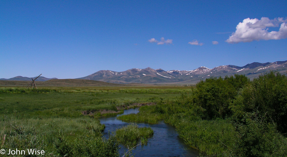
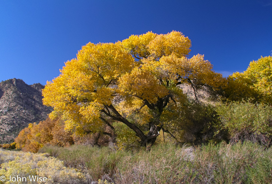
Green meadows, freshwater, snowy peaks, and blue skies were the nose and eyeball cleansing therapy we needed, and nature delivered after the horrors of our previous stop along the road.

Nevada

We’re now up on NV-225, passing the Wild Horse Reservoir, just enjoying this beautiful summer drive on a perfect Friday morning.

Caroline Wise and John Wise entering Idaho

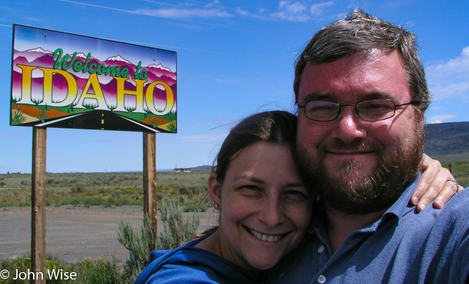
As we pass into Idaho, the road changes numbers to become ID-51. We are on the Duck Valley Reservation, which is home to the Shoshone-Paiute Tribe.

Idaho

Somehow, we are able to tune in to an NPR station off in the distance, and out here in the middle of nowhere, we are being introduced to the fascinating story of a Hasidic Jew named Chaim who took on the stage name Curly Oxide and joined the underground band Vic Thrill. Next up, we learned that Marlon Brando died the day before. A strange aspect of our travels is that we are mostly off the grid when it comes to current events, and it has happened that upon getting home, we can be in astonishment at what was going on while we were away. Why didn’t anyone tell us of the major news? Maybe they figured we already knew.

Caroline Wise and John Wise entering Oregon

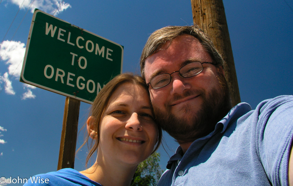
We stayed away from the freeway that would have taken us past Boise, Idaho in order to continue the avoidance of large populations and the frantic nature of cities. Instead, we traveled on the ID-78 towards Marsing, Idaho, staying south of the Snake River, to make our way through Homedale onto State Highway 19, which brought us into Oregon.

Adrian, Oregon

God damn you,  Rocky.

Somewhere in Oregon

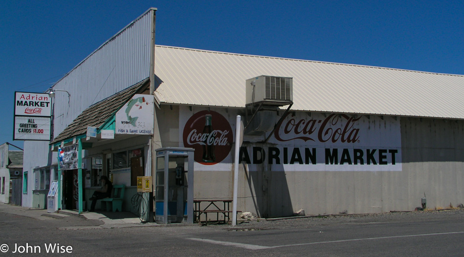
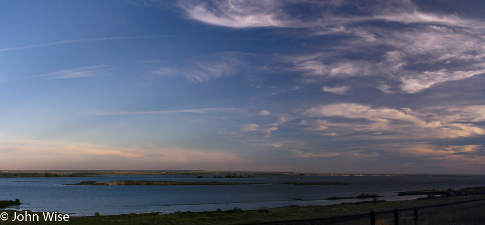
Here we are at one of those spots on the map where people will tell others about the “ugly” part of the state. In this case, it’s the eastern edge of Oregon that can’t compare to the coast, the mountains, or the Columbia River Gorge. Well, we are enchanted by the beauty of it all as we drive north from Adrian towards Owyhee.

Somewhere in Oregon

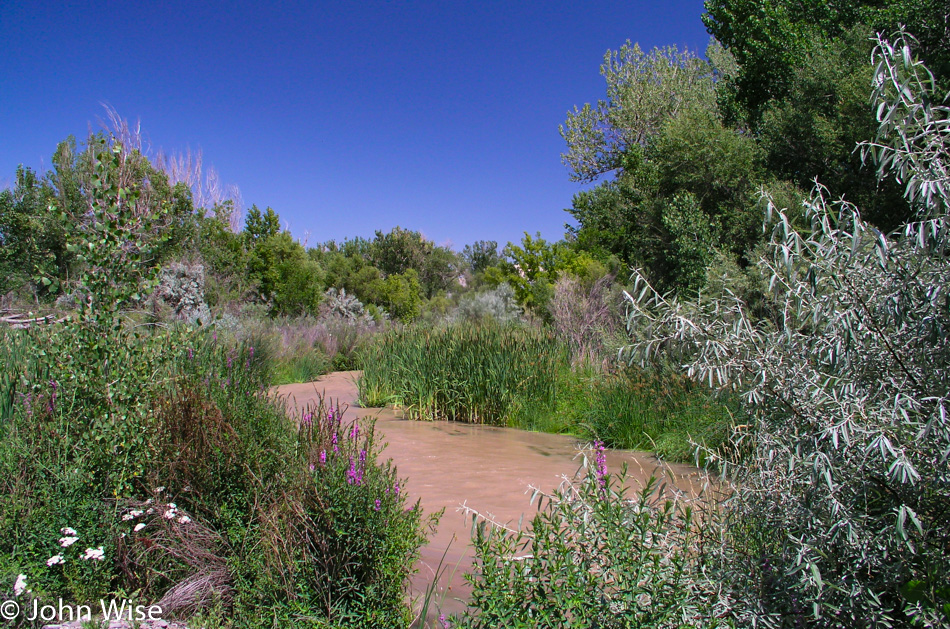
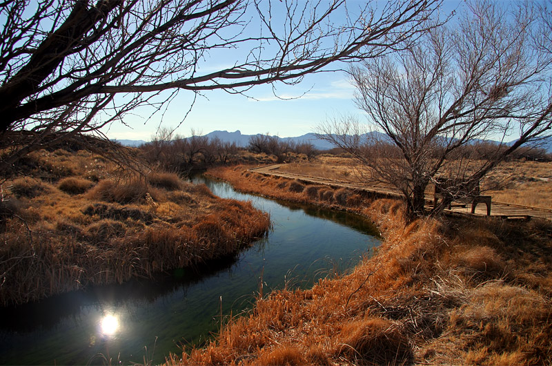
There are more than a few braids of the Owyhee River out here, including this mudflow slicing its way through the heavy, luscious growth. For people needing to drive 800 miles today, we seem to be making a lot of frequent stops. This is the luxury of the long days of summer that grow longer the further north we go.

Jamieson, Oregon

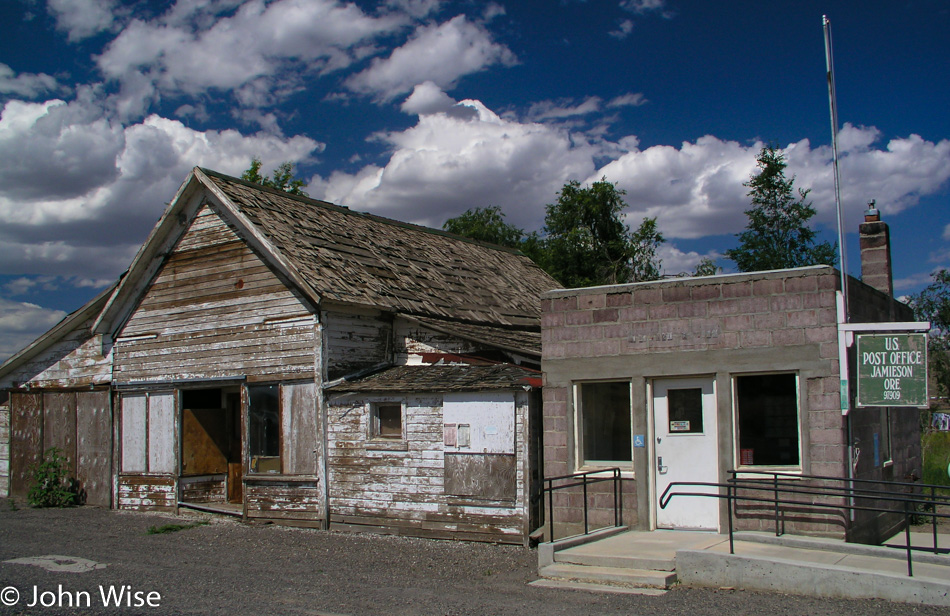
We left the “major” road for Lytle Boulevard that brought us to the John Day Highway or US-26 and the epicenter where everything is happening: Jamieson, Oregon. Note that this is the entire downtown hub of the place that is known as Jamieson; there is nothing else here. You are seeing it all.

Somewhere in Oregon

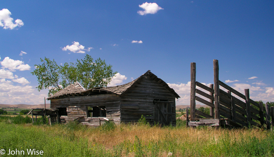
Somewhere on the other side of Unity, Oregon.

Caroline Wise standing in a small river in Oregon

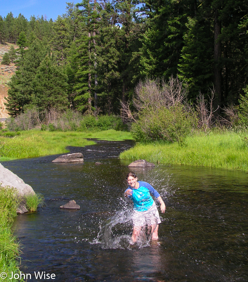
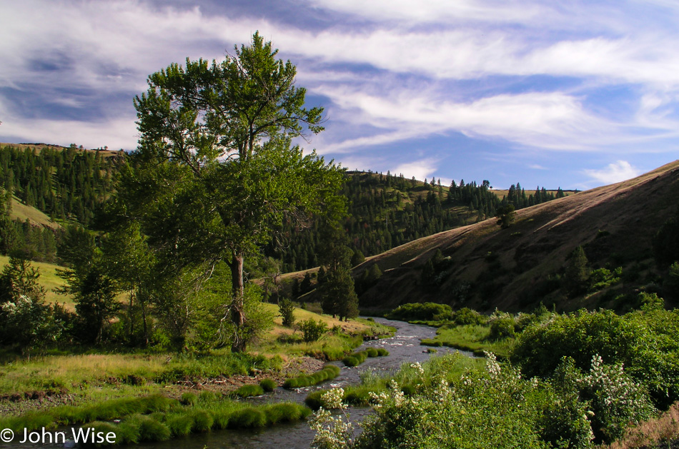
Caroline’s standing in the Middle Fork of the John Day River somewhere near Galena, Oregon. We have decided to deviate from the itinerary by taking a “shortcut” past Susanville, which travels a more northwesterly route. It’s approaching 5:00 in the afternoon, so maybe we should start paying attention to getting to Rimrock, Washington, where we already have a room booked. As for our shortcut, I swear the road didn’t look that twisty on the map.

Somewhere in Oregon

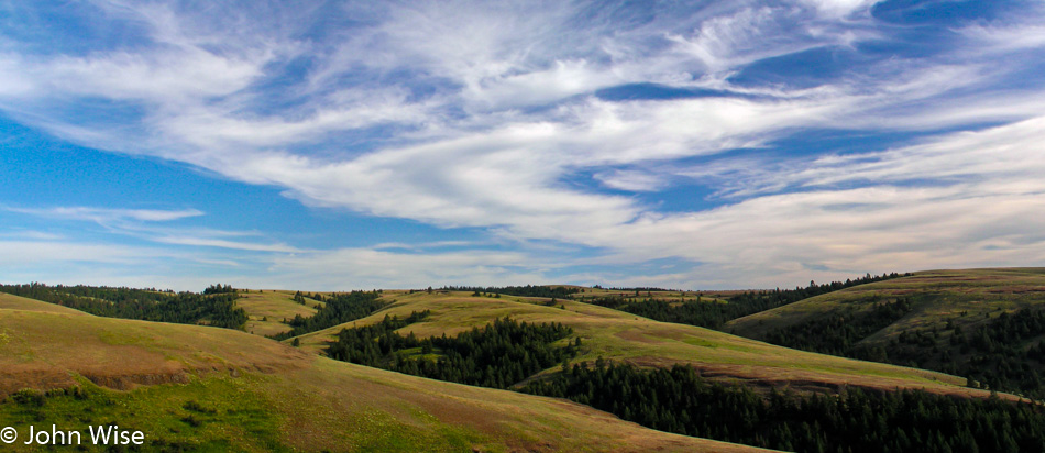
From County Road 20 over the US-395, there was some spot where we ran out of the forest for a moment, but where exactly we are, I cannot say.

Somewhere in Oregon

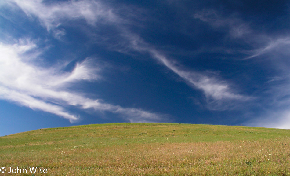
We continued on the 395 as far as Nye, Oregon, where the road forked at the OR-74 that became the Big Butter Creek Road. This photo does not correspond to what I’m describing at all, but I have no reference points to explain where we are in this image; I suppose we’ll just have to retrace our steps someday and take better notes.

Somewhere in Oregon

North of Pine City, Oregon, we merged onto the 207, also known as the Lexington-Echo Highway.

Somewhere in Oregon

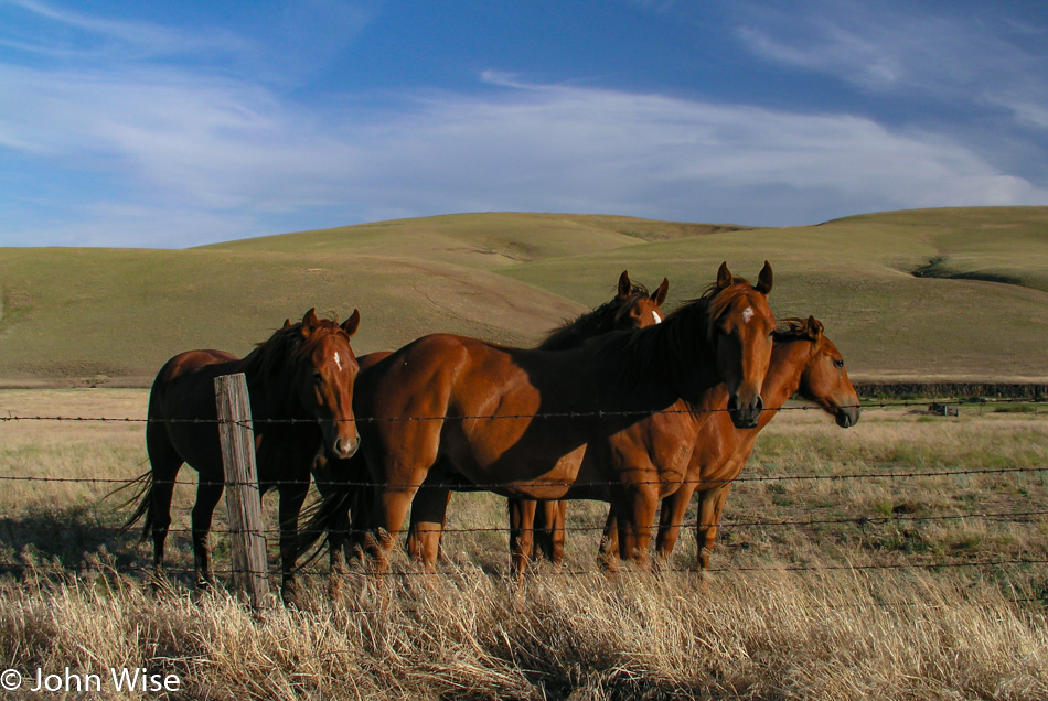
Not many stops anymore as we could feel the time working against us but we couldn’t pass up a bunch of photogenic horses standing at the fence line looking all needy.

Columbia River in Oregon

We crossed the Columbia River between Umatilla, Oregon, and Plymouth, Washington. Needing to keep up our pace, we drove along the north side of the Columbia on the 14 until we arrived in Alderdale; then we turned right towards Mabton.

Caroline Wise standing in the Columbia River in Oregon

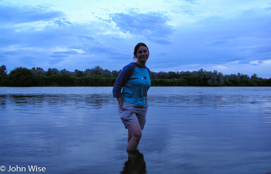
Okay, we can afford one more stop, but only one. The Yakima River was calling Caroline to take her shoes off one more time so she could step into yet another American waterway. It’s already after 9:00 p.m. at this pitstop and we still needed something from Walmart up in Yakima. By the time we reached Rimrock and the Game Ridge Motel, it was already almost 11:00 p.m. Our room way out of the way was only $55, but seeing we would have forfeited that money should we have opted at the last minute to call it quits in Yakima, we drove on into the night with all of these experiences of the day traveling with us.