Selway River

Selway River in Idaho

Odds are seriously good that next summer, for a short 5-days, Caroline and I will be out on this river. This is the Selway up in the middle of nowhere, Idaho. From Hamilton, Montana, where our group meets up, we’ll have an 82-mile (132km) drive to the Paradise Campground in Idaho, where we’ll get on the river. With Europe looking like a no-go for 2021, we are opting to get uncomfortable once again having to deal with some Class IV rapids. With 1,127 miles (1,813km) to drive to get up that way, it would be a shame to spend two days driving up and two days driving back, so we’ll consider leaving ten days early for some camping and hiking to get into the rhythm of being in wild nature before we put-in on the river. We considered Yellowstone for about 2 seconds until we thought about the summer crowds, and anyway, we’ll be in the vicinity of the Sawtooth, Salmon-Challis, Payette, Lolo, and Nez Perce-Clearwater National Forests before heading into the Selway-Bitterroot Wilderness so we should be able to find some interesting lands to explore. On the other hand, we could opt for a crazy road trip heading up through eastern Nevada, across the southwest corner of Idaho, into Oregon, up through the middle of Washington to Prince George, British Columbia, in Canada before continuing for another 1,400 miles to Dawson City in the Yukon up near the Alaska border. This trip would cover 3,300 miles (4,400km) each way, but here in my late 50s, the idea of a 6,600 mile (10,600km) road trip sounds difficult, but then again, it won’t get any easier as we get older, so maybe we should tackle something like this while we can?

We have a little less than six months before we leave, so there’s plenty of time to mull things over, but this will be tough as the options grow as I write this. I just discovered that we could catch a ferry bringing our car onboard and heading up the Inside Passage of Alaska to Skagway before continuing up to Whitehorse and then heading south to our white water adventure. I’ve got some research ahead of me.

Update: This trip never happened as family obligations in Germany shifted all of our plans in 2021.

Yellowstone

Caroline Wise and John Wise on the Idaho State Border

We zipped past Salt Lake City early in the morning, entering Idaho before 10:00 a.m.

Caroline Wise at Yellowstone National Park in Wyoming

By 1:00 p.m., we had reached the Montana Stateline, and fifteen minutes later, we drove through the gates of the world’s first national park – Yellowstone.

Yellowstone National Park in Wyoming

With almost 1000 miles (1564km) behind us, we are ready to start our sixth visit here. This time, we had planned to take in sites unseen on previous visits, so shortly after passing through the front gate, we stopped at the Two Ribbons Trail and took an easy 1.5-mile (2.3km) walk down a boardwalk along the Madison River.

Yellowstone National Park in Wyoming

This is the kind of nature we can get behind…

Yellowstone National Park in Wyoming

…this kind, not so much.

Yellowstone National Park in Wyoming

A visit to Terrace Springs took only a few minutes.

Yellowstone National Park in Wyoming

Hello, Mrs. Elk.

Yellowstone National Park in Wyoming

A little further north, Caroline suggested we check out the Monument Geyser Basin Trail.

Yellowstone National Park in Wyoming

Why did I agree? This short but brutal hike took us up the side of a mountain with more than 600 feet (182m) of elevation gain in less than half a mile (800m).

Yellowstone National Park in Wyoming

We always need a visit to West Thumb…

Yellowstone National Park in Wyoming

…for a view of the Fishing Cone on the lake and everything else at this southern end of the park’s geysers.

Yellowstone National Park in Wyoming

Looking a bit too stormy, so we better head to our magnificent hotel.

Yellowstone National Park in Wyoming

After we checked in at the Old Faithful Inn, it was time for a walk here on the Upper Geyser Basin.

Yellowstone National Park in Wyoming

Of course, our walk should be under a beautiful sunset.

Blue Star Geyser at Yellowstone National Park in Wyoming

Blue Star Spring in the Lower Geyser Basin, taken during our after-dinner walk, wasn’t blue at all in the golden-orange light of the sky.

Yellowstone National Park in Wyoming

Life is good.

Jutta On The Road – Day 9

Disclaimer: This blog entry wasn’t written until 17 years after the trip. It should be noted that it was a huge mistake to have not written it way back when. Sometimes, after writing so much about other days, it happens that at the time directly after the trip (or even during), I convince myself that the details are not that important. Years later, these details are that important, and pulling them out of foggy memories is difficult. The photos help and often leave clues, and then Caroline’s memories are usually far clearer than mine. With that said, here goes.

We wake up in a place that’s new to all of us. Nobody here on this adventure has any experience of what to do once the day begins in Concrete, Washington, about 40 miles south of the Canadian border. Well, I have a general idea, that’s to continue our drive eastward.

Adding a new national park to the list of these American treasures we’ve been so fortunate to visit, here we are at the North Cascades National Park today.

While everyone’s heard of the Grand Canyon, Yellowstone, and Yosemite, I don’t know of anyone who’s told us that we just had to visit the North Cascades. Might this be one of the United State’s best-kept secrets, or is it like Alaska and too difficult to get out here?

We’re at Gorge Lake, fed by the Skagit River; just out of sight are some high-tension powerlines; who built powerlines through a national park?

On one hand, it’s a shame that back during these days of moving quickly through these environments, we’d race through, take in an overview, and move on. With Jutta traveling with us, it wasn’t any better or worse as our methods of taking inventory had us thinking we’d scope the amazing places we want to return to, and then at a future point, we’d do just that. That hasn’t always worked out, such as with the North Cascades.

Looking through these memories, I’m struck by how beautiful this place is and wonder if Caroline and I shouldn’t consider putting a trip to Seattle on the itinerary, renting a car, and combining a return visit with another trip to nearby Olympic National Park too so we might get to do some hiking in these areas and feel like we’ve seen something more than what can be gleaned from a pullout on the road.

Off on a tangent, I went, where were these peaks and streams? If I do plan for a return, say in 2023, where should I look for trails for us to hike?

Maybe a little too much elevation gain would be required to hike to the top of the treeline, but I could think of worse ways to spend a day.

I believe this is Mt. Terror, strangely named, I think, but then again, I’m never going to try to ascend its peak.

We left the park and drove east as my crazy ambition was to have us visit Glacier National Park tomorrow; this is just nuts. And though we might be rushing through the landscape, we still have time to stop for a woman making waffle cones for homemade ice cream in the quaint town of Winthrop.

Time for old farm buildings bordering on decay? Always.

While we may not have taken enough time to truly linger in the flora of eastern Washington, I’ll certainly try to capture enough of the sights so we can remember that we were at one time in places that might have failed to lock into our mind’s eye quite the way Yellowstone or the Oregon Coast has.

Tiger Historical Center and Museum required a stop at the request of my mother-in-law. You see, the Engelhardt’s have what you might call spirit animals associated with them or animals they grew up loving. For Caroline, that would be the snail; for her sister Stephanie, it is the mighty mouse; and for Stephanie’s husband Klaus, it is the tiger.

This is the Columbia River, and at the time of this writing, in 2022, I can’t remember in what year back in the early 2000s Caroline and I first traveled the Columbia between Oregon and Washington, but looking at this image here I’m left thinking how different this northeast part of the river looks when compared to it entering into the Pacific Ocean at the Columbia Bar.

Caroline Wise with Jutta Engelhardt and John Wise at the Idaho State Sign

Taking these selfies at state lines was not always easy as the state signs themselves were not put up in consideration of sun orientation and time of day when you might be asking people with sensitive blue eyes to look, so I’ve taken plenty of squinty-eyed photos of these two women.

Then there’s the camera operator error and not recognizing that we were all too blurry to be able to use the selfie. If you are wondering what happened to Idaho and our driving across it, there were photos but nothing worth sharing.

Do not listen to sentimental music when exploring old memories; as I try to write about our moment here at the banks of the Kootenay River, the music in my ears renders a solemnity on the verge of sadness about the man I was as I applied a fierce intensity of moving us through such beautiful places instead of taking the appropriate amount of time to let it all sink in. Now that I’m older, I can better see the world through my mother-in-law’s eyes, and back then, on this trip, she was already 70 while here at the cusp of my turning 60; I’m enjoying our newer go-slow approach. I suppose this was the price to be paid when hanging out with your children still ripping through the world with a take-no-prisoners approach to life.

An American Bald Eagle flew just feet in front of our car while driving a back road and perched in a nearby tree in Montana

Just in front of our car, as we passed the Yaak River, an American Bald Eagle swept across the road and perched in a nearby tree. I stopped as quickly as possible, certain I was frightening away the eagle. Caroline jumped from the car with the camera in hand, and to our surprise, the eagle sat patiently posing while Caroline clicked away. Wow

The Tobacco River near Eureka, Montana, at sunset was near our cheap motel. While the lodging might have been a bit on the shoddy side, the views never are.

4th of July – Day 2

Highway 50 Nevada

It was 5:30 a.m. when we hit the road, taking Interstate 50 West, which is also known as “The Loneliest Road” in America.

In Eureka, Nevada on Highway 50

Arriving in Eureka, Nevada, we stopped at the Pony Express Deli, and while it’s under new ownership the breakfast was as great as it was on our previous visit. We weren’t in town long, though, because of the nearly 800 miles we’ll be driving today. From here, we leave Interstate 50 for NV-278 going north.

Cicada on Highway 50 in Nevada

Our breakfast was burritos with eggs, while this cicada enjoyed a cannibal burrito of cicada head cheese scraped right from the half-shell. This was not something we sought out by stopping the car and checking the bushes for acts of such barbarity, but the sound of millions of these seasonal insects was here en masse. Rotting cicada corpses baked in the morning sun while their brethren clambered across the highway, trying to get to the other side before another car passed. When we stopped to listen to the symphony, we were startled by a nearby bush that appeared to shift as the cicadas that were occupying it all moved simultaneously away from the sound of our car door shutting. It was there that we spotted this Alferd Packer of the cicada world.

Leaving these millions of cicadas presented us with a relatively serious problem: we would have to kill more of them. We rolled up the windows tightly to escape their screams and put the car in drive. Maybe we should have tried going quickly, but, like crispy potato chips, the sound of the crunching was intrinsically satisfying, so I crept along in the rising fog of decomposing cicada life juice that was evaporating off the hot street. Dear God, do not present us with such an attack of the senses ever again, please.

Nevada

Green meadows, freshwater, snowy peaks, and blue skies were the nose and eyeball cleansing therapy we needed, and nature delivered after the horrors of our previous stop along the road.

Nevada

We’re now up on NV-225, passing the Wild Horse Reservoir, just enjoying this beautiful summer drive on a perfect Friday morning.

Caroline Wise and John Wise entering Idaho

As we pass into Idaho, the road changes numbers to become ID-51. We are on the Duck Valley Reservation, which is home to the Shoshone-Paiute Tribe.

Idaho

Somehow, we are able to tune in to an NPR station off in the distance, and out here in the middle of nowhere, we are being introduced to the fascinating story of a Hasidic Jew named Chaim who took on the stage name Curly Oxide and joined the underground band Vic Thrill. Next up, we learned that Marlon Brando died the day before. A strange aspect of our travels is that we are mostly off the grid when it comes to current events, and it has happened that upon getting home, we can be in astonishment at what was going on while we were away. Why didn’t anyone tell us of the major news? Maybe they figured we already knew.

Caroline Wise and John Wise entering Oregon

We stayed away from the freeway that would have taken us past Boise, Idaho in order to continue the avoidance of large populations and the frantic nature of cities. Instead, we traveled on the ID-78 towards Marsing, Idaho, staying south of the Snake River, to make our way through Homedale onto State Highway 19, which brought us into Oregon.

Adrian, Oregon

God damn you,  Rocky.

Somewhere in Oregon

Here we are at one of those spots on the map where people will tell others about the “ugly” part of the state. In this case, it’s the eastern edge of Oregon that can’t compare to the coast, the mountains, or the Columbia River Gorge. Well, we are enchanted by the beauty of it all as we drive north from Adrian towards Owyhee.

Somewhere in Oregon

There are more than a few braids of the Owyhee River out here, including this mudflow slicing its way through the heavy, luscious growth. For people needing to drive 800 miles today, we seem to be making a lot of frequent stops. This is the luxury of the long days of summer that grow longer the further north we go.

Jamieson, Oregon

We left the “major” road for Lytle Boulevard that brought us to the John Day Highway or US-26 and the epicenter where everything is happening: Jamieson, Oregon. Note that this is the entire downtown hub of the place that is known as Jamieson; there is nothing else here. You are seeing it all.

Somewhere in Oregon

Somewhere on the other side of Unity, Oregon.

Caroline Wise standing in a small river in Oregon

Caroline’s standing in the Middle Fork of the John Day River somewhere near Galena, Oregon. We have decided to deviate from the itinerary by taking a “shortcut” past Susanville, which travels a more northwesterly route. It’s approaching 5:00 in the afternoon, so maybe we should start paying attention to getting to Rimrock, Washington, where we already have a room booked. As for our shortcut, I swear the road didn’t look that twisty on the map.

Somewhere in Oregon

From County Road 20 over the US-395, there was some spot where we ran out of the forest for a moment, but where exactly we are, I cannot say.

Somewhere in Oregon

We continued on the 395 as far as Nye, Oregon, where the road forked at the OR-74 that became the Big Butter Creek Road. This photo does not correspond to what I’m describing at all, but I have no reference points to explain where we are in this image; I suppose we’ll just have to retrace our steps someday and take better notes.

Somewhere in Oregon

North of Pine City, Oregon, we merged onto the 207, also known as the Lexington-Echo Highway.

Somewhere in Oregon

Not many stops anymore as we could feel the time working against us but we couldn’t pass up a bunch of photogenic horses standing at the fence line looking all needy.

Columbia River in Oregon

We crossed the Columbia River between Umatilla, Oregon, and Plymouth, Washington. Needing to keep up our pace, we drove along the north side of the Columbia on the 14 until we arrived in Alderdale; then we turned right towards Mabton.

Caroline Wise standing in the Columbia River in Oregon

Okay, we can afford one more stop, but only one. The Yakima River was calling Caroline to take her shoes off one more time so she could step into yet another American waterway. It’s already after 9:00 p.m. at this pitstop and we still needed something from Walmart up in Yakima. By the time we reached Rimrock and the Game Ridge Motel, it was already almost 11:00 p.m. Our room way out of the way was only $55, but seeing we would have forfeited that money should we have opted at the last minute to call it quits in Yakima, we drove on into the night with all of these experiences of the day traveling with us.

In America with Jay Patel – Day 2

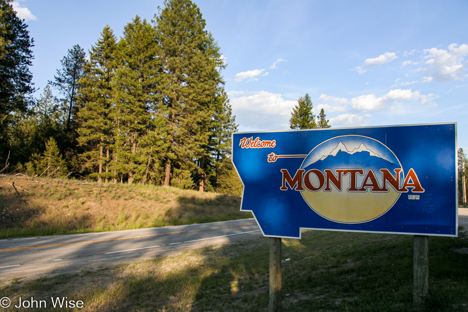
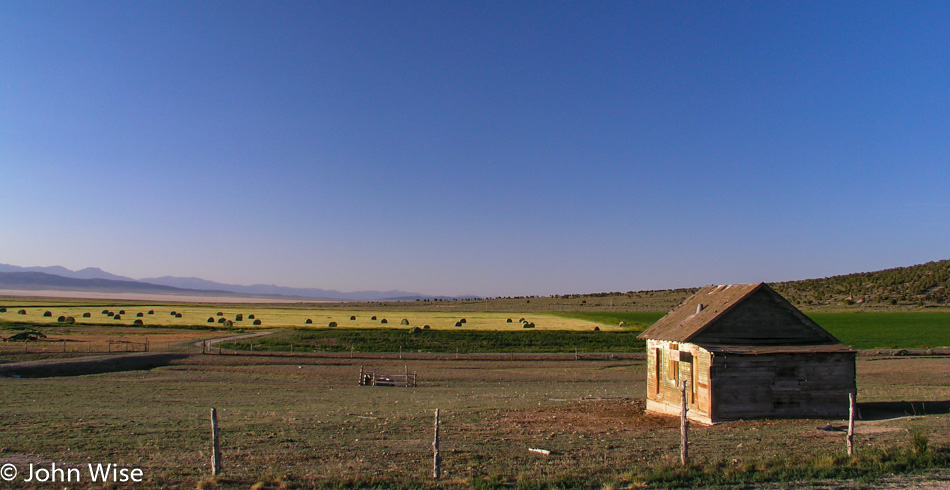
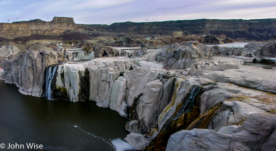
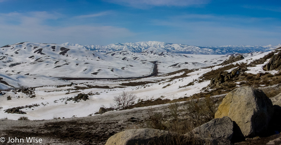
Here we are on the second day of our cross-country road trip, awake and heading up the road by 6:00 am. Interstate 70 runs along a quiet, sparsely populated area out of Richfield before delivering us to State Road 28, which leads us to the main north-south Interstate Highway 15, the only major freeway planned for this road trip.

The southern end of the Wasatch mountain range on our right still has a light dusting of snow along the uppermost ridgeline. The interstate is moving along too fast, leaving little time for sightseeing while we cruise along at 80mph. We do pull off the road at Layton north of Salt Lake City for a Barnes and Noble. Caroline and I had stopped before, knowing they served Starbucks. Only a short drive north now, and we will leave the freeway heading for State Road 89.

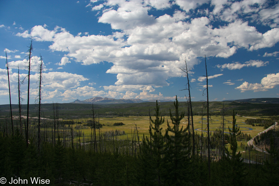
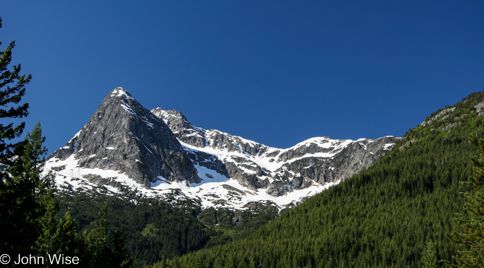
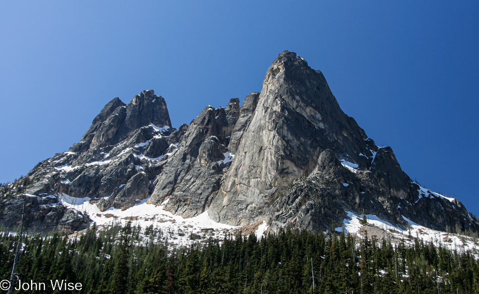
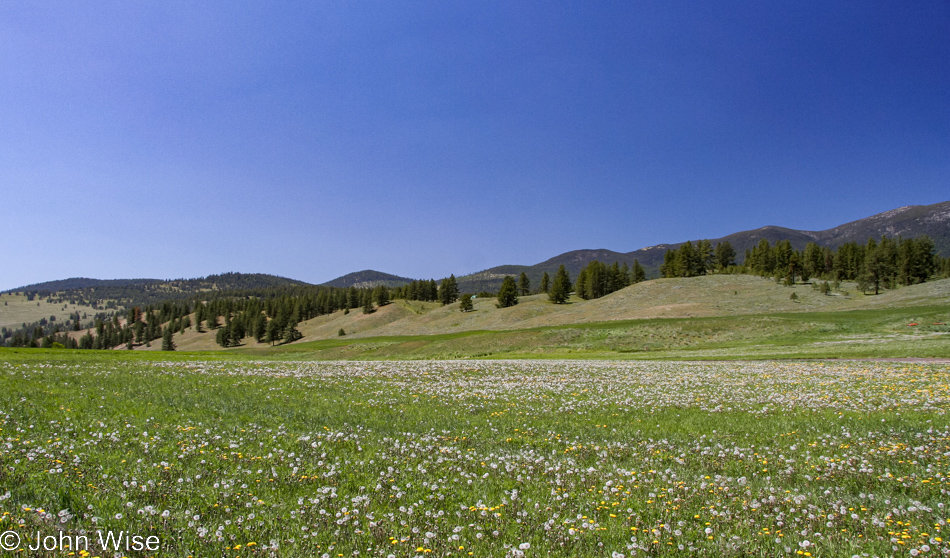
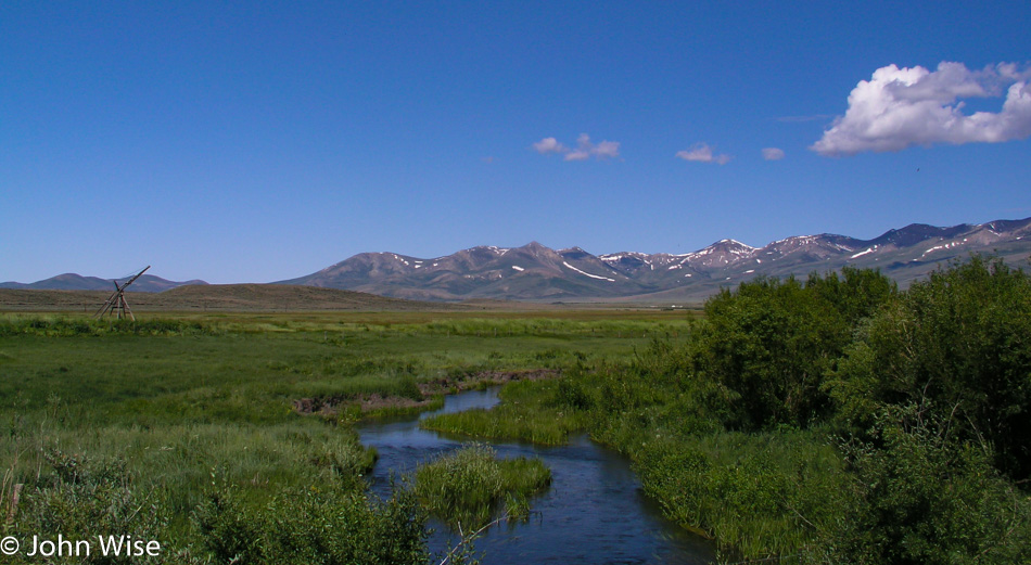
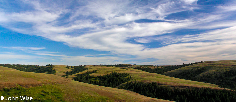
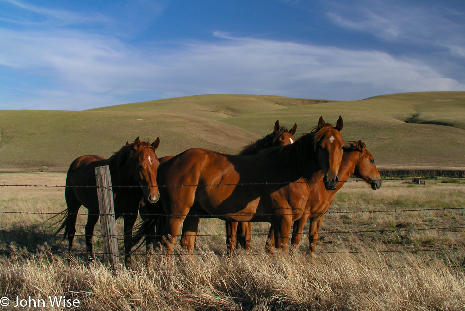
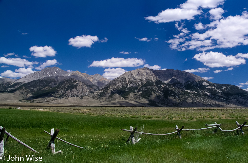
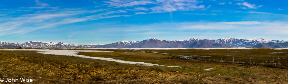
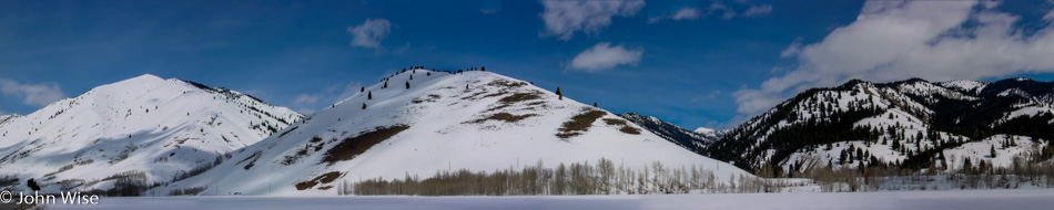
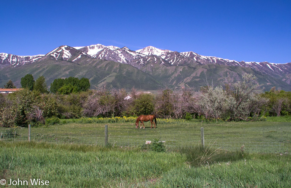
The 89 to Logan slices between more snow-covered mountains. The sides of the road are lusciously green. Back in Arizona, we have already approached 100-degree days, and the land is baked to a dull brown. Looking at these lands transitioning from winter to spring is a delight to the eye. A horse stands in its meadow, and if it wasn’t for our need to complete 675 miles of driving today, I think we would all change places with the horse and hang out in his pasture for a day or two. In Logan, the road officially becomes the Logan Canyon Scenic Byway, hence the reason we are traveling here today.

The Upper Dam in Logan Canyon on the Logan Canyon Scenic Byway in Utah

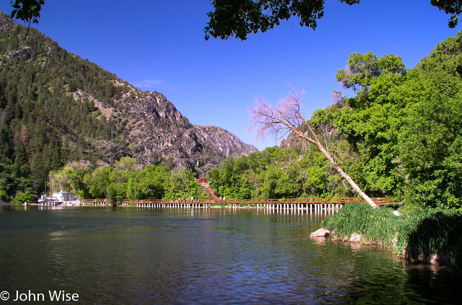
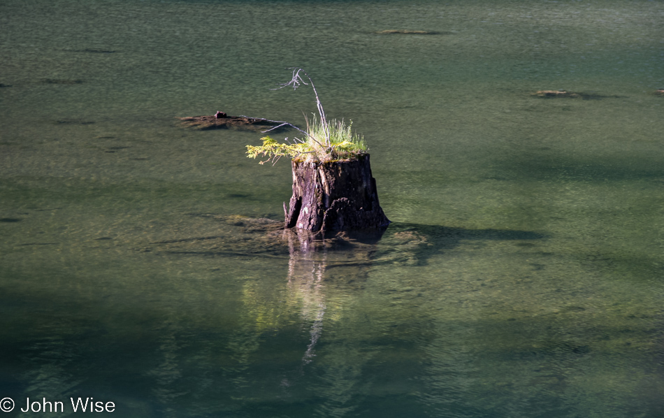
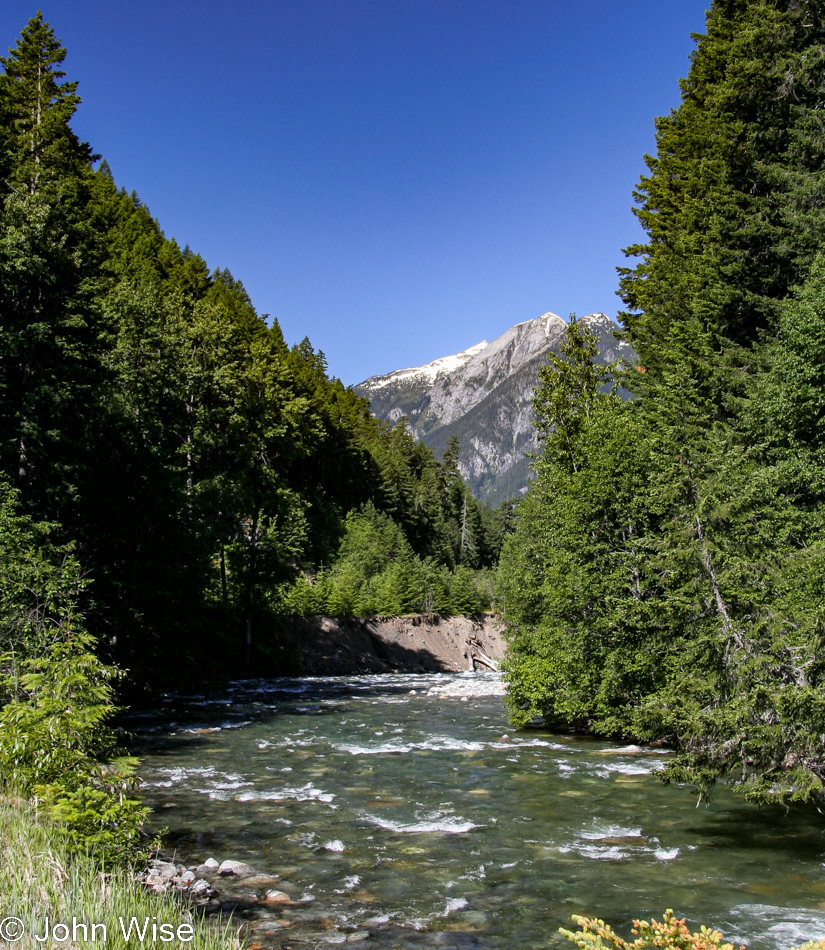
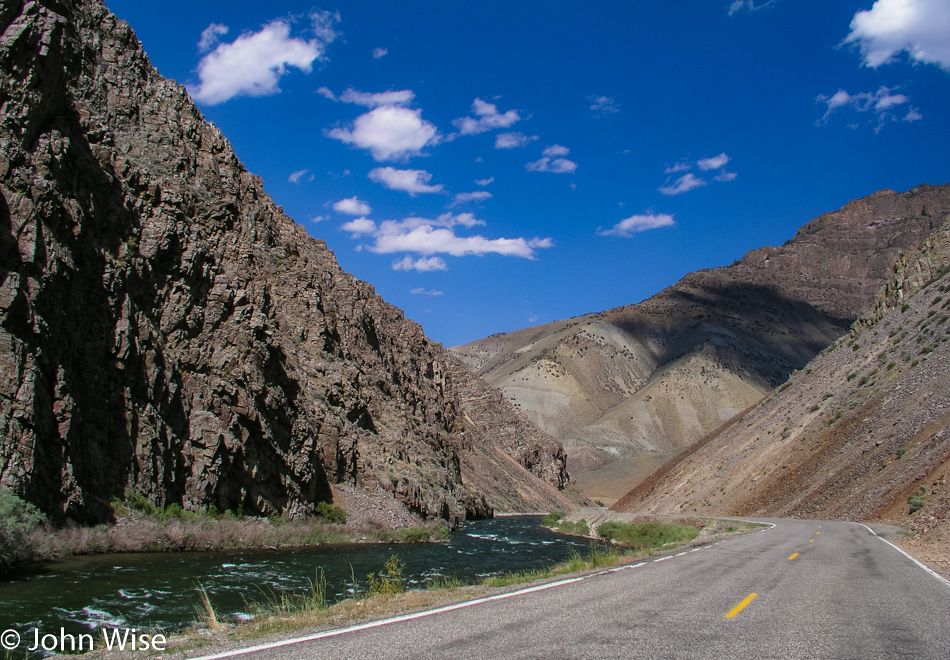
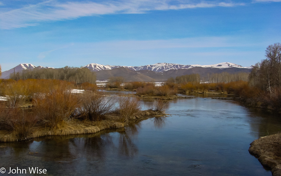
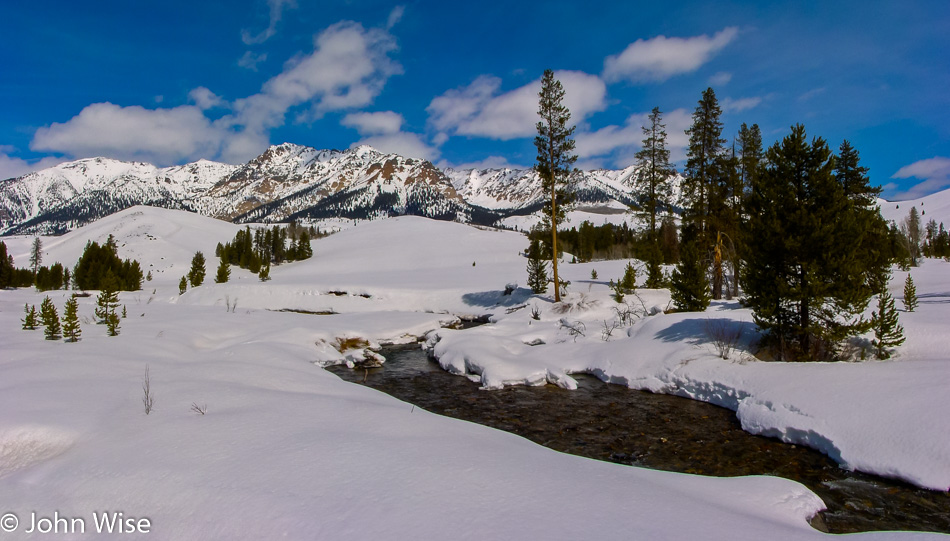
Our next stop is at the Upper Dam on the Logan River. I take a couple of photos and we continue northeast. The greens start to sparkle with effervescence. Small mountainside cascades tumble out of the forest heading toward the road before disappearing below the pavement to join the Logan River we are parallel to. We make a note to return to this particular corner of America in the future. Further on, jagged peaks jut out of low mountains the deeper we get into the canyon. No homes or businesses are to be found within a long sight; it is just us and the grandeur of nature out here.

Ricks Springs is a Paleozoic age carbonate rock cave offering up a mountain spring of fresh water on the Logan Canyon Scenic Byway in Utah

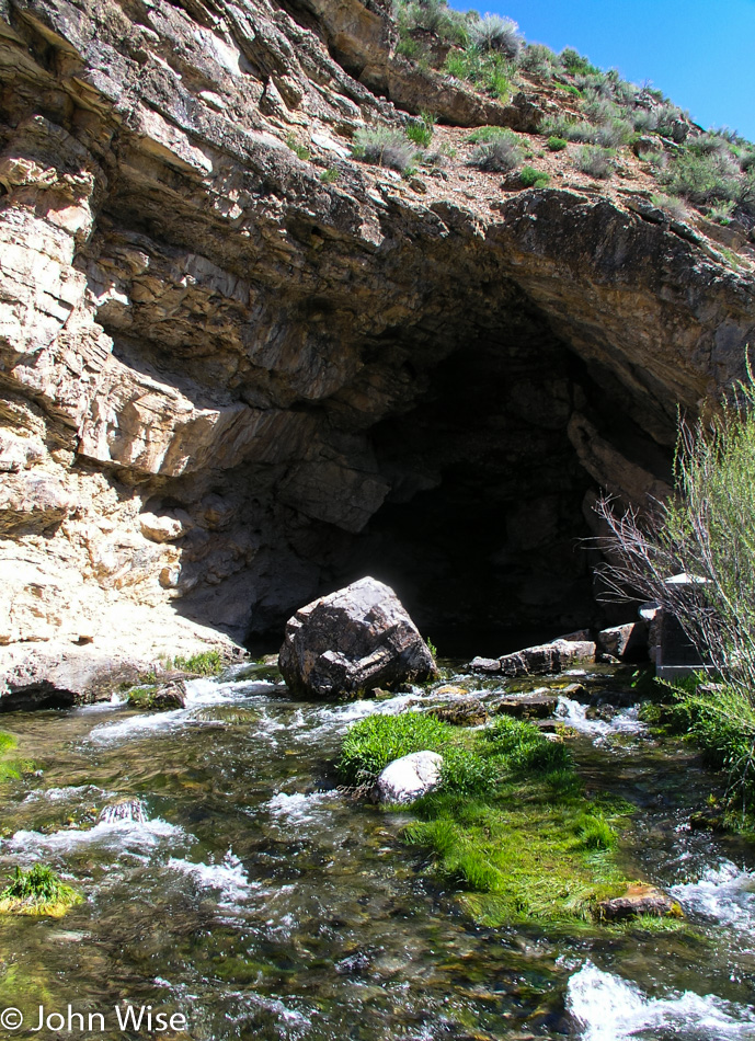
Ricks Spring on the left side of the road flows right out of rock, creating a pool under cover of a small cave carved from the Paleozoic-age carbonate earth. From here, it’s tumbling downhill as a small creek to join the Logan River. This scenic byway, the Wasatch Range, and Salt Lake City are all worthy of vacations in their own right. As the official byway comes to an end and we follow 89 north, the scenic quality of this new segment of road is still as beautiful as the road we came from. Most times, we cannot understand how the scenic designation stops at a particular point.

Bear Lake on the Utah / Idaho border

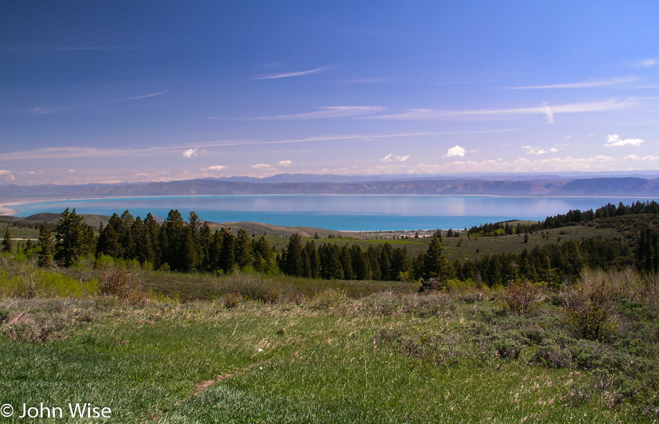
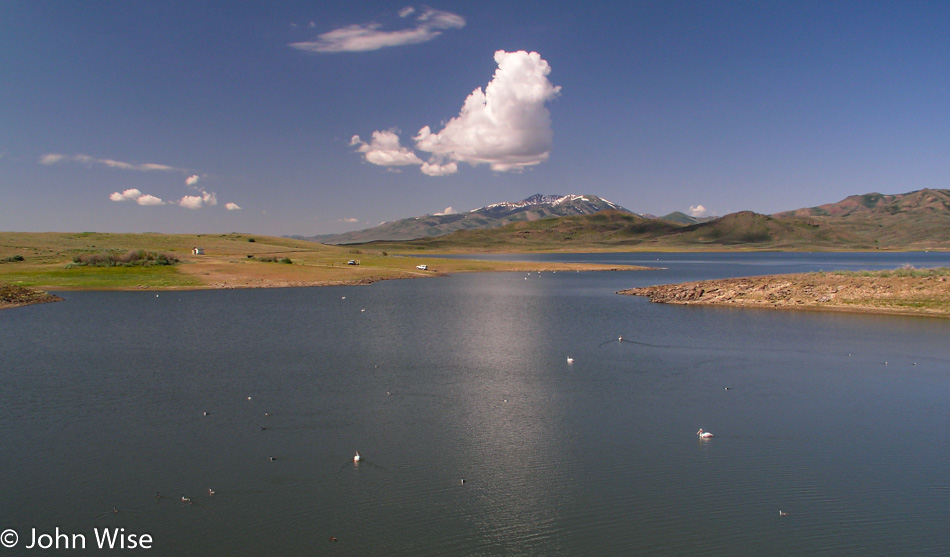
Bear Lake is where we turn left to head into Idaho. The waters of the lake are of a radiant turquoise blue that stretches for 20 miles in length. The original inhabitants of this valley were the Shoshoni and were nowhere to be seen.  Maybe on a subsequent visit, we can make an effort to learn more about the history of this corner of Utah.

In Idaho near the Utah border between Garden City, Utah and Paris, Idaho

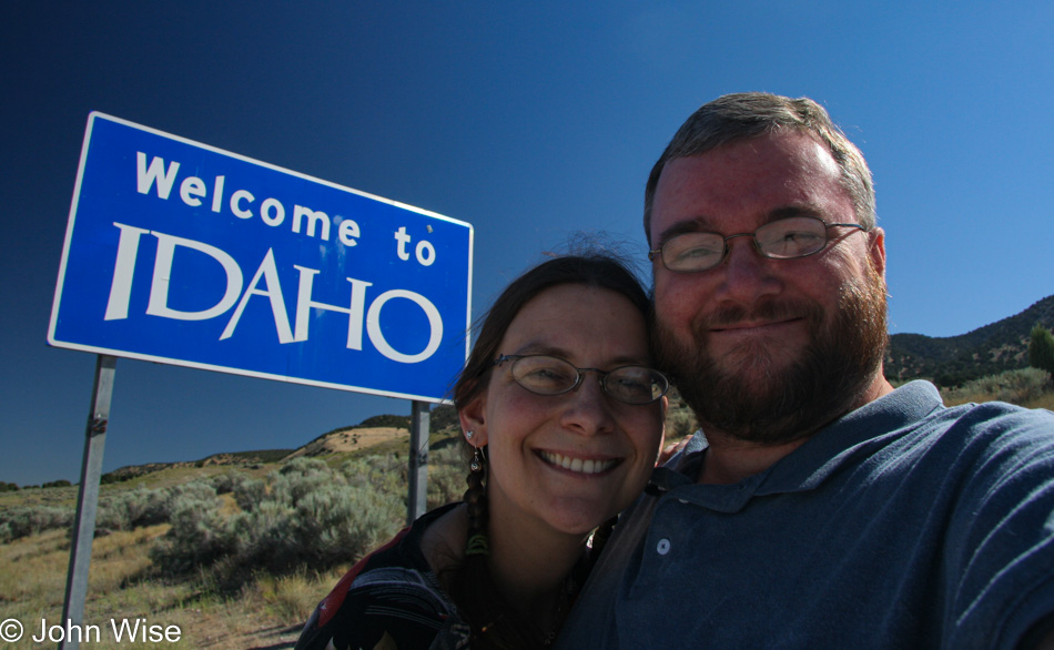
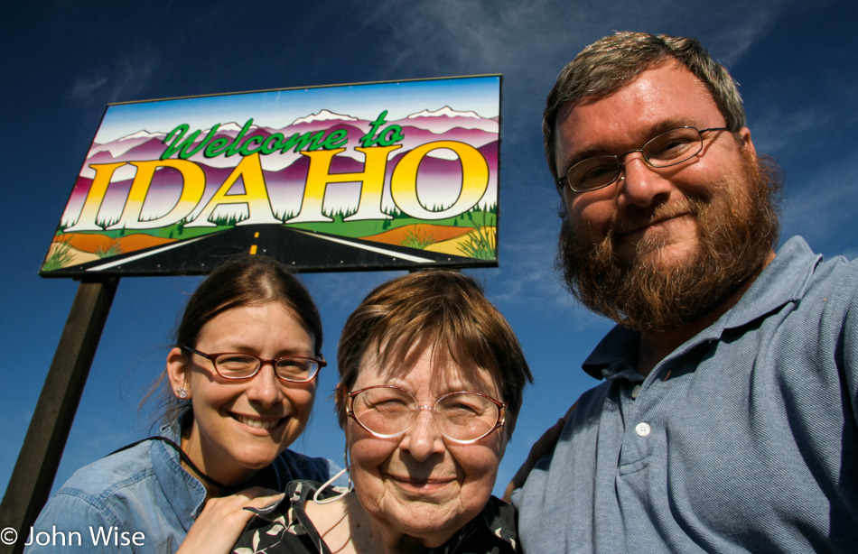
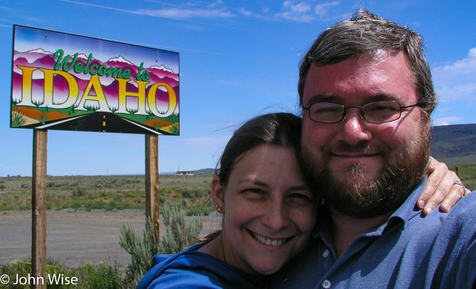
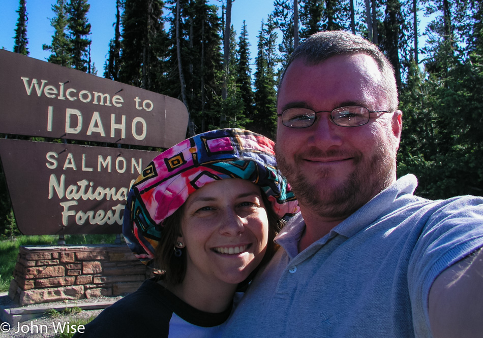
We arrived in Idaho before lunchtime and having finished the Pav Bhaji for breakfast, we were tucking into the Methi Roti with some homemade vegetable pickle Sonal’s mom made for us. A collective yummy sound resonates in the car as our palates and our eyes are delighted.

The Paris Post newspaper office, one of very few buildings in this small outpost between Utah and Wyoming in the southeast corner of Idaho

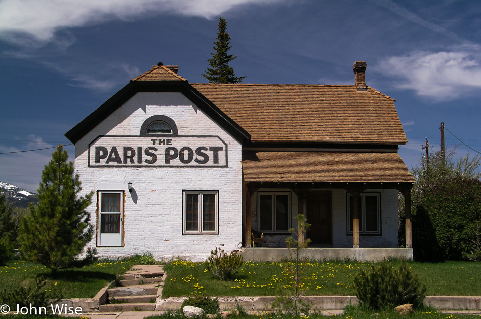
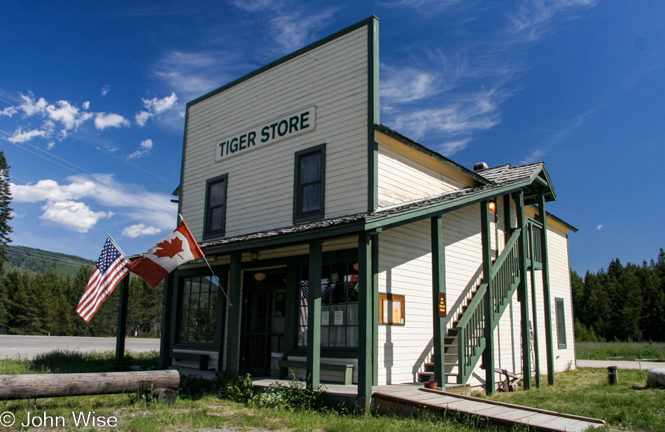
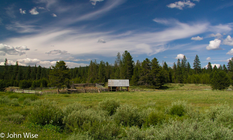
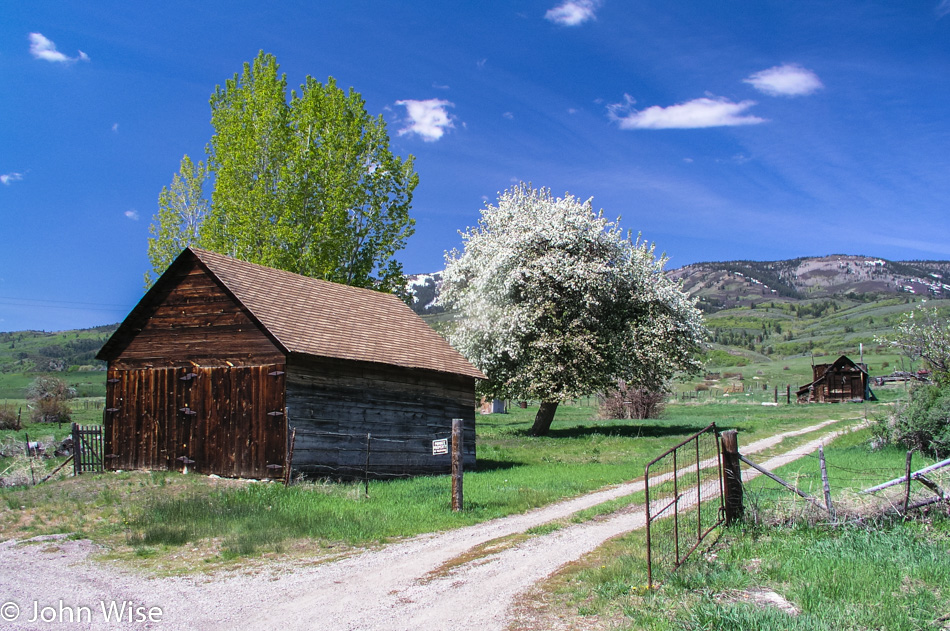
Paris, Idaho, is one of a few small towns along our road before entering Wyoming. Small is almost an exaggeration. The Paris Post newspaper office and the Paris Tabernacle lend great character to the town and make passing through this way a more memorable moment. A mountain in the distance is snow-capped, the land around us stretches with mountains as far as the eye can see, and the day is as beautiful as anyone might ask for.

The Ovid Schoolhouse on our way out of Idaho into Wyoming.

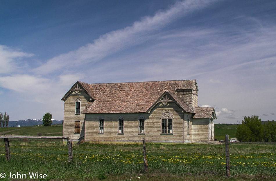
The Ovid Schoolhouse, or what we think is the schoolhouse, is the last notable building in Idaho on our road before entering Wyoming. On the few visits Caroline and I have made into Idaho we have never been less than impressed with the beauty of this land. It is unfortunate that the business and lifestyle demands of modern American society don’t treasure these locations, which contributes to their fading away.

Jay Patel, Caroline Wise, and John Wise about to enter Wyoming on our cross-country road trip

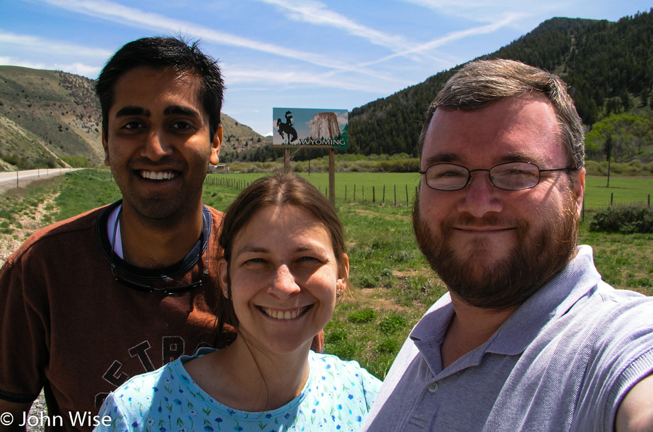
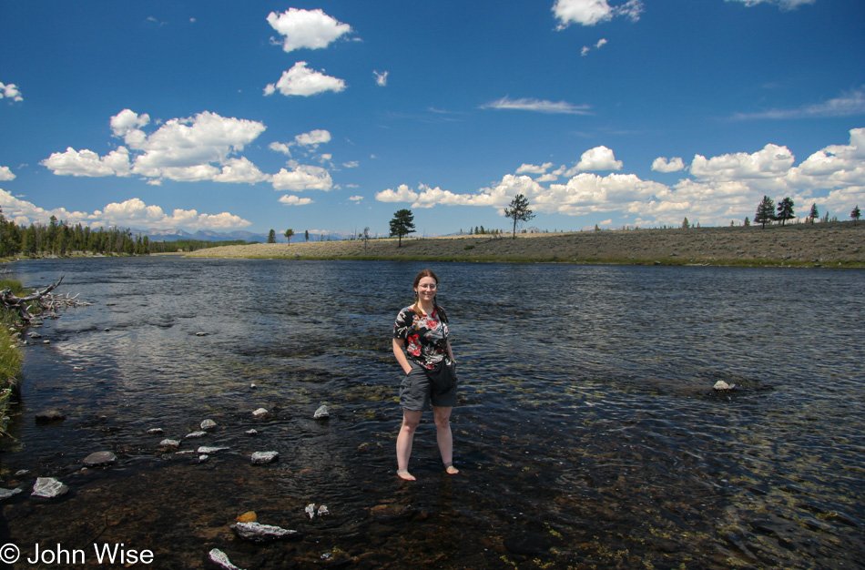
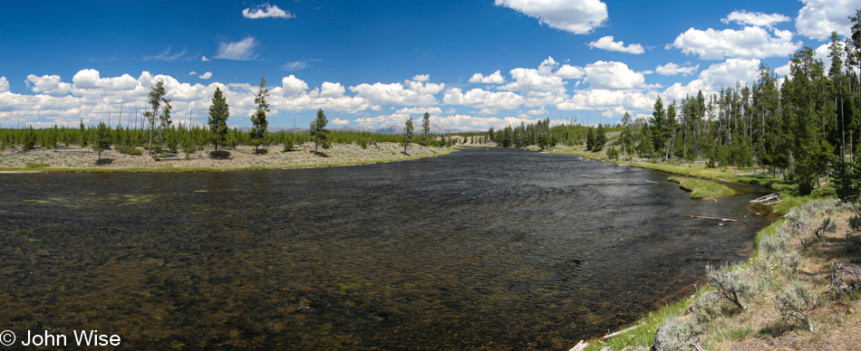
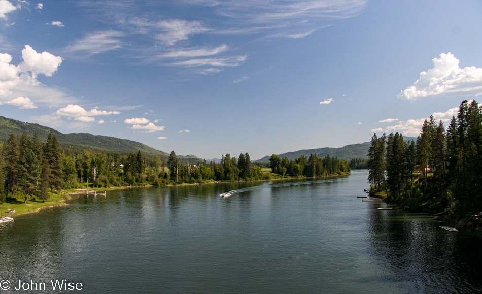
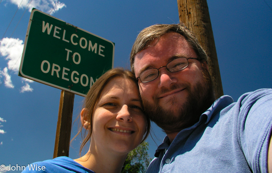
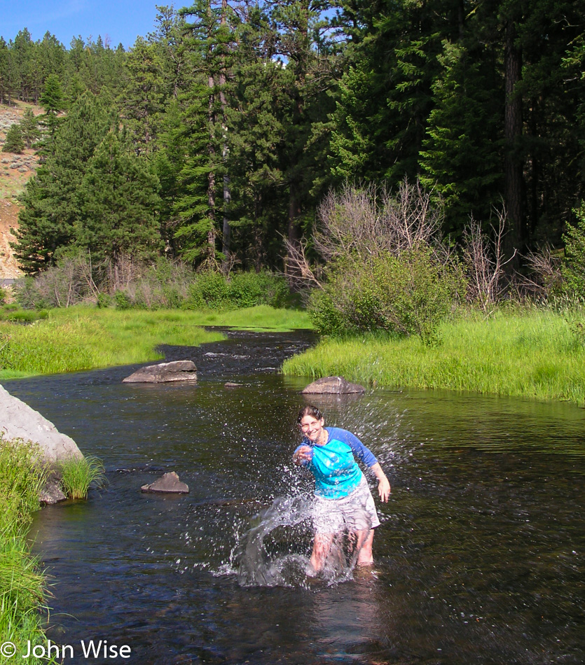
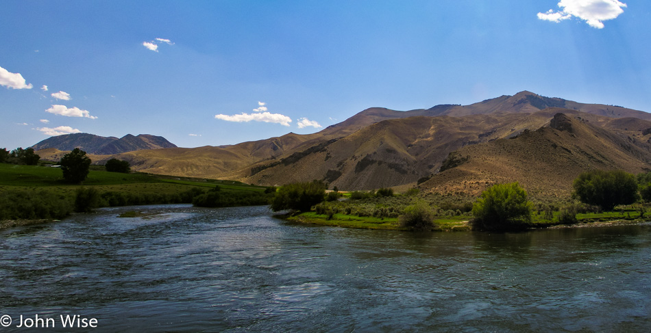
It is only 1:00 pm when we enter Wyoming; we are making great time. A turnoff catches my eye shortly after catching our first sight of the Snake River. It smells kinda funny, but that doesn’t stop Jay and Caroline from taking off their shoes and stepping into the wild river.

Grand Teton National Park

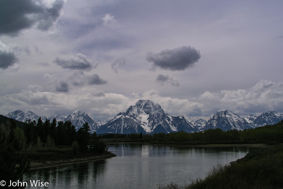
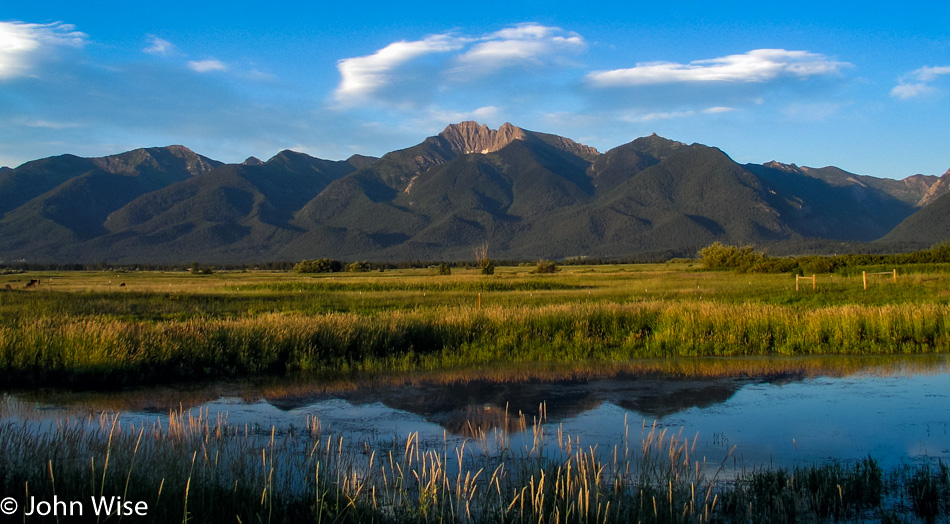
We were going to hang out in Jackson Hole, but the weather wasn’t all that impressive for walking around, so we got right to business and drove a bit further on to get our first glimpse of the Teton range. While this is Caroline’s and my third visit to this stunning corner of Wyoming, it is Jay’s first. We have come to the Oxbow, as for whatever reason, this is Caroline’s favorite spot here in the Grand Teton National Park.

Caroline Wise and Jay Patel in the south of Yellowstone National Park

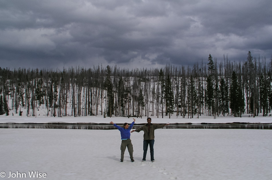
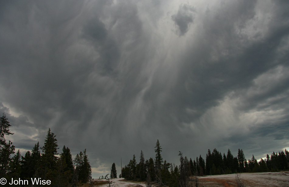
Dad needed to pull over the car so the kids could get out and play in the snow. Look at Jay’s left hand; he’s about to throw that snowball at my wife, but she can defend herself, so it’s all worth the laugh. By the way, the reason we are up here in Yellowstone is we have daylight today until shortly before 9:00, and the weather down south wasn’t conducive to a hike, so we took our chances that maybe things might clear up by the time we arrived at West Thumb.

Bacterial mat at Yellowstone National Park

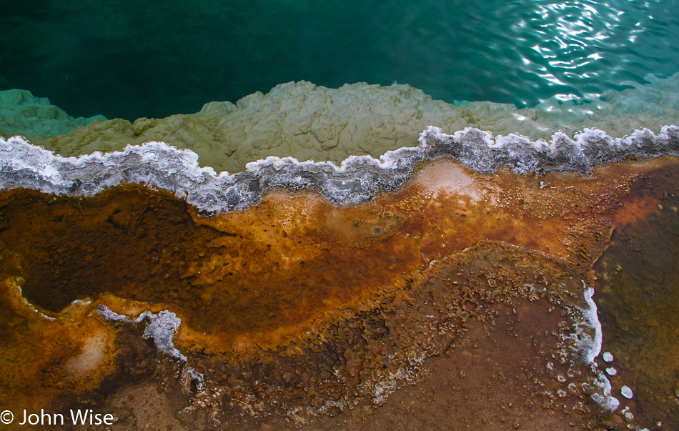
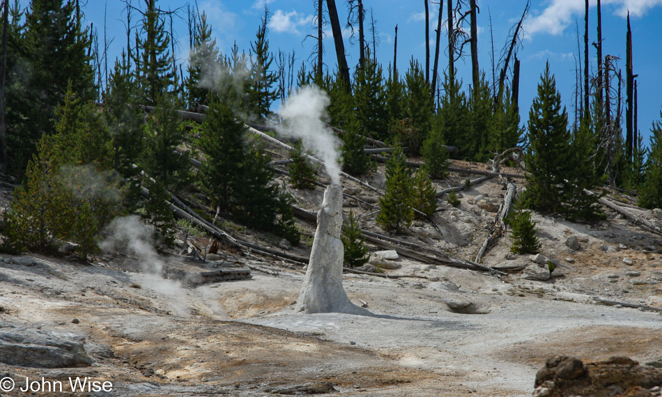
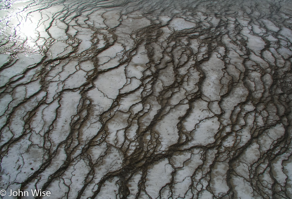
The colors may have changed their hue; the cyanobacteria might have darkened or, in some cases, have dried up altogether leaving a white dusty bed. One type of bacteria could be replaced by another type of bacteria, the new one more foreign than the one it replaced. Mud holes are either thicker and muddier, waterier, or are now a hissing dry depression of escaping steam. Although the specularity of the springs is not as vivid as witnessed under a blue sky and beating sun, they impress us here on this cloudy day with a quiet mystery; a sort of spooky silence that the rising steam lends drama to. For a moment, the sun peaks through but is quickly obscured again by the shifting sky.

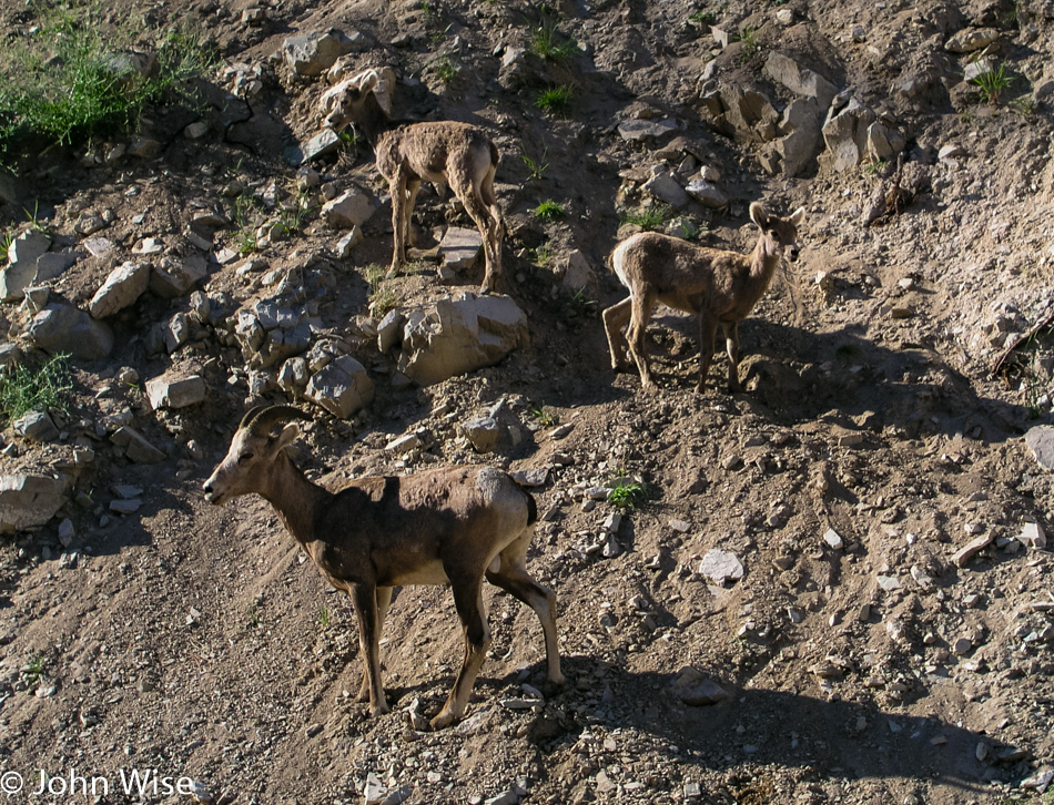
As we go to leave West Thumb an elk has raised its head in our direction and taunts us by sticking its tongue out, strange. The next elk wasn’t so much humorous, it was downright pissed off. After a pause so as not to startle the large animal, we began to move forward, but this elk had nothing to do with such a dumb idea. It hissed an angry, “I’ll smash your head with my mighty hoof,” kind of sound that strikes the fear of God into us. Being relatively naïve regarding elk behavior, I doubt what I witnessed to be real and make a second approach. The elk reciprocates with a step forward, another louder hiss, and an amount of spittle that says, “ok, now I’m spitting mad; how far do you want to take this?”

Well, that was enough for us; we slowly backed up and turned around on the boardwalk to take an alternate route to the car, hoping the elk wouldn’t feel like following us. We came up around its backside to watch a couple trying to pass as we had tried just minutes before. They got hissed at one time before the overly confident guy took one step too many, and that elk bolted after him. A sort of hysterical laughter came over us as this guy caught up with his more level-headed female friend, who chose to beat feet as the elk hadn’t quite stopped its charge.

Old Faithful Geyser at Yellowstone National Park

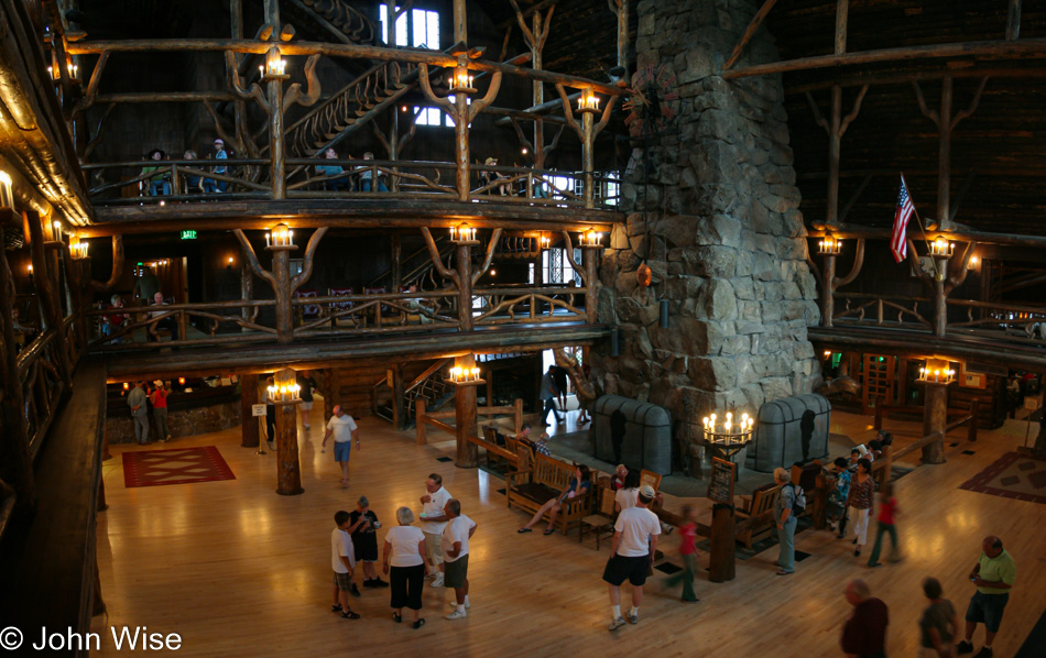
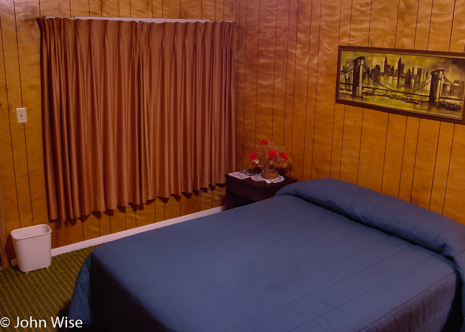
Old Faithful Inn is 100 years old this year, and it is where we’ll be staying tomorrow. We stopped in to try to sway which room number we were assigned. Caroline and I have stayed in room 225 on two previous visits and have taken a particular liking to the room. The room itself is simple and rustic: no bathroom, only a small sink, and poor lighting, but it makes up for its shortcomings with great recognition ability. If ever we are watching a documentary or a news blurb about Yellowstone, it is inevitable that an image of the Old Faithful Inn will be shown. Above the center of the entryway, just over the upstairs patio, are five awnings, with the center one belonging to room 225 where we have stayed many a night. I wait in line to make my request in person, just as I had over the phone on two calls prior to our arrival; I plead for room 225. With this evening’s crew about to make room allotments, luck might be with us.

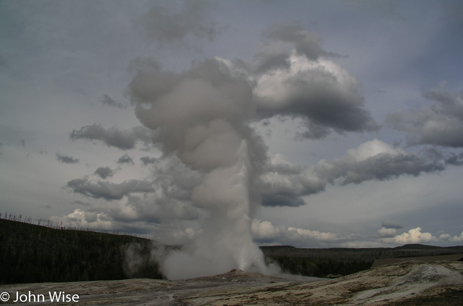
We step outside with only 10 minutes till the next eruption of Old Faithful. The park is great this time of year, even in poor weather. There are not a lot of people traveling through the park yet. The Inn may be sold out, but the surrounding hotels are still empty, the parking lots nearly empty, and in some cases, we are the only visitors to some sights. Tour buses haven’t shown up yet, school is still in session, and the motor homes are at bay. With room for hundreds of spectators, we approach the Old Faithful area, part of a group of less than 75 who will be watching for Old Faithful to so faithfully erupt one more time.

Seems like we waited twenty minutes, but so what, that is the science of calculating the eruption cycle of this most popular geyser on Planet Earth. The wait is worth it as a trickle of steam gives way to the rumbling thrust of water, adding more clouds to the cloud-filled sky. We watch and listen; Jay is especially taken by the sound of it; he had been certain that the sound he’d heard from a documentary on Yellowstone was a sound effect; to his great surprise, he learns that the earth does rumble when Old Faithful delivers another performance.

Geyser bed at Yellowstone National Park

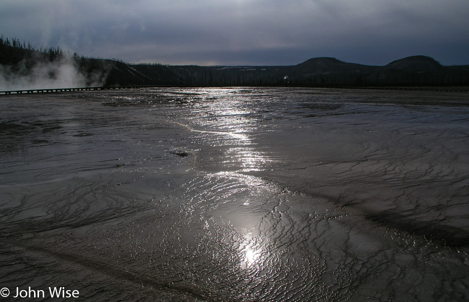
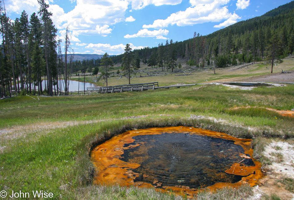
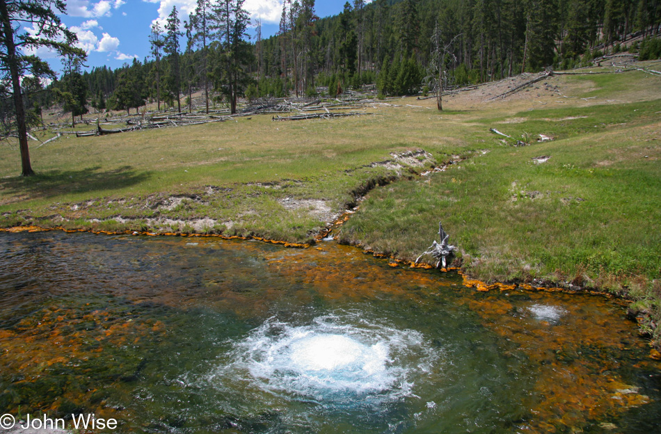
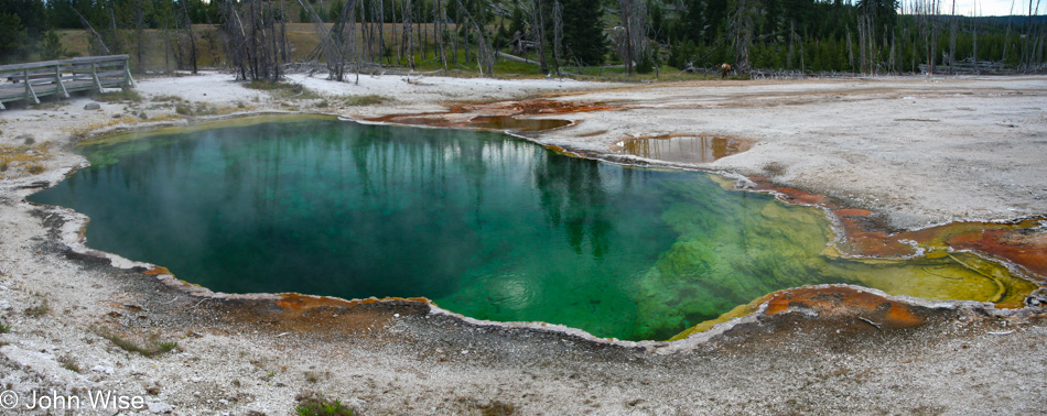
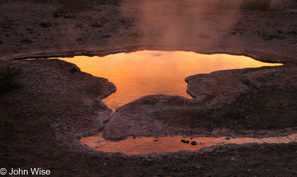
With relatively good weather on our side, we leave Old Faithful and the Upper Geyser Basin for Midway Geyser Basin and the Grand Prismatic Spring. This is the largest hot spring in the park and today is the hardest to see. On the way to this largest of springs, we pass the Excelsior Geyser, which on this day doesn’t have the billowing steam that has obscured so much of it from view as on previous visits. On the other hand, there is so much steam rising from Grand Prismatic that it’s too difficult to even glimpse a hint of its rainbow splash of vibrancy on the ground. What is amazing, though, is that we can see the colors of these springs reflecting in the steam rising overhead.

Close-up of geyser bed at Yellowstone National Park

The boardwalks here at Midway offer some of the best views of the calcified minerals that lay down terraces filled with streaming waters escaping from a geyser. The bacteria beds living on these terraces are brightly colored and vividly contrast with adjoining bacteria beds. Different times of the year, different water flow amounts, and water and air temperatures all affect the appearance of these springs and geysers. What you see this spring may not look the same or even similar come fall.

Some of the beds along this boardwalk appear like tissues of sinew and connected flesh stained by the rich mineralized water, while others are membrane-like which gives emphasis to Yellowstone as being something alive and amorphous. Another corner of Grand Prismatic Spring shows a snaking line of fire-red bacteria buttressing a chocolate brown bed to our left. A final look back at Grand Prismatic, and we see the trees on the distant hill reflecting in the waters leaving the spring, the rising steam capturing the rainbow of orange, green, and blue in its misty mirror of fog. Again, we are amazed by the sights of Yellowstone, where just hours before, I worried that the beauty of the park would be hidden in these less-than-ideal weather conditions. It turns out to be an unwarranted concern, the park is as beautiful as it always is.

Jay Patel at the Lower Falls of the Yellowstone River in Yellowstone National Park

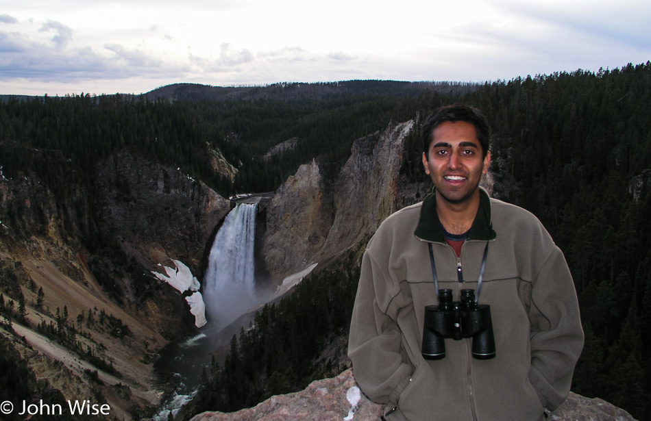
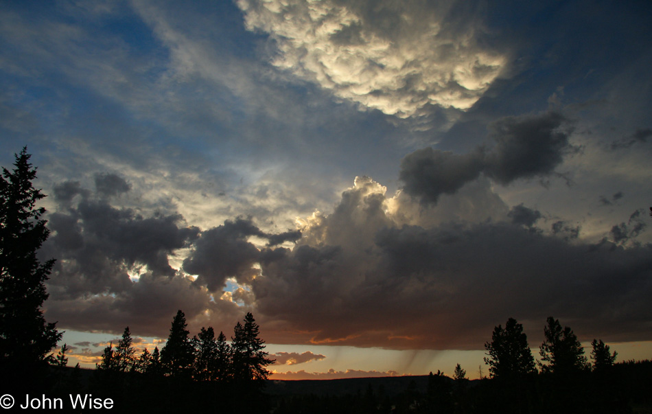
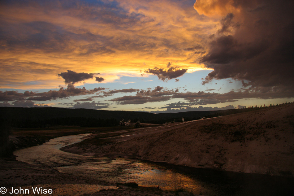
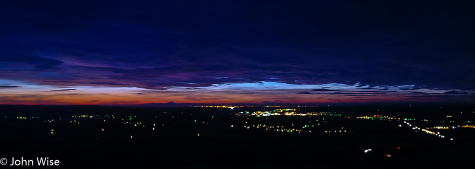
It’s 8:00 p.m. as we arrive at Lookout Point for our first view of the Yellowstone Falls. Remnants of ice cling to the canyon walls, giving a brief glimpse of the wintery majesty the falls create, its waters turning into a 308-foot ice sculpture. Here in spring, alone on this overlook at sunset, nothing interrupts the roaring sound of the falls slicing through the yellow canyon in our nation’s first national park, and we can simply sit here and enjoy its beauty. Not too long, though, as even with the sun so low in the sky there still may be time enough to descend the trail to the Brink of the Lower Falls.

We scurry, nearly running down the 600-foot descent along switchbacks until we are dumped out along the shore of the Yellowstone and the short walk leading to the overlook. Literally, every footstep we take increases the volume of the falls until we are directly at the edge where the water spills over the precipice, and the thunder of the crashing water is deafening. Looking into the canyon, no sunlight, gray overcast sky, and still the canyon inspires the three of us. Cragged and stained walls watch over the white waters of the Yellowstone River stretching out of view. This river, whose headwaters have emerged just southeast of where we stand, leading into and then draining out of Yellowstone Lake, is now on its way to the Missouri River.

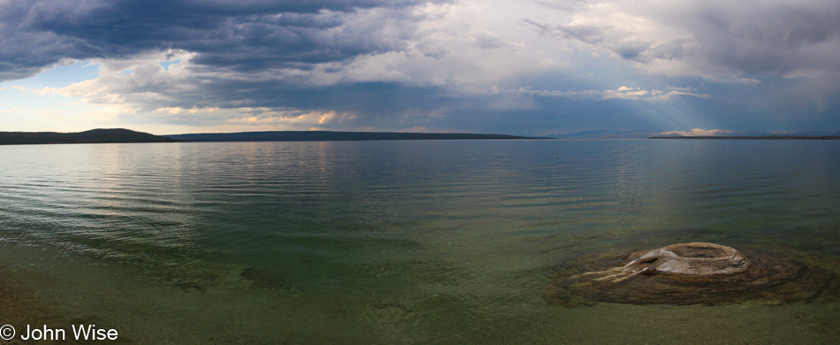
The hike back up is demanding, but we are fully satisfied with the day that the climb up could be twice as difficult, and we would hardly care. It is now time for us to make our way back to the Tetons. We take the Lake Village road through Hayden Valley to West Thumb, where we’ll leave Yellowstone via the South Entrance.

Yellowstone National Park at Dusk

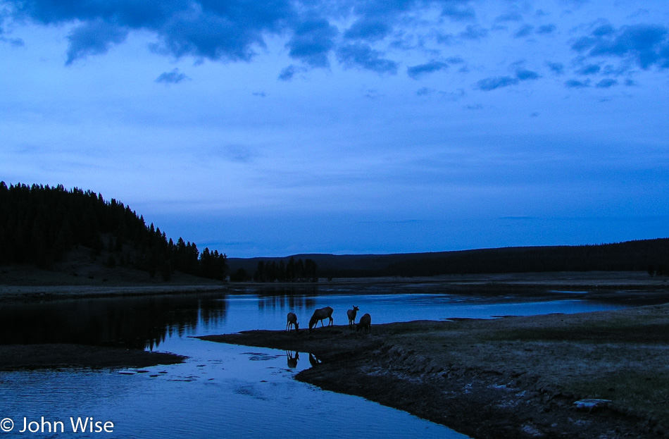
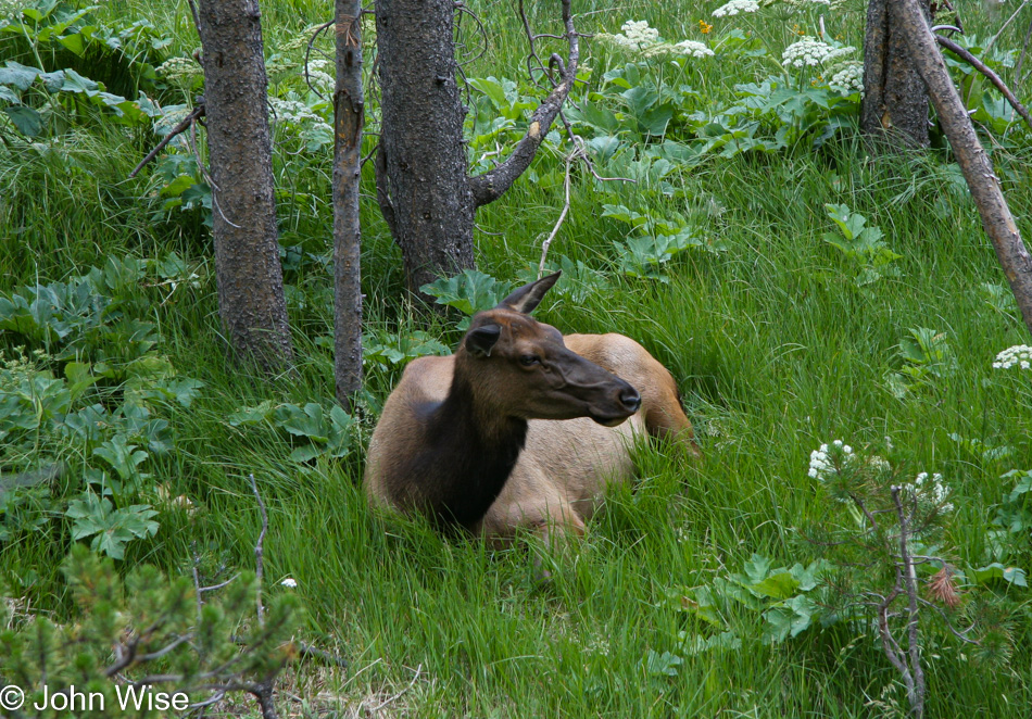
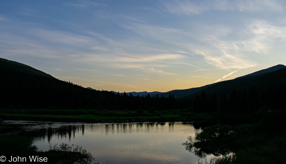
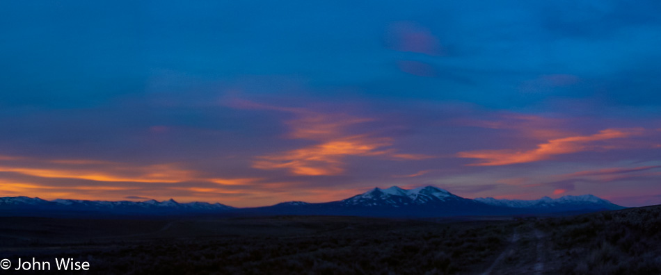
Driving slowly along this more tranquil part of the Yellowstone River we stop for one more photo along the road. A group of elk is standing next to the river’s edge, reflected in the water under the blue dusk of evening. This has been a perfect day. We check into our cabin at Signal Mountain Lodge and are quick to sleep at 11:00 p.m.

Glacier to Yellowstone – Day 2

Richfield, Utah

Happy Fourth of July, America! Last night, when we arrived, this small town was not yet asleep as folks were out setting up chairs while food vendors were getting ready for today. The sound of fireworks woke us before our alarm did; somebody must have been testing the setup for the evening’s festivities. It’s only 6:30 when we leave our motel and see that Richfield is ready for the parade scheduled for later in the day. We won’t be around for the celebration, though, as our fireworks are to be found at points north of here. To get there, we break one of our travel rules that stipulates we avoid main highways and we head for Interstate 15, but before we get on this main thoroughfare, we take a beautiful scenic detour on Highway 50 through the nice little farming village of Scipio. Sailing up the 15 at nearly 85 mph we pass Salt Lake City. We are not able to spot a single Starbucks logo from the freeway until I see a Barnes and Noble bookstore in Ogden and we know they always have a coffee shop. Armed with a quad shot venti mocha loaded with 5 or 6 bags of sugar and topped with whipped cream, I’m ready to hit the gas and take this Oldsmobile to the Arctic Circle.

EBR-1 Historical Landmark in Arco, Idaho

It started with the radio fuzzing in and out. We think it might be this Atomic City; then again, it could just be that we are also entering a wilderness area. At Blackfoot, Idaho, we left the Interstate and got on Highway 26 in the direction of Craters of the Moon National Monument. We never made it to the Craters, though, because 20 miles before it, the town of Arco up and attacked our inner geek, demanding that we stop. The world’s first Nuclear Power Plant, called the EBR-1, is open to visitors, and self-guided tours are FREE! Seeing my wife is well past her best years, and that we won’t be producing any offspring with her old eggs, we figure a little radioactive contamination won’t do her any further harm, so we leap at the chance to play with spent or fresh nuclear fuel, we’re not that discerning.

EBR-1 Historical Landmark in Arco, Idaho

Our dreams of playing with glowing fissile material were quickly dashed when we were informed that as part of our entry fee, we would not be offered a souvenir that could be used for powering our own reactor or freaking out people by handing them a rod of uranium-235. Here in Arco, Idaho, we are among the highest density of nuclear reactors on Earth: over 50 of them have been built here. I think I like the town’s first name of Root Hog, more than Arco, but that’s just me. Arco was named after the German inventor Georg von Arco who was also one of the founders of Telefunken, makers of radio vacuum tubes, who was visiting Washington D.C. when the town changed its name. History abounds.

Caroline Wise at the "Sail" of the USS Hawkbill in Arco, Idaho

It’s not every day you expect to find a “sail” from a submarine on a plain in the middle of a continent, especially one marked with the sign of the beast. But that’s exactly what you’ll find in Arco, in addition to a ton of nuclear experimentation. Regarding the satanic reference, a placard offered this from Revelations Chapter 13, “And I stood upon the sand of the sea, and saw a beast rise up out of the sea….Here is wisdom. Let him that hath understanding count the number of the beast: for it is the number of a man; his number is 666.” All of this is in the area that lays claim to fame for having the largest concentration of Nuclear Reactors in the World! We thought the earth opening up next would be a great encore; we didn’t have long to wait.

Borah Peak on the left off Interstate 93 in Idaho

On your left in this photo is Borah Peak, which is Idaho’s tallest mountain, standing at 12,662 feet tall or 3,859 meters. Just past this spot was a sign that said something about “Earthquake,” so we turned around to at least read it. It tells us of a crack in the earth caused by an earthquake, and it’s only two miles up the road. Turns out that it’s a washboard road of dirt and gravel where we fly our Oldsmobile at 40 mph, which is okay as we’re in a rental. Back on October 28, 1983, a 6.9 magnitude earthquake at Borah Peak occurred, causing the mountain range to gain 6 inches in elevation while the valley we took the photo from dropped 9 feet (3 meters). The crack before us is proof that, indeed, the earth has opened here, casting doubt on the forethought that went into putting the largest concentration of nuclear reactors in the world just down the road. Oh well, it’s beautiful out here, no time to worry about meltdowns and the earth opening a window into the gates of hell and so we bump back down the road to rejoin the highway.

Interstate 93 in Idaho

We’re following the Salmon River on Interstate 93.

Interstate 93 in Idaho

Since turning off the Interstate hours ago, we get to reflect on the roads and scenery that deliver the reason for us to endure these long road trips. With high mountains surrounding us and green grassy fields in between, the shadows of the clouds paint the landscape for miles before and after us. It’s difficult not to stop and sit by the roadside listening to the birds and the silence that punctuates their songs. These are the places in America where you have to relax for a moment after stepping out from your car to concentrate your breathing so it doesn’t interfere with the quiet we so rarely have the opportunity to experience. The day is beautiful as we hold hands and, from time to time, smile at each other with that knowing glance that we are so incredibly lucky to be experiencing this moment.

Caroline Wise and John Wise on the Idaho and Montana State Line

We are on the Chief Joseph Pass as we approach Montana, where we will stop for the obligatory selfie in front of the state sign. We had missed the Idaho sign earlier in the day, so we needed to get that out of the way first. Next up, we skip across the street and shoot a photo of us in front of the Montana state sign; this is almost becoming a compulsive disorder. So here we are in the wilderness, nothing but trees and mountains for miles and miles, sitting in the mountain air at 7014 feet when to my overwhelming surprise, we meet a couple roadside with a little wood cart they’ve hauled up here. Relaxing in lawn chairs under the trees, this husband and wife team are hawking beef jerky, not actually hawking as that would imply some level of work; they are sitting here waiting for whoever might pass over these mountains.

Turns out we don’t have enough cash for a package, and obviously, at this altitude on a remote stretch of road, they don’t accept credit cards, so we swap the little cash we have and a couple of grapefruits we had stowed in our ice chest. This is one of the great pleasures of road-tripping; how often have you met a couple sitting in the forest on lawn chairs selling jerky halfway through a transcontinental flight?

Big Horn Sheep off Interstate 93 in Montana

From the crest where we had our jerky encounter, the road begins its descent, and before you can blink an eye, we are making a near emergency stop on the side of the road, as a bighorn sheep herd with about 30 animals is meandering next to and across the road. As it’s early summer, the lambs are out with their parents, learning the fine art of ledge walking. We sat here right next to these families while the rocks from above tumbled ever closer to the Oldsmobile. After nearly 20 minutes, there are about half a dozen cars now parked with us before we begrudgingly move on.

A Bee on Interstate 93 in Montana

This lonely bee looked forlorn, and without a good dusting of pollen, it had us wondering what troubles this poor soul had seen. It just sat there kind of sulking as I approached to take its photo; while I wouldn’t want to be stung by it, it sure was pretty.

Interstate 93 in Montana

Still on Highway 93, we were passing through lush green valleys and rolling mountains on the way to Missoula when we entered the Flathead Indian Reservation. A roadside pullout invited us to stop at an overview of the gorgeous valley that we learned had been an inland sea after the last ice age scraped the form we see today.

Continuing our way north, we remained on the 93 to Polson, where we met Flathead Lake and the beginning of the evening’s fireworks displays. The road hugs the lake, and from dusk till dark, we wound our way up the road to Kalispell, all the while watching dozens of fireworks displays along the shore. This far north, the sun finally set just past 9:30 p.m., yet we were still seeing remnants of dusk on the far horizon as we pulled into the Blue and White Motel in Kalispell, nearing the 23rd hour of a long day.

California via Utah, Nevada, Idaho, Oregon – Day 2

Outside Jackpot, Nevada

Sweet Jesus, who plans these trips? Up at 4:3o a.m., are you kidding me? Well, I guess we’ve got to do this while we’re young, as plenty of people have told us it will get harder as we get older. That’s Ruby Mountain in the distance under the pre-sunrise sky. Somehow, I feel lucky to be able to see this view and not only see it under full daylight, which is easy. Next stop, Idaho.

Twin Falls, Idaho

Shoshone Falls in Twin Falls, Idaho, which I can only guess was a spectacular waterfall prior to dams. While it’s kind of interesting to look at in its own right, I’d still love to see it with a serious flow of water cascading into the Snake River below.

I guess this draws in the kids and us idiots because, seriously, Native Americans riding dinosaurs? And, of course, Native Americans have to be nearly naked because that’s how they rode their horses while battling John Wayne in the old Westerns.

We drove northeasterly on Highway 26 with the hopes of visiting Craters of the Moon National Monument, but there was too much snow for our visit, and so onto the list it goes. For a consolation prize, we are offered this spectacular view of the mountains on the south of Highway 20 while driving west near Picabo, Idaho.

One more photo on Highway 20 before turning north on the 75.

We just passed Ketchum, Idaho, and the turn-off to Sun Valley which are both famous for catering to the wealthy, which makes sense as Ketchum at least is reminiscent of Durango and Telluride over in Colorado.

The snow is pretty thick out this way and seems to be getting heavier. Sure enough, just a few miles past this and north of Galena, we reach the end of the road. Well, more road, but the snow is covering it, meaning we won’t be traveling in that direction. Time to turn around and head back to Highway 20.

That wasn’t so bad, as the view looks different when traveling south instead of driving north. This is near Fairfield, Idaho, and I should admit that I’m happy as a clam that the skies are blue because if there was a hint of snow, we would have been totally unprepared for such driving conditions.

This is Cat Creek Summit and what will have to be the last photo for a while as we are heading into Oregon to meet up with my sister Amanda Goff. The nearly three hours we lost on our drive up and back Highway 75 risk making us late for our dinner date.

We stopped in Baker City, Oregon, for a pit stop and to admire how beautiful the place is, but we’re just as quickly back on the road. We are in La Grande for this sunset and about 45 minutes away from Pendleton, Oregon. Our dinner with Amanda was a brief hour and forty-five minutes, but it was the first time we had seen her in at least a couple of years.

We found a motel in Arlington, Oregon, on the Columbia River, and as we were incredibly tired we took the first place we came across. Well, it’s the only overnight option in Arlington, a place that has a population of about 500 people. The historic room is perfect vintage 1971 decor with fresh wood paneling, green short shag carpet, and burnt orange curtains.

The crackle lacquer lamp and plastic glasses on the nightstand (paper-wrapped and sanitized for our protection) top off the experience, letting us know we’ve arrived in a real class joint that has bucked modernity for that kind of authentic flair not found everywhere. How much did we pay for our night in the ’70s? It wouldn’t matter, as this was priceless.