A Great Big Happy Place

Caroline Wise at the Grand Canyon National Park, Arizona

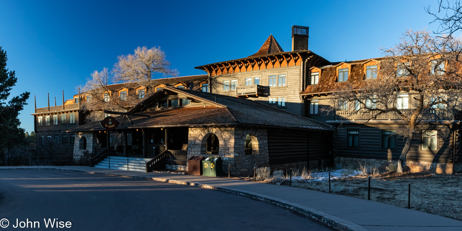
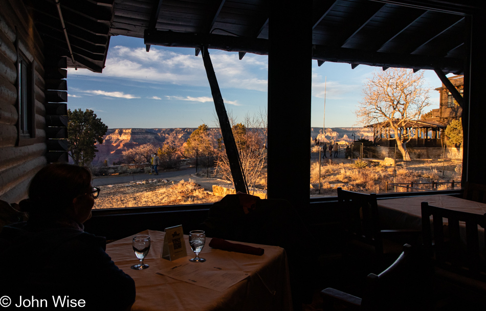
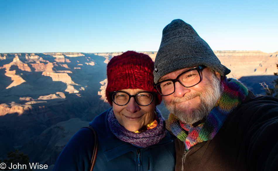
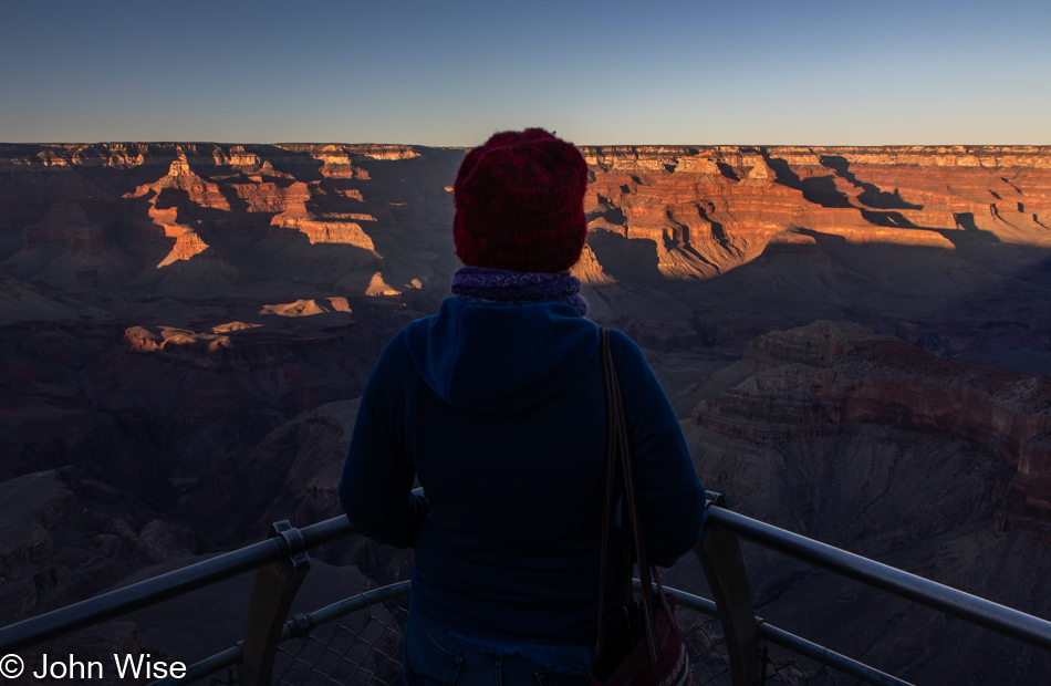
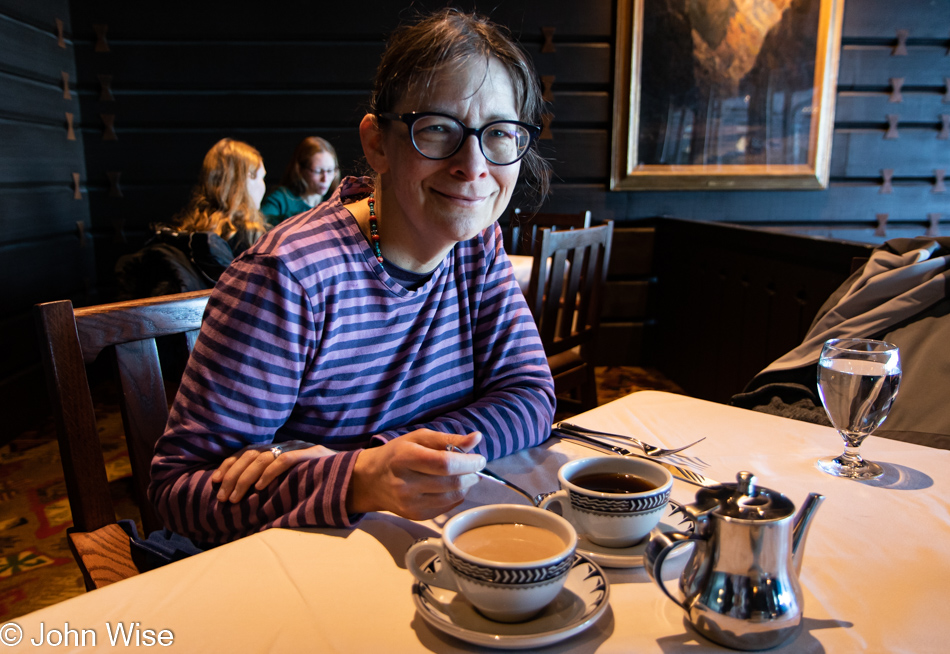
A great, big, happy place graced with a sweet, happy face is the kind of starting a day I find agreeable. Add a pot of Belgian hot chocolate, mix in some coffee, and breakfast is off to a great start too. Can you recognize the setting by now? Yep, we are back at the El Tovar, luxuriating in yet more indulgence as if that were even possible.

Grand Canyon National Park, Arizona

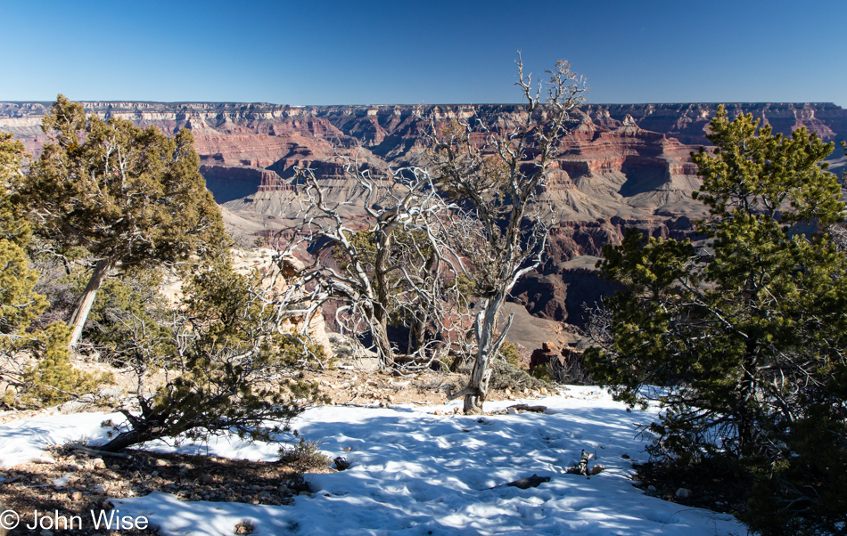
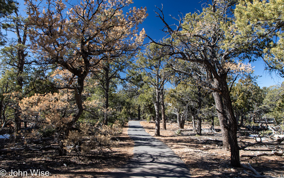
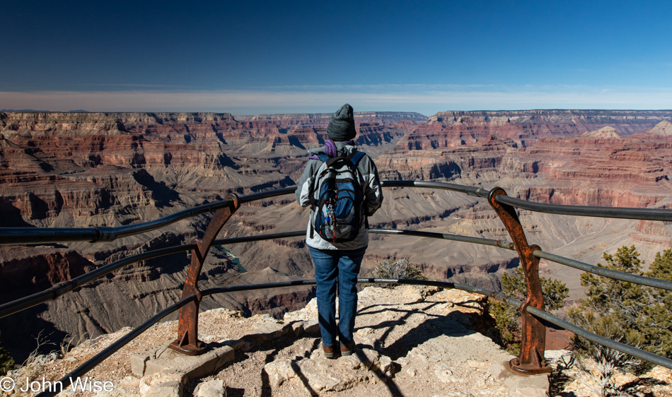
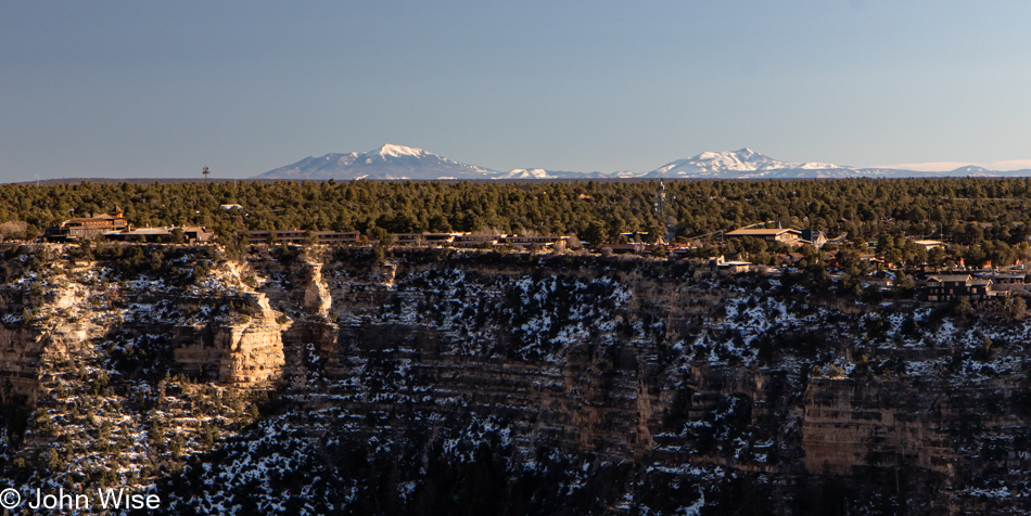
Yesterday’s journey on the Rim trail took us west; today, we go east.

Grand Canyon National Park, Arizona

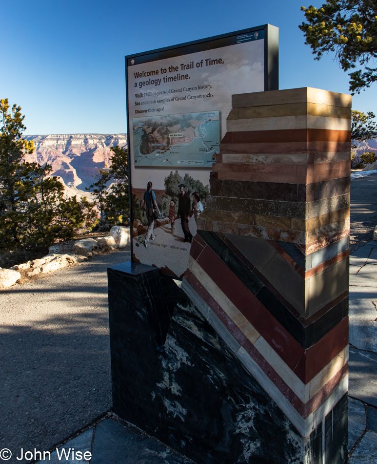
I didn’t share it yesterday, but our walk took us out on the Trail of Time, albeit the part of history that is not visible, such as the beginning of the timeline when the earth formed. Today, the Trail of Time marks spots along our walk that not only explain when particular geological layers were laid down but also what the rocks look like and how they arrived here at this corner of our planet.

Grand Canyon National Park, Arizona

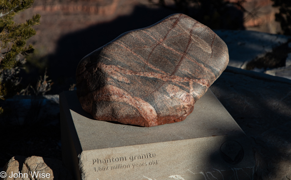
Gneiss, schist, and granite make up the Basement Rock layers of the canyon, and I would have loved to share an image of the Vishnu Schist, but that rock is black and sat in shadow; thus, my photo wasn’t worthy. Again, in my book Stay in the Magic, which chronicles our first-ever whitewater adventure, I wrote about my teary-eyed encounter with the basement. I’d like to recommend you click here to read about that day back in the fall of 2010

Grand Canyon National Park, Arizona

This is an example of Bass Limestone that is part of the very interesting Supergroup formation that is squeezed into the canyon. While I find the subject fascinating, maybe it’s not the quickest of explanations without diagrams, although the photo of the Trail of Time sign clearly shows the angular intrusion of the Supergroup between the basement and the majority of visible rock layers here in the canyon.

Grand Canyon National Park, Arizona

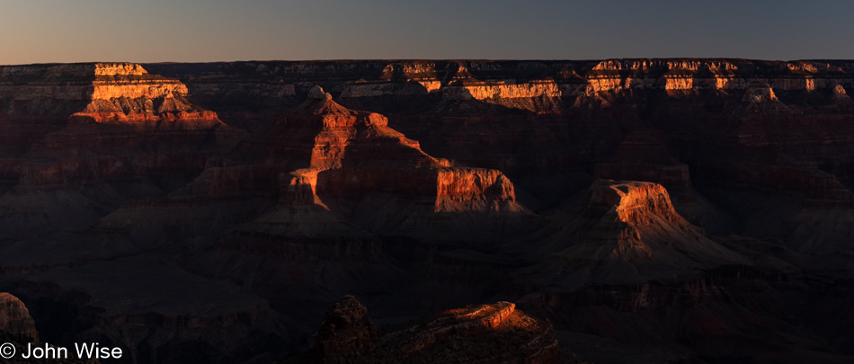
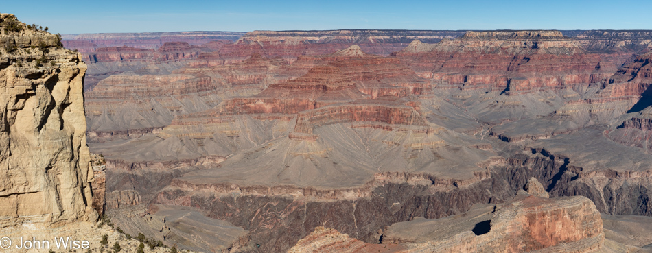
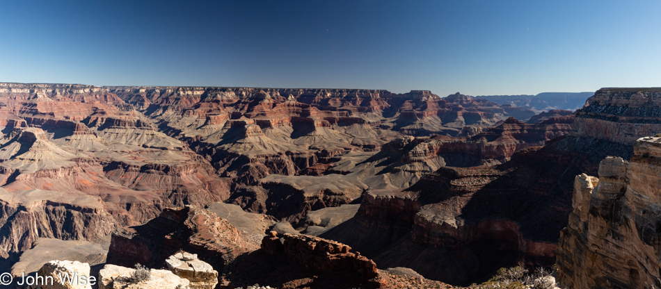
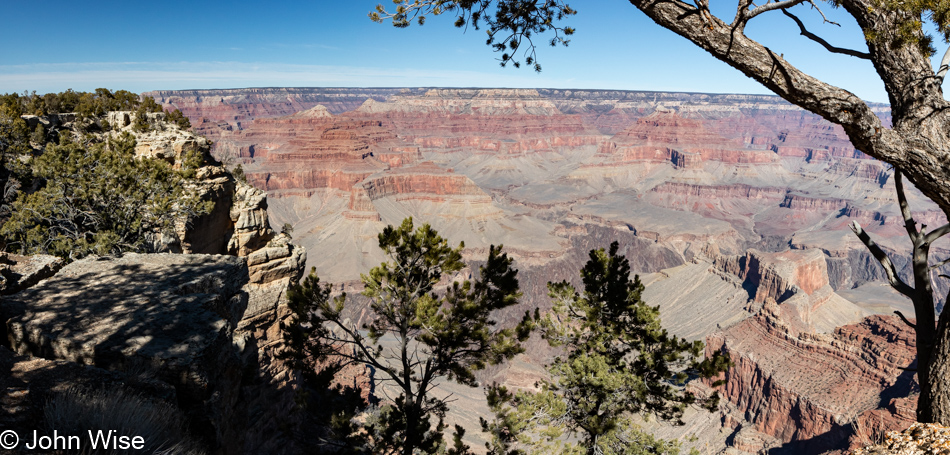
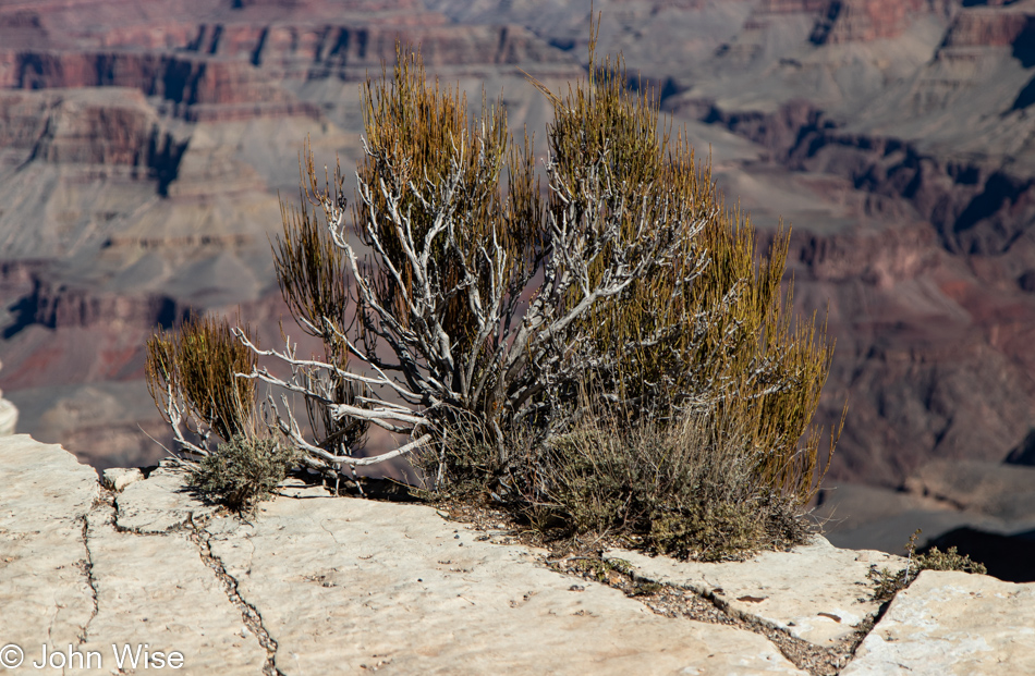
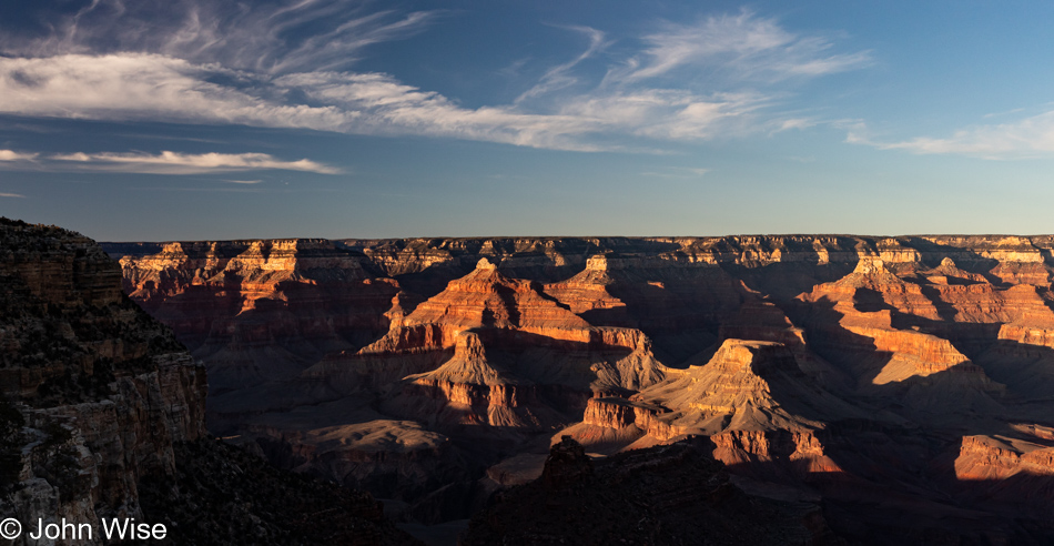
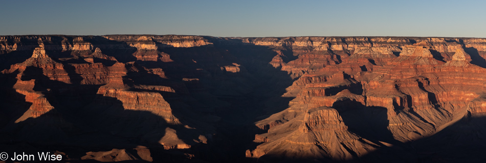
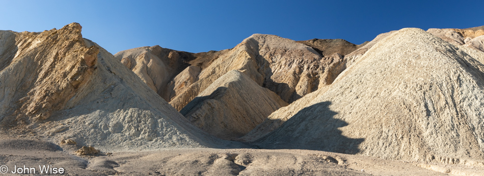
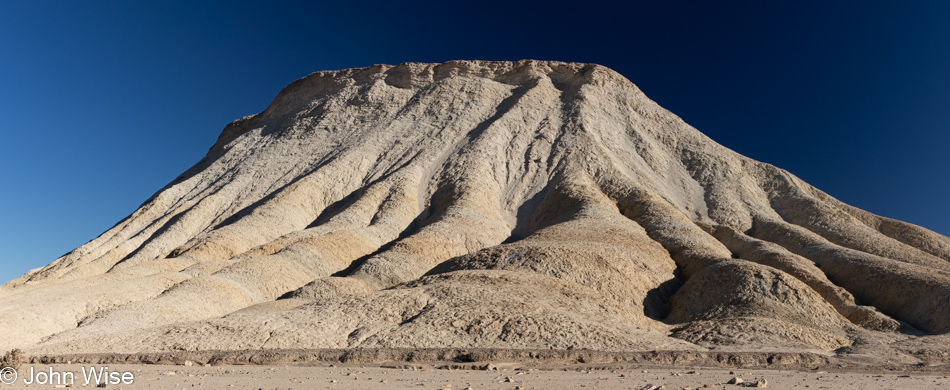
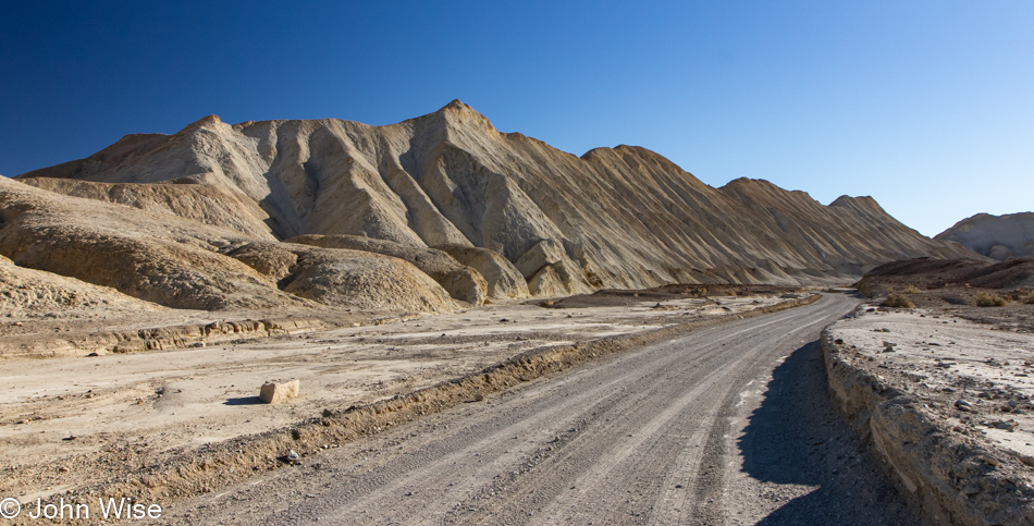
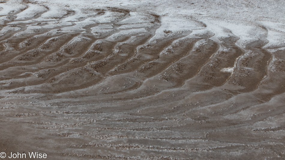
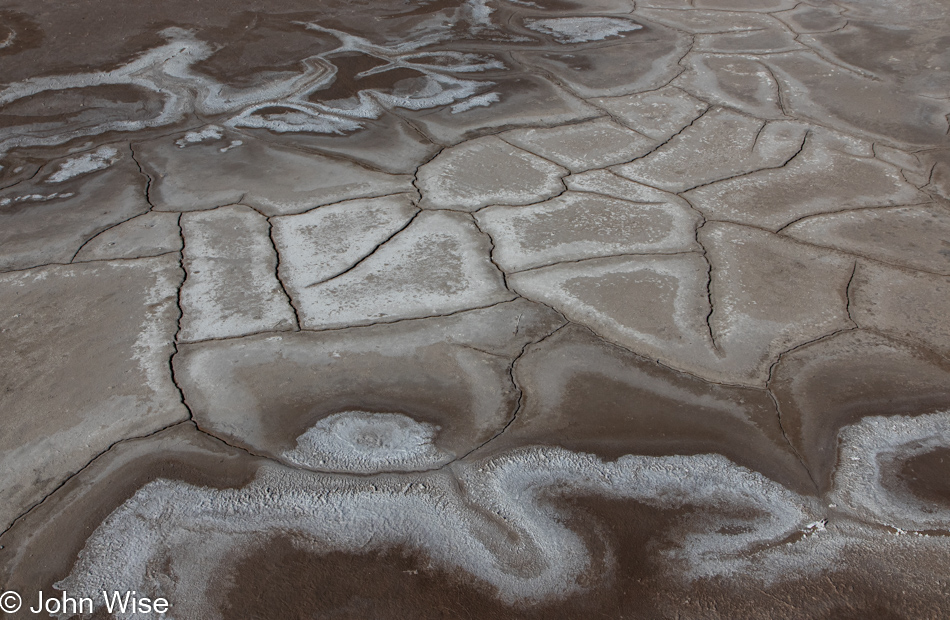
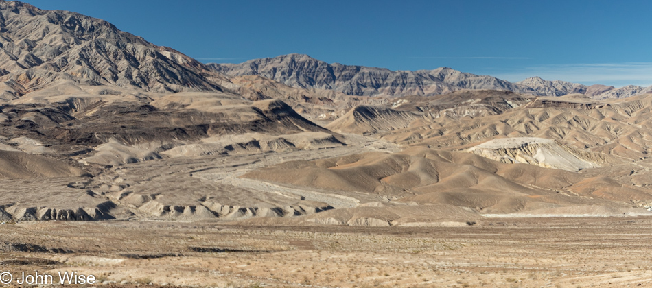
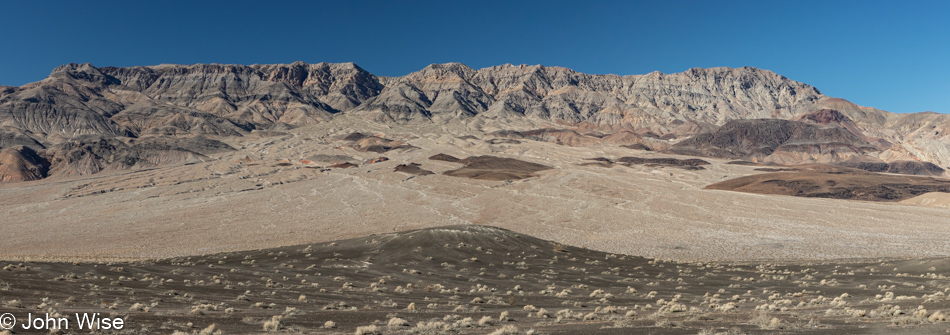
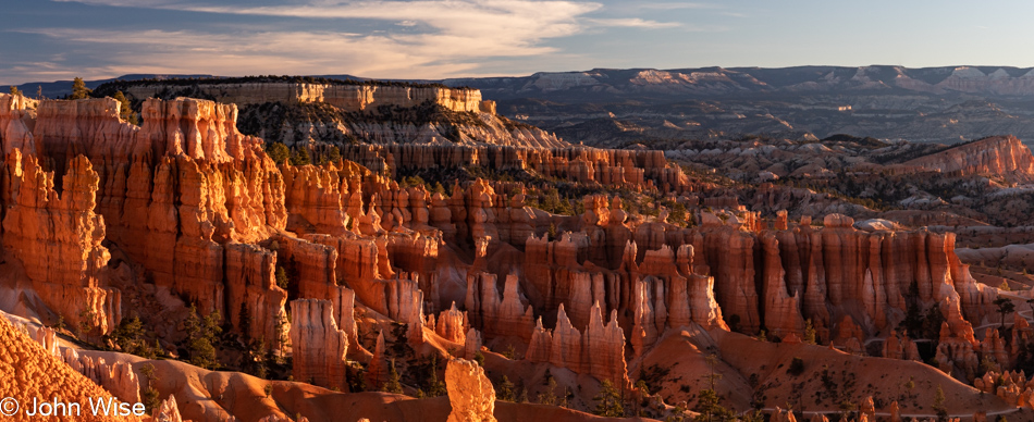
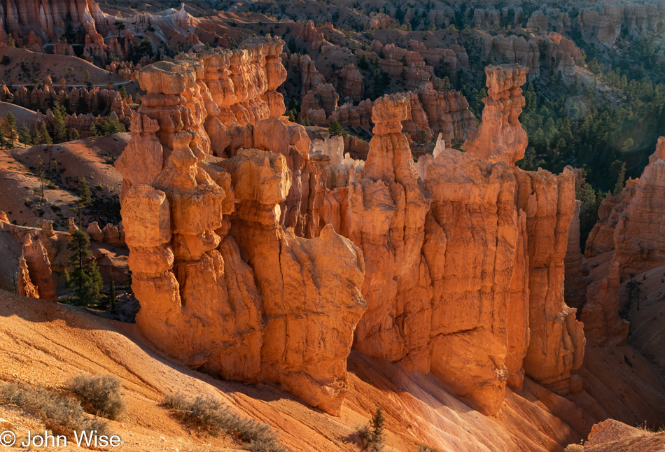
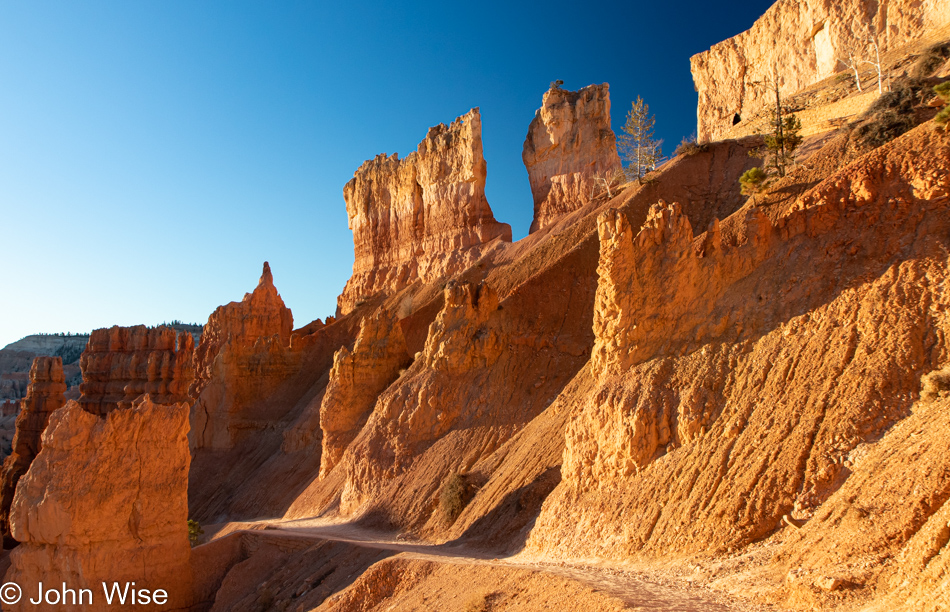
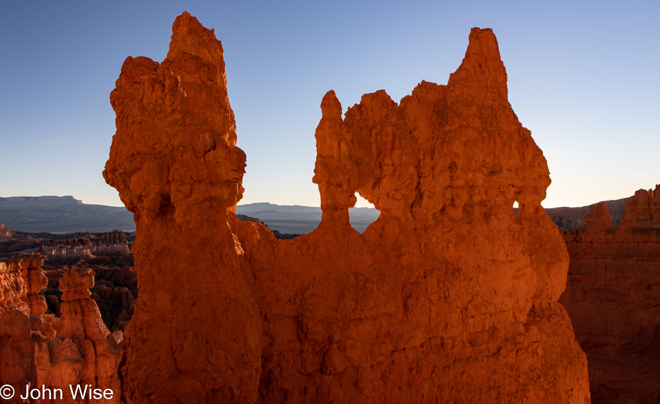
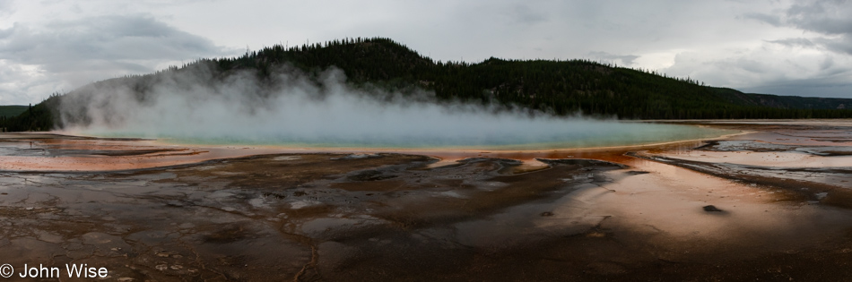
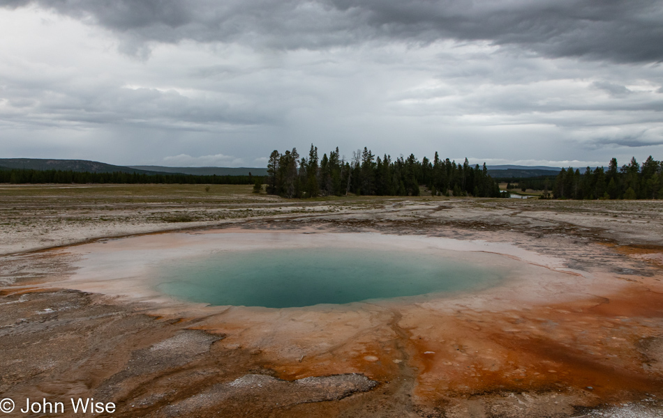
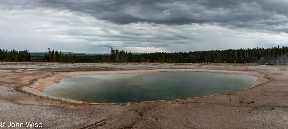
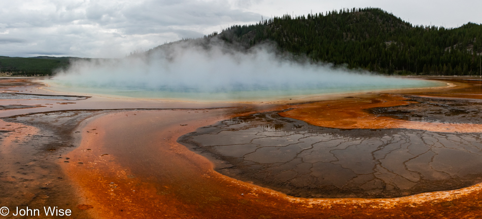
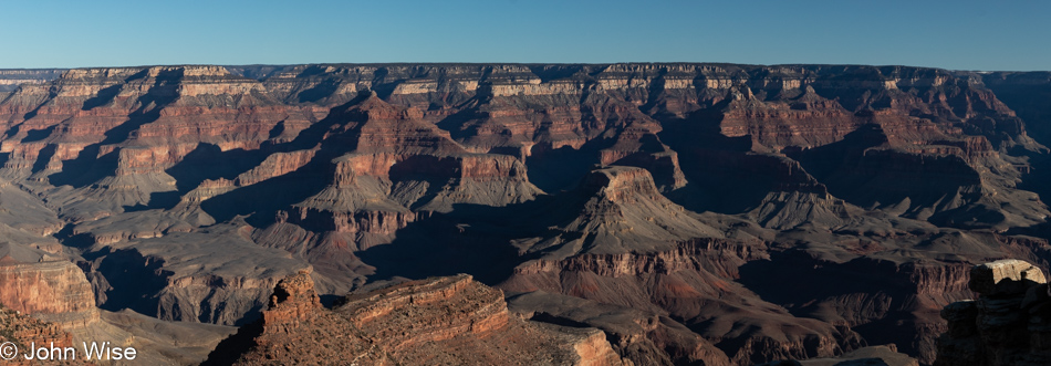
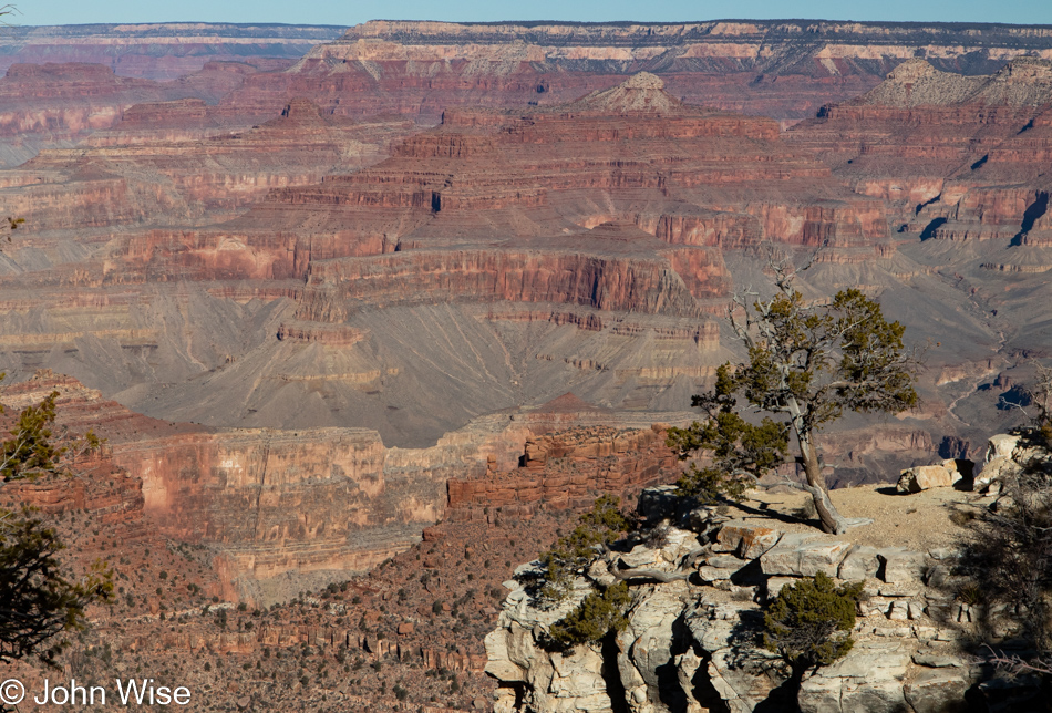
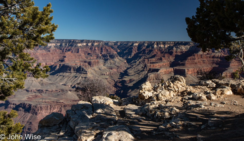
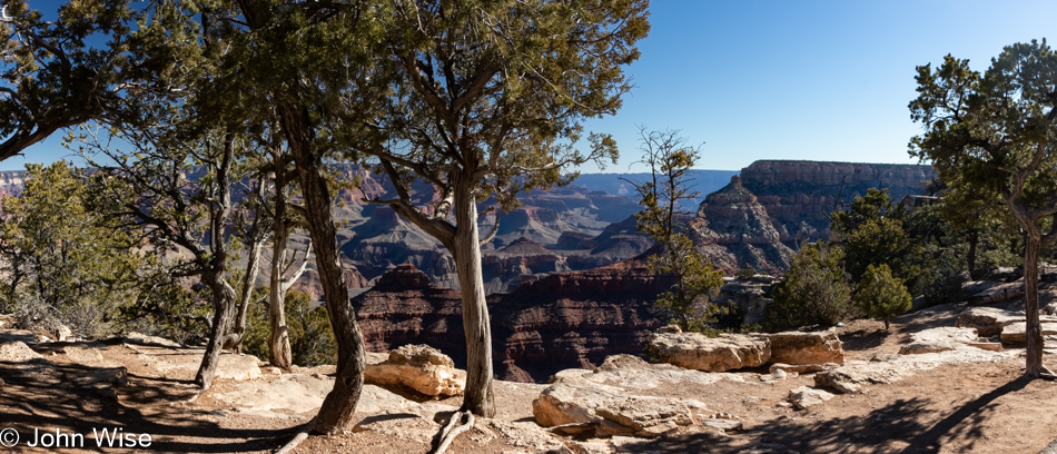
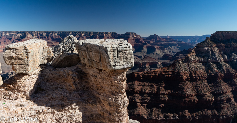
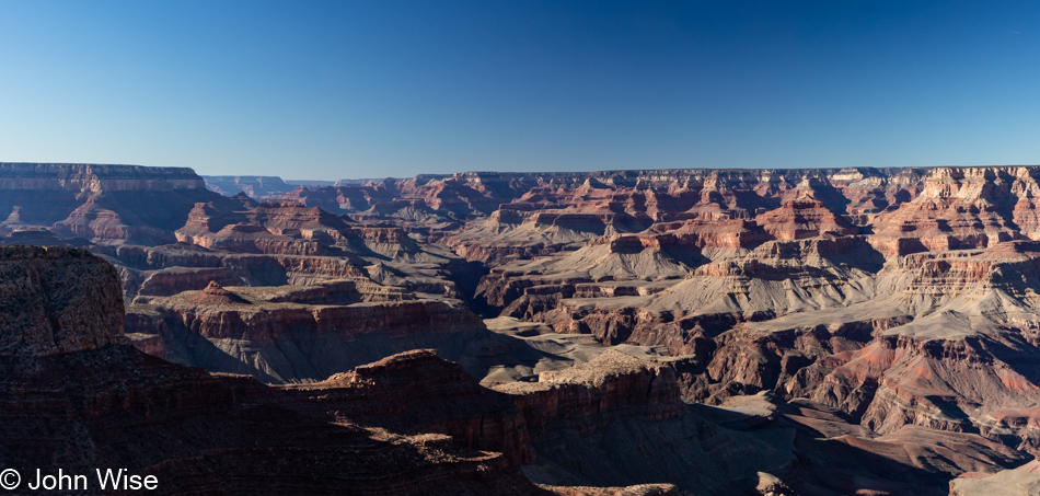
By now, I wouldn’t blame the casual visitor to my blog for getting a sense that I’m posting many photos that look like others. Maybe you’ve not been to the canyon or studied its geology and history, so you wonder why these somewhat repetitive images are so intriguing to Caroline and me. Well, each photo I share is another work of art painted by the adept hand of Mother Nature.

Grand Canyon National Park, Arizona

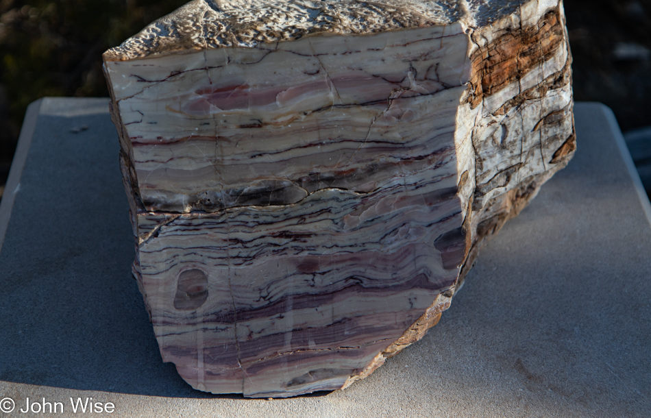
This polished section of rock was on the south side of our trail and was unmarked. The named and year-identified rocks are on the north side of the trail. I do wish we knew what this was.

Grand Canyon National Park, Arizona

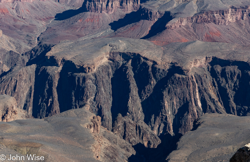
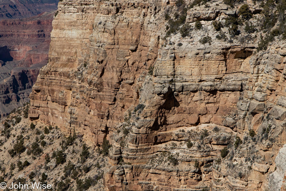
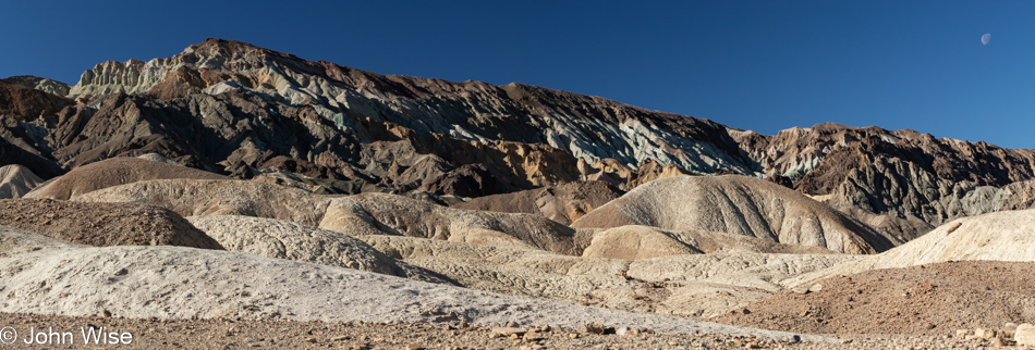
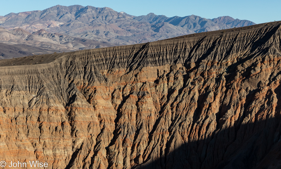
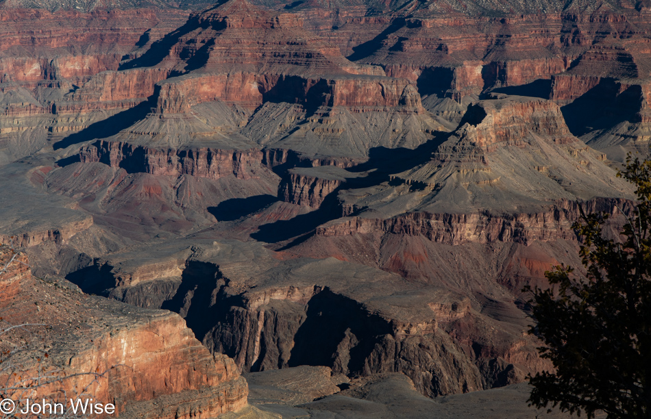
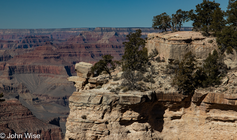
There’s as much gone from erosion in this photo as there is to be seen. A one-mile layer has been eroded from the north rim, which is visible at the top of this image. That’s where the fossils of dinosaurs and mammals would have been found had weathering not erased that part of history from our continent. To see what’s missing, simply travel north of here into Utah, Wyoming, and Montana, where much of that record still exists.

Grand Canyon National Park, Arizona

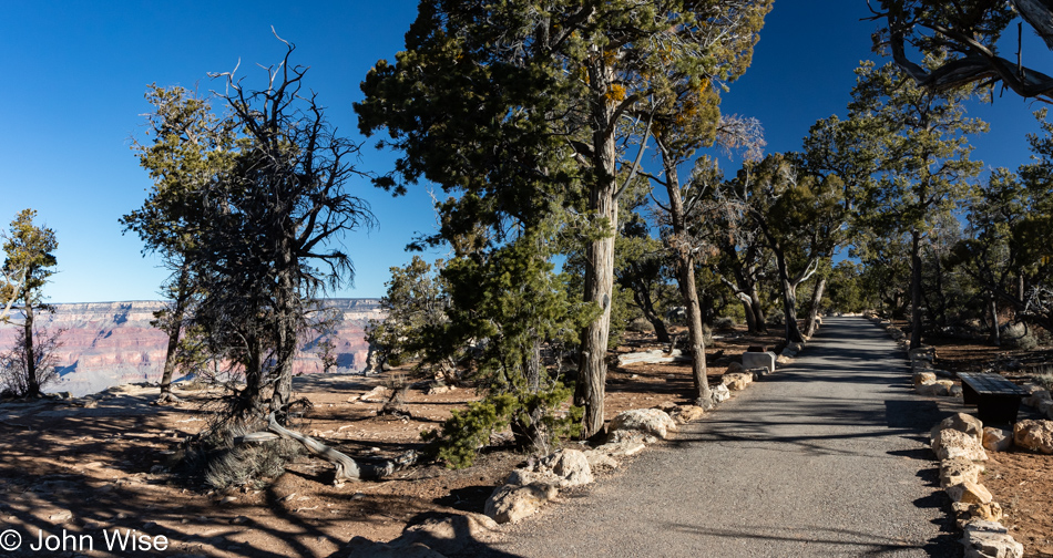
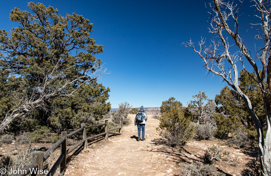
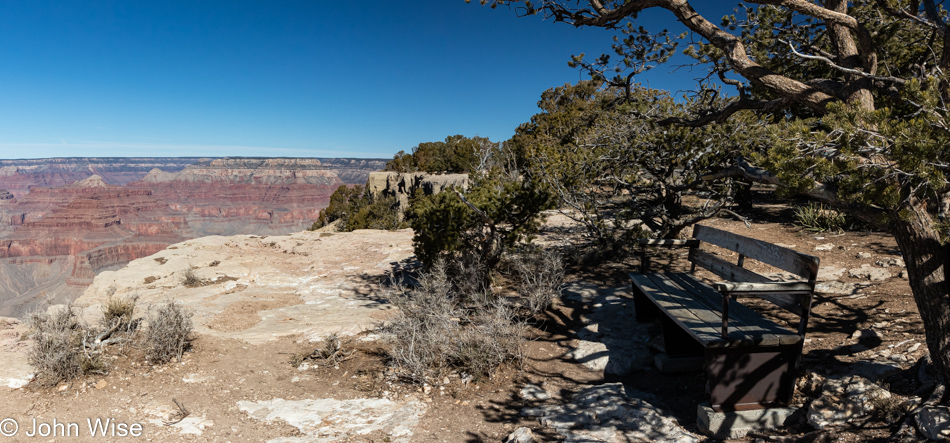
The Trail of Time is not a difficult hike into the canyon; it’s a handicapped-accessible path offering all visitors the opportunity to take a nice slow walk on the canyon’s edge while also learning about the history of how the canyon formed. Spoiler alert: this place isn’t only 6,000 years old.

Grand Canyon National Park, Arizona

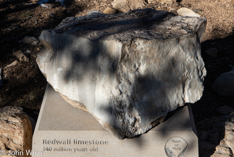
Things are not always as they seem here in the canyon, such as that age reference made to the religiously devout just above. This Redwall limestone is obviously not red. Back when the science of geology was a nascent endeavor, the people who had a hand in naming canyon features might have played fast and loose with things, as the truth about Redwall limestone is that it appears red due to erosion of the rock layer that lays just above it.

Grand Canyon National Park, Arizona

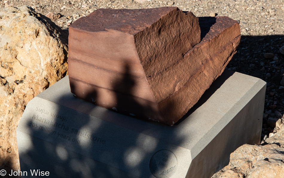
Manakacha sandstone is a 200-foot thick layer that rests upon the Redwall limestone, and thanks to its erosion, the limestone below it appears to be red. Don’t forget that limestone is formed by the shells of sea creatures, while sandstone is formed from eroded rocks that accumulate on a land basin or underwater. Maybe this all seems normal to most people, but to me, the processes that were at work to create the lands we live on are simply astonishing yet probably mostly taken for granted.

Grand Canyon National Park, Arizona

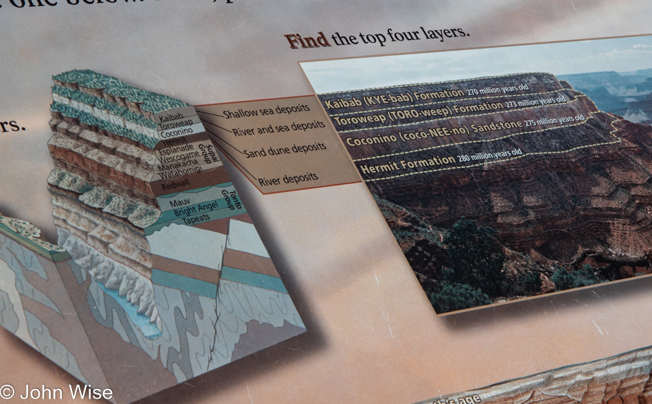
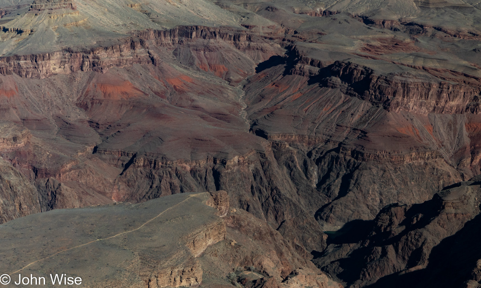
This sign points out the top layers you’ll see in the following photo, where first there was a river (Hermit Formation), and then on top of that, sand dunes formed (Coconino Sandstone) until a river and a sea started leaving deposits (Toroweap Formation) before another shallow sea formed (Kaibab Formation). Personally, my mind is blown again and again, no matter how many times I read this and see it with my own eyes.

Grand Canyon National Park, Arizona

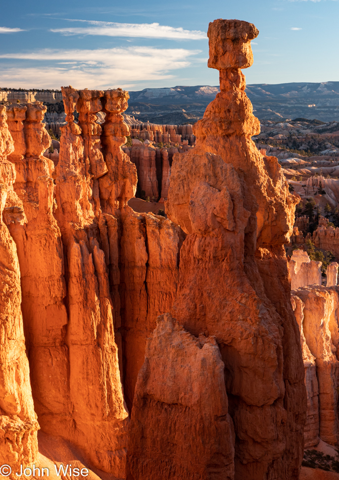
How many photos that capture minor iterative differences in this scenery are required to be shared? All of them. I look at the spectacles of nature in ways similar to how others listen to their favorite songs. How many people might listen to nearly all 213 songs the Beatles released and never believe they all sound the same? Well, each photo I share here of these views of the Grand Canyon is a song, and each major point in the canyon is a different artist.

Grand Canyon National Park, Arizona

Inspired by our travels, writing these posts to images is the musical composition or aroma of a favorite dish that becomes a classic in the repertoire of references that amplify what would otherwise be fading recollections. In effect, I’m creating a soundtrack that allows us to relive moments as viscerally as a favorite song brings us back to being a teenager or falling in love for the first time.

Grand Canyon National Park, Arizona

Listen closely, and you might pick up on the smell of amazing as you gaze into the deep canvas of the infinite. While you scan the horizon, you are seeing the past, the present, and the future, too, though nothing of you is still left here from previous visits and your next present moment will be elsewhere. Out of that reality, your presence will likely never have been known here, but should any of my writings and photos exist at some later date far from this day, I might be so lucky to remain a part of the places I’ve been just as the sediments and fossils do before they rejoin the flow.

Grand Canyon National Park, Arizona

The flow of time, of rivers, of songs, and stories over the ages all create impressions that leave temporary indelible marks on those things they touch. Carving into youth, imagination, rock, and space, these flows impress character and define the extent of culture that should be boundless but are often constrained by self-imposed and societal boxes that people are unable to escape. The man cave is not the totality of experience, nor are the toys that allow us to distract ourselves; it is the vastness of the Grand Mind and Imagination traversing words and thoughts we ultimately have to use to define where we are in this universe. Not taking the path of going deeper within one’s humanity of language, words, and speech, we risk falling off the cliff and into the void of an abyss. We are not meant to become nothings in a universe that offers us the unbelievable; we, too, must carve a mark upon the life we’ve been offered.

Grand Canyon National Park, Arizona

Well, this is embarrassing as, apparently, I’ve run out of songs. My lyrical content has dried up, and I’m sitting here trying to regain my flow as I move to finish this blog post.

Grand Canyon National Park, Arizona

At least we are at the end of this trail, and I can begin transitioning to our exit of the Grand Canyon. This particular end is near the South Kaibab trailhead, where we’ll get a ride back to Grand Canyon Village, where lunch and our car are to be found.

Caroline Wise at the Grand Canyon National Park, Arizona

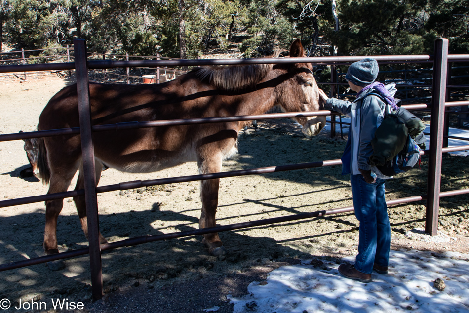
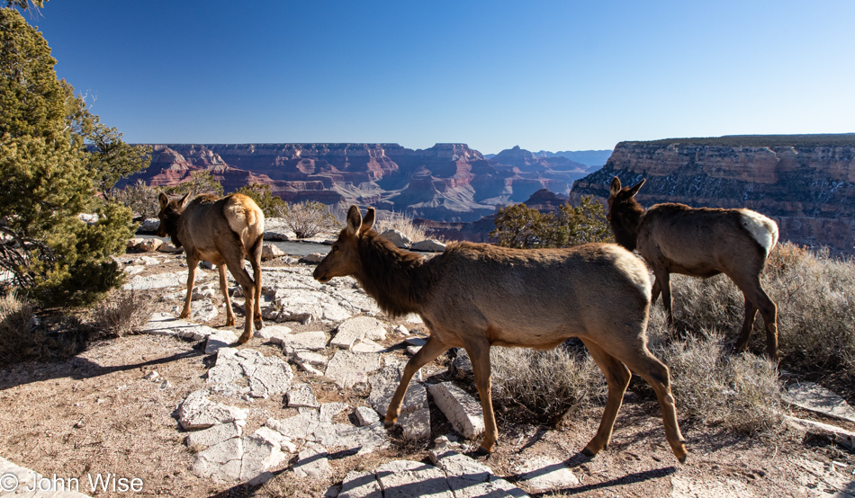
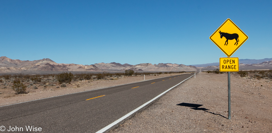
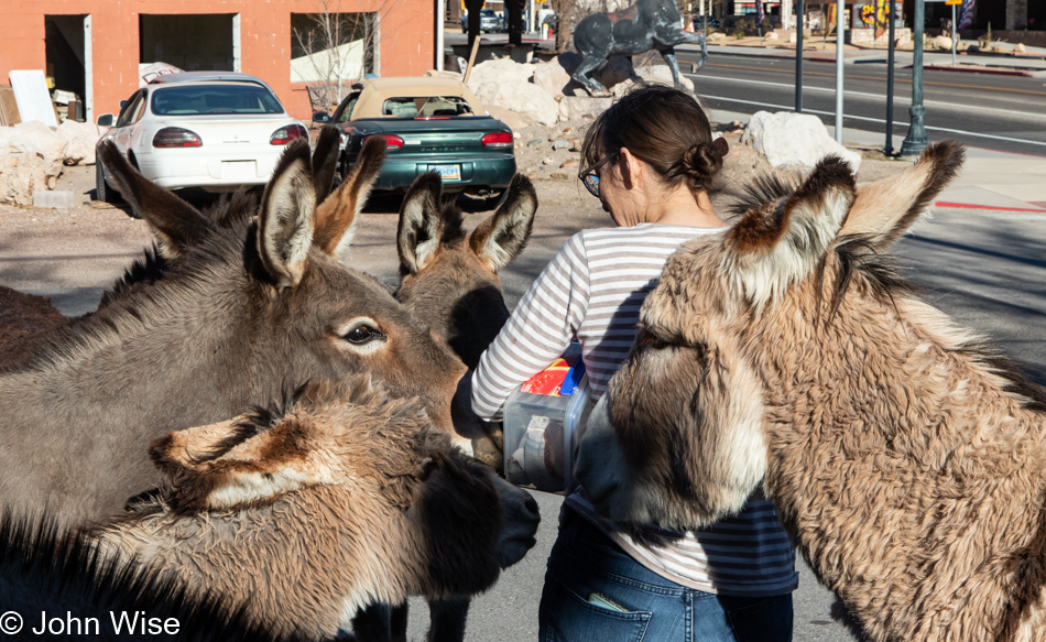
Of course, mule-powered transport the five miles back would be preferred, but as that would involve stealing a couple of these friendly animals, we’ll defer potential arrest and instead opt for the shuttle bus that stops here.

Grand Canyon National Park, Arizona

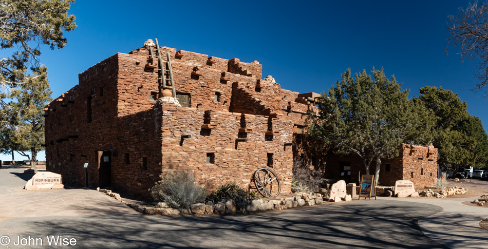
Lunch was at the El Tovar because, of course, it was. Thinking we’d get out of the Grand Canyon without another stop at a gift shop was folly because, of course, it too was. While Caroline went hunting for postcards in the Hopi House gift store, I remained vigilant in the great outdoors, waiting for the perfect image to present itself in case another addition to the photos shared here was required because I will never have enough to write about.

Grand Canyon National Park, Arizona

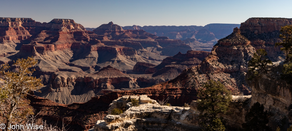
Caroline might insist that this was Moran Point, but I will remain defiant in my insistence that I read Moron Point; I’d then bet a dollar that she’d use that tired reference to the town in Texas that she says is indicative of these moments, it’s called Dumas. [John, you can be such a dumbass – Caroline] [John, did you really just write that fake comment in my name? – Caroline (the real one ^_^)]

Grand Canyon National Park, Arizona

We both agree that this is Lipan Point and remain astonished that we’d never visited this overlook before. Keeping something unseen to drag us back works again.

Grand Canyon National Park, Arizona

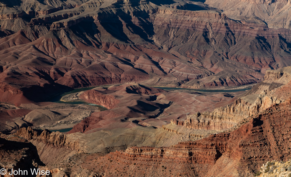
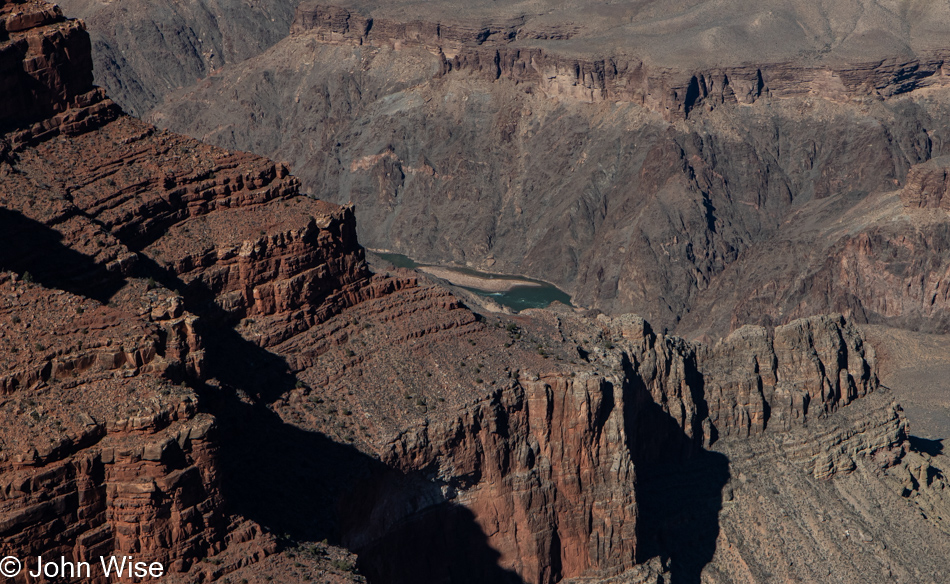
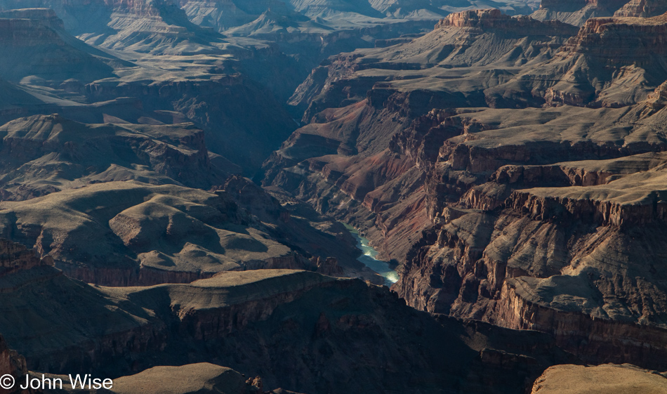
At Lipan Point, we decided to skip the Desert View Watchtower in order to catch this overlook and the next one. But before we leave this view of the Unkar Delta, I need to point out another detail from our river trip that took us down the green band out in the middle of this image called the Colorado River. Just left of center on river left (as seen from the flow of a river, which in this case comes in at the right and flows to the left of the photo) is Cardenas Camp at mile point 71.6. The Unkar Delta area is also known as Furnace Flats; if you are curious about some of the psychedelic rock down in that area, you should take a glance at Day 5 of Stay in the Magic; your mind will be blown.

Grand Canyon National Park, Arizona

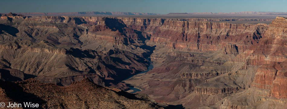
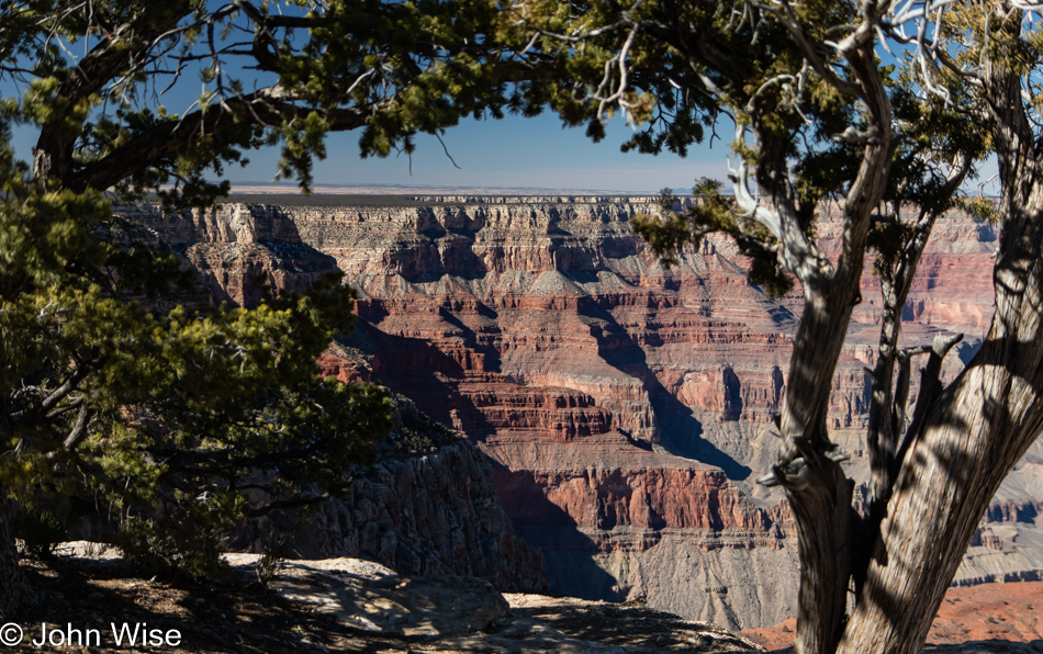
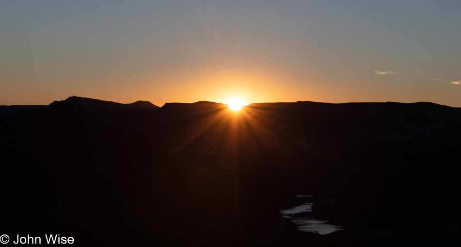
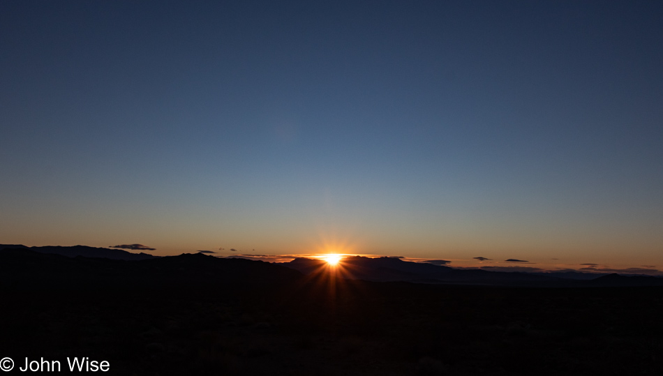
Finally, this is the view from Navajo Point, looking north up the Colorado River. If you look closely towards the top right of the image, you can make out a crack in the plateau that branches off the main gorge. This smaller canyon going to the right is the canyon that brings the Little Colorado River in to meet its bigger brother. And with that, we say goodbye to another visit to the Grand Canyon. What an amazing weekend and culmination of the third trip away from home this year.

It’s Oh So Grand

Grand Canyon National Park, Arizona

We’ve not seen all the sunrises that have ever risen over the Grand Canyon, but we’ve seen every one of them we’ve been present for, and that’s probably more than either of us might have ever expected had we imagined such a thing after our first visit here together. The thought strikes me that we might only be here at the edge a couple of times this year when these first rays of light reawaken the spectacle of this treasure, and while that will be infinitely more than the fraction of less than .01% of humans that will even visit the canyon and even less than that who will wake up here. While we are certainly in a fortunate minority of humanity as measured by those who will greet the first light of day from within a national park, it feels like there’s room for more. Maybe we can…I was going to write, “…add another day this year,” but before I could jot those characters down on my keyboard, I went ahead and looked for availability on the North Rim of the Grand Canyon, and there, on the last day of the season, found a cabin that had “Book Me!” written all over it. I obeyed.

El Tovar Hotel at the Grand Canyon National Park, Arizona

Of course, breakfast would be had at El Tovar, the home of Belgian hot chocolate, and as far as the Grand Canyon (and maybe all of Arizona), this is the only place to indulge in such a treat. We’ve been lucky enough to spend more than a few days in this famed hotel at the precipice of the canyon, but rooms are now hard to come by and have grown in expense. Rightfully so, considering the likely enormous upkeep of such a historic structure. So, while we may not want to spend so much of our budget on lodging, that doesn’t mean that we won’t attempt to eat every meal we can here.

Grand Canyon National Park, Arizona

From Grand Canyon Village, we head west on foot in the direction of Hermit’s Rest, though the likelihood of getting that far is slim at best. Who cares? We’ll just walk out on that rim trail as far as time allows.

Elk at the Grand Canyon National Park, Arizona

About a dozen elk were also heading in our direction, though their stopping to forage meant we were moving a bit faster. While they appeared nervous about us, we were equally nervous about them as they have a big weight advantage over us puny humans. Be that as it may, it is amazing to be in close proximity to such graceful wild animals that appear to daintily nibble at things and walk with a light gait.

Grand Canyon National Park, Arizona

There were light patches of snow still present, though much of the white stuff had iced over. Speaking of ice, there are smatterings of that in shady spots in the Village as well as on the trail. Prior to choosing the rim trail, we’d already read that most entries into the canyon were loaded with enough ice to require crampons and walking sticks just to be safe, and we had brought neither.

Grand Canyon National Park, Arizona

We did bring wide-open eyes, ready for expansive vistas that we’d calculated would communicate directly with our memories and imaginations to remind and inspire us that what we thought we knew would appear new and unique. Searching those previous experiences, we couldn’t find a hint that we’d ever walked this trail as far as we are now, but even if we had, could that familiarity possibly diminish something that looks like this?

Grand Canyon National Park, Arizona

Right down there in the black rocks known as Vishnu Schist, a.k.a. the Basement, lies the river called Colorado, which is a place we have very minor experience with. Over ten years ago, as I’ve probably shared a thousand times by now, Caroline and I were aboard dories right down exactly there. We were on Day 7 of our journey and had woken up at river mile 84.6 above Clear Creek. We’d run a couple of rapids, one called Zoroaster, that was quite large, before taking out at mile 88.1 for a walk to Phantom Ranch. After an hour or two along Bright Angel Creek, visiting a gift shop, and visiting the first flush toilets in a week, we were again riverside where we’d have lunch before passing right through here to our next camp that was only 6 miles downriver.

Grand Canyon National Park, Arizona

The view from here is one of expanse and the immense flow of time. The gargantuan landscape stretches out in all directions; there doesn’t seem to be a beginning or an end. Down in the canyon, the world is ancient, within grasp, and extremely detailed until you try to reach out and experience it. From our perspective on the canyon rim, it feels like you could reach the other side rather quickly, but that’s an illusion, while on the river, there is no outside world. Infinity is nearly within reach of being understood if you’ve been on the Colorado through the Grand Canyon, but it’s an illusion as the North Rim is only about 14 miles away while the South Rim is under 8 miles via the Bright Angel Trail. Not that those distances really mean anything, as the majority of your time on the river, there is no way out other than straight ahead. Of the other trails in and out of the canyon, many are treacherous and difficult.

Grand Canyon National Park, Arizona

Today’s walk here on the Hermit’s Rest rim trail is one of extraordinary ease, other than the acclimation to the cold and elevation.

Caroline Wise at the Grand Canyon National Park, Arizona

The swerve of the trail has the pleasant effect of bringing the canyon below into view again and again.

Grand Canyon National Park, Arizona

Look at the river in the center of the photo, just to its right, and on the opposite shore is Granite Camp, which is next to Monument Creek and just above Granite Rapid at river mile 93.8. On the 28th of October, 2010, we slept right down there. While I’m no hydrological expert, I’d wager that the sandbar you can see is the result of the Class 8 rapid just upstream.

Grand Canyon National Park, Arizona

Framing, shadows, air quality, clouds or lack of them, season, time of day, and intensity of the sun all contribute to how we’ll see the Grand Canyon on any particular visit. Just stop in any of the gift shops and look at the photos on offer: aside from the fact they were taken by people with great cameras, being present at the right moment when conditions are just right plays an important role in what version of the canyon you might witness.

Grand Canyon National Park, Arizona

As the time inches past noon, we spot what looks like a perfect place for lunch right here at Mohave Point.

Grand Canyon National Park, Arizona

Before we set in for a mid-day meal, we spotted this lost necklace that had been placed on a branch awaiting its owner’s return. We are now the owners of this necklace; well, Caroline is. The chances of the person who lost it at some random spot on their walk ever returning to look for something they had no idea of when it fell from their neck is likely zero. So that it might continue to charm someone else who will now associate it with a perfect lunch stop at the Grand Canyon, it seemed only natural that it should continue its journey to other places.

Caroline Wise and John Wise at the Grand Canyon National Park, Arizona

It was Caroline’s idea to bring our thermos with us and a couple of bags of Heisse Liebe (Hot Love) tea from Germany. [Heisse Liebe is the name of a popular dessert in Germany, a combination of vanilla ice cream with a hot raspberry compote. Just to give the gentle reader an idea of what the flavors in this tea are – Caroline] After sharing a sandwich we had picked up this morning, we enjoyed a couple of cups of hot love and the smiles that come with that. [And also the memories of our first shared cup of tea from this very thermos in Winter in Yellowstone back in 2010 – Caroline]

Grand Canyon National Park, Arizona

The perfect dessert feast for the eyes was next up on our mid-day break that included visual culinary delights such as this one.

Grand Canyon National Park, Arizona

The closest either of us was getting to this Mormon tea plant growing on the very edge of the cliffside would be from this photo; while I love most everything about the canyon, standing near areas where a gruesome potential death awaits those of uncertain footing drills into my acrophobia with tensions that extend empathetically to those nearby.

Caroline Wise at the Grand Canyon National Park, Arizona

While neither you nor I can see Caroline’s face, I can tell you from experience that her eyes are telling the story of how deep these impressions she’s taking in are resonating within her. If not from nearly imperceptible extra moisture emanating from tear ducts, then the way she’ll smile at me with eyes pleading for my understanding of how monumental the experience and memories that flow through her. My wife, while vitally realistic, is also a romantic who loves indulging those things that plum her wellspring of love and sense of profound awe that we are so lucky to experience such gifts.

Grand Canyon National Park, Arizona

We made it out to the Abyss, but it turns out that we had nothing to fear as, apparently, we’d vanquished the monsters that might have looked into us. Instead, we are happiness personified by looking at an intrinsic beauty contained in the arrangement of rocks, plants, and reflected light that paints these images for all to see.

Grand Canyon National Park, Arizona

The cost to stay at the Bright Angel Lodge is $139 per day, and the price of three meals within the park will set you back between $100 and $200. Transportation to get to the Grand Canyon will depend on where you live, but if you are a mule deer, it’s all free, aside from the risk of being hit by a passing car. If you consider that a mule deer lives an average of about ten years, life in the Grand Canyon would cost us humans over $875,000. The lesson here might be: have cloven hooves instead of hands, and you may not have to toil a lifetime, never being able to afford real luxury.

Grand Canyon National Park, Arizona

I can’t remember a visit with such clear air as we’re enjoying here today. That is Humphreys Peak standing over Flagstaff, meaning we can see 70 miles (112km) south of here.

Grand Canyon National Park, Arizona

Maintaining a snail’s pace in order to allow even more of the canyon to seep into our souls, we required a solid 8 hours to walk 11 miles of rim trail out and back. It would have been 17.5 miles had we made it to Hermits Rest.

Grand Canyon National Park, Arizona

Returning at sunset, our hunger had grown large, and without a reservation at El Tovar, we could only hope for a table. We could have never guessed that this would be where we’d be sitting for dinner but this is exactly where we were seated and without any wait at all. It was dark as we finished, and the lounge had a waiting line, so a slice of apple pie and an Old Fashioned were not going to happen; instead, we headed to the upstairs part of the lobby to grab a table. I opened the computer to work on photos, Caroline brought out her knitting, and we listened to the piano player arpeggiate pop songs and lounge favorites into a glissando wormhole as big as the canyon just outside.

An encore of starlight for the walk back to our room was provided by an obliging clear sky that allowed us to marvel at a Milky Way that all too frequently is not seen by us city dwellers. Come to think of it, nothing about this time in the Grand Canyon is common to those of us who live in big cities.

Heading Towards a Giant Hole

Highway 64 to the Grand Canyon National Park South Rim, Arizona

Today’s title could allude to a lot of things, such as something financial, emotional, or possibly even intellectual, but the reality is much more mundane, though the gravity of the hole is immense. This hole of immensity is mere hours away from our home, and for those encountering this blog post who have the knowledge that we reside in Arizona, it should be apparent what this reference means. That’s right, we are going to the Grand Canyon National Park, which lies just 217 miles north of us.

I’d love to find an appropriate metaphor to stand in for the destination and relate our adventure to some esoteric thoughts I’ve recently been reading or writing about, but trying to be real, we are going somewhere beautiful and likely extremely cold to go walk with one another because that’s what silly people in love do. Sure, we could walk around Phoenix and save the expense, but our mission to help keep the American economy humming demands that we rent a room on the South Rim for a couple of nights.

Bedrock Campground near Valle, Arizona on Highway 64 on way to the Grand Canyon National Park

The other benefit of this brief excursion is that it will inspire me to photograph things that will force me to write about our experience, so I might offer the appearance that important events happen in our lives other than eating, defecating, and sleeping. But here I am at the coffee shop hunting for wit instead of heading home to finish the last-minute packing and making lunch that would allow us to skip out of town, but as I’m not impossibly feeble (yet) to control things, I’ll add a period to this sentence, call it a paragraph, and get moving.

Grand Canyon National Park South Rim, Arizona

Living only three and a quarter hours from the South Rim of the Grand Canyon allows us to leave at nearly any time, but it was our intention to catch the sunset in the canyon, so leaving at 1:00 p.m. would give us plenty of margin. Sure enough, it’s shortly after 4:00 as we reach the park entrance. There will be no selfie here as we’ve got that photo from a previous visit, maybe more than one. Then again, we likely have many versions of the next image, too.

Caroline Wise and John Wise at the South Rim of Grand Canyon National Park, Arizona

A little more than 28  years ago, we made our first visit together to the Grand Canyon. Just a few days before, we’d gotten married in Las Vegas on a trip from Frankfurt, Germany. Back then, we had no idea that one day we’d be living in America; as a matter of fact, it would be the following year, in 1995, that we packed up and headed west. As I sit here at the lounge in El Tovar following dinner trying to write this, I apparently don’t have enough fingers to be able to count how many times we’ve been to this corner of Arizona, but I’d guess we’re approaching a couple of dozen times.

Grand Canyon National Park South Rim, Arizona

Once we arrived at Yavapai Point, we were not interested in chasing the setting sun. We could be happy right here. I could be cynical and say we’ve seen it all before, but that would somehow diminish the intensity of feelings still experienced as maybe the view is no longer new, but the memories we’ve shared with so many friends and family continue to echo out of the depths and crevices that have captured our oohs, aahs, and astonishment.

Caroline Wise at the South Rim of Grand Canyon National Park, Arizona

Have you noticed that all three photos are of the same location? Can you tell that Caroline froze to death where she was standing as I asked her to wait one more second until the light was just right? It’s a brisk 32 degrees or a big fat ZERO Celsius for our friends in other countries, and with a bit of breeze, we were slightly, but only slightly, chilly, probably in part because we are wearing those warm, cozy things Caroline has knitted for us just for these occasions.

Grand Canyon National Park South Rim, Arizona

As we were losing available light, it was time to head up the road to the Bright Angel Lodge, where we were spending the next couple of nights. Without dinner reservations, we were hoping to get a table over at the El Tovar, and with luck on our side, we were seated without so much as a 10-second wait. That put us here in the lounge with an after-dinner Old Fashioned for Caroline and a hot chocolate for me. By 9:30, the place is empty, our bill is paid, the stars are certainly out in the millions, and after we bundle up into these many layers of winter clothes, we’ll take the short walk over to our hotel.

Nothing is really as easy as it first sounds when it involves doing something in a timely way when we are in a place of such immense beauty. With the moon out of the picture, the Milky Way screamed out at us for our attention while absolute quiet surrounded us. Where is everyone else who should be out here gawking at the sky? Caroline points out how lucky we are that they are already tucked into their warm rooms and cabins because if they were here stargazing, they’d probably also be chatting up a storm. Instead, it was just us and millions of dots of light as we strained our hearing, certain we’d pick something up of that far-away light that worked so long to reach us.

Escaping Death

Death Valley National Park, California

Moving into the heart of Death …Valley. We skipped a hot breakfast so we could bring ourselves back to the park earlier rather than later. Our time today is short because our drive home will require 403 miles and 6 hours to get there. The hot spring-fed pool that was part of the draw of staying in Shoshone we only visited Friday night when the winds convinced us that on blustery cold nights, the hot spring might not be the best idea. No matter, though, as yesterday justified every expense and investment in time to be here. Caroline’s one request for the day was for a repeat visit to Salt Creek, which we visited with her mom many years ago.

20 Mule Team Canyon in Death Valley National Park, California

Distraction number one is found on the left side of the road at Twenty Mule Team Canyon. Uncertain if we’d driven this dirt road before but then again almost sure we had, we’re here, either doing it again or driving it for the first time. I guess this might as well be the first time, considering that we’re that forgetful or maybe confused that another location might share some appearance with this canyon. No matter, here we go.

20 Mule Team Canyon in Death Valley National Park, California

Hey, was Star Wars filmed here? Something or other here or nearby from that franchise was filmed in the area, but of all the movie trivia I might be interested in, those facts are of no interest to me. So John, why are you sharing that tidbit if you don’t really care? Because I read it while looking for what else to share aside from that, we are on this 2.5-mile long drive into Twenty Mule Team Canyon.

20 Mule Team Canyon in Death Valley National Park, California

A giant sandworm emerged from here back when Death Valley was being used as a set for the desert location called Sanubia in the film Dune. I’m referencing the David Lynch version, obviously back when he had a giant sandworm constructed for the desert scenes, as he didn’t have access to digital effects. By the way, none of this is true, but I had nothing better to say and I felt it played well after the Star Wars trivia that is factual.

20 Mule Team Canyon in Death Valley National Park, California

If you think that we might be blasé about things easily found on the side of the road compared to those distant places that require extra effort, you’d be wrong. At the time we are at a place, we really are present to take in the magnificence of the unique characteristics that define that location, and so it is here, too, that we are in awe of the shapes, colors, silence, and geological history on display that is easily witnessed right from the car.

20 Mule Team Canyon in Death Valley National Park, California

Sometimes, nothing from the landscape needs to make sense; it’s just beautiful; it’s there, not requiring us to quantify it or explain our relationship to it. The visual poetry it contains is offering us its lyricism and will forever be oblivious to our musings about it. It’s a perfect situation where, if we take the time to understand ourselves in its presence, just maybe we learn something new about being humble.

Caroline Wise becoming a Jr. Ranger at Death Valley National Park, California

As I set in to write about this photo, I went hunting for previous blog posts that might hint at how many other times Caroline has stood before a park ranger to be sworn in as a Junior Ranger, but I couldn’t find that info. Searching for “National Park” in the index, I came up with 386 entries, but I know that only a fraction of those would pertain to the term “Junior Ranger.” As for searching specifically for “Junior Ranger,” that only turned up 26 hits, and I have to admit to a level of laziness that has me feeling reluctant to scrub through nearly 400 posts or believe that she only has 26 badges. Maybe someday I’ll return to this subject and create a post about each and every badge my wife has earned, but for now, I’ll leave it here that today, on the 23rd of January 2022, Caroline Wise earned her Death Valley Junior Range badge and is standing just a little taller because of it.

Death Valley National Park, California

With her badge firmly pinned to her shirt pocket, fueled up on more of that café de olla Mexican coffee, we were ready to head to Salt Creek, but things didn’t quite go as planned. The proverbial bright, shiny object caught our attention, and before we knew it, we were walking out to look at a part of the salt pan we’d never taken a close look at. Oh, there’s water out here.

Death Valley National Park, California

A whole lot more water than we expected.

Death Valley National Park, California

There are details impossible to see even in an environment as wide open as Death Valley. Out on the salt pan, things frequently change, sometimes step by step.

Death Valley National Park, California

Our original intention when we pulled over was to simply walk over to the salt, take a photo or two, and be on our way. The further we got, the further we were compelled to go. If you’d like to try and understand the scale of things, I’ll offer you the hint that our car is on the right side of this photo.

Death Valley National Park, California

In the driest place in the United States, Caroline and I were surprised to find evidence of waves that were relatively fresh.

Death Valley National Park, California

That’s Caroline out there; as a matter of fact, we were the only ones here.

Death Valley National Park, California

Turn around, walk a dozen more steps in any direction, and things are again different.

Death Valley National Park, California

These blog posts that take on extraordinary length are caused by my incessant need to keep snapping photos of those things worth reminding Caroline and me of the incredible things we’ve seen.

Death Valley National Park, California

In the second photo, after we started walking out on the salt pan, the one with a snow-capped Telegraph Peak (scroll up eight images), you will see a distinct dark area, almost black, between areas of white salt. Those turned out to be salt crusts that are akin to lave tubes in our view, meaning hollow tunnels and bumps that rise off the surface of this desert floor. Research might explain how they form, but the mystery of what is at work here is more interesting for now.

Death Valley National Park, California

Again, the remnants of waves.

Death Valley National Park, California

This felt like I was looking at a satellite view of the Grand Canyon; speaking of, we’ll be there in two weeks.

Death Valley National Park, California

Somewhere along the way, Caroline was reading to me about some of the geology of Death Valley and mentioned how there are more than a thousand feet of salt and clay in this basin above the bedrock, but they quit drilling at that point. Then we try to imagine how, when Glacial Lake Manly was here, there were places that were up to 800 feet deep underwater. I even found mention that the area was once connected to the Colorado River.

Death Valley National Park, California

Back in 2004, a lake formed once again due to an exceptionally wet season, but was quickly gone. Seeing the photos of people kayaking across Death Valley while I was researching things for this entry was intriguing.

Caroline Wise and John Wise in Death Valley National Park, California

While not as windy as Friday night or Saturday, you should be able to glean from our disarranged hair that it’s still a bit breezy.

Salt Creek in Death Valley National Park, California

This is pickleweed, part of the goosefoot family, which includes quinoa. Maybe the best reason I had for sharing this image is that I enjoy writing pickleweed and goosefoot, and reading those words out loud puts a smile on my face.

Salt Creek in Death Valley National Park, California

We are at Salt Creek, which is typically dry during summer, but in winter, enough water is flowing from the spring further out in front of us that visitors are treated to the sights of seeing pickleweed bloom and, if they are really lucky, they might even see the famous Death Valley pupfish that call this desert home.

Salt Creek in Death Valley National Park, California

A trail extends from the end of the boardwalk out in the distance; we are looking back towards the parking area for you to orient yourself to our place.

Salt Creek in Death Valley National Park, California

We are about halfway to the spring that feeds this small creek with occasional pools such as this one. At the time, I didn’t know how close we were to the spring, sadly, but maybe on a future visit, we can walk back to it to see where the pupfish hang out during the heat of summer. Adding another hour to our time at Salt Creek and Death Valley wasn’t possible today; we’ve got to start moving towards home.

The view from Hells Gate in Death Valley National Park, California

Goodbye, Death …Valley, as we escape your clutch on our souls. Today will not be the day we are held for eternity in this vast purgatory camouflaged as a national park. That’s not really how I feel about this place as I look down into Valley of Death from the Gates of Hell, but like so many other hackneyed writers relying on cliches, I just couldn’t help myself to bring some drama to our departure, and the beginning our trip home.

The Corkscrew at Hells Gate in Death Valley National Park, California

Still at the Gates of Hell but looking in the other direction, we are presented with Corkscrew Peak in the Grapevine Mountains. This is the exit.

Highway 374 in Nevada on the way to Beatty

Normally, these signs do not deliver the promised animal sighting, but this one did, albeit a dead one. Not a quarter-mile past this cautionary sign was a dead donkey. Its eye was already taken by the nearby birds of prey that scattered as we humans approached for our souvenir taste of donkey flesh; just kidding as this donkey, while not yet stinking from here back to hell, didn’t look very appetizing. I know you are now thinking, just what kind of dead donkey looks appealing to your tastebuds? Well, to be honest, the kind that’s ground up and served Bolognese style in Italy.

Caroline Wise and donkeys in Beatty, Nevada

After our lunch stop in Beatty, Nevada, Caroline dove right into the donkey mosh pit and had no idea they weren’t interested in dancing anymore after she entered holding a box of bread slices. At that point, the donkeys started attacking in a feeding frenzy, with one particularly aggressive hairy little guy nearly scooping out a chunk of buttery German hip fat as it grabbed her shirt to get her attention.

U.S. Highway 93 south to Kingman next to the Colorado River in Arizona

The donkey party continued after we got back in the car since we still had bread bits left. Getting three of them to remove their heads from the open window wasn’t easy, but soon, we were back on the road with a singular focus, finding a great sunset spot to pull over and grab a photo. To the right, under the sun in the shadows, is the Colorado River. This was taken shortly after we passed the Hoover Dam. And with that, I bid adieu to another great weekend away.

Off To The Racetrack

Death Valley National Park, California

We have reservations we grabbed at the last minute just a few days ago that will be taking us off the proverbial beaten path; it was a lucky score, considering this is the popular time of year to visit Death Valley National Park. An alarm was required to wake us before the sun returned, as we were at least an hour from our meeting point at Furnace Creek. A hot breakfast wasn’t going to be an option here in Shoshone with its one cafe that opens at 8:00; good thing we came prepared. With the essentials out of the way, we were underway.

Death Valley National Park, California

Leaving ourselves plenty of time to dawdle for the sake of taking photos, we took a quick left on Jubilee Pass Road, which at 72 miles to Furnace Creek is slightly more than the 57 miles we had driven through Death Valley Junction outside the park but the path we’ve chosen is definitely the more scenic way even if it takes nearly twice as long.

Death Valley National Park, California

We reset the odometer as we turned away from Shoshone in the hopes that if we knew how many miles still lay ahead of us, we could better manage how many stops we could make along the way. In the distance is the southern end of the Panamint Range of mountains, which is also the western park barrier, but the taller peaks are further north. What we were most interested in was the amount of water we were seeing in this small pool.

Death Valley National Park, California

In the afternoon sun, the brilliant colors of the Amargosa Range come to life, illuminating the extraordinary variety of minerals that constitute the mountains on the eastern side of Death Valley here on the southern end.

Badwater in Death Valley National Park, California

Reaching Badwater Basin, we just had to get out for a short walk here at 283 feet below sea level. On a previous visit to Death Valley, we arrived well before sunrise and walked out what felt like forever but was likely well less than 2 miles of the 5-mile wide valley floor. Still, in shadow, we awaited the sun’s arrival and then walked back as the salt pan turned crispy, clean white with the sunlight slowly crawling along at our snail’s pace. Today, there’s not a lot of pure white salt out there, probably due to not having any rain of consequence in addition to the wind-driven sands that can hide that particular view of the salt.

Death Valley National Park, California

We are on the last stretch of driving before we park the car and jump into a jeep at Furnace Creek. Look to the left, and you can see the effect of the wind kicking up sand over the Mesquite Flat Sand Dunes.

Death Valley National Park, California

This was the view looking back south just as the air quality was starting to get really bad.

Death Valley National Park, California

Lucky us that just past the sand dunes things cleared up. We met up with Hal, our driver for the mystery tour I’ve been alluding to, got into the Jeep, and drove 200 feet around the corner to pick up lunch at a small gift shop and store. Loaded up with sandwiches, some fresh fruit, and a couple of cups of café de olla (some super yummy Mexican coffee), we were ready to continue our trek north.

Death Valley National Park, California

Our guide shares an incredible history culled from his adventures as a helicopter pilot in the Vietnam War, where he earned five purple hearts, his love of photography and Death Valley, a friendship with Art Bell, who was also from Pahrump, Nevada, and some wild adventures where he delivered Cessna’s, with extra fuel tanks, to Australia via a series of island hopping starting with Hawaii.

Death Valley National Park, California

While Hal still owns a helicopter to this day, it’s his intense love of this national park that seems to drive him. I doubt there’s a place in Death Valley he’s not visited. From his enthusiasm for the drive-through Titus Canyon, we now have something new to look forward to on a future visit to this corner of California.

Death Valley National Park, California

Our drive from Furnace Creek to the turn-off for our next stop is 56 miles, but we are finally approaching a very iconic part of Death Valley we’ve waited more than a dozen years to visit. We are excited to be here at this juncture, though we still have 27 miles of bumpy sandy road to cover, which is the reason we needed someone with a 4-wheel drive high clearance vehicle to get us out here.

Road to Racetrack Playa in Death Valley National Park, California

Intention plays an important role in opening doors to finding surprises. Back on December 3rd of last year, I started an exercise that began with an empty spreadsheet. The idea was to best the number of travels we took back in 2004 when we hit a personal record of 22 excursions out of Phoenix. With 2022 around the corner, I wondered if we could squeeze more than that into this upcoming year. Knowing that we were going to the Bosque del Apache National Wildlife Refuge in New Mexico over Christmas, I simply went out two weeks from that and figured a quick weekend trip to Los Angeles would be a good starting point to launch into bi-monthly travels.

Well, this is the second trip in that series that kicked off just two weeks ago, and it so happened that on our way back from L.A., Caroline brought up how one day we should figure out how to get out to Racetrack Playa in Death Valley, I’m sure she was thinking of this national park as she knew as we were driving south of it on the way home that we were visiting in two weeks. We already had the experience of knowing that our car was never going to bring us out there, so I told her to search for tours of the place. She came up with Farabee’s Jeep Tours, but I misunderstood the pricing, and so shortly before our visit, I figured we’d never be able to book the trip, so I didn’t even try.

Road to Racetrack Playa in Death Valley National Park, California

This past week, just Tuesday actually, I decided to call Farabee’s and see if anything at the last minute might be available. To my great surprise, the Saturday tour out to Racetrack Playa hadn’t sold out, and there was someone available who’d take us. The point I’ve wanted to make here is that my exercise of setting 24 getaways created the mental space of anticipating just what we’d do on each of those, but without those mileposts ahead of us, would we have even considered options for any given upcoming weekend?

Another example came up yesterday on our drive north as we started discussing what we might do while at the Grand Canyon. I thought we’d consider the Hermit’s Rest Trail as we’ve never been on it, but it turns out that there are spots with enough exposure that people with acrophobia would be smart to take into consideration. Well, then, it’s a good thing I still have nearly two weeks to go before we get there. Do not leave everything up to chance; create intentions, put things into a document, and then explore how and what you’ll do once you think that thing might be worthwhile.

Caroline Wise at Teakettle Junction on the Road to Racetrack Playa in Death Valley National Park, California

Eighteen years ago, on the 6th of July, 2004, Caroline and I, on a 118-degree day in the shade, drove down a northern dirt road entry into Death Valley. From Big Pine to Furnace Creek, our 105-mile 4-hour journey had us passing the famous Crankshaft Junction (click here to see that blog post). Today, we are now visiting the equally famous Teakettle Junction and we are thoroughly impressed that our adventures have brought us to this outpost.

Road to Racetrack Playa in Death Valley National Park, California

There it is, Racetrack Playa, home of the sailing stones.

Racetrack Playa in Death Valley National Park, California

For years, mystery surrounded how these rocks were sailing across this dry lake bottom. Of course, aliens must have played a role, but the truth was finally confirmed in 2014 that on winter days with just the right amount of rain, freezing temperatures that help form a thin ice layer and light winds, the conditions are such that even very heavy rocks have been filmed traveling at up to 15-feet per minute.

Racetrack Playa in Death Valley National Park, California

We only have an hour or so out here, and while we could have been happy with a mere 15 minutes, we’d also like to remain all day just waiting for one of those little green men to materialize and nudge one of these rocks forward.

Racetrack Playa in Death Valley National Park, California

This “elephant skin” that is the floor of the Playa is a massive series of hexagonal polygons formed in the clay. If you are interested in more details about the processes that have created this amazing environment, there’s plenty more info on the internet.

Racetrack Playa in Death Valley National Park, California

The playa is nearly perfectly flat, with the north side rising only 1.5 inches over the 2.8-mile length of the lake bed.

Racetrack Playa in Death Valley National Park, California

That’s right, these rocks can make turns, change direction, and even fall into each other’s tracks to travel with one another.

The Grandstand at Racetrack Playa in Death Valley National Park, California

Welcome to the Grandstand, jutting right out of the northern end of the Playa.

The Grandstand at Racetrack Playa in Death Valley National Park, California

We walked around it and over the saddle but were most impressed with the lichen growing on the northeast-facing rocks.

Racetrack Playa in Death Valley National Park, California

Sadly, while I made efforts to only show Racetrack Playa in its perfection, some people do not care about how others will visit this remote site. Out of view are the impressions of tire tracks created by young men who feel compelled to drive out on the Playa, perform donuts, and race from one end to the other with no regard for the damage they leave or the time it takes for this complex ecosystem to repair itself. The vandalism by somebody’s off-road vehicle occurred in 2016, six years ago!

But drivers are not the only culprits, as I’ve read of photographers who’ll move rocks far away from their tracks to stop other photographers from being able to capture the same image in order to give their own photographs more value. We are a sad and tragic species with an education barely higher than the clay that makes up the ground here.

Good thing the earth doesn’t need us and has proven to humans that it has created everything that has real value, like dirt, plants, air, water, animals, and even us. Should we disappear from this environment, nothing would be lost except the harm we are able to commit upon each other and the ecosystems that support our lives. This incredible day is not another day for me to spend endless paragraphs lamenting the state of things; we are here for the glorious beauty that enthralls these two tree-huggers out to witness the extraordinary.

Road to Racetrack Playa in Death Valley National Park, California

With that, we jumped out of the Jeep, ran over to the nearest Joshua Tree, and hugged it until we felt nature understood us.

Road to Racetrack Playa in Death Valley National Park, California

We passed a woman on a bike earlier on our way to the Racetrack, and we just passed her again as we were leaving. Our guide stopped this time and asked if she needed anything, “Nope, but thanks for asking,” was her polite answer, and so we drove on, but not without thinking about this woman’s tenacity.

Road to Racetrack Playa in Death Valley National Park, California

Deserts are beautiful places of earth stripped of masks, thus allowing us to see the naked geological forms not obscured by forests or oceans. They could also be the place and occasion for stripping away our facades and allowing the desert within us to be seen and exposed. As people stand before a raw and punishing nature, there is no human status, elegance, or charisma that means a thing to the reality of desert austerity, unable to fathom one’s self-importance. We should be humbled by the incredible fact that we are alive, and if we are truly fortunate, we can bring ourselves to places not enjoyed by everyone.

Ubehebe Crater in Death Valley National Park, California

We are looking into Ubehebe Crater at a moment in the day when the bottom of the crater is in a dark shadow, not the best condition for photographs. This is our last stop of the tour into the north of Death Valley, and tragically, we only have about 15 minutes here before heading back to Furnace Creek, but now we know that there’s a paved road that brings visitors right to the rim. Next time, we’ll hike the perimeter or maybe even consider the steep trail down into the depths of this massive hole that was created by a steam-induced explosion.

Death Valley National Park, California

Well, that was stunning, astonishing, inspiring, wonderful, and a multitude of other superlatives that should be hauled out to paint our experiential memories of what the day brought to our senses. Now it’s time to bask in those impressions and try to cement them into our personal catalog of recollections.

Road east out of Death Valley National Park, California

This is the opposite view of driving into the sunset as we drive into the night.
If you want to know the outcome of tomorrow,
Pray consult the blog post related to the following day.

Deep In The Hoodoos

Bryce Canyon National Park in Utah

Nineteen degrees (-7 Celsius) is cold by most people’s measure, but that’s what greeted Brinn and me as we took our things to the car before breakfast, a car frosted over with ice. Lodging, dinner, and breakfast, were nothing of special note unless noting relative mediocrity is worthy, which I suppose with even having written this made it all noteworthy.

Looking at this overview at Sunset Point on the first steps down the Navajo Loop, it’s easy to be caught breathless by the magnitude of spectacular beauty, and yet the services surrounding this natural phenomenon are heartless utilities of banality built for people of no discernment. I do not mean to imply that I want to see 5-star luxury and Michelin-starred restaurants, but what is here is a testament to the fact that people with low expectations stay in the area. What’s missing? Reasonably priced glamping, cabins with barbecues along with a nearby grocery trading in at least a few fineries, restaurants that don’t serve the lowest common denominator foods pulled from SAD (Standard American Diet).

I looked into renting an e-bike for a half-day, and WTF? The local rental place wanted $59 for a half-day, which is only $4 cheaper than a 3-day rental up on Rügen Island in Germany, right on the Baltic Sea (the cost for a full-day rental was only $22). Also, the battery range for e-bikes in Germany (we also rented in Frankfurt) is 50 to 62 miles on a charge, while the range for e-bikes at this Bryce location is 25 to 40 miles, and the path from the shop to the park is 17 miles in one direction, so maybe you’ll have enough power for the roundtrip.

Then it dawns on me: only provide mediocre services so the nature of the place appears even more valuable compared to the ridiculous expense and horrid culinary experience had in the nearby town. Okay, enough lament; on with the beauty.

Bryce Canyon National Park in Utah

In an instant, the affront to my sense of the aesthetic is washed away like the soil that at one time must have surrounded these hoodoos. Spires, a.k.a. hoodoos, are what we came for, and now was the time to immerse ourselves in amongst them instead of just standing over their grandeur, snapping a few photos, and moving down the road.

Bryce Canyon National Park in Utah

Half of the Navajo Loop is closed for the season due to the potential for ice covering the trails on Wall Street as that part of the path is known. Well, for me this was a great deal because this meant a new trail for me. On a previous trip, Caroline and I had taken the Wall Street leg of Navajo Loop and continued on the Queens Garden Trail to Sunrise Point.

Bryce Canyon National Park in Utah

Little did I realize back on our previous hikes (I believe we’ve done this twice before, but I’m sure Caroline will have the better memory, so look for her note – Nah, I think you’re right – C.) just how different this branch of the trail would appear. It’s immediately and abundantly clear that, after more than a dozen years since our last visit, I must plan a return visit for my wife and me and stay more than a half-day so we can hike the Peek-A-Boo trail we’ve never taken.

Bryce Canyon National Park in Utah

It falls on my head as though Thor’s Hammer had struck me: because we had taken the other side of the Navajo Trail, we’d only seen this feature from above, and that other side of the trail doesn’t offer anything at all like this view. By the way, this rock feature is known as Thor’s Hammer.

Bryce Canyon National Park in Utah

Also, regarding my head, but also my center of gravity that appears to smack dab in the crack of my torso found at that southerly spot of my backside, my sense of vertigo appears to grow worse with age. The unseen photo down this canyon that is on my right, just out of sight, is a series of steep switchbacks that are triggering this fear of heights.

Bryce Canyon National Park in Utah

Then, down near the bottom of the trail, it appears that we are on nothing more than a common forest trail. Oh, while verifying a few things for this post, I saw the Fairy Land Loop Trail is the longest trail in the park at 7.8 miles and would seem to imply that I’ll have to carve out an additional day for Caroline and me if we are to include that one too. If we were to wait another dozen or more years to return to this park, I’d have just hit my  70s, and I can’t be all that certain I’d be able to knock that out. Do things while you can is my motto, all the things!

Bryce Canyon National Park in Utah

See human for scale!

Bryce Canyon National Park in Utah

And before you know it, we are on our way out. Sadly, this is not a ride at Disneyland with some people mover ready to carry us back up the 47 stories it’ll take to reach the rim again. Come to think about it; I’m happy this is not owned by Disneyland with rides where the masses could crowd this spectacle of nature with minimal effort.

Bryce Canyon National Park in Utah

Not the best photo of Brinn I’ve taken, but it’s certainly the best I’ve ever taken that includes his shadow.

By the time we were getting off the trail, all we could do was drive, drive, drive, as we were looking to get back to Phoenix earlier rather than later. Okay, we did stop for a slice of pie at that “Ho-Made” joint called Thunderbird Restaurant at Mt. Carmel Junction in southern Utah, but after lunch, we were in agreement that pie would have to wait for a future visit, which is just as well as Brinn was here with me, not the person he’s in love with and of course I wasn’t here with Caroline so his pie experience will have to wait.

Sure, we were in a hurry, but could I really skip taking any photos on the way home? Nope, and so the world’s largest dream catcher is my stand-in for representing our path back to Phoenix, which is the same route we just took yesterday on our way up.

This concludes our quick two-day jaunt covering 900 miles of sightseeing and Brinn’s first-ever visit to Utah.

Wild Nature

Grand Prismatic Spring at Yellowstone National Park in Wyoming

It’s right in front of you, the biggest of its kind on these shores, but you can’t see it as it hides below a veil of steam. We are at Midway Geyser Basin in Yellowstone National Park, and right there is the Grand Prismatic Spring. Some walk by disappointed that the thing they know from photos or TV is not can’t be seen by them today while I relish the idea that I’m once again in the proximity of greatness.

Midway Geyser Basin in Yellowstone National Park, Wyoming

What would be needed to wake people to the fact that they are always near greatness? Because this rainbow-hued spring cannot be viewed in all of its vibrancy, people are grumbling while perceiving something was lost during their vacation. Nothing is common here; everything is out of the ordinary and unique, yet they fixate on seeing one or two things to define the value of where they’ve been. For some, seeing Old Faithful and bison will be enough to say they’ve seen Yellowstone, but that’s as shortsighted as going to Paris and briefly seeing the Mona Lisa and glancing at the Eifel Tower in order to tell everyone back home that they’ve been to the City of Light while ignoring the billions of other things that make Paris the city it is. While no one can see the entirety of a place in hours, we can be grateful for what we do have the opportunity to experience.

Midway Geyser Basin in Yellowstone National Park, Wyoming

Looking at the earth below our feet, we can gaze into the heavens using the reflection of the sky above while the waters that flow from the Grand Prismatic Spring continue to build the travertine structures and create beds for the bacteria that live in these organic puzzle pieces. The tiniest bit of skill is required to extract words from the language to give meaning to where we are, but when we betray that potential by reducing our vocabulary to grumbling, we forget to pay homage to our humanity and good fortune. We do not only smile at the baby, we convey a multitude of cultural and emotional context that is sharing with the next generation what we find important. When we pass through nature and find disappointment that we didn’t see the bear or some other particular thing, we are breaking the contract of sharing our best traits with the next generation by teaching them to vocalize their disapproval for all those around them who might be enjoying the moment.

Midway Geyser Basin in Yellowstone National Park, Wyoming

Behind me, while I was taking in the Grand Prismatic Spring, was the Excelsior Geyser, also shrouded in steam but with the gray sky and bits of sunlight peeking through. I looked at the reflections in that direction and couldn’t believe my luck at how many times I’ve stood in the park watching billowing clouds rise from hot springs that give us hints of things unseen below us.

Midway Geyser Basin in Yellowstone National Park, Wyoming

Words and emotions are the communicative hints of who we are within that are largely unseen by others. When we express ourselves with enthusiasm we are recognizing our good luck at how many times we’ve been in a situation worth sharing. Our essence of being human is locked in this exchange just as the waters of the geyser create the picture of the object you are looking for.

Midway Geyser Basin in Yellowstone National Park, Wyoming

Far from the waters that flow from the hot spring, beauty is also to be found. In a similar sense, the words and emotions people share flow far away from them, offering impressions to artists and new generations who borrow from those precious moments to shape culture. To desire only the big picture is to throw away the largest mass of unrealized potential, and this is the condition of those who only desire to exemplify the most superficial nature of the self, the exterior. We inhabit a multitude of various planes of existence that create our cultural complexity, and yet, by displaying only our external selves, we fail to share the inner self, maybe because we are afraid of the person inside we don’t really know. In my view, it’s a tragedy that we fail at putting the deeper self on display while we invest so much energy and money visiting the gym, buying trendy clothes, the right accouterments, tattoos, our cars, and homes that demonstrate the external self. We should aim for the same symbiotic relationship of elements we witness in the complex beauty we find in nature. When someone is more aligned with that symbiotic balanced personhood, we are better prepared to find magnificence in the little things.

Standing on our own atop a monument of what lies below the surface takes daring, as in our culture, we have no real room for individuality. Like here in Yellowstone, we don’t care about the hydrological function below the surface; we only desire to see the herd of animals, the forest, or the geyser as it’s geysering.

Excited to get to Grand Prismatic before the crowds, we waited for breakfast until we reached the perfect place for it. That ended up being after we turned east, away from Mammoth Hot Springs, on our way to the Lamar Valley at Blacktail Pond Overlook. I should finally note that we are traveling with much of our own food to cut down on expenses, hence why our first meal of the day was roadside.

I have to give my daughter credit as, like this ground squirrel, she takes an intense interest in observing stuff and trying to find her own angle as she snaps away, taking photos that will join her book of memories. The entire drive from Phoenix to this corner of Wyoming, she’s been talking about seeing animals along the way; this is the reminder for her that she not only saw ground squirrels but even had one rush up to her and try to poop on her shoe.

Bison in Lamar Valley at Yellowstone National Park, Wyoming

It’s rutting season for the bison, and the males are emitting some impressive guttural sounds. If their size doesn’t frighten you, these deep grunts certainly will.

Bison in Lamar Valley at Yellowstone National Park, Wyoming

As they compete for dominance among one another, they pair off and let the fur fly as we onlookers marvel at the primal force and musculature on display here in the park. Jessica and I were able to hang out at a safe distance and watch the fury the bison were directing at rival males to land prime mating opportunities if they could prove they were at the apex of this hierarchy.

Bison in Lamar Valley at Yellowstone National Park, Wyoming

These incredibly beautiful animals are but a few of the 360,000 that exist in the North American herd today. Prior to the arrival of our European ancestors, it is estimated that 30-60 million of them existed. At the low point, only about 1,000 of them were alive as they verged on extinction. If farmers on the borders of Yellowstone had their way, this herd would be destroyed as they risk bringing disease to the nearby cattle populations. A disease that ironically was brought in by non-indigenous cattle in the first place. By the way, those 360,000 bison are nothing when you think that right here in the United States, we slaughter 46 million cows, 121 million pigs, and 9 billion chickens per year, and it’s the existence of 360,000 bison that irks the cattle industry.

Okay, I’ll get off the mountain and come back down to being a tourist. Leaving Lamar Valley, we couldn’t take the road that passes Mt. Washburn (this is not that mountain) as that road is closed for construction. So we backtracked through Mammoth, past Norris Geyser Basin, where we turned left towards the lake again in hopes of seeing more elk.

Okay, so this isn’t wildlife, but if you think about it for a moment, this is wildlife.

West Thumb at Yellowstone National Park in Wyoming

Over the course of our drive to West Thumb Geyser Basin, we spotted a few elk, but with periodic rain and dark skies, I wasn’t able to capture a half-decent image, but that’s okay, by the time we reached this corner of the lake we had a respite in the foul weather.

West Thumb at Yellowstone National Park in Wyoming

Here at the Fishing Cone, it was common practice 120 years ago to stand on the cone and fish for trout. Once caught, the fish was dunked into the hot waters of the geyser and cooked before incredulous visitors. Back then, it was possible to see this geyser erupt to heights of 40 feet over the lake.

West Thumb at Yellowstone National Park in Wyoming

Back in 2003, the boardwalk led right up against this hot spring. I can only imagine it was moved closer to the lake to help stop people throwing stuff into the pool. While we are lucky to have been able to walk the original trail, I understand that we humans are not trustworthy to follow the rules and act respectfully. If you’d like to see that old boardwalk and what this pool looks like on a sunny day, click here and scroll down 24 photos.

West Thumb at Yellowstone National Park in Wyoming

Here we are at the edge of controlled and wild nature. In one corner, we have the National Park’s attempt at controlling people who oftentimes are being introduced to a vast, uncontrollable side of America, and in the other corner the untameable and unpredictable face of a caldera. Nature cannot bow to our will, though we do have the ability to harm it. In the end, it has a greater ability to inflict destruction upon us in profoundly unsettling ways. We are the ones who, with knowledge and the ability to control our actions, are supposed to respect nature and support how we can symbiotically live within it as it sustains us and all other life.

West Thumb at Yellowstone National Park in Wyoming

This dry, hot spring that might have also been a geyser is a dusty bowl here on our visit. Is it only dry due to the time of year, was it clogged with debris people threw into it, or is something ominous at work where the hydrology of the park is cooking up even bigger changes? We are not afforded the luxury of knowing the intention of such large complex systems below the surface of the earth, so why do we think we can control even larger and more complex systems such as oceans and the atmosphere of our planet? I think indigenous people are correct in saying that modern man does not pay enough respect to the land we live on or the skies we live under.

West Thumb at Yellowstone National Park in Wyoming

Forboding sky, meet convulsive earth, with these little naive people standing between you who believe they reign tall in the hierarchy of this spectacular evolving creation. I dream of the day they stand with respect before nature and harness their knowledge to instill values in their kind that are able to invest in places such as this in the same way they do their cars, homes, and cities. Fortunately for humans, there are no destructive hordes of creatures harvesting or burning their cities, and there are no other animals or organisms on earth that intentionally poison their drinking water or work so vigilantly as they themselves do to soil their environment. In that respect, humans might be one of nature’s biggest mistakes.

Grand Prismatic Spring at Yellowstone National Park in Wyoming

Well, here we are back at Midway Geyser Basin for a late-day visit to Grand Prismatic Spring to see how conditions changed between morning and now.

Midway Geyser Basin in Yellowstone National Park, Wyoming

Everything checks out for being in its place. Beauty still rules the view. Best of all though, thanks to the overcast skies, the parking lot, earlier quite overloaded with dozens of cars waiting to get in, was half empty, meaning we were here mostly alone. Just us here with some hot springs, distant trees, threatening storm clouds, the warm and glorious bacteria cheering our return, and some unfathomable amount of air and earth. Yep, just us.

Midway Geyser Basin in Yellowstone National Park, Wyoming

Hey John, is this really one of your best examples of photographic magic? Well, that’s purely subjective, isn’t it? What I can assure you of is that it’s a snapshot of a place and a moment that I experienced with my daughter here on August 2nd, 2021.

Grand Prismatic Spring at Yellowstone National Park in Wyoming

Yep, that’s lava flowing out of the water, or maybe it’s a trillion parties of bacteria in their lit cities, as seen from this satellite view. Oops, I was wrong; this is the work of Banksy, who threw down some damn realistic-looking graffiti turning this plain old hot spring into a multi-billion dollar artwork.