Moving into the heart of Death …Valley. We skipped a hot breakfast so we could bring ourselves back to the park earlier rather than later. Our time today is short because our drive home will require 403 miles and 6 hours to get there. The hot spring-fed pool that was part of the draw of staying in Shoshone we only visited Friday night when the winds convinced us that on blustery cold nights, the hot spring might not be the best idea. No matter, though, as yesterday justified every expense and investment in time to be here. Caroline’s one request for the day was for a repeat visit to Salt Creek, which we visited with her mom many years ago.
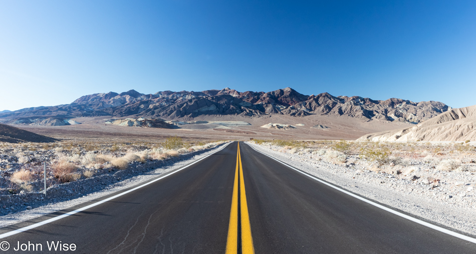
Distraction number one is found on the left side of the road at Twenty Mule Team Canyon. Uncertain if we’d driven this dirt road before but then again almost sure we had, we’re here, either doing it again or driving it for the first time. I guess this might as well be the first time, considering that we’re that forgetful or maybe confused that another location might share some appearance with this canyon. No matter, here we go.
Hey, was Star Wars filmed here? Something or other here or nearby from that franchise was filmed in the area, but of all the movie trivia I might be interested in, those facts are of no interest to me. So John, why are you sharing that tidbit if you don’t really care? Because I read it while looking for what else to share aside from that, we are on this 2.5-mile long drive into Twenty Mule Team Canyon.
A giant sandworm emerged from here back when Death Valley was being used as a set for the desert location called Sanubia in the film Dune. I’m referencing the David Lynch version, obviously back when he had a giant sandworm constructed for the desert scenes, as he didn’t have access to digital effects. By the way, none of this is true, but I had nothing better to say and I felt it played well after the Star Wars trivia that is factual.
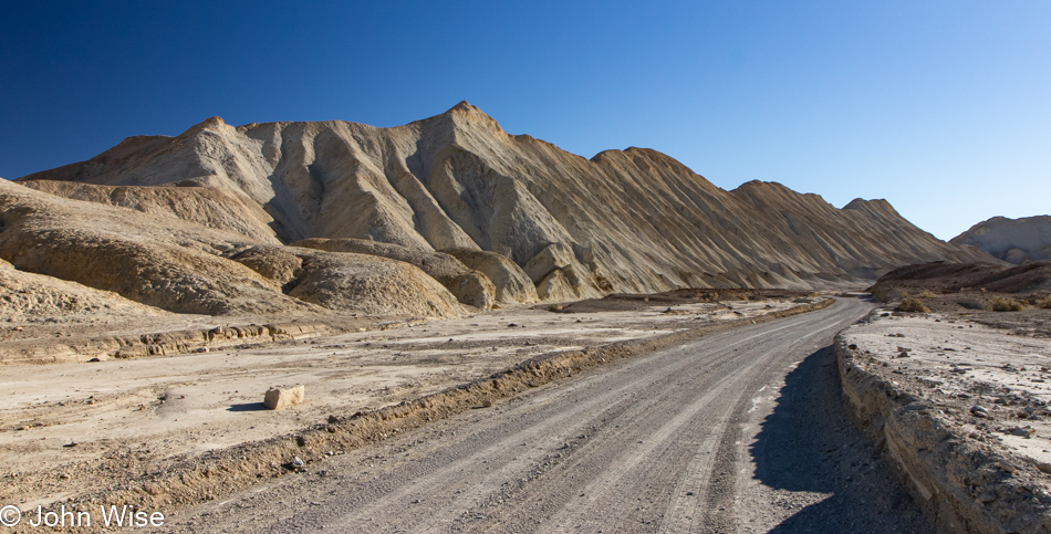
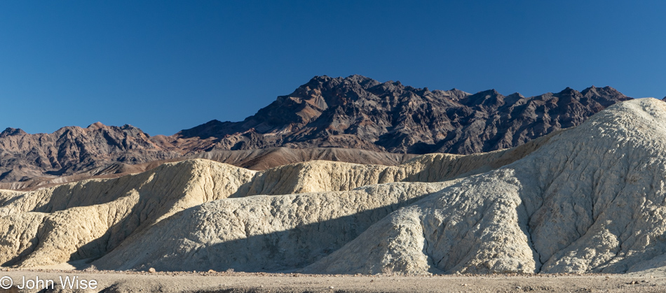
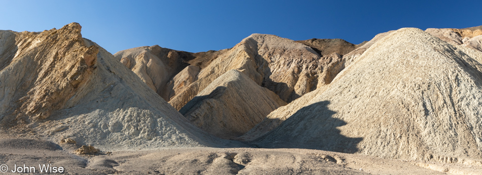
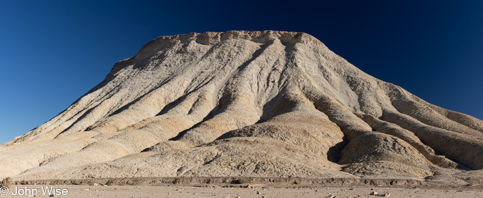
If you think that we might be blasé about things easily found on the side of the road compared to those distant places that require extra effort, you’d be wrong. At the time we are at a place, we really are present to take in the magnificence of the unique characteristics that define that location, and so it is here, too, that we are in awe of the shapes, colors, silence, and geological history on display that is easily witnessed right from the car.
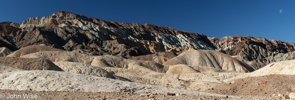
Sometimes, nothing from the landscape needs to make sense; it’s just beautiful; it’s there, not requiring us to quantify it or explain our relationship to it. The visual poetry it contains is offering us its lyricism and will forever be oblivious to our musings about it. It’s a perfect situation where, if we take the time to understand ourselves in its presence, just maybe we learn something new about being humble.
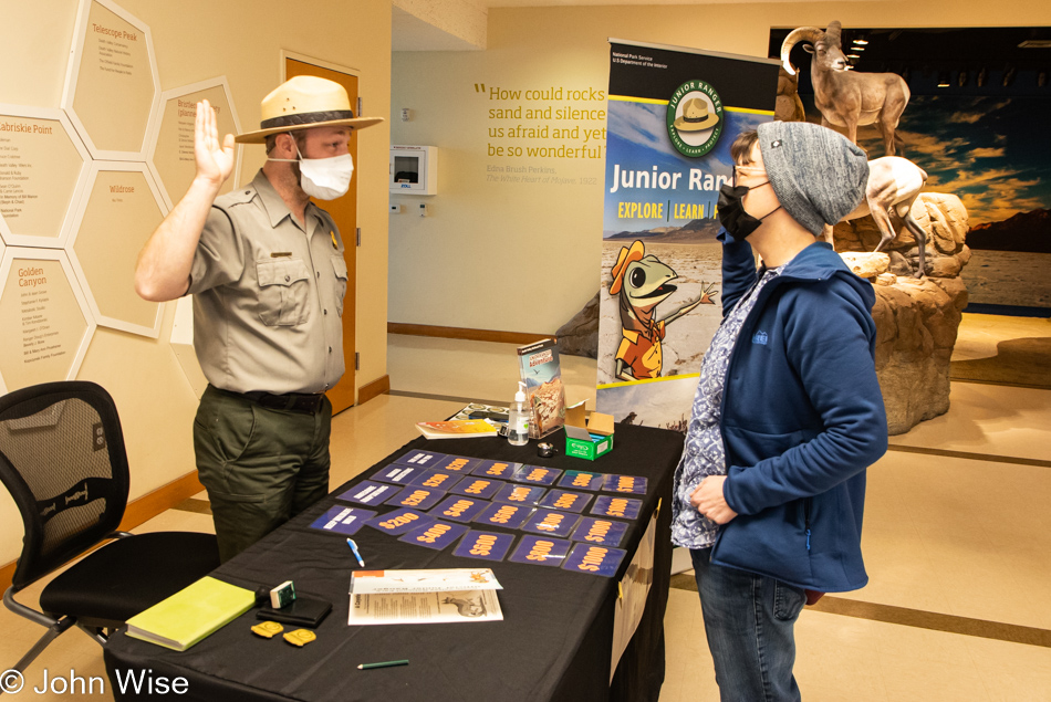
As I set in to write about this photo, I went hunting for previous blog posts that might hint at how many other times Caroline has stood before a park ranger to be sworn in as a Junior Ranger, but I couldn’t find that info. Searching for “National Park” in the index, I came up with 386 entries, but I know that only a fraction of those would pertain to the term “Junior Ranger.” As for searching specifically for “Junior Ranger,” that only turned up 26 hits, and I have to admit to a level of laziness that has me feeling reluctant to scrub through nearly 400 posts or believe that she only has 26 badges. Maybe someday I’ll return to this subject and create a post about each and every badge my wife has earned, but for now, I’ll leave it here that today, on the 23rd of January 2022, Caroline Wise earned her Death Valley Junior Range badge and is standing just a little taller because of it.
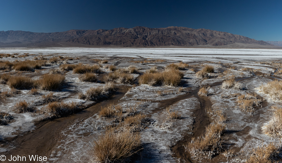
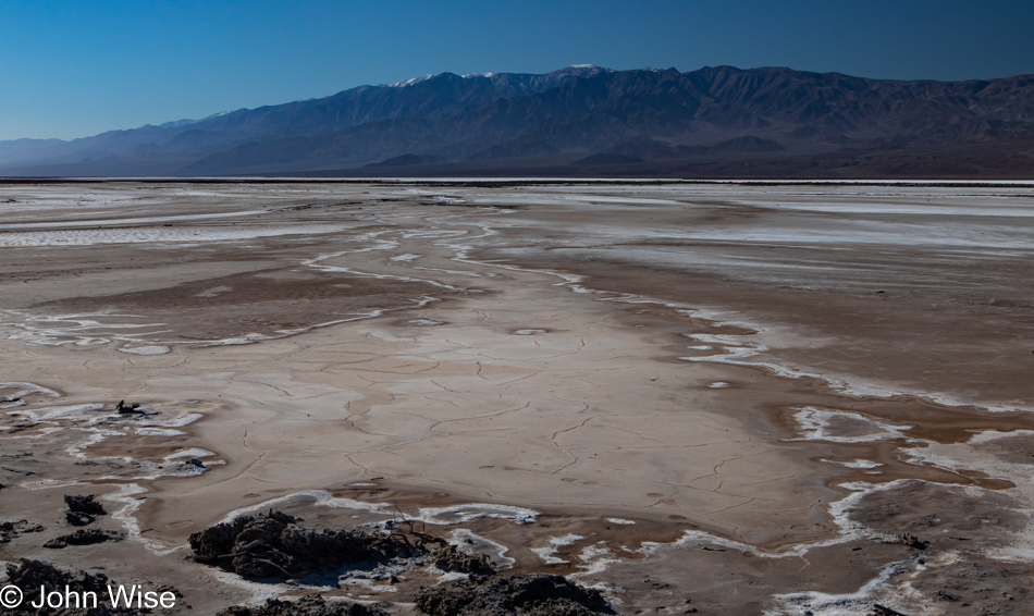
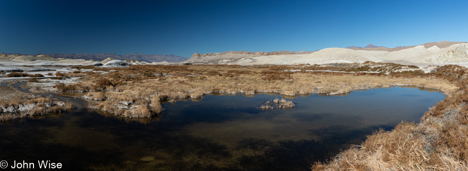
With her badge firmly pinned to her shirt pocket, fueled up on more of that café de olla Mexican coffee, we were ready to head to Salt Creek, but things didn’t quite go as planned. The proverbial bright, shiny object caught our attention, and before we knew it, we were walking out to look at a part of the salt pan we’d never taken a close look at. Oh, there’s water out here.

A whole lot more water than we expected.
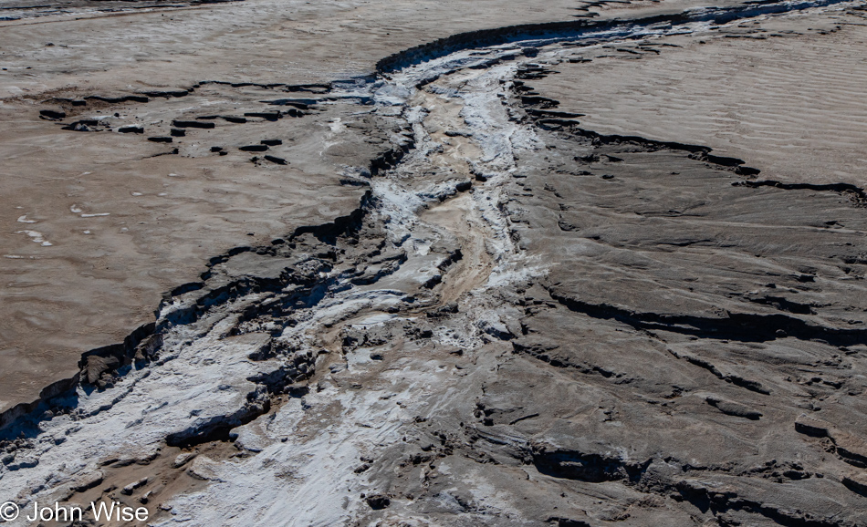
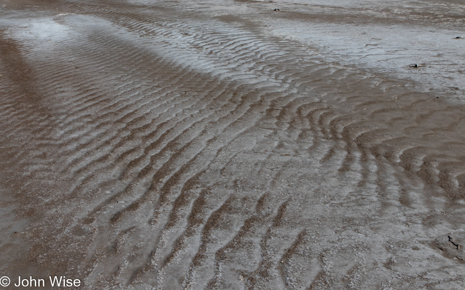
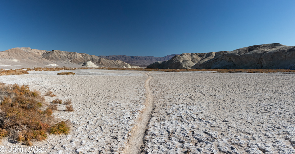
There are details impossible to see even in an environment as wide open as Death Valley. Out on the salt pan, things frequently change, sometimes step by step.
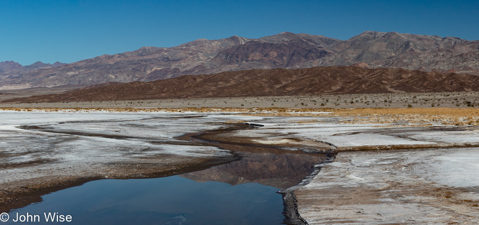
Our original intention when we pulled over was to simply walk over to the salt, take a photo or two, and be on our way. The further we got, the further we were compelled to go. If you’d like to try and understand the scale of things, I’ll offer you the hint that our car is on the right side of this photo.
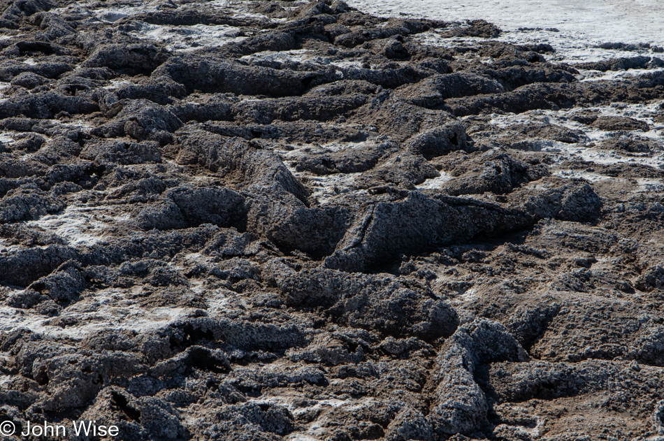
In the driest place in the United States, Caroline and I were surprised to find evidence of waves that were relatively fresh.
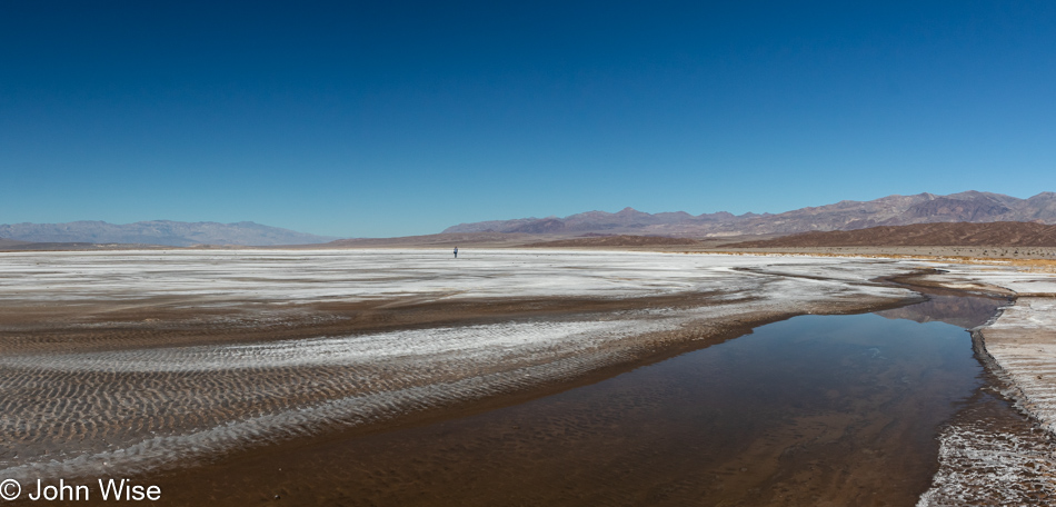
That’s Caroline out there; as a matter of fact, we were the only ones here.
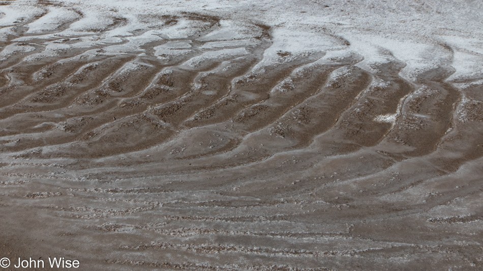
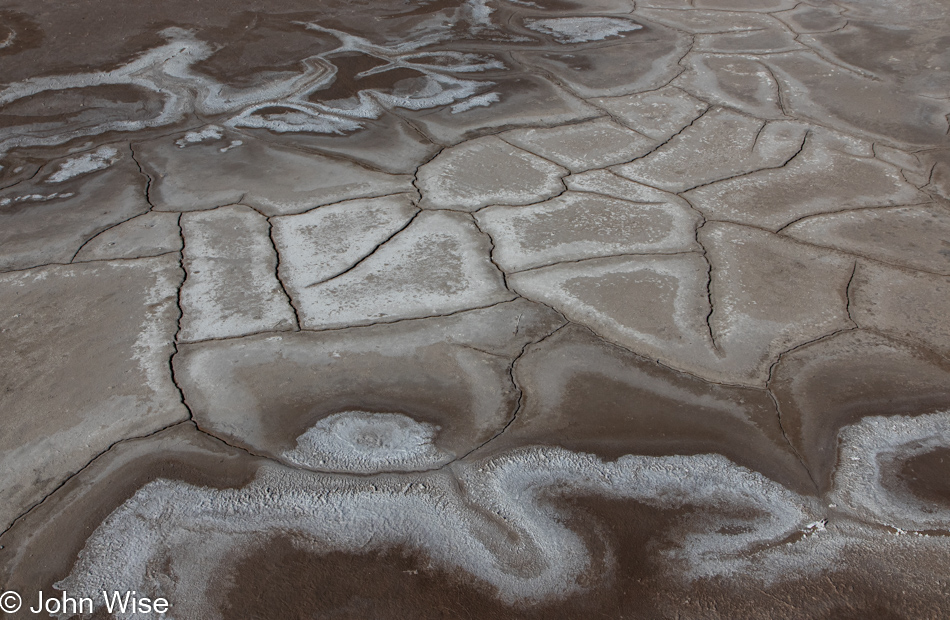
Turn around, walk a dozen more steps in any direction, and things are again different.
These blog posts that take on extraordinary length are caused by my incessant need to keep snapping photos of those things worth reminding Caroline and me of the incredible things we’ve seen.
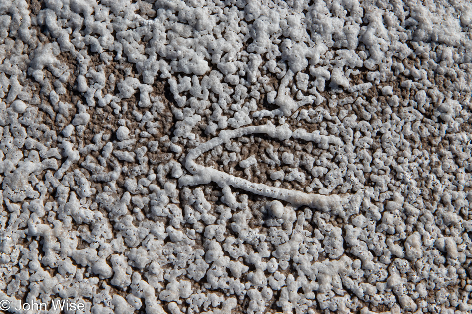
In the second photo, after we started walking out on the salt pan, the one with a snow-capped Telegraph Peak (scroll up eight images), you will see a distinct dark area, almost black, between areas of white salt. Those turned out to be salt crusts that are akin to lave tubes in our view, meaning hollow tunnels and bumps that rise off the surface of this desert floor. Research might explain how they form, but the mystery of what is at work here is more interesting for now.
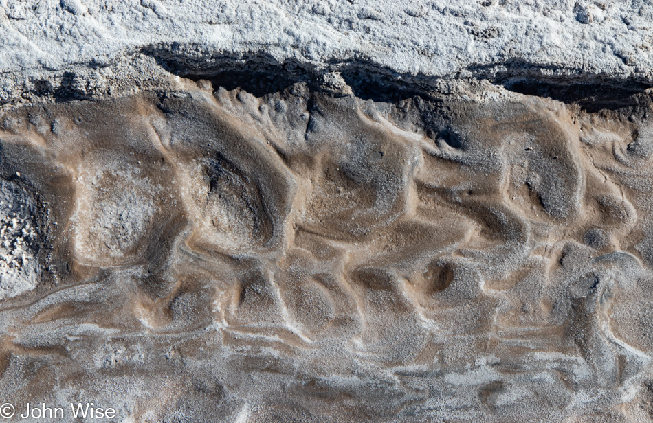
Again, the remnants of waves.
This felt like I was looking at a satellite view of the Grand Canyon; speaking of, we’ll be there in two weeks.
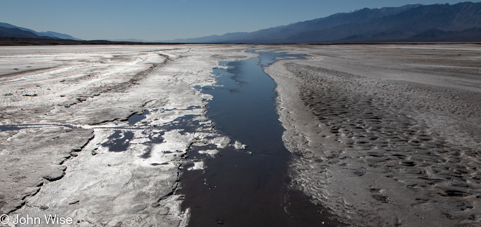
Somewhere along the way, Caroline was reading to me about some of the geology of Death Valley and mentioned how there are more than a thousand feet of salt and clay in this basin above the bedrock, but they quit drilling at that point. Then we try to imagine how, when Glacial Lake Manly was here, there were places that were up to 800 feet deep underwater. I even found mention that the area was once connected to the Colorado River.
Back in 2004, a lake formed once again due to an exceptionally wet season, but was quickly gone. Seeing the photos of people kayaking across Death Valley while I was researching things for this entry was intriguing.
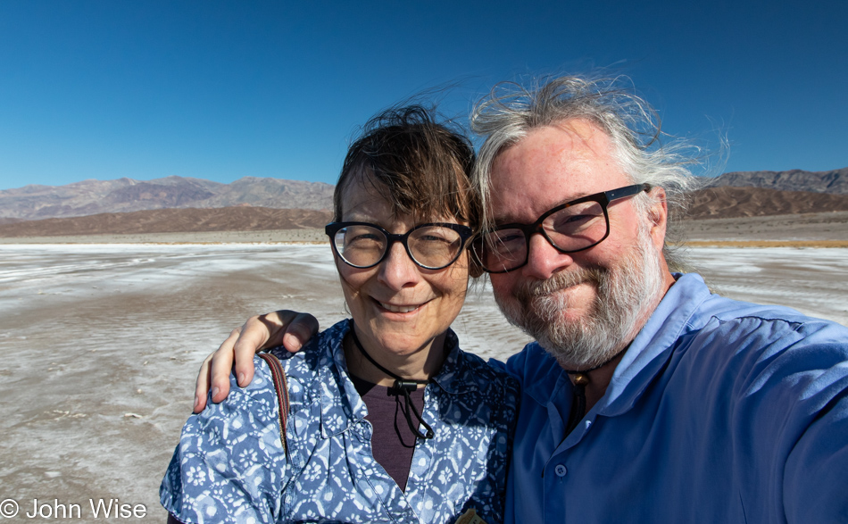
While not as windy as Friday night or Saturday, you should be able to glean from our disarranged hair that it’s still a bit breezy.
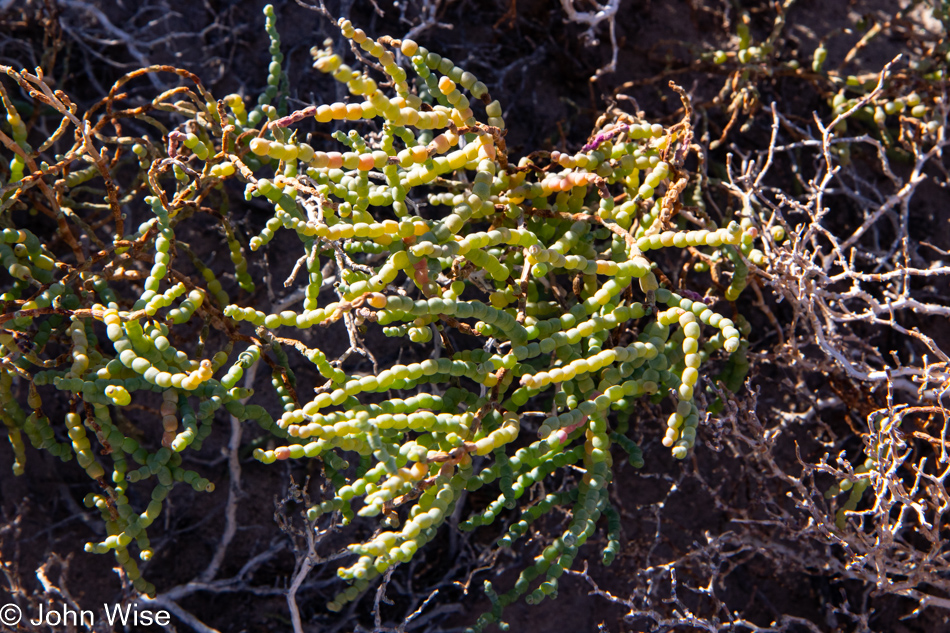
This is pickleweed, part of the goosefoot family, which includes quinoa. Maybe the best reason I had for sharing this image is that I enjoy writing pickleweed and goosefoot, and reading those words out loud puts a smile on my face.
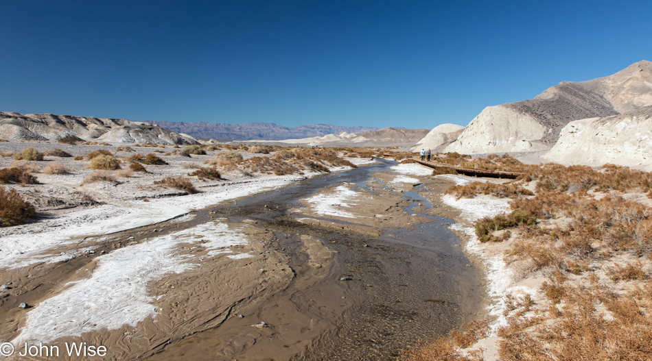
We are at Salt Creek, which is typically dry during summer, but in winter, enough water is flowing from the spring further out in front of us that visitors are treated to the sights of seeing pickleweed bloom and, if they are really lucky, they might even see the famous Death Valley pupfish that call this desert home.
A trail extends from the end of the boardwalk out in the distance; we are looking back towards the parking area for you to orient yourself to our place.
We are about halfway to the spring that feeds this small creek with occasional pools such as this one. At the time, I didn’t know how close we were to the spring, sadly, but maybe on a future visit, we can walk back to it to see where the pupfish hang out during the heat of summer. Adding another hour to our time at Salt Creek and Death Valley wasn’t possible today; we’ve got to start moving towards home.
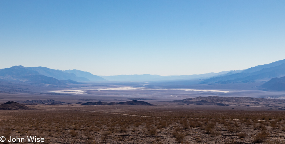
Goodbye, Death …Valley, as we escape your clutch on our souls. Today will not be the day we are held for eternity in this vast purgatory camouflaged as a national park. That’s not really how I feel about this place as I look down into Valley of Death from the Gates of Hell, but like so many other hackneyed writers relying on cliches, I just couldn’t help myself to bring some drama to our departure, and the beginning our trip home.
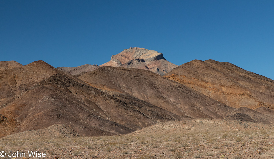
Still at the Gates of Hell but looking in the other direction, we are presented with Corkscrew Peak in the Grapevine Mountains. This is the exit.
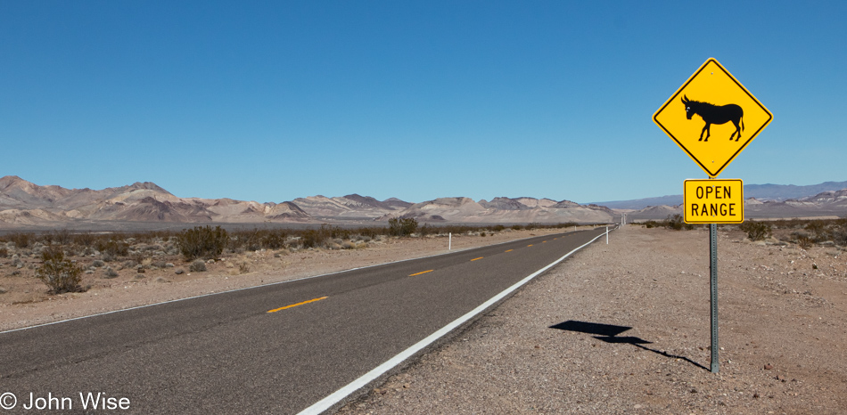
Normally, these signs do not deliver the promised animal sighting, but this one did, albeit a dead one. Not a quarter-mile past this cautionary sign was a dead donkey. Its eye was already taken by the nearby birds of prey that scattered as we humans approached for our souvenir taste of donkey flesh; just kidding as this donkey, while not yet stinking from here back to hell, didn’t look very appetizing. I know you are now thinking, just what kind of dead donkey looks appealing to your tastebuds? Well, to be honest, the kind that’s ground up and served Bolognese style in Italy.
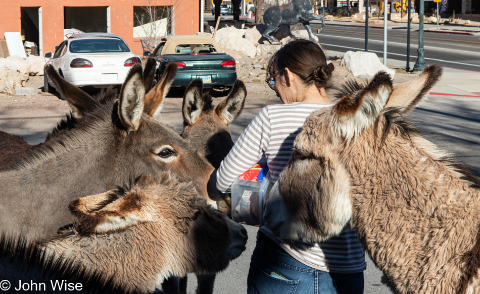
After our lunch stop in Beatty, Nevada, Caroline dove right into the donkey mosh pit and had no idea they weren’t interested in dancing anymore after she entered holding a box of bread slices. At that point, the donkeys started attacking in a feeding frenzy, with one particularly aggressive hairy little guy nearly scooping out a chunk of buttery German hip fat as it grabbed her shirt to get her attention.
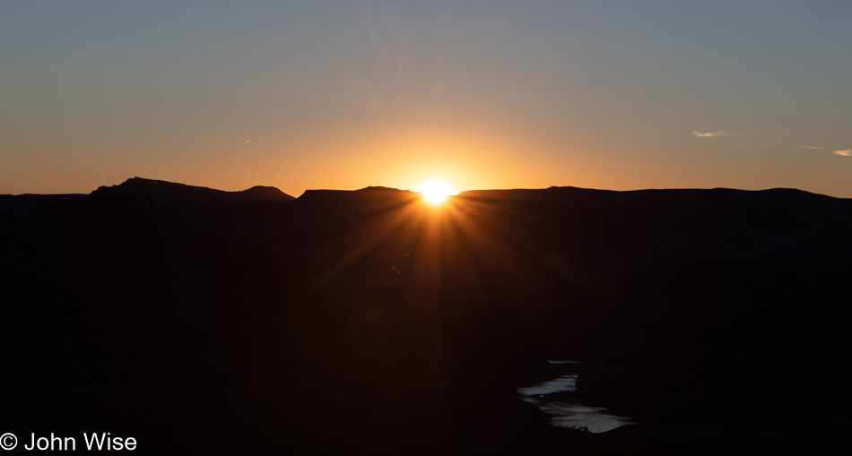
The donkey party continued after we got back in the car since we still had bread bits left. Getting three of them to remove their heads from the open window wasn’t easy, but soon, we were back on the road with a singular focus, finding a great sunset spot to pull over and grab a photo. To the right, under the sun in the shadows, is the Colorado River. This was taken shortly after we passed the Hoover Dam. And with that, I bid adieu to another great weekend away.