Easter in the Valley of Death

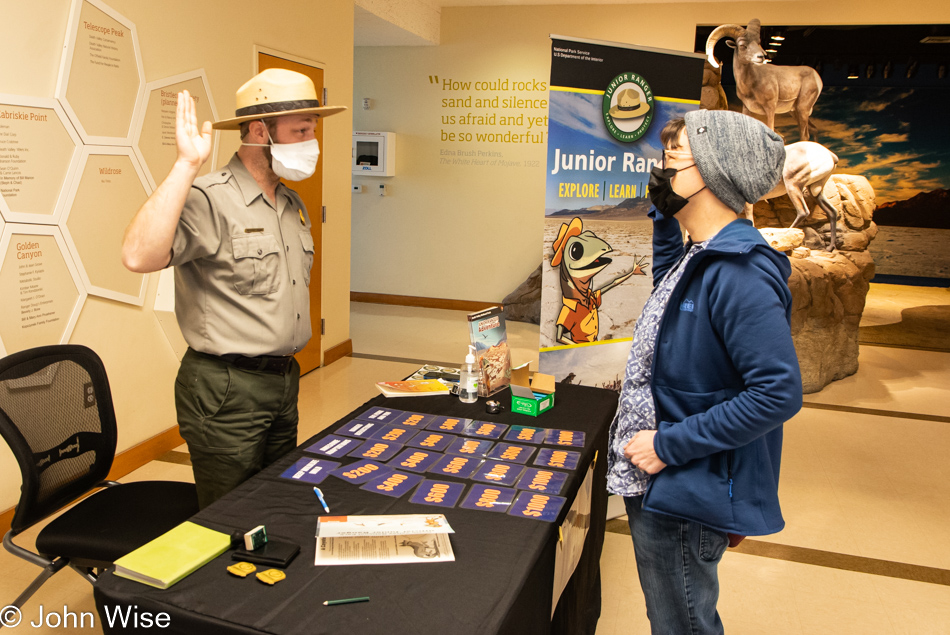
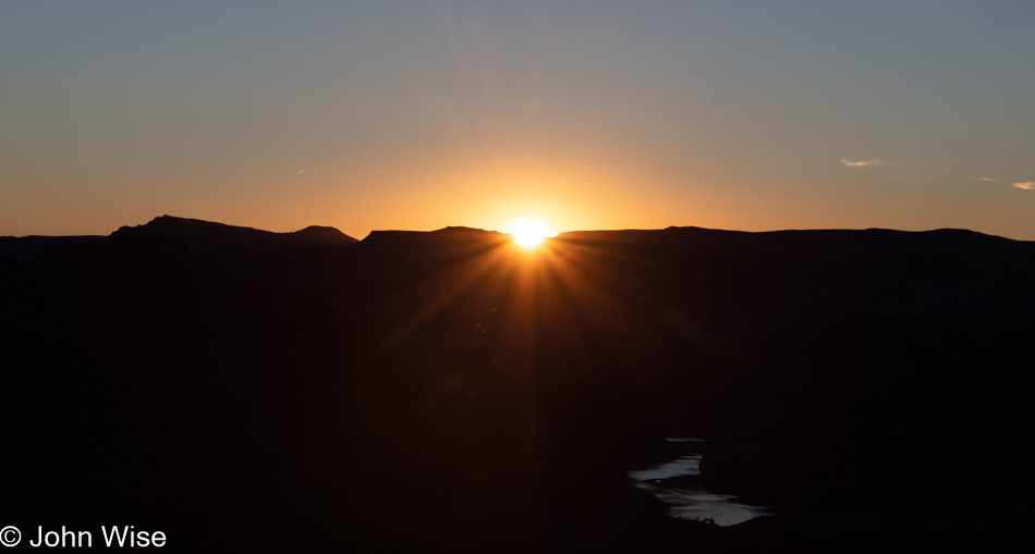
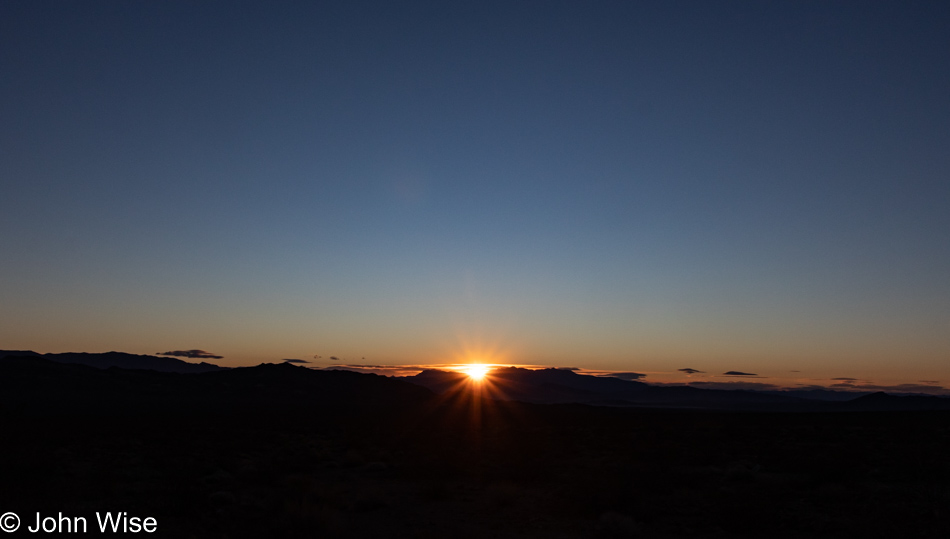
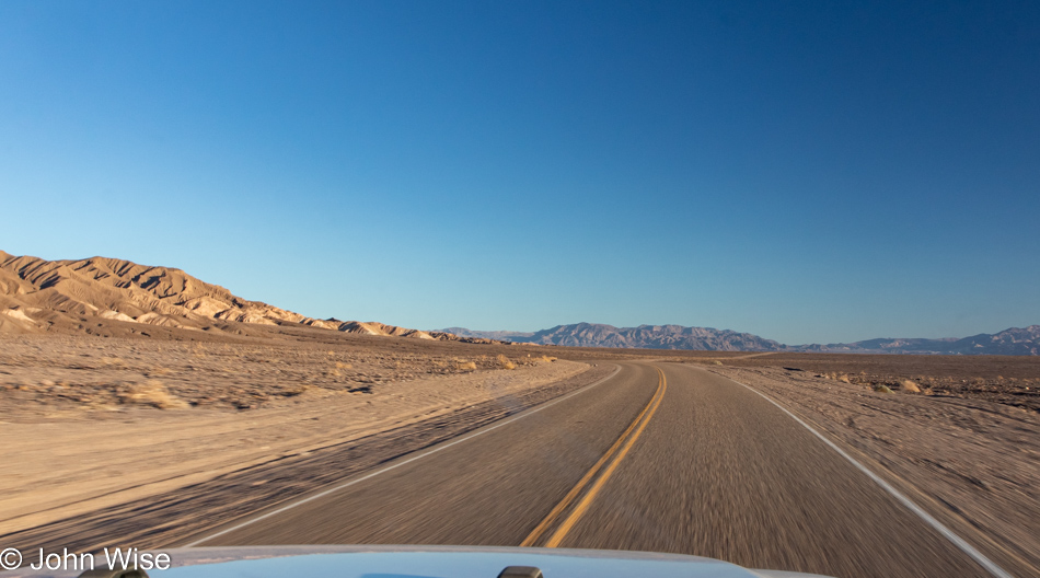
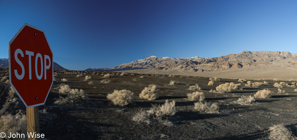
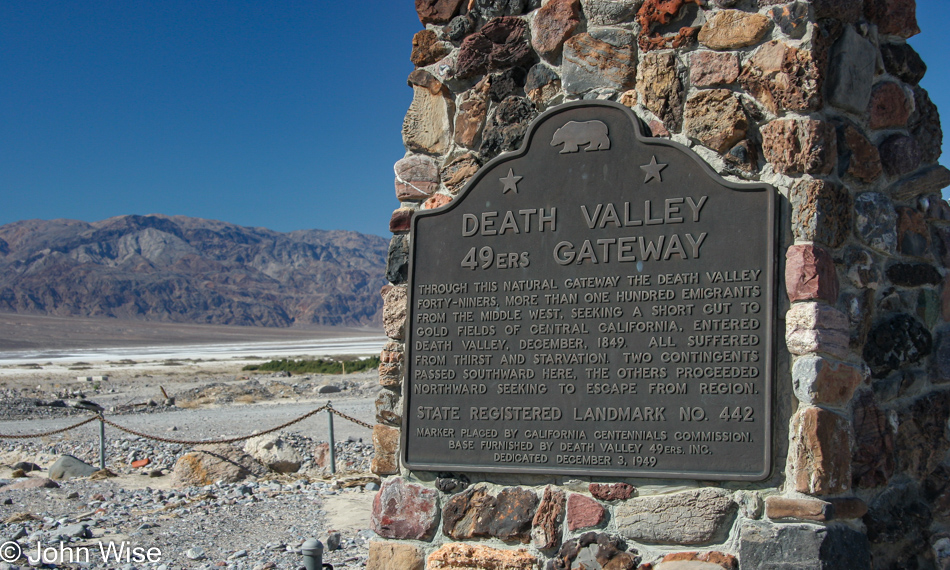
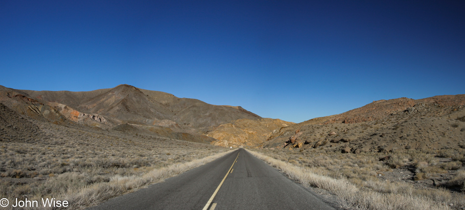
Being on a mini-vacation could be the opportunity to take it easy, right? Wrong, we were up by 5:30. Just as we were about to leave the Inn, Caroline took the opportunity to WhatsApp family in Germany who’d assembled for Easter dinner. However, out here in Shoshone, California, the connection is less than optimal, and the call brief. I am able to use the short delay to jot down a few things, and then we’re on our way towards Death Valley for a hike before things get too busy over there, and we need to head home to Phoenix.

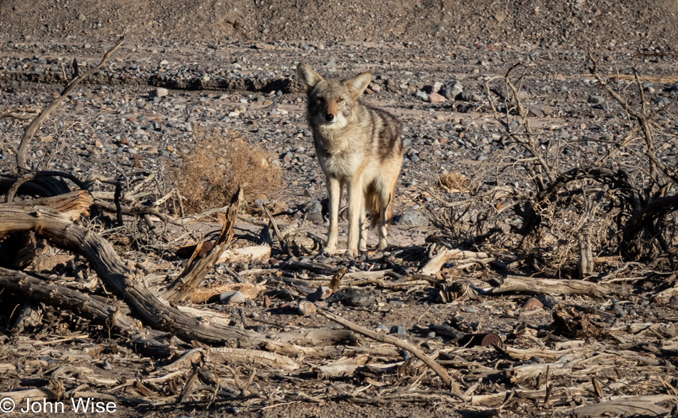
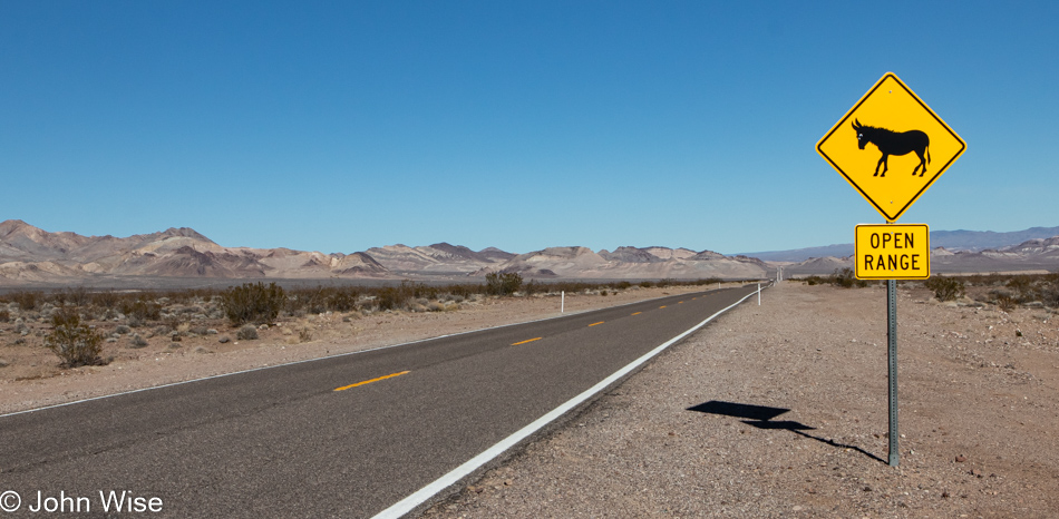
The Death Valley Coyote Committee fell short, with only a single member showing up to greet us, can you tell that this otherwise wild animal has grown accustomed to approaching cars up at the main entrance to the park for meal handouts?

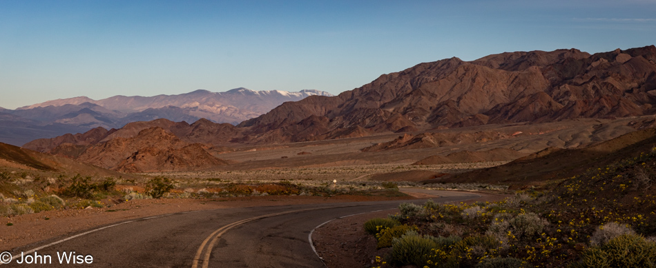
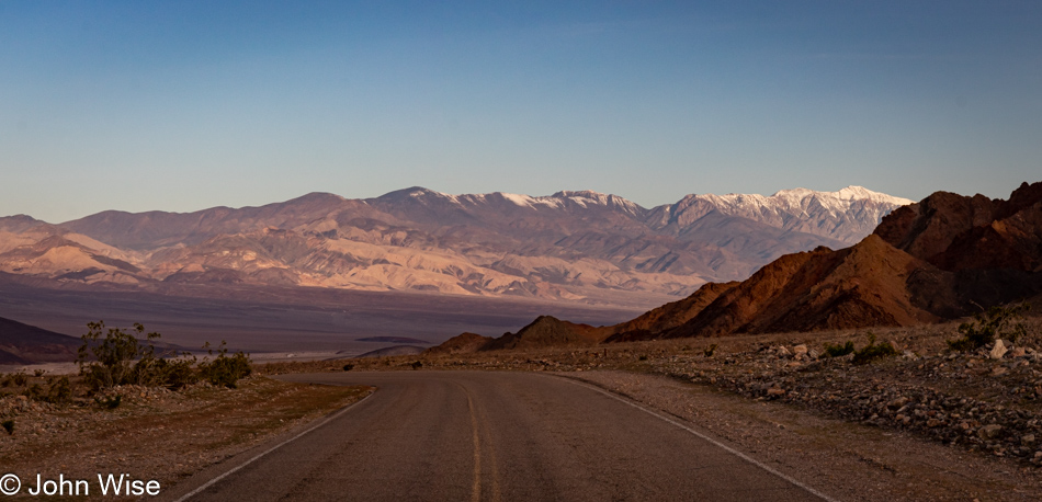
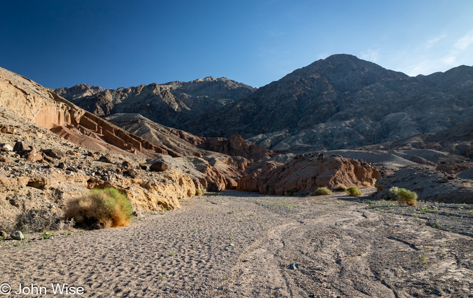
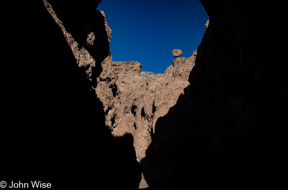
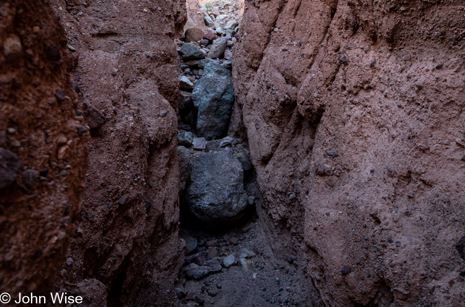
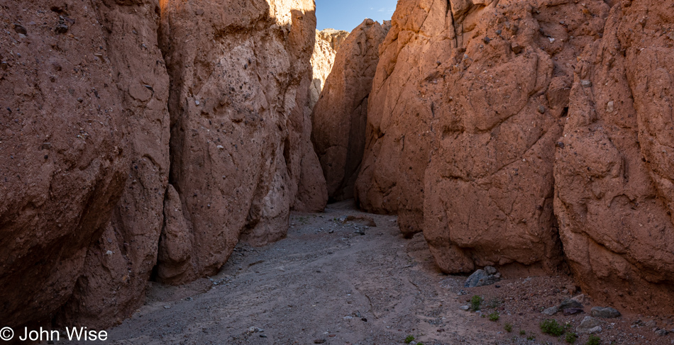
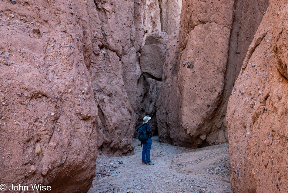
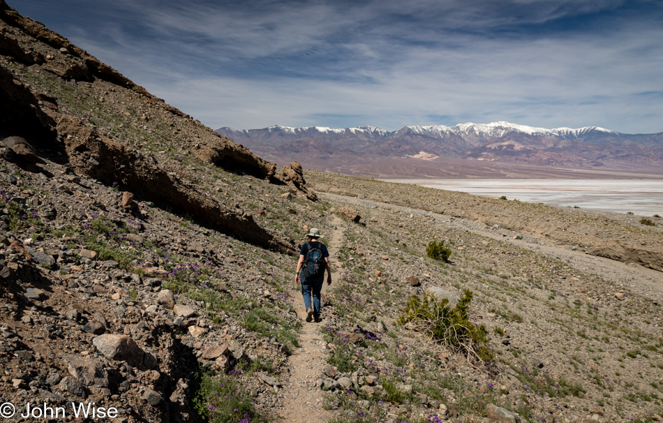
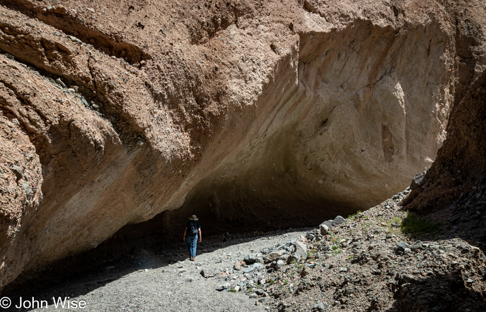
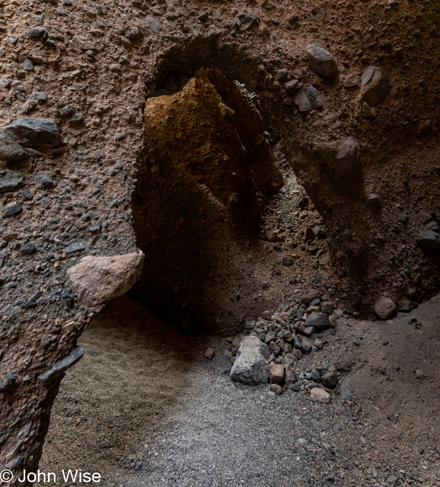
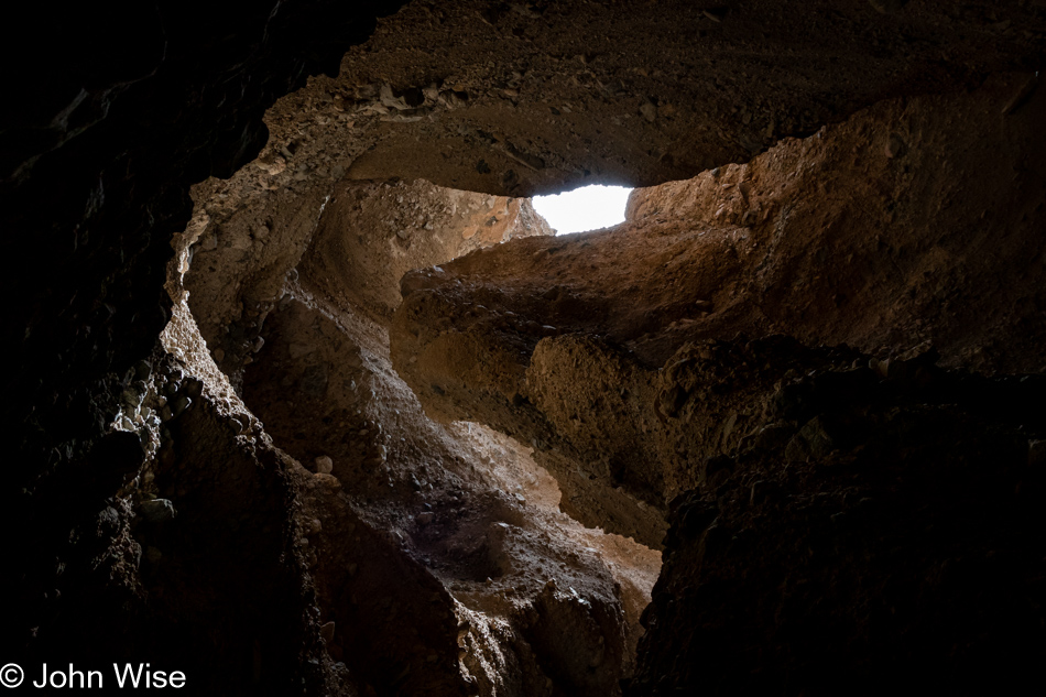
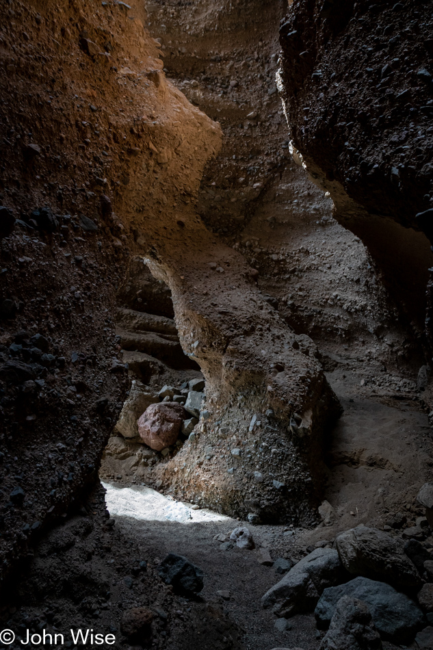
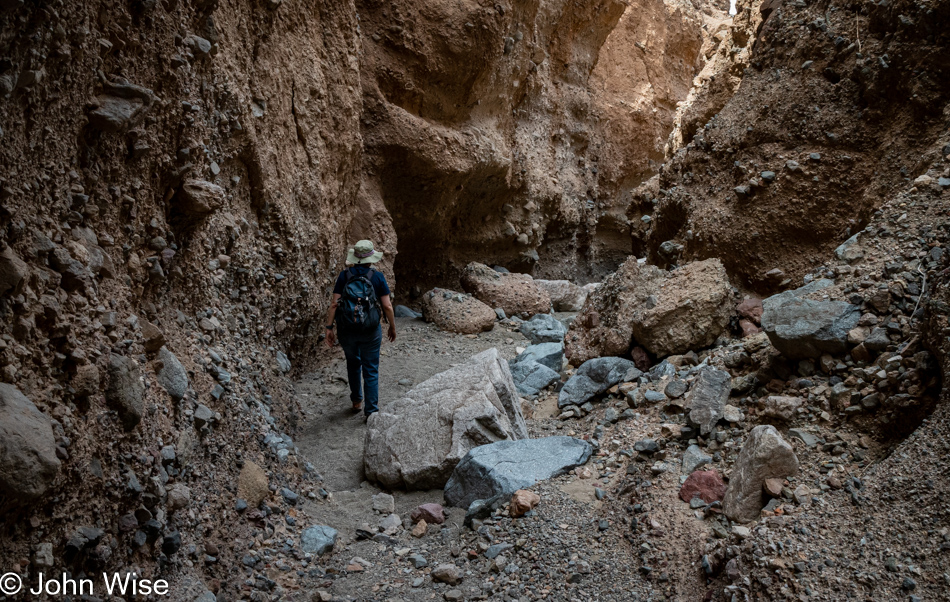
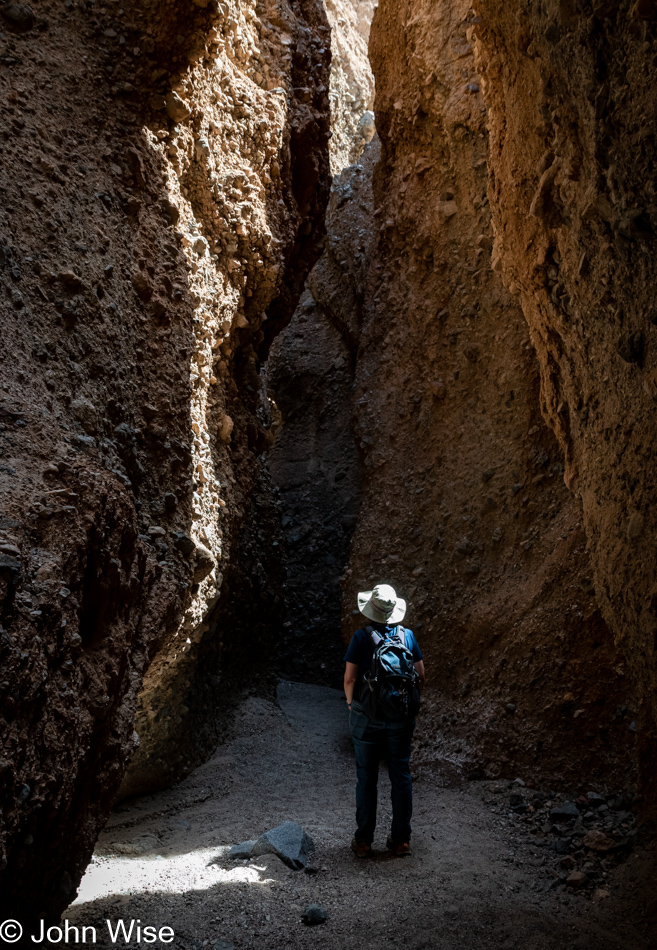
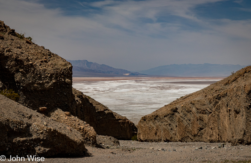
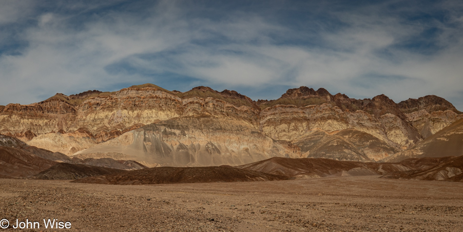
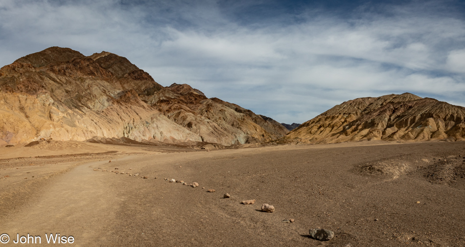
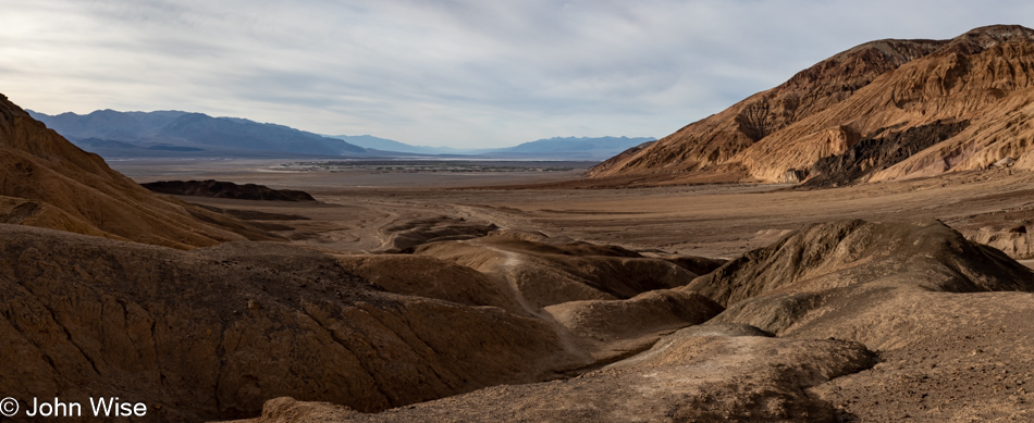
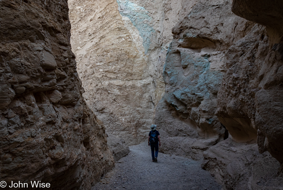
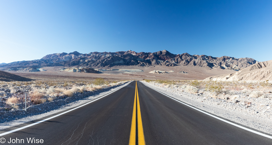
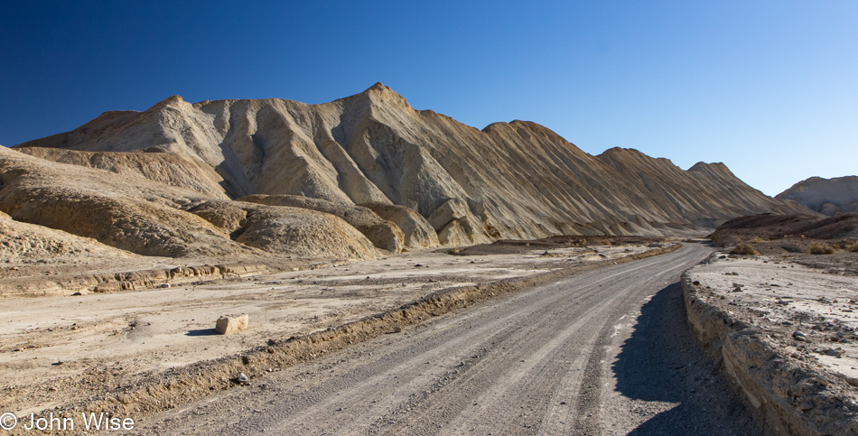
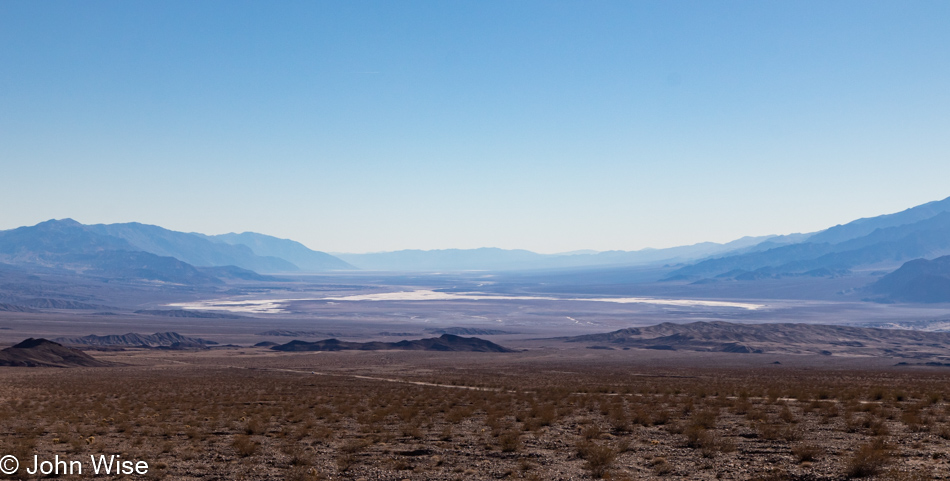
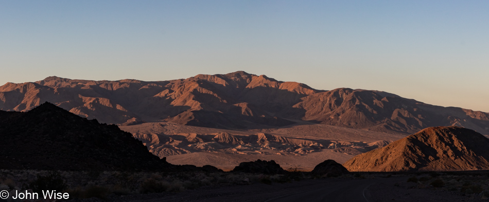
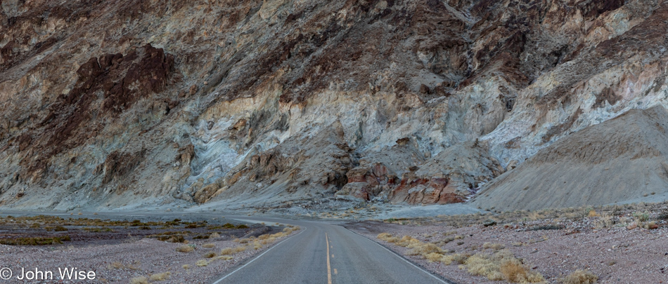
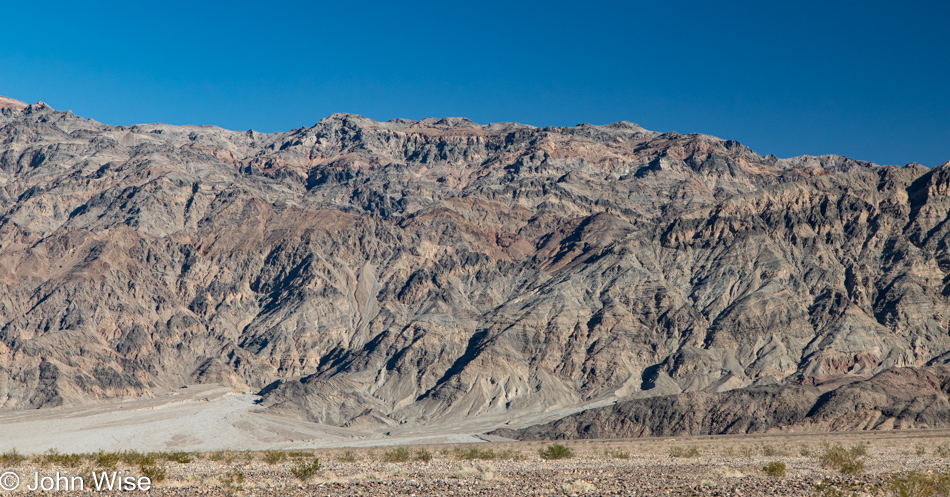
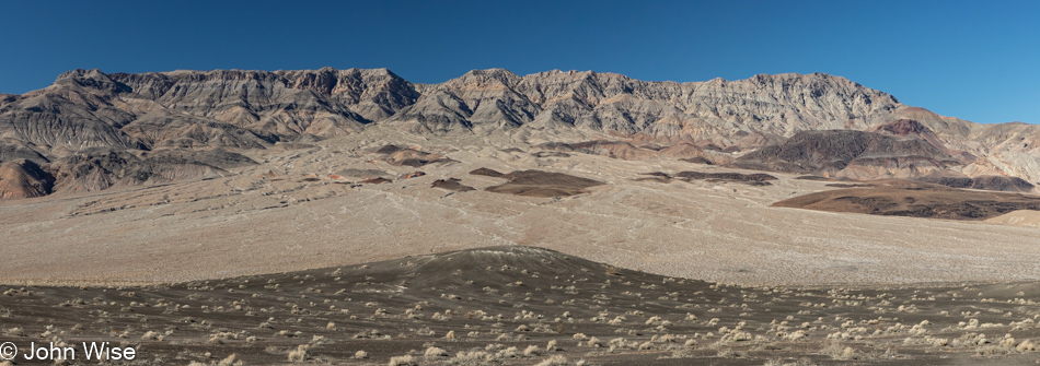
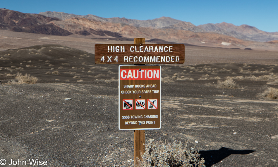
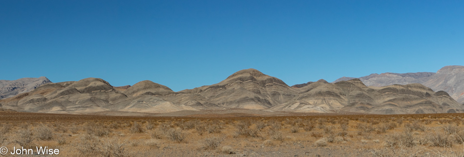
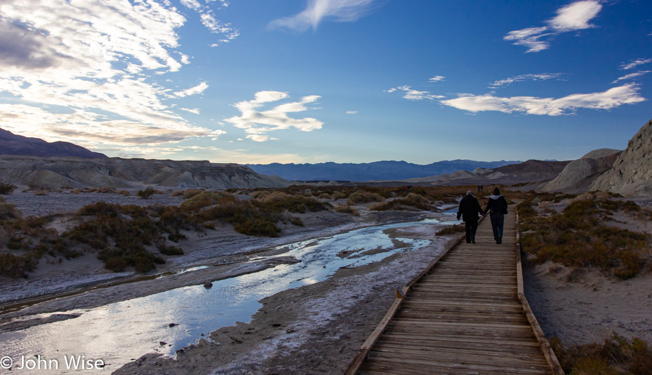
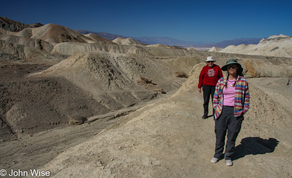
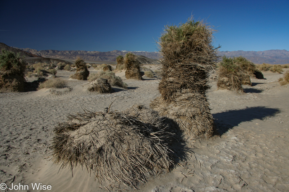
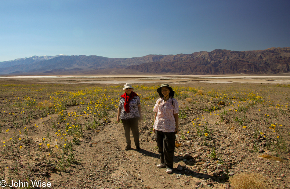
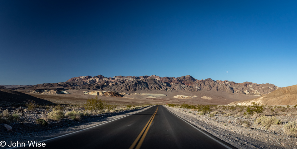
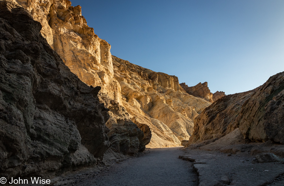
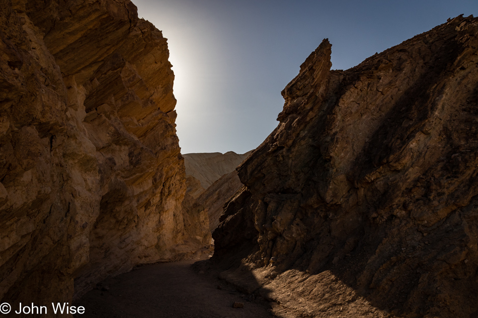
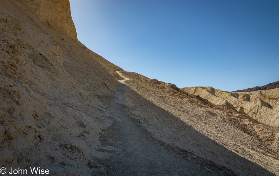
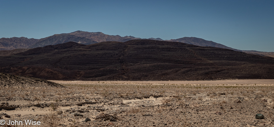
There’s no time to spare if we are going to get on the Golden Canyon Trail this morning, and knowing that the first part of this 5.5-mile hike draws a big crowd, we opted to head into Golden Canyon first, which would have us taking the trail we are ultimately interested in clockwise. You see, Golden Canyon is just one small part of our intended hike; our main objective is the Gower Gulch Loop Trail with a detour to the Red Cathedral. After being shocked by the crowds at Badwater yesterday, this location was running a close second for pulling in throngs of visitors. We knew that if we were going to enjoy this trail, we’d have to arrive before the masses overwhelmed the parking area with overflow parking ending up on the main road.

Our faulty memories initially thought we’d hiked this short segment with my mother-in-law Jutta, but as we got further into Golden Canyon, we realized that we’d likely never been here before, and we were well aware that even this assessment might be wrong. I could scour our previous seven visits to Death Valley to verify things, but how many hundreds, if not thousands, of photos would I have to check? As I finished writing that question, my curiosity got the best of me, and it turns out that I have over 2,000 photos that have been properly tagged with the words “Death Valley,” and I only had to scroll forward to 2008 to find that we were indeed in this canyon on a previous visit. Taken on a beautiful February late afternoon were photos of Caroline and her mom walking in a very empty Golden Canyon that we apparently had all to ourselves. Sometimes, I think things are changing in ways I don’t like, and I tend to attribute my disdain for those changes to those of a man growing grumpy and looking at the past through those proverbial rose-colored glasses, but by judging by those old photos, I see that, in fact, this national park has grown busier.

Fortunately, we are still able to find moments when we are seemingly alone and must offer gratitude that we’ve had so many previous opportunities to visit, oblivious that within little more than a dozen years, the number of people in the parks would go so high that it would interfere with our memories of what solitude meant to us and how we were able to experience it on those earlier encounters. I can’t write this without thinking that Caroline and I need to make every effort to revisit our favorite places yet again before the next burst of visitation threatens to put everything on a reservation or lottery system.

What I couldn’t really identify in my photos from 2008 was exactly how far we trekked into this canyon, but it wasn’t likely very far. My mother-in-law in tow wasn’t one with big stamina, and making surface impressions was certainly enough for her. That really means that this was all new to us, and what’s better than getting to experience something for the first time twice in a lifetime?

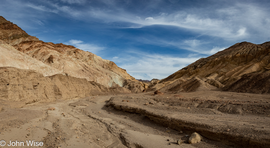
Our previous encounter with Golden Canyon was at 5:00 in the afternoon, while we arrived today before 8:00 in the morning hence, the shadows are falling in very different patterns. This triggers the thought that I should collect earlier photos before leaving for these trips and have them on hand so I can compare what we see with shots I took years prior and try to take them again, but what would really make that work is if I’d taken notes about the conditions regarding visitors and then I could contrast the experience from a decade or two earlier with today.

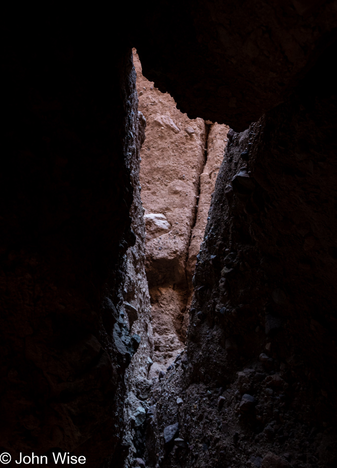
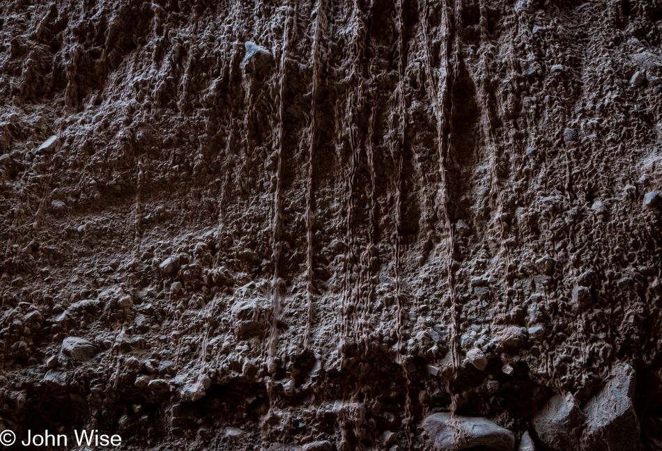
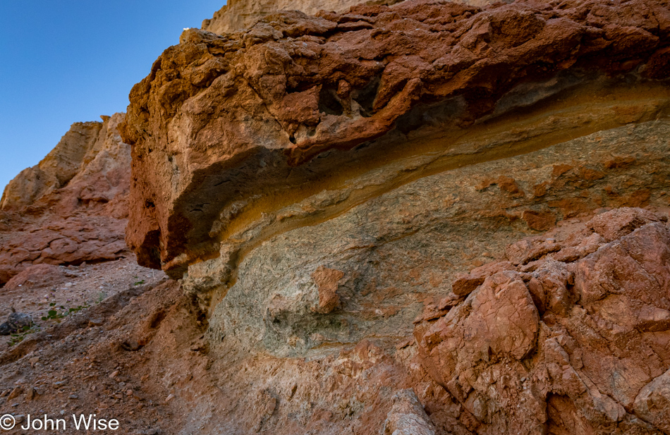
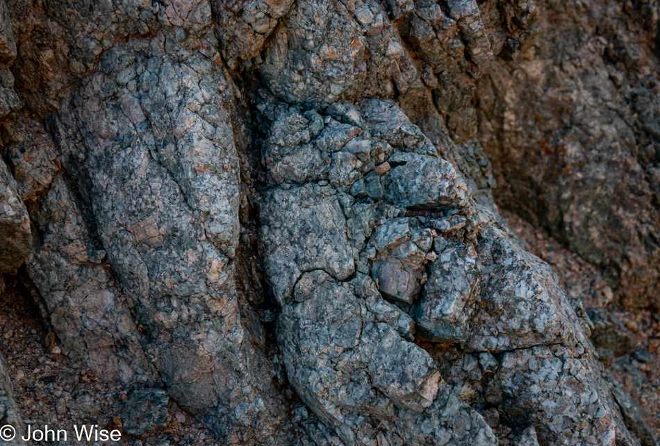
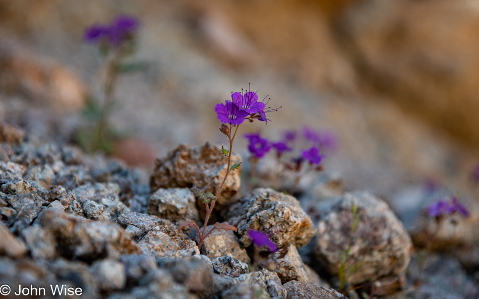
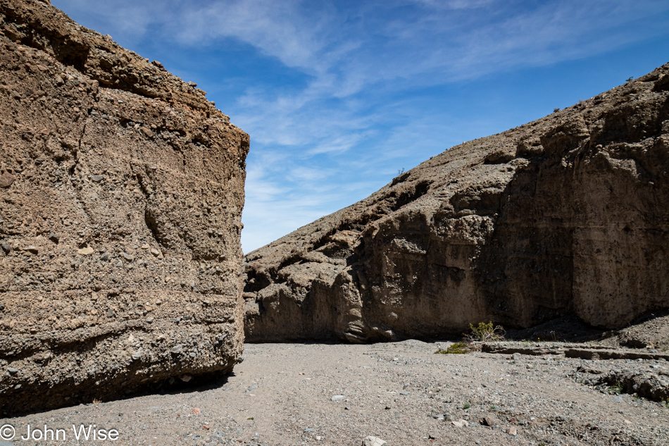
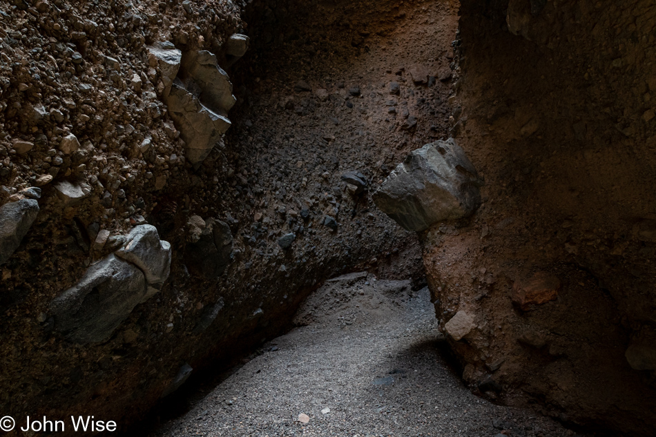
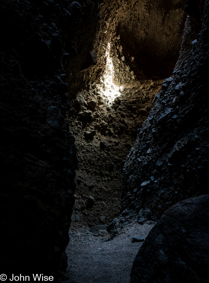
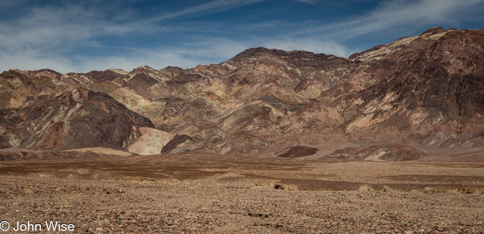
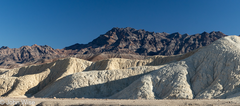
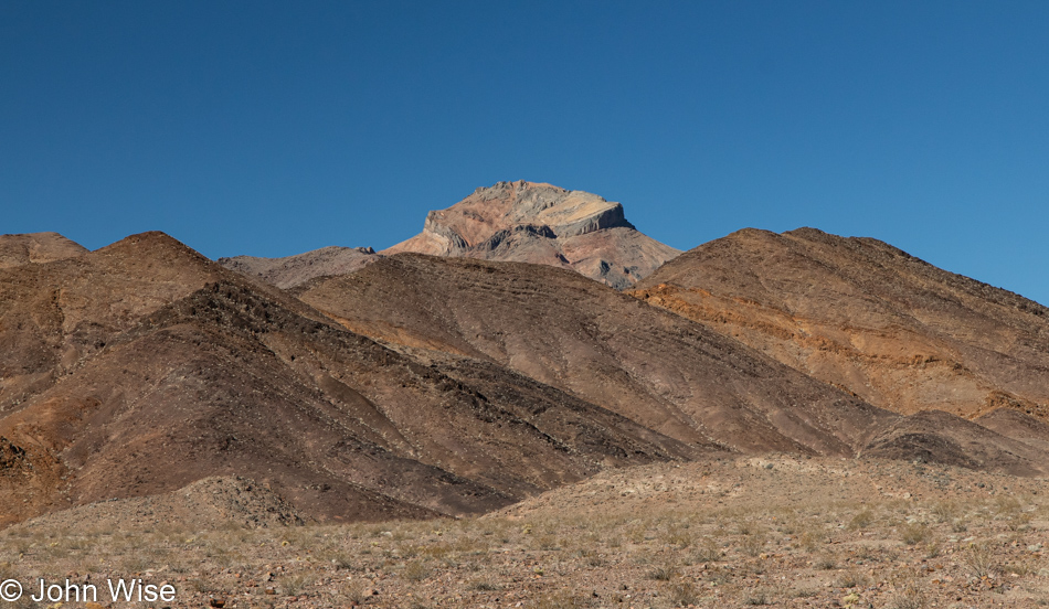
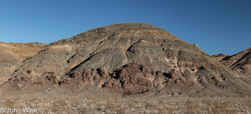
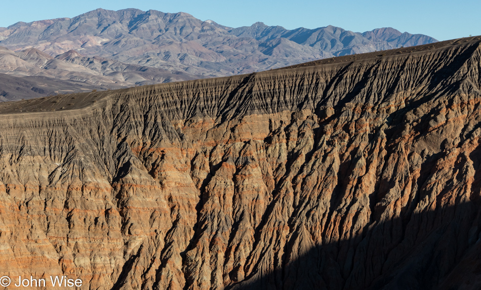
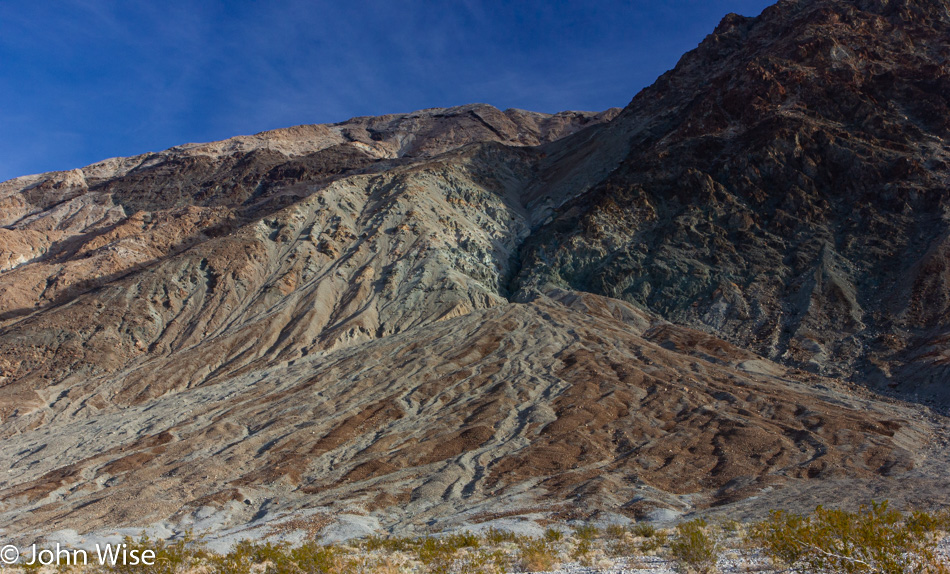
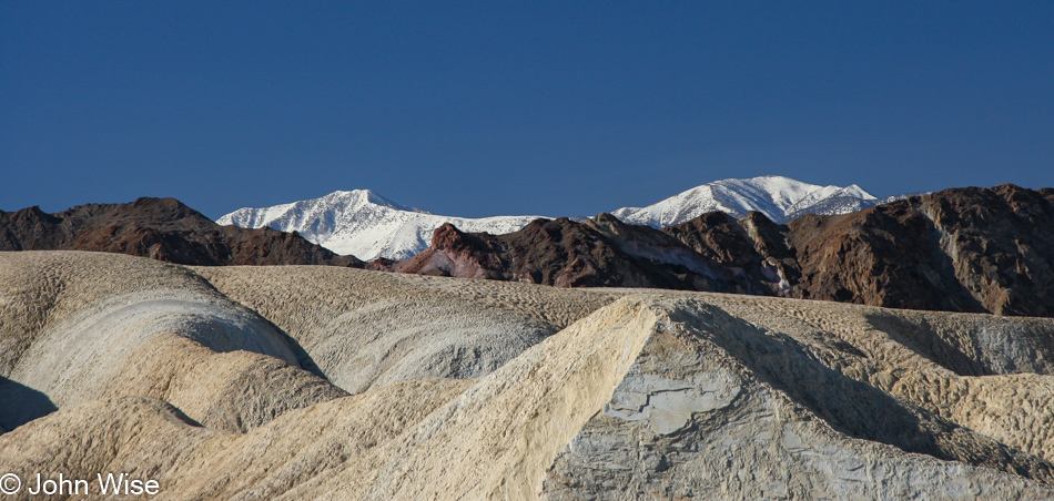
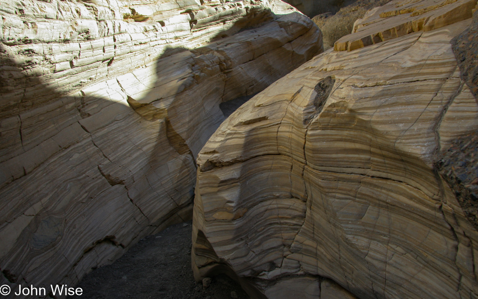
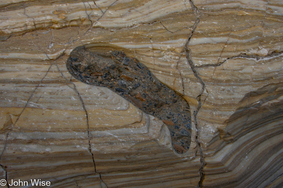
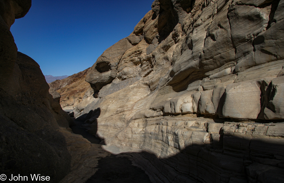
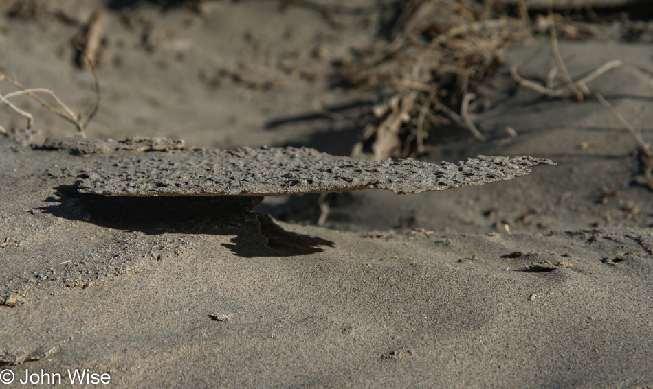
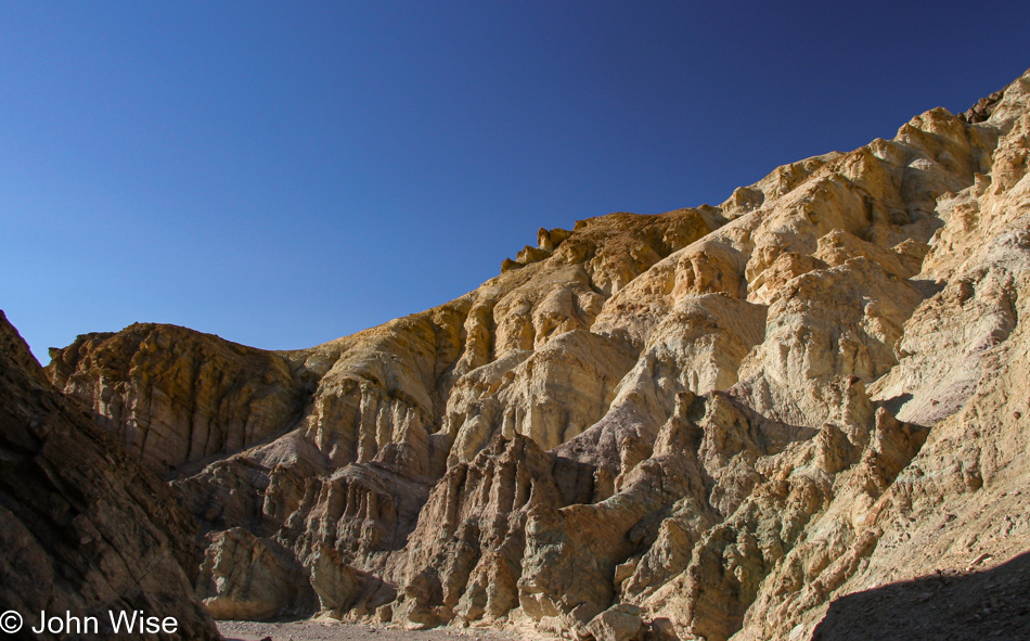
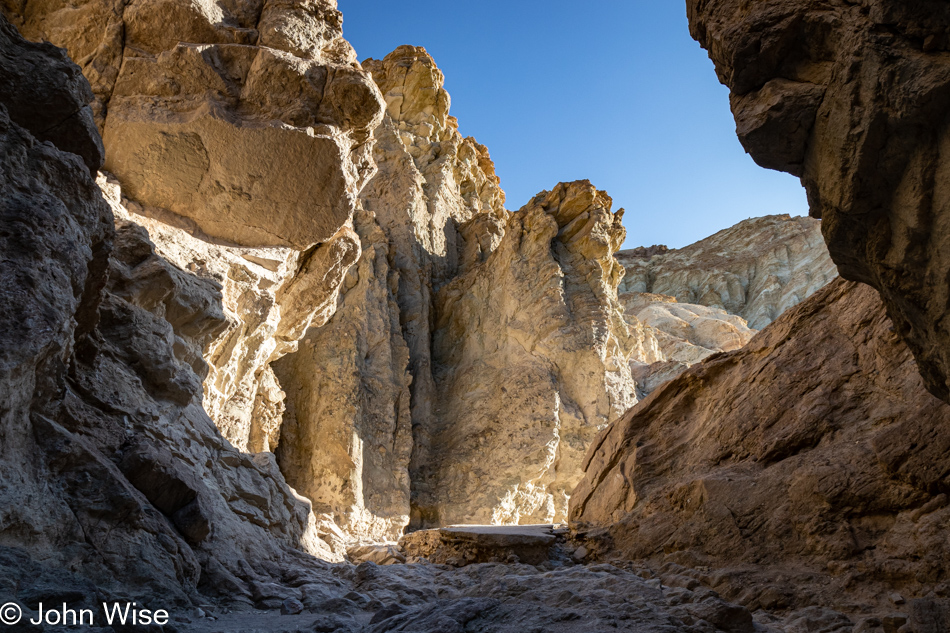
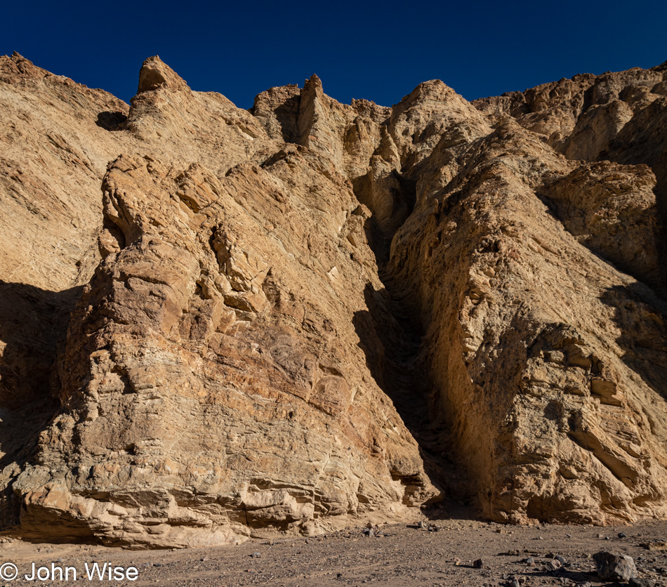
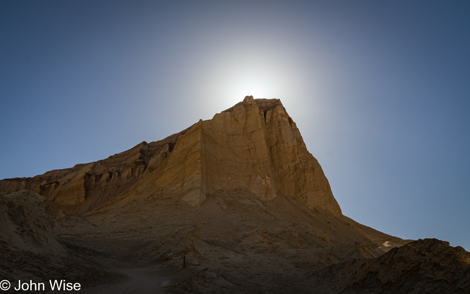
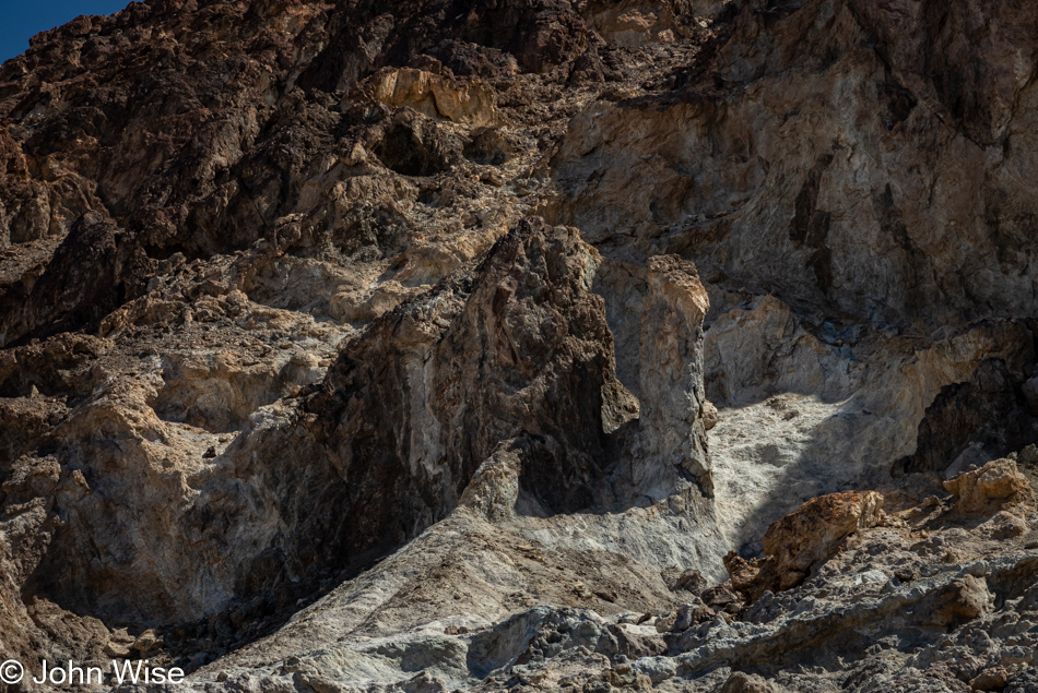
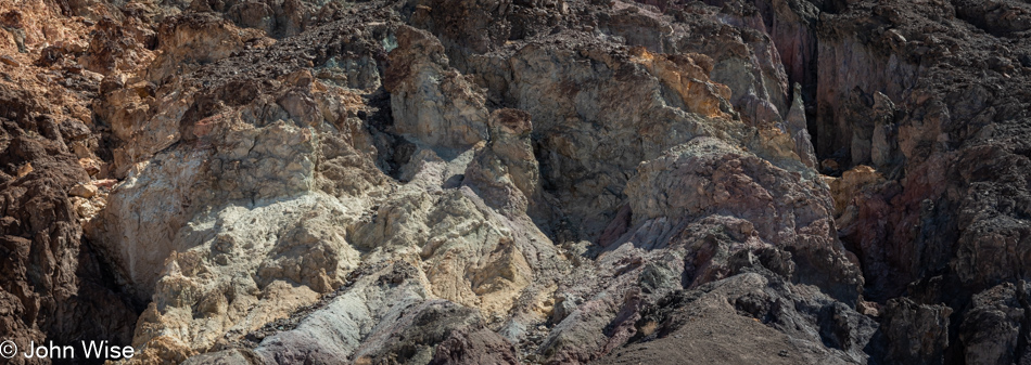
I’ve stared at these rocks a good long time trying to understand the erosion patterns. To my eye, it looks like this was uplifted just yesterday, and the sharp edges formed while it was lying down are yet to be worn down. Knowing that this wasn’t thrust into this angle in the past month, let alone a few hundred years, only adds to the mystery surrounding time and how much of it must pass before things start to appear familiar as far as eroding mountains are concerned.

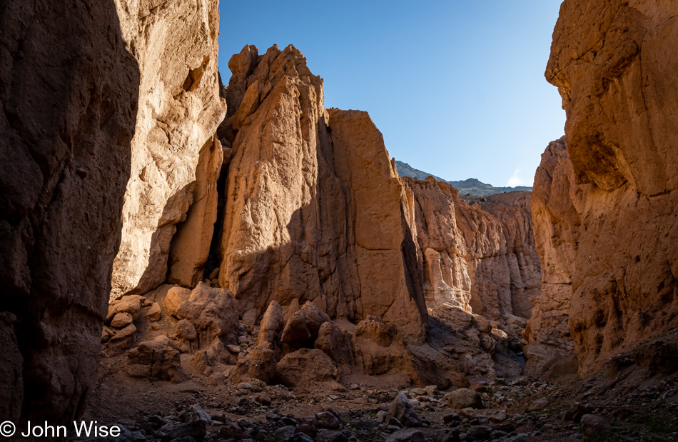
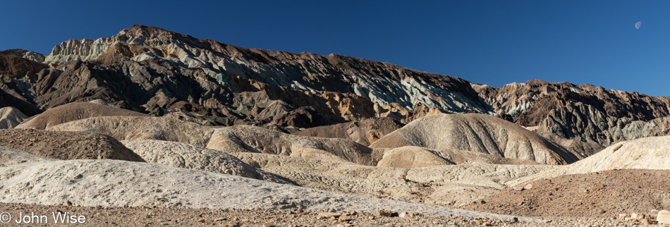
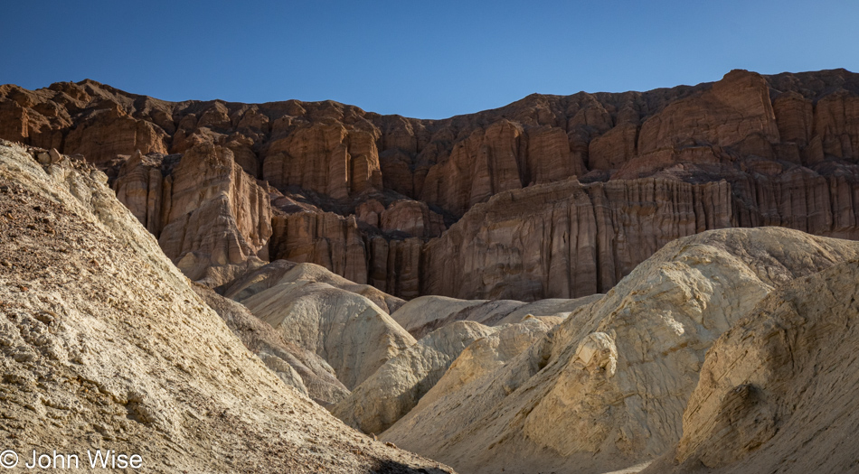
To suggest that there is art here seems to imply that the rest of nature might be devoid of it; on the contrary, art is in everything and everywhere. In researching for this post, I came across a photo of the nearby Manly Beacon taken by Ansel Adams back in the 1940s, and now I’m looking at my own stuff through the filter of someone who made a serious craft of capturing the western United States, but I’m me, and this is the best I can do, and I can take great solace in knowing that I’m trying to express myself.

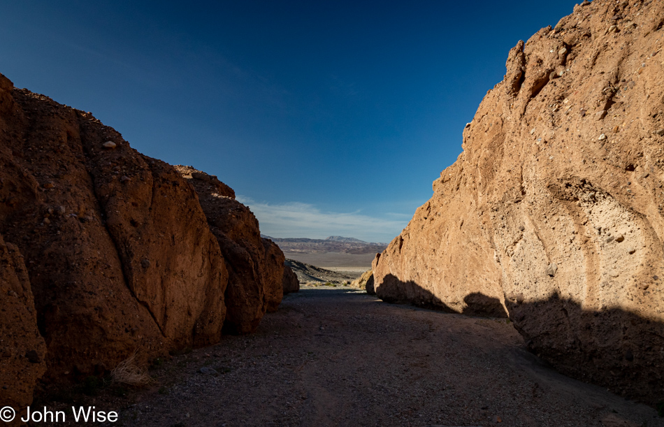
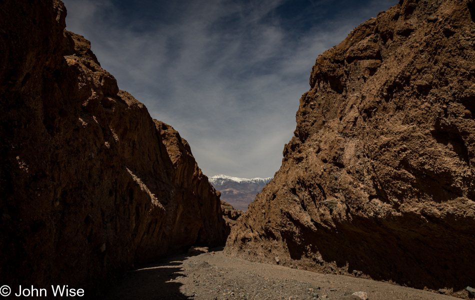
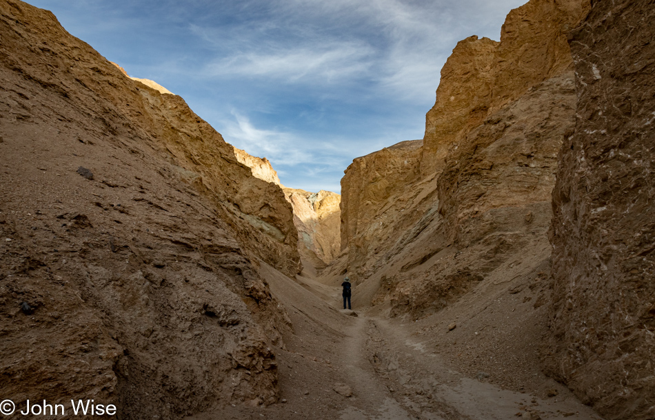
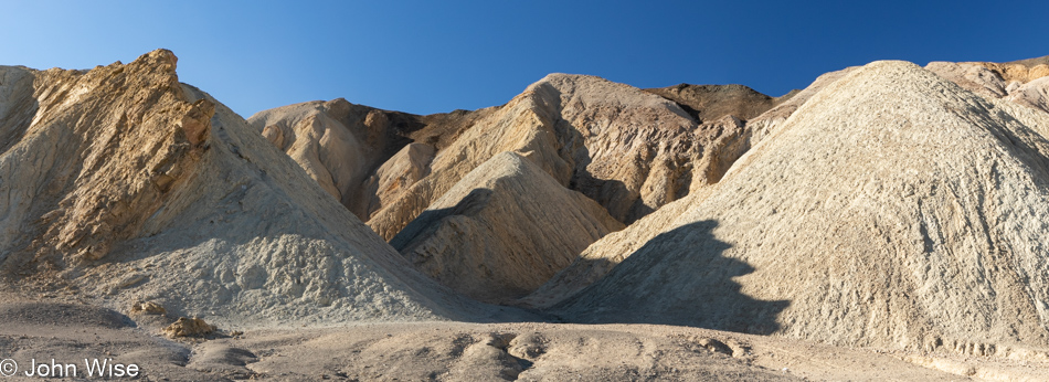
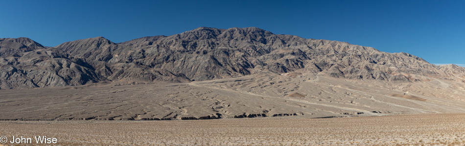
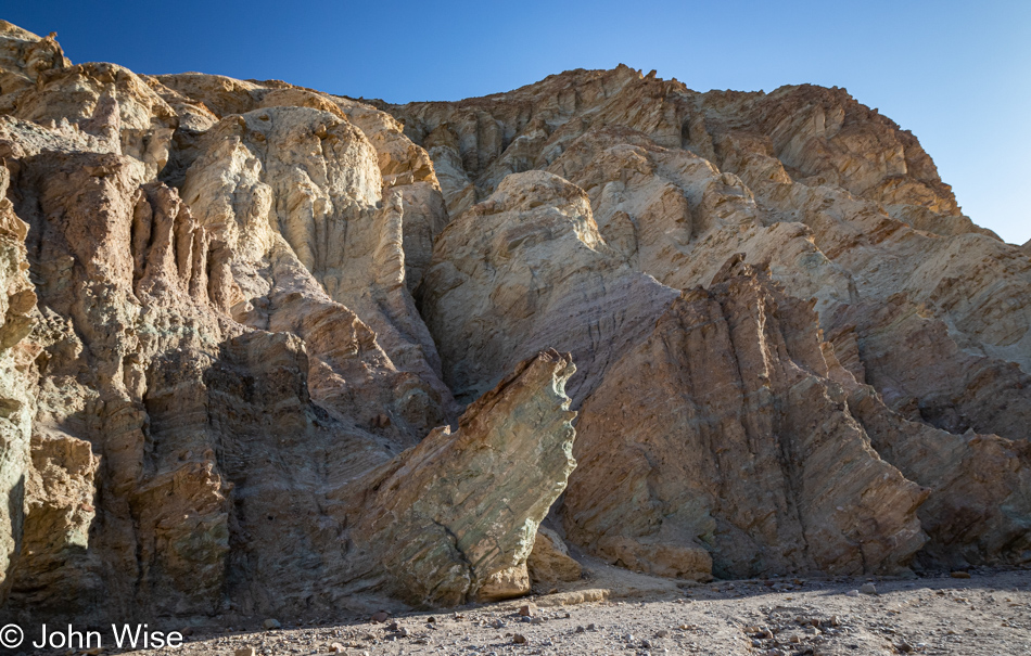
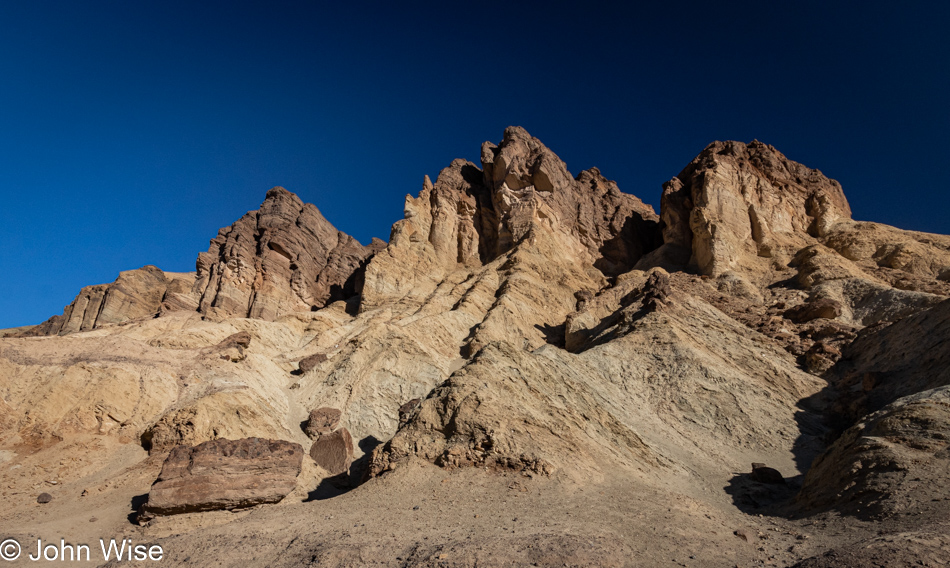
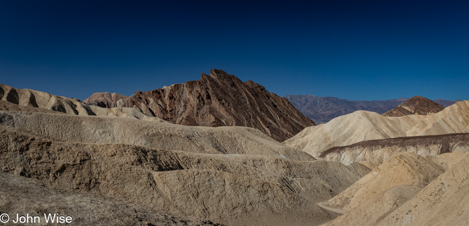
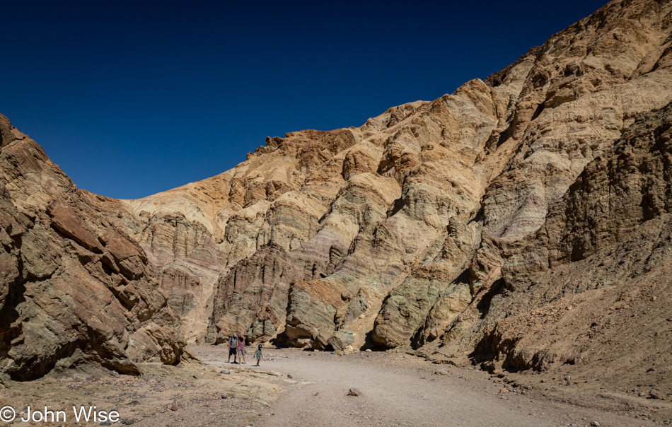
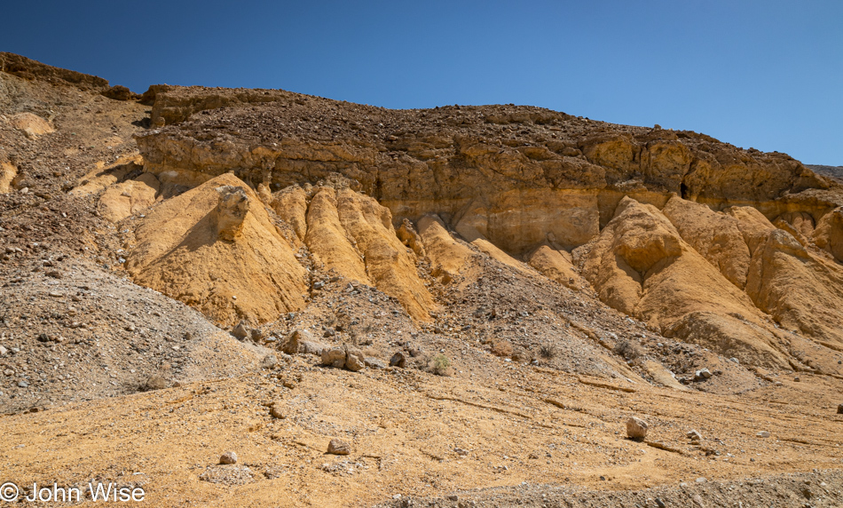
We think this is the Red Cathedral, and while we’ll get closer, there never was a sign pointing to a specific spot letting us know that this was it.

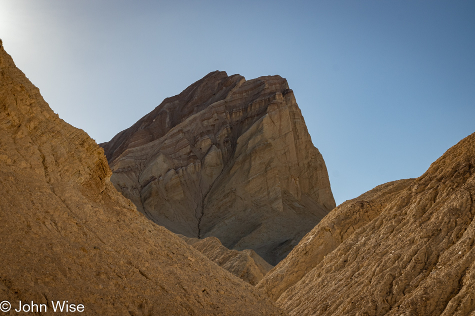
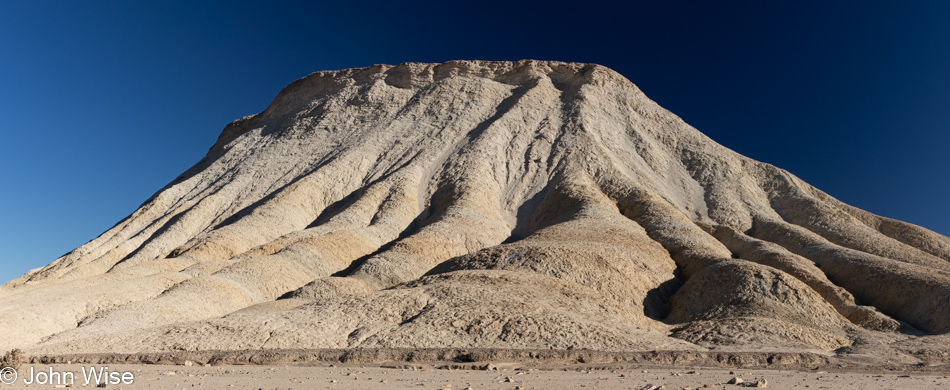
This, though, is Manly Beacon and that we are certain of.

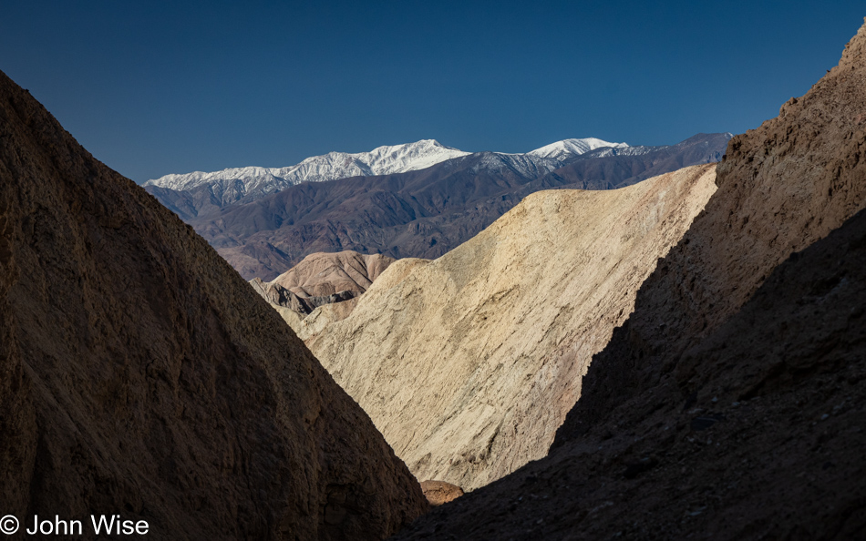
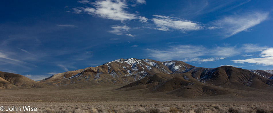
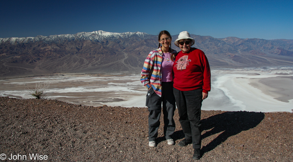
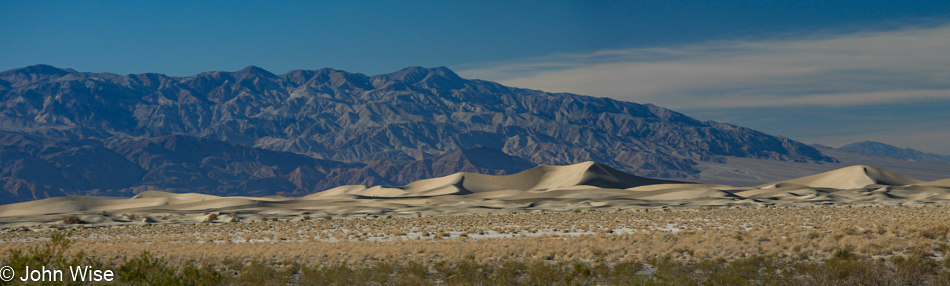
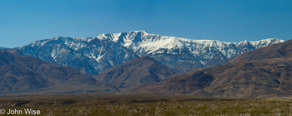
That’s Telescope Peak over there.

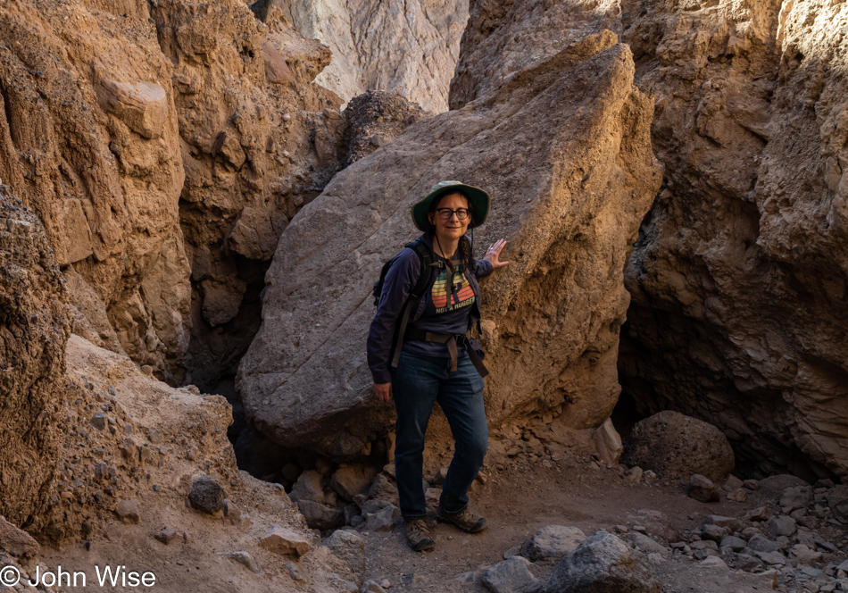
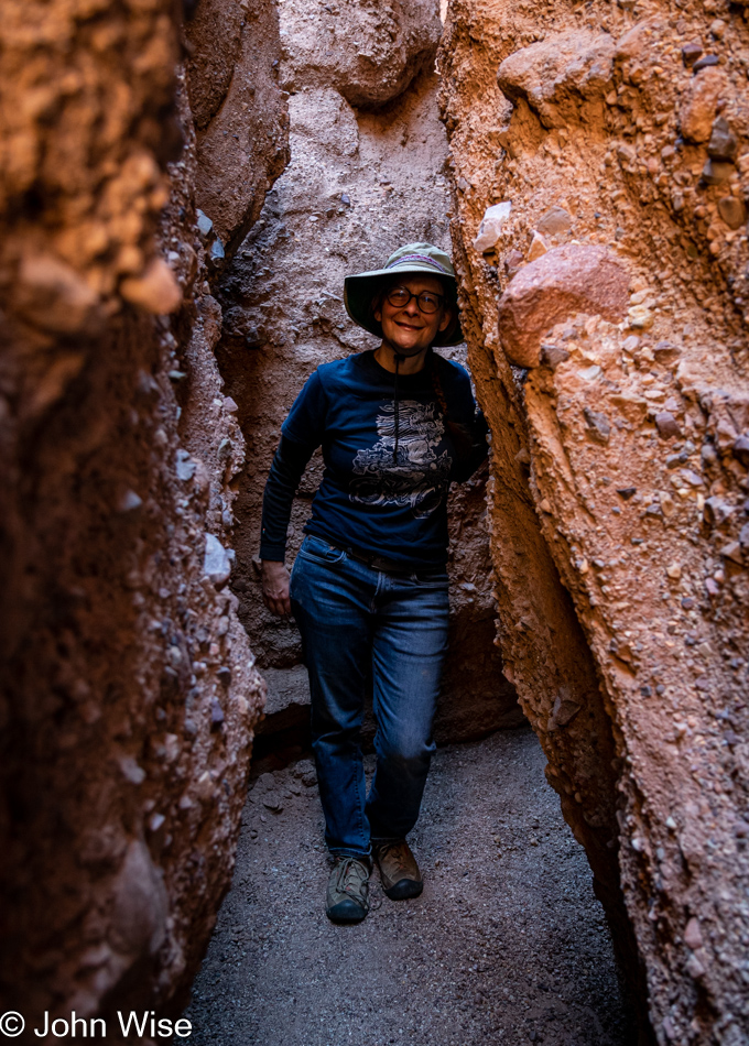
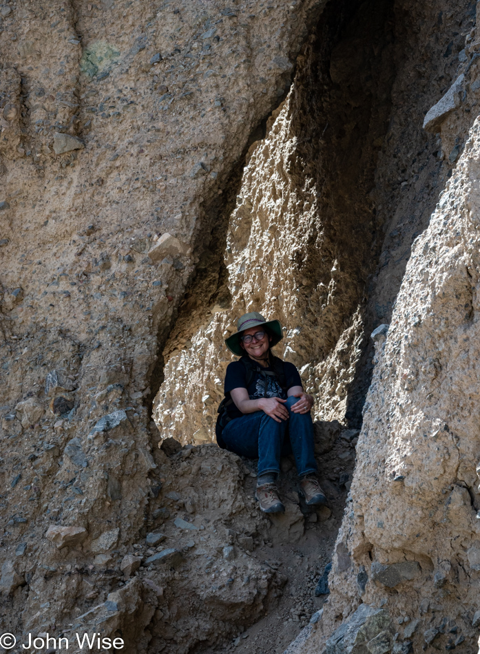
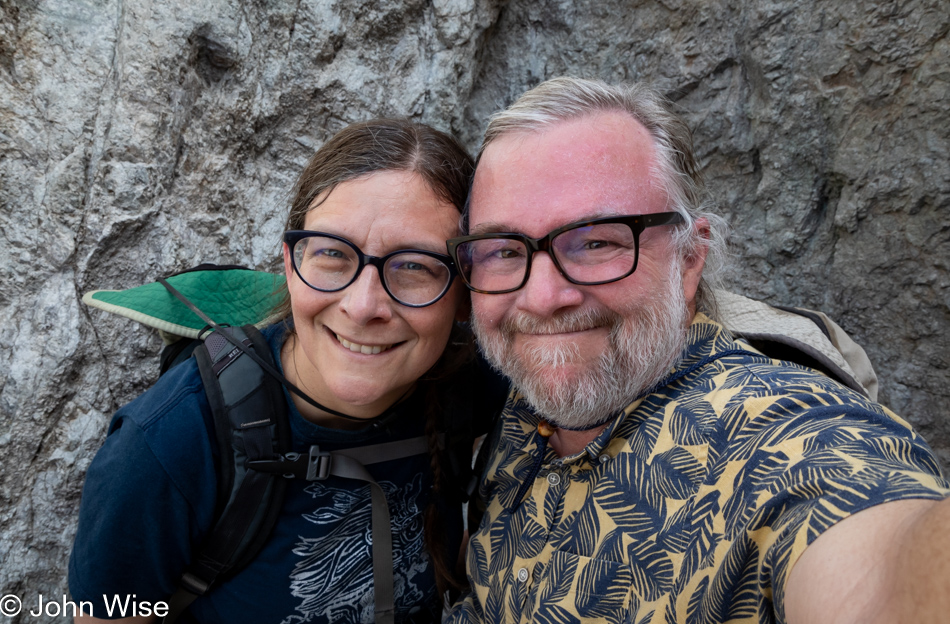
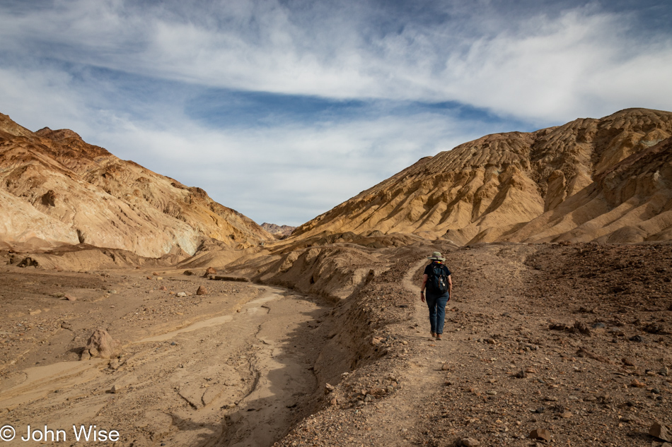
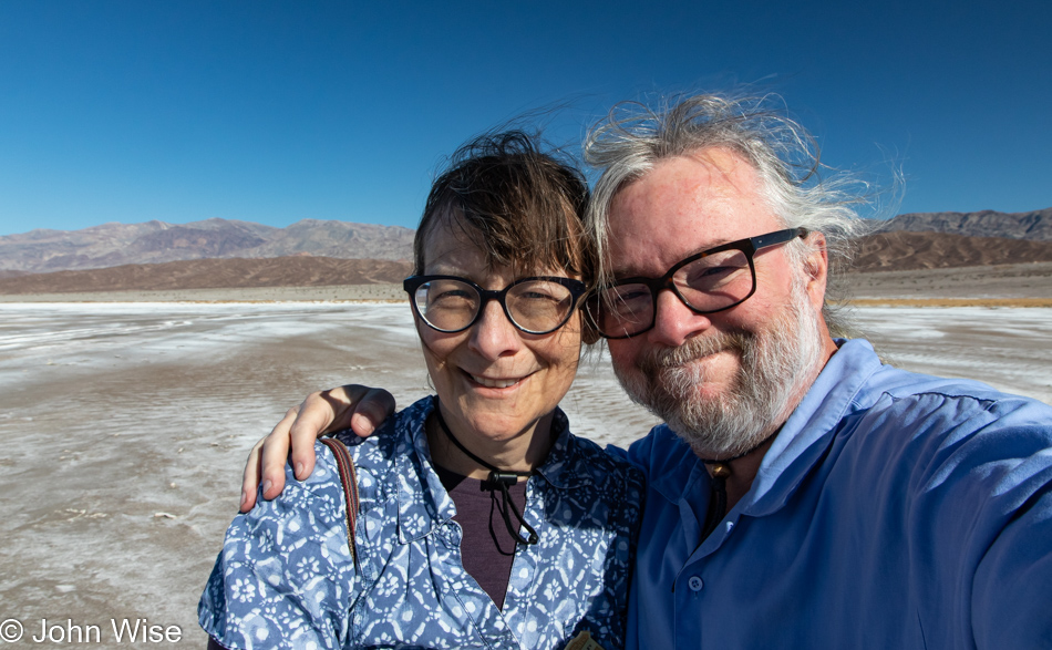
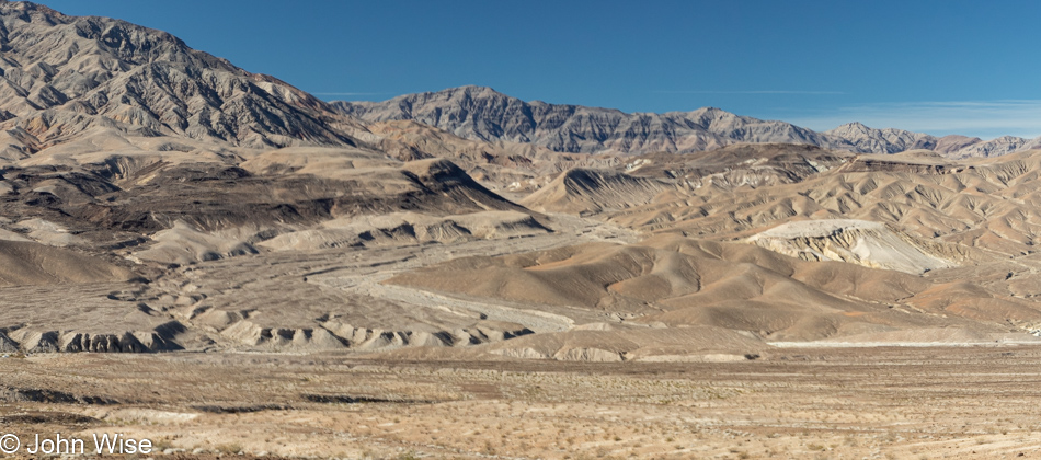
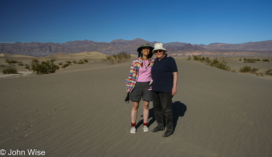
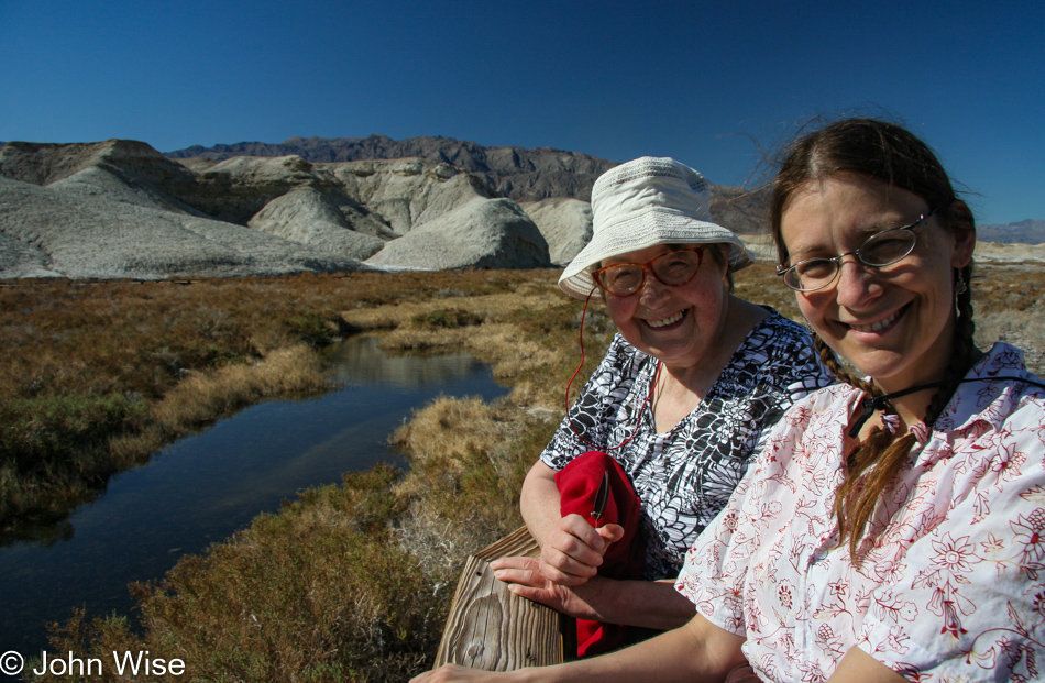
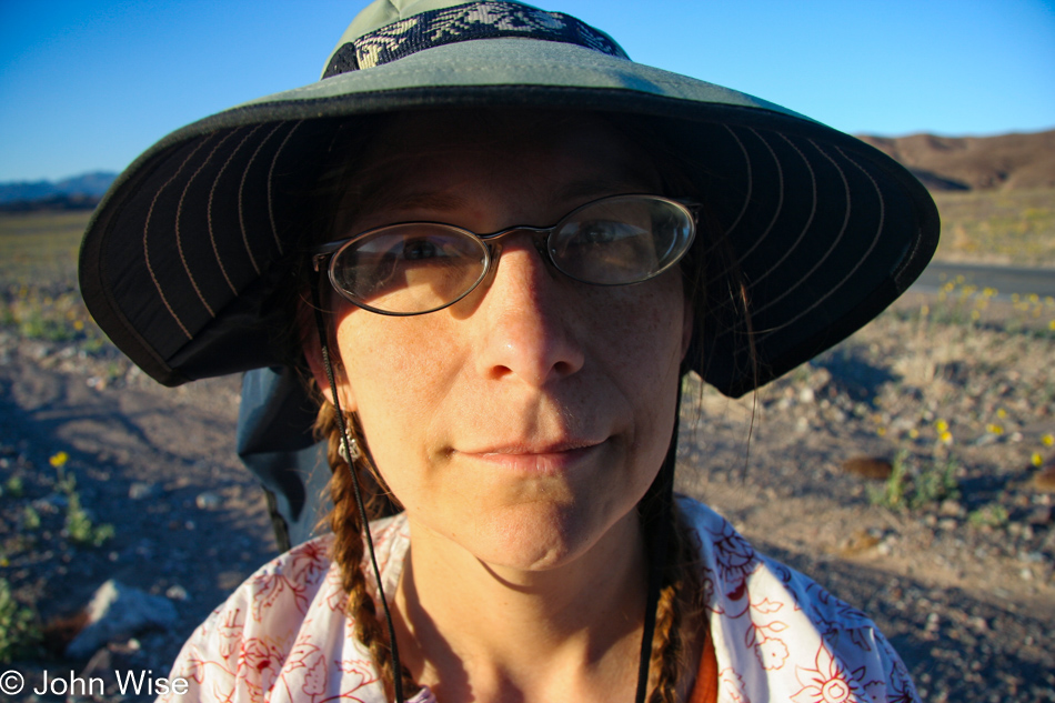
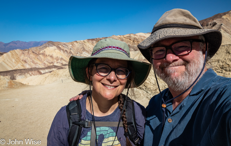
This is Caroline Wise over here, near the end of this part of the trail. Time to connect with the Gower Gulch Loop Trail.

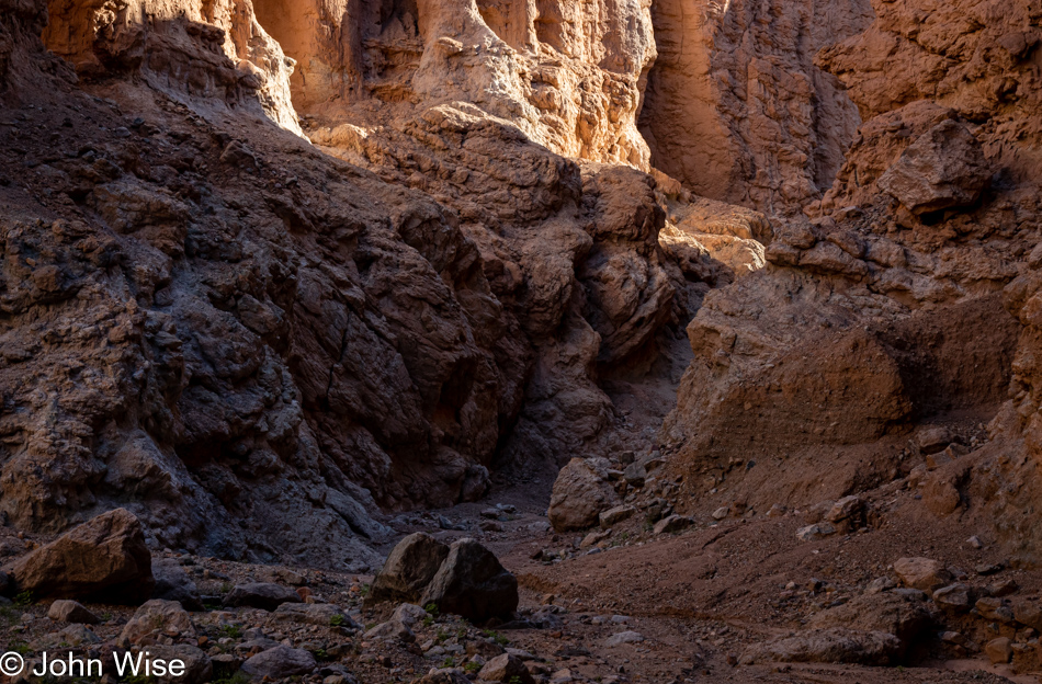
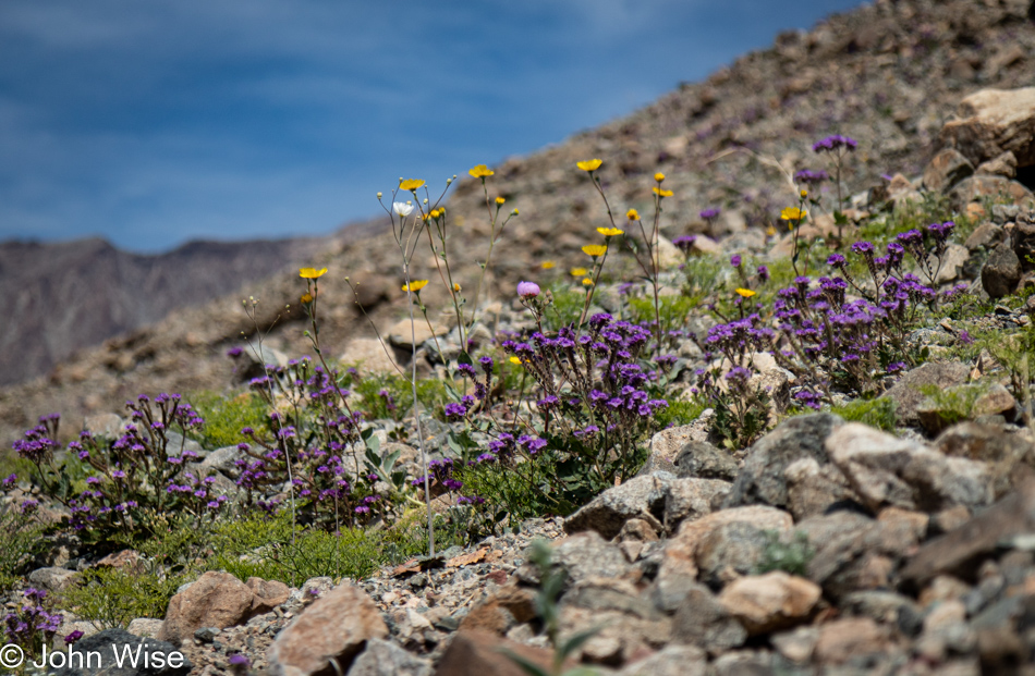
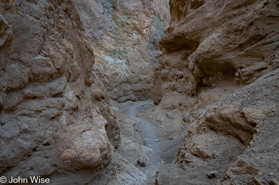
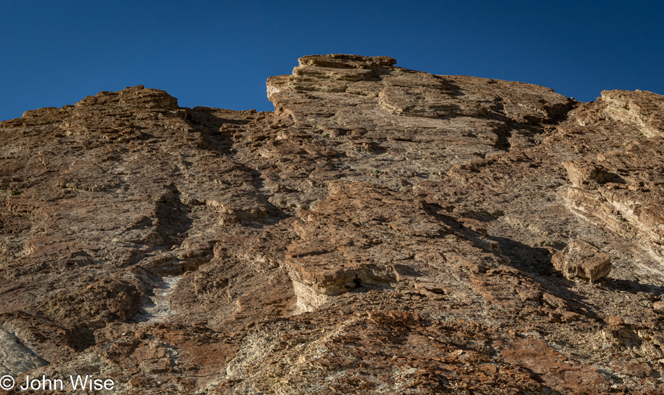
The first part of this trail is a bit steep, which is great with views such as this.

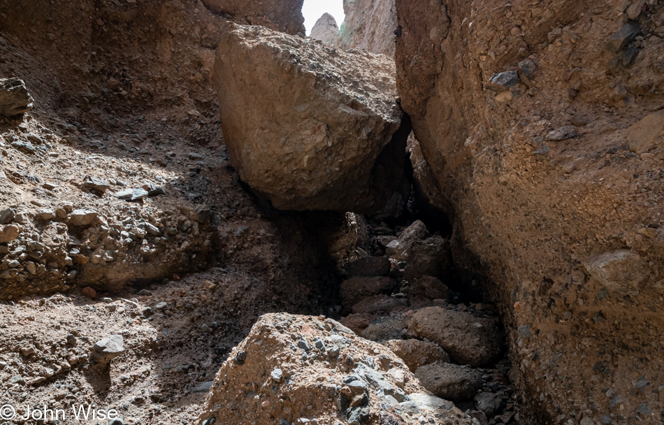
I’ve spotted something ahead, and it’s not the sun that is making me nervous over at the foot of Manly.

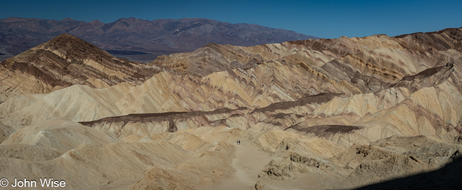
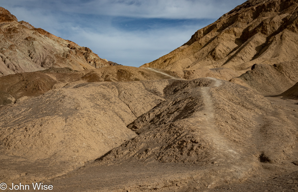
First, though we must go higher as everything changes perspective depending on from what distance you are looking at a thing. If you look at the center of the trail we are slogging up, you’ll see a couple who, in passing, told me not to worry a bit and that the object of my concern shouldn’t be one. That’s a relief.

That was until I got up on the razor’s edge, where my imagination of imminent doom stole any confidence I might have been trying to bring forward. My knees buckled, and I knew this was the end of the trail for me. I think it’s high time for me to get those trekking poles I’ve considered to give me a bit more stability and something to lean on in these situations or simply accept that I could crawl on my hands and knees to the other side. But no matter today, as panic set in and in an instant, we were on our way back down to the place whence we came.

I’m trying hard here to put on a brave face because I’m seriously and, to my core, disappointed in what I cannot do. While we’ll have accumulated 27 miles of walking and hiking over the long weekend, these turnarounds slap hard at what I want to accomplish, and it’s not just me here; I know for certain that Caroline, too, wants to see what’s out there on the other side of the trail we’ve never experienced. So, I try to suck down the pride and giant sense of failure before putting on a grimace of a smile to say to myself, “It’s okay; we can’t do everything in life we might want to do.” And anyway, we are doing a lot and know that, but still, it’s bittersweet.

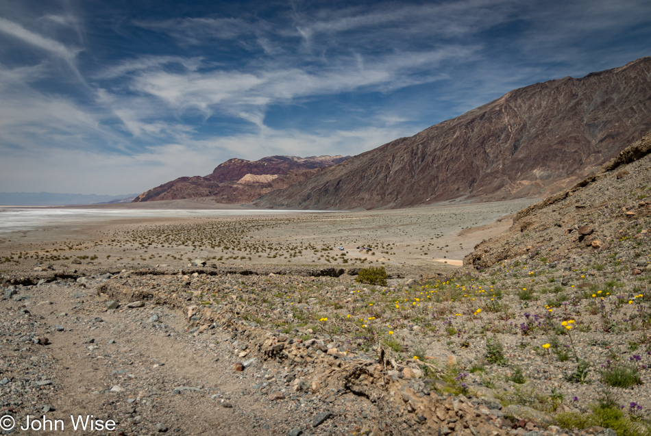
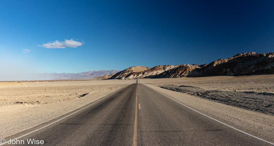
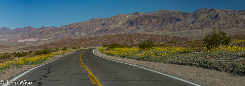
Exiting the canyon, we encountered a lot more people, which was exactly what we hoped to miss by taking the Gowers Gulch trail, but looking on the bright side, finishing our time early in Death Valley means we’ll be getting home earlier than we might have otherwise.

Unless we end up stopping at a bunch of other places because we think we’re so early.

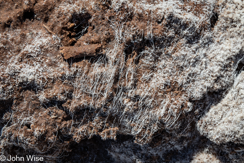
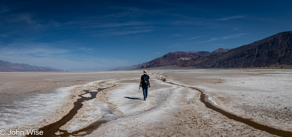
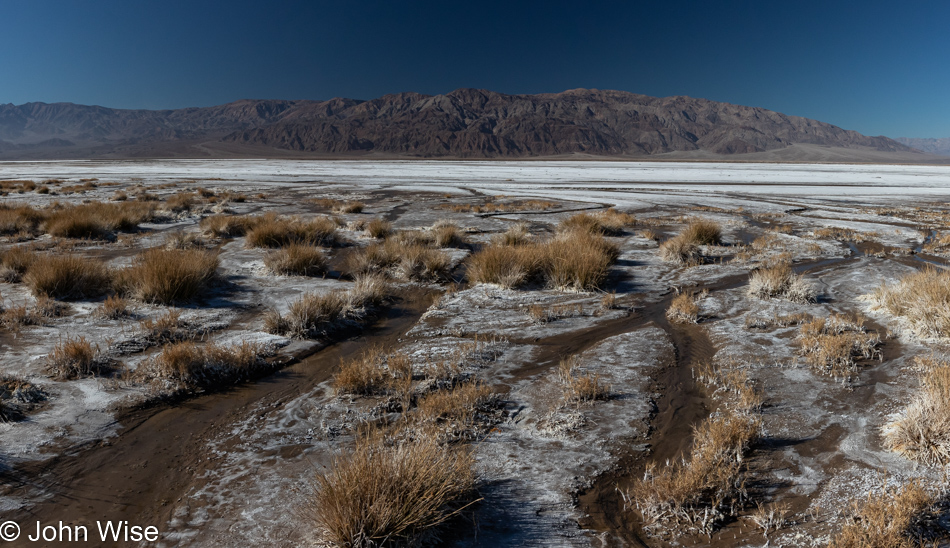
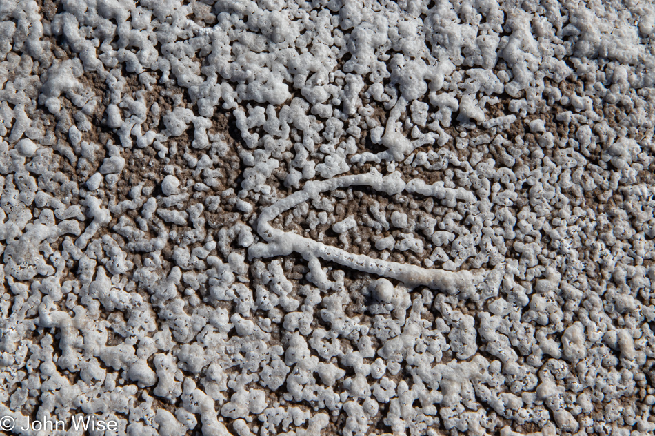
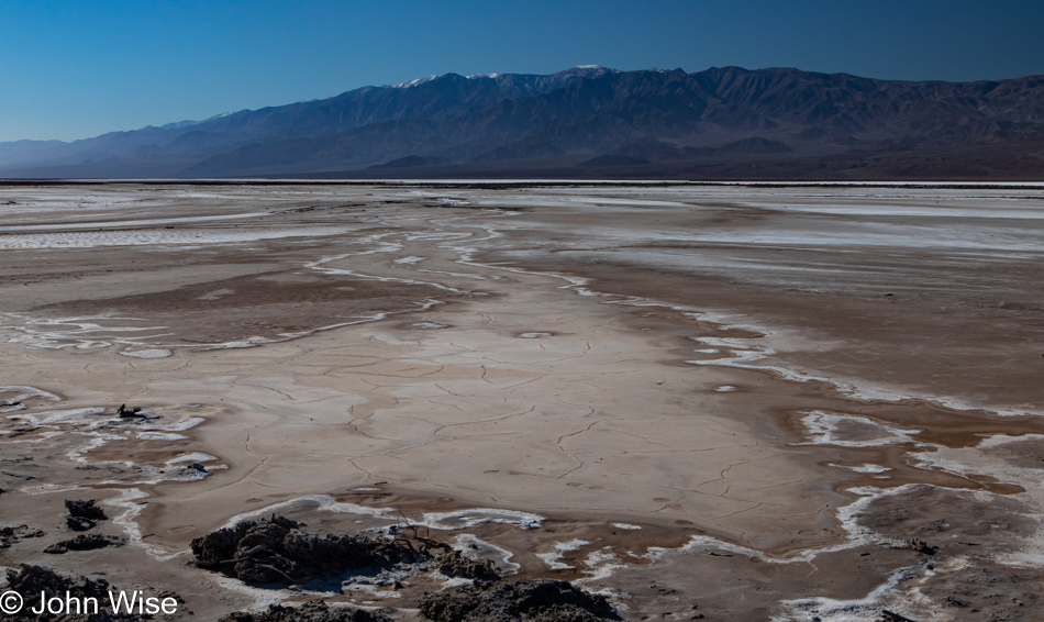
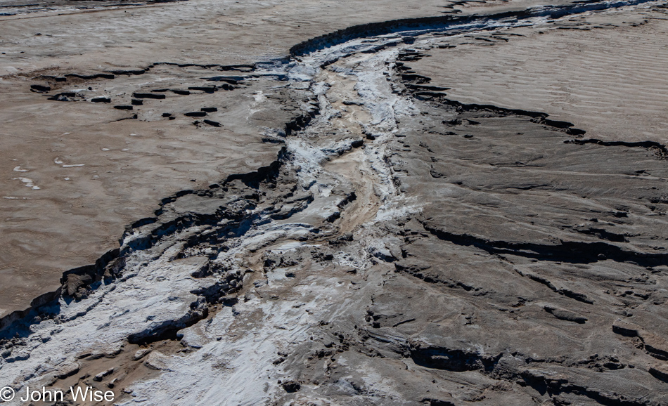
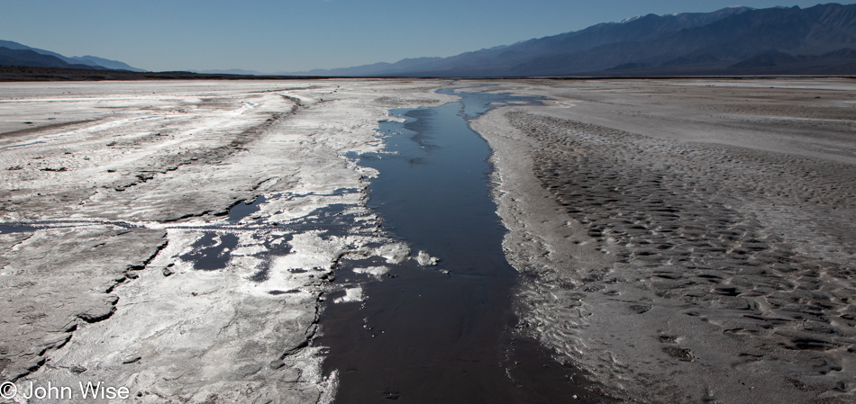
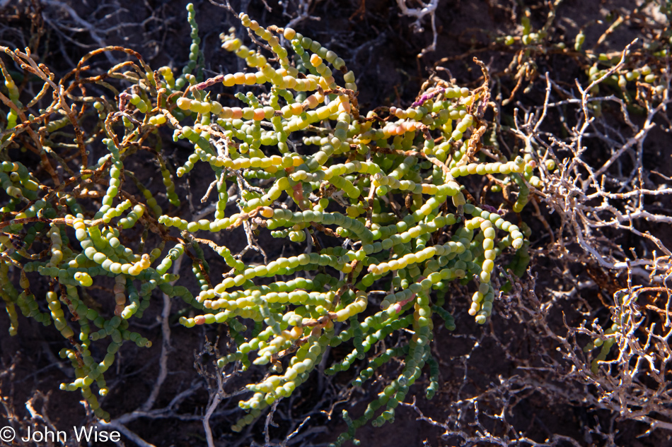
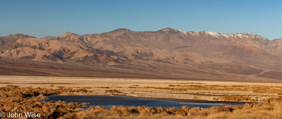
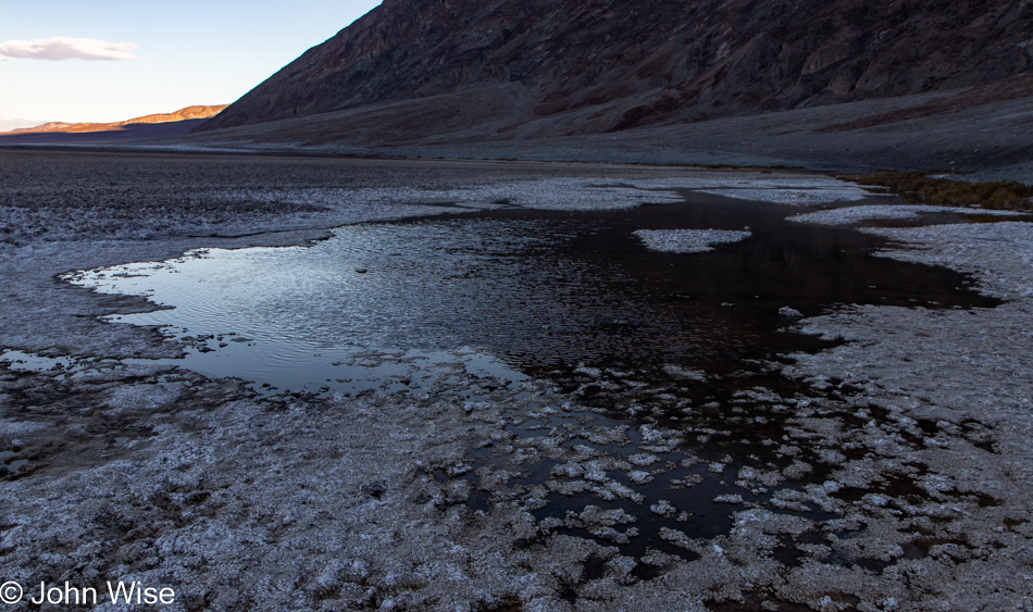
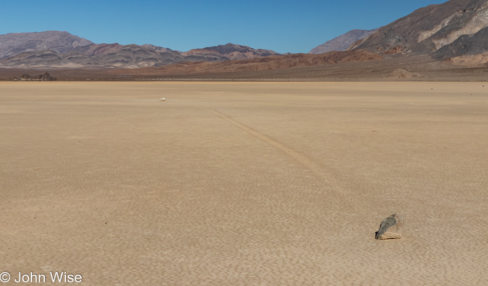
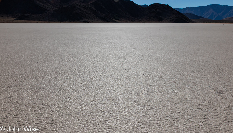
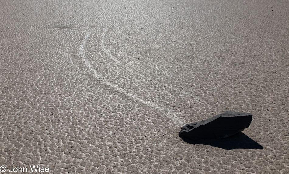
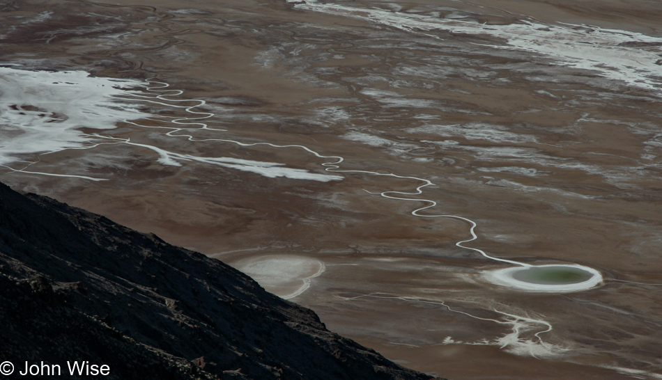
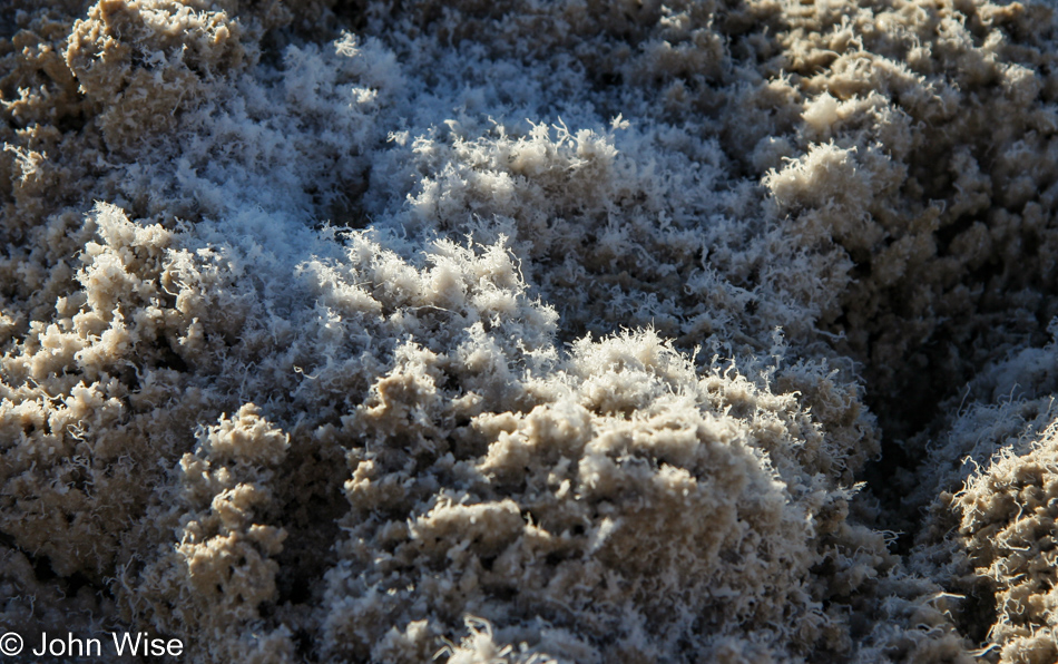
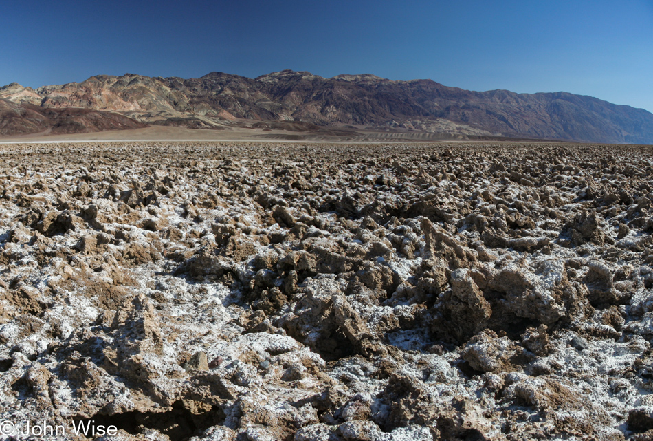
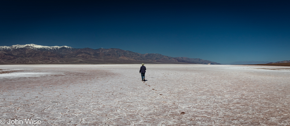
Good thing we felt flexible with our time because while out exploring one of a few areas of the saltpan, we were able to catch sight of these very fine and fragile salt filaments, which ChatGPT informed me are quite rare.

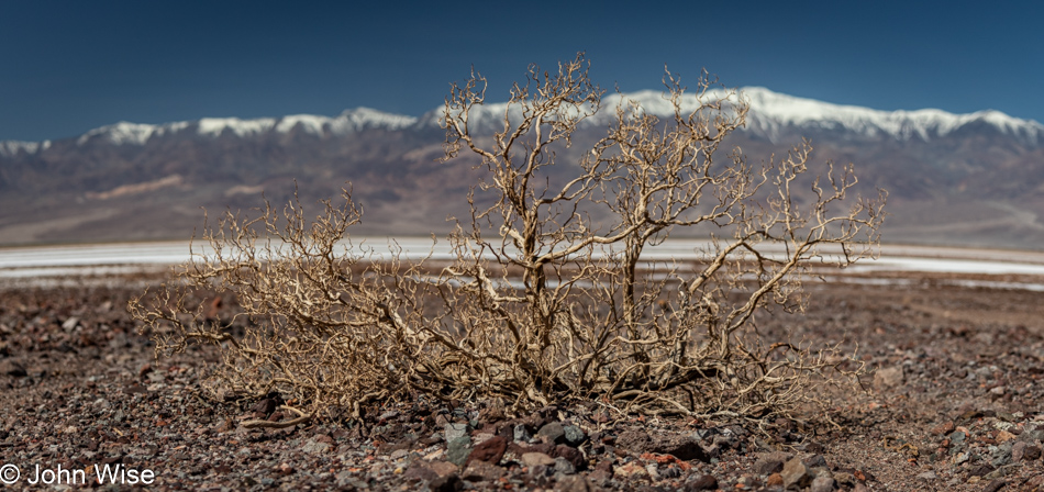
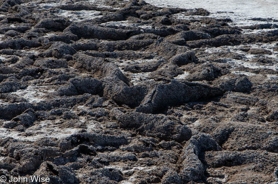
In a landscape with so few large plants, a dried-up old bush skeleton stands in stark relief of the vast space where little else interrupts the eye.

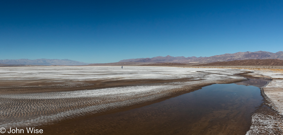
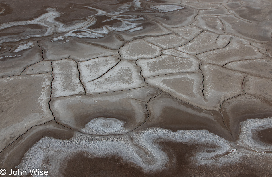
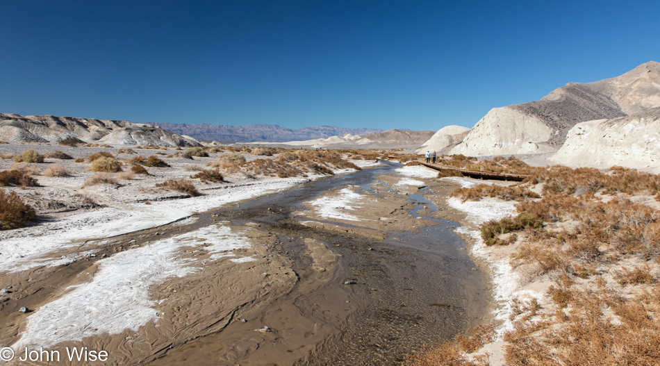
Could it be that on our way into the park/life, we take things for granted as we aim for the places that will bring glory and a sense of accomplishment, and then on the way out, we grow fearful that we’ve missed many important sites due to our myopia of not always seeing what seems to have been right in front of our faces. Looking at this rock formation, one might suddenly capture the essence of Death Valley held right here, but on closer examination have second thoughts that it holds so much relevancy. When departing places/life, moments of recognizing small details you missed take on greater significance, and possibly a little panic seeps into those fleeting thoughts, triggering you to gaze deeper. This is one of those instances.

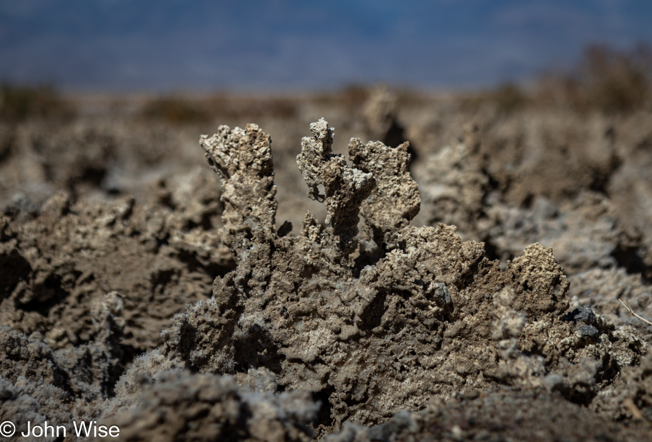
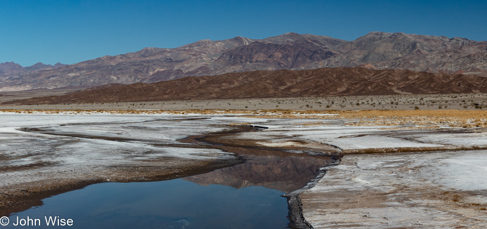
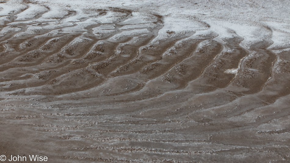
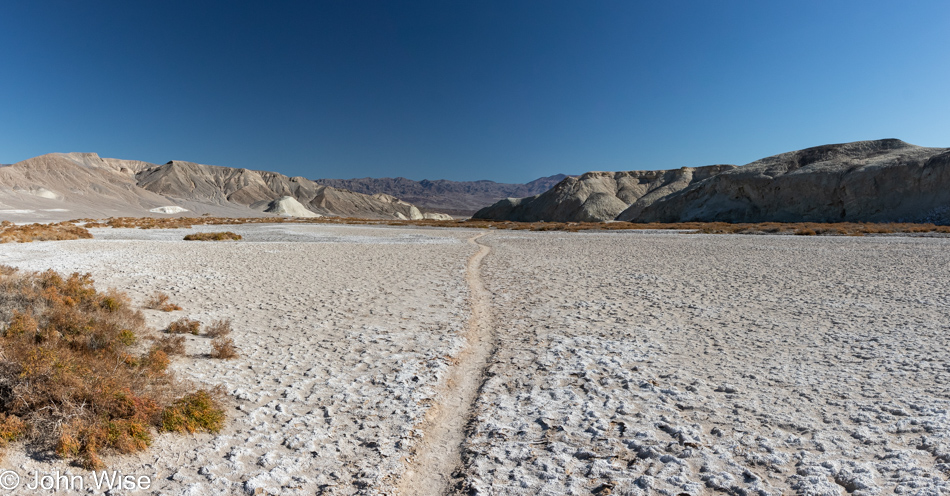
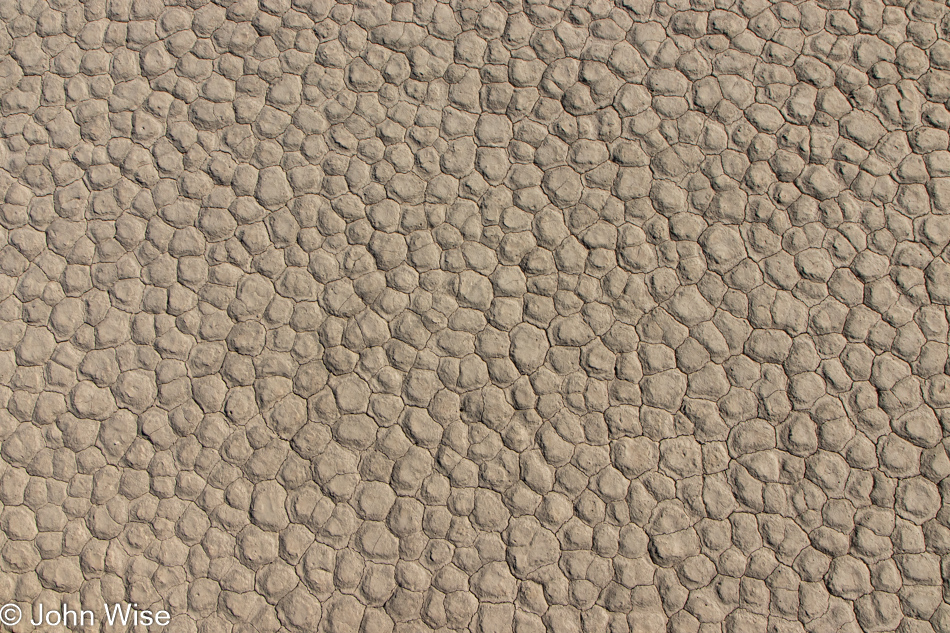
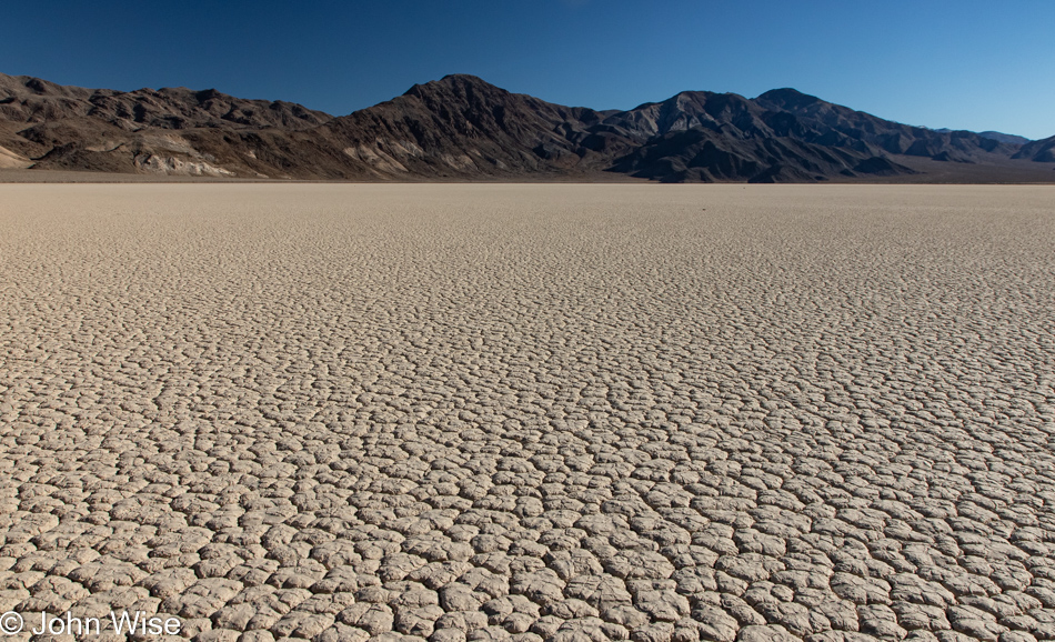
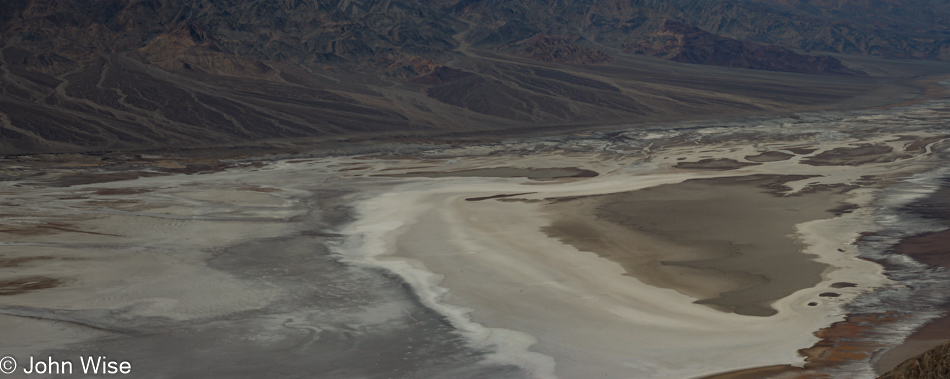
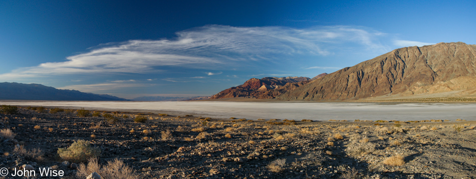
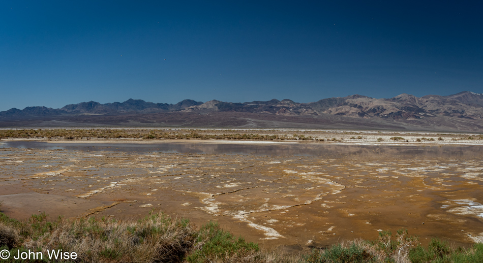
Salt and mud crusts such as these are part of where the Devils Golf Course further north takes its name. These hard and very resilient jagged surfaces rise up over the underlying mud during wet periods, and if I were a geologist or could find a really knowledgeable source who could explain the precise action, I’d share more, but I’m coming up empty.

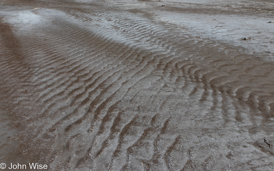
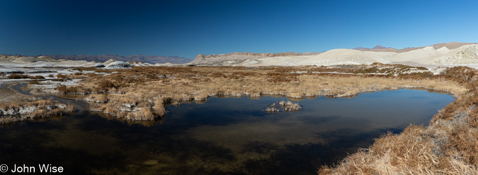
My fingers hover over the keyboard as I’m reminiscing how our feet are occasionally sinking and slipping in the mud out here. Gazing at that image, I’m trying to find something to say that speaks louder than the poetry of being out in the middle of a place where one can sense isolation and quiet that lingers in the small corners of the soul for a longer time than the body was present. It’s funny how people want to visit other planets when similar experiences can be had in so many places right here on the earth we live on but see so little of. We have the opportunity to walk on the surface of a sphere hurtling through space that has been evolving for billions of years to get most everything right before our arrival, and we’re already bored of it and fantasize about going to Mars so we take a photo of someone walking across its landscape with an exclamation of, “Wow, we did it.” Meanwhile, on our own space-traveling outpost, we can’t make the effort to realize the perfection we exist in every day.

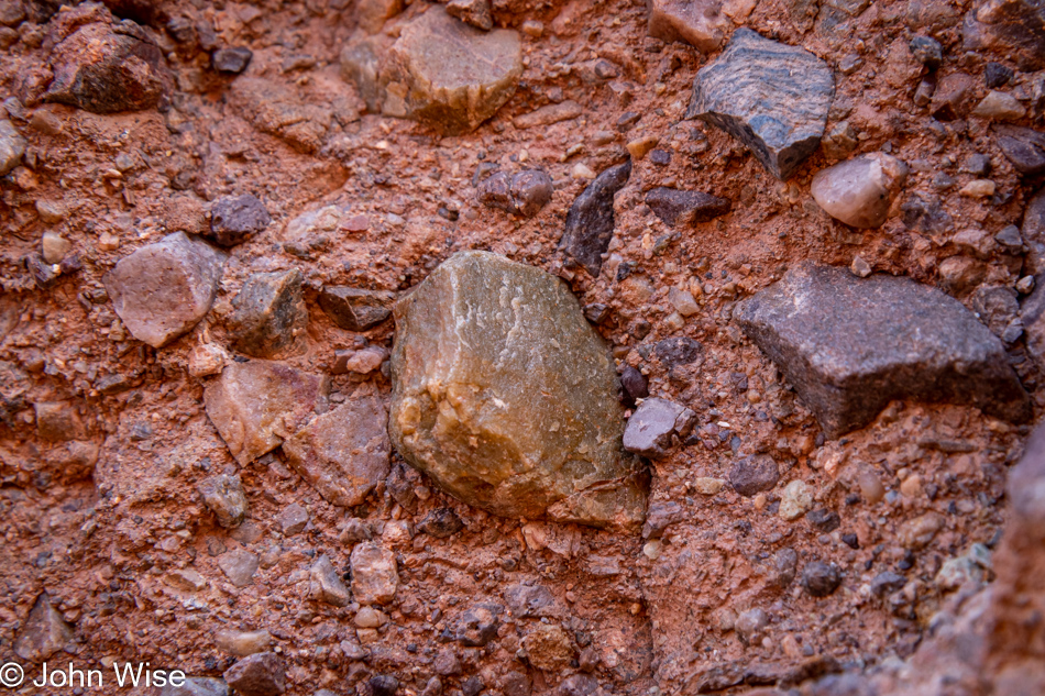
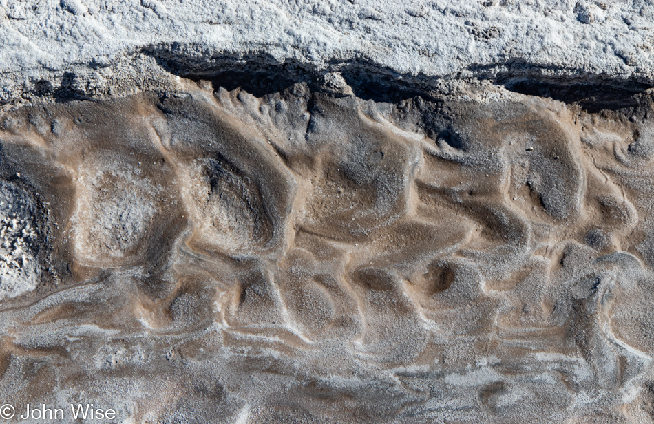
Right here might be some of the precursors of the macro-minerals we are made of, including calcium, phosphorus, potassium, sodium, chloride, magnesium, and sulfur. There might also be some of the 16 trace minerals: iron, zinc, copper, manganese, iodine, selenium, fluoride, molybdenum, boron, cobalt, nickel, vanadium, silicon, strontium, chromium, and bromine. Finally, there are other trace minerals whose role in our bodies we are still trying to figure out, such as arsenic, aluminum, barium, beryllium, bromine, cadmium, chromium, cobalt, gallium, germanium, gold, lithium, nickel, palladium, platinum, rubidium, silver, strontium, tellurium, thallium, tin, titanium, tungsten, vanadium, and zirconium. What I’m pointing out is that we consider life to be living beings (like ourselves), but without the rocks that become soil, the plants and animals that nourish other things wouldn’t have been able to give rise to us.

At first glance, I thought this was sulfur, but on reflection, I remember we didn’t smell anything that would have confirmed that. Limonite is yellow, so maybe that’s what we are looking at. Whatever it was, it was attractive enough for me to stop yet again on this trek to leave Death Valley.

I referenced the minerals that make up the human body and how we consume them from the food we eat, but the really big deal is that we are 65% water and oxygen. So, if you consider a 150-pound (68kg) person, 98 pounds (44kg) of their weight is in the form of water and oxygen. But wait, there’s more! This part might have you thinking I’m stoned as I write this, but I had never considered that when we look at H2O, it is the oxygen that makes up 89% of its weight. While this may be basic chemistry to everyone else, this is the first time I learned of this. So tell me again, why does a creature that is so reliant on soil, oxygen, and water desire to try living on a planet that is mostly dry, has only trace amounts of oxygen, and the dirt is called regolith, which means it is not soil and will need considerable work to become useful for growing food? The only answer I can come up with is that it is easier to distract people with fantastic dreams of leaving our earth instead of trying to live on it and care for it. And somehow, we believe we can make another (extremely inhospitable) planet habitable. We must be insane.

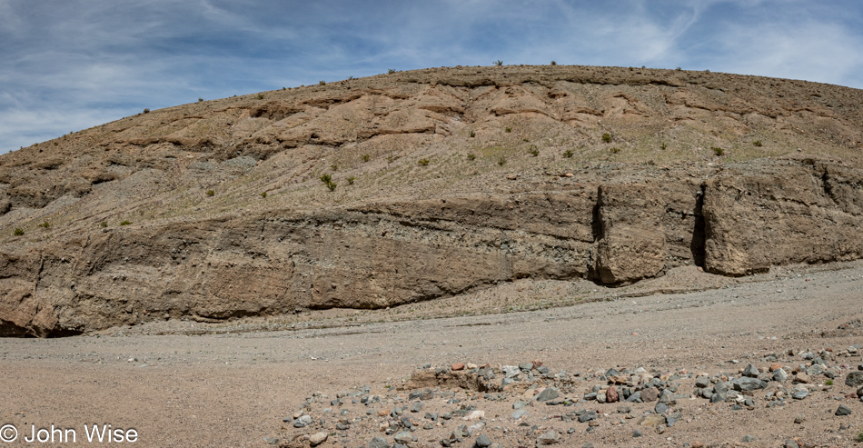
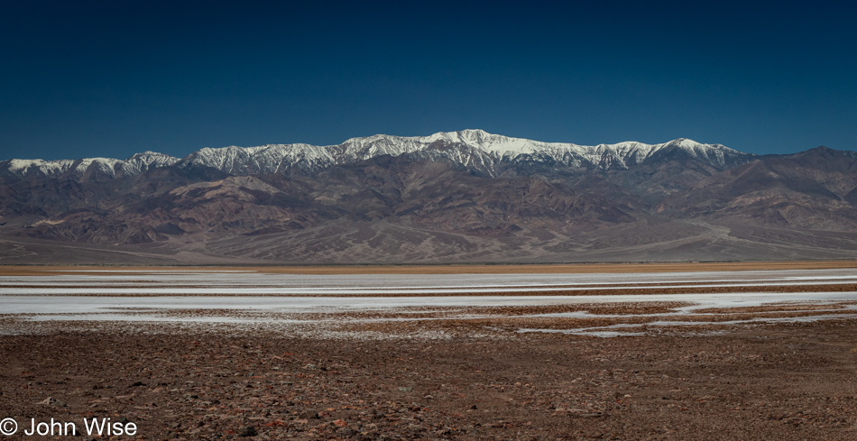
A fading sign caught my eye, necessitating a quick backup to pull over and read what I thought I had. Sure enough, those horizontal edges are remnants of shorelines from Lake Manly on what was at one time an island. We should have noticed this before as we’ve seen similar features in the Yukon, Canada, where a backed-up Alsek River flooded a valley nearly all the way to Haines Junction, leaving similar shoreline markings on nearby mountainsides. This rather large, still-visible detail allows us to easily imagine the 100-mile, 600-foot deep lake that stretched from here to points north. Just one more instance of not being able to see what’s in front of you due to a lack of knowledge or not knowing where to look.

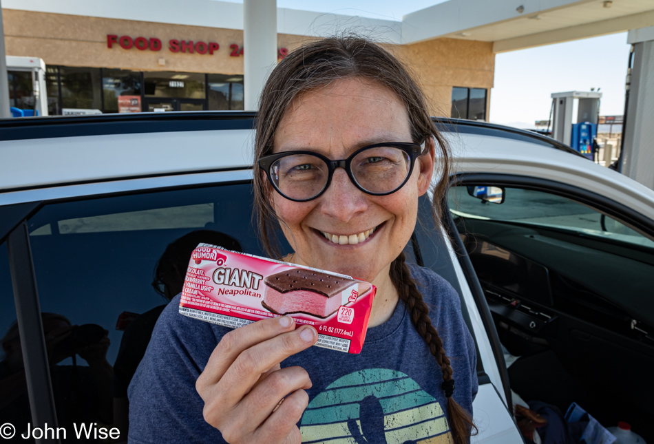
For years Caroline has been looking for a Neopolitan ice cream sandwich as she finds the plain old vanilla to be boring. Well, we finally found one here in Baker, California, and still, she’s not happy on two counts. First, the version in Germany she grew up with uses waffles for the outside instead of the sticky chocolate cake-like stuff we are accustomed to in America. Second, she realized that if the flavors were distributed using the length of the sandwich, she’d be able to enjoy all three flavors at once.

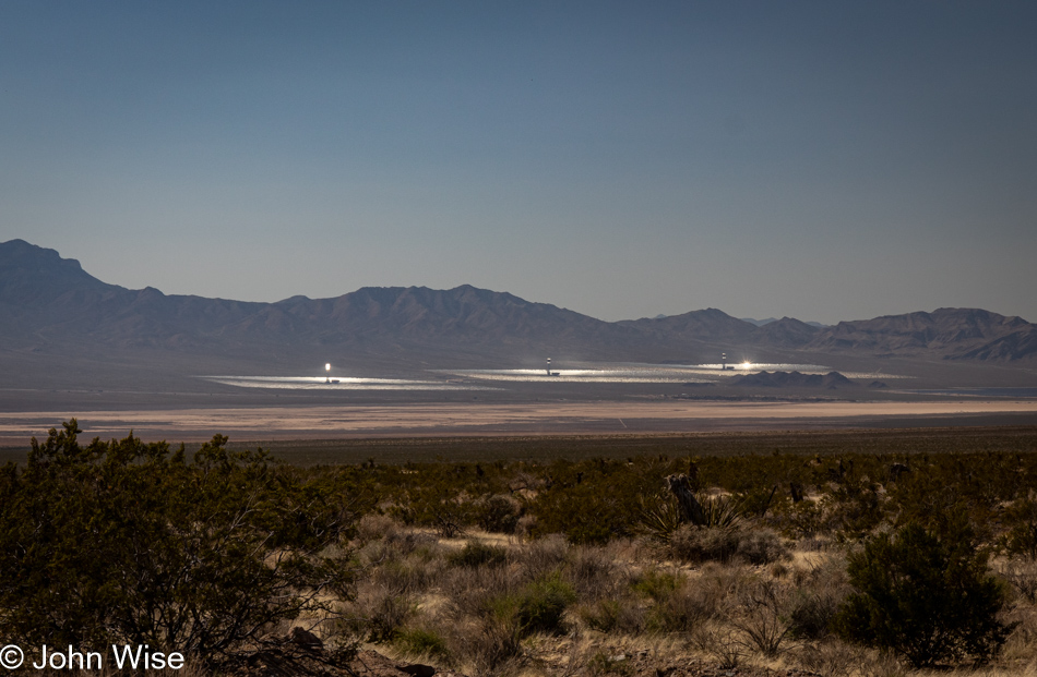
Ivanpah Solar Electric Generating System or Thermal Plant is the world’s largest bird roaster. The atmospheric glare is extraordinary to witness as we approach the (miniscule) town of Nipton, California. It’s obvious that there’s a bizarre amount of ambient light illuminating the air being reflected and directed from the strategically angled mirrors. After getting home, I was looking to learn something or other about this peculiar sight, and in one particular article, they talked of the 900-degree (482c) instant-combustion beam that has smoking birds plummeting to earth roasted if they get to close to the bad hot place. This has me thinking that these thermal plants might be avian hell because, for a bird that is innocently out and about in their normally supportive bird environment, things become instantly torturous as the sky aims to cook them alive in a blindingly fast millisecond.

Seems like it was only ten years ago that my hair was hardly gray, and now, in the right light, it looks like I have a personal thermal plant perched upon my head.

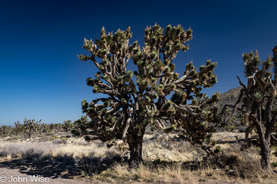
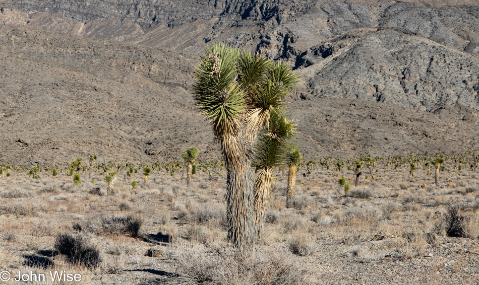
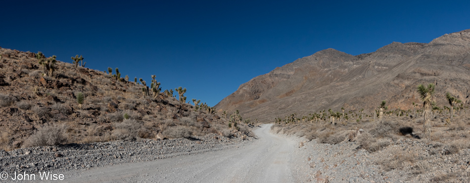
Whoa, how have we missed this Joshua tree forest out here? It turns out that we’ve not previously driven Highway 164, a.k.a. Nipton Road, and so we knew nothing of the Wee Thump Joshua Tree Wilderness. The words Wee Thump mean “ancient ones” in the Paiute language. This is the third largest Joshua tree forest on earth, as in the entire earth, and we’ve now seen these giants with our very own eyes.

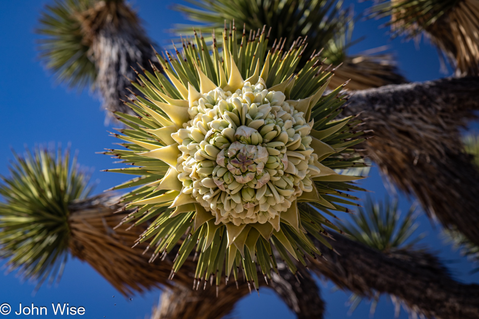
And not only that, they are in bloom. We cannot say we’ve ever seen Joshua trees in bloom, so we’ll go with this being a first. In that sense, come to think of it, this is like an Easter egg, well for me at least. I’ll explain that comment in just a sec.

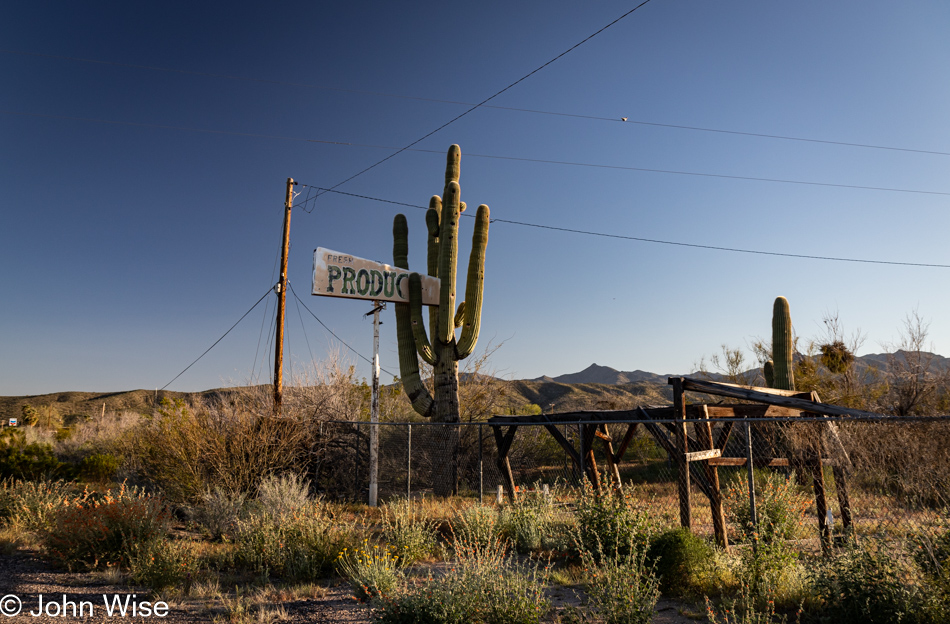
Not one to miss abandoned roadside America, this old “Fresh Produce” sign seemingly held fast by the saguaro was a site that needed recording. We are passing through Wikieup north of Nothing and only about 120 miles from home at this point, and it was here that Caroline found her Easter egg.

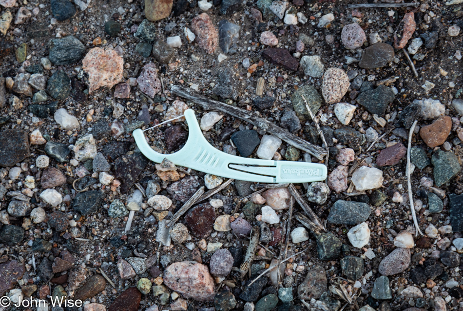
Happy Easter, Caroline! Yet another dental floss pick, an Easter egg of the best kind. You see, Caroline had been haunted by these stupid little things and sees them everywhere. They pop into her view all the time, to the point that she’s considering getting a task-specific pair of tweezers and a plastic bag that she carries with her to collect these bits of trash used in the hygiene of caring for one’s mouth. Why they seem to be so widely distributed is a mystery, but maybe if she starts documenting their location and picking up these discarded tools, she can start to identify what they have in common or if there is a pattern on the map that might become apparent. While they are something absurd to be consumed by, their vexing ubiquity found strewn across the landscape is likely creating a bit of neurosis for my wife. Does anyone know of a lost dental floss pick support group she can join?

Stamina in the Face of Death Valley

Death Valley National Park, California

Recently, I turned 60, not with dread but also not without the nattering echoes of those who came before me and groaned of declining energy and poor stamina when they entered this age. When we left home yesterday, it had not been my intention for this trip to be a test of any sort, but maybe it will end up being some of that. With the arrival of my 60s, what impact might I find? Leaving Phoenix, we had a 450-mile drive ahead of us that should have taken about 7.5 hours, but with countless stops for photos of this and that, we optimized our indulgence by stretching out our time crossing the Sonoran and Mojave Deserts before arriving at the doorstep of Death Valley at 7:00 p.m. Checked-in to our room in Shoshone, we walked across the street to the old familiar Crowbar Saloon we first ate at back in 2007 and then took the dark road up to the hot spring pool, this also brought us to having walked 5.5 miles for the day. By 10:30, we were snoring, but if you read yesterday’s post, you’d already know some of those things.

It’s 5:30 in the early morning as we peel ourselves out of bed after sleeping better than is typical for our first night out on the road. We are embarking on our day in the wee hours even after our lengthy 17-hour day of traveling yesterday. The point here is, and this is only now dawning on me, we are still plowing into experiences and doing our best to take advantage of our time in the world. As we turned on the road that would bring us to Death Valley, the sun hadn’t yet peeked over the horizon, but by the time we were about to descend to the saltpan, the world of this harsh landscape was becoming well illuminated. Who knows what the rest of my next decade will bring, but here on the other side of 60, I’m thrilled to know that my stamina hasn’t fallen by the wayside.

Death Valley National Park, California

Having passed in and out of Death Valley from the west, the north, the northeast, and the south, the southerly approach is by far my favorite. The gradual approach from this side of the park also benefits from the quiet due to so few people out this way. Most visitors will congregate in the relative proximity of the visitor center. While many will go as far south as the iconic Badwater location (282 feet below sea level), that leaves the bottom 50 or so miles of the park relatively unvisited, and it is down here where our day begins in earnest.

Room Canyon at Death Valley National Park, California

There is no trailhead and no parking lot. We just pull up in front of mile marker 39 and start walking east. Our first hike of the day is Room Canyon, rated as a moderate 3-mile trail. The path to the canyon is not identified with cairns, but if you look at the ground ahead of you, you’ll see the footprints of others, and you can hope they went in the right direction. This is as good a place as any for me to include my endorsement of the AllTrails app and how important it has become to us. Before arriving somewhere, like here in Death Valley, which doesn’t have phone service, one should identify the trails they are interested in and then download the trail maps while they have plenty of signal. Our go-to trails are typically rated as moderate because easy is just too easy, though, for an interpretive experience, those are often not bad. The strenuous trails often feature rock climbing, exposure, or some serious elevation gain. Everyone who ventures into America’s national parks and hikes should have AllTrails with them and do some research before embarking on their adventure.

Room Canyon at Death Valley National Park, California

After our short hike into an alluvial fan, we are now in the mouth of a canyon carved out of the alluvium that’s been deposited from the eroding mountains behind us.

Room Canyon at Death Valley National Park, California

The post title mentions stamina and is in reference to what we’ll have to muster if we are to capture the three hikes we have penciled in as the activities for our day, but by now, it also speaks to what I’ll require to complete writing this post that still has nearly 50 photos below this one. Should you be able to slog your way through this marathon post, which will likely veer into a fair amount of prolix (defined as speech or writing using or containing too many words/tediously lengthy), you too will have had to find your stamina for such a long post to find what gems might exist here, if any.

Room Canyon at Death Valley National Park, California

For Caroline and myself, the gems are many, at least in viewing the photos that we find to be magnificent. The writing that accompanies these images is often a mixed bag where at least I wonder if I’ve not said this all before. Even if I add a new twist or some bit of delightful poesy where a verse finds a potentially enchanting resonance, one must toil over hundreds if not thousands of words until they, too, find a diamond in the rough.

Caroline Wise at Room Canyon at Death Valley National Park, California

Speaking of finding a diamond in the rough, it’s now been 10,000 years and 12 trillion experiences shared with this woman, who (according to her) has enjoyed being between the proverbial rock and a hard place that is our relationship. There’s something about her smile here that may not be apparent to others: it is the look of “Wow, I can’t believe we are here.” Today, along with our planned hikes that are not considered to be some kind of “I’ve worked for this, and I’m owed it,” is a day of astonishment that we have the ambition and compatibility to venture into places with someone who equally enjoys the time. How far we go is irrelevant; how far we’ve come carries a satisfaction that accumulates, as does our love.

Room Canyon at Death Valley National Park, California

Had this been the extent of our adventure, we’d leave and realize our good fortune to have been able to find so much indulgence between yesterday’s drive up, time in the hot spring last night, sunrise this morning, and this first bit of exploration in Room Canyon here at Death Valley. But this is only the beginning, and nobody should ever, for even a second, consider that there are greater rewards ahead. Every moment is the most valuable token of a splendid life any two people have been granted.

Caroline Wise at Room Canyon at Death Valley National Park, California

I don’t believe that those who named this place Death Valley were being ironic, but then again, we do not call Earth the Death Planet, though death happens every day. I vote for renaming this national park Massively Wow Life Valley because being here amplifies the sense of how incredible it’s been that life took hold on this outpost in the Milky Way.

Room Canyon at Death Valley National Park, California

As a telescope acts as a portal through space into unknowns, so too does nature act as a portal into its history and maybe its future. As I peer into this crevice with light falling in from above, I can surmise what is out there, but I do not have first-hand knowledge. This mystery is the intrigue that helps propel our dreams.

Room Canyon at Death Valley National Park, California

From one space, we enter another by the simple act of going forward. Obviously, we had to have the means to be here, but I’d argue that everyone has that opportunity if they were to desire such things. The argument that most people can afford this if they own a relatively decent car could easily be taken issue with, but I’d say that while those more than 500 miles away would have to focus on something closer to where they live, such a weekend could cost as little as about $200. Without going into too many details, that’s about $120 for gas, $40 for two nights of camping, and park admission. As for food, that was going to be consumed at home regardless. Instead, people will convince themselves that a real immersive vacation must take place at Disneyland, Hawaii, Las Vegas, or on a cruise to the Bahamas. This all-or-nothing mentality is great for Caroline and me because we find ourselves all alone today at Room Canyon.

Room Canyon at Death Valley National Park, California

If you look closely at this image and the one above it, you’ll see that we’ve progressed about 100 feet up the trail. Sometimes, it’s not the broad vista, i.e., the big picture, that’s all important but the readjustment of your focus to see what you might miss if you are only honing your hyperopic vision.

Room Canyon at Death Valley National Park, California

Earlier this year, we spent a couple of hours in Kartchner Caverns, and in my subsequent writing about them, I deeply considered their formation and the molecular processes harnessed across time. Peering into those details in ways I hadn’t previously, I was enchanted watching in my mind’s eye the accretions forming to produce the cavern features we were there to experience. Today, we are here in an open-air canyon, and under an overhang are signs of accretions dripping down a wall. Where’s a geologist when you need one? How old might these be, what is their mineral composition, and how many other places in Death Valley can we find others?

Room Canyon at Death Valley National Park, California

Again, my kingdom for a geologist! While I understand that softer rock erodes faster than the overlying harder rock, I dream of knowing what was at work during those years these layers were forming. The greenish layers are making a sandwich of what appears to be sandstone, and within the green lower area, there is red rock, but it’s not evenly distributed, so what’s the story?

Room Canyon at Death Valley National Park, California

And then this small area of turquoise-hued rocks catches my eye and while I can appreciate the aesthetic qualities, I’m being denied any knowledge of precisely what’s at work here to have created this pocket of blue-green treasure. Learning that Death Valley has not really been a place to find much copper, I’ll eliminate the chance that the minerals at work here are malachite or azurite, which both oxidize towards green and instead, I’ll lean towards this display being caused by the presence of chlorite.

Flowering plant at Room Canyon at Death Valley National Park, California

Hey Caroline, have we ever seen flowering desert rock nettle before? Looking for them, I learned that the International Carnivorous Plant Society considers the Eucnide urens a “murderous plant” because flies that come in for aphids are killed by the plant, but while this nettle strengthens its stinging spines with calcium phosphate, the same stuff our bones and teeth are made of, it can’t “eat” the flies so it does not qualify as carnivorous and is simply a murderer.

Wildflowers at Room Canyon at Death Valley National Park, California

On the other hand, there’s this notch leaf scorpionweed that, while intensely and beautifully saturated in a wonderful shade of purple, can cause a rash similar to the effect of poison ivy. Please consider that I may be wrong about identifying this wildflower, just as I can be wrong about almost everything I write here.

Wildflowers at Room Canyon at Death Valley National Park, California

After an exhaustive search, I’ve come to the conclusion that this is the gravel ghost flower.

Conglomerate at Death Valley National Park, California

The scale of my lack of knowledge is often frightening because it took until the day in Phoenix writing this post that I was able to answer the question of why I wasn’t able to find a single hint of fossils in all of the alluvia I was scouring for hints of life. While I wanted to believe that this was made of eroded materials that settled on the shore of the long-gone Lake Manley, I should have noticed that the rocks that have been cemented together do not show signs of water erosion. This debris arrived from high above where it broke off the surrounding mountains and collected at the foot of them. It should have been obvious that there would be no fossils in this type of alluvium. This feels like a gaping chasm in the basics of understanding how our planet was made, how it evolves, and how what we perceive shouldn’t be taken for granted.

Caroline Wise on the salt pan in Death Valley National Park, California

The world of John would certainly be rendered simpler if I were to drop the curiosity and join the modern clan/cult of “Veni, vidi, vici,” best exemplified in the digital age by posting an iconic photo to Instagram while sitting back to enjoy the influencer cred. Maybe you ask, what is this Latin phrase harkening back to Julius Caeser? “Veni, vidi, vici” is translated to, “I came, I saw, I conquered,” which has been reduced to, “I came because someone really cool also went; I saw what I had to see in order to take the same photo, I’m a winner because everyone else tells me I am.” Am I alone in thinking that my totem should read, “Odi profanum vulgus et arceo?”

Carolne Wise at Sidewinder Canyon in Death Valley National Park, California

This is the moment we realize just how important AllTrails is to our peace of mind, as there are five potential trails that lead into Sidewinder Canyon, and only one can be right. A family of four coming off of one of these warns us from heading that way, so we consult our AllTrails map that we downloaded in Shoshone the night before to adjust our bearings. With nearly a dozen cars at the trailhead, we can only wonder how others made their decision.

Sidewinder Canyon in Death Valley National Park, California

From our initial impression, it would appear that the others are heading into places that are not Sidewinder Canyon. Should this prove true, we are promised a quiet 5-mile hike this afternoon.

Carolne Wise at Sidewinder Canyon in Death Valley National Park, California

It was a slog under direct sunlight in loose gravel before Caroline took up this perch in the shade of what appeared to be a fallen slab of the cliffside. After what felt like about 45 minutes, maybe even an hour, where we had 1,145 feet of elevation gain to contend with, there was serious consideration of turning around while we wondered what could possibly be so interesting further up the wide mouth of this gravelly canyon.

Sidewinder Canyon in Death Valley National Park, California

There were these occasional spectacular views of looking back at the snowcapped Telescope Peak in the Panamint Range, and as you can see, we are now able to enjoy a bit of shade as the canyon narrows.

Carolne Wise at Sidewinder Canyon in Death Valley National Park, California

When do the exciting views that make this such a highly recommended trail begin? Just kidding, if a massive rock overhang that could fall at any time to snuff us out of existence isn’t thrilling, what is?

Carolne Wise and John Wise at Sidewinder Canyon in Death Valley National Park, California

We’ve reached the end of the trail as it relates to our skills of clambering up the rock faces behind us. While we could see the way up, the way back down might present other challenges for the overweight guy afraid of heights, so we’d just have to turn around, check out the side canyons, and call it quits here at Sidewinder Canyon.

Sidewinder Canyon in Death Valley National Park, California

On the way in, we skipped all four side canyons that branched off the main trail with the idea that we might do them on the way back down. This was the last one and is now the first one on our return. The only one marked with a cairn, there must be something special here, so, at a minimum, we’ll explore this short quarter-mile hike.

Sidewinder Canyon in Death Valley National Park, California

Right away, Sidewinder Canyon transformed into a gem, but at this time, we’d not yet seen a thing.

Sidewinder Canyon in Death Valley National Park, California

It is impossible to convey just how astonishing the sight of what you are looking at is. Not only did things cool off substantially in this narrow slot, but the light was at a premium, though there was just enough to understand that the hole we were about to walk through was a bizarre feature tucked away back here. We stood here a good 5 minutes examining things from all angles trying to figure out if it was manmade or carved by nature. There’s a steep path up and around it that Caroline braved, trying to gain a vantage point that might explain how this doorway got here. The surrounding rock and towering slice of earth overhead balanced over the opening suggest that it would have been stupidly foolish for any human to dare stand under so many tons of rock precariously resting in this space and dig it out, so it must be a natural path to the other side.

Sidewinder Canyon in Death Valley National Park, California

Step through the open door and look up; this is that view, which helps explain why it’s so dark down here.

Sidewinder Canyon in Death Valley National Park, California

The word that comes to mind regarding the state entered in this passage is stupefied. How does the hand of nature massage its contours to offer us a perfect world that not only supplies the essential ingredients to care for ourselves but then throws in a load of sensual aesthetic qualities that present our senses with an exquisite orchestration of visual, audible, and other sensory delights that dumbfound us as we stand there in awe? Incredulous that we’ve been gifted this ability to perceive such intense beauty, we are often brought to the edge of emotion that wants to find a way out in some way that far exceeds the exclamation of “wow!” Much of what I write here is a feeble attempt to capture the tiniest fragment of that enthusiasm that feels all too impossible to convey, and so I just keep on searching for the proper sequence of words that might talk back to us in the future and remind us that we’ve traversed the furthest reaches of the incredible that few will discover within or outside of themselves.

Sidewinder Canyon in Death Valley National Park, California

Charles Darwin once said, “The love of all living creatures is the most noble attribute of man.” I’d change that to include the love of all things, even those things we cannot overcome.

Carolne Wise at Sidewinder Canyon in Death Valley National Park, California

That large boulder was the end of this side canyon for us; we turned around and were able to enjoy it all over again.

Carolne Wise at Sidewinder Canyon in Death Valley National Park, California

Slot number two. See human for scale.

Sidewinder Canyon in Death Valley National Park, California

If you take nothing else from this post, leave knowing that these photos are poor representations of the breathtaking sights found here in Death Valley.

Sidewinder Canyon in Death Valley National Park, California

We have emerged from slot canyon number three in our sequence, and I’m left with the impression that hikers should consider visiting these in reverse order compared to what we chose, meaning visit each side hike as you are entering Sidewinder Canyon in order to save the best for last but then again, who am I to judge what is pleasing to others?

View from Sidewinder Canyon in Death Valley National Park, California

Let’s return to the subject of stamina as I now have 36 photos I’ve written to and have 16 ahead of me, including this one. Caroline often wonders why I don’t just slice the image count in half or even a third when the chore of writing to each and every photo means I’ll be spending an inordinate amount of time teasing thoughts out of my head, often longer than the actual time spent in an environment. You see, this is a clever ploy used by me to spend studied time in front of the photo waiting for some intrinsic value or grand inspiration to seep out of the pixels to talk to me about what I might share. Once I find that muse, er um, delusion, I run with it, and in so doing, I create the situation where my wife will have to then look into each bit of writing to ensure I’m coherent and grammatically correct, but there’s a side effect to writing so much, and that is she is then compelled to dwell within the scene allowing her memories to find a deeper place within our shared experience.

Wildflowers at Sidewinder Canyon in Death Valley National Park, California

This entire process, no matter the motivation, requires the stamina to persist and, if need be, go slow to find my footing before establishing a flow that hopefully brings me to the end of the page without cutting out the remaining images before continuing with the next day. This is the third or fourth day of returning to this evolving post, and other than my wife reading this; I really have no expectation that anyone else will, other than some artificial life algorithm training another Large Language Model (LLM) so it can sample yet another human in order to learn how people express themselves. Like these wildflowers that must bloom in a hostile environment where nobody may ever happen by to appreciate their tenacity to persist, they pop into life for a brief time, grace us with their beauty, and could care less if they’re well received. Right there, that’s my writing philosophy.

View from Sidewinder Canyon in Death Valley National Park, California

Just to the right of the center of the image is our car, which will whisk us away to lunch if we don’t become distracted on the way up the road.

Death Valley National Park, California

This is not Badwater, we didn’t bother to stop at Badwater on this visit to Death Valley because EVERYONE else was there. Never have we seen so many people and such a number of cars at that iconic location ever. It was an absurd level of visitors, as though Badwater had become an extension of a Disney ride. All we could do was crawl by with mouths agape wondering which influencer delivered the horde to this formerly serene place.

Death Valley National Park, California

By the time we reached The Oasis and the Last Kind Words Saloon, our lunch options were pretty limited and, to be honest, as I was having no kind thoughts about the type of visitor the park attracts these days, I just wanted a quick bite so we could get back on a trail away from the grotesque superficiality on display here. Having a captive audience in Death Valley, the concessionaire puts us visitors in the bind of not having many options, and they are able to charge what the market will bear. We shared ten wings ($26), Caroline had a beer ($10), and I had an iced tea ($4). With tip, our bill for a shared appetizer and two drinks was $51. Not only that, our time at the saloon stole an hour from our day. Growing discouraged with our brief time here at the hub of Death Valley, we had one more thing to take care of, which was buying a new annual pass for our National Parks at the visitors center. Asking the ranger about the mayhem, we were advised to reconsider visiting on holiday weekends. This is Easter weekend, and there are still remnants of spring break filtering through. Now we know.

Desolation Canyon in Death Valley National Park, California

Time for a return to peace and quiet, which is exactly what one might expect at Desolation Canyon.

Caroline Wise at Desolation Canyon in Death Valley National Park, California

Who needs to check with AllTrails? The path very obviously goes that way.

Desolation Canyon in Death Valley National Park, California

There were some sketchy areas along the way for me, but as much as possible, I at least went as far as I could before my vertigo was either overcome or defeated, and we had to turn around. Things were going along more or less fine until I reached the point of ultimate pucker, where my butthole gland jolted me with a surge of anxiety that screamed a clear and resounding “nope!” It was at this point that we looked at the AllTrails map and saw that we were off the main route. How could this be, as the trail was so clearly defined?

Desolation Canyon in Death Valley National Park, California

We’d already been hiking back when it occurred to me that I should have taken a photo from our furthest point up the pucker trail. Oh well, it’s early enough; we can try this again once we get back down there.

Desolation Canyon in Death Valley National Park, California

I see; we weren’t supposed to walk on the visible trail next to the wash; we were supposed to be in the middle of the wash.

Desolation Canyon in Death Valley National Park, California

We quickly learned why this canyon earned its name: this is absolute desolation. Not a single plant, lizard, or bit of moisture though we did hear the occasional bird tweeting from above. Then there was also that guy who was on his descent from a nearby peak because he has the kind of hooves that allow his species to ascend escarpments and was now racing to reach Dante’s View at Coffin Peak before sunset after he whipped out his wings.

Desolation Canyon in Death Valley National Park, California

It’s intensely beautiful down here, but the sun is not in our favor, and like just about anywhere on the trails in Death Valley, we wouldn’t want to be out here after the sun sets, so we keep on moving, not taking the time we should in order to take it all in.

Caroline Wise at Desolation Canyon in Death Valley National Park, California

There was another dead end ahead for us before finishing the Desolation Canyon Trail, a rock face with obvious hand and foot holds but purely vertical and something that I wouldn’t have been happy needing to come down. Mind you; this is certainly a disappointment for me as I, like any normal person who’s already invested the effort in getting out here, want to reach the end of the trail for that sense of winning a prize for reaching the end of the trail. Alas, this isn’t meant to be my way of winning; I’ll have to accept that by being forced out of this canyon earlier than expected, we were able to do other amazing things that were meaningful, too. Those details follow.

Sunset over Death Valley National Park, California

It feels like a rare moment when we are afforded the opportunity to experience a glorious sunset here in Death Valley. I don’t know why we can’t find any memories of sunsets in the park; maybe it’s due to being overwhelmed by the sites of the day or that they simply can’t compare to the spectacular sunsets we witness in Arizona, regardless of the reason, today, we were gifted with this late burst of color in the early evening sky that bore remembering.

Sunset over Death Valley National Park, California

From where we left the trail, the nearly 70-mile drive down to Shoshone was going to take us nearly 90 minutes, getting us to dinner shortly before 8:00, but here we were stopping yet again. There’s no question in our minds that whatever might be sacrificed later is just the way it is because capturing yet another reminder of a perfect day takes precedence.

Sunset over Death Valley National Park, California

Nearly 15 miles covered by 32,000 steps on three different hikes is what we got in today. Starting with Room Canyon, moving on to Sidewinder Canyon with a quick jaunt out onto the salt flat in-between before finishing the day on the Desolation Canyon trail. When we pulled into our motel, we figured it was too late to hit the hot spring, so we went for dinner at the Crow Bar across the street and talked of taking a dip in the morning before the day got underway, but as luck would have it, we got our order in before a large (loud) party of Germans and before we knew it, it looked as though we could clear our bill and get to our room to change by 8:40 allowing us almost 15 minutes at the pool. We wasted no time and were in the water by 8:45. The gate is supposed to be locked at 9:00, but as luck was once more favoring us, the guy didn’t show up until some minutes after 9:00 allowing us a full 20 minutes of hot spring winddown for our tired bodies and heavy feet. This was just the elixir nature ordered for this couple of outdoor enthusiasts who were celebrating their stamina to be on the go and enjoying every moment of a day that stretched into a 15-hour adventure of non-stop sublime impressions.

Escaping Death

Death Valley National Park, California

Moving into the heart of Death …Valley. We skipped a hot breakfast so we could bring ourselves back to the park earlier rather than later. Our time today is short because our drive home will require 403 miles and 6 hours to get there. The hot spring-fed pool that was part of the draw of staying in Shoshone we only visited Friday night when the winds convinced us that on blustery cold nights, the hot spring might not be the best idea. No matter, though, as yesterday justified every expense and investment in time to be here. Caroline’s one request for the day was for a repeat visit to Salt Creek, which we visited with her mom many years ago.

20 Mule Team Canyon in Death Valley National Park, California

Distraction number one is found on the left side of the road at Twenty Mule Team Canyon. Uncertain if we’d driven this dirt road before but then again almost sure we had, we’re here, either doing it again or driving it for the first time. I guess this might as well be the first time, considering that we’re that forgetful or maybe confused that another location might share some appearance with this canyon. No matter, here we go.

20 Mule Team Canyon in Death Valley National Park, California

Hey, was Star Wars filmed here? Something or other here or nearby from that franchise was filmed in the area, but of all the movie trivia I might be interested in, those facts are of no interest to me. So John, why are you sharing that tidbit if you don’t really care? Because I read it while looking for what else to share aside from that, we are on this 2.5-mile long drive into Twenty Mule Team Canyon.

20 Mule Team Canyon in Death Valley National Park, California

A giant sandworm emerged from here back when Death Valley was being used as a set for the desert location called Sanubia in the film Dune. I’m referencing the David Lynch version, obviously back when he had a giant sandworm constructed for the desert scenes, as he didn’t have access to digital effects. By the way, none of this is true, but I had nothing better to say and I felt it played well after the Star Wars trivia that is factual.

20 Mule Team Canyon in Death Valley National Park, California

If you think that we might be blasé about things easily found on the side of the road compared to those distant places that require extra effort, you’d be wrong. At the time we are at a place, we really are present to take in the magnificence of the unique characteristics that define that location, and so it is here, too, that we are in awe of the shapes, colors, silence, and geological history on display that is easily witnessed right from the car.

20 Mule Team Canyon in Death Valley National Park, California

Sometimes, nothing from the landscape needs to make sense; it’s just beautiful; it’s there, not requiring us to quantify it or explain our relationship to it. The visual poetry it contains is offering us its lyricism and will forever be oblivious to our musings about it. It’s a perfect situation where, if we take the time to understand ourselves in its presence, just maybe we learn something new about being humble.

Caroline Wise becoming a Jr. Ranger at Death Valley National Park, California

As I set in to write about this photo, I went hunting for previous blog posts that might hint at how many other times Caroline has stood before a park ranger to be sworn in as a Junior Ranger, but I couldn’t find that info. Searching for “National Park” in the index, I came up with 386 entries, but I know that only a fraction of those would pertain to the term “Junior Ranger.” As for searching specifically for “Junior Ranger,” that only turned up 26 hits, and I have to admit to a level of laziness that has me feeling reluctant to scrub through nearly 400 posts or believe that she only has 26 badges. Maybe someday I’ll return to this subject and create a post about each and every badge my wife has earned, but for now, I’ll leave it here that today, on the 23rd of January 2022, Caroline Wise earned her Death Valley Junior Range badge and is standing just a little taller because of it.

Death Valley National Park, California

With her badge firmly pinned to her shirt pocket, fueled up on more of that café de olla Mexican coffee, we were ready to head to Salt Creek, but things didn’t quite go as planned. The proverbial bright, shiny object caught our attention, and before we knew it, we were walking out to look at a part of the salt pan we’d never taken a close look at. Oh, there’s water out here.

Death Valley National Park, California

A whole lot more water than we expected.

Death Valley National Park, California

There are details impossible to see even in an environment as wide open as Death Valley. Out on the salt pan, things frequently change, sometimes step by step.

Death Valley National Park, California

Our original intention when we pulled over was to simply walk over to the salt, take a photo or two, and be on our way. The further we got, the further we were compelled to go. If you’d like to try and understand the scale of things, I’ll offer you the hint that our car is on the right side of this photo.

Death Valley National Park, California

In the driest place in the United States, Caroline and I were surprised to find evidence of waves that were relatively fresh.

Death Valley National Park, California

That’s Caroline out there; as a matter of fact, we were the only ones here.

Death Valley National Park, California

Turn around, walk a dozen more steps in any direction, and things are again different.

Death Valley National Park, California

These blog posts that take on extraordinary length are caused by my incessant need to keep snapping photos of those things worth reminding Caroline and me of the incredible things we’ve seen.

Death Valley National Park, California

In the second photo, after we started walking out on the salt pan, the one with a snow-capped Telegraph Peak (scroll up eight images), you will see a distinct dark area, almost black, between areas of white salt. Those turned out to be salt crusts that are akin to lave tubes in our view, meaning hollow tunnels and bumps that rise off the surface of this desert floor. Research might explain how they form, but the mystery of what is at work here is more interesting for now.

Death Valley National Park, California

Again, the remnants of waves.

Death Valley National Park, California

This felt like I was looking at a satellite view of the Grand Canyon; speaking of, we’ll be there in two weeks.

Death Valley National Park, California

Somewhere along the way, Caroline was reading to me about some of the geology of Death Valley and mentioned how there are more than a thousand feet of salt and clay in this basin above the bedrock, but they quit drilling at that point. Then we try to imagine how, when Glacial Lake Manly was here, there were places that were up to 800 feet deep underwater. I even found mention that the area was once connected to the Colorado River.

Death Valley National Park, California

Back in 2004, a lake formed once again due to an exceptionally wet season, but was quickly gone. Seeing the photos of people kayaking across Death Valley while I was researching things for this entry was intriguing.

Caroline Wise and John Wise in Death Valley National Park, California

While not as windy as Friday night or Saturday, you should be able to glean from our disarranged hair that it’s still a bit breezy.

Salt Creek in Death Valley National Park, California

This is pickleweed, part of the goosefoot family, which includes quinoa. Maybe the best reason I had for sharing this image is that I enjoy writing pickleweed and goosefoot, and reading those words out loud puts a smile on my face.

Salt Creek in Death Valley National Park, California

We are at Salt Creek, which is typically dry during summer, but in winter, enough water is flowing from the spring further out in front of us that visitors are treated to the sights of seeing pickleweed bloom and, if they are really lucky, they might even see the famous Death Valley pupfish that call this desert home.

Salt Creek in Death Valley National Park, California

A trail extends from the end of the boardwalk out in the distance; we are looking back towards the parking area for you to orient yourself to our place.

Salt Creek in Death Valley National Park, California

We are about halfway to the spring that feeds this small creek with occasional pools such as this one. At the time, I didn’t know how close we were to the spring, sadly, but maybe on a future visit, we can walk back to it to see where the pupfish hang out during the heat of summer. Adding another hour to our time at Salt Creek and Death Valley wasn’t possible today; we’ve got to start moving towards home.

The view from Hells Gate in Death Valley National Park, California

Goodbye, Death …Valley, as we escape your clutch on our souls. Today will not be the day we are held for eternity in this vast purgatory camouflaged as a national park. That’s not really how I feel about this place as I look down into Valley of Death from the Gates of Hell, but like so many other hackneyed writers relying on cliches, I just couldn’t help myself to bring some drama to our departure, and the beginning our trip home.

The Corkscrew at Hells Gate in Death Valley National Park, California

Still at the Gates of Hell but looking in the other direction, we are presented with Corkscrew Peak in the Grapevine Mountains. This is the exit.

Highway 374 in Nevada on the way to Beatty

Normally, these signs do not deliver the promised animal sighting, but this one did, albeit a dead one. Not a quarter-mile past this cautionary sign was a dead donkey. Its eye was already taken by the nearby birds of prey that scattered as we humans approached for our souvenir taste of donkey flesh; just kidding as this donkey, while not yet stinking from here back to hell, didn’t look very appetizing. I know you are now thinking, just what kind of dead donkey looks appealing to your tastebuds? Well, to be honest, the kind that’s ground up and served Bolognese style in Italy.

Caroline Wise and donkeys in Beatty, Nevada

After our lunch stop in Beatty, Nevada, Caroline dove right into the donkey mosh pit and had no idea they weren’t interested in dancing anymore after she entered holding a box of bread slices. At that point, the donkeys started attacking in a feeding frenzy, with one particularly aggressive hairy little guy nearly scooping out a chunk of buttery German hip fat as it grabbed her shirt to get her attention.

U.S. Highway 93 south to Kingman next to the Colorado River in Arizona

The donkey party continued after we got back in the car since we still had bread bits left. Getting three of them to remove their heads from the open window wasn’t easy, but soon, we were back on the road with a singular focus, finding a great sunset spot to pull over and grab a photo. To the right, under the sun in the shadows, is the Colorado River. This was taken shortly after we passed the Hoover Dam. And with that, I bid adieu to another great weekend away.

Off To The Racetrack

Death Valley National Park, California

We have reservations we grabbed at the last minute just a few days ago that will be taking us off the proverbial beaten path; it was a lucky score, considering this is the popular time of year to visit Death Valley National Park. An alarm was required to wake us before the sun returned, as we were at least an hour from our meeting point at Furnace Creek. A hot breakfast wasn’t going to be an option here in Shoshone with its one cafe that opens at 8:00; good thing we came prepared. With the essentials out of the way, we were underway.

Death Valley National Park, California

Leaving ourselves plenty of time to dawdle for the sake of taking photos, we took a quick left on Jubilee Pass Road, which at 72 miles to Furnace Creek is slightly more than the 57 miles we had driven through Death Valley Junction outside the park but the path we’ve chosen is definitely the more scenic way even if it takes nearly twice as long.

Death Valley National Park, California

We reset the odometer as we turned away from Shoshone in the hopes that if we knew how many miles still lay ahead of us, we could better manage how many stops we could make along the way. In the distance is the southern end of the Panamint Range of mountains, which is also the western park barrier, but the taller peaks are further north. What we were most interested in was the amount of water we were seeing in this small pool.

Death Valley National Park, California

In the afternoon sun, the brilliant colors of the Amargosa Range come to life, illuminating the extraordinary variety of minerals that constitute the mountains on the eastern side of Death Valley here on the southern end.

Badwater in Death Valley National Park, California

Reaching Badwater Basin, we just had to get out for a short walk here at 283 feet below sea level. On a previous visit to Death Valley, we arrived well before sunrise and walked out what felt like forever but was likely well less than 2 miles of the 5-mile wide valley floor. Still, in shadow, we awaited the sun’s arrival and then walked back as the salt pan turned crispy, clean white with the sunlight slowly crawling along at our snail’s pace. Today, there’s not a lot of pure white salt out there, probably due to not having any rain of consequence in addition to the wind-driven sands that can hide that particular view of the salt.

Death Valley National Park, California

We are on the last stretch of driving before we park the car and jump into a jeep at Furnace Creek. Look to the left, and you can see the effect of the wind kicking up sand over the Mesquite Flat Sand Dunes.

Death Valley National Park, California

This was the view looking back south just as the air quality was starting to get really bad.

Death Valley National Park, California

Lucky us that just past the sand dunes things cleared up. We met up with Hal, our driver for the mystery tour I’ve been alluding to, got into the Jeep, and drove 200 feet around the corner to pick up lunch at a small gift shop and store. Loaded up with sandwiches, some fresh fruit, and a couple of cups of café de olla (some super yummy Mexican coffee), we were ready to continue our trek north.

Death Valley National Park, California

Our guide shares an incredible history culled from his adventures as a helicopter pilot in the Vietnam War, where he earned five purple hearts, his love of photography and Death Valley, a friendship with Art Bell, who was also from Pahrump, Nevada, and some wild adventures where he delivered Cessna’s, with extra fuel tanks, to Australia via a series of island hopping starting with Hawaii.

Death Valley National Park, California

While Hal still owns a helicopter to this day, it’s his intense love of this national park that seems to drive him. I doubt there’s a place in Death Valley he’s not visited. From his enthusiasm for the drive-through Titus Canyon, we now have something new to look forward to on a future visit to this corner of California.

Death Valley National Park, California

Our drive from Furnace Creek to the turn-off for our next stop is 56 miles, but we are finally approaching a very iconic part of Death Valley we’ve waited more than a dozen years to visit. We are excited to be here at this juncture, though we still have 27 miles of bumpy sandy road to cover, which is the reason we needed someone with a 4-wheel drive high clearance vehicle to get us out here.

Road to Racetrack Playa in Death Valley National Park, California

Intention plays an important role in opening doors to finding surprises. Back on December 3rd of last year, I started an exercise that began with an empty spreadsheet. The idea was to best the number of travels we took back in 2004 when we hit a personal record of 22 excursions out of Phoenix. With 2022 around the corner, I wondered if we could squeeze more than that into this upcoming year. Knowing that we were going to the Bosque del Apache National Wildlife Refuge in New Mexico over Christmas, I simply went out two weeks from that and figured a quick weekend trip to Los Angeles would be a good starting point to launch into bi-monthly travels.

Well, this is the second trip in that series that kicked off just two weeks ago, and it so happened that on our way back from L.A., Caroline brought up how one day we should figure out how to get out to Racetrack Playa in Death Valley, I’m sure she was thinking of this national park as she knew as we were driving south of it on the way home that we were visiting in two weeks. We already had the experience of knowing that our car was never going to bring us out there, so I told her to search for tours of the place. She came up with Farabee’s Jeep Tours, but I misunderstood the pricing, and so shortly before our visit, I figured we’d never be able to book the trip, so I didn’t even try.

Road to Racetrack Playa in Death Valley National Park, California

This past week, just Tuesday actually, I decided to call Farabee’s and see if anything at the last minute might be available. To my great surprise, the Saturday tour out to Racetrack Playa hadn’t sold out, and there was someone available who’d take us. The point I’ve wanted to make here is that my exercise of setting 24 getaways created the mental space of anticipating just what we’d do on each of those, but without those mileposts ahead of us, would we have even considered options for any given upcoming weekend?

Another example came up yesterday on our drive north as we started discussing what we might do while at the Grand Canyon. I thought we’d consider the Hermit’s Rest Trail as we’ve never been on it, but it turns out that there are spots with enough exposure that people with acrophobia would be smart to take into consideration. Well, then, it’s a good thing I still have nearly two weeks to go before we get there. Do not leave everything up to chance; create intentions, put things into a document, and then explore how and what you’ll do once you think that thing might be worthwhile.

Caroline Wise at Teakettle Junction on the Road to Racetrack Playa in Death Valley National Park, California

Eighteen years ago, on the 6th of July, 2004, Caroline and I, on a 118-degree day in the shade, drove down a northern dirt road entry into Death Valley. From Big Pine to Furnace Creek, our 105-mile 4-hour journey had us passing the famous Crankshaft Junction (click here to see that blog post). Today, we are now visiting the equally famous Teakettle Junction and we are thoroughly impressed that our adventures have brought us to this outpost.

Road to Racetrack Playa in Death Valley National Park, California

There it is, Racetrack Playa, home of the sailing stones.

Racetrack Playa in Death Valley National Park, California

For years, mystery surrounded how these rocks were sailing across this dry lake bottom. Of course, aliens must have played a role, but the truth was finally confirmed in 2014 that on winter days with just the right amount of rain, freezing temperatures that help form a thin ice layer and light winds, the conditions are such that even very heavy rocks have been filmed traveling at up to 15-feet per minute.

Racetrack Playa in Death Valley National Park, California

We only have an hour or so out here, and while we could have been happy with a mere 15 minutes, we’d also like to remain all day just waiting for one of those little green men to materialize and nudge one of these rocks forward.

Racetrack Playa in Death Valley National Park, California

This “elephant skin” that is the floor of the Playa is a massive series of hexagonal polygons formed in the clay. If you are interested in more details about the processes that have created this amazing environment, there’s plenty more info on the internet.

Racetrack Playa in Death Valley National Park, California

The playa is nearly perfectly flat, with the north side rising only 1.5 inches over the 2.8-mile length of the lake bed.

Racetrack Playa in Death Valley National Park, California

That’s right, these rocks can make turns, change direction, and even fall into each other’s tracks to travel with one another.

The Grandstand at Racetrack Playa in Death Valley National Park, California

Welcome to the Grandstand, jutting right out of the northern end of the Playa.

The Grandstand at Racetrack Playa in Death Valley National Park, California

We walked around it and over the saddle but were most impressed with the lichen growing on the northeast-facing rocks.

Racetrack Playa in Death Valley National Park, California

Sadly, while I made efforts to only show Racetrack Playa in its perfection, some people do not care about how others will visit this remote site. Out of view are the impressions of tire tracks created by young men who feel compelled to drive out on the Playa, perform donuts, and race from one end to the other with no regard for the damage they leave or the time it takes for this complex ecosystem to repair itself. The vandalism by somebody’s off-road vehicle occurred in 2016, six years ago!

But drivers are not the only culprits, as I’ve read of photographers who’ll move rocks far away from their tracks to stop other photographers from being able to capture the same image in order to give their own photographs more value. We are a sad and tragic species with an education barely higher than the clay that makes up the ground here.

Good thing the earth doesn’t need us and has proven to humans that it has created everything that has real value, like dirt, plants, air, water, animals, and even us. Should we disappear from this environment, nothing would be lost except the harm we are able to commit upon each other and the ecosystems that support our lives. This incredible day is not another day for me to spend endless paragraphs lamenting the state of things; we are here for the glorious beauty that enthralls these two tree-huggers out to witness the extraordinary.

Road to Racetrack Playa in Death Valley National Park, California

With that, we jumped out of the Jeep, ran over to the nearest Joshua Tree, and hugged it until we felt nature understood us.

Road to Racetrack Playa in Death Valley National Park, California

We passed a woman on a bike earlier on our way to the Racetrack, and we just passed her again as we were leaving. Our guide stopped this time and asked if she needed anything, “Nope, but thanks for asking,” was her polite answer, and so we drove on, but not without thinking about this woman’s tenacity.

Road to Racetrack Playa in Death Valley National Park, California

Deserts are beautiful places of earth stripped of masks, thus allowing us to see the naked geological forms not obscured by forests or oceans. They could also be the place and occasion for stripping away our facades and allowing the desert within us to be seen and exposed. As people stand before a raw and punishing nature, there is no human status, elegance, or charisma that means a thing to the reality of desert austerity, unable to fathom one’s self-importance. We should be humbled by the incredible fact that we are alive, and if we are truly fortunate, we can bring ourselves to places not enjoyed by everyone.

Ubehebe Crater in Death Valley National Park, California

We are looking into Ubehebe Crater at a moment in the day when the bottom of the crater is in a dark shadow, not the best condition for photographs. This is our last stop of the tour into the north of Death Valley, and tragically, we only have about 15 minutes here before heading back to Furnace Creek, but now we know that there’s a paved road that brings visitors right to the rim. Next time, we’ll hike the perimeter or maybe even consider the steep trail down into the depths of this massive hole that was created by a steam-induced explosion.

Death Valley National Park, California

Well, that was stunning, astonishing, inspiring, wonderful, and a multitude of other superlatives that should be hauled out to paint our experiential memories of what the day brought to our senses. Now it’s time to bask in those impressions and try to cement them into our personal catalog of recollections.

Road east out of Death Valley National Park, California

This is the opposite view of driving into the sunset as we drive into the night.
If you want to know the outcome of tomorrow,
Pray consult the blog post related to the following day.

Death Valley with Jutta

Death Valley National Park in California

We are in Death Valley National Park on the last day of the year. With Jutta having been here a couple of other times, we decided to take her into a corner she hadn’t visited yet, nor had we.

Death Valley National Park in California

To get to our surprise location, we had to head to the west side of the park and find the Emigrant Canyon Road turnoff.

Death Valley National Park in California

Our route took us right into the snowline on this beautiful blue sky day.

Jutta Engelhardt and Caroline Wise in Death Valley National Park in California

We are at the Wildrose Charcoal Kilns that are now long out of use, but back in the late 1800s they were busy at work making charcoal for the miners in the area.

Death Valley National Park in California

Our views were spectacular up here, affording Jutta sights of Death Valley that few take the time to see. From way up here, we needed to way back down there as Caroline needed to get to the visitors center before they closed so she could be sworn in for her newest Junior Ranger badge.

Jutta Engelhardt and Caroline Wise in Death Valley National Park in California

With a stroll down a boardwalk in Death Valley, we closed out 2013.

Dante’s View as Overlook of Death

Started the day thinking we would drive out to Racetrack Playa with our puny two-wheel-drive sedan – wrong. When the sign says recommended for high clearance vehicles, well, at least here in Death Valley, they mean it. One of these days, we’ll see those mysterious sliding rocks.

Now, with about 8 hours to play with as the Playa is off the itinerary, we’ll have to satisfy ourselves with other sites. Flowers are a nice start.

And more flowers.

We are often asked, “What’s to do in Death Valley?” If layers of multi-hued rocks, sand, salt flats, grand vistas, the occasional wild animal, extremes, hanging out below sea level, views of things you’ve never seen with your own eyes, and the stinkiest toilets in Southern California (at Bad Water, especially when in Summer) are of no interest to you and your experiences, you might hate being in Death Valley. But, if you are intrigued by things never seen, smelled, or felt by your senses, then this place will have things in abundance for you.

The next stop was Dante’s View, one of the more famous overlooks of Death Valley and the salt bed below. A few years ago, a flood of near biblical proportions inundated this National Park. Had we been here those days, we would have been looking out at a very temporary lake that, in places, was two feet deep. Some people canoed across the basin, likely the only time in their lives they would have that opportunity.

In the month that followed the most intense wildflower explosion occurred, which we did not learn of until the tail end of the phenomenon and sadly missed it. Now we’re stuck with this dried-out salty white view of a lonely desert. Oh, well, at least there are these human ornaments enhancing the view.

Maybe it’s the psychedelic attraction at work here, as images such as these trigger memories from long ago.

Like us, Jutta never tires of seeing these sights as we try to cement impressions deep into our histories.

Yesterday, I wrote about Bennetts Long Camp and the naming of this desert valley to reflect what it did to some of those who passed through over 150 years ago; here’s another sign identifying their way into death.

I don’t believe I knew prior to today and our walk on this trail that there were water-carved slot canyons here.

So, just how did this aggregate fill what appears to have been a burrow that seems to have been dug into accumulating layers of sedimentary sand well before it turned to rock? Was this once a home for a creature long ago?

One day, we’ll need to carry a book about the geological history of this region with us so we might better understand precisely what’s been going on here across time.

Into the sand dunes because nobody can ever experience too many environments in a single day.

We didn’t make it out to those dunes, but maybe someday.

While I didn’t share a photo, as I’m already posting so many here today, I’d taken images of the fading stars as we entered the park along with the first glimmers of sunrise, but this moonrise couldn’t be ignored.

A good macro lens would have come in handy in photographing these fine examples of salt crystals branching off like fibers reaching for the sunlight.

As above, so below.

Happy mom and fortunate daughter after another tremendous day experiencing the extraordinary.

Death Valley Signs of Life

Death Valley National Park, California

Not much death happening around here at this corner of Death Valley.

Devil's Golf Course at Death Valley National Park, California

Just a bunch of life from what we can see. This is the Devil’s Cornfield, made up of clumps of soil weathered by aeolian winds with arrow weeds growing atop of them. What are Aeolian winds? From Wikipedia, I quote: “Aeolian processes, also spelled eolian, pertain to wind activity in the study of geology and weather and specifically to the wind’s ability to shape the surface of the Earth (or other planets). Winds may erode, transport, and deposit materials and are effective agents in regions with sparse vegetation, a lack of soil moisture, and a large supply of unconsolidated sediments. Although water is a much more powerful eroding force than wind, aeolian processes are important in arid environments such as deserts.”

Death Valley National Park, California

Proof that water can run pretty deep here when it does rain, or how does one explain this phenomenon?

Jutta Engelhardt and Caroline Wise in Death Valley National Park, California

Living in Arizona, we have come to not see names of places as literals, such as Bloody Basin, which is not full of blood, and Big Bug Creek, well, maybe the big bugs are now extinct. So when you see Salt Creek on the map in Death Valley and everything tells you that this dryest of dry places is tough on life, who would ever expect to find Salt Creek flowing with water supporting a small marsh? Salt Creek turns out to be the remnant of Lake Manly, which 12,000 years ago during the Holocene was still a real lake before the area turned to desert. Amazingly, underneath all of this scorching desert lies one of the world’s largest aquifers, the legacy of Lake Manly. At Badwater Basin, one can see signs of the aquifer in the small areas covered by a thin layer of water.

Death Valley National Park, California

Not far from the Devil’s Cornfield, we are now visiting the Devils Golf Course.

Death Valley National Park, California

I’d venture that these are the petrified waveforms that froze in time back when the devil was playing golf and listening to whatever kind of music a devil listens to, probably AC/DC.

Jutta Engelhardt and Caroline Wise in Death Valley National Park, California

How lucky we are that on this particular weekend in this most inhospitable of landscapes known as Death Valley, we would find wildflowers in bloom.

Death Valley National Park, California

Sand, flowers, rocks, satan, and snow.

Death Valley National Park, California

There seems to be more water flowing here in Death Valley than one would imagine.

Death Valley National Park, California

After taking a wrong turn here at the Bennetts Long Campsite many years ago, a group of people heading for California’s gold rush area was effectively trapped due to lack of water and navigating skills. While a person did walk about 250 miles looking for help, some of the party died here, hence the naming of the place that would become known as Death Valley.

Death Valley National Park, California

We explored a side canyon with a name that has been lost in time.

Update: In 2023, we took a hike up Golden Canyon, this is that canyon.

Caroline Wise in Death Valley National Park, California

Does my wife have bird-like features, or is it just the weird camera angle?

Death Valley National Park, California

The sun is getting low, and soon, we’ll be overtaken by hunger. Better head for the exit.

Death Valley National Park, California

Tomorrow, we will take in the view from above.