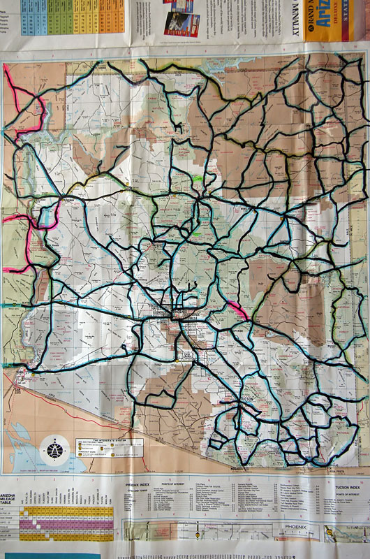
This map of Arizona has been with Caroline and me since shortly after moving to Arizona in 1995. The dark black lines are the roads traveled to date. A few other roads have been taken but are not highlighted as I drove them myself without Caroline; this is a record of our Arizona travels made together. When we bought the map, some roads weren’t paved yet, and some roads didn’t exist. There are some short segments we haven’t taken, although we have driven all of the surrounding roads, and as of yet, we haven’t returned to close those gaps. Often, we have seen so much of an area that we are certain the short road won’t show us any more than that which has already been seen. This weekend, we will fill in a small area of dirt roads around Willcox, Arizona. November 11 and 12, we will drive the Buck and Doe backcountry dirt road from Peach Springs to Grand Canyon West before we visit Meadview, Temple Bar, Pearce Ferry, and the ghost town of Chloride. On this trip, we will also return to Oatman – another ghost town, this one on old Route 66 to take the gold mine tour we missed out on a previous pass-thru. After that, there is an area on the Tohono O’odham Indian Reservation left to visit, along with a 25-mile road through the Colorado River Indian Reservation.