Map of our U.S. Travels

Map of John Wise and Caroline Wise's travels across America

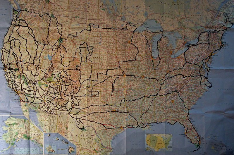
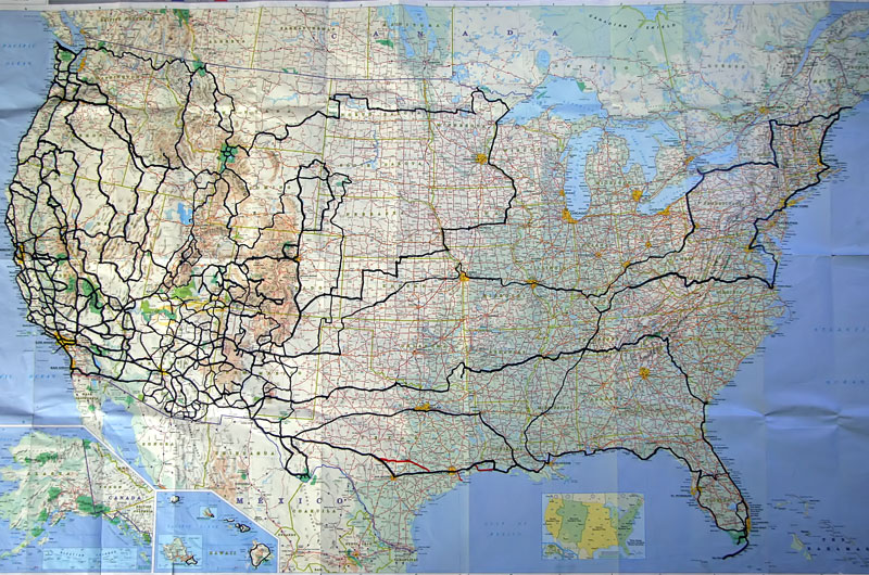
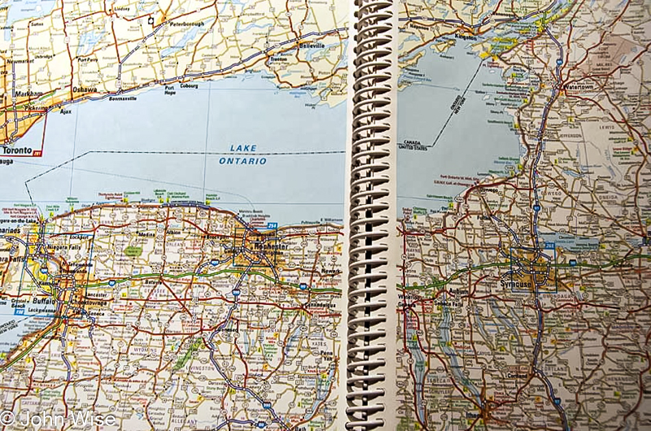
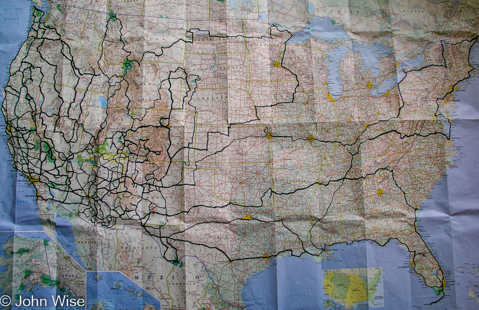
It’s been 18 years since we started tracking our travels on an old Michelin map. While we’ve been to all four corners, the geographical center of the United States in Lebanon, Kansas, and been to some places such as Yellowstone nine times and the Oregon coast probably more than that, there are still vast swathes of America that remain unseen to us. Large parts of the North and South Carolina coasts have not been explored yet along with small segments of the Texas, Florida, and New Jersey shorelines we’d still like to visit. The Great Plains could certainly use some work, along with the Southern States. We’ve been to the majority of the Hawaiian Islands and while we’ve seen Alaska from Anchorage to Fairbanks and from Juneau to Haines, that is one state that would require two lifetimes to see it all.

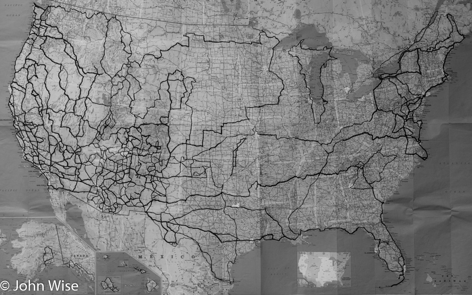
I used an infrared filter on the image to turn it black and white as it brought up the darker highlighted roads we’ve traveled and brightened the state outlines making them easier to see, should you be wondering why this photo, in particular, was chosen to be presented sans color.

Arizona Road Map of Our Travels

Map detailing the travels of John Wise and Caroline Wise in the state of Arizona

Yesterday’s blog entry spoke of the difficulty in finding roads we’ve not traveled before in Arizona. Looking up the last time I posted a map of our state I see that I’ve never shared it, so here it is. I believe this is the first map of Arizona we purchased back in 1995 after moving from Frankfurt, Germany to Phoenix, the copyright date is 1994. The routes in various highlighter colors I think might be when I thought each road trip could be its own shade, or maybe it was just the pen I found at the time?

Now that we have enough distance in time from some of the roads that have already been traveled we will be trying to fill in some of the small gaps such as paying visits to Sasabe, San Miguel, and Sells in the south. Alamo Lake in the west, Shumway, Ft. Grant, Mt. Graham in the east, and finally Temple Bar, Cove, and possibly the short road to Perkinsville up north. Everything else requires a four-wheel vehicle, not our Prius.

I’ll Take The Low Road

Map on the United States detailing John and Caroline Wise's travels

Two and a half years ago, I posted another photo of this map, which is quickly becoming more tape than paper. The map’s backside holds what must amount to yards of tape since the seams tend to fall apart after years of opening and closing this much-loved map. Many roads have now been traveled multiple times; our odometer will attest to the many miles driven north, south, and north again along the Oregon coast, for example. If you look closely and compare maps, you will see we have added a circumnavigation around Lake Michigan. In Maine we added Madawaska and Lubec to the list of furthest points outward that can be traveled in the lower 48 states; they join mile marker zero in Key West, Cape Flattery in Washington. By the way, we also found the geographical center of the United States, which lies in Lebanon, Kansas. Small sections of the eastern seaboard were driven, as was the shoreline of Lake Ontario and the St. Lawrence Seaway. We flew into Oklahoma City and made our way to Yarn School in Harveyville, Kansas, and prior to that spent the 4th of July in Canadian, Texas, visiting a rodeo and an old-fashioned town parade. A few small stretches of secondary roads in New Mexico were taken as prizes, adding to our road collection. Our upcoming travel plans will take us back to Oregon in November, Yellowstone in January, and the Northeast when my mother-in-law returns in April; not until next Thanksgiving will we likely see virgin road when we land in Atlanta, Georgia, for a road trip through the Old South. I don’t think many people outside of Presidential candidates will ever have the opportunity Caroline and I have made for ourselves to see so much of this great, big, beautiful country

Anywhere Left?

Map of Arizona with John and Caroline's travels highlighted

This map of Arizona has been with Caroline and me since shortly after moving to Arizona in 1995. The dark black lines are the roads traveled to date. A few other roads have been taken but are not highlighted as I drove them myself without Caroline; this is a record of our Arizona travels made together. When we bought the map, some roads weren’t paved yet, and some roads didn’t exist. There are some short segments we haven’t taken, although we have driven all of the surrounding roads, and as of yet, we haven’t returned to close those gaps. Often, we have seen so much of an area that we are certain the short road won’t show us any more than that which has already been seen. This weekend, we will fill in a small area of dirt roads around Willcox, Arizona. November 11 and 12, we will drive the Buck and Doe backcountry dirt road from Peach Springs to Grand Canyon West before we visit Meadview, Temple Bar, Pearce Ferry, and the ghost town of Chloride. On this trip, we will also return to Oatman – another ghost town, this one on old Route 66 to take the gold mine tour we missed out on a previous pass-thru. After that, there is an area on the Tohono O’odham Indian Reservation left to visit, along with a 25-mile road through the Colorado River Indian Reservation.

Map of Our Travels

United States map with black highlights showing the roads Caroline and I have travelled over the past six years

Since early 2000 we have kept track of the roads we have traveled across the United States on this map. When embarking on new road trips we intentionally have chosen roads not driven before. In Arizona there are very few roads we have not explored, in Nevada, there is one major highway traveling east-west we have yet to undertake. The dense area of the southwest is approximately the size of Continental Europe and has been easy enough to cover on short two to five-day drives. The journeys to the eastern U.S. typically require a minimum of two weeks and hence our travels to the eastern seaboard have been rather limited. This coming weekend we will be adding some new highlights in New Mexico, Colorado, and Texas as we head to Canadian, Texas, for the 4th of July.

Itinerary Building

Closeup of map section featuring Buffalo, New York

All free time is being given to building the itinerary for Jutta’s visit to the United States in May. Caroline’s mom should land in Phoenix, Arizona, on May 13th and will have nearly a week to get over jet lag and allergies from coming into this dry state. On May 20th, we will embark on a cross-country trip that will take us to Niagara Falls, Vermont, New Bedford, Mystic Seaport, Statue of Liberty, Central Park in New York City, Lancaster in Pennsylvania to visit the Amish, Washington D.C., Chesapeake Bay, Cape Hatteras, the Smokey Mountains, Natchez Trace Parkway and a few other stops in-between.

More about my mother-in-law’s trip will be posted soon.