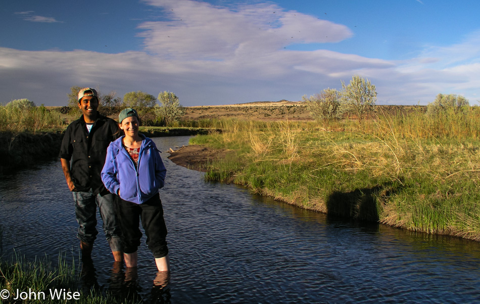
Saturday at 6:30 in the morning, with a light rain breaking up in the face of the approaching sun. We’ll only be in this small corner of Missouri briefly today. Five years ago, Caroline and I were just 63 miles south of here in St. Joseph, Missouri, after having visited the hometown of Amelia Earhart in Atchison across the Missouri River in Kansas. It was that beautiful stretch of river that had me penciling in this corner of Missouri in the hope of reliving a moment from that earlier cross-country road trip.
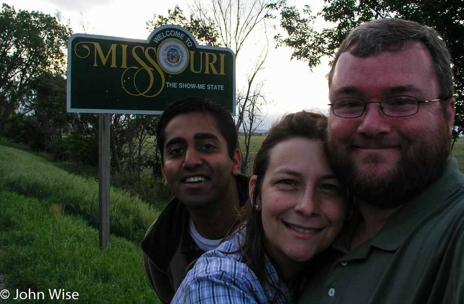
Crossing into Missouri last night, we never had the chance to stop for our photo in front of the “Welcome to Missouri” sign, so we took this opportunity to snap a photo of us leaving.
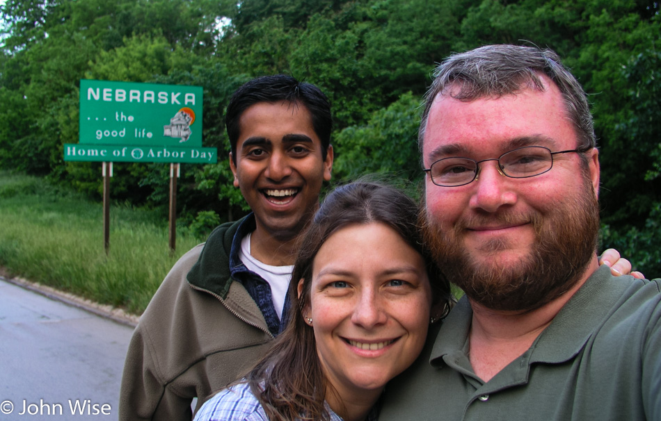
Turn around and blam, Nebraska. Barns offer the best clues to the fact that we are still in farmland. The small, still-sleeping town of Auburn strikes me with similar feelings that I experienced in Vinton, Iowa: I think I could live here. A wish is said that this great slice of Americana doesn’t disappear in the economic reality that drags life and business to the two coasts, laying waste to so much of Middle America.
The road between Auburn and Beatrice is 52 miles long, 52 miles of farms. The map shows that we pass through Tecumseh, Crab Orchard, and Filley, but we can find no distinguishing characteristics because the homes belonging to the barns are spread out to such an extent that the borders of these small towns are lost as we pass through. The other side of Beatrice is the reason this road became part of the path on our journey home.
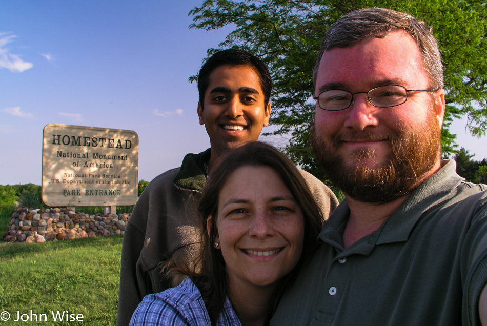
The Homestead National Monument of America is one of only three national monuments in this state without a single National Park. [Note from the future: Since 2021 this place is known as Homestead National Historical Park – Caroline] That’s not to say Nebraska is devoid of a rich history or beauty, as it can claim one national historic site, five national historic trails, and one national scenic river. So, if a potential visitor to Nebraska is wondering what to do and the trails of Lewis & Clark, the California Trail or the Mormon Pioneer Trail, Oregon Trail, and the Pony Express trail captivate your curiosity, this is a state you might want to consider visiting.

The Homestead Monument’s visitor center was still closed as we arrived, a common occurrence during this outing. The trail to the grounds of the monument was wide open, though, and without another soul in the park, we were able to wander the area undisturbed. Homestead was established to commemorate the Homestead Act of 1862, where nearly any man or woman could make claim to 160 acres of land granted by the U.S. Government to live the American dream. This site is one of the first homesteads claimed and demonstrates what the lands were like to the earlier settlers on the Great Plains. Of course, this doesn’t take into consideration that the lands were stolen from Native Americans to give to whites so our ancestors could establish supremacy while practically enslaving Indians or simply exterminating them. That ugly part of history doesn’t seem to make an appearance here, so we’ll just try to imagine that the indigenous inhabitants got bored hanging out with nothing to do and left for the Arctic or maybe a different planet.
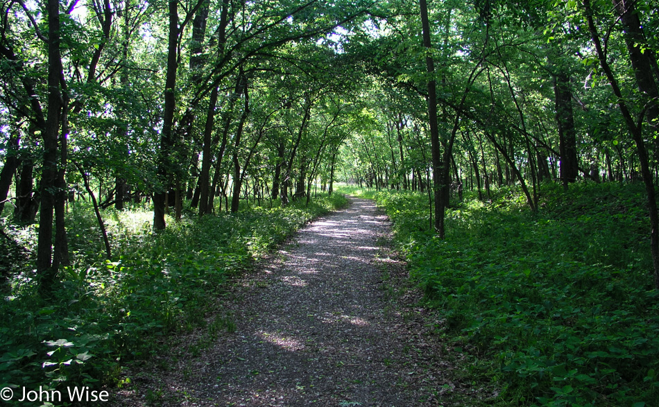
We entered the homestead through a woodland path next to a small creek. The forest is comprised of white oaks, green ash, osage orange, and cottonwoods which are surprising to us visitors who have imagined the Great Plains as desolate grasslands. The trail leaves the forest for a moment, taking us to the edge of the prairie before looping back into the thicket of plants, grasses, flowers, mushrooms, and the occasional frog.
The grasslands known as the tallgrass prairie that existed prior to their destruction for cattle ranching have been restored here. A 2.5-mile trail leads us around the extent of the prairie past grasses with names such as big bluestem, switchgrass, cordgrass, Indiangrass, and little bluestem. During our leisurely stroll, we hear creatures scurrying through the grasses, but they remain well hidden.
Every visitor should be so lucky to experience the quiet we did here at Homestead National Monument. We could listen to the faint breezes passing through the grasses while birds, frogs, and other small animals lend their voices and steps to embellish the perspective of history.
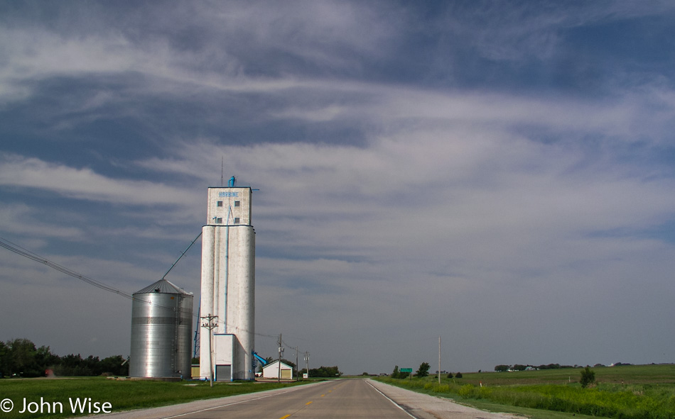
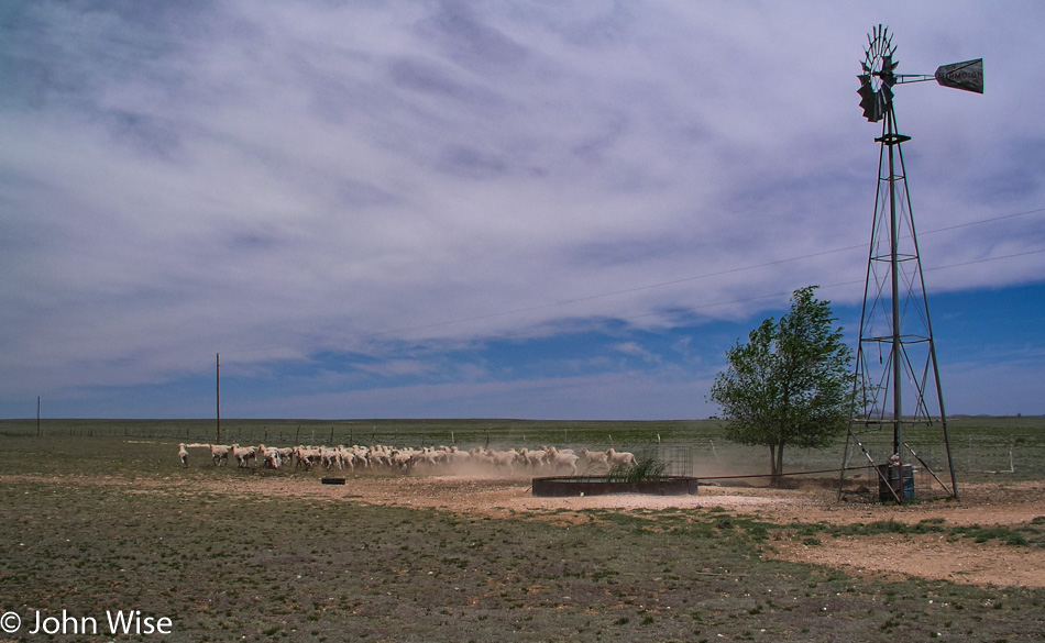
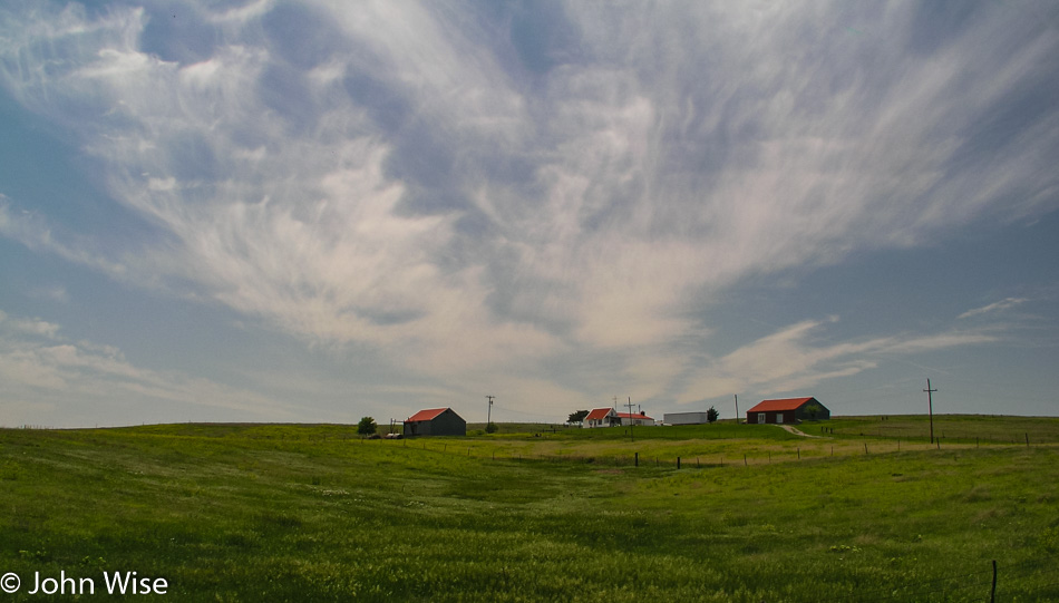
For a short stretch, the land is flat, as flat as a board. Only the recurring grain elevators stand off the horizon to give reference to anything being further ahead.
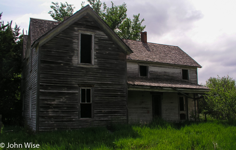
Little Blue River is anything but: it is brown, mud brown. Somewhere between Fairbury and Gilead, a little water tower stands over the landscape, almost in the middle of nowhere. As prolific as the grain elevators, community churches dot the landscape giving elegance to the barns, silos, elevators, tractors, and open space. Somewhere in all this openness along our current stretch of road, we stop at a deserted home.
The windows are gone, the sink is on the rear patio, and the barn has lost its purpose. Cows from a nearby farm stand by a salt lick checking us checking them out. Amongst the weeds, weed! A pot farm right here in Middle America. Well, that’s an exaggeration; it’s a few plants that, like the weeds they are, have taken hold next to the other weeds. They are scattered too randomly to have been planted with intent and soon will be large enough for someone to spot them here in the open, and he will probably remove them unless some unscrupulous teenagers find them first.
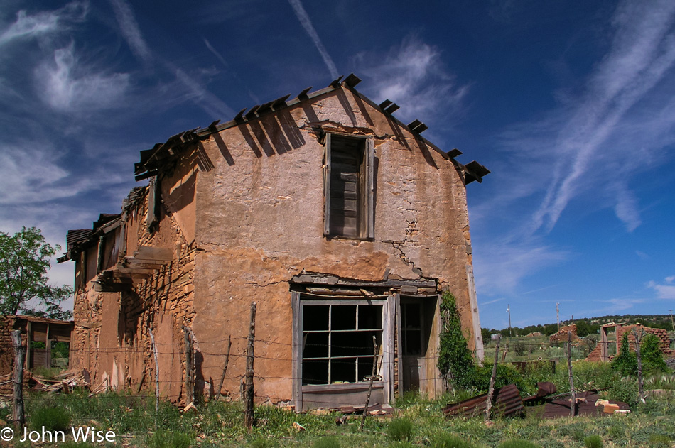
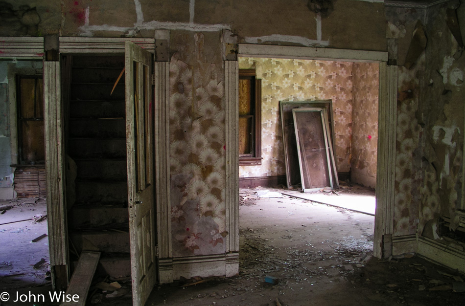
These abandoned homes convey many feelings to me as I pass them and occasionally explore one here and there. The paint inside is flaking, and the wallpaper is peeling; outside, the paint has usually been weathered away. These are reminders of other people’s lives who may have met with such hardship as to drive them away. Still, they hold fragments of memories and offer clues about histories that have joined the blowing dust.
Walking through the fading shells, I hope to see an old photo of the family or a fork or spoon once used during better times. Usually, the remnants of the inhabitants are long gone, replaced with the trash or graffiti of later visitors. The floors creak as I pass over them, and doors, when still attached, squeak when opened. Most always I find evidence of birds or animals that have taken refuge or made their own homes within these old homes. It will be a sad day when these relics are gone and replaced by our more modern homes made of plastics, wire, stucco, and cement.
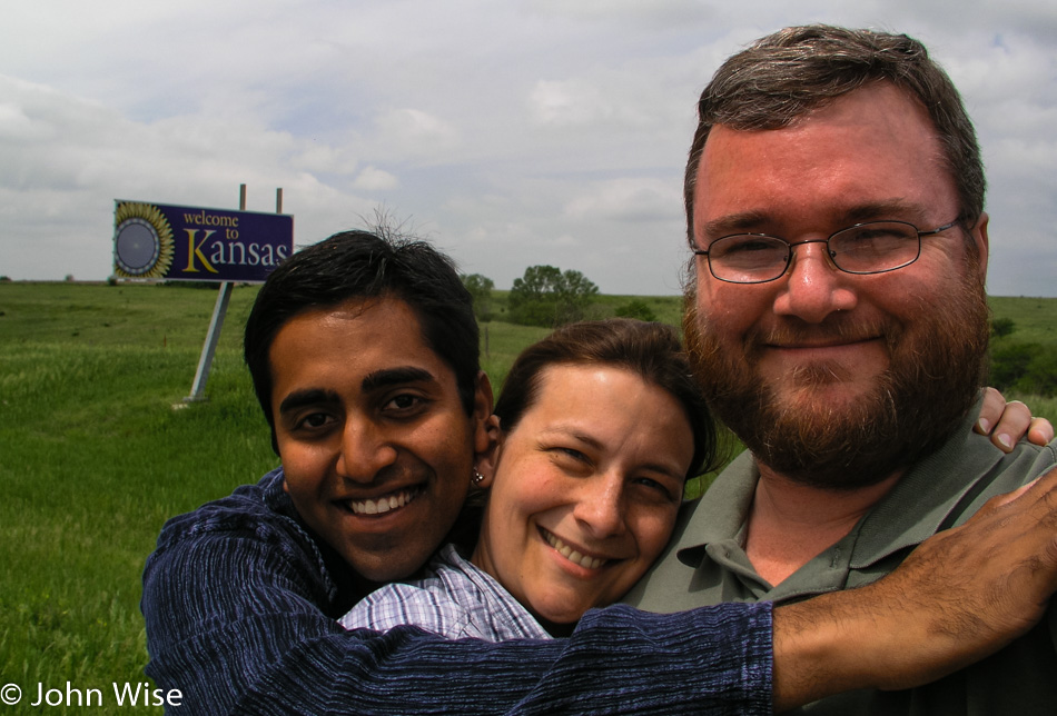
Our time in Nebraska has been short. Red Cloud is the last town we will pass through before turning south to make our way across Kansas. The Republican River crosses our path while we are southbound, but we can find no place to step into its muddy, shallow waters. Kansas greets us with its bright sunflowery “Welcome to Kansas” sign. We have now driven more than 4,600 miles, with more than 1,500 in front of us to finish between today and tomorrow.
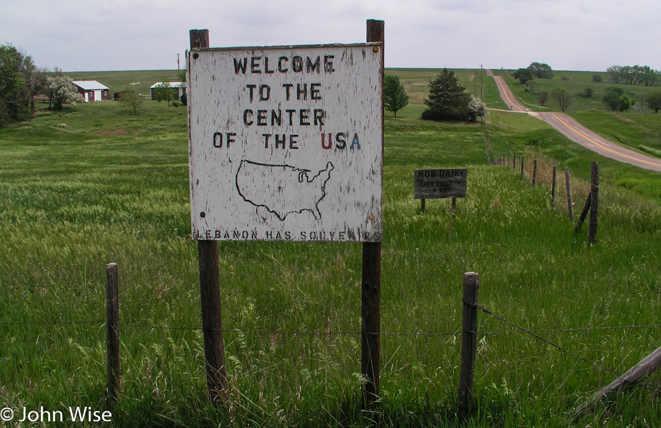
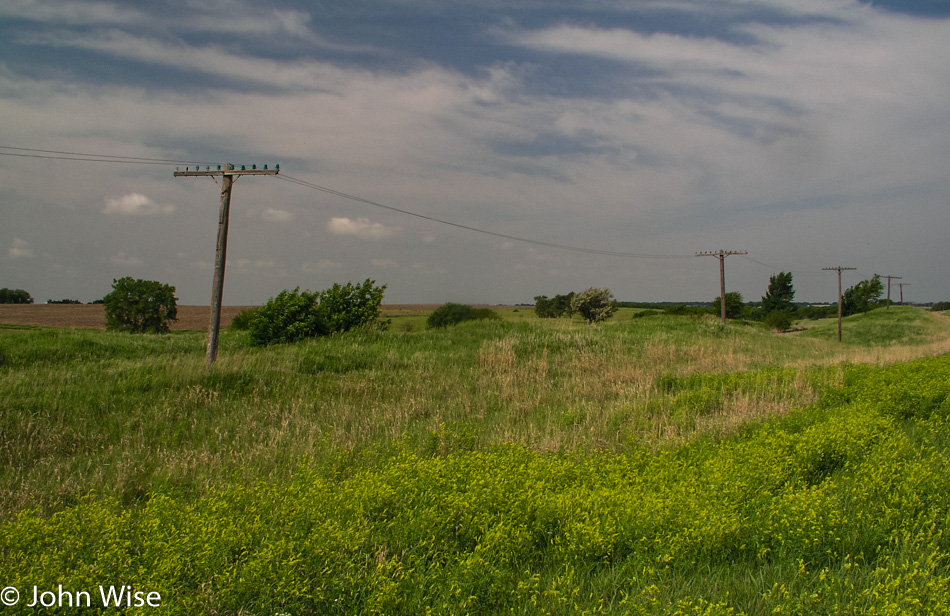
Entering Kansas the birds are singing, insects are buzzing, and the sweet smell of grass blows into the car as the wind works the fields into an ocean of waves. This is a fitting place for the geographic center of the 48 contiguous US states. A small monument stands in recognition of this claim to fame here, one mile west of Highway 281 and two miles north of Lebanon.
Out here in this flatness, we missed our turn. Not only did we miss our turn, but we missed it by 23 miles. The next opportunity to correct our mistake takes us through the nearly deserted town of Waldo, where most of the buildings appear empty. We stop at the outskirts of Plainville for gas and stop again at the corner of Main St. and Plainville after spotting a mailbox that lets us get rid of more of the postcards on their way to India, Germany, Arizona, and California.
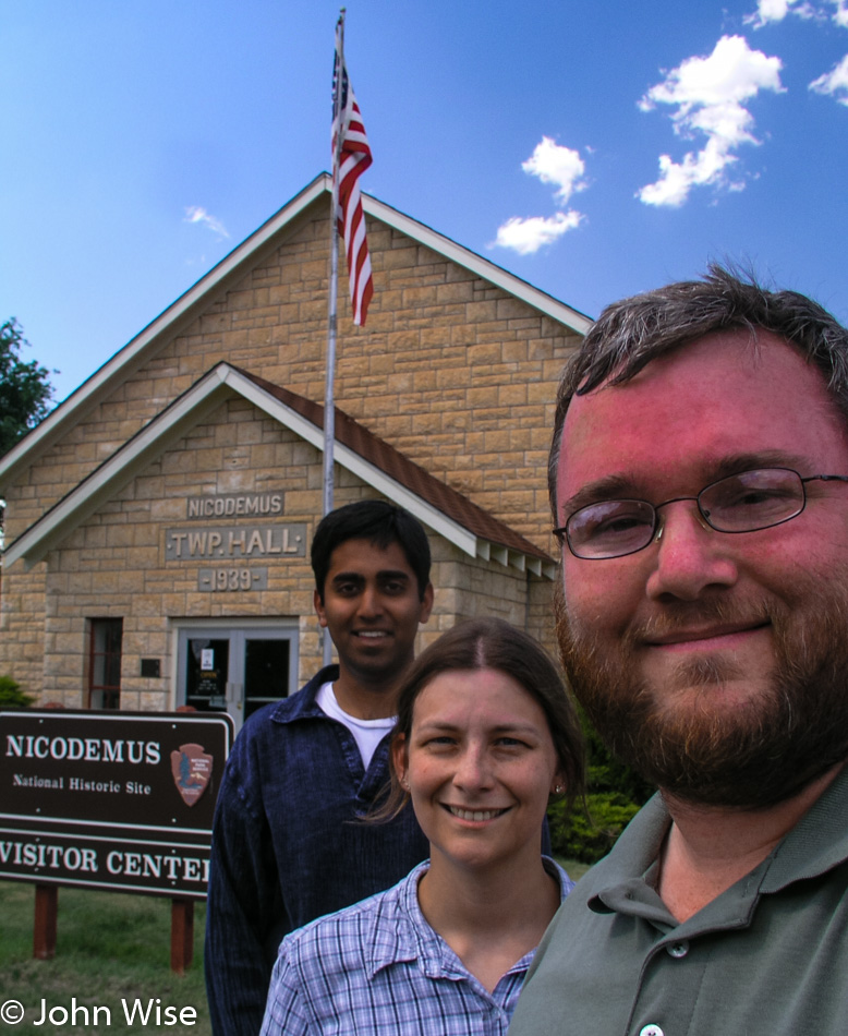
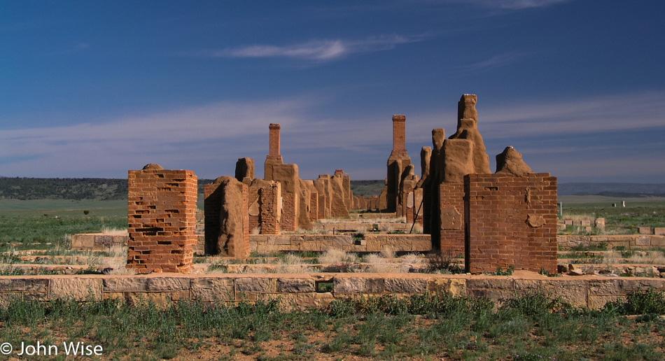
Nicodemus was where we were heading before our missed turn, and now we have arrived. Out west, this is the only remaining town established by African Americans following the Civil War. In September 1877, during the Reconstruction Period, Nicodemus was founded with people originally living in dugouts, like prairie dogs. By the spring of 1878, about 300 people were living here, and the town began to transform. By the mid-1880s, the town had grown to include two newspapers, three general stores, three churches, a school, an ice cream parlor, a bank, homes, and a few hotels.
A hoped-for rail line was laid south of the Solomon River but too far to be of benefit, and Nicodemus began its long slow decline. African-American cowboys, soldiers, miners, farmers, and business owners who had gotten their start in Nicodemus long maintained a bond with the community and for years celebrated the last weekend in July in Nicodemus with “Homecoming.” Homecoming originated as Emancipation Day, observing the freeing of the slaves from the West Indies; the celebration became Homecoming and has endured for over 100 years.
The town continues to exist today, with a small handful of residents holding fast to ensure the town doesn’t die. The National Park Service in 1996 established Nicodemus as a National Historic Site. The five remaining historical buildings can be viewed on a nice walking tour of the community. The visitors center is now located in the Township Hall with the four other buildings awaiting restoration work.
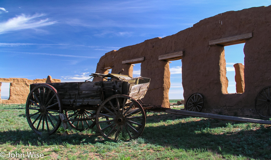
Our tour of the town starts at the old St. Francis Hotel and leads past an old playground at a corner park. The next stop is the boarded-up African Methodist Episcopal Church. An old barn is the home of some friendly enough pigs that have taken up residence under the floorboards. A dozen of them come out to greet us, looking hungry; without a food offering, they soon lose interest and head back under the shady building.
The First District School is the last building at the edge of town. Some minor restoration work has already begun on the school to stop its collapse until further funding can be found. A rusty swing set, slide, and jungle gym look unused for more than a generation. The skies are beautiful today over Nicodemus; it is easy to see why, after the town had some roots, people would want to call this home.
The streets of Nicodemus are growing grass, and the signs are close to falling down. The walk down these historic roads is a solemn one, and my thoughts turn to wonder at how life had once tried to flourish here. The last historic building on the west side of town is the First Baptist Church.
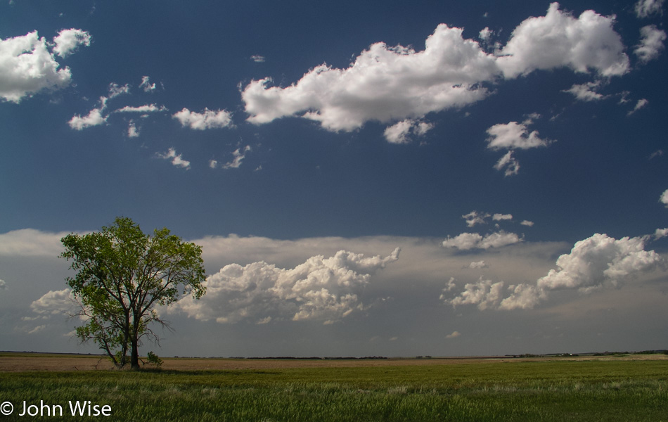
Back through the playground for a final stop at the Township Hall and we strike out once again on this extraordinarily flat land. From here to the border of Colorado, we pass through the flattest of land driven during this trip. Windmills, the occasional tree, fluffy clouds, and some blowing dust crossing the highway keep us company. Another grain elevator, some horses, green grasses against a blue sky, the sun lowering over the flat horizon, and we are now close to Colorado.
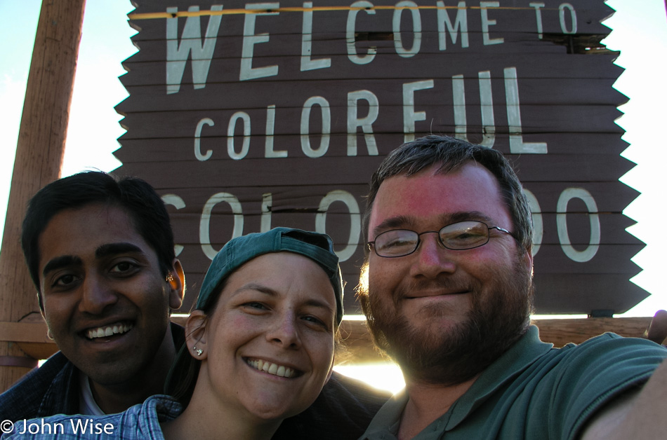
Before crossing the state line, we re-enter Mountain Time and gain an hour. It’s 7:00 p.m. as we drive into Colorado, and a plaque next to the road commemorates that we are on the Santa Fe Trail that ran through this very spot from 1822 to 1872. This road that took various peoples to a new life out west is a road typifying the pioneer spirit and America’s love of the freedom to go.
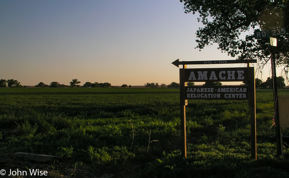
Twenty miles further down the road, that ideal came to an abrupt halt for 6,285 Americans of Japanese descent and 1,033 Japanese immigrants who were interred at the Amache Relocation Camp, also known as a concentration camp. Starting on August 27, 1942, American authorities, who had begun the roundup of all people with Japanese features, began filling this camp in Colorado as they were also doing in California, Arizona, Utah, Idaho, Wyoming, and Arkansas.
This 10,500-acre camp, with the smallest population of “Japs” of the camps, was ultimately closed on October 15, 1945. At its height, the camp had its own newspaper, school, medical facility, and general store. The barracks were 120 by 20 ft., with a family of seven or less assigned a room of 20 by 20 ft., allowing for six apartments per barrack. With the end of the war and the publicizing of the Nazi concentration camps, America moved with haste to eliminate all remnants of its own concentration camps. Bulldozers came in and stripped the lands bare, removing streets, buildings, gardens, schools, guard towers, and camp fencing.
Today, only a few foundations still exist. The old roads are now graded so visitors can gain some understanding of the layout of the camp. Trees that were not knocked down grow in such a pattern as to show the deliberation they were planted with next to a structure that no longer exists. While the foundations are cracked with weeds making their way through the former floors, it doesn’t take a lot of imagination to see what had been here.
As time goes by, remnants of the land’s previous occupants are making their way out from under the plowed land. Rusty cans, a forgotten sign, part of a ceramic pipe, another can with still legible type pokes its way out of the earth. Some of this may be trash blown in or dumped here as the years have gone by; some might be the artifacts of a blemish to America’s sense of dignity and fairness.
The sign to Amache is small and easy to miss; the road number is not to be found on two maps of Colorado we own. Finding information on the Internet as to the precise locations of the camps across the western U.S. is difficult to ferret out, suggesting a lingering embarrassment regarding their existence. The street signs in Amache identifying the blocks have mostly been stolen; a couple lay in the grass, hiding from casual visitors.
For sure, these were not death camps; medical experimentation did not occur at these sites. But the involuntary confinement and denial of the rights owed to each and every American were callously trampled by our country’s long history of xenophobia and the general hysteria that accompanied the bombing at Pearl Harbor that put into action the establishment of these camps.
The sun sets on Amache in this lonely corner of Colorado on a forgotten piece of land whose tragedy demands we do more to honor those who pay with their very freedom for the rights the rest of us enjoy. Some of us may fight for our country, but what is the sacrifice of those imprisoned without the chance to fight, who are isolated and robbed of their dignity, and whose children grow up knowing the hatred of the majority surrounding them? What is their contribution to the fight to make a more just and humane society from the cruelty that has so often been put upon those in these lands whose only offense is that they are different? Visiting a Concentration Camp can either make you stop and think or, as is demonstrated from the damage here at Amache, make you reach out and try to wipe this out of history.
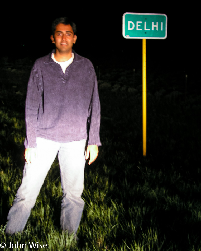
Most of the driving in Colorado is at night; tomorrow, we have to be back in Phoenix, and with nearly a thousand miles to go, any miles we can finish today will make tomorrow’s trip all the better. Jay has some nostalgic feelings along this road south as we pass Delhi. We try to grab a photo, but it is as dark as dark gets, and the city sign reflects too much light to be able to effectively take a good photo. Compared to its namesake on the other side of the planet, this Delhi here in Colorado might have 50 people living here.
We end the night in Trinidad, Colorado. Tomorrow, we will gain another hour crossing back into Arizona and will finish the final 715 miles of driving before climbing into our own beds again.