New Mexico, Here We Come!

Trump Supporters in Show Low, Arizona

Like Satan diving into holy water, we are genuinely concerned about outing ourselves as the enemy were we to walk through the doors of The Trumped Store here in Show Low, Arizona. Claims of the best coffee in the area and the promise of hotdogs were not enough of a draw for us to cross the street and pay a visit. In these days of diminished retail presence, someone is making enough money selling Trump paraphernalia to have been planted on this main thoroughfare through town for years now. My favorite part of this enterprise is a quote from their website where grifters are grifting the grifter:

“The products sold by company are not licensed, introduced, or otherwise authorized or approved by President Trump, His Campaign or by any of its affiliates; and President Trump’s Campaign Committee does not receive any proceeds whatsoever from the Trumped Companies Sales or Activities.”

East of Show Low, Arizona on U.S. Route 60

Out of the ugly and into the beautiful. Truth be told, that stop in Show Low was a minor speed bump because the road northeast of the Phoenix area was as spectacular as it always is. There are no photos from that leg because we’re entertaining the idea that instead of spending the night in Albuquerque, New Mexico, we might be able to make it all the way to Santa Fe. Leaving earlier than anticipated helps in this equation of covering the requisite 500 miles to reach this city sitting in the clouds at over 7,100 feet (2,194 meters).

Near Springerville, Arizona

It’s so easy to see the world reflected in the still waters lying upon the surface, but do you know how to see it in the eyes of the person you love? And how should you know with certainty that what you see in those eyes is a real representation of enchantment or a façade being presented for the sake of harmony but hiding deeper unhappiness? Maybe you don’t, but Caroline and I seem to have either reached a permanent delusional state of tricking one another, or we really do see the resonant frequencies of amazement in each other’s smiles when we stop to gaze at the exquisite sights that nature deploys upon those susceptible to such murmurs.

New Mexico State Line on U.S. Route 60

We left Phoenix seemingly minutes ago, and blam! we’re in New Mexico. These roads we’ve been traveling might be at risk of growing overly familiar, and maybe we struggle to find alternative routes to mix things up a bit, but that won’t stop us from these long hauls. After previous journeys that took us over Holbrook, Arizona, to Gallup, New Mexico, or when we skirted through St. John’s, Arizona, over to Zuni before taking the route south through Mogollon, New Mexico, then cutting over through Duncan, Arizona, we find a way so the adventures continue to pile up like so many stickers found on this State Line sign on U.S. Route 60. As for the nature of what brings us out this way yet again after having been in this Land of Enchantment twice already in the past five weeks: well, those exact details will have to wait until tomorrow when I share that story.

Pronghorn Antelope off U.S. Route 60 in New Mexico

We might have had better luck catching, dispatching, and cooking this pronghorn antelope than getting a proper dinner meal here in New Mexico because it seems everything other than fast food closes at 8:00 p.m. It was just a few weeks ago on our way to Gallup, New Mexico, for the Sheep is Life celebration that we were wondering out loud why we haven’t seen any pronghorn on that trip, and then here today, we finally see a solo member of the species hauling ass trying to race past us. While it finally put on the brakes and reversed direction faster than we possibly could have, we have to have respect for this antelope speeding well over 55 mph (88 km/h), making the capture of this photo taken by me in the driver’s seat tricky, to say the least. Little did I know that the pronghorn antelope is the second fastest land animal on earth, only surpassed by the cheetah by a mere mile or two per hour.

La Ventana Natural Arch in El Malpais National Monument, New Mexico

Prior to stopping here at the La Ventana Natural Arch in El Malpais National Monument, we dipped in at the Narrows Rim Trail that we hiked last year for some reminiscing. Back then, we didn’t hike the entire trail because we arrived at the trailhead late, and this has us dreaming of a return to the 7.3-mile out-and-back hike that brings you to a cliff across from the arch pictured here for a view from above. Enough of the sightseeing; time to finish the long haul to Santa Fe.

Another Southwest Experience

Breakfast at Baja Cafe in Tucson, Arizona

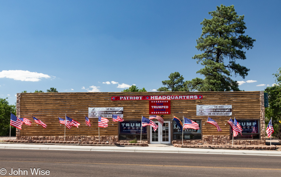
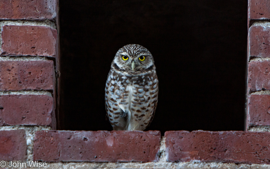
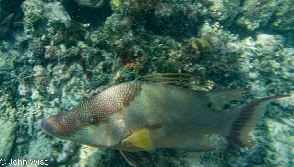
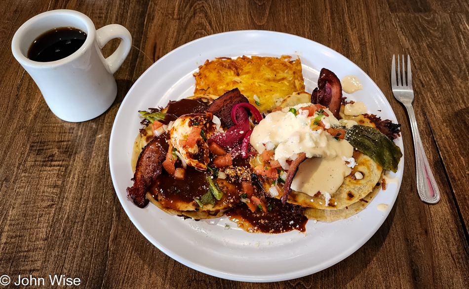
Breakfast entered the charts under the category of “wow” and, for the umpteenth time, triggered the big question: why are we living in Phoenix again? Baja Cafe in Tucson appeared on a number of Best Breakfast” lists. We thought Five Points Market & Restaurant was brilliant, and it was, but Baja Cafe ups the ante with some uniquely inspired creations, such as their variations on eggs benedict. From their menu, I’ll just share their exact description of the dish pictured:

Brisket Caramelo – Grilled crisp Caramelos stuffed with shredded brisket, tomatoes, chorizo, cheddar, and Jack cheese. Topped with two strips of corn husk smoked bacon, fire-roasted diced green chile, and two poached eggs. Finished with a combination of New Mexican red chile sauce and a smoked gouda cheese sauce, pico de gallo, cotija cheese, and pickled onions.

Last night at El Charro, upon hearing us talk about breakfast options in Tucson, our server recommended Baja Cafe and told us that one of his favorites there was the corned beef hash, so Caroline ordered it. We shared both plates and agreed that the corned beef hash was the best we’d ever had, while this play on eggs benedict will hopefully bring us back to try some of the other variations of this otherwise staid dish. After breakfast, it was time to hit the road.

South of Tucson heading to Sonoita, Arizona

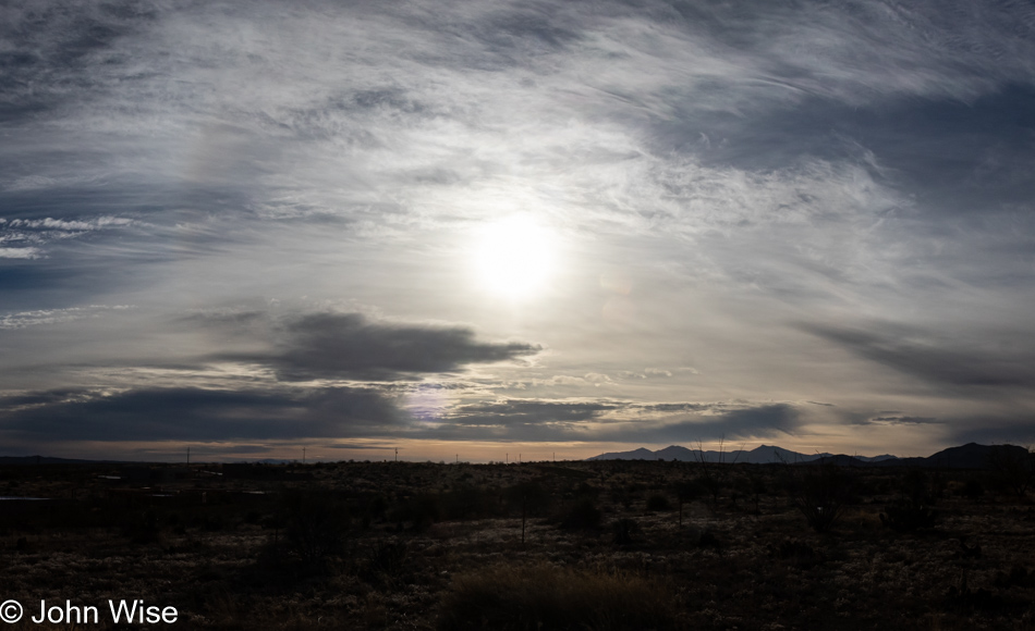
Leaving Interstate 10 in Vail in the direction of Sonoita on Highway 83, there were a couple of glimpses of sun, but for the most part, the sky just grew cloudier.

Heading to Sierra Vista, Arizona

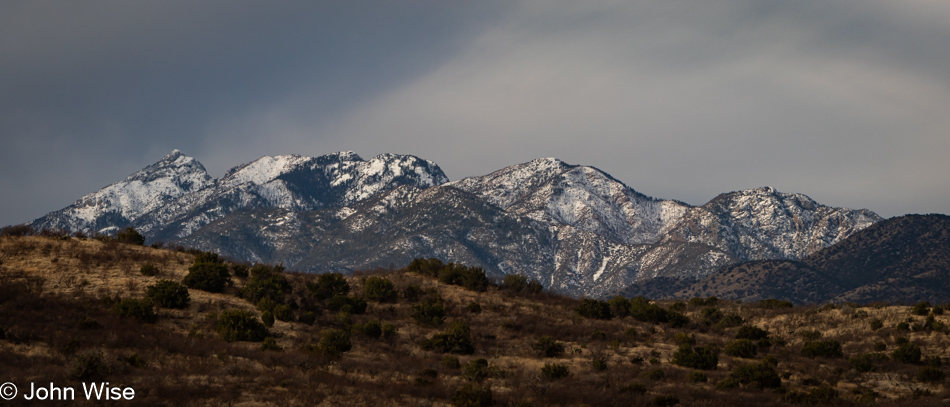
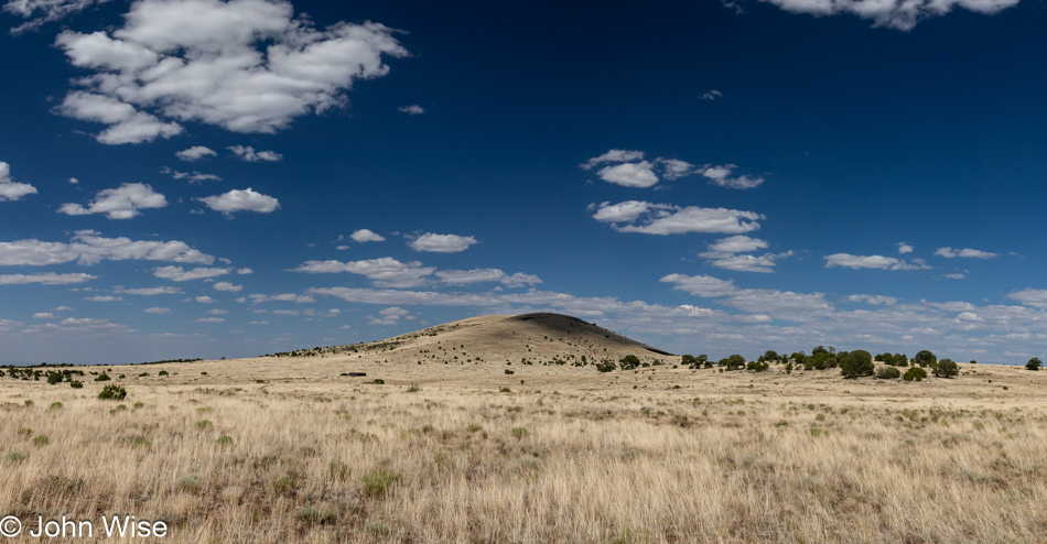
Even before leaving Tucson, we were drawn into the snow-covered mountains surrounding the city, with the exception of the west. The mountains in the other three directions had a healthy dusting of snow, which, for us central Arizona desert dwellers, is a sight for dry eyes. I had figured that the snow was going to be unique to Tucson, but I was wrong as seen right here just outside of Sonoita looking at Mount Wrightson.

Sierra Vista, Arizona

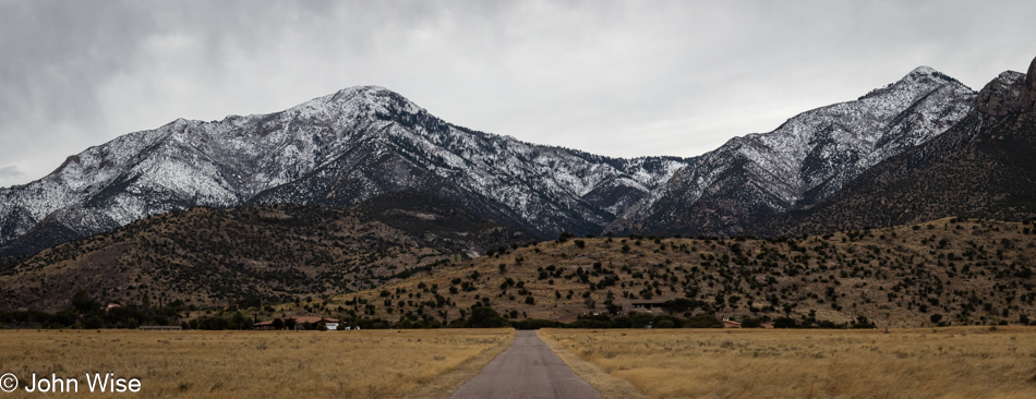
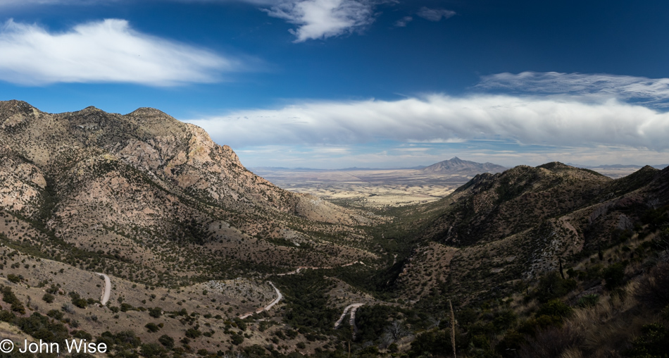
Our old friend Mal de Puerco joined us in the car, and under the gray skies with our seat heaters on, we needed a stop in Sierra Vista for coffee lest we find the car driving itself over the tan grasses more suited for grazing cows than napping pigs. The forecast calls for sun in the afternoon, and so before that, we’ll just mosey along with nary a concern about what to do next, except Caroline is nudging me that our 10-minute coffee stop has now stretched into nearly 30 minutes, so off we go on our trip further south. The mountain on the left is Miller Peak in Hereford, flanked by Carr Peak on the right.

Coronado National Memorial in Hereford, Arizona

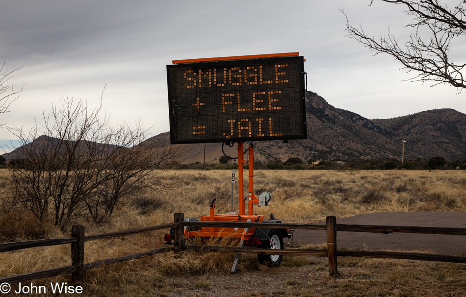
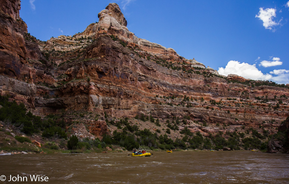
It was almost a coin toss regarding visiting Bisbee or Coronado National Memorial, but Coronado won since we couldn’t remember being there in the past 20 years. It turns out that it’s been almost exactly 20 years since our last visit because my blog showed us that it was back in May 2003 that we were last down here. Two things: back on the left, you can see a hint of blue sky, but the elephant in the room is, why is this sign reading “Smuggle + Flee = Jail” right before the entry to the park?

Caroline Wise at Coronado National Memorial in Hereford, Arizona

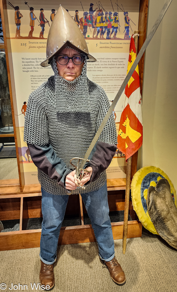
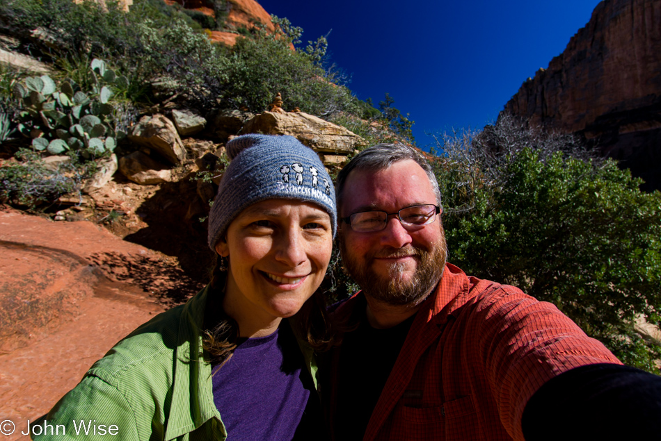
Ten years ago, in a land far, far away stood the imposing figure of Caroline the Warrior donning simulated battle gear at the Frankfurt Historical Museum, but today, we are in the land of Get Real, and you put on an authentic recreation or just get lost. Chain mail armor is heavy-duty stuff with an emphasis on heavy. After getting Caroline into that metal shirt, which felt like it weighed 30 pounds, followed by the mail coif over her head, she opted for the helmet of the Kniggits instead of the more fashionable mohawk style she wore in Germany. Click that link in the top line and scroll down to see what I’m talking about. It turned out that her glasses helped the helmet stay put because after she took them off, the weight of the steel helmet fell onto her nose.

Caroline Wise at Coronado National Memorial in Hereford, Arizona

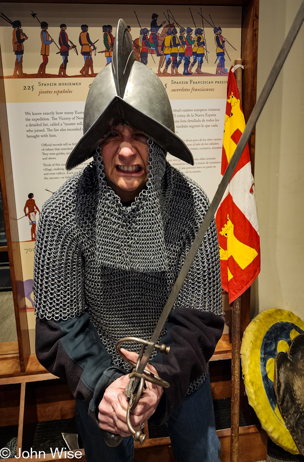
But with that, she was now angry enough at what I was putting her through that she was able to channel a fierce rendition of one of the soldiers traveling with Francisco Vazquez de Coronado back in 1540. Anyone else in the visitors center might have thought us drunken fools from our boisterous laughter. We were locked in side-splitting fits of laughing, the kind that starts to take your breath away and pulls tears from your eyes.

Coronado National Memorial in Hereford, Arizona

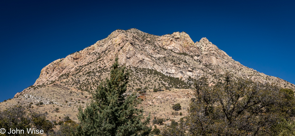
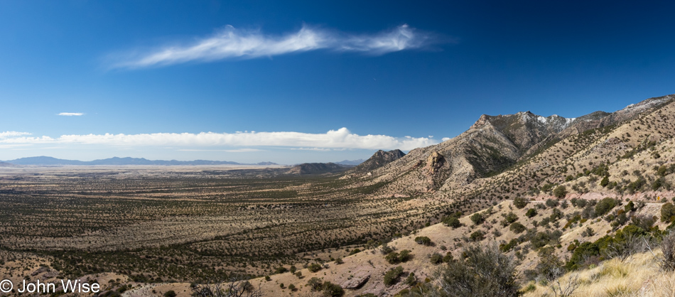
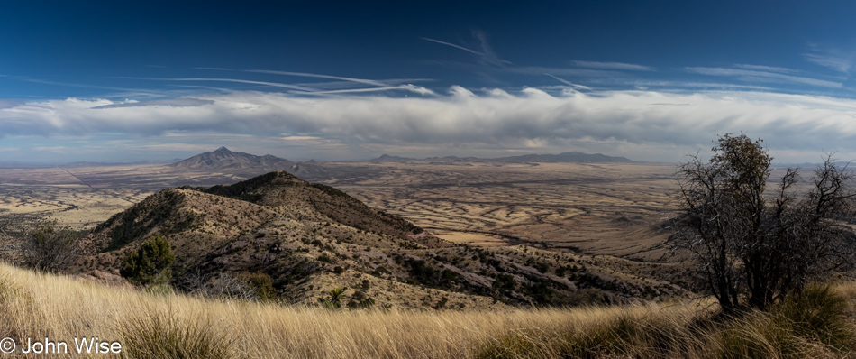
We expected the gray weather to continue, but after indulging in that roaring laugh attack, the weather gods must have recognized that we were ready for joy because when we went back outside, the sun had come out and stayed with us. The view is of Montezuma Peak behind the visitor’s center.

Coronado National Memorial in Hereford, Arizona

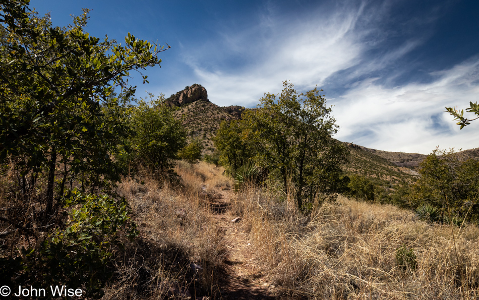
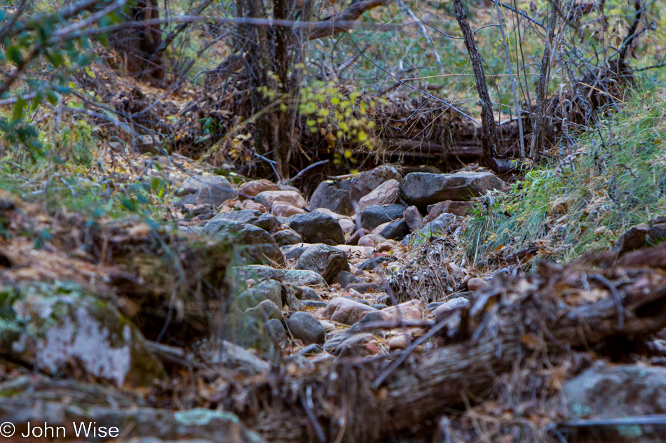
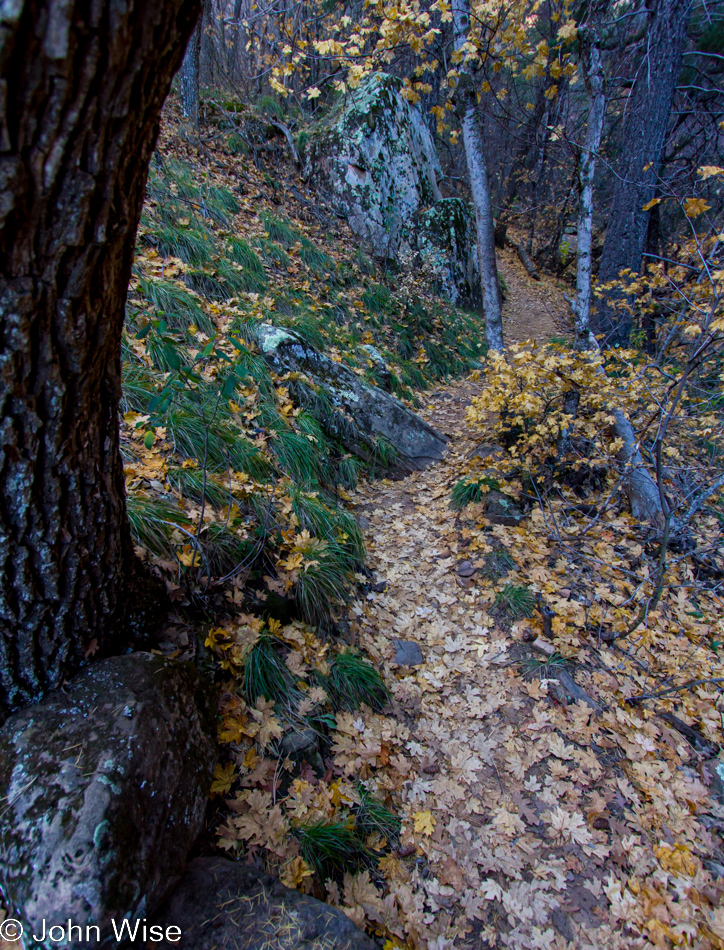
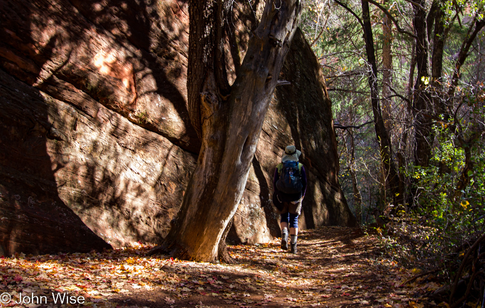
Armed with a Junior Ranger booklet, we took off to see how far we could get on Joe’s Canyon Trail, how far because when I enquired about steep dropoffs on the trail, I was told there might be a couple of spots.

Coronado National Memorial in Hereford, Arizona

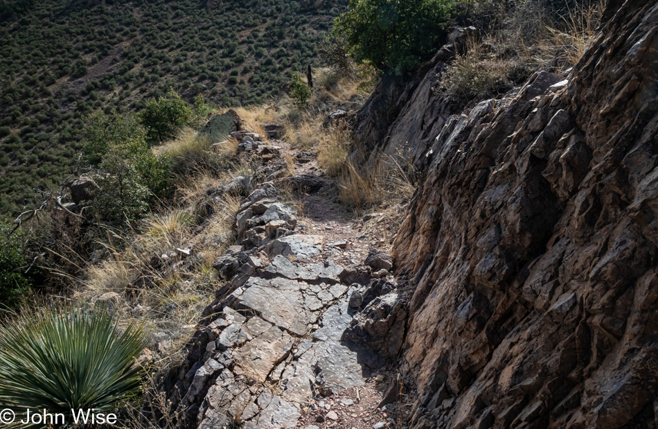
Somehow, I managed to get past this constriction, probably because I’d not had enough of the trail yet, and after more than a couple of months without any hiking, I desperately wanted some serious nature time, and with the weather cooperating, we needed to persevere.

Coronado National Memorial in Hereford, Arizona

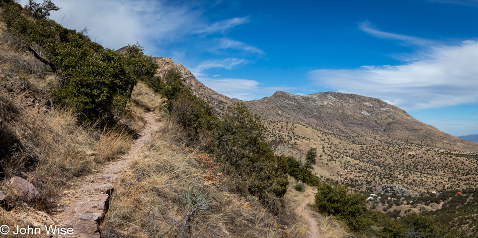
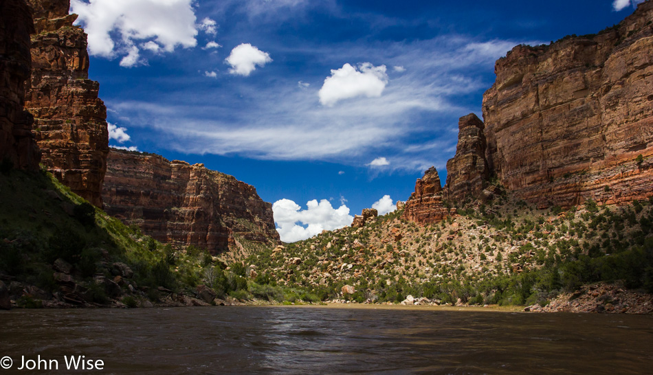
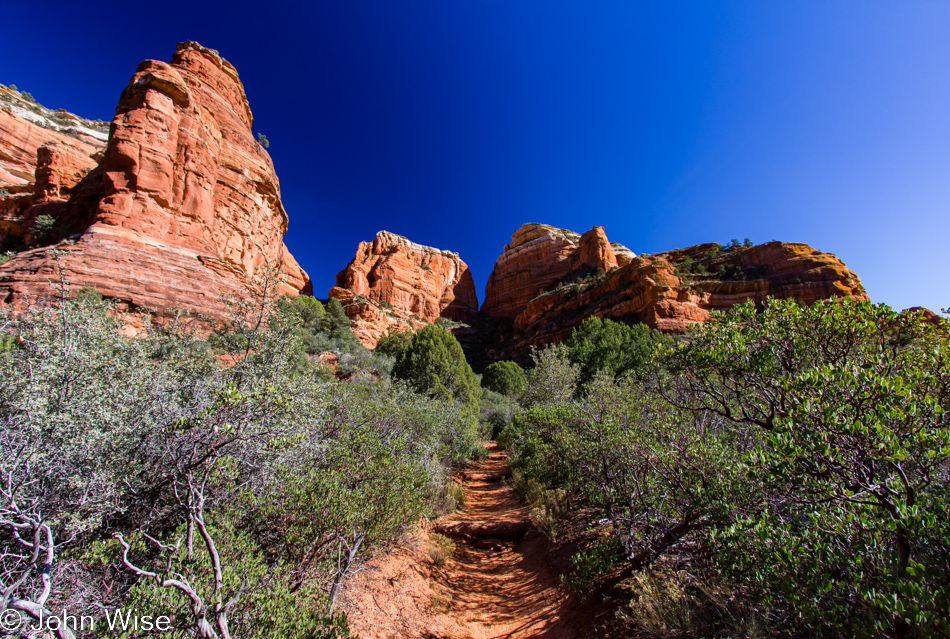
The views up here were spectacular, but after our time on this trail, we would drive up higher towards Coronado Peak and capture even better views of mostly the same sights, so I’m saving what’s out on the horizon until we get there.

Coronado National Memorial in Hereford, Arizona

We made it to about 600 feet of the 1000 feet of elevation gain Joe’s Canyon Trail should have delivered when I reached the limit of my ability to handle the narrowing trail, and at about 1.5 miles, we turned around for the hike back to the visitors center.

Coronado National Memorial in Hereford, Arizona

After our hike, we drove up to Montezuma’s Pass for what we would have both sworn was our first visit to this particular vantage point, but my blog would prove us wrong.

Coronado National Memorial in Hereford, Arizona

I hadn’t planned on taking our new car on dirt roads quite yet, but there we were at the base of the mountain, facing the choice of babying our pristine Kia Niro with only about 500 miles on it or seizing the day and conquering the mountain on a narrow rocky dirt path to Montezuma Pass and the Coronado Overlook just past that.

Coronado National Memorial in Hereford, Arizona

We were on a race against time as the visitors center down below was going to close at 4:00 and Caroline had to turn in her junior ranger booklet before that.

Caroline Wise and John Wise at Coronado National Memorial in Hereford, Arizona

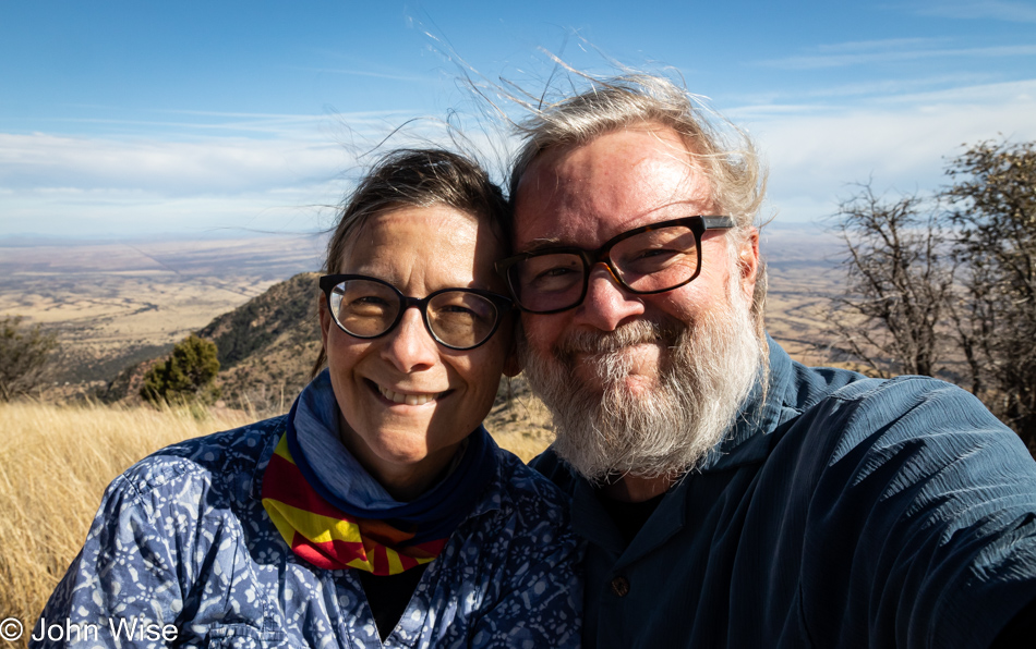
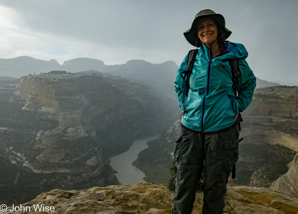
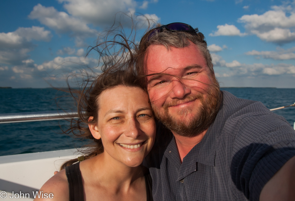
Good thing there was still time to take a selfie up here. The majority of the view behind us is looking into Mexico; I think it’s making me look old.

Caroline Wise at Coronado National Memorial in Hereford, Arizona

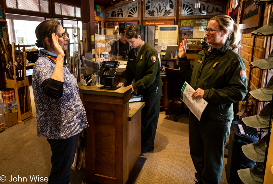
Caroline made it, meaning not only were we on time, but she possibly answered everything correctly. I say possibly because not a concern was paid about what she scrawled in the booklet which is unfortunate as she really makes an effort to do justice to the questions which, while aimed at children, require a serious bit of work. Her enthusiasm shows how seriously she is taking the honor of being sworn in as a junior ranger, even if it’s her 100th badge.

Miracle Valley, Arizona

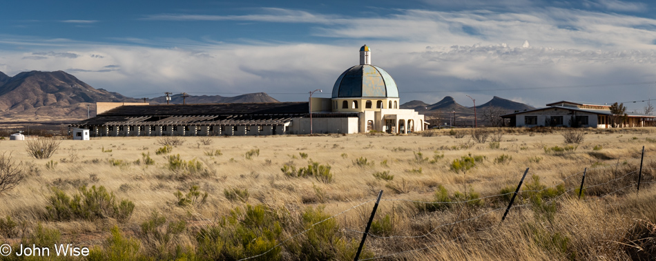
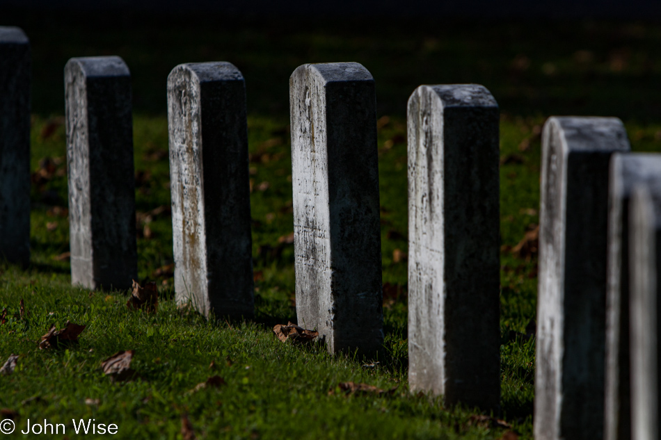
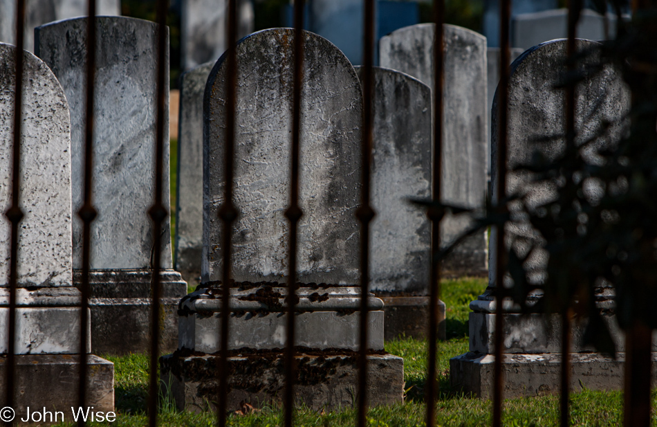
This is the Miracle Valley Bible Church and the site of a shootout between church members and law enforcement that occurred over ten years before the much more famous incident in Waco, Texas, involving the followers of David Koresh. Seeing this again today had me wondering what happened to the photos I took of this place a few years prior, and it turns out that I glossed right over them then because I was still deep in working on the blog posts that were detailing the last trip to Europe we had only returned from in the days prior to visiting Bisbee. Back then, in 2019, I had been invited onto the property by a gentleman who walked along with me, explained a few things about the site, and then allowed me to wander around and take photos. It’s about time for me to share those and get working on that post as soon as I’m done with documenting this weekend.

Miracle Valley, Arizona

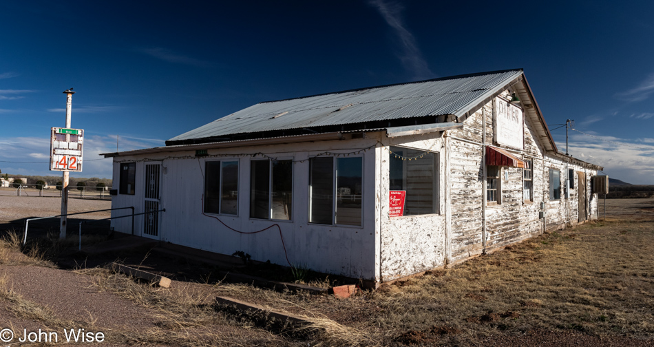
This is what remains of the Palominas Trading Post in Hereford that at one time hosted a gas station back when gasoline was only $1.42 a gallon, and, according to the bleached sign on the west side of the building, this was also a diner. Google StreetView shows the place still open in 2008, but sometime shortly after that, the sign fell down, the newspaper and ice machine disappeared and it has since remained empty. Coldwell Banker has been trying to unload the 2.3 acres and 2,700 sqft of decrepit buildings out in the middle of nowhere for $219,000. How this is valued at more than $1000 is beyond my imagination.

Whitewater Draw Wildlife Area in McNeal, Arizona

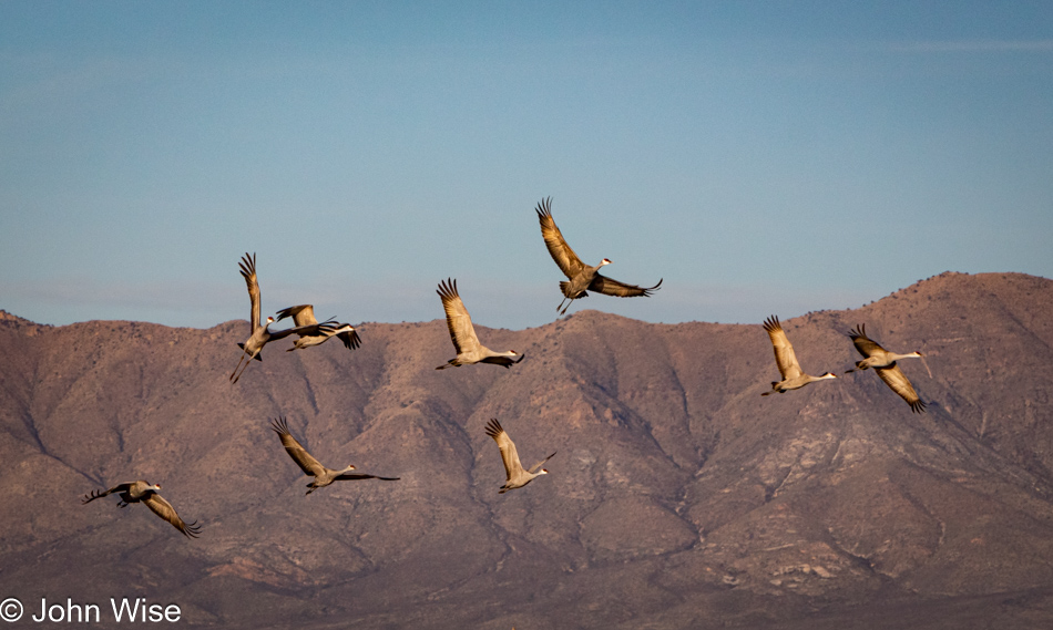
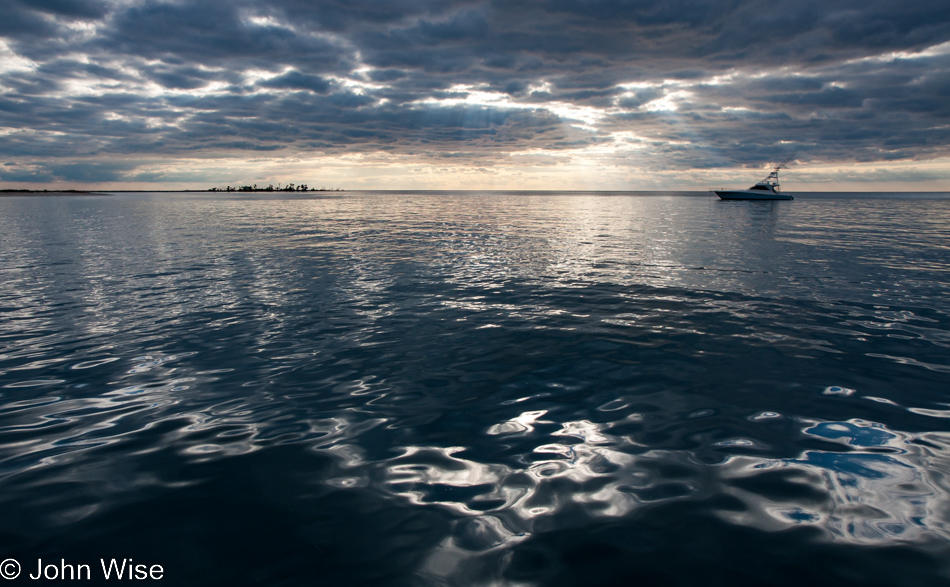
We had one more stop to make today before checking into the Gadsden Hotel down in Douglas and thought we should consider making a reservation for dinner just so they knew were desiring a table. We are at Whitewater Draw in McNeal, Arizona, where last year we saw tens of thousands of Sandhill Cranes; today, we see hundreds, but that’s good enough.

Whitewater Draw Wildlife Area in McNeal, Arizona

The barn that had been standing near the parking lot on the left last year has since blown down. It was also where the WIFI router for the Crane Cam was housed, so we had no way of looking at the scene prior to our arrival and finding out if the cranes were even on hand. Sadly, the front desk at the Gadsden also didn’t know the status of the birds.

Whitewater Draw Wildlife Area in McNeal, Arizona

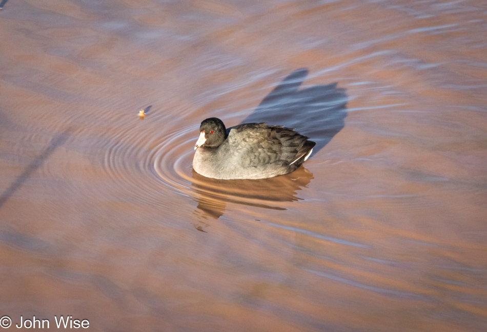
There were lots of ducks plying the shallow waters but getting a photo of one of them was difficult, near impossible, as they had their heads submerged under the surface the majority of the time.

Whitewater Draw Wildlife Area in McNeal, Arizona

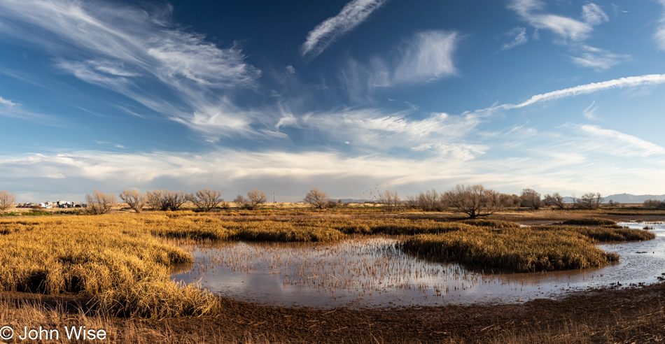
The shadows should let you know that it’s now late in the day, while the inability to see a millimeter into the water suggests it might be turning into a mud puddle in the next week.

Whitewater Draw Wildlife Area in McNeal, Arizona

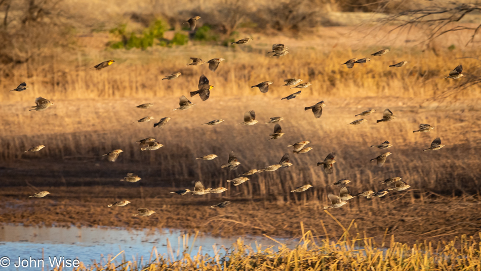
Good thing we got a reservation for 7:00 p.m. as we had time to hang out and were rewarded with seeing murmurations of the yellow-headed blackbirds. While we came for the sandhill cranes, it was those little yellow-headed birds that stole the show today.

Whitewater Draw Wildlife Area in McNeal, Arizona

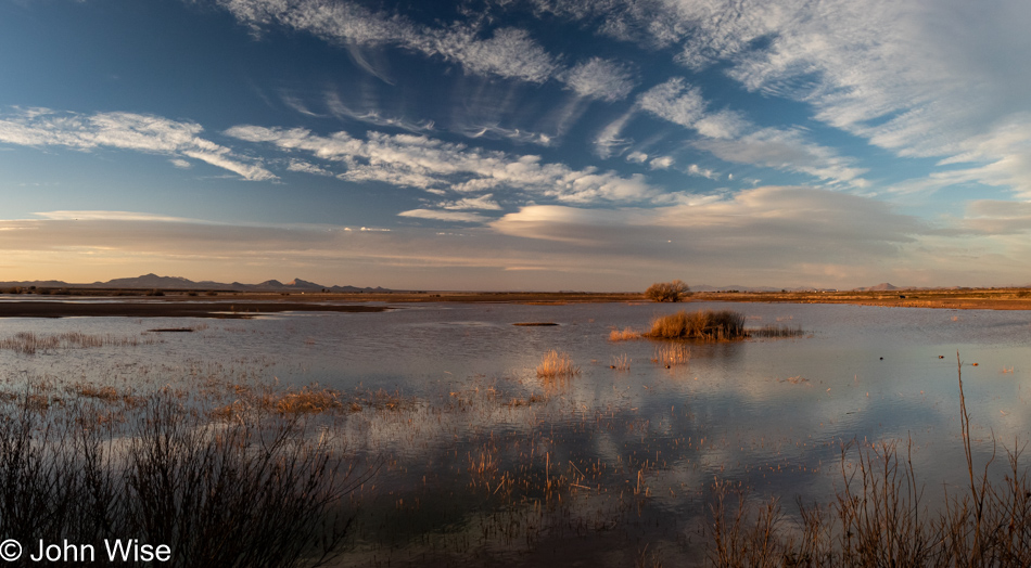
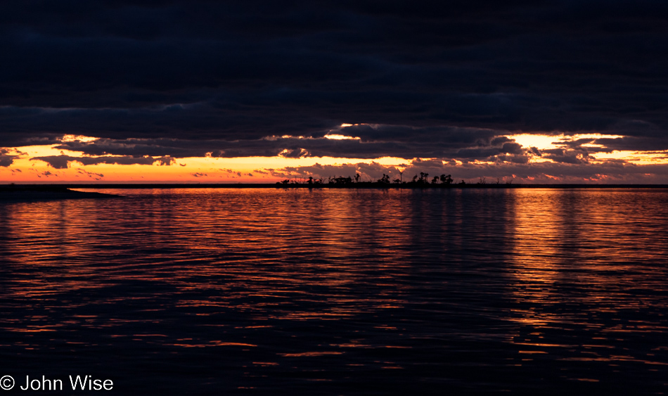
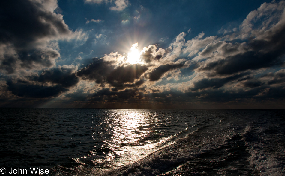
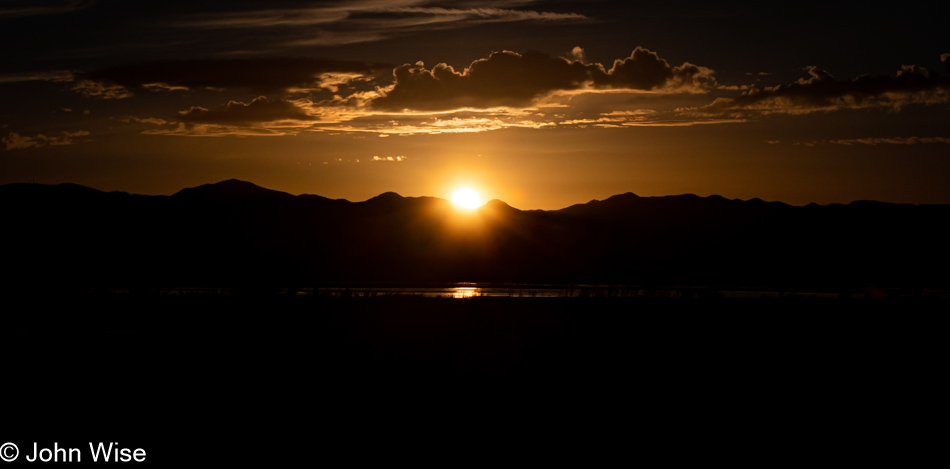
There’s a speck on the left that is one of the few remaining cranes flying away from the lake today, but that’s not what we were focused on; it was the sky and the reflections on the surface of the water.

Whitewater Draw Wildlife Area in McNeal, Arizona

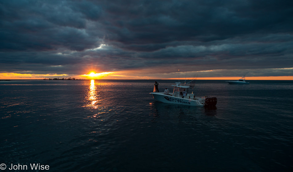
With sunset happening at about 6:20 p.m., I thought we’d have enough time to reach Douglas since it was only about 30 minutes away, but as we made our way towards the parking area, we saw and heard that a very large party of those Yellow-headed Blackbirds were making a commotion to the south of where we’d been. There were thousands of them jostling for branch space on a section of the lake in the late-day shadows.

Whitewater Draw Wildlife Area in McNeal, Arizona

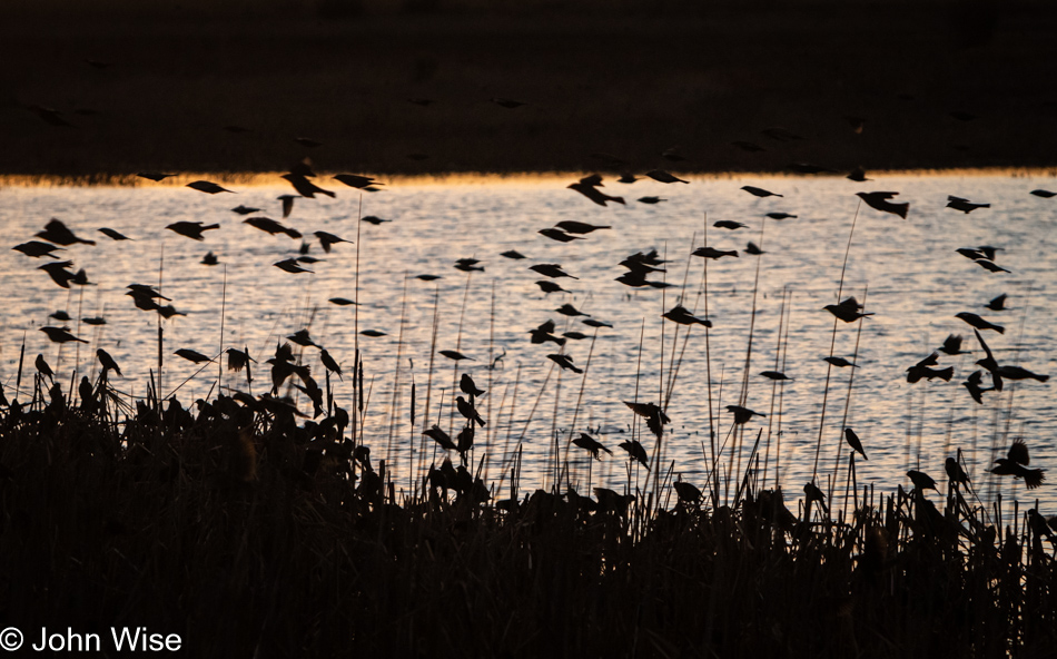
Only a tripod and an F/1.2 aperture lens would have possibly delivered a decent photo of those quick-moving little birds that were darting here and there before the thrush of hundreds of them would lift off simultaneously and readjust the position in ways we cannot begin to understand. Time to go south to our accommodation on the Mexican border.

Once we got to dinner, we were surprised to find that Cesar, who served us breakfast last year nearly to the day, was to be our server for dinner. When I saw him walk up, I remembered him immediately; it took him a solid 15 seconds to rebuild the memory. Cesar lives in Mexico and is still studying to be a nurse, just as he was last year. He’s since purchased a mirrorless camera and is getting deeper into photography.

Our room is a suite, and it’s spectacular. While my eyes are growing heavy as I try to get the more important impressions and details written down, Caroline has been luxuriating in the whirlpool in our room, and though I wish I could have been more prolific with the words, my eyes are falling shut as I push the computer to the side.

Yampa – Day 2

Caroline Wise on the Yampa River

Finished yesterday with a “minor” mishap. As we went off to sleep, we found out that my CPAP battery had given up its charge. Inexplicably, it simply appeared to be dead, and after the initial panic that I would be without my CPAP for the length of the river trip, we had to accept our new situation and hoped it would not interfere too much with the quality of our trip down the river. So far, so good, and here we are, all bright smiles and ready for whatever comes next.

Rafting down the Yampa

For something to happen, we must go forward in search of just what that will be. For those of us who have never been here, this is pure exploration.

On the Yampa River

Deeper into the canyons, our boatmen row while we indulge in the luxury of taking time to see our surroundings.

Cliff side details on the Yampa River

Close-up detail of the cliff in front of us.

Cliff side details on the Yampa River

The canyons and the rocks they are made from vary from corner to corner, and it is often the contrast between the types and colors that demand the greatest scrutiny.

Rafting the Yampa River

Those dark gray clouds portend something ominous in the distance. While it’s too early for a serious monsoon, it’s never too early for a good rain shower. Good thing that just a couple of hundred feet down the river can change your entire perspective; maybe blue skies are still going to arrive?

Kayaker on the Yampa River

We take an early camp so we can go on a hike; this is the view from where we are spending the night.

Plant life along the Yampa River

With our tents set up, Caroline and I wander around to investigate the area. The first plant to catch my attention was this juniper tree.

Plant life along the Yampa River

Sometimes, the beautiful depth of field and particular lighting are enough for me to post a photo to add visual memories to our journeys.

Plant life along the Yampa River

I could be mistaken, but I think this is a variety of sagebrush.

Trail for our hike along the Yampa River

As remote as this place feels and in spite of the fact that you can only get here by the river, there’s enough foot traffic to keep the trails clear and well-defined.

Plant life along the Yampa River

Just like I can never post enough photos of rivers, oceans, cliffs, animals, clouds, and Caroline, I can’t post enough of the plant life we find, either.

Panorama near our camp on the Yampa River

The sky grew dramatic and maybe even a little bit threatening.

Plying the Yampa River

It is warming the cockles to see a dory with its iconic form plying the waters in front of our camp.

On the Yampa River in Dinosaur National Monument in Colorado

Note: you can’t imagine my shock when here in the last 48 hours of 2023, methodically working through these blog posts and scanning for grammar inconsistencies and omissions, I discovered this, and the next two images had no text. There really is nothing to add as in the intervening years, we’ve not found any lost journals that could lend details to these days on the Yampa. 

On the Yampa River in Dinosaur National Monument in Colorado

Not the loveliest of weather for a hike.

On the Yampa River in Dinosaur National Monument in Colorado

Good thing there are lovely flowers along the trail; they’ll certainly appreciate whatever rain they can capture.

Caroline Wise on the Yampa River in Dinosaur National Monument in Colorado

Despite the looming clouds, our group decided to hike up to Wagon Wheel Point, which promised dramatic views over the Yampa. John decided to sit this one out because of his recently injured knee. Led by most of the guides, we hiked up the Bull Canyon Trail, which is relatively short but quite steep (about 500ft elevation gain in a bit over 1 mile). Once we had reached the canyon rim, we walked a bit further on what looked like an unpaved road to reach the overlook at Wagon Wheel Point. It was very humid but never actually rained, although there was lightning and thunder. Needless to say, we didn’t linger and turned around soon.

Plying the Yampa River

And then their travel companions brought up the rear as they went by effortlessly on the way to their camp.

NOTE: It’s now four years after we took this trip when I’m posting details for days 2, 3, 4, and 5. The brain is foggy, and while the pictures lend something back about the days, I’m left to a pure interpretation of them for the story. Caroline will have made a once-over on my writing by the time you are reading this and will have hopefully added some of her recollections, too. (May 9, 2018)

Yampa – Day 1

Caroline Wise and John Wise at the put-in for the Yampa river

Here we are, set to go out on our third river trip, this time on the Yampa and Green Rivers. Yet again, we’ll be traveling with our favorite boatman, Bruce Keller, as well as river friends Steve “Sarge” Alt and “First Light” Frank Kozyn. We first met all three on our Colorado River adventure in 2010, and Bruce has since then also been our guide on the Alsek in Alaska. Our put-in today is at Deerlodge Park in Colorado on the eastern edge of Dinosaur National Monument. Unlike our previous multi-week trips, this “little” sojourn will only be five days long. At Deerlodge Park, we pack up our dry bags, find a personal flotation device that appeals to us, go through a safety talk, and before we know it, it’s time to get to the business at hand.

On the Yampa river in Dinosaur National Monument Colorado

The brochure promised us plenty of sunshine, flush toilets, and feather beds. So far, our guides have certainly delivered on the first promise; we could not have wished for better weather. Back at the put-in, the terrain was relatively flat and for a moment did not portend that within an hour we’d be entering canyons, but here they are, and with their arrival, a rush of intrigue comes with this change in landscape.

On the Yampa river in Dinosaur National Monument Colorado

The passage narrows, and it starts to feel as if civilization moves further away from us. While not as expansive as the Alsek and not as deep and broad as the Grand Canyon, the intimacy of the Yampa here in Dinosaur National Monument is already allowing me to feel like this place is of a size that I can take in and almost comprehend.

On the Yampa river in Dinosaur National Monument Colorado

With the water getting a little choppier, the sense of being somewhere wild grows within. The adventure of the trip starts to take hold.

On the Yampa river in Dinosaur National Monument Colorado

Geological details surround us. This is about the time I started to dream of a trip without a schedule where we could pull up to the cliffside and examine the sandstone, look for fossils, or just hang out and bask in the location we are so lucky to be experiencing.

On the Yampa river in Dinosaur National Monument Colorado

It’s just past midday, and we’ll pull into our first camp early to give us plenty of time to set up our tents, build out the kitchen, do some exploring, or just chill out and enjoy the moment.

Lichen in Dinosaur National Monument Colorado

Our tent is up in minutes, and soon, we are out examining what’s to be found in our new neighborhood. Turns out there’s this gang of lichen hanging out, and while it looks soft and fluffy, looks can be deceiving. We also found a good amount of cacti giving us the stink eye, but no dinosaurs yet…..hmmm, I wonder if any of the other guests could be considered one?

Steve Alt (Sarge) and Frank Kozyn (First Light Frank) washing dishes off the Yampa river in Dinosaur National Monument Colorado

That’s Sarge on the left and First Light Frank on the right; they are the official dishwashers on this trip down the Yampa. I just dare you to try to come between these two former Marines and their dishes. They even travel with their own gloves.

On the Yampa river in Dinosaur National Monument Colorado

With the rafts tucked away for the night and our bellies full, the only thing left to do was sit around a fire and talk. Like all first days out on a river, this one came with most everyone cutting out early and catching up on the sleep they’d been deprived of over the previous couple of travel days as we converged on Vernal, Utah, where the trip first organized before heading to our put-in this morning. It’s great to be out here on a river again, wondering what big adventure awaits us around the next corner.

Hiking in Sedona – Day 2

Hiking in Sedona, Arizona

I need to note something at the beginning of this post that really should have been said on day 1 of this trip to Sedona: these three days of hiking north of Phoenix weren’t posted until 2023 because things slipped through the cracks. It’s been stated in other posts I’ve not always been diligent in keeping up with this blog and tragically, there were no notes about this adventure, so whatever is written here are musings pulled out of thin air.

Hiking in Sedona, Arizona

At the time we took this journey away from home, we were escaping the confines of being in Phoenix, which was becoming oppressive because, as I said on day 1 of these posts, we’d recently come off our first whitewater rafting trip down the Colorado River in the Grand Canyon. This was our way of repairing a small part of us missing being in nature.

Hiking in Sedona, Arizona

As I moved to post these entries, triggered by the creation of our massive travel index that’s been a work in progress, I’m looking at these photos for the first time in more than a dozen years.

Hiking in Sedona, Arizona

While the images are familiar, there’s also an otherness to them: I’m surprised by what I captured, such as with this particular shot.

Hiking in Sedona, Arizona

Other images might just be standard fare, such as a look at the trail we’re hiking out on, but seeing the colors of fall and reminiscing where we were at that moment in our lives is a pleasant re-encounter.

Hiking in Sedona, Arizona

Obviously, it was a beautiful weekend out here, and the views on the Boynton Canyon Trail were spectacular.

Caroline Wise and John Wise hiking in Sedona, Arizona

Considering this is one of the most popular short hikes in the area, the trail was not as quiet as yesterday’s, but as it was the day after Thanksgiving, people were probably spending time with family because it could have been a lot more crowded.

Hiking in Sedona, Arizona

I wonder if we revisited these trails today if they’d be overrun?

Hiking in Sedona, Arizona

Good thing that, at least pictorially, I’m at the end of the trail, which also means we’ll leave Sedona at this juncture to visit a place nearby.

Tuzigoot National Monument in Clarkdale, Arizona

This is Tuzigoot National Monument in Clarkdale, about 20 miles west of Sedona.

Tuzigoot National Monument in Clarkdale, Arizona

The pueblo was built over 600 years ago by the Sinagua people.

Tuzigoot National Monument in Clarkdale, Arizona

We spend a good amount of time here this afternoon following the trail down to the river that is the namesake of the Pueblo ruins. While we call it Verde River today, the old Tonto Apache name for the river was Tuzigoot, meaning crooked waters.

Dry Tortugas Day 2

Sunrise on Fort Jefferson on Garden Key at the Dry Tortugas National Park

It was still dark out around 5:30 when we awoke. In only a few minutes, the first blue-gray twilight would begin to illuminate the morning sky. A thick cloud cover gave doubt whether we would see the sunrise at all, but as the sky filled with a deep red and orange glow, we were glued to the dock, watching the day come into being. As the light spread across the calm, warm waters of the Gulf, an occasional fish would break the surface, leaping for something unseen by us. Mesmerized, we sat there while the world turned from darkness to beauty.

Sunrise on Fort Jefferson on Garden Key at the Dry Tortugas National Park

An hour later and still, we sit dockside, gazing eastward at the oncoming day. The fishermen who also spent the evening on the Dry Tortugas have begun to stir and will soon be gone.

Sunrise on Fort Jefferson on Garden Key at the Dry Tortugas National Park

Fortunately for us, the cloud cover was to break up after hanging around the early part of the day to lend dramatic flair to the morning sky and reflective ocean waters. With the dawn comes the idea we could easily have spent days here on this little island paradise.

Fort Jefferson on Garden Key at the Dry Tortugas National Park

By 9:00 a.m., the sun had pushed the clouds to the side, and it was time to get in the water. This is where we would stay until we turned to prunes or got too cold. Our first venture into the sea was in front of our now packed-up campsite on the western shore. Along the wall of the moat, there are more fish here today than yesterday. The waters are also calmer, as is the wind, so visibility is greater, too, making the first swim of the day that much better. Slowly, we float along, watching fish watching us.

Fort Jefferson on Garden Key at the Dry Tortugas National Park

Well, float along and avoid the jellyfish.

Fort Jefferson on Garden Key at the Dry Tortugas National Park

The aptly named Needlefish.

John Wise on Fort Jefferson on Garden Key at the Dry Tortugas National Park

What is it about this photo that is so unflattering? Is the snorkel in my mouth, the squinty eyes, or that I might be confused with a sea monster?

Fort Jefferson on Garden Key at the Dry Tortugas National Park

Come here, Mr. Pelican, I have a little snacky for you! While we did get a photo of a pelican entering the water, it was a bit too abstract and blurry to share, so instead, I present you this guy looking at the strange thing emerging from the depths to take its photo.

Fort Jefferson on Garden Key at the Dry Tortugas National Park

Cold and pruney, it was time to warm up with a walk in the sun atop Fort Jefferson for one more view of the azure waters surrounding us.

Fort Jefferson on Garden Key at the Dry Tortugas National Park

What an incredibly small island this really is! We know it’s only 16 acres, but if you look at a satellite image, you’ll better appreciate just how small. You’ll also see why the taller Loggerhead Lighthouse was built, as the water out here is very shallow.

Owl on Fort Jefferson on Garden Key at the Dry Tortugas National Park

Here we are 70 miles out to sea, and I would have thought it was strange to see an owl this far away from the mainland, but with crabs and maybe some fish in the shallower waters along with rodents and insects, it’s finding enough to keep it healthy. Could it possibly have a mate out here?

Fort Jefferson on Garden Key at the Dry Tortugas National Park

We try to ignore the time as it won’t be long before a boat arrives that will take us away. Until then, we will bask and try to imagine our eventual return when maybe we could spend three or four days and nights out here. It’s not long before we are both warm and dry, conditions that demand we return to the water.

Fort Jefferson on Garden Key at the Dry Tortugas National Park

Caroline takes charge of the camera, giving me the opportunity to stop taking photo after photo and freeing my hands to swim with only my sense of awe working. While she swims further out along the wall, looking for bigger fish to photograph, I meander, spending many a minute studying conch, urchins, and corals. The sun glimmers on the white sands of the ocean floor, and light dances, darts, and flashes on the sides of fish turning as though this were a performance for the big floating stranger looking to be dazzled with the show of nature.

Fort Jefferson on Garden Key at the Dry Tortugas National Park

Our next snorkel venture had us back on the western shore, except this time, Caroline wanted to try going as far as she could around Fort Jefferson. She made it halfway before the winds picked up again, and the choppy water towards the north side of Garden Key had her turning around. Out here on the far side of the moat, the corals are larger, the fish more abundant; we had even seen a leopard shark here earlier in the day on a walk around the moat wall. Sadly, Caroline didn’t see the shark while in the water, but she did get to swim up to a pufferfish. But that elusive pufferfish didn’t stick around for many photos, and the ones Caroline took were too blurry to share here.

Fort Jefferson on Garden Key at the Dry Tortugas National Park

But she really made a serious effort to follow this hogfish around and so I present you with the best of the bunch. From the moat wall, we made the second trip of the day over to the old pilings towards the south of the island. These pilings were once part of a dock that had been used for loading coal over one hundred years ago, but today are a coral sanctuary and a favorite habitat for fish – pelicans too; we watched from below as pelicans dove in the water looking for a quick bite.

Caroline Wise and John Wise on the Gulf of Mexico in Florida

The time we traded to be on Garden Key here at the Dry Tortugas National Park was over too soon. Our memories will be tied to those blue waters and blue skies, wrapping this tiny 16-acre (6.5 hectares) island in a beauty these pictures poorly represent. For a little bit more than 24 hours, life was near perfect.

Gulf of Mexico in Florida

Wait a minute, is that the S.S. Minnow? I tried yelling over to get Gilligan’s attention but I don’t think he could hear me.

Gulf of Mexico in Florida

As the sun drew low in the sky, we would soon approach Key West. Landing, it was as though we were transported into New York City with thick crowds, cars, noise, and buildings all around us. Truth is that Key West itself is a small town with its own laid-back style, but coming from the solitude of that island, there was a moment when even this felt like a metropolis. I can only wonder how difficult it is for those who spend weeks out there to readjust to “normal” life.

Gettysburg, Pennsylvania

Dawn at the Gettysburg National Military Park in Pennsylvania

Today was the last day of our short vacation that began in Baltimore and will end there, too, but until then, we have something to do that starts right here in Pennsylvania, where we spent the night.

Dawn at the Gettysburg National Military Park in Pennsylvania

This little old train station should offer you all the clues you need to figure out where we are. While you might surmise where we are, the people at Segs in the City bungled our scheduled Segway tour and never showed up; no big deal, as we are pretty good at entertaining ourselves.

Dawn at the Gettysburg National Military Park in Pennsylvania

Shortly after the break of dawn seemed like a great time to arrive at Gettysburg National Military Park.

Gettysburg National Military Park in Pennsylvania

It’s late in the year, early autumn, and with the summer vacation season closed, we seemed to have picked a particularly solemn time to pay a visit to these hallowed grounds

Gettysburg National Military Park in Pennsylvania

While it often happens that we are so early that we’ve beat everyone else it’ll be much like this the majority of the day, just Caroline and I.

Gettysburg National Military Park in Pennsylvania

Like the Blue Ridge Parkway about 160 miles south of here or the Natchez Trace Parkway, further southeast, this vast tract of land has been preserved to appear much the way it did back in 1863 in the days prior to the battle that would be the turning point in the Civil War.

Gettysburg National Military Park in Pennsylvania

The map for the self-guided tour does a great job of taking us into the small corners of the park.

Spotting the National Park welcome sign, we had to note the moment here with a selfie.

Gettysburg National Military Park in Pennsylvania

The monuments are adding up with various regiments receiving recognition while also sharing where the unit had originated from, such as New York, Maryland, Pennsylvania, Ohio, etc.

Gettysburg National Military Park in Pennsylvania

This site was a bloodbath of people killing others, one side fighting to defeat slavery and preserve a union and the other wanting to defend the barbaric practice and remove themselves from the rest of the country that wanted to end slavery.

Gettysburg National Military Park in Pennsylvania

Back on those summer days of June, 7.863 people died, and 51,000 were wounded.

Gettysburg National Military Park in Pennsylvania

Not exactly a historic building (dating from the 1940s) but it certainly lends itself well to being in the right environment for those who might want to offer prayers.

Gettysburg National Military Park in Pennsylvania

Can anyone moving through such an idyllic landscape begin to imagine what those three pivotal weeks out here would have been like with gunfire ringing out, canons firing, dead men scattered about, the wounded lying in agony waiting to be tended to, and the rage of men driving the whole thing into such barbarism?

Gettysburg National Military Park in Pennsylvania

Closeup detail of the Spirit Triumphant, a statue noting the losses of Louisiana at Gettysburg.

Gettysburg National Military Park in Pennsylvania

That’s the George and Dorothy Rose Farmhouse out there; sadly, it’s only available for tours during special events; our visit is not one of those days. The house was built back in 1811, and its barn burned down in 1910; today, it belongs to the National Park Service. Part of the property was known as the Wheatfield, where more than 20,000 soldiers clashed, wounding or killing 6,000 men. Not only did Confederate soldiers use this farm for shelter some of the buildings also served as a field hospital. It’s estimated that there are between 500 and 1000 men buried right here.

Gettysburg National Military Park in Pennsylvania

This statue depicts New York General Gouverneur K. Warren on this hilltop since August 8, 1888. From this vantage point, you might want to consider that there were approximately 160,000 men out there intent on killing one another. The Great Lawn in Central Park holds approximately 185,000 people who’ve listened in on Jimi Hendrix, Elton John, and Simon & Garfunkel, while Glastonbury draws about 200,000 people a year if you want to Google an image of what so many people look like and then, imagine then armed and fighting hand to hand.

Gettysburg National Military Park in Pennsylvania

And then, over the three days of the battle, there were no Porta-Johns, no food trucks, no souvenir vendors, and certainly no bands filling the air with music unless you count military drums. Nope, just the sound of the wounded begging for help and those at death’s doorstep praying for mercy.

Gettysburg National Military Park in Pennsylvania

This carnage was considered honorable and necessary by the 11 rogue states of Texas, Arkansas, Louisiana, Tennessee, Mississippi, Alabama, Georgia, Florida, South Carolina, North Carolina, and Virginia because they were pissed about not being allowed to have slaves as members of the United States of America.

Gettysburg National Military Park in Pennsylvania

Strange thought that maybe at least some of the trees growing on this old battlefield drew upon the blood and sweat of those who fell on this ground.

Gettysburg National Military Park in Pennsylvania

One can only wonder what the monuments will look like in the future after we do this Civil War thing all over again.

Gettysburg National Military Park in Pennsylvania

Or maybe there will be no monuments as the self-loathing of a people frustrated with their own personal failures that they blame on others will have them existing in hovels like the grubby little animals they aspire to be.

Gettysburg National Military Park in Pennsylvania

The museum features the Gettysburg Cyclorama, a painting in the round by the French artist Paul Philippoteaux depicting Pickett’s Charge. The narrative, along with spotlights on points of action offers a great view of the battlefield for visitors to this national historic site.

Gettysburg National Military Park in Pennsylvania

I don’t believe these are the boots any of us would have liked walking in.

Gettysburg National Military Park in Pennsylvania

As the hour of our departure quickly encroached, we darted over to the house where Abraham Lincoln allegedly penned the Gettysburg Address on the back of an envelope. This has since been proven wrong, as there are drafts of the speech Lincoln was working on from as early as July 1863.

Gettysburg National Military Park in Pennsylvania

On November 19, 1863, Abraham Lincoln came to Gettysburg, Pennsylvania, for the dedication ceremony of the Soldiers’ National Cemetery, where he gave one of the greatest speeches in American history.

Gettysburg National Military Park in Pennsylvania

Four score and seven years ago, our fathers brought forth on this continent a new nation, conceived in Liberty, and dedicated to the proposition that all men are created equal.

Now we are engaged in a great civil war, testing whether that nation or any nation so conceived and so dedicated, can long endure. We are met on a great battlefield of that war. We have come to dedicate a portion of that field, as a final resting place for those who here gave their lives that that nation might live. It is altogether fitting and proper that we should do this.

But, in a larger sense, we can not dedicate—we can not consecrate—we can not hallow—this ground. The brave men, living and dead, who struggled here, have consecrated it, far above our poor power to add or detract. The world will little note, nor long remember what we say here, but it can never forget what they did here. It is for us the living, rather, to be dedicated here to the unfinished work which they who fought here have thus far so nobly advanced. It is rather for us to be here dedicated to the great task remaining before us—that from these honored dead we take increased devotion to that cause for which they gave the last full measure of devotion—that we here highly resolve that these dead shall not have died in vain—that this nation, under God, shall have a new birth of freedom—and that government of the people, by the people, for the people, shall not perish from the earth.

—Abraham Lincoln

Gettysburg National Military Park in Pennsylvania

There’s a certain tragedy about visiting Gettysburg that I think arrives with our ignorance of history, politics, ethics, and our own education. Do we really comprehend how fragile the tenuous bonds are that hold us together? The civility of a people is degraded when empathy, education, and community are sacrificed for economic prosperity and give rise to incivility and outright hostility, possibly leading to something as contemptible as a civil war. Monuments may offer us a space to find reflection on distant moments out of a past we believe we no longer really relate to, but they should act as warnings and stop signs that force us to ask ourselves, are we traveling on our own path to war as we forget about the common good in order to only care about ourselves?

Gettysburg National Military Park in Pennsylvania

The casualties at Gettysburg for soldiers from New York state alone were 82 officers and 912 enlisted men killed, with 306 officers and 3763 enlisted men wounded.

Gettysburg National Military Park in Pennsylvania

One-hundred forty-six years after these men fell, we no longer have any idea who any of them were. While some fought for holding a country together, others fought for the folly of idiots who only knew their own greed and ignorance unable to perceive any greater good.

Gettysburg National Military Park in Pennsylvania

I initially thought we might spend a couple of hours here, but after eight hours and a rushed tour of the museum, we were hardly ready to leave.

Gettysburg National Military Park in Pennsylvania

Our self-guided driving tour took us past hundreds of monuments over hill and dale under blue skies from sunrise to late afternoon before we took to the skies for the nearly five-hour flight back to Phoenix, Arizona.