Where Do You Find The Middle?

Sunrise over Scobey, Montana

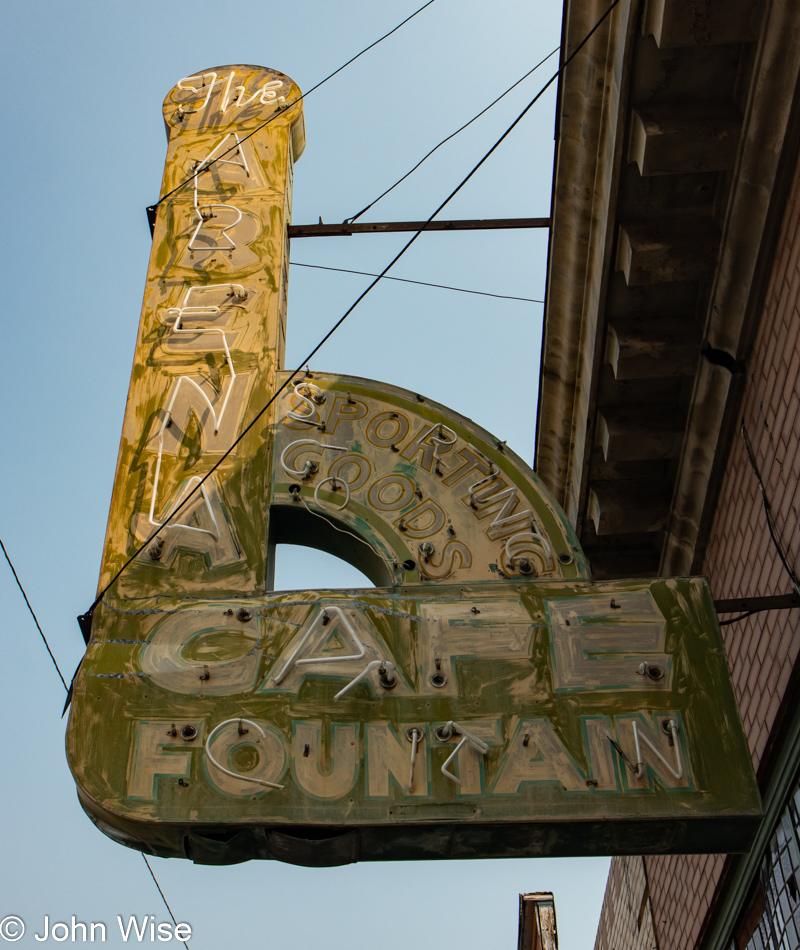
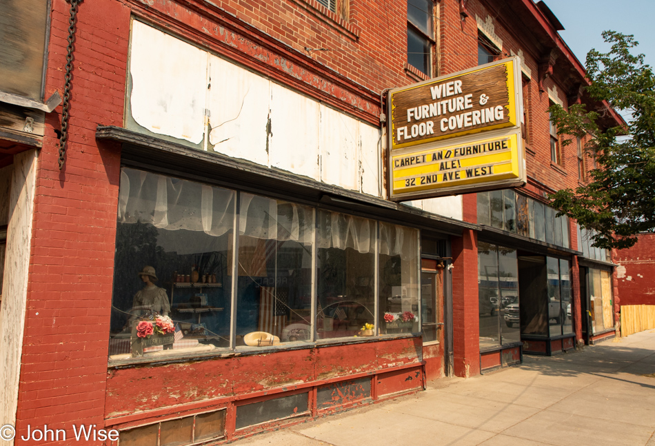
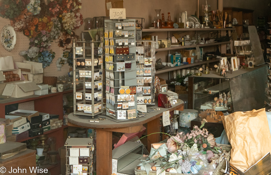
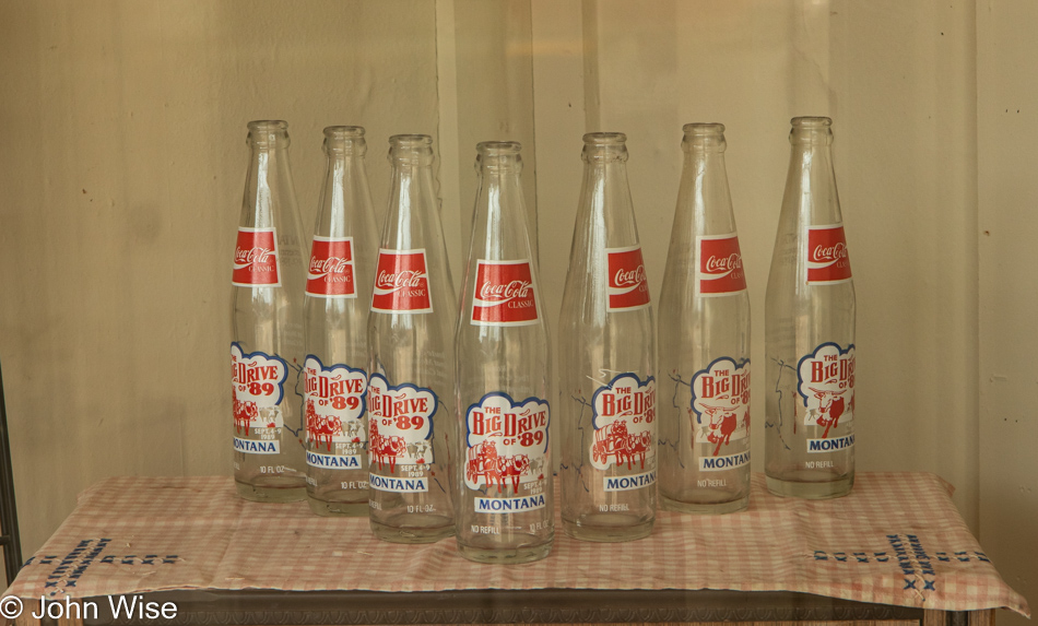
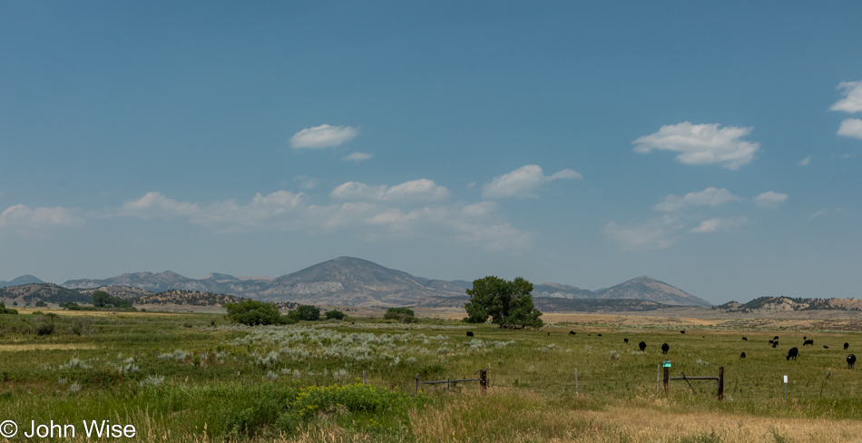
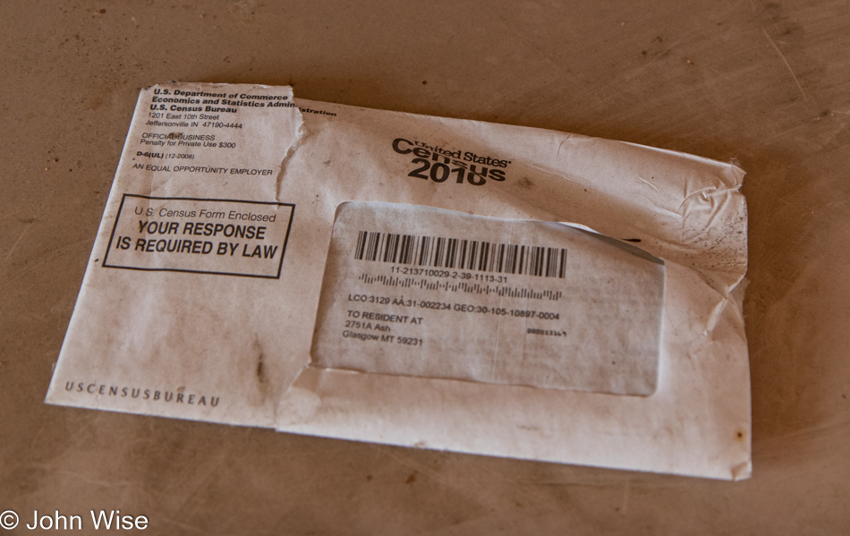
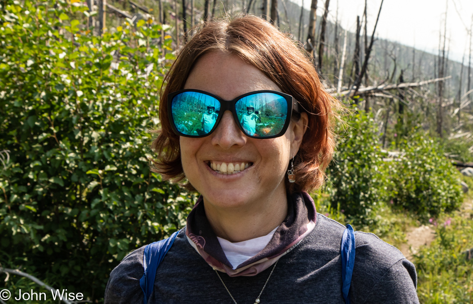
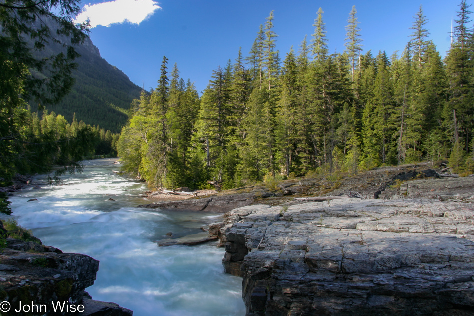
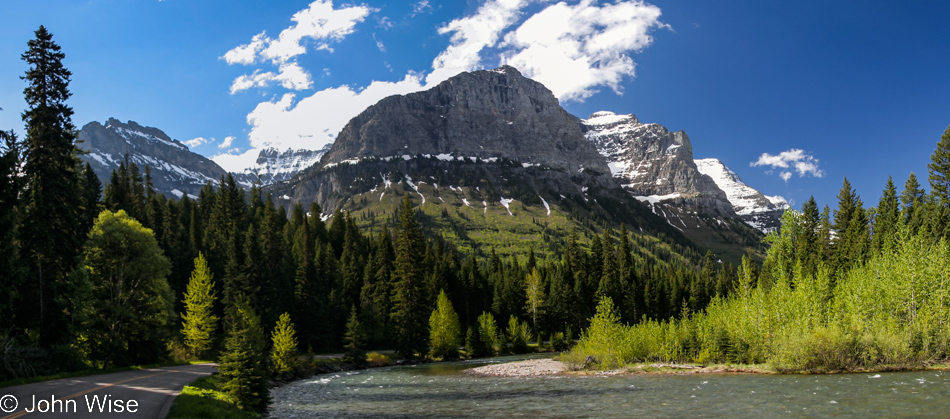
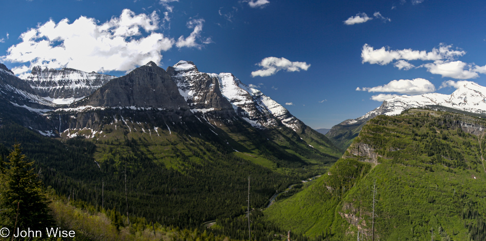
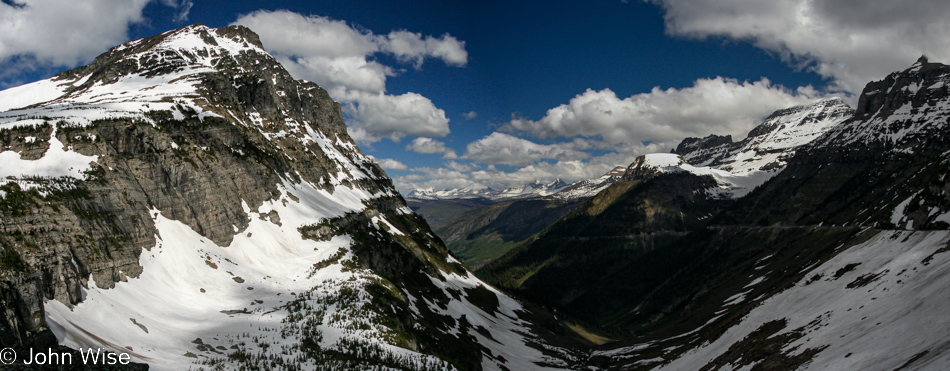
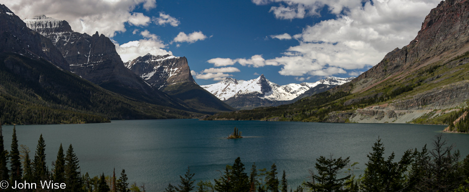
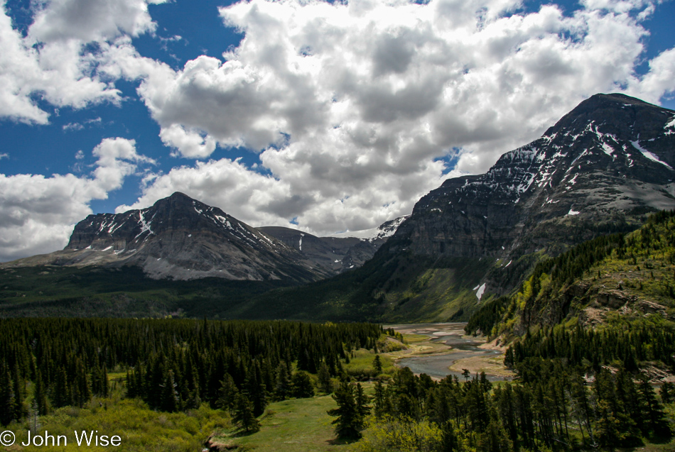
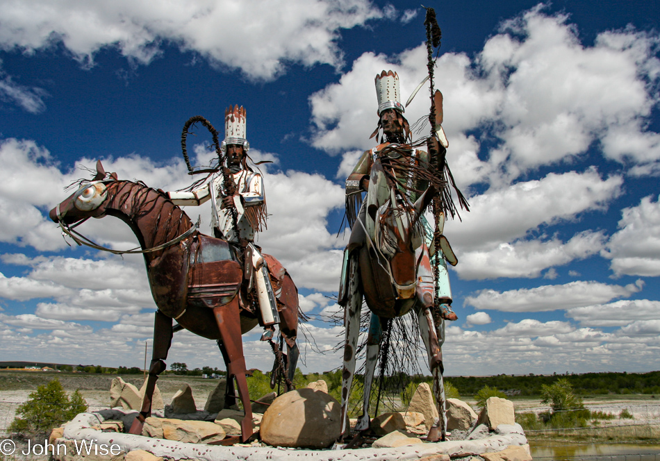
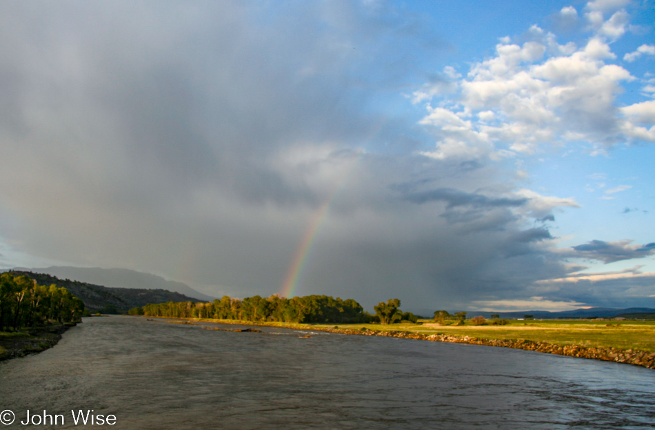
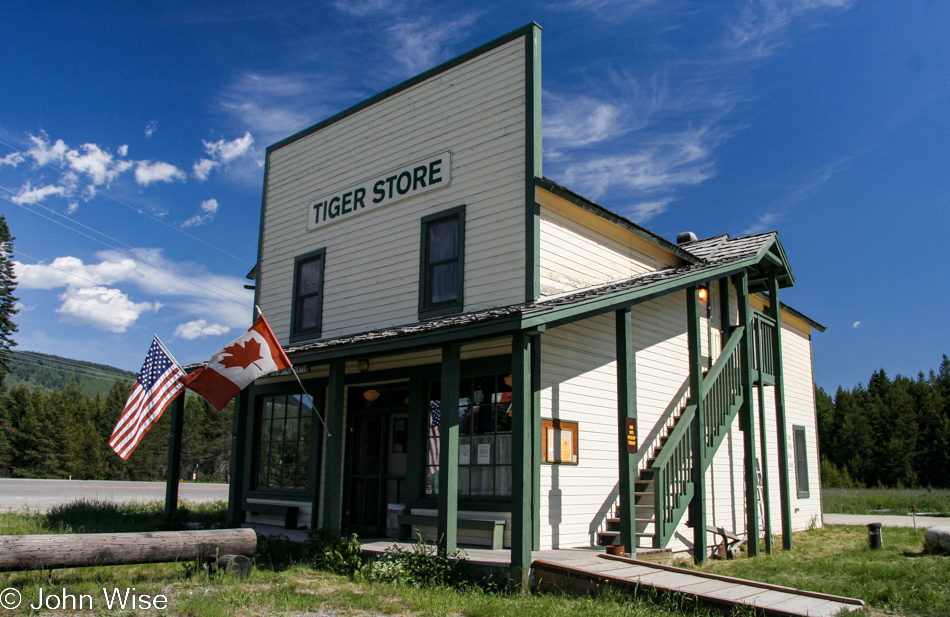
Scobey, we hardly knew you. The Daniels County Museum and Pioneer Town we drove by last night and that the locals raved about won’t be visited by us this trip, but here it is linked in my post, so we might stumble upon it again should we make it up here in the future. We had to be up and out early as, from this point on the map, more than 2,000 miles home had to be finished in four days.

Northeast Montana

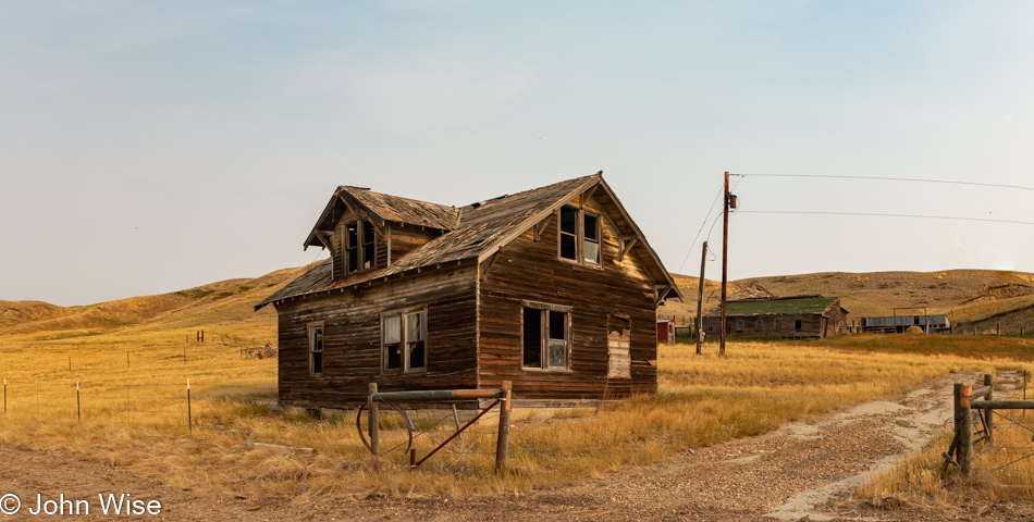
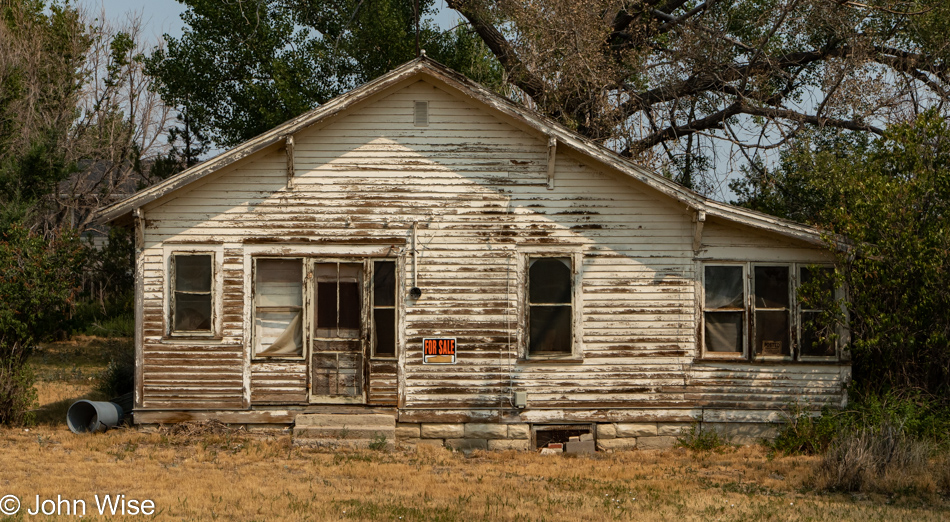
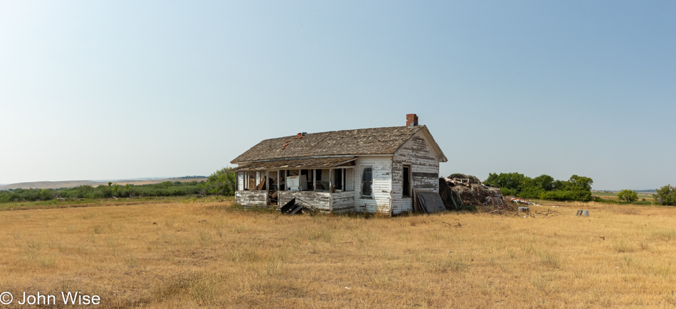
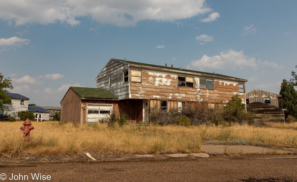
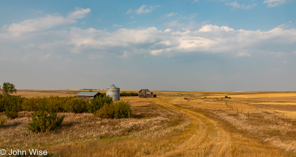
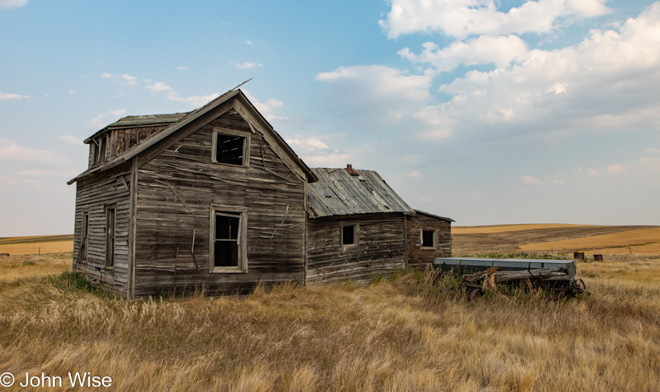
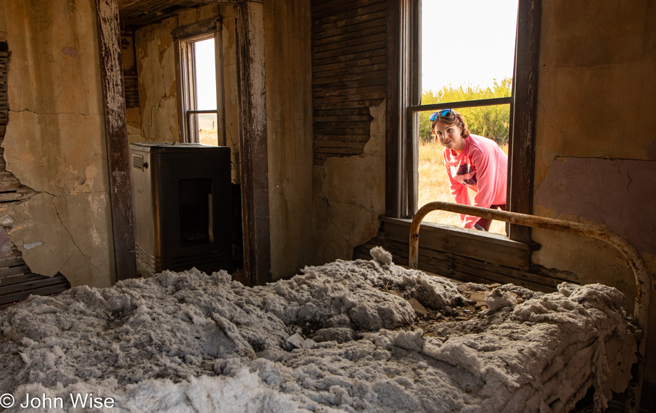
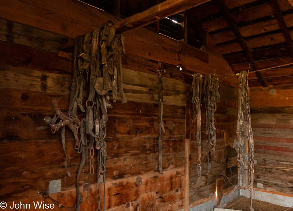
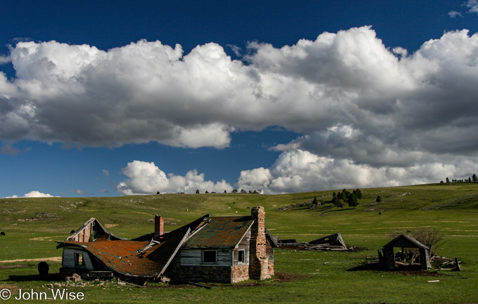
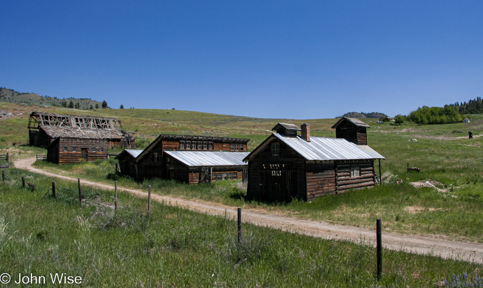
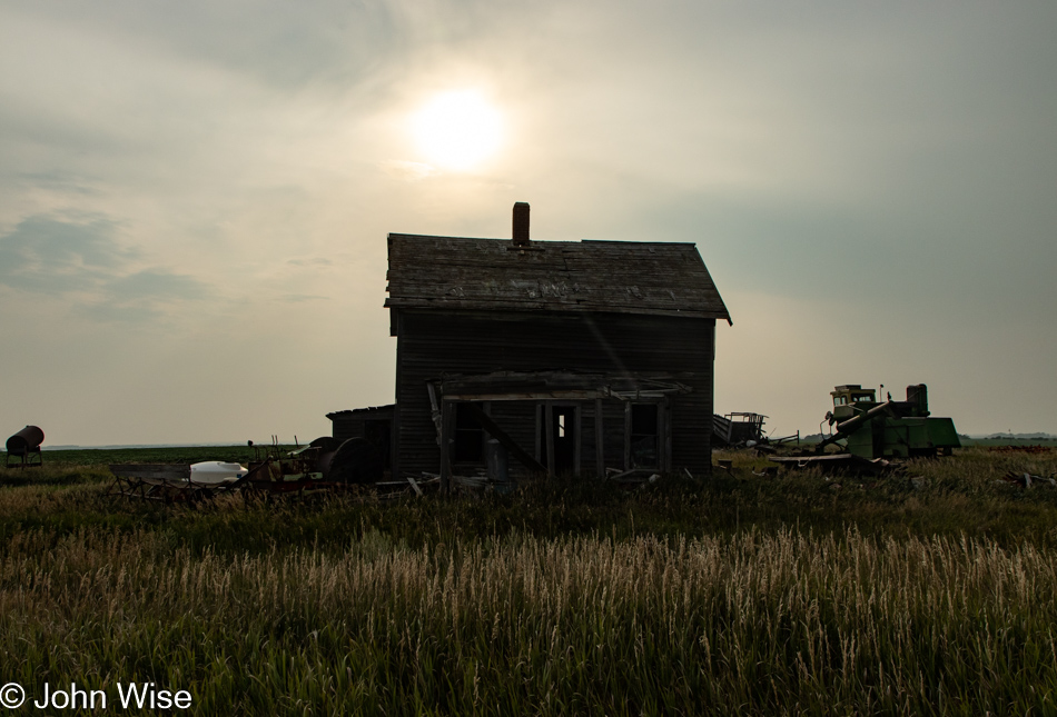
I hope we run out of abandoned homes eventually because they are time sinks but just look at this beauty.

Northeast Montana

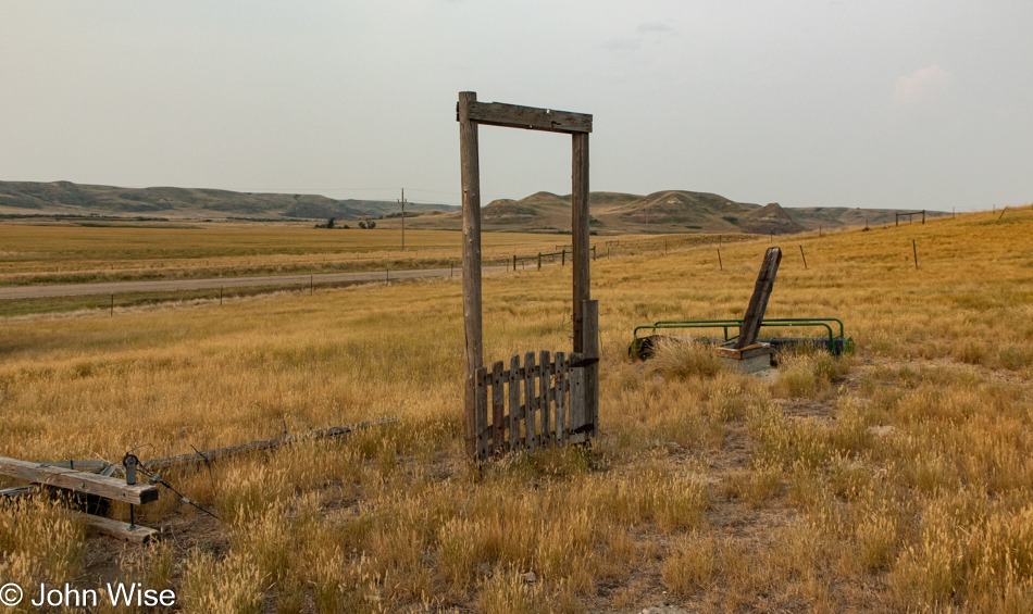
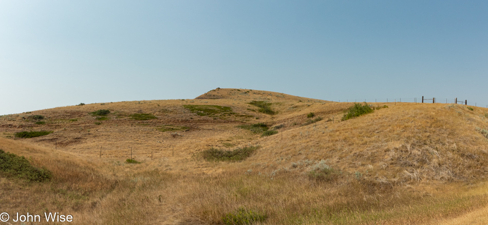
Whatever fence had been attached to this gate is now long gone, but I do find it intriguing that it’s here in the middle of the property, leading nowhere.

Northeast Montana

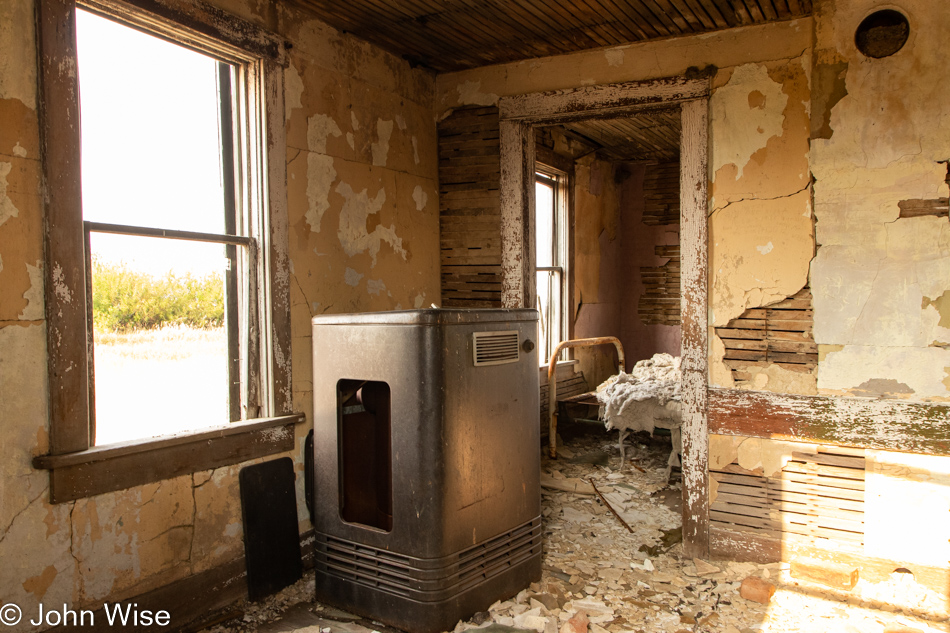
I’ll guestimate that this house was abandoned between 1965 and 1972 based on the old television that was shot dead somewhere in the past. Cable TV obviously wasn’t a thing yet, as the two tuners were used for VHF and UHF bands. My guess is that it’s black & white as there are no color controls visible, nor can I spot a door hiding any knobs. Color TV became mainstream in the mid-’60s.

Northeast Montana

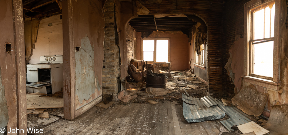
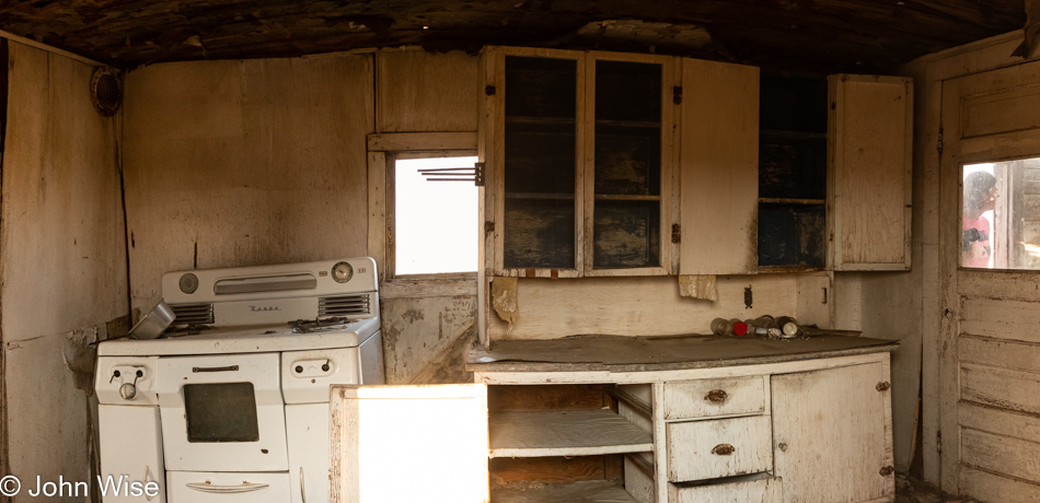
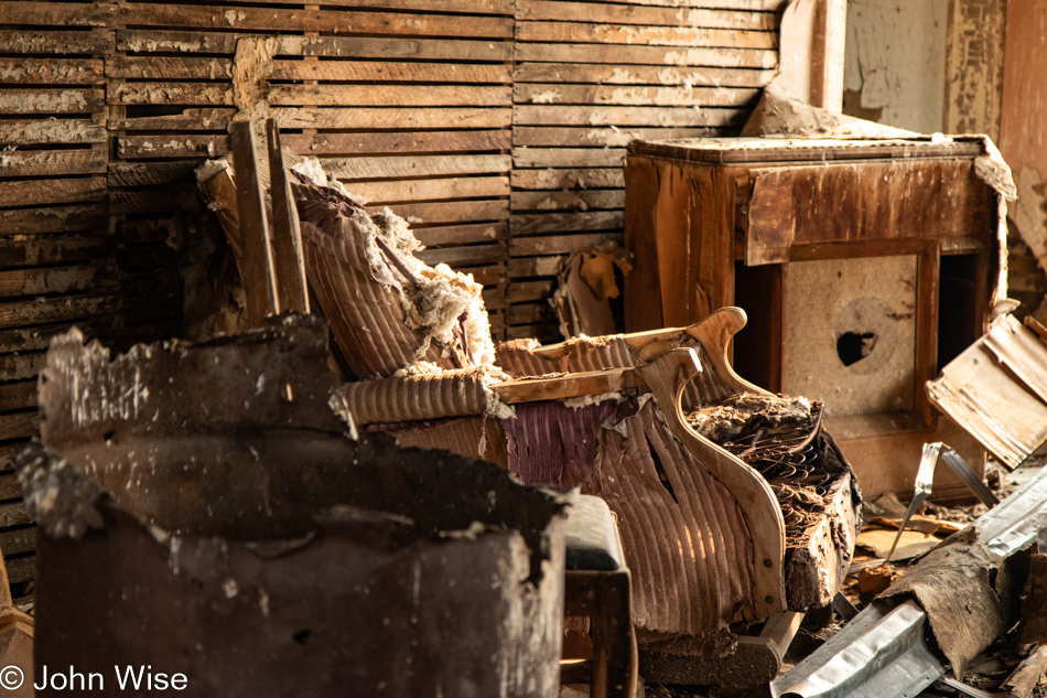
But then I started to reconsider after spotting a  Zenith washing machine with a manual ringer attached, which appears to be from the mid to late 1940s, while that stove over in the kitchen might be an early 1950s model. I’m guessing that the cabinet in the photo below is a record player.

Northeast Montana

Finally, there’s a painted-over sign on the front of the house that I was able to manipulate with a bit of Photoshop until I could decipher that this Farm Bureau sign was offering a $200 reward for information about anyone tampering or destroying this property. Well, that program with a $200 reward appears to have run from about 1930 to 1969, so I’ll stick with my guestimation of when this property was abandoned.

Redstone, Montana

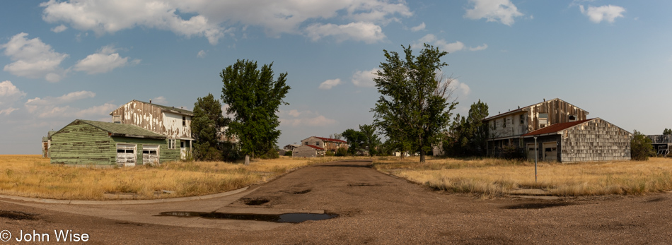
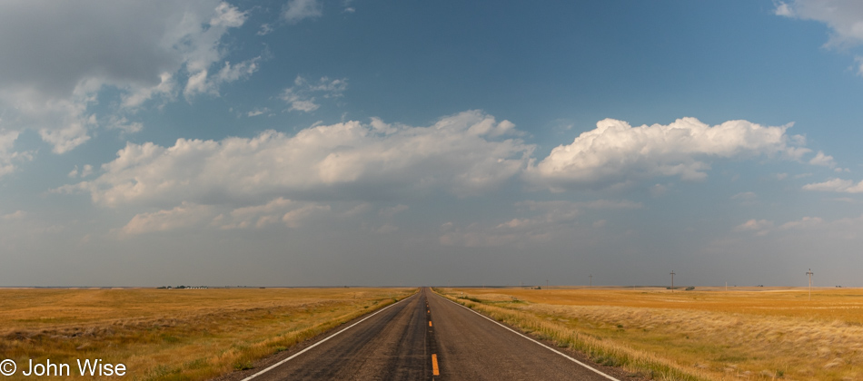
Another 50 miles east, we reach another ghost town. This one is called Redstone and is still in Montana. I say still because we were 45 minutes away from North Dakota.

Redstone, Montana

Like St. Marie, this town is not totally deserted yet as there are some holding on to this remote corner, really out in the middle of nothing.

Westby, Montana

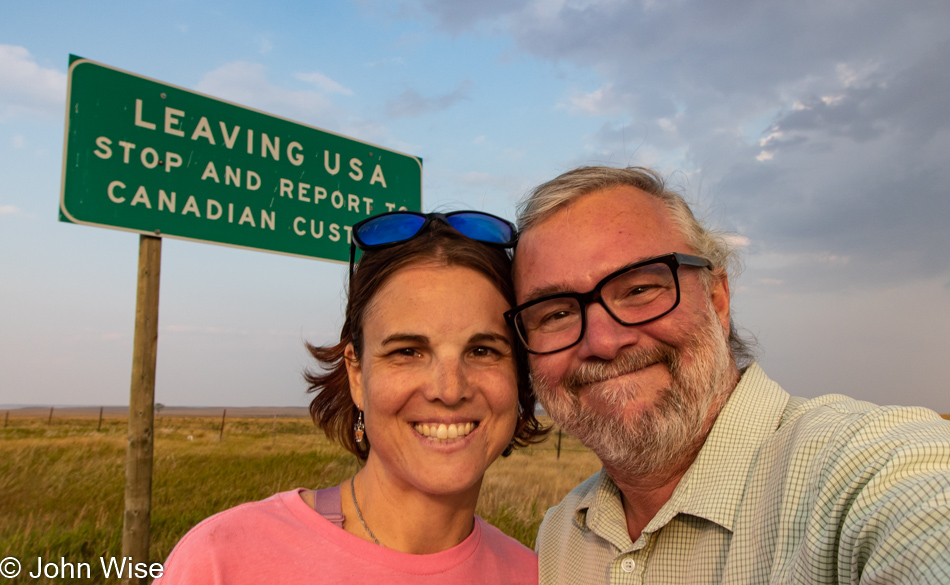
Westby, Montana, is our last stop in this state as we are about to enter…
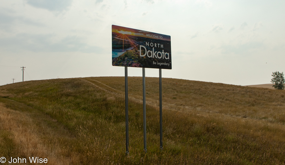
Northwest North Dakota

…North Dakota.

Northwest North Dakota

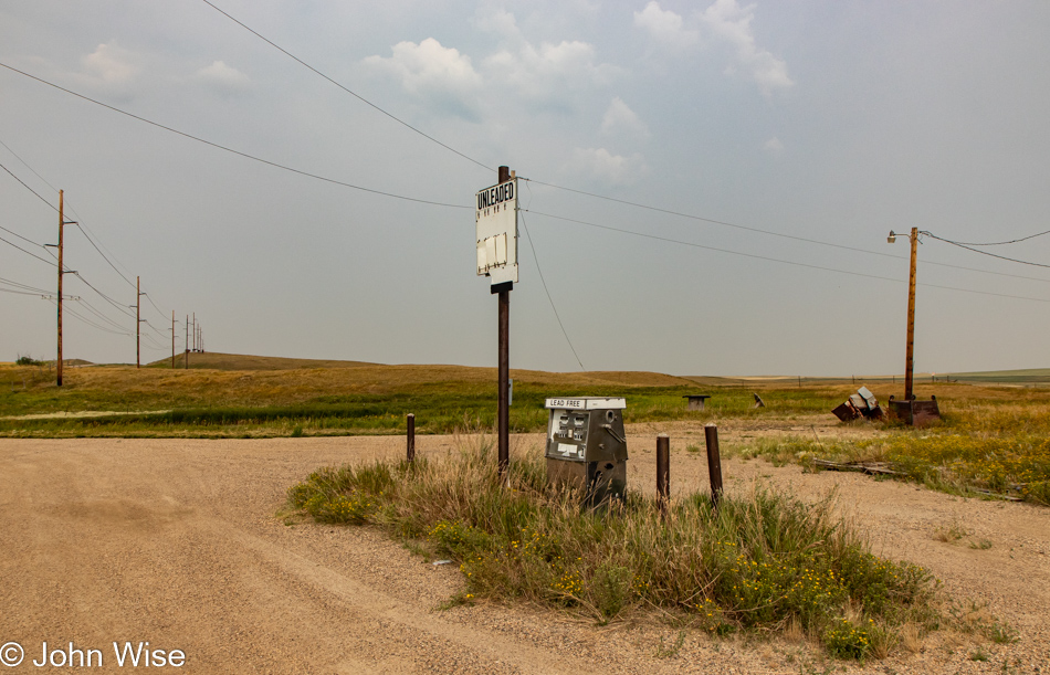
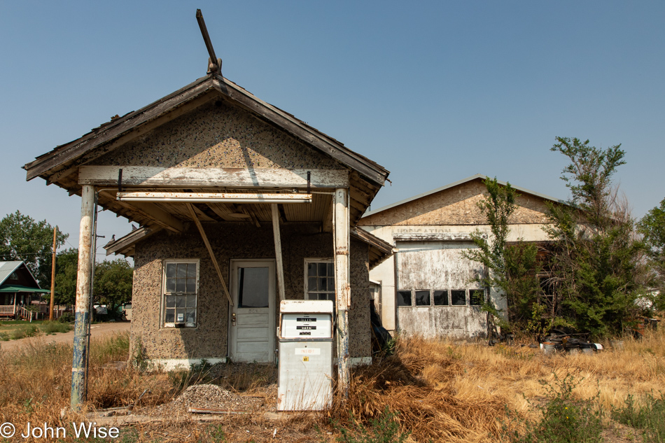
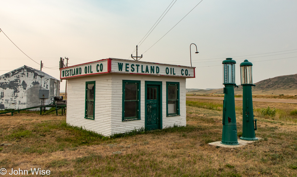
And this is where we’ve been ever since. We ran out of gas, and this station has been closed for a long time. Thanks, Google, for telling us that this was our next opportunity to fill our tank. The cafe on the other side of the pump is more bird sanctuary than a place to get a bite. If you somehow get this far in this entry and you’ve not seen us in a while, please send someone to this random spot along U.S. Route 5, east of the old Air Force facility in Fortuna, North Dakota, to save us. By the way, we don’t even have cell service out here so I can’t know that anyone will ever see this before we die.

Northwest North Dakota

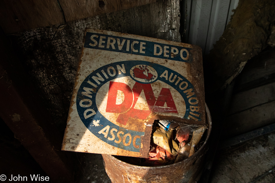
While we were out here waiting to be rescued, we visited the metal building next door and found that the padlock wasn’t locked, so of course, we opened the door to explore the rusting hulk. The brand-new snow plow thing in the back of the garage was of no interest, but this sign from the Dominion Automobile Association was cool. Maybe I should have noticed the maple leaf there on the sign, a viable clue to what I was photographing, but I had no idea that this was the Canadian version of AAA here in America.

Northwest North Dakota

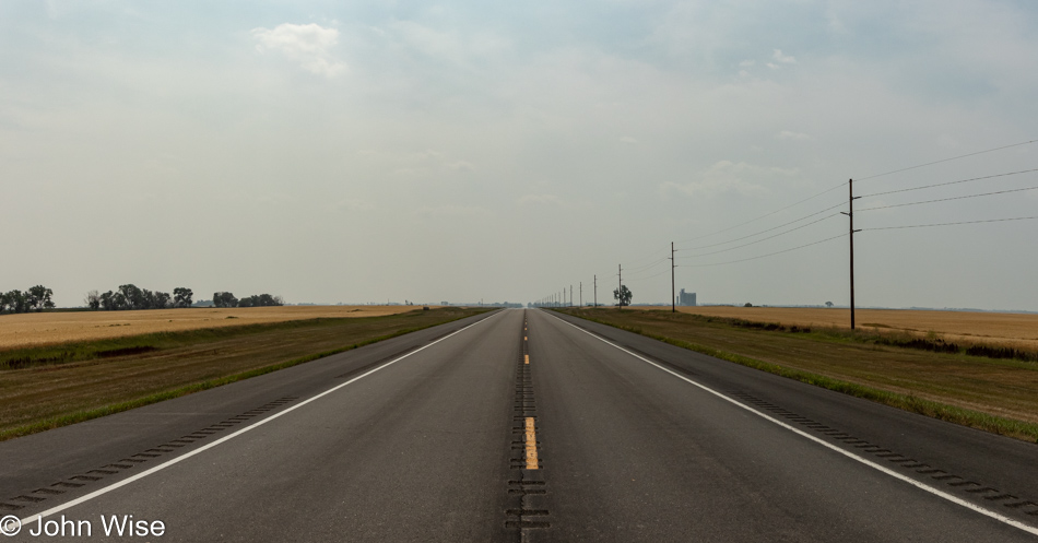
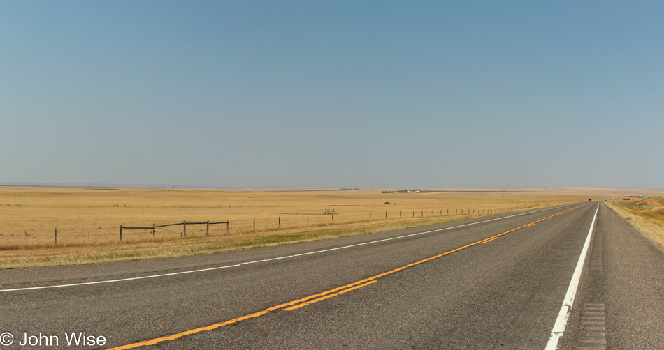
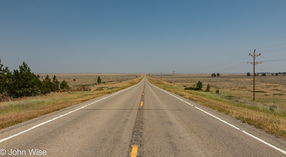
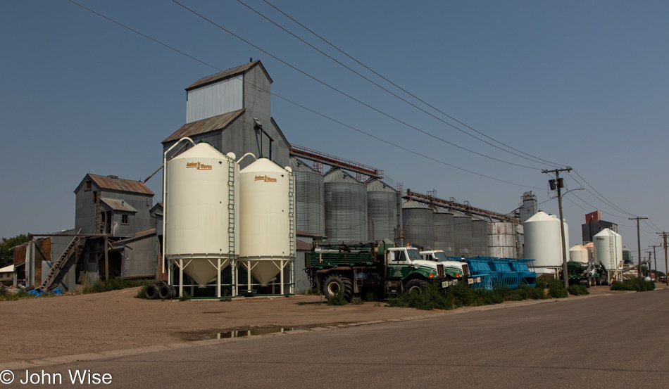
At the intersection of 93rd St NW and 27th Ave NW is the town of Renville, North Dakota, but calling it a “town” is being generous. A convenience store sits on one corner, and a grain silo on the adjacent corner. There is no town. What is here is U.S. Route 83, which runs from the Canadian border all the way down to Brownsville, Texas, for a total length of 1,885 miles or 3,033 kilometers. We are skipping the leg that runs northeast from here to the Canadian border, as the extra 31 miles each way will add an hour to our drive time today. With it being 1:00 p.m. already and another 353 miles ahead of us today, we are well aware that we can easily turn 5 hours of driving into 8 hours of dawdling.

Highway 83 North Dakota

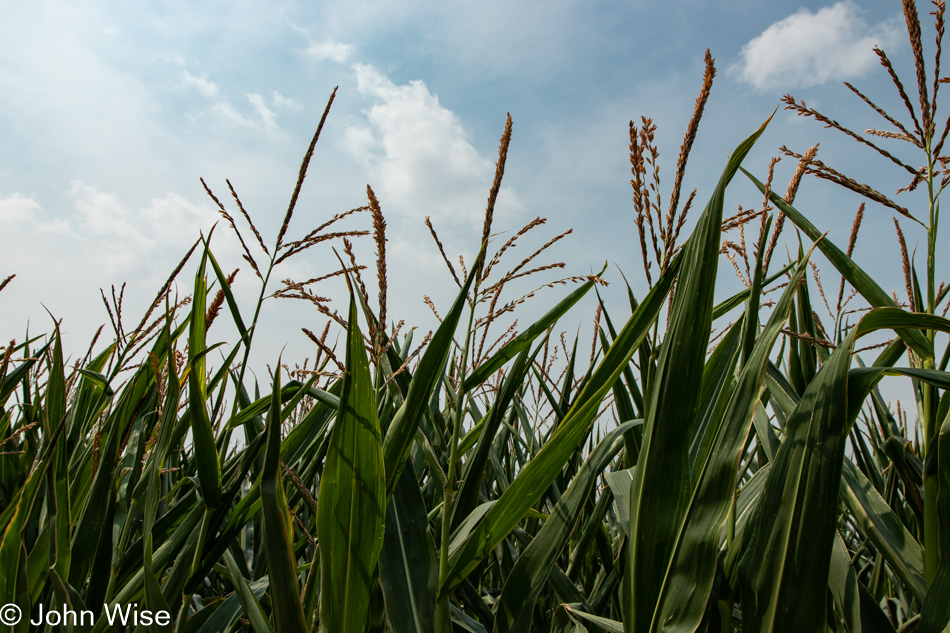
This photo of corn though cannot be considered wasting time as it feels obligatory to feature at least one image of corn porn, considering where we are here in the very middle of America.

Highway 83 North Dakota

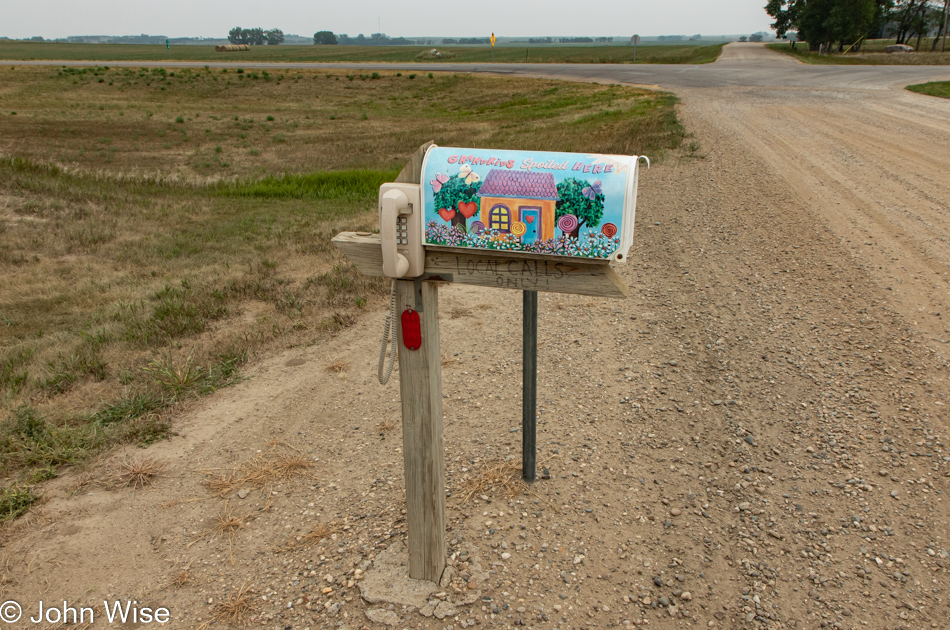
Okay, this can certainly be considered a moment of dawdling, but I just had to know if the phone worked. No, I didn’t need to know that because the fact is I pulled over to heed the call of nature, and the cool mailbox was a bonus I only saw after I stopped. After reading that I could only make local calls, I was minorly disappointed as I wanted to ring Caroline back in Phoenix, but imagine the anguish I felt when I learned that the phone didn’t work at all.

Highway 83 North Dakota

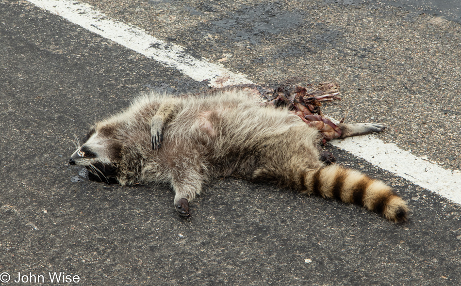
Had this unfortunate raccoon played it safe and stopped in Bismarck with Jessica and me at the Bearscat Bakehouse to pick up some yummy bearshit donuts, it might have stayed alive to tell the story like I am today. Enough making light of this poor animal’s sacrifice to the monsters of the road that tore off its foot and spilled its guts; sure, it’s an ugly and tragic photo, but this is what our need to be on roads does.

As a matter of fact, based on a 1993 study, over 130 million animals become roadkill every year in America, but that pales in comparison to the 32.5 trillion insect deaths we are responsible for. Interestingly, it seems we might be more effective killers than we know, as some studies suggest that those death numbers are going down which only means that we are having a noticeable impact on the amount of insects in our environment.

To paraphrase Pastor Martin Niemöller:

First, they killed the birds and squirrels with their cars, and I did not speak out—because I was not a bird, nor a squirrel.

Then they ran over the sheep and deer, and I did not speak out—because I was not an ungulate.

Then they splattered the bees, flies, grasshoppers, and butterflies on their grills and windshields, and I did not speak out—because I was not an insect.

Then the aliens hit me with their spaceship—and there was no one left to speak out for me.

Highway 83 North Dakota

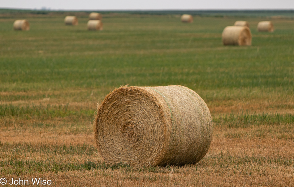
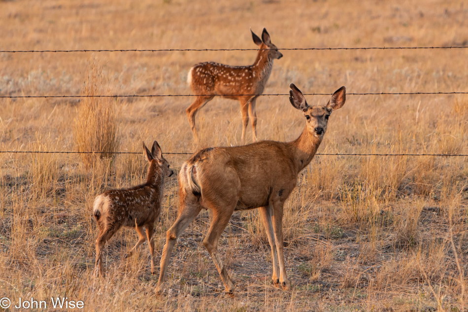
There will be no idyllic scenes of farmhands tossing hay bales on flatbed trucks out here today as these hay rolls can weigh as much as 1,700 pounds or about 770 kilos each. The golden age of hard work has been relegated to the machines, and that would be okay if it weren’t for the large segment of our population that is only about as smart as a 40-pound hay bale.

Highway 83 North Dakota

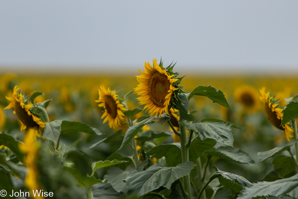
I remember how back in my day, I and about 1,000 hardworking young whippersnappers would hit the field with a 35-gallon basket strapped to our backs and we’d busy ourselves picking those sunflower seeds right out of the flower heads. At the end of the day, tired, with hands cramping from the delicate work, we’d sit around the pickup truck that was going to bring us back into town, and we’d try to guess how many seeds we’d picked. Sam Miller seemed to have a strange knack for being the closest, but how does a boy keep track of how many seeds he’d picked while we were singing those old ditties about bringing in the summer harvest of sunflower seeds? Maybe Sam wasn’t really singing but was closely paying attention to exactly how many seeds he’d picked instead.

Highway 83 North Dakota

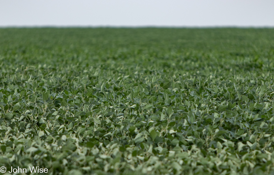
I remember how, back in my day, I would have to pick an entire field of beans ten times bigger than this all by myself…

Welk Homestead State Historic Site in Strasburg, North Dakota

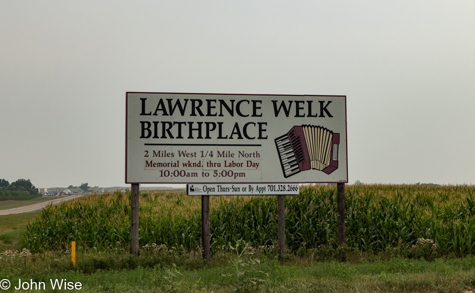
…and then at night, we’d all gather around the television to watch the Lawrence Welk Show. We’d dance along to a polka or two as Myron Floren belted out the tunes on his accordion while Barbara Boylan danced up a storm with Bobby Burgess. Life was good…

Highway 83 North Dakota

…until the dark clouds of punk rock came along, and Black Flag, the Cramps, and the Circle Jerks disrupted the harmony of living as one with nature out here on the Great Plains. Before we knew it, many in our bucolic town were pogo dancing and singing about being a Human Fly: life was never the same again. Yep, that was back in 1978, and when 1982, Lawrence Welk and his Champagne Music Makers ended the last show with that old familiar Adios, Au Revoir, Auf Wiedersehen, I shed a quiet tear.

Highway 83 South Dakota

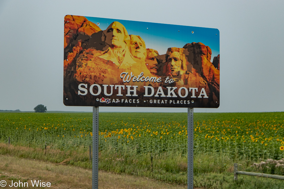
For a minute, I moved south, but to tell you the truth, it was much of the same. Sure, South Dakotans were more in tune with ska and British punk, but how much Madness, Clash, Buzzcocks, and Sex Pistols can a person listen to? It seemed like half the state was singing something about Homicide and slam dancing; where the hell did that come from?

Highway 83 South Dakota

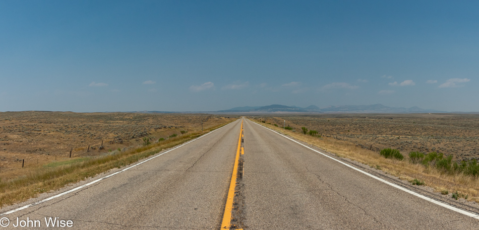
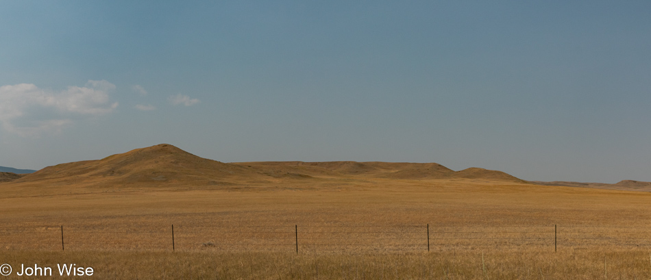
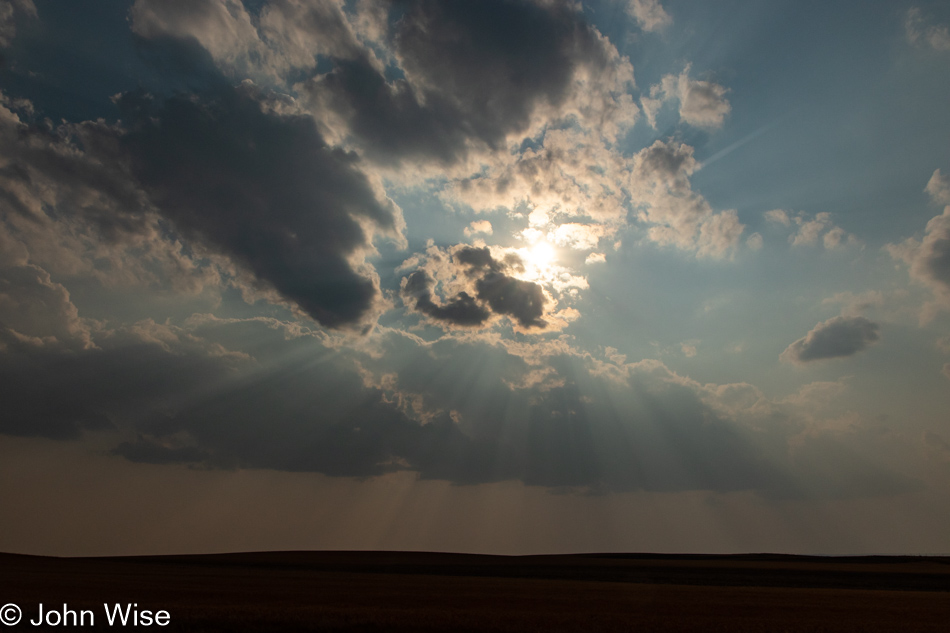
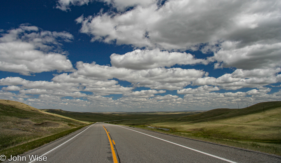
Maybe you thought I would have something better to write about that might share our experience out on the vast, dusty, flat plains of the middle of America? Are you kidding? The mind wanders when there is nothing on the horizon. The land is blank, and animals are sacrificing themselves due to the tremendous boredom that comes with being in a place that hardly supports life.

Highway 83 South Dakota

We drove for hundreds of miles before we spotted even a tree. Sure, we could have gone west to Sturgis, but how would we be welcomed driving a Hyundai, carrying a computer, expensive cameras, and eating granola at an event that attracted over 400,000 bikers in leathers, drinking whiskey from “tailpipes” (if you know what I mean) and spitting in the eye of COVID?

Highway 83 South Dakota

So, we drove and drove, further and further south, as far as south would go. Whoa, is this Dorothy’s house? Just kidding, that’s tomorrow night in Liberal, Kansas, where nerds gather to celebrate the Wizard of Oz.

Highway 83 South Dakota

Have I ever told you the story of when we used to pick semechki for the gopniks over in Ukraine? We’d have to wear our best Adidas out in the field for the marketing material, but damn, did we have it good with such a hot market for sunflower seeds grown right here in South Dakota. Life was perfect out in the field, listening to those mixtapes of Теорія Ґвалту and their folk/ska songs that had us dancing in the fields…

Highway 83 South Dakota

…until the dark clouds of techno music came along, and we were hosting giant raves among the soybeans and corn, listening to trance as the DJ played well into the next day. As magic mushrooms replaced our staple crops we knew then that the likes of Lawrence Welk would never again grace the airwaves that once had made America great. Had Donald Trump really wanted to “Make America Great Again,” he’d have had us all drop some good acid and binge-watch all 1,065 episodes of that seminal Lawrence Welk show that defined our country’s greatest generation. As the sun and my heart set here on the plains, I brought up Bubbles in the Wine and remembered better times while sharing a tear with my daughter, who learned today just who her father really is.

Way Up North

Roundup, Montana, appears mostly dead as you enter town, though the bars and lone casino will likely serve the depressed-looking small population for some years to come, at least those who cannot afford to move on. I might suppose that as usual in impoverished areas, the women are the last members of a community trying to maintain the financial health of a place – this dumb assumption is based on that Jessica, and I only saw only men entering the bars and the casino here in the still early morning.

While the town’s former retail presence has faded and is but a dusty shadow of abandoned dreams, my research after returning home showed that this little town has become a kind of hub for Amazon. Third parties that sell things on Amazon are forwarding products to Roundup for repacking, allowing resellers to avoid state sales tax (Montana doesn’t have one), and this allows their packages to conform to Amazon’s shipping requirements.

There were more than a couple of shops with full inventories showing their age. Greeting cards bleached by the passing years and old sweaters with a layer of dark grime suggest that the shop owner’s departure was abrupt. Now I have to wonder if the people who operated these shops passed away, gave up, or moved. If they are still in town, do they ever visit these time capsules?

The local antique shop was closed long ago and strangely enough, remains untouched, same with the other shops. That the windows are intact and the doors not broken in might be a testament to people in small towns all knowing one another and the local hoodlums knowing they’ll be identified as the culprits, so they keep their noses clean and leave the relics of former prosperity alone.

We are leaving Roundup on U.S. Highway 87 and spot this “art project” with a For Sale sign. Of course, we had to stop. The phone number was cut out of the sign, and the house is a ruin, but like the buildings back in downtown, it hasn’t been ransacked. I called this an art project as I can’t imagine this was ever really for sale and that the sign was a prankster’s joke.

What an amazing day of contrasts this is turning to be as we left the bikers, Beartooths, and trees of Red Lodge on our way into the Great Plains here on Highway 87.

There were very few cattle out here and only a couple of oil wells being actively pumped that we could see from the road, but there’s lots of agriculture under cultivation.

Damn, we are foiled here on our adventure in the Great Flat Plains that we’ve been told are out here as we spot these hills.

I’m a sucker for abandoned structures as their decaying presence feels as though they contain hidden mysteries waiting to be discovered. The appeal is as strong for random farmhouses as it has been for exploring old castles across Europe or visiting the Eastern State Penitentiary in Philadelphia.

Some might ask why we’re out here traveling roads in the middle of nothing. Large expanses of wide-openness strain the eye to see further while filling the imagination with the potential that something might appear. And when that something emerges out of nowhere, we get to take delight that we have discovered maybe the only thing that might be seen today. And so we continue to crawl over the landscape, looking for treasures.

Highway 19 gave way, merging into Highway 191. Before long, we are back in the hills and encountering the Upper Missouri River Breaks National Monument. The Missouri River is one of the treasures we have passed over many a time and what qualifies it as such beyond simply being a river is the history of the Lewis & Clark expedition that traveled its waters.

Jeez, will we ever encounter the infinitely flat expanse of land where we are able to get lost in nothing at all? What are those mountains out on the horizon?

They are the Little Rocky Mountains, as seen from Montana Highway 191.

Warm brown grasslands offer ideas of being in the breadbasket of a country.

And where do all those seeds that feed us end up? In grain silos like these found in Malta, Montana. We were looking for hot food but only came up with a sausage and egg breakfast burrito at a gas station/farm equipment shop east of here that was pretty gross, to be honest. It turns out that burritos are not very sought after in this part of America. For the rest of the day, stopping at various gas stations trying to satisfy my craving for a good old meat, bean, and cheese frozen burrito was only met with disappointment. Too bad I wasn’t looking for beer and a can of tobacco.

Saco, Montana, has an old defunct gas station that plays host to a stupid amount of pigeons. That mound next to the pump is pigeon poop. In front of the door is another mound, while above our heads in the roof is evidence of a ton more poop. Squeezed between a couple of boards and a gap was a dedicated specimen existing in two worlds, that of the open air and an amount of avian feces I would never want to rain down on me…and so I stepped away from the building and my desire to peer into its windows.

More of those amber waves of grain.

And then, out of nowhere, a mirage appears in the form of a ton of ruins. In a previous life, the town of St. Marie was the Glasgow Air Force Base. Back in 1976, the facility was shuttered, and instead of condemning everything to clean it off the face of the earth, the government tried selling homes to the residents who wanted to stay. Most of the town never sold.

While there are a few handfuls of diehard residents living among the ruins, the school and all the businesses are long gone. The nearby airfield survives and is said to be used by Boeing, but the multitude of warning signs are all from a company called Montana Aviation Research. I’ve been stopped by law enforcement near a DuPont factory in Buffalo, New York, an airfield north of Tucson, Arizona, and a random road north of Las Vegas, Nevada, by menacing men who obviously meant business telling me to leave the area, I take signs for an area under surveillance seriously.

Entering these abandoned former military homes, I was constantly aware that at any moment, either a local sheriff or armed residents might interrupt our explorations and demand that we leave. So, as we dipped into places with open doors, I made sure we kept things brief so we would hopefully avoid being surprised by people who didn’t appreciate our snooping.

It turns out that back in 2012, the wacko members of a local sovereign-citizen movement called the Citizens Action Committee of Valley County attempted to take the town as their own, but fortunately for the people who were living there, they failed. Researching this history and learning of the Montana Freemen who, in the mid-1990s, tried something similar to maybe another Branch Davidians or Ruby Ridge-type incident, I have to wonder about the New Yorkers and Californians who are leaving behind one looney place for another.

To deter squatters, the electricity has been cut to large parts of St. Marie, but appliances are often still in place, and I’d wager that with the gas, electricity, and water turned on, some of these homes that have been empty for 45 years would be habitable with just a few days of work. After scouring the better part of the abandoned corners of this old Air Force Base, it was time to get back down the road as we’d earlier entertained the idea of going further than our original destination. By now, though, we’ve likely lost about 90 minutes to roaming around Roundup and St. Marie.

Okay, I think we’ve finally found the flat part of Montana.

While the sun isn’t so low in the sky to threaten the arrival of the evening quite yet, we do want to reach the Canadian border for a selfie, proving that we’d made it that far north. So we drive.

We drive until another distraction rears its head just north of Baylor, Montana. This old farm had no fences and nothing suggesting we shouldn’t “trespass.”

All the elements of intrigue are on display, old wood, old machinery, old cars out back (beyond a fence). No windows, but there were signs of stuff inside the house as we approached.

The old house is barely a shell, and I could see it collapsing in the next ten years, but that didn’t stop us from wanting to go inside for a more intimate view. Our smarter selves were effective in dissuading our dumber voices, trying to convince us to take the risk as stepping on nails or falling through floors could be problematic so far away from phone and medical services.

Jessica did her best to lean into the window in the center of this photo, trying to snag the old pot on the stove I wanted, but it fell off and became unreachable. As you look at this image, you can see that the left side of the kitchen is listing. This structure was way too sketchy to attempt going in, but we did try to open the door on the right, behind which you can glimpse Jessica. I’m glad we couldn’t pry it open, as it did occur to me that it might be the structural support that was the glue keeping everything standing. By the way, the stove appears to be a valuable antique!

I’m in love with this bed and would gladly claim the frame and bring it home if that was possible. Even the cotton batting that is no longer in its mattress cover is intriguing. Where did the cloth that contained it go? I’m surprised that birds haven’t claimed all of the fluff for their nests, but then again, where would birds build homes in a place with so few native trees?

Over at the barn, I was incredulous to find the center third filled with barley. The closeup I shot of it was taken to avoid all of the poop that was atop the grain. Not only rodent poop but rather large ones (all very dried out) that were scattered about. The grain silo next door suggests that it was last filled and is still full of barley from a 1960 harvest. It’s inexplicable as to why the barley never sprouted, molded over, or was decimated by rodents and birds over the 61 years it’s sat here.

After Caroline saw this photo, she wished that I’d reached out to share an image so I could have snagged her one of these ancient bridles. Maybe she would have restored it and sent it to our niece in Germany, who loves horses but I couldn’t have imagined that she’d have been interested. Maybe she and I can travel through this corner of America next summer to collect a bridle, bed frame, an old stove, and that pot I wanted. Heck, there’s even an upstairs to the old home that might contain things of interest.

Instead of just bolting across the road it was moseying over, the deer and her fawns casually headed to the fence and then turned back to look at us with our window open, snapping photos of this beautiful family.

All the way up U.S. Route 24, we reached the Canadian border, and other than some border agents, there was nothing else out there. With all the ruins and this detour, we will not get further than my planned stop. Hey, Scobey, Montana, here we come.

Arriving in Scobey, Montana, after 12 hours of driving, we stopped at our hotel but didn’t check in as we learned there might be a restaurant still open over at the local golf course. It was dark as we passed what appeared to be an amazing history museum on the edge of town, but obviously, it wasn’t open. We’d called ahead to the Club House to verify it was open while on our way, and sure enough, it was open. Keep in mind that Scobey has a population of about 1,100 people and is seriously out in the middle of nowhere, so this was a real find after 8:00 p.m. on a Thursday night.

At dinner, we met Don and Laura Hagan while their daughter Erin was our server. We got to know a couple of other locals, too, but it was the Hagan family that made our night. Don has been farming about 4,000 acres of durum wheat, peas, and canola out this way while Laura works in the healthcare industry. If Caroline and I should ever pass through here, we’ll have to look them up. Thanks, Scobeyians, for making us feel so welcome.

Deep In The Beartooth Mountains

We stayed in Red Lodge, Montana, just for this reason, a hike in the area known as the Absaroka-Beartooth Wilderness. Not a half-mile south of our hotel is West Fork Road, which dead-ends in the Custer Gallatin National Forest. Yeah, lots of names.

A relatively short part of the road was paved and a seemingly larger part of it is gravel, but Rock Creek that runs next to the road is nearly ever-present.

Somewhere out there is the end of the road and the beginning of some trail options.

A small wooden bridge took us over this view of the West Fork of Rock Creek.

Not far from the trailhead, we were greeted by this beautiful little marmot. Considering the burned log, Mr. Marmot is perched upon, you might be wondering if maybe fire has been through here recently. Well, we’ve been seeing the scars on the landscape, though there’s lots of regrowth in the area. Back in the summer of 2008, the Cascade Fire burned through about 10,000 acres southwest of Red Lodge.

We had planned to hike the Basin Lake Trail but decided to at least see what was at the end of the road and then decide if we might want to hike a mile or two in that area before tackling our 5-mile hike at the lake. We didn’t have a lot of water with us nor a backpack to carry it in, hence the consideration of a manageable 5-miler.

The trails out here are about 12 miles and up, so with only 2 liters of water, we knew that we’d have to keep things brief. In addition to being dumb enough not to have bought more water in town, we took off down the trail without so much as a tiny snack.

No matter, though, as we’re not going far, and when we return up the road to Basin Lake, we’ll remember to take a couple of energy bars from the car with us.

Though all around us is evidence of the fire, the regrowth is drawing us in to see what’s just up ahead.

Are these berries a type of bear food, or are we the tastier morsels? Without bear spray, I’m feeling a tiny bit vulnerable. Also, while we were out here, we failed to recognize these as elderberries, so we didn’t stop to enjoy a few.

That didn’t stop us from gobbling up as many raspberries as we could. These would come in especially useful about 5 hours later.

We passed a guy loaded with camera gear that told us of a nearby waterfall. That was enough to pull us deeper into the mountains to at least see that sight with our own eyes. He thought we were relatively close at this point.

We were wondering whether we might have missed the falls the guy told us about, as this cascade didn’t look like the image he showed us on his phone. No matter, this is pretty enough, and maybe the falls are just up ahead.

No, we want waterfalls, not rockfalls.

Okay, a lake is nice and well appreciated, so we’ll take that as motivation to look just a little further up the trail. We also seem to be moving away from the burn area as we are seeing more trees that escaped destruction.

Things are becoming enchanting with this giant boulder that apparently arrived from high above as who doesn’t love swirly granite?

Although we’d been super conservative with our limited water, we were aware that we should turn around soon if we were going to make our 5-mile hike back to Basin Lake.

Just a little further, and that would be it, but first, we needed to luxuriate in the shade of the forest that was getting thicker with every step forward.

Well, I learned that this is a tachinid fly, which was first identified by Carl Linnaeus back in 1761, and that Carl is known as the “Father of modern taxonomy,” but other than that, all I can share is that this is a fly.

Indian Paintbrush is beautiful no matter where one may see it. While I could be wrong about where I first saw it, my memory of when I learned its name goes back to our 2012 trip on the Alsek River.

I’ve just spent the better part of the last 20 minutes trying to determine what type of butterfly this is. Google, with its image search function, is great, but I keep getting pointed to this being a dark green fritillary. The problem is that this butterfly is not found to be in North America. Then there’s the silver-bordered fritillary that is a species found over on this side of the earth so I guess I’ll go with that.

As we walk along the trail, the scenery is forever changing, with perspectives offering views that are never the same twice. At best, we can only glance over, take an impression, and keep going; such is the nature of limited amounts of time and resources. The original inhabitants and explorers of these lands would have been able to crawl over the environment to their heart’s content; I, on the other hand am not offered this luxury.

Ooh, the trail is fully green now, so we should be smart about this and turn around.

Have I ever shared with you that my middle name is Moss-Garden?

Come to think of it, maybe I should have named my daughter Cascade instead of Jessica.

I believe the 60% of me that is water senses when molecules of its kind are flowing nearby, signaling me to bring them closer to where their cousins are free to travel where they will as opposed to being my prisoners. Sorry water, but in order for me to walk the land, I have to carry my personal ocean with me.

But look at how seductive this appears. Your cells will dry out one day anyway, so why not set them free to spill back into the flow? Water nourishes all, and if you think about it for a second, why not ask yourself what exactly you are doing to benefit life as you sequester those 16 gallons of water so selfishly?

Mountain ranges often act as vapor dams where clouds bunch up to drop their moisture on one side of the range. Down their slopes, the water is carried by gravity past trees and plants to feed them while also filling depressions and pockets, which supports the various lives that are scattered across this environment that is too hostile for humans to live in. What isn’t captured for these purposes might join a stream below, carrying it to other locations where water works to sustain all living things on this planet.

These craggy mountains are not the most inviting when it comes to the idea of taking a hike up their slopes unless walking on scree is your idea of a good time. Maybe if I were closer to that side of the range we are walking in, I’d have a different opinion, but from my vantage point, that looks hairy.

Damn, these photos suck compared to my memories of how extravagantly beautiful this place is.

Have you guessed yet that we have not yet turned around? We have no food with us, and while there’s a ton of water flowing nearby, neither Jessica nor I am willing to risk a Giardia Party in our pants on the way back to the trailhead. You would be correct in your summation that we are being idiots out here trying to limit how much we are drinking compared to the length of our hike.

Going into the mountains short on the essentials is feeling like my predicament right now as I try to write a coherent blog post about our hike; I’ve included too many photos, and I’m short on words to describe all of this.

Tufts of thick green grasses reflected in the water made for a beautiful sight while I stood on the opposite side of the river in admiration. I took the photo as I knew I wanted the reminder to share with Caroline after our return that this trail is significant for us and that we should endeavor to come back. Of course, my enthusiasm should be enough to share with my wife the impact this area has made on me, but on the other hand, I’d like for her to see a tiny fraction of what I was able to see.

My daughter Jessica is shooting an excess of photos too, but for her husband, my son-in-law, Caleb, who couldn’t be here with us.

If I think about it, I might have to admit to a small fetish with drying bleached fallen tree trunks and limbs. There’s something about the grain, twists, and jagged edges that my eyes find particularly appealing.

Fetish number 2, lichen. I should just continue with admitting that moss has a place in my heart, dried leaves too, and while I’ve taken time to inspect a scat or two trying to identify the fur or berries in it, I can’t really say I’d stop for every pile of poo I pass. Lichen, moss, driftwood, fallen leaves, plants reflecting in the water, yeah, all those things I’ll never get enough of.

Speaking of reflections.

Meadows are yummies for the eyes in my world.

I’d go out and frolic, but we don’t have bear spray, and by this time we’d seen probably three other groups out hiking and a family or two, and they all had bear spray on their hip …jeezus, we were unprepared. Well, not totally unprepared as we are armed with cameras and various lenses with plenty of storage capacity that, if we had to, we could probably photograph a bear to death.

Walking through this rockfall, I’m the kind of guy who listens closely for the boulder heading down from the cliffs above at ballistic speeds, as I imagine that I might be right here at the wrong time, ready to dodge such a deadly projectile.

This is not a forest pancake; it was a crawling fungus triggering PTSD memories from that late 1950s sci-fi horror film titled “The Mutoid Space Creature With Two Radioactive Mushroom Pancake Heads.”

It’s been over 4 hours since we started down this trail, and our Fitbits are saying we are already nearly 6 miles into the mountains.

We are looking for something that suggests that this is the definitive turn-around point; I’m certain that something along the way will let us know that this is it.

But we just keep on going.

Okay, this is it. The path forks, and we certainly won’t be making the hike up a strenuous trail to get to Lake Mary, though it’s only a mile. We are both getting hungry, and we are thirsty which was to be expected after this many miles with an equal number yet ahead of us. The other side of the fork goes to Quinnebaugh Meadows, though a part of me wonders if we have already reached that point. On that other fork, enough water is flowing over the trail that we know that this is where we turn around.

How’d we miss this on our way up the trail?

Ooh, and how did we miss this?

Did we see these flowers earlier, or were we looking the wrong way?

The hike back is mostly downhill, so we are making great time on our retreat, but some nice cold water sounds perfect right about now.

Along the trail, after being in the thick of the forest, we will be back among the raspberries that sustain my growing hunger pangs. My eyes, on the other hand, are well-fed.

Thirsty and hungry I still can’t help myself taking photos.

I first spotted a small snake crossing our path, but neither Jessica nor I were quick enough to grab a photo. Not 15 minutes later, she spotted this specimen curled up and warming on a stone. It didn’t move a scale the entire time we snapped off a dozen photos.

I took more than a few photos of butterflies, but this one was my very favorite.

Seven hours and twelve and a half miles later, we were done with our hike into the wilderness in a state of total unpreparedness. It was great to sit down in the car only to discover there was an extra bottle of water on the floor behind Jessica. Food was also at hand as we’ve been traveling with an ice-chest stocked with what we’d need to avoid restaurants as often as we’d want to. The hard part here was only having a small snack, so we’d be prepared for what comes next.

Dinner was again at the Piccola Cucina Ox Pasture Italian restaurant, except this evening, we indulged in our first dessert of the trip with a tableside “deconstructed” tiramisu. The espressos turned out to be a big mistake, as sleep was difficult to find after getting back to our motel. All around, it was just a perfect day, and was terrific to be out of the car for so long exercising the legs. Just an all-around sense of “wow!”

Transition Zone

Yellowstone National Park in Wyoming

On our way out of Yellowstone, we are driving once more through Lamar Valley as the Northeast Entrance Road is technically U.S. Highway 212. Before we get to that point in the day though, we were stopped on the road by a herd of bison meandering from one side to the other. We definitely weren’t in a hurry (nor were the bison), but one California driver showed his disdain for some stupid animals and stopped cars as he pressed his Big Ass Truck through the waiting cars and past the bison while gesticulating wildly at us sheep who were observing these creatures’ right of way. Sadly, those of us who don’t (or no longer) live in California don’t really expect any different behavior from these elitist tools. And what did we get for our patience? This photo is of a beautiful young bison who personally came up to our car and thanked us for not running over any members of her tribe.

Yellowstone National Park in Wyoming

Then that very same baby bison offered to have its parents pose for us, Dad looking stoic and Mom gazing lovingly at her mate. Our fairy tale visit to Yellowstone is now complete, except for not seeing bears, wolves, herds of elk, bald eagles, lions, the largest eruption ever of Old Faithful, a helicopter view of Grand Prismatic, witnessing the super volcano hurling its guts over the Eastern United States, and Jesus appearing in the heavens above. Other than those omissions, our time here has been great.

Yellowstone National Park in Wyoming

Somehow, we ended up under the caldera rim as smoke started billowing from the rumbling floor of Yellowstone. Is this the big one? Are we about to be launched into the stratosphere to get that birds-eye view of the total destruction the tabloid press and Discovery Channel have been promising us for years? False alarm, we’re just passing through a mountain range on the way towards Cooke City, Montana.

Beartooth Mountain Range in Montana

We are in the Beartooth Mountains for my first-ever visit to this rarely accessible range. The southern end of this road is often closed due to snow which has stymied Caroline and me driving this famously scenic byway in the western United States on previous occasions. The rest of the images that accompany this blog post are seriously compromised as the smoke from California and Oregon wildfires were making for poor visibility conditions. The following photos have a judicious amount of dehazing applied to them.

Beartooth Mountain Range in Montana

The short stretch of Beartooth Highway, a.k.a. U.S. 212 that I’ve traveled on in the past I thought might be indicative of the entire highway, and I therefore assumed that the beautiful photos I’d seen from deep in the mountains required hikes far away from the road, but today I would learn that this idea was wrong. This was the first stop along U.S. 212 that was so enchanting that I had to pull over. Mind you, I wanted to pull over a dozen times before this, but convincing myself that I wouldn’t get a reasonable shot left me with so much doubt that I hadn’t given in. Reflecting upon even this image, I feel cheated as we were near the top of a pass in a large meadow, and there was so much more that captured the eye than this photo represents that I’d like to exclude it, but then I’d have to also end this blog entry right here.

Beartooth Mountain Range in Montana

In-person, the pink and gray granite against the green meadow was so vibrant that it encouraged me to attempt grabbing images that avoid the hazy horizon, but without direct sunlight, my camera just didn’t do the job that my eyes were able to glean.

Beartooth Mountain Range in Montana

I should share that I took very few notes about this day while Jessica and I were out on our road trip, and so here I am eleven days later, looking at the images and considering what I want to say and finding it difficult to grab words that will be vibrant enough to convey how profound things appeared. This tight crop betrays the nature of what’s up here, though maybe that’s a good thing as it should press me even harder to bring Caroline on a return visit with the hopes of catching this range on a clear day.

Beartooth Mountain Range in Montana

I shot this as a panorama, but the blue haze towards the right of the lake obscured too much, so here’s the left corner. With this final bit of lament regarding air conditions, I’ll try to move on.

Beartooth Mountain Range in Montana

Every corner up here in the Beartooth Mountains begs the visitor to leave the car behind and go for a hike, but without knowledge of trail length, bear spray, or even somewhere to pull over, it’s not so easy as just venturing into the landscape. If a return visit is ever going to be possible, it should be with the idea that we will remain in the area for three to five days with a number of trails already selected.

Beartooth Mountain Range in Montana

Like our visits to the glaciated area along the Alsek River in Canada and Alaska, I’m in awe at the profusion of wildflowers which have the briefest of windows to explode on the scene before the snows begin to fall again and the days grow short.

Beartooth Mountain Range in Montana

Why isn’t this area a national park? I’m guessing that the main reason would be that the designation would then require a better effort to offer visitor services in a place that might only be intermittently visitable for 60 to 90 days a year. Jumping ahead in our drive through here, I got the impression in Red Lodge, Montana, where we were staying for a couple of nights, that there are parts of the Beartooth range that are accessible for a good part of the year. So, the problem of access might be restricted to the highest elevations and coming in from the southerly entrance.

Beartooth Mountain Range in Montana

If you suffer from a fear of heights, avoid this road. Being simultaneously drawn to look out at the horizon and demanding that I maintain tunnel vision can produce moments of panic as it feels like my eyes are drawn too deeply into what lies beyond the safety of the road.

Beartooth Mountain Range in Montana

Live cams need to be placed throughout the area, or better yet; I need to photograph a couple of dozen or more locations once a month for a year so everyone can see how these places change throughout the year.

Beartooth Mountain Range in Montana

One has to wonder why this road is even here. On one side is Cooke City, Montana, and entry to Yellowstone, but there are plenty of other ways into the park. On the other side is Red Lodge, Montana, with a small population of 2,200 that really doesn’t gain a thing having this road wend its way through such treacherous terrain. That must mean that this road is only here for the pleasure of those few travelers who learn about its existence and need to revel in such extraordinary sights.

Beartooth Mountain Range in Montana

Along the road, we encountered a construction site where a primitive single-lane dirt road must be navigated behind a pilot vehicle that takes us past a bridge being built. $27 million in improvements elevate the roadway over the landscape so animals will have a better path through the environment. As construction can only proceed during the short summer season, there’s no completion date in sight, but when it is finished, it promises to add to the nail-biting experience of being out on the edge of the earth.

We are obviously above the tree line here at 10,947 feet (3,336 meters) above the sea far below. Sorry, but I must lament that with the Sturgis Motorcycle Rally starting soon, the roar of the bikes hauling ass up here is a bit annoying. Of course, to them, the incredible vistas make for an exciting ride, but those who get out of the car and want to spend a moment in admiration of the solitude in such a remote area find it difficult with the constant racing by of so many bikers. Not only do we hear the noise of their stupidly loud exhausts, but we must also contend with radios blaring classic rock and country anthems.

To belabor the point, this public performance of these songs from motorcycles is my equivalent of hearing the Horst Wessel Song on a hike through the Zugspitze in Germany. Mountains are for quiet contemplation, not listening to AC/DC sing Thunderstruck or Lee Greenwood asking God to bless the U.S.A. Yeah, I’m that curmudgeon.

Beartooth Mountain Range in Montana

The expanse is nothing short of awe-inspiring; the scale exceeds any ability of the photograph to portray what is seen beyond the haze. For the rest of our drive out of the mountains, the weather was turning dark due to storms in the forecast, and I just wanted to exit the strenuous side of the drive, so this was the end of photos.

Arriving in Red Lodge, Montana, it was raining as we checked into the hotel, but we were quickly gone to find a restaurant. Just a few minutes later, the rain stopped again, and instead of grabbing a bite to eat, we dipped into the local coffee shop that was closing at 6:00 to catch up on some note-taking and ensure we’d be awake past 8:00 p.m.

Dinner was at Piccola Cucina Ox Pasture Italian restaurant. What this place is doing in a town of 2,200 is beyond me, as their other locations are in New York City and Ibiza. Real and I do mean real Italian cuisine is to be found here. When I ordered the Cacio e Pepe I would have never dreamed that they actually make their pasta here locally and that my dish would be served from a cheese wheel at my table instead of a plate of something they call Cacio e Pepe.

Yellowstone Winter – Way Home

Caroline Wise and John Wise at the Roosevelt Arch in Yellowstone National Park, Montana

The driver pulled up to the Mammoth Hot Springs Hotel at 7:45 a.m. to pack our bags onto his coach before herding us into the vehicle for the two-and-a-half-hour drive to Bozeman, Montana. With sunrise happening at 8:00 this morning we had not an instant for sightseeing in the park, although we stopped for a couple of minutes at the historic north entrance of the 106-year-old Roosevelt Arch.

Looking east during sunrise in Gardiner, Montana just outside Yellowstone National Park

Looking east to the rising sun, we are on a bridge in Gardiner, Montana, crossing the Yellowstone River.

Flying over Wyoming

We were able to catch an earlier flight than the one booked and were home before sunset this evening.

Flying over Utah

Our dreams of Yellowstone will occupy future travel plans until, once again, we find ourselves grinning ear to ear, pinching one another, wondering if it’s really possible that we should be so lucky to have come back once more – so sweet is our charmed life.

Flying into Phoenix, Arizona

Time to retire the winter gear. Warm clothes are a fantasy here as we have enough pleasant weather that allows us to wear shorts and short-sleeve shirts nearly year-round. Now, to find our way out there in the sea of brown to the place we call home.

Jutta On The Road – Day 10

Caroline Wise and Jutta Engelhardt at Glacier National Park, Montana

Disclaimer: This blog entry wasn’t written until 17 years after the trip. It should be noted that it was a huge mistake to have not written it way back when. Sometimes, after writing so much about other days, it happens that at the time directly after the trip (or even during), I convince myself that the details are not that important. Years later, these details are that important, and pulling them out of foggy memories is difficult. The photos help and often leave clues, and then Caroline’s memories are usually far clearer than mine. With that said, here goes.

Wake up, practice the ablutions you’ve adopted, and step into new, unknown experiences so your life might rise like the sun on the horizon. When the final night comes, will you be able to celebrate in the knowledge that you danced through this life, even if it’s just metaphorically? Yes, Jutta comes to America primarily to visit her daughter and maybe me a bit (but only a bit), and then there’s the obligatory exploration of aspects of her ability to bring in the new, to dance with her children in unfamiliar places, often doing unfamiliar things. Today, that involves the three of us driving into the mountains of Glacier National Park here in Montana. Before we got to this park sign, we detoured a brief way up north to the Canadian border, getting there before the sun did, turned around, and headed this way.

Glacier National Park, Montana

We were not those lucky few who could afford to stay within the park’s borders, so we had to drive down from Eureka through Whitefish and Columbia Falls to get here, but upon our arrival, it appeared that everything was just as amazingly beautiful as if we’d slept within Glacier. The lodges in the park are highly coveted and, like all great places, are booked well in advance, but don’t worry if you can’t snag a reservation; just look at the following photos to see that you too can experience the astonishing.

Glacier National Park, Montana

We’ve read that Glacier is crowded; well, maybe that’s true in the summer or up at the Logan Pass visitors center, but right here, right now, things are, as you can see, perfect.

Glacier National Park, Montana

What’s not perfect is the insane road that’s been carved out of the mountainside. Beware those who easily entertain a fear of heights.

Glacier National Park, Montana

Just looking at all that snow triggers my anxiety as I can easily imagine that during the winter, the road we are traveling is a frequent target of the snow gods ready to toss passing cars off the road. Funny how the imagination can impact the pucker factor even when such situations are not really possible or even likely but somehow have crawled into the mind.

Glacier National Park, Montana

The worst part of the road is that you can see it ahead, while the best part is EVERYTHING ELSE!

Glacier National Park, Montana

You know, to be honest, I’m happy to be here before the main summer season gets underway, as with the amount of snow here still draping the mountains, one gets a faint idea of what this corner of Montana looks like during the winter.

Glacier National Park, Montana

That’s Wild Goose Island in Lake Mary, meaning we’ve already gone over Logan Pass, and while I may be mistaken, I think that’s Going-To-The-Sun Mountain to the right and the namesake of the road we are on.

Glacier National Park, Montana

Heading into the Many Glacier area of the park that requires visitors to get on Highway 89 north towards Canada and turn off at Babb, this is one seriously big national park.

Swiftcurrent Lake at Many Glaciers in the Glacier National Park, Montana

We’ve arrived at Swiftcurrent Lake and will now dream for as many lifetimes as necessary about staying at the chalet over on the far left.

Caroline Wise and Jutta Engelhardt at Swiftcurrent Lake at Many Glaciers in the Glacier National Park, Montana

After visiting Glacier National Park, a number of people asked if we’d ever been up to Jasper and Banff National Parks, and as sad as it is to admit here in 2022 when I’m writing this post, we’ve still not visited that corner of Canada.

Glacier National Park, Montana

It’s all pretty crazy when you stop to think that this is just a small part of the Rocky Mountain range that stretches 3,000 miles from northwest Canada down to New Mexico.

Driving north on Highway 89 towards Canada in Montana

Being a short 10 miles from the Canadian border, you bet we headed up there.

Blackfoot Nation Sculpture in Babb, Montana

We could have shared a boring photo of the customs station or sign to Canada, but this roadside Blackfoot Nation Sculpture was way better.

Somewhere on Highway 89 in Montana

Highway 89 will take us all the way to Gardiner, Montana, today, which is where we’re staying the night so we can visit the next national park first thing tomorrow.

Somewhere on Highway 89 in Montana

Along the way, we’ll pass through Fairfield, Neihart, Ringling, Wilsall, and Wineglass.

Somewhere on Highway 89 in Montana

Minutes before, we were passing through Ringling, Montana. It sure is wide open out here.

Rainbow over the Yellowstone River on Highway 89 in Montana

You just know that this had to be the last photo of the day as we cross the Yellowstone River with one fairly strong rainbow and a hint of pale one to its left. Yep, this is how life should be: rainbows welcoming us back to Yellowstone, where we’re going in the morning.

Jutta On The Road – Day 9

Disclaimer: This blog entry wasn’t written until 17 years after the trip. It should be noted that it was a huge mistake to have not written it way back when. Sometimes, after writing so much about other days, it happens that at the time directly after the trip (or even during), I convince myself that the details are not that important. Years later, these details are that important, and pulling them out of foggy memories is difficult. The photos help and often leave clues, and then Caroline’s memories are usually far clearer than mine. With that said, here goes.

We wake up in a place that’s new to all of us. Nobody here on this adventure has any experience of what to do once the day begins in Concrete, Washington, about 40 miles south of the Canadian border. Well, I have a general idea, that’s to continue our drive eastward.

Adding a new national park to the list of these American treasures we’ve been so fortunate to visit, here we are at the North Cascades National Park today.

While everyone’s heard of the Grand Canyon, Yellowstone, and Yosemite, I don’t know of anyone who’s told us that we just had to visit the North Cascades. Might this be one of the United State’s best-kept secrets, or is it like Alaska and too difficult to get out here?

We’re at Gorge Lake, fed by the Skagit River; just out of sight are some high-tension powerlines; who built powerlines through a national park?

On one hand, it’s a shame that back during these days of moving quickly through these environments, we’d race through, take in an overview, and move on. With Jutta traveling with us, it wasn’t any better or worse as our methods of taking inventory had us thinking we’d scope the amazing places we want to return to, and then at a future point, we’d do just that. That hasn’t always worked out, such as with the North Cascades.

Looking through these memories, I’m struck by how beautiful this place is and wonder if Caroline and I shouldn’t consider putting a trip to Seattle on the itinerary, renting a car, and combining a return visit with another trip to nearby Olympic National Park too so we might get to do some hiking in these areas and feel like we’ve seen something more than what can be gleaned from a pullout on the road.

Off on a tangent, I went, where were these peaks and streams? If I do plan for a return, say in 2023, where should I look for trails for us to hike?

Maybe a little too much elevation gain would be required to hike to the top of the treeline, but I could think of worse ways to spend a day.

I believe this is Mt. Terror, strangely named, I think, but then again, I’m never going to try to ascend its peak.

We left the park and drove east as my crazy ambition was to have us visit Glacier National Park tomorrow; this is just nuts. And though we might be rushing through the landscape, we still have time to stop for a woman making waffle cones for homemade ice cream in the quaint town of Winthrop.

Time for old farm buildings bordering on decay? Always.

While we may not have taken enough time to truly linger in the flora of eastern Washington, I’ll certainly try to capture enough of the sights so we can remember that we were at one time in places that might have failed to lock into our mind’s eye quite the way Yellowstone or the Oregon Coast has.

Tiger Historical Center and Museum required a stop at the request of my mother-in-law. You see, the Engelhardt’s have what you might call spirit animals associated with them or animals they grew up loving. For Caroline, that would be the snail; for her sister Stephanie, it is the mighty mouse; and for Stephanie’s husband Klaus, it is the tiger.

This is the Columbia River, and at the time of this writing, in 2022, I can’t remember in what year back in the early 2000s Caroline and I first traveled the Columbia between Oregon and Washington, but looking at this image here I’m left thinking how different this northeast part of the river looks when compared to it entering into the Pacific Ocean at the Columbia Bar.

Caroline Wise with Jutta Engelhardt and John Wise at the Idaho State Sign

Taking these selfies at state lines was not always easy as the state signs themselves were not put up in consideration of sun orientation and time of day when you might be asking people with sensitive blue eyes to look, so I’ve taken plenty of squinty-eyed photos of these two women.

Then there’s the camera operator error and not recognizing that we were all too blurry to be able to use the selfie. If you are wondering what happened to Idaho and our driving across it, there were photos but nothing worth sharing.

Do not listen to sentimental music when exploring old memories; as I try to write about our moment here at the banks of the Kootenay River, the music in my ears renders a solemnity on the verge of sadness about the man I was as I applied a fierce intensity of moving us through such beautiful places instead of taking the appropriate amount of time to let it all sink in. Now that I’m older, I can better see the world through my mother-in-law’s eyes, and back then, on this trip, she was already 70 while here at the cusp of my turning 60; I’m enjoying our newer go-slow approach. I suppose this was the price to be paid when hanging out with your children still ripping through the world with a take-no-prisoners approach to life.

An American Bald Eagle flew just feet in front of our car while driving a back road and perched in a nearby tree in Montana

Just in front of our car, as we passed the Yaak River, an American Bald Eagle swept across the road and perched in a nearby tree. I stopped as quickly as possible, certain I was frightening away the eagle. Caroline jumped from the car with the camera in hand, and to our surprise, the eagle sat patiently posing while Caroline clicked away. Wow

The Tobacco River near Eureka, Montana, at sunset was near our cheap motel. While the lodging might have been a bit on the shoddy side, the views never are.