Fairyland Trail – Bryce National Park

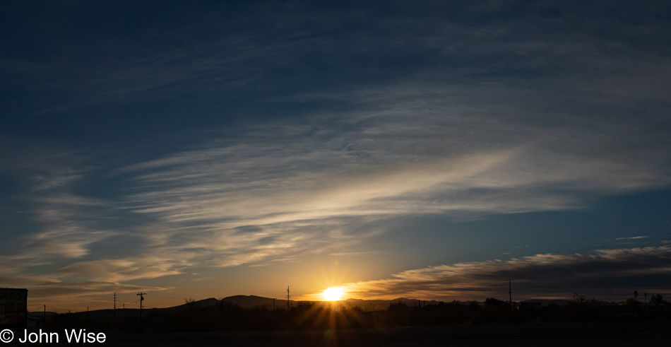
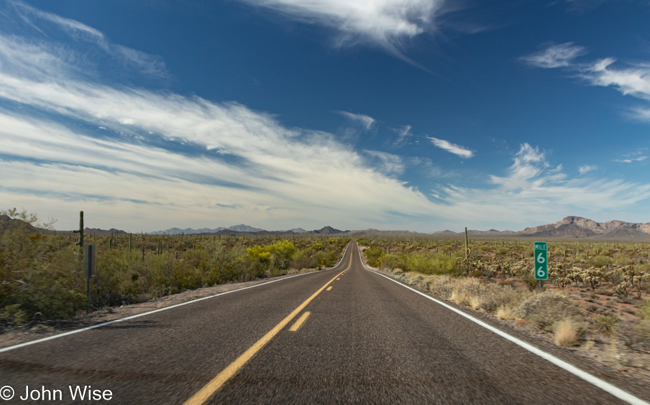
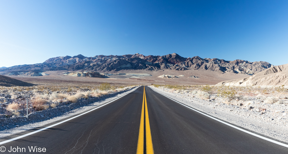
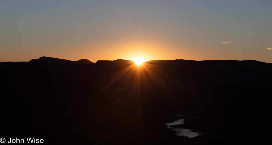
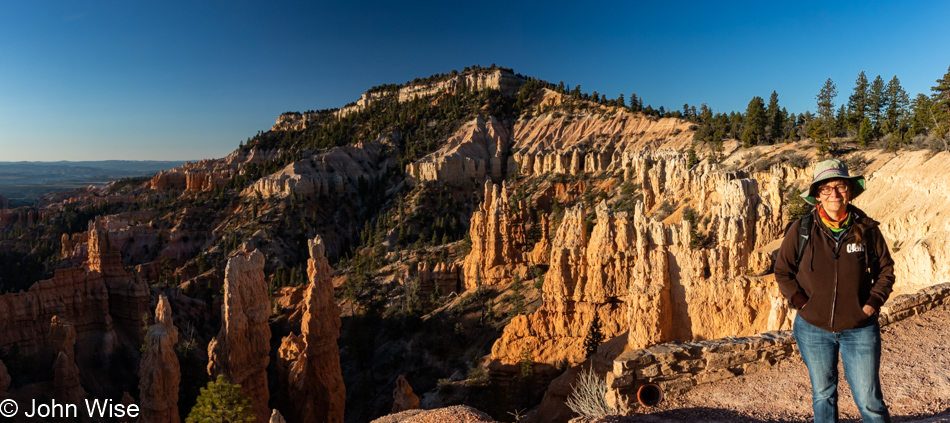
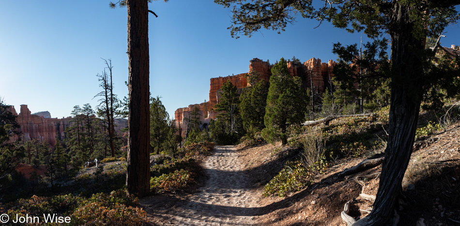
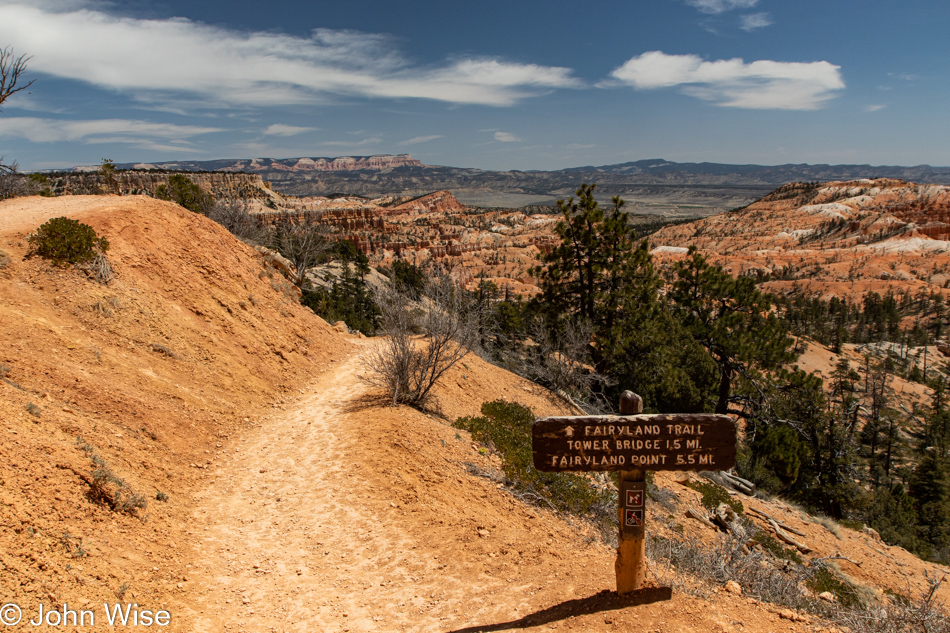
In the quiet cold of a crisp, clear morning alone near the trailhead of the Fairyland trail in Bryce National Park, we hear echoes of The Continental as he greets us with a hearty “Wowie-wow-wow-wow!” Oh, is that cowbell in the distance? Well, this beautiful sight doesn’t require more cowbell, though I suppose a little wouldn’t hurt either. Time to get Walken and make our way into our day on the trail.

Note – Caroline, upon reading the above just moments after I wrote it, wondered if we’ll remember the references when we are older. Hey Caroline, we are already old, and if we don’t know what this is pointing at, we probably have dementia or some other brain ailment. With that in mind, I’m including this link to the Saturday Night Live skit with Christopher Walken playing The Continental.

I closed Friday’s post, chronicling our drive north to be right here on this early Saturday morning, by writing about the role of love in these adventures. That was how I had planned to start today’s post, too, but being goofy was part of the beginning of this day as well, so that is that. Finding profundity even in the shadow of these photographic reminders is not always easy, though, in the back of my mind, I always hope to find some exalted eloquence to bring Caroline and me back to the sense of grandeur we were experiencing on these days out in the American wilderness.

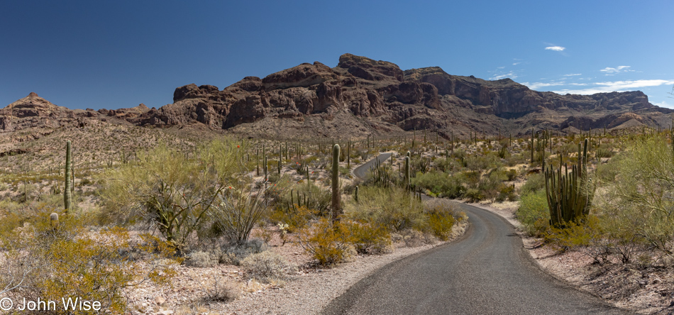
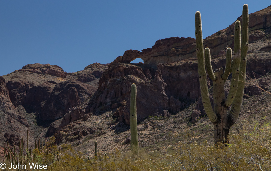
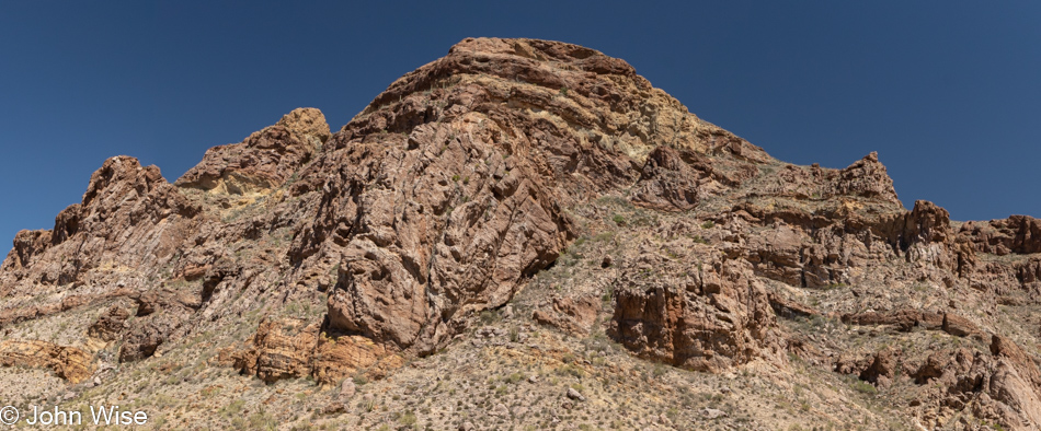
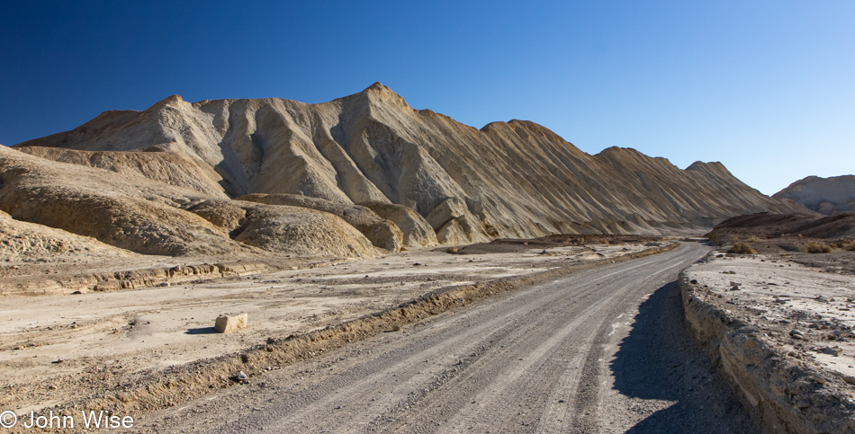
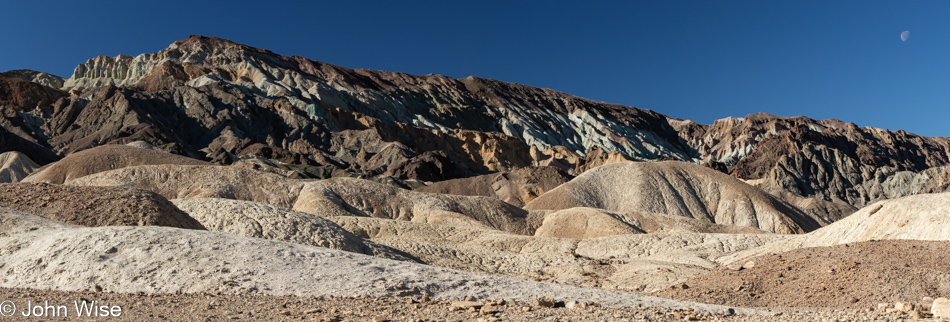
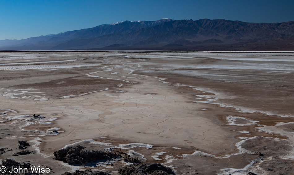
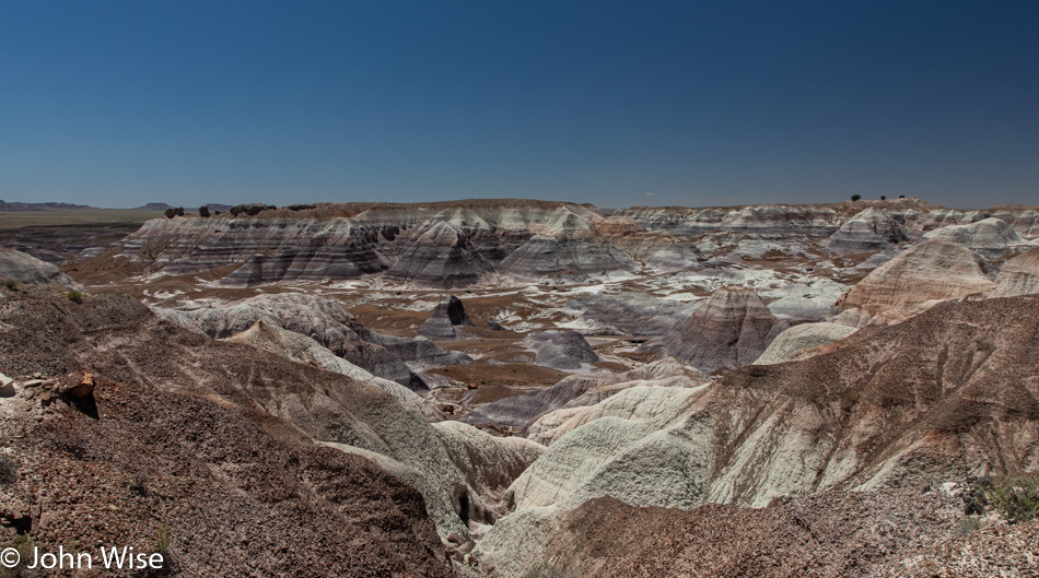
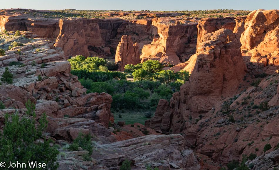
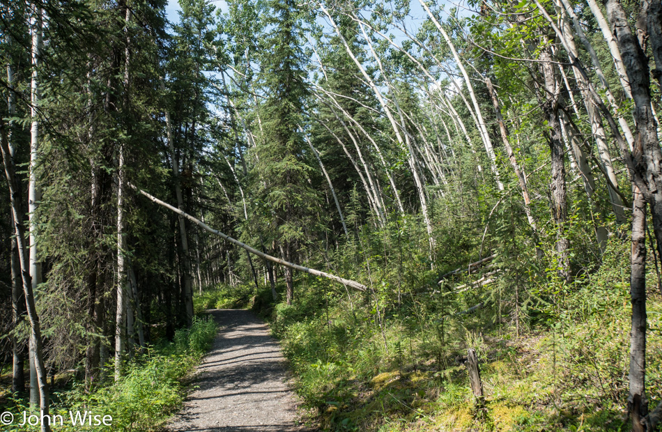
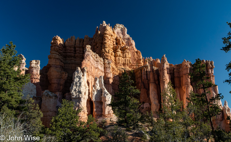
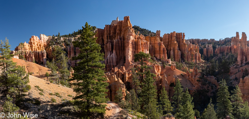
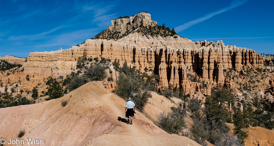
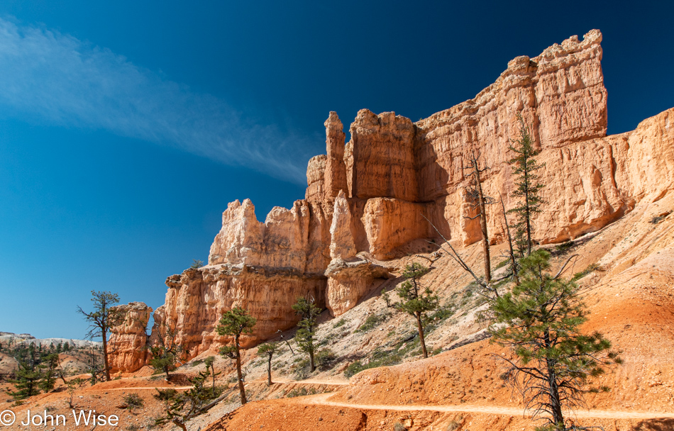
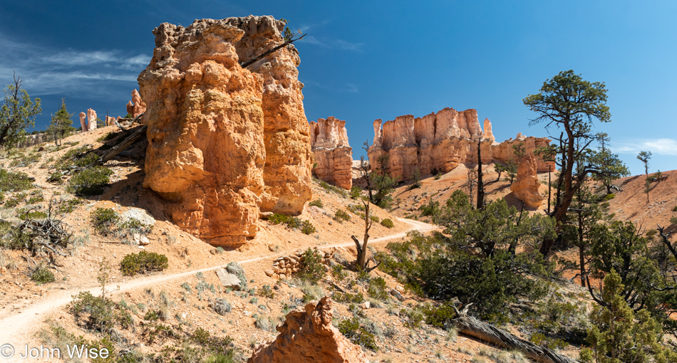
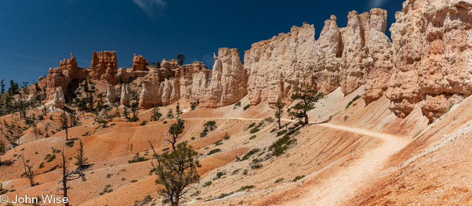
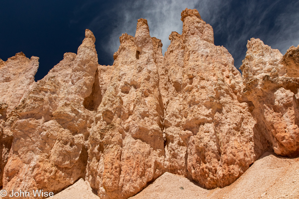
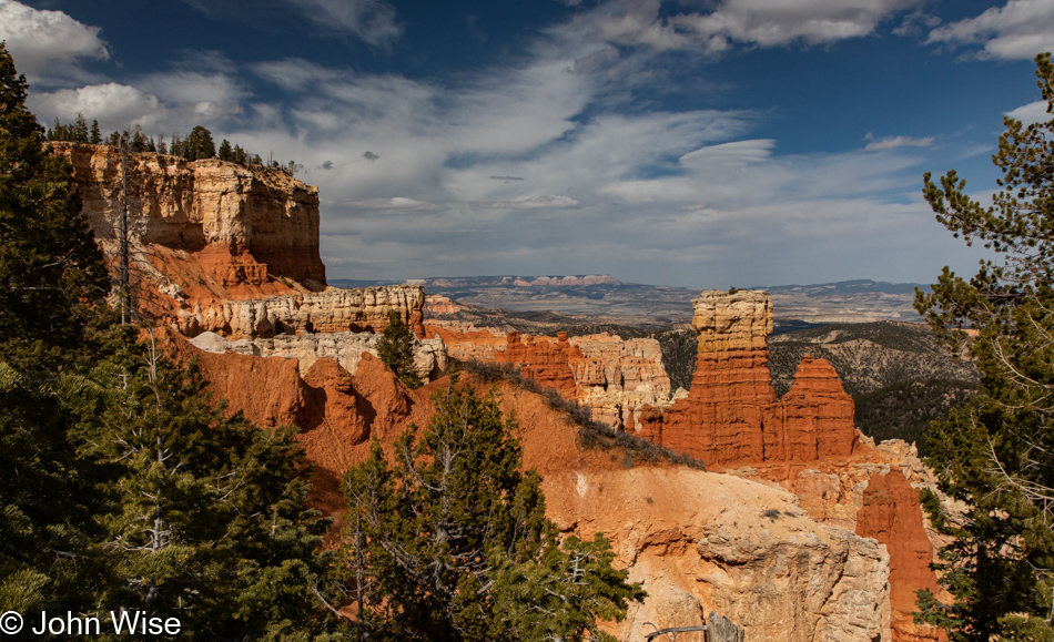
Awe is a well-worn word that likely shows up on half of all of our travel posts. I should probably mix it up and occasionally write of our veneration or admiration, but awe comes closest to gob-smacked without sounding so heavy-handed and cliched, so I’ll stick with awe. Now join me in looking in awe upon the hoodoos of our wildest imagination because this is no CG rendering of a fantasy landscape; it is the reality of the Fairyland Trail.

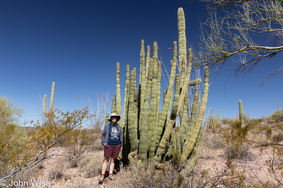
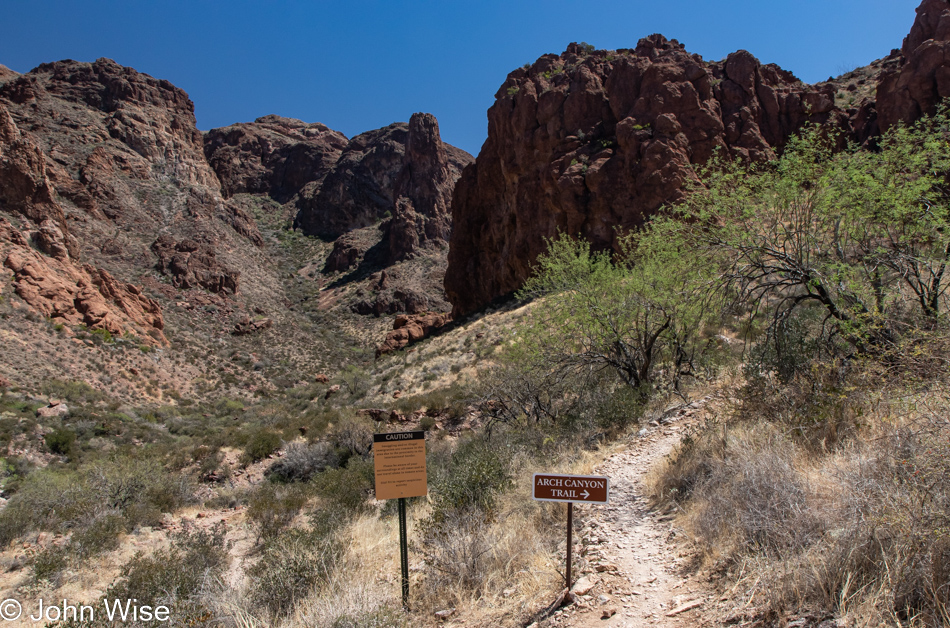
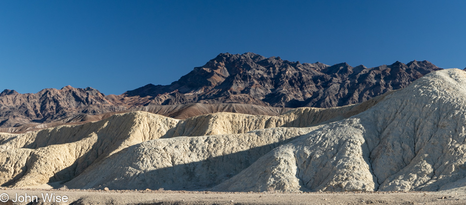
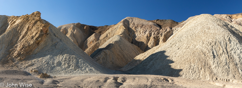
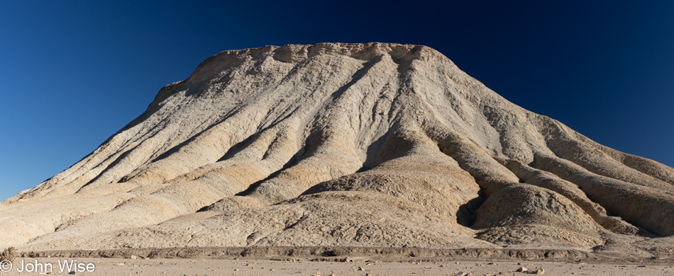
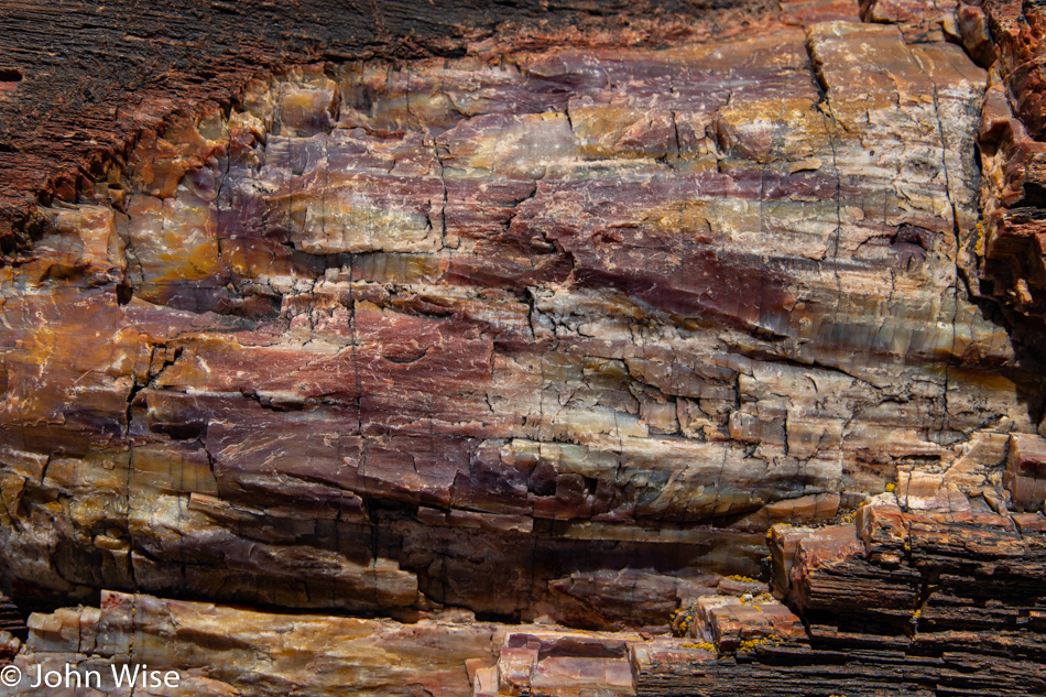
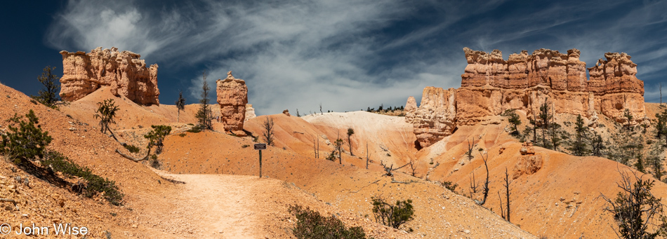
In the run-up to this visit to Bryce, I was looking for trails we’d not traversed previously, and that are of a particular length so we could spend the majority of our day out in the middle of things. Having been here before, I considered that there is the rim, it goes down to the basin, and along the way, we marvel at the hoodoos. As I’ve mentioned these “hoodoo” things a couple of times already, I should share just what they are. According to Wikipedia, “A hoodoo is a tall, thin spire of rock, usually formed by erosional processes. Hoodoos typically consist of relatively soft rock topped by harder, less easily eroded stone that protects each column from the elements. They generally form within sedimentary rock and volcanic rock formations.”

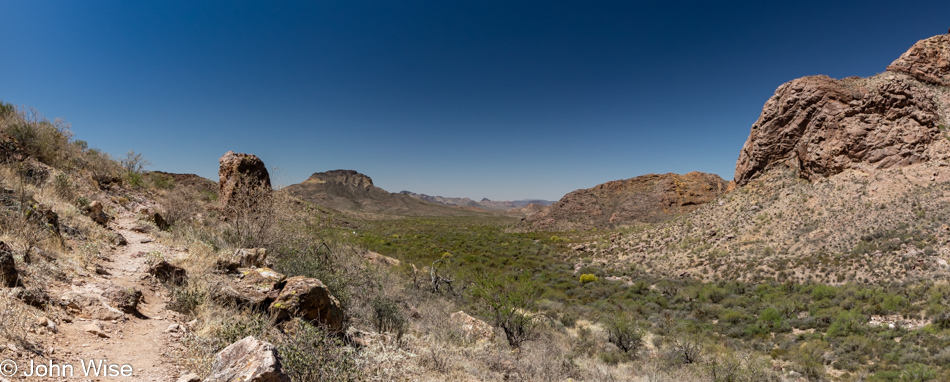
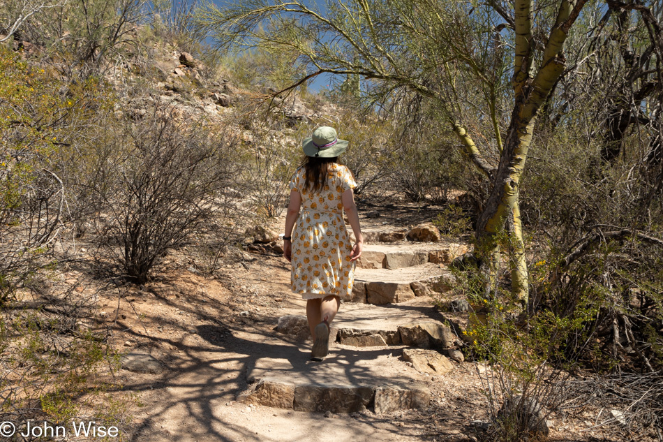
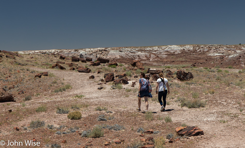
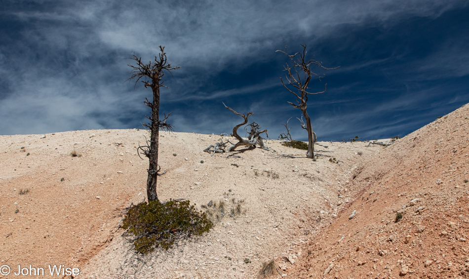
What we are learning on this trail that I missed doing my research is that there is exposure here. I have acrophobia, or extreme fear of heights, and that’s what I had to deal with very early on the trail. I can only hope we don’t encounter more of that nonsense. At this point in our hike, we didn’t yet know that the trail was also rated as strenuous, but we’ll fully recognize that during the last few agonizing miles. Being up here at around 8,000 feet of elevation might also contribute to the extra exertion our hike requires.

Like the imperceptible speed of erosion, Caroline and I move along like glaciers scraping over the earth in such a way that only time is allowed to witness our movement. In our mastery of ninja-snail skills, we require millennia to make progress down the path. This is a quality we are constantly refining so we might graduate to spending many millennia or maybe someday a myriad to move from here to there. And what do we see while lingering on the trail into our world? The understanding that reality is different than desire. We wish to observe a molecule of growth emerge from a filament of lichen, to watch a photon be absorbed by the leaf as it uses the sun’s energy to convert carbon dioxide and water into sugar, to be present in the mind of the bird as its instinct to fly is first relayed from its brain to its wing. Those are desires, wishes, dreams, and flights of fantasy that, under the circumstances of being on a hike, are all equally impossible to realize. Instead, reality dictates that we are only allowed to absorb but a fraction of the infinity flowing into our eyes, and so we go slow, hoping that more of more remains in memories that seem to be tossed off all too easily following these encounters with the amazing.

Now, look back to where you’ve been. Was this there before, or has it been altered by a shift in perception? Why wasn’t our brain tuned to see it in all lights and angles? Is there a method of grading this in our minds that would allow a higher prioritization in the hierarchy of memories? How sad the tragedy that we have evolved to better recognize faces, even of those we might wish to forget; seriously, why do any of us carry the image of Hitler, Freddy Kruger, or even the mask of Darth Vader better than we can recall the image of things out of nature aside from the most iconic monuments? Just then, the answer jumps into my head: mountains, beaches, trees, and flowers rarely kill people; other people kill people, so knowing which faces are dangerous is a survival strategy.

Scroll back and then return here. Am I sharing a different aspect of something already seen, or is this a wholly new view? Had I written this in situ, I might be able to answer that question but it’s now a week later. It takes a good amount of time to parse 815 photos to find the 70ish or so that I’m posting, and so my brain, while not wiped clean, is looking at these images and wondering, is this something I’ve already shared? If I were to extend that thinking, I’d give up writing the words dropping in on this page, as where else have I shared these exact thoughts?

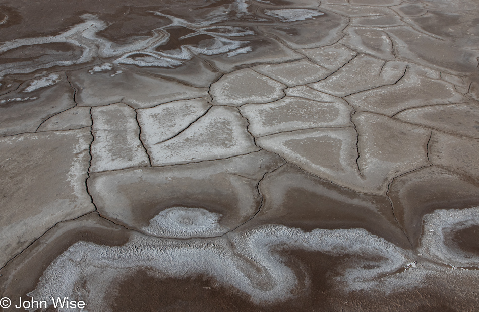
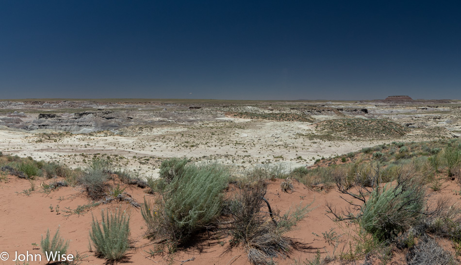
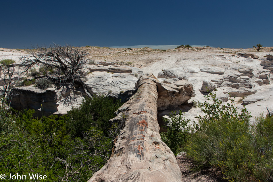
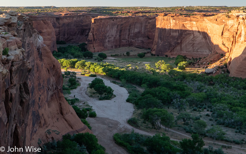
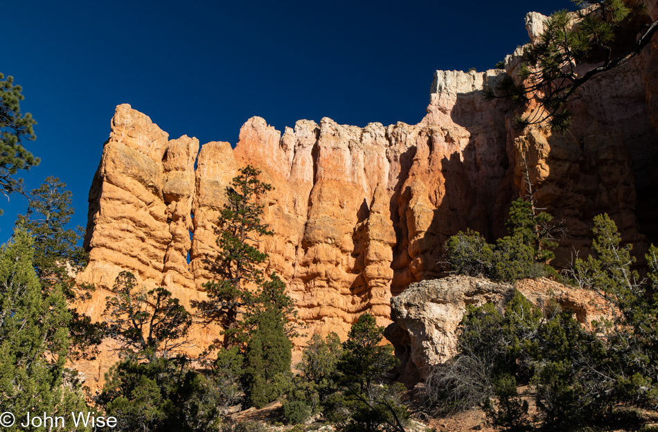
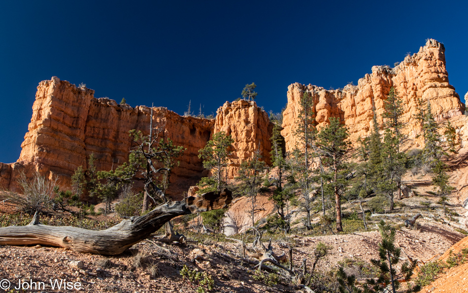
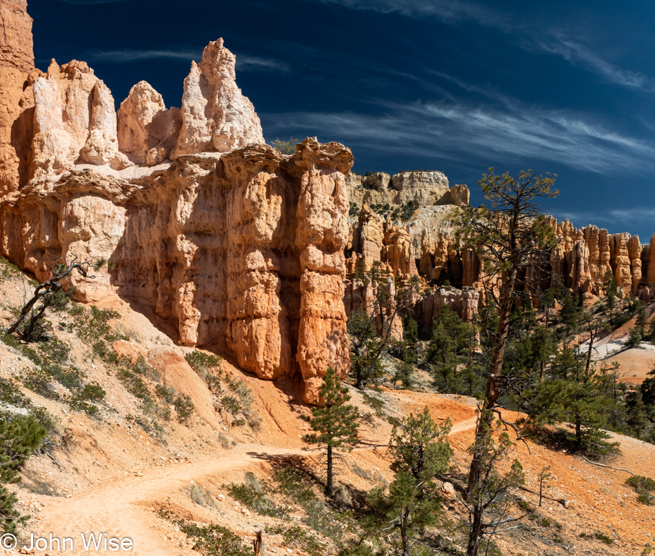
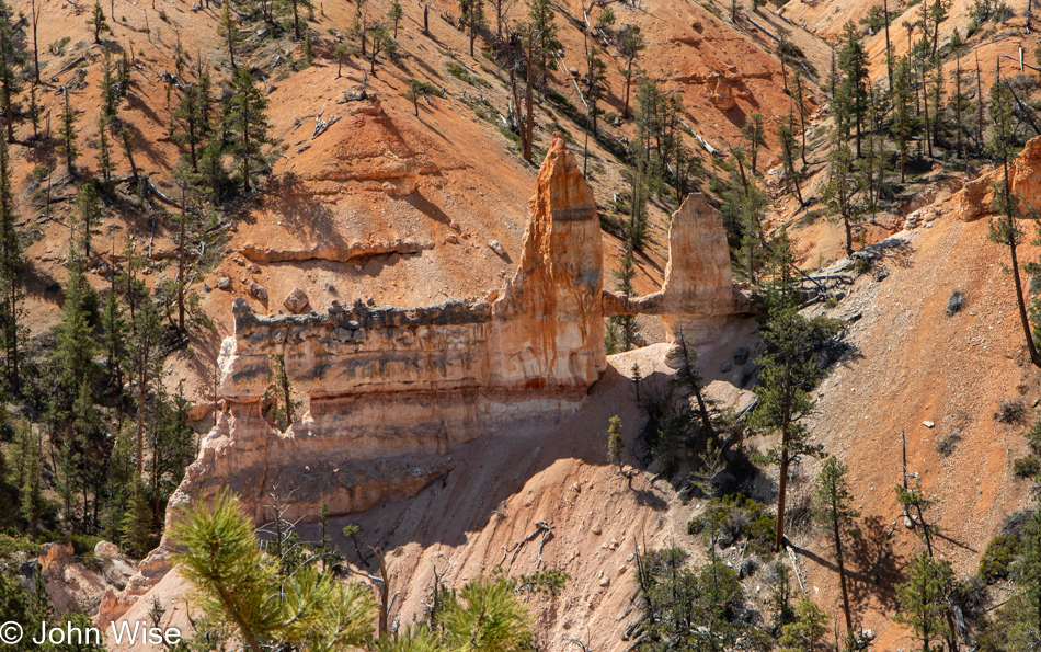
Trees struggle to hold on to the loose, ever-shifting earth; bushes cling low to the surface to establish a foothold lest strong winds send them off to other places, while rocks and sand continue to fall from above. Rain and snow work between the unseen spaces, ensuring there will always be less to see here than the time before, and there is nothing we can do to freeze this treasure in time, guaranteeing that anyone, even just tomorrow, will ever see Bryce Canyon in just the same way we have. An hour from now, our footsteps may disappear under the stride of someone else who passes through, a leaf might sprout, or a larger rock let’s go, and the path forward will be unpassable until those who care for these trails take it upon themselves to remedy the blockage so we can continue experiencing such sights.

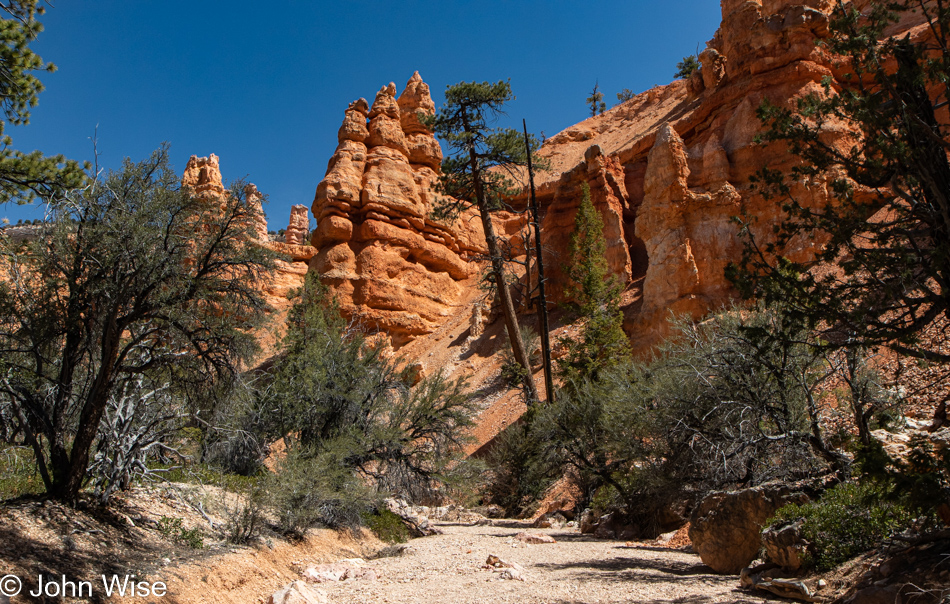
If Arvo Pärt were up for it, he’d be my first choice to compose the soundtrack for Bryce, next up Max Richter, and I suppose even Hans Zimmer might craft something appropriately elegant; instead, I’ll have to make do with the sound of the wind, birds, our steps in the sand, and the silence that emerges from between the hoodoos as although they may take on the visual characteristics of organ pipes, they do not bellow in lush tones though they appear as if they could serenade us with the most beautiful music.

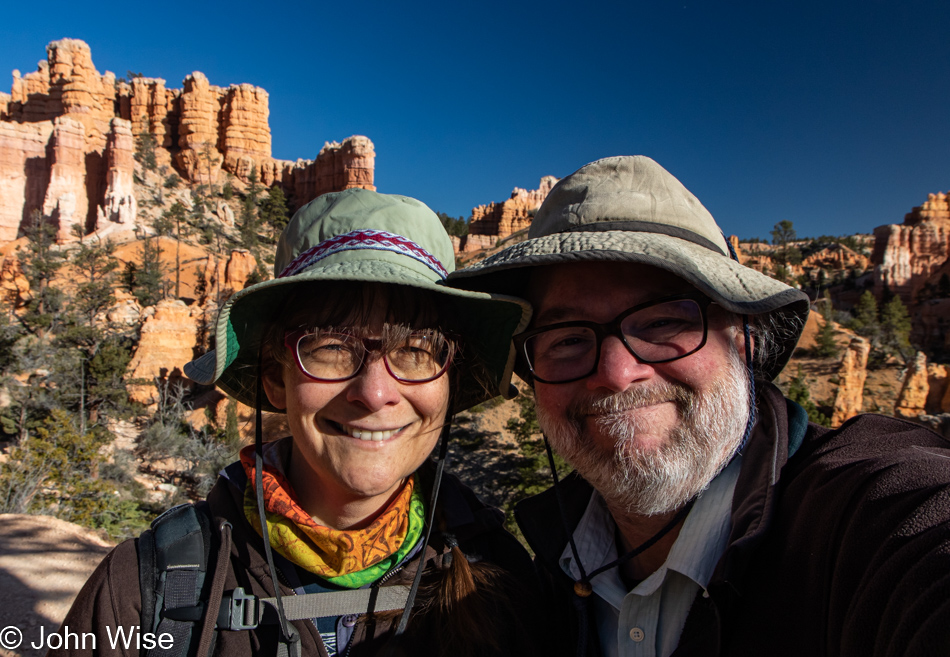
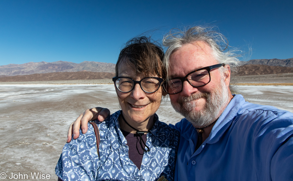
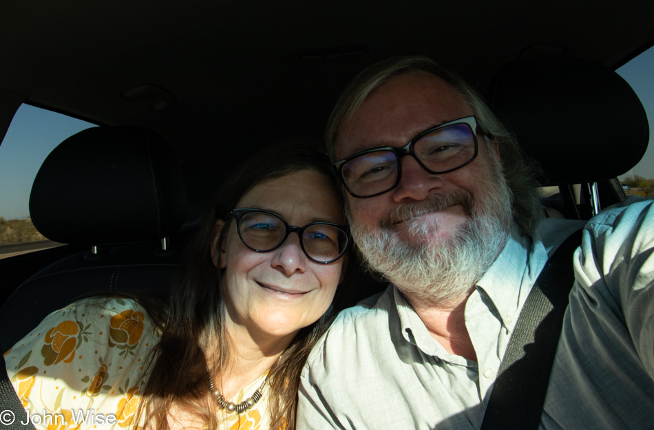
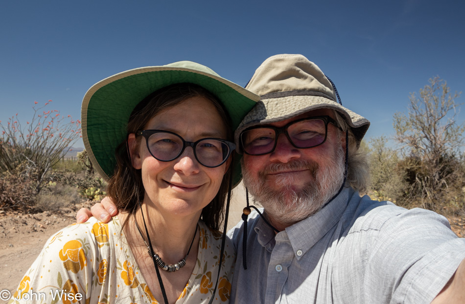
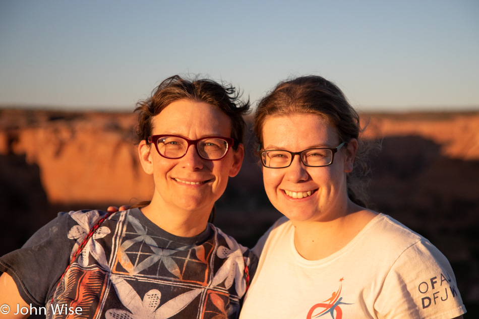
Sure, we are looking at the camera, but we’re so well practiced with this act of taking selfies that we understand that we are looking at each other, searching for the mirror of each other’s happiness, and as days pass until we look once again at these faces captured during this moment, we’ll know full well that we are gazing at love. Those two faces were engineered by the hidden hand of the universe to know the matching snuggly places where things just fit and find reassurance that the feelings and scents belong together just as the nature and shape of the surface of the earth are perfectly matched to the atmosphere that embraces everything underneath it. In this sense, I am Caroline’s tree and earth, and she is my oxygen and universe.

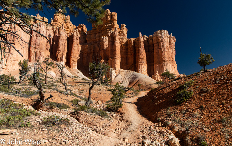
Every word I share here should be part of a love letter, and the fact is, even in lament, I’m in love, if in no other sense than the potential that things don’t have to be the way they are when they fail. Our human systems might fail our fellow men and women, but on occasion, we execute things perfectly, such as when the initiative has been undertaken to carve a trail through a mess of chaos that allows us to scale places we’d otherwise not be able to tread. I have no idea who mapped this trail, who paid for it, or who toiled to reshape the earth, so however many years later, we’d be here on a perfect day taking a stroll through a national park among alien rock formations as though it were the most normal thing ever.

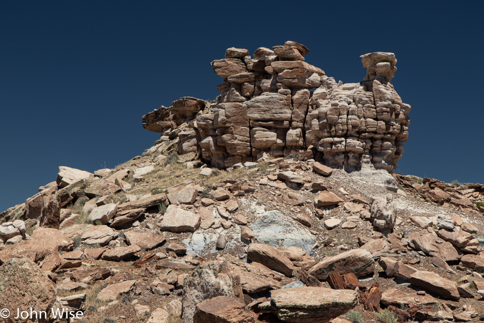
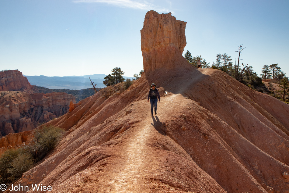
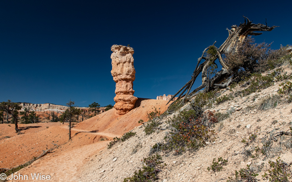
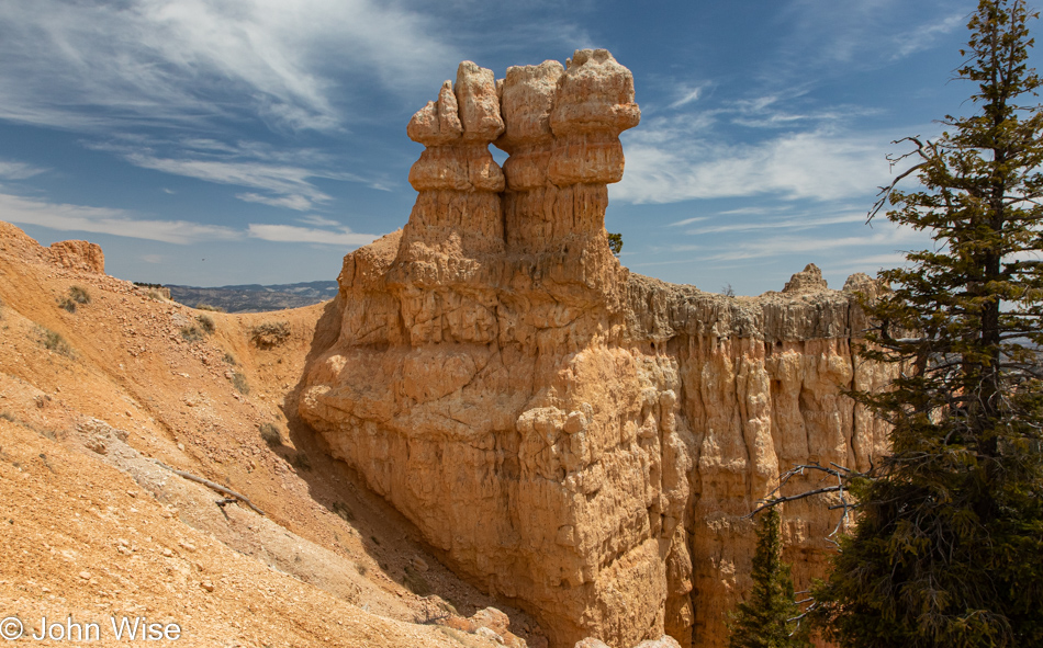
Consider this precariously balanced top-heavy spire just waiting until the day we arrived; for us, this could be the most normal thing ever because these forms are what shape this park, right? Wrong, this is not normal; this is treasure and experience beyond all monetary value as my mind nor my imagination is able to assign memories to the idea of money but intriguing beauty fits like a glove to deliver something akin to ecstasy.

John Wise on the Fairyland Trail in Bryce National Park, Utah

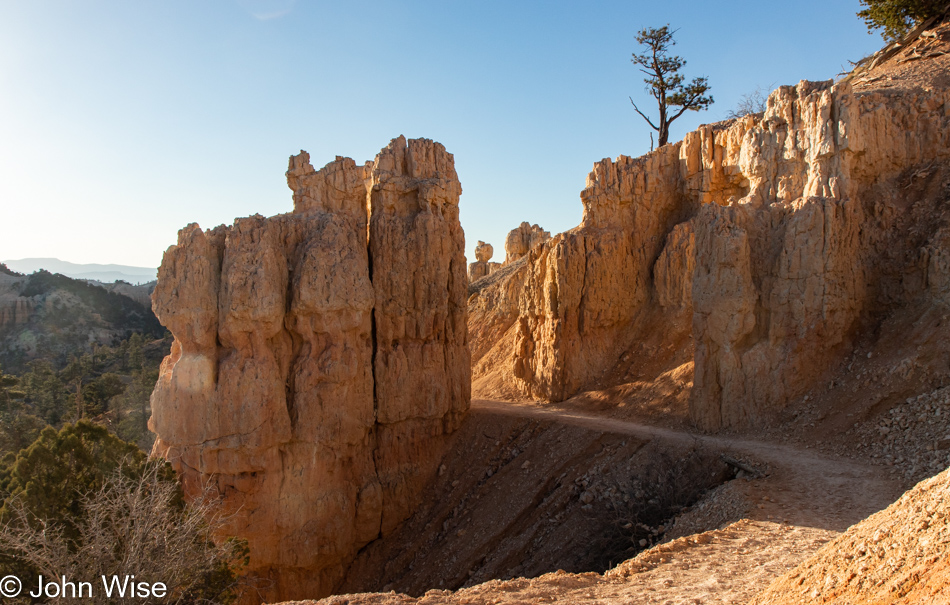
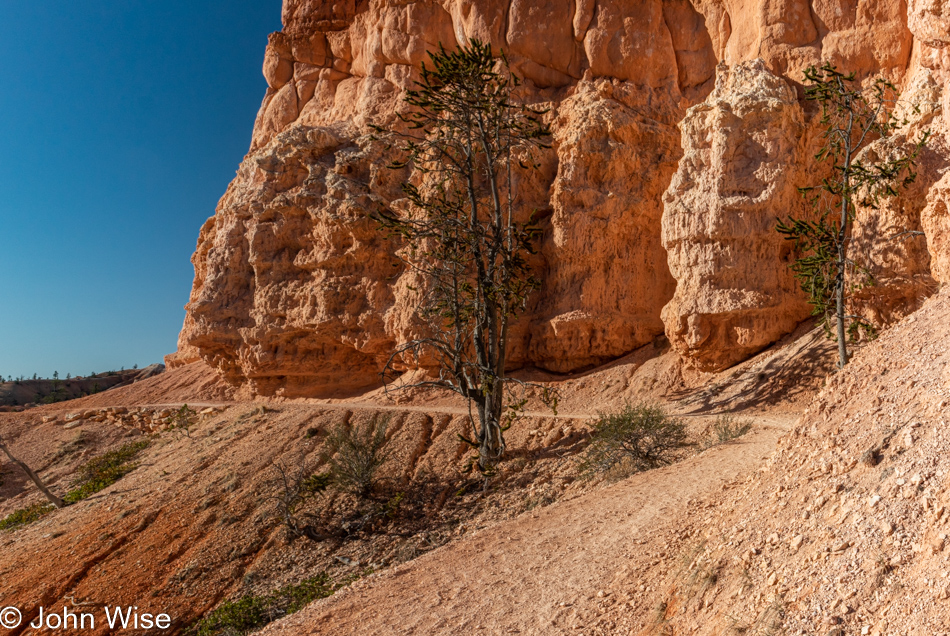
At the opposite end of ecstasy is terror, and that’s where I was standing before crossing this narrow razor’s edge of near-certain death. I gave two seconds of serious consideration to turning around, but back there at the trailhead was the first time I was launched into a bout of anxiety regarding my horror of hovering next to an abyss. Turning around would be defeat, though knee-buckling fear wrenched my stomach into a convulsion that initiated a conversation with my lower intestine, specifically my rectum, that pinched off in ways that drilled at my confidence. Before I can turn into a quivering wreck of adventure-canceling jello, I ask Caroline not to say a word of encouragement to me, don’t start after me before I reach the other side, just wait in silence.

I forgot to share with you that on the way to the park, the temperatures dipped as low as 25 degrees (-4c), though, at the trailhead, it had already warmed to a toasty 28 degrees (-2c). Add to this, I was wearing shorts because why would I need pants when we’d already seen temperatures in the upper 90s (35c’ish) down in Phoenix? Well, at least I had my long-sleeve wool shirt and a fleece, but by this time in our hike, we’d moved beyond needing a sweater, so I’d tied that around my waste. The gusty winds we were promised for Sunday were practicing for tomorrow’s performance, and while admittedly relatively light, they felt as though they would pick up at any second to whip over the ridge over which I’m about to struggle while wearing a sail around my waist. Oh, holy expletives, just go, John, and so I did, talking to myself out loud to remind my feet to find the trail with a tunnel vision that should blind me to the monsters from below trying to draw me into the void.

My atheist inner voice started talking to me after I turned around to watch Caroline cross, pleading with my non-existent god not to allow another inch of exposure to encroach on my well-being. Begging didn’t help as there was more to come, but nothing as precarious as this fine line dividing life and death.

Writing about my fear sure was a lot easier than living through the moment, but these unfolding views demanded I continue, that and my pride that I should accomplish our 8-mile hike we would turn into a 10-mile journey. How the extra 4400 steps were clocked is lost in mystery.

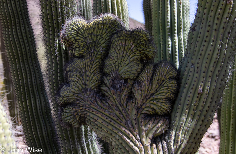
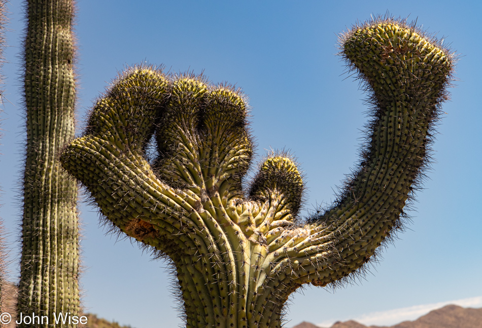
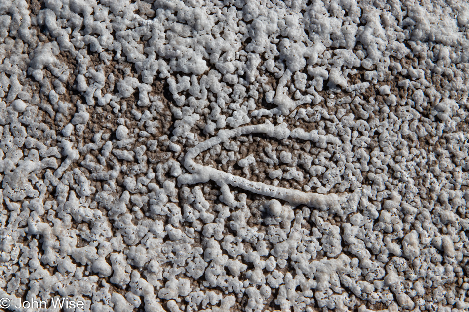
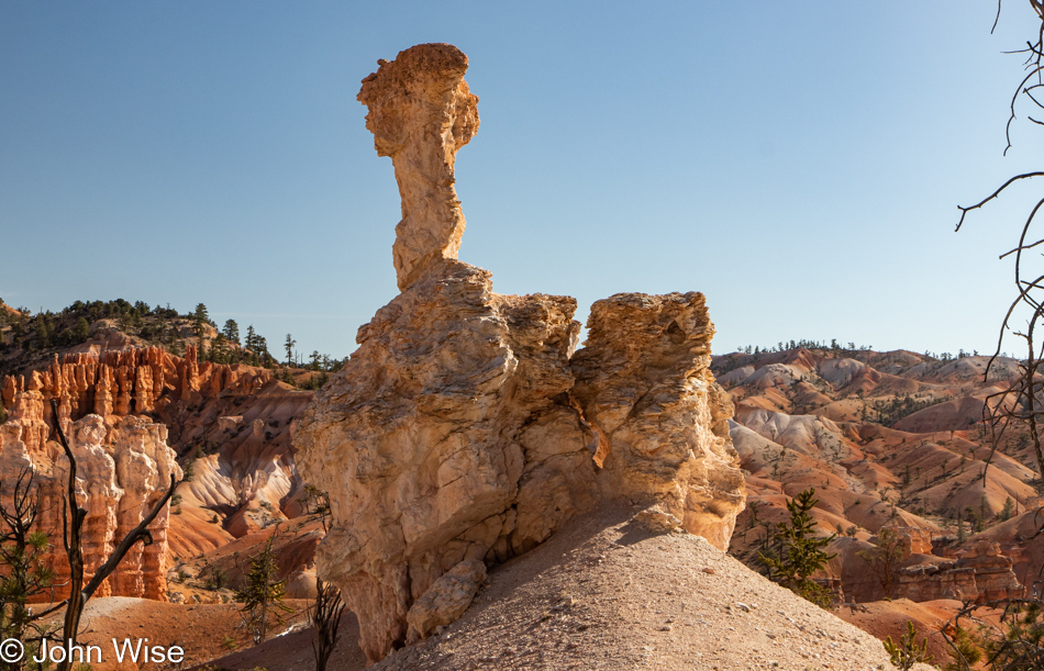
Yeah, it looks just like that thing we won’t mention here.

Here, in my parallel universe, exactly one week after we were hiking these trails, I’m immersed all over again in Bryce Canyon, except now I have the luxury of channeling all of my attention towards interpreting the experience. I’ve been writing since 7:30 in the morning; it is now 5:00 in the afternoon, and I’m not yet halfway through my task. When I call this opportunity a luxury, I’m not exaggerating, as how many people have the wherewithal to sit down with their thoughts, recollections, and inspiration before trying to bring back those impressions to feed my wife’s and my memories while possibly inspiring someone else to dream of visiting some of the places we’ve gone? What a gift that rises to equal the very act of traveling, including this travel within myself a week later.

Like the trail, like the day, like our love, I just keep going forward, searching for whatever surprises might be around the corner.

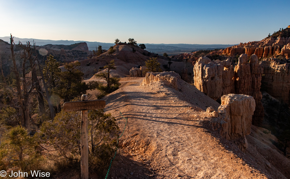
The Fairyland Trail could easily be renamed the Fairytale Trail and live up to that new name. If one arrives equipped with an adequate supply of imagination in their mental backpack, they will quickly consider that this basin is not only host to the potential of fairies but is a place where a narrative of enchantment can unfold into a fantastical story that will travel with them the rest of their lives.

Should you doubt my claim above or fail to find the magic of astonishment in environments that plant the mythical seeds of the profound within us, maybe you will be fortunate enough to be visited by a creature sent to whisper the secrets of how to peer into unseen universes and embrace the impossible. Maybe part of the key to these moments is to exude such an extraordinary amount of love that creatures, trees, the sky, and mountains become aware of your presence and open the window to that hidden dimension.

But what if that dimension is not hidden at all but simply unknowable to those without the vocabulary and love to embrace potential and opportunities? Could the inability to give sense to the unfathomably profound be part of the reason there are so few people out here? Maybe the peeking in from the rim of the canyon both here at Bryce and down south at the Grand Canyon is all that fragile, inexperienced minds are able to tolerate as they make baby steps into exploring the depths of places too overwhelming during their first encounters?

We gain a footing in the mysteries of our world as we bridge the way forward, crossing over the fears that travel with us. I’d like to suggest that those fears are actually tools that propel our uncertainty and challenge us to work harder at overcoming them if we are to continue growing. On the other hand, there will always be those afraid to step over the shadows of the unknown while sadly spending lifetimes insulating themselves from exploring the breadth of potential happiness. I believe that confidence and, subsequently, happiness arrive with conquering the irrational, the fear, and the thoughts that we might only learn a mere fraction of things from the vastness of potential knowledge and experience. For example, overcoming the terror I experienced walking next to the ledge gives me the reward of being on the other side of that anxiety. On this other side, I find a new world I was reluctant to step into, but I am now able to discover the ecstatic joy of new things so beautiful that they defy easy description.

If I were a poet, I could focus my writing on trying to send aloft these images with a descriptive narrative allowing the blind to understand what was captured and what it is that is elevating my aesthetic sense of inspiration. Even with my creativity crippled, I’m driven to continue trying to unravel a flow of experience on these pages. But I’m sadly aware that I’m lost in a linguistic poverty that continuously fails in the conveyance of the magnitude of emotion I float through when my best friend and I are under the spell of such moments.

And so I just continue to write, searching for what’s out there. In the same vein, I hope that as I discover sights new to me, I might find a new sequence of words in my writing that will transform my brain allowing me the expression I’m looking for. Without constant practice, I’ll certainly end all possibility of obtaining that revelation. Oh, is that it over on the right? Probably not; I better keep foraging both in nature and in the expanse of a mind not afraid to fail.

I have to laugh out loud as I scrolled down to this photo and thought, “This is my brain, an expanse of clouded blue and a barren landscape with just three words barely clinging to life I must choose from what will reveal intrinsic values that transcend my mortality.”

The trail has started its ascent towards the rim with the end of the heavy lifting in sight. After having been out here for hours there’s a bittersweet sense that our time among the hoodoos is coming to an end.

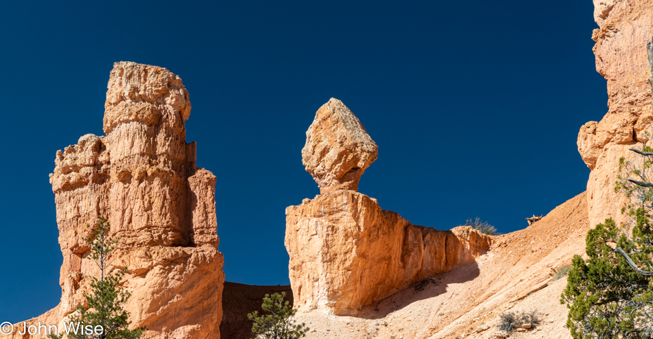
Are you thinking what I am? These formations surely do look a lot like candy nut clusters made of some sort of milk chocolate nougat.

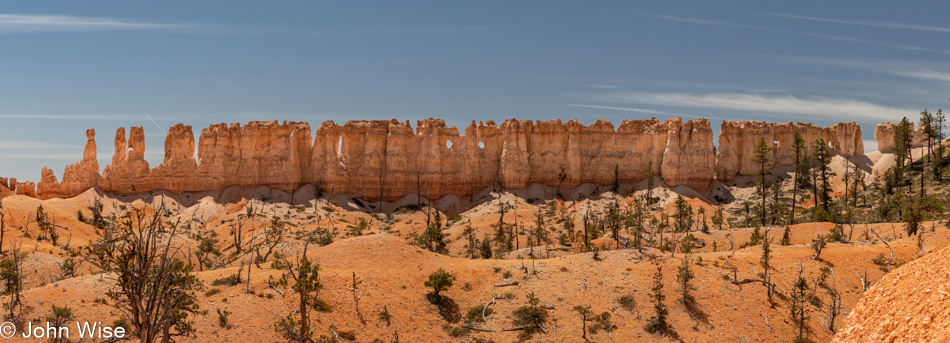
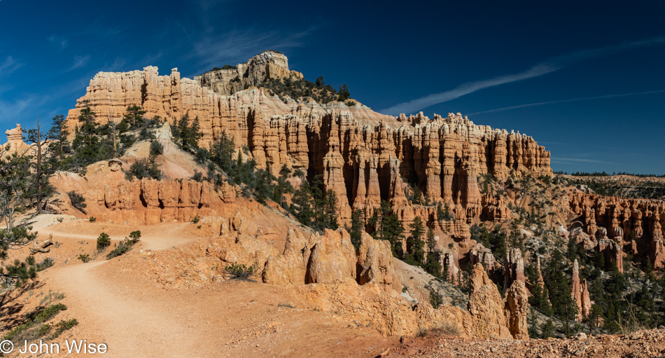
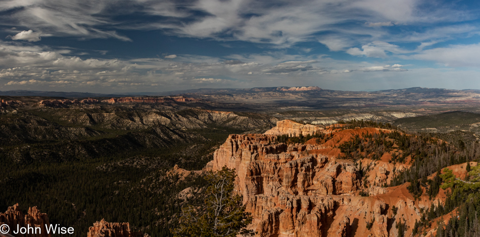
By this point on the trail, I’m tired. This is the Chinese Wall as it’s known out there, and that’s about all I have to say about it. Regarding this sense of being tired, this is the second day of writing this post, and it’s already late in the afternoon as I try to finish. Rightfully so, too, as I’m approaching nearly 3,000 words that I’ve shared here.

Hallelujah, we are reaching level ground soon when we meet the Rim Trail for the walk back to the Fairyland Trailhead. Not long after this, we reached the elevation of nirvana and were savoring the ease we’d be traveling the next hour or so; we could see cars in the Sunrise Point parking lot and proper toilet facilities. Phew, easy going from here forward.

WTF, we are climbing? Those thoughts that the last miles would be a stroll in the park were misguided. I should have done better research regarding our hike today. Not only did we discover a couple of extra miles out here, but we were also contending with 4,619 feet of elevation change (1,408 meters), and of course, those pesky drop-offs and facts such as the trail being rated as strenuous, so why should the end of it treat us nicely?

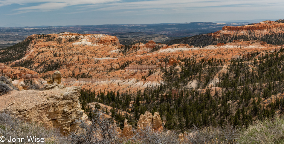
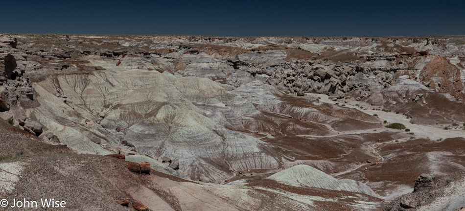
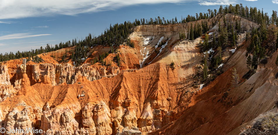
Well, at least there’s this brilliant overlook where we can gain a different perspective of the Chinese Wall near the dead center of this photo.

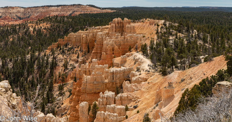
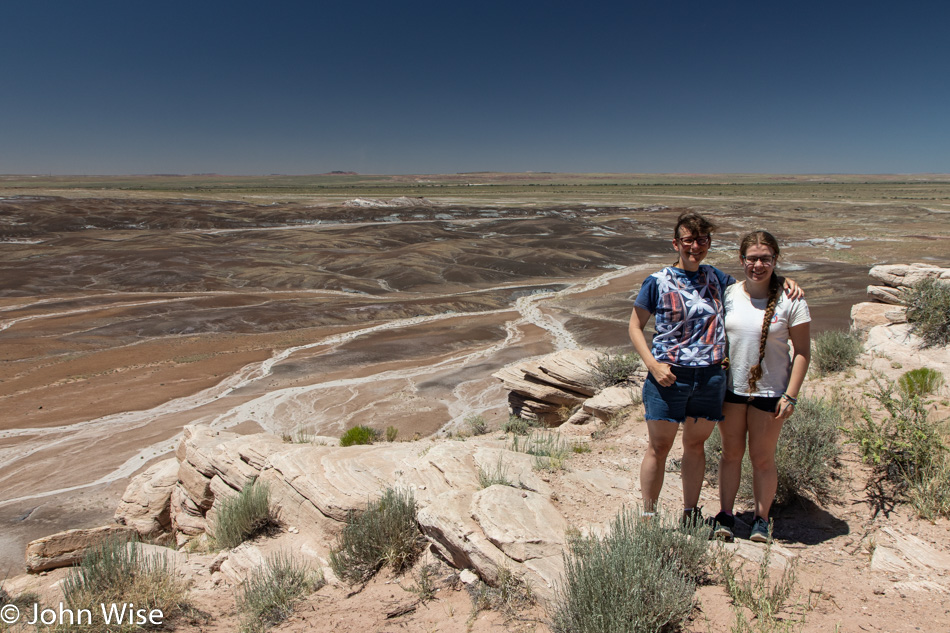
We’re finally at the high point of our hike, and the view around us is spectacular. If I share the other directions surrounding us, I’d only pile on more writing obligations and all I want to do is both finish the hike and this hunt for something else, anything else I can share here that will pull you into our experience.

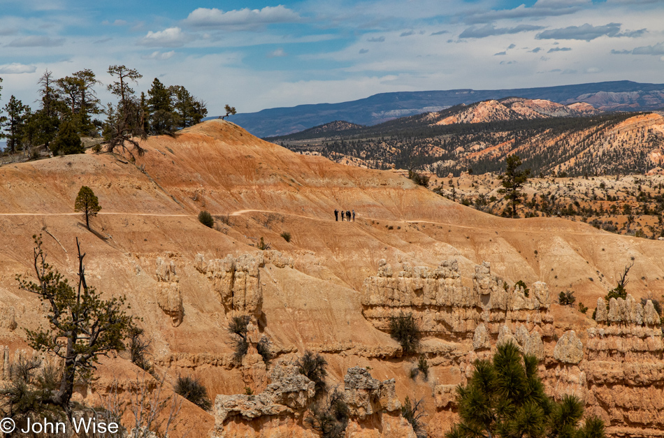
This must be it, the end, as that’s the beginning. Right out there, where the five lunatics are standing calmly at the edge. Just to the left is the trailhead where I first clenched at the thought of crossing that narrow strip of trail sliced into this 60 to 70-degree slope, as judged by my puckering backside. Lucky for me and for Caroline, as I don’t think she would have hiked this alone, there was nobody out there at 7:00 this morning that I had to pass because I wouldn’t have been able to. But now we are just minutes from our car, air-conditioning, a giant bag of popcorn from Costco, and rest for our weary, aching joints.

Caroline Wise becoming a Junior Ranger at Bryce National Park in Utah

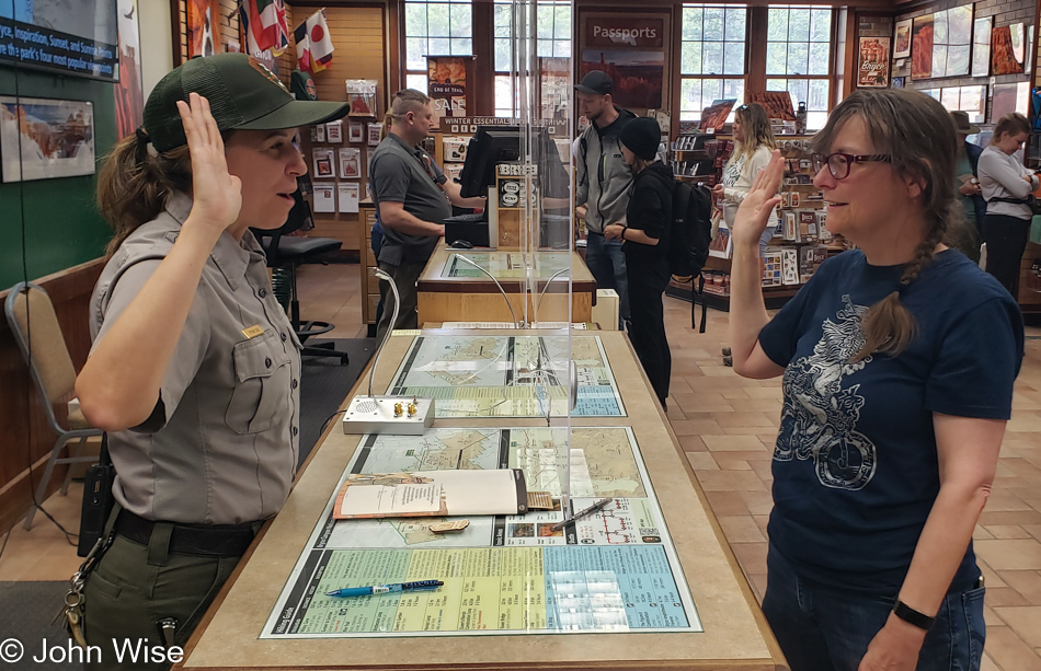
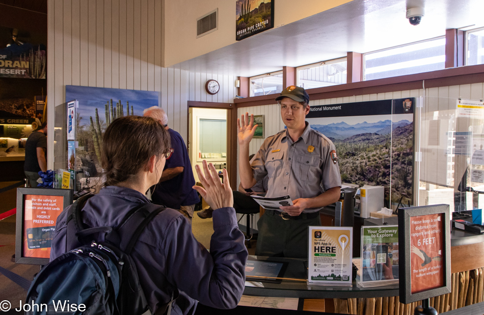
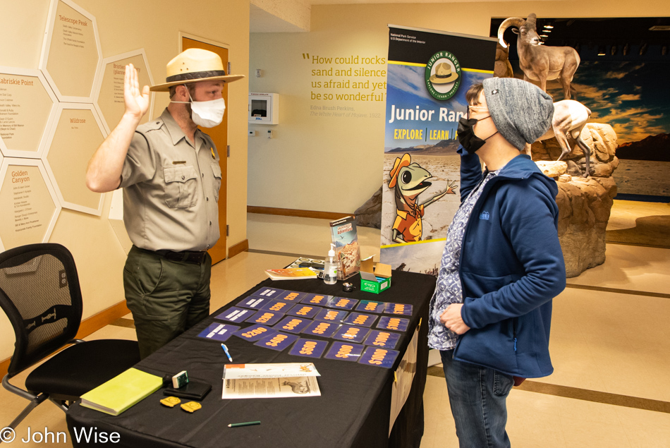
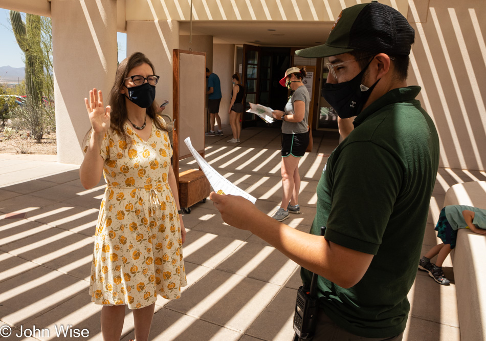
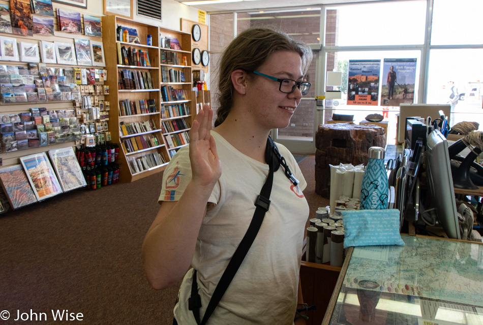
Seeing how it was still early, we jumped over to the visitor center for Caroline to collect a Junior Ranger workbook in order to earn her ranger badge, the real reason we visit any national park or monument. As for me, I found a chair and did nothing, enjoying the fact that my wife had to answer every question and do every exercise because she’s not a kid; adults must suffer to earn these kinds of rewards.

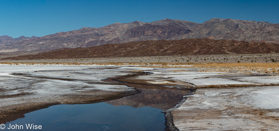
Hmmm, it was still early, and although we were exhausted, we weren’t ready to find dinner or go crash at the hotel. We’ll go for a drive down to Rainbow Point. We didn’t get far before we pulled over at the Aqua Canyon Overlook to get a good look at the snow that’s still lingering in the park.

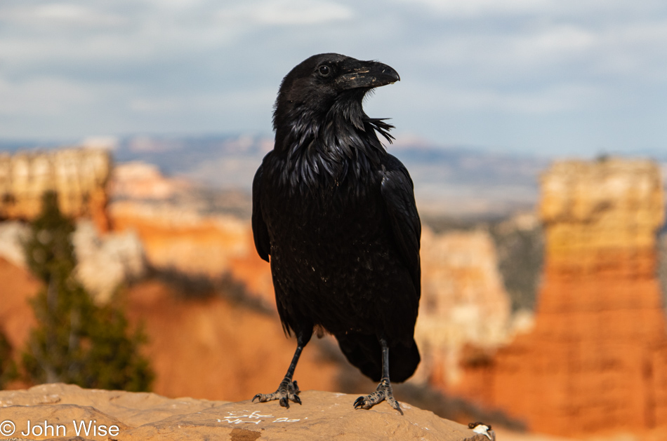
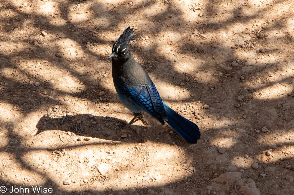
Where is MY FOOD, you meaningless, empty-handed land animals? My freshly minted Junior Ranger wife swore to uphold the rules and regulations of the national park, and that means not feeding this bird…like she “accidentally” might have done with that beautiful blue and black Steller’s jay pictured in so many photos above.

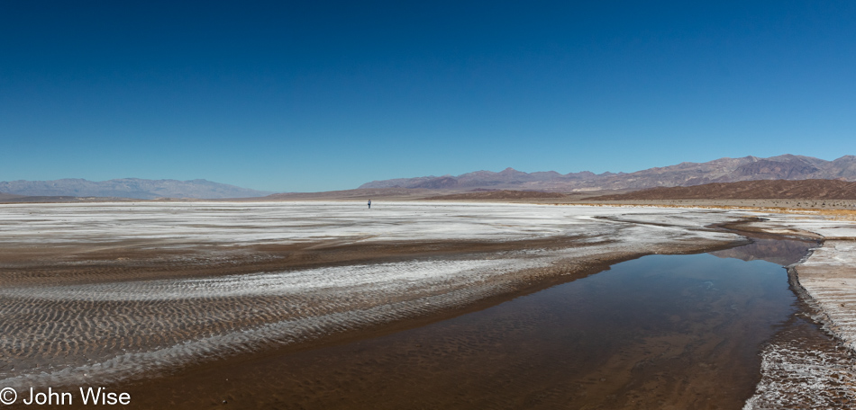
We are in no hurry to leave the view of Agua Canyon as that would mean working our legs back to the car and stepping off that crazy steep curb we parked in front of. So it was a normal curb, but our joints were screaming at us with an angrier voice than any raven might as they complained about any step that went downhill.

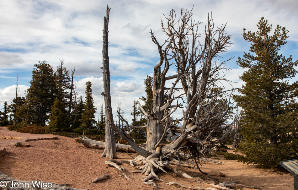
Caroline had the brilliant idea that we could relieve the growing discomfort by limbering up with a 1-mile trail rated as easy with a minor 200 feet of elevation change. Plus, it’s called the Bristlecone Loop Trail, so we’ll see some of those amazing trees we last saw years ago at the Great Basin National Park over in Nevada. What a damned stupid idea this was; why did I agree to this act approaching a kind of suicide for my poor knees? Since when can 2 degrees of descent make me want to cry? Please, invisible non-existent god, lift me off this trail and drop me at the nearest restaurant where I promise I won’t make a spectacle of my pitiful being by rubbing cheesecake on my knees as though somehow that might help.

The end credits start to roll right here. There are no funny outtakes. We made it back to the car and drove 15 miles down the park road to the Bryce Lodge dining room to have one of the worst buffet-style meals we’ve ever had to suffer through. Did we care that it was poor? Heck no, while we had almost zero energy left, we were still able to muster some tiny bit of something inside so we could smile at each other and bask in the awe that we earned bragging rights to having had such a great day. Life rocks.

Down Around Ajo Way

Sunrise in Ajo, Arizona

A slow day in the Desert Southwest started with the sun pouring into our east-facing window. Like an alarm clock hammering at our ears, the light of day insists that sleep is over. Into the morning we go.

After using those supplies of the hygienic type we secured last night, we started our journey south. Ajo, though it means garlic in Spanish, is no place for culinary delights by a long shot. Just getting breakfast is a chore. Likely due to the carnage of two years of pandemic, Google and the business listings of Ajo are out of sync. Luckily, we found Oasis Coffee at the main square, where we were able to get some decent coffee, a bagel for Caroline, and a bacon egg panini for me. Behind the wife was a gaggle of Brits that we learned were also heading down to the national monument; we were determined to beat the crowd, so it was time to drop the pen, go find some water, and point the car towards the trail. That was until Caroline thinks “bathroom” but finds half a dozen of those gray-haired people of English descent already in line ahead of her; she’ll just have to pull up a tree or cactus somewhere south of here.

Catholic Church in Ajo, Arizona

Starting our drive south of Ajo, I was wondering why a place would be named after a herbaceous bulb related to the onion that doesn’t seem to be related to this town in any way. Wikipedia came to the rescue by informing us that Ajo might have gotten its name from the similar-sounding Tohono O’odham word for paint (oʼoho). As for Tohono O’odham, they are the original dwellers on these lands, and their name means Desert People.

Organ Pipe Cactus National Monument in Ajo, Arizona

Search out the extraordinary and be prepared to be surprised. Here we are at Organ Pipe Cactus National Monument down in a tiny corner of Southern Arizona, but that is deceiving as it turns out that this desert outpost with very few roads is more than 12 times bigger than Paris and almost 4.5 times bigger than Munich. Yep, it’s that big! There are about 101 miles (162km) of dirt roads through the monument; of those, we’ll only be able to visit 21 (34km) today.

Organ Pipe Cactus National Monument in Ajo, Arizona

The one paved road through the park is an artery traveling between Mexico to the south and Why, Arizona, and points beyond to the north. Our first stop will be the visitor center to pick up the Junior Ranger booklet so Caroline can nab a badge from this park. As it turned out, my wife was going to have to step up to adulting as this national monument offers a “Desert Ranger” program for non-kids.

Cristate Cactus at Organ Pipe Cactus National Monument in Ajo, Arizona

The first question has Caroline wishing for the Junior Ranger booklet where she can draw cute pictures and write poetry because asking her to describe and diagram the genetic mutation that leads to cristate cactus formations has her stumped. That is until I offered her the explanation that this is a defect in the apical meristem and as far as the diagram was concerned, she was on her own.

Organ Pipe Cactus National Monument in Ajo, Arizona

Our wish during this visit to Organ Pipe Cactus National Monument was to make our way over the 41-mile-long Puerto Blanco Drive that would have brought us past Quitobaquito Springs (closed for restoration work), but the ranger informed us that there are sandy parts of the road and that at a certain point, we will be limited to one-way traffic so turning around becomes impossible should we hit a part of the road we’re not comfortable negotiating.

Organ Pipe Cactus National Monument in Ajo, Arizona

Instead, we are heading up the popular Ajo Mountain Drive.

Caroline Wise at Organ Pipe Cactus National Monument in Ajo, Arizona

What was the lesson learned from visiting this particular organ pipe cactus that was a short walk away from the gravel road? For me, it was I should have worn my hiking boots as random unidentifiable cactus needles are able to penetrate the rubber soles of my walking shoes, and while I didn’t need pliers to remove them, it’s a rude moment when a needle meets flesh.

Organ Pipe Cactus National Monument in Ajo, Arizona

I would like to imagine that nearly anyone looking at this image would be able to figure out the reference to organ pipes.

Organ Pipe Cactus National Monument in Ajo, Arizona

After a good stretch of washboard dusty dirt road, we run into some paved sections that are always delightful as, for a couple of minutes, our car is turned into the greatest luxury ride ever.

Organ Pipe Cactus National Monument in Ajo, Arizona

Guess how many cars have passed us at this point? Mind you that we’ve already been crawling around out here at a snail’s pace for a good hour. Well? The answer is NONE!

Organ Pipe Cactus National Monument in Ajo, Arizona

E-bike rentals here at the park would be ideal as the 21 miles of this road are too much to walk, but the car is allowing us to drive too fast. Being realistic, the argument against e-bikes could easily be made that most visitors are only interested in getting a glimpse of things the quickest way possible.

Organ Pipe Cactus National Monument in Ajo, Arizona

The Desert Ranger booklet points out that standing right here should be the largest organ pipe cactus easily accessible to those driving by, but all we found were these whale-like looking skeletal remains of what once was the said cactus.

Organ Pipe Cactus National Monument in Ajo, Arizona

The ocotillos are in bloom, and why it took me so many years to learn the details of this semi-succulent plant is beyond me. First of all, the name is Spanish for Little Torch, which should be obvious enough from the color and shape of the flowers. This plant that is able to live for nearly 60 years is related to the boojum tree. Finally, the fresh flowers are edible and can be used in salads; when dried, they can be used as herbal tea.

Organ Pipe Cactus National Monument in Ajo, Arizona

We’ve reached Arch Canyon, and the one and only hike we’ll do out here today. Look closely at the big blue spot in the rocks, and just above that is a minuscule, fragile-looking second arch. I’ll just go ahead and tell you now: the trail that would have taken us up close and personal with the arches eventually would get too hairy for me, so this will be the best photo of it that I was able to take, but we wouldn’t know that until we got deeper into the canyon.

Organ Pipe Cactus National Monument in Ajo, Arizona

So, we started our pleasant hike over a well-groomed trail thriving on the exquisite beauty and solitude out here.

Organ Pipe Cactus National Monument in Ajo, Arizona

Looking back on the way we came.

Organ Pipe Cactus National Monument in Ajo, Arizona

It was just around this corner where a steepish ascent up some slick rock marked by cairns would have taken us up the mountain for a more intimate encounter with the arches, but like I said…

Organ Pipe Cactus National Monument in Ajo, Arizona

As we turned around just beyond those signs, one of them warning us about immigrants and traffickers, I spotted the smallest arch I’d ever seen. About 25 feet overhead was this tiny opening I don’t believe a hand could have fit through.

Cristate Cactus at Organ Pipe Cactus National Monument in Ajo, Arizona

Another organ pipe cristate, also referred to as a crested cactus, was found, but the saguaro cristate described in the booklet couldn’t be found; maybe it is now gone.

Cristate Cactus at Organ Pipe Cactus National Monument in Ajo, Arizona

I can’t remember ever seeing this cristate mutation in the Phoenix area; I wonder if this is an environmental factor due to elevation, weather, or soil chemistry.

Organ Pipe Cactus National Monument in Ajo, Arizona

Come to think about it, why don’t these organ pipe cacti call the desert up in Phoenix home? From Phoenix down to the Mexican border and beyond, these lands are all part of the Sonoran desert. As a matter of fact, the Sonoran desert extends 260 miles south to Guaymas, Mexico, and yet, saguaro cacti are only native to Arizona. Of course, the internet has all the right answers. It turns out that organ pipe cacti require predictable, warm-season rains and rocky soil, and the Phoenix area doesn’t meet those requirements.

Organ Pipe Cactus National Monument in Ajo, Arizona

Flowering jumping cholla, also known as teddy bear cholla, is what’s leaving the needles on the ground I’m stepping on; this is my best guess.

Caroline Wise at Organ Pipe Cactus National Monument in Ajo, Arizona

After nearly 5 hours in the monument and some serious noodling to figure out the physics, chemistry, biological function, and symbiotic relationships between various plants and creatures, it was time to turn in the 40-page questionnaire that tested Caroline’s knowledge that might allow her to become a Desert Ranger and as you can see for yourself at her swearing-in ceremony, she is now a fully qualified Desert Ranger with distinction. She earned this extra title for explaining how cycles of the moon influence the hydrological function of organ pipe cactus and the volume of water exchanged with the environment during these transitional times. Yep, she’s that smart…O estoy tan lleno de mierda.

Ajo, Arizona

So, from the visitors center, we were supposed to head down to Puerto Peñasco, Mexico, but things didn’t work out that way. The proverbial confluence of events conspired against our inner Schweinehunds, and we headed north instead of our dreamed-of Pollos Sinaloa El Angel for lunch near the ocean. Giving up that grilled chicken had us feeling defeated as that really was the only reason for driving hundreds of miles into the desert at the cusp of summer, that and the Carne Asada we enjoyed yesterday.

Mining Museum in Ajo, Arizona

Seriously though, we were warned that passing through Sonoyta on the border carried risks of police trying to fleece tourists passing through for any perceived infraction; one anecdotal story from the ranger at the park of having his phone stolen down in Rocky Point by armed men, and then the admonition to be very aware of the U.S. side of the border closing at 8:00 p.m. and the heavy traffic on holiday weekends. Sonoyta hotels often sell out due to travelers after waiting hours in line being turned away when the border closes. Too much hassle in our book, so we returned to Ajo, sat down for lunch followed by a coffee back at Oasis, and then drove across the way to visit the closed Ajo Historical Society Museum.

Mining Museum in Ajo, Arizona

The rusting hulk of a Kilbourne & Jacobs Automatic Air Dumping Car is a relic of the mining industry made by a company that was founded in 1881 and went bankrupt by 1923. I think this logo plate weighs more than the bumper on our Kia.

Mining Museum in Ajo, Arizona

This is the train car from just above.

Mining Museum in Ajo, Arizona

I was considering the effort to restore that decaying train car, heck we see people on YouTube restoring anvils, lanterns, knives, planes, cars, etc., well restoring that car would be interesting to me. This got me thinking of restoring the 100-year-old wood cart this broken wheel is attached to, so I researched the world of wooden wheels used for these types of projects, and it turns out there’s a market out there. I’d imagine it is a small one, but for between $300 and $1000 apiece, people are able to acquire wood wheels for their covered wagons, carriages, cannon wagons, and vending carts that require an old-world appeal.

Mining Museum in Ajo, Arizona

Ajo was the site of the first open-pit copper mine in Arizona, for what that’s worth.

Ghost Figure by Val Uschuk of Ajo, Arizona

The Ghost Figures of Ajo are sculptures distributed around town by Val Uschuk, who seems to spend her time between Durango, Colorado, and out here in the remote desert. The pieces are worth seeking out, and when we are in Durango in August, we’ll be sure to keep our eyes open for the ones that are installed there.

Escaping Death

Death Valley National Park, California

Moving into the heart of Death …Valley. We skipped a hot breakfast so we could bring ourselves back to the park earlier rather than later. Our time today is short because our drive home will require 403 miles and 6 hours to get there. The hot spring-fed pool that was part of the draw of staying in Shoshone we only visited Friday night when the winds convinced us that on blustery cold nights, the hot spring might not be the best idea. No matter, though, as yesterday justified every expense and investment in time to be here. Caroline’s one request for the day was for a repeat visit to Salt Creek, which we visited with her mom many years ago.

20 Mule Team Canyon in Death Valley National Park, California

Distraction number one is found on the left side of the road at Twenty Mule Team Canyon. Uncertain if we’d driven this dirt road before but then again almost sure we had, we’re here, either doing it again or driving it for the first time. I guess this might as well be the first time, considering that we’re that forgetful or maybe confused that another location might share some appearance with this canyon. No matter, here we go.

20 Mule Team Canyon in Death Valley National Park, California

Hey, was Star Wars filmed here? Something or other here or nearby from that franchise was filmed in the area, but of all the movie trivia I might be interested in, those facts are of no interest to me. So John, why are you sharing that tidbit if you don’t really care? Because I read it while looking for what else to share aside from that, we are on this 2.5-mile long drive into Twenty Mule Team Canyon.

20 Mule Team Canyon in Death Valley National Park, California

A giant sandworm emerged from here back when Death Valley was being used as a set for the desert location called Sanubia in the film Dune. I’m referencing the David Lynch version, obviously back when he had a giant sandworm constructed for the desert scenes, as he didn’t have access to digital effects. By the way, none of this is true, but I had nothing better to say and I felt it played well after the Star Wars trivia that is factual.

20 Mule Team Canyon in Death Valley National Park, California

If you think that we might be blasé about things easily found on the side of the road compared to those distant places that require extra effort, you’d be wrong. At the time we are at a place, we really are present to take in the magnificence of the unique characteristics that define that location, and so it is here, too, that we are in awe of the shapes, colors, silence, and geological history on display that is easily witnessed right from the car.

20 Mule Team Canyon in Death Valley National Park, California

Sometimes, nothing from the landscape needs to make sense; it’s just beautiful; it’s there, not requiring us to quantify it or explain our relationship to it. The visual poetry it contains is offering us its lyricism and will forever be oblivious to our musings about it. It’s a perfect situation where, if we take the time to understand ourselves in its presence, just maybe we learn something new about being humble.

Caroline Wise becoming a Jr. Ranger at Death Valley National Park, California

As I set in to write about this photo, I went hunting for previous blog posts that might hint at how many other times Caroline has stood before a park ranger to be sworn in as a Junior Ranger, but I couldn’t find that info. Searching for “National Park” in the index, I came up with 386 entries, but I know that only a fraction of those would pertain to the term “Junior Ranger.” As for searching specifically for “Junior Ranger,” that only turned up 26 hits, and I have to admit to a level of laziness that has me feeling reluctant to scrub through nearly 400 posts or believe that she only has 26 badges. Maybe someday I’ll return to this subject and create a post about each and every badge my wife has earned, but for now, I’ll leave it here that today, on the 23rd of January 2022, Caroline Wise earned her Death Valley Junior Range badge and is standing just a little taller because of it.

Death Valley National Park, California

With her badge firmly pinned to her shirt pocket, fueled up on more of that café de olla Mexican coffee, we were ready to head to Salt Creek, but things didn’t quite go as planned. The proverbial bright, shiny object caught our attention, and before we knew it, we were walking out to look at a part of the salt pan we’d never taken a close look at. Oh, there’s water out here.

Death Valley National Park, California

A whole lot more water than we expected.

Death Valley National Park, California

There are details impossible to see even in an environment as wide open as Death Valley. Out on the salt pan, things frequently change, sometimes step by step.

Death Valley National Park, California

Our original intention when we pulled over was to simply walk over to the salt, take a photo or two, and be on our way. The further we got, the further we were compelled to go. If you’d like to try and understand the scale of things, I’ll offer you the hint that our car is on the right side of this photo.

Death Valley National Park, California

In the driest place in the United States, Caroline and I were surprised to find evidence of waves that were relatively fresh.

Death Valley National Park, California

That’s Caroline out there; as a matter of fact, we were the only ones here.

Death Valley National Park, California

Turn around, walk a dozen more steps in any direction, and things are again different.

Death Valley National Park, California

These blog posts that take on extraordinary length are caused by my incessant need to keep snapping photos of those things worth reminding Caroline and me of the incredible things we’ve seen.

Death Valley National Park, California

In the second photo, after we started walking out on the salt pan, the one with a snow-capped Telegraph Peak (scroll up eight images), you will see a distinct dark area, almost black, between areas of white salt. Those turned out to be salt crusts that are akin to lave tubes in our view, meaning hollow tunnels and bumps that rise off the surface of this desert floor. Research might explain how they form, but the mystery of what is at work here is more interesting for now.

Death Valley National Park, California

Again, the remnants of waves.

Death Valley National Park, California

This felt like I was looking at a satellite view of the Grand Canyon; speaking of, we’ll be there in two weeks.

Death Valley National Park, California

Somewhere along the way, Caroline was reading to me about some of the geology of Death Valley and mentioned how there are more than a thousand feet of salt and clay in this basin above the bedrock, but they quit drilling at that point. Then we try to imagine how, when Glacial Lake Manly was here, there were places that were up to 800 feet deep underwater. I even found mention that the area was once connected to the Colorado River.

Death Valley National Park, California

Back in 2004, a lake formed once again due to an exceptionally wet season, but was quickly gone. Seeing the photos of people kayaking across Death Valley while I was researching things for this entry was intriguing.

Caroline Wise and John Wise in Death Valley National Park, California

While not as windy as Friday night or Saturday, you should be able to glean from our disarranged hair that it’s still a bit breezy.

Salt Creek in Death Valley National Park, California

This is pickleweed, part of the goosefoot family, which includes quinoa. Maybe the best reason I had for sharing this image is that I enjoy writing pickleweed and goosefoot, and reading those words out loud puts a smile on my face.

Salt Creek in Death Valley National Park, California

We are at Salt Creek, which is typically dry during summer, but in winter, enough water is flowing from the spring further out in front of us that visitors are treated to the sights of seeing pickleweed bloom and, if they are really lucky, they might even see the famous Death Valley pupfish that call this desert home.

Salt Creek in Death Valley National Park, California

A trail extends from the end of the boardwalk out in the distance; we are looking back towards the parking area for you to orient yourself to our place.

Salt Creek in Death Valley National Park, California

We are about halfway to the spring that feeds this small creek with occasional pools such as this one. At the time, I didn’t know how close we were to the spring, sadly, but maybe on a future visit, we can walk back to it to see where the pupfish hang out during the heat of summer. Adding another hour to our time at Salt Creek and Death Valley wasn’t possible today; we’ve got to start moving towards home.

The view from Hells Gate in Death Valley National Park, California

Goodbye, Death …Valley, as we escape your clutch on our souls. Today will not be the day we are held for eternity in this vast purgatory camouflaged as a national park. That’s not really how I feel about this place as I look down into Valley of Death from the Gates of Hell, but like so many other hackneyed writers relying on cliches, I just couldn’t help myself to bring some drama to our departure, and the beginning our trip home.

The Corkscrew at Hells Gate in Death Valley National Park, California

Still at the Gates of Hell but looking in the other direction, we are presented with Corkscrew Peak in the Grapevine Mountains. This is the exit.

Highway 374 in Nevada on the way to Beatty

Normally, these signs do not deliver the promised animal sighting, but this one did, albeit a dead one. Not a quarter-mile past this cautionary sign was a dead donkey. Its eye was already taken by the nearby birds of prey that scattered as we humans approached for our souvenir taste of donkey flesh; just kidding as this donkey, while not yet stinking from here back to hell, didn’t look very appetizing. I know you are now thinking, just what kind of dead donkey looks appealing to your tastebuds? Well, to be honest, the kind that’s ground up and served Bolognese style in Italy.

Caroline Wise and donkeys in Beatty, Nevada

After our lunch stop in Beatty, Nevada, Caroline dove right into the donkey mosh pit and had no idea they weren’t interested in dancing anymore after she entered holding a box of bread slices. At that point, the donkeys started attacking in a feeding frenzy, with one particularly aggressive hairy little guy nearly scooping out a chunk of buttery German hip fat as it grabbed her shirt to get her attention.

U.S. Highway 93 south to Kingman next to the Colorado River in Arizona

The donkey party continued after we got back in the car since we still had bread bits left. Getting three of them to remove their heads from the open window wasn’t easy, but soon, we were back on the road with a singular focus, finding a great sunset spot to pull over and grab a photo. To the right, under the sun in the shadows, is the Colorado River. This was taken shortly after we passed the Hoover Dam. And with that, I bid adieu to another great weekend away.

Another Year – 58!

Caroline Wise and John Wise driving to Saguaro National Park in Tucson, Arizona

Woke just before 5:00 a.m. without the assistance of an alarm and got to preparing a hot breakfast prior to a short walk. After a stop for a latte to go, we are heading south in the direction of Tucson. Our destination is Saguaro National Park. Along the way, we return to one of our favorite pastimes, reading out loud. Caroline is closing in on finishing The Greedy Queen: Eating with Victoria by Annie Gray, which is taking an inordinate amount of time due to us not being in the car all that often.

Saguaro National Park in Tucson, Arizona

The particular reason for this day out on the road is that it’s my birthday. Not only are we traveling, but Caroline baked me a cake; well, bread to be more specific although a dessert bread for sure. What kind is it, you ask? Almond, dried apricot, and orange, a yummy favorite of ours from the Moosewood Cookbook.

We were supposed to be heading into New Mexico back on Friday, but after weeks of dithering about where exactly we’d end up, I lost the enthusiasm to pick a place. So, at the last minute, as just this past Friday, we decided to drive to Saguaro National Park.

Caroline Wise at Saguaro National Park in Tucson, Arizona

It’s been years since we stopped at the closest national park to the place we call home, though we’ve been meaning to do this for years so Caroline could collect a Junior Ranger badge from here. Today is the day. And it was also the day we forgot our park pass so instead of paying the entry fee, we just went ahead and bought another yearly pass, knowing that the money goes to one of our favorite causes, the preservation of America’s beautiful wildlands.

Saguaro National Park in Tucson, Arizona

After checking in at the visitors center and confirming that someone would be able to accept her workbook we printed at home, we took off for a loop drive down a dirt road so my wife could gather the depth of knowledge about this park that might qualify her as Senior Junior Ranger Woman.

Saguaro National Park in Tucson, Arizona

We intended to take two short walks from the road, but at the first small pullout, seven other cars were parked with absolutely nowhere else to park nearby, so we continued our slow eight mph crawl up the road. We didn’t drive that slow due to the poor conditions of the road, nor did we drive that slow to piss off the people coming up behind us on this narrow path; we drove this slow because under 12mph in our Kia Niro, we are only using electricity and with the windows open the quiet is more befitting the environment.

Caroline Wise and John Wise at Saguaro National Park in Tucson, Arizona

I took five shots to get this one reasonable image, but what’s missing is the grand vista stretching for miles with a million cacti between us and the mountains in the distance. This could have been remedied by switching to my 10-22mm wide-angle lens, but I should know better than switching lenses on a dusty road. By the way, how do you like how I coordinated the color of my shirt with the color of my beard?

Saguaro National Park in Tucson, Arizona

We don’t know which plant this skeleton is from, though it’s obviously not from one of the nearby saguaros but we thought it beautiful enough that it was worthy of snapping an image of. Maybe this will be the photo that propels me virally into social media fame, though that would mean I have to throw it up on Instagram, and well, I’m just about too lazy to even try that.

Caroline Wise at Saguaro National Park in Tucson, Arizona

Truth in advertising admission, I’m standing behind Caroline, holding her purse while she goes ahead so I can snag a more “natural” image of her ascending the stairs on this short trail to view some petroglyphs. You might think that it’s no big deal that I’m holding a purse, but do some math regarding today’s birthday, and you’ll see I was born in 1963, and I obviously do not have the DNA to be comfortable holding a purse. As soon as I get the photo I want, I will yell at her to rush back to fetch her purse so I can maintain my illusion of what it means to be a man.

Petroglyphs at Saguaro National Park in Tucson, Arizona

There were more approachable petroglyphs at the top of Signal Hill, but this abundance from below was more appealing to me, so here they are.

Saguaro National Park in Tucson, Arizona

I can’t help but wonder if Phoenix and Tucson once looked like this. Meaning a wide-open desert covered with cacti of a number of types but especially saguaro. These sentinels of the Southwest have been known to stand for up to 300 years with one particular now dead specimen having reached a height of over 40 feet with 52 arms. Evolution works by bringing ecosystems into harmony, and so I tend to believe that there’s likely a very good reason why these cacti have these characteristics, and while they are protected today, that doesn’t diminish that we’ve cleaned millions of them off lands where we built houses.

Saguaro National Park in Tucson, Arizona

Sure, it’s great that we at least have pockets of them on lands forbidden to be developed, but what have we lost in our efforts to replace nature with concrete, cinderblocks, and asphalt?

Caroline Wise becoming a Junior Ranger at Saguaro National Park in Tucson, Arizona

Poems, puzzles, drawings, and questions across ten pages are now complete and Caroline is being sworn in yet again and awarded a Junior Ranger badge, quite the honor.

Longhorn Grill in Amado, Arizona

For 20 years, we’ve meant to stop in here at the Longhorn Grill so we can claim our bragging rights to having eaten under the world’s largest fossilized steer skull ever found, and now, here on my 58th birthday, which is also the same day Caroline has earned her dozenth Junior Ranger badge, we’ve finally done it. Was it worth it? That depends. Was the food amazing? No way, but we didn’t expect it to be, considering it’s midway between Tucson and Mexico, meaning it’s in a relatively impoverished area of the state, and there isn’t anyone passing through these parts looking for gourmet food. Can I recommend it? Absolutely, because these cherished icons sitting roadside across America won’t be there forever, and often, you meet some amazing fellow travelers who contribute to making our days memorable.

Saguaro National Park in Tucson, Arizona

Earlier, as we drove south out of the national park, I noticed on the GPS a northern section of this western branch of Saguaro that had a road passing through called Picture Rocks Road that we’d never been on. Seeing it had been so many years between visits, there’s the chance we may never pass through this area again, so I figured we should take the detour and check it out, just in case.

We arrived back in Phoenix before 5:30 p.m., which was a lot earlier than I thought we’d be home, but I don’t feel like we diminished our experience of being out for a Sunday drive on Easter during my birthday. As a matter of fact, I’d say this was a gloriously beautiful day that once again presses on my mind to come up with the superlatives that might convey a hint of how perfect this was for Caroline and me, but I guess the old saying, “You had to be there,” rings true and will have to suffice.

Being Out – Day 2

Simpson Hotel in Duncan, Arizona

Without a sound, we woke from our internal alarm to find the house reflecting its age with quiet. It’s only when moving into the parlor that the tick-tock of a clock becomes our companion to the emerging day. The place settings that were put out the night before identify where breakfast will be, but that’s still being concocted if Clayton and Deborah’s movements in their kitchen are indicators. Coffee is brought out with the promise of being strong in order to appeal to our European sensibility. We start to wipe away the remnants of sleep with this jolt of caffeine and the serenading of opera flowing from the kitchen and wait patiently; Caroline knits a sock, and I am writing.

Breakfast must be identified and accounted for as it is a labor of passion and investment of skills. Initially, we were informed that the cooking services were on hold for the duration of the virus, but it turns out that my rhapsody about the wizardry of tastes that enchanted our memories of a January visit was enough to have Deborah inquire of the man behind the frying pan if he’d be willing to grace us with a new ensemble of flavors to help us break the overnight fast. He agreed.

Simpson Hotel in Duncan, Arizona

Aplomb cannot be the right choice of words as I do not believe Clayton finds his time in the culinary alchemist’s lab to be demanding. Our breakfast arrives, radiating the skills of the maestro. We are brought a small ramekin of fresh fruit, a carafe of juice, and a plate separated into threes, which could be a nod to the father, the son, and the holy ghost, or is it a reflection of academia where there is your opinion, my opinion, and someone else’s opinion? On second thought, maybe nothing at all was implied with our servings of veggie frittata, field roast sausage, and chia seed pancakes about to be topped with prickly pear agave syrup, but it’s nice to dream. As for the appeal of the palette? Gluttony would have me asking for seconds while manners dictate I simply gush over the exquisite meal.

Speaking of dreaming, it is time to temporarily leave this house to wander over to the Gila Cliff Dwellings and visit others’ faded dreams.

Gila River at Gila Cliff Dwellings National Monument in New Mexico

In the distance, long before we ever reach our destination, we start to see where normal used to be. Driving into an adjacent state reminds me of the freedom to roam. Our sense of place has an inherent need to take ourselves to the end of the road in order to look out and wonder what’s beyond the limits of what we can see and know. Our exercise in exploration offers us a footing to better understand what the toil at home is for.  This journey over to Silver City, New Mexico, where we’ll connect to State Road 15 going north through Pinos Altos and up into the Gila National Forest area, where the cliff dwellings are, will literally deliver us to the end of the road.

Caroline Wise at Gila Cliff Dwellings National Monument in New Mexico

Nearly two hours of twisting, windy road in an air-conditioned car traveling between 25 and 45 mph allowed us to arrive in the middle of nowhere in comfort; we even had iced drinks in the backseat along with snacks for our visit by way of absolute luxury. The entire way, I thought about those who would have lived in the cliff dwelling we are visiting for the second time in our lives. How far did they venture away from home? Had any of them ever gone so far as to walk to the ocean? What was the totality of their universe? I’d wager that they likely did not have concepts for the need to escape on a weekend sojourn to change things up.

Gila Cliff Dwellings National Monument in New Mexico

From the clues that remain in the area, researchers have surmised that people known as the Mimbres lived in this area, with the Gila River running through it, from about 1,000 to the year 1,250. Only 25 years later, the members of the Mogollon people took up residence on the cliffside, building a series of 46 stone rooms within five caves, but then abandoned the area a bit over 100 years later. We have little certainty about what was in the minds of indigenous peoples of North America since before we could learn of their customs and history, our ancestors tried to annihilate all references and appearances of what they might have contributed to our culture. Such was the weakness our forefathers felt about their own religion. Funny, not funny, how that holds true to this day.

While I stand upon lands they were forced to give us, I cannot stand in their footsteps. I watch the shadows of birds whose ancestors flew over the same adjacent canyons as their descendants. Lizards scurry about just as they would have when the Mogollon and Mimbres people walked amongst them; I can’t help but wonder if the lizards and birds don’t know more about the people of these lands than we ever will.

Gila Cliff Dwellings National Monument in New Mexico

I’m jealous of the stones that knew the touch and felt the warmth radiating from the people and their hearths, taking refuge from the elements within these homes fashioned by ancient architects. I listen closely to the silence but cannot hear the echoes of knowledge of the band of humans brought to this corner of remoteness.

I don’t mean to infer there was ever anything in North America like a hub or city for the millions of indigenous people that strode among the trees, mountains, rivers, and animals over the centuries. The one thing I can surmise, though, is that while they likely knew hardship, they also knew how to occupy a quiet place upon the land, which has me questioning if they didn’t find a kind of enlightenment in the quiet of the mind when one soars effortlessly within one’s environment.

Caroline Wise and John Wise at Gila Cliff Dwellings National Monument in New Mexico

But this is all speculation and flights of fantasy, as my own mind is a hive of parasitic jingles and messages conditioned by consumption that were supposed to deliver me to happiness and success. I can have everything shipped home from Amazon, Walmart, musical instrument shops, all kinds of food, even marijuana, but I cannot have anyone bring me the vastness of being from a place that conveys the spectacle only nature can deliver to one’s eyes, ears, nose, and touch. For this reason, I will always be poor.

Wild grape at Gila Cliff Dwellings National Monument in New Mexico

Had it been the Mimbres or the Mogollon living here, they did so without fee, without tax, without deed, and without anyone to answer to. All they needed to do was survive, and maybe that wasn’t all that easy as, within about 100 years, they abandoned their perch with a view. I don’t believe they all perished, but would like to think they moved on as circumstances had become difficult, which necessitated a relocation, and that their descendants are now in nearby communities. As a visitor to these lands, I’m allowed to take nothing besides my memories and photographs; I cannot even pick a wild grape that would have been free for the taking in the centuries before my ancestors arrived.

Caroline Wise at Gila Cliff Dwellings National Monument in New Mexico

Caroline has continued in her effort to know something more about the place we’ve been visiting and on our arrival, she inquired about the local Junior Ranger program only to learn she could earn her Senior Ranger badge today. Needing to understand what could be gleaned from a visit to this National Monument, she ventured up the trail, trying to capture every clue from the details on display so that when the park ranger tested her knowledge, she might qualify for the honor of once again taking the oath to help protect what is held as important to our culture. With her right hand raised, socially distanced, and masked up, Caroline is now a Senior Ranger.

Gila Cliff Dwellings National Monument in New Mexico

Our own time here was extraordinarily brief, and the timing was perfect, with beautiful skies on hand until they started to darken with the threat of storms on the horizon. We managed to visit another small dwelling and almost missed some incredible pictographs had my eye not caught a hint of them after we’d started to drive away. I reversed back to the Lower Scorpion campground and pulled into the parking lot again so we could take a different trail that delivered the reward of more than a dozen cliffside panel pieces with meanings lost in time or at least lost to the invading forces. We can admire the messaging from afar, but deciphering their intrinsic value is a guessing game that I cannot claim to know how to win.

Driving south toward Silver City, New Mexico

Our signs, on the other hand, are easy to parse, “This windy road pissed off others who passed this way which required them to leave their vehicle with a weapon and attempt to murder the sign.” We’ll pass through old town Pinos Altos on our way back through Silver City, where we’ll need to get dinner. This town is not very well equipped for serving people food on a Sunday. Most restaurants are closed. I can only guess that Silver City is not really on anyone’s map of places to go, and so with a depressed economy, the locals cannot support these businesses seven days a week. If there was a demand from tourists, I’m sure owners would have brought on staff.

Once we’d decided on where we’d pick up food, we started hearing a commotion outside of our windows; it was the buzz of cicadas sounding, unlike the ones we have in Phoenix. Their screams were like a sine wave of volume modulation that would wax and wane, and at the top of their crescendo, you wouldn’t be blamed if you were slightly frightened into thinking some kind of imminent explosion of their species was about to occur. I say, unlike their Arizona brethren, as the chirp is significantly different.

Caroline Wise dining el fresco in Silver City, New Mexico

After our incredibly mediocre Mexican dinner, taken al fresco in a local park, we licked the wounds of having missed out on one of New Mexico’s famous green chili dishes, but there will be other visits to this part of the Southwest in the future. On the bright side, we are enjoying the idea of taking our food to go and finding a picnic table to have a private dinner in the great outdoors.

Driving west towards Mule Creek in New Mexico

Our options to return to Duncan were to go back the way we’d come or take a longer route up north on a road we’d not traveled in years. Of course, we took the long way. Were we rewarded with some spectacular sunset for our efforts? Nope. But, there was one moment when a deep, beet-red sun peeked through a keyhole in the clouds and let us have a tiny glimpse of our star far out in the distance. We’d never seen such a phenomenon and sadly do not have photographic proof as the road we were on was not amenable to pulling over safely to indulge our sense of capturing an aesthetic we’d not experienced yet in all of our years. Such is the magic of the little moments that pass without documentation, images, icons, or words. It feels like the Mogollon people and so many other native peoples from these lands can only be seen as the fleeting image of something profound and beautiful glimpsed through the tiniest of keyholes.

Katharina – 4th of July

Katharina Engelhardt and Caroline Wise in Northern Arizona

We were up and gone relatively early. The car was pointed northeast with the consideration that the 4th of July exodus from Phoenix that would have started yesterday afternoon and continued today was likely heading west to California and north to one of the many lakes in Arizona. So why were we going to the northeast? Because nobody goes to nothingness.

Katharina Engelhardt and Caroline Wise at Petrified Forest National Park in Arizona

The only place we had in mind before leaving Phoenix was the Petrified Forest National Park that Caroline had recommended after I refused to take us to Monterey, California, and its aquarium due to the horrific traffic returning to Arizona on Sunday that there would have been no way to avoid. Travels on holidays in America by air or car have become exercises in frustration. The sooner we are able to get away from the traffic jam without having to finish a nice long weekend stuck for hours on the road, going nowhere, or hanging out in the airport, the better. Turns out we were lucky in deciding not to go to California because around the time we took this photo the city of Ridgecrest experienced a 6.4 magnitude earthquake.

Katharina Engelhardt at Petrified Forest National Park in Arizona

Kat loves horses so much so that it might verge on obsession. As the ranger rode up on her steed, I grabbed Caroline and Katharina, who were busy working on the Junior Ranger booklet so she could earn her very first Junior Ranger badge from an American National Park.

Petrified Forest National Park in Arizona

Over the past 24 years, we’ve probably visited these petrified trees more than half a dozen times, and try as we might to see changes, things appear exactly the same as they did during our previous visits. Funny how wood that has turned to stone has such resilience against the elements.

Katharina Engelhardt and Caroline Wise at Petrified Forest National Park in Arizona

Aunt and niece off checking out the sites, talking German, and getting to know one another just a little better.

Petrified Forest National Park in Arizona

Meanwhile, I study the colorful details of wood that is no more. This brings up the thought of how much else we see that we think we understand, only to have no idea that it is something completely different than what our first observation might suggest it is.

Petrified Forest National Park in Arizona

The vast expanse of the desert acts as a great camouflage for the similarly vast expanse of time that is directly before us but might not be so apparent. When we see shifting sands and plants, it brings us to the immediacy of the moment, but every other element preceded our here and now by many millions of years. In the arid remains of our past, we find the reminder of how briefly temporary our own fragile existences are.

Petrified Forest National Park in Arizona

As I look at this red rock, I can’t help but see petrified travertine rivers flow, and I suppose this is possible as obviously the trees that fell along the banks of rivers in this area about 225 million years ago were being exposed to highly mineralized waters, thus transforming their wood into stone. Then, all of a sudden, I can imagine that this area may have looked very similar to the Plitviče Lakes National Park that we recently visited in Croatia. Compare this landscape to some of my photos from that day back in late May by clicking here.

Petrified Forest National Park in Arizona

Trees up to about 200 feet (60 meters) grew in this area, and this fallen giant has a brace of concrete underneath it to help support its incredible weight. What you are seeing is not the full length of the tree, but it was the best I could do, and even though I’m relatively happy with the image where support is hidden, I don’t feel the photo has any depth to all you to just how massive this thing is. Thinking about this now I should have had Caroline and Katharina standing over on the opposite side of the tree for a sense of scale.

Petrified Forest National Park in Arizona

The fossilized remains of volcanic ash flows can be seen peeking out from the red rock debris that has fallen over it. The rock above the gray and purple underlying layer is sandstone that accumulated on top of the earth where a forest once stood, but now even remnants of its existence are quickly disappearing.

Petrified Forest National Park in Arizona

The little bit of precipitation the area gets is still enough to work at carving away the stone, with evidence of water flow everywhere you look.

Katharina Engelhardt and Caroline Wise at Petrified Forest National Park in Arizona

Would an Ancestral Puebloan from 4,000 years ago who may have stood right here seen essentially the same thing? How did they see this world, and was there any need to explain it or understand it?

Petrified Forest National Park in Arizona

There’s a trail down in there that Caroline and I have never taken and the same is true for the Agate House. So this is a note for us to visit the Petrified Forest National Park again, get out on this trail at Blue Mesa, and get over to the 700-year-old house made of petrified trees.

Katharina Engelhardt at Petrified Forest National Park in Arizona

Katharina is being sworn in as she receives her Junior Ranger Badge.

Caroline Wise in Northern Arizona

It’s called a Picadilly, and it’s made of shaved ice, kool-aid, and pickles. Sounds strange, but it was certainly an interesting concoction. While its origins are mysterious, it definitely originated on the Native American lands of northern Arizona, and rumor has it that it came out of the mind of Shasta Namoki, who is Hopi-Tewa living up on First Mesa.

Horse on the Navajo Reservation in Northern Arizona

We’ve been on the constant lookout for horses and were not disappointed when coming across this near-perfect specimen of a stallion. I’d like to point out the almost imperceptible copyright statement of my niece, who is my guest photographic contributor of all things horse for the duration of her stay in America. By the way, I should also give her blog a nod by giving the link to Kats Travels and Adventures.

Canyon De Chelly National Monument in Chinle, Arizona

We are calling it a day up in Chinle, Arizona. Today, we learned that Kat was not prepared for the incredible distances between places out here in the southwest. For us, the 382 miles (619 km) is a relatively short drive, but for Kat, it is the equivalent of driving from Frankfurt, Germany, to a bit past Paris, France.

Canyon De Chelly National Monument in Chinle, Arizona

Our stop after checking in to our motel is catching the sunset at Canyon de Chelly National Monument.

Canyon De Chelly National Monument in Chinle, Arizona

It’s funny how familiar all of this looks to us now and how exotic it appeared during our first encounters. We wonder how Kat perceives it and if she’s able to pick up on the beauty of it all or if she sees it as a relatively barren moonscape.

Caroline Wise and Katharina Engelhardt at Canyon De Chelly National Monument in Chinle, Arizona

I think it’s great that Caroline and Kat have been able to spend the first full day together here in America in each other’s company. I’m wondering if this is the first full day ever that they’ve been together?

Canyon De Chelly National Monument in Chinle, Arizona

Time to go find dinner as the sun sets on the west. Our only real choice was Denny’s because I refused Church’s Fried Chicken or Burger King. Dinner in Chinle on the best of days is a chore, but here on July 4th, it was made even worse. I should point out that Kat is a recent convert to vegetarianism, and we are doing our best to accommodate her, though in rural America, that is no easy task. By the end of dinner, we agree that, yes, the drives are long but are necessary to get to worthwhile sites that can lend broad impressions to Kat and her first visit out west.

Chinle, Arizona

Dessert was drinking in the Milky Way back at Canyon de Chelly.

Alaska – Day 1

Roads and rivers we've traveled in Alaska

Anchorage leaves a lot to be desired, and so does Fairbanks, but there’s big nature between the two, so those less-than-ideal realities will have to be endured. To be fair, their lackluster impression probably has more to do with our budget than with a totality of blanket statements that cast aspersions upon the aesthetics and services either of these cities have on offer. We did, after all, have an amazing dinner riverside in Fairbanks that will stand out as an enduring memory, but the lodgings offered for under $200 a night are deplorable. So, let’s move past these temporary stopovers and get on with why we are here.

We came up this far north for several reasons: one was because of Alaska, two, Denali, and three, to add to our map of America, more specifically, the map where we track which roads we’ve traveled throughout the United States. While we’d had a brief stay in Anchorage on our previous trip to Alaska, all we did was grab a rental car for a few hours to head in the general direction of Seward; we didn’t have time to see anything else. That trip was at the tail end of a rafting adventure that saw us rafting the Alsek River between Haines Junction and Yakutat, Alaska. This time, we are once again here to raft the Alsek, but we left Phoenix early to get a couple of days in some unexplored territory before we hit the river.

Caroline and John Wise at Denali National Park in Alaska

Because Anchorage is right on the coast, it turns out they get their fair share of cloud coverage. As we came in under clouds, so shall we go. Our drive out of town led us north on Highway 1 towards Denali National Park and Preserve, and with gray skies, there wasn’t much on the horizon for the first few hours of the drive.

Sometimes, the legends and myths surrounding a thing can make that thing much larger than it truly is, and with that magic of the unknown, dreams cascade in ways that no reality will ever compare to. Then again, reality sets into motion an entirely new sense of knowledge that replaces the fantasy with the experience that often has the effect of drawing us back in for return visits and creating the fertile ground for new dreams.

Denali National Park is one of those places whose scale and reputation come with some big expectations. First of all, it’s not as remote as our imaginations have already plotted on the map. From Anchorage, where we landed the day before, it’s a mere 237 miles to the park. Next, based on anecdotal stories, we approached this place with the idea that the crowds would be on par with Disneyland on Thanksgiving; fortunately for us, that was hardly the situation.

On the Roadside Trail in Danali National Park

Our first stop had to be at the visitor center, as a trip to a National Park wouldn’t be complete without Caroline working to get her Junior Ranger badge. While kids can get by doing an activity or two from the workbook, Caroline tries to answer every question and complete as many tasks as possible to at least show some serious effort. Seeing we didn’t have all day to spend in the park, she’d have to limit herself and chose the Sled Dog Demo. I didn’t come to Alaska to spend even one minute on a bus that could take us there, so we got on the Roadside Trail for the nearly two-mile hike to the kennels.

The forested trail is a nice introduction to the flora of the area, though the fauna was either in hiding or had already suffered the sixth great extinction. We made it to the kennel minutes before the demo with enough time to get a quick pull of water from the hose nearest to the dogs. As I was drinking from it I was wondering, did any of the dogs lift a leg on this thing?

Alaskan Huskies in Danali National Park during a demonstration of sledding, summer style.

These Alaskan Huskies are a beautiful, spirited breed of dogs with the pack instinct fully intact. They appear to love moving as a unit and dragging the wheeled training cart around the track that has been set up just for this purpose. The skilled handlers take pride in showing us visitors the working life of these dogs that we learn are most comfortable when chilling on a ten-degree-below-zero winter day.

Caroline snuggling up with one of the huskies in Danali National Park

With a ranger autograph in hand that proves Caroline attended a ranger-led program, we take the Rock Creek trail back to the visitor center, and at 2.9 miles long, we relish the idea of our creekside return. Turns out that the Rock Creek trail is not aptly named as there is no sight of the creek, though we do hear it twice on our hike back to the visitors center. Regarding that aforementioned extinction, we do learn it’s not complete yet as we pass a couple of squirrels and the shiny berry-infused scat of a bear.

Squirrel in the wilds of Alaska

Back at the Visitor Center, Caroline is ready for swearing-in, though we are reminded that it is a pledge to maintain a code of behavior and provide a good example of being a steward while visiting our public lands. Win of wins for being here today as Caroline is leaving with a commemorative centennial wood badge that sadly would be lost by the time we got back to Arizona.

Caroline Wise earning her Junior Ranger badge at Danali National Park in Alaska

One more thing to do before leaving is head up the road to Savage River, which, for this trip to Denali, will be the end of the road for us. Going beyond this point requires the visitor to sign up for a bus trip to one of several points along the 83-mile-long gravel road. The longest journey into the park takes 13 hours or about 12 hours we don’t have right now. Reaching the bridge over the not-so-Savage River, we have not yet gleaned a view of the mountain formerly known as Mt. McKinley, now known by its native name, Denali, and have every reason to come back at a future date to see more of this enormous park and preserve.

Savage River at Danali National Park in Alaska

Somewhere out there in the distance beyond the Savage River is the namesake of this park that we’ll hope to catch a glimpse of on a subsequent trip.

On the way to Fairbanks, Alaska

By the time we reach Fairbanks, we are hungry and head directly to the Pump House, which seems to be the most popular place in the area. Rightfully so, as it’s in a national historically registered building right on the Chena River, and the food is perfect, from the fresh seafood appetizer to the rhubarb cobbler. It is so perfect we will talk of the meal from the Pump House months from our fantastic meal.

Seafood tower at the Pump House in Fairbanks, Alaska

At 10:30 p.m., the sun is shining bright as though it were maybe 5:00 p.m. back home in Arizona; this is unsettling. It’s not even sunset, and everything is closed. Some people say it is the endless night of January that is disturbing, but for me here right now this, seemingly still early, part of the day demands that people should still be active doing normal daytime stuff. I think I might have the opposite issue with this long day if I were living here, as the long night would be perfect for long runs at making music, crafting, reading, and doing all the other stuff that requires hours of mindful focus for extended periods.

Sadly, our hotel is an abomination and lends a pallor to the entire idea of what Fairbanks is. The state of Alaska would be well served to create a board of standards of how quality and service are managed when a typical visitor, spending a couple of hundred dollars for a room, probably has an expectation that exceeds the type of room on offer that would cost $10 a night at a flophouse on Skid Row or anywhere else. I have to remind myself that we are not in Alaska for the accommodations but for the expansive nature and beauty that surrounds us outside of the city limits.