Utah to Oregon Road Trip – Day 7

On the Cape Arago Highway in Charleston, Oregon

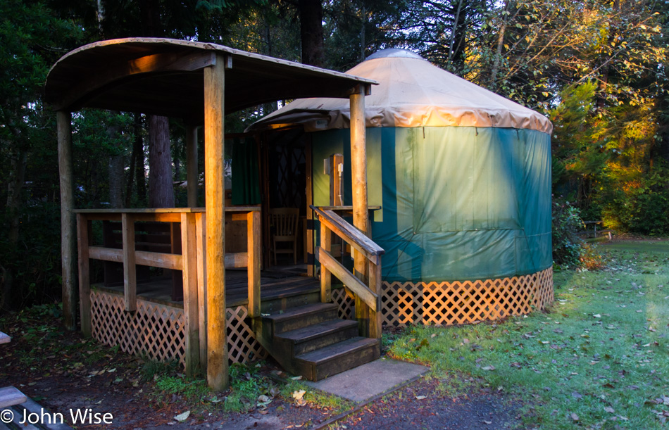
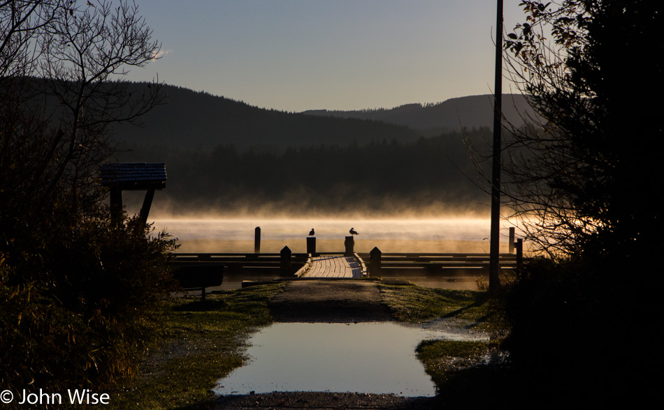
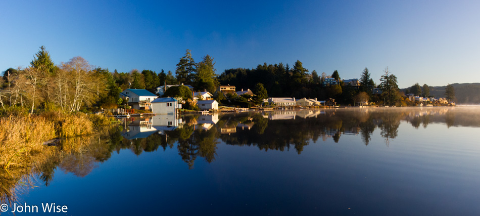
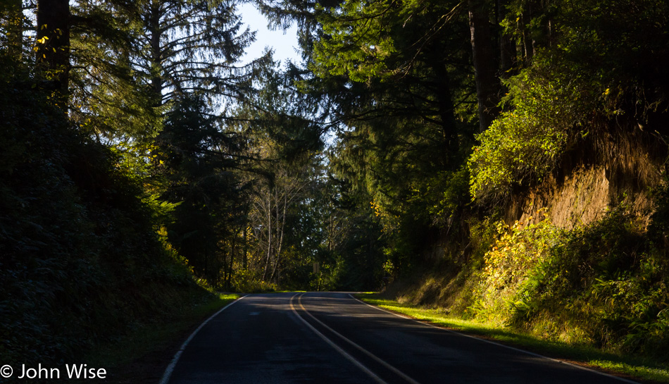
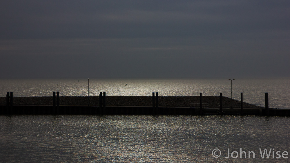
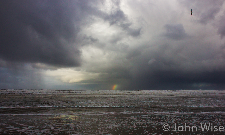
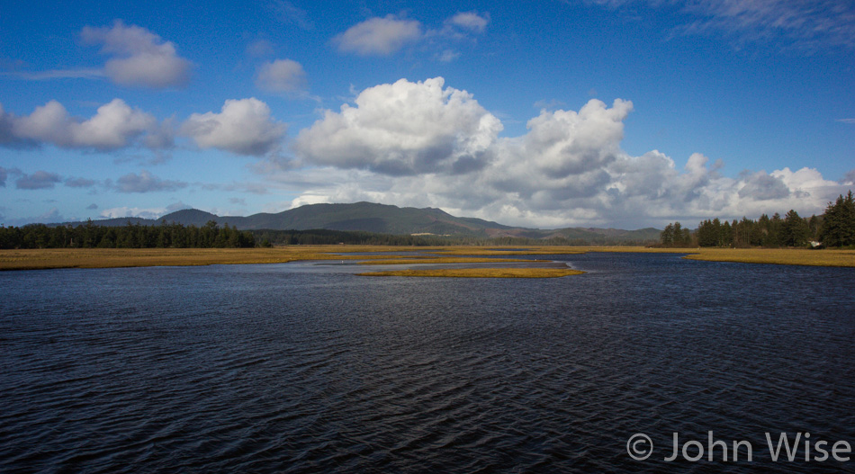
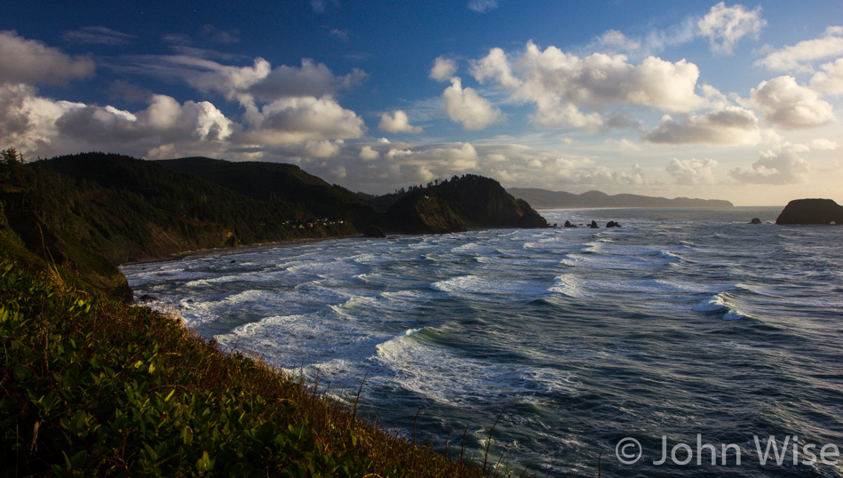
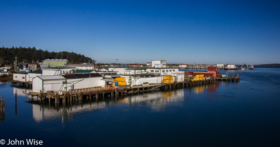
A new corner of the coast we’ve never visited before or one that I have conveniently forgotten, maybe we passed through at night? This is the view from the bridge crossing into Charleston, Oregon, on Thanksgiving day. We only have 155 miles planned for today’s drive down to Crescent City, California, so we’ll be sure to take a leisurely stroll along the way, maybe two. Upon consulting with the wife she assures me that we’ve been through the area but that maybe we’d been traveling north and weather conditions were poor.

Trail to Bastendorff Beach in Charleston, Oregon

The short trail to Bastendorff Beach, where we’ve been warned not to eat the shellfish as they are toxic. No log rolling in the surf either, as it’s been deemed dangerous enough that we’ve been requested to stay off of them. Seems there is nothing fun to do here. Should also inform you that the sign told us that pallet burning is prohibited, although, on another part of the sign, it certainly encouraged us to make tracks and move quickly to higher ground if we feel the ground shake as we are in a Tsunami hazard zone.

Shore Acres State Park in Oregon

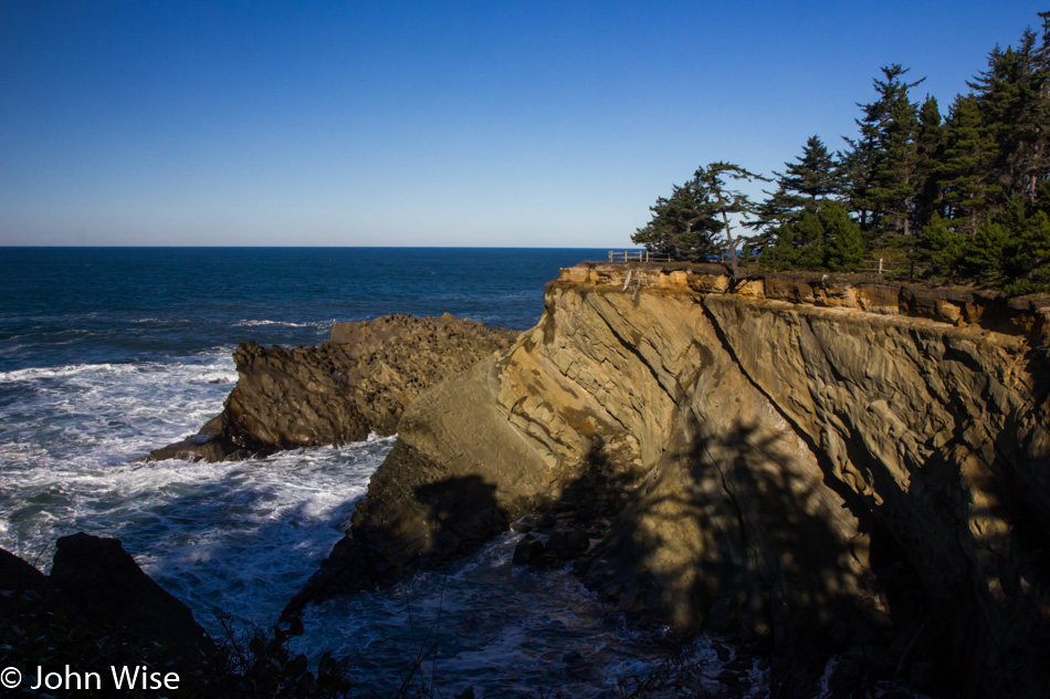
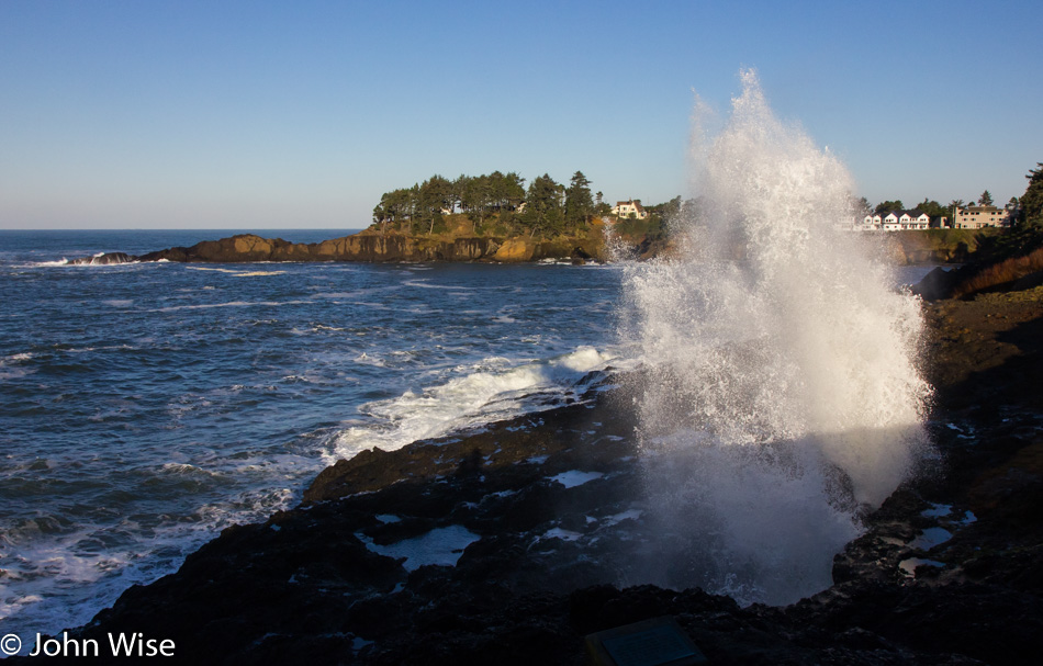
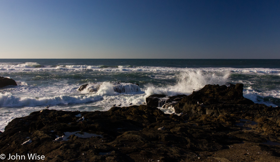
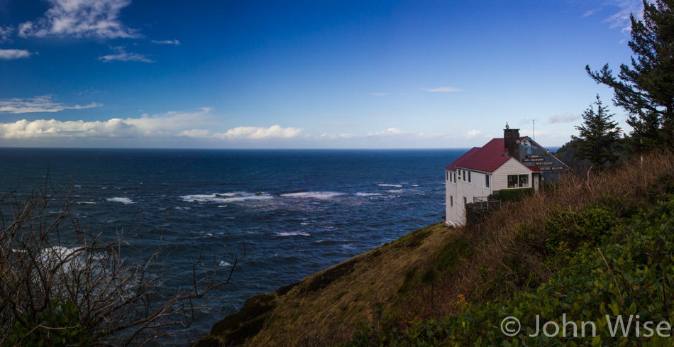
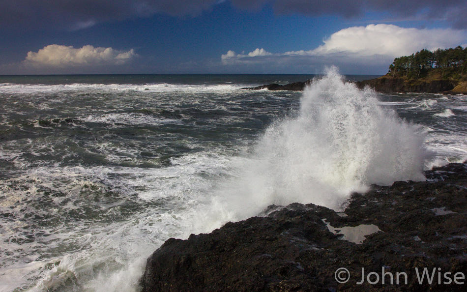
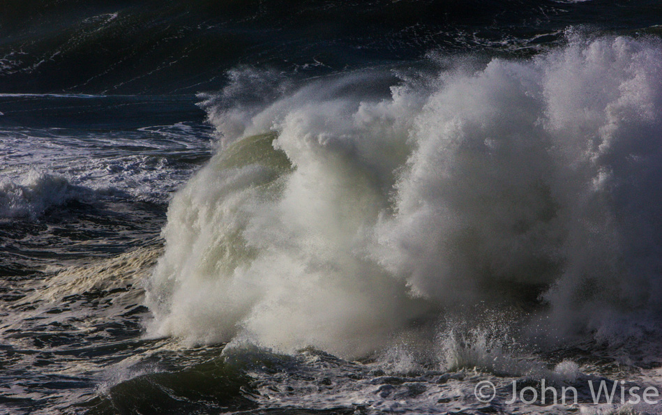
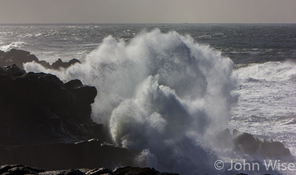
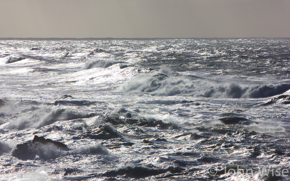
Just a few minutes down the road, we are at Shore Acres State Park, which was originally the estate home of a lumber baron until the place burned down and the owner sold the land to the state.

Shore Acres State Park in Oregon

Poor weather on a previous visit held us back from exploring the area, and to be frank, you don’t see much of this stuff from the car. We are still at Shore Acres.

Caroline Wise at Shore Acres State Park in Oregon

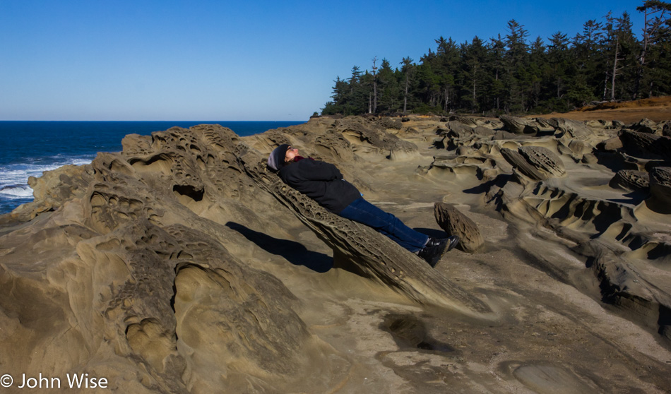
While the shadow gives it away, there was a moment when I was looking at Caroline resting on this rock protrusion that is about as wide and long as she is wide and tall that I thought she was hovering at this impossible angle. The illusion for that moment was perfect.

Shore Acres State Park in Oregon

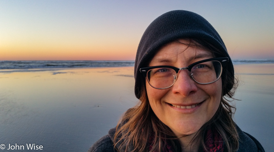
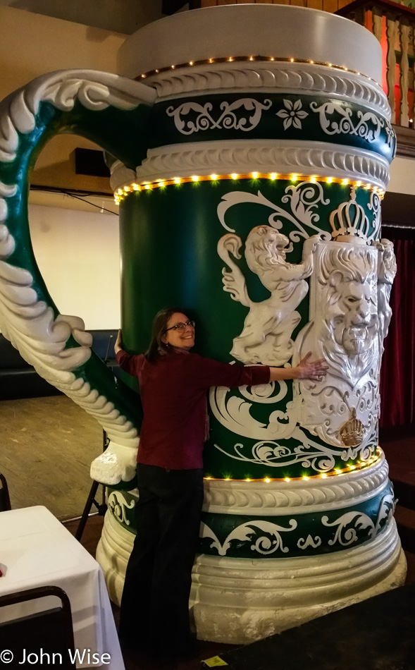
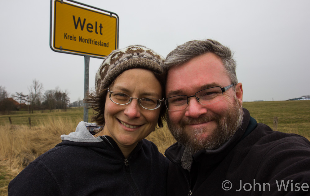
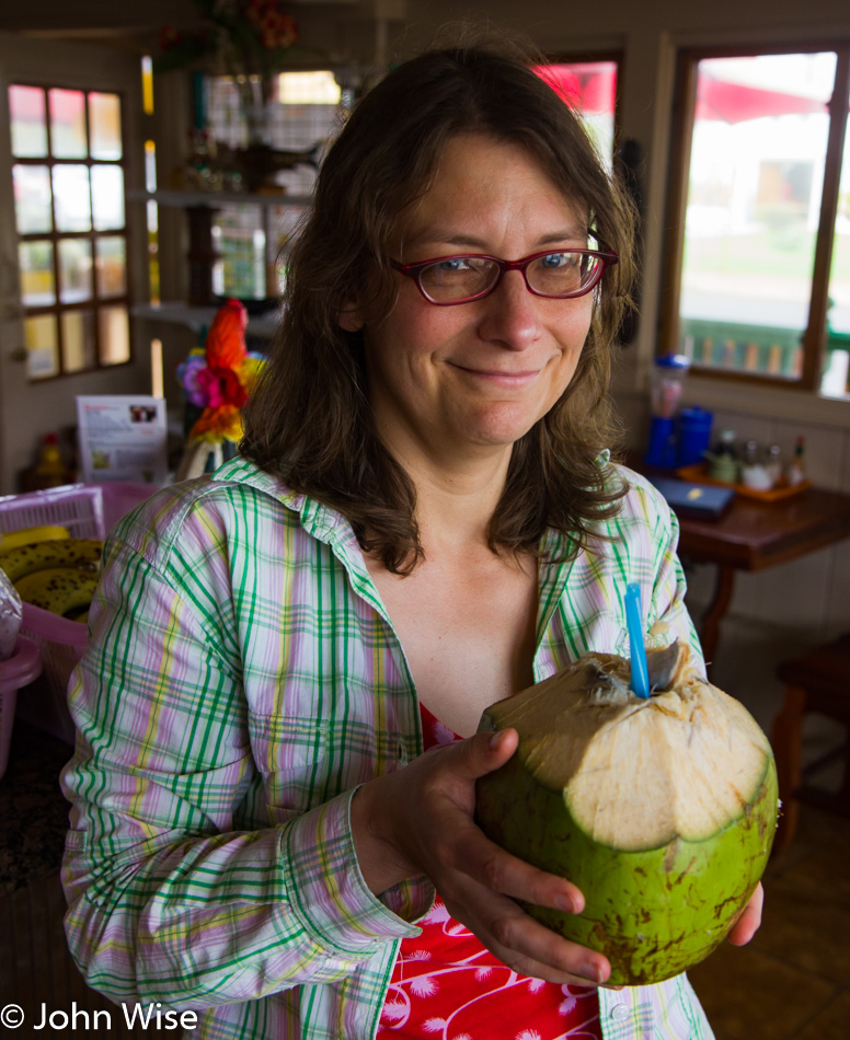
Sometimes, I have to post a photo, though I don’t have a lot to say about the moment because there was something about the composition and conversation with my memory that demands I share this, if, for no other reason than when Caroline and I look back at this in years to come, we get to ask ourselves for the countless time, “Wow, did we really get to do all this?”

Shore Acres State Park in Oregon

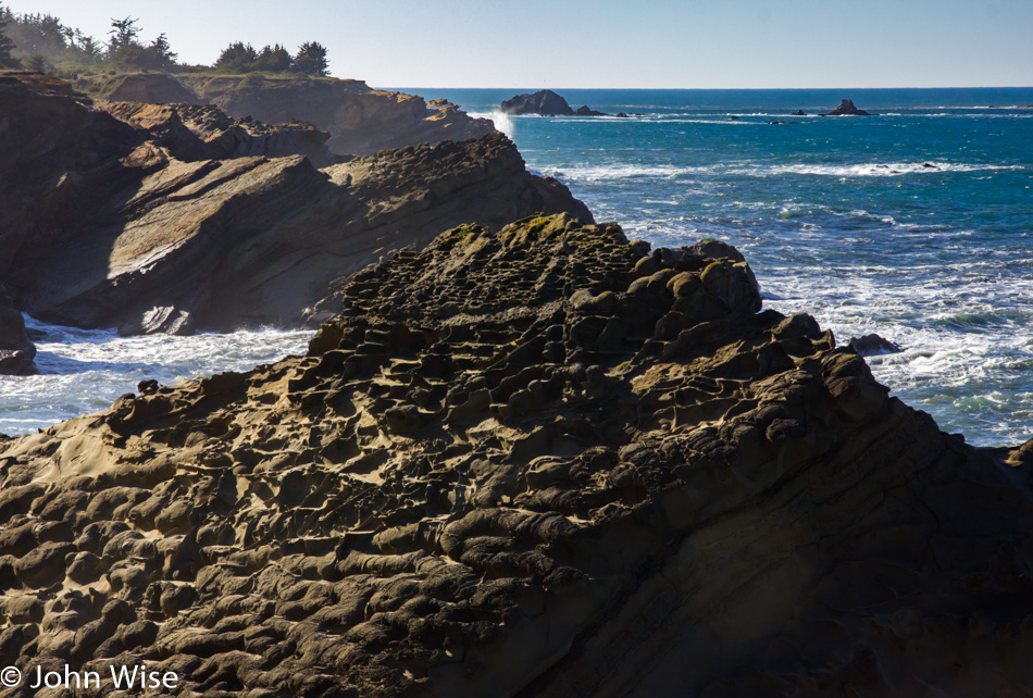
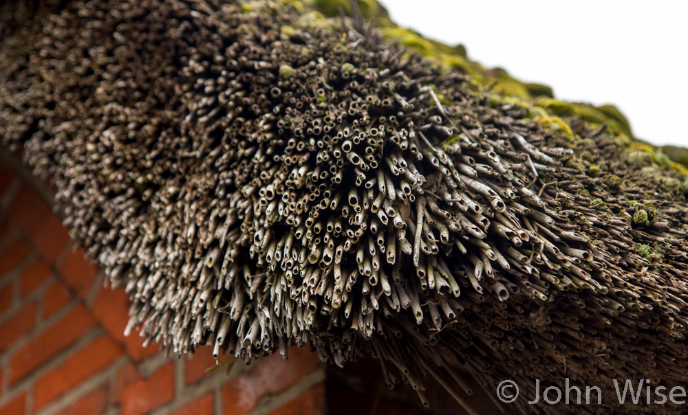
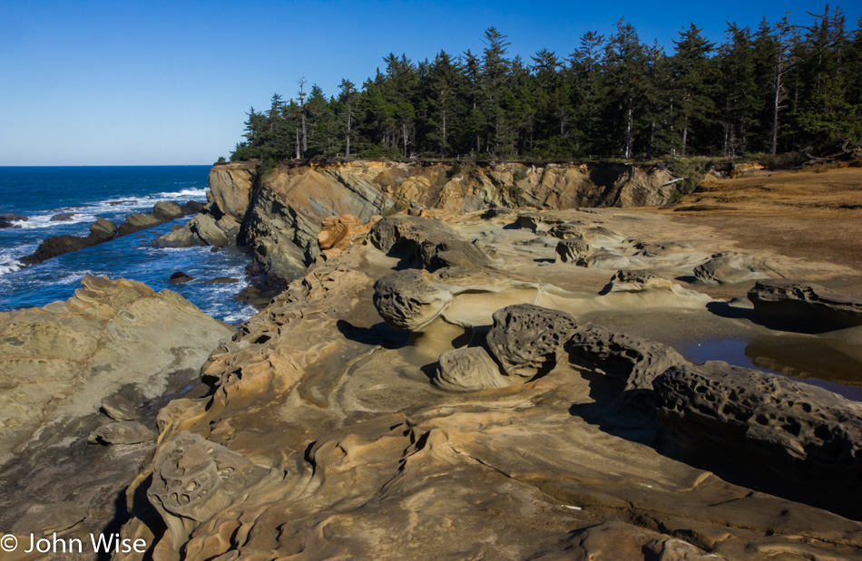
The intricate detail of features that look like pockets, cubby holes, and those hay bundles next to road construction that are supposed to control drainage are all over this rock outcropping. Wish someone could tell me what the fossil record suggests happened to create these intricate patterns here at Shore Acres.

Trail at Cape Arago State Park in Oregon

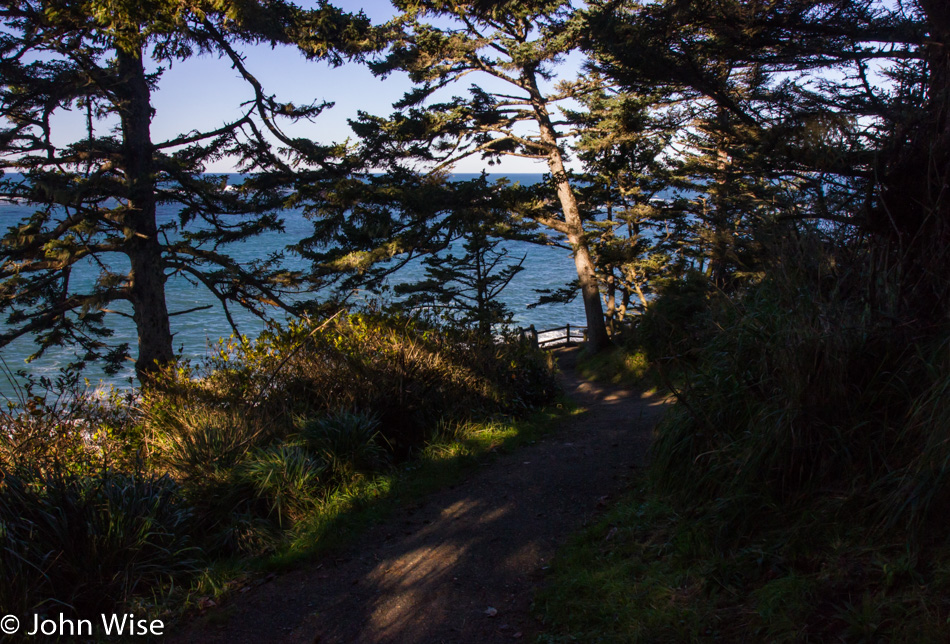
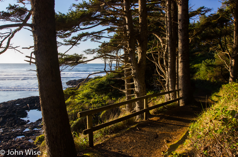
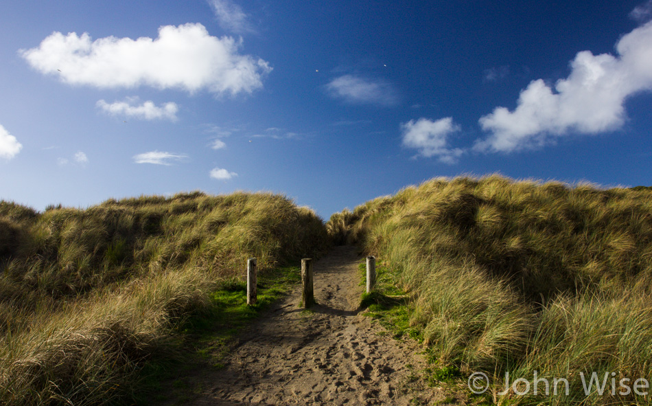
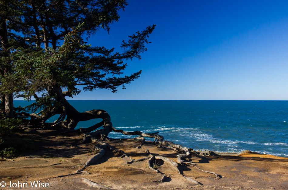
While I marked this image as being a trail at Cape Arago State Park, I’m no longer sure; I guess we’ll just have to return to this spot someday and hope to note where this is and then update the entry.

Looking south towards Table Rock near Bandon, Oregon

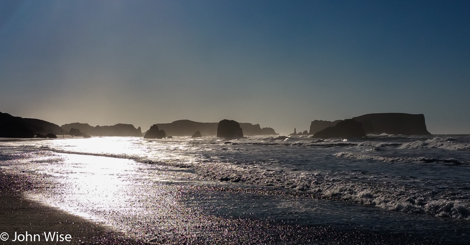
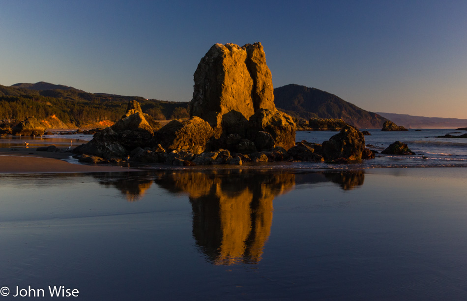
The day is just zipping by with us nearing Bandon, Oregon. We are looking south, just north of town, with one of those features being called Table Rock.

Face Rock in Bandon, Oregon

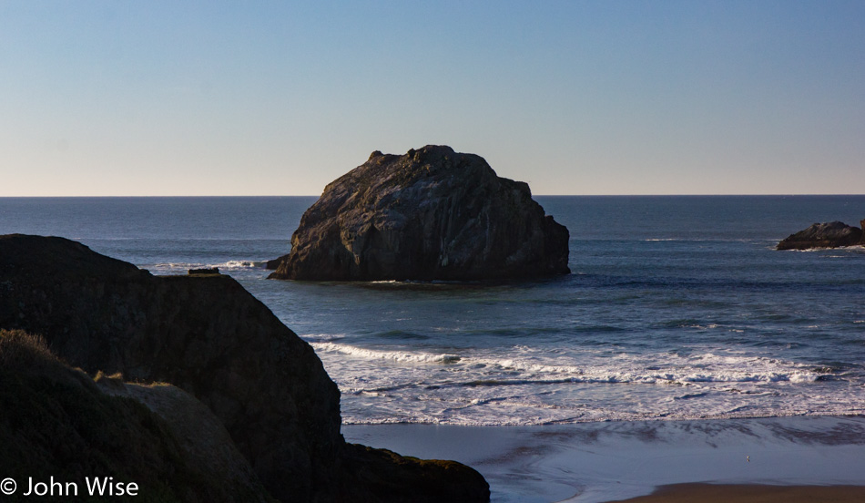
For obvious reasons, this is called Face Rock.

View from Gravel Point at the Face Rock State Scenic Viewpoint

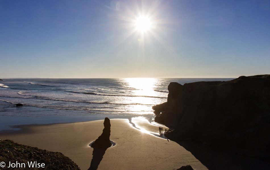
With people standing where they are it just became apparent just how low the tide is, time to look for tide pools. We are standing on Gravel Point at the Face Rock State Scenic Viewpoint in Bandon.

On the beach at Port Orford, Oregon

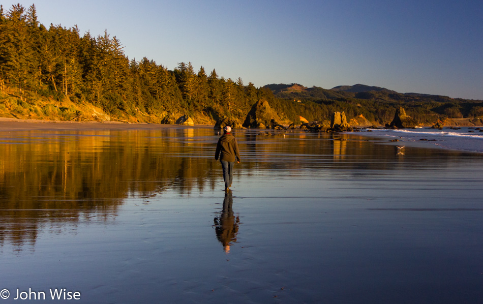
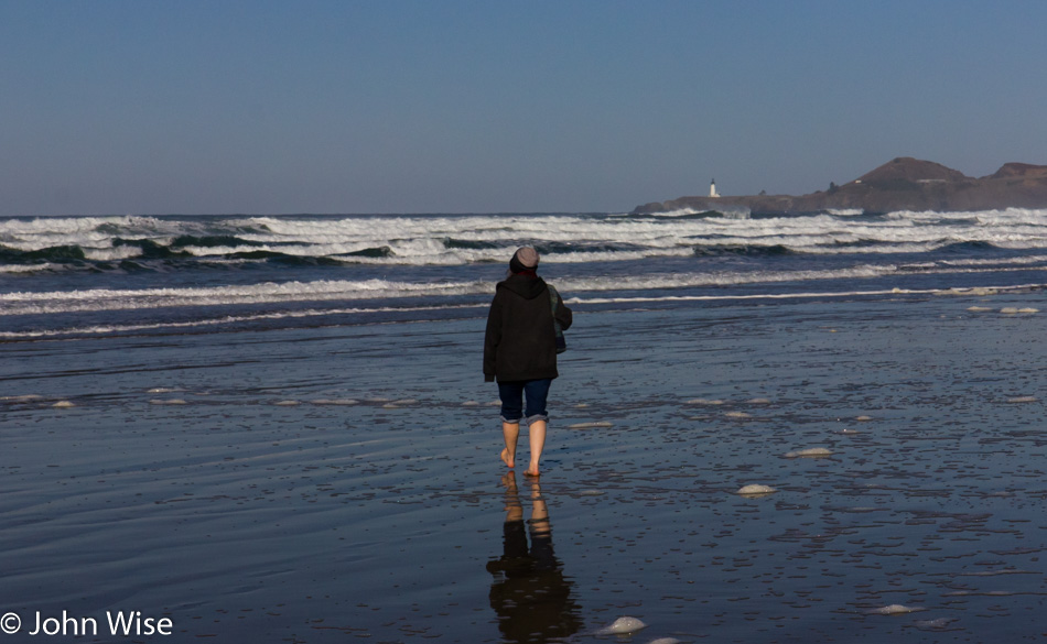
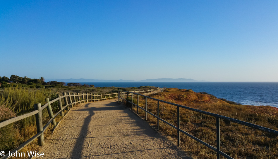
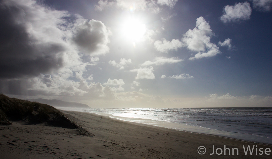
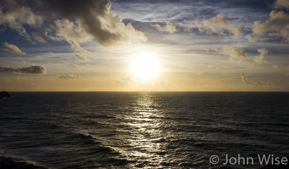
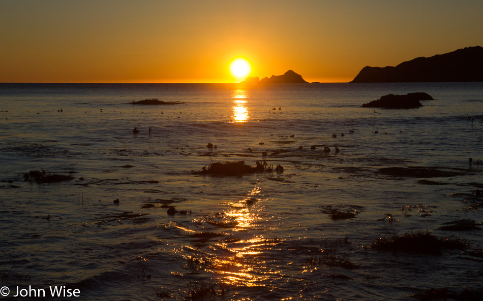
This beach at Port Orford, Oregon, will be our last stop of the day before moving on to our destination down in California. This trek south has seriously been at a snail’s pace, with only about 65 miles covered in 10 hours, but walks such as this are priceless, and we’d gladly sacrifice a bit of sleep in order to visit these states of perfection.

On the beach at Port Orford, Oregon

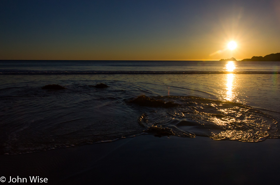
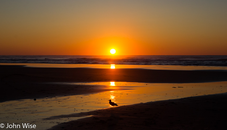
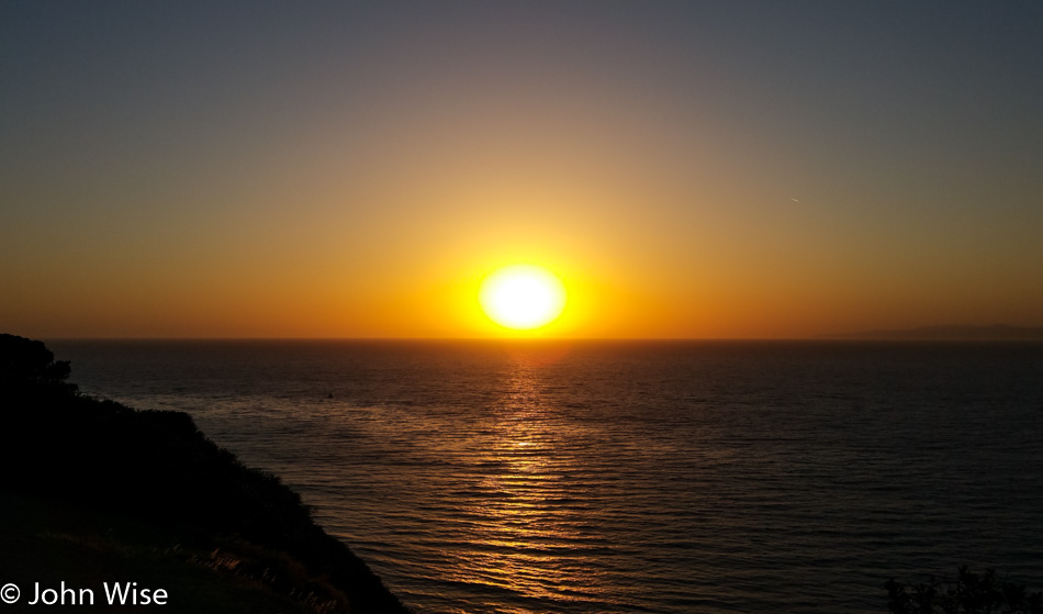
With the sun moving lower and lower in the sky, we have precious little time left for our quest.

On the beach at Port Orford, Oregon

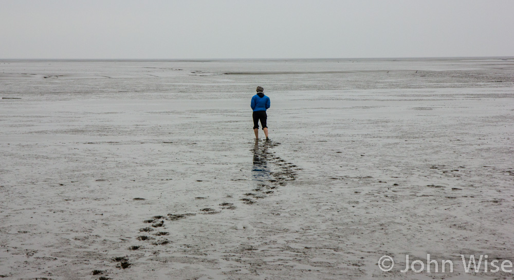
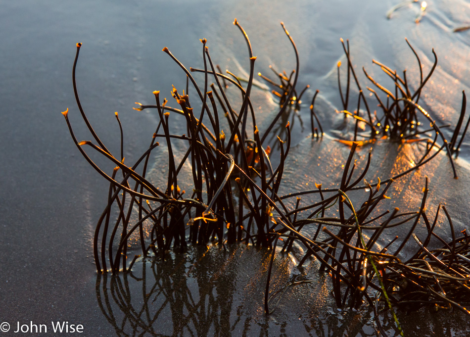
Looks like we are approaching some places where we might find some sea life exposed due to the low tide.

Caroline Wise on the beach at Port Orford, Oregon

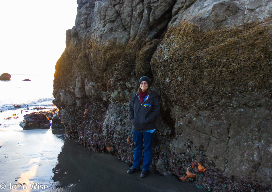
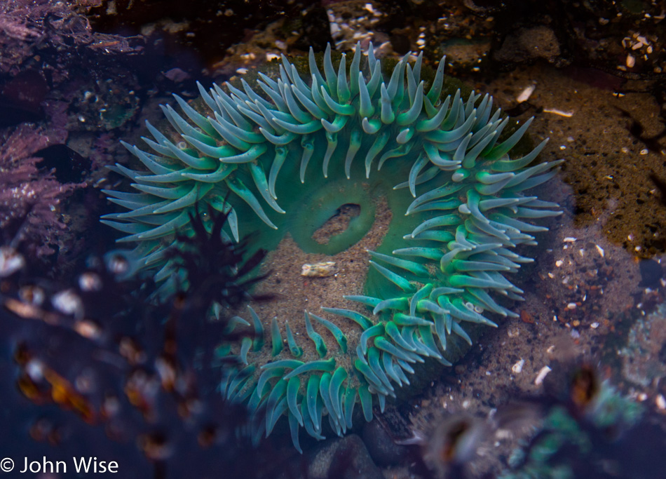
We knew the tide was low, but not this low. I think this would be considered more of a negative tide. See Starfish for scale.

The seafloor at Port Orford, Oregon

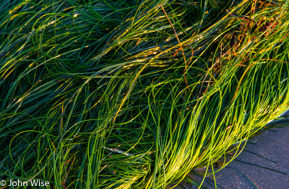
The bed of the seafloor is exposed. While we are accustomed to seeing seaweed wash ashore, it’s not often we see seagrass growing in the sand and outside its natural habitat.

Starfish at low tide in Port Orford, Oregon

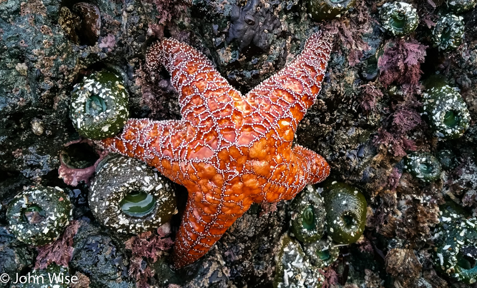
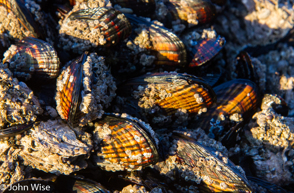
I count almost a dozen anemones, some barnacles, and one big orange starfish, all looking like they are looking forward to the return of their habitat that has abandoned them in a strange environment where aliens have approached and are examining them. The anemone to the right of the lower right leg of the starfish got an anal exam from one of the aliens; you know, it wasn’t me that poked it, so that only leaves you know who.

The seafloor at Port Orford, Oregon

Beautiful little plants are seldom seen by us beachcombers, who are more accustomed to staring at people in bikinis and tight, form-fitting swim trunks that accentuate their buns.

On the beach at Port Orford, Oregon

And just around this time as the sun was about to dip out, so did Caroline’s phone. By the time we got to the car, it was dark out on the beach, and while we retraced a few of our steps, it was obvious our search for her lost phone was an act of futility. While this was as good a reason as any for Caroline to adopt a new phone, there was still some sadness that the images of tide pool creatures she’d been probing became lost research that would forever go unexamined.

Battery Point Lighthouse in Crescent City, California

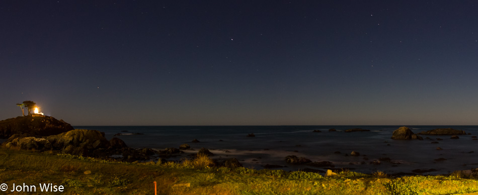
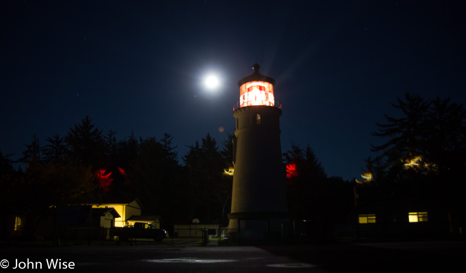
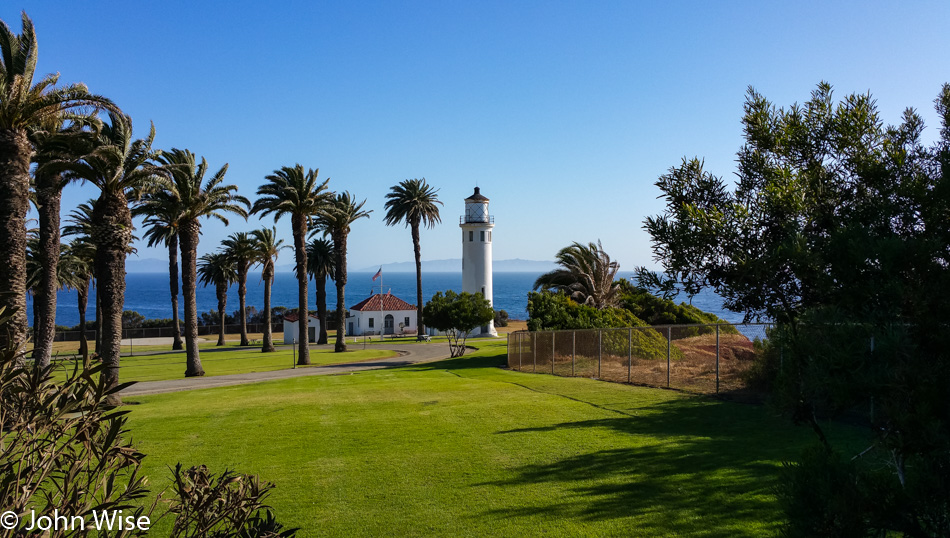
It was 10:00 pm as we pulled into Crescent City, California, and not too late to snag a photo of the Battery Point Lighthouse and stars shimmering above it. A perfect day all-in-all.

Utah to Oregon Road Trip – Day 6

Yurt at Devils Lake State Park in Lincoln City, Oregon

The affinity Caroline and I have for these yurts cannot be understated. Although the price has nearly doubled over the time we’ve been staying in them, it is well worth every penny for their location, proximity to the beach, usually the quiet during this time of year, and the cozy factor. You could say it is our version of glamping.

Devils Lake State Park in Lincoln City, Oregon

Out of the yurt, it was a short walk to the still-steaming Devils Lake, which is the namesake of the state park we have been staying at. Our first night in a yurt was 12 years earlier at Harris State Beach near Brookings down the coast. We stayed in the Winchuck unit, and over the years, we’ve incorporated yurts into our travel plans on at least eight of our intervening trips up here. At times, we’ve opted for motels as when we fly into Portland it’s often easier to grab rooms than pull our bedding along with us, but we’d prefer if every trip would see us staying in an Oregon State Park.

Homes along the shore of Devils Lake in Lincoln City, Oregon

Living on the lake here is that beautiful.

Depoe Bay blow hole Oregon

We must be driving south today because this is the Depoe Bay blowhole in the town of Depoe Bay. The tide plays a large role in how explosive the ejection of water is going to be. Behind me is a spot when the tide is right, shoots water up about 70 feet, and will certainly get you wet on a hot summer day; not so great here on a cold fall day, though.

Caroline Wise walking down an Oregon beach

That’s Yaquina Head lighthouse out there, and so we must be fairly close to Newport, Oregon. Again, we are further south, and it was time to see if I had any notes regarding this Thanksgiving vacation; sure enough, I had a loose itinerary that showed a reservation for the William M. Tugman State Park down by Florence, Oregon. So now we know just how far we’ll be driving today; it will be about 108 miles or 172km for the rest of the universe. You can wager that with these skies, it will continue to be a spectacular day.

Wet sand on an Oregon beach

Sand that is wet or sand that is dry. Sand that is black or white as snow. Sand that is blowing or being dragged back to sea. Sand is a magnificently varying and shifting thing that requires as much observation as the waves, the clouds, the tide pools, and the shells. You never know what kind of patterns might greet you at a beach, so you should just plan to stop at them all as we try to do, even if it takes many years.

Along the Oregon Coast

We’ve heard that it never rains here, and it’s perpetually sunny and warm; in our dreams. Now, if this were further south near Santa Barbara, California, that statement might be mostly true. Today meets our dreams of relatively warm and certainly very sunny.

In the forest along the Oregon Coast

Blue-gray lichen sitting on a branch…I thought as I started writing this that I was going to be able to carry it forward with a limerick, but it’s late as I press into the midnight hour in an attempt to finish writing this entry. Maybe someone else will come along and offer up some witty continuation of my half-hearted attempt.

In the forest along the Oregon Coast

This is the main highway traveling south, but I could be looking north for all I know. No matter which way I look, it appears to be quiet without the crush of traffic one would expect down south on the California coast. For all these years, visiting mostly in November, Caroline and I have often felt that the coast was ours.

Oregon coast

Something (probably the waves) caught our eye (could have been the rocks), and so we pulled over (likely was the birds) and stopped a minute to have a look (you never know when you might see whales in the distance) and enjoy the sound of the ocean (oh yeah, the sound) and the little tide pools (well, we hope for tide pools because who doesn’t like seeing starfish) before getting back in the car to investigate what else is beckoning us from further south.

Hillside trail along the ocean in Oregon

Ah, it was this trail that drew our attention and made us stop. Just look at this trail, the green, the blue, browns, and a path that takes the visitor to a spot to gaze at things from a perspective not yet seen. Certainly worthy of our attention and awe.

Caroline Wise on the Oregon Coast

I know that this doesn’t look like a forest trail or an overlook from our previous stop; that’s because we moved on. As for what’s up the trail? That mystery is for you to solve should you be able to find it. As for what is in the picture? That’s my wife, Caroline, and that smile on her face is a legitimate bona fide smile that originates in her heart. I can affirm this fact with you because, after 26 years of exploring our world together, I can interpret those eyes better than anyone, including her. Those are the eyes of happiness (as worn by a nerd).

Mussels on the seashore in Oregon

The tide is going down as the day grows late, and sea life is thrust into the open where its watery environs have temporarily abandoned it. I have to satisfy myself with these mussels because down here we’ve never seen chitons or sea cucumbers on the Oregon coast. Now, if we were up on the Straits of Juan de Fuca in Washington, I’d put money on finding me a chiton or two.

Anemone on the Oregon coast

Tide pools rock. We never tire of seeing anemones, starfish, barnacles, sea snails, tiny crabs, and other tiny little seathings scurrying about. Too bad the tide has to return….then again.

Sunset on the Oregon Coast

We explored around those tide pools as long as we could, and then it was once again that time of day that suggested some dinner, and finishing the drive to our lodging was probably a good idea. I’m glad we did, too, because somewhere down the coast, this perfect spot to take a photo of the sunset presented itself as a kind of magic, making Caroline and I swoon in even deeper love as we bask in the incredulity that this should all be for us.

Umpqua Lighthouse near Florence, Oregon

There were no yurts left at the Umpqua State Park and Lighthouse when I made my reservations, but luckily, there was a free unit down the road a mile or two. A visit to this lighthouse feels as close to a Thanksgiving tradition as Caroline and I get. We don’t care about turkey, family get-togethers, or football. We’re most content out on the coast sipping coffee between walking and exploring the beaches up and down this amazing state of Oregon.

Los Angeles – Day 1

The Original Pantry in Los Angeles, California

Caroline and I left Phoenix last night for a special event being held in downtown L.A. tomorrow that she needs to be here for. So today, we are starting the day with breakfast at The Original Pantry Cafe and will bum around the city doing stuff.

The Arboretum in Arcadia, California

Off to Arcadia and The Arboretum where the two of us have never visited together. I visited 40 some odd years ago during a field trip that took us here and to the San Gabriel Mission, but my memories are weak, so this visit was certainly in order to refresh things.

The Arboretum in Arcadia, California

These intensely beautiful southern California days make visiting and dealing with the traffic all the easier. Add some art, good food, and the ocean; life is perfect.

The Arboretum in Arcadia, California

Although this part of the state has its fair share of drought-related issues, it never fails to amaze us how lush everything is. Of course, our perspective is likely skewed due to our arrival in L.A. from the desert well east of here. The Arboretum is great, but Descanso and The Huntington are maybe a notch above.

The Arboretum in Arcadia, California

I’m convinced a giant used these matches and that they may be responsible for one of California’s notorious fires.

Caroline Wise at Alpine Village in Torrance, California

We needed some German stuff, and so off to Alpine Village in Torrance we went. Lunch was had in their German-themed restaurant, and the cheesy factor of the entire place was not lost on us. Sadly, it seems that the attraction of places like Alpine Village is waning. I’ll bet in its heyday, this place was packed.

Update: in March 2023, Alpine Village was permanently closed.

Twenty minutes away over in Palos Verde, we set our sights on the Point Vicente Lighthouse as somewhere else we’d never been, and so we had to pay a visit. The island in the distance is Catalina.

Palos Verde, California

Spent some hours here walking around the peninsula; where else should we go that might be more beautiful than where we are right now?

Palos Verde, California

Stayed through sunset, I think you can understand why.

The Wattenmeer

Sunrise over Kiel, Germany

We wake in time to see the sunrise over the harbor in Kiel. This is a rarity for us, as in Frankfurt, we are surrounded by buildings, and seeing the horizon is not possible unless your day starts in one of the highrises. It was late last night when we finally found a hotel. Our corner room on the 8th floor at Hotel Astor was only €69, and the view was tremendous. Time in the room, though, is short because we are excited to get back on the road for our visit to the Wattenmeer.

Heading to the sea in northern Germany

Where we are headed on the coast is even flatter than this. The Wattenmeer (Wadden Sea) is a shallow coastal plain now recognized as a UNESCO World Heritage Site. Neither Caroline nor I have ever visited this far northern corner of Germany, and we are both excited to be doing so, even with the gray weather. While it’s only about 70 miles (114 km) from Kiel to St. Peter-Ording on the western coast of Germany, the country roads slow us down, leaving time for some sightseeing.

A stork seen in Christiansholm, Germany

Wat in Dutch is mud, so Wattenmeer is loosely translated as mudflat sea. For Germany, the area is a National Park; for us, it’s a once-in-a-lifetime dream come true; we hope. The drive takes us through a number of small villages, including Christiansholm, where we see this stork occupying its nest. This is the first stork in the wild that either Caroline or I have seen.

A reetgedecktes haus (reed roof house) in northern Germany

The area we are heading into while German is also home to the Frisians. The land along the coast from the northern Netherlands up to Denmark is known as Frisia or Friesland. The native people were first mentioned in 12 BCE and speak Frisian, though not that many these days. The homes in the area are famous for their old-fashioned roofs known as “Reetgedecktes Häuser,” or thatched roofs made of reed.

A reed roof (thatch) in northwest Germany

Getting up close to the thatch roof is not to be missed. From the distance the roofs are beautiful, but up close to it, the details from the hollow reeds can really be appreciated. Where thatched roofs were once commonplace, today, they are nearly a mark of luxury. To build one is labor-intensive and I can’t imagine there are many craftspeople around who work on such roofs. Now I wonder how sound and weather-insulating they are; we’ll have to find a rental to stay in on a subsequent visit.

A thatched roof house in northwest Germany also known as a Reetgedecktes Haus

Older homes whose roofs have withstood the test of time or have so far avoided renovation can be an artwork in part crafted by the hand of nature. If you were wondering how fire retardant a dried reed roof might be, look no further than this healthy covering of moss that lives atop this house.

Caroline Wise standing in front of the Karolinenkoog sign in northwest Germany

Hey, did that sign read Karolinekook? I had to turn right around for a photo of that. Oh, it reads Karolinenkoog. So what the heck is a koog, and why Karoline? First of all, a koog is a polder; now that this is cleared up, I can move on to Karoline. Do you say you don’t know what a polder is? Well, neither did I. A polder (also known as a koog in German) is a low-lying area of land that is kept dry by a dike or was a former lake or sea bed. Karoline is in honor of Princess Caroline of Denmark (28 October 1793 – 31 March 1881). For me, the sign will always read CarolineKook.

Roadside toilet huts in northwest Germany

What’s a road trip without the need to stop at nearly every roadside toilet? It’s a trip without my wife. This outpost for the disposal of bodily waste is a marvel of modernity. The door is controlled by auto-locks. After the depositor has entered the facility, he or she has a set amount of time to take care of business before the auto-clean cycle convinces the user to get out or get cleaned up by the uncaring, unceremonious tools of auto-cleansing. And to make the toilet experience better for women, the left-side “pissoirs” are urinals for us men. The WC or water closets on the right are for more serious business and women. Inside, which I should have taken a photo of, there is no room for vandalism, and in any case, if the pissoir senses destruction of any part of the facility, the floor is covered in water, and the perpetrator is electrocuted.

On a narrow road separating some homes from the sea behind the dike on the left. In northwest Germany.

South of Tönning, we are about to have our first encounter with the dike system that keeps the North Sea at bay. We scrambled up the grassy hillside to look out into the gray murk of an overcast day. Not a lot to see when the horizon is obscured by mist and flatness that defies finding monuments or objects that allow one to orient oneself. No wonder it is recommended for people taking long hikes on the Wattenmeer to have a guide show them around. There are stories of people getting disoriented out on the mudflats as the tide comes in, which can end in disaster.

Sheep (four legged organic lawnmowers) standing on the dike ready to go to work at the Wattenmeer in northwest Germany

Further down the road, we find another location that looks inviting, mostly because there were all these sheep hanging out, and my wife is nothing if not a sucker for the furry four-legged organic lawnmowers. Up the hill, and there it is, the mudflat and no sign of the sea.

Caroline Wise sans shoes out on the mud flat of the Wattenmeer in northwest Germany

Of course, it would be Caroline who would have to dip her feet into the mud, maybe even some shallow water, if she could find it. As for me, well, my weight tells me that I’ll be ass-deep in sucking mud 1.6 seconds after placing myself in harm’s way. Caroline assures me that the mud is solid; I’ll take her word for it, but still opt to remain on the shore where I can snap photos from the dry comfort of land.

Caroline Wise's mud covered feet after walking in the Wattenmeer of northwest Germany

The fine, silty mud covers Caroline’s feet like hot fudge on ice cream. A smile likewise graces her face because she has now strode in the Wattenmeer. A nearby shower head and hose are available just for these occasions of cleaning one’s muddy feet, and we move to take advantage of the convenience. This is the first time during this trip that Caroline will voice that if we had to return to Frankfurt right now, she’d be happy with what we’ve already done. It’s great being married to someone who is so satisfied with such small things in life.

Caroline and John Wise stand before the sign announcing the World (Welt) in Germany

We now have proof that we have seen the world. The sign reading Welt behind us is German for World. Should there be any doubt that Caroline and I have seen the world, we can show any naysayers that it is true; we have, in fact, seen the World.

A beaver in a waterway near the Wattenmear of northwest Germany

The Watt (pronounced “Vot”) is a bird sanctuary, it is also home to other species that are being pushed out of Europe as humanity has continued to change the environment. The Wattenmeer itself exists due to people reclaiming the ocean floor and trying to manage lands that otherwise would be submerged. Beavers have done this for a millennium; today, they have little ground and river-ways left for their type of engineering. I do think we were pretty lucky today to see this guy heading for his hideaway.

A gaggle of geese perusing the grounds on the Wattenmeer in northwest Germany

Thousands of birds and many species of various types call the 500km coastal region of the Wattenmeer home during migration periods. This gaggle of geese is making a pit stop on their trek north while skeins of others are seen overhead looking to do bird things I’m poor at interpreting.

The lighthouse in Westerhaver, Germany on the Wattenmeer

Our drive took us out on the far side of a peninsula jutting off of mainland Germany. We looked for every opportunity to visit the sea along the way. In Westerhever we spotted a lighthouse in the distance, time to schedule a visit. From the view of the dike, we thought we were satisfied and that this was good enough. Anyway, the people walking out to it were way over on our right, starting at the crowded parking lot I had turned my nose up to. Maybe we’ll just walk a short while to the right and see if the view improves. A little further and pretty soon, we are on the boardwalk. Is this far enough? Okay, just a bit further. Forty-five minutes later, we are at the lighthouse which does not offer tours but does have a toilet available. Oh yeah, on the horizon past the lighthouse, you are looking at mud; the tide is still out. When the tide is in these channels in the foreground are filled with water.

Sheep on the Wattenmeer in northwest Germany

Sheep are everywhere on the dike system, as is evidence of their passing. A lot of sheep, and you find a lot of sheep poop but no fiber anywhere. Not even a lamb sandwich was found.

A lone black-headed seagull soaring by against a gray sky at the Wattenmeer in northwest Germany

Shorebirds are not here in big numbers yet. The occasional black-headed gull swoops by, but the cacophonous sound of flocks of seagulls is not to be heard. I dream about being here on a quiet summer day when Caroline and I can have a stretch of the Wat to ourselves to watch the shorebirds work the mudflats and marshes.

A drainage canal on the Wattenmeer that helps preserve the land

These lands have been worked for centuries as people have wrestled with nature to keep the land they have carved out of the sea. This is one of the many drainages that are kept clear so the land drains as the tide goes out. In this way, the land isn’t washed away and serves as sheep pasture. Unfortunately, we could not be here at the Wattenmeer for both low and high tide.

Another thatched roof house at the Wattenmeer in northwest Germany

This photo is being used not because the old house was built in 1737 it’s because the photo of the windmill I took didn’t turn out all that nice. Mühle Catharina (The Catherine Mill) is a three-story rental property that sleeps eight right in the windmill! If you want to book it, as we do and hopefully will someday, it costs €165 per day (about $200) with a minimum 1-week stay required. Located in Witzwort, Germany, it is a perfect location for a week of biking the flatlands of the Wattenmeer and even making a day excursion to Hamburg or even Copenhagen, Denmark.

The harbor of Husum, Germany

In Husum, the sun is struggling to work its way past the clouds that have dogged us all day; it’s uncertain if it will win. Neither of us knows a thing about this city and so we find a parking spot and start walking right on over to a maritime museum.

An old ship wreck on display at the North Frisian Maritime Museum in Germany

We don’t hesitate to pay the small fee to enter the North Frisian Maritime Museum. Inside and downstairs (near the toilets) is the museum’s newest big display item: the Uelvesbüll shipwreck. Discovered in a side channel near a dike, the wreck is over 400 years old. We can walk right up to it, even reach over and smell the wood. To stop the decay once it was pulled from the silt, preservationists cured the wreck in a giant vat of sugar water. According to the info on display, the sugar crystals create a protective seal of the wood, and the technique is far cheaper than the alternatives. I’m enchanted with what history this small ship may hide and wish to know more. Being here is also a reminder that there may be many more maritime museums along the English, Irish, Danish, French, Dutch, Spanish, and Belgian coastlines; we need to move to Europe.

A cicada enclosure made of whale bone on display at the North Frisian Maritime Museum in Husum, Germany

Never seen a whalebone scrimshaw cicada enclosure before; heck, I’ve never seen a cicada enclosure of any type prior to this one. In the case of various scrimshaws was this one particular item that fascinated me enough to want one. Of Moorish influence, this work of art was carved around the year 1700. Does someone out there want to make a 3D print of it?

A device for measuring the speed of a water craft as measured in "knots" on display at the North Frisian Maritime Museum in Husum, Germany

Caroline is a font of information; some of it she keeps to herself because she thinks it’s common knowledge. Almost under her breath, she suggests I must obviously know what this thing is that we are looking at. Of course – not, I reply. Did you ever wonder where the term “knots” came from for measuring the speed of a boat? Neither had I, but my wife knew. By throwing out a line and measuring the knots tied into the rope, a seaman could estimate the speed they were traveling by counting the knots unspooling against a measure of time. Thus, a speed could be calculated.

Notes that had at one time been tied to the leg of a pigeon used for communication. On display at the North Frisian Maritime Museum in Husum, Germany

Tauben-Depesche – Pigeon Dispatch. These small notes were once rolled up and attached to the legs of carrier pigeons. If nothing else brings you to the North Frisian Maritime Museum, surely a now-historic note that was once carried by a small bird must nag at your curiosity. The great forgotten things we can find in museums. I think I need more time to explore the world’s hidden treasures.

Our last glance at the sea in Dagebüll, Germany

By the time we exited the museum, the sun had peeked through the clouds, and with its light, a multitude of sun-seekers filled the town square with the intention of having an ice cream. That sounds great to us and we join in with a visit to Janny’s for something called the Eis & Heiss (Hot and Cold). The concoction is made of hot cherries, chocolate syrup, cherry water, and ice cream, all topped with whipped cream. Trying to use all the daylight we can, we continue the drive north for another 45 km (28 miles) before pulling into Dagebüll and the Hotel Neuwarft for some dinner and sleep. The room was great and inexpensive. Dinner at the hotel’s restaurant was also very good. All-in-all, it was a perfect day.

Hawaii – Day 11

Kahili Mountain Park on Kauai, Hawaii

That’s funny it doesn’t look or smell like Sunday, but it is. Well, if it is Sunday, then that means we have to head into Lihue and leave exploring Kahili Mountain for another day.

Hey, this isn’t the road to Lihue, and there’s no way we’ll be buying a Poke bento this early. Ah, we are just sightseeing before we get to our regularly scheduled activities. Wait a minute, we don’t have a schedule! Well, then, without anywhere we really need to be, I guess another drive up and down the tree tunnel is warranted.

Once back on the main road, we made it over to Lihue for breakfast at the Tip Top Motel Cafe And Bakery that’s been feeding islanders and visitors for nearly 100 years. The place is highly rated among locals, and we now understand why. It was packed and noisy, but all the same, we were seated pretty quickly. Our orders were taken within minutes, and coffee was delivered before we saw the menu, which was already at the table. Ten minutes later, my Moco Loco arrived, and Caroline’s banana pineapple pancakes with guava pineapple compote were placed in front of her. If we weren’t suffering from a wicked addiction to the Koloa Fish Market, we’d be wise upon a return visit to eat breakfast here every day.

We are on our way north, heading to Hanalei, as Caroline needs to exchange some ukulele sheet music that was misprinted. You can bet it will not be a direct out-and-back journey, as this beach stop attests. Which beach is this, you might ask? Who cares? It’s a beach on Kauai, and we were so rude as to carve our names into the sand, letting those who follow know that “We were here.”

Roadside, fresh, chilled coconuts sounded like a great idea, and with nothing stopping us from indulgence, we obliged our hedonistic sides and packed in some more calories.

Another reason to snack has presented itself with the Anahola Farmer’s Market. That’s right, you read it correctly, they are selling apple bananas, and we are buying them because one can never eat enough apple bananas when in Hawaii. As for that sample of BBQ pork, I tried that morphed into a plate to go; we’ll just call that “breakfast dessert.”

There is no pineapple such as these on the mainland of America. These giant, ripe, and incredibly sweet, perfect pineapples are unique to Hawaii. We may eat this later today, tomorrow with breakfast, or on Christmas morning before we board our flight back to Arizona. The cold reality that we are down to our last 48 hours in Hawaii is better left for dealing with in the minutes before we drop the rental car, for now, we need to return to the exploration of paradise.

Kilauea Point National Wildlife Refuge is a fond, fond memory from our first visit, and with perfect weather, we would be fools not to stop again. That there is a Junior Ranger Program here is an added bonus, and within minutes of arriving Caroline has her booklet and walks along noodling over the questions.

It’s mere minutes later before we see a pod of whales offshore, and while once again we are denied seeing a breaching cetacean, we do get to see plenty of tail fins, spouts, and arching backs.

Can one have a favorite bird? While I certainly have my least favorite bird in city-dwelling pigeons, I probably only know of a fraction of bird species from around our globe, and there are many beautiful specimens, but the albatross certainly holds a special place in my imagination. Just the idea that this bird can fly non-stop around the earth without landing while expending little to no energy is a feat of evolution that boggles my mind. Then consider that we know that they can live up to at least 66 years of age and that once bonded with a mate, they will stay together until the end of their lives. Of course, there are those beautiful eyes they have that I’m too gullible in assigning anthropomorphic qualities to. I’ll just go and blurt it out right here: I love the albatross.

Check out the nene, also spelled nēnē, otherwise known as the Hawaiian goose. This native of Hawaii is only found on the islands out here in the Pacific and is speculated to have arrived on the islands when they were blown off course at some time in the past. They are friendly, curious birds with a unique soft call compared to the harsh sound of the common goose.

The Kilauea Point Lighthouse could not stand out in greater contrast to the blue sky, deep blue water, and greenery out here on this spit of land.

The sky is also full of frigate birds, and while a little bit buzzardly looking, they are graceful and draw my admiration for their ability to live free, fly around, and not be subject to the arbitrary laws and whims of power-hungry bird enforcers.

I don’t really care if they are red-footed or blue-footed because this bird has the word booby in it. Yeah, buddy, this is the red-footed booby. I tried a good two or three minutes to get a pair of boobies in my shot, but all I got was this bird in front of the ocean. I’ll be looking for a pair of boobies to photograph and will get back to you, the reader, should I see them.

The ocean churns hard around Kilauea Point, and at times, we watched waves break on a cliffside, sending its waters a good 80 feet straight up. With birds, dolphins, whales, a lighthouse, and perfect weather all around us, it is hard to figure out what to give our full attention to.

You should know just how badly I want to reach out and feel how soft those feathers are around the nene’s neck. These official State Birds of Hawaii are protected and endangered and so even if my judgment is occasionally poor, I will respect the request not to interfere with these gorgeous birds.

The other day, when we were up and purchased the ukulele, the sky was overcast, and this overlook of the Hanalei National Wildlife Refuge was jam-packed with others who had the same idea of snapping this image. This spot on Kauai is probably the second most famous after the Napali Coast and is certainly an iconic location. Down below are paddies with taro plants, which are essential to the Native Hawaiian diet of both poi and lau lau.

Here’s the view from below the overlook of those plots of taro. The last time we were here, we didn’t make time to follow the narrow road that was more of a wide sidewalk leading into the refuge; today, we did. The road might go for a couple of miles, but it was hard to tell, considering how slow we were traveling. There are thickets of bamboo, a couple of homes, a trail we won’t take this visit, and a slow-moving waterway that is the likely source of irrigation of all this taro.

Over at Hanalei Strings, we learn that there are no refunds, only exchanges. That was okay as Caroline opted to leave with more yarn; as I went to pay for the difference, the guy waved it off, saying it was for the trouble of driving back up, like driving around a Hawaiian island is a hassle or something.

The next stop was at Tahiti Nui. Why Tahiti Nui? Because Caroline, prior to leaving for Hawaii, let it be known that she wanted umbrella drinks on this excursion, and the other day at the Limahuli Garden a lady told us of a particularly nice dive bar. While it was specifically described as a dive bar, we were reassured that it was a great dive bar. While I, being the teetotaler, opted for Julia’s Iced Tea, which was a mix of iced tea, lemonade, and guava juice, Caroline “started” with their famous Mai Tai. Sitting there, taking in the sights of bar culture, we couldn’t help but do some noshing until Caroline decided on her second drink, a lilikoi margarita. With the umbrella drinks checked off the to-do list, one of us walks back to the car, and the other weaves.

A small apparently little-used road led us to a small cove. There are no facilities, no lifeguards, and apparently, clothes are optional.

When we were finally ready to leave that isolated spot of tranquility, the clouds were moving in, suggesting that another spectacular sunset was being scratched off the itinerary. Over to Starbucks, we went and with coffee in hand, we walked around. Wouldn’t you know it, there’s a man talking to a woman while holding a piglet. Turns out the woman is his girlfriend who works in the shop; we volunteer that we are certified expert piglet caregivers and would gladly watch his new pet while he properly visits with his girlfriend. So here we are, just hanging out in Kapaa, drinking coffee and chilling with a piglet cradled in my wife’s arms because that’s how we roll when on the isle of Kauai.

Sadly, the owner came back for his little black pig, which was okay as I would have had no idea how we’d ever get it on a plane to Arizona. Before returning to the cabin, we stopped at Walmart which turns out to be the best place for cheap souvenirs to drag back to coworkers in Caroline’s office. For our friend Rainy, we found some Hello Kitty pineapple-flavored marshmallows.

We packed up a day early so our last night would be as stress-free as possible. I headed to the shower outside, and Caroline pulled up the ukulele and tried playing. I say she “tried” playing because she’d chosen to try Aloha Oe, and in between the tears, she would have to stop and catch her breath. I listened to her through the walls and couldn’t help but feel teary-eyed with her as her romantic notions were affecting both of us.

Oregon Coast – Day 5

A short rainbow in the distance at South Beach State Park in Oregon

Shortly after our moonlit walk on the beach last night, the weather turned. As the evening went on, things became worse, tormenting our plans for sleep. A bright flash of lightning startled both of us awake somewhere in the middle of dreams, followed by a near-instantaneous clap of monumental thunder. Then it started to rain as though buckets were being tossed on the exterior of the yurt. With the rain picking up, the wind joined in the chorus until buckets were replaced by barrels of water; this was not the serenade that would lull us back to sleep. Eventually, nature’s concert exited the stage, and before we knew it, it was time for us to leave the yurt. A shower is finally on tap. With the hair degreased and the funk defunked we packed the car and followed last night’s footsteps back to the ocean. A hole in the sky had opened, offering a respite and a peek at blue, but it was changing fast. We are in a state of oohs-and-aahs; seafoam is blowing up the shore, and a strong, constant wind works nature’s art exhibit here on the edge of the Pacific. In the distance, the shortest rainbow I’ve ever seen is on the horizon, letting us know the rain is coming our way. It catches us before we reach the car.

The Lookout at Cape Foulweather on the Oregon coast

Breakfast was an event worthy of making note of here on my blog: we returned to the Newport Cafe! It was a pricey start to the day, but it was indulgent, too, if you love seafood. Caroline ordered the “Hang Town Fry” – fresh Yaquina Bay oysters (a whole lot of them) grilled with spinach and onions before being mixed into a heap of scrambled eggs served next to a mountain of red potatoes and toast. Her breakfast is huge and “good and plenty” – especially the baby aliens (oysters). My breakfast was the “Pacific Seafood Scramble” – crab, shrimp, and scallops with fresh veggies and scrambled eggs topped with cheddar. By the time we are finished with our morning feast, the sun is lifting a layer of steam off the street, with the sky opening fast. This photo was taken north of Newport at The Lookout at Cape Foulweather, a nice little gift shop with one of the best views ever.

Waves crashing ashore on the Oregon coast

The next photos will attest to how beautiful our day would turn out to be, but they do not portray the whole truth. Over our shoulders and off in the not-too-distant horizon, big heavy clouds remained a near-constant presence. Who needs to look at that stuff and worry about what it may bring when right before us is all the incredible we could possibly need?

Remnants of a storm keeps the surf ferocious on the Oregon coast

The sea remains ferocious from the effects of the storm that has been churning up the coast. We content ourselves sitting at various pullouts along the coast, watching and listening to the waves come crashing in. Each massive explosion of surf produces a little rush of excitement as the chaos unfolds right before us.

Waves explode against the coast as storm ravaged seas churn on the Oregon coast

In the distance, the sea looks calm, but by the time those deceptive waters reach the shore, the fury that the storm has produced is unleashed along the Oregon coast. We stand here in awe watching the display that is a far cry from the staid scenery of cactus standing vigil over the desert landscape in which we spend the majority of our time. Let’s celebrate nature’s diversity with fireworks from the ocean!

The molten sea off the coast of Oregon as it shimmers in the sunlight

A change of perspective and the sun rising in the sky is all that is required to throw new light upon what a minute ago seemed to become as familiar as the back of my hand. The ocean turns into molten metal, and we melt before its beauty.

A trail leading to the beach over sand dunes and beach grasses on the Oregon coast

There is more to see at the sea than just one stretch of ocean, so we move further up the coast. These grass-covered sand dunes are an absolute favorite of mine here in Oregon. They create mystery for what lies on the other side; I never know if I should expect a party or a rogue wave to crest the hilltop as we approach the trail down to the beach. I shot a dozen more such images, but where do I draw the line with sharing too much of a theme?

The mid-afternoon sun pushing storm clouds to the east on the Oregon coast

No killer waves, no party either, just one other person as far as the eye can see. During the fall and winter, there are very few people out here. Tomorrow, that will be different. It’s Thanksgiving, and people, for some reason feel that is a good reason to venture onto the beach, but on the days around the holiday, we are often the only ones out here. Of course, we love the solitude, but all the same, we wonder how the beauty of this place doesn’t draw others by the thousands.

Sand Lake at the Clay Myers State Natural Area at Whalen Island

Whalen Road crossing Sand Lake at the Clay Myers State Natural Area at Whalen Island is one of our favorite views along the coast. You have to leave Highway 101 heading towards Cape Kiwanda and Cape Lookout instead of driving directly to Tillamook for your cheese and ice cream fix, but the detour is well worth the drive. Not only is the Whalen Island area beautiful, but the entire Three Capes coastal drive is a stellar attraction here on the Oregon coast. We could easily spend a week just exploring Cape Kiwanda up to Cape Meares, with stops in Tillamook for salmon jerky at Debbie D’s Sausage Factory and smoked brie over at the Blue Heron French Cheese Company.

Netarts Bay in Oregon

A view of Netarts Bay with our ever-present shadow of clouds moving right along with us. So what that we can’t strip off a layer of clothes and go swimming, and who cares if we won’t be tanning out here under those gray clouds? It’s still a sight to see. Sometimes, I can’t help but think that the majority of people on Earth are so well-conditioned that they can look at scenery such as this and not see what’s really right before their faces. I’ll bet if a popular TV show were filmed at this location or some movie had a pivotal scene play out here, there would be a whole new interest in coming out here and all of a sudden being one of those who “Have always loved Netarts Bay, my family used to come here every year when I was a kid. Of course, I’ve been here before.”

Netarts Bay from above looking southwest on the Oregon coast

That last photo was Netarts Bay from below; this one is from above. The perspective is kind of wonky, and I’ve certainly failed the rule of thirds, but I couldn’t help but be intrigued at how the curves of the coast and strange angles of the trees skewed this image. Now imagine you are out on the bay in your small boat; it’s summer, and after a day of sailing on the bay, you pull up to the shore for a barbecue.

Cape Meares Lighthouse on the coast of Oregon

Road number 131, also known as the Netarts Oceanside Highway, becomes the Cape Meares Loop in the town of Oceanside. This is another one of those places that, while we are passing through, makes us think, “Someday, we’ll have to stay here.” Up the road a little more and a turn-off leads through the Cape Meares State Park over to the Cape Meares Lighthouse. I don’t know anymore how many times we’ve been out here and we’re still not bored visiting it. Matter of fact I think I have a very similar photo already on my blog. (Sure do, from May 2005, click here to see it)

Out on the Three Capes scenic area near Tillamook, Oregon

There’s not a lot of daylight left out here, so we’ll take our time to enjoy it, who cares if we get into Tillamook in the dark when we have views like this? We are on the trail from the lighthouse, leading back to the parking lot. For those of you who have been out here, you know exactly which one I’m talking about; it goes uphill, and doesn’t it always seem to be that it is the last trail of the day when you least want to climb up hills? Oh, how I’d like to live right here.

Looking west from Cape Meares State Park at the Pacific ocean in Oregon

Last photo of the day before we head into town to grab some smoked brie, salmon jerky, and a beer for Caroline. We have to backtrack to Cape Lookout, where we are staying in another yurt. In all the dampness, I still managed to get a fire going and fought hard to keep it alive. We were out here to camp, and camping ain’t that without a fire. Tonight, we dine like royalty on French bread with brie while listening to the crackle of the fire. What a charming day.

Rafting The Alsek – Canada To Alaska Day 2

Passing a lighthouse on the Inside Passage after leaving Juneau, Alaska on the way to Haines

This trip to Alaska is more than just a vacation; we are getting started on another big adventure. While today is a part of the journey, it is really about getting into place for the action to get underway. This wasn’t a spur-of-the-moment, “Let’s get out and do something” kind of trip either, and NO, we are not here for a cruise! Planning for our introduction to Alaska started last summer with us weighing options between two different rivers and available dates. We ended up opting for the Alsek River over the Tatshenshini River, which is just a mountain range from where we are heading today. We start early and take a shuttle to the dock, where we will board a fast catamaran operated by the Alaska Marine Highway for our two-and-a-half-hour ride up the Inside Passage. Fog obscures the view that we are certain is nothing short of spectacular, but those sights are not to be seen by us today and will require another visit to delight in its certain beauty.

John and Caroline Wise on the Alaska / Canadian border

We dock in Haines Junction and are greeted by Andy from Chilkat Guides. Andy is the company rep I’ve been talking to for the past year about this grand outing. A few minutes later, with our gear loaded on the van, we were on our way to the company warehouse. Some of the other passengers we’ll be traveling with are already here; some are yet to arrive. A few minutes later, a big truck pulls up and out steps Bruce Keller, one of our boatmen. This is not just any old boatman either; Bruce was with us on our 18-day dory trip down the Colorado River through the Grand Canyon a year and a half ago. He is here at our request; after all, it was Bruce on Day 1 of that Grand Canyon adventure who told us a story about a Tatshenshini/Alsek trip he had been on in years past. The flames of our curiosity were stoked. There’s another reason we wished for Bruce to join us here, but I’ll get to that later.

On the Haines Highway going north

Once all of us guests are assembled, the briefing begins. We are introduced to our other two boatmen; our trip leader is Shaun Cornish, who also goes by the nickname “Corn,” and next is Martha Stewart – no, not that one. Dry bags are handed out for packing our gear into, along with a sleep kit, and fisherman’s rubber overalls and jackets. Packed up, it’s time to hit the road in our school bus. Not so fast; we still need heavy rubber boots and felt liners to keep our feet dry and comfy once we get to the river, that, and some alcohol. Once that’s done, we are ready to get underway and drive north up the Haines Highway. A peculiar situation occurs on this type of river trip; we do not start our river journey in Alaska but in the Yukon Territory of Canada. The river will take us out of the Yukon and into British Columbia before shoving us across the U.S. border in the middle of nowhere some days further downstream. But we still have to check in with customs, so at the U.S. / Canadian border, we first file into the U.S. crossing station and surrender our passports for checking into the U.S., although we haven’t even left yet. Then it’s time to check in with Canada; once more, the passports are handed over, and we wait a few minutes. We are clear and, again are heading up the highway.

Side of the road off the Haines Highway

The trek out of Alaska and the way into the Yukon are well deserving of all the superlatives offered by the many travel writers and poets who have attempted to convey a sense of the beauty that exists within this landscape. Words like “heavy,” “large,” and “expansive” quickly come to mind. “Overwhelming” soon tramples the senses, leaving me to shake my head in disbelief that I am even here. I want to feel cheated that we are not stopping at every pullout to stand in awe of all of this, but I understand that we are on our way to something really big.

A lumbering grizzly bear makes his way across a meadow off the Haines Highway

Not to say we can’t stop, and after spotting a grizzly bear, well, that demands we pull over. Oblivious to our presence and not caring a lick about our need for photos, this famous lumbering creature turns his back on us and wanders away from the meadow it was grooming, to disappear into a thicket of trees. As far as wildlife was concerned this day, the bear would be the only encounter we’d have. Like the bear, we, too need to keep on moving.

Roadside mountain and lake view off Highway 3 in the Yukon Territory of Canada

Photographing this environment is difficult. Clouds change quickly, and the land is so expansive that getting it “all” into frame becomes an exercise in frustration. If I were driving and getting to a destination at any particular time was not a factor, I would pull over every two minutes to insist that this was going to be the photo that would define our trip. Instead, I frantically shoot photos out of the window of the school bus and assure myself that I am coming back someday to linger while we mosey down the road.

Off-roading in a school bus requires a full 90 minutes to travel but 5 miles on this poorly maintained road to the Alsek River

It’s already 5:00 pm by the time we leave the road near Haines Junction for a bumpy ride down a narrow, poorly maintained scratch into the earth. It will take 90 minutes on this rut to travel just 5 miles. The adventure has now begun. Just as quickly, it nearly comes to a standstill. Flowing water goes where it wants to out here, and when it does so in random ways, it can cut banks into the gravel, and that’s just what our bus got stuck on. But we are traveling with pro’s and in an instant, Corn has us off the gravel bar and bumping wildly on our way to our campsite.

On the way to our campsite down a poorly maintained road in the Yukon

Onward we crawl. From this location back in 1850, we would have been submerged below a very large lake. In 1725, Lowell Glacier surged forward, creating a temporary 125-year dam that blocked the flow of the Alsek River. During those formative years, a lake over 30 miles long had collected, until in 1850, the glacier broke. When those waters were released, a massive flood scoured the landscape clean as it made its way to the Pacific about 150 miles downstream. The shoreline of that lake can still be seen in the mountainsides next to our route.

Snow covered mountains in early summer line the primitive road that is delivering us to the Alsek River

We have fallen in love with the terrain. Pinching ourselves will not wake us from this dreamscape. It is now incomprehensible how this can get any better. The idea that we are just at the beginning of a two-week rafting trip down a wild, infrequently traveled river only builds the sense of excitement that tingles the eyes and accelerates the heart with anticipation. As it was with our rafting trip down the Colorado, we cannot fully comprehend that we are so fortunate to be here, but so it is. Shortly, we will exit the bus. Our gear will be thrown onto the sandy soil, and we will from that point on, only move further and further away from civilization and the modern world. We are entering a place where few dare enter, a primitive land lost in time, carved during the epoch known as the Pleistocene. Do not cue Twilight Zone music here.

Setting up camp on the Alsek River in the Yukon, Canada

What happened? Were we afraid that in a space so large, we would feel isolated, distant, and alone? Maybe the others thought I had made a sound judgment when scouting the location to set up the first tent. I had chosen this spot for Caroline and me because we were camping close to some obvious runoff that had poured over this drainage in the last few days, and this particular location looked to be an inch or two above the rivulets that can be seen in the bottom of the photo. Still, I wasn’t so sure about my logic and wondered if we should have searched for higher ground. I was sure the others would after having witnessed my poor judgment. No one else pursued that line of thought, though; they simply huddled around us. I agonized about moving the tent to find some ‘open’ space but was certain that would have been perceived as anti-social. On the other hand, who needed a tent when the plan was to stay up all night? To experience a 24-hour day seemed like a great idea, before a full stomach after dinner changed the equation.

Looking downstream on the Alsek River in the Yukon, Canada

This is the direction we’ll travel in the morning. Three inflatable rafts, three guides, twelve passengers, and 184 miles between us and the ocean. What is it that lies in front of us? What kind of wildlife will we see? Will a rapid spill of one or more of the rafts and its human cargo into these icy waters? Might we witness calving glaciers or rolling icebergs? Standing on this shore, there are no answers, but there is an abundance of curiosity, trepidation, enthusiasm, and outright bewilderment. Today, we have placed ourselves at the precipice of adventure, whose grandeur exceeds our ability to comprehend even a fraction of what’s to come. It will take months, if not years, into the future to fully appreciate where this river will have taken us.

A double rainbow greets us at camp where the Dezdeash River is becoming the Alsek in the Yukon Territory of Canada

The last act of this momentous day occurred under a rainbow. At the beginning of this day’s recounting, I mentioned there was more to the story as to why it was important for us to have Bruce along as one of our guides. It was here on this day next to the Alsek that I presented Bruce with the first copy of my book titled “Stay In The Magic.” One month following the completion of our November 2010 Colorado River rafting trip, I took the opportunity to phone Bruce. Just prior to leaving the Grand Canyon, the boatmen told us that the worst part of these big river trips was about to begin: the phenomenon known as re-entry. Upon returning to “normal” life after an extended stay in the amazing, it happens that what was once normal and routine now seems out of place and peculiar, at best. We were reassured that this would pass after a few days. Well, there it was a month later, and Caroline and I were still deep in the Grand Canyon and were not making a very elegant departure from the experience we had marveled at. It was towards the end of that phone call that Bruce reassured me that we were truly lucky, that we should enjoy our extended stay in those memories, be happy that they didn’t disappear moments after our return, and that we should “stay in the magic.” At the time, I didn’t know yet that I was writing something that was going to go beyond one of my usual blog entries. As my writing continued and I realized that I was indeed on my way to authoring a book, I voiced a rhetorical question to Caroline one day, “I wonder what I’ll call this if I ever finish it?” Her reply: “What about that phone call with Bruce a couple of months ago where he told you to, “Stay In The Magic!?” And that is where we have stayed, in the magic.