Oregon Coast 2019 – Day 2

Caroline Wise and John Wise on the Oregon Coast in 2019

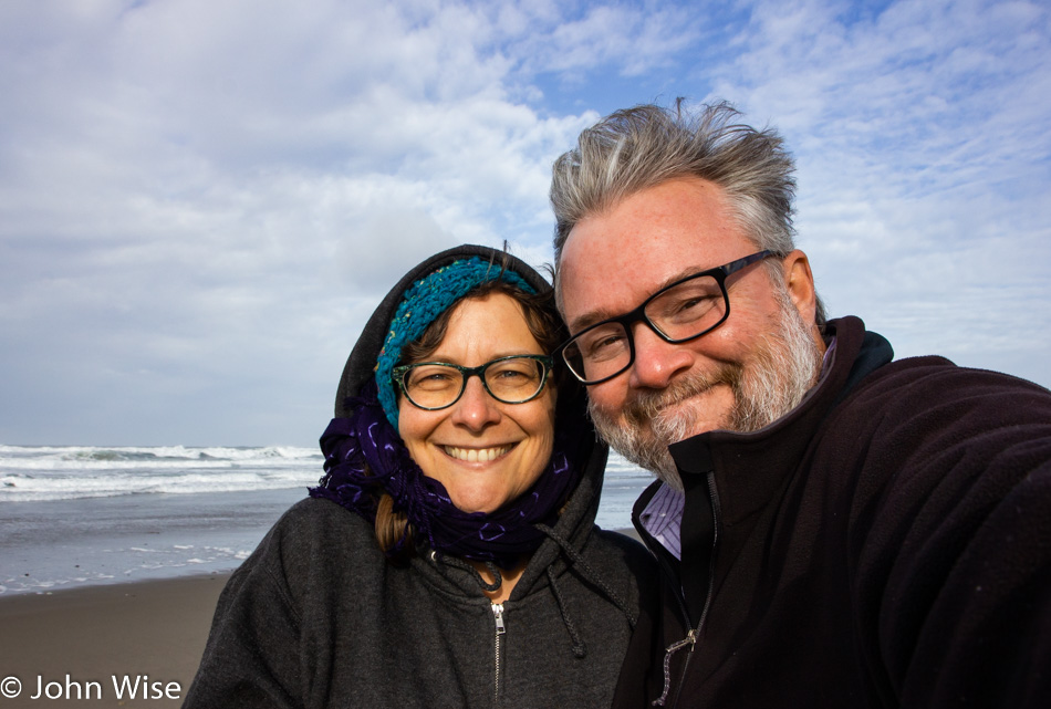
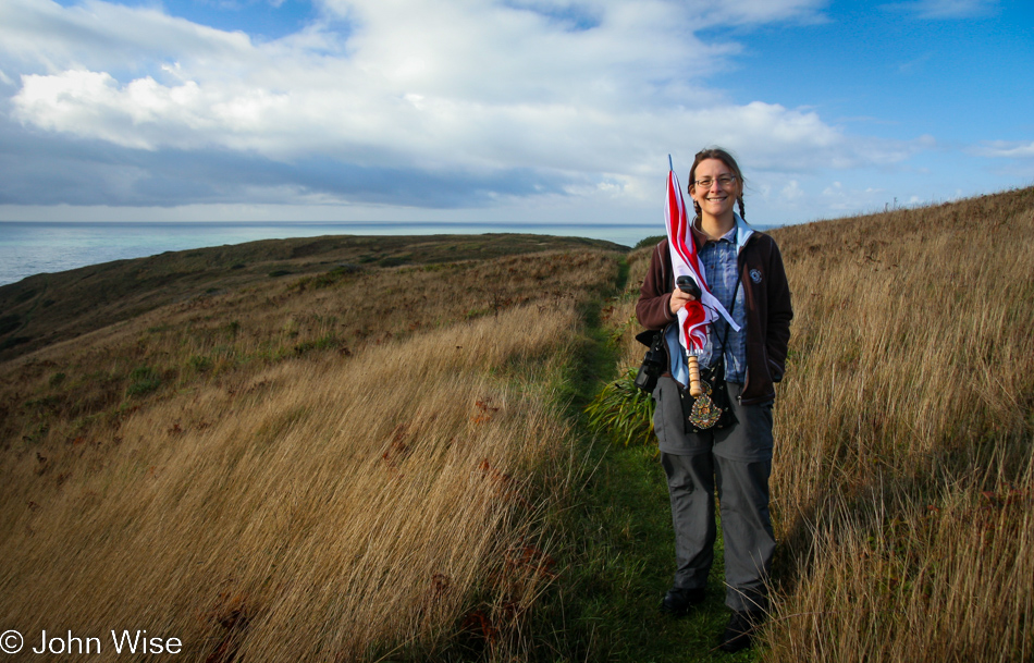
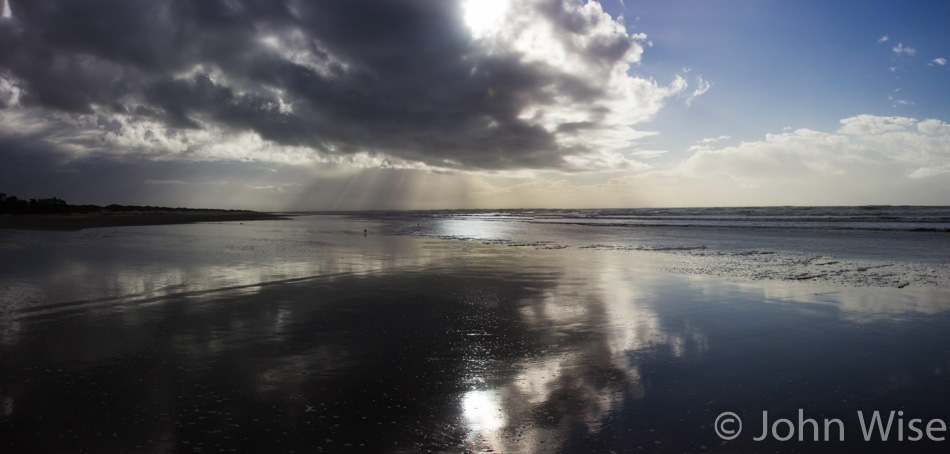
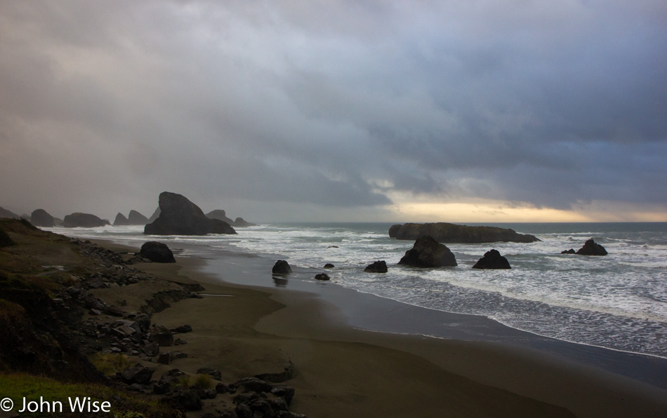
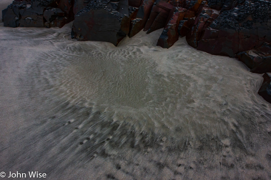
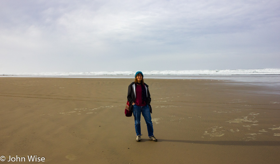
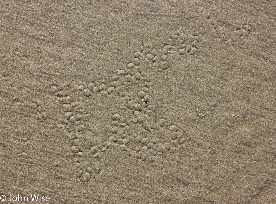
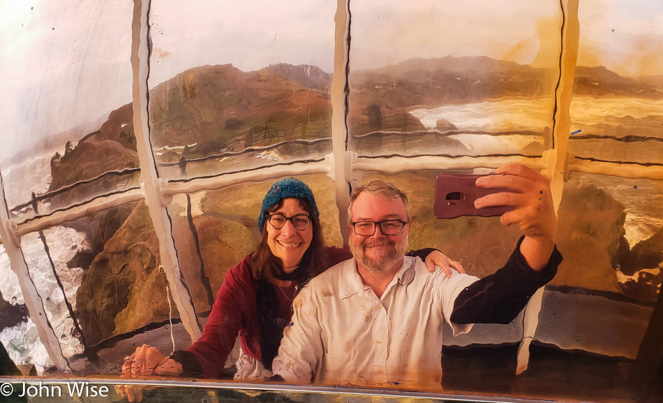
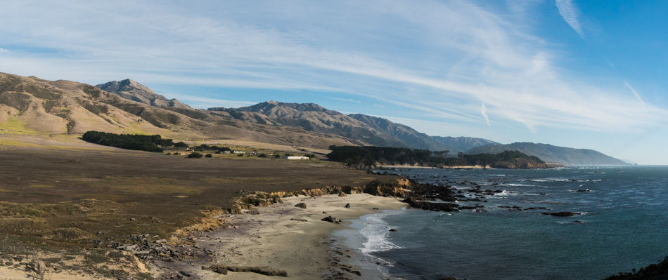
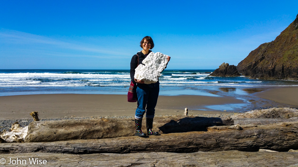
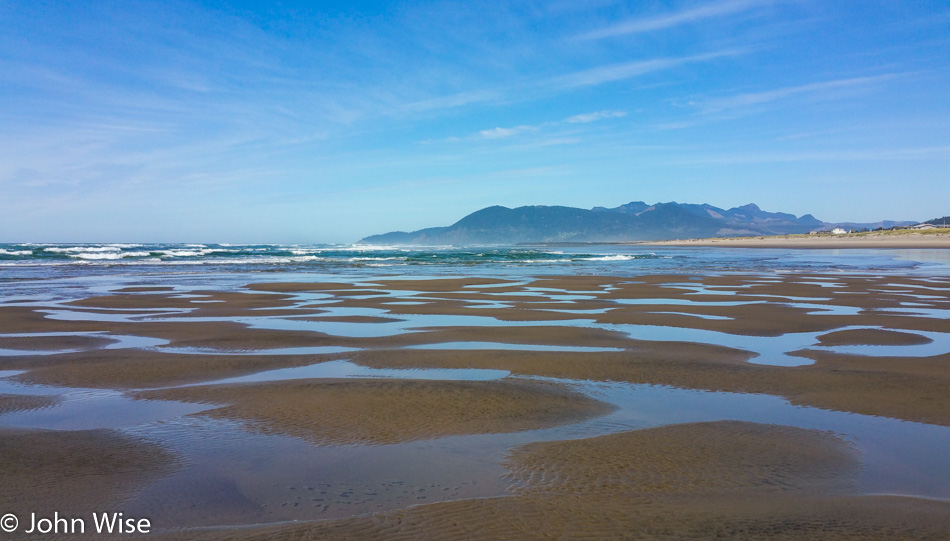
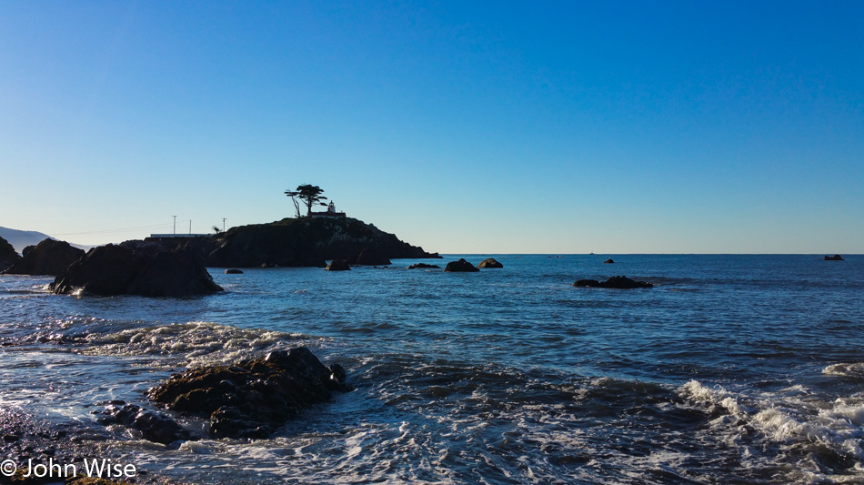
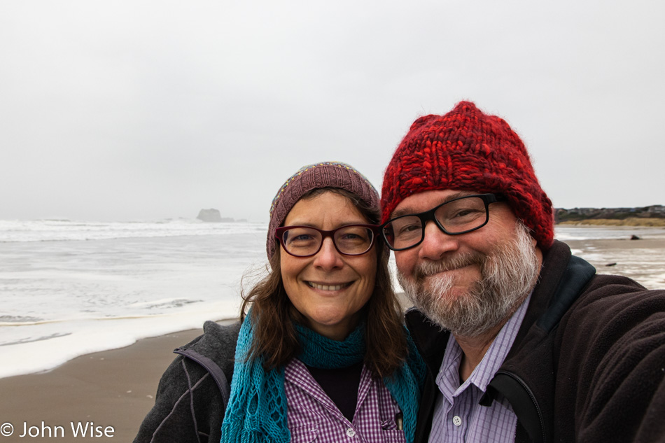
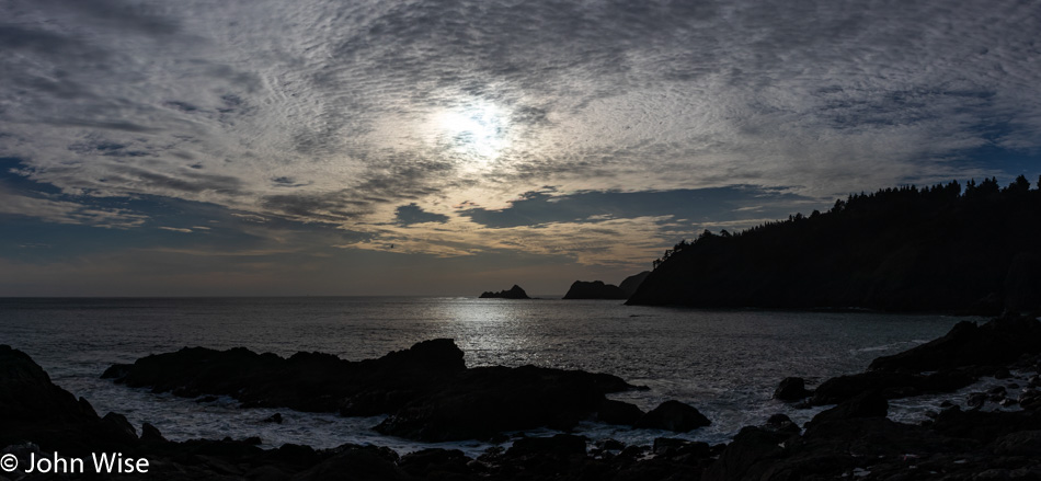
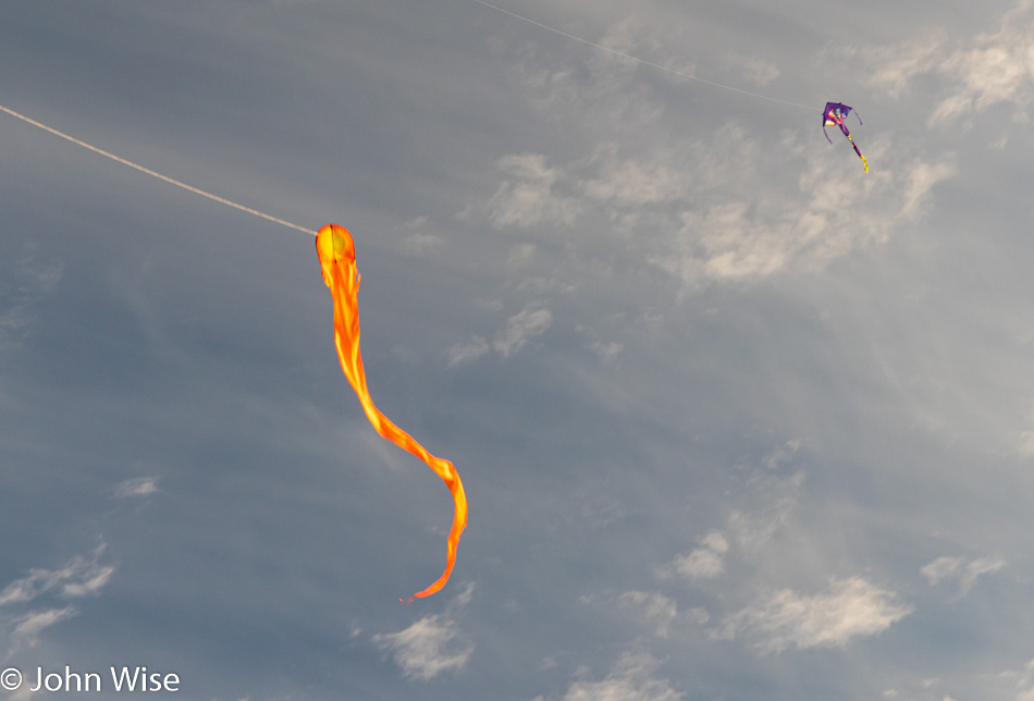
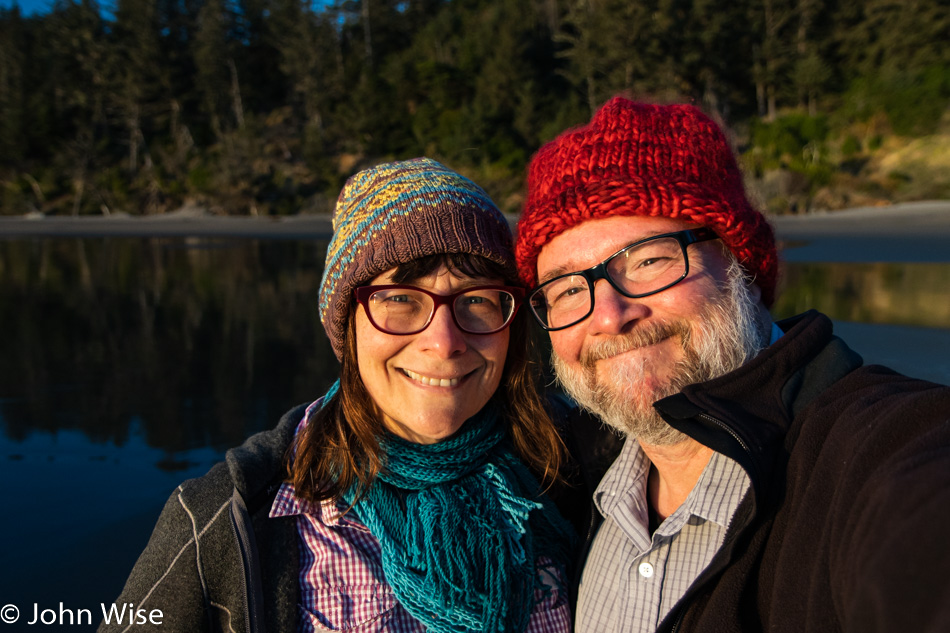
When starting the day on an Oregon beach, we don’t need the sun to make our faces shine. These smiles are produced by location, love, and the thrill of being able to wear warm clothes that rarely come out of storage in Arizona. This is south of Face Rock in Bandon, the same stretch of beach we were on yesterday during the sunset.

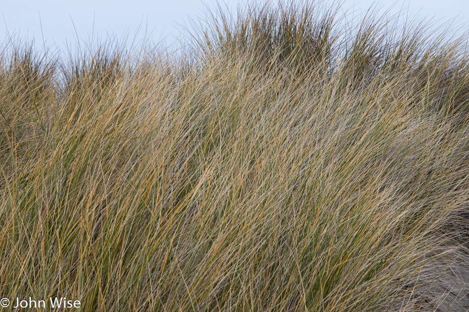
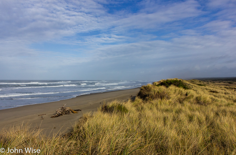
This is European Beachgrass, an invasive species found here on the Oregon Coast. We only recently learned of its negative effects on the coastline and how it changes the habitat in some radical ways. Still, I find it beautiful.

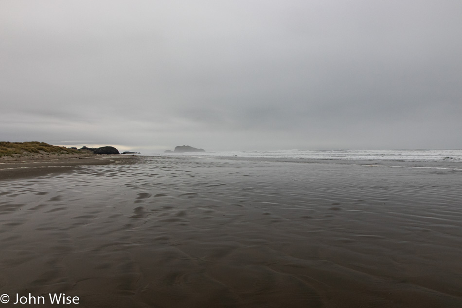
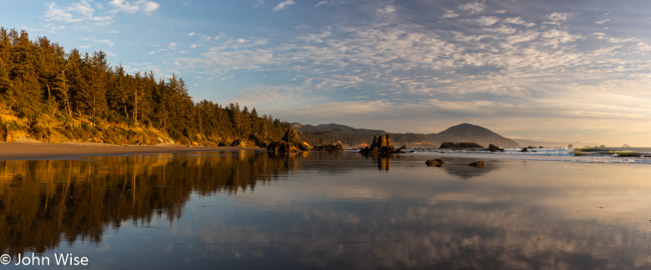
With a good long walk down the beach, we feel better about heading out for breakfast. A few other people with dogs and a young couple with an enthusiastic toddler were the only others out here this morning. For decades, Caroline and I have seen the sad reality that given the option of waking late, staying cozy next to a TV, and minimizing the effort of getting out, people opt for just that. While this lazy behavior has offered us quiet walks on beaches from the North Sea to Hawaii, I still can’t help but lament how uninspired the general population feels to me, with empty beaches perfectly exemplifying our state of woeful affairs.

Stewart Lane seemed like a nice shortcut through the woods, but wouldn’t you know it that the not-so-trusty GPS maps that show the gravel road connecting to another backroad we’d like to take no longer goes through. So, was Stewart Lane a waste of time? Nope, we quite enjoy these little forays into the abyss of having gone nowhere.

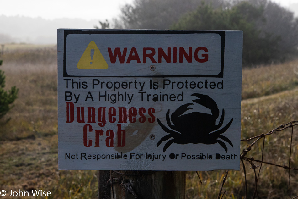
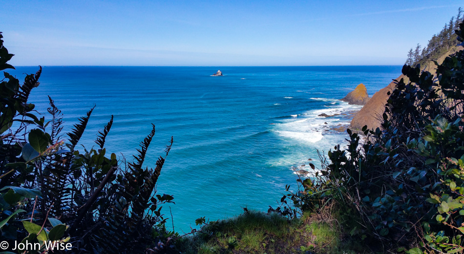
That backroad we were just on that took us nowhere was supposed to connect to Lower Four Mile Lane, which looked like it might let us get to a section of the sea we’d never visited. By the end of the lane, we turned around, having failed to find access. Just as we were giving up, a small sign (not this one shown above) caught my eye that directed us to the Four Mile Creek Trail. Skirting the edge of private property (see above sign), we took a nice short walk towards the Pacific.

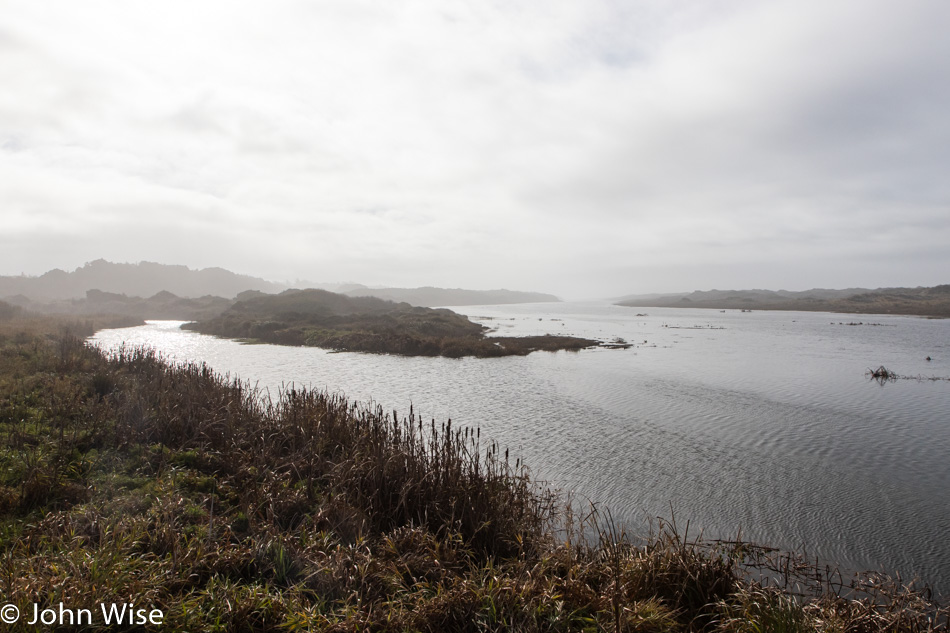
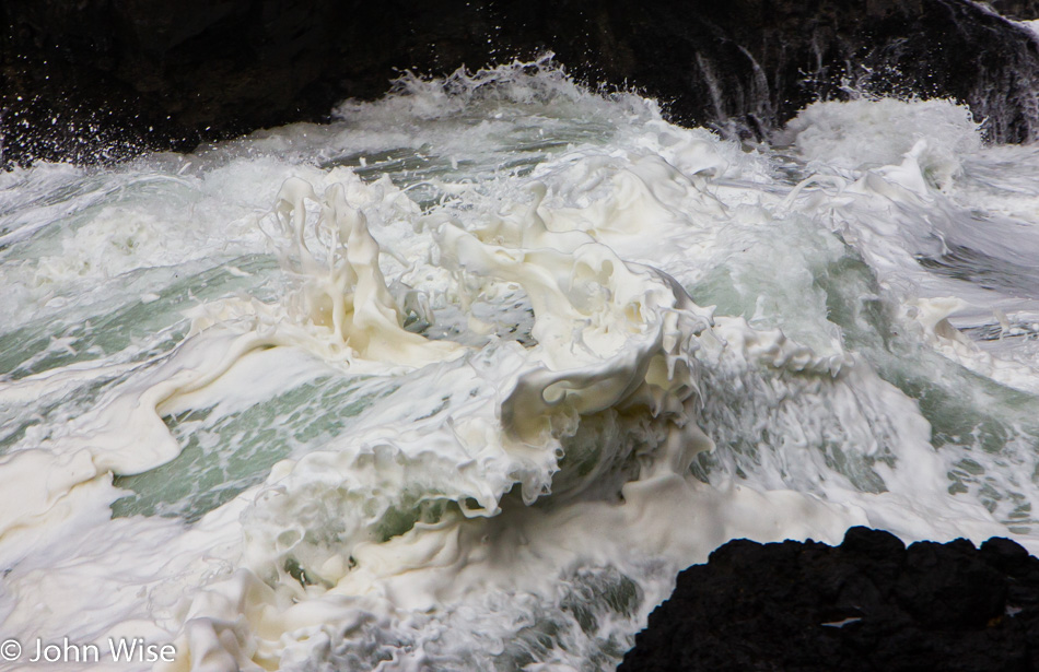
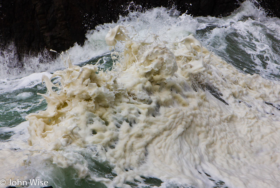
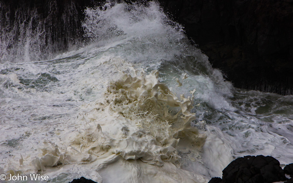
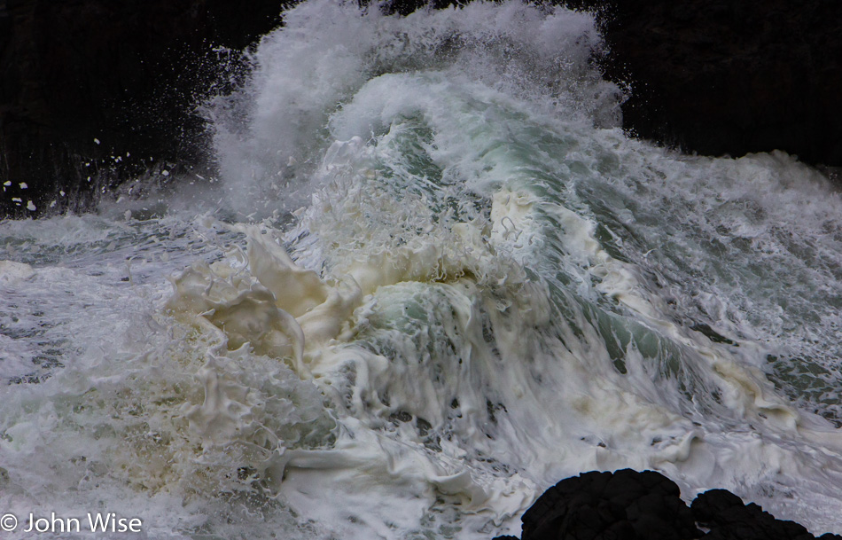
Four Mile Creek enters New River as seen standing on a giant piece of driftwood. This was about as far as we got as New River stopped us from venturing further. Had we brought a couple of handy dandy foldup kayaks with us, we could have crossed the narrow river over the island you can make out on the right. Instead, we stood around enjoying the sound of the crashing surf we couldn’t see and imagined the adventures that could have been had on the deserted island.

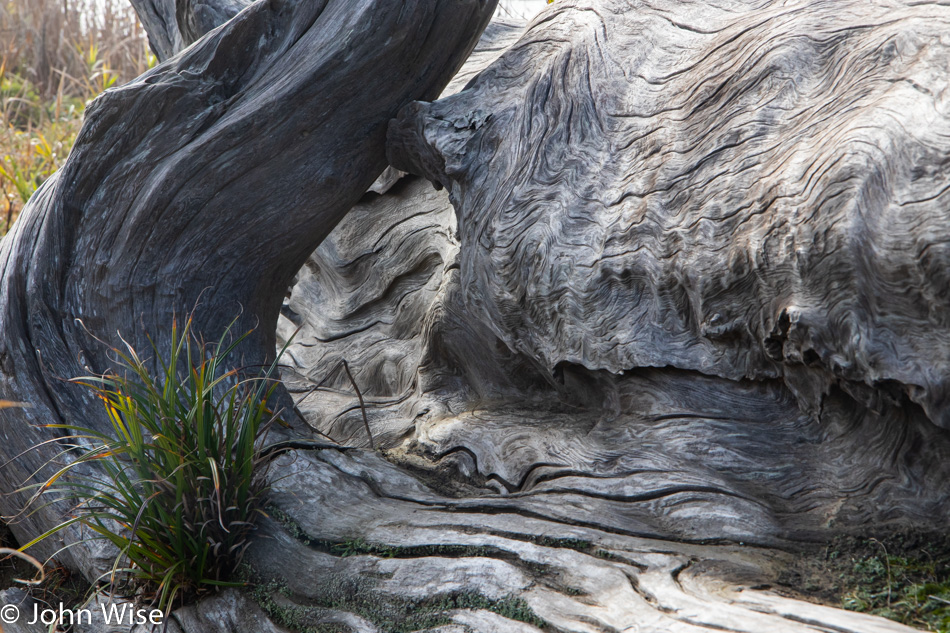
This is the biggest piece of driftwood we may have ever seen. This gray hunk of whale size tree is the hulking remnant of a Redwood. How’d this get so far up the coast from California, you might wonder? So did we.

It turns out there used to be Redwoods in Oregon, and supposedly, there’s still a very small grove tucked away, but due to people’s efforts to harvest every single tree of size, ensuring there are no old-growth forests remaining on earth, Oregon is no longer known as a place that is home to these majestic trees. A local told us this tree is rumored to have been sitting right here for about 100 years now. What a sad and tragic reminder of how quickly we are ready to despoil our lands and oceans in order to move money around.

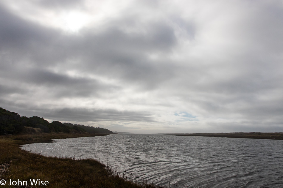
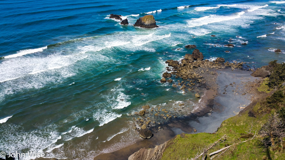
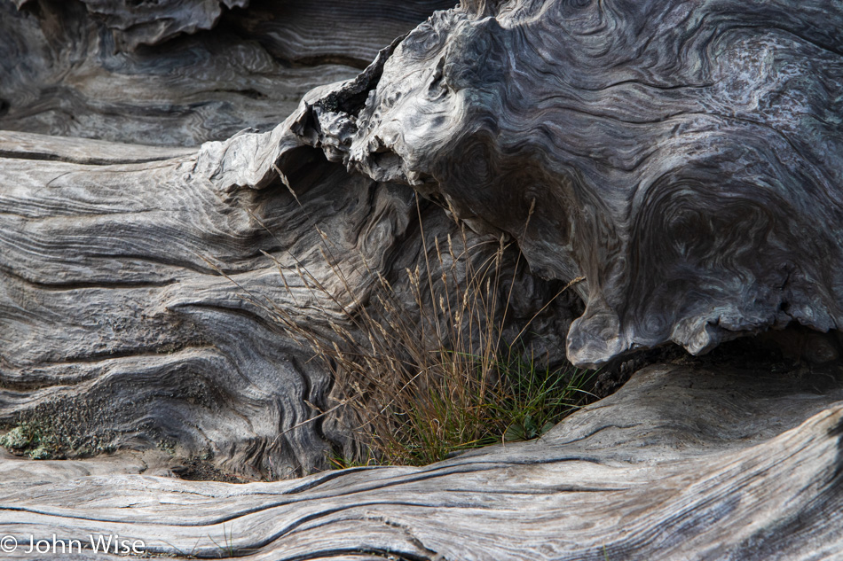
This may look like where we just were, but it’s a mile down the road. It’s still the New River, but it’s in a section of the park that once was called the New River Nature Center but appears to be the New River A.C.E.C. now, which stands for Area of Critical Environmental Concern.

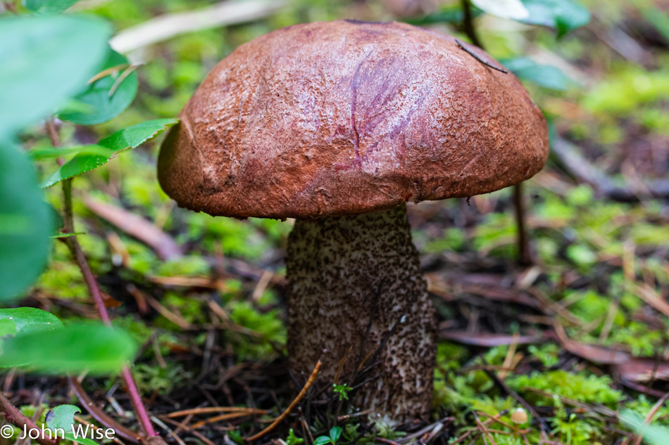
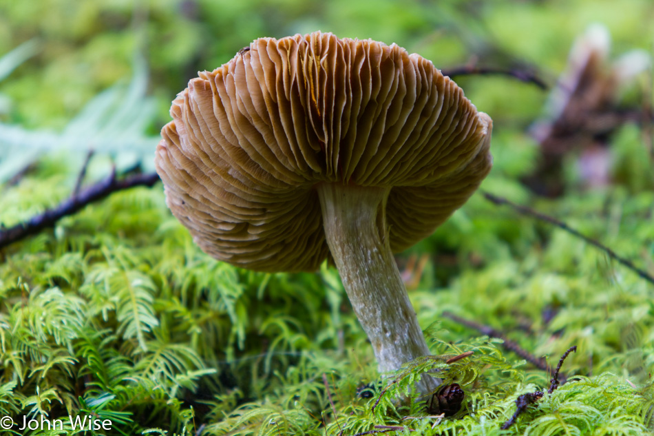
This is one of the few mushrooms that was still standing upright. While there are signs everywhere asking visitors not to harvest mushrooms, they are of little good as that is exactly what is happening here every day. What isn’t stolen by people looking for a cheap meal or sold to others is knocked over to spore more growth so the next harvest is better than the previous. While we were here, we saw a group of three people from California parked next to the road, one of the passengers getting out with a backpack disappearing off-trail into a thicket to poach mushrooms.

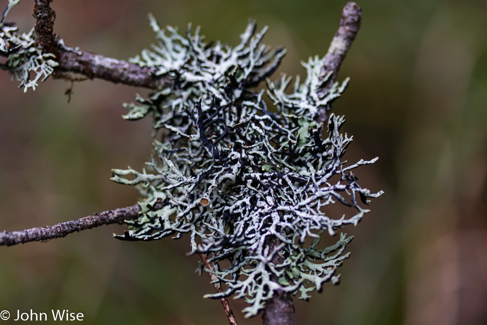
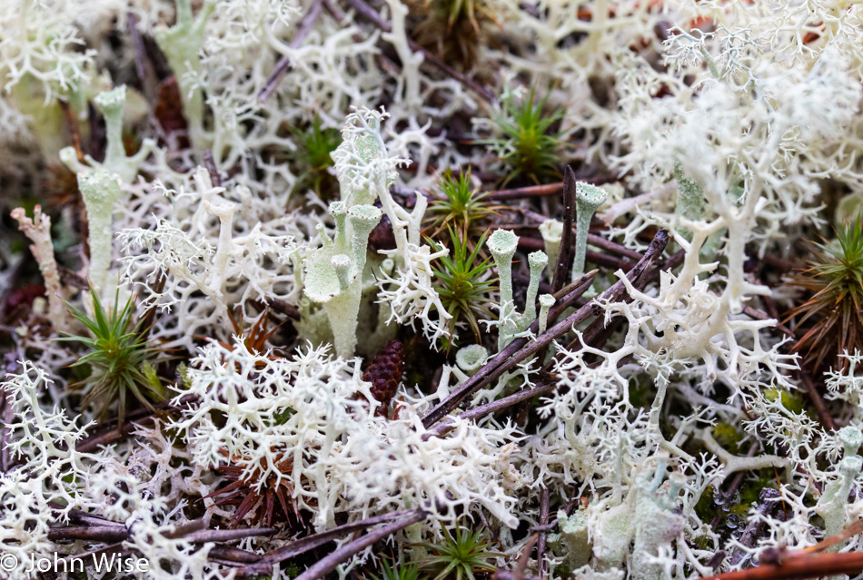
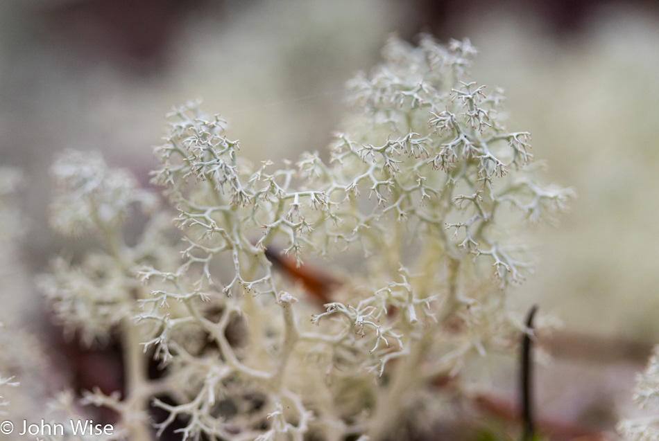
Fortunately, moss and lichen are not very palatable. While some are edible and are eaten by people in the Arctic, they are left alone by humans here along the coast.

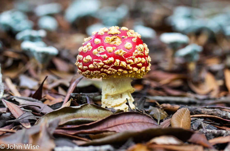
If only the mushroom hunters would stock up on these and devour a toxic dose that would remove them from the gene pool. Leave the wild mushrooms for visitors to wildlands, you ugly thieves of nature, and give greater opportunity to tourists to find more reasons to return, thus leaving their dollars in your local community. The same goes for the clear-cut trees, but I’ve written about that before.

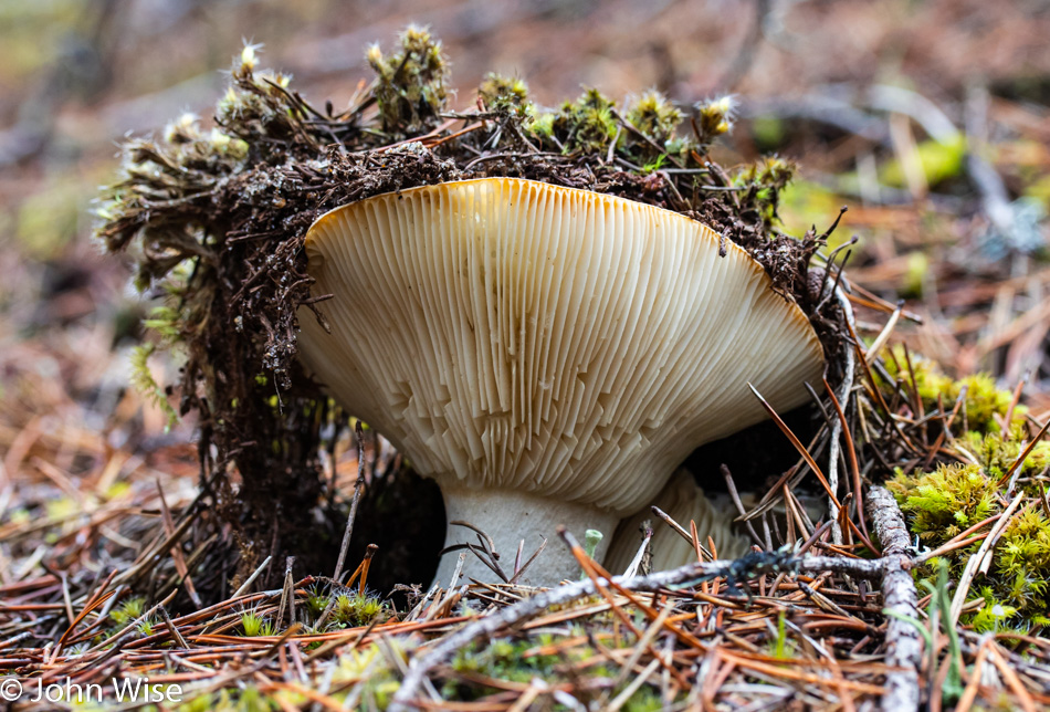
To someone walking along the path, this is a beautiful sight. It’s a rare sight that must be sought after, as the majority of trailside mushrooms have been kicked over and broken into 20 pieces.

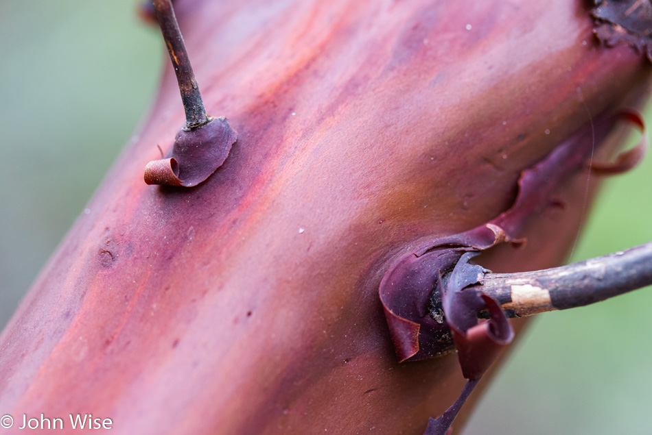
Manzanita trees feel as amazing as they look. How we could walk by them and not stroke their luxuriously smooth surfaces is beyond my imagination because once you touch manzanita, the manzanita has stroked your senses.

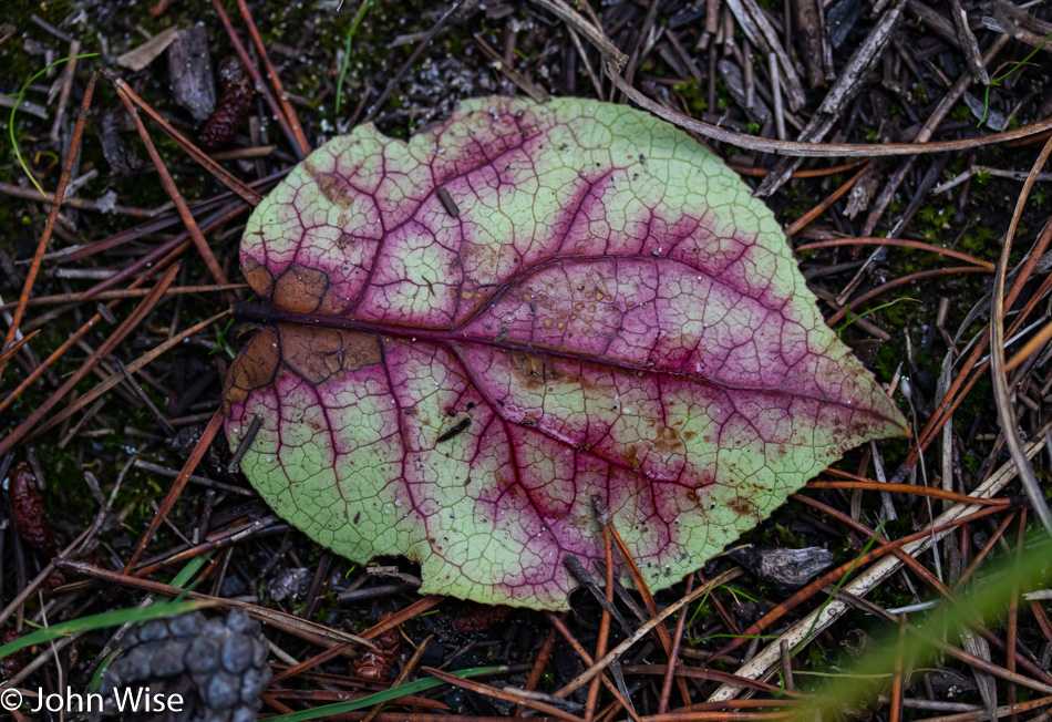
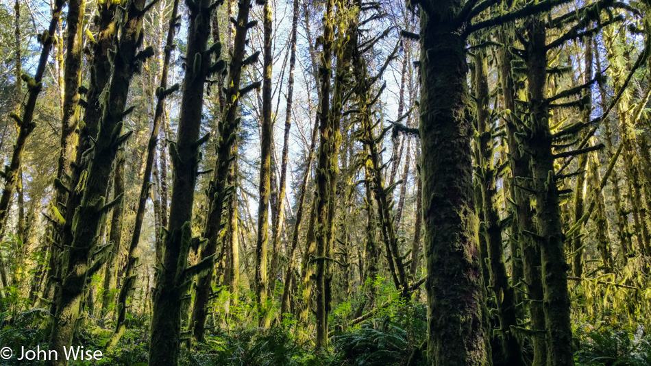
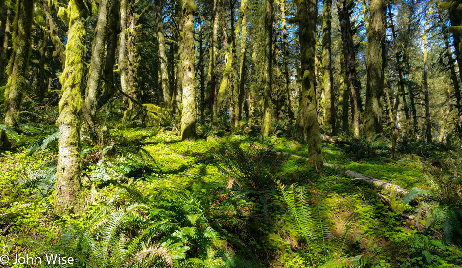
Can you tell that I decided to bring the macro lens with me? Hmmm, did I already mention this in the previous entry? Oh well, so now you know for certain it is with me, and you should expect a few images that look at things in greater detail than previous blog entries about Oregon. Far too often, I’m focused on the landscape with a look to the ocean as we are entirely enchanted with those views, and having more of them for our memories is quite satisfying, but we also are in love with the many details we see in between along the way.

There are maybe a dozen large-sized cities on the 363-mile-long Oregon coast. The largest is Coos Bay, with about 16,000 people, so by large city standards, these are small towns. While the more typical nationwide chains have some presence out here, such as Starbucks, McDonald’s, and Walmart, we are never very far from nature. Once out on a trail or a quiet stretch of beach, it feels as though we are even further removed from the rush of city life, not that there’s a lot of that here anyway.

Finding the images that will feature not only the visual impact made by the many vistas but also those things that are integral parts of a complex landscape that is so much more than trees and ocean is a large part of my exercise. Just what needs to be seen that will fill the gaps of intricacies that are easily overlooked?

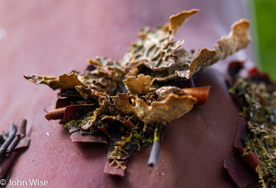
Branches reaching out leafless and white serve what purpose here in the forest? Do they have a method of using nutrients that offer a symbiotic relationship to some part of the ecosystem that is invisible to the casual observer? What are the light green golf tee looking like things? I think they are a fungus, but don’t really know.

Dendrites come to mind when looking at these branching arms.

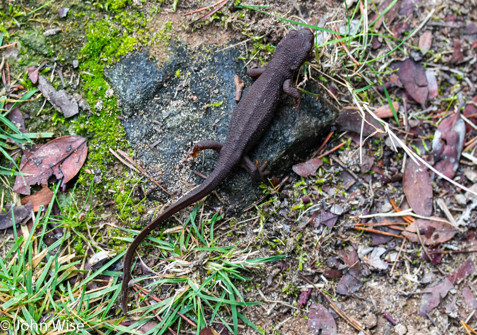
Newts on trails seem like a bad mix but are welcome hiking buddies that make us smile. Astute readers will know that it’s likely everything we see puts smiles on our faces. If I think about that for more than the second it takes to write such optimistic thoughts, I’d have to take pause and find honesty that litter and dog shit definitely do not put smiles on our faces; scowls come to mind.

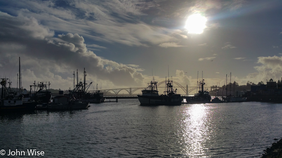
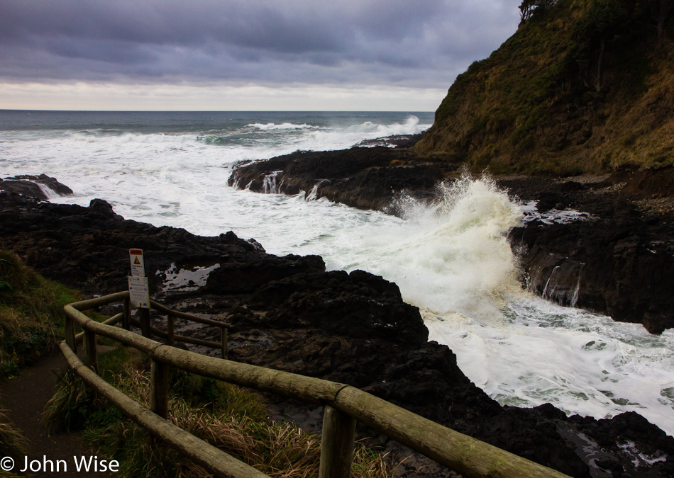
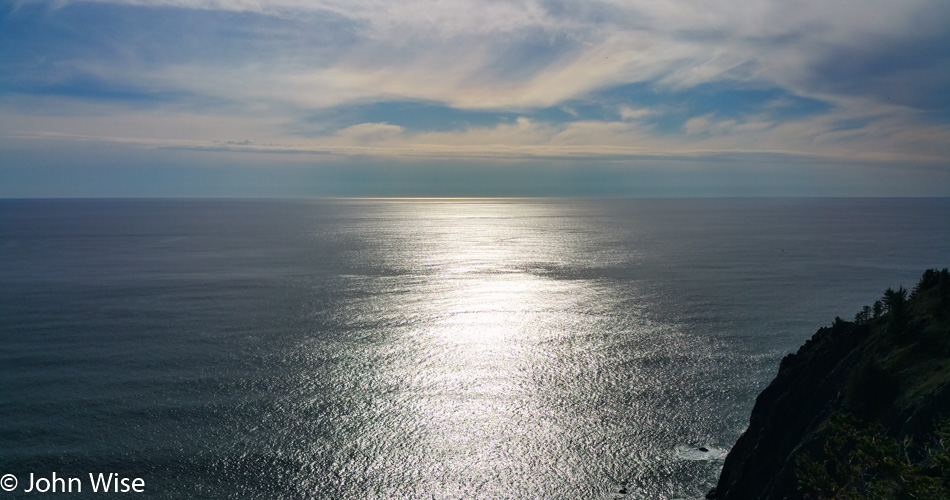
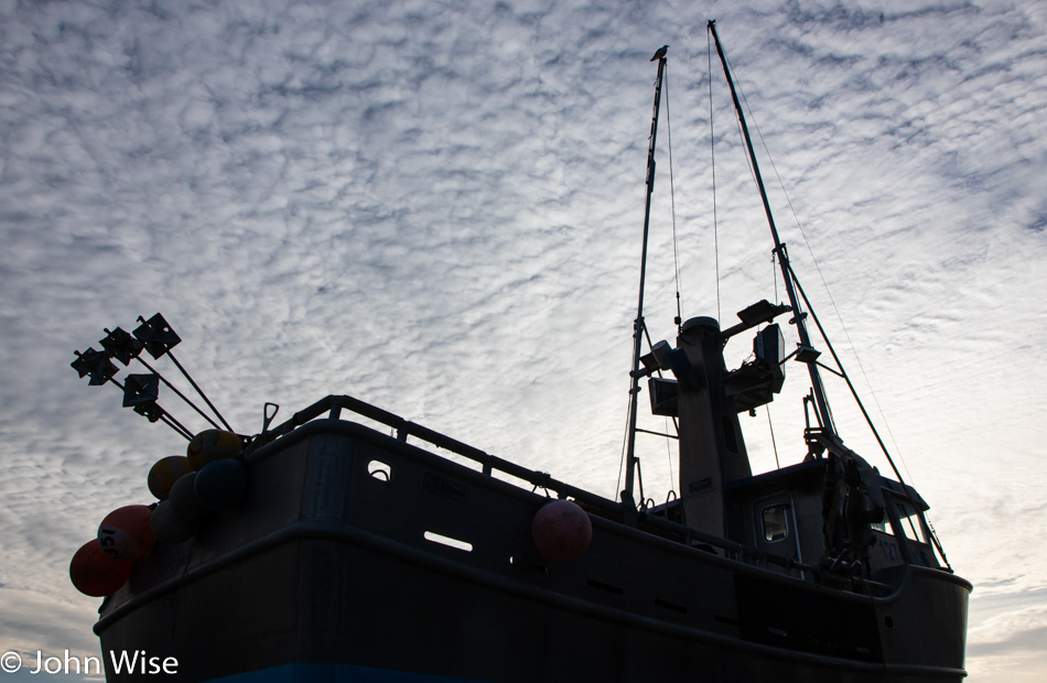
The dock at Port Orford would be the one southerly point on the coast we try to get to if we are within 50 miles of it. In bad weather, this spot is a dynamic churn of chaos that has astonished us with its fury. During calm seas, the idea of heading out of the small bay for a day of fishing is an attractive fantasy that maybe one day we could be heading out with a local skipper. Behind me is Griffs on the Dock, which serves up some decent seafood, and on my side are some water tanks where a local entrepreneur has taken to growing red dulse, which is an edible alga.

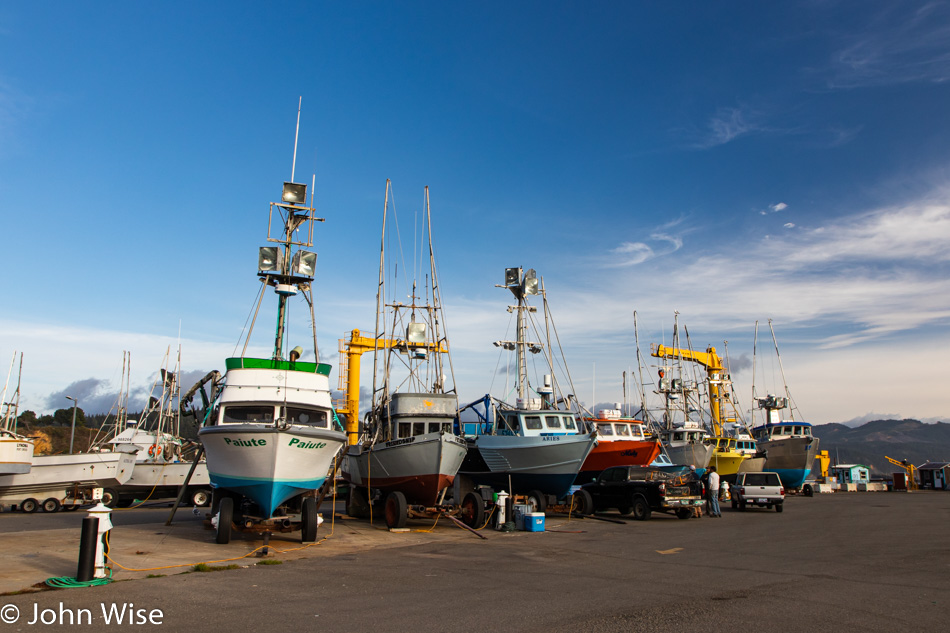
Most of these fishing boats have been here for years and the majority of them we recognize from year to year. One of the guys who captains the red one there in the middle of them all told us how the boat to his right is owned by his brother. That turquoise boat was rescued from salvage for a steal after it had flipped and bobbed in the surf, tearing it mostly apart a bit further up the coast. We were talking to him as we noticed that for the past couple of years, the crab pots that are usually on the dock haven’t been out. He informed us that the season has been getting a later and later start due to the small size of crabs that need to reach a certain size to harvest.

It’s kind of funny that for the many times we’ve been down here on this dock, we’ve never seen one of these boats in the water. Maybe we could time a future visit to coincide with them pulling a boat or two out of the water.

Humbug Mountain is about 50 miles north of California, and it is the furthest point south we’ll travel on this vacation. We’ve been meaning to climb the trail up this bulwark even though we’ve read it doesn’t offer any spectacular views, but to date haven’t been able to fit it in. On another occasion, we had the time but didn’t have the gear for the amount of rain that was coming down.

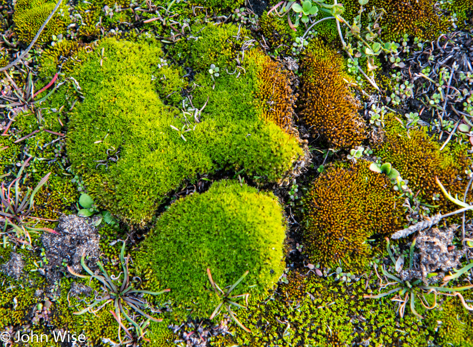
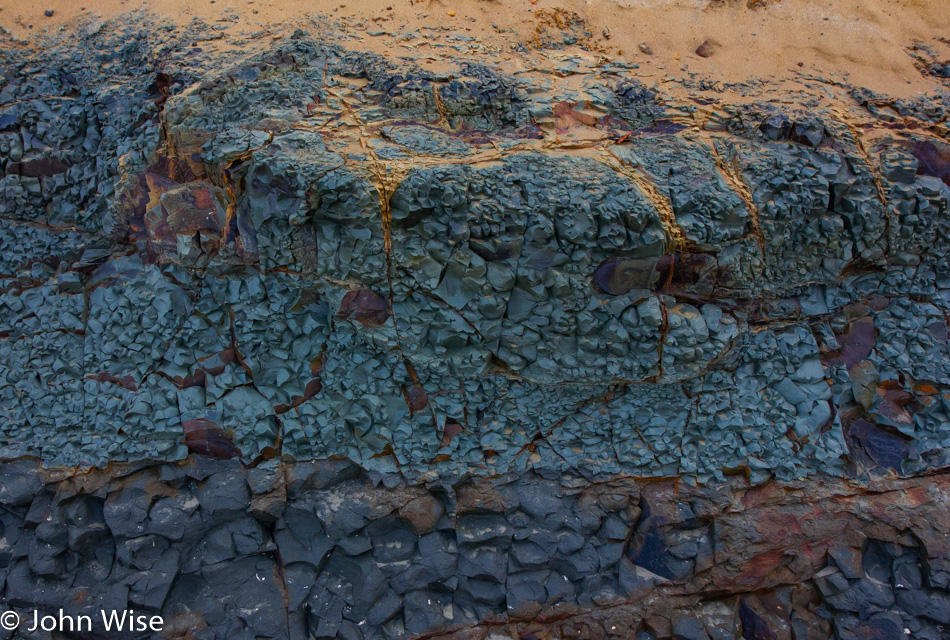
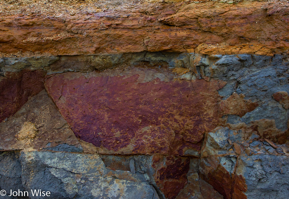
When we pulled over on the north end of the mountain next to the road, we jumped over a barrier that keeps cars from careening off the cliff, though there are plenty of other locations to do just that if this were your inclination. Expecting dirt and trash, we were surprised by the moss and something else that I’ll show you after the next photo of a sunset.

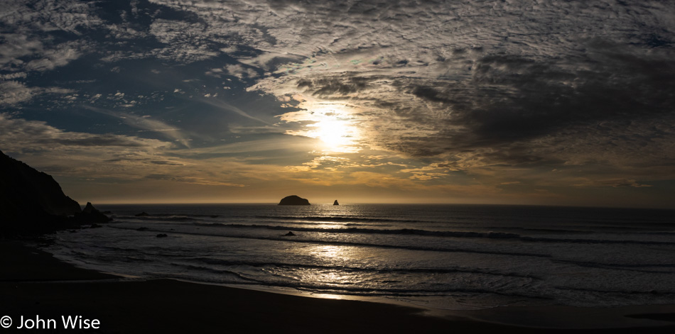
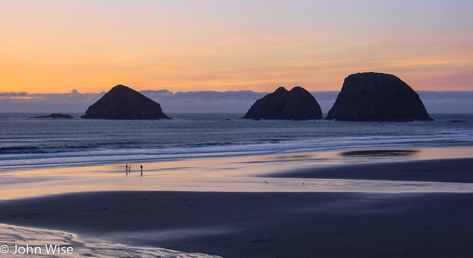
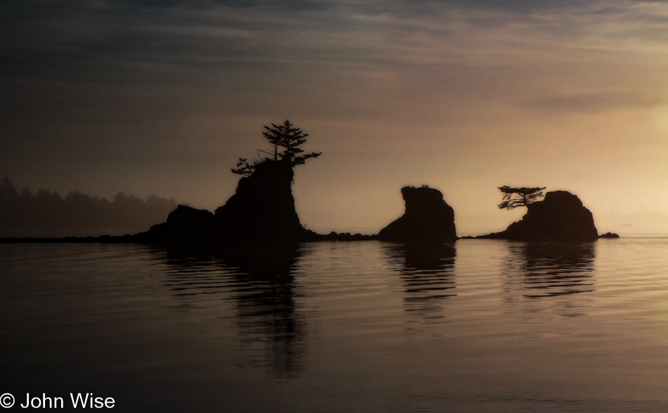
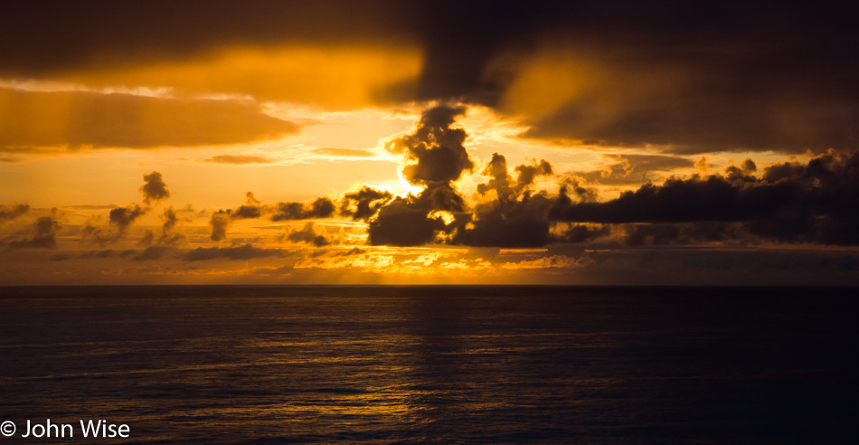
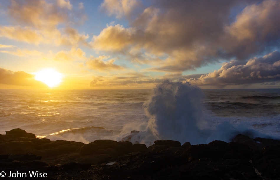
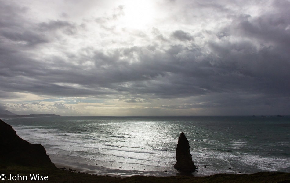
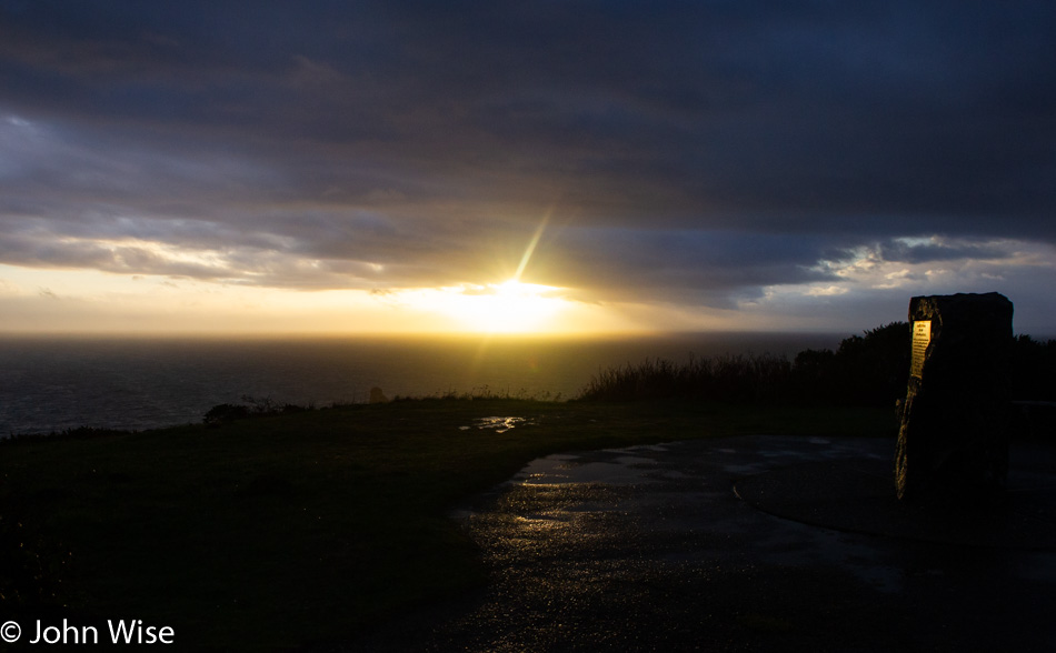
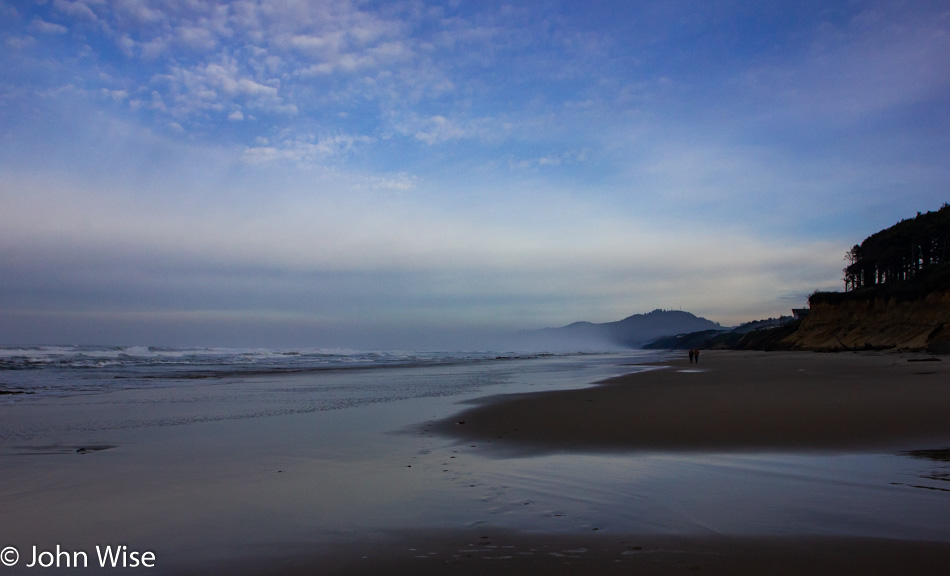
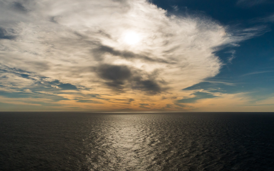
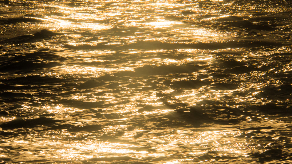
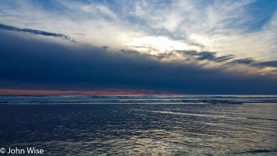
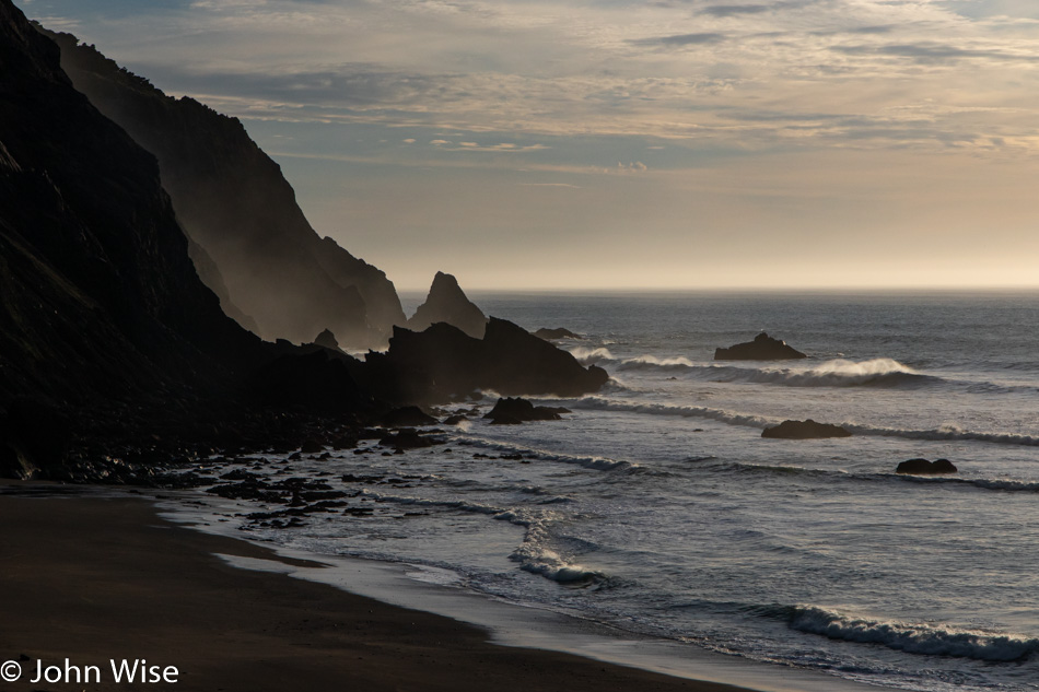
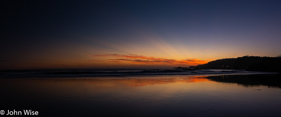
I could have skipped this gratuitous inclusion of yet another sunset photo as there’s another that shares some similarity to this one, but the warmth, clouds, golden glow, and fog in the distance are so enchanting I just had to share it.

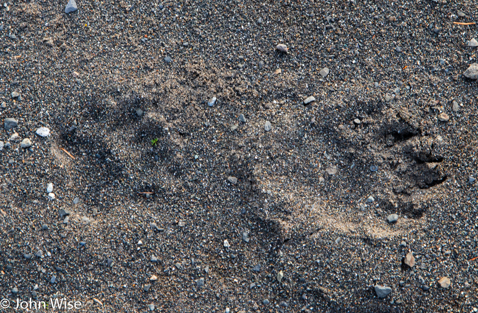
Bear tracks. We had no idea that we’d ever really see bear tracks this close to the ocean and on a cliffside next to the road, that means it had to cross that highway to get over here.

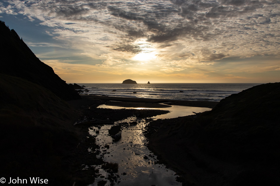
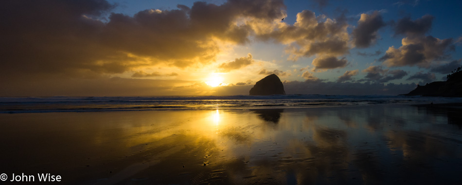
So the story behind the inclusion of this sunset photo that shares some resemblance with the one above is that this one has Brush Creek illuminated by the setting sun, and Caroline insisted I take this photo for her.

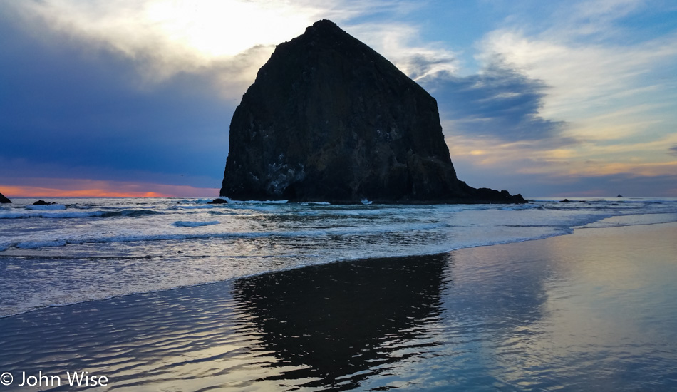
Here we are back in Port Orford because one can never visit this town too often. The particular stop is at Battle Rock Wayside and is the same place Caroline lost her phone on a previous visit.

This is why one can never visit Battle Rock Wayside too often. The timing of being here at low tide for sunset was not planned for. Other than where we are staying, there was no fixed itinerary for what we might be doing while up here in Oregon. The hope is to find new things to do should we realize that we’ve visited a particular location one too many times, but like all previous visits, we drop in on our familiar haunts with all the enthusiasm as though it’s the very first time we’ve ever seen the place.

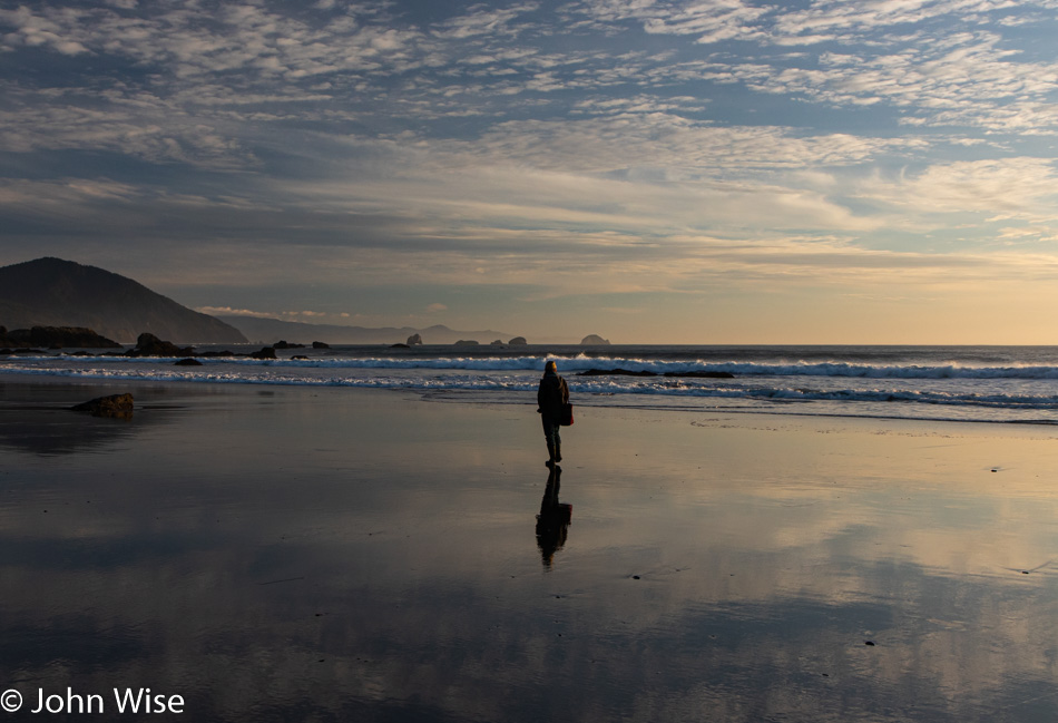
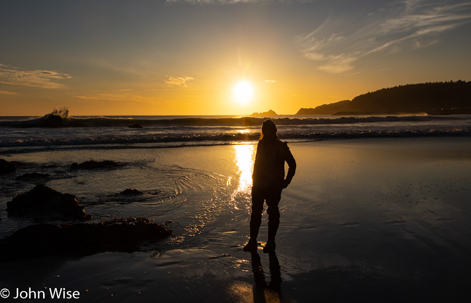
I’d swear Caroline is in another world when she’s at the ocean. I’d love to know her perspective and how she sees this seascape in front of her. While I look for photos, sounds, words, and other things to record in my mind to convey here at some future date should I find the time, Caroline is over somewhere else searching and observing her happy place in a way I can never fully appreciate. She’s never gone long, I should point out, as we reconnect every few minutes and then walk together for a while, sharing a kiss, a hug, a snuggle, an exchange of words that profess our love for each other.

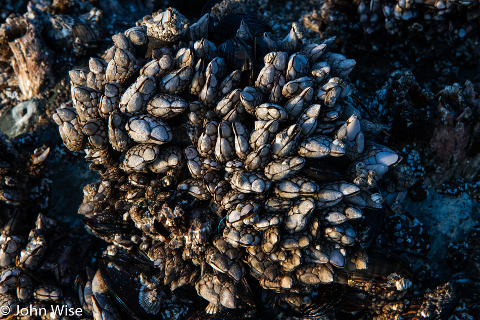
Are these the same gooseneck barnacles we’ve seen here before? The likelihood is pretty good that they are, as some barnacles can live as long as ten years.

At home in Phoenix, Caroline works hard and often long hours but one of the luxuries of having committed so much to learn to do what she does is that she usually has great benefits. While health care takes greater and greater importance in our lives as we age towards our 60’s it is time off that is the best reward. Knowing how to use that rare commodity for things other than the mundane becomes our greatest treasure, and getting out for traveling is the best use of that time we know. If Caroline could correct me here on the blog, she would likely add that having time at home for weaving, spinning, knitting, and other fiber-related arts is also of importance to her.

One of our encounters where the smiles at the situation become too much to bear for one person, and to balance the load we reach out to each other and blurt something or other out about how lucky we are or how much we love each other. There’s a lot of telling each other how much love we feel and how happy we are to be out here once again.

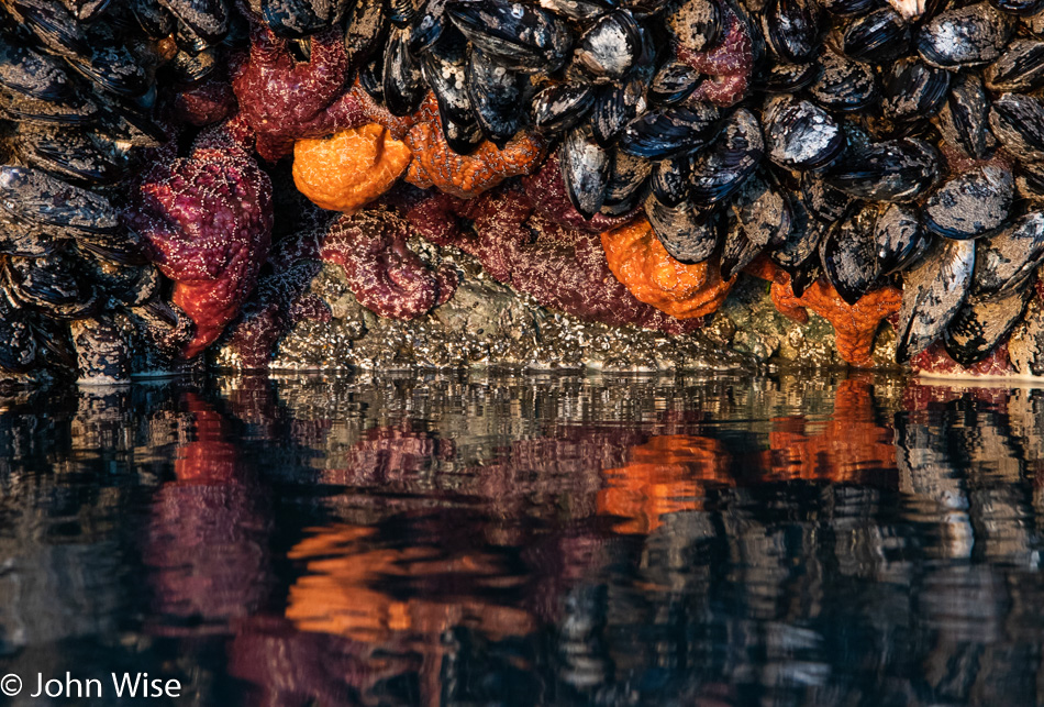
Starfish were in short supply on our last couple of visits, but they have bounced back this year. The tide also appears to be one of the lowest we’ve ever witnessed here. These windows into coastal life are extraordinary but could be so much more interesting if Oregon were to recognize the value of knowledge sharing out here and give us digital docents so we could listen to audio tours of information regarding each section of the coast we are visiting. Explain to us how clear-cutting helps the environment or business or whatever. Give us info about the wildlife refuges and estuaries. Bring in marine biologists to tell the stories of the ebb and flow of habitats and species.

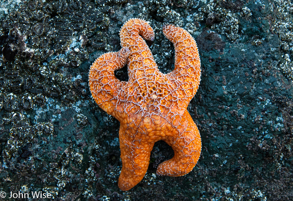
If this isn’t a sexy pose, I don’t know what is. It looks kinda hot, huh?

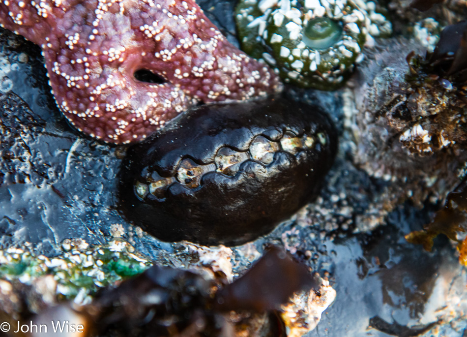
Chitons are the kevlar of the sea. At least, I’m fairly sure they are bulletproof. This type is known as Katharina Tunicata or, more commonly, the black Katy chiton. I’ve read they were good eating by indigenous California tribes but how they are harvested is beyond me.

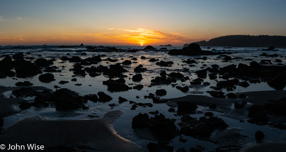
As I said, we’ve never seen the water this low. By now, we are only enjoying the setting sun as checking out the wildlife has grown more difficult in the fading light.

We took a good long time to leave the Battle Rock Wayside here at Port Orford, even though we knew we had a long drive ahead of us. Not too long but long enough, plus we would need to stop for dinner.

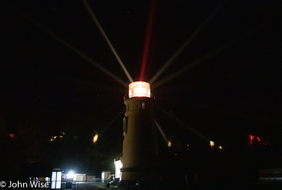
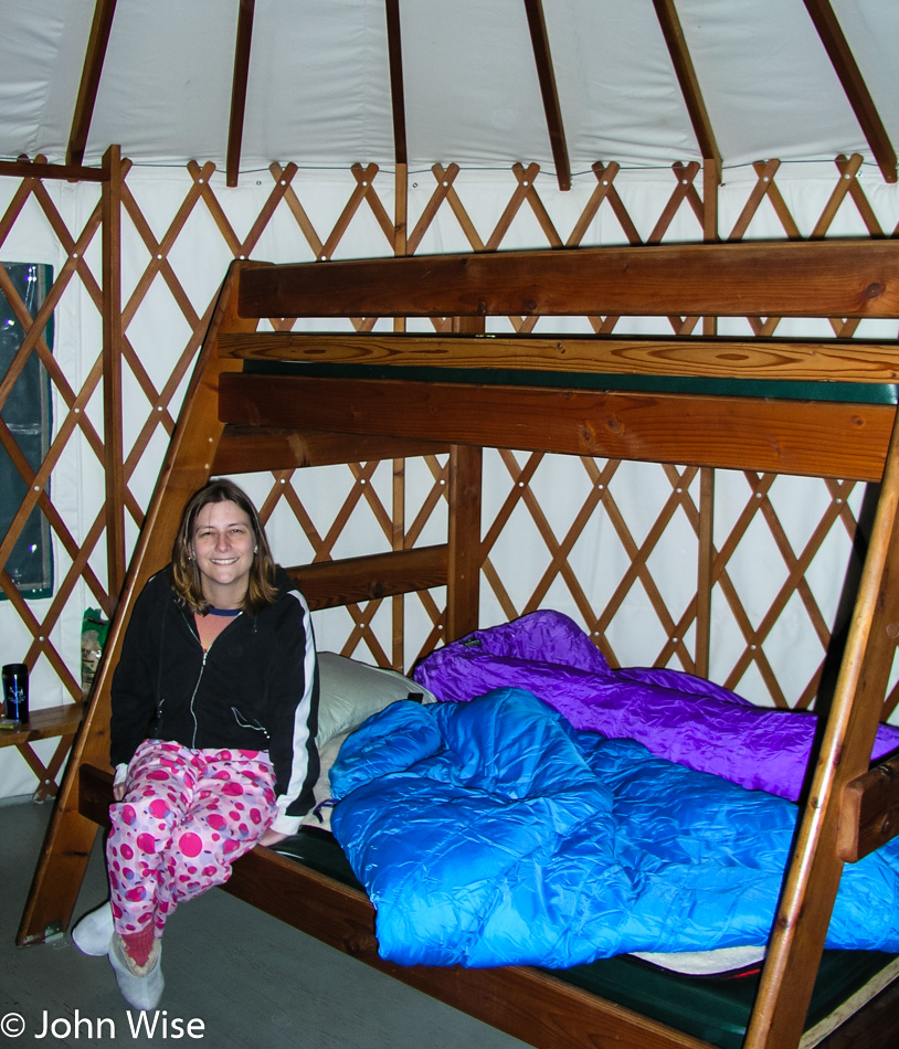
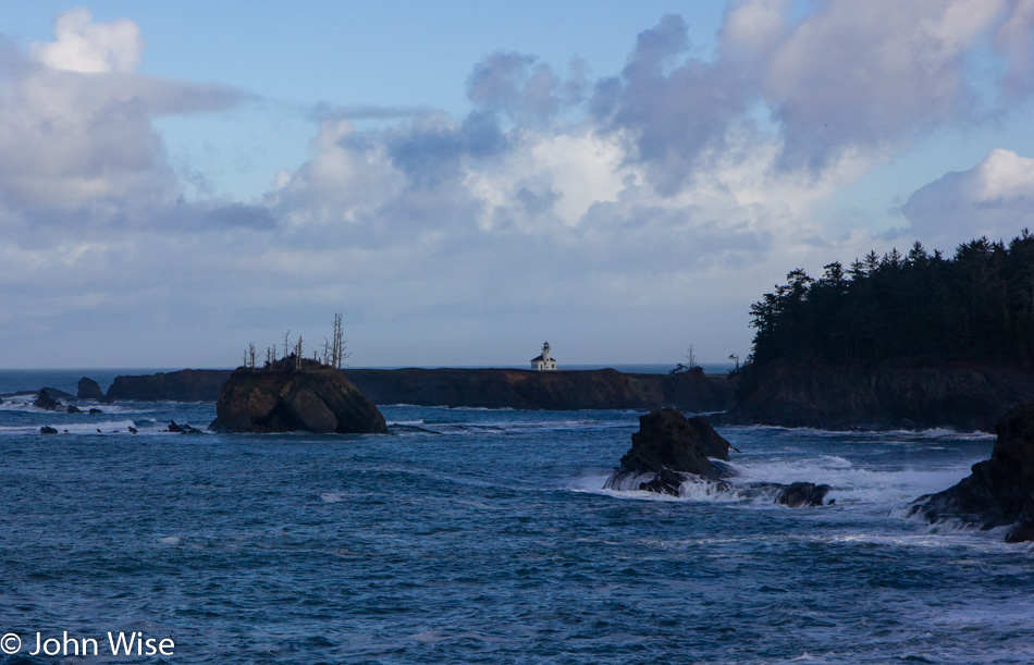
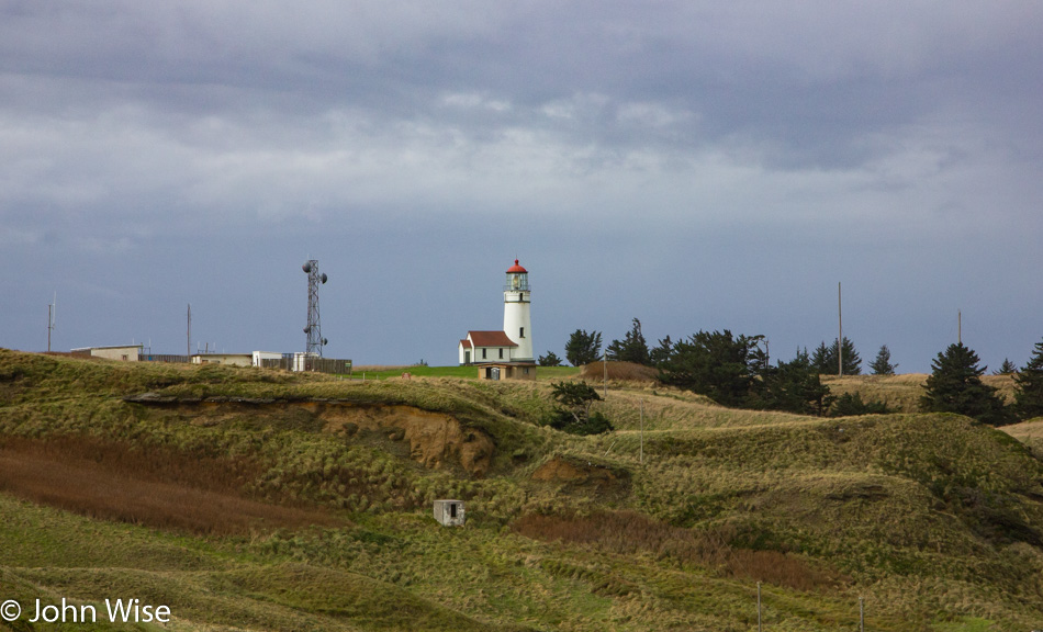
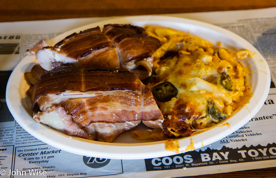
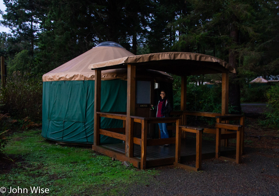
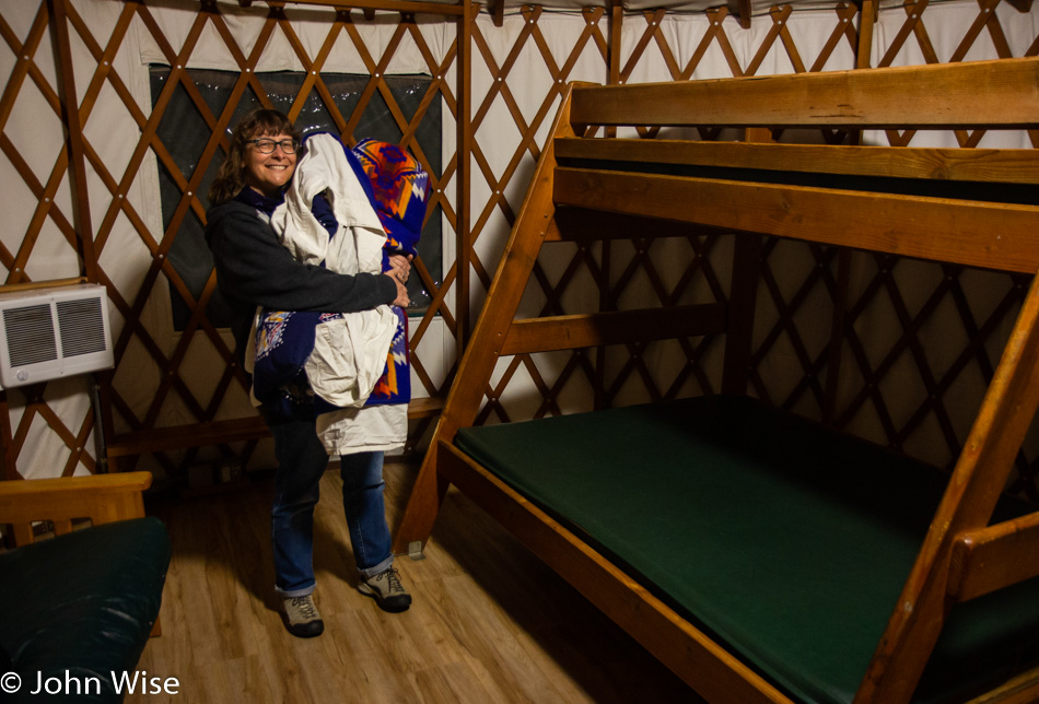
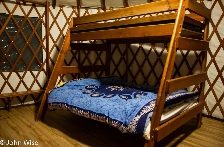
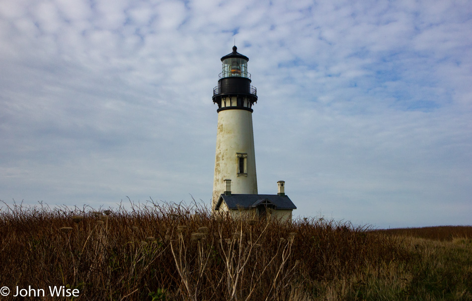
Dinner was back in Coos Bay and was another forgettable meal at a place not worth mentioning, but we’re not here for culinary delights. Our lodging this evening is close to the Umpqua Lighthouse in the state park that bears its name. This is our first night in a yurt on this trip; two nights will be spent right here while we’ll be in various yurts for a total of five nights this week. While it’s difficult to see in this photo when it’s presented so small, there are many a star in the sky this evening. What else can’t be shared is the strange silence of the light penetrating the night sky and illuminating the fog and flashing on the trees as the light turns. Somehow, it feels like the two white and one red light should have some kind of tone or pulsing sound as it slices through the darkness.

Number 19 of 17

Caroline Wise and John Wise on the Oregon Coast November 2018

Here, at the last minute, we decided that we’d go north. The destination we are heading to is Oregon, the coast specifically; it will be our 19th visit during the past 17 years. Only seven of the previous journeys into the state were made outside of late fall and winter, with our inclination to spend time on the rocky coast during the quiet season. The photo of us above is from last year somewhere along the Oregon coast.

Three Arch Rocks March 2002

Trip 1: Back in March 2002, we made our first visit to the Oregon coast and were smitten within minutes of arrival. This is the view from Three Arch Rocks National Wildlife Refuge, seen from Oceanside Beach near Maxwell Point.

Cleetwood Trail Crater Lake July 2002

Trip 2: By July of the same year, we were once again underway on our way up through California on our way to Oregon. It was the long 4th of July, 2002, and we now knew that the drive that far north wasn’t all that difficult, so off we went. The trail took us past a remote corner of Death Valley, through a ghost town, and up to Crater Lake National Park before we turned around to race home to Phoenix, Arizona.

Mount Hood November 2002

Trip 3: Hey, it’s now November 2002, and we’ve just gotten started exploring Oregon with so much left to find. Here’s Caroline standing in an ice-cold mountain stream at the foot of Mount Hood. If you think freezing cold water phases my wife, you’d be sadly mistaken. We are now attempting to see all four corners of the state and the interior, so we have a better idea of exactly where we want to return to on future visits.

Harris Beach Yurt and Caroline Wise in Oregon November 2003

Trip 4: November 2003 and where better to go than back to Oregon. In the intervening time between visits, we’d learned that more than a few state parks along the coast have yurts as part of their accommodation offerings. Back then, they were incredibly cheap in our eyes and seemed romantic from afar. With this here, our first night staying in a yurt, we fell in love faster than it took to unlock the front door. We knew we were hooked. This photo of Caroline was taken at Harris Beach near Brookings, Oregon.

Horses near the Columbia River Gorge in Oregon

Trip 5: Barely six months had gone by before the call of Oregon summoned us back. Emboldened by the ease we were getting to places we thought were too far for 5 to 7 days, we took on this July 2004 summer drive back to Crater Lake. From there, we headed over the Columbia River and up to Washington to see Mount Rainier before driving out to Olympic National Park. Our return was via Oregon and California back to Phoenix, where the scorched desert awaited us. The photo was taken somewhere between John Day and the Columbia River in Oregon.

Caroline Wise and John Wise at Dutch Bros in Grants Pass, Oregon

Trip 6: This one was almost missed as we were only in Oregon for 2 hours after leaving the Redwoods down in California to head up to Grants Pass for a cup of Dutch Bros. coffee. It seemed like a great idea at the time. November 28, 2004.

Cape Meares Lighthouse in Oregon May 2005

Trip 7: May 2005, and it was time to share our affinity with the Pacific Northwest with my mother-in-law, Jutta. With Caroline and I now quite familiar with some “best of” places, we took her mom to Death Valley, the Redwoods National Park, up the coast of Oregon into Washington, and then over to Glacier National Park in Montana before dropping into Yellowstone for her second visit to that park and then down across Utah before stopping for her first-ever visit to the North Rim of the Grand Canyon. The photo is of the Cape Meares Lighthouse near Tillamook, Oregon.

Caroline Wise at Cape Ferrelo Viewpoint in Brookings, Oregon

Trip 8: Oh, it’s Thanksgiving, and there’s no better way to escape family obligations around the holidays than for us to be out on the road. November 2006 was the witness to this short 7-day excursion up through San Francisco with a quick jaunt into Oregon for a couple of days before heading down to Santa Cruz, California, to spend some time on that coast, too. The photo of Caroline was taken at the Cape Ferrelo Viewpoint near Brookings, Oregon.

Carl Washburne State Park in Oregon November 2007

Trip 9: This is becoming a trend where we pack things up for a road trip that somehow keeps ending up in Oregon in November because here we are in 2007, testing the question of, “Will it be boring this time?” The answer was a resounding “NO!” This photo was taken in the Carl G. Washburne Memorial State Park, home of the most southerly temperate rain forest in the United States.

Rocks rising above the water in Siletz Bay, Oregon

Trip 10: You can pass Siletz Bay near Lincoln City, Oregon, one hundred times, and this view will always look different. I’m not sure we’ve stopped here that many times, but on this November 2008 trip along the coast, we were taken by the silhouettes etching out a perfect scene as our day was coming to a close. It was difficult choosing this photo of Siletz Bay when this was also the trip up the coast that had us stopping at the Devils Churn near Cape Perpetua for a sight that enchanted us for a solid hour or more. Click here to see an image from the Churn that is still one of my favorites.

Caroline Wise Kayaking in Garibaldi, Oregon September 2011

Trip 11: Oh my, it’s been three years since last we visited Oregon though we have great excuses why we couldn’t make it. In 2009, we visited Yellowstone National Park for the first time during winter. In May of that year, my mother-in-law Jutta spent two weeks with us in the Eastern United States. In 2010, we visited Yellowstone in January again, as the year before was so fascinating. Then, later in the year, we rafted the Colorado River through Grand Canyon National Park for nearly three weeks. Enjoying the idea of boating, we stretched out on our 10th trip to Oregon for some kayaking here in Garibaldi in September 2011.

Near Heceta Head Lighthouse in Oregon November 2011

Trip 12: A second visit in one year is kind of extraordinary, but we apparently have an addiction problem, and I don’t mean mushrooms. This trip saw us bringing a friend along as maybe they can corroborate our sense of amazement for Oregon or they can point out why our regard is too high, and we can back off this incessant need to visit the state every chance we get. The mushroom was photographed near Heceta Head Lighthouse in Florence, Oregon, in November 2011.

Oregon Coast November 2012

Trip 13: Rafting in Alaska this summer wasn’t enough for us, so here we are in November 2012 for our 12th visit to Oregon. With some research, information about the location of this photo could be found but I’m feeling kind of lazy about this time in trying to write this blog. You see, when I started this entry, I thought we’d made 14 visits, but then I discovered a few more trips about which, for one reason or other, I never blogged. With no photos posted here, I had just assumed my blog showed all of our visits; wrong.

South Coast of Oregon May 2013

Trip 14: Out with my daughter Jessica in May 2013 because we’d never seen the state of Oregon with her in our company; seemed like as good a reason as any.

Oregon Sunset November 2015

Trip 15: It’s that time of year again. Here we are in November 2015, and once again it’s Oregon on our minds. We missed last year due to me starting a new company to build a Virtual Reality world, only to end up neglecting ours. True, we did raft the Yampa River up in Colorado and Utah with friends, and we visited Los Angeles and San Francisco during 2014, but it was truly the slowest travel year we’d experienced in over a dozen years.

Depoe Bay, Oregon November 2016

Trip 16: November 2016, did you think there was any chance we’d miss the opportunity to visit Oregon at this time of year?

Caroline Wise at Rockaway Beach, Oregon April 2017

Trip 17: Are we bored yet? Do we look bored? One doesn’t ride the wild corn dog if things are not top-notch. April 2017 marks the first time ever we’ve been in Oregon during this month: wow! So now we’ve visited this amazing state in March, April, May, July, September, and November, leaving only six other months we’ll have to plan visits for. Where do you find this exhilarating ride? In Rockaway Beach.

Boiler Bay in Oregon November 2018

Trip 18: By now, you must have already guessed that this was shot in November 2018. If you guessed that date, you win a trip with us to Oregon on one of our next visits. You just have to pay your way and pass a compatibility test with us grizzled travelers, and maybe you’ll be out exploring such fantastic sights such as this one on a late afternoon at Boiler Bay near Depoe Bay, Oregon.

Oregon Coast – Day 9

The Inside Range of Coos Bay in Charleston, Oregon

The bittersweet last full day doing the vacationy stuff is at hand. The goal is not to dwell on this being an end but an incredible gift of a day that will stand out in a singular fashion of having been a great collection of moments in its own right. I try my best when we are out on epic journeys not to see their conclusion, so much as an appreciation of the idea that asked, “What if this were the only day in my entire life to be out here and this had always been my dream to be right here on a day such as this?”

If you read yesterday’s overly long post, you’d know that we stayed at Sunset Bay State Park last night. What I hadn’t shared is that once more, we slept in one of our favorite dwellings ever: the mighty yurt. From there, the nearest breakfast joint is in Charleston, where we stopped at the new-to-us Cape Cafe. Soon after we were out driving around town near the Inside Range of Coos Bay when we snapped this photo. I don’t know about you, but this looks about as perfect as perfect gets.

Cape Arago Lighthouse in Coos Bay, Oregon

Cape Arago is home to one of the four lighthouses on the Oregon coast that cannot be visited by the general public. Even seeing this one is a bit off the beaten path, and this is about as close as one gets. Also, this isn’t the original lighthouse that first stood here back in 1866; that one was built further to the left, but erosion threatened it, so it was ultimately moved. Then, the second lighthouse was also in danger of being lost to the encroaching sea, and so finally, in 1935, this current structure was built. Until 2013, there was an old bridge to the island, but without maintenance, it had degraded to the point that it was finally removed. Prior to Europeans/Americans setting up shop here, there’s evidence that the Coos indigenous people had a village out on the island. The other island on the left in the foreground is called Qochyax, pronounced “Quay-KEE-awk,”  which means “women and children” in the Coos language.

Bullards Beach State Park in Bandon, Oregon

Nothing like the call of nature to direct where we head next. Typically, a state park is a safe bet when it doesn’t look like we’ll be hitting a town for a while, and so it was that we pulled into Bullards Beach State Park. Seeing we’re here, we simply must go up over the dune for a walk along the ocean on such a beautiful day.

Caroline Wise and John Wise at Bullards Beach State Park in Bandon, Oregon

These are the faces of contented happiness where the chill wind is a welcome reminder that we are still in Oregon. While I’ve wished it before, I’ll wish it again with a plea that we could easily take sound photos so that years from now, we could also listen to the ocean in the background when returning to this blogged memory. We probably walked around here forever until reaching the edge of infinity, where the horizon of time started to fade, so as much as we would have liked to have never left, we decided that we’d leave anyway as infinity is only so big.

The Famous Langlois Hot Dog in Langlois, Oregon

Louis Pasteur once said, “Chance favors the prepared mind;” with those sage words, we try to pay attention to all that is around us; otherwise, we risk missing important details. Good thing we saw the sign directing us to try the World Famous Langlois Hot Dog. We weren’t really hungry yet, but we were not going to miss the chance to experience something that has gained the attention of people around our planet. We ordered but one of the dogs in order to split it and verify if the claims rang true with us. One bite of this spectacular wiener, and we ordered another. Hailing from Frankfurt obviously makes Caroline an expert in Frankfurters, and my being married to one also makes me an expert. And while these wieners are a bit short and stubby, they are still greatly satisfying. Where exactly does one find a World Famous Langlois Hot Dog? Why in Langlois, Oregon, at the Langlois Market served by the Langloisese. This probably leaves you wondering just what is a Langlois. It’s a disused French word meaning England.

Beach south of Cape Blanco Lighthouse in Port Orford, Oregon

We are on the verge of straining to stand up against a fierce wind blowing over the bluff here at Cape Blanco. Not only is it piercingly cold, but occasionally, the wind carries tiny drops of rain, though maybe it’s bringing ocean spray from the crashing waves below.

These kinds of scenes ignite a spark of imagination where my mind kicks into wondering about our primordial beginnings. Long before creatures had arrived on primitive lands, prior even to the arrival of plants, our still naked earth would have spent eons with a hostile atmosphere, the only witness to these views. Here and there, the sun would poke through the clouds to illuminate a tiny spot on the ocean while not a soul in the eternity of the universe was ever on hand to see what was at work behind the cloak of evolution. Lands were forming and convulsing while magma ran over the surface to extend the reach of where we humans would one day walk along a shore. After billions of years, we should be so lucky to bask in this symphony that plays the elements with a skill mostly unknown to those who gaze into this abyss.

Cape Blanco Lighthouse in Port Orford, Oregon

Cape Blanco Lighthouse is an elusive outpost we are yet to pillage with our senses. Someday, we may arrive during the time of year they welcome visitors, but so far, we are consistently here at the wrong time of year. You may wonder what our shared fascination is with lighthouses. They are one of those intrinsically interwoven icons taken from the tales of the mariner. The lighthouse speaks to the symbiotic relationship between land and sea, man and machine. This beacon worked to help the seafarer navigate the treacherous coastal waters while transporting their cargo of people and treasure, be that food, products from another area, or gold itself. During times of stormy weather, the lighthouse received the full force of the gale, and in the cold dark of night, it was the job of the keeper to maintain the beam that can reach 50 miles (80 km) out to sea. It is that light that allowed the oceangoing traveler to know they were about to be safe once again as they landed on terra firma. The lone sentinel in the night is such a romantic notion that it sits squarely on our bookshelf of dreams.

Chicken Bomb from Wild Oaks Grill in Port Orford, Oregon

We drove right by Wild Oaks Grill on the side of the road on the outskirts of Port Orford, but then Caroline told me this place was getting some great reviews, so we pulled a quick U-turn and headed right over. Rob, the owner, greeted us and told us all about the process he uses to smoke everything he makes. He has a knack for doing everything large, including today’s special, “The Chicken Bomb.” This concoction is only for the serious of appetite and could easily sate two, maybe three, people. What is it? It’s a homemade sausage stuffed into a chicken breast filled with cream cheese and then wrapped in bacon before the entire thing goes into the smoker. The mac and cheese that was served with is a spicy mix of jalapenos and habanero and is introduced to the smoker as well. Rob serves up some quality BBQ, but his less-than-ideal location leaves him looking for new digs farther south. We’ll be stopping in on our next visit to Oregon should we find ourselves in his neck of the woods again.

Shark Fin Rock at Gold Beach in Oregon

I feel that I’ve shared a photo of this location too many times already, but I cannot find a previous post of it. Maybe I never identified it formally, and so I am being denied finding it. This is Shark Fin Rock at Meyers Creek Beach near Gold Beach. Off in the distance, where the sun is still shining through, and behind these clouds on the left is sunny California, just a mere 35 miles away. Oregon has arranged the cloud cover to scare away the hordes from their southern neighbor who might otherwise recognize that the Oregon Coast is a magnitude more beautiful than theirs and consequently start migrating north.

Samuel H. Boardman Monument on the Oregon Coast

Then, like a wink to those who are already up north, the sun peeks out to reassure us that its golden light is never far away. This view and the monument reflecting the sun is in honor of Samuel H. Boardman who was the Oregon State Parks Superintendent who oversaw the establishment of the state’s roadside parks. The lands put to the side are an amazing collection of beautiful places that no one landowner is able to monopolize. The views are permanently available to all of us who make the effort to travel this coastal road and the highways that supply access to the parks on the interior.

Caroline Wise at Harris Beach State Park in Brookings, Oregon

On our first visit to the coast of Oregon 15 years ago we stayed right here at Harris Beach State Park in the Winchuck yurt. Tonight, we are staying in Chetco, named after the local indigenous people of southern Oregon and the river that runs through Brookings.

Caroline Wise at Harris Beach State Park in Brookings, Oregon

All those years ago, these yurts were a lot cheaper to rent per night in the offseason than they are now, but they still represent one of the best bargains for being close to the ocean. Driving up from Arizona, we are able to bring all the bedding we want. Wrapped up and ready to unroll is a sheet atop a Pendleton blanket (made in Oregon, 550 miles away in the northeast corner of the state) and our feather comforter.

Harris Beach State Park in Brookings, Oregon

With the heater on, the bed made, and Caroline and I set up at the small desk the only thing missing is the patter of raindrops on the canvas roof. We can hear the low rumble of the ocean that’s only a couple hundred feet away as we smile at one another and revel in how perfect these cozy moments are. If today were the only vacation journey of our lives it would have been the most amazing experience anyone has ever had. To see it any other way would mean that we had become jaded and undeserving of seeing the magic all around us.

Oregon Coast – Day 8

Beach at Moolak Shores Inn north of Newport, Oregon

Who doesn’t want to walk along the ocean with the snowy plovers as they are reflected back at themselves, producing an even more beautiful scene? The stormy sea appears to be racing to capture them, and if successful, maybe try to convert them into fish or a kind of mini penguin; who knows? This flight of whimsy catches me as I watch the interplay between the birds and the sea that dance upon the shore. The speed of those legs and their extended beaks demonstrate a perfectly evolved bird package able to burrow for a meal in time with the receding waters. This is a natural elegance we should all stop to appreciate.

Beach at Moolak Shores Inn north of Newport, Oregon

Out of destruction comes change, and from that, a different form of beauty arrives. Volcanoes, in their moments of ferocity, appear dangerous until their violent activity takes a pause, allowing the impact of their disgorging to be seen through the lens of time. This clay sandwiched between layers of sand tells the story of a volcano here on the ring of fire that sent out a layer of ash in a wet environment. As nature continued her story, the sands of time continued to accumulate. Then, in yet another century, the fire and raw earth took center stage again. Another volcano (or maybe the same one) spewed its wrath into the sky and upon the land until, once again, the sand between was trapped under a near impervious layer of fine sediment that would remain damp for thousands of years into the future.

Beach at Moolak Shores Inn north of Newport, Oregon

How does the cauldron of the earth’s bowels work? At one moment, the ash that erupts is gray, followed by another eruption of differently-hued ash, creating a multi-colored natural layer cake of sediment. The greenish hue of the top layer is likely caused by the amount of bentonite in the ash, while the blue of the clay below is most likely due to lower concentrations of iron and aluminum. Seeing how I’m in no way a geologist, I can only guess at things here, but to my untrained eye, it appears that the earlier volcanic ash layer with less iron and aluminum was also compositionally different, forming chunks that are quite unlike those of the clay that rests right on top of it.

Beach at Moolak Shores Inn north of Newport, Oregon

There’s enough iron in these sediments that they are rusting and adding yet another hue to the palette of the earth on display here next to the ocean. Now, look to the top of this photo, and in the sandstone layer, you might see a couple of bands (more evident on the right side of the image) that are darker than the sand above and below it. My guess is that either the temperature of the ocean had changed for a time, thus producing a variation in the vegetative matter that was settling, or maybe runoff from the land was carrying a layer of sediments from further inland. Of course, all I can do is speculate using my limited knowledge of this kind of stuff, but I can tell you that I certainly enjoy wondering about the beautiful things we stumble upon during our explorations as a form of entertainment. Should we fall into some great amount of wealth during our lives, I would be employing the expertise of professionals able to shed light on these mysteries instead of relying on a smartphone and our ability to ask the right questions. Sometimes, neither is available, so we can only speculate.

Beach at Moolak Shores Inn north of Newport, Oregon

Four years ago, I embarked on a path of building a virtual world called Hypatia. It was never intended to be a game per se but a platform meant to enable people of all ages to start developing skills that are becoming more relevant to being able to participate in our current economy. Minecraft was perfect for drawing children into an environment where digital workmanship and collaboration were key to fostering the individual’s progress. Society at large is also in need of such opportunities and training. The grouping of people who share knowledge to further each other’s potential is known as agglomeration, and many communities and even entire states have but a nascent movement towards that goal.

Virtual reality (VR) may end up being a mere stepping stone to augmented and mixed reality (AR and MR), but VR is available now and can offer access to skills that could be a conduit to greater opportunity while the AR/MR technologies are further refined, and prices brought down. My sense was that if we could use a virtual city paradigm to get people to collaborate in VR, bridging the gap of economic and geographic isolation while spurring them to participate and help us build this digital world, they would, at the same time, acquire some of the skills that would help them create a career out of working with digital information and knowledge systems. Online digital agglomeration in virtual space sounded like a great idea to me.

Why do I believe this is important? There is a lot of information stored in various objects and topographies along the Oregon Coast and the larger world, but I cannot know them all. Augmented reality could offer a mapping of resources and act as a knowledge interface that would allow those of us walking these shores to better identify the elements, history, and forces that are at work here. Just imagine what we could learn about the clay we were looking at above if a Smart AR system was able to identify our location along with the object of our gaze and then tell us the approximate time in Earth’s history when a volcano located at a specific nearby spot on the map laid down the ash. Then it could also tell us more about the chemical composition of the clay and the molecular and medicinal properties that might be known. Maybe early people or contemporary local artists have been using clay to make art. Are there examples of those works in local shops or museums? Smart augmented reality could share that knowledge with people as they are out exploring their world. But millions of trained artists, coders, musicians, and developers would need to work many years in order to see this come to fruition.

Beach at Moolak Shores Inn north of Newport, Oregon

How fast do these western snowy plovers run? Are they migratory? What’s in their diet? We cannot ask the birds themselves to help us understand them, and sadly, there are never any ornithologists just hanging around when you need one. A smart augmented reality system would identify the birds and their traits, teaching us about their habitats, if they are endangered, and what their nests look like. We could bring up MRIs, x-rays, and molecular diagrams of their bone and feather structures that help make them particularly adept for life on the shore.

Beach at Moolak Shores Inn north of Newport, Oregon

Fluid dynamics are a complex side of science, and while I can make a wild-ass guess as to how the receding water, along with different elements within the sand, work to align particular types of grains to create such beautiful patterns, I have no real knowledge about these processes. My point is that just as there are countless grains of sand in this photo alone, there are countless pieces of information and 3D models to be built that could be assembled into teaching systems delivered to everyday people out exploring the world while on vacation or out in the field learning. This exposure to knowledge furthers our vocabularies and allows us to see our world not just from the superficial recognition that the walk along the ocean is beautiful but also that at a more intrinsic level, it can be astonishing when we start to understand it at a granular level.

Beach at Moolak Shores Inn north of Newport, Oregon

Many people in our current age are stuck like rocks in petrified sediment that doesn’t allow them to break free of intellectual nearsightedness. Like the ocean wearing down the coast, it crashes into humanity, and our use of knowledge must act as the sea to help loosen those locked into their own tight orbits of intellectual rigidity to reach an escape velocity, allowing them to deploy their minds for the betterment of all of us.

Obviously, this is not an overnight solution where a tempest of thought lands upon the shore of our brains, offering instant enlightenment; we must be a persistent wave battering at the immovable rock. Nearly ten years ago, I wrote a tongue-in-cheek blog entry about universal basic income that I believe still has some salient points. If we were to start exploring something along the lines of using participation credit to boost income along with a culture-wide program to lift our digital literacy, I think we’d be laying the foundation and building blocks to help bring us into the next stage of our economy.

Beach at Moolak Shores Inn north of Newport, Oregon

Even the chaotic properties of rushing water and grains of sand can work together to bring visual order in beautiful accidental patterns. It is then my hope that the intentional minds of humans able to exercise deterministic ideas might also find a symbiotic relationship that would allow us to assemble within our own chaotic universe of thoughts and actions the energy to once again find a common vision. Across history, we have striven to tame nature, develop agriculture, and utilize basic elements to make metals; we have organized ourselves into cities and states, learned to understand the universe, and share knowledge with a thin wafer of silicon, glass, and a flat battery gathered in a package that fits in our pocket. Humankind is not yet at the frontier of taming the planets found circling other stars, but we must continue to endeavor to improve our lives in our own time and on our own planet.

A people without purpose is capable of going to war in order to find a renewed sense of that purpose. I, for one, do not want to lose or sacrifice loved ones because we are choosing the path of continued ignorance after such a long period of great advancements. We must ask ourselves what makes sense that we can work towards at this moment in history that allows all of us to share in trying to accomplish the impossible. How can everyone looking for a greater purpose contribute to the betterment of our species and help provide a healthier, more supportive environment and home for our children and ourselves? This goal must extend beyond our most successful cities and embrace those who remain isolated from the participation of building the future.

Beach at Moolak Shores Inn north of Newport, Oregon

It’s time for us to move away from the public spectacle of being a constant witness to the tragically absurd lives of politicians and celebrities and bring the focus back to what our roles are as individual citizens working to make our communities, states, country, and planet better places. We cannot wait for the wealthiest to share a modicum of their treasure in some trickle-down fashion so that maybe in a thousand years, your town will finally be a financially viable outpost where your descendants will want to retire.

We need a universal basic income agreed to for the entire planet. It must be as ubiquitous as oxygen, something we all have access to. We need a planet-wide goal of helping the ecosystem best support each and every one of us. We can start that process with a basic income and a goal of recording, creating, and sharing all the knowledge locked in the various natural and cultural systems of our earth. I may never make it to Tumba, Rwanda, in Africa, but why shouldn’t I be able to learn about the people who live there and how they coexist with the flora and fauna in the area instead of watching a rerun of Game of Thrones? [Note: I have never watched Game of Thrones or much of anything else on television since 1985] Sure, I can learn what’s available about Tumba on the internet, but I want an immersive experience that takes me to a face-to-face encounter with the Tumbanese without me having to fly halfway around the world.

Beach at Moolak Shores Inn north of Newport, Oregon

Life is like this pattern in the sand in that it will not be here long. Our lives are profoundly short, and the patterns that flow through our perceptions should always be shifting, reorganized by the sea of experience. The good fortune of having been born in this age is that we’ve been able to witness the ushering in of a ubiquitous form of electronic knowledge sharing that must also evolve. We are all witnessing the social problems that are associated with intellectual stagnation and being locked into aging paradigms that do not offer growth and progress. We see it with Brexit, the Yellow Vests in France, with Donald Trump, and the rise of populism. We should resist the temptation to exercise our anger and instead deploy our better natures to rise to the challenge of improving ourselves and our neighbors, wherever they may be on earth.

Moolak Shores Inn north of Newport, Oregon

This blog entry has become a short story, as now it’s over 2,000 words, and I’m only on the 12th image of 30. It is going to become increasingly difficult to share meaningful thoughts without digging deeper into subject matter that may not really relate to our day of meandering, though why shouldn’t the mind meander just as the body and eyes do? This overnight at Moolack Shores north of Newport is part of our effort to explore every bit of the Oregon Coast with as fine a granularity as possible. To date, we have stayed at 13 state parks along this segment of the Pacific Ocean and 12 towns in between, so on average, we have spent a night every 14 miles out here on the western side of Oregon.

For more statistics, we first visited back in 2003 and have now been up here 11 times and even visited twice back in 2011. By the time we are done with this trip, we’ll have accumulated a total of 68 days spent just along the Oregon coast. We’ve also traveled the Columbia River Gorge, spent some time in Crane Hot Springs, Crater Lake, and Portland, and traveled the interior of the state. Now, the sad or maybe good news: some of you reading this might think we’ve been lucky to take nearly a dozen vacations to Oregon with an average stay of about six days, but this is only about 0.2% of our lives so far. Please think hard about that. We’ve stayed over two months on the Oregon coast while on those vacations, and it barely registers as a tiny percentage of all of our time on Earth. Even if you were to travel on vacation two weeks a year every year from the time you are 18 until you are 80, you will have spent a mere 3% of your waking days on serious vacations where truly new experiential opportunities exist.

Caroline Wise on Nye Beach in Newport, Oregon

You must get out and stretch your limited time for gathering experiences on the planet you live upon. There’s no good excuse that stops you from venturing out of your routine. Find someone who will help you if you must. Just go out 20 miles from home if that’s the best you can do, and if you’ve never been more than 5 miles from where you grew up, you really have an urgency to get out. I know that some people reading this will find it hard to believe that there are those who have stayed within a 5-mile radius of where they’ve always lived, but I’ve heard that sad story countless times. This woman in the photo you’ve seen many a time on this blog is 5,295 miles (8,522 km) from her birthplace in Frankfurt, Germany, and yet she’s walked in the halls of the White House, climbed the Statue of Liberty to stand in the largest crown on earth, rafted the Colorado River (yeah I wrote a book about it), snorkeled in Hawaii and Florida, went snowshoeing in Yellowstone, strolled the streets of New York City, and went leaf-peeping on the Upper Peninsula of Michigan. Between all that, she’s been to every state in the U.S., and we found time and resources to visit Europe more than once.

Nye Beach in Newport, Oregon

The point is not to brag but to beg people to live with intention and a larger purpose than lying around like a beached jellyfish. Vacationing is a great balance and reward for the investment in pushing your life forward. Then, once you reach that point where your rewards have been great, it starts to occur to you that it would make life all the better if you could help others reach these heights. But all the wishing in the world and playing the lottery of passivity while complaining about other’s unfair advantages will never propel you out of the situation where you find yourself stuck in place.

Nye Beach in Newport, Oregon

The path could be paved with many dead ends, and often, you will feel you are going in circles, never arriving at a destination, but again, you must persevere. Sometimes, we must become aware that we are walking over missed opportunities because we don’t have it within ourselves to deal with the discomfort of doing something we’ve already convinced ourselves is not a thing we would like. But like this pattern in the sand, I have no idea what created it, and I could have easily walked right by, but there’s something intriguing here, so I stopped to photograph this sand anomaly so I could possibly learn what made this after I got home. Try as I might, I’m just not finding a clue. Someday I hope to return to this post and update what it was that created these patterns. Though I’m still lacking that knowledge, I’m not discouraged that I don’t know everything and that I can take great comfort in the fact that I will continue this journey of seeking and not always knowing.

Yaquina Head Lighthouse in Newport, Oregon

If you are still with me on this tiny tome, let the lighthouse be the signal that we are again encountering a story of travel not of the mind or the economic future of humanity but of two people achieving another milestone. It has taken years to connect with the Yaquina Head Lighthouse, as on previous visits, we couldn’t coordinate our arrival time with one of the tours that are offered. Matter of fact we’d first shown up today two hours early and left. Little did Caroline know that I had planned on us returning, but for a time, she was disappointed that we’d missed the chance yet again. The three previous photos were taken on Agate Beach in Newport, where we took a long walk down nearly the entire length of the beach. Funny enough, I’d lost track of time until, at 11:25, I looked at my Fitbit and panicked a little. I immediately called the lighthouse and asked if we were the only two people who wanted to go on the tour and that they please hold it. It had taken 80 minutes to walk down but only took about 10 minutes to return as we hoofed hard to get back to our car.

Yaquina Head Lighthouse in Newport, Oregon

We had 10 minutes to spare when we got to the visitors center, and five minutes before the beginning of the tour. We were standing outside the door of the lighthouse with about ten others, waiting for our guide to welcome us in. Stacy, dressed in garb from the era, was our guide and knew her subject matter. Here we are in the oil room that at one time was fitted with 10 of these barrels used to store 100 gallons each of porcine fuel that was used to keep the flame upstairs alight. We learned that the light burned more fuel in the winter, which only made sense as the days were short and the nights quite long.

Yaquina Head Lighthouse in Newport, Oregon

There are 114 steps to the top of the lighthouse, which was built starting back in 1872. The flame was first lit by Head Keeper Fayette Crosby on the evening of August 20, 1873. With our visit to Yaquina Head today, we have now visited all but one of the visitable lighthouses on the Oregon coast.

Yaquina Head Lighthouse in Newport, Oregon

The group made its way up the iron staircase with us spaced apart so as not to put too much weight on any one section. In the space below the Fresnel lens where the keeper of the light would spend their duty time ensuring the light remained lit overnight, we squeezed into the small space to hear more of the history of this 93-foot tall beacon. I immediately fell for this hand-stamped maker’s mark that, to my eye, looked like the original. Turns out that the company was founded just six years prior by Frederic Barbier and Stanislas Fenestre, who built the Fresnel above us. For a time, they were the world leaders in the manufacturing of this most important element of a lighthouse. The company closed down in 1982 after 120 years in business.

Yaquina Head Lighthouse in Newport, Oregon

This is the original 150-year-old lens that has always made Yaquina Head home. The land it sits over juts out nearly a mile into the Pacific, which was a great location to place the lighthouse.

Yaquina Head Lighthouse in Newport, Oregon

Our view of the ocean, once we got to poke our heads up into the lantern room where the Fresnel resides is spectacular. One easily gets the sense of staying perched high above the roaring surf as the wind howls and the thunderous ocean crashes into the land surrounding the lighthouse. The walkway around the outside of this space is not allowed for visitation as safety for the visitors and the preservation of fragile parts of the lighthouse is of primary concern.

Yaquina Head Lighthouse in Newport, Oregon

These panels on the floor allowed light from the rotating beam to spill through the thick crystal-like glass pieces fixed in iron so the light keeper could monitor things from the warmth of the service room below.

Caroline Wise and John Wise at Yaquina Head Lighthouse in Newport, Oregon

A reflective piece of hand-hammered brass acted as our mirror at the top of the lighthouse in the lantern room. Stacy was nice enough to allow us both a second jaunt up the stairs to snap a distorted selfie with the coast looking north on the right and south towards Newport on the left.

Devils Churn south of Yachats, Oregon

This is the Devil’s Churn inlet south of Yachats at Cape Perpetua. This is one of the worst possible places for Caroline and me to visit on a stormy day, as I’m likely going to get lost in the crazy surf that slams into this narrow cut into the basalt.

Devils Churn south of Yachats, Oregon

Every femtosecond in the presence of this cauldron, there’s a temporary sculpture of extraordinary beauty transitioning from one form through millions of other forms. The chaos wrought by the fluid dynamics is being spectacularly demonstrated as the ocean forces the energy of its waves into this crevice. There’s a power on display that intimidates me and has me standing well back from any potential of a rogue wave scooping me up to drop me in the maelstrom of unbelievable consequence. My imagination races as fast as the rushing water at the thought and feeling that would only briefly be experienced if one were being tossed about in water that never stops heaving and contorting in an inescapable trap.

Devils Churn south of Yachats, Oregon

I keep one eye on the camera’s viewfinder and the other, paying attention to waves crashing on the rocks while this amassing wave careens forward to squeeze into an even narrower crack in the rock before hitting the unseen back of the inlet where, on occasion, the water can splash well over a hundred feet into the air. As my eyes dart around, trying to observe all of the insanity and my ear tunes in the roar of the exploding water, I’m snapping away, hoping my camera might capture but a few good shots that best exemplify the abstract forms found surfing above the water they ride in on.

Devils Churn south of Yachats, Oregon

After dozens of shots are taken, I tell myself that it’s enough, but it is never enough. Every time we are here when the ocean is pulsing in fury, I’m reminded of the Japanese woodblock print titled “The Great Wave off Kanagawa” by Hokusai. I stand in awe of the art that nature is showing me.

A casual glance doesn’t allow one to fully appreciate these images, nor does the resolution that I share them with.

Devils Churn south of Yachats, Oregon

Non-stop exhilaration pumps as my adrenaline demands that I stay just a few more minutes. Maybe the next surge will produce the crashing wave that fills the chasm from side to side, frightening me enough so I run back to our car should I be so lucky to survive. Only then might I be satisfied that I truly stood at the precipice of oceanic hostility and survived its wrath and better understood its potential to fully seize and shake my sense of amazement to a magnitude not yet experienced.

Devils Churn south of Yachats, Oregon

With the light soon to start its fade out and 80 miles (128 km) still ahead of us before reaching Sunset Bay State Park in the dark, we needed to get going. It has taken us all day to move only 30 miles (48 km) down the coast. Our progress was quite reasonable, though, as we’d never visited Moolack Beach before, and we finally were able to tour Yaquina Head Lighthouse.

Rare Sights

The common sparrow

This is not a rare sight; on the contrary, it is the common sparrow. So why post it? Because I don’t often see common sparrows next to the Pacific Ocean with a perfect blue sky and red flowering torch aloe for a backdrop, so it’s kind of rare.

Two harbor seals in Monterey Bay, California

Two common harbor seals on a rock. Again, not something I’m likely to encounter in the desert of Arizona, nor will the people of Minnesota around this time of year when they are hitting -37 degrees of coldness.

Caroline Wise buying yarn at Monarch Knitting in Pacific Grove, California

Okay, this is pretty common, as in way too common a sight for me. This is what every fiber artist MUST do on vacation: search and visit every yarn shop on your travel route! Today, we made the pilgrimage to Monarch Knitting in Pacific Grove, but I should cut the wife some slack because the yarn she’s holding is the yarn I chose. When we walked in and were greeted by the staff, I immediately asked for the fingering weight yarn (as I’m oft to do) so I could scope some yarn suitable for socks. Those colors will end up as a pair on my feet sometime in 2018. They represent the sunset and color of the ocean for me. Caroline also picked up about $8000 in yarn for herself because that’s what these junkies do. Well, maybe it was only 4 or 5 skeins for about a hundred bucks; I’m getting old, and my powers of observation have only become more refined in how self-serving they are. There, wife – you happy that I finally admitted it in print?

The Point Sur Light Station

This is not a rare sight, but the perspective is about to change to one that is rare. It just so happens that after 20 years of passing this rock in the distance, we have arrived on the right day at the right time to be able to visit it. This is the Point Sur Light Station and is open for three scheduled visits per week: one on Saturday, one on Sunday, and one at 1:00 p.m. on Wednesdays (check the hours as these are for Winter).

Point Sur Light Station welcome sign and meeting point

The three tours are only offered on a first-come-first-serve basis. We arrived over an hour early but still, there were two cars in front of us. By the time the gate was opened, there were certainly more people wanting in than are allowed. The tours are limited to 40 visitors, and there are NO reservations. After driving down the single-lane road to the base of the volcanic rock, we collect and divide into two groups that make the walk up the even narrower road without guard rails that fall off to a steep drop to the ocean where death awaits the person who steps in the wrong direction or driver whose brakes are less than stellar. My vertigo is about to go crazy.

Point Sur Naval Facility

This is the Point Sur Naval Facility, which was once part of a worldwide network of defensive listening stations that tracked the movement of Soviet submarines. The Point Sur NAVFAC is one of the remaining Sound Surveillance System (SOSUS) facilities and the only one remaining on the West Coast (according to the California Parks website). It is rumored that the site will open to the public at some point in the future.

Walking up the paved trail to the Point Sur Light Station

Pausing as we climb the 371-foot tall rock to the lighthouse that was first lit on August 1, 1889, and finally automated in 1974 as it became too expensive to employ humans to guarantee the functionality of the light and horn that warned ships for almost 100 years. As we walked up the rock, our docent Melissa shared stories about the facility and some history. Ricky was the other docent who was just behind us.

A bridge on the final leg to reach the Point Sur lighthouse

This little bridge nearly stopped me from seeing the lighthouse. Do you see the gap on the right side? That gap and the larger one on the ocean side drop into oblivion, a.k.a. DEATH. My knees were wobbling, and my lower intestines were knotting into vibrating, wracked contortions of squeamishness, sending their horrific energy straight out my pooper; sorry, but that’s where the center of anxiety driven by vertigo dwells in my body. Knowing there were children in the group that had been walking near the edge of the trail and hadn’t shown a care in the world, there was no way the old dude was going to belly-crawl this bridge or turn around I mustered some strength and aimed for the third GAPING crack from the right (hoping it didn’t open as I passed) and tried to follow its line. Once on the other side, the wood rail that was acting as a barrier ended, and the asphalt gave way to the sky and probably more death – oh, how I hate that I have vertigo. On the other side of all of this, Melissa assured me that we weren’t returning the same way. Hopefully, this would be a relief, but I still didn’t know if other hairy corners awaited me.

The Point Sur Lighthouse

The Point Sur Lighthouse is seen in most of its glory. I say most because the original Fresnel lens was removed years ago, though the preparations for its return are being made, and maybe on a subsequent visit, we’ll visit at night and be able to see the beam reaching out to sea. This is a milestone in our travel as we have looked out upon this rock and longed to visit but could never quite coordinate our time of arrival; today will be a day to stand out. Not only have we finally made it out here, but according to Melissa, we are extraordinarily lucky with the weather, as it is a rare day in winter when blue skies and relatively warm temperatures greet visitors.

Inside the Point Sur Lighthouse

It’s a pretty tight fit for 20 people to stand in this room to listen to the docent tell of the history held in this facility; no wonder we break up into two groups. Upstairs, the squeeze is on until Melissa invites one of the other guests to open a side door so we can step outside.

Caroline Wise and John Wise atop the Point Sur Lighthouse on a windy day

Once outside, things were wide open and cool compared to the stuffy little room under the glass enclosure of the lighthouse. Then we walked around the northeast corner, where the wind was blowing so hard that Caroline and I removed our glasses for fear of having them blown off our faces as we turned around for a selfie. Other versions have Caroline’s hair standing almost straight up while my short-cropped helmet of brittle gray hair sits nearly shellacked to my big redhead. In this photo, the hump on my left shoulder can be seen; I’m usually pretty good about hiding that side of my anatomy, as being a hunchback comes with some stigma. Being out here and having all of our senses stimulated is a win of epic proportions that tickles both of us to a delight that other mortals might only dream of experiencing. We attribute this sense of adventure to love, knowledge, and being nerds.

The Point Sur Lighthouse

This is the money shot for me. The path leads us up a steep stairway that climbs the rest of the distance to the top of the rock, which is the Point Sur Light Station. It is from those stairs that I stopped to snap this photo. It sure would be amazing to return someday to see the Fresnel lens back in there.

The carpentry and blacksmith shop at Point Sur Light Station

This is the carpentry and blacksmith shop that sits in front of the lighthouse; behind me are the living quarters called the Triplex, where the assistants to the lighthouse keeper lived. That facility is currently being renovated, while this shop is freshly finished with a great display inside this still-working building. Maybe you noticed from the photos that this has been a beautiful day so far.

A doll inside one of the renovated houses at Point Sur Light Station

Next door to the Triplex is the freshly renovated living quarters of the lighthouse keeper and his family. The decor is straight out of the late 1950’s Americana. There was no TV on display as back in the day; there would not have been any signal that would reach out here. There was, however, an old-fashioned cabinet-style record player with a 45rpm record on it: “Four Walls” by Jim Lowe, which was made into a hit that same year by Jim Reeves – Click here to listen to the song.

There is a gift shop up here that is only accessible during these docent-led tours, so be sure to pick something up to commemorate your visit or enjoy a cup of coffee or hot chocolate. They accept credit cards, and this is also where you’ll pay your $12 per person entry fee at the end of the tour.

The view on the walk down from the Point Sur Light Station

Our three-hour tour is over, but we are still accompanied by our docent for the final descent down the 371-foot volcanic rock that holds this 100-year-old relic that’s on the National Register of Historic Places.

A seashell at Garrapata Beach

This seashell is about to return to the ocean. This shell, along with a couple of hundred others collected over the years along the coast are being returned to the sea as we feel they belong there more than in our living room. Part of us feels guilty as to the casual observer; there are two people here at Garrapata Beach throwing stuff wildly into the ocean. We’ve been meaning to do this for some time but have forgotten our bag of shells more times than we care to remember. It’s as though a circle has been closed.

Kelp from just off shore at Garrapata Beach

We walked back to the stairway leading up to a short path and roadside, where we parked the car. We rarely get to visit Garrapata Beach more than once on a trip up and down this part of the coast, and no matter how many times we visit, it’s always with a heavy feeling that we agree that it’s time to leave. We probably wouldn’t have stopped here again had we not remembered back on Christmas day to grab the bag of shells, but having this opportunity is a treasure and marks a perfect ending to another perfect day, which, when we are traveling, is seldom rare.

Sunset at Garrapata Beach

The sun is low in the sky as we bid the Big Sur coast farewell for another bit of time between visits. There are still a thousand things to see and do along this stretch of ocean, and hopefully, the next time we return, it will feel as new and exciting as it has on this adventure.

Oregon 2017 – Day 2

Ecola State Park north of Cannon Beach, Oregon

With the weather in our favor for this visit to Ecola State Park north of Cannon Beach, we were prepared to give this place the time it deserved. We were not in a rush to get anywhere else today, so we just might be here all day.

Ecola State Park north of Cannon Beach, Oregon

Making our way deeper into the park.

Caroline Wise at Ecola State Park north of Cannon Beach, Oregon

At some point, the trail split, and we headed down to the beach where Caroline found this trophy chunk of Styrofoam that we can now be confident won’t be a whale snack later this year. I don’t believe we have ever left a beach where Caroline doesn’t have a pocket full of trash. Sometimes, I think she’s busy with a myopic view of what’s in front of her feet as she looks for plastic and forgets to see the bigger picture. This probably has something to do with why she likes my photos so much, they allow her to see where she was.

Caroline Wise at Ecola State Park north of Cannon Beach, Oregon

We have moved along to the upper trail with a great view of the Tillamook Rock Lighthouse, though you may not know just how cool it was, seeing how I used my phone to take this photo. Someone sent a drone out there and shot this GREAT video! In the comments on the video is some history of being a lightkeeper on this desolate rock; read it here.

Caroline Wise at Ecola State Park north of Cannon Beach, Oregon

The landscape is varied here at Ecola and is well worth the visit if the weather is on your side. On our first visit, the winds were howling, and the rain was shredding sideways.

Caroline Wise at Ecola State Park north of Cannon Beach, Oregon

We’ll need to make a third visit here so I can bring a proper camera, do justice to the finer details, and get the shots that might have worked with a better lens. It’s all still pretty beautiful and a great reminder of our time here.

Manhattan State Beach in Rockaway, Oregon

After lunch at a small cafe in Manzanita, we headed over to Manhattan Beach State Park in Rockaway Beach and took a long walk on a wide-open beach where we couldn’t see anyone else for miles.

Manhattan State Beach in Rockaway, Oregon

You walk along and think that you’ve pretty much seen it all, just beach and more beach, and then you run into something strange like these patterns and little sand islets. Just in front of me, you might be able to see that the water is greener; that’s because it is deeper right there, as though a pocket has been carved out of the beach.

Heading north back to Cannon Beach, Oregon

Getting later and hungry, it was time to return north for our reservation at the Wayfarer Restaurant.

A Manhattan at the Wayfarer Restaurant in Cannon Beach, Oregon

Facing the ocean is the Wayfarer Restaurant in Cannon Beach. Being on vacation and seeing they make them, Caroline opted to start with an Old Fashioned.

Cannon Beach, Oregon

After dinner, it was time for more walking; who could blame us when this was the scenery we were walking through?

Cannon Beach, Oregon

With the sunset, the temperature chills quickly, but the light lingers for a good long time. A full day and a perfect return to the Oregon coast for our first April visit.

Utah to Oregon Road Trip – Day 8

Battery Point Lighthouse in Crescent City, California

We stayed near the water’s edge last night with the Battery Point Lighthouse in our sights. This is nearly from the same vantage point as last night.

Caroline Wise and John Wise at Trees of Mystery in Klamath, California

After more than a dozen years passing “TREES OF MYSTERY” and then repeating the phrase in a deep sing-song voice for days we have decided to finally visit this cheesy roadside attraction that pulls in the tourists. Today, we were the tourists.

Trees of Mystery in Klamath, California

Big trees are what you find up the hill.

Trees of Mystery in Klamath, California

After a stop in the Redwoods National Park and the obligatory Junior Ranger Badge hunt, it was high time to hit the road and finish the 400 miles we’d allocated to drive today that would deliver us to San Jose, California, for the night.