Kings Canyon – Day 4

Hume Lake at sunrise in Kings Canyon National Park, California

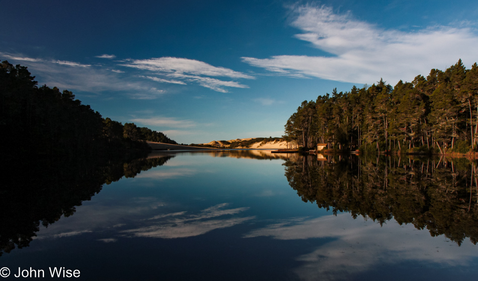
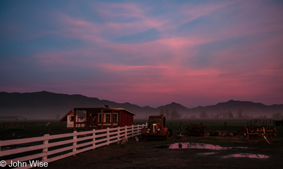
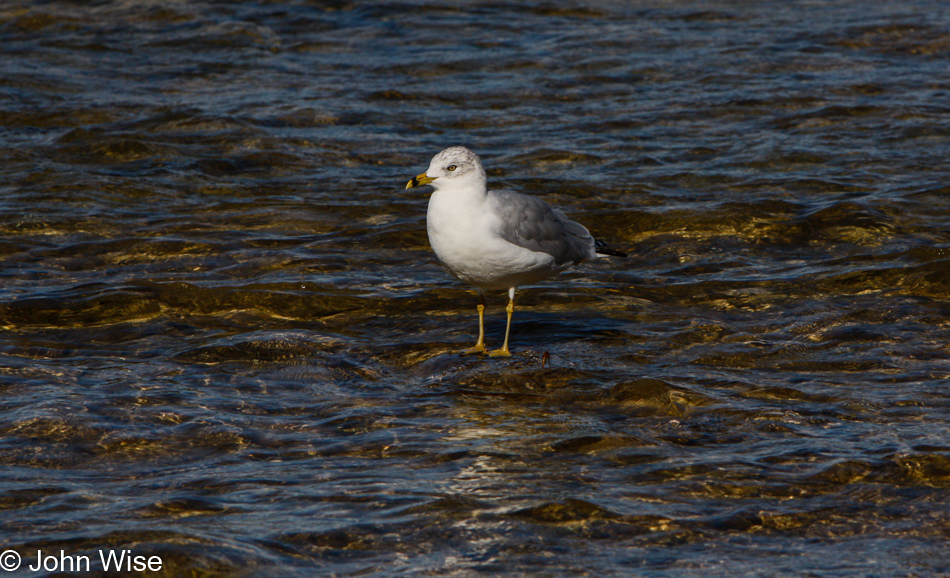
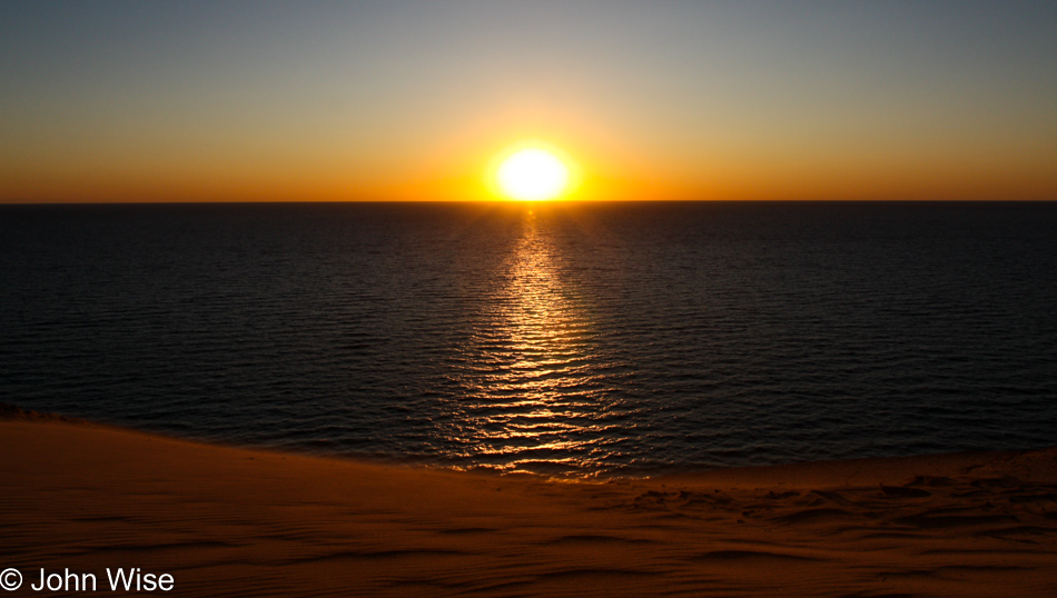
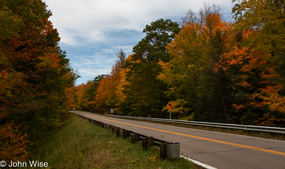
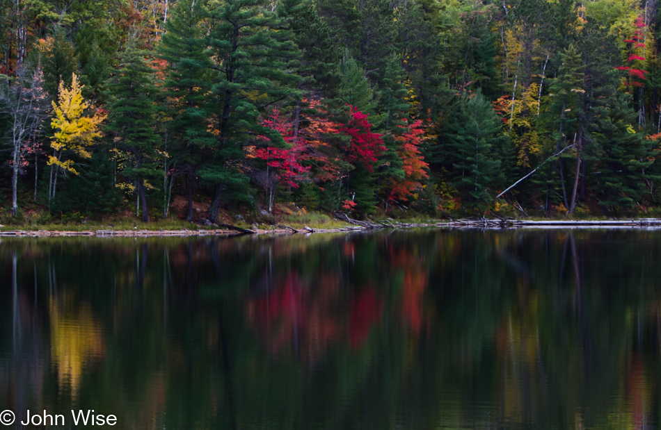
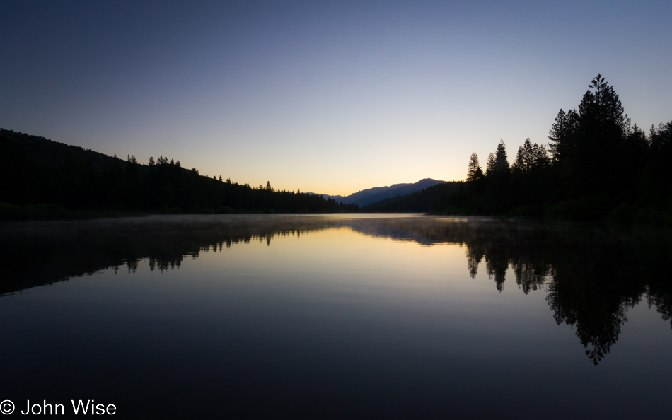
The original plan was for us to drive out of the national park late in the day yesterday. Instead, we opted to grab a night at Kings Canyon Lodge, which had a free room – on a holiday weekend! We’ll have a few more hours in the midst of all this spectacular beauty, although we’ll get home later. We arrived at Hume Lake just at sunrise when a breeze blew through and disturbed the water’s glassy surface. Ducks were beginning to stir, and a light fog was lifting off the lake– a perfect sunrise moment. But we had little time to linger.

General Sherman in Sequoia National Park, California

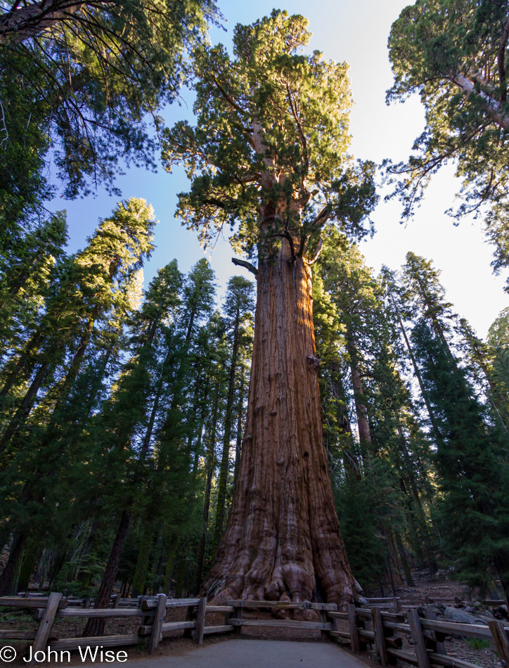
The General Sherman tree!

Small waterfall on the Congress Trail in Sequoia National Park, California

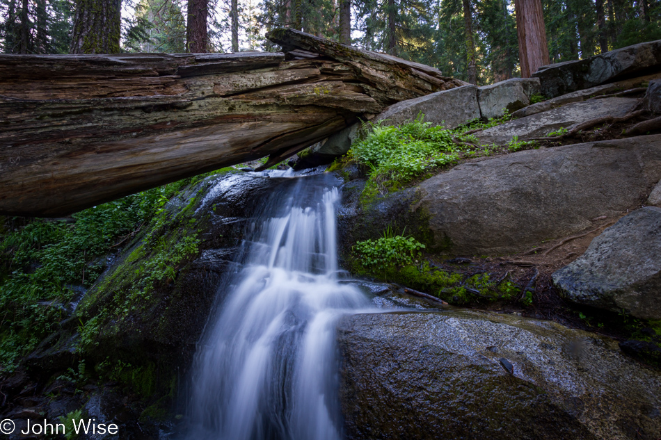
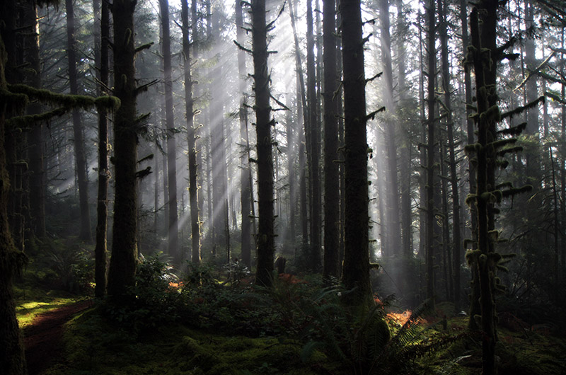
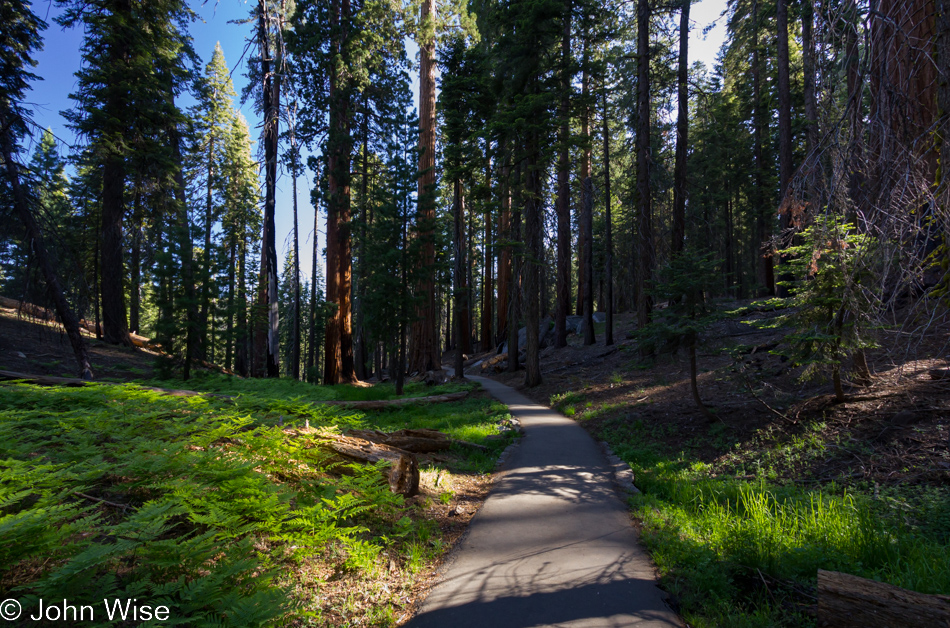
We do decide to take time to enjoy the sights at the General Sherman trail after all. Eight years ago was our last visit to this corner of Sequoia National Park, and being right here in the middle of the park, it would have been a shame to skip a return walk through the woods on our way south. Everything is different. Well, the trees are all the same, but the parking lot has moved, and the trail is altogether new. The next thing that strikes us is the evidence that yesterday was a major holiday that brought out the worst in people. Trash is everywhere. Paper, wrappers, bottle caps, pieces of plastic, and toilet paper. That’s right, TP. Who is it that thinks about bringing toilet paper out on the trail, squats next to a giant sequoia to take a pee, and then leaves her wad of paper right there at the foot of the tree? Good thing there is all this beauty around us competing for our attention.

Caroline Wise standing in the trunk of a giant Sequoia tree in Sequoia National Park, California

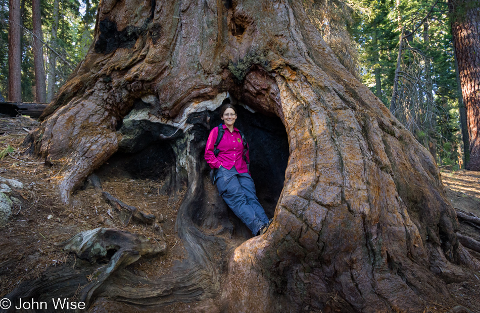
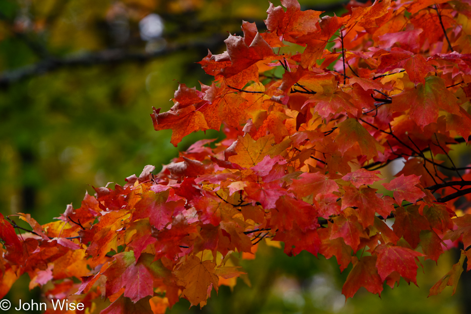
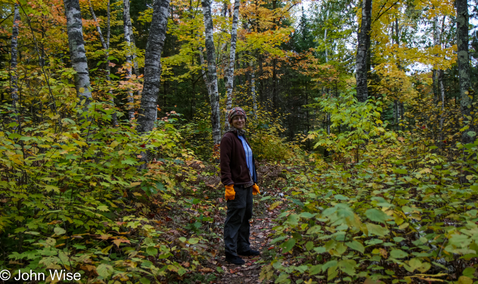
Something these photos have trouble conveying is the size of the trees. With Caroline standing in the trunk, it’s easier to get the idea of the enormous footprint these giants have imprinted on the hillside. Besides the General Sherman tree at the beginning of the trail, nothing looks familiar. Had there been a billion fewer mosquitos, maybe we could have walked slower, allowing us to remember a few familiar locations; instead, we hoofed it. The Congress and the House parts of the grove were the only other trees that stoked our memories.

The Senate in Sequoia National Park, California

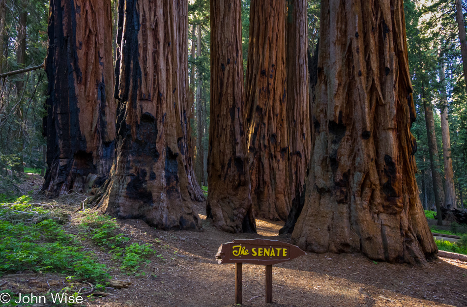
The Senate stands tall over the rest of the grove, likely doing a much better job than the old wooden characters back in Washington, D.C.

On the loop trail near the General Sherman tree in Sequoia National Park, California

As we are leaving the trail, everyone else is joining it. Less than two hours to cover the two-and-a-half miles, a land speed record for the snail hikers. The truth of it was the motivation brought on by the angry hordes of mosquitos. Before leaving the park through the south exit, we have to endure a partial road closure that is regulated by a light, a long, painful red light that takes forever to turn green. Eventually, though we are quickly descending the mountain to rejoin urban America. Oh, the misery of forcing ourselves back into reality.

A motel sign for a motel that is long gone in Yucca, Arizona

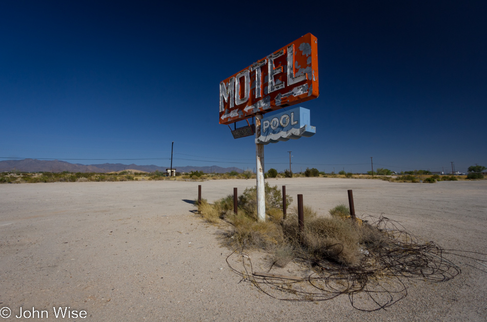
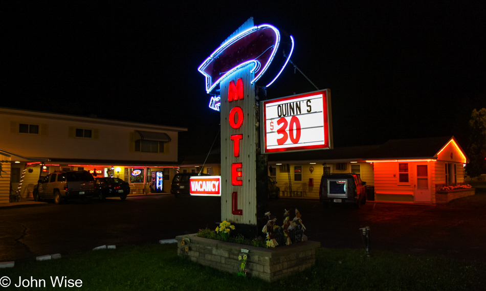
Most of the drive home is through the desert. From out in the Mojave east to that infamous hotspot Needles, California, we cruise along at ten miles per hour over the posted speed limit. Here comes Ludlow and Dairy Queen, yummers; a chocolate malt sounds good right about now. Off the freeway, and OMG, there are ninety-five cars and three hundred other ice cream-hungry travelers here. We don’t even get below fifteen miles per hour as we turn around and are right back on the I-40. At the last possible second, I pull off in Yucca, Arizona, to photograph a town that has all but disappeared. A defunct neon sign is all that remains of the motel that is no longer to be found.

Dry Tortugas Day 2

Sunrise on Fort Jefferson on Garden Key at the Dry Tortugas National Park

It was still dark out around 5:30 when we awoke. In only a few minutes, the first blue-gray twilight would begin to illuminate the morning sky. A thick cloud cover gave doubt whether we would see the sunrise at all, but as the sky filled with a deep red and orange glow, we were glued to the dock, watching the day come into being. As the light spread across the calm, warm waters of the Gulf, an occasional fish would break the surface, leaping for something unseen by us. Mesmerized, we sat there while the world turned from darkness to beauty.

Sunrise on Fort Jefferson on Garden Key at the Dry Tortugas National Park

An hour later and still, we sit dockside, gazing eastward at the oncoming day. The fishermen who also spent the evening on the Dry Tortugas have begun to stir and will soon be gone.

Sunrise on Fort Jefferson on Garden Key at the Dry Tortugas National Park

Fortunately for us, the cloud cover was to break up after hanging around the early part of the day to lend dramatic flair to the morning sky and reflective ocean waters. With the dawn comes the idea we could easily have spent days here on this little island paradise.

Fort Jefferson on Garden Key at the Dry Tortugas National Park

By 9:00 a.m., the sun had pushed the clouds to the side, and it was time to get in the water. This is where we would stay until we turned to prunes or got too cold. Our first venture into the sea was in front of our now packed-up campsite on the western shore. Along the wall of the moat, there are more fish here today than yesterday. The waters are also calmer, as is the wind, so visibility is greater, too, making the first swim of the day that much better. Slowly, we float along, watching fish watching us.

Fort Jefferson on Garden Key at the Dry Tortugas National Park

Well, float along and avoid the jellyfish.

Fort Jefferson on Garden Key at the Dry Tortugas National Park

The aptly named Needlefish.

John Wise on Fort Jefferson on Garden Key at the Dry Tortugas National Park

What is it about this photo that is so unflattering? Is the snorkel in my mouth, the squinty eyes, or that I might be confused with a sea monster?

Fort Jefferson on Garden Key at the Dry Tortugas National Park

Come here, Mr. Pelican, I have a little snacky for you! While we did get a photo of a pelican entering the water, it was a bit too abstract and blurry to share, so instead, I present you this guy looking at the strange thing emerging from the depths to take its photo.

Fort Jefferson on Garden Key at the Dry Tortugas National Park

Cold and pruney, it was time to warm up with a walk in the sun atop Fort Jefferson for one more view of the azure waters surrounding us.

Fort Jefferson on Garden Key at the Dry Tortugas National Park

What an incredibly small island this really is! We know it’s only 16 acres, but if you look at a satellite image, you’ll better appreciate just how small. You’ll also see why the taller Loggerhead Lighthouse was built, as the water out here is very shallow.

Owl on Fort Jefferson on Garden Key at the Dry Tortugas National Park

Here we are 70 miles out to sea, and I would have thought it was strange to see an owl this far away from the mainland, but with crabs and maybe some fish in the shallower waters along with rodents and insects, it’s finding enough to keep it healthy. Could it possibly have a mate out here?

Fort Jefferson on Garden Key at the Dry Tortugas National Park

We try to ignore the time as it won’t be long before a boat arrives that will take us away. Until then, we will bask and try to imagine our eventual return when maybe we could spend three or four days and nights out here. It’s not long before we are both warm and dry, conditions that demand we return to the water.

Fort Jefferson on Garden Key at the Dry Tortugas National Park

Caroline takes charge of the camera, giving me the opportunity to stop taking photo after photo and freeing my hands to swim with only my sense of awe working. While she swims further out along the wall, looking for bigger fish to photograph, I meander, spending many a minute studying conch, urchins, and corals. The sun glimmers on the white sands of the ocean floor, and light dances, darts, and flashes on the sides of fish turning as though this were a performance for the big floating stranger looking to be dazzled with the show of nature.

Fort Jefferson on Garden Key at the Dry Tortugas National Park

Our next snorkel venture had us back on the western shore, except this time, Caroline wanted to try going as far as she could around Fort Jefferson. She made it halfway before the winds picked up again, and the choppy water towards the north side of Garden Key had her turning around. Out here on the far side of the moat, the corals are larger, the fish more abundant; we had even seen a leopard shark here earlier in the day on a walk around the moat wall. Sadly, Caroline didn’t see the shark while in the water, but she did get to swim up to a pufferfish. But that elusive pufferfish didn’t stick around for many photos, and the ones Caroline took were too blurry to share here.

Fort Jefferson on Garden Key at the Dry Tortugas National Park

But she really made a serious effort to follow this hogfish around and so I present you with the best of the bunch. From the moat wall, we made the second trip of the day over to the old pilings towards the south of the island. These pilings were once part of a dock that had been used for loading coal over one hundred years ago, but today are a coral sanctuary and a favorite habitat for fish – pelicans too; we watched from below as pelicans dove in the water looking for a quick bite.

Caroline Wise and John Wise on the Gulf of Mexico in Florida

The time we traded to be on Garden Key here at the Dry Tortugas National Park was over too soon. Our memories will be tied to those blue waters and blue skies, wrapping this tiny 16-acre (6.5 hectares) island in a beauty these pictures poorly represent. For a little bit more than 24 hours, life was near perfect.

Gulf of Mexico in Florida

Wait a minute, is that the S.S. Minnow? I tried yelling over to get Gilligan’s attention but I don’t think he could hear me.

Gulf of Mexico in Florida

As the sun drew low in the sky, we would soon approach Key West. Landing, it was as though we were transported into New York City with thick crowds, cars, noise, and buildings all around us. Truth is that Key West itself is a small town with its own laid-back style, but coming from the solitude of that island, there was a moment when even this felt like a metropolis. I can only wonder how difficult it is for those who spend weeks out there to readjust to “normal” life.

Light Beams

A light fog helps create light beams from the sun as the sun shines into the forest at Carl Washburne State Park in Oregon

Not taking any photos leaves me with no new photos to post. Well, not a new one that was shot today anyway, so I am filling in a gap with this slightly older photo taken on our vacation to Oregon last month. This image is once again from the Carl G. Washburne Memorial State Park. With a little bit of fog in the air and the sun throwing light into the forest, these light beams never fail to amaze me.

Umpqua to Siletz Bay

Umpqua Lighthouse State Park in Reedsport, Oregon

Disclaimer: This post is one of those that ended up being (mostly) written years after the experience was had. While there was a paragraph or two posted way back then with a single photo, there were no other notes taken, so most of what is shared here must be extracted from the images and what memories they may have lent us.

Our last day on the Oregon Coast started in our rental yurt at Umpqua Lighthouse State Park. This view is from the overlook in front of the lighthouse, and between us and the ocean, you’ll find many an offroad enthusiast with some kind of vehicle racing over the sand.

Umpqua Lighthouse State Park in Reedsport, Oregon

These romantic artifacts from our past survive both as beacons beckoning us to remember the past and drawing those of us attracted to the light still visible from another age.

Siltcoos Beach in Florence, Oregon

With 375 miles ahead of us today, we will not be able to stop everywhere, but that doesn’t mean we won’t push things. We walked over the sand dunes here at Siltcoos Beach, hanging out for about a half-hour.

Siltcoos Beach in Florence, Oregon

Maybe because we don’t live here, we have to hold fast to these images and memories, immortalizing them on these pages so we can always refer to them. I wonder if those who live in these places put as much emphasis on seeing intently what might be too easy to take for granted.

Jessie M. Honeyman Memorial State Park in Florence, Oregon

Another short drive and we pulled over to Honeyman State Park, a park that we had somehow missed stopping at on any of our previous visits to Oregon. The air was still, and with the sky speckled with light, thin clouds, we were treated to a perfect reflection of trees, sky, sand dune, and clouds on the small lake.

Prichard Wayside in Florence, Oregon

That’s the Siuslaw River Bridge over there, and we’re at the Prichard Wayside on the south side of Florence as we take this opportunity to see this bridge from a different angle. If time allowed, we’d make it a project to capture all of the coastal bridges of Oregon from various perspectives and different lighting situations; heck, I should include that we’d like to do the same for the nine lighthouses out here, too.

Big Creek Bridge in Lane County, Oregon

Big Creek Bridge is just north of Carl G. Washburne Memorial State Park, which we are indeed passing by without a brief return visit.

Devils Churn Cape Perpetua Scenic Area on the coast of Oregon

The same could not be said about our next stop as we pulled into the parking lot at Devils Churn for a brief stop.

Devils Churn Cape Perpetua Scenic Area on the coast of Oregon

I swear, we’ll only be here a few minutes.

Devils Churn Cape Perpetua Scenic Area on the coast of Oregon

Yes, Caroline, I’m almost done. I think.

Devils Churn Cape Perpetua Scenic Area on the coast of Oregon

But how can we leave when things are this spectacular?

Devils Churn Cape Perpetua Scenic Area on the coast of Oregon

Well, it required nearly an hour for us to pull ourselves away and get back on the road. Let me correct this before Caroline does: it took nearly an hour of prodding. In Yachats, we drove next to the bay and marveled at the rough surf under the deep blue skies and then had a lunch of clam chowder at Mo’s Annex in Newport. Obviously, there are no photos of this segment of the drive as maybe, just maybe, I was a bit too indulgent at the Churn.

View from Devils Punch Bowl area in Otter Rock, Oregon

In Otter Rock, we threw a last look into the Devil’s Punchbowl.

View from Devils Punch Bowl area in Otter Rock, Oregon

No, I won’t get lost in the crashing surf here, too; I know we still have about 300 miles ahead of us, and it’s after lunch.

View from Devils Punch Bowl area in Otter Rock, Oregon

Yeah, but I would have missed this one had I jumped back in the car.

View from Devils Punch Bowl area in Otter Rock, Oregon

We’ve only been here for about 15 minutes.

View from Devils Punch Bowl area in Otter Rock, Oregon

That is a gutsy surfer on a good 8-foot wave on a late fall day in these cold northern waters. Now we can get back to the car, and we’ll just keep going all the way to Seattle for our flight home.

Depoe Bay, Oregon

Wouldn’t you know it, we ran into another distraction in Depoe Bay, where we watched water shooting no less than sixty feet into the air. This shot is not of that 60-footer; just keep scrolling.

Depoe Bay, Oregon

Getting closer…

Depoe Bay, Oregon

A spouting cone was working hard as the tide was at just the right height for this horn to spout a jet of misty water high in the air, accompanied by the onlookers’ oohs and aahs. With the perfect shot in the camera, we can take our drive north seriously now.

Rocks rising above the water in Siletz Bay, Oregon

By the time we reached Siletz Bay, the sun was low in the sky, and we were trying to convince ourselves that we really should stop making all these roadside visits, but the day was so beautiful, and we suckers for beauty were mere moths drawn to the light. Click here to compare to the photo I took of the same place three days before.

Tillamook, Oregon

Under a pink, lavender, and dark blue sky, we reached Tillamook with the hopes of nabbing one more sandwich from the Blue Heron Cheese Company, but unfortunately, we were more than a few minutes too late. We arrived in Seattle, Washington, sometime late in the evening with heads full of terrific Oregon memories from our 10th visit to the state.

Sleeping Bear Dunes

Staying at the edge of the water demanded we wake before sunrise to see our star rise over Saint Mary River. Regarding the city we stayed in called Sault Ste. Marie, notice that we are on the Saint Marie (Mary) River, and the Sault part of the name is from an obsolete word that is used to describe rapids. [I’m going to go out on a limb and say that it is related to the English word somersault – Caroline] It was those rapids between Lake Superior and Lake Huron that necessitated the locks that were built here.

A timelapse video would probably best depict the action of one of these massive ships passing through the locks, but I’m shooting photos, and this ship in the early sunlight will have to suffice.

Oh yeah, we are still leaf-peeping.

We pulled over near St. Ignace at the lower end of the eastern Upper Peninsula to look up at this strange rock outcropping called Castle Rock that is now used as an observation point to look out over Lake Huron. We’ll have to make a note of it and move on.

We are about to cross the Mackinac Bridge, which is currently the third-longest suspension bridge in the world. At home, looking at my photos taken that day from the Father Marquette National Memorial, I was perplexed as to why the bridge looked so short compared to the photo of the same bridge, two images below. I finally figured out that I had used my 70-200mm lens to shoot this photo at 140mm, which shrunk the space between the foreground and background. Just wait till you see how long it really is.

We turned eastward to follow the Lake Huron lakeshore. Caroline once more shed her shoes and lept into the water, or maybe she just gently strode in? With Lake Huron in the bag, so to say, we have now visited all of the Great Lakes and the Saint Lawrence Seaway. To Caroline’s bragging rights, she has stood in the waters of the Great Lakes, the Pacific, the Atlantic, and the Gulf; rivers include the Colorado, Little Colorado, Snake, Mississippi, Columbia, Yellowstone, Ohio, Klamath, Missouri, Rogue, St. Croix, the Animas and many a smaller but no less significant waterway across America.

That bridge that looked a bit short is actually 26,372 feet long, or just a hair shy of 5 miles! From this spot on the lake, we headed 20 miles southeast to Cheboygan before turning west to reach the west side of the state.

Going through Google’s Streetview, these streets look like any other streets but bordered with these bursts of color, the roads take on wholly new qualities that propel the views into something extraordinary.

Over on the western side of the state, we are back at the shore of Lake Superior.

We are moving south with an objective referenced in the title of this blog. Along the way, we’ll be passing some beautiful towns, ones I stopped at with my mother a few years before. As I’ve not recovered from that trauma yet, and I desire this trip to be uniquely Caroline’s and mine, we are bypassing Petoskey, Charlevoix, and Traverse City in order to take in more nature.

Witness this humble seagull of Charlevoix that is nothing at all like the intolerable snobs found in town. Contrary to the elitists that pollute the nearby intellectual and cultural waters of a beautiful space, this lowly seagull adds to the sense of wildness, and while it might shit on us, it isn’t an intentional act committed in the yawning ignorance of someone who fashions themselves as better than others due to their fortunate economic perch.

Driving next to Grand Traverse Bay.

Passing through Maple City.

Shetland School from 1871 near Maple City, Michigan

This former one-room schoolhouse, built in 1871, must be one of the most photographed buildings in this part of Michigan. It is now a private residence.

This little outpost near Maple City is called Michigan Traders, and for the fall season, they are hosting The Ugly Tomato Farm Market; if Caroline’s memory is correct, which it often is, this is the first place we ever tried the famous Honeycrisp apple.

Just out of Maple City in the direction of Glen Arbor is another opportunity for us to use our coveted National Park Pass, the Sleeping Bear Dunes National Lakeshore.

It’s already late in the day upon our arrival, meaning exhibits and the visitor center are already closed for the day, no matter, as at least we’ll gather some impressions of the park anyway.

We meander along the narrow roads, waiting for the sand dunes to make an appearance.

Sleeping Bear Dunes National Lakeshore overlooking Lake Michigan

And here they are starting to emerge near the water’s edge.

Sunset from Sleeping Bear Dunes National Lakeshore overlooking Lake Michigan

In the eight years since we began these haphazard journies through America, we have never failed to be amazed at the sights and people we have met along the way. I can no longer tell you how many times we have sat at a precipice, hillside, forest, sand dune, trail, or roadway and watched yet another golden sunset fill us with oohs and aahs.

Just moments after I had taken the previous photo, we walked towards another vantage point. What you could not see in the setting sun was that the wind was howling. If you look at the grass here, you will see it blowing to the right, and the white fuzziness over the bright spot is a thin layer of blowing sand.

In the little town of Honor, Michigan, across from Long Lake, we pulled up a couple of seats at the Manitou restaurant before driving a few more miles south to stay in Frankfort…you know, like Frankfurt?

Autumn

Lake Winnebago, Wisconsin

Out of the American Southwest, we aimed for the northern woods to witness autumn. Fall in Arizona is much like springtime in Arizona and not too distant from the conditions of winter. To differentiate seasons in the desert, one only needs to consider the temperature. If it’s above 90, you are moving in or out of Summer; everything else is simply the rest of the year. Through our travels and reading, we have come to be aware of the leaf peeper phenomenon. Leaf peeping is the act of venturing into the natural landscape to participate in the act of witnessing foliage change color. It is true we have some deciduous trees changing color in the mountainous areas of Arizona, but those leaves turn yellow, gold, and finally brown. Vibrant reds, vivid oranges, and fluorescent yellows must be seen where an abundance of maples grows. And so it was that we followed our inner geekiness on a pilgrimage to the forests of Wisconsin and Michigan with the hope we might catch prime leaf-peeping season before high winds and a freeze stripped the trees bare.

Fond du Lac, Wisconsin

And so, with the break of dawn and the crazy idea that we should make it to Michigan today, which is about 450 miles away according to the route up U.S. Highway 45 that we’re eyeballing, we’ll have to keep gawking at the sights to a minimum as if that were possible.

Lake Winnebago, Wisconsin

Lake Winnebago and the surrounding tributaries were our first stumbling blocks out of the gate. What the photos can’t share is the lovely sound of flocks of geese overhead, heading to warmer climes down south.

Somewhere on Highway 45 in Wisconsin

Somewhere along the way, we passed through Oshkosh, Wisconsin. This is not Oshkosh.

Somewhere on Highway 45 in Wisconsin

If this doesn’t sing fall to you, nothing will.

Somewhere on Highway 45 in Wisconsin

I can assure you that they weren’t speeding, but they might have been gobbling.

New London, Wisconsin

This is no longer the City Hall for New London, Wisconsin, on Route 45; I just can’t believe a new building could be cooler than this.

Somewhere on Highway 45 in Wisconsin

After a couple of teases yesterday, it’s looking ever more promising that the colors we’d hoped for are on big display and that we will not have to worry about finding disappointment.

Somewhere on Highway 45 in Wisconsin

And then there was this: wtf? Who thinks these are in good taste? From my perspective, they are racist figures, and while I’m well aware that racism is alive and well across the breadth of the United States, I still prefer not to see this; then again, when we are in the South, I just know we’re going to see the rebel flag down that way. Funny how, after World War II, the German government made swastikas and images of Hitler illegal, but we can’t do something like that right here…oh yeah, freedom of speech and all that.

Somewhere on Highway 45 in Wisconsin

If I were only in Phoenix for a week, the cinderblocks and beige everything would be experienced as an overwhelming scream of conformity, but as I live there month to month, year to year when I can get far away from that sterility, my eyes and senses demand I soak in as many old homes, barns, streams, wooden churches, and unfenced yards as I can.

Somewhere on Highway 45 in Wisconsin

The desert bakes this scene out of your imagination. The very idea that water just flows in random places and not because it was dammed further upstream or that it’s been raining, but it’s just here boggles the mind.

Somewhere on Highway 45 in Wisconsin

It seems that a trip for us must now have at least some dirt road; maybe this is one of the key signs of looming perfection.

Somewhere on Highway 45 in Wisconsin

Many more of these detours, and we won’t be getting to our next destination until it’s good and dark, not that that would be a first.

Somewhere on Highway 45 in Wisconsin

Getting back on the road…

Somewhere on Highway 45 in Wisconsin

…only to find another moment of distraction.

Somewhere on Highway 45 in Wisconsin

Of course, I had to stop to photograph this old Ford truck sinking into the earth and being eaten by the weeds. Gives meaning to Found On Road Dead.

Somewhere on Highway 45 in Wisconsin

Should you have some kind of PTSD from the leaves of fall because you’ve grown up somewhere you had to clean them away or suffer from some other kind of trauma related to an abundance of leaves, you might want to skip the next days of blogging.

Somewhere on Highway 45 in Wisconsin

Nature’s fireworks explode right in front of us.

Fallison Lake Nature Trail near Boulder Junction, Wisconsin

Here we are, entering the Fallison Lake Nature Trail near Boulder Junction because we needed a nice break out of the car, and walking around a lake sounded like a therapeutic jaunt that would stretch these legs.

Fallison Lake Nature Trail near Boulder Junction, Wisconsin

Wow, curling bark! This is the most beautiful curling bark I think I’ve ever seen.

Fallison Lake Nature Trail near Boulder Junction, Wisconsin

But John, didn’t you say you had to temper these jaunts else you’d arrive late in that place you are supposed to get to this evening? Yeah, but there’s some nature out here begging us to explore.

Fallison Lake Nature Trail near Boulder Junction, Wisconsin

Those famous words are coming back…as above, so below.

Fallison Lake Nature Trail near Boulder Junction, Wisconsin

Mmmm, is that a yummy squirrel snack we spy you noshing on?

Fallison Lake Nature Trail near Boulder Junction, Wisconsin

Hey, hey, you humans, you got snacks?

Caroline Wise on the Fallison Lake Nature Trail near Boulder Junction, Wisconsin

This is a human squirrel scurrying through nature, hunting for visual treats. The orange hands are indicative of the female of the species.

Fallison Lake Nature Trail near Boulder Junction, Wisconsin

Like dirt roads that must be taken, a visit to the forest would be incomplete without mushrooms.

Fallison Lake Nature Trail near Boulder Junction, Wisconsin

A tree felled by a beaver is certainly not something we see very often. I could stare at those impressions left by the beaver’s teeth for a long time and try to imagine its vigilance in bringing it down one scrape at a time. That’s some serious power put to work in order to harvest dam parts.

Quinn Motel in Ironwood, Michigan

It’s almost 14 hours after we left Fond du Lac this morning that we pull up to the kind of motel we want to afford. We’re in Ironwood, Michigan, just across the border from Wisconsin, and Quinn’s is offering us an overnight stay for only $30! We couldn’t resist and couldn’t care less about the condition of the room as long as we had a dry place to sleep.