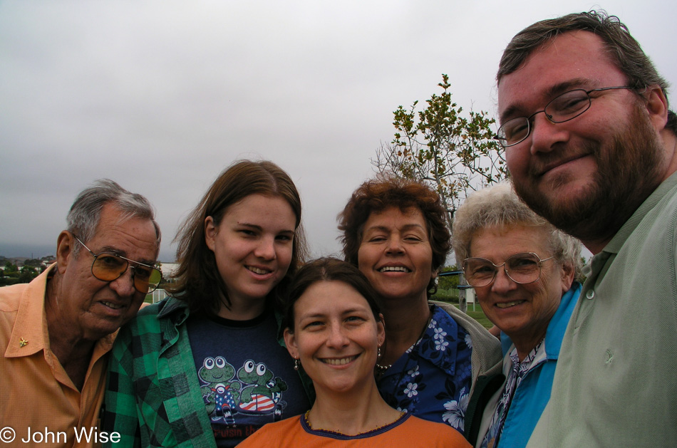
Hung out with family in Santa Barbara the entire day doing all the normal stuff such as breakfast at Cajun Kitchen, lunch at Costco, shopping, walking the dog, and some forgettable dinner, but we were happy about the chance to all be together.
Dreams, Moments, Travels
Hung out with family in Santa Barbara the entire day doing all the normal stuff such as breakfast at Cajun Kitchen, lunch at Costco, shopping, walking the dog, and some forgettable dinner, but we were happy about the chance to all be together.
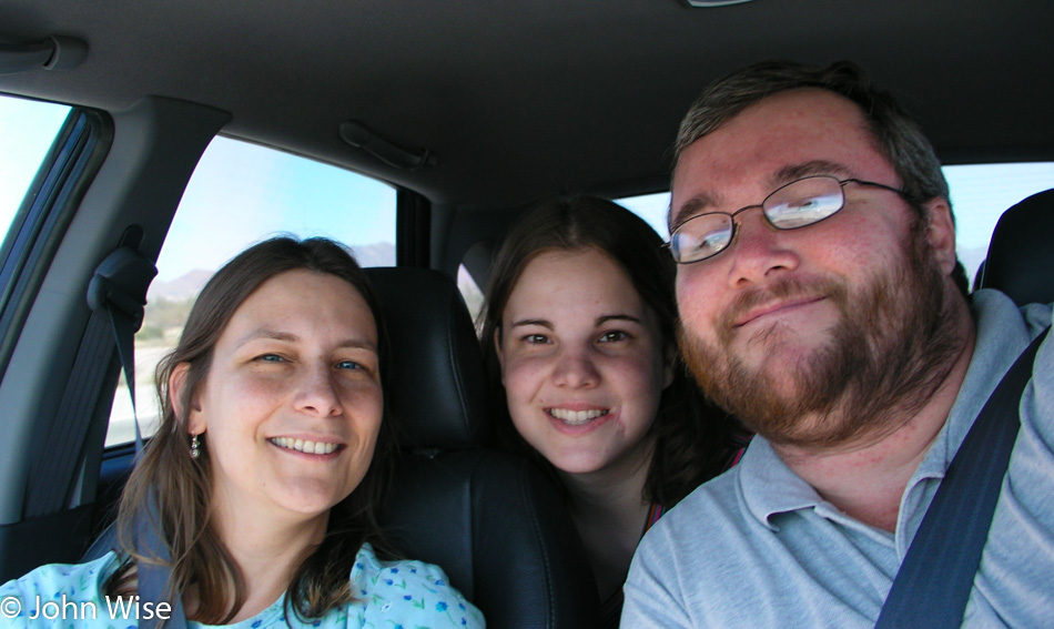
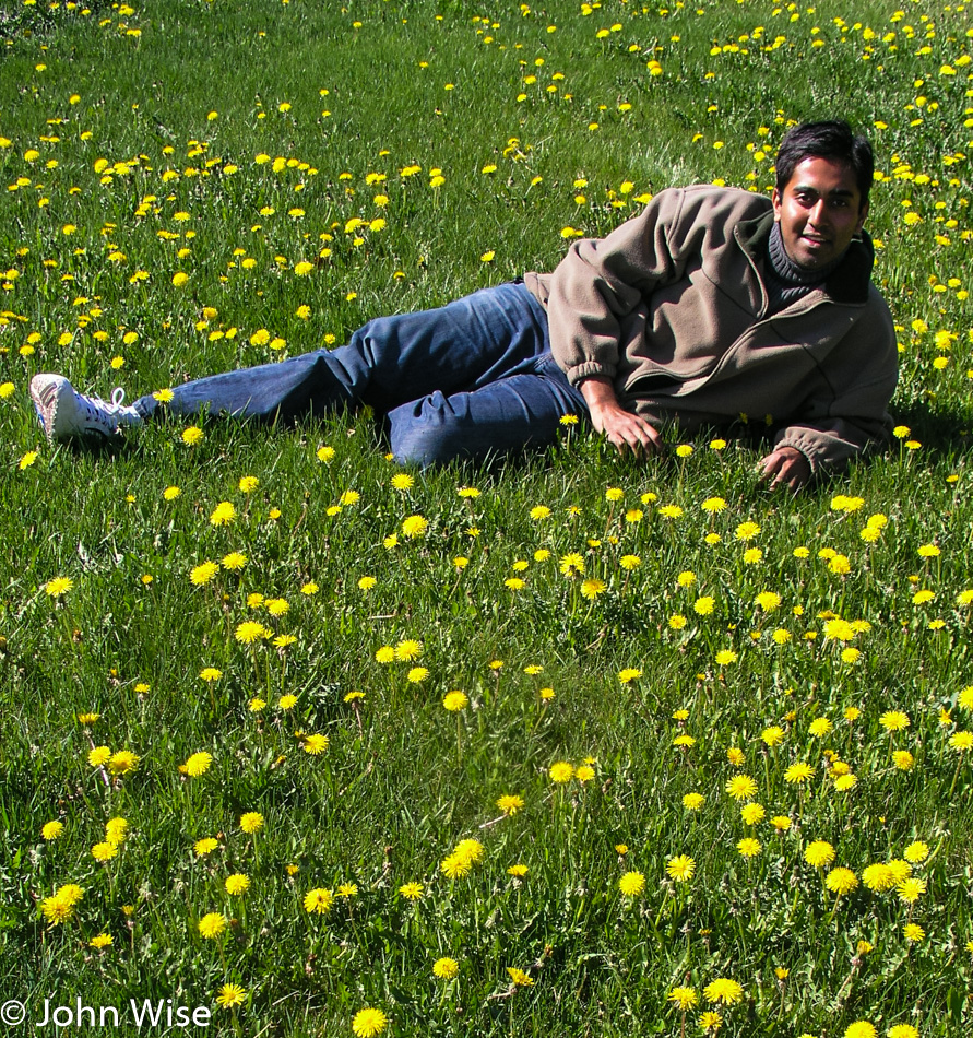
Shortly before heading off to the Navy, Jessica stopped in Arizona for one more visit.
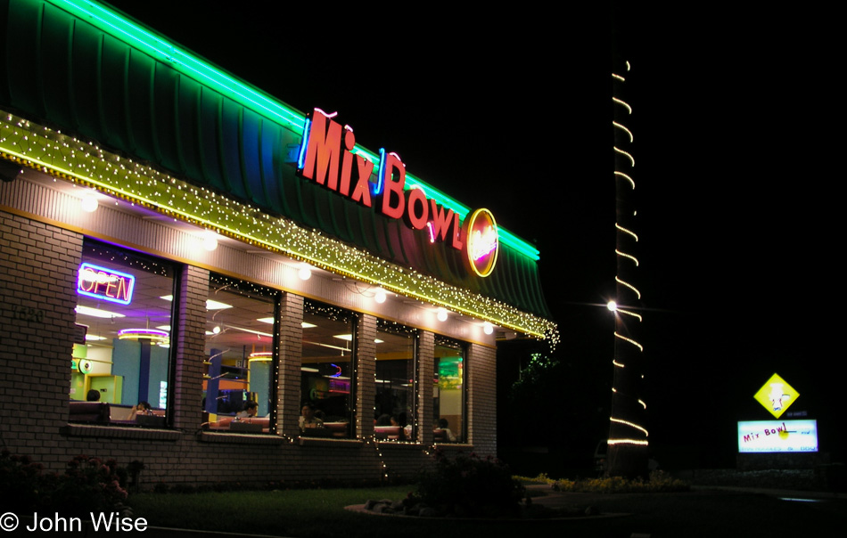
Immediately, we drove over to southern California and had dinner at Mix Bowl, a fast-food Thai cafe, before staying the night in Santa Barbara to say hello to Aunt Ann and Uncle Woody.
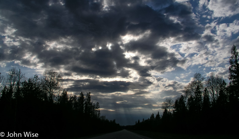
Ring…Ring….The alarm should have shaken us awake on the final day of this 13-state road trip. But Caroline, sometime during the night, turned it off, and we overslept by half an hour. Maybe she was about to take another midnight shower before she rechecked the clock, seeing it was too early to arise, and went back to sleep forgetting to reset the clock. It’s another hour before we checkout. We drop the key at the front desk and take advantage of the offer for coffee and donuts. Exhaustion is catching up with us.
Snow on the mountains with blue skies and wildflowers was a welcome sight as we got back out on the road.
Just as we start enjoying the mountains, they give way to the continuation of the Great Plains. Our next turnoff is towards the Fort Union National Monument and the Santa Fe National Historic Trail. The park doesn’t open till 8:00, but it’s 8:05, so we are ear-to-ear grins as this is one of the rare moments we are not too early.
We enter the grounds of the monument through the visitor’s center. This is the last National Park or Monument that we will enter on this particular National Park Pass that is expiring this month. A year before, we paid $50 for the annual pass and since that time it has taken us to the following National Parks: Everglades, Great Smoky Mountains, Hot Springs, the Grand Canyon twice, Glacier, Yellowstone twice, Grand Tetons twice, Canyonlands, Black Canyon of the Gunnison, Arches, Mesa Verde, Bryce, Great Basin, Redwoods, Channel Islands, Saguaro, Voyageurs, Theodore Roosevelt. We have also visited the following National Monuments on the same pass: White Sands, Hohokam Pima, Walnut Canyon, Dinosaur, Organ Pipe, Coronado, Chiricahua, Salinas Pueblo Mission, Bandelier, Petroglyph, Tuzigoot, Montezuma’s Castle, Wupatki twice, Sunset Crater, Great Sand Dunes, El Malpais, Gila Cliff Dwellings, Pinnacles, Tonto, Homestead, Fort Union, Effigy Mounds, and the Little Bighorn Battlefield. Finally, into these sites too: Fort Bowie National Historic Site, Tumacacori National Historic Park, Chaco Culture National Historic Park, Fort Clatsop National Memorial, Nicodemus National Historic Site, Fort Union Trading Post National Historic Site, onto the Blue Ridge Parkway.
The value of our National Parks is not wasted on Caroline and me; we love each and every park in the system we have visited. The $50 we pay each June for our annual park pass is some of the best money we spend all year. When we consider that the fees just to enter Glacier, the Grand Canyon, and Yellowstone would have been $100 for the past year, you can see how we appreciate this little plastic credit card-sized treasure.
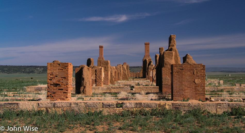
Back to Fort Union, the day couldn’t be better; a deep blue sky and high clouds with snow-capped mountains far on the horizon is our backdrop. The fort was established in 1851 and served as a guardian to the Santa Fe Trail for forty years. Over those years, three different forts had been constructed with the last two’s remains still visible.
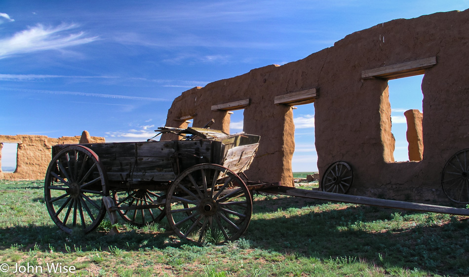
The ruins are not better preserved as the land the fort had been built on was never properly acquired and was actually squatting on private land. As the fort’s land was given back to its owner and people at the time not being able to see the future importance of such a place, the owner allowed all takers to come in to remove bricks, fixtures, wood beams, and other miscellaneous building materials that were subsequently used on their own homes and farms.
For 65 years, the fort sat exposed to the elements before President Eisenhower signed into law the bill that established national monument status for the biggest military fort of its day west of the Mississippi.
Visiting the ruins today, you walk down the original sidewalk, now cracked and buckling, past the remaining walls and chimneys. Some of the adobe walls still have original plaster holding tight to the walls that once gave refuge to soldiers protecting travelers of the Santa Fe Trail. A sundial still tells time much as it has for more than 100 years.
Some walls still stand over 12 feet tall and are the best preserved within the monument. Most of the structures were made of adobe, but a few remain made of stone. Amidst the walls, a number of old wagons, wheels, and farming implements still lay about. Thorny thistles poke out of the earth near the old stone jail. The cells were small and dark but quite cool, too; the cells probably offered the coolest location in the fort during the hot summers.
At the visitor’s center, we take a walk through a well-equipped museum that displays artifacts found during excavations over the years. On the western frontier, this is the most extensive and one of the most popular forts in the care of the park.
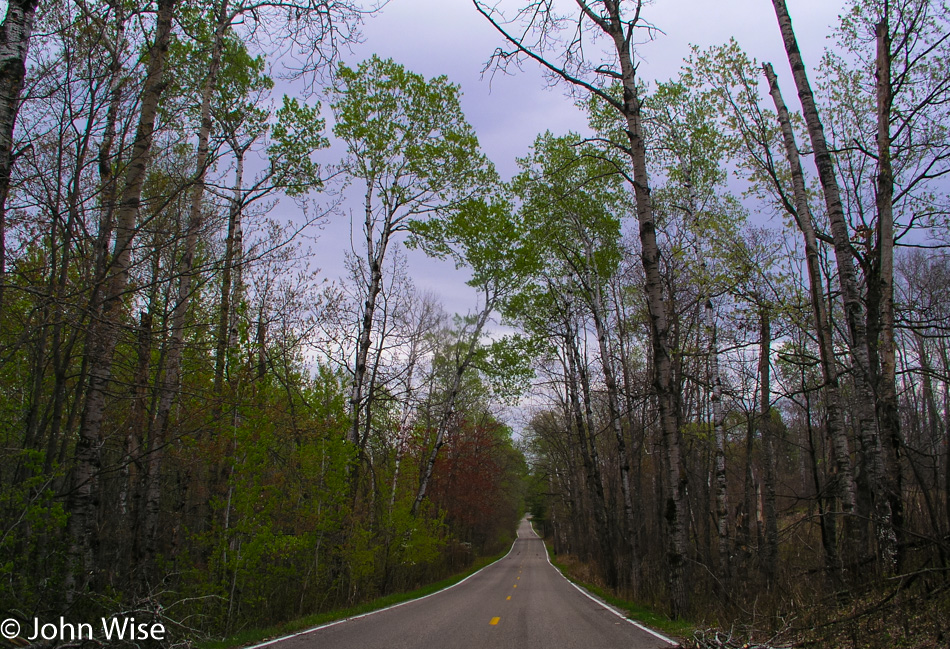
On Interstate 25 for a short while, then we turn off on Route 84 which is a surviving segment of old Route 66. Typical with many of the towns that were on the now-famous route, they fall into decline, and in some cases, they disappear altogether. Anton Chico is one of the towns that are having a difficult time hanging on. Many of the buildings are collapsing or abandoned and awaiting their ultimate demise.
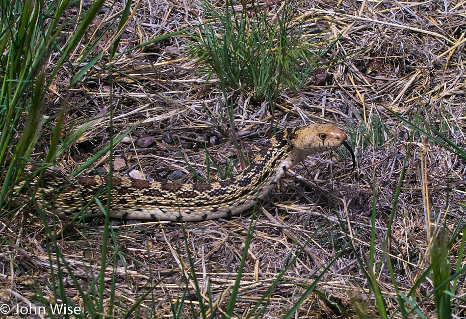
The old Route 66 must have been a scenic highway; the short segments we’ve traveled have always shown us the more beautiful parts of the country. We now dread the I-40, which replaced it; the interstate moves fast, with many a trucker pulling another load across the country on this congested superhighway. Only 26 miles down the I-40, and I’ve had enough. We turn off exit 230 south to Encino. Along the way, we pass a small lake and a snake trying to cross the blistering highway.
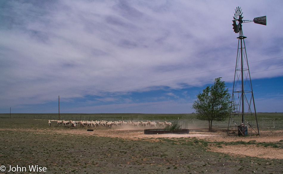
Further along, a small flock of sheep scurries across the desert, kicking up dust as they run off. Not far after Encino a small abandoned house with its electricity meter still running has been taken over by birds that are nesting throughout the home. The former ranch, its trailer home, and fencing are all in need of serious repair. No for sale sign sits outside not that I’m in a buying mood for this dilapidated old place anyway.
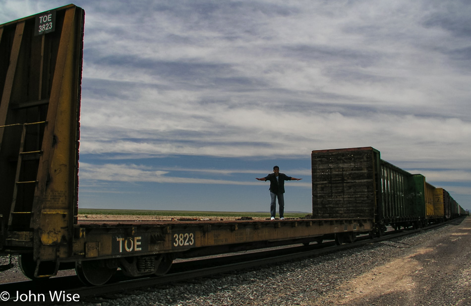
Jay jumped up on a train to get the feeling for what riding the rails across America might be like, more like surfing a train, I suppose. We pass a man walking across the desert who obviously doesn’t fit in the picture. I pull over to offer him some cold water, which he seems to appreciate, and we learn that he is Bob Brandkamp, who is on a ‘Road to Awareness” to help bring awareness to mental health. Bob is strolling across America. He is also mighty alone out here with some wide swaths of land to cover before coming upon another town that may or may not be inhabited. We wish him luck and then after leaving, wish we had given him one of our nice cold peach cups. Well, he is walking across America; I suppose he should be well prepared.
The land is austere, with short grasses and even smaller clusters of shrubs abounding. A dry salt lake stretches along the road for a while before our gaze returns to an empty land. At 12:30 we enter Mountainair and one minute later leave Mountainair. A half-hour after that we cross the Rio Grande and are now close to Socorro.
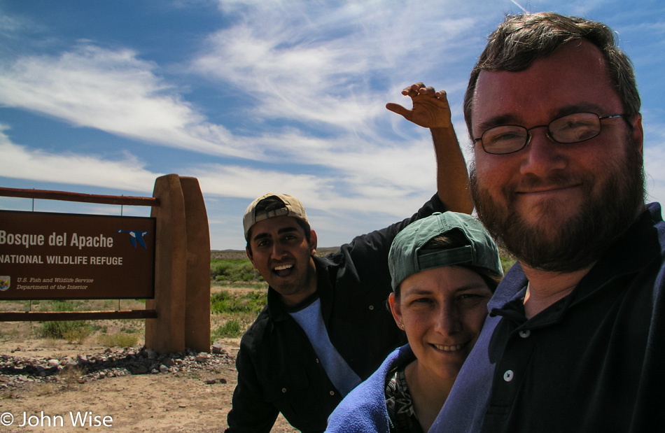
Socorro a favorite New Mexican town of ours. It is here that we stay when we go to the Bosque Del Apache Wildlife Refuge for bird watching in winter. The first inevitable stop is the El Camino Family Restaurant, the only restaurant we eat at here in Socorro. The El Camino is a New Mexican version of Denny’s. 24-7 breakfast is standard, but the New Mexican touch is that they will smother anything you order with green chili if that’s your wish. The food has a bite, is considerably better than Denny’s, and is inexpensive. If someone were to ask Caroline and me what our favorite top 10 restaurants in America are, I’m sure the El Camino would be on it.
We are in the area, so we make our way down the road for a short detour to the Bosque, the winter home to 10s of thousands of migratory birds. We spent a New Year’s Day here a couple of years ago and were rewarded with seeing more than 20,000 snow geese simultaneously lift off an iced-over lake as two eagles spooked them into action. The flapping and commotion of so many birds overhead brought tears to nearly every one of the 35 people who braved the 18-degree (-8 Celsius) morning to watch the large birds disperse. On another early spring visit, we listened to thousands of songbirds bring the refuge to a symphonic ecstasy.
Today, the refuge is nearly silent save for the wind rustling the grass. Some stragglers are in the few ponds that still have water. The grasses, though, are lushly green and taller than we’ve seen them at other times of the year. The wind blows just enough to make small waves on the water, and we, in turn, wave goodbye to the refuge.
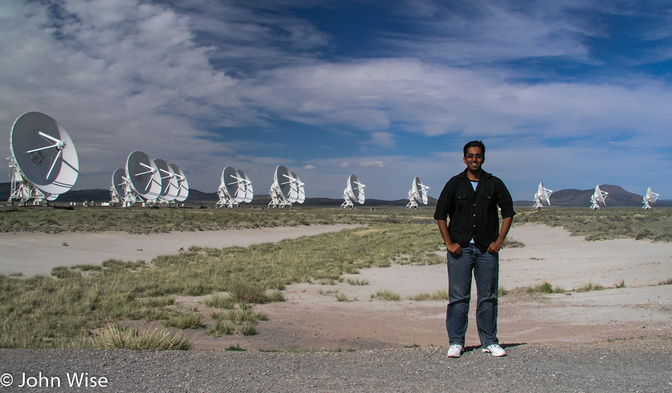
By the Rio Grande River again, we look for a place, any place to get down into the water but give up quickly with the need to return to Phoenix before midnight. North on the I-25 for a short time until Interstate 60 takes us west. The I-40 would be faster but is also so anticlimactic after such a rewarding long drive across so much beautiful land. Besides, just off the 60 is the VLA, also known as the Very Large Array.
The VLA gained fame after Jodie Foster, in her role in the film Contact, made the radio telescopes world-famous. Short on time, but with such dramatic skies, we take the turnoff to visit the VLA. Under these giant radio telescopes, the wind howls through their massive structures. Today, the ears listening to space are configured in such a way that all of the dishes are stacked close to the visitor center. On other visits, the array is spread across many a mile.
Pie Town, that famous locale for pies: we’ve been through here so many times we can no longer count them. Pie Town must surely be open to serving us some pie today because it is just not possible that this place can be closed every single time we come through. Wrong. It is closed, and we will have no pie. I’d tell you more about Pie Town, but then you might have the same curiosity we have only to never be able to satisfy that curiosity because Pie Town is never actually serving pie, or so it seems.
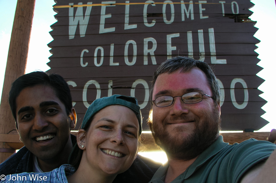
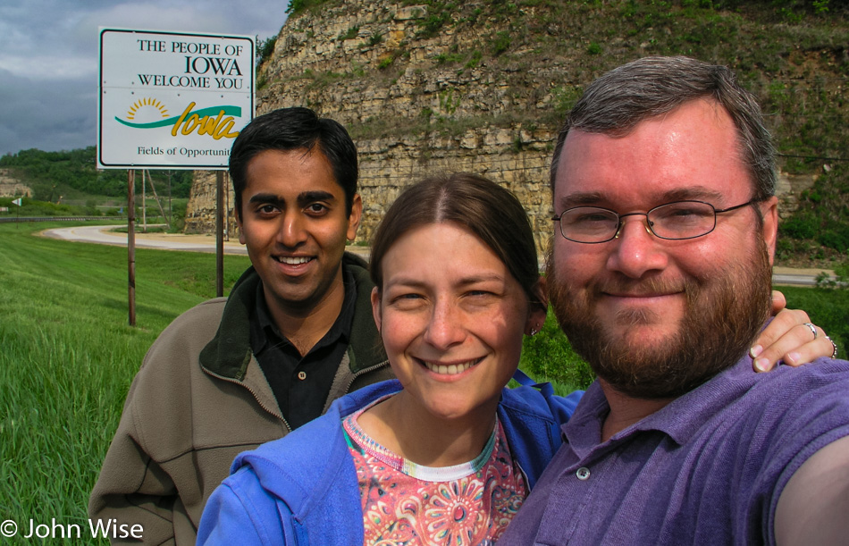
The road is quickly approaching Arizona just as fast as the sun drops in the sky. As if coordinating with the Arizona state welcome sign, the sun is nearly aligned behind the sun of our state’s flag.
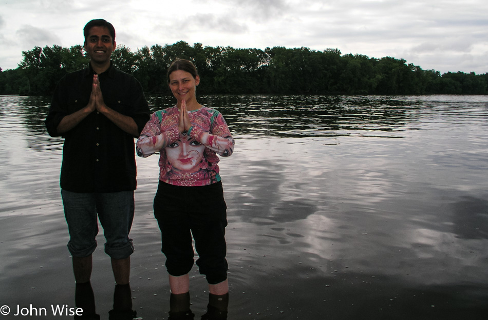
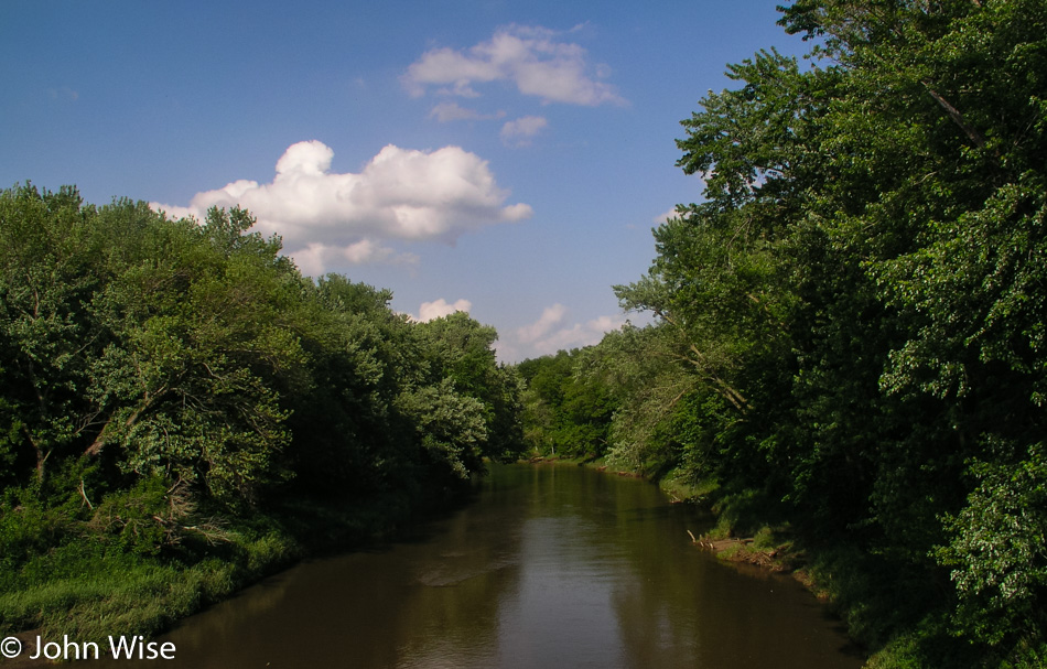
One more chance to step into a river has presented itself. Appropriately, it is the Little Colorado River. When the trip began, the first river that Caroline and Jay stepped into was the Colorado River; today, with only a few more hours before we got home, they stepped into the Little Colorado River.
Caroline, who has come down with a cold late on the trip closes her eyes and tries to get a little rest. The sun sets in the Tonto National Forest while we snake our way down and through the Salt River Canyon. At 10:48 p.m. after 6,132 miles, we are home.
Saturday at 6:30 in the morning, with a light rain breaking up in the face of the approaching sun. We’ll only be in this small corner of Missouri briefly today. Five years ago, Caroline and I were just 63 miles south of here in St. Joseph, Missouri, after having visited the hometown of Amelia Earhart in Atchison across the Missouri River in Kansas. It was that beautiful stretch of river that had me penciling in this corner of Missouri in the hope of reliving a moment from that earlier cross-country road trip.
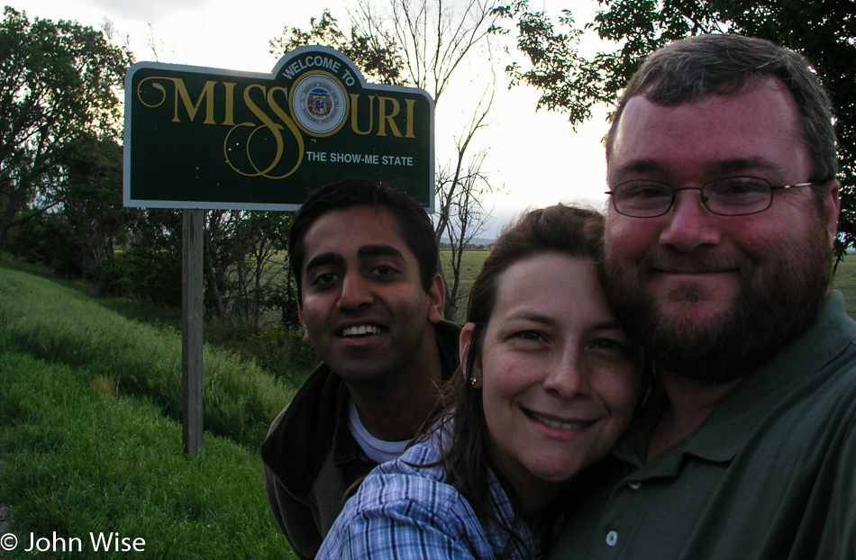
Crossing into Missouri last night, we never had the chance to stop for our photo in front of the “Welcome to Missouri” sign, so we took this opportunity to snap a photo of us leaving.
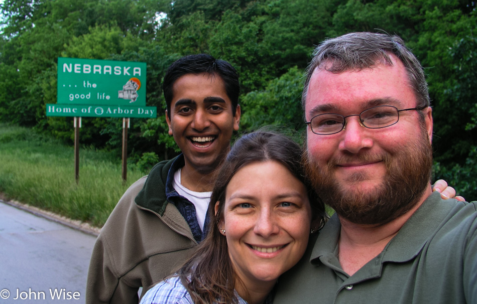
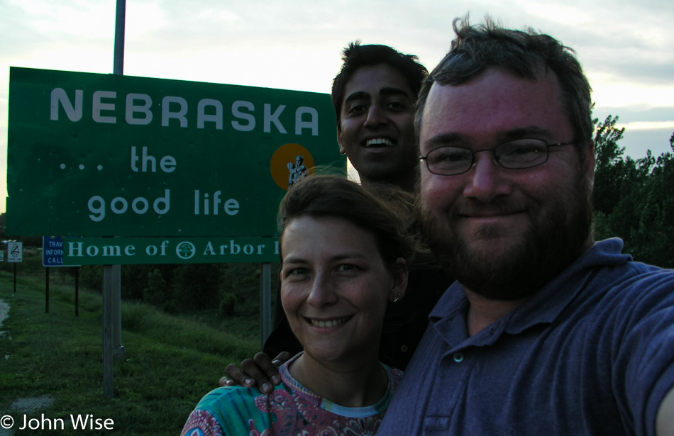
Turn around and blam, Nebraska. Barns offer the best clues to the fact that we are still in farmland. The small, still-sleeping town of Auburn strikes me with similar feelings that I experienced in Vinton, Iowa: I think I could live here. A wish is said that this great slice of Americana doesn’t disappear in the economic reality that drags life and business to the two coasts, laying waste to so much of Middle America.
The road between Auburn and Beatrice is 52 miles long, 52 miles of farms. The map shows that we pass through Tecumseh, Crab Orchard, and Filley, but we can find no distinguishing characteristics because the homes belonging to the barns are spread out to such an extent that the borders of these small towns are lost as we pass through. The other side of Beatrice is the reason this road became part of the path on our journey home.
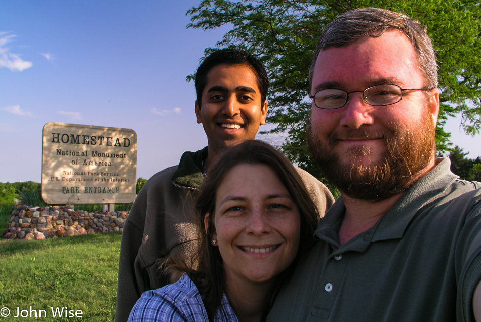
The Homestead National Monument of America is one of only three national monuments in this state without a single National Park. That’s not to say Nebraska is devoid of a rich history or beauty, as it can claim one national historic site, five national historic trails, and one national scenic river. So, if a potential visitor to Nebraska is wondering what to do and the trails of Lewis & Clark, the California Trail or the Mormon Pioneer Trail, Oregon Trail, and the Pony Express trail captivate your curiosity, this is a state you might want to consider visiting.

The Homestead Monument’s visitor center was still closed as we arrived, a common occurrence during this outing. The trail to the grounds of the monument was wide open, though, and without another soul in the park, we were able to wander the area undisturbed. Homestead was established to commemorate the Homestead Act of 1862, where nearly any man or woman could make claim to 160 acres of land granted by the U.S. Government to live the American dream. This site is one of the first homesteads claimed and demonstrates what the lands were like to the earlier settlers on the Great Plains. Of course, this doesn’t take into consideration that the lands were stolen from Native Americans to give to whites so our ancestors could establish supremacy while practically enslaving Indians or simply exterminating them. That ugly part of history doesn’t seem to make an appearance here, so we’ll just try to imagine that the indigenous inhabitants got bored hanging out with nothing to do and left for the Arctic or maybe a different planet.
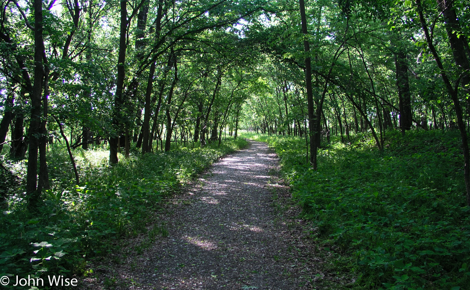
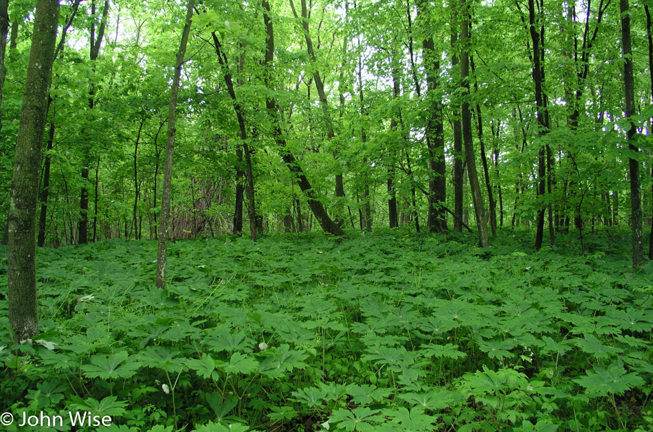
We entered the homestead through a woodland path next to a small creek. The forest is comprised of white oaks, green ash, osage orange, and cottonwoods which are surprising to us visitors who have imagined the Great Plains as desolate grasslands. The trail leaves the forest for a moment, taking us to the edge of the prairie before looping back into the thicket of plants, grasses, flowers, mushrooms, and the occasional frog.
The grasslands known as the tallgrass prairie that existed prior to their destruction for cattle ranching have been restored here. A 2.5-mile trail leads us around the extent of the prairie past grasses with names such as big bluestem, switchgrass, cordgrass, Indiangrass, and little bluestem. During our leisurely stroll, we hear creatures scurrying through the grasses, but they remain well hidden.
Every visitor should be so lucky to experience the quiet we did here at Homestead National Monument. We could listen to the faint breezes passing through the grasses while birds, frogs, and other small animals lend their voices and steps to embellish the perspective of history.
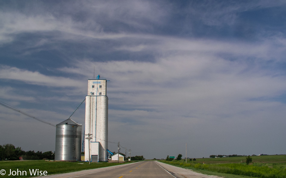
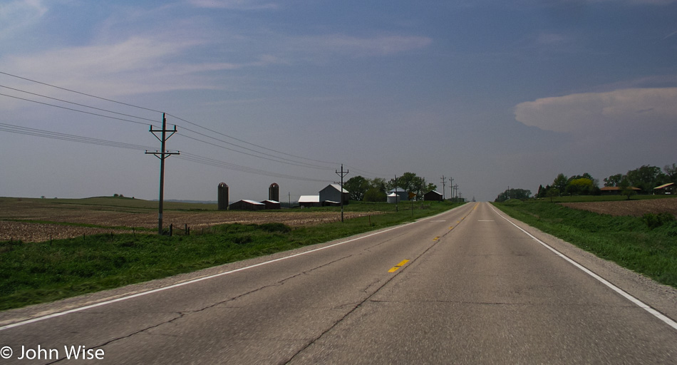
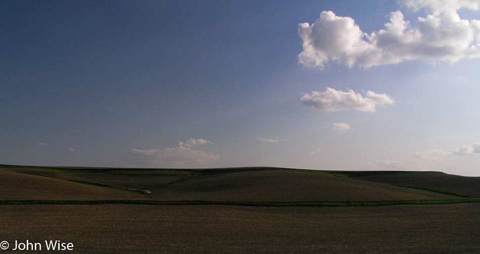
For a short stretch, the land is flat, as flat as a board. Only the recurring grain elevators stand off the horizon to give reference to anything being further ahead.
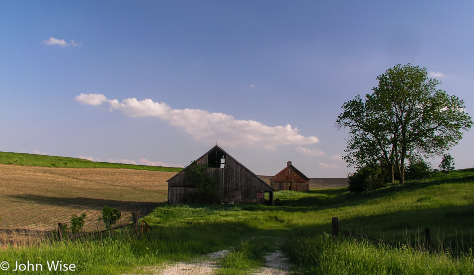
Little Blue River is anything but: it is brown, mud brown. Somewhere between Fairbury and Gilead, a little water tower stands over the landscape, almost in the middle of nowhere. As prolific as the grain elevators, community churches dot the landscape giving elegance to the barns, silos, elevators, tractors, and open space. Somewhere in all this openness along our current stretch of road, we stop at a deserted home.
The windows are gone, the sink is on the rear patio, and the barn has lost its purpose. Cows from a nearby farm stand by a salt lick checking us checking them out. Amongst the weeds, weed! A pot farm right here in Middle America. Well, that’s an exaggeration; it’s a few plants that, like the weeds they are, have taken hold next to the other weeds. They are scattered too randomly to have been planted with intent and soon will be large enough for someone to spot them here in the open, and he will probably remove them unless some unscrupulous teenagers find them first.
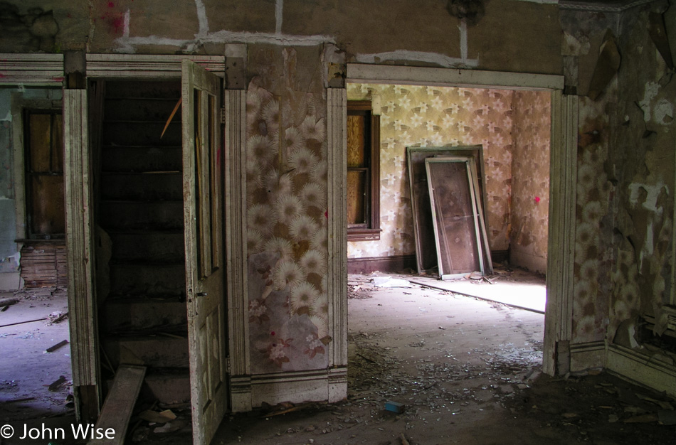
These abandoned homes convey many feelings to me as I pass them and occasionally explore one here and there. The paint inside is flaking, and the wallpaper is peeling; outside, the paint has usually been weathered away. These are reminders of other people’s lives who may have met with such hardship as to drive them away. Still, they hold fragments of memories and offer clues about histories that have joined the blowing dust.
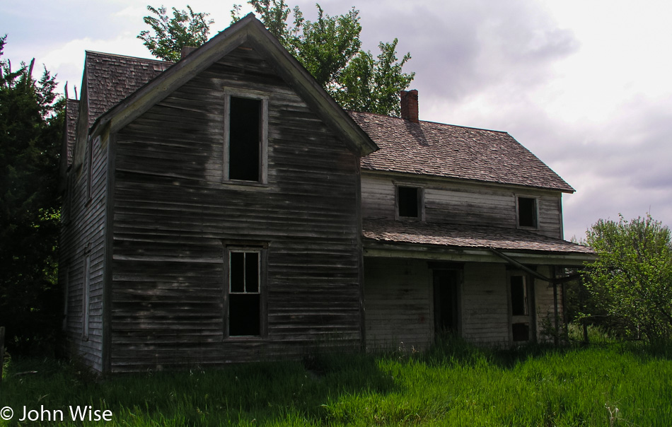
Walking through the fading shells, I hope to see an old photo of the family or a fork or spoon once used during better times. Usually, the remnants of the inhabitants are long gone, replaced with the trash or graffiti of later visitors. The floors creak as I pass over them, and doors, when still attached, squeak when opened. Most always I find evidence of birds or animals that have taken refuge or made their own homes within these old homes. It will be a sad day when these relics are gone and replaced by our more modern homes made of plastics, wire, stucco, and cement.
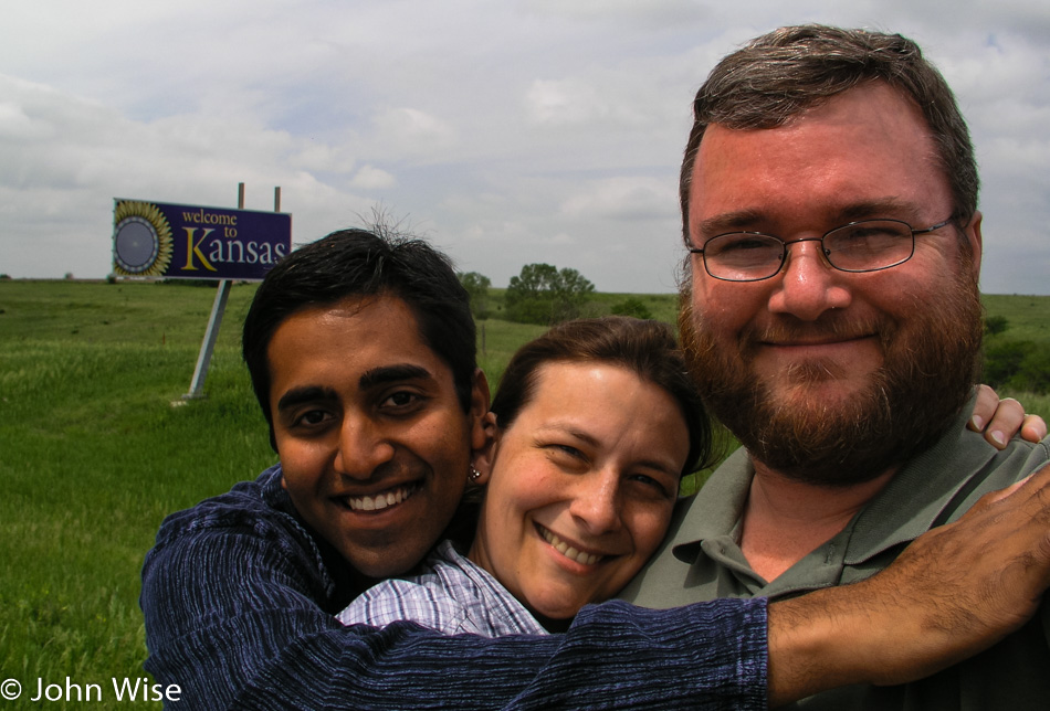
Our time in Nebraska has been short. Red Cloud is the last town we will pass through before turning south to make our way across Kansas. The Republican River crosses our path while we are southbound, but we can find no place to step into its muddy, shallow waters. Kansas greets us with its bright sunflowery “Welcome to Kansas” sign. We have now driven more than 4,600 miles, with more than 1,500 in front of us to finish between today and tomorrow.
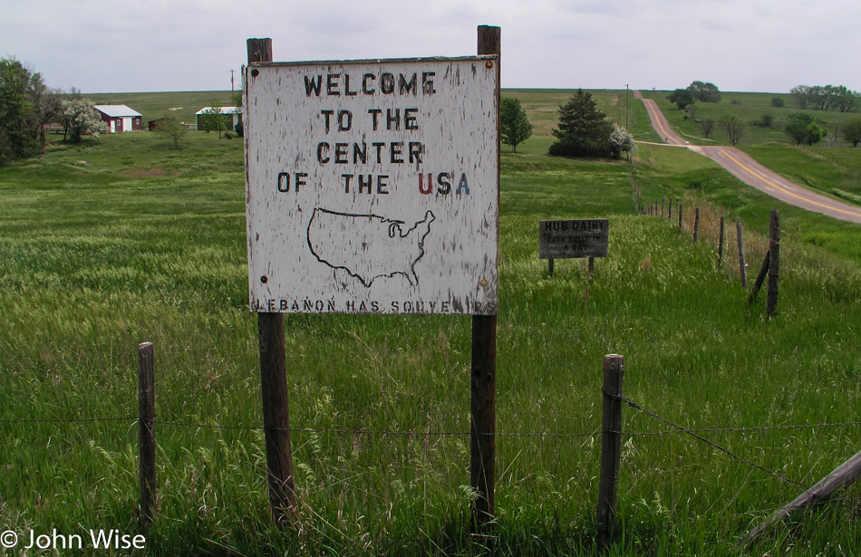
Entering Kansas the birds are singing, insects are buzzing, and the sweet smell of grass blows into the car as the wind works the fields into an ocean of waves. This is a fitting place for the geographic center of the 48 contiguous US states. A small monument stands in recognition of this claim to fame here, one mile west of Highway 281 and two miles north of Lebanon.
Out here in this flatness, we missed our turn. Not only did we miss our turn, but we missed it by 23 miles. The next opportunity to correct our mistake takes us through the nearly deserted town of Waldo, where most of the buildings appear empty. We stop at the outskirts of Plainville for gas and stop again at the corner of Main St. and Plainville after spotting a mailbox that lets us get rid of more of the postcards on their way to India, Germany, Arizona, and California.
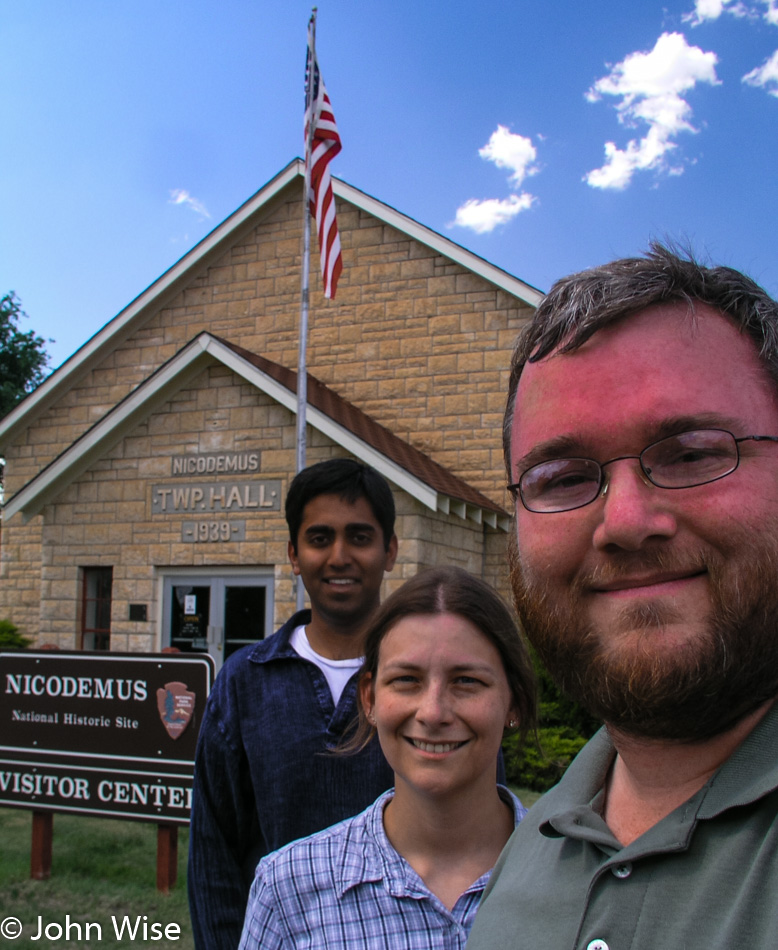
Nicodemus was where we were heading before our missed turn, and now we have arrived. Out west, this is the only remaining town established by African Americans following the Civil War. In September 1877, during the Reconstruction Period, Nicodemus was founded with people originally living in dugouts, like prairie dogs. By the spring of 1878, about 300 people were living here, and the town began to transform. By the mid-1880s, the town had grown to include two newspapers, three general stores, three churches, a school, an ice cream parlor, a bank, homes, and a few hotels.
A hoped-for rail line was laid south of the Solomon River but too far to be of benefit, and Nicodemus began its long slow decline. African-American cowboys, soldiers, miners, farmers, and business owners who had gotten their start in Nicodemus long maintained a bond with the community and for years celebrated the last weekend in July in Nicodemus with “Homecoming.” Homecoming originated as Emancipation Day, observing the freeing of the slaves from the West Indies; the celebration became Homecoming and has endured for over 100 years.
The town continues to exist today, with a small handful of residents holding fast to ensure the town doesn’t die. The National Park Service in 1996 established Nicodemus as a National Historic Site. The five remaining historical buildings can be viewed on a nice walking tour of the community. The visitors center is now located in the Township Hall with the four other buildings awaiting restoration work.
Our tour of the town starts at the old St. Francis Hotel and leads past an old playground at a corner park. The next stop is the boarded-up African Methodist Episcopal Church. An old barn is the home of some friendly enough pigs that have taken up residence under the floorboards. A dozen of them come out to greet us, looking hungry; without a food offering, they soon lose interest and head back under the shady building.
The First District School is the last building at the edge of town. Some minor restoration work has already begun on the school to stop its collapse until further funding can be found. A rusty swing set, slide, and jungle gym look unused for more than a generation. The skies are beautiful today over Nicodemus; it is easy to see why, after the town had some roots, people would want to call this home.
The streets of Nicodemus are growing grass, and the signs are close to falling down. The walk down these historic roads is a solemn one, and my thoughts turn to wonder at how life had once tried to flourish here. The last historic building on the west side of town is the First Baptist Church.
Back through the playground for a final stop at the Township Hall and we strike out once again on this extraordinarily flat land. From here to the border of Colorado, we pass through the flattest of land driven during this trip. Windmills, the occasional tree, fluffy clouds, and some blowing dust crossing the highway keep us company. Another grain elevator, some horses, green grasses against a blue sky, the sun lowering over the flat horizon, and we are now close to Colorado.
Before crossing the state line, we re-enter Mountain Time and gain an hour. It’s 7:00 p.m. as we drive into Colorado, and a plaque next to the road commemorates that we are on the Santa Fe Trail that ran through this very spot from 1822 to 1872. This road that took various peoples to a new life out west is a road typifying the pioneer spirit and America’s love of the freedom to go.
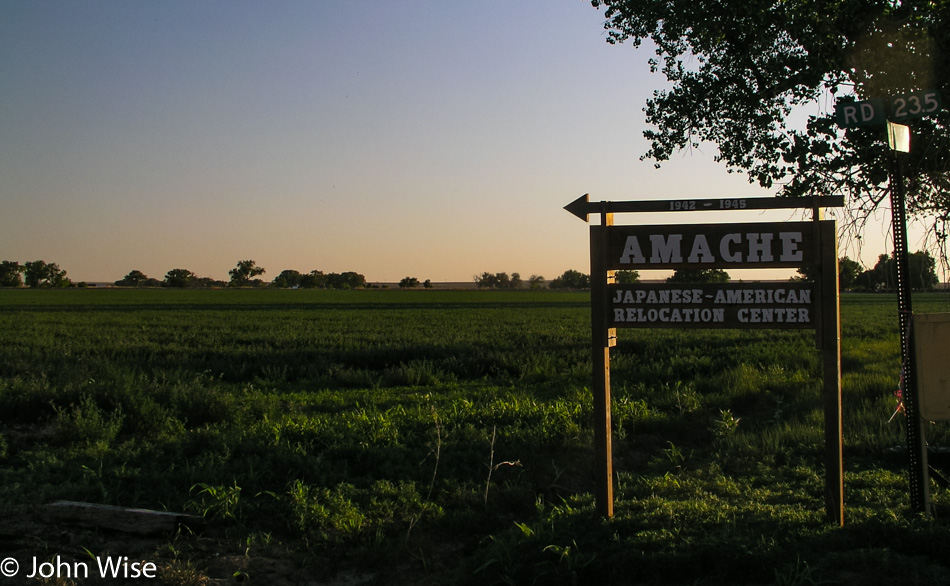
Twenty miles further down the road, that ideal came to an abrupt halt for 6,285 Americans of Japanese descent and 1,033 Japanese immigrants who were interred at the Amache Relocation Camp, also known as a concentration camp. Starting on August 27, 1942, American authorities, who had begun the roundup of all people with Japanese features, began filling this camp in Colorado as they were also doing in California, Arizona, Utah, Idaho, Wyoming, and Arkansas.
This 10,500-acre camp, with the smallest population of “Japs” of the camps, was ultimately closed on October 15, 1945. At its height, the camp had its own newspaper, school, medical facility, and general store. The barracks were 120 by 20 ft., with a family of seven or less assigned a room of 20 by 20 ft., allowing for six apartments per barrack. With the end of the war and the publicizing of the Nazi concentration camps, America moved with haste to eliminate all remnants of its own concentration camps. Bulldozers came in and stripped the lands bare, removing streets, buildings, gardens, schools, guard towers, and camp fencing.
Today, only a few foundations still exist. The old roads are now graded so visitors can gain some understanding of the layout of the camp. Trees that were not knocked down grow in such a pattern as to show the deliberation they were planted with next to a structure that no longer exists. While the foundations are cracked with weeds making their way through the former floors, it doesn’t take a lot of imagination to see what had been here.
As time goes by, remnants of the land’s previous occupants are making their way out from under the plowed land. Rusty cans, a forgotten sign, part of a ceramic pipe, another can with still legible type pokes its way out of the earth. Some of this may be trash blown in or dumped here as the years have gone by; some might be the artifacts of a blemish to America’s sense of dignity and fairness.
The sign to Amache is small and easy to miss; the road number is not to be found on two maps of Colorado we own. Finding information on the Internet as to the precise locations of the camps across the western U.S. is difficult to ferret out, suggesting a lingering embarrassment regarding their existence. The street signs in Amache identifying the blocks have mostly been stolen; a couple lay in the grass, hiding from casual visitors.
For sure, these were not death camps; medical experimentation did not occur at these sites. But the involuntary confinement and denial of the rights owed to each and every American were callously trampled by our country’s long history of xenophobia and the general hysteria that accompanied the bombing at Pearl Harbor that put into action the establishment of these camps.
The sun sets on Amache in this lonely corner of Colorado on a forgotten piece of land whose tragedy demands we do more to honor those who pay with their very freedom for the rights the rest of us enjoy. Some of us may fight for our country, but what is the sacrifice of those imprisoned without the chance to fight, who are isolated and robbed of their dignity, and whose children grow up knowing the hatred of the majority surrounding them? What is their contribution to the fight to make a more just and humane society from the cruelty that has so often been put upon those in these lands whose only offense is that they are different? Visiting a Concentration Camp can either make you stop and think or, as is demonstrated from the damage here at Amache, make you reach out and try to wipe this out of history.
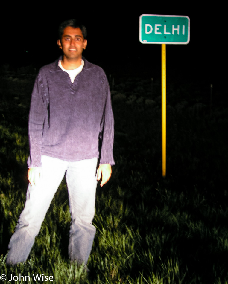
Most of the driving in Colorado is at night; tomorrow, we have to be back in Phoenix, and with nearly a thousand miles to go, any miles we can finish today will make tomorrow’s trip all the better. Jay has some nostalgic feelings along this road south as we pass Delhi. We try to grab a photo, but it is as dark as dark gets, and the city sign reflects too much light to be able to effectively take a good photo. Compared to its namesake on the other side of the planet, this Delhi here in Colorado might have 50 people living here.
We end the night in Trinidad, Colorado. Tomorrow, we will gain another hour crossing back into Arizona and will finish the final 715 miles of driving before climbing into our own beds again.
It was bound to happen: bad weather is collecting overhead. Thunder, lightning, and rain, with the TV news issuing flood warnings north of us. Some mild disappointment makes an appearance with the realization that the Apple Blossom Scenic Drive won’t be quite as scenic under these conditions. But we are heading generally southeast away from the storms so our hopes are that we might drive out of the foul weather and back into blue skies.
An hour down the road and a break in the clouds offer hope for a brighter future on the horizon. At Prairie du Chien we stop for a hot breakfast, the first since the Teton’s nearly a week ago. Our restaurant of choice is McDonald’s, hot and greasy. We ordered a bunch of Egg McMuffins, hash browns, coffee, and orange juice. After so many days of eating cold food from our ice chest, McDonald’s has extraordinary appeal.
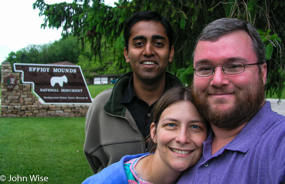
Wisconsin begins to fade away as Iowa comes into view after crossing the Mississippi for the last time during this vacation. From Marquette, the road north along the western shore of the Mississippi will take us to Effigy Mounds National Monument.
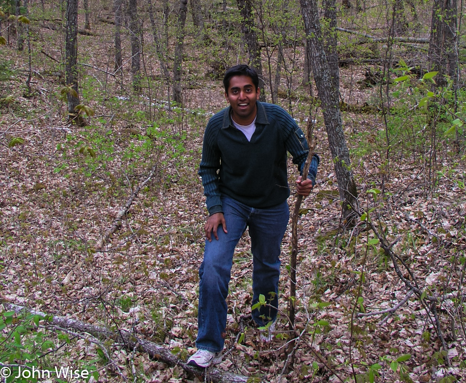
Amazing, it is as though someone switched on super green. We entered the park near the visitor’s center after one of the park personnel familiarized us with the lay of the land. The trail begins easily enough on a boardwalk leading us to the base of the mountain we are about to climb, not a giant Western-style mountain, mind you. The dirt trail that’s up next isn’t all that steep initially, but after the first bend, we start making a fairly steep ascent. Steep enough to require a number of switchbacks, but any difficulty the trail gives is more than made up for with the lush flora surrounding our every step.
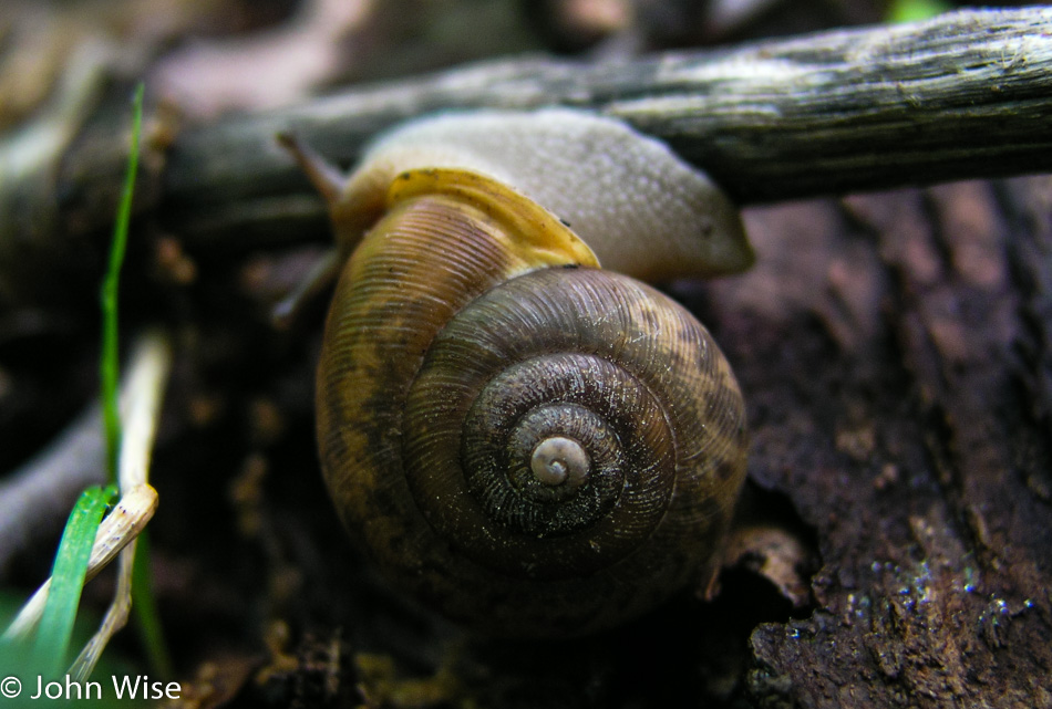
Flowers abound, tiny and delicate, a kind of whisper of beauty in the woods. Ferns, mosses, mushrooms, snails, and new plant growth of all types are found in every direction.
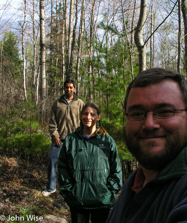
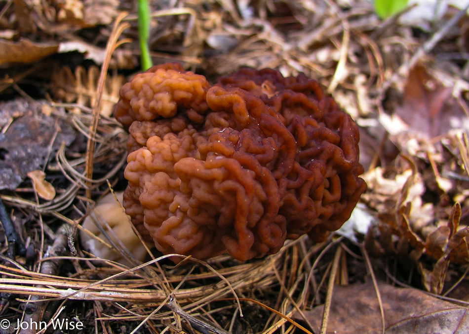
We are tiptoeing through an enchanted forest with a quiet typically reserved for libraries. The beauty is so great we don’t want the slightest noise from our plodding steps to disturb the scenery. In hushed tones, Jay draws my attention to another strange-looking fungus, and then we see our first effigy. It’s a bear. Next to the bear is a string of mounds our guidebook suggests are likely burial mounds and are not effigies themselves.
I almost overdosed on this encounter with Green. There should be warnings here for people coming out of the Southwest that saturation could have deleterious effects on people more accustomed to a brown palette with hints of tan.
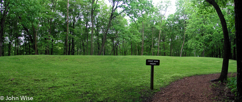
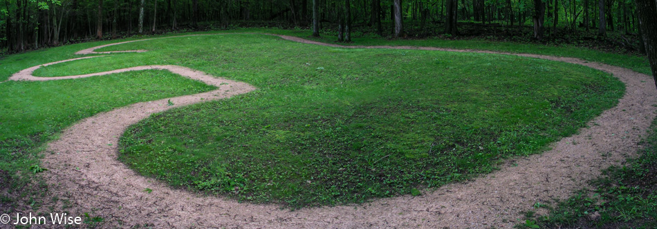
Along the emerald green path, I’m still picking out small mushrooms, little flowers, and a field of plants, creating a floor sitting a foot and a half off the ground. The Great Bear Mound is the largest effigy remaining in the park system; it is so large I can find no way to photograph it to demonstrate its bear likeness.
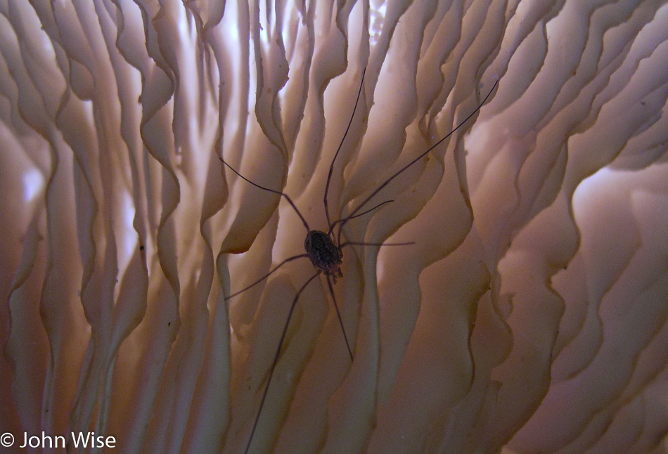
Fungi of assorted types are scattered about here in greater frequency than we’ve seen elsewhere in America. A wide variety and odd shapes peak out or grow on various surfaces almost everywhere we look. Bulbous knoblike mushrooms and white giant ones with spiders making homes within semi-transparent louvered cozy-looking fins found underneath. Then, right next door are blobs of melted wax-looking fungi that are scattered about.
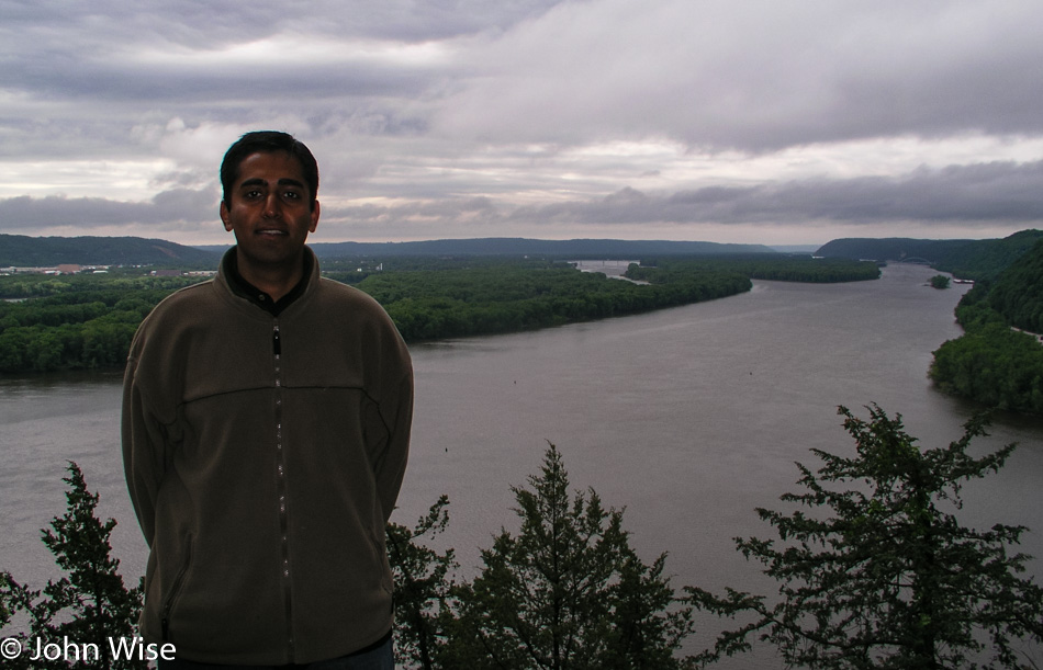
At the top of our short hike is Fire Point, a lookout over the Mississippi River. Hey, was that the sun? Get real.
Back on the other side of the small town of Marquette is a boat launch, another one of “those” photos, you know, standing in the water. Without speed boats, crowds, police helicopters, and other distractions, the river looks to us the way it must have looked to the Native Americans and early white settlers a couple of centuries ago. We are sad to leave the great Mississippi River.
Before we’d ever visited the Great Plains, I’d heard about the vast wheat and cornfields that stretch across the expanse of flat land called the heartland of America. Images of verdant rolling hills with an abundance of rivers, sporadic trees, wildflowers, prairies, and meadows were never a part of that equation. Today’s trip to Iowa is an eye-opener. The only time we hear of Iowa in the western United States is when the annual tornado tears out another trailer park. During our brief time in Iowa, we never see even one mobile home park but we see a ton of lush beauty.
The homes we do see are immaculate. We had noticed a phenomenon while in Wisconsin that has roots in Iowa, too; maybe it’s a Midwest characteristic. Their yards have the cleanest, most well-groomed lawns the three of us have ever laid eyes on. The nation’s golf course manicurists must all hail from the Midwest. In the middle of the afternoon, you can see maybe one in four homeowners out behind the lawnmower but more probably riding the lawnmower.
Entering the small village of Vinton, we drive into classic Americana. This is the place I would like to call home. Main Street is wide, with broad sidewalks and storefronts sitting below the two-story buildings that line the street. Garish neon signs are not seen, and the street lamps are old-fashioned globes that leave a nicer impression than a glowing Budweiser sign. The town is clean and quiet, seemingly in better financial shape than larger cities like Superior in Wisconsin. I wish the town officials luck in maintaining the character of such a fine little place.
South of Vinton, we are entering the Amana Colonies and right away wish we had more time to stroll the streets and historic buildings on this gorgeous spring day. We pass through West Amana for the main Amana Colony. You step out of the car and into a view of America not seen for one hundred years. The village is superbly maintained, its German heritage fully intact.
If for no other reason than the historic appeal of each and every building, even non-shoppers such as myself must be drawn into the stores. Stepping out of the bakery, we notice that the humidity is rising rapidly, quite high, really. To the north from where we have come from, dark clouds are amassing. A shop owner tells us what radio station to tune into when we return to the car so we can hear any weather alerts if they are issued.
We continue our walk amongst the historic buildings stopping occasionally on the lookout for gifts for friends and family back in Phoenix. Caroline and Jay both find candles for themselves, and I pick up two pounds of caramels to split between three or four friends. The old German architecture is complemented by well-tended gardens. Houses are made of stone, brick, and bare wood planks. Gardens are a combination of a wide variety of shrubs and a terrific assortment of the most colorful flowers.
The humidity is bearing down, and thunder is heard in the distance. With a bit of rain starting to fall, we leave the Amana Colonies and look back once we are on the road to see a blackening sky and remember the radio station. 105.7 KOKZ comes in with the announcer telling of tornado warnings in effect for three counties northeast of Amana or the area we just drove through.
In order to put distance between us and any tornado, we turn onto Interstate 80 heading west. For more than 100 miles, we cruise along at 80 mph, looking at blue skies, happy to miss a tornado but unhappy to have missed the intimacy of the countryside drive. Exit 93 at Stuart will take us back to the smaller road we should have stayed on had it not been for the storms.
Just 10 minutes after leaving the Interstate with the hope of making a solid disconnect with the speed of the highway, I turn off at Nations Bridge Park, following a small dirt road to a hilltop. On said hilltop sits a two-story viewing platform that only looks in one direction and that is through a heavy mesh fence that stops people from crawling out on the roof of the building. Not exactly memorable, but nice.
Another river, another house, more rolling hills, a windblown field of grass, the sun drawing lower in the sky. A large farm, a solitary tree, two barns on the side of a hill, the sun now hiding behind a cloud. The pace is slow and the road long; not a lot to distract the senses of someone needing constant stimulation, but this is just fine for me today.
Entering Kimballton an odd sight of Hans Christian Andersen’s Little Mermaid perched on a dry fountain. At 6:15 p.m., the town is closed for the evening, and short of rolling up the sidewalks, this place is empty. The same goes for Elk Horn, where we’ve come to see a famous Danish windmill, everything is closed.
The windmill came to America in early 1976 to help us celebrate our Bicentennial and possibly help maintain a small town, a town with one of the largest populations of Danes, too. Built-in 1848 in Norre Snede, Denmark, the windmill was disassembled and shipped to America. With the help of 300 volunteers, the iconic attraction was reassembled to become the only authentic Danish-built windmill in America.
Heading west as our destination is still way out in the distance.
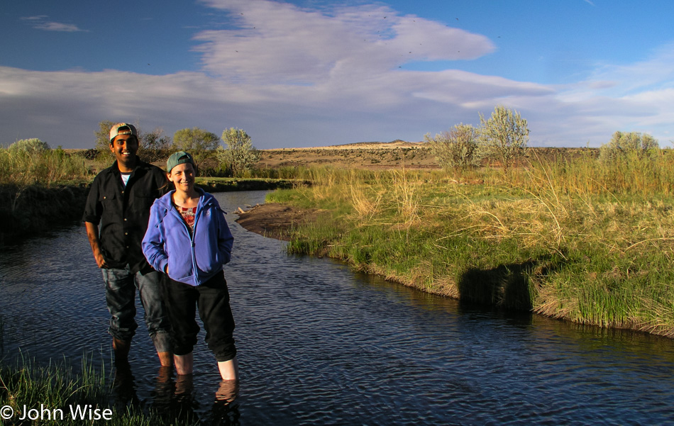
It’s toward the end of sunset when we reach the Nebraska State Line and then speed over the bridge to dip feet into the Missouri River.
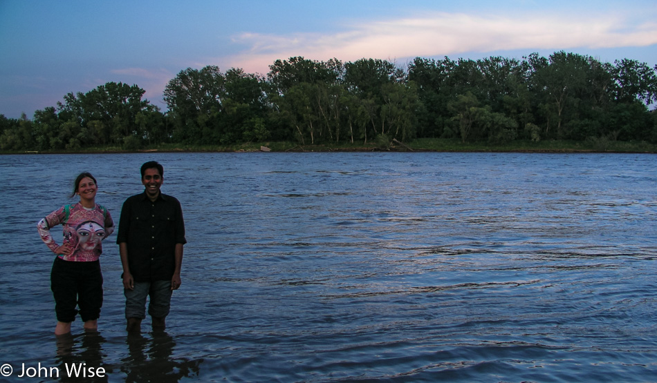
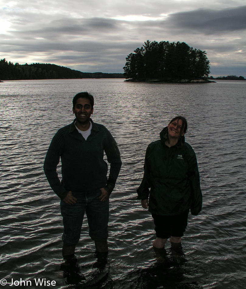
Now in Nebraska, Caroline and Jay are knee-deep in the Missouri River. This has been a great day for stepping into iconic waterways. After only 15 minutes in Nebraska, we are back in Iowa as that’s just the way the road works out this way.
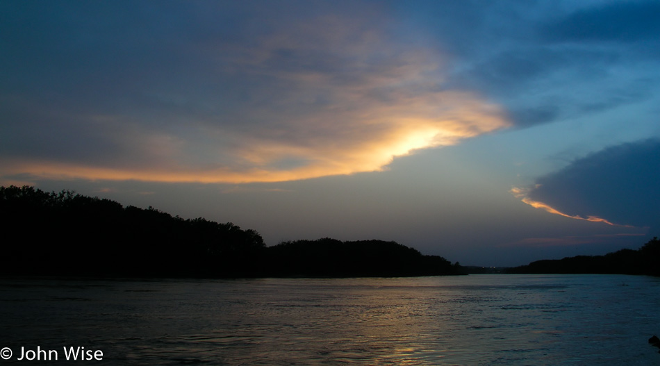
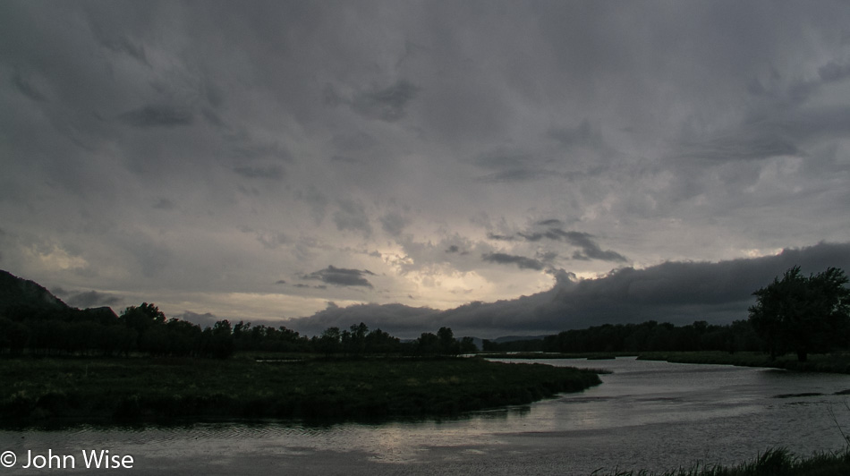
With daylight fading and night fast approaching, we enter the De Soto National Wildlife Refuge to watch the rest of the sun slip under the horizon. The darkening blue sky hanging over this channel of the Missouri River flows past the border of tall grass meadows framed by forest. A small lake is half encircled with cattails, and a pond reflects some of the last light in front of silhouetted trees. At the shore of the Missouri is a high cloud, grabbing hold of the remaining light; the sun will scatter over the river, reflecting golden light in the waters before us. Our day becomes complete with this grand show between water, sky, and sun.
At 9:00 p.m., we finally leave the refuge and head into Council Bluffs, Iowa to hunt for pizza. The best and only thing we can find is Godfathers. Forty-five minutes later, we are on Interstate 29, south of Rockport, Missouri. With some minor difficulty in such a small town, we finally found our hotel. The hotel isn’t really in Rockport; it is the next exit after the turn-off for Rockport. It’s 11:30 p.m. as we lay down.
We were quickly off to sleep last night, exhausted as usual. Caroline was the first to wake up and jump in the shower. Exiting the bathroom she was wondering why I had not stirred an inch. It was then in the still-dark room that she saw that it was midnight, and she’d been asleep less than an hour when she headed to the shower to get ready for the new day. Hearing her story, I couldn’t help but laugh, and that got her to laugh at the situation, too. All the same, we were still up early and ready to go before 6:00 a.m.
It was our intention to visit Lake Kabetogama in more detail, but this morning, as we drove past resorts, cabins, and private lake access, we could not find any public access. We can see the lake, but we simply can’t reach it. This turns out to have worked in our favor.
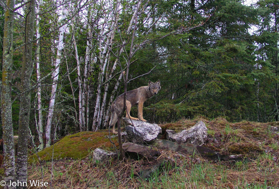
We finally found a dirt road that looked promising for leading us to Lake Kabetogama, so we turned down it. Fairly quickly and right next to the road, we spot some deer. We stop to take their photos before continuing to drive down the dusty road. I see something to my left, but it’s not a deer. Maybe it’s a coyote? Wrong, it’s too big. Could it be a dog? I try offering it some food thrown from the window, figuring if it’s a dog, it’ll come running. It has no interest. I’m starting to think it’s a wolf.
At first, the wolf stood there at the dark edge of the forest but soon approached for a closer look at us stepping out on an overhanging cliff. It seems we are both going in the same direction as the wolf continues its journey, tracing up the road just inside the tree line. We inch along with the wolf as it occasionally turns to inspect us. The wolf comes back out of the woods, stepping onto a rock for a picture-perfect pose with its eyes glowing in the early morning light. She takes a final look over her shoulder at us and turns to disappear into the forest.
I’m awestruck. If the camera hadn’t captured those moments I would place the story with those old fish stories that tell of having caught a fish that was this big. The entire time, we had our windows wide open, hoping to hear the slightest sound the wolf might make. We looked for its pack but only saw the lone individual.
Some locals at the main junction gas station and convenience store confirm just how lucky we are. A Bureau of Land Management worker assures us that we likely did not see a wolf and that they are more afraid of us than we are of them. I try to reassure her we are not nervous or fearful of an encounter but that we think we really did see a wolf. She relates a story of her time working in this part of Minnesota and that we might, on the rarest of occasions, capture a fleeting glimpse of a wolf in the distance as it crosses a road, but that is the best-case scenario. Furthermore, it is too early in the season this far south.
To confirm to her that we have not seen a ghost or are confusing a wolf with a stray dog or coyote, I show her my series of photos. Her astonishment was obvious as she let fall from her lips: “That’s a timber wolf!”
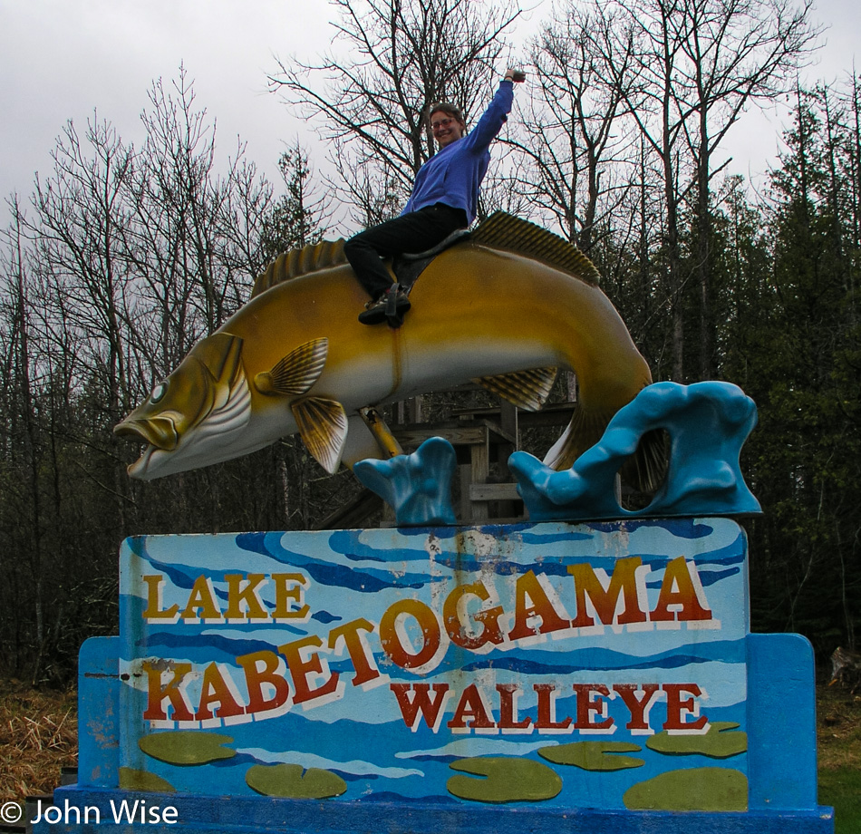
A ten-foot fish, a Walleye, to be precise, is mounted eight feet over the ground and equipped with a small set of stairs and a sort of saddle to allow those people looking for a truly cheesy photo to climb up and embarrass themselves. Caroline sprints to mount the Walleye first, followed by Jay, who fashions himself to be at the rodeo and then Caroline and I both get on for a tender moment on our ten-foot fish.
Our next stop was the Woodenfrog Campground. A trail leads to some picnic tables and a small peninsula. Caroline tries to warn Jay of the approaching bear trap, but Jay blindly steps forward directly into a pit of animal diarrhea. We’re not talking a small spot but nearly the entire sole of his shoe is dripping with the goo working its way up the side of his nice white shoes. Green doody jumped halfway to the knee of his pants leg.
We’re not 10 minutes down the road when I slam on the breaks and pull a quick U-turn. A bald eagle is perched low in a tree next to the road, and a juvenile bald eagle is sitting higher in another tree nearby but is too far away for the capabilities of our rather primitive camera. The first eagle didn’t waste much time hanging out and was soon gone.
We find the Little Fork River but nowhere to jump in. The Soudan Mine State Park, where we would have enjoyed taking that 2,400-foot descent into the mine, doesn’t open again until Memorial Day, but the gift shop is open year-round. The gift shop is open; who needs a souvenir from a place they can’t visit?
At the Bear Head Lake State Park, we check things out just to see what’s here. The attendants direct us to a trail that takes us lakeside, where we might see a pair of nesting eagles. Heck, we can never see too many eagles and were down the trail with binoculars ready to scope out the happy couple. Nothing, not a feather; we scan the horizon with nothing found. We can see neither the nest nor signs of the eagles.
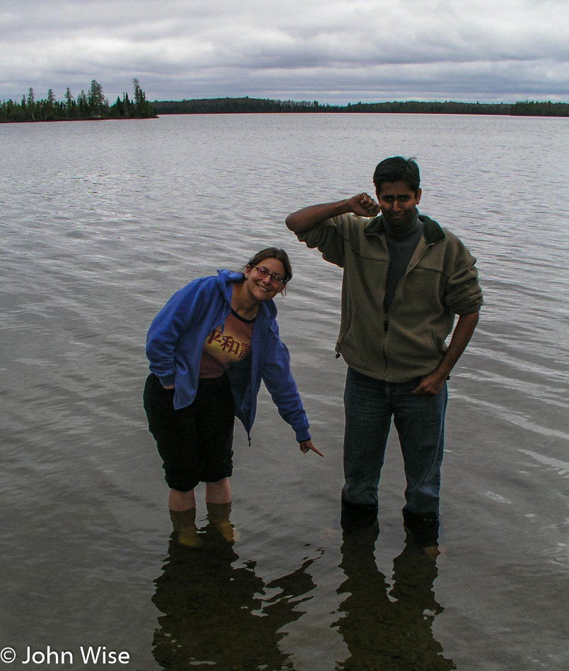
Well, then we’ll do the next best thing: off with shoes and socks, roll up the pants, and jump into the lake. Wait, Jay has forgotten to roll up his pants, oh, now we get it: Jay is attempting to purge the remaining crusting green stuff off his pants leg. With a stone in hand, he scrubs away while Caroline moves upstream, trying to spot those elusive eagles.
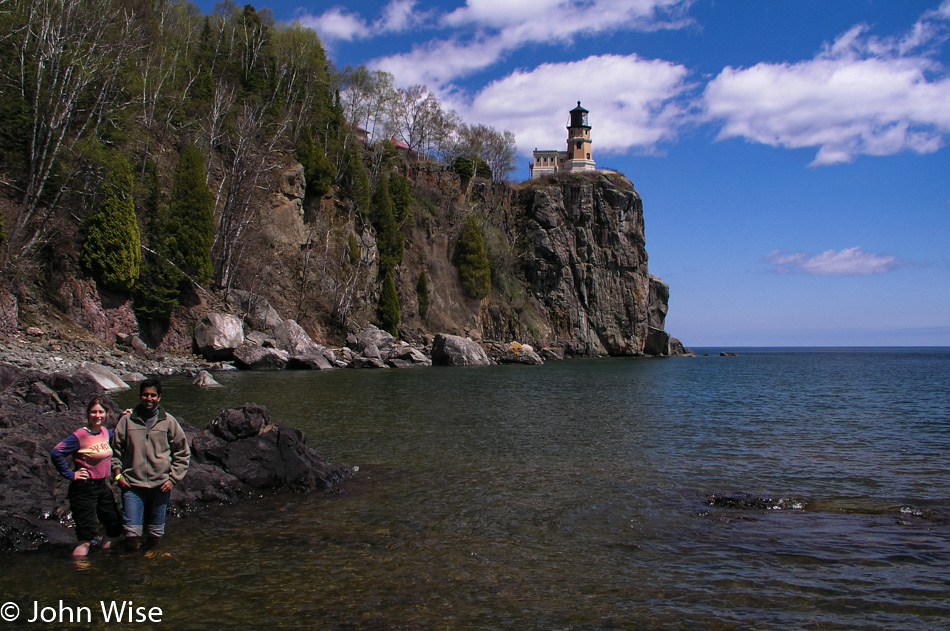
We drive through Ely, over the Kawishiwi Bridge, through Isabella, past a moose, all the way to Finland before we start to see blue skies. And now Lake Superior sits before us looking to be an ocean compared to the lakes and ponds we’ve been visiting the two previous days. At Palisade Head, the view stretches from north to south, with Michigan off in the distance across the lake.
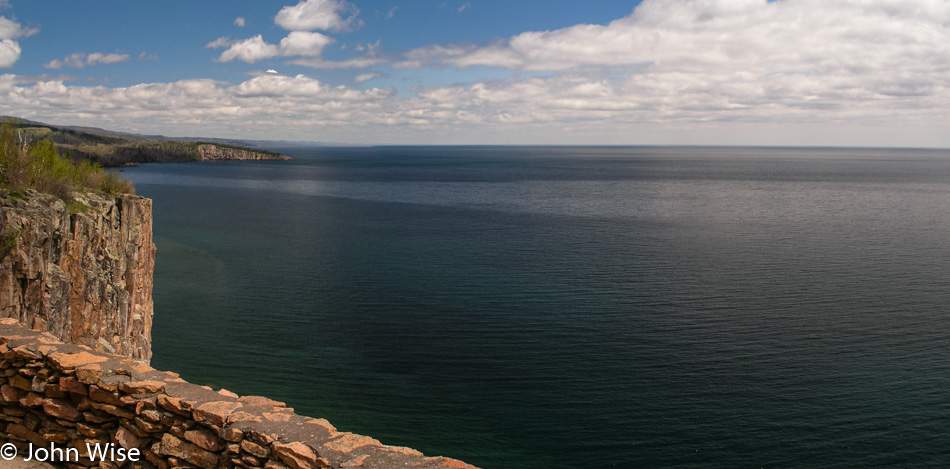
Here we are at Split Rock Lighthouse State Park with a sky that has continued to clear up, making for ever more incredible views. Entering the visitors center to pay our admission the three of us are giddy that the day is turning out so beautiful and that we actually made it all the way to Lake Superior on our trip across this part of America.
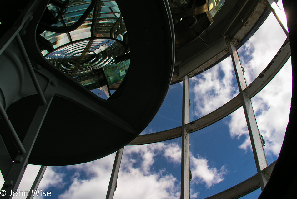
For Jay, this is his first lighthouse; for Caroline and me, this is the first on a great lake. The grounds are immaculate; the lighthouse is gleaming as if it were still new. Inside the lighthouse, a freshly painted black spiral staircase takes us upstairs past windows full of ladybugs. No one else is in the lighthouse as we reach the Fresnel lens.
Back downstairs in the entryway, a custodian in period dress waits by an iron stove to answer any questions we might have. Informatively, he tells us that the stove is a recent addition because when the lighthouse was in use, had there been a heater inside the structure, it would have fogged up the lenses, diminishing the effectiveness of the light. Yikes, that must have made for one cold lighthouse during those January blizzards blowing in from Canada. On second thought, why would a lighthouse need to be active when the lake is frozen over?
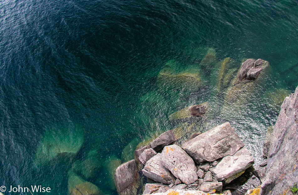
Jay crawls on his belly to the edge of the cliff we’ve been standing back from. He has the camera with its strap wrapped tightly around his wrist, with me holding his feet, he inches a little further and then a little further, and finally, he takes a photo looking straight down. Down there, you can look into the crystal clear green waters of the lake. A bit further down the trail, we come upon a mighty long set of stairs that go down to the lake. This section should be a must-see for all visitors to the park, as the views are spectacular. By this time, you should know why we had to get to the lakeshore, off with the shoes and socks, roll up the pants, and jump in; it’s Lake Superior.
The walk back up the stairs is a thigh master of a workout. I’m not alone in the pain of burning leg muscles as we get back to the top. Now, we can take the time to visit the living quarters with a person in period dress to introduce us to the old home. I’m more interested in snatching a sample of the beans and cornbread she has on the old stove, but she’s not entertaining my suggestions of sharing her grub.
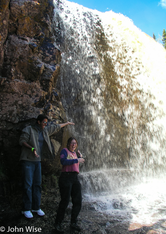
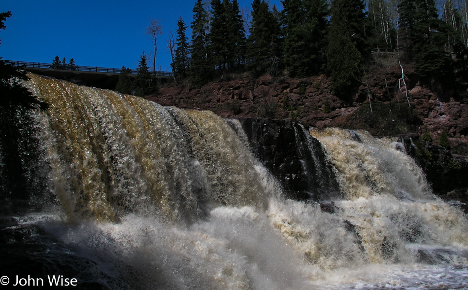
Based on my research prior to leaving Phoenix, Gooseberry Falls, south of the lighthouse, was a must-see. I had seen photos of the falls online prior to leaving, and they were undoubtedly beautiful, but they did not do justice to what we were about to see with our own eyes. Due to winter runoff, the water flow was a magnitude greater than that of the photos I’d seen before, making the falls all the more powerful, rushing in gold and white over the ledge. It is the tannins from the trees and plants upstream that color these waters to a golden brown, as we’d seen at Big Falls Campground.
The middle falls are the most accessible of the three that comprise the Gooseberries. At the middle falls is a path leading to the riverside and then a ledge that allows us to walk up to the spilling edge, almost standing beneath them. Where the path led down to the riverside we found a spot slow-moving and shallow enough for Caroline and Jay to safely step into Gooseberry River. The upper falls have to be seen from a distance but are no less captivating, and the lower falls went unseen by us as time restrictions only allow so much time at any one location. A trail that loops down past the lower falls and over the river to the other side of the middle falls and then up and over the upper falls would surely be a walking tour that everyone with enough time at the park should make.
Our encounter with Minnesota has easily laid the groundwork for a return visit. (Boy, that sounds redundant by now.) Although, instead of driving next time, I would consider the following itinerary. Fly into Fargo, North Dakota, and drive to Lake Itasca to spend a day or two camping near the Mississippi headwaters and biking the nature trail. Overnight at Big Falls on the Big Fork and then on to Voyageurs and two or three days canoeing Lake Kabetogama before heading to the shore of Lake Superior. We would make the trip north up the shore to Grand Portage before leisurely driving back down the coast with an overnight camp at Gooseberry Falls. Finally, from Duluth, I would drive inland to Jacobson, picking up the Great River Road to trace the Mississippi River down to Minneapolis for the flight home.
Not much further down the road today, we pass through Duluth and into a state of shock. We are encountering Superior, Wisconsin, which strikes us like a trainwreck. Salt Lake City was the last ‘major’ city we passed through. For days, we’ve been in the countryside, away from signs of industry and crowded cities. Superior is one of those mythic rust belt towns that are dilapidated and crumbling. From the first moments of being thrust into ugly, we need to get out of here. Looking down the main street, it’s easy to see the former glory of this once prosperous community, but with manufacturing job losses the façade is now well worn with many a shop for sale or lease.
We stop for gas at a Holiday filling station where at least the word holiday evokes a sense of happiness. Turns out that I’ll soon pay for my negative impression of Wisconsin. Outside of Superior, the landscape opens up to our relief; yards are dotted with dandelions, and my shock begins to subside. Maybe it was my hurry to get as far away from Superior as fast as I could, although I swore it was because I had just passed another car, which I had.
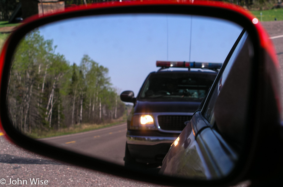
A Wisconsin State Trooper, the single most unfriendly police officer I have ever dealt with, and I grew up in Los Angeles, makes a U-turn to come up behind our already stopped car. I saw the disco lights go on before he passed us; I knew I was close to 80 mph or so, as I said, I seriously had just finished passing another car.
The trooper approaches our red race car with a scowl asking what we are doing in Wisconsin, if we are visiting family or have family in Wisconsin. We explain we are on a 10-day cross-country drive to visit a few national parks and riverways for a short vacation. The officer insisted that my speed was too fast even if I was passing another vehicle and wrote me a citation. Being an out-of-state driver, I’ll be allowed to pay the fine with my Visa or MasterCard immediately: the $205 fine! I wasn’t aggressive, I wasn’t mad, I knew I was over the speed limit, I pulled over without him having to drive another mile and direct me to pull over, my window was down, and driver’s license and rental agreement in hand. I asked the officer if he couldn’t lower the speed he clocked to give me some break on the fine amount, “No, I couldn’t do that. The state legislature determines the laws; I enforce them. That’s my job.”
Ok, get me out of Wisconsin; I don’t want to spend one more penny in a state that employs such unsympathetic, surly policemen who, in this instance, was our first encounter with whatever hospitality that Wisconsin might have to offer. I’m trying to let go of the seething anger I’m now feeling for this guy who pulls me over in his $47,000 SUV. I’m bitter, and it will be another half hour before I calm down enough to start enjoying the road again.
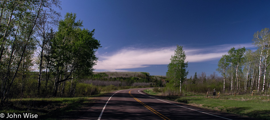
The sign for the St. Croix National Scenic Riverway brings a smile back to my face. Caroline and Jay muscle their way into the St. Croix and, with a superb show of strength, manage to stake a claim in the river, displacing the weaker water with their brute force. The road we’re on does a good job of hugging the river on our trip south. A few miles after where the Yellow River merged its waters with the St. Croix, we turned onto Route 79, a rustic road.
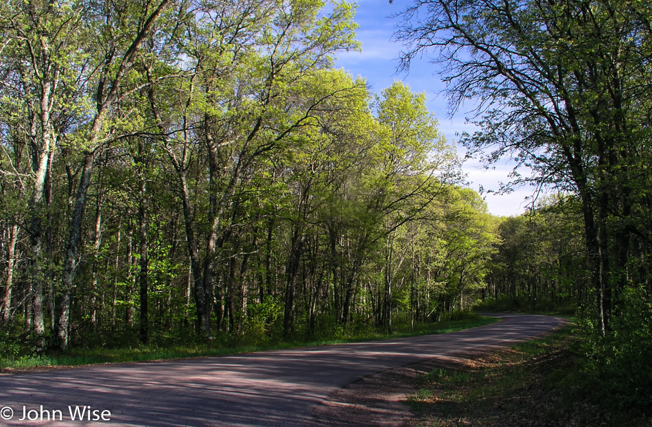
Not much wider than a single lane, this road cuts a stunning path through the forest. The narrowness of the road creates a tunnel-like atmosphere, with the trees almost joining overhead. Crisp green new growth in the trees and on the ground lends dramatic shadows over the road and into the car. This is the kind of road I could spend a lifetime driving, or better yet; it would be amazing if our great country would create a national bike path that would allow for the crossing of America without ever having to deal with competing automobiles. Without a map covering these small details, we only drive a couple of miles before turning around to reconnect with our road south.
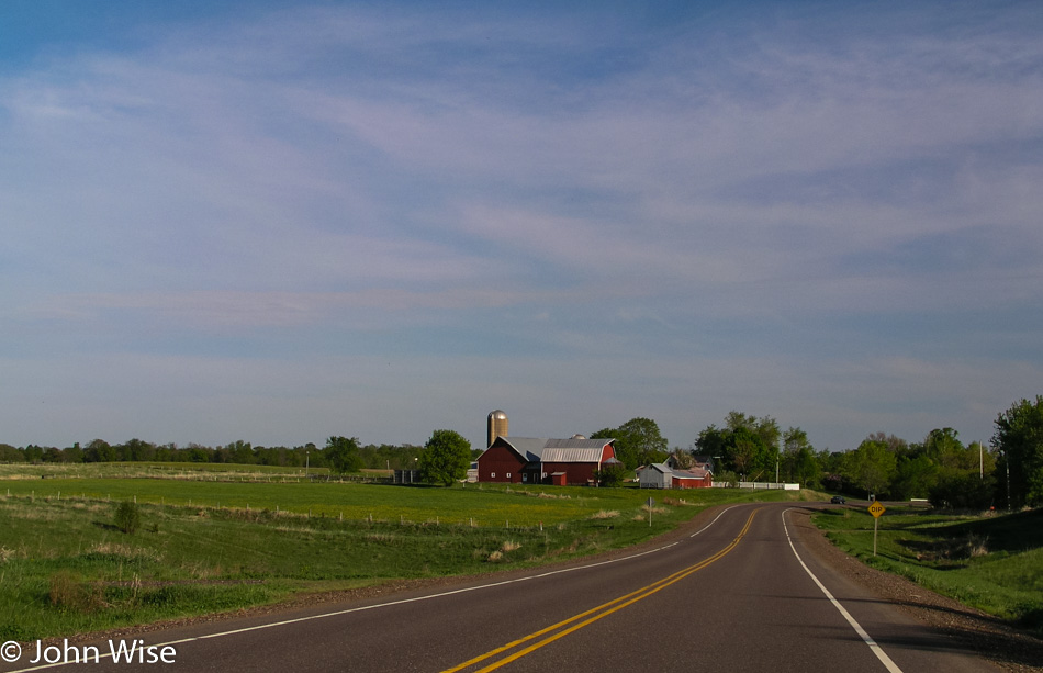
As the road moves away from the river, farmland stretches away from the road. Barns and elevators are common and frequent sights on this gently rolling land. The road swerves back to the river and the heavier tree line. We reach St. Croix Falls late in the day, accompanied by all of the anticipation of checking out one more waterfall.
At Osceola, we deviate from the plan and cross the St. Croix as our map shows the other road stays closer to the river. We are back in Minnesota with no discernable characteristics between one state and the other. A half-hour later, we returned to Wisconsin. Through every town we’ve passed, there have been plenty of lilacs blooming in purple, pink, and white, and they smell, oh, so sweet.
Prescott, Wisconsin, is where the confluence of the St. Croix and Mississippi has come to form an incredible breadth of the world’s second-largest river, the Mississippi. It is fast approaching dusk when we arrive, and are unable to find a good vantage point to see where these two become one. A local points us to a boat dock, suggesting it’s the best we’re going to find. A barge of enormous size is pulling up the Mississippi, taking 10 minutes just to pass this small corner, and a couple of fishermen float slowly back to the dock. Dusk will take its time giving way to darkness this evening.
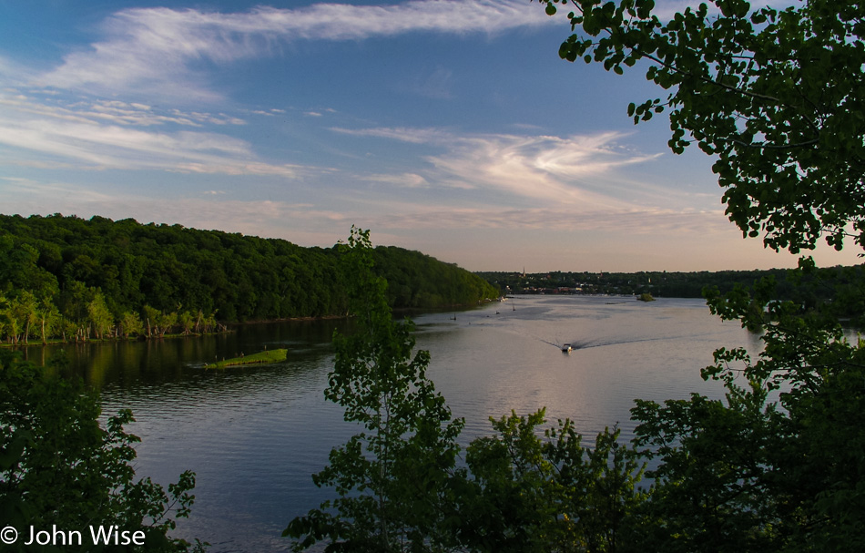
More than thirty minutes after leaving Prescott and the St. Croix behind us, the sky holds a faint blue light and an even fainter orange glow of the sun. An early moon set over the Mississippi, which has become Lake Pepin at this intersection. Lake Pepin and the Mississippi River Valley are artifacts formed when the large glacial Lake Agassiz near the intersection of Minnesota with North and South Dakota started flowing about 12,000 years ago. As those waters receded 9,500 years ago, sand, which had been deposited at the Chippewa River delta where it joined the Mississippi, created a dam, and Lake Pepin was born.
We still had two more hours to drive tonight before reaching La Crosse, Wisconsin. Approaching Lake Superior earlier in the day was our halfway point, as from there, we would be heading south before turning west on our way home. The river valley has been so enchanting it’s both a shame to drive it at night and a shame not to take it to its southern terminus. Even in the dark of night, we see enough details of the small towns to be aware of how much grandeur we are missing by having to press on. On the other hand, we are also aware of how lucky we are to witness with our own eyes so much of the land we’ve already been able to lock into our memories.
Reaching La Crosse and a gas station at 11:00 p.m. we refill the ice chests as we have done every other night during the trip. $23 puts 11 gallons of gas in the tank. We have driven 3,849 miles in six and a half days for an average of 592 miles per day. Yes, we have many a friend and family member who think it crazy to endure so much driving in the name of vacation and relaxation. As we look at the sum of experiences, sites, and sensations, we, too think it crazy, crazy that others wouldn’t want to witness so much. For Caroline and me, this is like driving around your neighborhood to learn of the amenities such as parks, libraries, shopping, trails, and other services that bring comfort to someone as they learn to live in their new surroundings. We are driving around our neighborhood, not constrained by the idea of town, city, or state. Our town stretches thousands of miles in all directions because we are free to live in America. With that in mind, it makes sense to us to know the country we are living in.
Wednesday, we’re up early and moving by 6:30 a.m. We are looking for Blanchard, where the world’s tallest TV tower, at a height of 2,063 feet, stands sentry over farms stretching in all directions. Two towers in front of us are candidates, and we head in their general direction. No signs point to the actual tower, and we can’t find a road that looks to go to the base of the closest tower. We’re not even sure if the tower closest to us is the tallest tower, as it would make sense that the tower further away that looks to be the same height should be the taller of the two. We move on.
North Dakota was an unexpectedly interesting state whose reputation is unfounded, as far as I’m concerned. I think many a state suffers poor publicity due to the interstate system that has sped travel throughout our land. As travelers have become accustomed to a harried life, they demand the same of their travels. It is this speed of convenience, though, which takes them down main highways that are punctuated with the same businesses from one exit to the next. When I find myself on these interstates, I notice the bombardment of billboards to be the first major annoyance. Second is the over-proliferation of signs pointing the traveler to various services: rest stops, lodgings, restaurants, clean restrooms, construction zones, roads that are sponsored by such and such company or family, signs dedicating roads to various causes, groups, or loved ones, and signs warning of radar, animals, workers, storms, rocks, traffic congestion, passing rules, blowing dust, and let’s not forget prisons with signs telling us not to pick up hitchhikers. Thirdly, the country looks the same if every few miles, we see another Denny’s, Chevron, Red Roof Inn, McDonald’s, Dairy Queen, Motel 6, and the famous generic truck stop.
All across America, the main interstate is abuzz with information that never allows the inner explorer to see the countryside. It could be this information overload that turned Americans against the long road trip across their great country. Out on country roads, the slower roads, the roads that take you on a journey and not just a destination, is where we become familiar with the sights and sounds that give a unique character to each of these lower 48 states. North Dakota is the 44th state we’ve visited; this will not be our only visit. A day was not enough to become as familiar as we might like with North Dakota; we only scratched the surface.
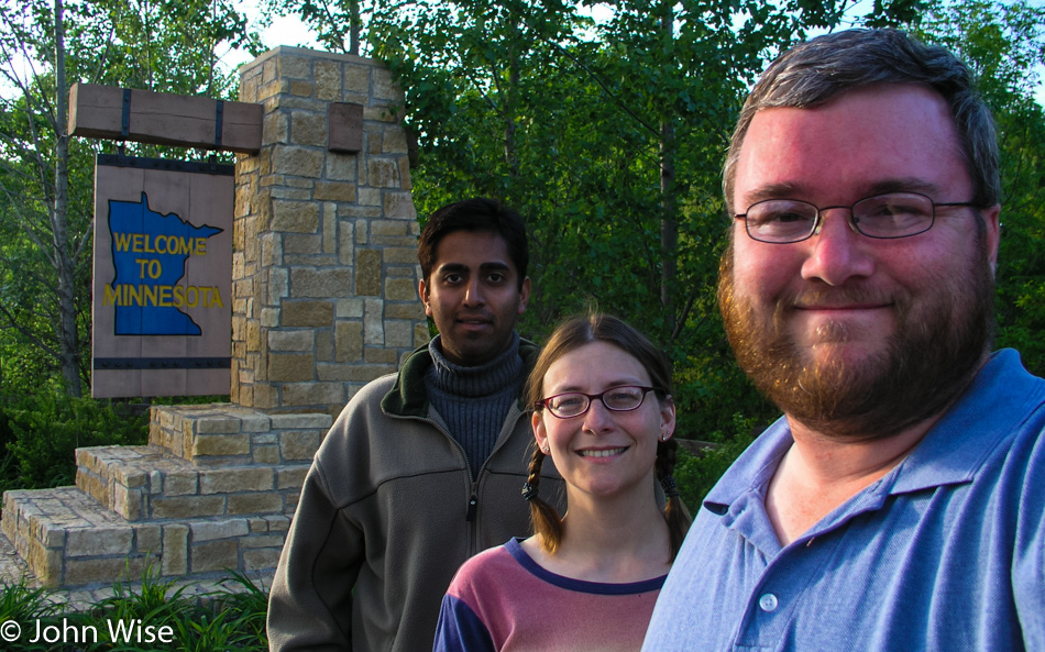
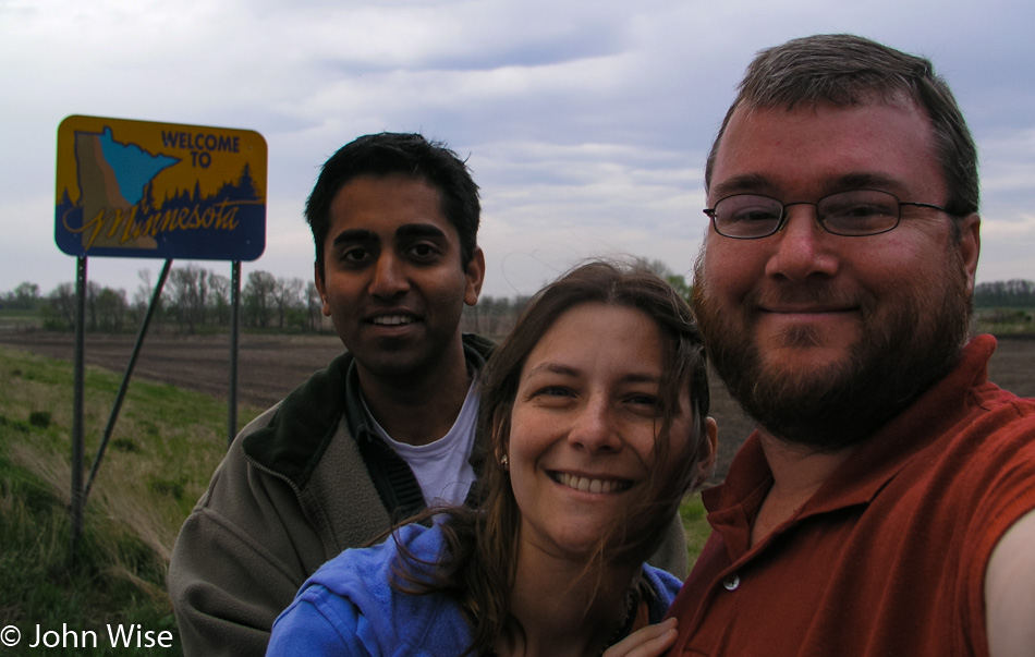
Minnesota is entered while crossing the Red River; our luck has it that the “Welcome to Minnesota” sign is a short bit past the river on dry ground. Not a spot was found to snap a photo of Caroline in the water; the banks of the Red River were muddy and steep, so we might have to wait for another trip to Minnesota to find a better location to step into the muddy waters of the Red.
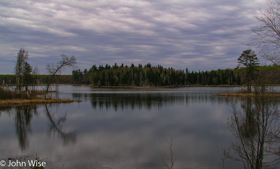
The change in geography is astounding as Minnesota lives up to its motto of being the Land of 10,000 Lakes. Skies began the day overcast and stayed this way for the remainder of the day. There were blue patches here and there that opened occasionally, but clouds and rain were nearly ever-present. The lakes and their frequency are also ever-present; we can’t turn a corner without another lake to our right, our left, or straight ahead.
Another landscape change made all the more dramatic was the contrast between yesterday’s wide openness and today’s sudden appearance of trees. Within but a few miles of crossing the border, the grasslands were gone and replaced by woodlands. Beaver dens and the sighting of beaver-gnawed tree trunks are easy to spot along the roadside. The small marshland areas opening to larger ponds and reflective lakes beg us to set out on a canoe and explore these beautiful waterways.
As much as we’d like to stop and see more of one or all of these wetlands, lakes, and ponds, we are on schedule to our destination this morning: Lake Itasca State Park. On our way to the fee station, we are excited about the prospect that we are about to see the headwaters of the Mississippi River. At the fee station, we get the news that the road that crosses within the boundary of the park to the north is under construction and closed to all through traffic. We stop at the visitor’s center to find our way.
Back on Highway 200, we are heading to another entrance. We cross the Mississippi River on the way in. The river narrows fast; at our first crossing, the river was about twenty-five feet across. A little further up the road, the river is only ten feet wide. The parking lot here is huge and can accommodate more than a hundred cars, but this early in the season, ours is the only car in the lot.
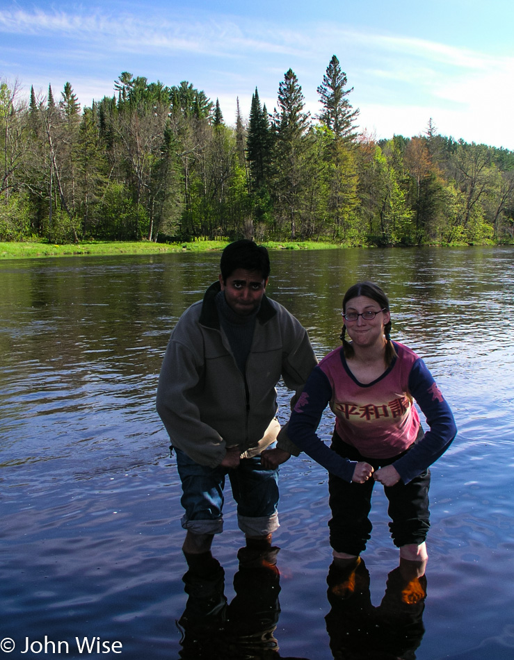
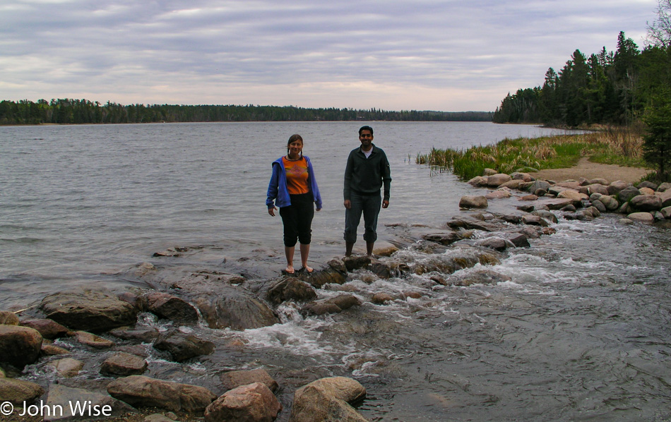
A well-marked trail leads in the direction of the place we are searching for, and within a few minutes, we are approaching a wooden post of some importance. It is proclaiming this to be the point of origin where the mighty Mississippi starts its flow of winding a path 2,552 miles long to the Gulf of Mexico. This trip wouldn’t be complete without Caroline crossing the Mississippi barefoot. While the water is cold, Jay is right there with her.
From Lake Itasca to Bemidji and further on to Grand Rapids, we follow the Great River Road. The Great River Road is a 2,069-mile-long Scenic Byway passing through five states on its way south; today, we will attempt to get lost along a 117-mile stretch. Due to construction and, at times, our poor map not showing the required level of detail, we are finding ourselves quite literally nearly lost, but not quite fully lost. Somehow, just when we think we should have gone right when we went left, and we are certain the dirt road can’t be correct, we come out of the woods and find we are right where we want to be. We needed three and a half hours to drive the 117 miles but have had many opportunities to cross the Mississippi and marvel at how fast this river picks up tributaries and starts becoming the massive river it is known as.
On the outskirts of Bemidji, nearing noon, Jay once again has a phone signal which is the first time since leaving Salt Lake City in Utah. We have to back up and park to maintain a connection so he can check voice mail and call Rinku, the girl who’s taking care of our cats and plants while we are out here in the middle of America. The cats are fine, but Rinku tells us that no one in Phoenix understands why we’ve not called already; they were getting nervous. Of course, I had forewarned everyone that we would probably be outside cell coverage until we were near Fargo or St. Paul. Obviously, no one believed me.
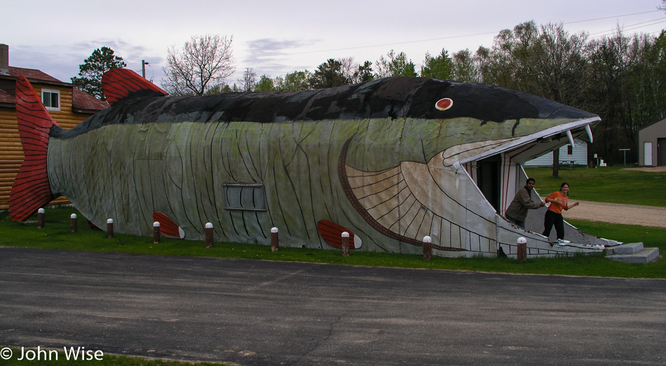
Outside of Pennington (population 52) is one of the slices of Americana that only happens right here on these shores: it’s the Big Fish Supper Club. And what better form for the building of the Big Fish Supper Club to have than that of a Big Fish? We would have eaten here for the novelty of being in the belly of the Big Fish but would have to satisfy ourselves by escaping its gaping jaws as the Big Fish wasn’t open yet.
For the next hour, we listened to frogs along the roadside, passed more beaver dens, tried to figure out how to pronounce Lake Winnibigoshish, and admired the flowers along with lake after lake. Turning right onto Little Bowstring Forest Road, a one-lane dirt path through the forest, up and downhill we wind our way through the forest until we come to a lake. It’s quiet except for the wind rustling the tops of the trees and the slight sound of the lake lapping the shore.
We spend time skipping stones over the water and looking at the trees and rippling water. A canoe comes to mind again. After our arms tire of skipping stones, we take a walk in the forest to inspect its carpet of mosses, leaves, bark, and plants while trying to hold fast to the memories that might help paint our future dreams.
We backtracked to a smaller lake that had been passed on our way in, its waters mirroring the surrounding forest. The woods here are lush. Saplings are pushing their way up through a thicket of other new growth and flowers. The early blossoms deliver their sweet smell to hungry noses.
Is this diversity only a small sampling of the abundance of Minnesota’s forest, or have we just been lucky to fall into its more beautiful corner? And what of the coming weeks, as spring kicks into summer, will there be an explosion of colorful growth? Our short time in Minnesota will have us leaving the state with more questions than answers but will also leave us with a great desire to return to find answers to our curiosity. Reading this last line again has me thinking I’ve written just that about every state Caroline and I have visited.
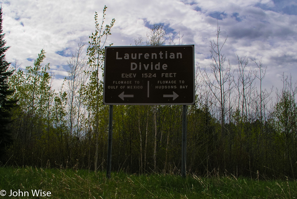
On the road again, we cross the Laurentian Divide, where from this point, the waters that flow on the left will head to the Gulf of Mexico, while to the right, the waters flow to Hudson Bay. Highway 38 takes us past Caribou Lake, one of more than 48 lakes that are here in the Marcell Township. In Marcell, we stop to take a second look at the Tender Tourist Trap, a flower shop that’s sort of an oasis inside a bigger oasis.
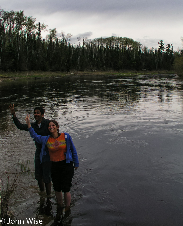
The Big Fork River is on the northern end of Highway 38, a slow, medium-sized river cutting through the forest. We stop at the Bill Counter Landing with the intent of stepping into the dark waters of the Big Fork but find the drop-off too steep to safely step in. At the Gronwoldt Landing, conditions are better but still tricky as Caroline and Jay have to step out onto a narrow gravel bar before the riverbed drops off. Wildflowers bloom under the gray sky along the rustic trail that brought us down to the river, a light rain has also begun to fall.
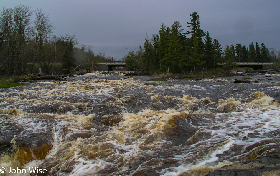
By the time we get to the Big Falls Campground near its namesake, the rain is coming down harder. Lucky for us, it’s soon letting up, allowing us to grab a better look while walking along the falls. Looking into the rushing cascade tumbling over boulders, the dark golden brown color of their tannin-stained waters rushes by just inches from where we stand. Again, we add to our notes to return to this spot to camp someday, as it is now in our top 10 coolest campground sites.
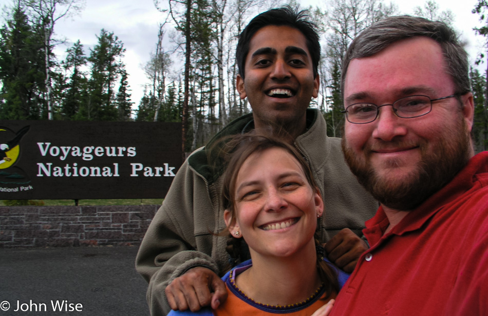
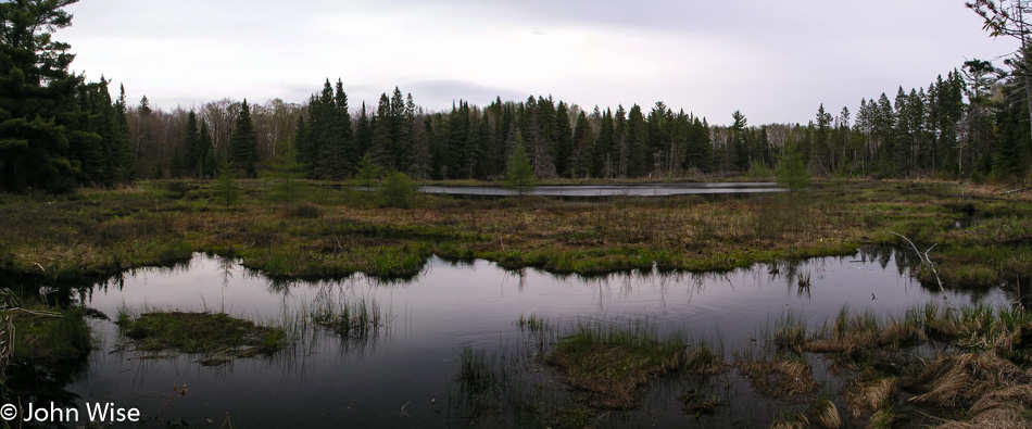
The Rat Root River is the last river we stop at before entering Voyageurs National Park. We have headed to the Ash River Section, hoping to go on a nature hike before dark. Unfortunately, the Visitors Center is closed, but a path leading to the river and Lake Kabetogama looks inviting, so we make our way to the nearest shoreline to consider dipping a toe or two in.
The first short segment of the path takes us to an overlook of the lake. We return a short distance to join the longer main trail. What starts as a well-marked walk quickly dissolves into a faint uncertainty. The area here along the lakeside is gorgeous with colorful foliage, gnarled tissue-like mushrooms, and even the sun makes an appearance. Hiking past fungi, fallen trees, saplings, mosses, and – a road? When we checked the map, we saw no hint of a road; well, we are all pretty sure we didn’t see a road bisecting the trail. Rather than chance taking a wrong turn just before dark, we turn back to return to the car. It’s at these moments where the Park Service would benefit the public by receiving better funding to deal with late arrivals to the National Parks.
With another moment of blue sky and a little sun lighting the way, Rainy Lake was our next stop.
Caroline’s brain fell out of her head at some point on the trail; lucky for her, Jay found it, and being a vegetarian and all, he gave it back.
Tonight we have a date. While making reservations for the various motels, hotels, and inns we would be staying at, I spoke with Vijay at the Budget Host Inn of International Falls. I recognized the accent of the voice on the other end of the phone, and I asked if he was Gujarati. Gujarat is a northwest state in India, which is also where Jay is from. Sure enough, Vijay is Gujarati. I also asked Vijay if he would like us to bring any Indian groceries his way. Caroline and I stay at our fair share of Patel Motels across America, and one thing we’ve learned about these Indians far away from a major metropolitan area is that they have trouble getting access to Indian foods.
The night of our arrival, we are carrying 40 pounds of chapatti flour, vegetable, and mango pickles, which are both similar to a relish, papads, two packages of Indian tea, Parle G cookies, a few chakri which are a snack made of rice flour, chili powder, and cumin, and a package of bhel puri that is also a snack. Sadly, we couldn’t deliver Undiu, a popular spicy Gujarati vegetable dish that would have been tradeable for a free room. The Undiu wouldn’t have survived the six days it took us to get here.
For delivering the groceries, Vijay very graciously invited us in for a hot dinner. Vijay serves us Indian and Chinese food, and for the first time in nearly a week, we get to sit down and have dinner in an at-home setting.
Leaving this feast and walking back to our rooms Caroline, Jay, and I were struck by the luck we’ve had on this trip. We appreciate this moment as one of our great fortunes and will not soon forget the hospitality offered to us for the favor we delivered tonight.
Early to bed and early to rise. Caroline took this to an extreme tonight. She woke after hearing the alarm shake her from sleep and jumped into the shower. Quietly, she sifted through her clothes to find the day’s outfit, and shortly before waking me to do the same, she was overcome by a strange feeling. It seemed awfully dark outside. She checked the clock again – it was MIDNIGHT.