In America with Jay Patel – Day 8

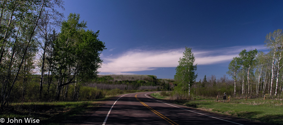
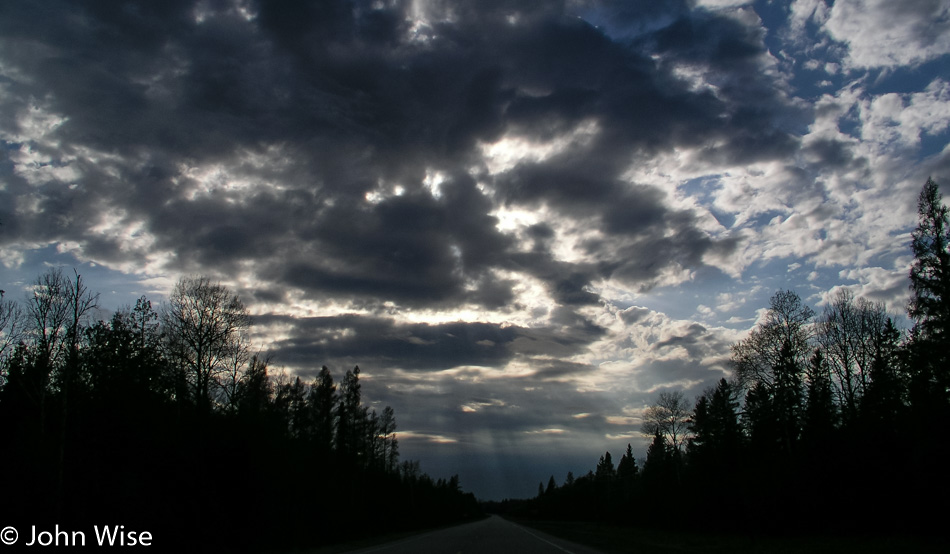
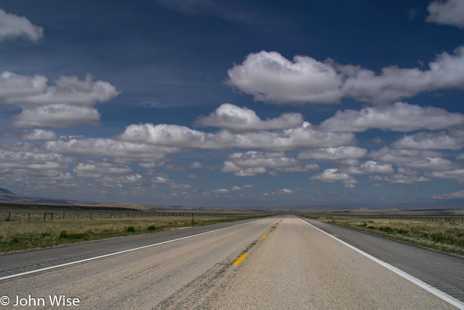
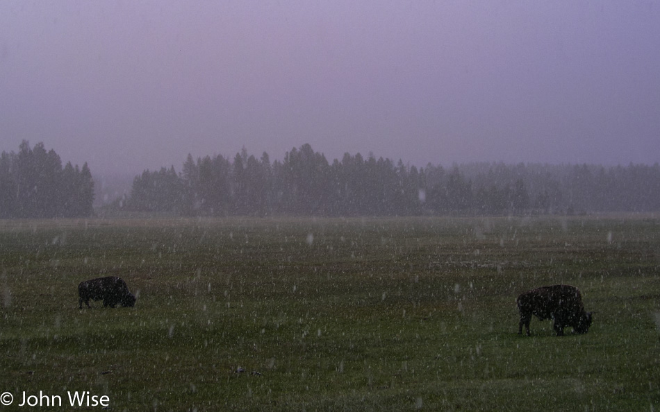
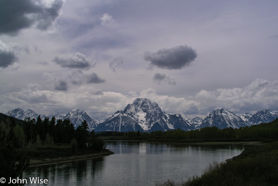
It was bound to happen: bad weather is collecting overhead. Thunder, lightning, and rain, with the TV news issuing flood warnings north of us. Some mild disappointment makes an appearance with the realization that the Apple Blossom Scenic Drive won’t be quite as scenic under these conditions. But we are heading generally southeast away from the storms so our hopes are that we might drive out of the foul weather and back into blue skies.

An hour down the road and a break in the clouds offer hope for a brighter future on the horizon. At Prairie du Chien we stop for a hot breakfast, the first since the Teton’s nearly a week ago. Our restaurant of choice is McDonald’s, hot and greasy. We ordered a bunch of Egg McMuffins, hash browns, coffee, and orange juice. After so many days of eating cold food from our ice chest, McDonald’s has extraordinary appeal.

Jay Patel with Caroline and John Wise entering Iowa

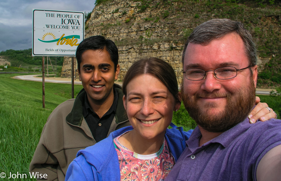
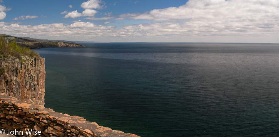
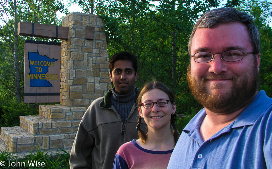
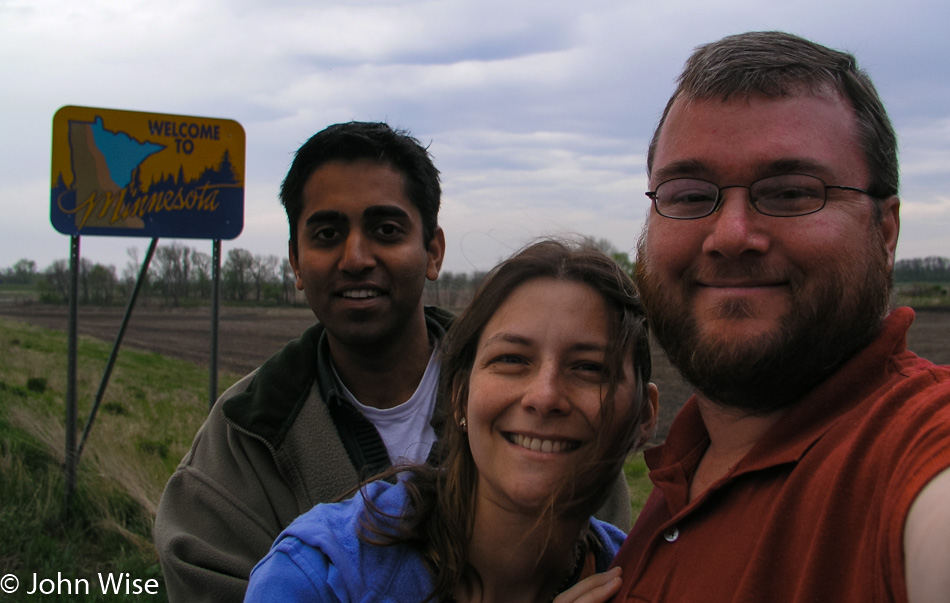
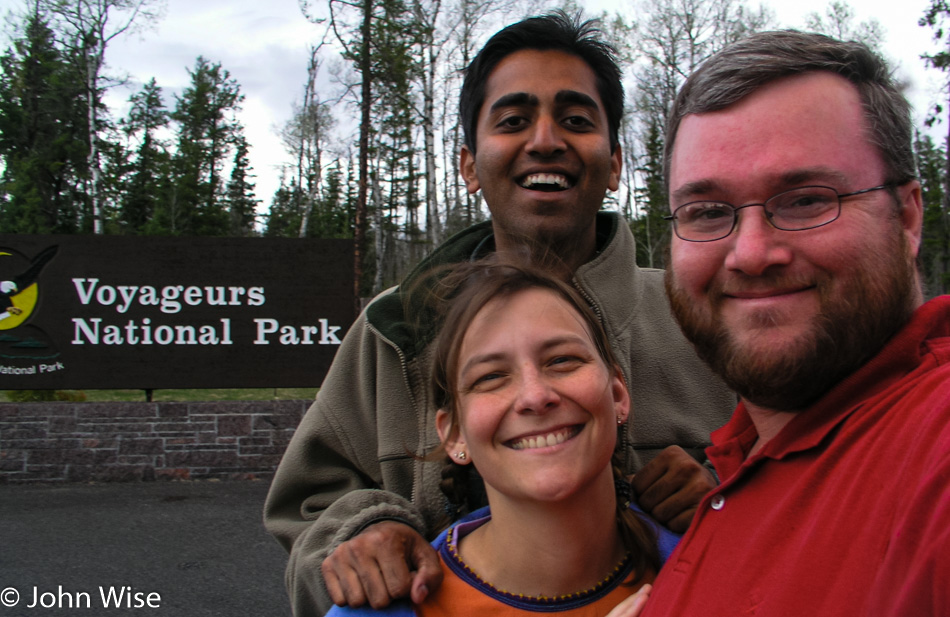
Wisconsin begins to fade away as Iowa comes into view after crossing the Mississippi for the last time during this vacation. From Marquette, the road north along the western shore of the Mississippi will take us to Effigy Mounds National Monument.

Jay Patel with Caroline and John Wise at Effigy Mounds National Monument in Iowa

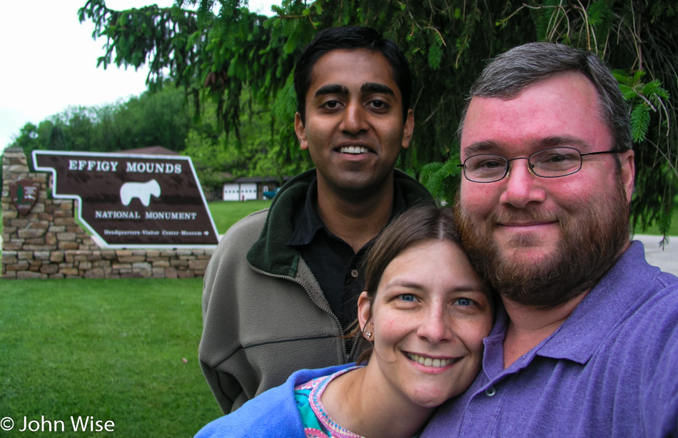
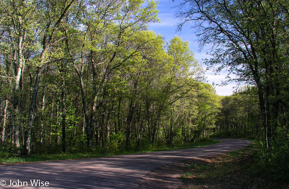
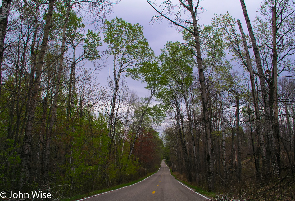
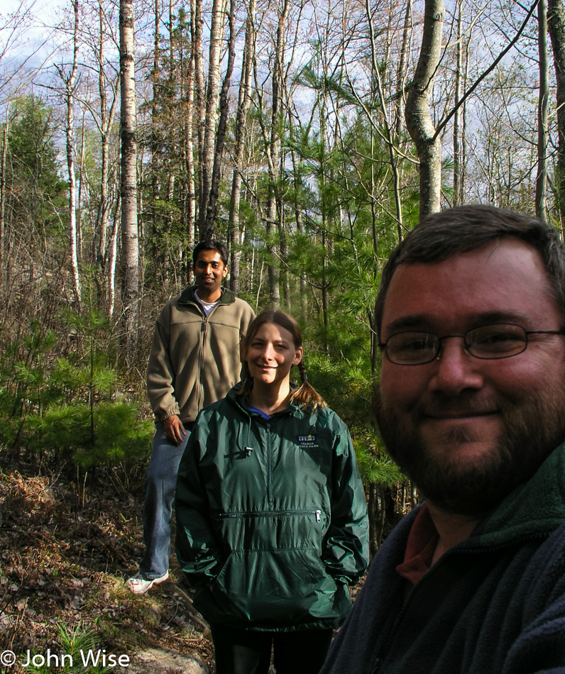
Amazing, it is as though someone switched on super green. We entered the park near the visitor’s center after one of the park personnel familiarized us with the lay of the land. The trail begins easily enough on a boardwalk leading us to the base of the mountain we are about to climb, not a giant Western-style mountain, mind you. The dirt trail that’s up next isn’t all that steep initially, but after the first bend, we start making a fairly steep ascent. Steep enough to require a number of switchbacks, but any difficulty the trail gives is more than made up for with the lush flora surrounding our every step.

Effigy Mounds National Monument in Iowa

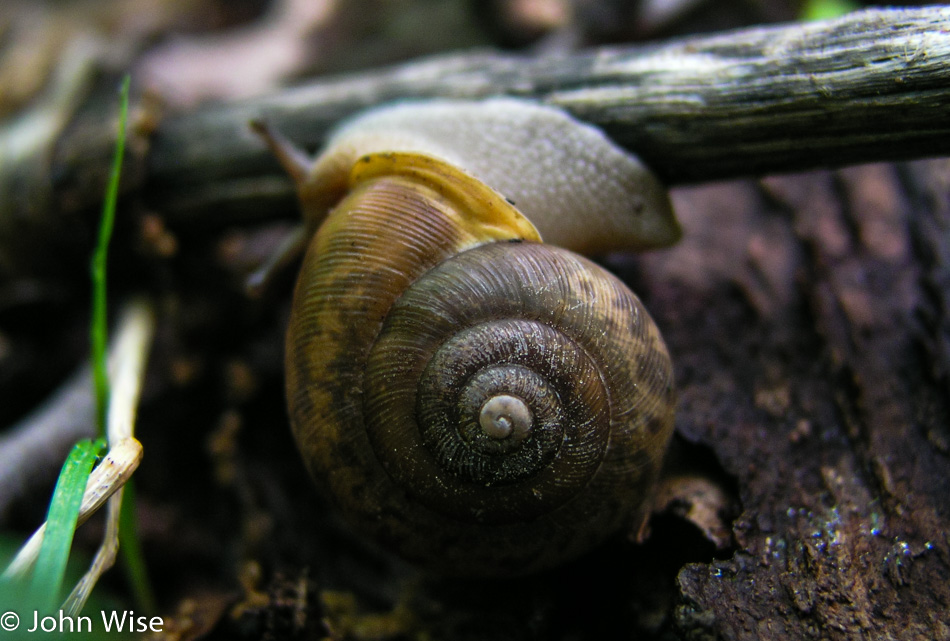
Flowers abound, tiny and delicate, a kind of whisper of beauty in the woods. Ferns, mosses, mushrooms, snails, and new plant growth of all types are found in every direction.

Effigy Mounds National Monument in Iowa

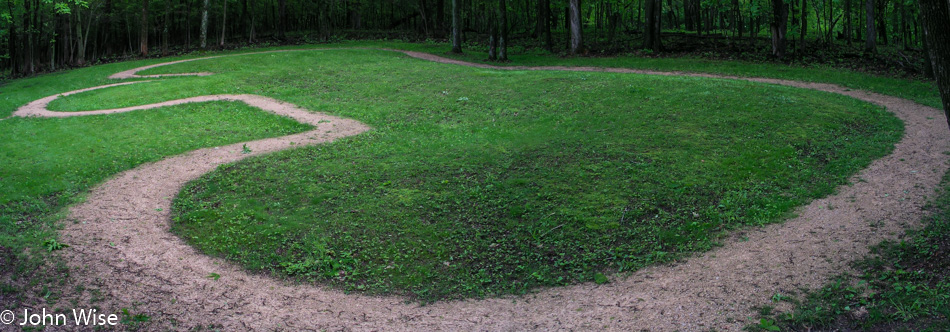
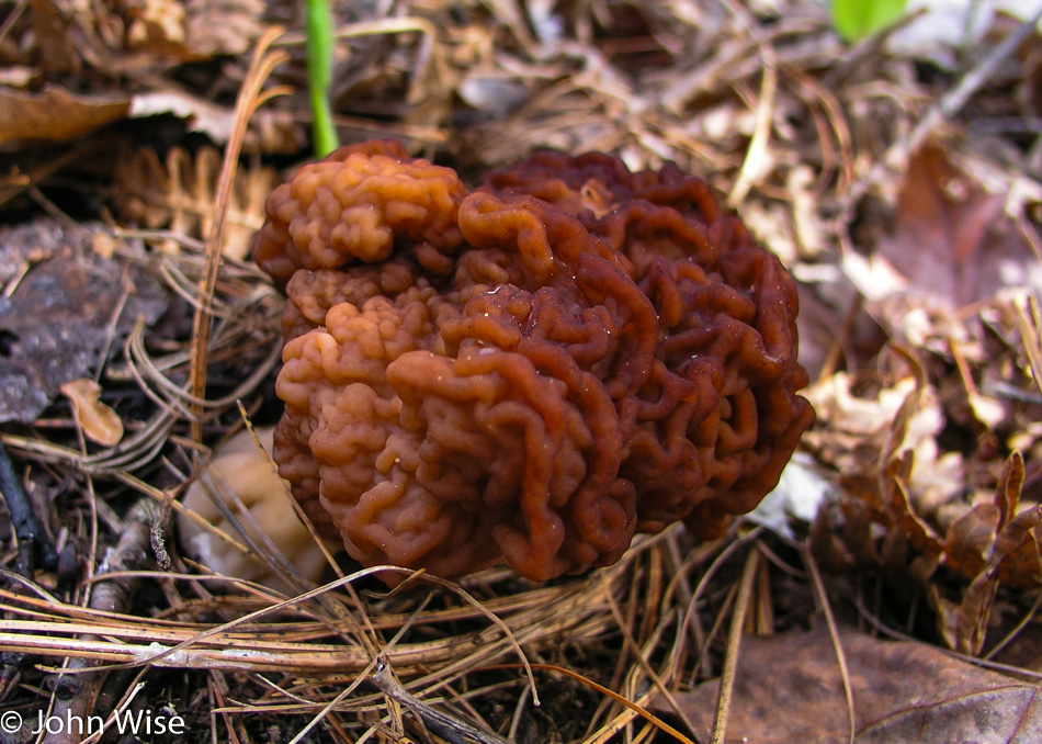
We are tiptoeing through an enchanted forest with a quiet typically reserved for libraries. The beauty is so great we don’t want the slightest noise from our plodding steps to disturb the scenery. In hushed tones, Jay draws my attention to another strange-looking fungus, and then we see our first effigy. It’s a bear. Next to the bear is a string of mounds our guidebook suggests are likely burial mounds and are not effigies themselves.

Effigy Mounds National Monument in Iowa

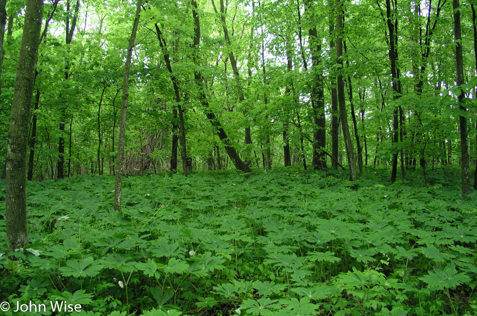
I almost overdosed on this encounter with Green. There should be warnings here for people coming out of the Southwest that saturation could have deleterious effects on people more accustomed to a brown palette with hints of tan.

Effigy Mounds National Monument in Iowa

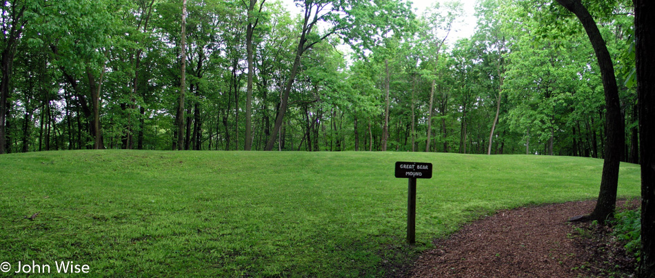
Along the emerald green path, I’m still picking out small mushrooms, little flowers, and a field of plants, creating a floor sitting a foot and a half off the ground. The Great Bear Mound is the largest effigy remaining in the park system; it is so large I can find no way to photograph it to demonstrate its bear likeness.

Effigy Mounds National Monument in Iowa

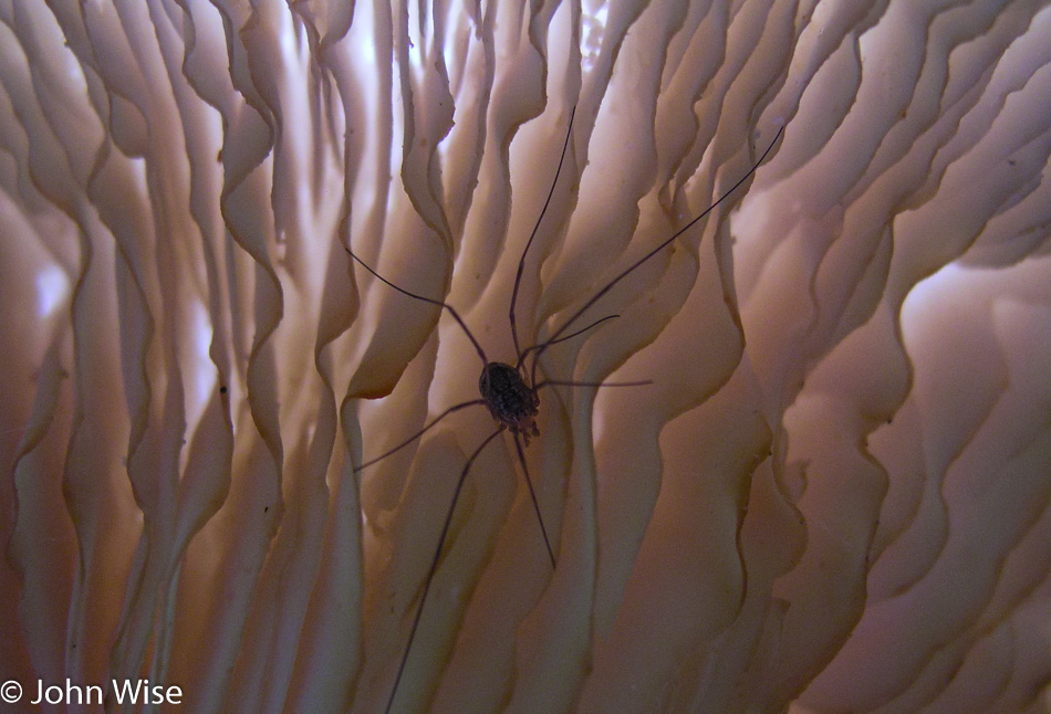
Fungi of assorted types are scattered about here in greater frequency than we’ve seen elsewhere in America. A wide variety and odd shapes peak out or grow on various surfaces almost everywhere we look. Bulbous knoblike mushrooms and white giant ones with spiders making homes within semi-transparent louvered cozy-looking fins found underneath. Then, right next door are blobs of melted wax-looking fungi that are scattered about.

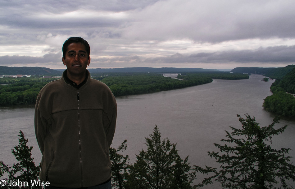
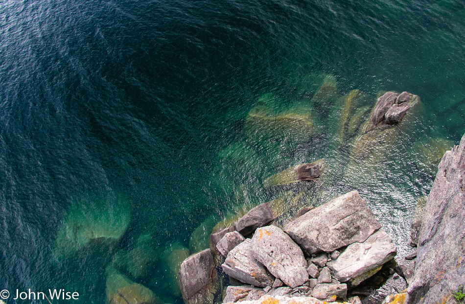
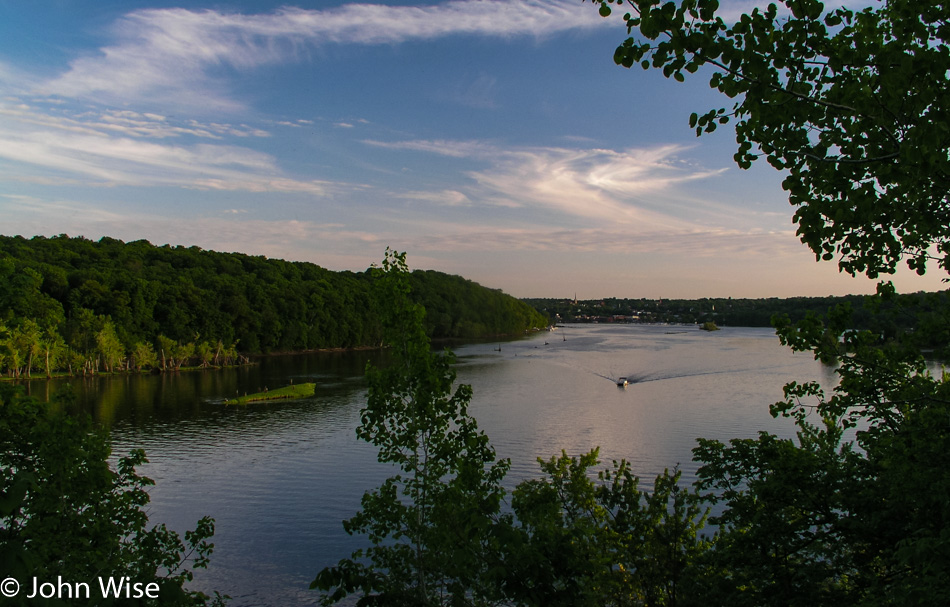
At the top of our short hike is Fire Point, a lookout over the Mississippi River. Hey, was that the sun? Get real.

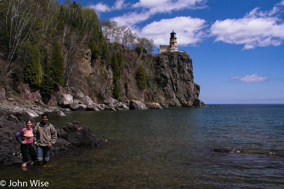
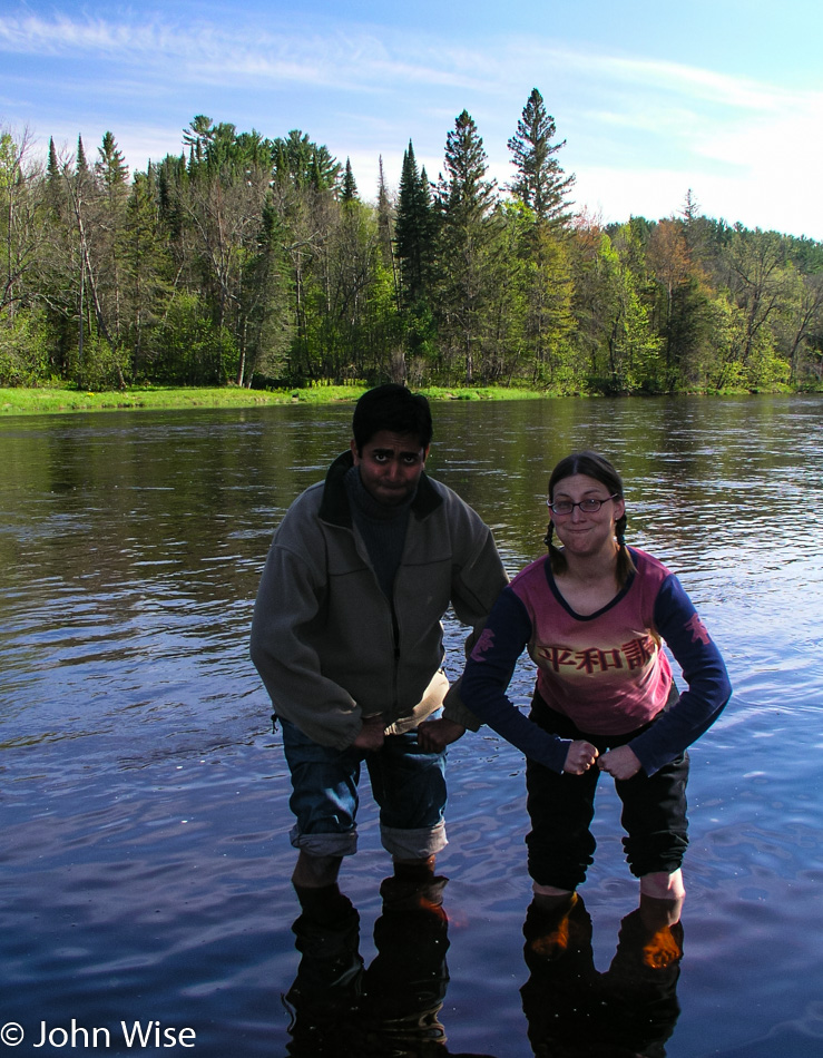
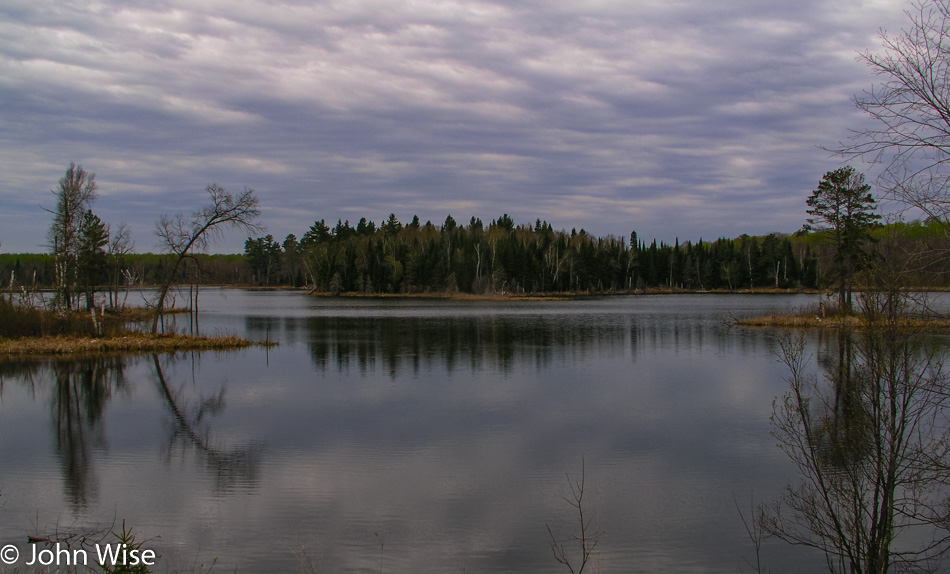
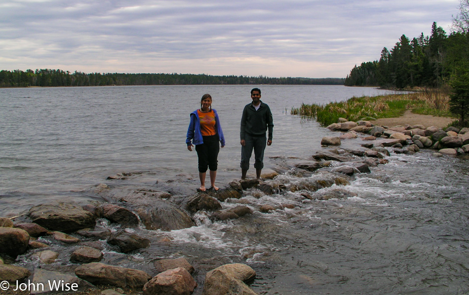
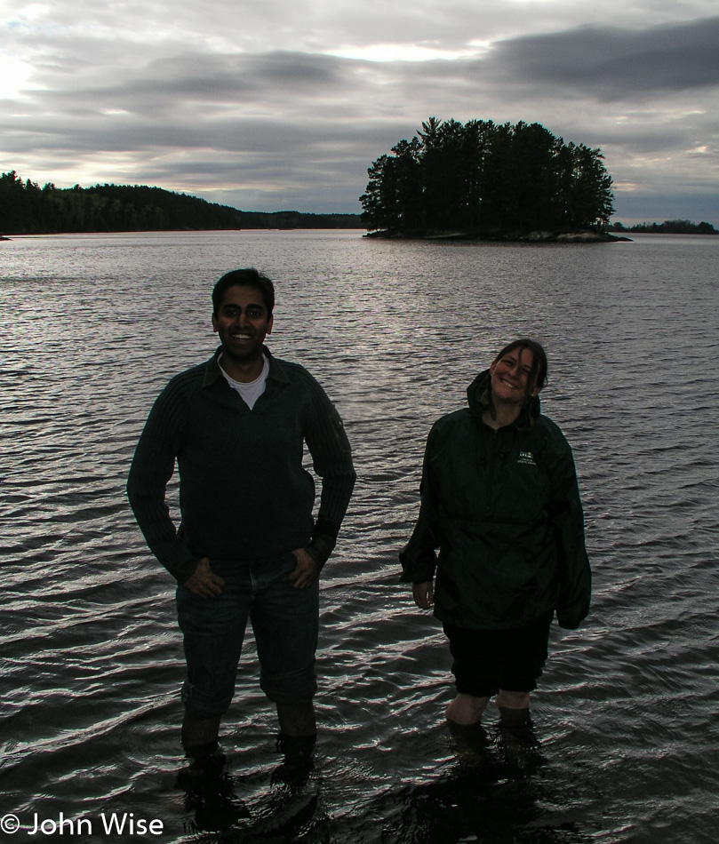
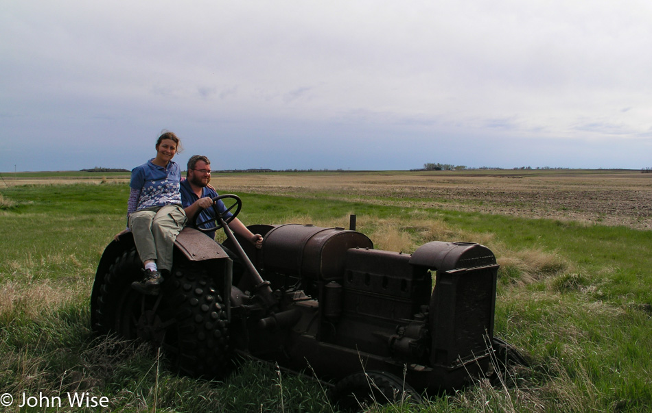
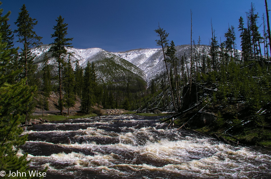
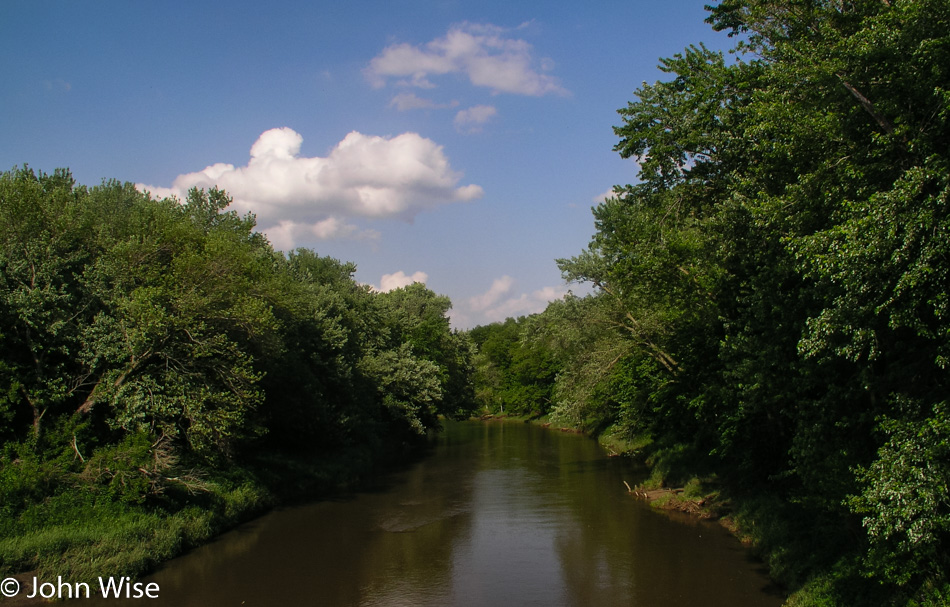
Back on the other side of the small town of Marquette is a boat launch, another one of “those” photos, you know, standing in the water. Without speed boats, crowds, police helicopters, and other distractions, the river looks to us the way it must have looked to the Native Americans and early white settlers a couple of centuries ago. We are sad to leave the great Mississippi River.

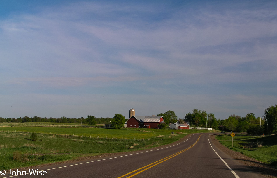
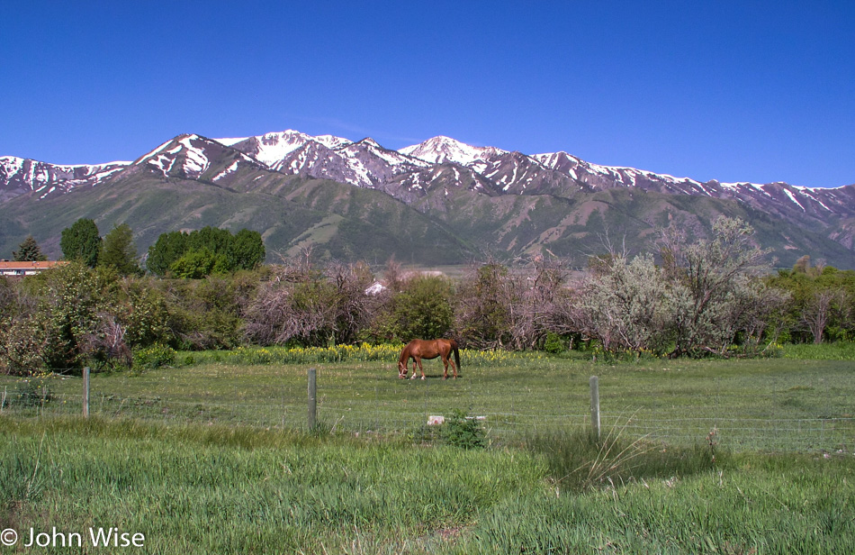
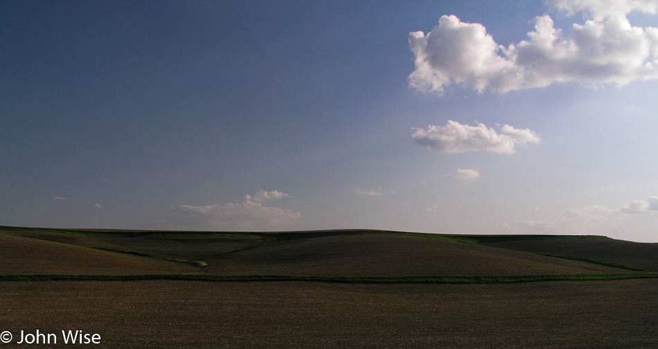
Before we’d ever visited the Great Plains, I’d heard about the vast wheat and cornfields that stretch across the expanse of flat land called the heartland of America. Images of verdant rolling hills with an abundance of rivers, sporadic trees, wildflowers, prairies, and meadows were never a part of that equation. Today’s trip to Iowa is an eye-opener. The only time we hear of Iowa in the western United States is when the annual tornado tears out another trailer park. During our brief time in Iowa, we never see even one mobile home park but we see a ton of lush beauty.

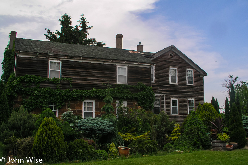
The homes we do see are immaculate. We had noticed a phenomenon while in Wisconsin that has roots in Iowa, too; maybe it’s a Midwest characteristic. Their yards have the cleanest, most well-groomed lawns the three of us have ever laid eyes on. The nation’s golf course manicurists must all hail from the Midwest. In the middle of the afternoon, you can see maybe one in four homeowners out behind the lawnmower but more probably riding the lawnmower.

Entering the small village of Vinton, we drive into classic Americana. This is the place I would like to call home. Main Street is wide, with broad sidewalks and storefronts sitting below the two-story buildings that line the street. Garish neon signs are not seen, and the street lamps are old-fashioned globes that leave a nicer impression than a glowing Budweiser sign. The town is clean and quiet, seemingly in better financial shape than larger cities like Superior in Wisconsin. I wish the town officials luck in maintaining the character of such a fine little place.

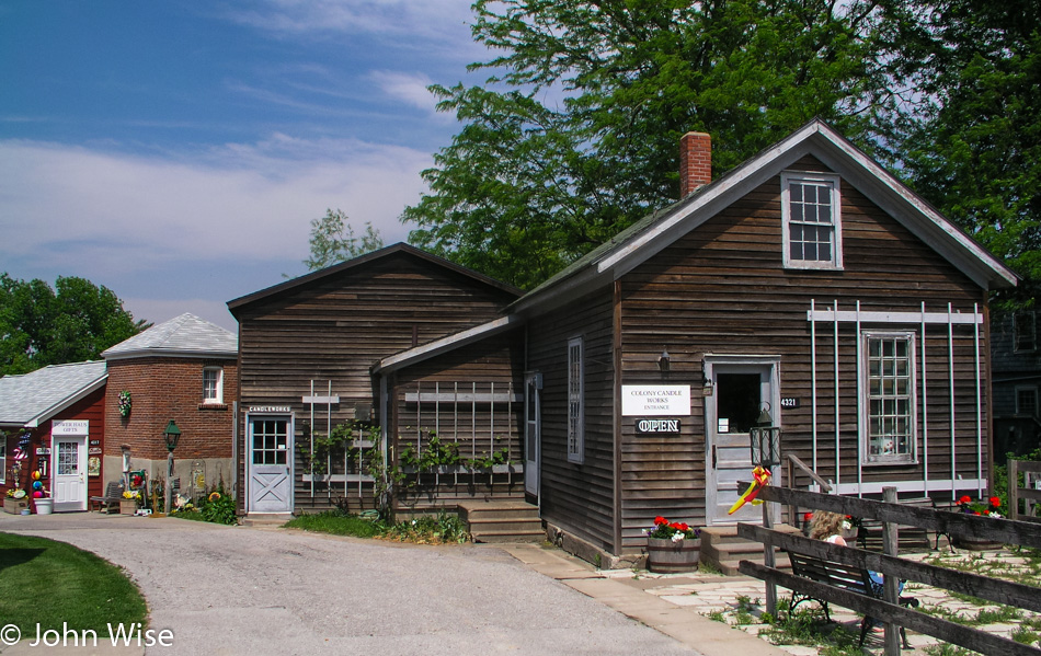
South of Vinton, we are entering the Amana Colonies and right away wish we had more time to stroll the streets and historic buildings on this gorgeous spring day. We pass through West Amana for the main Amana Colony. You step out of the car and into a view of America not seen for one hundred years. The village is superbly maintained, its German heritage fully intact.

If for no other reason than the historic appeal of each and every building, even non-shoppers such as myself must be drawn into the stores. Stepping out of the bakery, we notice that the humidity is rising rapidly, quite high, really. To the north from where we have come from, dark clouds are amassing. A shop owner tells us what radio station to tune into when we return to the car so we can hear any weather alerts if they are issued.

We continue our walk amongst the historic buildings stopping occasionally on the lookout for gifts for friends and family back in Phoenix. Caroline and Jay both find candles for themselves, and I pick up two pounds of caramels to split between three or four friends. The old German architecture is complemented by well-tended gardens. Houses are made of stone, brick, and bare wood planks. Gardens are a combination of a wide variety of shrubs and a terrific assortment of the most colorful flowers.

The humidity is bearing down, and thunder is heard in the distance. With a bit of rain starting to fall, we leave the Amana Colonies and look back once we are on the road to see a blackening sky and remember the radio station. 105.7 KOKZ comes in with the announcer telling of tornado warnings in effect for three counties northeast of Amana or the area we just drove through.

In order to put distance between us and any tornado, we turn onto Interstate 80 heading west. For more than 100 miles, we cruise along at 80 mph, looking at blue skies, happy to miss a tornado but unhappy to have missed the intimacy of the countryside drive. Exit 93 at Stuart will take us back to the smaller road we should have stayed on had it not been for the storms.

Just 10 minutes after leaving the Interstate with the hope of making a solid disconnect with the speed of the highway, I turn off at Nations Bridge Park, following a small dirt road to a hilltop. On said hilltop sits a two-story viewing platform that only looks in one direction and that is through a heavy mesh fence that stops people from crawling out on the roof of the building. Not exactly memorable, but nice.

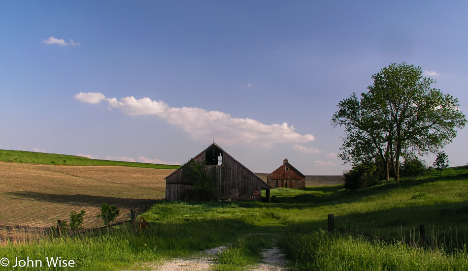
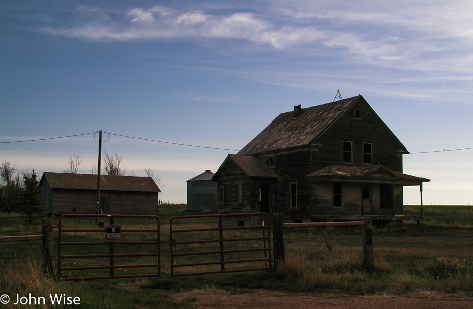
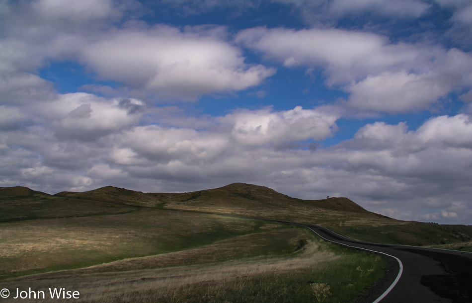
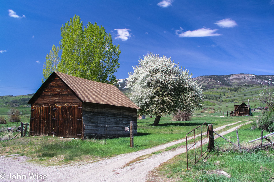
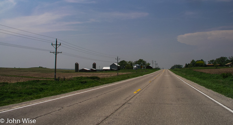
Another river, another house, more rolling hills, a windblown field of grass, the sun drawing lower in the sky. A large farm, a solitary tree, two barns on the side of a hill, the sun now hiding behind a cloud. The pace is slow and the road long; not a lot to distract the senses of someone needing constant stimulation, but this is just fine for me today.

Entering Kimballton an odd sight of Hans Christian Andersen’s Little Mermaid perched on a dry fountain. At 6:15 p.m., the town is closed for the evening, and short of rolling up the sidewalks, this place is empty. The same goes for Elk Horn, where we’ve come to see a famous Danish windmill, everything is closed.

The windmill came to America in early 1976 to help us celebrate our Bicentennial and possibly help maintain a small town, a town with one of the largest populations of Danes, too. Built-in 1848 in Norre Snede, Denmark, the windmill was disassembled and shipped to America. With the help of 300 volunteers, the iconic attraction was reassembled to become the only authentic Danish-built windmill in America.

Heading west as our destination is still way out in the distance.

Jay Patel with Caroline and John Wise entering Nebraska

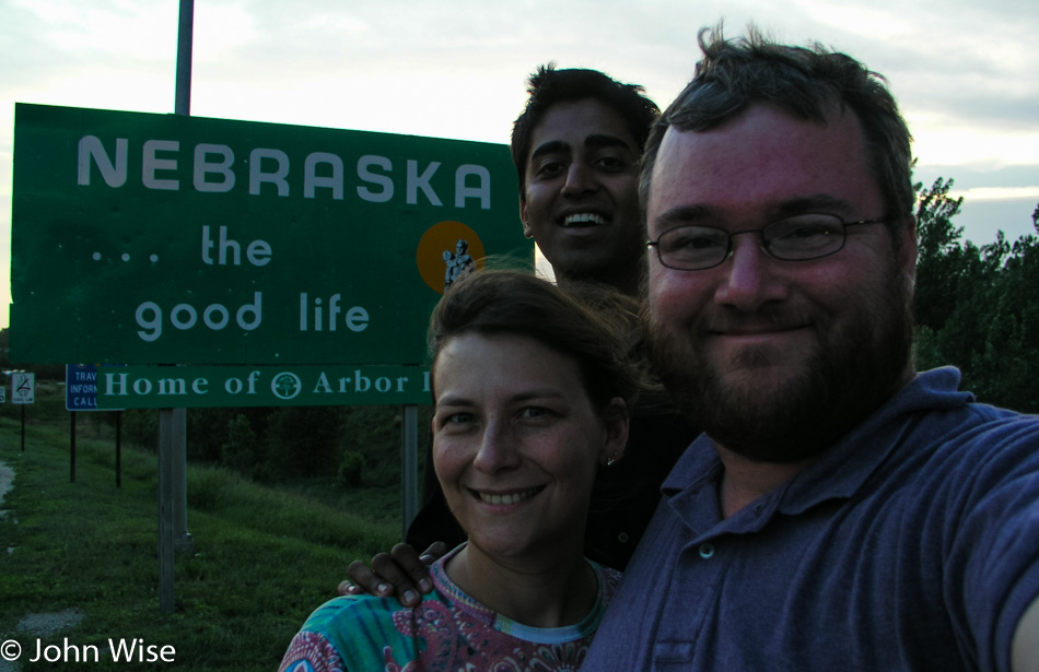
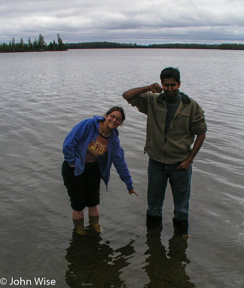
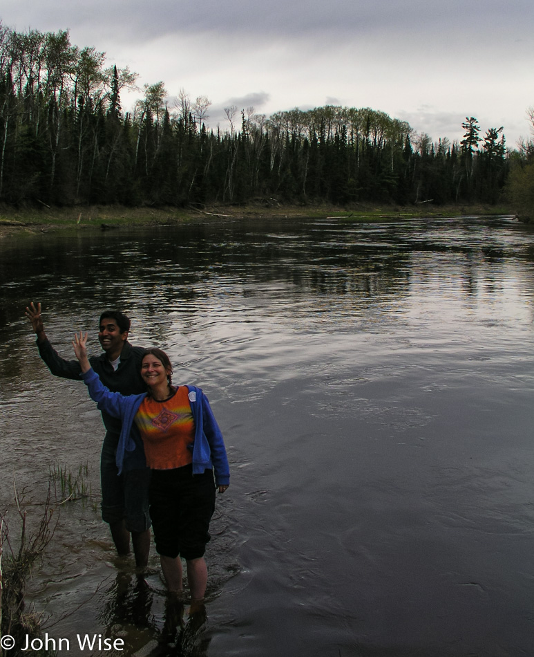
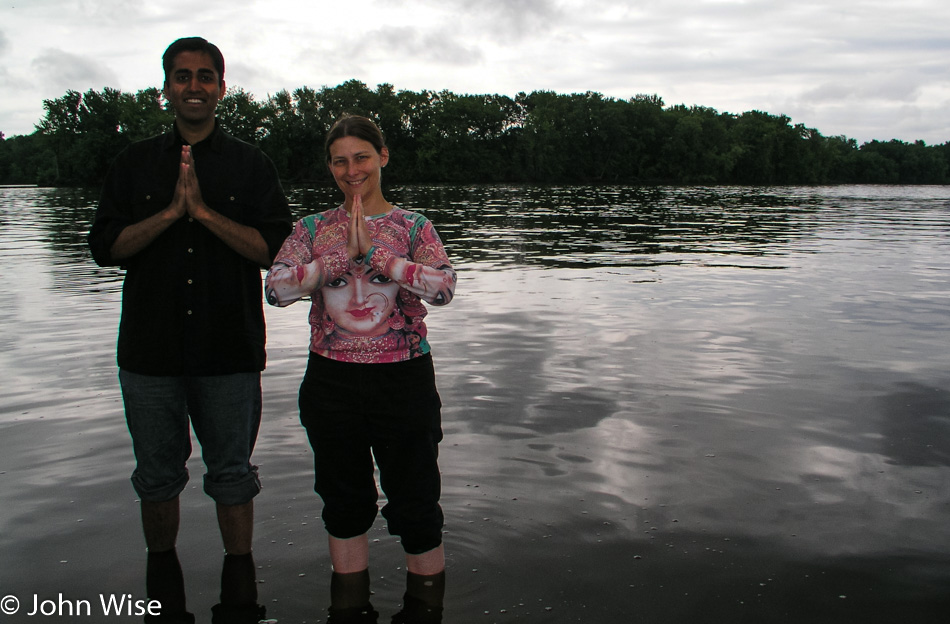
It’s toward the end of sunset when we reach the Nebraska State Line and then speed over the bridge to dip feet into the Missouri River.

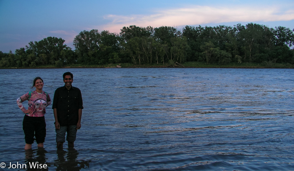
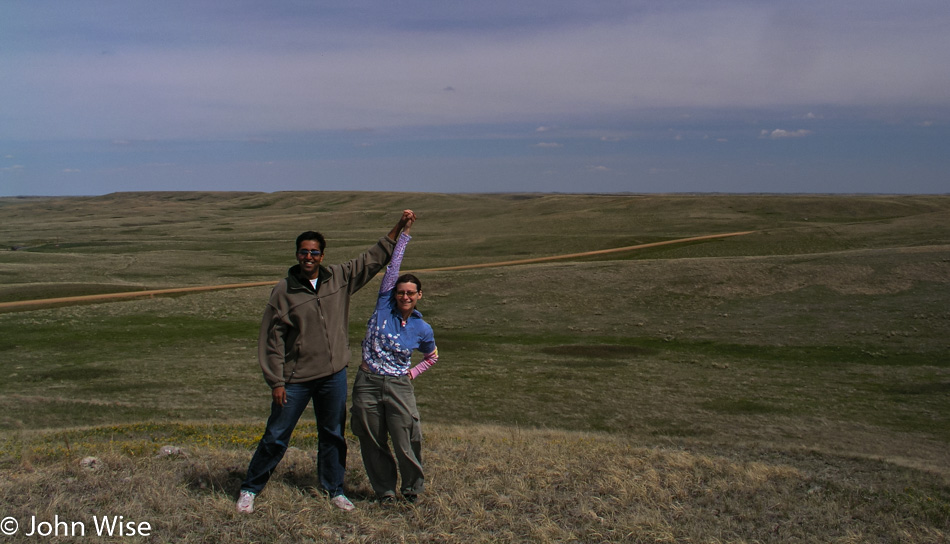
Now in Nebraska, Caroline and Jay are knee-deep in the Missouri River. This has been a great day for stepping into iconic waterways. After only 15 minutes in Nebraska, we are back in Iowa as that’s just the way the road works out this way.

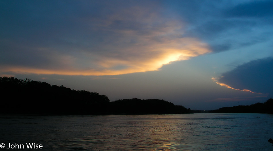
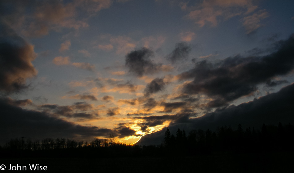
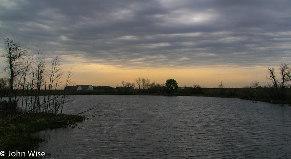
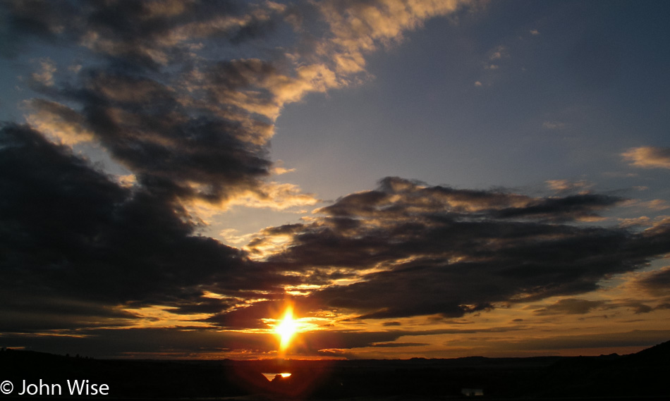
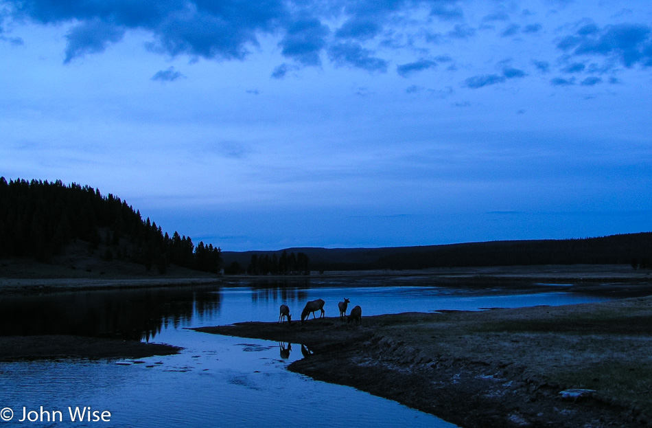
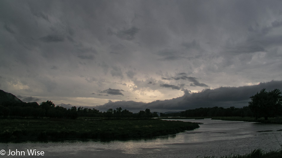
With daylight fading and night fast approaching, we enter the De Soto National Wildlife Refuge to watch the rest of the sun slip under the horizon. The darkening blue sky hanging over this channel of the Missouri River flows past the border of tall grass meadows framed by forest. A small lake is half encircled with cattails, and a pond reflects some of the last light in front of silhouetted trees. At the shore of the Missouri is a high cloud, grabbing hold of the remaining light; the sun will scatter over the river, reflecting golden light in the waters before us. Our day becomes complete with this grand show between water, sky, and sun.

At 9:00 p.m., we finally leave the refuge and head into Council Bluffs, Iowa to hunt for pizza. The best and only thing we can find is Godfathers. Forty-five minutes later, we are on Interstate 29, south of Rockport, Missouri. With some minor difficulty in such a small town, we finally found our hotel. The hotel isn’t really in Rockport; it is the next exit after the turn-off for Rockport. It’s 11:30 p.m. as we lay down.

In America with Jay Patel – Day 7

Sunrise in Minnesota

We were quickly off to sleep last night, exhausted as usual. Caroline was the first to wake up and jump in the shower. Exiting the bathroom she was wondering why I had not stirred an inch. It was then in the still-dark room that she saw that it was midnight, and she’d been asleep less than an hour when she headed to the shower to get ready for the new day. Hearing her story, I couldn’t help but laugh, and that got her to laugh at the situation, too. All the same, we were still up early and ready to go before 6:00 a.m.

It was our intention to visit Lake Kabetogama in more detail, but this morning, as we drove past resorts, cabins, and private lake access, we could not find any public access. We can see the lake, but we simply can’t reach it. This turns out to have worked in our favor.

Timber Wolf in the Lake Kabetogama area of Minnesota

We finally found a dirt road that looked promising for leading us to Lake Kabetogama, so we turned down it. Fairly quickly and right next to the road, we spot some deer. We stop to take their photos before continuing to drive down the dusty road. I see something to my left, but it’s not a deer. Maybe it’s a coyote? Wrong, it’s too big. Could it be a dog? I try offering it some food thrown from the window, figuring if it’s a dog, it’ll come running. It has no interest. I’m starting to think it’s a wolf.

At first, the wolf stood there at the dark edge of the forest but soon approached for a closer look at us stepping out on an overhanging cliff. It seems we are both going in the same direction as the wolf continues its journey, tracing up the road just inside the tree line. We inch along with the wolf as it occasionally turns to inspect us. The wolf comes back out of the woods, stepping onto a rock for a picture-perfect pose with its eyes glowing in the early morning light. She takes a final look over her shoulder at us and turns to disappear into the forest.

I’m awestruck. If the camera hadn’t captured those moments I would place the story with those old fish stories that tell of having caught a fish that was this big. The entire time, we had our windows wide open, hoping to hear the slightest sound the wolf might make. We looked for its pack but only saw the lone individual.

Some locals at the main junction gas station and convenience store confirm just how lucky we are. A Bureau of Land Management worker assures us that we likely did not see a wolf and that they are more afraid of us than we are of them. I try to reassure her we are not nervous or fearful of an encounter but that we think we really did see a wolf. She relates a story of her time working in this part of Minnesota and that we might, on the rarest of occasions, capture a fleeting glimpse of a wolf in the distance as it crosses a road, but that is the best-case scenario. Furthermore, it is too early in the season this far south.

To confirm to her that we have not seen a ghost or are confusing a wolf with a stray dog or coyote, I show her my series of photos. Her astonishment was obvious as she let fall from her lips: “That’s a timber wolf!”

Caroline Wise riding a 10 foot fish in Kabetogama Lake Minnesota

A ten-foot fish, a Walleye, to be precise, is mounted eight feet over the ground and equipped with a small set of stairs and a sort of saddle to allow those people looking for a truly cheesy photo to climb up and embarrass themselves. Caroline sprints to mount the Walleye first, followed by Jay, who fashions himself to be at the rodeo and then Caroline and I both get on for a tender moment on our ten-foot fish.

Our next stop was the Woodenfrog Campground. A trail leads to some picnic tables and a small peninsula. Caroline tries to warn Jay of the approaching bear trap, but Jay blindly steps forward directly into a pit of animal diarrhea. We’re not talking a small spot but nearly the entire sole of his shoe is dripping with the goo working its way up the side of his nice white shoes. Green doody jumped halfway to the knee of his pants leg.

We’re not 10 minutes down the road when I slam on the breaks and pull a quick U-turn. A bald eagle is perched low in a tree next to the road, and a juvenile bald eagle is sitting higher in another tree nearby but is too far away for the capabilities of our rather primitive camera. The first eagle didn’t waste much time hanging out and was soon gone.

We find the Little Fork River but nowhere to jump in. The Soudan Mine State Park, where we would have enjoyed taking that 2,400-foot descent into the mine, doesn’t open again until Memorial Day, but the gift shop is open year-round. The gift shop is open; who needs a souvenir from a place they can’t visit?

Caroline Wise and Jay Patel in at Bear Head Lake State Park in Minnesota

At the Bear Head Lake State Park, we check things out just to see what’s here. The attendants direct us to a trail that takes us lakeside, where we might see a pair of nesting eagles. Heck, we can never see too many eagles and were down the trail with binoculars ready to scope out the happy couple. Nothing, not a feather; we scan the horizon with nothing found. We can see neither the nest nor signs of the eagles.

Well, then we’ll do the next best thing: off with shoes and socks, roll up the pants, and jump into the lake. Wait, Jay has forgotten to roll up his pants, oh, now we get it: Jay is attempting to purge the remaining crusting green stuff off his pants leg. With a stone in hand, he scrubs away while Caroline moves upstream, trying to spot those elusive eagles.

Jay Patel with Caroline and John Wise at Split Rock Lighthouse on Lake Superior in Minnesota

We drive through Ely, over the Kawishiwi Bridge, through Isabella, past a moose, all the way to Finland before we start to see blue skies. And now Lake Superior sits before us looking to be an ocean compared to the lakes and ponds we’ve been visiting the two previous days. At Palisade Head, the view stretches from north to south, with Michigan off in the distance across the lake.

Split Rock Lighthouse on Lake Superior in Minnesota

Here we are at Split Rock Lighthouse State Park with a sky that has continued to clear up, making for ever more incredible views. Entering the visitors center to pay our admission the three of us are giddy that the day is turning out so beautiful and that we actually made it all the way to Lake Superior on our trip across this part of America.

Jay Patel at Split Rock Lighthouse on Lake Superior in Minnesota

For Jay, this is his first lighthouse; for Caroline and me, this is the first on a great lake. The grounds are immaculate; the lighthouse is gleaming as if it were still new. Inside the lighthouse, a freshly painted black spiral staircase takes us upstairs past windows full of ladybugs. No one else is in the lighthouse as we reach the Fresnel lens.

Split Rock Lighthouse on Lake Superior in Minnesota

Back downstairs in the entryway, a custodian in period dress waits by an iron stove to answer any questions we might have. Informatively, he tells us that the stove is a recent addition because when the lighthouse was in use, had there been a heater inside the structure, it would have fogged up the lenses, diminishing the effectiveness of the light. Yikes, that must have made for one cold lighthouse during those January blizzards blowing in from Canada. On second thought, why would a lighthouse need to be active when the lake is frozen over?

Lake Superior in Minnesota

Jay crawls on his belly to the edge of the cliff we’ve been standing back from. He has the camera with its strap wrapped tightly around his wrist, with me holding his feet, he inches a little further and then a little further, and finally, he takes a photo looking straight down. Down there, you can look into the crystal clear green waters of the lake. A bit further down the trail, we come upon a mighty long set of stairs that go down to the lake. This section should be a must-see for all visitors to the park, as the views are spectacular. By this time, you should know why we had to get to the lakeshore, off with the shoes and socks, roll up the pants, and jump in; it’s Lake Superior.

Caroline Wise and Jay Patel at Split Rock Lighthouse on Lake Superior in Minnesota

The walk back up the stairs is a thigh master of a workout. I’m not alone in the pain of burning leg muscles as we get back to the top. Now, we can take the time to visit the living quarters with a person in period dress to introduce us to the old home. I’m more interested in snatching a sample of the beans and cornbread she has on the old stove, but she’s not entertaining my suggestions of sharing her grub.

Jay Patel and Caroline Wise at Gooseberry Falls in Minnesota

Based on my research prior to leaving Phoenix, Gooseberry Falls, south of the lighthouse, was a must-see. I had seen photos of the falls online prior to leaving, and they were undoubtedly beautiful, but they did not do justice to what we were about to see with our own eyes. Due to winter runoff, the water flow was a magnitude greater than that of the photos I’d seen before, making the falls all the more powerful, rushing in gold and white over the ledge. It is the tannins from the trees and plants upstream that color these waters to a golden brown, as we’d seen at Big Falls Campground.

Gooseberry Falls in Minnesota

The middle falls are the most accessible of the three that comprise the Gooseberries. At the middle falls is a path leading to the riverside and then a ledge that allows us to walk up to the spilling edge, almost standing beneath them. Where the path led down to the riverside we found a spot slow-moving and shallow enough for Caroline and Jay to safely step into Gooseberry River. The upper falls have to be seen from a distance but are no less captivating, and the lower falls went unseen by us as time restrictions only allow so much time at any one location. A trail that loops down past the lower falls and over the river to the other side of the middle falls and then up and over the upper falls would surely be a walking tour that everyone with enough time at the park should make.

Jay Patel with Caroline and John Wise in Wisconsin

Our encounter with Minnesota has easily laid the groundwork for a return visit. (Boy, that sounds redundant by now.) Although, instead of driving next time, I would consider the following itinerary. Fly into Fargo, North Dakota, and drive to Lake Itasca to spend a day or two camping near the Mississippi headwaters and biking the nature trail. Overnight at Big Falls on the Big Fork and then on to Voyageurs and two or three days canoeing Lake Kabetogama before heading to the shore of Lake Superior. We would make the trip north up the shore to Grand Portage before leisurely driving back down the coast with an overnight camp at Gooseberry Falls. Finally, from Duluth, I would drive inland to Jacobson, picking up the Great River Road to trace the Mississippi River down to Minneapolis for the flight home.

Not much further down the road today, we pass through Duluth and into a state of shock. We are encountering Superior, Wisconsin, which strikes us like a trainwreck. Salt Lake City was the last ‘major’ city we passed through. For days, we’ve been in the countryside, away from signs of industry and crowded cities. Superior is one of those mythic rust belt towns that are dilapidated and crumbling. From the first moments of being thrust into ugly, we need to get out of here. Looking down the main street, it’s easy to see the former glory of this once prosperous community, but with manufacturing job losses the façade is now well worn with many a shop for sale or lease.

Jay Patel in Wisconsin

We stop for gas at a Holiday filling station where at least the word holiday evokes a sense of happiness. Turns out that I’ll soon pay for my negative impression of Wisconsin. Outside of Superior, the landscape opens up to our relief; yards are dotted with dandelions, and my shock begins to subside. Maybe it was my hurry to get as far away from Superior as fast as I could, although I swore it was because I had just passed another car, which I had.

Getting a ticket in Wisconsin

A Wisconsin State Trooper, the single most unfriendly police officer I have ever dealt with, and I grew up in Los Angeles, makes a U-turn to come up behind our already stopped car. I saw the disco lights go on before he passed us; I knew I was close to 80 mph or so, as I said, I seriously had just finished passing another car.

The trooper approaches our red race car with a scowl asking what we are doing in Wisconsin, if we are visiting family or have family in Wisconsin. We explain we are on a 10-day cross-country drive to visit a few national parks and riverways for a short vacation. The officer insisted that my speed was too fast even if I was passing another vehicle and wrote me a citation. Being an out-of-state driver, I’ll be allowed to pay the fine with my Visa or MasterCard immediately: the $205 fine! I wasn’t aggressive, I wasn’t mad, I knew I was over the speed limit, I pulled over without him having to drive another mile and direct me to pull over, my window was down, and driver’s license and rental agreement in hand. I asked the officer if he couldn’t lower the speed he clocked to give me some break on the fine amount, “No, I couldn’t do that. The state legislature determines the laws; I enforce them. That’s my job.”

Along the St. Croix National Scenic Riverway in Wisconsin

Ok, get me out of Wisconsin; I don’t want to spend one more penny in a state that employs such unsympathetic, surly policemen who, in this instance, was our first encounter with whatever hospitality that Wisconsin might have to offer. I’m trying to let go of the seething anger I’m now feeling for this guy who pulls me over in his $47,000 SUV. I’m bitter, and it will be another half hour before I calm down enough to start enjoying the road again.

Jay Patel and Caroline Wise in the St. Croix National Scenic Riverway in Wisconsin

The sign for the St. Croix National Scenic Riverway brings a smile back to my face. Caroline and Jay muscle their way into the St. Croix and, with a superb show of strength, manage to stake a claim in the river, displacing the weaker water with their brute force. The road we’re on does a good job of hugging the river on our trip south. A few miles after where the Yellow River merged its waters with the St. Croix, we turned onto Route 79, a rustic road.

Back roads of Wisconsin

Not much wider than a single lane, this road cuts a stunning path through the forest. The narrowness of the road creates a tunnel-like atmosphere, with the trees almost joining overhead. Crisp green new growth in the trees and on the ground lends dramatic shadows over the road and into the car. This is the kind of road I could spend a lifetime driving, or better yet; it would be amazing if our great country would create a national bike path that would allow for the crossing of America without ever having to deal with competing automobiles. Without a map covering these small details, we only drive a couple of miles before turning around to reconnect with our road south.

Rural roads in Wisconsin

As the road moves away from the river, farmland stretches away from the road. Barns and elevators are common and frequent sights on this gently rolling land. The road swerves back to the river and the heavier tree line. We reach St. Croix Falls late in the day, accompanied by all of the anticipation of checking out one more waterfall.

Jay Patel with Caroline and John Wise entering Minnesota

At Osceola, we deviate from the plan and cross the St. Croix as our map shows the other road stays closer to the river. We are back in Minnesota with no discernable characteristics between one state and the other. A half-hour later, we returned to Wisconsin. Through every town we’ve passed, there have been plenty of lilacs blooming in purple, pink, and white, and they smell, oh, so sweet.

Prescott, Wisconsin, is where the confluence of the St. Croix and Mississippi has come to form an incredible breadth of the world’s second-largest river, the Mississippi. It is fast approaching dusk when we arrive, and are unable to find a good vantage point to see where these two become one. A local points us to a boat dock, suggesting it’s the best we’re going to find. A barge of enormous size is pulling up the Mississippi, taking 10 minutes just to pass this small corner, and a couple of fishermen float slowly back to the dock. Dusk will take its time giving way to darkness this evening.

St. Croix River in Minnesota

More than thirty minutes after leaving Prescott and the St. Croix behind us, the sky holds a faint blue light and an even fainter orange glow of the sun. An early moon set over the Mississippi, which has become Lake Pepin at this intersection. Lake Pepin and the Mississippi River Valley are artifacts formed when the large glacial Lake Agassiz near the intersection of Minnesota with North and South Dakota started flowing about 12,000 years ago. As those waters receded 9,500 years ago, sand, which had been deposited at the Chippewa River delta where it joined the Mississippi, created a dam, and Lake Pepin was born.

We still had two more hours to drive tonight before reaching La Crosse, Wisconsin. Approaching Lake Superior earlier in the day was our halfway point, as from there, we would be heading south before turning west on our way home. The river valley has been so enchanting it’s both a shame to drive it at night and a shame not to take it to its southern terminus. Even in the dark of night, we see enough details of the small towns to be aware of how much grandeur we are missing by having to press on. On the other hand, we are also aware of how lucky we are to witness with our own eyes so much of the land we’ve already been able to lock into our memories.

Near the confluence of the St Croix River and the Mississippi River near Prescott, Wisconsin

Reaching La Crosse and a gas station at 11:00 p.m. we refill the ice chests as we have done every other night during the trip. $23 puts 11 gallons of gas in the tank. We have driven 3,849 miles in six and a half days for an average of 592 miles per day. Yes, we have many a friend and family member who think it crazy to endure so much driving in the name of vacation and relaxation. As we look at the sum of experiences, sites, and sensations, we, too think it crazy, crazy that others wouldn’t want to witness so much. For Caroline and me, this is like driving around your neighborhood to learn of the amenities such as parks, libraries, shopping, trails, and other services that bring comfort to someone as they learn to live in their new surroundings. We are driving around our neighborhood, not constrained by the idea of town, city, or state. Our town stretches thousands of miles in all directions because we are free to live in America. With that in mind, it makes sense to us to know the country we are living in.

In America with Jay Patel – Day 6

Wednesday, we’re up early and moving by 6:30 a.m. We are looking for Blanchard, where the world’s tallest TV tower, at a height of 2,063 feet, stands sentry over farms stretching in all directions. Two towers in front of us are candidates, and we head in their general direction. No signs point to the actual tower, and we can’t find a road that looks to go to the base of the closest tower. We’re not even sure if the tower closest to us is the tallest tower, as it would make sense that the tower further away that looks to be the same height should be the taller of the two. We move on.

North Dakota was an unexpectedly interesting state whose reputation is unfounded, as far as I’m concerned. I think many a state suffers poor publicity due to the interstate system that has sped travel throughout our land. As travelers have become accustomed to a harried life, they demand the same of their travels. It is this speed of convenience, though, which takes them down main highways that are punctuated with the same businesses from one exit to the next. When I find myself on these interstates, I notice the bombardment of billboards to be the first major annoyance. Second is the over-proliferation of signs pointing the traveler to various services: rest stops, lodgings, restaurants, clean restrooms, construction zones, roads that are sponsored by such and such company or family, signs dedicating roads to various causes, groups, or loved ones, and signs warning of radar, animals, workers, storms, rocks, traffic congestion, passing rules, blowing dust, and let’s not forget prisons with signs telling us not to pick up hitchhikers. Thirdly, the country looks the same if every few miles, we see another Denny’s, Chevron, Red Roof Inn, McDonald’s, Dairy Queen, Motel 6, and the famous generic truck stop.

All across America, the main interstate is abuzz with information that never allows the inner explorer to see the countryside. It could be this information overload that turned Americans against the long road trip across their great country. Out on country roads, the slower roads, the roads that take you on a journey and not just a destination, is where we become familiar with the sights and sounds that give a unique character to each of these lower 48 states. North Dakota is the 44th state we’ve visited; this will not be our only visit. A day was not enough to become as familiar as we might like with North Dakota; we only scratched the surface.

Minnesota is entered while crossing the Red River; our luck has it that the “Welcome to Minnesota” sign is a short bit past the river on dry ground. Not a spot was found to snap a photo of Caroline in the water; the banks of the Red River were muddy and steep, so we might have to wait for another trip to Minnesota to find a better location to step into the muddy waters of the Red.

The change in geography is astounding as Minnesota lives up to its motto of being the Land of 10,000 Lakes. Skies began the day overcast and stayed this way for the remainder of the day. There were blue patches here and there that opened occasionally, but clouds and rain were nearly ever-present. The lakes and their frequency are also ever-present; we can’t turn a corner without another lake to our right, our left, or straight ahead.

Another landscape change made all the more dramatic was the contrast between yesterday’s wide openness and today’s sudden appearance of trees. Within but a few miles of crossing the border, the grasslands were gone and replaced by woodlands. Beaver dens and the sighting of beaver-gnawed tree trunks are easy to spot along the roadside. The small marshland areas opening to larger ponds and reflective lakes beg us to set out on a canoe and explore these beautiful waterways.

As much as we’d like to stop and see more of one or all of these wetlands, lakes, and ponds, we are on schedule to our destination this morning: Lake Itasca State Park. On our way to the fee station, we are excited about the prospect that we are about to see the headwaters of the Mississippi River. At the fee station, we get the news that the road that crosses within the boundary of the park to the north is under construction and closed to all through traffic. We stop at the visitor’s center to find our way.

Back on Highway 200, we are heading to another entrance. We cross the Mississippi River on the way in. The river narrows fast; at our first crossing, the river was about twenty-five feet across. A little further up the road, the river is only ten feet wide. The parking lot here is huge and can accommodate more than a hundred cars, but this early in the season, ours is the only car in the lot.

A well-marked trail leads in the direction of the place we are searching for, and within a few minutes, we are approaching a wooden post of some importance. It is proclaiming this to be the point of origin where the mighty Mississippi starts its flow of winding a path 2,552 miles long to the Gulf of Mexico. This trip wouldn’t be complete without Caroline crossing the Mississippi barefoot. While the water is cold, Jay is right there with her.

From Lake Itasca to Bemidji and further on to Grand Rapids, we follow the Great River Road. The Great River Road is a 2,069-mile-long Scenic Byway passing through five states on its way south; today, we will attempt to get lost along a 117-mile stretch. Due to construction and, at times, our poor map not showing the required level of detail, we are finding ourselves quite literally nearly lost, but not quite fully lost. Somehow, just when we think we should have gone right when we went left, and we are certain the dirt road can’t be correct, we come out of the woods and find we are right where we want to be. We needed three and a half hours to drive the 117 miles but have had many opportunities to cross the Mississippi and marvel at how fast this river picks up tributaries and starts becoming the massive river it is known as.

On the outskirts of Bemidji, nearing noon, Jay once again has a phone signal which is the first time since leaving Salt Lake City in Utah. We have to back up and park to maintain a connection so he can check voice mail and call Rinku, the girl who’s taking care of our cats and plants while we are out here in the middle of America. The cats are fine, but Rinku tells us that no one in Phoenix understands why we’ve not called already; they were getting nervous. Of course, I had forewarned everyone that we would probably be outside cell coverage until we were near Fargo or St. Paul. Obviously, no one believed me.

Outside of Pennington (population 52) is one of the slices of Americana that only happens right here on these shores: it’s the Big Fish Supper Club. And what better form for the building of the Big Fish Supper Club to have than that of a Big Fish? We would have eaten here for the novelty of being in the belly of the Big Fish but would have to satisfy ourselves by escaping its gaping jaws as the Big Fish wasn’t open yet.

For the next hour, we listened to frogs along the roadside, passed more beaver dens, tried to figure out how to pronounce Lake Winnibigoshish, and admired the flowers along with lake after lake. Turning right onto Little Bowstring Forest Road, a one-lane dirt path through the forest, up and downhill we wind our way through the forest until we come to a lake. It’s quiet except for the wind rustling the tops of the trees and the slight sound of the lake lapping the shore.

We spend time skipping stones over the water and looking at the trees and rippling water. A canoe comes to mind again. After our arms tire of skipping stones, we take a walk in the forest to inspect its carpet of mosses, leaves, bark, and plants while trying to hold fast to the memories that might help paint our future dreams.

We backtracked to a smaller lake that had been passed on our way in, its waters mirroring the surrounding forest. The woods here are lush. Saplings are pushing their way up through a thicket of other new growth and flowers. The early blossoms deliver their sweet smell to hungry noses.

Is this diversity only a small sampling of the abundance of Minnesota’s forest, or have we just been lucky to fall into its more beautiful corner? And what of the coming weeks, as spring kicks into summer, will there be an explosion of colorful growth? Our short time in Minnesota will have us leaving the state with more questions than answers but will also leave us with a great desire to return to find answers to our curiosity. Reading this last line again has me thinking I’ve written just that about every state Caroline and I have visited.

On the road again, we cross the Laurentian Divide, where from this point, the waters that flow on the left will head to the Gulf of Mexico, while to the right, the waters flow to Hudson Bay. Highway 38 takes us past Caribou Lake, one of more than 48 lakes that are here in the Marcell Township. In Marcell, we stop to take a second look at the Tender Tourist Trap, a flower shop that’s sort of an oasis inside a bigger oasis.

The Big Fork River is on the northern end of Highway 38, a slow, medium-sized river cutting through the forest. We stop at the Bill Counter Landing with the intent of stepping into the dark waters of the Big Fork but find the drop-off too steep to safely step in. At the Gronwoldt Landing, conditions are better but still tricky as Caroline and Jay have to step out onto a narrow gravel bar before the riverbed drops off. Wildflowers bloom under the gray sky along the rustic trail that brought us down to the river, a light rain has also begun to fall.

By the time we get to the Big Falls Campground near its namesake, the rain is coming down harder. Lucky for us, it’s soon letting up, allowing us to grab a better look while walking along the falls. Looking into the rushing cascade tumbling over boulders, the dark golden brown color of their tannin-stained waters rushes by just inches from where we stand. Again, we add to our notes to return to this spot to camp someday, as it is now in our top 10 coolest campground sites.

The Rat Root River is the last river we stop at before entering Voyageurs National Park. We have headed to the Ash River Section, hoping to go on a nature hike before dark. Unfortunately, the Visitors Center is closed, but a path leading to the river and Lake Kabetogama looks inviting, so we make our way to the nearest shoreline to consider dipping a toe or two in.

The first short segment of the path takes us to an overlook of the lake. We return a short distance to join the longer main trail. What starts as a well-marked walk quickly dissolves into a faint uncertainty. The area here along the lakeside is gorgeous with colorful foliage, gnarled tissue-like mushrooms, and even the sun makes an appearance. Hiking past fungi, fallen trees, saplings, mosses, and – a road? When we checked the map, we saw no hint of a road; well, we are all pretty sure we didn’t see a road bisecting the trail. Rather than chance taking a wrong turn just before dark, we turn back to return to the car. It’s at these moments where the Park Service would benefit the public by receiving better funding to deal with late arrivals to the National Parks.

With another moment of blue sky and a little sun lighting the way, Rainy Lake was our next stop.

Caroline’s brain fell out of her head at some point on the trail; lucky for her, Jay found it, and being a vegetarian and all, he gave it back.

Tonight we have a date. While making reservations for the various motels, hotels, and inns we would be staying at, I spoke with Vijay at the Budget Host Inn of International Falls. I recognized the accent of the voice on the other end of the phone, and I asked if he was Gujarati. Gujarat is a northwest state in India, which is also where Jay is from. Sure enough, Vijay is Gujarati. I also asked Vijay if he would like us to bring any Indian groceries his way. Caroline and I stay at our fair share of Patel Motels across America, and one thing we’ve learned about these Indians far away from a major metropolitan area is that they have trouble getting access to Indian foods.

The night of our arrival, we are carrying 40 pounds of chapatti flour, vegetable, and mango pickles, which are both similar to a relish, papads, two packages of Indian tea, Parle G cookies, a few chakri which are a snack made of rice flour, chili powder, and cumin, and a package of bhel puri that is also a snack. Sadly, we couldn’t deliver Undiu, a popular spicy Gujarati vegetable dish that would have been tradeable for a free room. The Undiu wouldn’t have survived the six days it took us to get here.

For delivering the groceries, Vijay very graciously invited us in for a hot dinner. Vijay serves us Indian and Chinese food, and for the first time in nearly a week, we get to sit down and have dinner in an at-home setting.

Leaving this feast and walking back to our rooms Caroline, Jay, and I were struck by the luck we’ve had on this trip. We appreciate this moment as one of our great fortunes and will not soon forget the hospitality offered to us for the favor we delivered tonight.

Early to bed and early to rise. Caroline took this to an extreme tonight. She woke after hearing the alarm shake her from sleep and jumped into the shower. Quietly, she sifted through her clothes to find the day’s outfit, and shortly before waking me to do the same, she was overcome by a strange feeling. It seemed awfully dark outside. She checked the clock again – it was MIDNIGHT.

In America with Jay Patel – Day 5

Abandoned home in Montana

Well, we’re finally in North Dakota. I’ve been warned about this state: “It’s boring,” “there’s nothing to do,” and the ominous admonition of “You don’t want to go there.” I’d read in the state’s own visitor literature that it’s North Dakota’s black soil that makes the state special, not the most compelling reason for visiting a place. The movie Fargo didn’t add much to its appeal, either. One thing I’ve learned in visiting these forsaken places in years past is that Caroline and I always find something so endearing that we’re compelled to come back. I hope this isn’t the state to which we don’t want to come back.

The sun was up early, earlier than we were. An obligatory abandoned farmhouse sits alone, surrounded by fields freshly plowed, awaiting the first burst of new life to break ground. Checking into our motel last night, I learned of the Olsons and their world-famous gas station down the street in Sentinel Butte. Turns out Oprah Winfrey and others in the media have had an interest in this gas station the Olsons own as it’s where locals have keys and pay on the honor system. Sadly for us, we filled up in Wibaux the night before and haven’t driven 10 miles.

Medora, North Dakota, is a historic little town dating back to April 1883. It was founded by a 24-year-old French Nobleman who named the town after his wife, Medora Von Hoffman. Within three years, they left to return to France, their enterprise in ruin. It was during this time that a young Theodore Roosevelt visited the area and set up two ranches, bonding him to the area, which profoundly influenced the 26th President of the United States.

Theodore Roosevelt National Park in North Dakota

From experiencing life in these badlands, Theodore Roosevelt became America’s first conservationist president. During his tenure, he established the U.S. Forest Service in addition to proclaiming 18 national monuments and helping obtain congressional approval for the establishment of five national parks and 51 wildlife refuges. One hundred fifty of the national forests across America owe their designation to President Roosevelt. Although he failed to make the Grand Canyon a national park from the get-go, it was proclaimed a national monument in 1908. From establishing Crater Lake National Park, Mesa Verde National Park, Chaco Culture National Historical Park, and the Muir Woods to the Petrified Forest and Devils Tower as national monuments, our country can take the example of this great man for the legacy he left to the future generations who now enjoy the greatest national parks system in the world.

It is here in Medora that we find the gateway to the national park named in Roosevelt’s honor. Theodore Roosevelt National Park is broken into two primary areas, the South Unit and the North Unit, with two smaller areas also available to visit; we begin in the south. Prairie dogs and bison are the first wildlife we encounter as we venture into the park for a 36-mile loop tour.

Jay Patel and Caroline Wise at Theodore Roosevelt National Park in North Dakota

At 8:00 a.m., I see a campground that appears to be close to the Little Missouri River: it is. We drive past campers and pull into an empty campsite as close to the river as we can. A short walk through the grasses and past a lone Bison and we are at the muddy shore of the Little Missouri River. It’s the same routine as the other rivers, with the shoes and socks coming off, rolling up the pants, and stepping into the cold waters, this time with mud gushing between toes.

Bison in Theodore Roosevelt National Park in North Dakota

Leaving the campground, a capital specimen of bison makes the earth rumble as it saunters by with slow grace and demand for respect. Wild horses are nearby bringing the car to a stop again, allowing us to admire the perfection of this idyllic moment, truly appreciated by us city dwellers here in the national park.

Theodore Roosevelt National Park in North Dakota

Bison wander the extent of the park, we see them off in the distance, and sometimes they are here right outside our window on the edge of the road. The badlands themselves are eroded prehistoric sedimentary hills carved by ravines slicing through cliffs. From the exposed rock, a kaleidoscope of color splashes the landscape, blue-grays, orange, and red, with rust butting up against yellowed greens. Odd shapes appear to be melting from the years of weather bearing down on these once-alluvial lands created by the detritus flowing over the plains from the Rocky Mountains millions of years ago. These are the grounds where fossils and petrified woods are found emerging through the surface; they are a vivid look into the past.

The road climbs, falls, and twists through this erupting landscape past scrub, box elder, and juniper, through a dozen different grasses, herbs, the occasional wild turkey, and vistas that stretch as far as the eye can see. The surprise here is the description of this being a badlands. When I hear that, I conjure seeing a land that is greatly unappealing, but to the contrary, this part of America has an attraction that requires a more thoughtful look.

Theodore Roosevelt National Park in North Dakota

The visitor’s center was still closed during our early bird arrival, but it is now open. From here, we gain entrance to the grounds of the Maltese Cross Ranch Cabin, which Roosevelt had custom-made and where he lived during his years in the badlands. The cabin had originally been located seven miles south of where it rests today. The one-and-one-half-story cabin had a cellar prior to its move, and the upper half floor is where ranch hands would have slept. A few of the items in the cabin originally belonged to Roosevelt, with others being from the period to better demonstrate the living conditions of our future president back in the 1880s.

Jay Patel and Caroline Wise on the Great Plains of North Dakota

Back on the road, the car is quiet with the nodding tourists who could use a coffee right about now. At a gas station, Caroline and I clear the front seat of food, bags, CDs, maps, binoculars, crumbs, umbrellas, ponchos, empty cans, bottles, wrappers, and other miscellaneous stuff. We fold up the armrest, pull out the buried seat belt, and make space for a third person in the front seat.

To help keep Jay awake, we are stuffing him into the front seat so there will be no nodding off behind the sunglasses and insisting that he really was awake. Intimate would be a good description of conditions up here; tight and a bit uncomfortable would also describe things. Wacky and fun, though, are at the top of the list, and we pop in the CD from the Hindi film ‘Dil Chahta Hai,’ a favorite of all of ours. Dil Chahta Hai is a road trip movie following three friends and their quest to find love. In one particular scene, the guys are driving south in India to the beaches of Goa to a piece of music that is fitting to our moment squished into the front seat of our fire engine red Impala, except we are drifting through the grasslands of North Dakota far removed from any beaches.

The grasslands are part of the Little Missouri National Grasslands that encompass the Theodore Roosevelt National Park and remain to our left for the duration of our journey to the Northern Unit of the Roosevelt Park.

Not content to simply pass through, we turn off at Fairfield Pasture in the Grasslands to explore the details of what constitutes a national grassland. Following the dirt road until we are well away from the main road, we park and hike up the tallest hill around us to have a panoramic view of the area. Not a mountain in sight; trees and roofs are the tallest objects in our view. While this must be the flat land so many people lament, it is still very hilly, nearly ocean-like in its own way.

As is usual with our multi-thousand-mile road trips, we don’t have a lot of time in any particular location, and this one is the same. Before departing, I take a moment to really look around and give thought to the quantity and diversity of grasses that surround us. I have to get down on my knees, though, and take a more serious look to begin to appreciate how complex the flora is in our National Grasslands. This isn’t the grass we find in our front yards or on the golf course; these grasses are wild, colorful, bushy, thin, clumped together, weed-like, and flowering; they are many in their species and characteristics.

Theodore Roosevelt National Park in North Dakota

Crossing the Little Missouri River, we turn into the North Unit of Theodore Roosevelt National Park and lose an hour passing into the Central Time zone. The 14-mile road that traverses this segment of the park follows the river, although it’s out of view for most of the drive. With a turkey, more bison, and the return of the badland landscape, the park is at once familiar to us as it shares some similarities to its southern partner. Strikingly different is the tableland we cross between badland areas, offering a dramatic view of grasslands populated with grazing bison. This is a view as old as the earliest settlers would have seen all across the midsection of the United States.

Caterpillars in North Dakota

Wildflowers have started blooming here, lending more color to the already colorful landscape. The visitor center pointed out more than two dozen flowers in bloom that we unmercifully drove by, not having more time to stop and smell. The few we do stop for are splendid; a bumblebee flits around the blooms while in large silk cocoons hanging within ravaged milkweed plants are thousands of caterpillars.

We leave the park after only a cursory overview. We are still on the west side of North Dakota, and by evening, we need to be on the east side, just across the border from Minnesota.

Jay Patel with Caroline and John Wise in North Dakota

Driving across America, Caroline and I have seen countless signs that point out the Lewis & Clark Trail. From Fort Clatsop in Oregon to the Bitterroot Mountains in Idaho, from St. Joseph to Hermann, Missouri, and various other spots along the trail, we’ve seen more of the Lewis & Clark Trail than anyone we know and feel lucky to have done so.

Jay Patel at Fort Union Trading Post NHS in North Dakota

The Missouri River outside of Williston passes below us, wide and muddy. A detour takes us back west to visit Fort Union Trading Post National Historic Site. Unknown to us, we crossed back into Montana to turn into the parking lot of the Trading Post. Set back from the banks of the Missouri, the Fort is perched on a hill, but back in 1828, when the Trading Post became operational, the Fort was literally on the banks of the river. At that time, a visitor would step off a boat and walk 50 feet to the front entrance. The Fort is an important part of the history of the northern United States as the fur trade preceded gold and farming as the business that allowed settlers to take root on these lands.

Prior to the arrival of whites, it was the Assiniboine, Crow, Cree, Ojibway, Blackfeet, and Hidatsa Tribes who claimed these lands as their own. It was the voyageurs and other fur traders who, with the help of the Native population, made trading posts such as this an essential frontier stop for the commerce that was beginning to change the way of life that had been practiced for centuries before.

The Fort is well maintained, and from the accessible tower, you look out over the Missouri and see the world in much the same way it was seen more than 175 years ago. The museum on the grounds is small compared to other sites the park service administers. The real treasures of the museum are the various furs on display for the visitor to pick up, feel, and compare to the other furs. Jay makes a serious attempt to don a number of furs and get into the mountain man slash fur trapper mood but doesn’t quite get all that believable.

Jay Patel in North Dakota

Leaving the fort, we reenter Montana only to turn around and go back to North Dakota. The route chosen was to allow us to trace the Missouri River to where it is called Lake Sakakawea backed up behind the Garrison Dam. The road doesn’t come close to the lake often enough to call this a river road; most of the time, we are driving through the rolling hills of the grasslands. An abandoned tractor is sinking into the earth next to a similarly deserted ramshackle box of a former dwelling. A look inside the old house it’s a wonder if this place ever kept the winds at bay. A single room, four windows, two doors, a rusty bed frame, a shelf, a small table, and some rusty cans: all reminders of that thing someone called home.

North Dakota

We’ve seen a few grain elevators so far, but now they are becoming far more numerous. The hills are flattening out the further we move east of the badlands, but the countryside continues to roll. Midwest humor or cowboy artist, someone has taken the time to mount a couple hundred boots and shoes along a stretch of fence posts; we accept the gift and smile our way down the road.

Down the street, we spot a church, or what’s left of it. The graveyard still looks well kept, but the church may never return to its former glory. Glass is gone, doors are gone, the piano is broken and half missing, and some broken chairs still stand upright by walls shedding their paint. Maybe it’s that North Dakota black soil pulling that which doesn’t belong on these plains into itself to erase the things that shouldn’t exist here?

We fill up in Garrison where the lone gas station sells pizza and subs, bait and tackle, ice, and cigs. As far as we can tell, this is the grocery store/mall/the closest thing to Wal-Mart between Minot and Bismarck, which are separated by 116 miles of road. Nearing 7:00 p.m. and exactly 2,500 miles down the road, we pay $23 for 11 gallons of gas; only 214 miles left to Mayville, North Dakota.

The smoke blew for miles during our approach without us knowing its origins. Crossing Lake Sakakawea, we learned its source. To the east, the grasses burn slowly with a long fireline of a low height, casually clearing the land. No fire trucks, no water tankers, no live-action helicopters reporting breathlessly back to the local TV station, and no commotion on the bridge to watch the fire. Just the fire doing what fire has done here on the plains for many a thousand years.

North Dakota

We stop again, this time another abandoned home. Only at this stop did we become acquainted with some wildlife we were not prepared for; wolves would have been more welcome. After traipsing around the empty, darkened cabin, we are back in the car and again driving east when Jay exclaims, nearly screaming in panic, that something is on him. The scream suggests Jay got back in the car with either a skunk attached to his leg or a weasel latched onto his back. As calmly as possible, I stop the car short of skidding off the road, and myself, now near panic, scream back at Jay, “WHAT IS IT?” Jay fitfully convulses out his answer: “It’s a bug!” “[The deity of your choice] on a bike, a bug?” I ask him. Jay squeaks back, “Yes!”

It’s on Jay’s hand; it’s multi-legged, brown, and beyond our ability to squish it, meaning its superpower is unsquishability. It’s a tick. Later, we learn it’s a dreaded wood tick. After failing to flatten it, Jay puts down his window and throws it from his hand. I gas it as the window finishes closing and we are speeding away from this monster that till this moment had been known of but never seen by the three of us. For the rest of the night, we will scratch imagined bugs.

Caroline Wise and John Wise in North Dakota

Farmland, just miles, and miles of farmland we are driving through. More elevators and then a total surprise, well not at first, but we start to pass water: ponds, small lakes, slightly larger lakes, so much water that migratory birds are in abundance here. We spot pelicans and more pelicans, kingfishers standing on the rocks at the water’s edge, diving cormorants, yellow-headed blackbirds with a most striking repertoire of songs. Pheasants and red-winged blackbirds are perched on cattails. We drive slowly with open windows, listening to the songbirds, watching kingfishers scatter at our approach, and stop from time to time to appreciate nature’s display.

Kingfisher in North Dakota

Still itchy, scratchy, and certain we feel a bug on us every other moment, we find a way to make our bloodsucking tick encounter worse by talking about the diseases they impart on us, innocent victims. After the sun has set and dusk’s blue light is being overtaken by evening, it’s Caroline’s turn: “ON THE ITINERARY….IT’S ON THE PAPERS!” That tick didn’t get flicked off Jay’s hand; it made a mad jump back into the car. We must believe that the tick jumped back in as otherwise, we might think we were infested with the evil little things. Carefully, pinched between her fingers and sandwiched between the sheets of paper, Caroline places the tick outside the car on the ground, keeping her eye on it as I inch away.

Another hour in the car is in front of us. Nothing but a full inspection and shower is going to pacify our need to scratch and pick. And then, with the final light of day, it starts. At first, we think it’s raining; it sounds like rain but there’s no water on the windshield. That’s strange because it really does sound like rain. The sound stops, and we wonder what the heck that was, and then it starts again. Hmm, it sounds just like rain. It’s bugs, more bugs, bigger bugs, smaller bugs, lots of bugs, and clouds of bugs. So many bugs that we need a gas station to clean the windshield.

At the gas station, we describe the demon creature haunting our road trip; the girl at the front counter assures us that it’s not a tick phew. Yet the Sheriff in the shop insists it is. I think that the slight smile on the corners of the Sheriff’s mouth was the giveaway that he had recognized city folk freaking out over a tick and that it couldn’t hurt that much if we went on thinking we were being stalked by nature’s evil spawn.

By the time we arrive in Mayville, North Dakota, we are exhausted from our twitching, contorting, the acrobatics of fending off imaginary bugs crawling through our hair, down our necks, and on our legs that we forego the showers and fall immediately into bed and pass out. It’s 10:30 p.m.

In America with Jay Patel – Day 4

Yellowstone National Park

The beginning of our third full day of this 9 ½ day outing greets us with a promise of better weather. The first stop is the front desk to confirm weather conditions for the day; it looks like a repeat of the day before with a 40% chance of snow. The bad news could have been realized had we wanted to leave Yellowstone this morning, as many of the roads in and out of the park are closed. Overnight, the weather worsened, with people traveling north from the Tetons turned back due to heavy snow accumulation, as were travelers coming through the east side of the park via Cody. To the north and northeast, black ice has closed roads.

Old Faithful Inn Yellowstone National Park

No matter for us as we are heading out the front door of Old Faithful Inn before the sun pops up on our way to explore the Upper Geyser Basin. This morning, we intend to take a long, slow meander around Old Faithful, visiting every spring and geyser we can. It remains delightfully quiet as we leave the Inn.

Yellowstone National Park

The first spring we pass on the icy trail is called Chinaman (the above photo is not that spring), named after a Chinese man who, in the 1880s, had pitched a tent over the spring and began doing laundry only to have it quickly ejected as the basket, and his soap caused the spring to act as a geyser back on that fateful day. At Chinaman Spring, I’m reminded that even the smallest spring in the shadow of one of the largest geysers is just as interesting, just as fascinating as all of the other wonders here in Yellowstone.

Update: Anyone should guess by now, here at the end of 2023, when I’m verifying blog post details, this spring has been renamed and is now the more politically correct, Chinese Spring.

While crossing the Firehole River, Old Faithful begins another eruption. By the time I make it back up the hill on the other side most of the eruption is finished; only a giant steam plume remains. We pass the quiet Giantess Geyser, a sputtering pump geyser. The Sponge Geyser busily lets off steam while its boiling waters are just out of view, quickly rising back to the surface.

Doublet Pool has an extra three-dimensionality with its miniature cliff-like relief pattern bordering its perimeter. Continuing down the boardwalk, we pass various hot springs, followed by Ear Spring and Sawmill Geyser. As we approach Beauty Pool we are shocked at its appearance as the water is nearly black. The bacterial surface has been chewed up and is white. The nearby Chromatic Pool isn’t in better shape. Before leaving the park, we forgot to ask a ranger what had happened, and I can’t find anything on their website or in the news to suggest vandalism but taking photos of these once-grand springs was out of the question. I’m hoping they simply had a ‘bad hair day’ and that on a return visit, they will have returned to their former glory.

After Beauty Pool, the boardwalk snakes through the tree line, and as it does so, we had the bejesus scared out of us when three large Bison crossed the boardwalk immediately in front of us. Seeing the Bison step up on the boardwalk let my imagination fly, and had this wooly beast charging down the boardwalk as he claimed it as his own. Instead, they were more interested in grazing and moseyed on over to better grasses.

Reaching a bend in the boardwalk, the sun has made it down to strike a geyser where, moments before, it had only been illuminating the mountains across the basin. The cold morning is perfect for watching the steam rising from springs and geysers but that steam at times wreaks havoc when we are trying to see into certain springs and geysers.

Caroline Wise and Jay Patel in the south of Yellowstone National Park

Passing over the Firehole one more time, we are closing in on our turnaround point at the wickedly impressive Morning Glory Pool. I approach with caution after having seen Beauty and Chromatic Pools not living up to their names today; I was concerned that Morning Glory may be suffering the same fate. It was not. Morning Glory truly delivers on its name; it is the most glorious hot spring of the morning thus far. Its swath of color radiates outward, starting from a deep blue to a royal aquamarine, becoming moss green before giving way to gold and orange and finally a rusty red edge.

Amidst this beautiful landscape, Jay has been murmuring to himself along the trail, “Jacuzzi…..Jacuzzi.” It was here at Morning Glory Pool that Jay was about to test the waters when Caroline, who is fully familiar with park rules on keeping clear of the sensitive grounds and features, was not going to allow Jay to foul the waters of one of our favorite locations, she grabs Jay in a flurry and throws him to the ground over her shoulder. It was an amazing sight that not only saved the hot spring from gagging on Jay but cured Jay of his incessantly annoying repeating “Jacuzzi.”

Yellowstone National Park

Grotto Geyser was one of our favorite geysers on our first visit to the park some years ago. Since then we’ve not had the chance to see it erupting again, a shame, as it is one of the most unique eruptions due to the shape of the grotto.

Yellowstone National Park

Walking back toward Old Faithful Inn we pass a few more hot springs when Caroline and I recognize we’ve never taken the trail to the Punch Bowl. Turning right at the trees reflecting in a temporary pond likely created by snowmelt, we set out to see the new sights. Daisy, Comet, and Splendid Geysers are clustered on our left, but from our perspective and their heavy steam shroud, they are difficult to gather an adequate view of. Punch Bowl Spring, on the other hand, is wonderful. The boardwalk comes right up nearly to the edge of this boiling pot. The crater rises about 30 inches off the surrounding area, with the sinter rim of the crater jutting vertically to form the cauldron, giving the spring the form that lent it its name.

Yellowstone National Park

The sun is well on its way, crawling up into the sky two hours after we started this walk. We turn onto the asphalt trail that leads back to the Inn. The Firehole River cuts around small islands and glistens under the morning sun along the trail. Another unnamed spring, crystal clear except for an emerald glow near its center, enchants us while the bison just across from the spring is moving along the edge of the forest hidden in its darkness.

We step back onto a boardwalk to inspect the Castle Geyser and Crested Pool. The wind blows just enough steam away from the surface of Crested Pool for us to glimpse its waters and the boiling spot over which its waters are escaping the earth. The Castle is blowing steam but is quiet otherwise. Previous visits have made for brilliant photos of its bacteria beds, but today’s visit won’t deliver even one worthy photo.

Bison in Yellowstone National Park

Rejoining the asphalt, the bison who’d been foraging inside the forest line emerged to join us. This is almost too close for comfort; I’m not sure if I’m more nervous for us behind the Bison or the lady walking oblivious to their approach just in front of them. Fortunately for all of us, they peel off for a nice vegetarian breakfast instead of a quick game of bowling for people.

At the Old Faithful Inn, we stop for one more moment in room 225 before checking out and hitting the gift shop. Caroline and I would have been safe from buying any more Yellowstone souvenirs had it not been for this 100th-anniversary celebration of the Old Faithful Inn. Two glasses, a refrigerator magnet, a tin of mints, postcards, and a Yellowstone poncho for Jay, and we are sadly leaving.

Gas prices at Old Faithful are as reasonable as anywhere else, cheaper as a matter of fact than some other places we’ve already been. The odometer tells us we’ve traveled 1,483 of a planned 5,014 miles. The Impala, which our rental agency thought they were doing us a favor in upgrading us to, is, in fact, a curse as we are getting significantly fewer miles per gallon than we would have with the midsize car we reserved. But we get something better than lower gas prices here, we get another White Chocolate Caramel Cappuccino. Last night, as we left Mammoth, we stopped at the gas station there for some coffee, with Caroline opting for the Cappuccino. Lucky for Jay and me, Caroline was willing to share; unlucky for Caroline, she couldn’t have had more than a third of that cup for herself; today, we all have our own large cup of sweet yumminess!

Now it’s time to go with some haste to our next lodging, which is in Beach, North Dakota, nearly 600 miles away. We make a quick stop at Gibbon Falls to let Jay sit next to the rushing water; after having spent the past years in the desert, he has a special affinity for waterfalls. We continue our march northeast, stopping to give one very large Bison bull a full breadth. Such an impressive, peaceful-looking creature! But of course, we are aware looks can be deceiving as we cross our fingers that our bright red car doesn’t challenge this giant.

Back through meadows and over rivers, we make our to Mammoth Hot Springs for another check on the weather and what conditions look like over Chief Joseph Pass. We get an all-clear and will soon be leaving the Yellowstone wilderness after another incredible visit. As we pass through the Lamar Valley, by the Lamar River, the Absaroka Range of mountains rises up to lend yet more beauty to this incredible landscape. Craggy snow-capped mountains surround us, with the forest coming back to life after a long winter.

When you leave the park, the first noticeable sign that you have left is the quality of the road. For all the budget cuts the parks suffer from, the roads are almost always better maintained than the state roads, and these are winter-abused roads. Bouncing along, avoiding potholes, we pass through Cooke City, wishing Highway 212, cutting through the snow-covered Beartooth Pass, would magically open today. It doesn’t, and we drive as planned over the Chief Joseph Scenic Highway.

Moose

Outside of Cooke City but not yet on the Chief Joseph Highway, we stop for what might be our last encounter with snow, a patch knee-deep and still powdery. Back on the road, Jay excitedly blurts out that he saw something next to the road and that we need to turn around. It’s a moose. That moose stood streamside drinking the entire time we parked and watched it. He’d look up at us and then continue drinking. It was so quiet in these mountains we could listen to each slurp that moose made; he was still slurping as we drove off.

Leaving the jagged mountains behind us, we drive the winding road of the scenic highway through the Shoshone National Forest that blankets this segment of the Rocky Mountains. With an abundance of grasses and sage now part of the landscape, the mountains begin to recede, and we glimpse our first sight of the Great Plains. The change is abrupt and dramatic. Caroline and I both feel some anguish coming from the backseat as Jay can easily see that what lies ahead of us will be devoid of waterfalls and alpine meadows. A final jutting escarpment points its red cliff face in the direction where larger mountains grow, the opposite direction of our travels.

Flat Land. This is the Great Plains. This is where we wanted to be. After reading The Essential Lewis and Clark by Landon Jones and The Great Plains by Ian Frazier and having been to so many other locations across America where Lewis and Clark went before us, the time has come for us to experience the Great Plains for ourselves.

The Clarks Fork of the Yellowstone River is our first river crossing; unfortunately, we can find no place to drop down to the shoreline to make a stand in the river. The sky is expansive now that we are out of the mountains. Montana is just minutes away. While no mountains rise up on the horizon, we all notice that this is nowhere near as flat as we had expected. The hills are rolling, the clouds are low, and stretch for 50 miles in all directions. The tan grasses are making way for new green growth. Shadows race over hills. The Great Plains are beautiful.

Jay Patel, Caroline Wise, and John Wise at the state sign in Montana

We had left Yellowstone around noon and crossed into Montana near 3:00 p.m., it was almost 5:00 p.m. as we entered the Little Bighorn Battlefield National Monument. Out in the middle of nowhere, well beyond the cities of any meaningful population, a battle took place here at Crow Agency back in 1876. As if to mark this solemn place where many a life perished, the clouds have moved in to cast their shadow on these now hallowed grounds.

Little Bighorn Battlefield National Monument in Wyoming

The road that slices a path through the Battlefield is well placed, offering a unique overview of the lands that the highway below can’t offer. To our sides, the occasional wild horse grazes. Light and shadow dance over grasses and hills, demonstrating that even the veil of shadows in this wide-open space does little to hide anything, and with no cover, this would appear not to be a very logical place to hold a fight. Then pit 1,500 warriors, patriots fighting for their homeland against an invading force of 262 and it’s easy to see why this became a giant cemetery.

Little Bighorn Battlefield National Monument in Wyoming

Considering the details of what happened at Little Bighorn, I’m ambivalent about this being a National Monument. A nod to stupidity might be more in order or a monument to the suffering of Native Americans. But I am in America, where we are as likely to celebrate the accomplishments of Bonnie and Clyde, John Dillinger, and Al Capone as we are to celebrate Millard Fillmore, Benjamin Franklin, or Thomas Edison. So celebrating a General defending the American way no matter how misguided the Officer, sounds good, so we do it.

The battlefield itself stretches from side to side next to the five-mile-long road that bisects it. That one group of soldiers wouldn’t know what another group was encountering just a quarter-mile away is apparent, as the hills couldn’t be more effective in isolating the battling soldiers. There is no ideal vantage point to see the movements of those below, behind, or to the side. When Custer divided his men, it is now obviously a recipe for disaster for the observers who can whoosh by in their cars.

The site has a memorial to the Native Americans who fought here and lost their lives here. There’s also a monument to the white men who lost their lives, along with a graveyard that includes a marker for Custer, whose remains are actually buried at West Point. The museum is still an homage in reference to the park’s former name, the Custer Battlefield National Monument. There are many an artifact from Custer himself, his sword, a jacket, a trunk, a cap, and a few other mementos. The museum also has a nice collection of historic U.S. cavalry pieces found on the battlefield but has very little information or historical pieces from the 1,500 Native Americans who fought there.

Of the more than 115 National Parks and Monuments Caroline and I have visited, this one ranks below everything else. We leave the park, and but for a few rays of sun poking through the clouds, it is as dark as my feelings about the monument we just left.

Down the road, the cloud cover breaks apart; this country is open and gorgeous. Not too far out of Colstrip, Montana, we join Interstate 94, another of our brief encounters with a major highway. At 7:30 we pull off the highway in the small town of Forsyth to find access to the Yellowstone River. Shoes off, feet in, it is standing in the river time. A few more miles down the road, and the setting sun shines off the Yellowstone River, we are still 90 minutes away from our motel. Gas up in Wibaux, cross the border without a photo opportunity, and pull into the very small town of Beach, North Dakota. Tonight, we sleep at the Westgate Motel for only $44; it’s 10:00 p.m.

In America with Jay Patel – Day 3

Cabin in Grand Teton National Park

It’s only Sunday, and yet it feels as though we’ve been on vacation for a week. Jay wakes and is already in need of hot food. Part of keeping expenses down is that we pack about 85% of our food into coolers and crates; this also helps with Caroline being a vegetarian, as food options on the open road are not very considerate of vegetarians. Jay is also vegetarian, so the backseat is well-stocked with provisions. After hearing Caroline and I reminisce about previous breakfasts here at Signal Mountain Lodge, Jay is focused on having blueberry pancakes to start his day.

Jay Patel and Caroline Wise standing in Jenny Lake at Grand Teton National Park

We tried to get an early start to the day after our late night yesterday, but by the time breakfast was finished, it was nearly 9:00. This worked to our advantage, though, as the clouds that had been shrouding the Tetons had started to pull back. A drive south on the String Lake Scenic Road takes us to the shore of Jenny Lake. Shoes come off, and with the snowy Tetons set against a cloudy blue sky, Jay and Caroline step into the lake’s frigid waters.

Grand Teton National Park

The south exit over the Snake River is how we find our way out of the park, heading north toward Moran Junction. The road skirts the park boundary, offering a more panoramic view of the Teton Range. At the junction, we spot a moose just off the road chomping in the grasses and are the first car to stop to watch the moose do moose stuff.

Caroline Wise and Jay Patel in the south of Yellowstone National Park

Passing Jackson Lake as we leave the Teton’s we take notice of the clouds coming in hard and fast. Further up the road, we pull over at the same place we stopped at yesterday for more shenanigans in the snow, with Caroline taking a direct hit to the head, but she quickly recovers and has Jay cowering as he’s about to get an ear full of snow. Behind Jay, while he’s mounting his offensive, the sky has turned black.

Jay Patel making a snow angel in Yellowstone National Park

A truce is called, and Caroline turns to demonstrate her German Girl Scout skills, helping teach Jay snowman building. This is his first snowman; well, it wasn’t so much a snowman as it was the principle behind snowman building meaning they built a blob of snow. We were concerned with the weather and had something else on our agenda: watching Jay make his first snow angel.

Jay Patel on the Continental Divide in Yellowstone National Park

Approaching the Continental Divide, the snow lets up for a moment before it starts coming back down again. Time to move on and get a bit closer to our ultimate destination, as we have no idea how to read the weather. We arrived early at Old Faithful Inn, and as luck would have it, room 225 was ours. It was too early in the day to take the keys to our room as it was still being serviced, but we did check in, so there’s that.

Back outside, the snow is coming down ever so lightly, and the sky is bland without definition. We head to the benches on the boardwalk ringing the Old Faithful Geyser, and with only about 35 other visitors, we wait until the geyser blows, but before it’s finished, we are taking cover from the wet, blowing snow.

Bad weather or not, we are here for some serious sightseeing and will not be easily persuaded to sit in the warmth of Old Faithful Inn by the fire, sipping hot chocolates for hours while relaxing and soaking up the incredible ambiance – yet. We cross the road dividing Upper Geyser Basin from Black Sand Basin, don our ponchos, and get out to see Yellowstone stuff.

Hot springs in Yellowstone National Park

Cliff Geyser is spouting furiously as we stroll down the boardwalk. Ragged Geyser is bubbling along; the sun makes a momentary appearance on an anonymous spring, while the famous Handkerchief displays a small geyser. Rainbow Pool and Sunset Geyser are both beautiful and full of vibrant colors, even under an overcast sky. Heading back up the boardwalk, the clouds are giving way to patchy blue skies, so we head over to Emerald Pool to watch the colors of this hot spring become luminous as the light of the sun falls into it.

Bison in Yellowstone National Park

With a break in the weather during our approach to Madison Junction, we are now part of a convoy, backed up as a small herd of Bison between a cliffside and the Firehole River marched along as slowly as Bisonly possible. The herd had about half a dozen calves in tow that would periodically stop dead center in the street to feed. A park employee tried futilely to guide the Bison out of traffic, but the Bison had their schedule, and that was that. Forty-five minutes and a mile later, we are once again on our way.

Coyote in Yellowstone National Park

Turning east at Madison, another potential for a traffic jam is underway, except this time, it is a human who is causing the trouble. A coyote is staring at the driver of an SUV while standing dead in the middle of the street. He made for a cute photo of a coyote still wearing its winter coat but I can’t help but feel pity for the animal who gets a taste for human food and becomes a nuisance to the park and has to be put down. I could also imagine that maybe the coyote was communing with the driver in some kind of psychic bonding that had entranced the animal into ignoring oncoming traffic while staring deeply into the soul of the driver. What is more likely is that my first intuition was correct, and the coyote was waiting for potato chips and cookies.

Artist Paint Pots at Yellowstone National Park

The Artist Paint Pots were our next destination. It doesn’t feel like a popular site and has always felt remote, thus providing us a sense of what it might have been like for early explorers to find for themselves the magic of Yellowstone. Now, with its own parking lot and a much shorter trail compared to our previous visits, the Artist Paint Pots are more accessible than ever.

Yellowstone National Park

Today was as private as any other visit, probably due to the inclement weather. Slipping in the mud, we scrambled up the hillside trail, where the landscape was gray and the horizon bland. The mud pots are not as exciting as before as we stand here in inch-deep mud while being snowed on. Any other visit and we can linger here for half an hour watching and listening to the mud boil, splatter, and pop.

Yellowstone National Park

The road to Norris Geyser Basin is relatively clear, with the weather still holding to a state between gray and occasional light snow showers. We turn in the direction of Mammoth Hot Springs and pass Roaring Mountain which is pretty quiet today. While we drive by small lakes, creeks, and the Gardiner River the clouds part intermittently, offering glimpses of billowing clouds against a blue background. Approaching Mammoth, the clouds are heavy, and it appears that heavy rain is falling on Gardiner across the border in Montana.

We are chasing fragments of blue skies today and leave visiting Mammoth’s hot springs for tomorrow if time allows. We turn east and head towards Tower-Roosevelt, stopping at Undine Falls. At the Blacktail Deer Plateau, a spontaneous parking lot has formed on both sides of the road. Like all good Yellowstone tourists, we pull up and ask what everyone is looking at. About 74 miles away, on the side of a mountain, are three specks, not quite subatomic, but not yet cell size either: a grizzly mother and two cubs. I’m trying to get excited but this is like looking at Jupiter during a full moon night with the naked eye. Of course, I’m jaded; a few years ago, we watched a grizzly and her cub eating forest-kill 100 yards away from us. Someone tells us that there’s another bear further up the road near Tower Fall, so we make our way to the next sighting.

Cars are scattered along the edges of the road in a willy-nilly, haphazard parking style. Fashion-conscious photographers uniformly dressed as “stay clear, we are professionals” photographers dot the landscape. With barrel lenses stretching nearly to the bear itself, the annoying professional photographer’s sprawl in all directions, angling for the best location to photograph a black bear and its two cubs frolicking near the base of a tree. My measly digital camera with a simple 3X zoom would be embarrassing to whip out at this point. I feel less like a man than the real men around me, brandishing their impressive tools.

Bear watching for the day is finished; we feel lucky enough that we’ve seen both species of bear that live here in Yellowstone. Our turnaround point is coming up after we make our way through a stretch of the Lamar Valley. The clouds are hanging tough, and the blue skies we were chasing are not materializing so we turn around to check out Mammoth.

Bison being snowed on at Yellowstone National Park

Before ever reaching Mammoth, the snow has begun falling again, except this time, there seems to be sincerity about it. With evening coming on fast and the snow coming down even faster, we again skip Mammoth and decide it’s best that we cover those last fifty miles through the mountains as quickly as we can. At first, the snow is fun, and we are certain that although we are being quick about things, our haste is unwarranted, and soon the snowfall will subside again, and we can get back to sightseeing.

Yet the snow comes down harder. The road is getting slushy. Ok, maybe the snow isn’t that fun; it’s made even less fun by the sign we just passed that said snow tires or chains are required beyond this point. We hadn’t seen a sign like that on the way out or on the way into the park the day before or earlier in the day as we left those beautiful sunny Tetons. With newfound determination, meaning I step on the gas, we are moving down the road with the intent to stay ahead of the slush and, god forbid, the ice.

OH MY GOD, the Bison are accumulating snow, a sure sign that this is becoming a blizzard, and we risk being trapped on this road only 25 miles from the warmth of room 225. Um, excuse me, I freaked out too soon; a few more miles and the snow began to subside once more. Matter of fact the sky breaks up a little to throw glimpses of a faraway sun peering in on us.

Yellowstone National Park

This break in the weather affords us one more stop. We park in an empty lot at the Fountain Paint Pots in the Lower Geyser Basin. We pass the Celestine Pool with its steam rising against a small patch of blue sky mostly covered with heavy clouds. On our right is Silex Spring, and we take a final glimpse of its turquoise waters that appear to be glowing in the steam. At the Fountain Paint Pots, for which this area has been named, the shadows and cloud cover make distinguishing any detail of this bubbling cauldron difficult at best. Fortunately, there’s still enough light to enjoy the deep red of the Red Spouter. Our imagination fills in how dramatically the red stands out against the other features when the sun beats down on this hot spring. Clepsydra Geyser looked most dramatic with the dusk sky behind the boiling geyser that almost never stops erupting water. Finishing the loop trail, Celestine Pool’s overflowing waters captured the early evening’s blue shades for a final push to a day that, although we didn’t have the greatest weather it was remarkable nonetheless.

Old Faithful Inn in Yellowstone National Park

Room 225, here we come. The key is in my hand as we climb up the creaking 100-year-old stairs to the floors above. Just the way we remember it, not a thing out of place, not one new thing added, perfection.

Caroline Wise and Jay Patel at Old Faithful Inn in Yellowstone National Park

Downstairs, we fetch three hot chocolates before grabbing some comfy chairs to bask in the rich light and echoing sounds that are unique to this charmer of an Inn. Getting in early this evening and having this extra time to sit, watch, listen, and talk is the icing on the cake; for Caroline and me, this is one of the pinnacles of living and being fully alive.

In America with Jay Patel – Day 2

Here we are on the second day of our cross-country road trip, awake and heading up the road by 6:00 am. Interstate 70 runs along a quiet, sparsely populated area out of Richfield before delivering us to State Road 28, which leads us to the main north-south Interstate Highway 15, the only major freeway planned for this road trip.

The southern end of the Wasatch mountain range on our right still has a light dusting of snow along the uppermost ridgeline. The interstate is moving along too fast, leaving little time for sightseeing while we cruise along at 80mph. We do pull off the road at Layton north of Salt Lake City for a Barnes and Noble. Caroline and I had stopped before, knowing they served Starbucks. Only a short drive north now, and we will leave the freeway heading for State Road 89.

The 89 to Logan slices between more snow-covered mountains. The sides of the road are lusciously green. Back in Arizona, we have already approached 100-degree days, and the land is baked to a dull brown. Looking at these lands transitioning from winter to spring is a delight to the eye. A horse stands in its meadow, and if it wasn’t for our need to complete 675 miles of driving today, I think we would all change places with the horse and hang out in his pasture for a day or two. In Logan, the road officially becomes the Logan Canyon Scenic Byway, hence the reason we are traveling here today.

The Upper Dam in Logan Canyon on the Logan Canyon Scenic Byway in Utah

Our next stop is at the Upper Dam on the Logan River. I take a couple of photos and we continue northeast. The greens start to sparkle with effervescence. Small mountainside cascades tumble out of the forest heading toward the road before disappearing below the pavement to join the Logan River we are parallel to. We make a note to return to this particular corner of America in the future. Further on, jagged peaks jut out of low mountains the deeper we get into the canyon. No homes or businesses are to be found within a long sight; it is just us and the grandeur of nature out here.

Ricks Springs is a Paleozoic age carbonate rock cave offering up a mountain spring of fresh water on the Logan Canyon Scenic Byway in Utah

Ricks Spring on the left side of the road flows right out of rock, creating a pool under cover of a small cave carved from the Paleozoic-age carbonate earth. From here, it’s tumbling downhill as a small creek to join the Logan River. This scenic byway, the Wasatch Range, and Salt Lake City are all worthy of vacations in their own right. As the official byway comes to an end and we follow 89 north, the scenic quality of this new segment of road is still as beautiful as the road we came from. Most times, we cannot understand how the scenic designation stops at a particular point.

Bear Lake on the Utah / Idaho border

Bear Lake is where we turn left to head into Idaho. The waters of the lake are of a radiant turquoise blue that stretches for 20 miles in length. The original inhabitants of this valley were the Shoshoni and were nowhere to be seen.  Maybe on a subsequent visit, we can make an effort to learn more about the history of this corner of Utah.

In Idaho near the Utah border between Garden City, Utah and Paris, Idaho

We arrived in Idaho before lunchtime and having finished the Pav Bhaji for breakfast, we were tucking into the Methi Roti with some homemade vegetable pickle Sonal’s mom made for us. A collective yummy sound resonates in the car as our palates and our eyes are delighted.

The Paris Post newspaper office, one of very few buildings in this small outpost between Utah and Wyoming in the southeast corner of Idaho

Paris, Idaho, is one of a few small towns along our road before entering Wyoming. Small is almost an exaggeration. The Paris Post newspaper office and the Paris Tabernacle lend great character to the town and make passing through this way a more memorable moment. A mountain in the distance is snow-capped, the land around us stretches with mountains as far as the eye can see, and the day is as beautiful as anyone might ask for.

The Ovid Schoolhouse on our way out of Idaho into Wyoming.

The Ovid Schoolhouse, or what we think is the schoolhouse, is the last notable building in Idaho on our road before entering Wyoming. On the few visits Caroline and I have made into Idaho we have never been less than impressed with the beauty of this land. It is unfortunate that the business and lifestyle demands of modern American society don’t treasure these locations, which contributes to their fading away.

Jay Patel, Caroline Wise, and John Wise about to enter Wyoming on our cross-country road trip

It is only 1:00 pm when we enter Wyoming; we are making great time. A turnoff catches my eye shortly after catching our first sight of the Snake River. It smells kinda funny, but that doesn’t stop Jay and Caroline from taking off their shoes and stepping into the wild river.

Grand Teton National Park

We were going to hang out in Jackson Hole, but the weather wasn’t all that impressive for walking around, so we got right to business and drove a bit further on to get our first glimpse of the Teton range. While this is Caroline’s and my third visit to this stunning corner of Wyoming, it is Jay’s first. We have come to the Oxbow, as for whatever reason, this is Caroline’s favorite spot here in the Grand Teton National Park.

Caroline Wise and Jay Patel in the south of Yellowstone National Park

Dad needed to pull over the car so the kids could get out and play in the snow. Look at Jay’s left hand; he’s about to throw that snowball at my wife, but she can defend herself, so it’s all worth the laugh. By the way, the reason we are up here in Yellowstone is we have daylight today until shortly before 9:00, and the weather down south wasn’t conducive to a hike, so we took our chances that maybe things might clear up by the time we arrived at West Thumb.

Bacterial mat at Yellowstone National Park

The colors may have changed their hue; the cyanobacteria might have darkened or, in some cases, have dried up altogether leaving a white dusty bed. One type of bacteria could be replaced by another type of bacteria, the new one more foreign than the one it replaced. Mud holes are either thicker and muddier, waterier, or are now a hissing dry depression of escaping steam. Although the specularity of the springs is not as vivid as witnessed under a blue sky and beating sun, they impress us here on this cloudy day with a quiet mystery; a sort of spooky silence that the rising steam lends drama to. For a moment, the sun peaks through but is quickly obscured again by the shifting sky.

As we go to leave West Thumb an elk has raised its head in our direction and taunts us by sticking its tongue out, strange. The next elk wasn’t so much humorous, it was downright pissed off. After a pause so as not to startle the large animal, we began to move forward, but this elk had nothing to do with such a dumb idea. It hissed an angry, “I’ll smash your head with my mighty hoof,” kind of sound that strikes the fear of God into us. Being relatively naïve regarding elk behavior, I doubt what I witnessed to be real and make a second approach. The elk reciprocates with a step forward, another louder hiss, and an amount of spittle that says, “ok, now I’m spitting mad; how far do you want to take this?”

Well, that was enough for us; we slowly backed up and turned around on the boardwalk to take an alternate route to the car, hoping the elk wouldn’t feel like following us. We came up around its backside to watch a couple trying to pass as we had tried just minutes before. They got hissed at one time before the overly confident guy took one step too many, and that elk bolted after him. A sort of hysterical laughter came over us as this guy caught up with his more level-headed female friend, who chose to beat feet as the elk hadn’t quite stopped its charge.

Old Faithful Geyser at Yellowstone National Park

Old Faithful Inn is 100 years old this year, and it is where we’ll be staying tomorrow. We stopped in to try to sway which room number we were assigned. Caroline and I have stayed in room 225 on two previous visits and have taken a particular liking to the room. The room itself is simple and rustic: no bathroom, only a small sink, and poor lighting, but it makes up for its shortcomings with great recognition ability. If ever we are watching a documentary or a news blurb about Yellowstone, it is inevitable that an image of the Old Faithful Inn will be shown. Above the center of the entryway, just over the upstairs patio, are five awnings, with the center one belonging to room 225 where we have stayed many a night. I wait in line to make my request in person, just as I had over the phone on two calls prior to our arrival; I plead for room 225. With this evening’s crew about to make room allotments, luck might be with us.

We step outside with only 10 minutes till the next eruption of Old Faithful. The park is great this time of year, even in poor weather. There are not a lot of people traveling through the park yet. The Inn may be sold out, but the surrounding hotels are still empty, the parking lots nearly empty, and in some cases, we are the only visitors to some sights. Tour buses haven’t shown up yet, school is still in session, and the motor homes are at bay. With room for hundreds of spectators, we approach the Old Faithful area, part of a group of less than 75 who will be watching for Old Faithful to so faithfully erupt one more time.

Seems like we waited twenty minutes, but so what, that is the science of calculating the eruption cycle of this most popular geyser on Planet Earth. The wait is worth it as a trickle of steam gives way to the rumbling thrust of water, adding more clouds to the cloud-filled sky. We watch and listen; Jay is especially taken by the sound of it; he had been certain that the sound he’d heard from a documentary on Yellowstone was a sound effect; to his great surprise, he learns that the earth does rumble when Old Faithful delivers another performance.

Geyser bed at Yellowstone National Park

With relatively good weather on our side, we leave Old Faithful and the Upper Geyser Basin for Midway Geyser Basin and the Grand Prismatic Spring. This is the largest hot spring in the park and today is the hardest to see. On the way to this largest of springs, we pass the Excelsior Geyser, which on this day doesn’t have the billowing steam that has obscured so much of it from view as on previous visits. On the other hand, there is so much steam rising from Grand Prismatic that it’s too difficult to even glimpse a hint of its rainbow splash of vibrancy on the ground. What is amazing, though, is that we can see the colors of these springs reflecting in the steam rising overhead.

Close-up of geyser bed at Yellowstone National Park

The boardwalks here at Midway offer some of the best views of the calcified minerals that lay down terraces filled with streaming waters escaping from a geyser. The bacteria beds living on these terraces are brightly colored and vividly contrast with adjoining bacteria beds. Different times of the year, different water flow amounts, and water and air temperatures all affect the appearance of these springs and geysers. What you see this spring may not look the same or even similar come fall.

Some of the beds along this boardwalk appear like tissues of sinew and connected flesh stained by the rich mineralized water, while others are membrane-like which gives emphasis to Yellowstone as being something alive and amorphous. Another corner of Grand Prismatic Spring shows a snaking line of fire-red bacteria buttressing a chocolate brown bed to our left. A final look back at Grand Prismatic, and we see the trees on the distant hill reflecting in the waters leaving the spring, the rising steam capturing the rainbow of orange, green, and blue in its misty mirror of fog. Again, we are amazed by the sights of Yellowstone, where just hours before, I worried that the beauty of the park would be hidden in these less-than-ideal weather conditions. It turns out to be an unwarranted concern, the park is as beautiful as it always is.

Jay Patel at the Lower Falls of the Yellowstone River in Yellowstone National Park

It’s 8:00 p.m. as we arrive at Lookout Point for our first view of the Yellowstone Falls. Remnants of ice cling to the canyon walls, giving a brief glimpse of the wintery majesty the falls create, its waters turning into a 308-foot ice sculpture. Here in spring, alone on this overlook at sunset, nothing interrupts the roaring sound of the falls slicing through the yellow canyon in our nation’s first national park, and we can simply sit here and enjoy its beauty. Not too long, though, as even with the sun so low in the sky there still may be time enough to descend the trail to the Brink of the Lower Falls.

We scurry, nearly running down the 600-foot descent along switchbacks until we are dumped out along the shore of the Yellowstone and the short walk leading to the overlook. Literally, every footstep we take increases the volume of the falls until we are directly at the edge where the water spills over the precipice, and the thunder of the crashing water is deafening. Looking into the canyon, no sunlight, gray overcast sky, and still the canyon inspires the three of us. Cragged and stained walls watch over the white waters of the Yellowstone River stretching out of view. This river, whose headwaters have emerged just southeast of where we stand, leading into and then draining out of Yellowstone Lake, is now on its way to the Missouri River.

The hike back up is demanding, but we are fully satisfied with the day that the climb up could be twice as difficult, and we would hardly care. It is now time for us to make our way back to the Tetons. We take the Lake Village road through Hayden Valley to West Thumb, where we’ll leave Yellowstone via the South Entrance.

Yellowstone National Park at Dusk

Driving slowly along this more tranquil part of the Yellowstone River we stop for one more photo along the road. A group of elk is standing next to the river’s edge, reflected in the water under the blue dusk of evening. This has been a perfect day. We check into our cabin at Signal Mountain Lodge and are quick to sleep at 11:00 p.m.